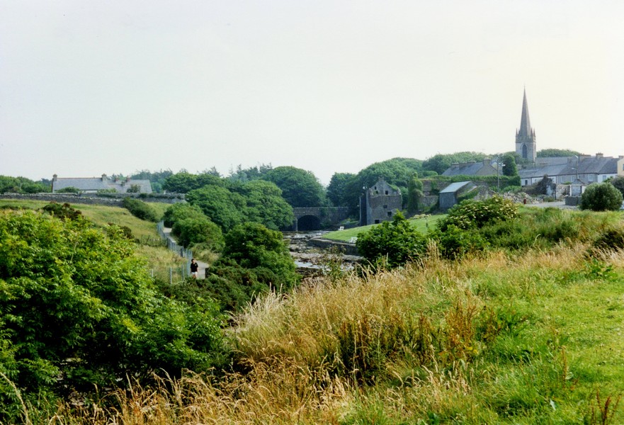
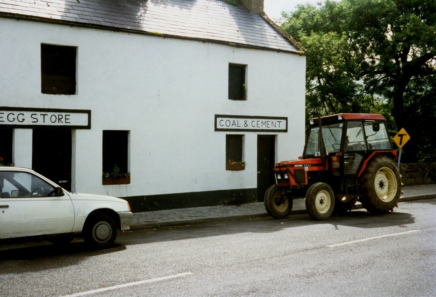
Sligo, Eire to Hermitage

Saturday 20th July 46 miles
A wonderful sleep and we got up to a fine morning of light cloud clearing to sun for most of the day.
We breakfasted outside (boiled egg) and then Adrian did the emptying tasks before we left about 10.30.
We drove into Sligo and managed to park. Sligo is a large town and just as crowded as the rest. We found a large food shop and bought lots of things – even wine was reasonably priced, but still no plain crisps! We bought the last of the postcards.
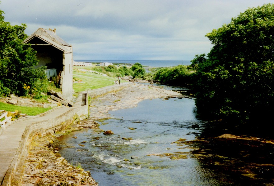
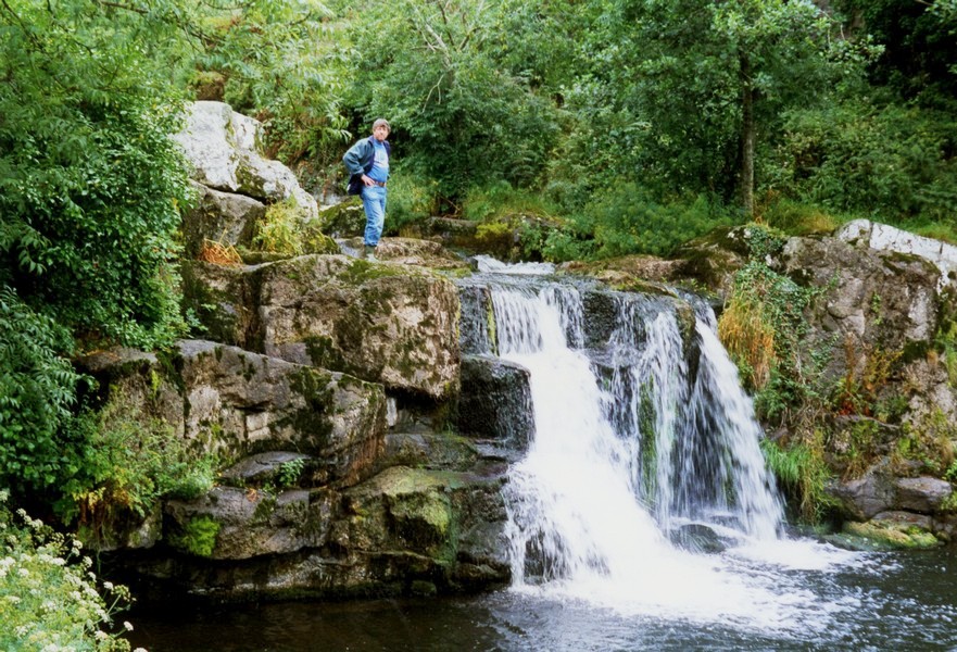
We arrived at about 11.00 and it was gone 12.00 when we left. We stopped to share a yummy Danish pastry beside the river.
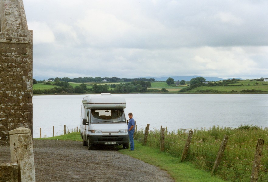
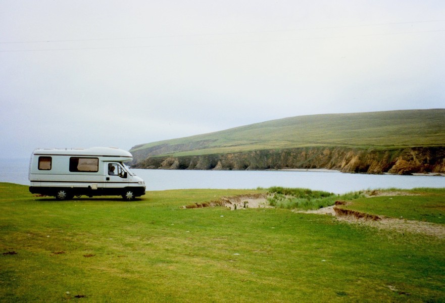
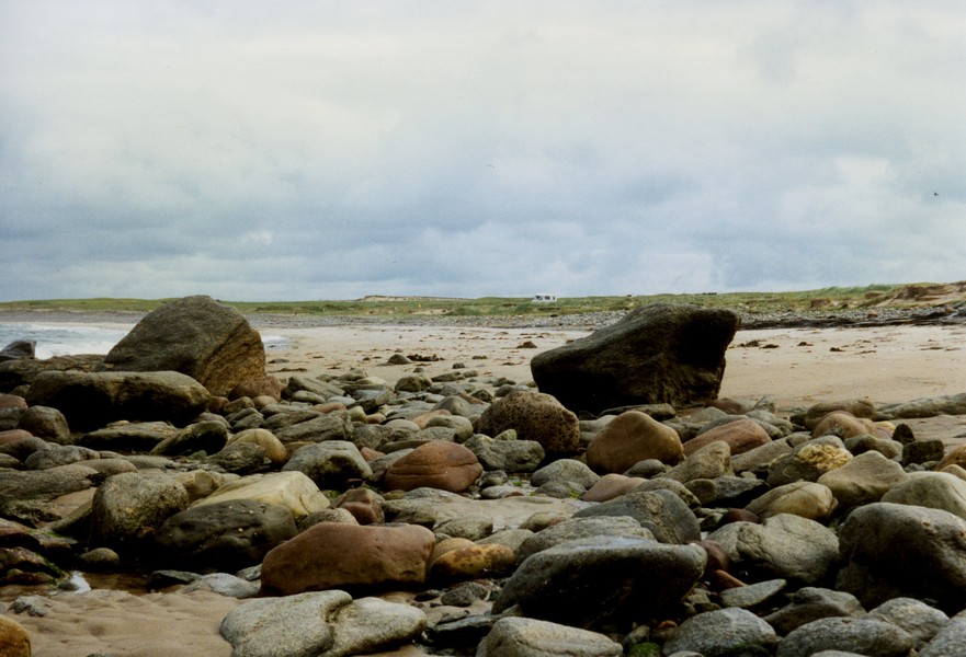
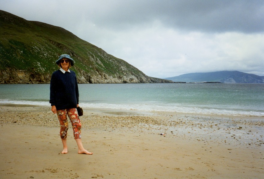
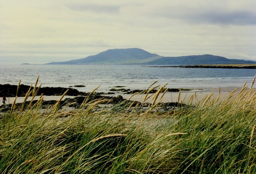
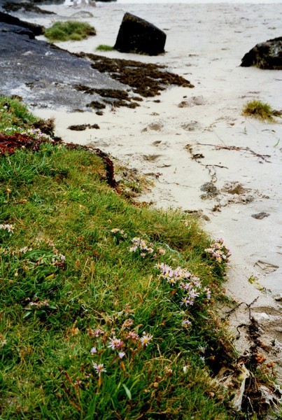
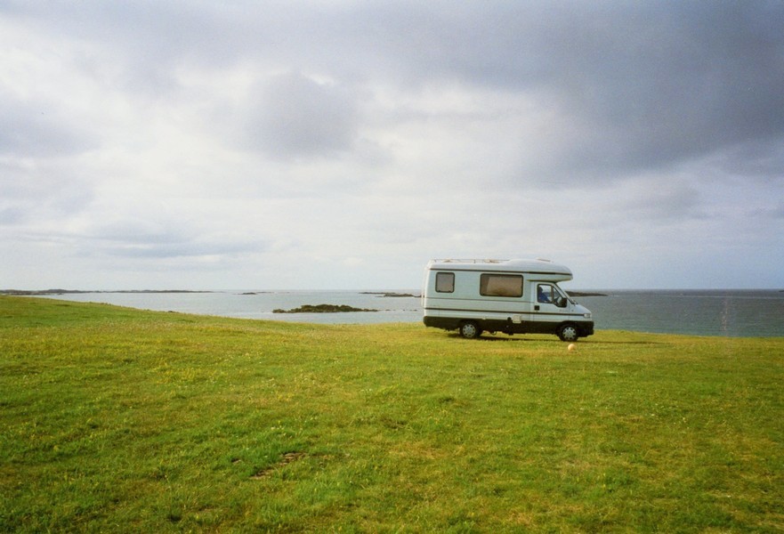
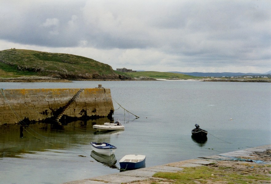
We drove round the peninsula with Strandhill campsite at the end. We didn't see a great deal. Came back to Ballysadare then went on the N59 for a short way, filling up with diesel at Beltra then turning off to a minor road towards the sea and from here we took another little road which ended by the beach, with just room for us to park.
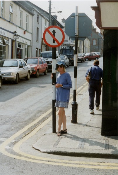
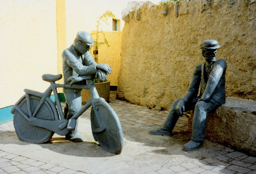
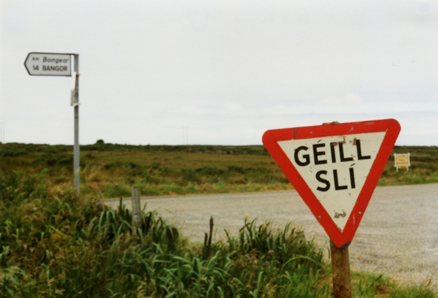
Sligo - does that mean it is a one way street or that it isn't
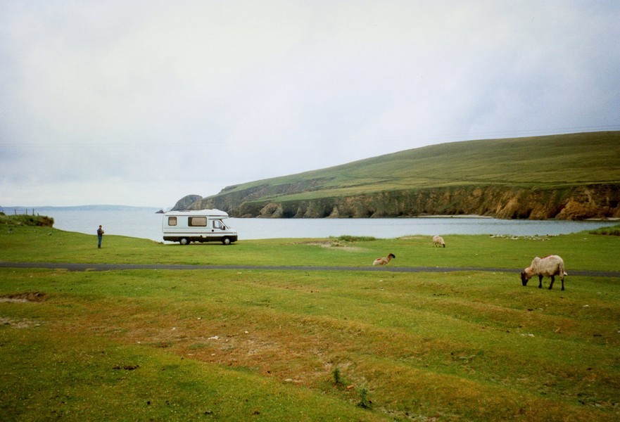
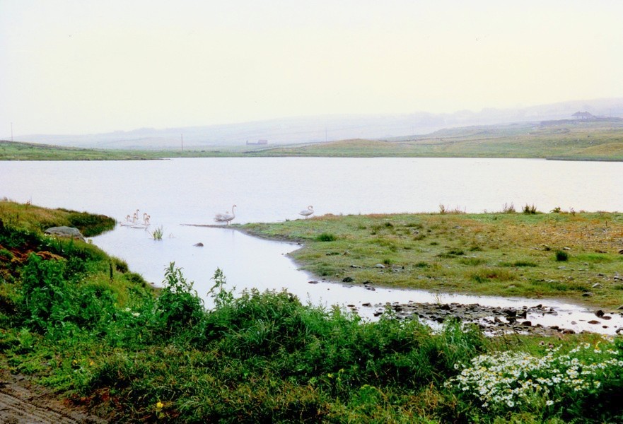
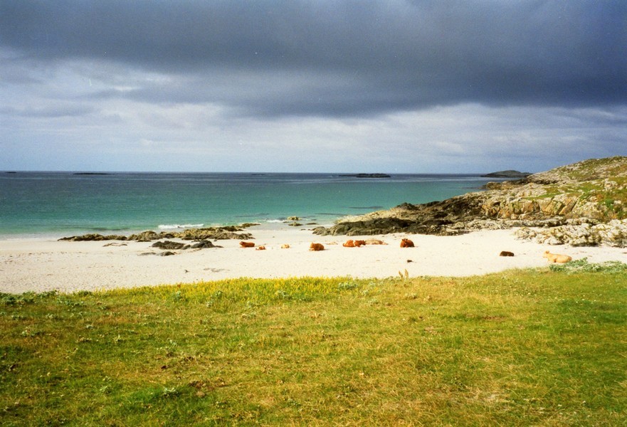
We went back for the binoculars – what a wonderful site! And how fortunate we were! We watched for almost half an hour and then they swam off. Apparently they have been around lately but it is three years since any have come in close. We were just at the right place at the right time!
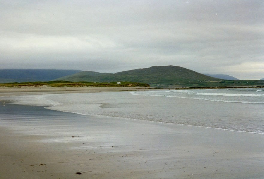
Afterwards we went down to an adjoining beach where local people were enjoying the sand in the sea and the "beach pub".
A few miles on from here we stopped at a site at Easky, a mostly touring site beside a river and very close to the sea. It was only 4.30, but we stopped here. I wrote the last of the postcards, but we amazingly tried the phone and got through to Thomas and had a chat.
Time rushed away. We did the washing/drying (although Adrian thought it was two tumble dryers). The washing took nearly 2 hours in the machine (£2) and the drying almost as long (also £2) and was still damp.
We ate outside – like a Swiss roll of pastry and minced beef, then walked up over the bridge and down the other side of the river to the sea.
We were looking back to the Strandhill peninsula and a hill which appears to be called Knockbarra. It was an idyllic spot and we sat on the stones at the top of the otherwise sandy beach and had lunch. One or two other people appeared – how dare they?!
After lunch I was looking through the binoculars and suddenly spotted a seal. We then watched for some time and saw seals in the water and on the sand beyond. In the far distance we could just make out last night's campsite. It was a lovely stop.
We drove down to another beach – a large sandy beach – but the car park was full (with local cars) and we didn't stop.
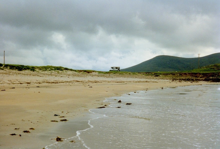
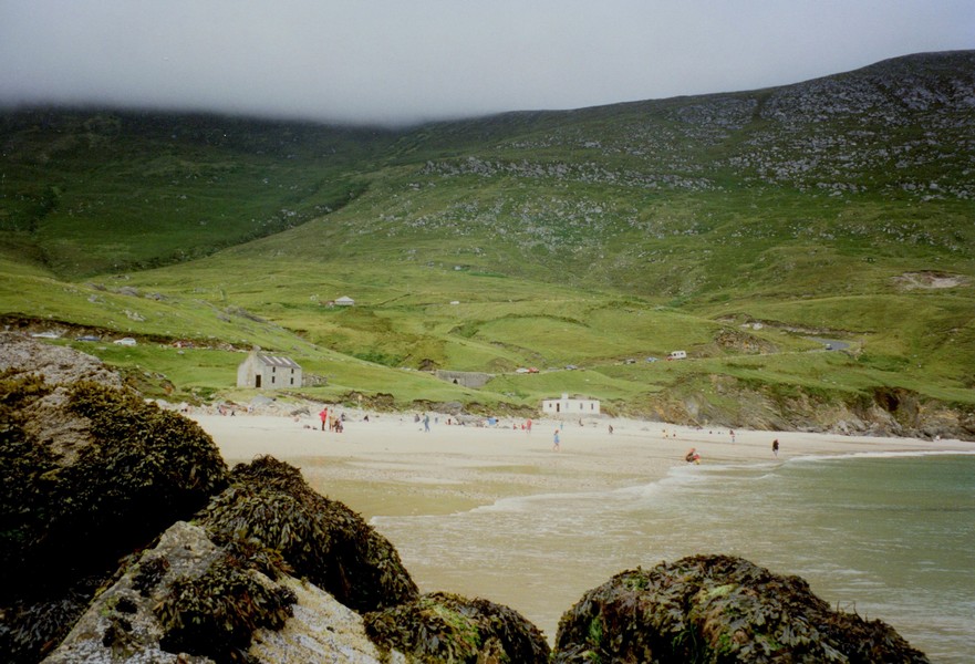
However soon afterwards we turned down to Aughris and arrived at a tiny little harbour and almost didn't stop. Thank goodness we did – lots of local people were rushing to the wall at the end, because a school of porpoises was swimming not far out!
There was an old tower here – several people were camping and someone was in surfing.
We walked back and up the street of the village, going into the pub for a beer and a Guinness. John Doyle was playing guitar and singing (started at 10 pm as all music seems to). We left some time after 11.00 and found that you could hear the music louder in the campsite! His Irish music was good.
Having collected up the washing, we sat outside by candlelight until almost midnight. The night was really warm. The River trickled by and we could hear the music in the background – very pleasant.
Sunday 21st July 104 miles
No sooner had we come in than the wind got up and blew all night, bringing some short lasted heavy rain. We expected the morning to be bad, but although windy, it was warm (a southerly wind we heard on the forecast).
We tried drying some of the washing which was still damp from last night. Filled the tank with water – always seems to be a slow process – so it was 10.30 when we left.
We drove down to the beach at Rathlee – it was a stony beach and we didn't stay. People were all leaving from church as we turned off. We continued to Ballina and stopped just before to look at the attractive river estuary.
On setting off, Adrian was on the wrong side of the road!
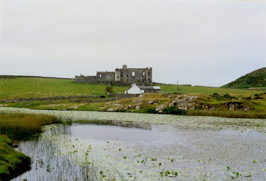
After Ballina we got hopelessly lost trying to find the road around Beleek. When we finally found it, we didn't think much of it, but then came across Rosserk Abbey – the ruins of an old Franciscan friary beside the water. This was an idyllic spot and after looking around, this is where we sat outside to have lunch. Curlews were calling across the estuary – a lovely spot.
Just as we were about to leave, a coach arrived (we had joked about this – the roads around here were very tiny even for us!) so we knew it was the time to leave.
Some plants we haven't mentioned are large canna type plants. It is pretty verdant generally around here.
Road signs not mentioned – SLOW followed by SLOWER – then – ROAD WORKS NOW!
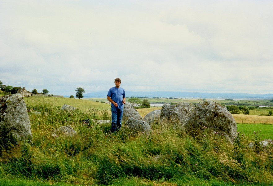
We drove into Killda and stopped soon after at a dolmen, then I had a short drive.
We stopped at Lackan Pier and had a pleasant time on the beach. Lots of nice fishing boats.
We had noticed lots of flags flying today – red and green – we think to celebrate the fact that Ireland has won its first medal in the Olympics – a gold for swimming. Well done!
We drove down to Downpatrick Head but didn't stop. Several cars were there – German, French and Dutch and people on the beach! It was a rocky beach – flat and "platformy".
A bit further we looked back to Downpatrick Head – quite dramatic with "pancake" type rocks. There was a field centre here, but we didn't stop.
We came to Belderg and follow the signs to a B&B which said campers welcome, but it was just their sloping front lawn. We went on to Belderg Harbour but couldn't stop there.
Monday 22nd July 99 miles
Despite the knowledge of the wonderful surroundings, I found it hard to wake up. When I did, I walked down to the edge of the sea and it felt quite warm. I couldn't resist going for a swim. It didn't feel that cold in the water – quite exhilarating in fact.
When I came back to the Tiv, Adrian had got things ready for me to have a shower. Breakfast (scrambled egg) was welcome after that. Then we had another walk on the beach, leaving at 10.30 with the sun trying to come out.
It was a fair morning, not really cold but with varying amounts of cloud during the day and odd bits of rain.
We followed a tractor up the hill out of the place. The driver was the man who spoke to us last night.
The area around here is very barren, much of the hillsides being cut for peat. We had to retrace our steps for a few miles, then followed the road to Portacloy. This was through much barren land, with half a dozen houses at the end and a small inlet and a pleasant beach. Some Dutch had camped here last night. Nice but ours was better! Again we had to retrace our steps for a while before driving south to Glenamoy.
Here we turned off through a forested area to drive around the next "lump". We are in an Irish speaking area here, even the "yield" (give way) signs are in Irish.
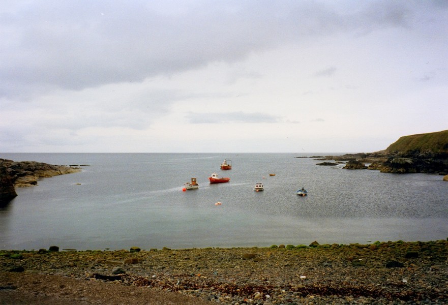
near Beltra
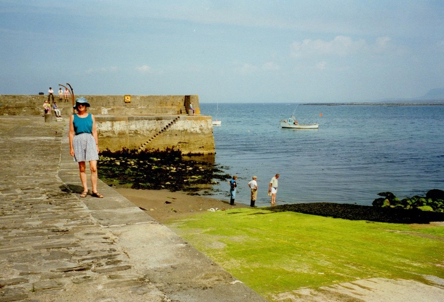
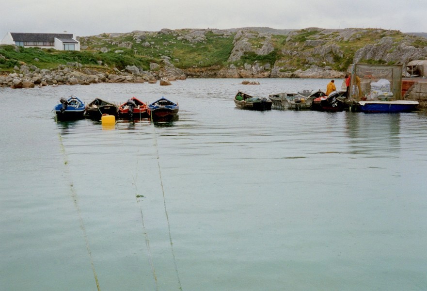
Aughris Harbour
Easky
Around Easky
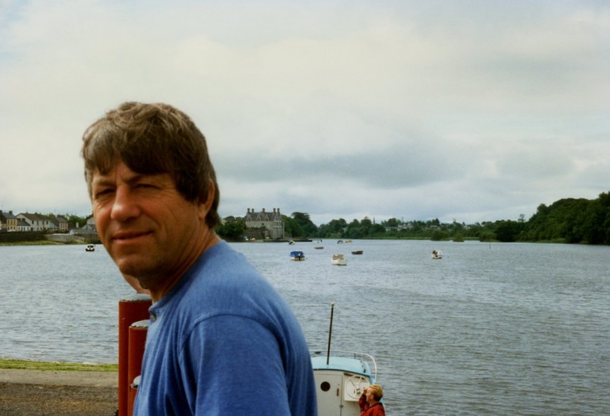
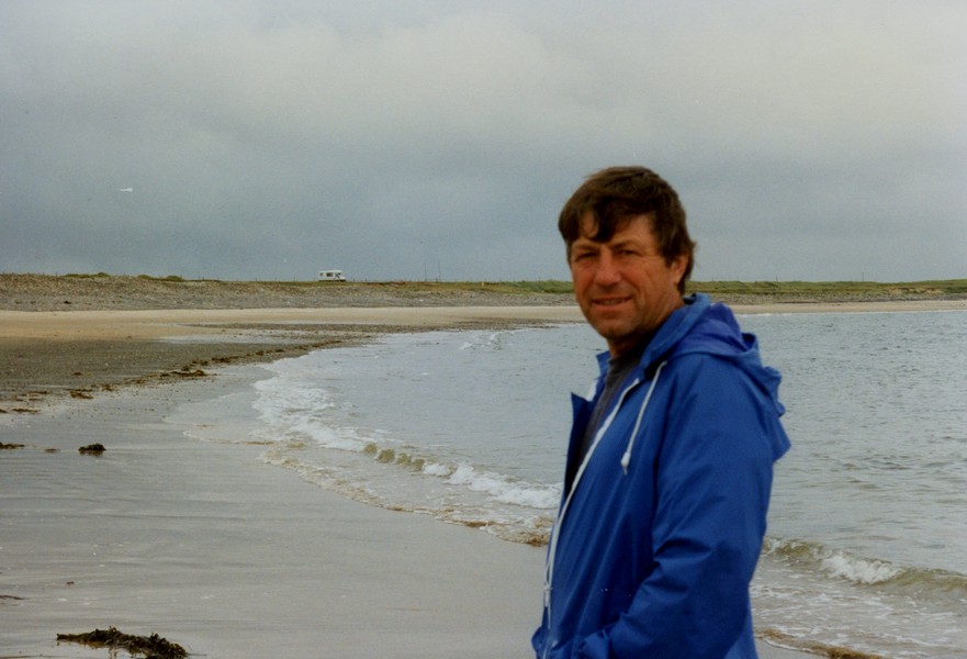
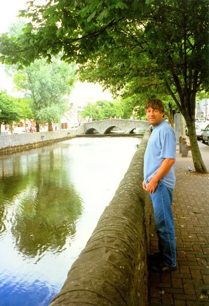
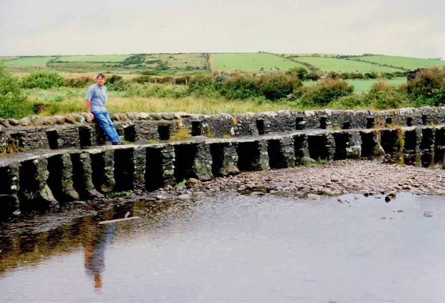
Adrian by the Ballina River
By Rosserk Abbey
Dolmen by St. Killda
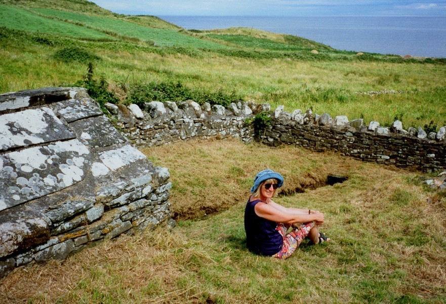
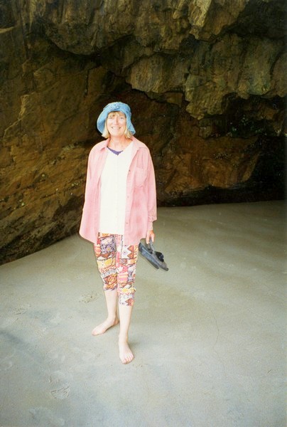
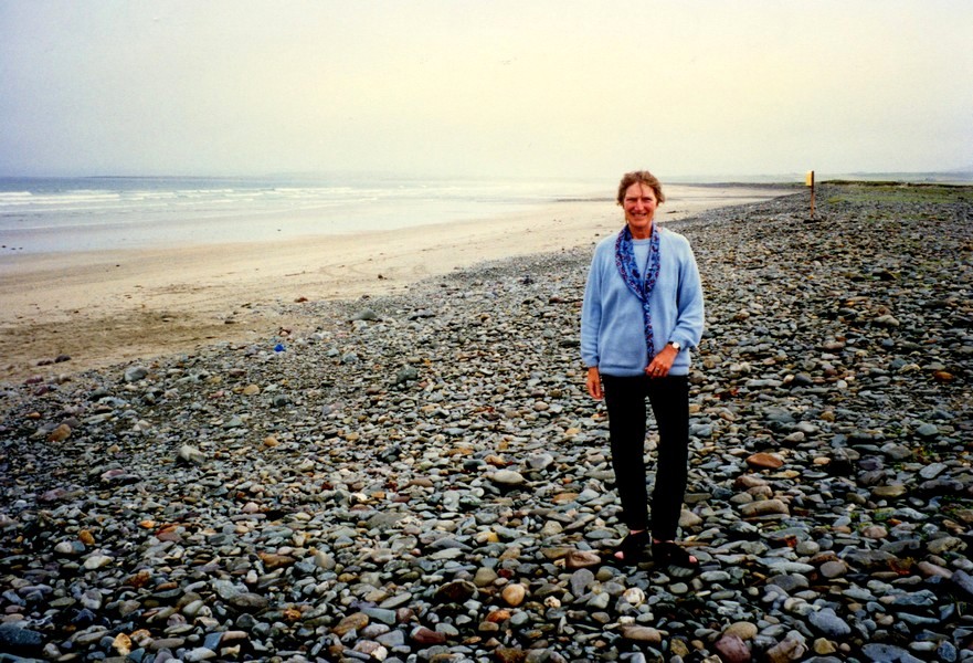
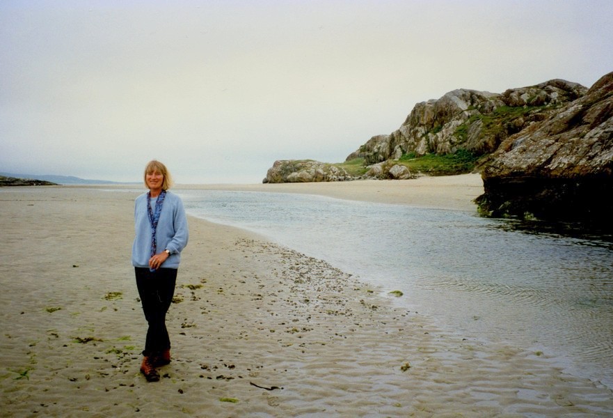
Rosie by St. Cummins Well
Lackan Bay
Belderg Harbour
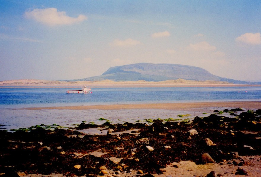
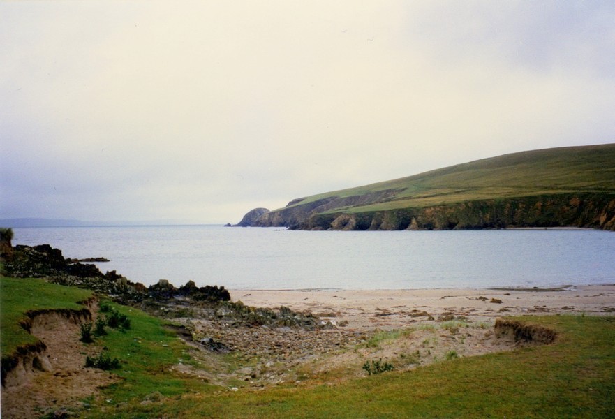
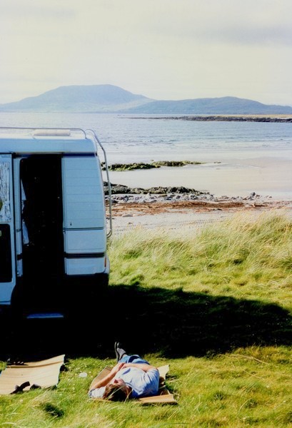
Rinroe Point
Enjoying Rinroe Point
We could look back over the water to Rinroe Point where we stayed last night. It looked quite different from a distance, rather barren and one wouldn't know how beautiful it really was.
At Inver on this "peninsular" we came across roadworks on a grand scale and managed to get past all the large vehicles.
We drove round to Belmullet leading to the Mullet peninsula. We parked right outside the bakers and went in and bought excellent pastries and a good French loaf – all reasonably priced. In a nearby store we bought some other bits and pieces.
We drove to a small harbour on the eastern side of the peninsula, then tried unsuccessfully to drive to the lighthouse. We drove up the eastern side of a long inlet of sea and had lunch here, sitting inside with the window wide open and watching seabirds – some with blackheads and red legs (we haven't bought our bird book) and also a Curlew.
We drove over barren land right to the north of the peninsula. There was a narrow inlet with steep sides, used by fishermen.
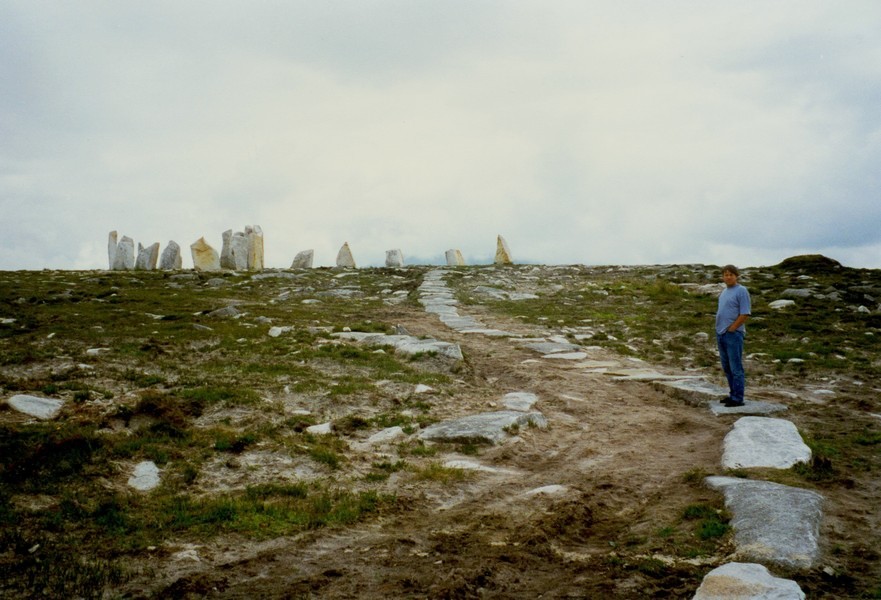
We now made the long trail back and right down to the southern tip of the peninsula – Black Sod Point – where there is a lighthouse. From here we did a circle of the bottom of the peninsula, viewing a Stonehenge type arrangement of stones – (but no other people here).
An Irish 'Give Way' sign
We looked out to the Kea islands and Black Rock looking like another Ailsa Craig.
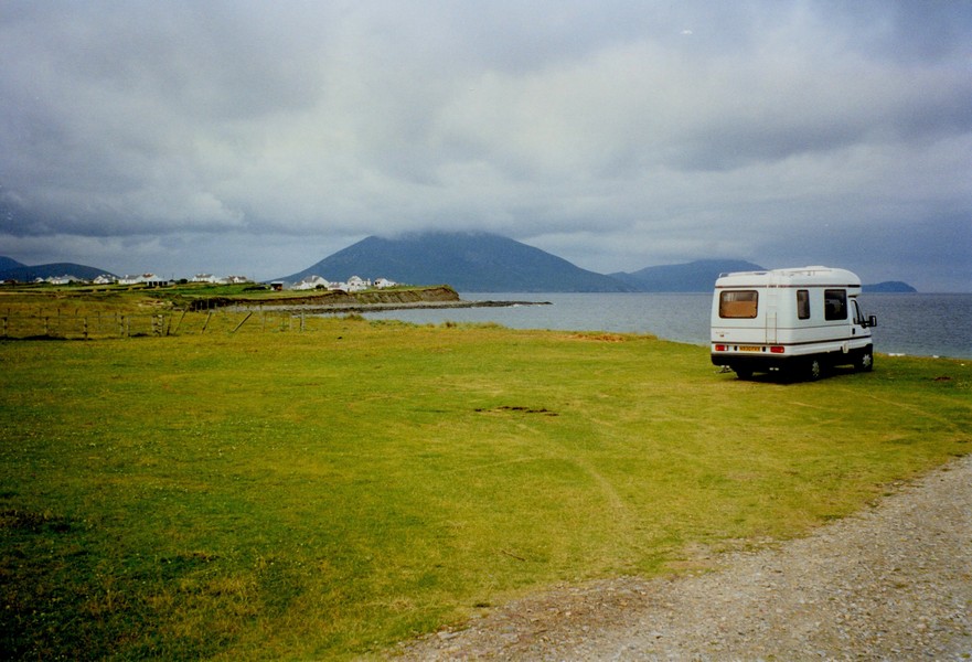
We then had to drive back to Belmullet and then turned southwards over very flat land. The weather had closed in and become very misty. On the Dooyork peninsular we turned off a little unmade up track and stopped by a long sandy beach for the night.
The stones at Black Sod Point
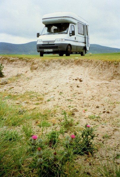
Adrian on the Dooyork Peninsula
Wednesday 24th July 72 miles
We left some time after 10.00 am on a fair morning and retraced our steps initially in search of the "deserted village". This was the ruins of the bottom half of the village of houses (so what's new?) set in the lower slopes of Slievemore – the tall barren mountain.
We understand the villagers to have fled en masse during the potato famine. It was interesting to see how closely the houses were packed together, with just room for a narrow track between. In the valley below we could see the remains of the field strip system.
Tuesday 23rd of July 88 miles
Again I found it hard to wake up. No swim in the sea this morning! It was very windy and had been so in the night, but not cold. We had a walk along the beach in the other direction before leaving at 10.20. Another lovely stop.
We had heard on the radio that the Irish girl had won two gold medals swimming now. Also a 70-year-old Irishman was arriving back in Limerick, after sailing single-handed round the world. He had taken 3½years.
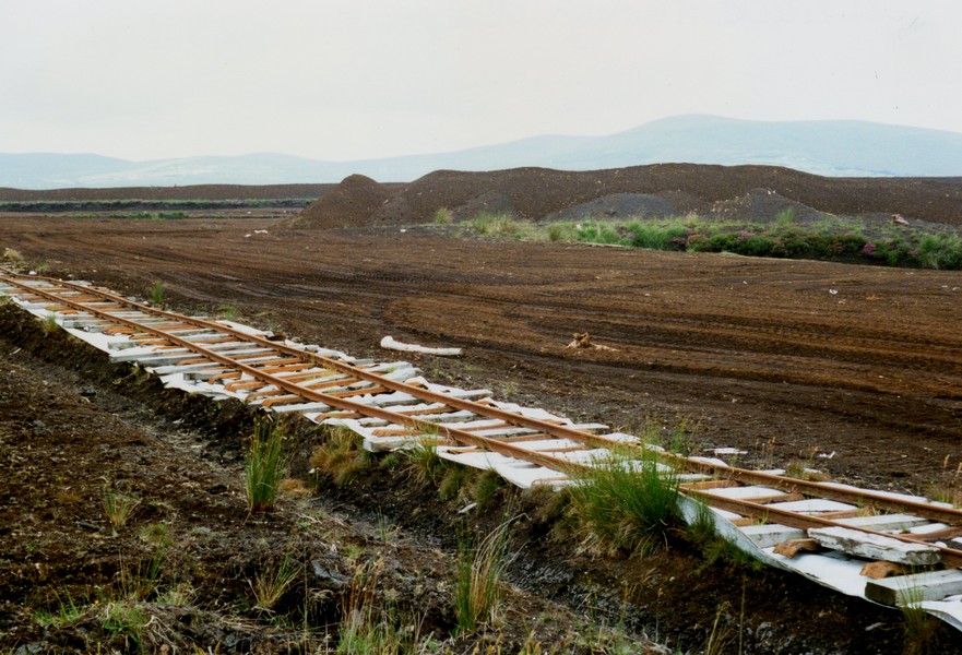
We had to drive inland over peat bog to Bangor. I picked some honeysuckle from the hedge beside the road.
At Bangor we went into a Spar supermarket and bought food including a fresh white Vienna loaf, some of which we ate a bit later looking out over the peat bog.
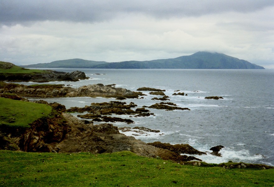
It was an interesting approach to the Corraun peninsula just before Achill Island. The flat bog contrasted with the steep stark mountains – Claggan Mountain to the east and Corraun Hill.
We noticed today as we had done previously that the children have the job of looking after the animals – cows and sheep - and can be seen herding them across and along the road. Also they had are seen (children) on and around tractors.
At Malleranny we came onto the Corraun peninsula and took the Atlantic Drive round the south of the peninsula. We immediately noticed more traffic than we have seen for the past couple of days.
We pulled off the road and had an excellent lunch, including the fresh bread and various cheeses we had bought, followed by chocolate Swiss roll. We had wonderful views in both directions over the sea.
. The clouds had descended and hid the tops of the hills. Very dramatic surroundings. Even today there were more than enough cars parked and lots of people were enjoying the unspoiled beach. It was blowy on the beach. After a walk and a paddle we returned to the Tiv and drove back to Keel, then to the north of the island at Doogort, where we stopped on an unpretentious touring site by the sea. We had tall fuchsia hedges around our pitch – protection from the northerly wind which was now blowing.
After supper of Irish salmon followed by mushroom omelette with bacon and good Portuguese wine, we walked out onto the fine sandy beach. I was togged up against the wind. The beach was littered with a rash of small jellyfish – about 6 inches across, all along the shoreline, looking like skin covered in goosepimples. As we walked back up to the top of the campsite the cloud descended from the mountain and it drizzled heavily. I kept going and discovered that from higher up there were wonderful views over the bay. The drizzle abated and the sky became a glorious mixture of greys, pinks and blues, with the sun glimmering on the edge of the water.
We now went back along the north coast of Achill and stopped at Achill Sound to visit Sweeneys supermarket before driving round the north side of Corraun Hill back to Mallaranny. We have noticed how town spellings vary from map to map to sign – any spelling seems to do! Mallaranny post office was written Malrany and a shop Mallranry for instance.
We have also seen a great many cyclists in this very hilly area.
We drove east towards Newport, taking a side road for a short distance. The road was very narrow in places and just before returning to the main road we had to wait a good five minutes while the driver of a car pulling a horse box in front of us chatted to the driver of a tractor and a large trailer going the other way – they didn't seem to see it as a problem!
Newport was a very pretty little place. We had lunch here beside the inlet (the new port) with the backdrop of a superb railway viaduct. It was very tranquil here.
On the way to Westport we took a small road again and had glimpses of inlets. We almost didn't drive into Westport, but needed a bank. Thank goodness we did. It is a flower bedecked little town of great charm. A tree-lined River, flows through the middle, spanned by numerous old stone bridges – it looked a bit like pictures of Bruges.
There were a great many little shops and rows of pastel coloured houses. The sun had made its appearance. We ate ice creams leaning against the wall by the river.
We now drove along the south side of Clew Bay. We viewed Croagh Patrick – a tall bare Mountain said to be a place of pilgrimage.
Thursday 25th July 37 miles
The morning was very grey and miserable. Adrian moved the van along a bit while I was still in bed as he was worried we might get stuck. The tide was a long way out, but I went down in the drizzle and had a quick "swim" – difficult in the crashing waves.
When I came back it rained quite heavily. Again Adrian had the shower ready. After breakfast we left about 10.15. One or two people had come down to the beach – to collect mussels maybe.
We drove down to the next beach – Cross Strand – initially pebbly but sandy beyond.
There were one or two caravans here. A minibus of young people arrived and they began putting on wetsuits. The sun kept trying to beat the drizzle – visibility came and went rapidly.
We were near Lough Roonah close by the sea. We drove on to another beach by another little Lough, with a group of white swans swimming. Back at the crossroads of these last two beaches, we took the fourth – an unmade up track, which took us to a ford (marked as a road on my map) and a very old clapper bridge (Bunlahinch Clapper Bridge).
It was very still and peaceful here and quite warm – the sun kept trying to come out, as it did all day.
Back on the main road we came to Doo Lough pass. This was very dramatic with steep bare hillsides looking Scottish or Swiss.
We drove alongside Lough Doo. There was a memorial to the famine walk of 1849. It was erected in 1994 and linked to South Africa's freedom. A quote by Mahatma Gandhi in South Africa said "how can men feel themselves honoured by the humiliation of their fellow beings".
We stopped briefly at Delphi activity centre and looked in at a craft shop. A wonderful setting for an activity centre, with steep hills all around and an attractive river running by. It was drizzling heavily.
We stopped for lunch beside the long inlet of water called Killary harbour. We enjoyed beans on toast. It was misty - very Scottish and very pleasant. We could see Leenaun in the distance.
At the end of the creek we came to the "often photographed" Aasleagh Falls. It was quite warm now. We came Leenaun – a very busy little place with lots of tourists and a couple of craft shops. There was an attractive bridge. It was warm and I put my shorts on. We had now come into County Galway.
In Leenaun Adrian was able to buy the half mile to inch maps he had been looking for. They were good for detail, but the roads were still difficult to make out. There were roadworks here with "Rammer hammers" for Simon (Simon had worked at Rammer in Finland recently).
We followed along beside Lough Fee, still barren but with rhododendron and tree-covered islands. Soon after, by the the sea, we stopped at Connemara caravan and camping site in an idyllic setting beside a sandy inlet at Lettergesh beach, Renvyle at 3.30.
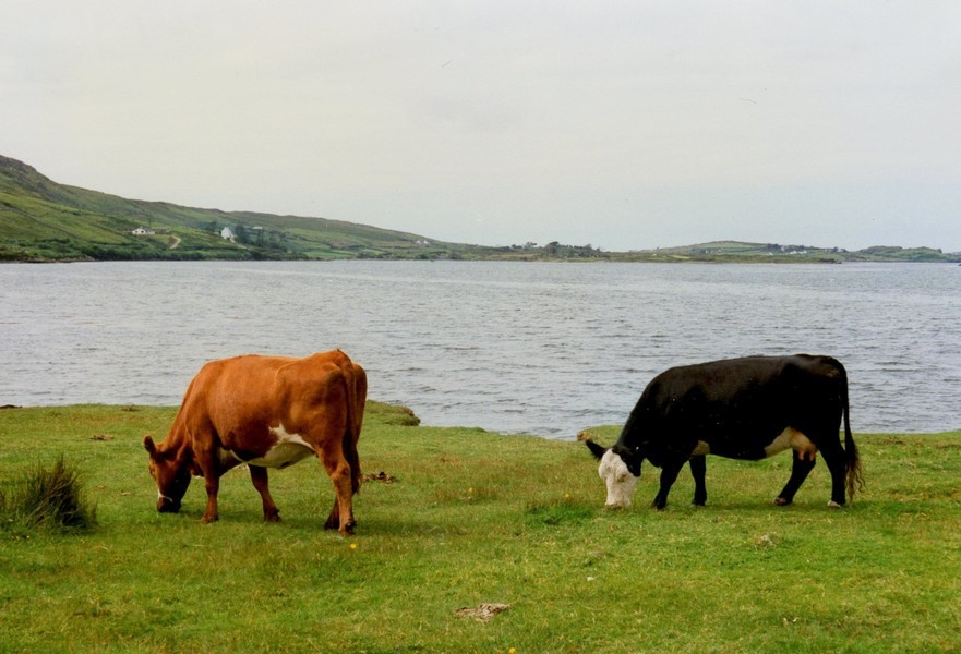
Having decided on our pitch (the site was in two separate strips divided by a strip of cornfield, with another two strips of cows between it and the cove) we walked out and around the cove.
Friday 26th July 55 miles
The saga of the washing continues! When I got up to get the early morning tea, I realised that we were out of milk.
Well, I thought we can go round to the reception and buy milk and get a token for the machine. Adrian decided to walk round and see if the machine was in use – it wasn't. I then walked round by the shop – it was closed (8.45 am). A lady passing thought it probably opened at 9.00 am.
Sure enough – elsewhere – is a sign saying "breakfast served 9.00 to 12.00 at the reception". Elsewhere again a sign saying reception open 8.30 am. But it wasn't! We decided – I would stay by the washing machine, Adrian would return to the reception and wait for it to open – (remember it's a long way).
After much waiting, I put the washing in and fiddled with the knobs ready to start. Lo and behold, it started filling with water. We met up and decided to go and have breakfast (minus the milk). This done and packed up we drove round. The washing was finished – no payment. We put it in the tumble dryer (should be 50p) and it started drying.
So, while Adrian refilled the water tank at a snails pace speed, the washing dried and I washed my hair – the peaty brown water seems to work well. I even ironed one or two things – all free of charge. So all's well that ends well!
Adrian had also had a saga of trying to phone Dublin to find gas suppliers – this wasn't a success, so for now we hope the gas doesn't run out – our cylinder is of a different size from usual in Ireland.
So it was 11 o'clock when we left. We stopped in Tully and bought food including hot French bread and hot apple pastries – both good at lunchtime.
Having driven around this peninsula we stopped at Letterfrack. The Connemara National Park started here. We drove a long way up towards the visitor centre, but then found you had to pay to get into the Park and as we said before there is plenty to see without paying. We drove back down again. Scenery all around was superb. Again the coastline is very indented with many offshore islands leading to wonderful views.
We came along by the sea at Barnaderg Bay and called in at a very attractive craft place. Lots of wonderful things, but too expensive for us (sweaters £60+!)
A bit further on we stopped by a sandy/pebbly beach at the end of an inlet overlooking Cleggan and ate our lunch – inside – always the strong wind blowing. Today had been a fair day – quite warm and quite a bit of sunshine.
Round the next promontory – still attractive, with low hills now – we stopped by a little beach at Claddaghduff looking to Omey Island – a "low tide island" – it would seem. This was a lovely area – barren rock with lots of shallow water and lots of sand – an ideal place for children to play and explore. Apart from the slightly brisk breeze it was wonderful. Pretty miniature Michaelmas daisy flowers were growing from the rocks.
We then drove inland along Streamstown Bay and back around a thin peninsula north of Clifden. Superb scenery. Rather more traffic here – definitely more touristy area. The road was called Sky Road where we turned down along the beach before Clifden (and got a wonderful view of it) and "Upper Sky Road" along the top.
We stopped in Clifden – very busy with lots of tourists. We looked around lots of shops and bought one or two souvenirs and the travel pills for going home, also an ice cream.
We then headed south to Ballyconeely – much flatter area. We turned off to a peninsula here and found a campsite situated right at the end – a large area of short grass and a field of tents and caravans scattered at random called Keeraun More.
We parked right by a pretty beach of coarse white sand bedecked with areas of rocks, looking out onto lots of little rocky islands. Lovely again!
It was about 5.00 pm and the day clouded over as it often seems to do at this time, but the sun came out again later. We enjoyed exploring the beach and then the view from the van.
Saturday 27th July 197 miles
We awoke to the sun streaming in and our glorious view of the beach and sea. Alas it didn't last long!
We heard the forecast saying "rain later" and by afternoon it was true Irish mist, followed by rain!
Also on the news we heard of an explosion in Atlanta – site of the Olympics, and on a cheerier note, that Michelle Smith had won a bronze medal making three golds and a bronze for Ireland!
We "emptied and filled". The young boy, about 12, was around on his bike – he seems to be in charge of the site during the day! We left around 10.15.
We drove first to Bunowen Bay – on the south of this peninsula – very attractive – a little pier, Connemara fishing boats, Castle in the distance and beyond that "The 12 pins" (peaks) – sandy beach. Very attractive.
We drove around the next area – full of lakes, looking like a map of Finland, but not at all – it was all humpy – a rocky area looking "primaeval". Granite, I read later. Moonscape almost!
We looked down at Dogs Bay, where there were campsites by a lovely bay with a "hammerhead" headland. Men were making a hay rick here – there is much use of pitchforks and scythes. Also children riding on tractors.
We came to Roundstone and briefly stopped by a music and crafts centre and looked out over wasteland beach to Inishnee peninsula. Roundstone itself was a cluttered little town busy with people – but it is Saturday morning – and a nice little harbour, but only small shops – no store or small supermarket that we could see.
We tried to get to Inishnee Island – joined by a bridge. We took a long narrow track to it – there was a weight restriction but no indication of a width restriction – however – when we finally got to the bridge – about 50 yards long – it was very narrow – too narrow for us!
We then had the fun of getting back again – there was nowhere to turn around – so while Adrian reversed, I stood in the back of the van shouting directions!
The countryside was still barren, strewn with rocks and covered with lines of stone walls.
I haven't mentioned the profusion of "cone flower" – a bit like smaller rosebay willow herb – growing everywhere. I have paid money in England for one for the garden!
Through all this barren ground we suddenly beheld a beautiful sandy beach. We then had to try and get to it!
We took the second of three narrow roads off the "main" road. This was very narrow and at one point a car was stopped and we had to wait. At the beach end, there was nowhere to stop or turn around and the road fell away steeply into the harbour. At the end of the harbour wall someone was painting a picture (in the rain).
We found a little track continuing up and followed it – it did as we guessed, join up with the "main road", although not marked on the map. Again it was very narrow and at one point we met a large van coming the other way – luckily with just enough room to pass at that point.
We rejoined the "brown" road and drove back to the first track off. This was even narrower, but we threw caution to the wind and followed it. We made it and stopped by the beach for lunch. A lovely spot after all our trouble!
At Carna we went into a little Spar supermarket where everyone was speaking Irish – it made us feel very strange. We had noticed that we were in another Irish speaking area. We were pleased to buy another film and also a bottle of water as the peat water from last nights site had lots of bits floating in it! Rather offputting!
Still on "day of narrow roads" we took a little road to the sea just before Kilkieran Bay, whereupon a man shovelling sand outside his house called to us to pull in for a bit – a large lorry was coming. Sure enough the huge lorry loaded high with hay pushed through the trees followed by a van into which the aforementioned man jumped in as it went past.
The track ended by the sea a few hundred yards further on – we puzzled for some time as to where the lorry had appeared from. We settled on thinking it was parked outside the house and had to drive down to the sea to turn around. Either that or it emerged from the sea with a load of hay!
It was a very strange beach with white sand looking like cement and the light aquamarine translucent sea in which there were a great many rounded black rocks, and surrounded by the bare barren hills. It felt weird, almost spooky.
The other side of the small peninsula we drove down a parallel little road to a harbour where there were more Connemara boats (currachs I believe). A bit further on at Kilkieran we drove down to the harbour past a coal loading point. Adrian was hoping to find some scales so that we could weigh the gas bottle – so that we knew how much was left. This he managed, with some very helpful people. I located "the Galway Guide" which told us about some of the places we were visiting.
We now felt well organised for the rest of our holiday, but didn't know that very soon our plans would change.
We were still in this strange, barren area, but now very flat, but still with lots of rocks – Granite it seems.
We turned off to the peninsula of Roc Muc, at the end of which there was absolutely nothing – not even the boat – just a small harbour wall. The Irish mist had returned.
On our way back up the peninsula we stopped at a telephone box we had noticed on the way. I had tried the phone a little while back, as it appeared that someone was trying to get hold of us on our phone. When we phoned Thomas it seemed that Mum Cape was not well at all. We telephoned and spoke to Lena and then we knew that we had to return home as soon as possible.
The weather seemed to be telling us this to – the mist continued, sometimes alternating with "real rain"!
We were not far from Galway, where we had initially planned to get to. With the visibility as it was, we weren't going to see much of the scenery anyway!
We rapidly prepared and ate a meal, then made our way to the "wine bar" – rather incongruous that – where we were told there would be Irish music. There was some Irish music, in amongst other music, but we spent the rest of the evening chatting to a very pleasant young Dutch couple who were touring by motorbike. A very convivial time – they even bought a bottle of wine for us to share. It was 12.30 when we got back to the van!
A long and eventful day!
(How did Rosie write all this, without notes at 12.30 at night?)
Sunday 28th July 125 miles
It was indeed a damp morning, but not as cold and not as breezy as the coast. Certainly a lovely campsite. We had telephoned and changed the ferry and also spoken again briefly to Lena telling her of our intentions.
We left just after 10.00, waving to our Dutch friends who we just packing up.
We continued down the Glen of Atherlow, looking quite lush and attractive despite the drizzle. At Bansha we joined the main road. Just before Cahir we stopped in a layby and ate the cakes which we bought yesterday and forgot to eat! This was the first of many places which would have suited us as an overnight stop last night! Cahir was a very attractive town, seeming very French (even the name!) With an old castle beside a wide River. At Clonmel we crossed the River Suir and followed the "scenic route". Just as we started on this we looked back to an attractive view of Clonmel across the River and there was "a heron on a log" – but he flew off just as I went to take a photo.
We passed Carrick – another attractive looking town with a Castle and interesting houses.
Along this route we have passed a lot of fine big houses set in wonderful surroundings. The land is much richer than we have been seeing in the north.
Adrian is amused that although the distances are usually written in kilometres, the speed limits are written in MPH!
At Fiddown we crossed the wide tidal Suir River and drove cross-country. Soon afterwards we stopped for lunch in a large "parking area" bordered by railway sleepers near Klilinaspick Church – had boiled eggs for lunch.
Soon after this we stopped to admire the superb view down towards Waterford and a large tanker approached and just scraped past.
We saw a sign saying "scenic waterfall" so stopped and donned wellies (it was just damp now and quite mild) and walk down the steep sloping hill to view the Poulanassy Falls.
This was a pleasant interlude in pretty country. At Mullinarat we came to a low bridge – 10 ft high – made it okay. Soon afterwards was a flat area of reforestation where the signposts for New Ross and Waterfoot seemed totally wrong at the junction. Many more unsignposted roads and junctions where the name on the signposts was broken or missing, made navigation difficult, but we eventually made it to New Ross.
We parked by the waterfront on the River Barrow and had a short walk around. It seemed a rundown town just beginning to wake up. Adrian said it had a future. I thought it had a past!
We now took the main road to Wexford, passing Cushingtown with a rather beautiful church. At Wexford we stopped by the Heritage Park at a beautiful site beside the River Slaney but didn't go into the Park as it cost £3.50 each.
We drove just north of Wexford beside the churned up brown sea near a wildfowl sanctuary. We couldn't go any further as there was a height restriction. A group of people came to catch crabs. We looked out towards Rosslare, then drove back into Wexford and to Rosslare and North of Rosslare to a long thin peninsula called Burrow.
This looked very eerie at first, looking through the reeds back towards Wexford. The visibility came and went.
We then drove just South of Rosslare and stopped above the beach and cooked a meal before driving to the boat. The visibility cleared as we set sail at 8.30 pm. We had a smooth trouble-free crossing and at 1.00 am parked at Pembroke for the night. The night had cleared to give a full moon which shone on the water as we crossed the sea.
Monday 29th July
We awoke at 7.15 am – we could see out to boats on the water. We left about 7.45am.
I had slept soundly after the travel pills!
The day was a mixture of cloud, sun and rain and felt warmer than in Ireland. We immediately noticed the smoother surface on the roads.
We still had place names written in two languages – this time Welsh and English!
We had an uneventful journey, stopping after about an hour for breakfast and then for lunch at Membury.
We arrived at St Davids, Ascot at 2.00 pm to see Irene and Lena, who told us the news that mum had died at 8.30 last night. I felt that she waited for us to leave Ireland!
We drove home, arriving back about 3.00 pm in a dramatic storm of torrential rain. We had had a wonderful time and look forward to returning to Ireland in the future.
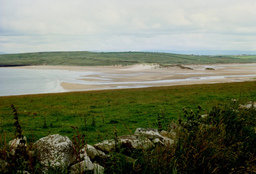
We came to St Cummins Well. It was very hot now. We stopped and viewed the well – didn't say our "Hail Mary's", but Adrian got chatting to a local old boy who had come up. He told us to go to the Strand – it was great (but not in winter). We missed the turn there, but in fact it was a huge estuary and all very sandy.
We drove to Glenamoy, then had trouble finding the road, but eventually found a road towards Benwee Head. We drove a long way to Porturlin, but it was just a creek and nothing much to see.
We drove back to Carrowteige, finally coming to Rinroe Point. This was after going on a "high up" road, then driving past a field and causing someone to move their van, then across a sandy track which gave us some anxious moments.
Eventually we came to a most the idyllic spot with a sandy cove on one side and a wide bay on the other. This is where we are spending tonight. Fantastic! After a Pimms (we have been carrying it since the start of our travels) and crisps we walked around the cove – tide coming in and it started to rain!
An Irishman parked next to us and decided to chat. Some more rain, but the perfect spot to spend the night. We relished in the surroundings while we prepared and ate supper (Wiener schnitzel).
After supper we walked out to the harbour and along the bay behind us – it was a real Irish mist
The weather cleared and we went for a walk along the beach to a stony ridge jutting into the sea. There were no people, just a lot of seabirds.
Later a girl drew up in her car and went for a swim and later another woman walked along the beach. Both waved.
Other than that we were on our own. We had supper – melon followed by an Irish smoked mackerel. Before bed I walked down for one last look at the sea. A great stop again.
We continued round the Corraun peninsula, stopping just before Achill Sound at a little folk Museum.
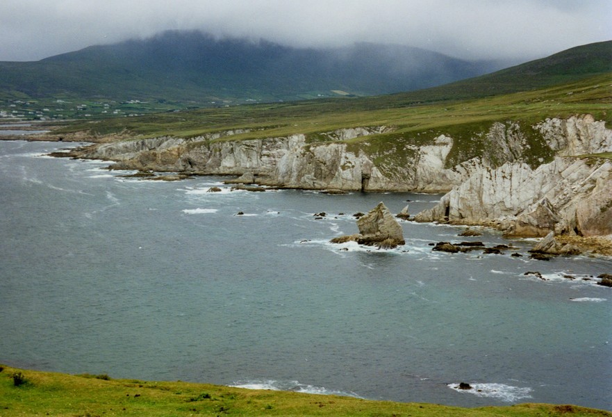
On Achill itself we continued on the Atlantic Drive, around the south. The views were superb, with steep stark hills and very dramatic cliffs with the waves beating against them.
I found the road high above the sea quite hairy at times.
At Keel in the centre of the island it was quite busy, with a reasonable campsite. The flattish land here contrasted greatly with the steepness all around.
We continued on the road along the south as far as one could go, following the side of the cliff up high and then down again to Keem strand, a beach of superb sand surrounded by steep sheer cliffs and with the deep aquamarine sea.
I came back to the van and we decided to move to a higher pitch so that we could enjoy the wonderful view.
We turned off here to Old Head where there was a nice little beach (crowded for us) and a campsite (bit pricey), so we didn't stop, although it had now turned hot and sunny.
We continued through Louisburg and took a road going to the west coast. Here we stopped beside the beach at Doughmakeon Strand just south of Gualagh Point with lovely views to Inishturk and Clare Islands.
Although windy, the sun was warm (it was 4.00 p.m.) and it was lovely to enjoy it. We decided to stop for the night.
We had supper of gammon with eggs/pineapple and sweetcorn. A man cycled along the beach and went in for a swim. Someone else came to surf.
We walked all along the beach and back. The sky quickly clouded over but the occasional streams of sunlight peeped through and shone on the water. There were lovely views all around.
calling in at the shop and buying inexpensive pizzas for supper and very expensive "Pringles" – the only plain flavoured crisps! We saw that the creamy flowered plant that we have been seeing a lot amongst the fuchsia hedges is an astilbe.
I was hoping to do the washing, but the machine was on the other side – only a few yards from here, but beyond the "strip" but a good 10 minutes walk. Also, to add a complication, you had to get a token from the reception. Adrian attempted the walk once in the drizzle, but the machine was in use. The drizzle got heavier, sometimes turning to rain. After supper we resigned ourselves to staying in and playing "beetle" – closely won by Adrian.
Time rushed away as it always does. After an excellent supper of pork steaks we went out and explored the surroundings. The sun was setting behind the hill. A fence prevented us from going any further that way. We walked around the huge area of camping, the grass smothered in wild flowers – yellow with wild allysum plants, blue with harebells, purple with orchids and many more.
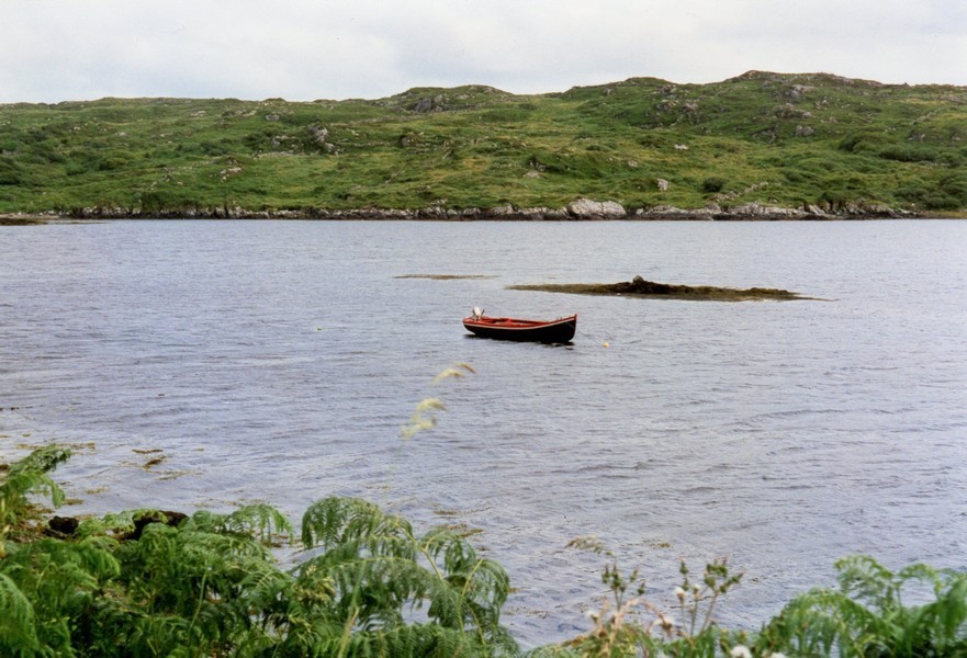
We walked down to the beach at the far end and walked for some distance around the rocky outcrop's. There was a little Connemara boat with its distinctive shape.
As we walked back across the grass, the sky took on the most wonderful array of colours – blues, pinks and greys with the interesting cloud formations.
Back in the van we watched the misty moonlight over the sea. It was light until very late, and then the light of the moonlight. We left the blinds up and enjoyed this wonderful spectacle until gone midnight. A lovely evening!
The Tiv at our overnighter on the Dooyork Peninsula looking to Corran & Achill
Rocks on the beach, Dooyork peninsula
Rail track over the peat bogs near Bangor
On Achill Island
Keem Strand Achill Island
Sunset at Doogort, Achill Island
From the 'deserted village' on Slievemore, Achill Island
Westport
Croagh Patrick from Old Head
Doughmakeon Strand
Rosie at Cross Strand
White swans on the beach near Cross Strand
Adrian on Bunlahinch Clapper Bridge
Doo Lough Pass
Killary Harbour
Leenaun Bridge
Rosie and strips of cows on Lettergesh beach
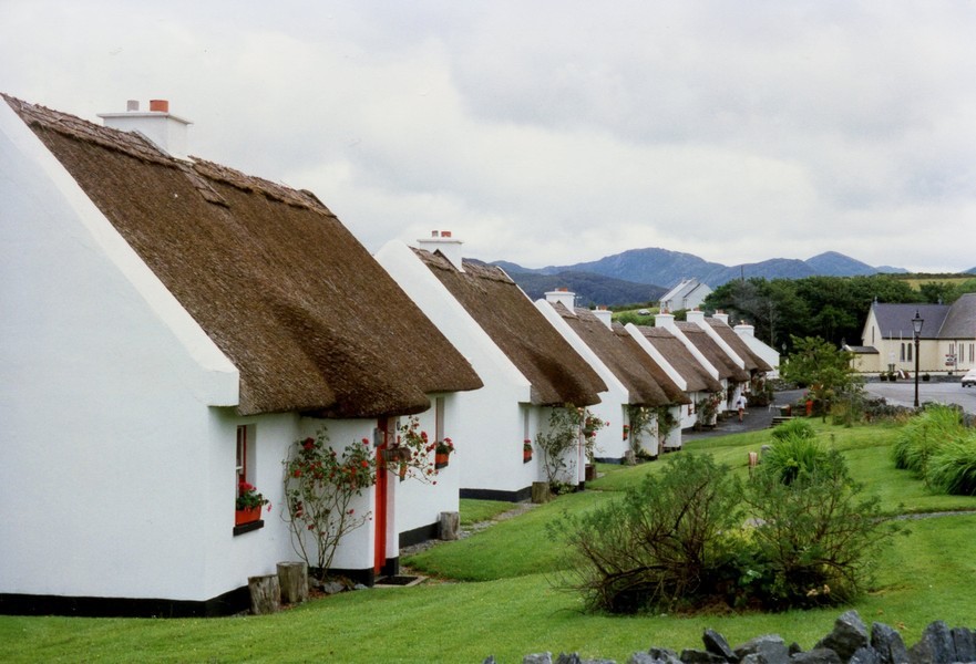
Pretty Irish thatched cottages, Tully Cross, Connemara
Claddaghduff Beach, Connemara
Cows and a Connemara boat at Streamstown Bay, Connemara
Clifden
The Tiv and the beach at Keeraun More, Connemara
The Connemara night sky
Bunowen Bay - The harbour and castle
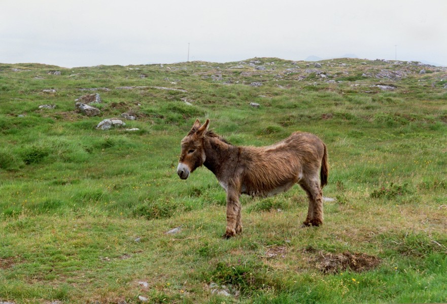
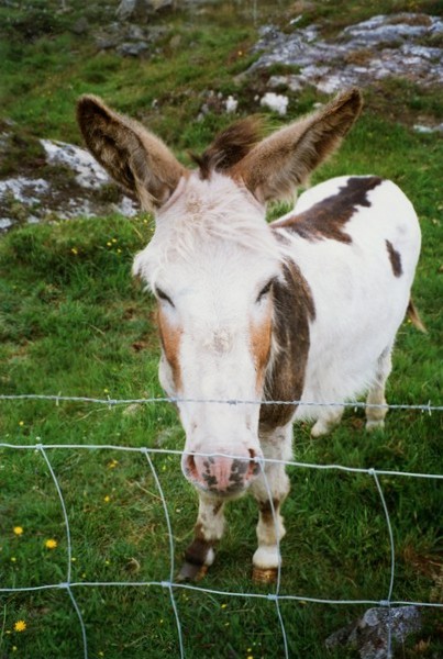
The donkey and the mule
The bay where the lorry turned round
Connemara boats (currachs)
The campsite we got to at Ballinacorty House
The Ponlanassy falls


We continued on the coast road to Galway – a much busier road and with all the "trappings" of more people – significantly the impolite drivers.
We had decided to drive on further today, in the hopes of getting the ferry tomorrow evening, but we had no details of ferry times and no telephone numbers to ring.
We found Galway town most unattractive – our mood and the unpleasant weather didn't help. Added to this it was the first large town we had driven around for a long time. It seemed like any other town outskirts with "out of town" shopping areas and rows of innocuous houses, characterless roads and Adrian swears that all Irish traffic lights are red!
We passed many vintage cars taking part in a "run" – awful weather for them and we felt for the great many cyclists and walkers that we passed – many late in the evening.
We could see virtually nothing of Galway Bay and vowed to return another time!
We travelled a great distance now – on main roads through Limerick, crossing the huge River Shannon with no problems. We had passed many ruined castles beside the road.
We had been hoping to find somewhere to pull off for the night, but didn't see anywhere suitable at all. We decided to turn off before Tipperary and take small roads to a campsite marked in the Glenn of Atherlow.
By now we only had the small scale map of Ireland, so navigating was incredibly difficult – added to which, the majority of the smaller roads in Ireland are not signposted. We were of course both tired and hungry too.
We had turned off at Pallasgreen and amazingly around 9.00 pm arrived at the site I had been looking for (we did later find another map and made me wonder how we did it!)
The site is in Ballinacourty House in a charming setting – very green! with hills and forests around and all the facilities in a wonderful old stone built house – very French seeming.