
Friday 12th February To the Otago peninsula 48km
We got up early to finish sending the website - always a relief when it's actually all done! it was nice to receive several responses soon afterwards.
Adrian spent some time trying to work out the safe, which he hadn't been able to lock/unlock..
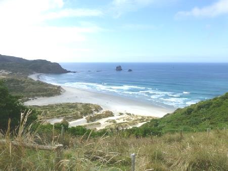
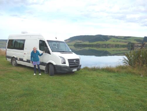
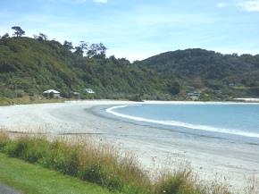
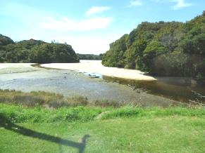
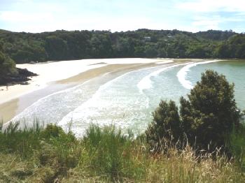
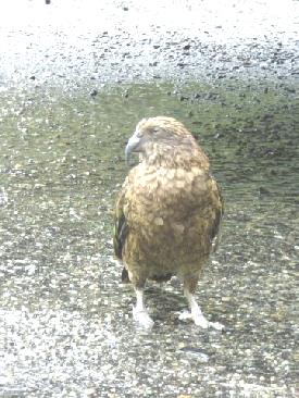
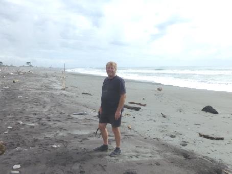
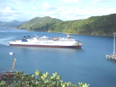
My watch had stopped, and so had the spare one I'd brought. We hadn't managed to walk down to the beach so drove there after leaving the campsite. It was a nice place to stop for coffee, high above beautiful St Kilda white sandy beach.
After that, it was time to shop. The supermarket was pleasant enough, but we stilll found prices high.
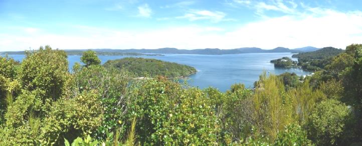
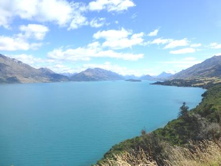
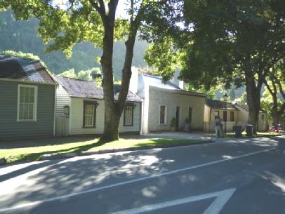
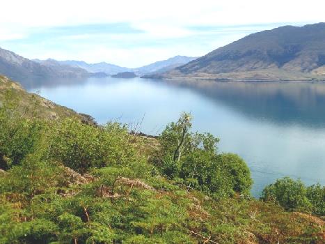
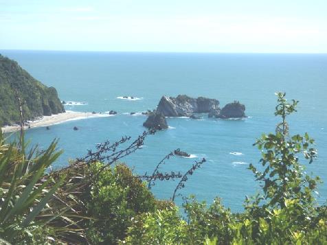
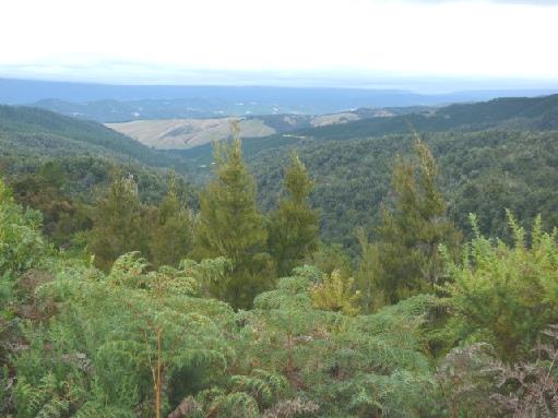
Then it was time to drive along the 'Portobello Road', along the northern shore of the Otago Peninsula. This was really lovely, making us think of the Antrim Road in Northern Ireland.
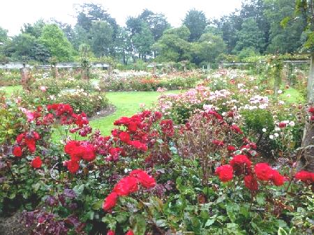
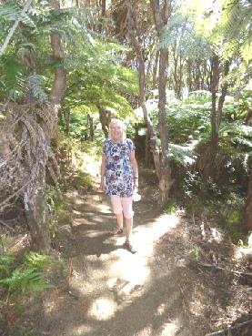
We stopped at Glenfalloch Gardens, delightful gardens set steeply beside the water. There were roses, red hot pokers, agapanthus, fuchsias. All looked lush and thriving. It was really quiet as we walked around beneath the huge trees.
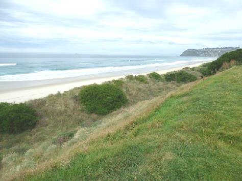
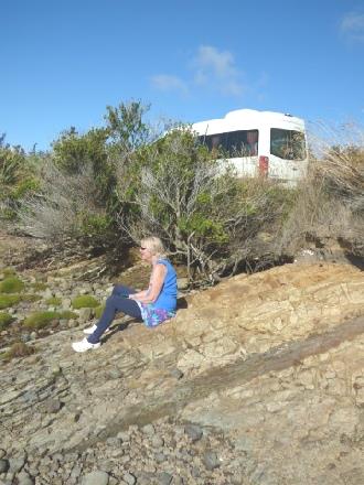
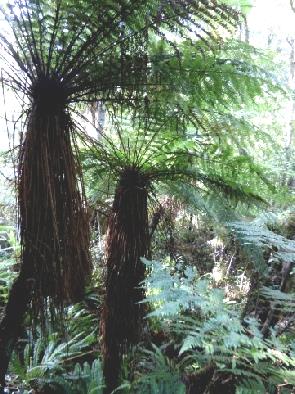
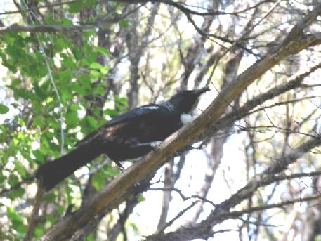
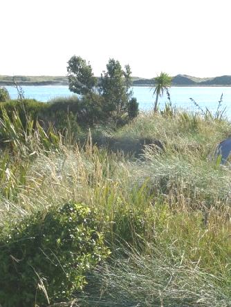
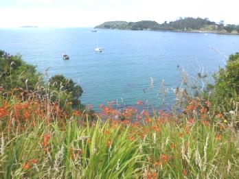
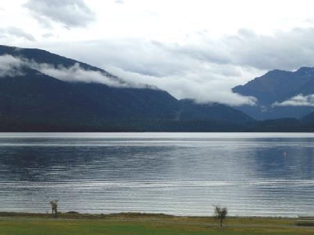
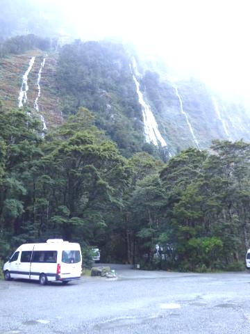
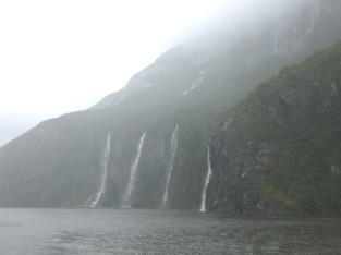
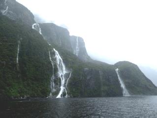
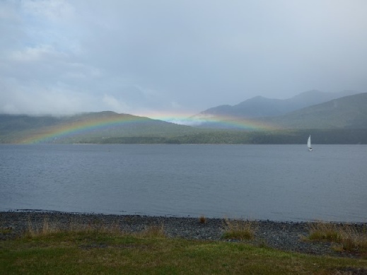
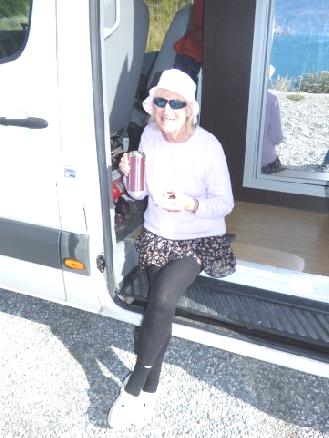
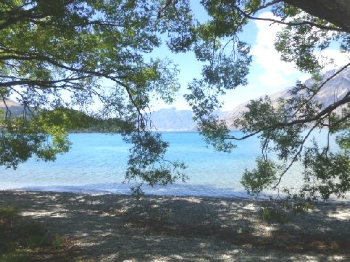
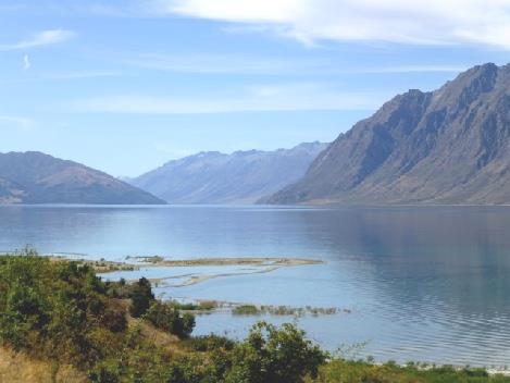
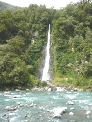
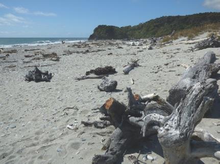
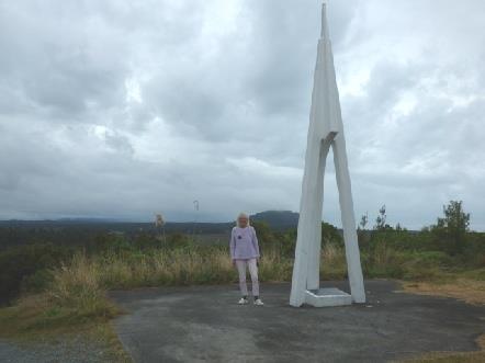
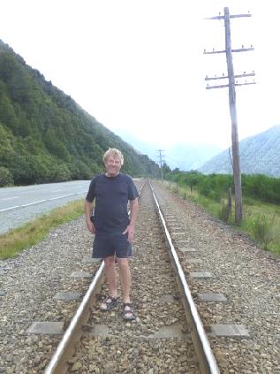
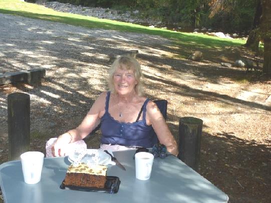
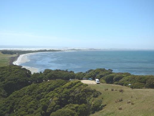
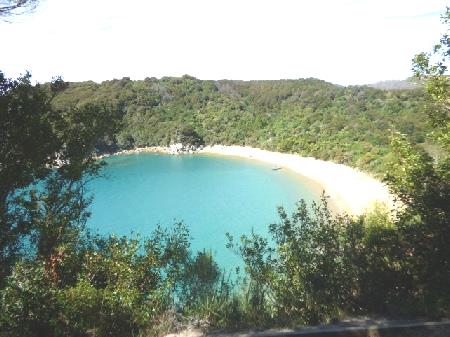
St Kilda’s beach, Dunedin
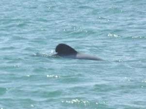
When we reached the 'town' of Portobello, we booked into the campsite before driving to the end of the peninsula at Taiaroa Head. A colony of Royal Albatross nest here, and we did see a lot soaring overhead. It was too blowy for me - the previously warm day had now clouded over. Blue penguins also come ashore here, but we didn't see any.
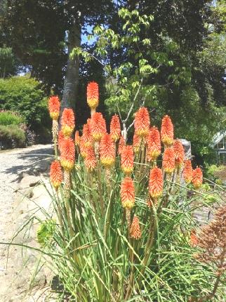
Gorgeous Glenfalloch Gardens
The Royal Albatross Centre had a lot of information on the albatrosses, and on Dr Lance Richdale who'd studied them back in the late 30s. There was a delightful cine film showing, which he'd made then. We saw that the centre had been opened by the Princess Royal in 2005. Prince Charles had visited in 2010.
As we drove back to the campsite, it started to rain, so the views weren't very good. When we reached the camspite, we saw that all powered sites had been taken, so it was good that we had booked. (there's virtually no free camping on the peninsula)
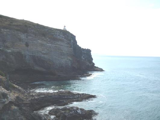
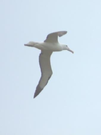
A Royal Albatross flies over Taiaroa Head
Saturday 13th February Superb beaches as we make for the Catlins 172 km
It was sunny when we left at 9.30. We headed for Sandfly Bay, and were pleased that the road was sealed, but it was closed beyond the turn off, so we had to return the way we'd come.
There were beautiful views as we walked down the steep path through the fields of sheep - they hadn't been told not to poo on the path! We walked as far as a viewpoint where we looked down to a beach of exquisite white sand between wild green headlands. We didn't continue right down to the beach. We could see a mother and baby sea lion, but once again no yellow eyed penguins. There were a lot of black birds on the sands.
We climbed back up, and followed Sandymount Road which was surfaced as far as some lime kilns dating from 1874, we then returned and stopped beside the water for coffee. There were some terns and a shag. The rocks here were very yellow.
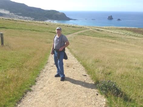
Setting off to walk to Sandfly Bay
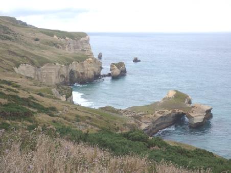
Next we made for Tunnel Beach. The path down to here seemed to rival Baldwin Street for steepness! We could see the arched rock on the seashore, but didn't walk all the way down there. There were plenty of other people doing so!
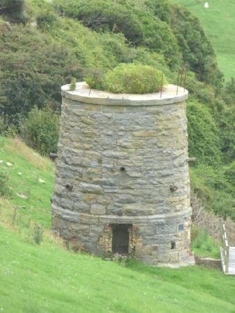
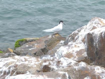
An ancient lime kiln and a tern
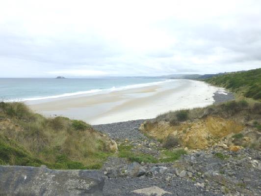
We stopped by another beautiful vast sandy beach for lunch - it didn't seem to have a name! Afterwards we walked through the undergrowth and down to the beach. As we reached the van again, a neighbouring chatty surfer talked to us.
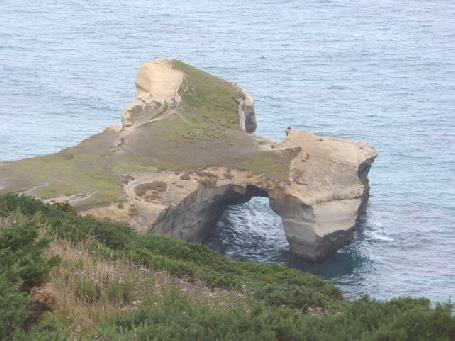
Tunnel Beach
The beaches from here to Brighton!! were stunning. We walked down some steps to one deserted beach. As we returned, a siren alarm rang out - later we passed several fire engines.
We continued to Taieri River Mouth, which was quite beautiful, but after this the road became unsurfaced (impossible to tell from the maps) so we had to return.
We now had to travel inland through farmland until Baclutha in order to cross the bridge over the Clutha River. We stopped here to get fuel, coming back to the coast at Kaka Point - the start of the Catlins. Here were more fantastic beaches. We'd hoped to drive to Nugget Point, for our last chance of seeing the rare yellow eyed penguins nearby, but the unsurfaced road put paid to that!
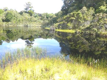
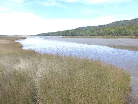
We continued through Omaka, the only 'town' in the Catlins, then headed for a free 'campsite'. This we didn't find, but we did find a fantastic spot beside Catlins Lake. There was beautiful bird song as we arrived. I sat on a rock on the 'beach', enjoying the stillness and solitude. There was surprisingly little birdlife - one shag, two black swans and 3 oystercatchers, but it was a dream of a place, making us think of estuaries in South Devon.
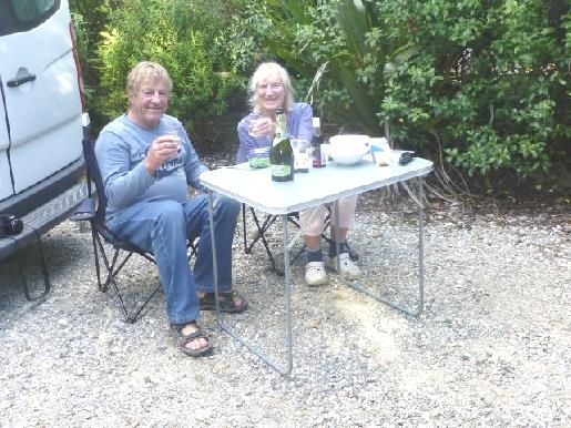
We revelled in the solitude, sitting with our beer/G&T at the water's edge, and later eating our supper here, trying to do a 'Rick Stein', waiting for the water to lap the table legs before the sun went down! A magical evening.
Un-named beach where we stopped for lunch
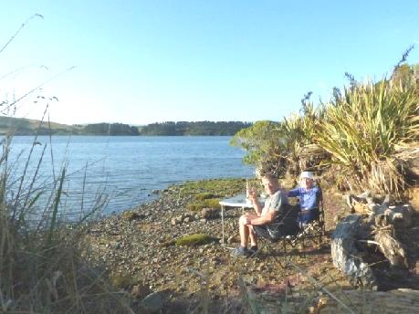
A magical spot beside Catlins Lake
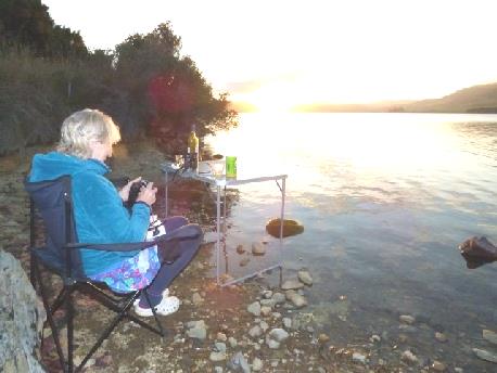
Sunday 14th February Double excitement at the end of a great day in the Catlins 114 km
A fabulous location to start Valentines Day! We exchanged cards - yes, even after all these years, before I cooked a Sunday/Valentines Day breakfast, including eggy bread. We ate this, with our beautiful view with the reflections on the water. Birds were singing tunefully from the trees beside us.
It was nearly 10 o'clock when we left this idyllic place, driving the few miles of unsurfaced road beside Catlins Lake, back to the Papatowai Highway. At the junction we saw shelduck and Canada geese.
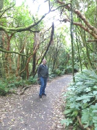
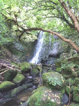
We hadn't taken the unsurfaced road to Purakauni falls, but soon stopped to walk to Matai and Horseshoe Falls a bit further on. This was a superb walk through forests of ferns and orange-barked trees. The Matai Falls were very pretty. We climbed up some wooden steps and a slope to Horseshoe Falls which weren't so impressive but we really enjoyed our walk, even easily managing the uphill stretch on the way back. With birdsong above us, it was lovely.
Leaving our lovely spot by Catlins Lake
Back by the coast, we pulled into Florence Hill Lookout, looking down to lovely crescent shaped Tautuku Bay.
Walking through the forest to Horseshoe Falls
Soon afterwards we walked through ancient forest to Lake Wilkie, reminding us of walks through rainforest in Australia.
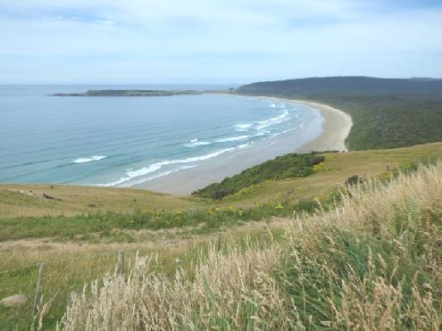
Tautuku Bay from Florence Hill lookout
A bit further on we took another walk to Tautuku Lake, where we walked out on a boardwalk to the reed filled inlet, where there were hundreds of snails, but no birds. We'd passed a small group of people with energetic young children leading the way. Most excitingly we saw a tui bird, like we'd seen in the reserve, and realised that this was the bird we'd been hearing singing so melodically.
A wonderful walk to Lake Wilkie
After this we didn't take the 3km unsurfaced road to McClean Falls, but then we couldn't find anywhere to stop for lunch. We finally crossed to a small grassy area on the other side of the road.
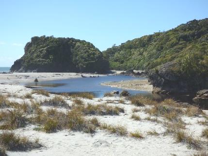
Now we made our way to Curio Bay. There were modern steps down to a platform beach which contained petrified trees.
We see a tui on the way to Tautuku Lake
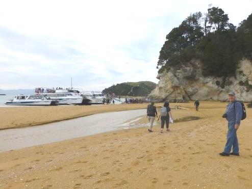
It was fun walking across the rocks, with the prospect that beyond it was a site where the yellow eyed penguins lived. We didn't see any, but drove along to the campsite, which you could drive through to access Porpoise Bay and a superb headland. We drove up to the headland first. Being Sunday, it was quite busy, but very lovely as we looked down, but we didn't see any dolphins. We enquired the price at the campsite but it was more expensive than our book suggested.
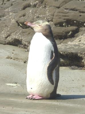
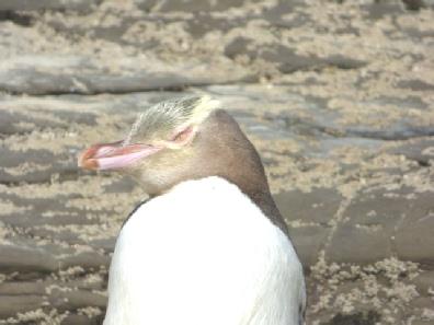
We decided to have a cup of tea by the wonderful beach before heading for the free camping spots Adrian had. Some people were out in the sea, and it did look quite fantastic. Then just as we were about to walk down on to it, I spied a PENGUIN on the beach! At first I thought that perhaps it was a stuffed one, to remind people to protect them. We walked down, and yes - it was a real yellow eyed penguin - extremely rare, and only found in southern New Zealand. A fierce ranger was making sure that no one came too close to frighten it. She said that it shouldn't be here at this time of day, and perhaps had become disorientated. As if that wasn't enough, we turned round, and there were a group of hector dolphins cavorting in the sea. We didn't know which way to look! No one much seemed to have noticed the penguin - when we got back to the van, the people sitting by their van next door had no idea it was there. I felt emotional with happiness - I'd said that I only needed to see one, so I thanked this one for being there!
Petrified trees at Curio Bay
We now didn't need to stay at the campsite (the only reason would have been to possibly spot the pengins at dusk, but as it seems there were only two familes nesting here, it wasn't very likely anyway.)
Instead we made for a free camping place at Fortrose, not taking the gravel road which went near to the most southern spot in New Zealand (except for Stewart Island).
We pulled in amongst several other campers beside Toetoes Bay, which was quite beautiful.
We sat out in the warm sun with our bubbly, the only annoyance being small biting sandflies.
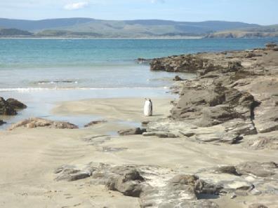
A rare yellow eyed penguin and a Hectors Dolphin at Porpoise Bay
I cooked salmon for supper. The couple in the next camper chatted to us, saying we'd chat more later, which we didn't. In the morning they were busy talking to other campers here – quite a group of them. We didn't join in!
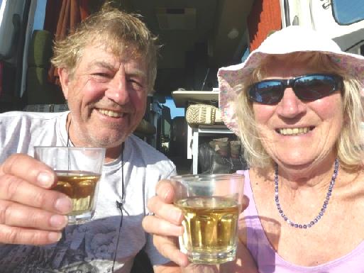
Cheers to Valentines Day and the yellow eyed penguin
Monday 15th February Right down south 87 km
We spent a long time planning our trip to Stewart Island tomorrow, and Milford Sound on Friday.
We left at 10 o'clock, having had a last look at the beach.
The road to Invercargill went across flat farming country and was often edged with pampas grass.
When we got there, we shopped in New World, once more finding goods more expensive than in England. People at the check out were chatty – something we couldn't experience in Morocco, when we couldn't speak the same language.
Our next visit was to 'E. Hayes & Sons Ltd'. This was a massive hardware store, mixed in with a 'museum'. There were exhibits of a few vintage cars, plus dozens of old motorbikes, as well as much more memorabilia. One of the bikes had belonged to local hero Burt Munro, who had raced it at Bonneville. The assistants were all very friendly, and were happy for people to wander around taking photos. As I told one of them, it was the most fun hardware store I'd ever been in! They sold other things too, and we purchased a pack of plastic wine glasses, as the van only had 2 tumblers! Also we were able to get a battery for my watch, which the young lad fitted for us! A great success!
It was now gone 1 o'clock, so we headed for massive Queens Park, where we sat in the van amongst the aesthetically pretty pastel flower beds. A statue of Burt Munro stood nearby. It started to rain, and as it didn't stop, we set off anyway for a short walk in the lovely gardens. There was an impressive rose garden, and some enormous trees. We were just sorry not to see more of the gardens.
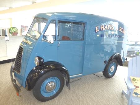
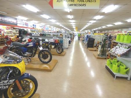
E. Hayes & sons splendid shop and museum, Invercargill
Adrian had hoped to stop at a 'cheap store' to get one or two things he still wanted, but all the parking was by meters or paying, so we continued out of the town, stopping at a booze shop on the way. The rain continued as we drove the 30 km across flat land to Bluff, ready for our trip to Stewart Island tomorrow.
We reached Bluff campsite, which we had very little information on. It didn't look much fun in the rain, and things went from bad to worse when we discovered that the internet 'wasn't working', the 'office' was unmanned – just a self service table in the communal kitchen - and the fee was the highest of any campsite yet! ($50 - £25). We'd wondered why the chap at the office table hadn't taken any notice of us, until we realised that he was just a camper, like us!
Adrian was so cross about the price of the campsite that we packed up and drove to the ferry terminal, but there was no chance of staying there. We drove down to Stirling Point, the end of Highway 1, where there was a signpost to various places in the world, including London, but ‘no camping’ signs everywhere.
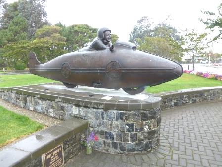
Local hero Bert Munro outside Invercargill’s Queens Park
We drove back to the site as the rain continued. We were surprised when an elderly lady with a car and caravan pulled in beside us, managing everything herself.
We started the next part of the website. We phoned Nicky, and had animated conversations with Louisa & Joanna.
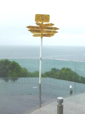
London 18958 km from Stirling Point, Bluff
Tuesday 16th February A superb day on Stewart Island 60km
There was more rain in the night, but luckily the day was quite bright. This was the day for our trip to Stewart Island, a place I had long wanted to visit.
We drove to the ferry terminal, arriving just before 9 o'clock - the car park was already full.
We were a few minutes late in leaving for our 9.30 crossing, but all went well. As we headed for Stewart Island, we saw sooty shearwaters gliding over the water and the occasional albatross. The captain slowed at one point, as he'd seen a yellow eyed penguin, but it didn't appear again. We were so glad that we'd seen ours a couple of days ago.
As we neared Stewart Island, I was surprised to see several other small islands.
After we disembarked at Oban, the only settlement on the island, it rained a bit. It was like a day we spent on Tresco, Scillies, many years ago - the sun and the rain had a battle - luckily this time too, the sun won!
We set off to walk the short fuchsia trail - which was lovely, through tall trees and ferns, but no sign of a fuchsia!
We called in briefly at the Rakiuri Museum ($2 each), where there was a lot about whaling in the past. There was a copy of Captain Cook's map, when he erroneously thought that Stewart Island was a peninsula, joined to South Island.
We ate the roll we'd brought with us for lunch, sitting at a picnic table by the front. At this point, there were several spots of rain, but luckily it soon stopped!
After this we went to join our 1 o'clock 'Village and Bays' tour. Most other people on the small bus were in a group. We had two single seats at the front of the bus. Our driver/guide was a very pleasant young lady called Kylie. She was of Maori/ Scottish descent, married with two young boys. She gave us a lot of info on the island, which she certainly appeared to love.
The island - New Zealand's 3rd largest, has 730 km of coastline. There are several long trails you can walk - the longest takes 12 days. There are no pigs, stoats or mice on Stewart Island. Rats and cats have become a problem in recent years. There are apparently a lot of white tailed deer, and kiwis outnumber humans, but we didn't see any, as they are shy and usually nocturnal.
We set off in the bus across to Lee Bay, to the gateway at the start of Rakiura National Park.
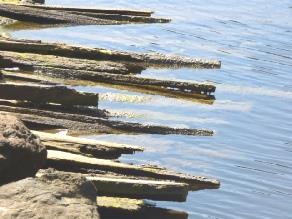
In the past a lot of logging had taken place - we stopped later to see some of the wood still lying in the water. We learnt that there is no doctor or hospital on the island, just one paramedic for the 400 inhabitants who all live in Oban.
Kylie painted a picture of a very caring and united community - certainly all the locals waved as we passed, and she waved to them. The elementary school has 30 pupils aged from 5-13. After that the children have to board on the mainland.
We passed pohutakana trees still in flower - Kylie said that they'd have finished blooming on the mainland. We also found out that there had been a minor earthquake this morning at 8.30, south of Stewart Island.
At 2.30 we were back in Oban, having had a good insight into the island, and passing some beautiful bays of white sand.
On the Fuchsia Walk, Stewart Island
Now alone again, we walked up and over through woods, coming out at stunning Bathing Beach, where I had a paddle and we rested a while before finding our way mostly by road back to Oban, on Half Moon Bay.
Horseshoe Bay
Chain link entrance to Rakiura NP
Lee Bay
Butterfield Beach!
End of Bathing Beach
Abandoned Rakiura wood
View from Observation Rock
We had a cup of tea and carrot cake sitting on the front before making for the 5 o'clock ferry back to Bluff. All went well, and just after 6 o'clock. we were heading northwards, not wanting to spend another $50 on the campsite in Bluff! We headed back through Invercargill. On the outskirts, Adrian spied a fish & chip shop, so we bought some and then hotfooted it 30 km to the free camping place at Thornbury, a pleasant grassy area beside the Aparima River. The fish & chips had lost some of their crispness by now, but we soon tucked in, washing them down with Blackmac beer. It had been a good day!
Looking through montbretia to Half Moon Bay
Pohutakana flowers
Beautiful Bathing Beach
Wednesday 17th February To Te Anau in the rain 163km
The morning started fine. A girl from the next car (we can't believe how many camping adapted cars there are) spent hours doing a yoga workout on the ground outside.
We walked under the bridge by the river to another camping area, and didn't leave until nearly 10 o'clock.
At Riverton, one of New Zealand's oldest settlements, we passed a nice steam engine beside the road near the river estuary. The town had become established through whaling.
Pleasant free camping spot by the Aparima River
We now crossed into the area known as Fiordland, and known to be wet. It started raining immediately, and continued all day!
We drove past Colac Bay, another area where you could free camp. It was a lovely bay, but the road had been washed away and was cordoned off. A sign said road closed, but we managed to get through.
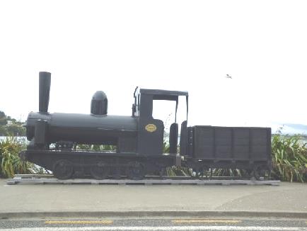
A nice steam engine at Riverton
A bit further on, opposite pyramidal Monkey Island, was another free camping spot. We walked on to the sandy beach, but the rain came on in earnest!
Damaged road at Colac Bay
We stopped as many others had at McCracken’s Rest lookout, looking down to the long dark pebbly beach which extended to the wild area of the southwest, with no road access. Surprisingly there were no birds here at all.
We were driving the Southern Scenic route, stopping next by 'Clifden Suspension Bridge', which had been built in 1899. We managed to walk onto it in a lighter moment of rain, before having our lunch.
Monkey Beach
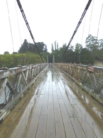
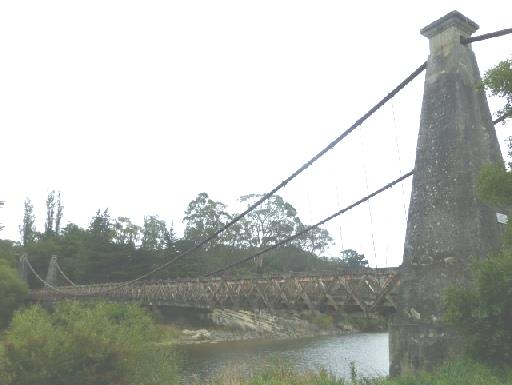
Clifden Suspension Bridge!!
Thusday 18th February The Milford Road (in the rain!) 126km
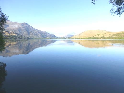
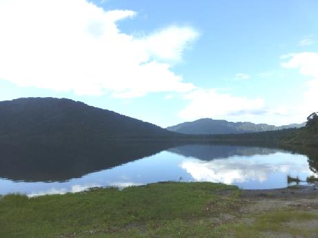
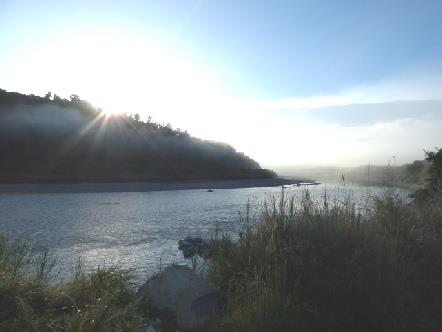
The morning started fine. We didn't leave until nearly 10.00 - the booking out time, as at many sites, which we think is rather early. The lake did look lovely this morning - now that we could see it.
Morning View of Lake Te Anau
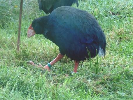
Another takahe
The rain returned as we continued through ever more impressive scenery. At first it hadn't been particularly remarkable, but after the Honeyford valley turnoff there were cascades spilling out everywhere from the near vertical amazingly high mountainsides, some of which had snow. Rivers gushed by.
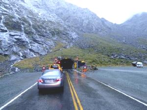
We reached Homer Tunnel, by the dramatic Gertrude Cirque, where waterfalls spilled out everywhere. The tunnel is 1200m long and is a constant 10% descent. It was started in 1935, but not completed until 1953. It is still very simple, hewn from the rock. Being narrow, there are traffic signals controlling it - Adrian was amused at a 'Hidden queue' sign.
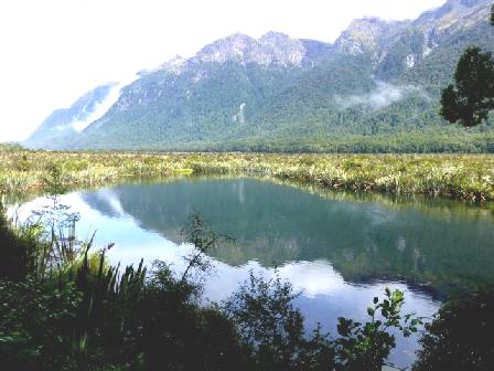
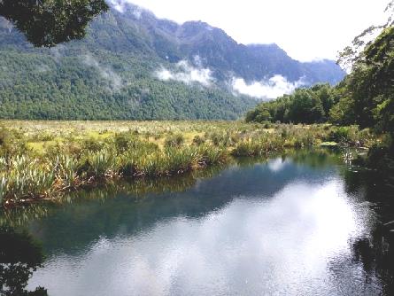
Mirror Lakes
The road is known for its high accident rate - we had passed two badly bent stranded vehicles on the way.
We reached the small habitation of Milford Sound - just a starting off place for the various tours really. We had tried to book camping at The Milford Sound Lodge yesterday, and had left an answerphone message, but when we reached there, all powered sites had been taken. We were offered an unpowered place to park for the same price - $50 (£25). As there were no other options - no free camping allowed - we had to take it. At least it was more in the open than some of the powered sites, which were set under dark trees. The rain continued, along with thunder & lightning. When the rain let off briefly, we walked across to the main building, and saw the unbelievable waterfalls all around. There was a washing machine - but tonight was not the night for that!
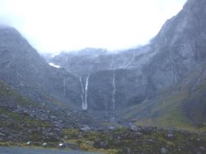
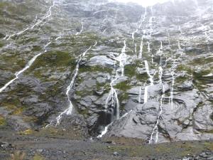
Waterfalls at Gertrude Cirque at the entrance to Homer Tunnel
The rain returned with a vengeance and lashed down. Everywhere around us became flooded. We read through our recent diary and then I got supper - cooking rice, as that took quite a while, and would warm the van a bit! (we had no heating).
Afterwards we walked across to the 'lodge', which was packed out with young people all eating supper, a bit like a youth hostel. We found a place to sit in a quieter spot, and usefully spent our time getting up to date with the website, while the rain continued to lash down.
We returned to our van and quickly got into bed!
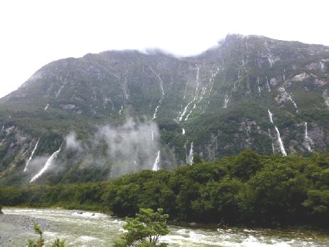
Waterfalls appeared everywhere!
Our guide was a young chap who we immediately noticed spoke much like us. Sure enough, he came from Ascot. He had just finished Uni studyIng marine biology. Family friends had visited here, and suggested that he came to work. He had only been here for a fortnight, and had a year's permit. We had a long chat to him, as all the others in the group left on the next boat, but as we knew that there would be no lift back for us until 2.30, we decided to stay. There was plenty of information to interest us.. After our chap was called to have his lunch break, we had a nice look around all on our own.
We caught a different boat back, but by now the skies were clearing and we even had a bit of blue sky. The views were now clear and magnificent. We'd had a really good trip.
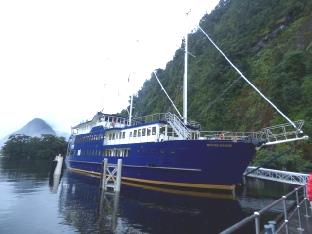
Milford Mariner
Bowen Falls
Looking across to the Stirling Falls
The 4 Sisters
New Zealand fur seals
Under the Stirling Falls
Our boat leaves the Observation platform
A few of the ‘extra’ falls
We had opted to stop off at the Undersea Observation Centre, so were dropped there with one or two others. There was an observation room which was 10 metres below the surface of the water so that you could observe the fish and coral. Because of the very narrow entrance to Milford Sound the sea water doesn't have much movement and because of the vast amount of rain water flowing into it and the fact that the fresh water 'floats' on top of the sea water, the fiord ends up as 8m of very tannin coloured fresh water on top of very deep seawater. This means that coral which only normally exists 100m down in the dark can be grown at 9m and you can see it. Unfortunately for us, the huge amount of rain meant that there was 9m of fresh water in the sound and so they had had to lower the 'coral gardens' as they had to stay in the sea water and so we couldn't see them!!. This was a disappointment, but we did see plenty of fish.
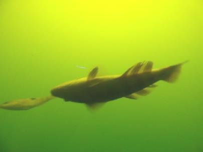
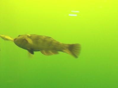
Some of the deep sea fish
We caught the 2.30 'park and ride' and then set off back to Te Anau on the Milford Road.
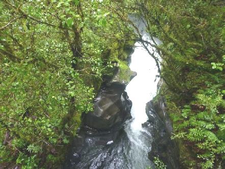
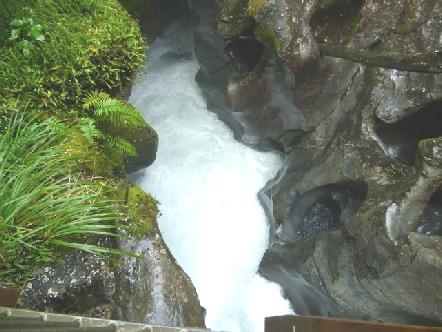
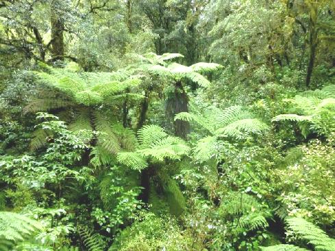
We stopped first at 'The chasm'. We had an enchanted walk through lush rainforest with tree ferns to a more than impressive 'chasm', where water gushed through below us, gauging out 'pot holes' in the rock.
The skies begin to clear as we return
We drove back through Homer Tunnel, stopping by Gertrude Cirque, now much more clear than on the way yesterday. As we drove towards Te Anau, the weather became drier and drier. We stopped once or twice more. Although the many simple campsites along the way had attracted us, we had decided to head for a campsite in Te Anau, and this time to have electricity!
Just after 5 o'clock, we arrived at 'Great Views' campsite, advertised outside as one of 'Family Parks', a chain which gave us 10% reduction. 'Oh no,' said the lady when we booked in, we haven't been 'Family Camps' for years. Adrian said 'well there's a sign outside'.'Oh', she said, 'we haven't taken that down yet'!!
A kea in the car park
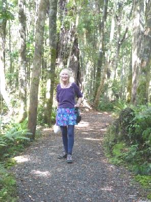
Through the rainforest
To the chasm
Saturday 20th February A quiet journey to Lake Wakatipa 135km
It was a mixed day - windy, sunny, showers. After catching up with emails, we didn't get going until 10.45. Then there was a beautiful brilliantly coloured low double rainbow. We stopped to enjoy it by the lake while we had tea/coffee.
After that it was time to do a bit of shopping, in 'Fresh choice', where we'd shopped the other day, and found the bread the best yet in New Zealand.
We set off through pleasant but unremarkable country, which sometimes looked rather English, especially when we stopped in a heathland reserve for lunch. The whole route was almost flat, down the centre of wide valleys with hills either side.
We continued to Kingston and zig-zag shaped Lake Wakatipa where we soon found a place to stop beside the lake.
A low rainbow over Lake Te Anau
It was really beautiful looking across the lake, but a bit windy. We phoned Simon (& Millie), Tom (& Rita) and Paul (&Joanna).
Just before bedtime, we discovered that the house battery had gone flat - no power, so no water and no real lights. We went to bed using our torches!
Peaceful spot by Lake Wakatipa
We continued along beside the lake towards Glenorchy, stopping just after the final 'zig-zag', where there was an exquisite view with blue sky, blue lake and snow on the top of the peaks.
Coffee with a view, near Queenstown
Now we began on the road back to Queenstown. We stopped at Bob's Cove, and started to walk down. It was a really long way, so we didn't go far, but stopped to watch birds flitting in the trees above - tomtits and fantails.
We came back to '12 mile delta' - a campsite and picnic area on Wilson's Bay - to have lunch. There was a pebbly beach in front, and remote mountains opposite.
Stunning view of Lake Wakatipa near Glenorchy
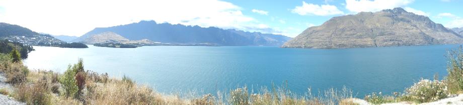
We now drove back through Queenstown, which was still teeming with people.
We stopped briefly to look at Edith Cavell bridge before making our way to Lake Hayes, where there was a free camping spot. A lady on the boat to Stewart Island had talked to Adrian about it. It was still only 3 o'clock, but the spaces were mostly taken, so we pulled in by the lake. It was sunny but windy. We could hear music and when we walked along, we found that it was a group of 3 men playing pleasant country music to a small audience.
Lunch at Wilson’s Bay
The wind dropped later and there was a beautiful sky over the lake, with the almost full moon.
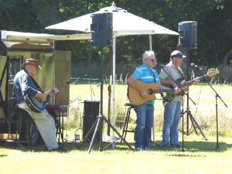
Great Country group
Evening by Hayes Lake
Monday 22nd February Problems sorted then a lovely ride to Makarora 171 km
It was a lovely day, but started very cold - I got really chilled. We were annoyed that we had a slip of paper put on the windscreen with a $200 fine for parking with a vehicle without a 'self contained' certificate - but we had got one, stuck on the window as required!
There were some ducks on the lake, which looked really beautiful with the sun shining on it at 9 o'clock when we left.
Lake Hayes as we left
Goldminers houses, Arrowtown
The post office
Ah Lum’s shop in Chinatown
A Chinese workers shack
Halfway up the lake, the road crossed a narrow strip of land before we drove up the eastern side of Lake Wanaka.
Lake Hawea
We passed a large herd of sheep following along the road before coming to Makarora campsite at 4 o'clock.
It was a very informal site, with a grassy field for motorhomes and edged by forested slopes. The sun was still warm and the situation very pleasant.
Lake Wanaka
Tuesday 23rd February To the west coast 160km
The night was much milder, and the day sunny and cloudy.
We watched the activities of the tiny 'airport' opposite us - two helicopters and one small yellow plane giving tourist rides.
It was nearly 10 o'clock when we left to continue through the forest along beside the Makarora River towards Haast Pass. They were working on the road - at one point we had to follow a pilot vehicle - it's a long time since we've done that.
After the Haast Pass, we soon stopped at Fantail Falls, which were pretty, but not as impressive as they might have been if we hadn't just visited Milford Sound!
We had tea/coffee afterwards sitting on rocks beside the river.
We stopped next at the Gates of Haast to view rapids under the bridge.
Fantail Falls
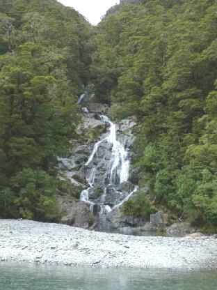
Next stop was a short walk through the primeval forest to look at impressive high Thunder Falls.
Gates of Haast
Thunder Falls
We saw no wildlife, but could hear birdsong above. It was pleasantly hot, and there were no other people at all. This coast is a World Heritage Site, like the Dorset Coast is.
We returned to Haast and crossed the Haast river on a 700m long bridge - the longest single lane bridge in New Zealand.

The Hapuki Estuary Boardwalk
In contrast to our walk, when we stopped at Ship Creek, it was really busy. There were two short walks that you could do here - one through the dunes and one through the swamp forest - but we just opted to walk onto the beautifully wild, sandy/pebbly beach, strewn with logs like the west coast of Vancouver Island.
Bridge over the Haast River
Knights Point was another lovely viewpoint, but again with many people.
The wild beach and Ship Creek
After that we headed inland to Lake Paringa, arriving at 4.30. This is a DOC (Department of Conservation) site. The views across the lake were lovely, but we couldn't see it from our spot. The bad thing here was the enormous number of sandflies.
Knights Point
Lake Paringa
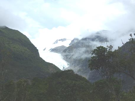
Wednesday 24th February The Fox and Franz Josef glaciers 162 km
The morning was damp and grey, with some rain. We left just after 9.30, driving through the lush rainforest to the Fox Glacier. When we rounded a sharp bend a cupboard burst open and all the pans and bowls shot out, but nothing got broken.
We stopped by the one-lane bridge over the Cook River, just before the Fox Glacier.
The road on this side of the river to the Fox Glacier was unsurfaced, with a height barrier of 3.2 metres - the height of our van.
We took the road on the other side and managed to find a space in the carpark. We remembered to take our hiking sticks, which was a good thing as the walk was quite rough, and included crossing a stream. The weather had brightened but it was still damping as we walked along amongst all the other people for 15 minutes, where we stopped to view the glacier before returning. It was good to see, but having seen very many glaciers in Iceland, Canada & Alaska, it was just the feeling of having seen it.
We were surprised how late some campers arrived (and left in the morning - perhaps so that they didn't pay!)
It was almost midday when we left, taking the road towards Lake Mathieson. We continued past to a viewpoint of the glacier, which made a really nice lunch stop. It was quite dry here, and really quiet and we had a good view.
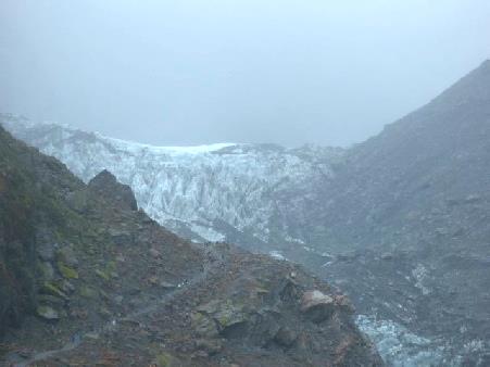
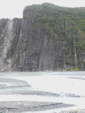
The Fox Glacier and the vertical valley sides
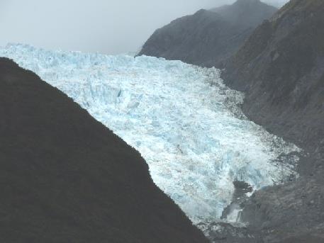
Our lunchtime view of the Fox Glacier
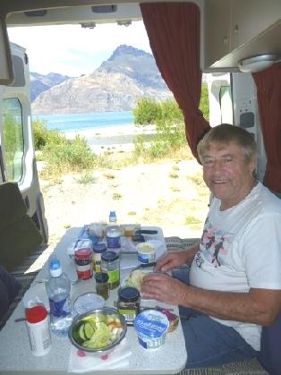
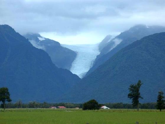
The Franz Josef Glacier
Whataroa Hotel, where we camped
Thursday 25th February Towards Arthurs Pass 138m
It rained in the night and the morning hung heavy with cloud so that we couldn't really see the mountains. When we set off at 10.15, we found that my seat belt was saturated where rain must have got in.
Our road northwards wiggled through the verdant forest with the Whataroa River spread out below in the flat plain. We stopped at Harihari and were able to dump the dirty water in a nicely grassed little campsite.
We stopped by Lake Ianthe for coffee - it was pleasant but would have looked nicer in the sun!
Continuing north, we pulled in for lunch south of Ross by a memorial to the road builders. We were accompanied by two inquisitive wekas - chicken like birds, once thought a pest, but now endangered.
Lake Ianthe
Ross had been another gold mining town - at one time the largest alluvial gold mine in New Zealand. We stopped to look at the old gaol and a miners cottage, part of a village trail. It was far more authentic and evocative than Arrowtown.
A weka by the road builders memorial
North of here we came to Hokitika, which had a beach of very grey sand. We shopped in New World, hoping to be prepared for my birthday tomorrow. As before, we found that we were given loads of plastic bags, unlike Britain now, when you have to pay for them.
When we came out, it was sunny.
We returned to the beach to sort the shopping. The log strewn beach looked far more attractive now!
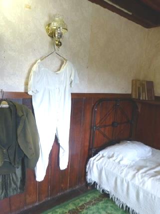
Ross Gaol - and the original onesie?
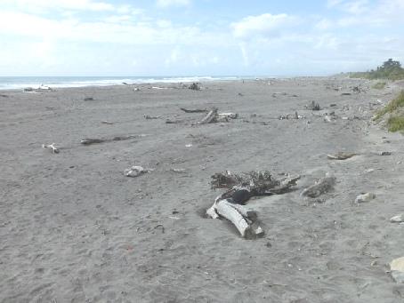
Pleasant Hokitika Beach
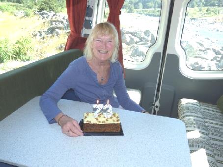
Friday 26th February Arthurs Pass on my birthday 226km
My 73rd birthday! We didn't think that I'd make that 5 years ago!
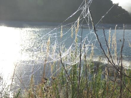
There was mist above the river, with the sun shining through the grasses, lighting up the large spiders webs.
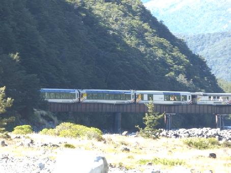
It was very windy when we stopped at Arthurs Pass village to have some of my birthday carrot cake, which was really good. Adrian had got a 7 and a 3 candle. We watched a large party of schoolchildren returning from an expedition, happily exploring in the river.
Adrian was delighted that at that point, the 'once a day' train appeared, before going into the tunnel. We would have liked to had gone on it, but it is only geared to setting off from Christchurch, so didn't suit us.
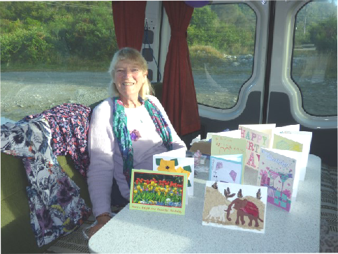
I enjoyed opening my cards and presents before cooking yummy bacon sandwiches for breakfast.
Early birthday morning
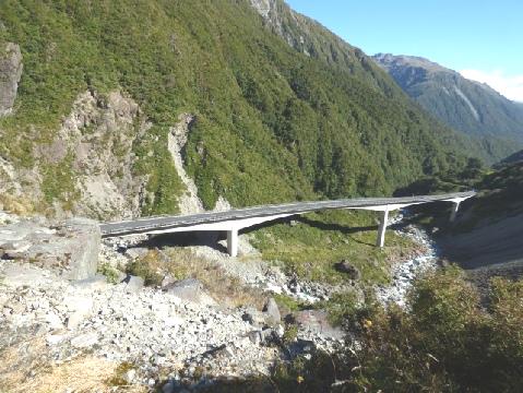
Viaduct near the top of Arthurs Pass
There was a rubbish bin here, but as Adrian returned to the van, the balloon by the door got stuck in it and burst with a loud bang!
We discussed which way we should now go - we could either go on down to Christchurch, or return over the pass, with the hopes of visiting Abel Tasman National Park before leaving South Island in a few days time.
We decided on the latter, so continued through the village, then returned over the pass. There was very little to mark the summit. We descended, coming down to the turquoise water flowing over the rocks in the Otira River. Orange lilies glowed in the sun.
There was a collection of old vehicles outside the Otira Hotel, including a nice old Ford model T truck. Only as we pulled away did we see a sign saying 'fish and chips'. It was just midday, so we carried on, hoping to see somewhere else to stop for lunch, as Simon's present to me was to have lunch out on my birthday.
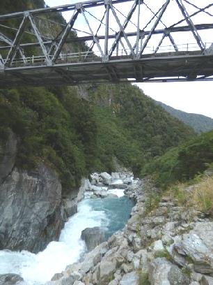
We stopped by Morrisons footbridge, a long footbridge over the river at the start of a walk. We crossed the railway and walked onto it.
How old?
A train for Adrian - going into the tunnel
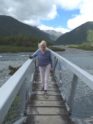
Over the railway to Morrison’s footbridge
Nice birthday lunch - thank you Simon & Laure!
This area was certainly not on the tourist route, and consisted of very simple villages, more as we remember from our last visit.
We pulled into Tawhai picnic site, which had a sign saying 'Nature walk'. It didn't say how long, but was just a lovely 10 minute stroll through the forest. Adrian had been heading for a campsite at Reefton, but I suggested a DOC campsite, at Slab Hut Creek, a few minutes off the road, at the site of former goldmine workings. We headed there and came to a delightful sunny spot in meadows beside the stony river, where you could still 'fossick' for gold.
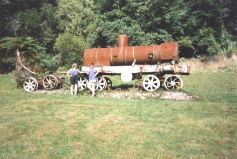
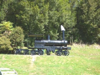
The engine in 1995, and now tarted up!
We sat at our table and chairs for more of my birthday cake, but all wonderful things have something to spoil them - a wasp settled on Adrian's hand and stung him!
We walked around, and moved to a more secluded spot by the river. Wasps seemed to be flying around everywhere, and with the continual nuisance of sandflies, Adrian was quite unsettled, and wanted to leave.
Things got better after we opened the bubbly, and tucked into sushi and nibbles, in fact it was really lovely. It had become very warm - so much so, that we were glad not to be cooking. We came in at 8.30, after a beautiful evening.
Tea and birthday cake
A birthday well celebrated!
Saturday 27th February Aggravating sandflies as we continue north 191 km
It was a mild, cloudy morning. We spent a long time doing the diary and photos for yesterday, and catching up with emails so didn't leave until mid morning.
We drove north through farming and forested country so we had difficulty finding anywhere to pull off to have another piece of my birthday cake (it was still my birthday in England!)
Soon after we had done, we came to Lyell, a former goldmining town. There was a nice picnic area/camspite where we stopped, but Adrian was so troubled by the sandflies - they seem to make a 'sandfly line' for him - that he voted it a miss.
Soon afterwards we stopped above the Buller River for lunch, coming just after that to the Buller Swing bridge - the longest in NZ. We pulled in, but didn't stop. It is a big tourist attraction with all sorts of activities - you had to pay even to walk across the bridge. We'd seen the bridge from a distance but Adrian was sorry not to be able to photograph it.
When we drove across the Buller River, there were hundreds of cars parked beside the road for Buller Festival – it looked like a large canoe slalom event down the rapids – but there was nowhere to stop.
In Murchison we got diesel and dumped, but when we stopped a bit further on to sort out tonight's stopping place, over a cup of tea, we were driven in by the sandflies, wasps and a gigantic bee.
It was nice then when we walked to Hope Saddle lookout, looking out to a world of green, hardly any sandflies bothered us.
The Buller gorge
As we descended now, we saw our first bit of Autumn colour, with some yellowy poplar type trees.
At 5 o'clock we came to McCleans Recreation Area at Woodstock, a campsite provided by one of the forestry companies, where several other people were camping on this Saturday evening. It was a pleasant grassy area with maple trees and loud cicadas.
It was pleasant sitting outside. We ate salmon and chips – chips fried from yesterday, and surprisingly good. We watched the young 'campers' with their 'sleeping cars' and came in at 8 o'clock. The stars were good.
View from Hope Saddle lookout
Sunday 28th February Farewell Cape! 249km
It was a misty morning, making us think of 'September morn' (almost March here !)
The young campers left before we did at 8.45. We wanted to be off early to drive right up to Cape Farewell, and be back to visit Abel Tasman National Park tomorrow.
We drove north through pretty country, with hops growing beside the road, as we'd seen yesterday, and vines and fruit trees.
We were following the Moteuka River, and arrived at the town of Moteuka at 9.15. We passed Wilson's tours, which was who we'd intended to go to Abel Tasman with. The office was open, and a nice young chap, who reminded me of Tom Dobrashian, booked us onto a trip tomorrow morning to go by boat up the coast, and be picked up later.
The main street of Moteuka was dripping with pretty hanging baskets.
After the flat land, we surprisingly came to 'Tanaka Hill', or Ngarua Pass. The road wiggled up amazingly, which didn't suit me! The road down was on longer bends but by then I was feeling quite giddy.
We stopped at Urunwenia reserve - an attractive picnic area, which had 'no camping' signs, but was packed with small tents! I began to recover from my travel sickness!
The town of Tanaka had a mid-west feel, except that the long main street was prolific with hanging baskets.
We drove on to Collingwood, a pretty former gold mining town, again with hanging baskets bursting with busy lizzies on the main street. We stopped by the wonderful beach, part of Golden Bay. It was delightfully quiet, with pretty houses, and wonderfully warm!
We now crossed dozens of bridges over rivers and streams, making us think of Cape York in Australia.
By midday we had reached Cape Farewell - the most northerly part of South Island, and named by Captain Cook (of course!) as he left New Zealand.
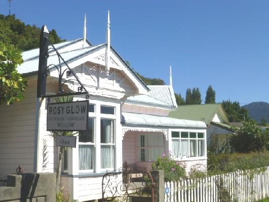
‘Rosy Glow’ beside the beach at Collingwood
We walked to an amazing view up to Farewell Spit and all around. It was strange to think that this beautiful place was once a busy coalmining area.
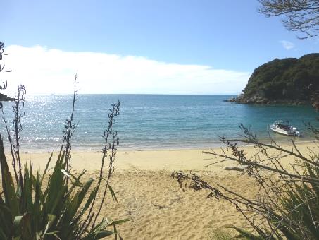
We stopped at Puponga at an idyllic cove for lunch. The warm water was turquoise, and was surrounded by headlands and islands. Heaven!
Farewell Spit from Cape Farewell
Now we began our return journey beside this beautiful coast where black swans on the sea added to the lovely image. On a sandspit we saw hundreds of birds which we thought were oyster catchers and gulls.
We continued past the steep hills, covered by dense forest, back to Tanaka, where we shopped in 'Fresh Choice'. A hippie busker was playing outside, accompanied by his dog. We dropped a coin in his hat.
Now it was time to tackle the winding Ngarua Pass again but by now the views were a bit misty.
We arrived at Kaiteriteri beach, where our boat goes from tomorrow. It was very beautiful, but incredibly busy. We needed to stay nearby, to be ready for our morning boat trip. There was a campsite right by the beach, but it was massive and looked full. Adrian went in to enquire, and found that there was space for us. At first I was most upset at having to be in this vast site at such a beautiful location, but we settled in, and found it to be rather pleasant.
We walked over to the wonderful beach, now quietening down on this Sunday evening. We'd found out where the boat leaves from tomorrow.
Perfect Puponga
Monday 29th February Idyllic Abel Tasman NP 0 miles
We were up early to get organised for our trip to Abel Tasman National Park.
I washed my hair, and we washed the sheets and big towels and hung them out. Adrian booked us in for another night here. We ate breakfast and made up our rolls for lunch, and were ready at 9 o'clock to walk over to the beach to catch the boat up the coast to 'Anchorage'.
Off to catch the boat to Anchorage!
We enjoyed the beach, then sat at a picnic table for the tea/coffee we had brought with us – there are no provisions of any kind in the park. Also there were no rubbish bins – you had to take out everything.
The sun was now warm as we set off through the dense forest to the neighbouring lovely sandy cove of Te Pukatea, with the sound of bellbirds above us.
We arrive at Anchorage, Abel Tasman National Park
It was quite a lot of 'up and down' as we made our way. We passed other walkers – almost all looked happy and greeted us. We spoke to one couple from Chipping Sodbury who have a daughter living in Sydney.
Walking up from this beach, we came to a nice memorial seat with a lovely view, but it was a bit too early for lunch. When we did stop for lunch, quite a few 'puffs' later, the bench was in the sun, looking down over Anchorage. We ate the rolls we'd made up, before walking back to Anchorage. There were quite a few people on the beach, including several kayakers. It was strange to think of people here when there are no roads – everyone had to come by boat – or walk!
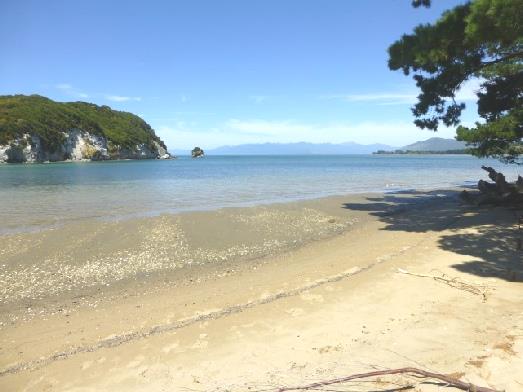
Exquisite Te Pukatea Beach
Tuesday 1st March Our last day on South Island 188km
Memorial to Rutherford at Brightwater
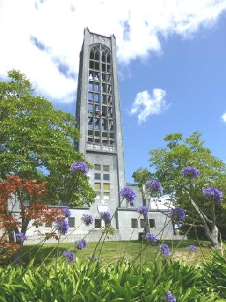
Nelson’s unusual cathedral
We arrived at Picton, and at 5.45 we pulled into the second campsite we tried - Alexanders Holiday Park.
We ate the mussels for supper, and they were good.
Tomorrow we leave on the ferry for North Island, but had we had more time, we would have liked to explore this attractive area more. I particularly liked the idea of the 'Post Boat', which took you out into the sound.
We had really enjoyed South Island, and wonder what we will feel about North Island now.
We didn’t walk the trail this time, but just enjoyed the view
This one isn’t our boat
This one is! (Our ferry for tomorrow)
We drove on through South Fiordland, surprised at first at the relative flatness of the land, looking much like England (especially in the rain)! We drove into increasingly hilly country, but with the poor visibility couldn't see a great deal. We came to Manapouri, where tours go from to Doubtful Sound. We stopped by the visitors centre, but didn't go in – it all looked a bit busy. We stopped above the lake for a cup of tea, and to discuss what we might do, as we were booked into a trip on Milford Sound on Friday. We'd have liked to have stopped at one of the simple DOC campsites, but with the inclement weather, thought that we'd head for a campsite to have electricity and to use the internet. Hence we arrived at Te Anau Lakeview site, an enormous 'holiday park', where the queue at the office was extremely long. It seemed to be mostly young people booking trips. I felt like giving up, but when our turn came, the chap was very pleasant, and we made for our spot, which had views of the lake in fine weather. Adrian's frustration then kicked in, as the so-called internet access didn't appear to work.
At 8 o'clock, the rain stopped briefly. I cooked our own 'fish and chips' - quite successfully refrying yesterday's chips, which we had with monkfish.
At 8 o'clock, the rain stopped briefly. I cooked our own 'fish and chips' - quite successfully refrying yesterday's chips, which we had with monkfish.
Our first stop was the Te Anau wildlife centre in its lovely location right beside the lake. We had a nice walk around. There were enclosures with various birds - most had been rescued. There was a pair of kakas, with their almost adult sized babies, and takahe, the rare turkey/puffin looking bird like we'd seen at the Dunedin reserve.
The netting around the enclosures was too fine to photograph the birds, although they did have small glass areas to take photos through. We weren't going to spend time hunting for the Canada geese though!
It was trying to rain as we had our tea/coffee at a picnic table before leaving, and then it never really stopped! Last night Adrian had remembered that his parents had come to Fiordland in the early 1970's. He found their notes - it had rained non-stop for 64 hours - we hope that we fare better!
Before leaving for Milford Sound, we got both shopping and fuel - neither are available along the 120km road. Adrian finally succumbed to buying an ice tray for his G&T!
Once we set off on the Milford Road, it was just green trees and mountains - there is no habitation at all. We stopped to have lunch at Te Anau Downs, where the boat leaves from to the start of the Milford Track. We didn't envy the few walkers we saw leaving in the heavy rain.
When we stopped at Mirror Lakes, it had actually stopped raining, and the sun was shining, but walking under the tall trees was still wet, as they were constantly dripping.
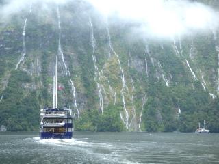
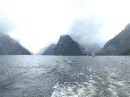
Friday 19th February Magnificent Milford Sound 116km
It rained all night, and was still raining in the morning. Everything hung damp. We discovered that the rain had leaked in through the roof light, and some of my clothes were wet, so we had to spend some time sorting out that problem!
We drove down into Milford Sound 'village'' and located the 'park and ride'. This saved the 300m+ walk to the boat (in the rain). We were pleased to find that the service was free, but dismayed that it didn't run from 1.00pm (when our trip supposedly ended) until 2.30 (lunchtime, the driver said!)
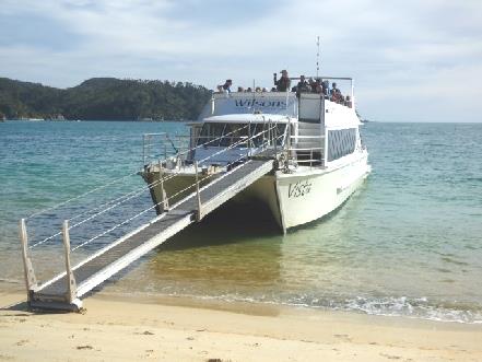
The ferry terminal was filled with a lot of very damp people! We boarded our boat, Milford Mariner, for our 10.30 sailing.
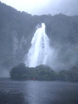
We were immediately aware of the gigantically high vertical sides of the fiord. Our first 'sight' was the Bowen Falls, absolutely teeming with water. In dry weather, they hardly exist at all.
We were able to pull into Deepwater Bay, which doesn't often happen, but the tides were just right. This is where the Milford Track ends. Locals fish for crayfish here, much of which is sent to China.
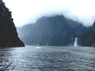
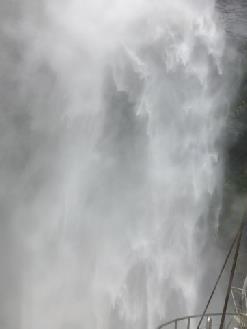
We continued out towards the sea, with waterfalls spilling from every direction - we were told that some are 1,000 metres high! We went up really close to one, which was extremely wet!
Milford Sound is the most northerly of the fiords and is 14km long. There are 13 more fiords south of it. We went right out to the sea where it became pretty rough and the captain turned back rather than complete the 'sea circuit'. We then began our return journey. We had a pleasant commentary, which we could hear even from on deck.
We were sitting with a young Chinese couple who spoke very little English, and an older Australian couple from Melbourne, although he was originally from Prague.
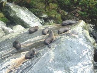
Although ours was called the 'wildlife cruise' the only wildlife pointed out to us was a group of New Zealand fur seals lolling on the rocks.
We passed Stirling Falls. We were told that there is a legend which says that if you're wetted by the spray you look 10 years younger. I tried it, but I don't think that it worked!
It rained all night, and was still raining in the morning. Everything hung damp. We discovered that the rain had leaked in through the roof light, and some of my clothes were wet, so we had to spend some time sorting out that problem!
We drove down into Milford Sound 'village'' and located the 'park and ride'. This saved the 300m+ walk to the boat (in the rain). We were pleased to find that the service was free, but dismayed that it didn't run from 1.00pm (when our trip supposedly ended) until 2.30 (lunchtime, the driver said!)
The ferry terminal was filled with a lot of very damp people! We boarded our boat, Milford Mariner, for our 10.30 sailing.
We were immediately aware of the gigantically high vertical sides of the fiord. Our first 'sight' was the Bowen Falls, absolutely teeming with water. In dry weather, they hardly exist at all.
We were able to pull into Deepwater Bay, which doesn't often happen, but the tides were just right. This is where the Milford Track ends. Locals fish for crayfish here, much of which is sent to China.
We continued out towards the sea, with waterfalls spilling from every direction - we were told that some are 1,000 metres high! We went up really close to one, which was extremely wet!
Milford Sound is the most northerly of the fiords and is 14km long. There are 13 more fiords south of it. We went right out to the sea where it became pretty rough and the captain turned back rather than complete the 'sea circuit'. We then began our return journey. We had a pleasant commentary, which we could hear even from on deck.
We were sitting with a young Chinese couple who spoke very little English, and an older Australian couple from Melbourne, although he was originally from Prague.
Although ours was called the 'wildlife cruise' the only wildlife pointed out to us was a group of New Zealand fur seals lolling on the rocks.
We passed Stirling Falls. We were told that there is a legend which says that if you're wetted by the spray you look 10 years younger. I tried it, but I don't think that it worked!
Sunday 21st February Around Queenstown 119km
We phoned Emma while we were still in bed (7am here, 8pm in England).
We had to solve the battery problem! Adrian thought that it was because he'd turned the fridge up higher.
We left at 8 o'clock on a fine morning, driving towards Queenstown along beside the lake. There were already lots of coaches heading for Milford Sound.
We needed to refill the gas bottle, and Adrian wasn't sure how it worked here in New Zealand. We went into the BP garage and he was very pleased that you could just fill the bottle, by standing it on some scales. The attendant filled the correct weight and then you paid for the amount you needed to fill it.
We stopped soon after to have a nice breakfast of poached egg, right above the lake, now that we had a bit of power, leaving at 10 o'clock.
We then drove back a bit to get some fuel and to go into a tyre/battery place we'd passed earlier, but it was closed on Sunday. The second booze shop we tried had sherry, which I wanted.
We drove through Queenstown, which was busy and bustling on this fine Sunday morning. It was probably a great place if you were staying there. We drove down a street almost as steep as Baldwin Street!
On the other side of Queenstown we stopped to have coffee, with a lovely view across to the barren mountains, sitting on the side step of the van.
We drove a few miles to Arrowtown - a former mining town. I hadn't thought of New Zealand as having a gold rush. The town had a street of houses from that era, but has become a real tourist spot with touristy shops and even 'real estate' in one of the houses. We did go into the pleasant post office. Luckily as it was early in the day, there weren't many tourists about, but the car parks were enormous.
There had been a large Chinese population here, and a whole area had been restored as the former Chinese town with original and rebuilt houses/shacks. There was also a street lined with sycamores and oaks, planted in 1867.
There had been a large Chinese population here, and a whole area had been restored as the former Chinese town with original and rebuilt houses/shacks. There was also a street lined with sycamores and oaks, planted in 1867.
I was warming up by the time we left.
We headed now beside the Kawarau River, stopping to take a photo of the bridge over it where they do bungy jumping - it's where we think that Tom did his memorable jumps way back in the early 90's. The valley was very fertile, with vineyards lining both sides until we came to the gorge. There was nowhere to stop until we came to busy 'Roaring Meg' lookout, where there is a waterfall formed by the hydro electric works. The trees here had been killed off, as they were now considered not part of the original landscape.
At Cromwell, the road turned north beside dammed Lake Dunstan. This is a fruit growing area, very dry, reminding us of the Okanagan in Canada. We stopped by a large roadside stall and bought some fresh fruit and vegetables.
Soon afterwards we had lunch at a picnic table by the Lowburn inlet, which had a lot of ducks on it.
We carried on to Wanaka, where lots of cars were parked beside the road by the lake.
Adrian found the offices to sort out about the 'fine' we had been erroneously given. With that sorted, we made for a garage to sort out about the battery. A really pleasant and competent young chap dealt with us. He was from the Isle of Skye, but had latterly been working at Applecross, before coming to New Zealand 18 months ago. We had to do nothing - he tested the battery - found it to be 'useless', then phoned Apollo, finally getting the OK from them to go ahead before he replaced the battery. We had no paperwork or anything just a nice chat to the man.
By 2.30 we were on the road again, driving up beside Lake Hawea, which looked beautiful with the barren rugged mountains opposite.
There was a memorial to people killed in a crash on the Fox Glacier in 2010.
By the time we left at 2 o'clock, it was raining again, and the view of the glacier had disappeared.
We stopped in the 'village' for diesel and a few groceries, hoping that the skies would clear again by the time we reached the Franz Josef Glacier, 23 km further on.
We drove through the verdant green landscape, arriving at another packed carpark, after the bumpy road with added cobbled speed humps.
Our walk to the Franz Josef Glacier was longer than planned, as they were working on the path and we had to go a longer way (the existing flat path by the river had been recently washed away and the new one was up and over a hill!). In fact the view from part way along was as good as at the 'end', but here we did have the added bonus of several waterfalls.
Both glaciers have receded so far in the last 5 years that without doing a 3 mile return walk they are now inaccessible to most visitors.
We drove on northwards to Whataroa, where we had a bit of trouble locating the campsite which Adrian had note of. Finally we found rather 'seen better times' Whataroa Hotel, with a small sign for campervans pointing to the field behind.
We managed to find our way into the hotel, where a group of locals, looking as if they belonged in a 50's movie, were sitting. The barman was quite surprised when we said that we'd driven into the field. 'How did you find it?' was his response. The whole town looked rather 50's - like we remember New Zealand when we came in 1995. We hadn't got the showers, washing machine or dump that we were hoping for, but we did have electricity, and certainly the place had character!
We went across to the 'pub' and had fish/seafood and chips with a pleasant beer. It was good. A group were still sitting in the smoking area drinking and smoking. A chap at the bar said as he went out there 'I'm 75 and I've never smoked once, but I still go and join them'. The barman, maybe owner, looked Maori and said that he came from North Island, but his wife was local. There were many other Maori looking people. It was like an old fashioned English pub.
Setting off again, we soon turned on to the road towards Arthurs Pass, saying goodbye to the west coast. Just after Kumara we found a place to stop for the night above the Taramakau River, where a tannin coloured stream met with the blue glacial waters of the river. The small campsite Adrian had been searching for hadn't materialised, so we stopped in a gravel area above the river.
Two young chaps came and looked at the river intently, then a few minutes later zoomed by on a speed boat. Another camper came in, but well away from us.
When I went to the cab, I slipped and hurt my elbow.
Adrian blew up balloons and tied them up with the string he'd bought. He had also tied up the toilet roll, so it now had a home in the loo!
The stars were great - we could see the Milky Way, Orion and the Southern Cross.
Happy Birthday!
It was really sunny by the time we left at 9.30.
We drove through magnificent forested mountains either side of the flat valley until we reached the high and steep Otira Gorge with its almost vertical sides. We stopped at a viewpoint, where there was a plaque which said that the Duke of Edinburgh had opened this part of the road.
When we stopped to look back to the long, high viaduct, a kea strutted round, then flew off showing its red underwing. Ancient trees were packed closely together on the steep slopes.
We had been amused that a sign at the foot of the pass said 'Unsuitable for towing vehicles' - about half the vehicles we saw were huge double trucks!
We passed a 'Historic tavern'', and thought that that would be a good place to stop for lunch - but it had closed down!
We came to the junction to drive past Brunner Lake - the way we wanted to go. This was through fairly flattish land, and was a busy cycling route. We headed for Moana, on Lake Brunner, where our Rough Guide suggested the Station Cafe. After mistakenly driving down to the lake first, we got to the cafe, overlooking the tiny station and the lake. It was run by a doddery old couple, and just as we arrived, a young lady came in and said that the first of the cyclists would be arriving in a couple of minutes! We put in our order for blue cod and chips quickly, and found a table outside - many were reserved for the cyclists, but two gents said that they were just leaving - they were from Christchurch, and had been working at Greymouth. They said that Christchurch had had really hot weather.
We enjoyed our meal - and only a couple of cyclists had arrived.
We drove down beside the lake and I wrote some thank you emails and stuck up my birthday cards with the blutac Adrian had bought.
We now followed the Arnold Valley to Stillwater, where we joined the 7 north, a route we had taken in 1995. We passed a part restored steam engine, which Adrian remembered photographing before - but back then it was in a sorry state, and unrestored!
We now followed the Arnold Valley to Stillwater, where we joined the 7 north, a route we had taken in 1995. We passed a part restored steam engine, which Adrian remembered photographing before - but back then it was in a sorry state, and unrestored!
There was a lot to be sorted - Adrian had 'dumped' and got water (we were just about out) and we'd put in one load of washing, and as all the driers were taken, I hung it out while Adrian had a shower. By now we had decided that it would be sensible to stay here tomorrow evening too, after our trip. This had several advantages, one being that the van could have electricity all day - we've had constant problems in keeping the computers and ipod charged, and the fridge cold.
We sat out for supper, thinking back to times we'd camped with our children in busy campsites beside the sea.
We sat out for supper, thinking back to times we'd camped with our children in busy campsites beside the sea.
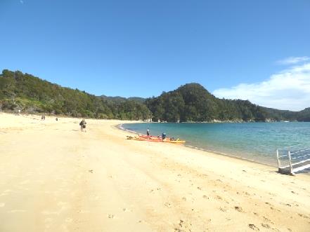
We had to walk up a 'plank' onto the boat. It all seemed too idyllic – reminding us of a beach in Mexico, but also seeming like a lovely film set.
The top deck of the boat was full, so we had to sit downstairs. The boat was a bit late in leaving, as various people sauntered across the beach and the skipper waited for them. There was a commentary, but it was very difficult to hear. Luckily we didn't get off at the first bay, as our stop was the second one! It is called Anchorage, but there isn't anything there except a tent campsite for walkers. We were pleasantly surprised to find that there was a flush loo with running water to wash hands. There was also a nice wooden 'hall', opened in 2013.
The long beach of yellow sand was fabulous, with forested headlands all around, and no habitation.
Walking through forest to a cooling swim
We walked around a bit, then returned to the beach and walked right along to the end, before relaxing on the sand. I even had a pleasant swim. It was the first time we've had an 'enforced relaxation', waiting until it was time to walk along to where the boat would pull up onto the beach to take us back to Kaiteriteri. This time we sat on the top deck. The skipper pulled in close to an island, where we saw a fur seal on the rocks.
We arrived back at 4 o'clock – it had been a superb day, and I was so pleased to have got to Abel Tasman, a long held dream.
We collected up our dry washing, before enjoying a well earned cup of tea and piece of ongoing carrot cake. It then became really windy.
We had bubbly again for 'Leap Year Day', (we started 'going out' on leap year day 52 years ago) but came inside for supper before doing more of the website.
It was a partly cloudy morning - not as nice as yesterday, and there didn't seem to be many passengers on the boat as we left at 9.15.
We'd phoned Simon, who seemed quite 'perky', and was using Manolo's bed in the lounge, as he is not supposed to sit at the moment.
We drove back through Moteuka, stopping to shop in New World, including some late birthday flowers for me. We noticed again the numerous bright hanging baskets of busy lizzies in the main street.
At Tasman, we took the 'scenic route' beside Ruby Bay. We stopped beside the lagoon and had the last of the carrot birthday cake. The tide was out, and there were just a few gulls and shags.
A bit further on, we stopped again by a sandy/pebbly beach looking across to the Queen Charlotte peninsula. Adrian spoke to a couple from Cambridge, who had just retired from farming. He said what a hard time it was for British farmers.
Soon after this we joined the road to Picton which we had taken in 1995, but first we diverted a few miles to see a memorial we had remembered to Lord Rutherford, who had been born here.
We managed to find it, a brickbuilt 'rotunda', with various bits of information. The thing we had remembered was a quote from the area inspector of schools in 1861, and which I have often quoted since, 'I think that it matters comparatively little what a child knows if he hasn't learnt how to find out more'.
The memorial was difficult to access, but I was so happy to have found it again.
We hadn't remembered what a productive area this is with fields of vines and fruit trees.
We drove beside the sea to Nelson. With the tide out, it made me think of Morecombe Bay.
We stopped by lovely Tahunanui beach at Nelson, with its white sand. After eating lunch on a bench looking through grasses to the sea, I lazed on the beach for a short while and Adrian rested inside. There was a memorial behind us to Abel Tasman who came here in 1642!
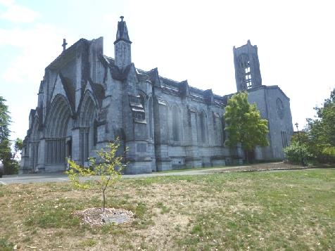
We left at 2 o'clock and drove on into Nelson, which is steep as we remember from before, but more spread out than we remember. Again there were prolific hanging baskets of busy lizzies.
We saw the long steps stretching up to the strange cathedral. This time we drove up to the cathedral and walked around, but there were still many 'ups and downs'. The cathedral was attractive inside in its simplicity, with some nice stained glass windows. It was started in 1925, but not finished until 40 years later. It is set in lovely parkland with a variety of massive, ancient trees.
We hadn't remembered what a productive area this is with fields of vines and fruit trees.
We drove beside the sea to Nelson. With the tide out, it made me think of Morecombe Bay.
We stopped by lovely Tahunanui beach at Nelson, with its white sand. After eating lunch on a bench looking through grasses to the sea, I lazed on the beach for a short while and Adrian rested inside. There was a memorial behind us to Abel Tasman who came here in 1642!
We left at 2 o'clock and drove on into Nelson, which is steep as we remember from before, but more spread out than we remember. Again there were prolific hanging baskets of busy lizzies.
We saw the long steps stretching up to the strange cathedral. This time we drove up to the cathedral and walked around, but there were still many 'ups and downs'. The cathedral was attractive inside in its simplicity, with some nice stained glass windows. It was started in 1925, but not finished until 40 years later. It is set in lovely parkland with a variety of massive, ancient trees.
It was 2.45 when we continued on our journey past all the densely forested slopes. We had to stop several times for roadworks – the man seemed to put the 'stop' sign up each time we reached them! Having passed yet another lot, we saw a car stating 'slow vehicles ahead'
Imagine our surprise to then come across 7 tractors! We were even more surprised when we saw on the lead car 'Great tractor trek. Bluff - Cape Reinga'! The whole length of New Zealand from bottom to top!! Even stranger, when we pulled into a campsite at Picton to book in, the lead car drivers were just booking in their tractor group. The man told Adrian that 2 had dropped out, so now there were just seven.
We came to the nice 'oldie worldie' town of Havelock, and stopped by a memorial Adrian remembered from earlier, where again there was information on Rutherford. It felt cool now, after a warm day. Havelock is known for its green lipped mussels. Our Rough Guide book told us that you could buy these in 'Four Square' supermarket. We had just passed the shop, so returned there. Having looked all around the small store, we spied the tank with the mussels. We bought a few, ready for supper tonight.
Our road now was called the 'Queen Charlotte Drive', which the book had said was slow going. It certainly was full of winding roads. On one sharp bend, a car and boat had gone over the side.
We stopped by a lookout, and immediately remembered it as Cullen Point. There was a 3½ km walk around a spit, one side being dark and sheltered, and the other sunny. We have often talked about it. There wasn't time for us to repeat the walk, we had to suffice with the fantastic views down to Pelorus Sound - just the blue of the water and green of the forested hills.


We then stopped to have lunch beside the wide, shallow aquamarine Haast river with beds of pebbles which made us think of Alaska.
We reached the west coast at Haast then Adrian reluctantly drove 14km south so that we could walk the Hapuki Estuary walk. This was mostly a boardwalk, going from lush forest to the brackish tannin coloured estuary.
We reached the west coast at Haast then Adrian reluctantly drove 14km south so that we could walk the Hapuki Estuary walk. This was mostly a boardwalk, going from lush forest to the brackish tannin coloured estuary.
Dunedin to Picton, New Zealand


You could pay a bit more to have a site with a view, but we chose a sheltered site and just enjoyed the warm sun which was now shining! We sat out with our drink and supper, by which time it was getting a bit cool. And I even did the washing! After last night, it was all brilliant!


