
Glasgow to Gretna Green

Saturday 6th July 1996 96 miles
Maybe it was the Scottish air, but I didn't want to wake up! It was 9 o'clock when we returned indoors and then enjoyed breakfast with Lois and the children. They were getting ready to go on holiday, when Joe returned from camp.
We finally left just after 11 o'clock and stopped at Bridge of Allan for shopping. We visited the Co-op, which we had done in 1990, the bakers for rolls, Scotch pies (very good) and doughnuts, and the greengrocers for cherries as we had also done in 1990.
About 11.30 we headed towards Glasgow on the M80, then followed the superb motorway system right through Glasgow, noticing some fine old buildings amongst the tower blocks.
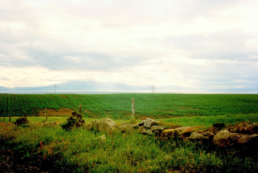
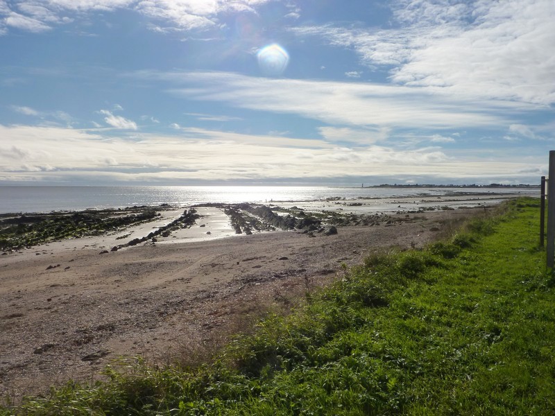
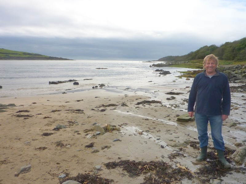
We reached the Firth of Clyde and stopped on the outskirts of Port Glasgow in the park looking across towards Dumbarton. We had lunch here, followed by a short walk out. The weather was fine today, with a mixture of sun/cloud, but the wind was cold.
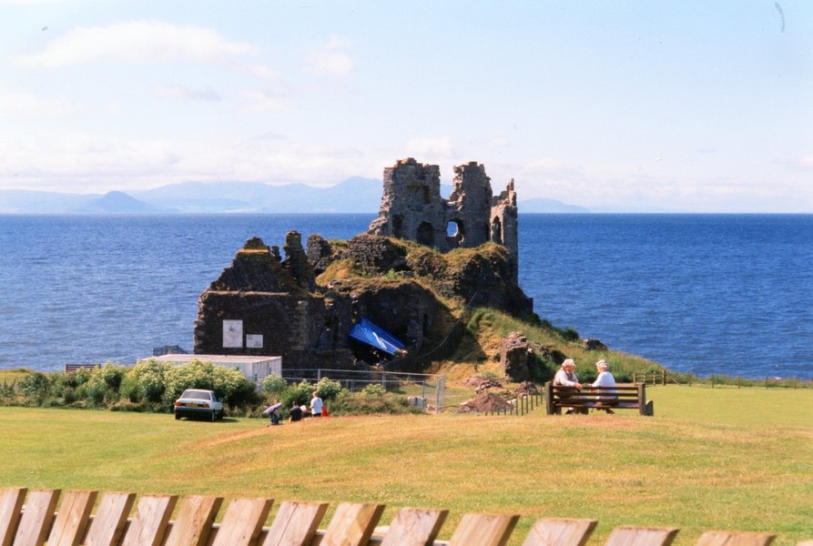
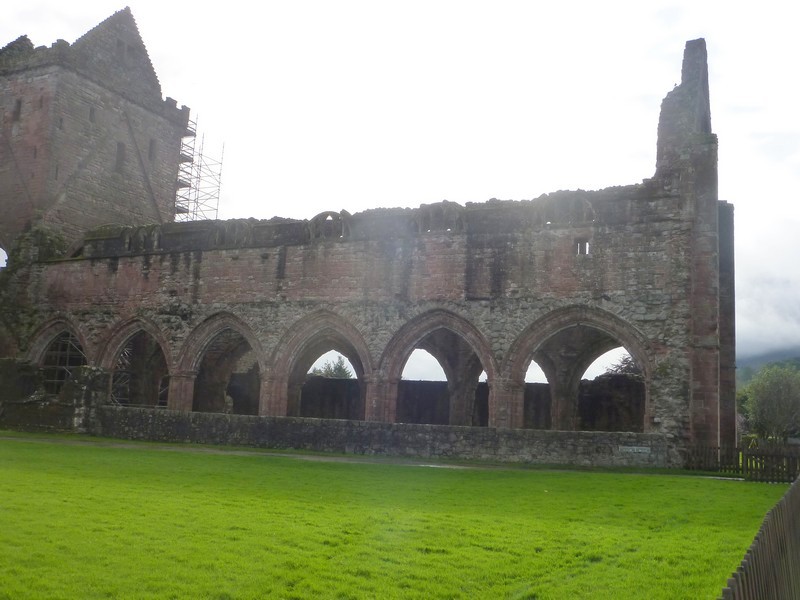
We looked briefly at Newark Castle, again in a fine setting – things had changed a lot since the 70s, when in our "AA Book of the Coast" it described the Castle is being squashed in between all the shipbuilding. Today most of that has gone.
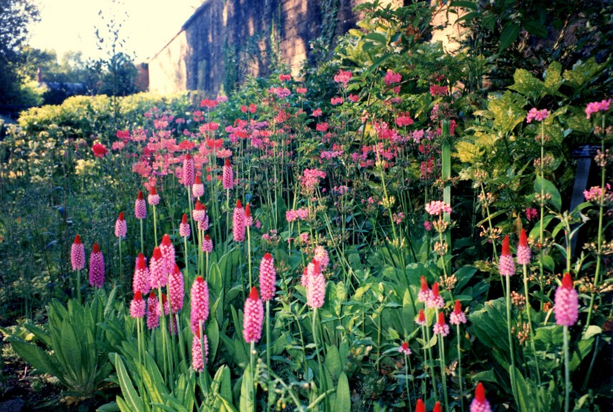
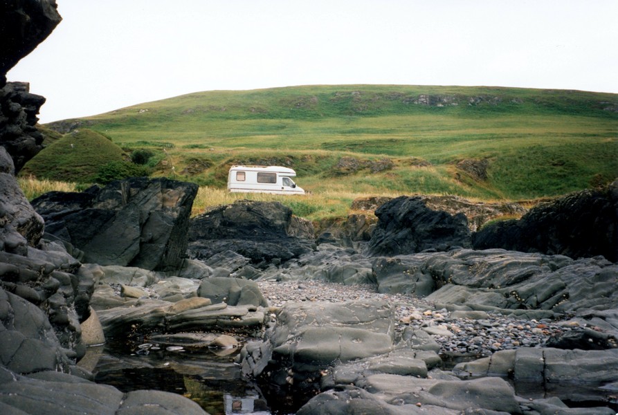
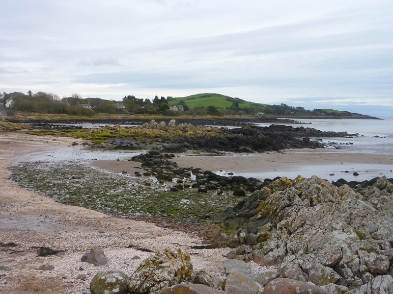
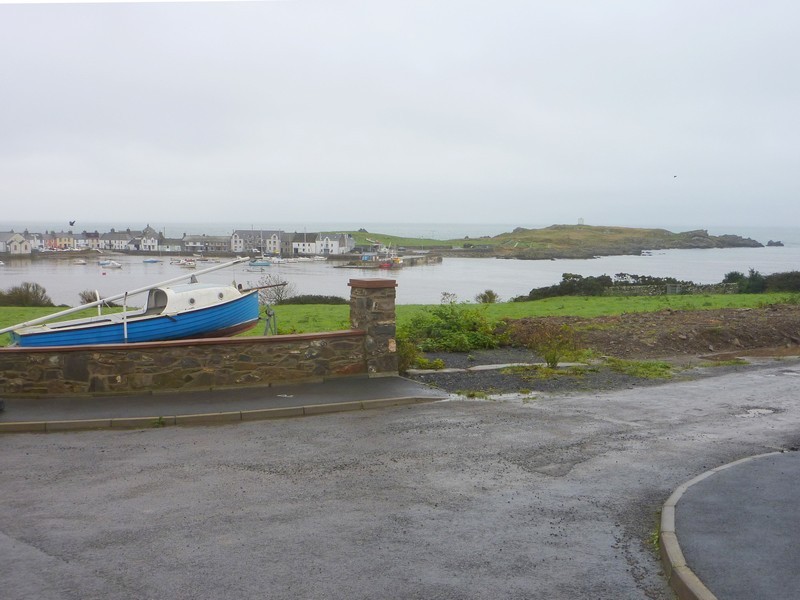
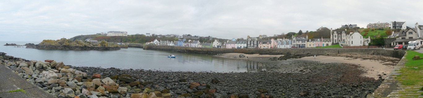
We were continuing our "Road around Britain" and proving that you never know what you will find! Port Glasgow merged into Greenock – and again unexpectedly this was a pleasant area with a fine promenade.
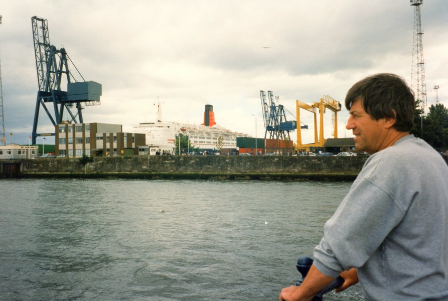
I made the remark "look at that boat lit up by the sun". We noticed a great deal of both traffic and pedestrians and thought that something must be going on – in Stirling we had come across crowds waiting for the "Orange Parade", but not stopped ourselves. This time we backtracked along the promenade and parked. We followed the crowds of people and found that they stopped near "the boat" – it was the QE2 and would appear to be the cause of all the excitement! One could take a boat trip to view it!
This section of RAB was the 2nd section for us in 1996. We had taken 4 days getting to Jon & Lois's in Bridge of Allan, Scotland visiting the place in Harpenden where we bought the Motorhome, Paul & Nicky in Cranfield & Simon in Wolverhampton on the way. Now we were on the way to Ireland
Our curiosity satiated, we returned to the van and continued west towards Gourock. The views across the Clyde towards Dunoon and Loch Long were superb. We thought of many places it reminded us of – Wellington, New Zealand (particularly the steepness of the land behind), Swiss/Italian Lakes and Kotor on the Dalmatian coast.
We now headed south along the coast past Inverkip and Wemyss Bay. Soon after here we looked at a site. It had good reviews, but was amongst the statics and it was voted a miss.
We continued south through Largs to Fairlie, where we stopped briefly near some sewage works. Across from here were the Cumbrae islands.
Opposite West Kilbride we drove down to the sea at Portencross, where they were still building the car park. We had stopped earlier for an ice cream with the excuse that it felt warm inside the van!
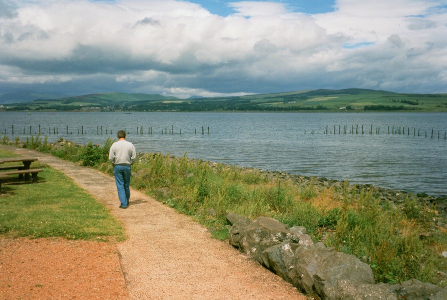
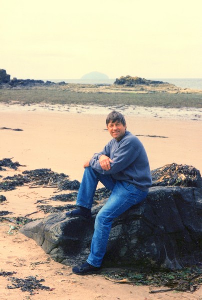
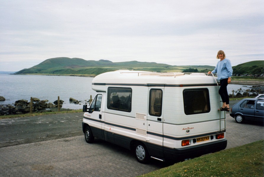
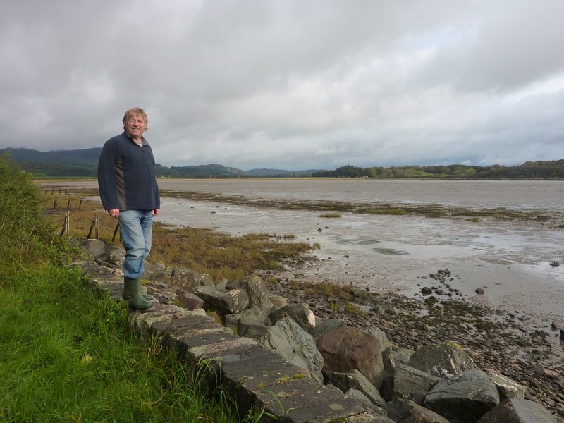
Adrian at Port Glasgow
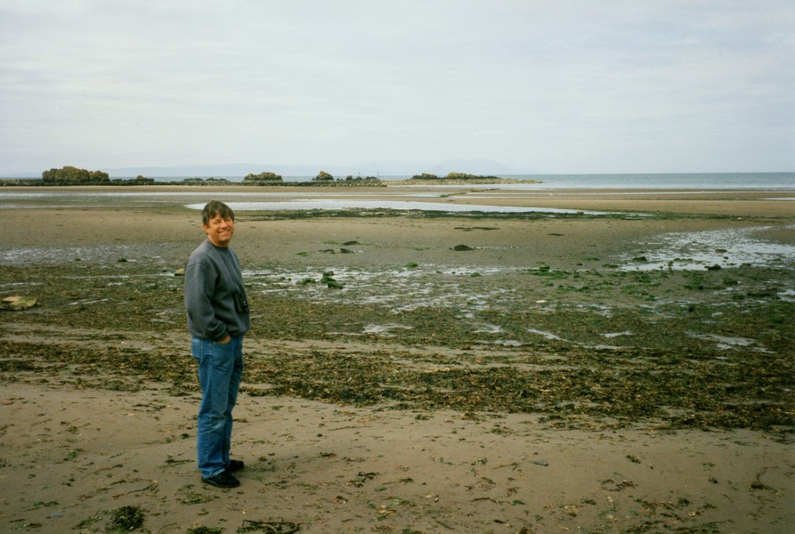
and by the QE2
At Ardrossan we found with difficulty a certificated site – unmarked and not where it said in the book. We parked on a strip of land beside the farm bungalow, with wonderful views down over Ardrossan and the Firth of Clyde. We had a short walk out, but I decided it chilly! At least the wind doesn't bother us in the Tiv!
We cooked supper and spent the evening reading – watching the ever-changing sky over the sea.
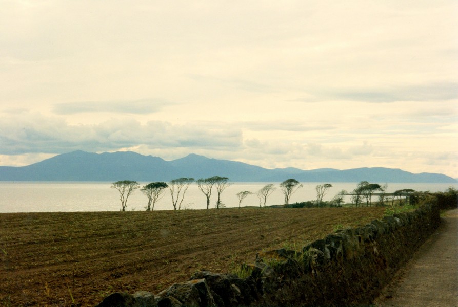
Evocative trees near Portencross
The view from the campsite at Ardrossan
Sunday 7th July 50 miles
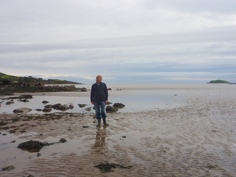
We enjoyed the view down over the sea while we had breakfast. We left just after 10 o'clock and drove down into Ardrossan. We found our way to the ferry terminal to Arran and picked up information for future trips.
Between Ardrossan and Saltcoats was a wonderful wide sandy beach devoid of people – reminding us of the Isle of Man. We had a walk on the beach then drove on to Saltcoats where we stopped briefly by the harbour.
The day was mostly sunny but with a strong, chill wind.
On the outskirts of Saltcoats we came to a swimming pool and stopped to have a swim in the uncrowded pool. A Scots woman was very chatty in the changing room, but I had difficulty in understanding her.
We drove around to Irvine. There was some industry, but further on there was a wonderful sandy beach reminding us of Quiberon. We had a short walk and I had a paddle. The water was surprisingly warm, but the wind was still strong.
We sat in the van to have lunch, enjoying the superb view.
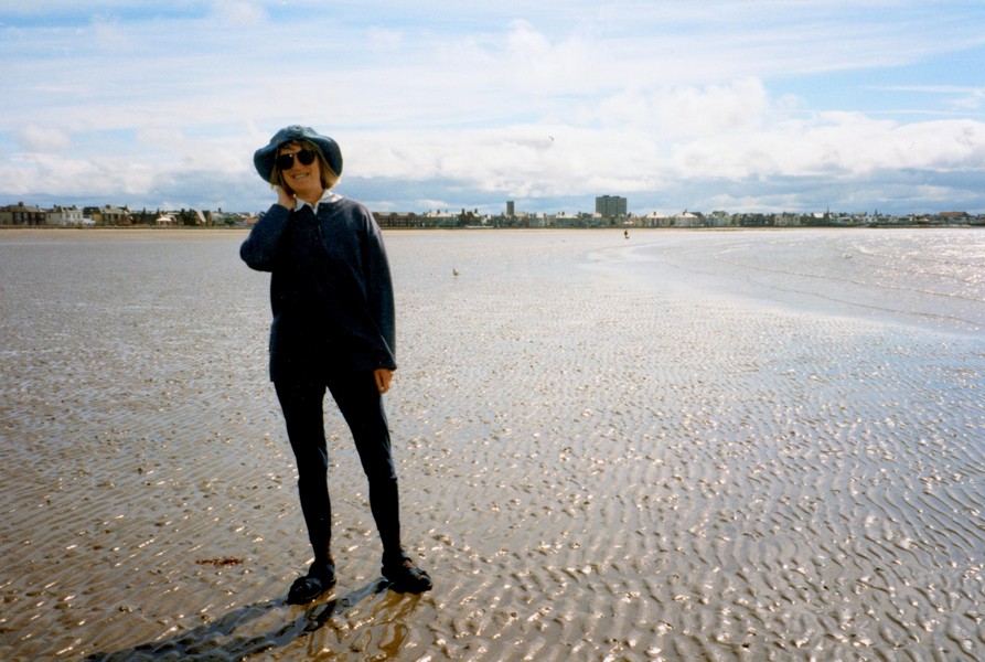
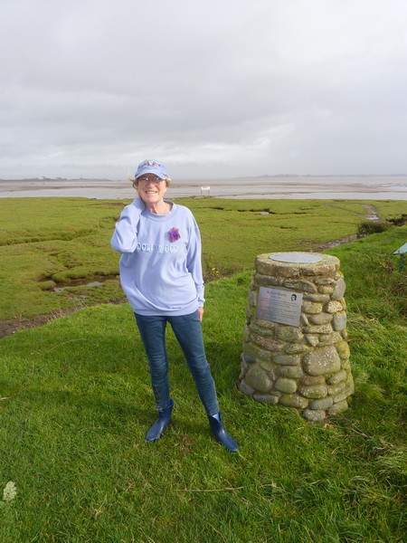
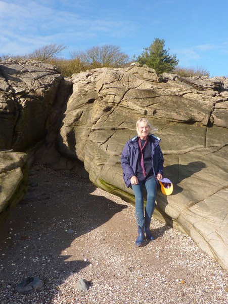
Rosie on the beach near Ardrossan
We had passed a large shopping "mall"dwarfing several churches and stopped as I wanted Littlewoods to change one of the tops I had bought in Bedford as the stitching was faulty. Sure enough Littlewoods was open (we had stopped earlier at a petrol station – also open on Sunday and also bought bread and rolls). I was able to exchange my top and Adrian bought himself two cheaply priced sweatshirts.
We joined the main road for a short distance then turned off to Barassie and Troon - very pleasant with lots of green grass between the houses and the beach. We passed some bleak semi-detached houses right on the beach – no trees or flowers. We had looked at them through binoculars last night from Ardrossan.
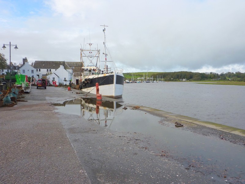
We stopped by Troon harbour with its colourful fishing boats, sheltered from the waves of the beach close by.
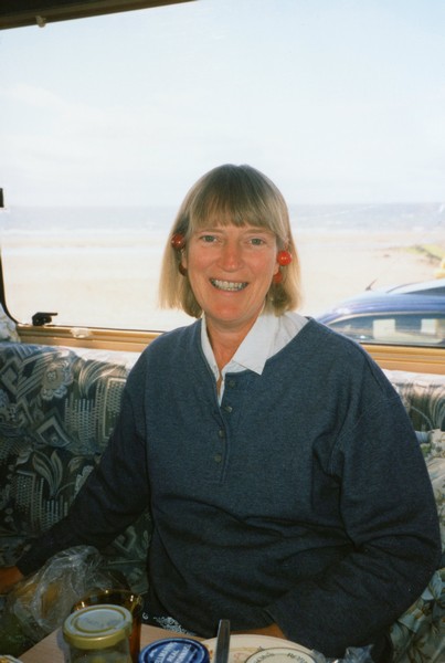
Cherry earrings, Irvine (doesn't she look young)
We passed under a low bridge 9'9" and just made it! There was no warning, and the next one along was 7'6"!
We took a nice leafy road to Prestwick and then Ayr – again with lots of greens beside the sea. It was quite busy, being a sunny Sunday afternoon, but quite reserved, considering its is Scotland's main West coast "resort"!
Golf courses abounded, but so did sandy beaches – as far as south of Ayr.
We turned off the main road at Dunure – a little harbour village but with all parking taken. Just up the road was Kennedy Park, with the ruins of a Castle – but for this you had to pay. It was very busy and at this point warm and sunny.
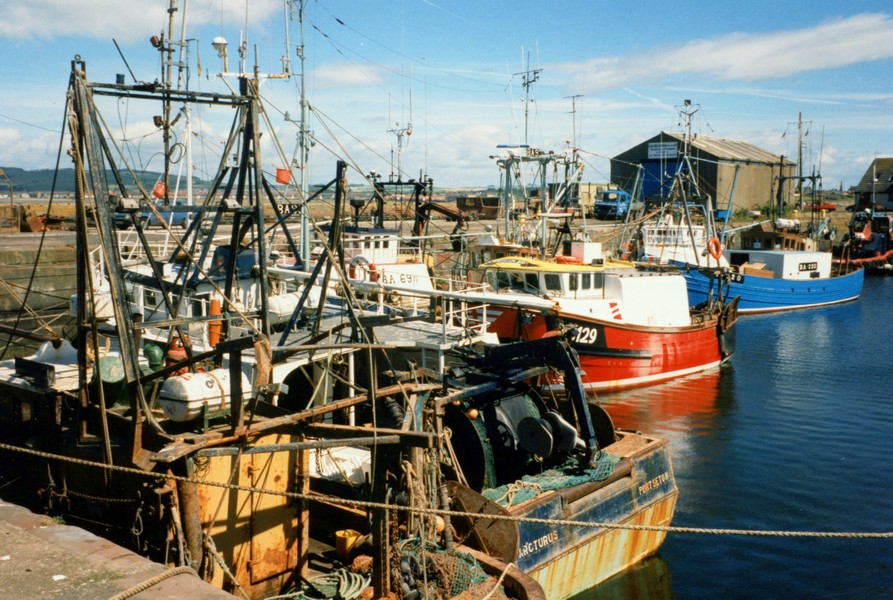
Troon Harbour
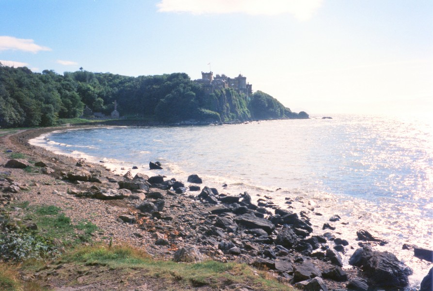
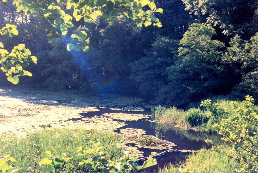
We now made our way to Culzean Castle – owned by the National Trust for Scotland, and with an adjacent Camping Club site. We booked in here, with a fine view over the sea to Arran, and almost immediately set off to walk in the grounds of the Castle. The Castle is an enormous site. We were gone a good couple of hours, so got a fleeting glimpse.
We were able to walk down to the beach and also viewed various parts of the estate including the Swan Pond and the Herb Garden. By the pond it was warm and still sunny and only the hunger pangs made me move.
Dunure Castle ruins
While I cooked supper, Adrian took some clothes over to the washing machine. We watched the interesting sky, but when the sun went down it became chill.
It was lovely to get the washing clean and dry and put away.
The beach at Culzean castle
The Swan Pond
Monday 8th July 61 miles
This was the morning for "emptying & filling" – emptying the dirty water and loo and filling up with clean water. I was able to buy rolls and butter so we were set up for the day. 10 o'clock seems to be leaving time – this time to drive the short distance into Culzean Park, parking by the deer field to have a quick look at the Castle (house). It was now 10.15 and the Castle didn't open until 10.30, so we sat looking out over the water to Arran while we waited. The morning was grey – with a chill wind – without that this coast of Scotland would be a match for anywhere in the world.
We entered the castle just before 10.30 – the guides were just getting themselves organised. Not being one for houses (as National Trust members I feel we can have a "quick look" as we don't have to pay), there is always something of interest. This one had a huge oval staircase – reminiscent of "Gone with the Wind" and one room I particularly liked – the "saloon" – with views over to Arran and an attractive carpet and ceiling. The guide in here was very chatty – she said that they had a debutants ball here last week – and she didn't think much of the debutants – they obviously left a lot of mess and some got worse for wear!
I think one of the worst jobs must be being a guide and waiting for people to walk through and look interested!
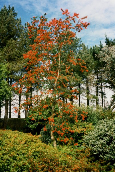
We made our way to the vast walled garden (open now) and particularly liked the Chilean Fire Bush – a tree with long threads of red flowers. We have seen one before at a National Trust garden in Sussex.
On the way back to the van we passed the Camellia house, where we stopped briefly.
We drove on to the far end of the Swan Pond where we brewed up tea/coffee to enjoy at one of the many picnic tables. We then walked down to the beach at Port Carrick – a lovely cove devoid of people, but we later saw a photo of it crowded (in the summer – what's this then?)
We enjoyed the flowers in the gardens of Culzean Castle
Chilean Fire Bush
We walked back – it was now lunchtime, but the picnic tables were full, so we decided to drive on a bit, but we had very much enjoyed Culzean Castle Country Park
We drove the short distance to Maidens and stopped by the beach to have lunch – inside the van, but with the window wide open – but the wind was still strong. Afterwards we had a walk on the sandy beach – which was rather wet and we got wet sandy feet.
Adrian on Port Carrick beach
Behind was an obnoxious "Sandy Bay caravan site" – why do they have to be so ugly (static sites) with no trees or flowers?
We drove through Turnberry (site of the famous golf course which I hadn't heard of!) to Girvan. We stopped here near the front after a false start when we got the wrong side of the River.
There was an attractive little harbour, with the tall thin church spire behind and an unobtrusive seafront, with a large area of green like so many other places on this West Coast.
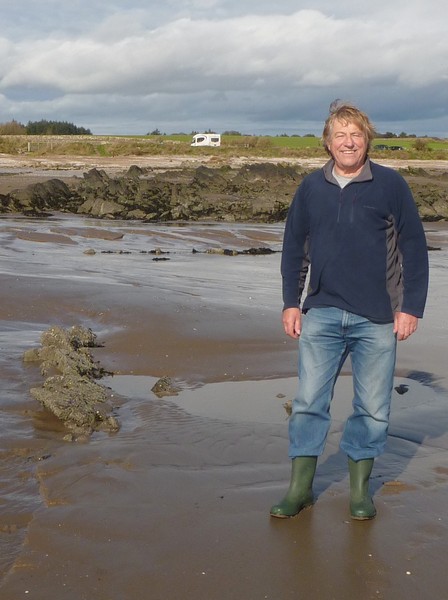
Adrian on the beach at Maidens
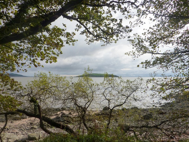
Next place was Lendalfoot with just a short row of houses. We stopped briefly in a layby and looked out over the beach. We had already stopped and explored a bit of rocky, stony coast looking right out to Ailsa Craig – the "fairy rock" which dominates every view from this coast. The wind had now dropped – bliss!
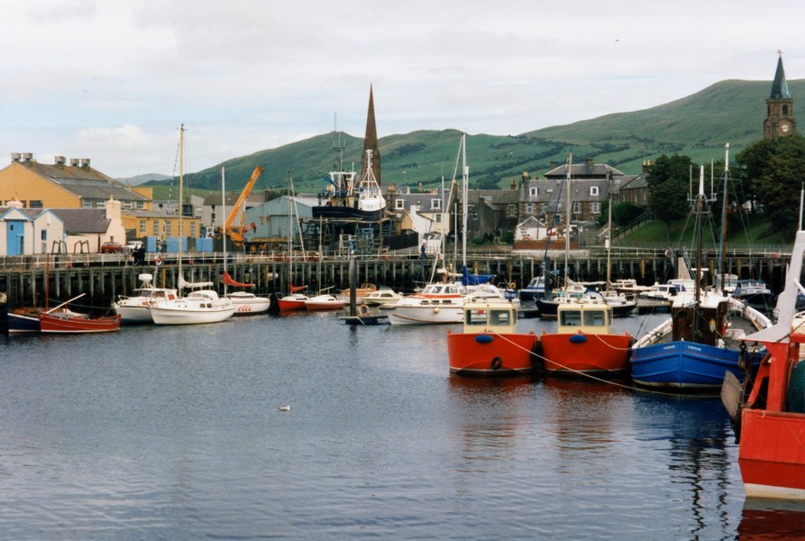
Girvan harbour
We drove through Ballantrae, with a short drive to the harbour, then took a pleasant minor winding road back to the main road. We now came into steep Scottish country as we drove to Cairnryan, where we were leaving for Ireland from tomorrow.
We located campsite (a patch of green beside a hotel) but at 4.30 thought it was too early to stop, so drove on down to Castle Kennedy – which had gardens which closed today at 5.00 pm and it was now 4.55. We took a small road hoping to view Castle Kennedy between two lochs but couldn't see anything – you can't win them all!
On taking a minor road to Stranraer we came across a gate over the railway and Adrian managed a difficult turn around.
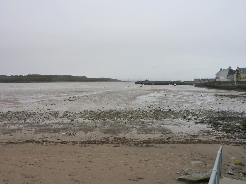
Stranraer had a line of pleasant houses along the front, but was dominated by the ferry terminal.
Lendalfoot
However we did come across a Tesco's and decided to stock up a bit.
It was nearer 6 o'clock when we returned to Cairnryan and the dull day now turned to rain. A small girl appeared and asked if she could come in. Having chatted for a few minutes she left!
After supper we walked out and managed to find a way onto the beach. We had a short walk, noticing a large patch of stonecrop growing on the beach. We saw one or two ferries coming and going both to Cairnryan and Stranraer.
We had a drink in the bar - very salubrious and with the children mentioned before continually running through and we then retired to the van.
We have noticed lots of people looking at our Tiv and waving as if it's something special – almost like being in the Morris!
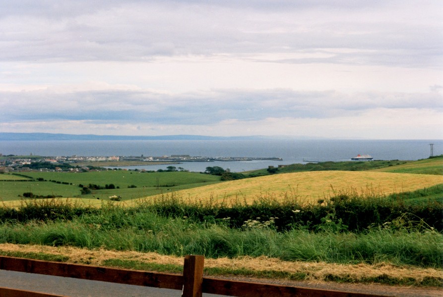
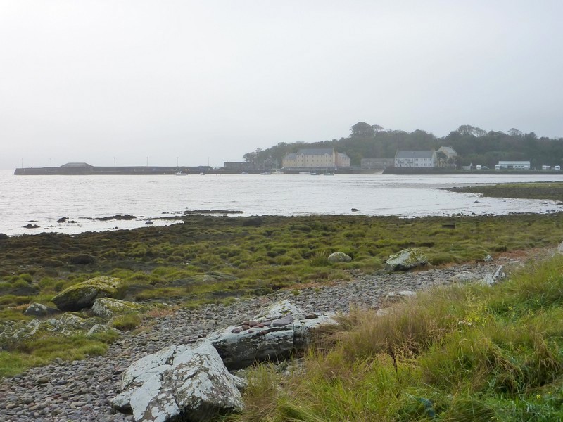
Looking to the ferry terminal at Cairnryan from Stranraer

The next section - the end of Scotland - was done as part of our Liverpool to Dundee trip (going north) and so unfortunatley goes the wrong way - from Gretna Green to Stranraer
Sunday 9th October (9/10/11)
We arrived In Scotland at Gretna on the old road beside the A74 motorway.
Gretna is a very plain town. We diverted to Gretna Green, in order to pass the Old Blacksmith’s Shop, renowned historically as the marriage venue. We had seen it before, but now noticed that all sorts of places had ‘jumped on the bandwagon’, advertising their venues for this & that.
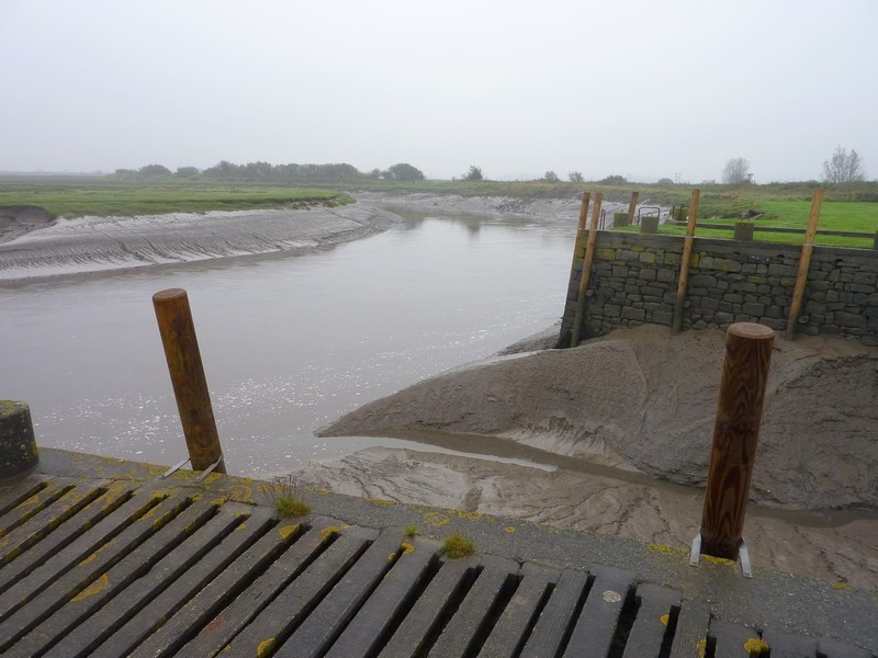
We followed the B road to Annan, taking a very long and extremely wet and narrow road to the shore at the mouth of the river Annan. A sign stated that Robbie Burns had been here! It was very damp and dismal as we looked out over the marshes.

We drove on down to Powfoot, where there were a lot of newly whitewashed single story houses, and then made a loop around nearby Cummertrees, but there was nowhere at all to pull off, and everywhere was really sodden.
At Caerlaverock we drove down long narrow tracks to two nature reserves. The first was owned by the wetlands trust, and ended at a visitors centre – too late for tonight. The second was wildlife trust, and ended in a waterlogged car park! On our long way back, we saw flocks of birds in the sky. One lot landed in the adjacent field. We stopped to view them – this reserve is known to be the habitat of pink footed geese – but a car coming in the other direction curtailed our viewing!
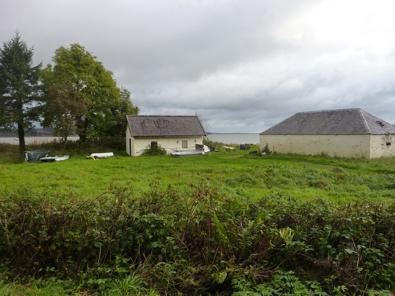
We were now driving around the estuary of the River Nith, and at 5.15 we came to Glencaple. Adrian had note of this as an overnighter, but didn’t hold out much hope. But!! The small unsurfaced ‘harbour’ had a sign stating that although motorhomes weren’t charged to stay on the harbour, a donation would be welcome! What an invitation and how nice! We walked out to look at the river, and various boards, telling of the birdlife, and of this tiny place as a former port, with boats sailing to America. A top spot, we’d say!
Boats at Annan Waterfoot
As the Nith Hotel was opposite the ‘harbour’, we had a rare treat, and went across there to eat. Adrian had trout, and I had deep fried camembert with Cumberland sauce. The John Smith’s was good, and after our meal, served by pleasant young girls, we sat by the open coal fire, coming back to the van at 9 o’clock.
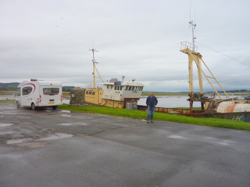
Adrian in the harbour carpark, Glencaple
Monday 10th October Hundreds of geese 47 miles
There was heavy rain and high winds in the night – I imagined us being whisked out to sea! The day started very wet and grey, but fortunately improved. Despite the unpleasant weather, this village gave the impression of having pride.
Rosie at Annan Waterfoot by the Robert Burns plaque
We left at 9.20, and made for nearby Dumfries. We drove around the town, passing some ancient walls surrounding a church and seeing the full and fast flowing river, with a nice pedestrian bridge. We needed bread, and a few others things, so having located Morrisons and stocking up again, we headed back to the river. By the time we left, the day had brightened a bit. Dumfries is home to Burn’s house and mausoleum.
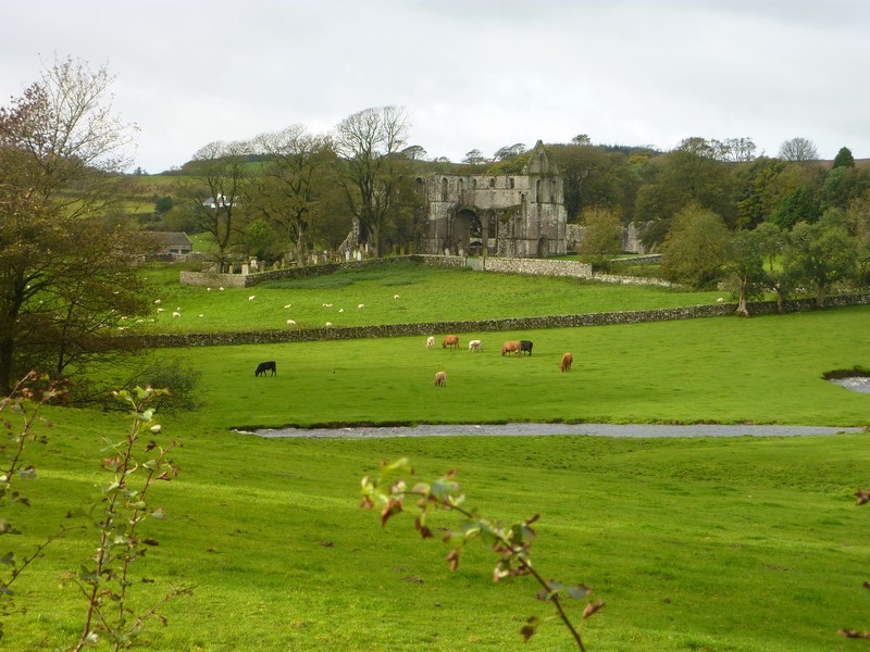
We headed south to the village of New Abbey, where we looked at the ruins of Sweetheart Abbey, built in 1272. New Abbey lies at the foot of the highest hill around – Criffel, at 1868ft.
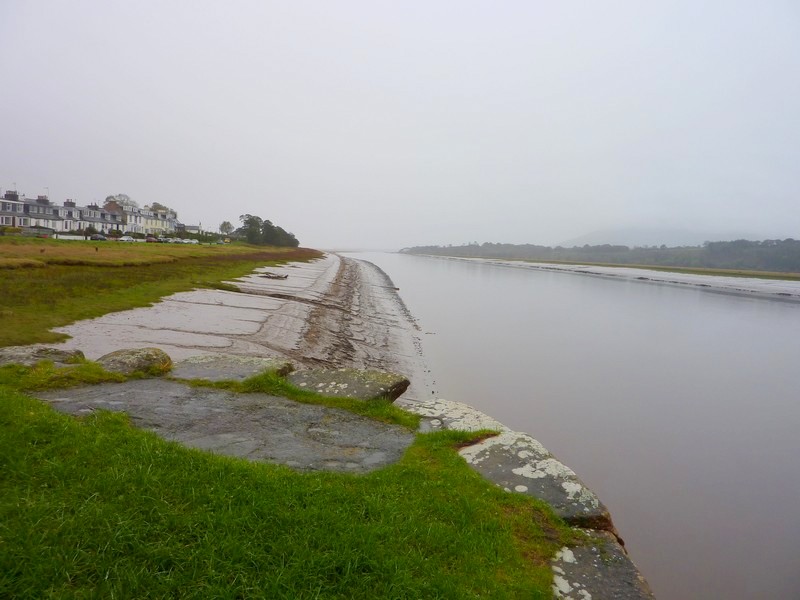
Dull morning at Glencaple
Tuesday 11th October Lovely scenery of the Solway Firth 90 miles
There was rain in the night, but the day was reasonable.
We decided to move on for breakfast, as there was a daytime fee for the car park. We saw a red squirrel as we left. We drove through the outskirts of Dalbeattie, on Urn Water and continued to Auchencairn, then took the road towards Balcary. We stopped beside the road to have our breakfast. There were trees behind us, and the view of the bay in front, looking lovely when the sun shone on the water. It was really peaceful when we stood at the edge of the shore. We continued to the place where the road ended. Just beforehand we met another car, and the elderly gent had great trouble in reversing.
By now the sky was clearing, and we even had a glimpse of sun. We stopped to look across the estuary from a nice viewpoint, with a picnic table, at Drumburn.
We turned down to Carsethorn, which at one time had formed part of the port for Dumfries. Now it consists of a single row of cottages, some whitewashed. We parked beside the firth, with views across it. We walked onto the rough beach of coarse sand, and decided to have lunch here. We’d intended sitting at the picnic table by the beach, but it started to drizzle as we were just about to eat, so we sat in the cab, looking out to the various birds – a wagtail, turnstones, and we think knots. Information boards told a bit about the location. It was a good stop.
We drove on on rural roads, some very muddy, past the cottage of John Paul Jones to Powillimount. There was a lovely sandy beach, covered in thousands of cockle shells, and a few mussel shells. In the sunshine, we walked along and over the rocks and down through the ‘scars’ to the edge of the receding tide. With birds flying overhead it was delightful.
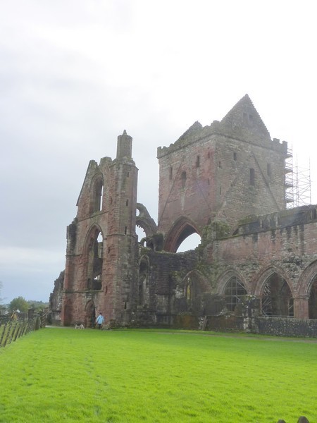
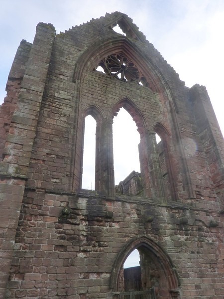
Sweetheart Abbey at New Abbey
We turned down next to Southerness, where a static caravan park spoiled the otherwise idyllic location of 2 short rows of cottages and an ancient disused lighthouse.
Powillimount
There was nowhere to park here, so we returned, and made for Mersehead RSPB reserve. Here we went for quite a long walk (for me) to the first hide. The path was often very muddy, and went past bushes laden with huge hips of rosa rugosa, just one of which was still flowering. Unlike most hides we have visited, this one really did come up trumps. Apart from the usual mallards and crows, there were lapwings at the edge of the lagoon, and just hundreds of barnacle geese! The Solway Firth is known as the winter home of these geese, which spend the summer on Svalbard.
Southerness
We drove on to Rockcliffe – a very pretty cove. We walked down onto the beach, where the tide had gone right out.
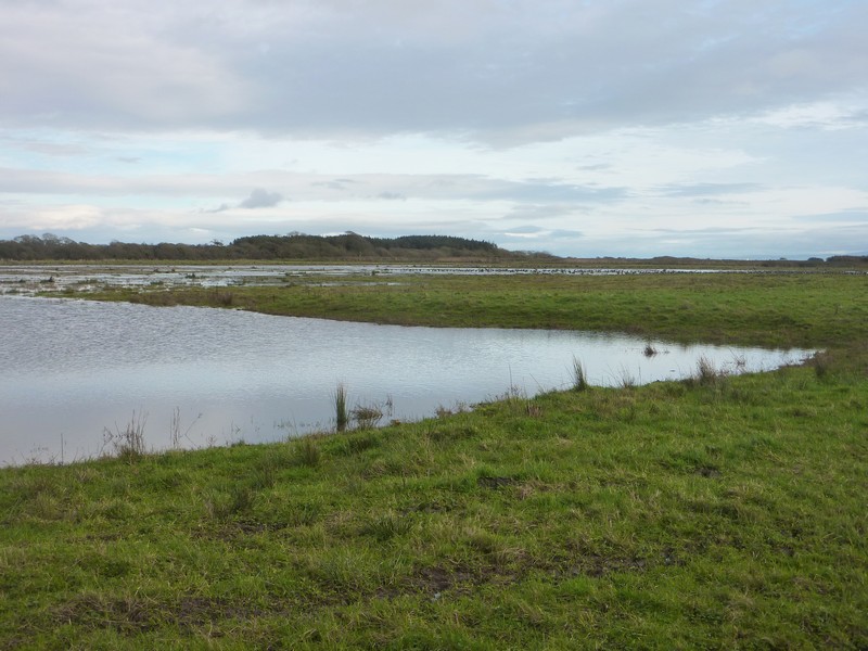
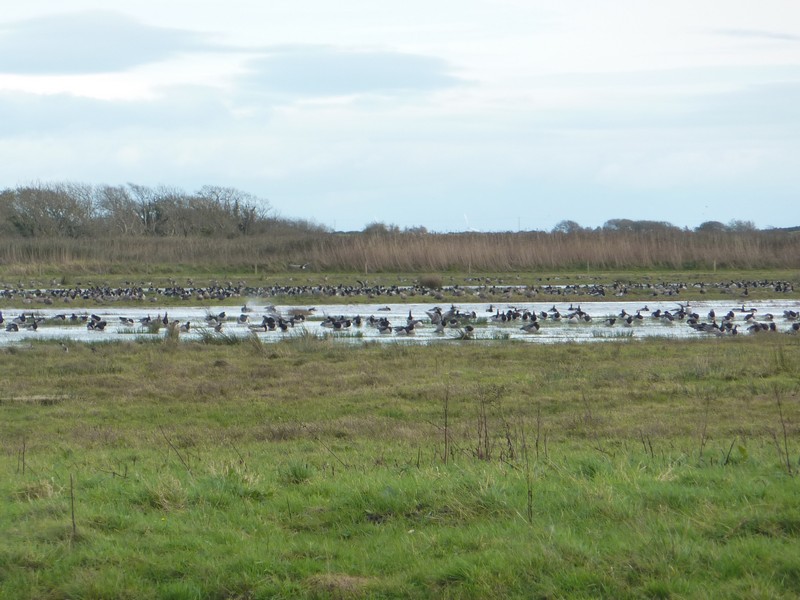
Hundreds of barnacle geese at Mersehead RSPB Reserve
A bit further up the Rough Firth, where the Urn Water reaches the Solway, we stopped at Kippford in front of a row of stone cottages and saw a lapwing and a curlew on the edge of the muddy estuary.
We continued towards Dalbeattie, stopping for the night at Richorn Trailhead car park in the Dalbeattie forest, which is popular with cyclists and walkers.
Rockcliffe
We now had to return to Auchencairn, through the pretty woodland scenery.
We took the next road, to Roscarrel, on a narrow road between stone walls, with farmland around, but this road just ended. A bit further on we passed ruined Dundrennan Abbey (1142), with a pretty tumbling burn beside it – the first of many we saw today.
The next turn off, to St Mary’s Head was another no-go and just ended at a military area. We headed now for Kircudbright, turning down beside Kircudbright Bay at Mutehill. It was really pretty with views across the bay. We then came to Kircudbright, driving first through a very ugly estate, before parking by the working harbour. The houses here were pretty and there were beds of bright red and yellow begonias around the harbour car park. We had a walk around in the sunshine, past a fishing boat, and looking up to 16th Century MacLennan’s Castle.


Balcary
Dundrennan Abbey
We crossed the River Dee, and drove down the western side of the bay, soon passing a large parking spot beside the water, which would have been ideal as a lunch stop, but we voted it too early, at just past midday. We were to regret this, as we then found nowhere to pull off, finally stopping by Cardoness Castle at 1.30!
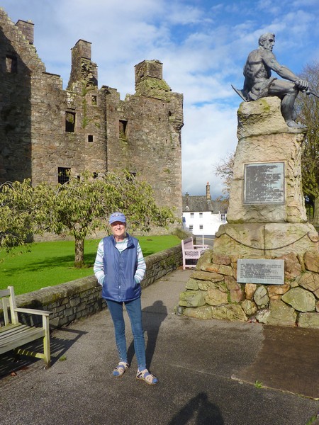
Kirkudbright Harbour and MacLennan's castle
We had driven down to Brighouse Bay, where we had a walk on a lovely sandy beach, but there were no views from the parking area. The neighbouring road to Ross offered nice views, but no stopping places. We took several more small roads, including one down to Sandfleet, on Fleet Bay, where there was a smart Camping Club Certificated Site, but nowhere to stop for lunch.
Where we did stop, by Cardonness Castle, was just south of Gatehouse of Fleet, which we’d never heard of, but which a listener to radio 2 had just texted in from!
Adrian at Brighouse Bay
Cardonness Castle
We now had to follow the A 75 to Newton Stewart, driving 4 miles north on a winding road to the RSPB reserve at Wood of Cree. We set off on a walk – initially through water several inches deep, and then on a steep and very muddy path through ancient woodland, eventually coming to an uphill path across grassland. We decided to return instead of making the circular walk, and on arriving back at the car park, hadn’t seen a single bird in the half hour we had been out! We did hear birdsong as we had our cup of tea.
We continued driving north, looking for somewhere to stop for the night, but there were no suitable pull-offs. We took a long and narrow road across the moors, where the woolly white coats of the sheep glowed like new sheepskin rugs.
We joined a B road back towards Newton Stewart, soon coming to a pull-off suitable for us to stop in for the night on the B7027 just south of Knowe.
Adrian had intended cooking the mackerel outside, to avoid having fishy smells inside the van, but just as he was about to start cooking, it began to rain! Undeterred, he continued with his plan, but was thwarted when the outdoor stove wouldn’t actually work!
He had to resort to cooking inside, and I made a plum crumble.
Adrian - Wood of Cree
Wednesday 12th October Lovely places, miserable weather, and a difficult ending! 121 Miles
It rained all night, and was still ‘mizzling’ when we left at 8.45.
As we drove back down to Newton Stewart, we often had to drive through stretches of water on the road. The neighbouring fields were sodden, and the River Cree, like all the rivers and streams we saw today, was more than full. We saw a deer as we drove through the woodland countryside and Adrian saw a red squirrel.
We drove back through the pleasant town of Newton Stewart to Wigtown, which looked rather elegant with its wide streets and French looking town hall. We drove first on a muddy track across low lying, flooded fields to the ‘harbour’ car park, by the River Bladnoch with its thick mud banks. We watched a little wagtail, but didn’t linger long, as we had the low lying road back to Wigtown to negotiate again.
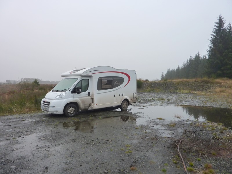
Our wet overnighter near Knowe
Continuing down this peninsula, which ends at Burrow Head, we came to the delightful little harbour town of Garlieston. It was here that the trials were carried out for the mulberry harbour during the second world war. We watched oystercatchers on the shore.
The harbour at Wigtown on the muddy River Bladnoch
Near the end of the peninsula, we came to the equally pretty harbour town of Isle of Whithorn, with its attractive stone cottages. We then took the road to Burrow Head, but there were no views here, just a caravan park.
Garlieston, where they built some of the Mulberry Harbour
Now we crossed to the western side of this peninsula, coming first to Monrieth. We parked high above the beach, and had our lunch. The gorse here, as elsewhere, seemed really bright on this dull day.
Next we came to the pretty fishing village of Port William, with its painted stone cottages. It appeared a proud and well kept village, we were just sorry to be seeing it in the ‘mizzle’.
The road was now running close to the shore of Luce Bay. It was very narrow, with extremely wet and muddy edges. Stair Haven would have looked lovely on a good day. We saw more oyster catchers and wagtails.
We drove on past Glenluce to the hammerhead Stranraer peninsula. The first town on the coast was Sandhead, a fairly recent development, but pleasant, with a long green beside the beach, acting as a parking/picnic area. The day was still really drear, but actually brightened before we left. The beach was well used, mostly by dog walkers, but there was one woman with two girls, the younger of whom walked nonchalantly along just like Louisa, splodging through the puddles! We walked on the beach ourselves, and saw & heard a curlew.
The next little place, Ardwell, had whitewashed cottages, and a similar picnic/parking area by the beach. As we continued south, we saw another oyster catcher and curlew on the beach. We drove on through Drunmore, which was in a nice position, with a harbour. From here we continued right down to Mull of Galloway, going through an area of mist before we drove for miles on a single track road across farmland to the lighthouse at the southern end of the peninsula – apparently the most southerly point in Scotland.
It was really beautiful here – calm and peaceful, with views all around, and good visibility at last. Further on, there was an RSPB reserve, but we had arrived at the wrong time of day, as we needed somewhere to spend the night. Although we could have stayed in the car park here, it would have been unsuitable if the wind had got up again. We had a quick look around, before beginning our return across the miles of farmland. We had the added anxiety of being extremely low on diesel, with nowhere close by to buy any.
A very difficult time followed! We drove right back, taking the road to Port Logan, on the western side of the peninsula, but passing absolutely nowhere at all to pull off for the night. Everywhere was so sodden, that we couldn’t risk going off the road. We returned to Ardwell, and then to Sandhead, both of which had no overnighting signs. We then took a long trail towards Portpatrick, but before reaching there, followed signs to Stranraer, as getting fuel was now a priority. It was dark when we reached the busy town, but Adrian located Morrisons, and we filled up with fuel. Phew! Now we only had one problem to solve!
After a false alarm of locating what Adrian had mistakenly thought a suitable spot, we headed around the bay to a ‘freebie’ spot he had note of, overlooking Loch Ryan. We arrived at 7.20, and were soon tucking into beans on toast! Outside we could hear curlews calling, and could look down to the lights of Stranraer.
The Isle of Whithorn
The Mull of Galloway
Thursday 13th October
It was a greyish morning. The curlews were calling as we left at 8.50 and drove back across the peninsula to Portpatrick, so that we could drive around the northern part of the Rhinns of Galloway, as this peninsula is called.
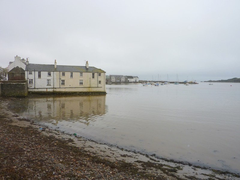
Portpatrick was really pretty, with nicely painted houses fringing the harbour. We walked down on to the coarse sand of the harbour beach and dipped our wellied feet into the Irish Sea.
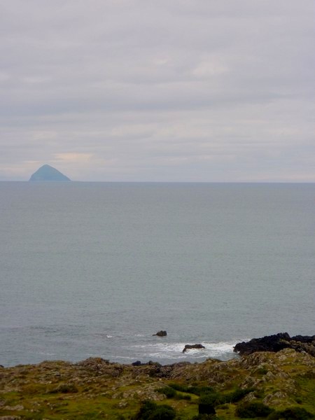
We now drove to the far north of the peninsula to Corsewall Lighthouse – now a hotel. To get there we had driven through rural country, with fields of cows alternating with lovely woodland. The last few miles were on a really narrow and winding road, ending with a narrow gateway, which Adrian just managed to drive through. We could see the pyramid shape of Ailsa Craig out to sea, and a ferry on its way to Ireland.
We made our way back, coming to Kirkcolm on the eastern side of the peninsula, on Loch Ryan. We looked across to Cairnryan, where we’d left from for Ireland in 1996. We drove the last bit down to Stranraer, and had now completed this section of our RAB.
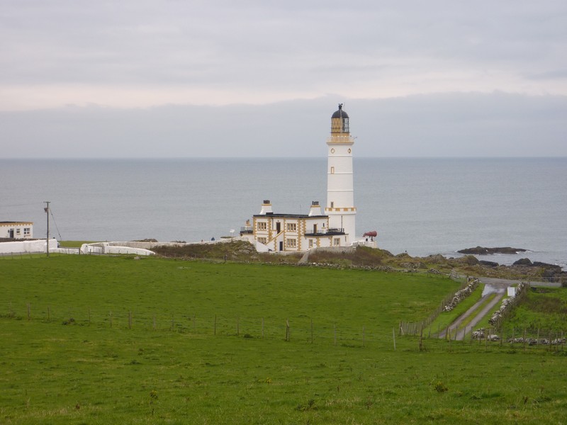
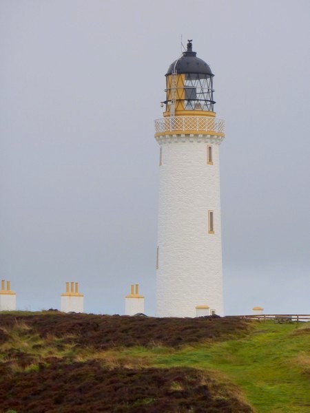
The 'hotel' lighthouse at Corsewall
Ailsa Craig
Portpatrick
The next section will be Runcorn to Gretna Green