
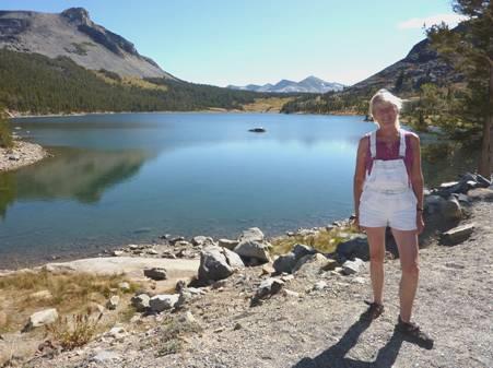
Tuesday 15th September William Lawson’s Gold Claim 83 miles
It was cool deep down in the valley, with the sun just appearing when we left at 9 o’clock. We continued on our scenic and uninhabited road, and reached Chico, in the Sacramento Valley. We could see the layer of smog as we looked down.
We continued to Oroville, noticing the palms and the flowering trees – but then we found that we are nearly at sea level, after being at 8,500 ft yesterday!
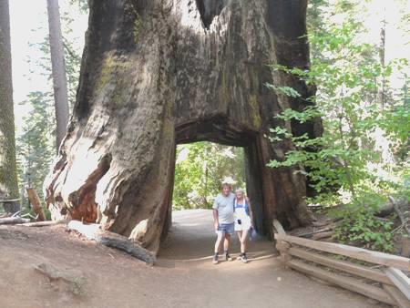
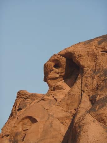
The reason that we had come here was that we wanted to find out more about William Lawson’s gold claim. This ancestor of mine has long interested us – he had gone on to live in the Marquesas Islands, in the South Pacific and there are many distant cousins there. We found out fairly recently that he had come to the California goldfields and had staked a claim. We made for the Butte County Historical museum, but found to our disappointment that it only opened on Saturdays. Not to be put off easily, Adrian found a door open at the back and ventured inside. Three ladies were there, preparing for a quilt exhibition on Saturday. The lady in charge turned out to want to be really helpful. She stopped what she was doing, and tried to answer our questions (although she was one of those people who didn’t really listen).
In one area, there were magazines called ‘the diggins’ which went back to the 1950s, and followed up stories connected with goldmining. Just browsing through them was interesting, but we couldn’t find any reference to William Lawson. We tried to find out where his actual claim was. He had written that in was on the ‘last fork of the West Branch of the Feather River’. As the river was dammed in 1968, to form Lake Oroville, it made things more difficult. We spent a long time looking through books and booklets, and the lady tried looking up all sorts of things for us. We bought an old map of the area, and thanked the lady profusely. It then worked out that Adrian was able to let her copy the letter which William had written, telling of his mining activities. She was thrilled to bits, and hoped that it would be put into a future journal.
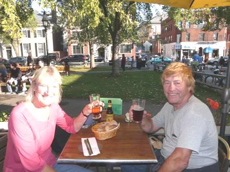
It was now past lunchtime, so we made our way to a nearby park, where we had lunch at a shady picnic table, with a steam engine behind us!
A couple came along to sit at the next seat and have a cigarette. They were Robert and Patty (but it sounded like Paddy). They wanted to get chatting. Patty had dyed black hair and no teeth. Robert looked like an ageing biker, with tattoos all down his arms, and was wearing a bandana. They were pulling along a little cart, wrapped up in which was a wooden treasure chest which he had made, and was trying to sell. Robert said proudly that he was nearly 50 (but he seemed older). He also said that he had MS, and he walked with a stick. He told us that he had watched a programme last night on Discovery channel about the Thames barrier. They seemed to be living ‘hand to mouth’, but we enjoyed the chat.
We now found our way (past road works where they were tarring the road) to the ‘Recorders office’. Here, amongst booklets on ‘Termination of Marriage’, and ‘changing birth details’, was the place where archive records were kept.
We hunted for some time, trying to find our way around the system, so that we could look for mining claims. The girls behind the desk were pleasant, but didn’t know much about it. We hunted through old records on barely legible microfilm. We found records for the West Branch of the Feather River, but no reference to William Lawson. We were about to give up, when, staring up from the feint writing I made out the name of William Lawson, amongst a group of other names. I could hardly speak for excitement!
We couldn’t print from this machine, but had to hand the roll over to one of the girls. She had great trouble in finding the right page to copy, and then in printing off something that we could read, but finally we had success, and for $3 we had a copy with William’s name on a gold claim!
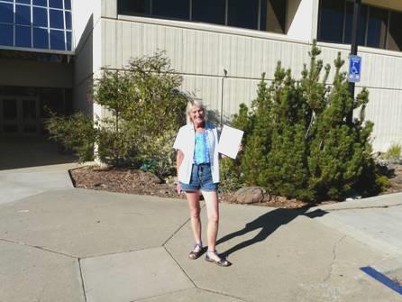
Rosie with William Lawson’s name on a gold claim
We walked out into the warm sunshine, flat, basalt-topped ‘Table Mountain up behind us.
We needed somewhere to stay tonight, and really wanted electricity, as we’d had trouble with the computers charging, and wanted to finish the website, and also to look at things regarding William’s whereabouts here. We tried an ‘overnighter’ place on Thermalito Forebay – part of the Feather River, but this cost $20 just to stay in a ‘carpark with no facilities’. We headed off to a campsite by theLake – a long way, but in the right direction for the ‘West Branch’. When we finally got there, we were astounded to see that it cost $40! No way, said Adrian! We had seen a place right outside the park gates, so pulled in there for the night. Adrian couldn’t settle, as he so wanted to get on with ‘computer things’. State Parks had been inexpensive when we came to California in 2002, but now they are exorbitant – thanks Mr Schwarzenegger!
We tried to enjoy the setting, with the dry yellow grass and the blue sky, and Adrian lit the barbie, while a group of deer came to forage in the field. The stars at night were the most amazing yet.
Wednesday 16th September A difficult road to Paradise 29 miles
It was warm with a blue sky. After breakfast I completed yesterday’s diary by plugging the computer into the engine battery.
At 8.30 we set off, hoping to get a look at where William had mined.
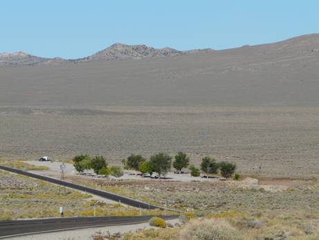
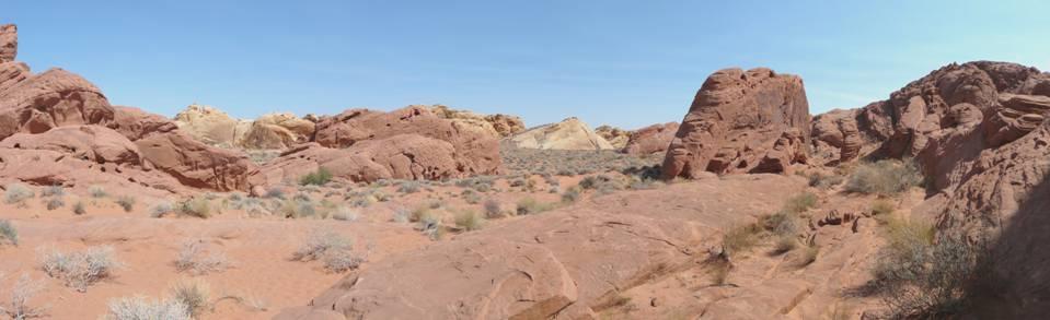
The road we were on went on for another half mile to a large carpark above the reservoir. We drove down there, and found that the water level was extremely low. This did give us more of an idea of what the valley sides would have been like before they were flooded.
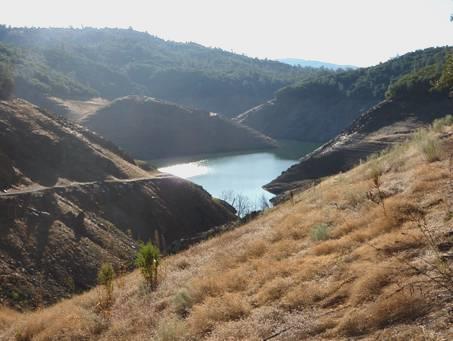
Low water on the dammed Feather River – lonely place to have a puncture!
Disaster struck though! We had been aware of a strange sound from one of the new tyres, and it was now that Adrian discovered that we had a flat tyre. He tried for about an hour to undo the bolts, but one of them was stuck tight, and wouldn’t budge, whatever he did. There was nobody else about, and not likely to be, and of course our mobile phone didn’t work here. Adrian had exhausted himself, so I walked way up the road, but still no phone signal, so I returned. Adrian then set off, hoping to find help. It was a long time coming! He first tried the track off to a small hydroelectric plant, where I had seen a truck enter, but the chap had no possibility or inclination to help! Adrian next tried a lone house, down a long track, but nobody was there. After that, he walked down into the campsite, where the only person there was the camp host, but he couldn’t help either! His rescue came with the passing by of a couple in a large old motorhome – Richard and his wife, who now live in Hawaii, where he runs an architectural firm. They gave Adrian a lift back down to the Bam, by which time it was 11 o’clock, and I had been quite anxious!
Richard had another tool, but that couldn’t shift the bolt either. Luckily their phone worked here, and Adrian finally phoned for assistance.
Adrian went off photographing, and the other couple went off too, leaving me their phone. It rang once, and made me jump – it was someone for Richard – ‘the tile man’, but of course I thought that he said ‘the tyre man’! Also, a truck had pulled up, which I thought was the repairer, but it was the campground host, whose conscience must have got the better of him, and he’d come to see it we’d got help. It was another hour before the repairer arrived – from Les Schwab, which we thought fitting when today was Adrian’s colleague Les Smart’s funeral.
I’d prepared a feta salad, which we were just about to eat when Robert, the tyre man, arrived. He quickly removed the bolt, put on the spare tyre, and took it back to Paradise, where we said that we’d collect it later. He had found that there was a large nail in the tyre. Paradise was the name we had for where William’s claim was, so we were heading there, hoping to see more of the West Fork valley.
Having eaten our lunch, and thanking Richard for his help, we left at 1.30 – five hours after arriving!
We drove on into Paradise, looking in at a couple of RV parks, as we knew that we just have to have electricity tonight to charge the computers.
We did take another road which wound down towards the lake, at the point where we’d been led to believe that William had his claim on the opposite side. The road was steep, narrow and very rough, so we didn’t get very far, and could only just glimpse across the valley.
This whole area of Paradise is residential in a very nice way – houses set amongst the forest. We managed to find our way to the main street, and eventually to Les Schwab, where we had to wait around for a while until they fitted back our tyre. It gave us a chance to look at the many emails which had arrived in the last couple of days, some wishing Adrian a Happy Birthday. All we had to do now was to find a supermarket, to shop for Adrian’s birthday food for tomorrow. We hunted near and far – there was every other kind of shop and business, but no supermarket. In the end, I asked a nice young woman, who replied ‘Oh, yes, Safeway is just along the road’! And so we finally got our shopping, and managed to find our way back to Pine Ridge RV Park. For once, Adrian was really happy to be in an RV park, and to have electricity!
I took the rubbish up to the bin and met Sarah. ‘I’m Sarah’, she said, but they call me Shorty (Shordy). ‘They say I’m not a kid, but I think I am, I’m three.’
We then wondered what to do first, and set about finishing the website, which we finally set up, and sending the email. Adrian printed off more of the diary, in between lighting the barbie for our evening meal.
We realised that everyone else on the site seemed to be living here. A small boy said to Adrian ‘Hello Newy. I call you Newy because you’re new here’.
Thursday 17th September Adrian’s birthday search for William Lawson’s gold claim site 25 miles
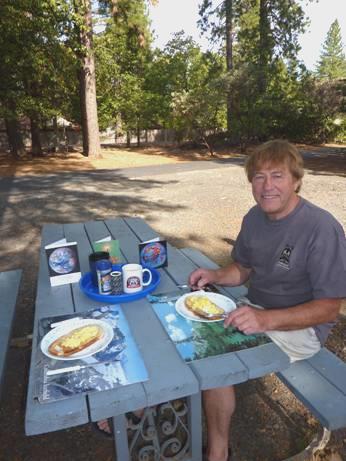
Happy birthday breakfast
Adrian chose to have scrambled egg for his birthday breakfast, which we ate outside, with his few cards decorating the table. We’d heard from all our kids, and Emma had given him a Fred Dibnah book.
We didn’t leave until 11 o’clock.
Adrian wanted to see if we could get nearer to William’s gold claim site from the other side of the West Branch of the Feather River. Before that, we turned off onto a road where we had a good view of the west branch, and the place where we had been stuck with the flat tyre yesterday. We made this a coffee stop, with a huge gooey choux bun.
Now we drove to the other side of the river, following routes to where we thought that the claim might have been. The roads were of varying surface, and extremely winding. They went through dense forest, but a huge area had been burned by fire last year.
Adrian had a route planned, to try to get to the inlet which distant cousin Peter Nield thought was the right place. We had a google photo of it. The road we were following became gravel, and then suddenly it was a sandy 4x4 track. The Bam could go no further, and there was still well over a mile to go to the point where Adrian thought that we could see up the valley.
We pulled in by somebody’s plot of fenced land. A group of men were chatting outside, one looking like Old Father Time. Adrian asked if we could park there for a while. The men said that they had lost everything in last year’s fire.
Adrian wanted to walk as far as we could, so we ate lunch first, and then set off in the searing heat. It wasn’t a pretty walk, because of all the burnt trees. Also it was a rough surface, and went down and then up repeatedly. After about 40 minutes we reached ‘the end of the road’ – after that, the track turned back on itself. A whole area here had been half cleared after the fire, so was very uneven underfoot. Nevertheless, we could see the valley opposite, and could imagine that it was the one we were searching for. We stopped and discussed, and took many photos before beginning the hot walk back.
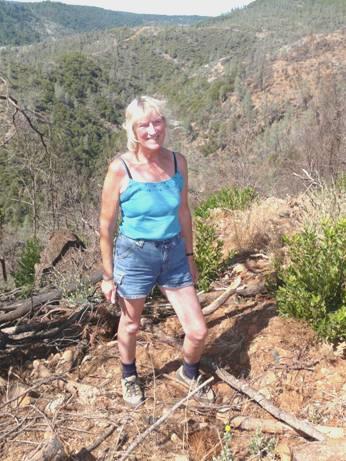
Rosie in front of ancestor William’s gold claim site
At one point we stopped by a little steam, where the presence of water made it feel cooler. A frog plopped into the water and later swam away.
It was 3.15 when we got back to the Bam, looking and feeling like two pickled beetroots.
We’d passed a campsite on our way here, and thought that we’d try it for tonight. We negotiated the gravel road, passing the llamas in a field, which had surprised us on the way, and found our way back to Conrow Campsite.
A young girl came out to collect our $15 and said ‘you guys can camp anywhere down there’. There was no electricity but there was water, she said.
We both admitted to be rather disappointed when we got to the site. It was beside water, but there was ‘no wading or swimming’. The slimy water didn’t entice us anyway, but the frogs didn’t mind.
It would appear to be a village community park. Two rough stages were set up near the water, with bales of hay, which must have been the seating for a recent performance. The site was very primitive, with several tipis around, but there were areas of dry grass, with really tall trees, so we pulled in and tried to cool down.
In fact, we realised that it was really atmospheric. We later opened the bubbly, and ate some birthday cake.
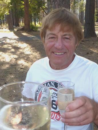
Cheers to Adrian!
We cooked the halibut and veggies on the stove outside, and just about finished eating before it got dark.
Adrian then lit a fire in the large open communal fireplace, and we sat out until late, under the stars.
Friday 18th September Old Sac and more old mining towns 168 miles
It was a nice morning. We enjoyed the quiet as we ate breakfast outside and then took the winding road back to Route 70.
We followed the wide, flat Sacramento Valley with its many orchards. We did stop and buy some peaches from a fruit stall, but it seemed to be the end of the season, and there wasn’t much left.
We reached Maryville / Yuba City and went in search of somewhere to get an oil change. Nothing came easily today – when we reached the first ‘Jiffy Lube’, a sign said that it had now moved! We managed to find the new place and waited while they did the oil change.
We needed three things now – petrol, propane and post box. Petrol seemed to be expensive nearby, so we trailed around – and the next fuel station we found had closed down! Finally we found somewhere to fill up, but it had difficulties with Adrian’s card, and resulted in him leaving off the petrol cap. It was many miles later, when we had been wondering what the rattling was, that a kind motorist beeped to say that the petrol cap wasn’t fixed – with the key on the new keyring which I had given Adrian for his birthday! This was as we headed for Sacramento, and had got into the first motorway hold up of the trip – about ¾ hour. It was because of road works, but they hadn’t adjusted the traffic lights to let more traffic through, as one lane was closed!
Hence we arrived in busy Sacramento at lunchtime. RV parking was expensive, but after a struggle, we found a meter with 40 minutes left on it, so we put some more money in, and made a hasty sandwich for lunch before walking out to explore some of the old town. The old part of Sacramento, known as Old Sac, was quite delightful, with a large area of historic buildings. These were now either candy stores or tourist shops, but the atmosphere was pleasant. The railway had run by, and beyond that the Sacramento River, joined here by the American River.
There were several museums, but Adrian wanted to visit the historic museum, which we did. We had rather a rush around this, as there was so much in it, but it was the goldmining era that interested us, and there was plenty about that.
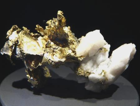
Gold found in quartz – as William may have found it
We had to leave, because of the parking meter, but now we drove through the town so that we could pass the Capitol Building. Sacramento had been established in the 1850’s, and the centre had a lot of attractive buildings, reminiscent of London.
After that it was a long drive out in a southwesterly direction, and into very arid country. We reached route 49, where there was a string of former mining towns.
We really enjoyed seeing some of these. Amador City was set on a hill. We walked up and down the main street, trying to keep out of the sun, as it was extremely hot (96ºF). Many of these towns have now become wine areas, and a bit touristy, with lots of antique shops. We wandered around Sutter Creek, and soon after leaving it, were over the moon to find a place to get propane, as we were quite desperate for it ( we had found a post box when leaving Sacramento, so could at last post the card to Simon & Laure for their Anniversary).
Jackson was a bigger town than the rest, but our favourite was Mokelumne Hill, which was very untouristy.
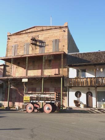
Mokelumne Hill
Now we just needed somewhere to stay tonight, and being so hot, we wanted a campsite. We followed a really pretty route to New Hogan Lake, where there was a Corps of Engineers campsite, but we took a long time in finding the right part of it. When we finally did, we saw that the water was really low, so from our spot we looked across a dry valley to another part of the campsite instead of across the water to a boat ramp.
I was feeling the effects of the heat, and we couldn’t think of cooking anything, so I made a tasty salad. It was lovely sitting out under the stars, which were brilliant because of our unobscured view. We saw campers across the valley with their campfires, and we had watched several hang gliders setting off from the hills opposite.
Saturday 19th September To King’s Canyon for our 1,000th night in the Bam 217 miles
We ate breakfast outside in the early morning cool and quiet. At 8.30 we set off, driving back to Route 49.
We had some more treats of past gold rush towns, the first being San Andreas, which had a nice Main Street.
Next came Angels Camp, named after two brothers called Angel. Outside the museum (not yet open) stood two wonderful old steam engines, and other bits of memorabilia.
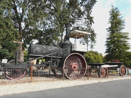
‘Old Beth’ at Angels Camp
In a nearby park, with more mining exhibits, there was a statue of Mark Twain, who visited here in the 1860s, and wrote a story about Jumping Frogs, which has become a classic event in the village now. The main street, which was right on route 49, was quite delightful and genuine looking.
We drove on through very dry countryside, dotted with all sorts of deciduous trees, sometimes reminiscent of Southern Africa. We stopped by a marker at Carson Hill, which stated that the largest gold nugget in California had been found here.
We stopped to have coffee and chocolate birthday cake overlooking New Lake Melones, in the already hot sun.
We turned off to visit the town of Columbia – the crown of all the old mining towns. This one had been made into a State Park in 1945, and was sheer delight. It has become a little tourist haven, with costume dressed guides and souvenir shops, but it was like a living museum, a bit like Beamish. The buildings lining the streets were just lovely. There was a wooden mining cabin, with ‘long tom’s’ where you could pan for gold. All this had a backdrop of the huge rocks which scatter the hills. A Wells Fargo carriage pulled by horses could take you for rides around the village from outside the actual Wells Fargo office.
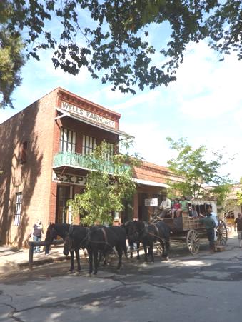
Well’s Fargo, Columbia
There was the dark old jail, and superb museum exhibits (all free). A real winner!
We drove on, through Sonora, the last of the gold rush towns that we were passing. We drove slowly because of all the traffic, so had time to see the main street.
Now we drove cross country, initially on a winding and badly surfaced road, to Merced. We had decided to drive down to King’s Canyon, which we had driven to in December 2003, but we couldn’t enter as the park then was closed for winter.
The countryside became increasingly arid, and we could find nowhere to pull off to have lunch. In the end, we stopped and ate our lunch on our seats in the shade of the Bam, beside a dry field.
From Merced we took Freeway 99 to Fresno, noticing all the acres of vines being grown, as well as orchards of fruit trees. From Fresno we wound up and up to King’s Canyon (at 6000ft) enjoying the great views as we did so. We had driven down this way in 2003, and this time we ended up in the same campsite as then, called Azalea. It felt cooler than down in the valley (it as 95ºF down there but only 70ºF up here), but not as cold as when we were here in December!
The site was busy, being Saturday night, but the sun was shining down through the huge trees as we set about enjoying our 1,000th night in the Bam, with plans to visit the canyon tomorrow.
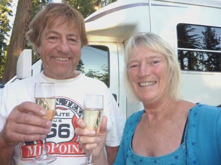
Cheers again! 1,000 nights
The evening was cool, but not cold, so we were able to enjoy a campfire, and Adrian cooked steak, corn, mushroom and potato. We’d toasted our 1,000 nights with bubbly, and sat out, with the stars up above us through the trees.
Sunday 20th September Kings Canyon for our 1,001 Bamadian nights 75 miles
It was a beautiful day for our day to visit King’s Canyon. After eating our breakfast outside, where it was sunny but still cool, the day soon became really hot.
We drove off, descending down and down into the canyon.
Above the descent into Kings Canyon
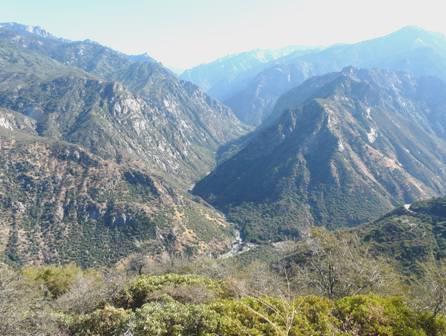
It was 35 miles to the end of the road – called ‘Road’s end’! Words can’t describe the grandeur of the dramatic, overpowering scenery. John Muir was a driving force behind keeping the area unexploited, and to be enjoyed by all. We marvelled at him exploring these wild areas at the end of the 19th century, when we find them pretty inaccessible now, by vehicle.
After our long descent, the road wound along beside the Kings River, named by Spanish explorers in 1805. We stopped many times to view and photograph. We walked a short trail to see straggly GrizzlyFalls on our way along the canyon, and on the way back we walked to Roaring River Falls, which shot out through bare rock, with a pool at the bottom, and with attractive pine trees. It made us think of places in Oz.
We reached Roads End at midday. Many strenuous trails lead from here – not for people like us! We did walk over to the river, to look at ‘Muir Rock’ – a huge slab of boulder which John Muir often used as his ‘stage’ to tell of his discoveries and hopes for the area. The river itself was really attractive, rushing over boulders, like a real life ‘rapid river’.
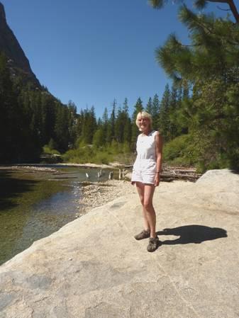
Rosie on John Muir’s Rock
We drove back a short way to Zumwalt Meadows, where we ate inside, because of aggravating little flies which flew into our eyes. Luckily they weren’t too much of a problem when we walked the 1½ mile trail around the meadows.
This was a delightful walk, which we thought twice about doing, partly because of the flies and partly because of the heat. In fact some of the walk was in shade, and there was a slight breeze. On one side of us was towering North Dome (8717 ft), a gigantic white stone peak. On the other side was Grand Sentinel (8518 ft). There were all sorts of trees growing, and meadow grass in a deep sienna colour. The path climbed up and over rocks, having crossed Kings River on a small suspension bridge.
As we made our return journey up the canyon, we enjoyed the views all over again. The passage of the sun meant that the colouring of the rocky peaks looked very different from this morning.
We had decided to loop back past Hume Lake for the last part. As we descended the long and winding trail to the lake, we were amazed to think that we had driven here in frosty conditions in December 2003, when the canyon road was closed. There was a campsite near the lake, but not very close to it, so we didn’t stop, but drove to the day use area, where we had a short but lovely swim in the lake.
Hume Lake
There were two more campsites marked on this loop, but the first small one wasn’t suitable, and we had trouble in finding the second. It was 6 o’clock when we did get to Ten Mile campsite (named after the creek), but the track around it was a 4x4 sandy and rough. We managed to find a fairly level spot.
It was a nice open spot, and we had a campfire, initially in our seclusion, but later other campers arrived further down, but we still sat out until 9.30.
Monday 21st September From Kings Canyon to Yosemite 173 miles
We left early on a cool morning and ate our pancake breakfast at Redwoood Lookout, looking down to a forest of sequoias.
We made the long descent from Kings Canyon to the San Joaquim Valley, stopping at 9.30 at a really nice fruit stall which had enormous peaches and nectarines and delicious grapes. We bought a few things and sampled some.
We managed to take a cross country route around Fresno, mostly in the foothills. We stopped for coffee by Friant Dam, on Millerton Lake, but had to sit inside as the picnic tables were all in the sun, and it was far too hot now!
We drove on to Oakhurst, a utility town, which didn’t impress us now any more than it had when we came through in 2002. We did the ‘useful things’ with difficulty! We’d got fuel, and the shopping in Raleys went OK. Adrian got out some money, for which he was charged, but we didn’t really get an internet connection, and the shop selling firewood was closed.
The worst thing was the washing – I had spotted a launderette, but this one was unlike all the others. Instead of putting in a stash of quarters (usually only half a dozen), the machines all worked by a card, which you bought in multiples of $1. The wash cost $2.95. No change was given. I got in a real tizz, when I put in another $1 for the drying, and thought that I’d used a $10 bill. We ate lunch in the van – too hot really to eat, and then collected the washing – which was still really damp! Adrian had to put up with clothes strung around the Bam, until they soon dried in the hot weather.
Now we made our way into Yosemite National Park. We had come here in March 2002, when a snow blizzard (against all the forecasts) prevented us from seeing anything when we first arrived. This time we didn’t have that problem!
We stopped at Sugar Pine log railway – now a tourist train, and looked in at the well stocked bookshop and buying one or two.
We continued into the park, intending to stay in a campsite in the valley, as we had done before. There was a road off before that to Glacier Point, and Adrian made one of his Murray predictions, saying that if we really wanted to drive that, we’d do it tomorrow. Fate decreed otherwise – we found out that all the campsites in the valley were full, but there was space at Bridal Veil Creek campsite, half way along the 16 mile road to the viewpoint.
The downer about this, was that they were resurfacing the road, and we had a long delay, and then a 5½ mile trail along the unsurfaced road, following a pilot car (memories of Bella Coola). We utilized the waiting time by listening to our recording of our previous trip here.
We arrived at the campsite at 4.30. We found a nice spot, and were tempted to stay put, but instead decided to drive the next 8 miles to the viewpoint tonight, so that we’d have more time for the valley tomorrow. The first part of the road was fairly straight and level, but then the road did a few turns, until we came to Washburn Point, the first of two lookouts.
We hadn’t realized two things – firstly, that this scenery is absolutely staggering, and secondly, that this seems to be THE place to come! Dozens of other cars had braved the horrid roadwork section and the winding road to see these views (and climbing to 8000ft). And they were just spectacular! Again, no words can describe the deep, deep, valley with its huge bare granite domes. There was visibility for miles of just mountain wilderness, with waterfalls far below falling from a great height. Just mind blowing!
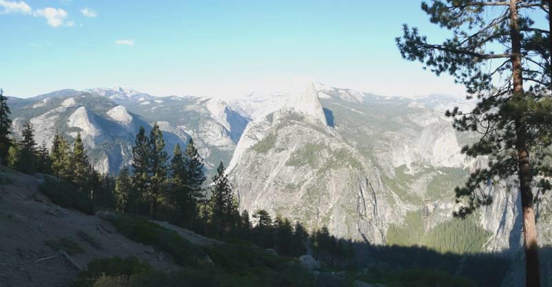
View from Glacier Point, Yosemite
At Glacier Point itself, we walked the short trail and viewed from different spots. People had come from all over – we heard half a dozen languages being spoken.
We were astonished to find that there used to be two hotels here – the first built in the 1890s! They burned down in 1969.
Having had our fill of the grandeur, we drove back to the campsite, arriving at 6 o’clock, time to get the campfire going!
We had a really pleasant spot, and sat out in the quiet until 9.30.
Tuesday 22nd September Glorious Yosemite 67 miles
The morning was really cold – but we were at over 7,000ft. It was still cool when we had breakfast at 9 o’clock.
We left and drove back to the junction, waiting for the road works pilot car. We then proceeded down into the valley.
The majestic scenery was just stunning. We hadn’t been able to see any of this when we arrived in 2002, because of the snowstorm, so now we just lapped it up!
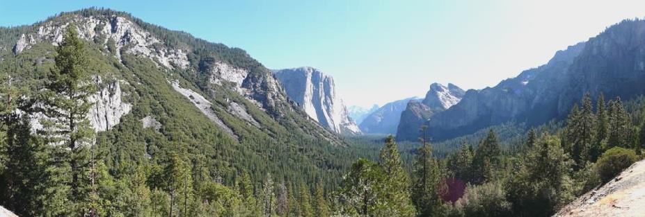
Yosemite valley 1
We drove through the road tunnel, and stopped afterwards to take in the view – the first of many stops! We stopped again by Bridal Veil Falls, which were really just a trickle today, but we walked to view them just the same, remembering our visit in the snow, when we could only feel, but not see them! One thing we hadn’t been prepared for was the enormous number of people visiting the park. It made driving on the narrow, winding roads difficult, and finding parking spots was often taxing! There didn’t seem to be many Americans. We heard English voices (from England) and all sorts of European languages, particularly eastern European and Russian. We noticed that these people didn’t acknowledge us when passing, or say hello as others do.
On our trail around finding somewhere quiet to have lunch, a coyote passed by as one had done in 2002! We did then have our lunch at a shady picnic table amongst lots of tall trees, with the brilliant white vertical rock surfaces up behind us. It was marred only by wasps.
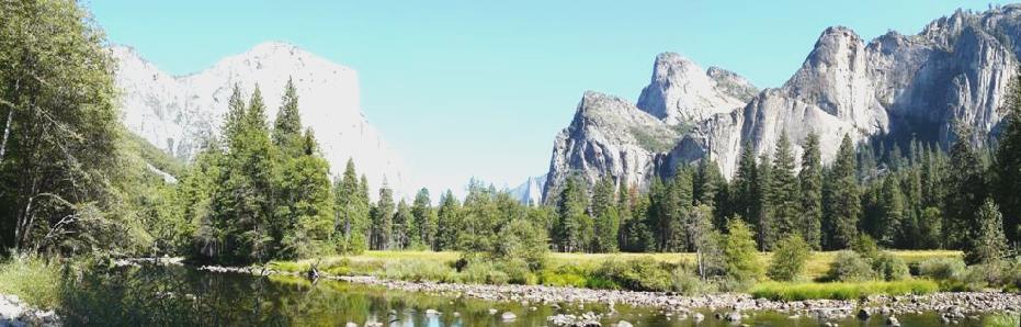
Yosemite valley 2
We were now on our return drive from the valley, but when we reached the end, we followed a different route, up through Big Oak Tree Flat, so that we could drive the northern road which runs west-east across the park. This road is closed in winter. Oak Tree Flat road had been closed a couple of weeks ago because of a vast fire – a prescribed burn which had got out of control. It didn’t make for a pretty sight as we drove through.
We reached the junction with the 180 east at 3 o’clock. Just afterwards, we arrived at the parking area for the walk to Tuolumne Grove. This is a grove of Giant Sequoias, one of three in the park, and of the small number on this edge of the Sierra Nevada. We wanted to do this walk, although we needed to drive on to find a campsite. The walk descended for a mile, dropping 500ft, and as it said, the walk back up seemed longer! The path followed an old road which had led to the park over 100 years ago. At that time, a dead tree had been carved so that a vehicle could pass through it.
The Big tree, Tuolumne Grove
That tree is still here, and from there, a rough half mile track led past the grove of these giant trees. Apparently Giant Sequoias are the largest living thing on earth.
It was pleasantly cool walking in the shade of the tall trees, but the walk down and then back up wasn’t the most exciting!
It was 4.45 when we arrived back, and continued our drive eastwards. The road passed through more forest, with occasional glimpses of pristine mountain wilderness both north and south of the road, but few places to pull off.
We arrived at Porcupine Flat campsite at 5.30, and manoeuvred the rough sandy paths, settling back in camping site number 1.
It rapidly became cool – we are at 8,100ft. We didn’t have too much firewood, so we cooked fish on the stove outside, and afterwards we had a lovely campfire in our very quiet situation.
Wednesday 23rd September More scenic joys as we continue through Yosemite and into Inyo NF 36 Miles
The morning was very cold, as we’d expected. We left at 8.30, and continued along this really scenic road with the huge slabs and boulders of granite beside us. We stopped at Olmsted Point, and from here we could see across to Half Dome, standing out above the Yosemite Valley. It was quite a stunning viewpoint. We walked a short trail so that we stood on vast slabs of granite, looking out to this amazing view. The vivid blue sky contrasted with the white of the granite mountains and the green of the various fir trees – there was no other colour. It was magical. By the time we’d walked back to the Bam, at 9.30, it was already hot, so time to strip down to vest and shorts.
Looking to Yosemite Valley from Olmsted Point
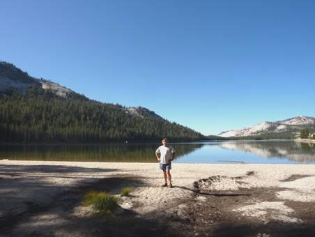
We soon came to pretty Tenaya Lake. At the end of the lake, we walked though a bit of coniferous forest to a white sandy beach – practically deserted now, but presumably very busy later in the day. Again we enjoyed the stark granite slopes, streaked here with brown.
Tenaya Lake
A bit further along we came to Tuolumne Meadows, and stopped at the wooden cabin Visitors Centre, where there were a lot of exhibits relating to John Muir, who spent 10 years in this area, and was instrumental in saving it as a wilderness. We marvelled at his detailed sketch/note book, which there was a copy of. It was reminiscent of Wainwright. There were quotations of his around the walls, and many books about him, but not one of his quotations, which we have been hoping to find.
We now set off on a lovely walk across the meadows, and crossing winding Tuolomne River. In the spring, these meadows would be full of wildflowers. We did see a few as we returned – tiny Michaelmas daisies, potentillas, lupins and achillea. The walk led to Soda Springs – some iron coloured water bubbling up in little pools. There was also an old cabin and lodge, but too early to be open today. We had revelled in the stark views up to more white peaks in this beautiful setting. We walked back a different way, meaning that the last part was beside the road, but it did give us the chance to walk a very short, flat and easy part of the Pacific Crest Trail, and to see climbers scaling the vertical granite Lembert Dome.
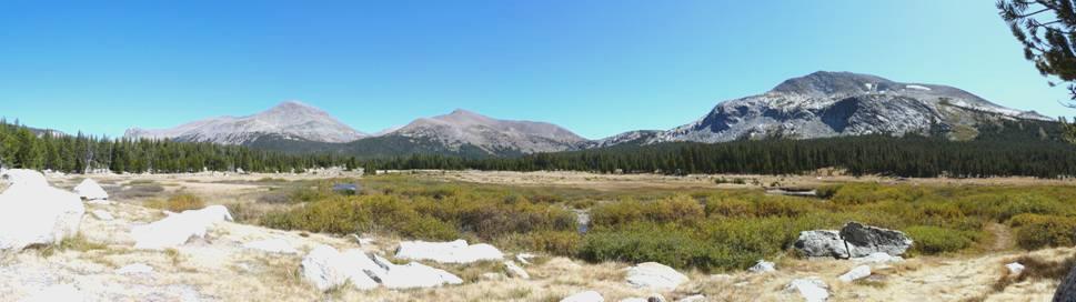
It was 12.15 when we returned. The nearby picnic area was too busy for us, so we continued along the road, still enjoying the dramatic scenery, but hoping to find somewhere to stop. We really hit the jackpot when we stopped by Dana Meadows, and took our seats down overlooking meandering Dana Fork. The colourful meadows were fringed by dark green conifers, with a backdrop of the ever wonderful mountains. Sheer heaven!
What a lovely spot for lunch!
We managed to drag ourselves away, and soon reached Tioga Pass (9945ft), and the park entrance. We immediately came into Inyo National Forest, and the scenery continued to delight us.
Tioga Lake
We stopped beside Tioga Lake, and were tempted to stay at one of the two small campsites here, but decided to drive on a bit. We did have a gorgeous walk around some small alpine lakes, in the clean, fresh but warm mountain air.
After Ellery Lake, the road descended for six miles, clinging to the side of Lee Vining Canyon. We hadn’t expected this road to be so attractive, so progress was slow. After making a long descent, a road turned off to some campsites, one of which, called Aspen, was still open. With aspen trees amongst the firs, it was very pretty, so at 4 o’clock we decided to stop. Being deep in the canyon, the sun very soon disappeared, and will be late arriving in the morning.
We had a lovely spot beside the river, and after Adrian had collected up some firewood, we had a wonderful campfire and sat out in the quiet until 9 o’clock.
Thursday 24th September White tufa columns in a lake of blue 165 miles
We ate breakfast outside by the rippling Lee Vining River, although the sun didn’t appear above the high canyon walls until we were just leaving.
We descended to Mono Lake, which had a surreal beauty, a bit like Pyramid Lake, surrounded by low, barren hills.
We drove eastwards, south of the lake, stopping to have a look at Panum Volcano, a plug dome volcano which has been dormant since it erupted 650 years ago. We had to drive down a long bumpy track to get there, and then we walked partway up the crater on the crushed pumice. We could see black obsidian shining from higher up. In the distance, we had a lovely view of the beautiful mountains we had descended from – with the brilliant blue sky of course.
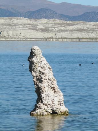
A bit further on, we took another track, to South Tufa Beach. We were surprised to see quite a lot of cars here, but then we realised why! From the parking area, you could walk a mile long trail to MonoLake. At the edge of it, were hundreds of tufa ‘pillars’, some sticking out of the water, others on the shore. It was a sight like nothing we had ever seen before. They looked so evocative, gleaming white against the pale blue water of the lake.
Tufa pillars in Mono Lake
Mono Lake is a salt lake, a centre of inland drainage – on the western edge of the Great Basin. It is fed by half a dozen mountain streams. In the past, water was used from the lake to ‘feed’ Los Angeles, and the water level consequently dropped dramatically. In 1994, it was agreed to let the water level rise again, over a 20 year period. By then, many of these strange columns will be drowned again.
Who’s your friend?
It was odd to see seagulls – 80% of California gulls breed here. At the edge of the water were millions of tiny flies, called alkali flies. They flew up in clouds as you approached. They, and the brine shrimp, form food for the many birds which live here and for those which stop off on the north/south migration route. As we left the parking area, we saw four E-type jaguars parked there – a photo stop for Adrian!
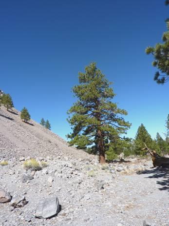
A Jeffreys pine growing on the edge of a cinder cone
We drove on a bit, and stopped for coffee by one of the Mono Lake cinder cones. Bits of shiny obsidian were everywhere here. We were shaded by wonderful Jeffery’s Pines. Apparently this is the start of the largest Jefferys Pine forest in the world. Sadly a large area of it was burned by a lighting fire in 2001. We stopped at the former site of Mono Mills, where there had been a timber mill from 1880 until 1917.
Now we drove through miles of arid, desolate country to Benton. A sign on a building said ‘Benton Hot Springs 1882’, and the place looked as though it was still in that era! There were just a few dwellings and lots of antique bits of machinery. There was nowhere to pull in at all.
A few miles on, at the junction with Route 6, was the more recent town of Benton. We managed to find a shady spot in the community park to have lunch. There was no shade around, just the views up to the stark mountain range which forms the border with Nevada.
We left at 1.30, and 15 minutes later drove into Nevada, with the sight of Boundary Mountain (13,143 ft) up beside us – the highest point in Nevada.
We continued, with the colourful mountains either side – all sorts of hues showing through the trees, although there were no trees at all in the wide flat valley.
We went over Montgomery Pass (7,150 ft), where there was just a derelict casino and motel. Some miles further on, at Coaldale, there was only a collection of dilapidated buildings. The route continued through flat, arid country, with just a few tufts of dry grass. To either side were the absolutely barren coloured hills. The only excitement was a sign saying ‘litter barrel ahead’.
We saw some green trees in the distance, and realised that this was the rest area. It was called Millers, after a town which had been abandoned in 1947. Nothing remains of it now. Nearby was “LoneMountain’, which seemed an apt name!
We reached the town of Tonapah – the first town we have seen for days. It is a town built on mining, and the Main Street didn’t have to try to look authentic – it was just a remote outback town in the middle of a bleak, arid landscape. Mining relics adorned the roadside, and there were several motels. Adrian filled up the petrol tank, and was glad that he had done, when the sign outside town said ‘next gas 163 miles’!
We drove on some more miles, coming into an area of National Forest, but there were no trees to be seen – just the yellow flowering rabbit brush, and a sprinkling of pink grass.
When we spied the green of a few trees, just before Saulsbury Summit, we realised that it was another rest area, so at 4 o’clock we decided to stop there for the night.
Friday 25th September Across miles of Nevada desert to a stunning Valley of Fire 235 miles
There was a surprisingly cool breeze in the morning. We left at 8.30, and soon reached Saulsbury Summit (6532ft), and left the National Forest. The only trees had been the half dozen in the Rest Area!
Spot the Rest Area!
Now it was on through, scrub covered ground, with distant mountains and the ever blue sky. As we descended from the next summit, Warm Springs (6293ft), there were just a few bushes.
We reached the site of Warm Springs, and here we were turning south onto the ‘Extra Terrestrial Highway’. We didn’t see any ETs, but just as we started off, we watched a whole group of chukars (a bit like partridges), strutting along like a line of penguins. There were a few trees here, by the stream, presumably from the springs. It was now 111 miles to the next gas station.
The sun shining on the pink and white heather-like plants beside the road looked really pretty, as we drove across the wide, flat valley, surrounded by the bare distant mountains.
The journey continued like this – flat valleys, mountain ridges, scrub vegetation. At one point there was a short lived river, and a muddy pond with ducks on it.
We reached the ‘town’ of Rachel at 10.15 – a few prefabricated buildings and a small hotel called ‘AleInn’. As we drove on, we saw the delightful sight of a whole ‘forest’ of evocative Joshua trees filling the valley. We had seen one or two yesterday, but now they were in profusion.
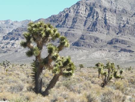
Joshua, Joshua
We reached the end of the ET Highway, and turned south onto a road which was busier (but not busy!) We passed one or two small communities, and thought what a different life it must be, living in this desert isolation, with no shelter from the blazing sun.
We were able to stop for lunch at a picnic table under shady cottonwood trees, but the desert just continued.
We were heading in the direction of Las Vegas, but had no intention of going there – once was more than enough for us! We had found a route which went round Las Vegas, by driving through a State Park called Valley of Fire. This entailed about 15 miles of motorway, until we turned off to the road to the park. The route was very scenic, with rock cliffs looking like vertical solidified mud, but even better was to come. We suddenly caught sight of the bright red sandstone outcrops, weathered into all sorts of weird shapes. With Lake Mead in the far distance, it was quite a sight!
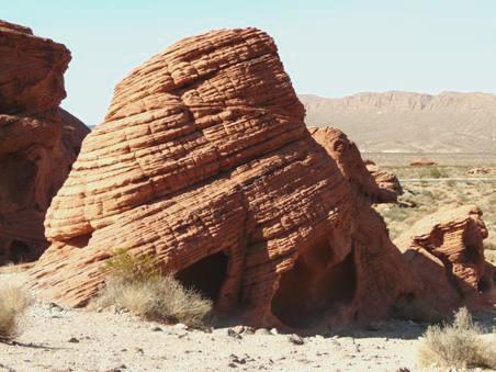
‘Beehives’, Valley of Fire
We entered the park, for which there is a fee, but this is refunded if you are camping. We had hoped that the site wouldn’t be full, as it is Friday night, but there was still plenty of room when we arrived at 3 o’clock. We chose to have electricity – partly to charge the computer batteries, although after our long drive today, that wasn’t such a problem. Also with the temperature being almost 100ºF, we needed air conditioning!
Later, as the sun went down, the light on the red rocks was really vivid. It was still incredibly hot, but we did have a barbecue, and sat out until 10 o’clock in vest and shorts. I had been aware of German speaking people around us, particularly children. During the evening, a nice chap called Beat came along to take photos of the rocks, with the bright moon above. He was from near Zurich in Switzerland, and was here with his wife and 3 children for a three week holiday. They had flown in yesterday, and had picked up the motorhome. He spoke excellent English – he had lived in Teddington for some time! He said that they, and the other Swiss families here, had been told that this was the best place around here to camp.
Saturday 26th September Fiery temperatures in fabulous Valley of Fire 21 miles
Our big decision today was whether to stay here another night, as we knew that we needed electricity in these temperatures, and this was a nice and not too expensive place to be.
We left early to walk to some nearby petroglyphs, which is what the campground is named after – atlatl is a primitive spear which is depicted. Even at this hour, it was already hot! Later, at the excellent Visitors Centre, we saw that today’s high was 100ºF, and low 69ºF!
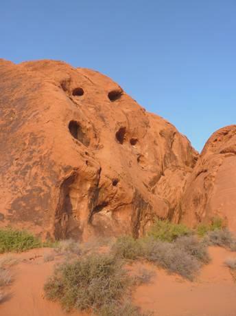
Giant holes E.T. or a tortoise?
We came back to eat breakfast at our shaded picnic table before driving off to explore something of this wonderful park.
We drove first around a loop from the campsite, and then stopped to walk to some petrified logs. We have seen a lot of these, so they weren’t as impressive as they might have been.
A road went off northwards for 5½ miles, ending at what is called ‘White Domes’. This road was really scenic, and the colours of the rock formations were a feast for the eyes. Every shade from red to orange, peach, yellow and white, and every rock shape imaginable.
Pastel shades
There were several places to stop off and photograph, often entailing a walk. Our only complaint in this excellent park, is that all the ‘unofficial’ pull-offs had been blocked off, with just three ‘official’ ones – but not where you really wanted to stop.
We braved the so-called ½ mile trail to ‘Mouse’s Tank’, although in the blazing sun, and walking through fine red sand littered with hidden rocks, it seemed much further! We revelled in each little bit of shade we found. There were petroglyphs along this track too, and the walk ended at ‘Mouse’s Tank’ – a dip in the rocks in which water collected, although there wasn’t any today. Mouse was an Indian who had hidden away in this park in the 1890s, managing to survive because he knew that water collected here. The park was known to have no water, so everybody thought that he had died.
Kissing cousins How many faces can you see?
Later, when we were walking near the White Domes, a chap asked us if there was a good fishing spot nearby, as he’d been told that there was! We thought that he must be joking, and expected Jeremy Beadle to pop up and laugh at us, but he appeared to be serious!
We were able to have lunch at a shaded picnic table, entertained by a whole group of antelope ground squirrels. These entertaining little creatures differed from other ground squirrels and chipmunks. They didn’t keep still for a second, constantly scampering around, sometimes briefly ‘kissing’ another ground squirrel and occasionally lying deep in the sand. It was fun while we were walking to see their little tracks, and those of other creatures which live in this desert environment.
By now we knew that the only sensible thing to do was to stay here for another night, so we drove back to the campsite, arriving at 3 o’clock, and pulling into a place which would soon lose the sun, so be a bit cooler!
We cooked excellent beef burgers tonight, made with meat from Trader Joe’s. It was far too hot for a campfire. It was much quieter tonight. We saw a few bats at dusk, as we had last night. We sat out, enjoying the warmth, but coming in to the cool of the air conditioning.
Sunday 27th September Over the Hoover Dam into Arizona 171 miles
We had shade last night, but not this morning for breakfast. I sat on the step of the Bam. We left at 9 o’clock to drive eastwards out of the park, stopping at the various viewpoints on the way.
One of the ‘Seven Sisters’
As we left the park, we immediately came into Lake Mead Recreation Area.
We drove down to Overton Beach, but the whole place was closed up as the level of the water was so low. Everywhere looked very bleak.
We continued through the grey mountain desert before coming to an area of really colourful hills, including the red sandstone. We passed the turn off to Colville Bay, where we had overnighted in 2002.
We drove on to Henderson, a place we well remember, because in February 2002 it is where we received our Bam licence plates – NO1 HGS (number one hugs). This offshoot of Las Vegas isn’t attractive in itself, but a useful place! In Walmart, Adrian bought a travel bag, so that we can transport some extra stuff home from the Bam. In Albertsons we bought enough food to last us for the next few days – we haven’t shopped for a week. It was very hot. I desperately wanted an internet connection, as we have been out of contact for so long. We couldn’t find one, so stopped to have lunch in the van (with the engine running all the time, for the air conditioning) before leaving for Boulder City.
Here we had better luck in getting an internet connection, and I was able to send a message to our kids, and to wish Simon and Laure a happy wedding anniversary, also Katy & Aaron, whose first wedding anniversary is today, and happy birthday to Jill.
Now we headed for the Hoover Dam. In 2002, we had been prevented from driving over the dam in our RV – an offshoot of September 11th. Adrian was really keen to see this engineering feat, which he remembered learning about in his childhood.
This time, we had to wait in a long line of traffic- four miles of it – to get there. We were in luck at the security check, as RVs had to go to one side, and that meant that we jumped about 20 cars. Sunday afternoon wasn’t the best time to come, as hundreds of people had come to view the dam.
Driving slowly had at least given Adrian time to view the dam, and the construction of the new bridge over it.
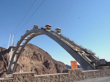
The new bridge under construction at the Hoover Dam
We couldn’t believe the number of people coming to visit. Having crossed the dam, we were able to park in one of the 15 parking areas. We walked out in the heat, but others were walking the long way down to have tours.
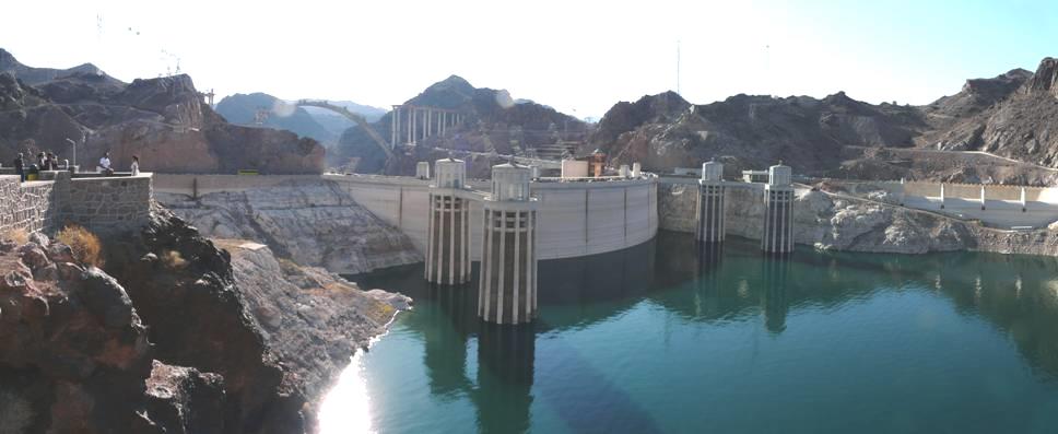
The Hoover Dam
After this, we drove on for 70 miles to Kingman, through desolate country, with just the straight road going through the flat valley, hills to either side. We were amused in the middle of this to see a sign saying ‘Grand Canyon National Park 220 miles’.
We reached Kingman, which we had visited when driving Route 66, and found our way to Zuni Village RV Park. This was as uninspiring as any RV park – lines of RVs, with a picnic table between, set in gravel. The first spot we were given was near the road, but Adrian changed it so that we were further back, with several free places in front of us, and close to the swimming pool.
We hastily made our way there, as the sun went down, and found the surprisingly cool. We had felt so hot beforehand. Ironically, it was not so hot tonight – 85ºF.
Later, we sat outside (the only people) and ate prawns for supper.
Monday 28th September News from home as we travel through the desert 124 miles
We spent a ‘busy’ morning – Adrian getting on with his ongoing task of cleaning the outside of the Bam in preparation for selling it, and me writing the many emails which I’d been waiting to do. We went for another swim in the small, cool pool, and were surprised at the sign saying ‘maximum 33 people’ – I think they would all have to be standing up!
We didn’t leave until almost midday. We’d just received an email from Simon, saying that Manolo had been frighteningly ill with croup, which had put paid to their wedding anniversary celebrations. He assured us that he was OK now.
We travelled east for about 20 miles by the I40 motorway, joining it at a most unpleasant roadwork section, when the entrance ramp led straight into the line of fast traffic.
We turned off to drive south-easterly towards Phoenix on route 93. We drove through varying scenery, but there were no places to pull off at all. We eventually turned off onto a dusty side road to have lunch, sitting in the Bam, with the engine running the air conditioning, so that it was cool enough to eat.
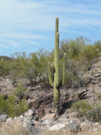
Oh, what a lovely cactus!
We had been enjoying seeing the large cacti and the ocotillo bushes. A little way further on, we turned off to look at a BLM campsite at Burro Creek. It was a lovely situation, with lots of cacti, but also trees down by the river, which was in a deep gorge, with a fine bridge crossing it. I went off for a little walk around, but when Adrian saw that the thermometer was 101ºF and rising, he drove off to find me. At that point, I had just reached the Bam, so we were chasing each other! We’d loved to have stayed here, but knew that it was just too hot.
Soon afterwards, as we ascended a long hill, our phone logged in, and we received a surprise email from Val – Sara had just given birth prematurely to a little boy, by Caesarean section! Feeling quite emotional at the news, we drove on, thinking what an isolated situation we were in to receive such news.
How more remote to hear of news from home!
The desert scenery now became quite dramatic. We turned off to drive to Congress, a small ‘film set’ town which we had driven through a few years ago. Near here was an Escapees RV Park called North Ranch, and that is where we were staying tonight – needing to have electricity once more to be able to survive the heat.
I must admit to feeling really down at yet another uninspiring venue. There were desert hills all around, but no character to the vast park – just lines of RVs, although we did have a big clear space around us. There wasn’t even a swimming pool at this one. We knew that we’d arrived in the area a day too early – we leave on Thursday morning from Phoenix – but the excessive heat of the past few days has meant that we’ve had to go into sites. The fact that our ‘exploring’ time is over was hard to think of.
We ate sushi outside for supper.
Tuesday 29th September Staying put 8 miles
We settled down to having this extra day ‘in situ’, and set about organising ourselves for our departure.
This entailed doing the masses of washing, and sorting which things to take home. Adrian had bought an extra new travel bag the other day, but discovered to his horror and annoyance, that the zip wasn’t able to be opened!
We paid to have an internet connection for the day, and used this to phone all our children, and tell them of Sara’s news. We also spoke to Pip and David, and to Renee. It seemed ironic, that in our far-away isolated situation, we knew more than they did!
In the afternoon, we drove back to the small habitation of Congress, but found little to see. We amused ourselves for some minutes by walking around the large and well stocked Dollar Store.
After coming back, our ‘neighbour’ came by to chat. He was about our age, and on his own, presumably a bachelor. He was an astronomer, and spent much time meeting up with his like minded friends. He hoped to visit England, and see Herschel’s home near Bath. Both his parents had died fairly recently, and he had bought his RV, and loved travelling in it. He said that he had enough money to travel for another couple of years, then he would have to find a job. It made us feel very lucky. A lady who had chatted to me this morning had been RVing with her husband for several years, but both had to try to find work.
For the first time for many days we saw clouds, and the evening was not as warm as others, but still mid eighties. It meant that we had a lovely sky. We had a barbie, and sat out enjoying the warm evening.
Oh what a lovely sky
Wednesday 30th September By the time we get to Phoenix 102 miles
There was a short rain shower at around midnight, but the morning clouds soon disappeared. It was very windy at first, but warm again with a clear blue sky.
I was really pleased to phone Val, and to have a chat about Sara. We just hope that all is well.
We drove on past Wickenburg, which we didn’t recognise at all from our previous visit some years ago, and headed for Phoenix. We enjoyed seeing all the large cacti, which we had so loved when we were in this area before, but we realise that weather and temperature is everything, and the high temperatures that we have been experiencing recently have certainly curtailed our activities.
Phoenix is vast! At the area called Surprise, we stopped so that Adrian could exchange his travel bag at Wal-Mart. Then we continued on the long trail through until we finally found the storage place, after much difficulty. We met Jennifer, and went through all the formalities, so that we can leave the Bam there early in the morning.
Now we had to find our way to the RV Park which Adrian had located. It was made more difficult, as we couldn’t turn off the motorway when our computer map said we could. When we reached ‘Green Acres’, our hearts dropped, as we saw just bleak rows of RV’s. Worse would be if there weren’t any spaces, having finally got here!
We met Harold, a dry old chap. Yes, he had a space for us. ‘I’ll show you the spot. I know that you’ll like it. It’s shady’. He drove the hundred yards in his buggy – and yes, it was shady – there were a few trees around the edge of the barren site, and we had two to shade us.
There weren’t even picnic tables between the vast RVs here, but we put our own table and chairs up behind us, and had lunch, backed by a concrete wall!
We had plenty to keep us busy, so the afternoon passed, and later we went for a swim in the pool, which was cool, but warmer than the last one.
Adrian had put out the (rarely used) sunshade to clean it, so we sat under that for a well deserved drink, watching the continual lines of planes coming in to land before we ate supper outside in the pleasant temperature of 80ºF.
Cheers to a clean awning and Bam
Thursday 1st October From Phoenix to Boston 11 miles
We were up really early to get ready for our flight to Boston, via Cleveland, Ohio. The night had been a bit cooler than recently, but another clear sunny day dawned.
We were concerned that we’d not heard from our accommodation in Boston, to tell us how to get access to our apartment, as we would be arriving after hours. Adrian had tried unsuccessfully to phone many times, and his emails had not produced a reply. He asked the dry old RV site manager if he could use his phone, and the answer was ‘no’! Adrian did phone for a taxi to pick us up from the storage place at 9 o’clock.
All sorted and packed up, we set off to drive to the storage place, not trusting the motorway this time. Adrian got bothered that the dual carriageway we arrived at meant that we had to drive for half a mile or more before we could turn round. He was anxious to get to the storage place before the taxi driver. He needn’t have worried. When we arrived at ‘Absolute Storage’, he was able to phone Boston from the office, and sort out our arrival details. However, when he phoned to check the taxi, they seemed to know nothing about it! We had to wait another 15 minutes until another one came!
Farewell to the Bam
Our nice Mexican taxi driver arrived, having had trouble finding the place, as we had. He was from Morelia, and was planning to move back there, to a house that he was building, when he retired. Then, as we reached the motorway en route to the airport, we found that it was blocked solid! Time for deep breathing! The driver tuned in to traffic news, and we discovered that an accident had caused long hold ups, as we had just found out!
Luckily the traffic did move along slowly. Adrian had booked in on-line yesterday, so we felt hopeful that we would catch our flight!
As our Mexican driver dropped us at the airport at 10 o’clock, a black airport official went to check our bags – outside the terminal. At first Adrian thought that he was a porter, but no – all was OK. We had to pay for one extra bag, which we’d expected, but everything had seemed so casual. In fact it continued that way – the security staff were most lighthearted, and from now on, everything went really well.
Having said that, when we reached our departure lounge, we were told that the plane was absolutely full, so everybody must be very careful with their amount of hand luggage, and stow it under the seat. One of the officials had an officious manner, and told people to take out what they needed from their hand luggage, so that they didn’t delay others when they got to their seats.
In fact there was no problem. As we took off, we could see the vast and expanding city of Phoenix, before flying over colourless, arid desert. Just once, the beige and dull green of the landscape was lit up by a valley of burning autumn colour. Surreal!
And then we came into cloud – something rarely seen by us recently – and a section of turbulence. When we came down from the cloud, it was to a view of brown and green rectangles of cultivated land as we neared Cleveland. We had moved on 3 time zones, so it was now about 6.00 pm local time. Cleveland looked a very ‘treey’ place, but each house was like a little box, with its neat bit of grass around it. Adrian had spent his flight time finishing his book on Fred Dibnah. We looked down from the plane, and saw our bags being unloaded onto a truck, and driven off – so we hoped for their safe arrival at Boston!
Our next flight left at 7.25. We had been surprised to hear that the plane was overbooked, as there were very few people in the departure lounge. Then we saw the size of the plane – and it was tiny! We took off just as it was getting dark, and could see Lake Eerie, with the lights of Cleveland twinkling. The flight was only 1¼ hours. The large moon shone down from the now clear sky, and then we could see the lights of Boston as we landed at 8.45. And joy of joys – there were our bags on the carrousel!
The temperature here was a bit different though – 59ºF instead of 99ºF!
Our silent taxi driver drove us to Copley House where Adrian picked up the keys for our nearby apartment. It felt a bit like arriving in Kensington, with fine brick houses, and tree lined brick pavements.
Our room was a bit pokey, but adequate. I had brought a bit of our remaining food, so I made enchiladas before we walked down the road to the small ‘7 till 11’ shop, where we bought enough food for breakfast.
Friday 2nd October A day in Boston
There was blue sky, as we’d been used to, but the temperature was a bit different from Phoenix!
After I’d made breakfast we walked around to Copley House to sort out payment for the apartment. We’d had to book one night separately from the other two, but were pleased that we could stay in the same room, even if it isn’t the best! We hadn’t relished the thought of transporting our stuff to another location for one night. The name ‘Copley House’ covers 4 different buildings, each with apartments.
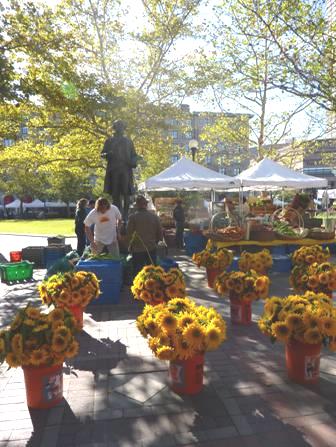
Now we set off to enjoy Boston. We walked through a smart area to Copley Square, which was our favourite place of the day. With a huge stone building looking like a ‘Hotel de Ville’, and a wonderful fruit and flower market being set up in front, we felt that we were in France!
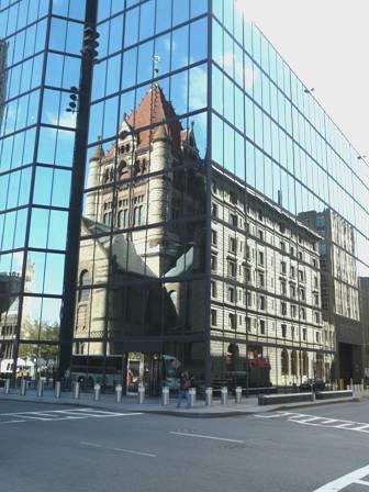
Copley Square
It certainly didn’t seem like America! The variety of attractive old stone buildings could be London too.
The fruit and flower stalls were so tasteful, that Adrian went and told one of the stall holders how impressed he was.
Boston Public gardens or St James Park?
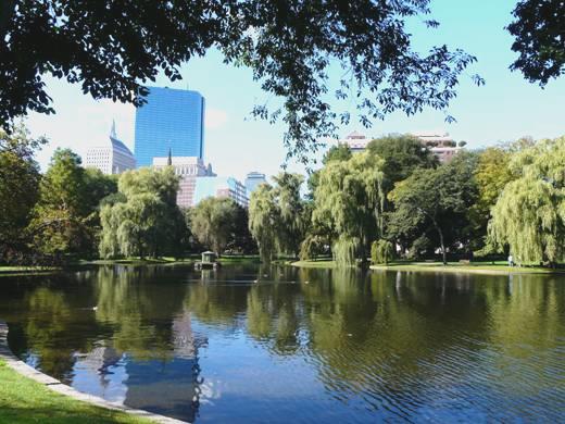
We walked on to Boston Public gardens, which looked like St James Park
We then into Boston Common, which was reminiscent of Ealing Common.
It was from here that the ‘Freedom Trail’ starts - a 2½ mile walking trail following most of the sights of the early history of Boston. In the cramped and busy Visitors Centre we bought a rubbishy paper leaflet supposedly describing the walk ($3!). The map was pretty useless, and didn’t even have numbers to correspond with the numbers given to the sights. Adrian was not impressed!
Nevertheless, we followed most of the trail, and enjoyed the various sights. England had set a good standard, and it’s nice that so many of the historic buildings remain.
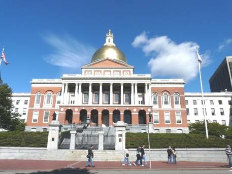
The State House
We didn’t cross the Charles River to walk to Bunker Hill, but we could see the huge monument from the bank. We had decided to follow along beside the harbour, so that we could get to the ‘Boston Tea Party’ site. It made us think of the harbour front at Portsmouth – especially with names like ‘Commercial Road’ and “North End’! We had now left the vast crowds behind, but the walk wasn’t as nice as we’d hoped, as the wharfs were now occupied by up-market apartment blocks. Then, when we finally came to the place where we expected to see the ‘Boston Tea Party’ – marked on our maps – there was nothing there! We walked halfway across the river bridge, and found a poster telling of the ‘New Tea Party site’ which would be coming!
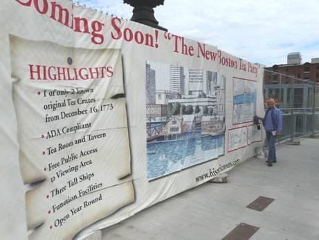
No tea today!
Rather deflated, we had to think what to do now. We decided to head for South Station, and try to find out about transport to Concord and Lexington, which we hope to visit tomorrow. This proved far more difficult than we could possibly have imagined! The two towns are only 20 miles away from Boston, but we had real trouble in getting anyone who knew anything about them. We trailed around both the rail and the bus station, and were sent from one person to another. We just got more bewildered. In the end, both flagging rather, we caught the metro (when we’d figured that out) back to a station near to our apartment, where, after finding a supermarket to buy goods for the next couple of days, we walked back ‘home’.
We ate sushi for supper, and then I suggested walking out around our area. It was then that we discovered that we were just around the corner from the Boston Symphony Orchestra Concert Hall. We saw that there was a performance tomorrow night, so we walked in, where it said ‘Box office’. In fact, a performance was taking place now, so an usherette rushed up to us. The Box office had closed at 9 o’clock (this was nearly 9.30), and she didn’t know about tomorrow – but at least we had been inside.
We knew that the ‘Mapparium’, which Hil had given Adrian a birthday card of, was nearby. We also knew that this was inside the Mary Baker Eddy building, but we hadn’t realised that she had been the founder of the Christian Science Movement. I have been re-reading a book about our favourite Joyce Grenfell, a strong Christian Scientist. We hope that it will work out for us to visit on Sunday. As we walked on, there was a long reflecting pool, which looked good in the night light. We were so glad that we had walked out.
Saturday 3rd October Lexington and Concord in the rain
Our first really wet day! Adrian had spent ages on the computer trying to work out our travel plans for today, and trying to book tickets for tonight’s performance at the Concert Hall – which he failed to do as the ‘system’ wouldn’t work.
After breakfast, we set off for a day in the rain, stopping at the Concert Hall, whose booking office didn’t open until 10 ‘clock today. We found a long queue of people, and they were all waiting to get tickets. They were mostly students, as some tickets were released every month, free to students. The booking office hadn’t even opened, and it was well after 10.00.
We gave up as we needed to leave here by 10.40, and attempted to enter the underground, but the entrance we were at only accessed the outward line – we had to cross the road first, and then go down! We took some time getting a ticket which gave multiple trips, but by then, the train which had arrived had just left.
We waited for the next train, changed at Park Street, and arrived at Alewife station. From here we planned to catch a bus to Lexington.
All went to plan, but it was pouring when we arrived at Lexington. We found our way to the place where the tour bus left from. The bus was already there and just about to leave (the next one was another 1½hrs) – Adrian even broke into a run! We asked if they would wait while we purchased our tickets, which they did, then it was off on the ‘Tour’.
We had thought that this was the best way of seeing the sights of Lexington and Concord – so relevant to America’s history.
In wonderful weather, it would have been different, but today, we were just driving through pouring rain, being told of the happenings of 19th April 1775. Our costumed guide was lovely and enthusiastic. She was a teacher of 3rd Grade, and loved the history, but the bus just drove on past the sights, so nothing had any impact.
When we reached Concord, we all got off the bus, and walked across the ‘little bridge’, where the action had happened which had such an impact on the history of America and the world. It was the beginning of the independence of America from Britain.
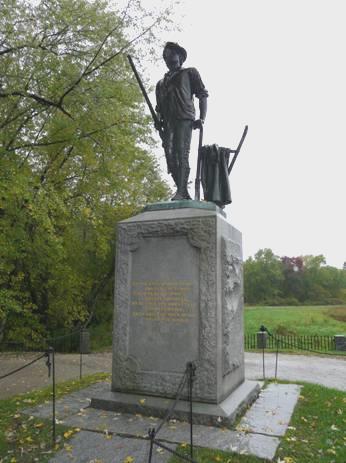
The Minute Man Statue On the little bridge at Concord
When the bus began its return journey, we stopped off at a very different venue – Orchard House, which had been the home of the Alcott family. I was very keen to visit this site, as ‘Little Women’, and the names associated with it, have great meaning to many in our family, as well as to me. We had actually seen a wonderful performance of ‘Little Women’ while in New York a few years ago.
It was a wonderful visit. Our guide, who reminded us of niece Louise, was delightful, and to see the house made the story really come to life. Louisa May Alcott had based her story on herself and her 3 sisters, and going around the house, you could just see that. Apparently 80% of the artefacts were original. There were sketchings on the walls which younger sister May (Amy) had drawn. Their father had been a philosopher/teacher, and his ‘school’ building stood behind the house. He was a vegetarian, and a deep thinker. Their neighbours, and fellow thinkers, were Ralph Waldo Emerson and Thoreau. A superb video at the beginning of the tour depicted Louisa May talking about her family and her influences.
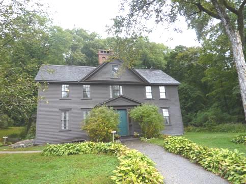
‘Little Women’ was born here!
After leaving here, we needed to catch the next bus – a short distance back along the road. We were in time for it, but it was early, and as we walked along, we saw it approaching on the other side of the road. I hailed it and waved, and luckily it stopped (they only came every 1½ hours). The costumed guide on this bus was a very uninspiring elderly gent. We managed to get him to let us alight at Lexington centre, as there were places here which we wanted to visit (included in the price of the tour). First we needed to eat the sandwiches which we had brought with us – it was 3 o’clock, and we hadn’t had any opportunity to eat, and we were starving! Even then, we had to stand under our umbrellas, as we couldn’t find anywhere sheltered to sit!
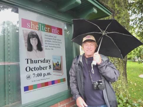
Shelter me while I eat my lunch!
In the still constant rain, we located the visitors centre here, and then nearby Buckman Tavern. The ladies in here were very helpful, and took us through the building, so that ‘Robert’ could give us a tour, and hopefully we could fit in another tour as well. Robert showed us around, and we began to assimilate the events of that momentous day in 1775.
Just along from here was the Hancock/Clarke house, which had been used by Paul Revere and others on the night before the 19th April 1775. The two ladies in here were so interested in our travels, that that is all we talked about. One of them had an Irish husband, who had lived in London for some years. She had travelled to Britain several times, so had a different outlook. We had given up on catching the 4.30 bus, so just waited for the tour of the house, which we enjoyed. The other couple on the tour couldn’t understand that we didn’t like American food!
When we left here, it was 5 o’clock. The tour buses had stopped, so we walked back into Lexington to catch the regular bus back to Alewife, and then our two trains back to Symphony, our Metro station.
We went into the Concert Hall, but sadly there were no tickets left for tonight (only a few really expensive ones). We felt really sorry, but at least now we had time to relax after a rather difficult day.
It was 6.40 when we arrived back. We got a drink, and prepared supper.
The best thing about today for me was that I had decided to bring back my little wellies from the Bam, as the only other footwear I had was sandals. Also, we were sorry that the day was so bad, because at last we had seen some autumn colour.
Before going to bed, we walked out again ‘around the block’.
Sunday 4th - Monday 5th October Mapparium, Havard and Home
It was a dry, mild day – wonderful after yesterday. In fact by the afternoon it was sunny and warm, with a clear blue sky.
Nothing goes really smoothly – this morning our lights suddenly went out! The room was pretty dark anyway. We waited some time, managing with head torches, but then we discovered that some of the electric points were working. This meant that I was able to get breakfast, but packing up in the half light wasn’t easy!
Our plan today was to visit the Mary Baker Eddy Library this morning, and then to take our luggage to ‘Copley House’, before spending the afternoon visiting Harvard, and then going to the airport for our flight home.
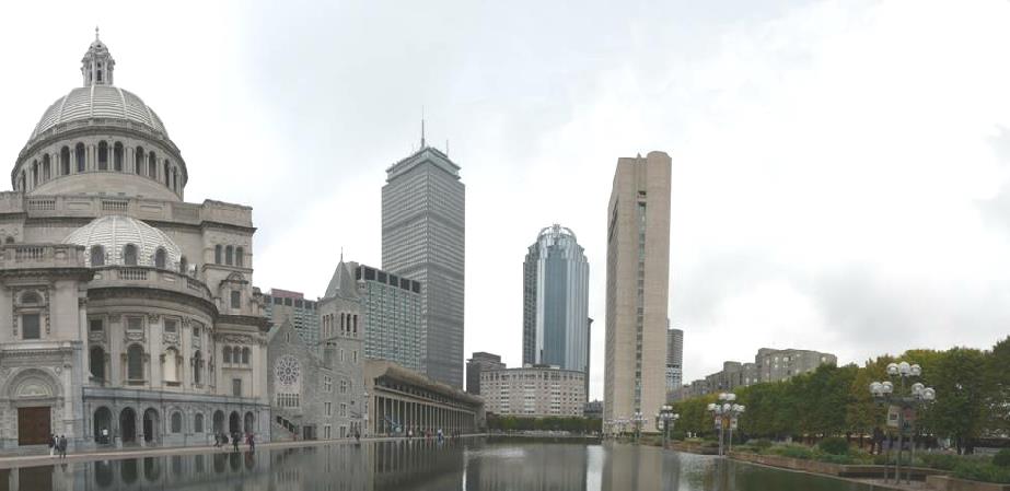
Skyline by the Christian Science Church
All actually went to plan! When we arrived at the library, a ‘tour’ of the Mapparium was just about to start. We had really wanted to see this, which Hil had given Adrian a birthday card of. We were not disappointed! Adrian in particular loved it. We walked inside a large glass dome (three storeys high), with a ‘map’ of the world set up in coloured glass around us. It had been designed and made in 1935, so the countries appeared as then. The acoustics in the room were amazing - every whisper could be heard! It was certainly worth a visit. After seeing it, we looked around the very interactive and ‘up to the minute’ museum, which showed some aspects of Mary Baker Eddy’s life, and her beliefs. It was a bit of a whistle stop tour as we had to get back to our room to collect our bags.
We left our apartment at midday, and made the difficult journey, carting all our luggage along the uneven brick pavements to ‘Copley House’, where we were leaving our bags until later.
This done, we walked back down to catch the bus to Cambridge, home of Harvard University. The bus was really busy, which didn’t make for an enjoyable journey, but once we arrived at Harvard Square, we revelled in the vibrant atmosphere. There were people of all ages and cultures, all just enjoying themselves. It was lunchtime by now, and we chose an excellent Italian Restaurant to eat at. We sat on the pavement, which was lovely, especially as the sun began to peep through. The downer was that we couldn’t order alcohol with our meal outside, and we’d both just fancied a beer! The food was great – we both ate all of our pizzas, and the salad was fresh and the bread roll the best we’ve tasted. Our young waiter was really pleasant, and a chap even came and started playing Simon and Garfunkel music on his guitar.
We walked on around the streets, coming to a church which said that it dated from 1633. We were astonished to see that the preacher this morning had been Rev Fred Small! We have a CD of his music from Mike, and one of our favourite songs is his composition of ‘Everything possible’. How wonderful if we’d been able to actually hear him. (he’s a bit of a one off)
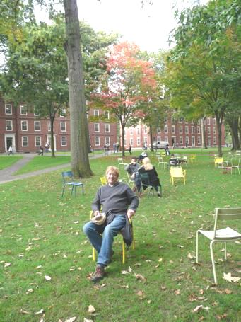
Adrian relaxing at Harvard
We now walked through ‘Harvard Yard’, some of the university campus. Being established so long ago, it felt very English, with large brick buildings. Churches and spires abounded and there were large green lawns with coloured seats. The other noticeable thing, being a university town, was the number of bicycles everywhere.
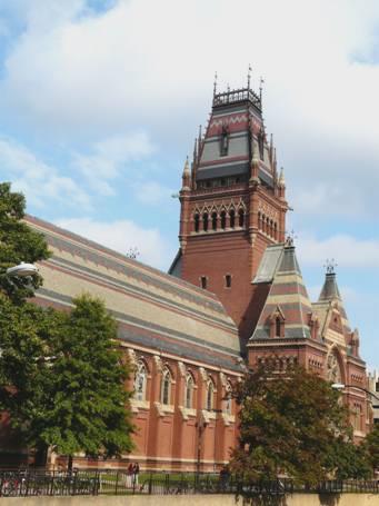
The Memorial Hall, Harvard
We made our way down to Charles River, looking very like the River Thames at Kew! We sat in the sun by the river for a while before walking back into the hubbub of the busy streets.
We thought that we’d try to have our beer, and found an atmospheric bar, with an outdoor area (on the pavement again). We ordered our beer, but found that by Cambridge law, you had to order food with it – anything would do (why this didn’t apply at lunch time we don’t know). We ordered a basket of bread – the cheapest thing – which was nice, but we didn’t need it, having had such a good lunch! While we were drinking, our singer from earlier had moved on, and started playing here! We left to the sound of ‘feeling groovy’, which makes everybody feel happy!
Cheers, and farewell!
As we got back at 4.45 to where the bus had dropped us, another bus was there, ready to go back to Boston. We decided to get on, and were glad that we did, because at the next stop, the bus filled up with students, all carrying loose bedding – they must have been to some overnight ‘do’. They all got off at ‘MIT’, the college of technology, half way back to Boston.
We made our way back to Copley House to collect our bags. A taxi arrived for us very quickly, so we were soon transported to the airport. It’s always the same when we’ve got plenty of time – everything went smoothly, we just had to wait for our 9.30pm flight.
The flight was under 6 hours long. The annoyance to me was that my personal handset didn’t work. This didn’t matter much for the films, as the flight was so short (we actually slept a bit), but it also meant that I had no light, so couldn’t read, or see the meal (not much of a loss).
It was dark as we took off, but we could see the lights of the New England coast. As we neared Ireland, there was thick cloud, and we descended to Heathrow at 8.40 local time to a very grey day.
Hil was there to meet us – we were really surprised that she had got there early on such a horrid Monday morning.
She drove us back to Hermitage, where we chatted for a while, but she was off to India later today!
After the day had dried up a bit, we ventured into the garden, to find it more unkempt and overgrown than ever before!
We’d had another really great trip, with more sunshine than we’ve ever had, but we still don’t relish the thought of the approaching English winter!
Lassen, California to Boston Massachusetts


Editors note, October 2023 - in 2018 a fire completely destroyed the homes of 27,000 people who lived in the beautiful town of Paradise and only now is the place beginning to be rebuilt