
Monday 30th April Two Lick Bottom! 89 miles
The day started like a lovely September morn – sunny but cool, with damp grass. It became very hot.
We ate breakfast outside before doing the ‘jobs’! There was a laundry here, but it was up by the office, over a mile away, so we tried to work out how best to do things! It took the rest of the morning, but we did get the washing done, including the duvet covers. We had wanted to do a walk here, but only managed a short walk beside the river. Before leaving we walked along by a little stream, which flowed into the Bluestone River at a waterfall. We had enjoyed the birdlife and the butterflies – a lot of large black swallowtails and small dark butterflies were getting moisture from the damp, stony path.
As we left the park, we enjoyed seeing the blue flowers growing in the crevices of the vertical pink sandstone cliffs.
We followed the wide, swollen and fast flowing Greenbriers River, having lunch sitting above it.
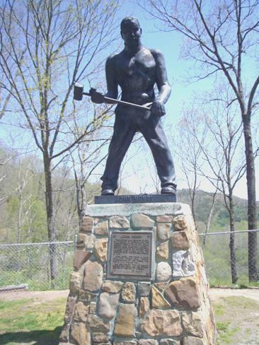
John Henry
We had stopped by the statue to John Henry, who we had been reading about. There is a legend that says that he died trying to have a race with his hammer against the mechanical drill during the building of a tunnel on the Cleveland and Ohio Railroad. We knew a song about this, but found that we were confusing it with one about John Hardy. Later, however, with the help of our computer, we realised that we did know the John Henry song too, but couldn’t remember who we had singing it.
We continued to Lewisburg, where on the outskirts we were able to get an internet connection and send our second email and website. The road was really busy here, but we soon turned off onto scenic route 60, the Midland Trail. We drove through the smart spa town of White Sulphur Springs before heading into the Monongahela National Forest. We were rather disappointed to find that we were driving up a valley with habitation, with forest in the distance.
As we have been generally heading north all the time, we keep coming backwards into spring. By the side of the road here, we actually saw daffodils still in flower!
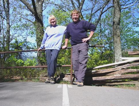
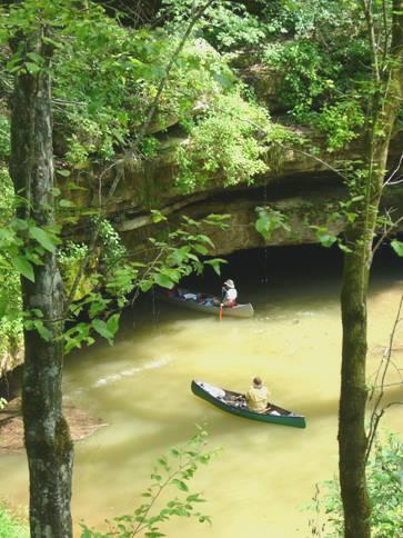
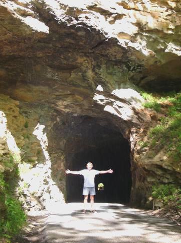
We needed somewhere to stay tonight, and came to Pocahontas Campsite. This looked rather neglected, with bits of wood and tree debris strewn around, but had an attraction. There was nobody else here, but another camper did come in. We found that there was a walk from the campsite by the unlikely name of ‘Two Lick Bottom’. After a quick cup of tea, we set off on what turned out to be a delightful walk. We walked initially along the valley floor by a stream, then climbed gradually up through the forest. Tiny flowers peeped through the dead leaves and sun filtered through the trees. The walk was remarkably well signposted.
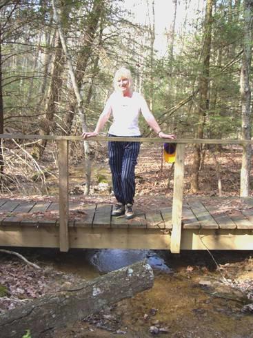
Rosie at Two Lick Bottom
We returned to our spot, and Adrian cleared up some of the debris to start the fire. It was really warm, and we sat out until 9.30.
Tuesday 1st May Wonderful walks with wildflowers and waterfalls along the Highland Scenic Road 68 miles
A superb day for our halfway point through this trip! We were up early, when it was still cool, but sunny. It very soon became hot.
Not long after we set off we saw 2 white tailed deer, their white tails bobbing up and down as they pranced.
We saw another group in a field a bit further on. Up in the trees beside them, turkey vultures were spreading their wings out in the sun, like cormorants.
We drove through the small town of Minnehaha Springs, following a pretty tributary of the Greenbriers River to Marlinton. This was an attractive town on the Greenbriers River. Cyclists were getting ready to cycle along the Greenbriers Trail, which runs beside the river.
At 9 o’clock we set off to drive along the Highland Scenic Highway. It was a delightful drive, with almost no traffic, and numerous viewpoints to stop off at.
We walked lots of short trails, and saw more wildflowers than I have ever seen!
The first walk took us past a small pond, where there were newts and tadpoles swimming.
In the woods up behind were carpets of wood anemones and pretty yellow erythroniums.
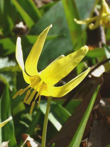
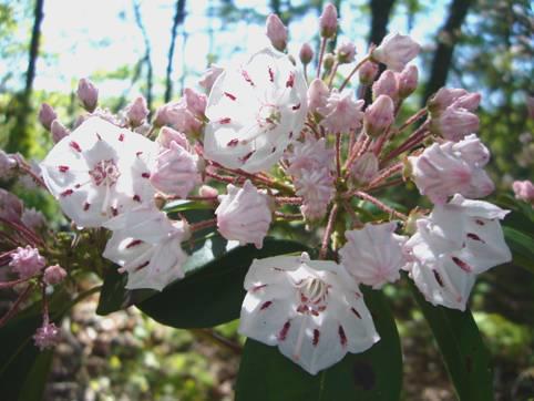
Erythronium – Fawn Lily
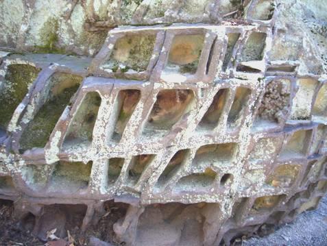
Another walk we did was to see the honeycomb rocks formed by criss-crosses of hematite, with sandstone in between. There were boards with scientific explanations of this phenomenon, but I found it hard not to concentrate on the flowers – violets in blue, yellow and white, trilliums in pink, white and deep red, wood anemones and mandarin, a lily like yellow flower.
‘Honeycomb Rocks’
At Black Mountain (4,500ft) we walked a short trail and learnt about the logging of this area in the early 1900s, and of the huge fire of 1930.
We walked through carpets of flowers to an overlook to Cranberry Glades. The walk ended up right above the road, but the path there was so pretty. We descended to the Glades now, stopping to have lunch at a picnic table near the Nature Centre (open only Thursday-Sunday!) I had cooked a small baguette in the oven. It was hot but gusty here. We walked 2 short trails before setting off again.
Perhaps the most interesting walk was the one through the boglands in the glade. When we arrived at the parking area, a bare chested chap was loading his wife’s invalid buggy into the car. She had curlers in her hair! They told us that part of the trail was under water. We set off on the boardwalk, and soon came to the wet bit, so took our sandals off and paddled. The water level seemed high, but also there was an enormous amount of damage from fallen trees. The high winds of a couple of weeks ago must have affected a wide area.
The walk itself was lovely. The bog was more typical of Northern Canada, so was misplaced here. There were pitcher plants, not in flower yet, but the flowers which were out looked so luxuriant because of the damp environment. The violets were enormous, but pride of place here must go to the marsh marigolds, which looked glorious in their yellow profusion.
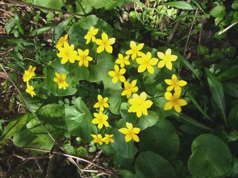
Marsh marigolds
At Hills Creek there was a walk to 3 waterfalls, each grander than the last. There were no other people about, as there were for almost all our time today, so we were able to enjoy the peace of the forest.
Now we headed for Summit Lake campsite – a far cry from last night’s site!
We arrived at 4.30 to find many of the pitches already taken. The site was by a lake, as the name suggests, so there were plenty of fishing people staying here. We took a while settling on the right pitch for us, but eventually found one, in a little secluded dell, where the sun filtered through the tall trees.
Before getting to work on the fire, we walked down to look at the lake.
While we were eating, a neighbouring couple came along and said that bears had come down to the campsite last night. We sat out until late, but saw no bears.
Wednesday 2nd May New River Gorge 87 miles
We started the day with a walk around the lake. Once more we saw a beaver’s dam, but no beaver. Dozens of fishermen were already out – we try to see the attraction of fishing, but it still alludes us! We passed three of the men chatting together, looking like caricatures of themselves.
We met the lady from last night, who was going down to sit by the lake with her fishing husband. They own a 20 acre farm near Charleston WV, but spend a lot of time travelling, and leave their son to look after the farm. They have visited Alaska and Nova Scotia, and spend their winters in Florida.
We came back to our spot, where Adrian cooked bacon and eggs for breakfast outside. It tasted delicious. We enjoyed the peace of our isolated spot, with just a few birds around. We had seen a red winged blackbird for the first time this trip. We could see the muddy bear paw prints on the rubbish bin.
We left our idyll at 10 o’clock, and drove the 2½ miles back to the road.
We stopped for coffee at Fenwick, sitting above the Laurel River, while swallows skimmed over the water. A car had pulled in behind us, and both men dressed up to go river fishing.
We were heading back now to New River Gorge, having made a circular trip into the Monongahela Mountains. We were driving through forested areas, with the occasional village, so it was a big surprise to come across a huge coal mining complex.
At Rainelle, which had once been a logging town, but now looked very rundown, we shopped in an uninspiring Kroger Store.
We pulled in to have lunch and were just about to leave when we heard the first clap of thunder of what turned out to be a short-lived but violent storm. We drove through the tiny town of Winona, and then followed a very small road through forest, with nowhere to pull off and let the storm pass.
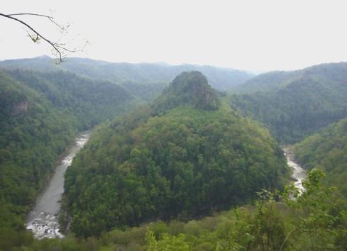
We were heading for the scenic drive around the New River Gorge. The road was really narrow, and was one-way for most of its length. Our first view of the gigantic gorge bridge was masked by the steam rising, after the storm had passed, as the humidity was so high. It is certainly a spectacular sight. As we drove on, we could see rocks and debris washed out by the rain.
The river here is a favourite white water spot, and the gorge is a famed rock climbing area – there are 1,600 climbing routes. We took a few photos for Tom.
We were feasting our eyes on the lush green of the trees, which were all in leaf here. There were also some trees with huge pinky foxglove type flowers, and a few large flowered magnolias.
We wound right down to the bottom of the gorge, crossing the river, and then stopping to view again. A railway runs on either side of the valley – one for the ‘up’ line and one for ‘down’, as there wasn’t enough width for 2 tracks together. There had been twin towns either side of the river – Fayette and South Fayette.
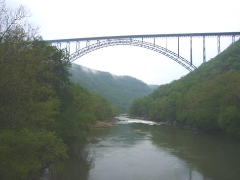
New River Gorge
This was a big coalmining area in the past. The now beautiful forested river gorge is a bit like the Forest of Dean in that once there were no trees only small villages and coal mines. Now all that has gone.
Having stopped and tried to take in all the different aspects of this gorge, we ascended to the bridge level, and drove back across the gorge bridge – apparently the second highest in U.S.
We now took a small road to rejoin Highway 60, known as the Midland Trail, at Ansted. We pulled off for the night near Hawks Nest.
After supper we walked out briefly along the damp track behind us.
Thursday 3rd May A wet drive through Charleston 63 miles
There was some rain in the night, and the morning was damp and misty. We drove back ½ mile to the Hawks Nest overlook and walked out to look down onto a large bend in the deep New River gorge. We could see a dam below us, and realised that we had been parked high above it last night.
The road continued on a winding descent to Gauley Bridge, where the New and Gauley Rivers converge to form the Kanawha River. We stopped by some lovely falls as rain began to fall again. It continued for the rest of the day!
Gauley Bridge had the potential of being an attractive old town, but sadly it wasn’t.
The road became busier and there was more urbanisation and industry as we neared Charleston, the capital of West Virginia.
Just before that we stopped at Malden, which had formerly been an important salt producing town. It was the childhood home of Booker T Washington, the great black American leader and educationalist.
He had walked here with his family in 1865, when he was nine, from Virginia – 225 miles - when they had been freed. We had some trouble in finding the replica of the log cabin which he had lived in, which was hidden behind the Baptist Church which he had taught in. The surroundings weren’t very pleasant now.
As we came into Charleston, we pulled into Daniel Boone Park, above the river, to have lunch. Daniel Boone was an early pioneer who had a cabin here in the late 18th century.
When the rain had nearly stopped, we walked down to the river. The banks were really muddy from earlier flooding. We could see the gold cupola of the capitol building in the distance.
We drove on into Charleston, commenting on the pleasant houses we were passing, when we realised that we had come right to the capitol building. We stopped for a while to view it.
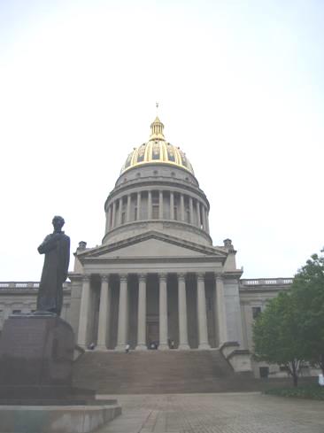
Capitol Building Charleston West Virginia
This was mile 0 for the West Virginia Road system and also of the Midland Trail, which we had been following, which follows the former route which buffalos, and later Native Americans, and then colonists, walked to get salt from the rocks here.
After the pleasant area around the Capitol, we drove through the usual American grot, and then through a very industrialised area. In South Charleston, an ancient Indian Mound stood out incongruously.
A few miles further on we came to St Albans, where the City Park beside the Kanawha River allowed free camping! Although only 3.15, this was too good a chance to miss, especially as there was electricity, and we even had an internet connection!
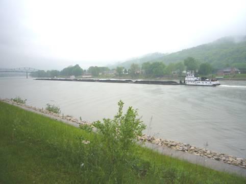
Coal barges on the Kanawha River at St Albans
We had lovely views of the river – a long string of coal barges went by. The ‘downer’ was the busy road behind us, but the rain blotted out much of the sound.
After supper we walked out briefly, but the rain continued.
Friday 4th May Into Kentucky 119 miles
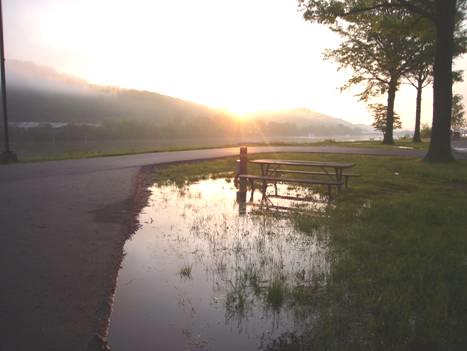
It was wonderful to wake up and see the sun just rising above the hills, and shining down onto the river after such a wet day yesterday.
Sunrise after the rain
We drove across the road to Krogers, where we bought a few things. The ladies at the deli counter were really taken with Adrian’s accent.
We drove around, trying to find the ‘Historic Centre’ of St Albans, but even Walnut Street didn’t offer the solution!
We now left the Kanawha River, which flows north for a few miles to join the Ohio River, but we reached it at Huntingdon. There were some nice houses as we drove through the town, but a tall and unattractive flood defence wall hid the area by the river.
We managed to find our way to the river, and had our lunch ‘on the banks of the Ohio’. We sat at a picnic table, near where 3 ‘down and outs’ were sitting. They looked a motley crew, and were watching TV, which they had plugged into a socket under the shelter. One spoke to us, and said that he had been in the army in Europe, but had hated it! They seemed a bit worse for wear, and when they started smoking, we came in!
We joined the motorway to drive into Kentucky, as far as the Welcome Centre at Grayson, so that we could get maps and leaflets. Kentucky is one of the few states which we haven’t visited. Our first impressions weren’t good, as we passed a huge ugly oil refinery.
The patchwork of different greens of the trees soon made up for it.
From Grayson we took a pretty route south, but there was nowhere to pull off for the night. When we reached Paintsville, and found that there was aWalmart, that’s where we pulled in. At least it gave us a chance to get the photos printed.
Saturday 5th May Between Kentucky and Virginia 92 miles
The night had been surprisingly quiet. The morning was damp and grey. We left early and located the Country Music Museum, but it didn’t open until 10 o’clock. We had been following the Country Music Byway, but none of the names of the country singers were known to us, and it was just a busy road.
Of more interest was the Jenny Wiley byway, which we had also been following for part of the way, and we looked in at a state park named after her. She was a white woman who had been captured by Indians in 1789, with her young son. Her other children had been murdered, as was her son, and later her newly born child. After many months she escaped, and after being reunited with her husband, had 5 more children. She had become a legend around here.
There were dramatic steep cliffs beside the road as we drove on to Prestonsburg, where we turned off to view Middle Creek National battlefield. There had been a Civil War battle here on 10th January 1862. It was a victory for the Unionists, under Garfield, who later became president of USA.
We pulled in by the Mountain Arts Centre to see who might be performing, but there were no posters or leaflets at all, and the place wasn’t yet open. Just beforehand 3 coaches had arrived with noisy police/fire engine escort, as is the wont here, but we didn’t know who the important people inside were.
A thought had crossed our mind at first that it might have been the Queen, who is here to watch the Kentucky Derby today, but that is some distance away in Louisville.
We continued south to Pikeville, a quite large and pleasant town. We phoned Emma at Elm Gable, and a bit later spoke to all our 4 kids, who are there this weekend. We had walked a bit around the town, which had pretty hanging baskets of pink, purple and white petunias. We found out a bit about the long feud between 2 families – the Hatfields and the McCoys, which had lasted for many years after the Civil War. Later we looked into a cemetery where some of them are buried. The grass was long, with blue flowers resembling bluebells, but it was too steep and muddy to investigate much.
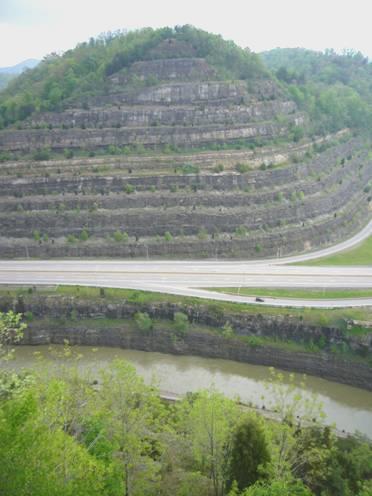
We drove up to a lookout over the ‘Cut Through’. Pikeville is situated in a large meander of the Big Sandy River, which often flooded the town. A man by the name of Hambley had the idea of a ‘cut-through’ the mountain, which would take the railway and the diverted river. This enormous project was started in 1973, and took 14 years to complete. It was quite an impressive sight.
The Pikeville Cut-through
There was a covered picnic table by the lookout, which we thought ideal for lunch, as the weather looked a bit unsettled. We had just started lunch when it began to rain. It got harder and harder. We soon lost all sight of a view, and became trapped under our shelter, which by now was letting in some water. Streams appeared everywhere, as we just stood and waited for the rain to let off a bit.
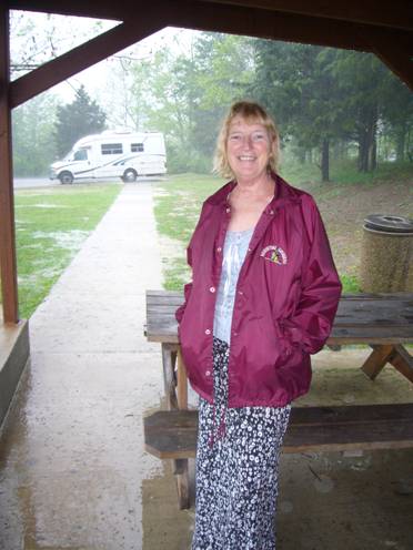
Waiting to make a dash for it
It hardly let up, but in the end we made a dash for it back to the Bam. We then found that the fridge had been turned off, so altogether it was quite a watery time!
When we eventually left this spot, water was gushing out everywhere – thick brown streams were appearing all over the place, and water was rushing out of the rocks by the road.
We drove on south to Breaks Interstate Park, which is situated in the high hills between Kentucky and Virginia.
The Towers’
We stopped by views of this gorge scenery, and continued to the campsite, which appears to be in Virginia.
We decide to stop here, and hope that the evening isn’t too damp.
In fact it stayed dry until we had come in, after 9 o’clock. Everything was wonderful, except for the silly ‘no alcohol’ rule, which meant resorting to teacups again.
Sunday 6th May In and out of 3 states and the Cumberland Gap 139 miles
We heard some rain in the night, but it was a beautiful day.
We ate breakfast outside before setting off to drive around the route which had several viewpoints along it.
We could look down into the gorge, and see the end of a rail tunnel. At that point a train went by – 2 engines at the front, and two at the back, and about 100 trucks piled high with coal. We have been amazed at the amount of coal mining activity still going on in this southern area of the Appalachians.
We were amused that this gorge is dubbed ‘Grand Canyon of the South’ – that makes 4 this trip, as New River was also known as a ‘grand canyon’.
We stopped by a view called ‘Stateline’, where you could see into Kentucky, and the route we had driven in on yesterday.
We had been wondering which of the several trails to walk, but our choice was excellent – we combined 2 shortish walks – the first part through the green forest, and the second a really rough path past some enormous rocks, known as ‘The Notches’. It was an unexpected delight to find ourselves clambering over the rocky path, with gigantic rocks towering above us.
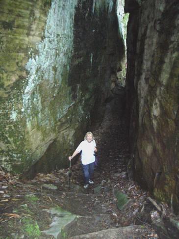
‘The Notches’
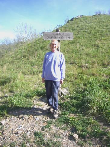
We now had a discussion on which way to go – on through Virginia, or back through Kentucky. We were heading for the Cumberland Gap, the road of which now only goes through a tunnel.
We settled on driving the first section through Virginia, which we were already in, then crossing into Kentucky. This, we thought, would avoid driving through the tunnel, which I wasn’t very keen on.
Our route followed the valley, with the river and the railway, and was really pleasant. We stopped for lunch by the river, and thought how English it seemed – green and pretty.
We travelled on into Kentucky – now 2.45. We passed Kingdom Come State Park, but decided to keep going. It was a good road, through lovely scenery, and we reached Cumberland Gap at 4.30.
We went into the National Park Visitors Centre, mainly to get a map, and were surprised to find that the only campsite was through the tunnel, on the Virginia side!
Luckily the tunnel wasn’t very long, so through we went – driving through a short stretch of Tennessee before coming into Virginia!
Once at the campsite, we chose a really sunny spot, in an open grassy area. There was plenty of wood around, which Adrian got working on for a fire.
It was lovely, in our seclusion, and we sat out until 9.30, seeing the stars, and a few fireflies before we came in.
About Cumberland Gap. Animals, and Indians had followed this route for centuries. Daniel Boone had trailed a route through the gap in 1769 – following the ‘Wilderness Road’, which is where the campsite is. Settlers followed this route, and in 1806, Lewis and Clark both came through the gap on their way back to Washington to report on their successful trail to the west.
In 1996, the road was put into a tunnel, so that the gap could return to its previous appearance.
Monday 7th May Cumberland Gap, Cumberland Gap 145 miles
A cool but lovely morning. We set off for the small town of Cumberland Gap. From here we could walk up past an old iron furnace to the actual Cumberland Gap. It was quite a thrill to be here.
Cumberland Gap
We tried to understand the importance of this gap through the Appalachians. There are apparently only 3 gaps through the 900 mile long and 150 mile wide range of mountains.
Having returned to the Bam, we drove back through the tunnel and up the 4 mile winding road to the top of Cumberland Mountain. From here we had wonderful views down to the gap below. We could see the three states of Kentucky, Virginia and Tennessee.
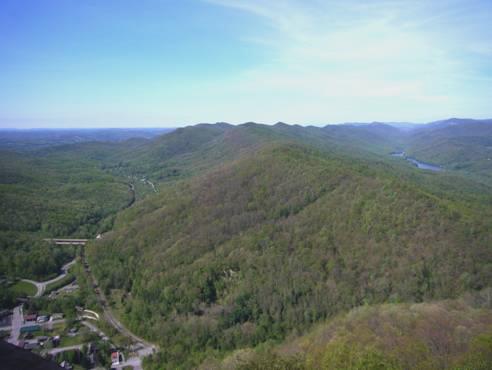
Virginia, Kentucky and Tennessee all meet at the Cumberland Gap
The sky was blue, and the visibility was perfect. We had the best of both worlds – beautiful weather and no people. There were remains of forts here, dating from the Civil War, although no battles were actually fought in the gap. People have been coming to the ‘Pinnacle Overlook’ for a long time – the road had been built in 1929. We were glad that we had ignored the ‘20ft vehicle’ limit – the Bam is just over that.
Between Virginia and Kentucky
We now left the sanctuary of the park, and came straight into Middlesboro, where we stopped to shop in ‘Food City’. Adrian had to get yet another card, but it was worth it for the discounts. At the check out, everyone tried to be helpful – packing your own bags just isn’t done here, they even tried to unload our stuff into the Bam.
Now it was time to head north. It was a good road, following the route of the ancient Wilderness Road. Just south of London (!), we pulled into Levi Jackson State Park, where there was a reconstructed Grist Mill, and a whole collection of millstones. We walked a short stretch of the actual Daniel Boone Trace, and looked in at a little cemetery where a group of pioneers had been massacred by local Indians in 1786.
We drove on through unremarkable London, then on through pretty, rural countryside, but yet again with nowhere at all to pull off.
Thus it was that we ended up at Natural Bridges State Park, and could see no alternative but to camp here. There were 2 small campsites – we stopped at the second one, Whittleton, as we didn’t like the price of the RV sites, and at this one we took an unserviced site – i.e. no water or electric laid on. (in fact no-one came for the money)
It must have rained hard here the other day, as everywhere looked rather muddy. Having finally found a spot to suit us, I sat in the last of the sun before we set off to walk up into the hills behind us to a small cave, with an arched entrance called Henson Arch.
We came back at 7 o’clock to get the fire going.
After eating our meal we asked the young German couple who I had spoken to earlier if they’d like to come across. They were Peter and Ingeborg, from Munich, although she was originally from Steiermark in Austria. They were both nurses, and had travelled in USA several times. We shared a few beers, and sat chatting until almost midnight, when they went back to their tent, and we had to come in and clear up.
Tuesday 8th May Glorious natural arches 42 miles
Despite our late night, we were up at 7 o’clock. The night had been really cold, but the day became beautifully hot, with a clear blue sky all day.
We left the campsite and drove over to the parking area for the trails to Natural Bridge.
We set off at 9 o’clock to walk to the bridge. It was the most fantastic walk. There are several different trails which lead to the bridge – we took the ‘shortest and easiest’ for the ascent, which was still pretty steep. It was delightful walking through the forest of fresh green trees, with huge rock formations too. When we reached the bridge, we could climb up through a natural cleft in the rocks to the top of the bridge.
This, and the others in the area, are actually arches, not bridges, as they have been weathered by wind and rain not by flowing water, the softer rock having been eroded away to leave an arch. This one was quite impressive. We have seen a lot of natural arches and bridges in the west, mostly in a desert situation, so it was different to see one amidst all the lush vegetation.
We boldly walked across the top of the bridge, and found that you could walk on to a viewpoint back to it. We decided to do this, and in getting there passed the top of the ‘skylift’ – a chair lift which could carry you up to this point. It was now nearly 10 o’clock, and the lift started operating at 10.00, so we watched while the young operator came up on the chair lift to start his day. We walked on to the lookout, but found that with all the greenery, it was hard to make out the shape of the arch.
Having walked this far, we found that you could walk on further and return by a different route. Never liking to return the same way, if possible, we continued. The delight on this walk, called the ‘Laurel Ridge Trail’ was that the mountain laurel – kalmia – was out in flower, and looked quite exquisite with its dainty pink flowers, looking as though they had been finely cut, like a Christmas lantern.
The dainty flowers of kalmia – mountain laurel
Adrian had got a leaflet on the walks, and we knew that we had a descent of steep steps – and my, were they steep! They were cut into the high cliff edge, and we had to negotiate them by going down backwards! I excelled myself, and after that, the walk was more straightforward.
There are apparently 22 types of salamander in the park – we did see one.
The railway was brought here in the early 1900s, so tourists have been coming since then!
It was 11.15 when we set off again to drive the nearby Red River Scenic Drive in Daniel Boone National Forest. This was a loop drive, with several places where you could walk to see more arch formations. There are also much longer walks in the forest, one being 278 miles long! We did walk a tiny bit of that later, down by the river, where there was supposedly a suspension bridge. We never got to the bridge, but we did see a scarlet tanager (a beautiful bird).
Our first walk was to ‘Angels Window’ – how many formations of that name must there be? The second was called Whistling Arch. We so enjoyed the bright green leaves, with the sun shining through them, and the clear blue sky beyond. There were wildflowers too – the little bluets, and carpets of blue salvias, looking like an apology for the bluebells we are missing at home.
Our lunch stop was our most delightful yet – sitting at a picnic table in our isolation, with just the peace of the forest surrounding us.
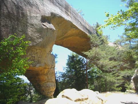
Sky bridge
We walked a trail to another arch – Sky bridge. This should have been a loop trail, but a tree had fallen across the steps on the return route, so after walking across the top of the bridge, and then down to view it from underneath, we had to return the same way. I braved it on top of the bridge for a photo!
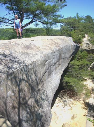
Rosie being very brave!
We continued with our loop drive – and passed Peter and Inge, who were just setting off for a walk! We stopped and chatted. Another chap, who we had seen several times today, also came along at that point. Adrian had thought to go into the forest campsite this morning, and had got a map of the walks – the others weren’t so lucky, so had a good look at our map.
There was one more excitement left on the route – the road went through a 900 ft long tunnel, carved out when it was used for a narrow gauge logging rail track. Only when we got there did we find that it was only 12ft high, and about as wide, but very uneven! We proceeded cautiously, and emerged victorious at the other end! We stopped to look back at the unlikely looking entrance!
Yes, we drove the Bam through here!
Having completed the loop drive, we had to drive on a few more miles to Koomer Ridge campsite, which we had called into this morning. We found ourselves a nice spot amongst the tall trees, as the sun filtered through.
We had a lovely evening in our quiet solitude, coming in at 9.45 after looking up at the stars and the few fireflies. The evening had stayed warm – we were in shorts, and the night was warm too.
Wednesday 9th May Bluegrass and horse country 133 miles
We sat outside for breakfast – it was already warm, before walking a short ‘cliff trail’ around the campsite, with views over the sheer valleys. We set off to drive towards Lexington. We put the radio on briefly, and heard of severe flooding in Missouri, and dire weather elsewhere.
We drove swiftly to Winchester, (another one). We drove down the pleasant Main Street before continuing to Lexington.
We were in the bluegrass area of Kentucky, and could certainly imagine a blue tinge to the grass – those parts which weren’t manicuredly cut. This is also horse country, and we drove past one horse farm after another, each one surrounded by black picket fencing – a sombre change from the usual white fences. Everywhere was incredibly neat.
Lexington dubs itself ‘Horse capital of the world’. Near the centre was a nice statue of race horses, in what was called Thoroughbred Park. There were plaques to people well known to the racing world. Adrian said that there was no point in looking at them, as we wouldn’t know anyone, when we saw one to Bing Crosby, who had been a keen racehorse owner.
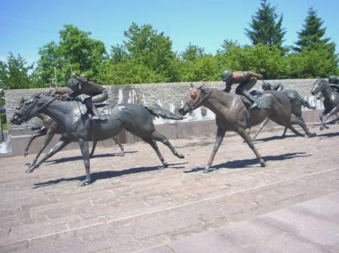
Photo finish!
Lexington had nice buildings too, including the childhood home of Mary Todd Lincoln, wife of the president.
We continued to Frankfort, capital of Kentucky State, and situated around meanders of the Kentucky River. We were able to park right by the old capitol building, and walk around the surrounding area. It looked very attractive from a distance, but needs a bit more loving to make it look really good. There were black and white photographs of past times in some of the windows. We saw a plaque which interested us, saying that the newspapers printed here told the world of the success of the Lewis and Clark expedition. We are planning to follow some of their route from St Louis in a week or two, but there are places in Kentucky associated with them, particularly of their return journey to Washington after their successful trip to the west.
We were incredibly hot now – the temperature was in the 80’s F. We drove on to the impressive new capitol building, set at the end of a pleasant avenue with shady trees and attractive flower beds.
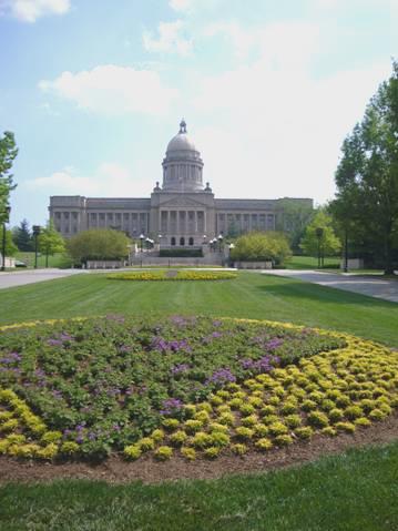
Capitol building Frankfort, Kentucky
Now we had the usual problem of where to stay tonight. We took the road south, which was busy, with no possibilities of stopping places. We turned off, but were just driving through the painfully neat horse country, with not an iota of spare ground. We were planning to visit a Shaker village tomorrow, so were heading that way. The Shaker community here died out in 1910. As they believe in celibacy, the movement can only continue by getting new recruits! We arrived at the village, hoping to enquire about opening times tomorrow. It all looked so ridiculously neat, that we both felt we had no desire to visit. It just seemed to be an immaculately restored village, and we have seen plenty of those.
We still needed somewhere to stop tonight, so had to resort to the old faithful – Walmart, at Harrodsburg. We drove through the attractive town first, and pulled into the newly sited Walmart at 6 o’clock. With a grassy verge behind us, it was quite pleasant.
Thursday 10th May A taste of bourbon on a busy day 142 miles
For the first time we had left the windows open at night, as it was so warm – we hadn’t expected to wake at 4.00 a.m. to hear torrential rain lashing down!
It was relatively short lived, and the day was beautiful, and hotter than ever – 87ºF.
We drove south a few miles to Danville, passing stone walls which made it feel like England.
In the centre of the attractive town of Danville were a group of nicely restored/reconstructed buildings known as Constitution Square. There was a marker about Lewis and Clark, who had come through here on their return to Washington in 1806. The town had some fine college buildings. It was a good start to the day.
Our next stop was near the pleasant town of Perryville, site of a Civil War battle in October 1862. You could walk around the whole site, but we just stopped long enough to have coffee. The woman in the ‘museum’, was very proud of their little set up. She had spent some time in England, which she had loved – living in Harley Street! We were amused that after her saying that people still took sides over the Civil War, she followed it by saying ‘the Unionists were on this hill, and we were over there’!
We gave up on our search for the ‘Lincoln Homestead’ – the home of Lincoln’s parents for a short while before he was born – there were no sign posts, and we had plenty more to do today.
Next Came ‘My Old Kentucky Home’ State Park. We gave this a miss too, when we found that you had a guided tour of the brick built home of the cousin of Stephen Foster. He had written the song of that name in 1850, but now it all seemed hyped up, with an immaculate golf course in the grounds. We did stop to have lunch in the neighbouring picnic area.
We were in Bardstown, whose other claim to fame is the bourbon whiskey distilleries. One, called Heaven Hill, was just along the road from us, so we called in. A tour was just about to start, so off we went, walking across to one of the huge ‘rickhouses’, which held hundreds of barrels of whiskey. I’m a ‘whisky’ (Scotch) drinker, but Adrian isn’t fond of either, but we both really enjoyed the tour. The lady guide was once more fascinated by us being from England. The large storage buildings looked most unattractive, as the white painted walls soon turned black with mould from the whiskey, but there was plenty to interest us, and we ended with samples of their whiskey.
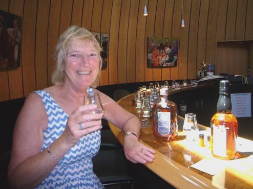
A nice drop
There was a small museum attached which had much about the history of bourbon distilling, and of Kentucky’s history. Apparently the climate is right for the corn to grow well here, and the water from the limestone rocks is perfect for whiskey production.
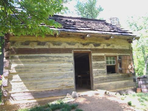
We drove on around the pretty town of Bardstown, then south, where we stopped next at a small reconstructed cabin which is where Lincoln had lived as a young boy. The site had recently been purchased by the National Parks, so was in a gloriously unrestored state.
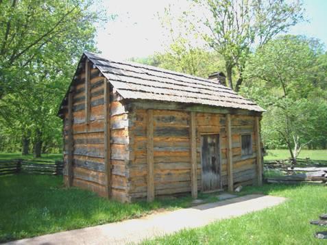
Abraham Lincoln’s home when he was small, Kentucky
Ten miles further on at Hodgenville was the site where Lincoln had actually been born. The reconstructed cabin here was housed in an OTT granite and marble ‘temple’, built in the early 1900s. The cabin is now definitely thought not to be the one in which Lincoln was born, but it is called the ‘symbolic’ birthplace of Lincoln! It is situated on the farm which his parents owned at that time, called Sinking Spring Farm because of a spring on it, which we climbed down to. It was delightfully cool on this hot day.
Soon after leaving here, we crossed time zones, which fortunately gave us an extra hour on this busy day! We continued to Mammoth Cave National Park, where, having found nowhere suitable to overnight at on the way, we drove into and located the campsite. We had driven through the usual grot attractions at Cave City before coming into the sanctuary of the park. We called in at the visitors centre to get information on the cave tours for tomorrow before finding a spot and getting the campfire going. We both felt pretty exhausted!
Although there was a threat of rain, and Adrian put the awning out, it stayed dry, and we sat out until 10 o’clock (9.00). A deer had come by and stayed a while. It was very warm.
Friday 11th May Mammoth Cave 8 miles
Our day at Mammoth Cave was another ‘You can’t always get what you want’ – by coincidence that song was playing on our CD today, and was quite appropriate!
The morning had started dull, but we enjoyed breakfast outside. We were up early, as we were sticking to ‘our time’ for these 2 days before we go back into Central Time for a bit longer. We had taken a long while discussing which cave tour to go on, and had finally settled on the only ‘self guiding’ tour, as we could then go at our own pace. I am always conscious of my claustrophobia.
We were at the ticket office soon after it opened at 8 o’clock (9 a.m. our time), to find that they weren’t doing that particular tour! In fact the information on the tours was all a bit ‘hit and miss’.
We decided to go on a guided tour by the name of Frozen Niagara. Our guide was an informative and enthusiastic lady by the name of Linda. There were only 8 others on this first tour of the day – some tours allow up to 120 people, which can’t be much fun.
This tour would appear to be for the ‘softies’ – we were by far the most energetic. Mostly they were older people, but there was a young chap who was like a huge unattractive Bart Simpson/Humpty Dumpty, and had trouble even walking.
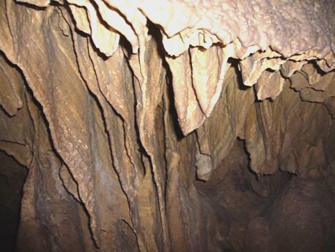
Mammoth Cave is the longest cave system in the world – 367 miles, with probably more yet to discover. We only ventured into a tiny bit of it, but it was supposed to be the prettiest part. We have been in many caves, and this was certainly quite pretty.
Inside Mammoth Cave
A new thing for us was seeing cave crickets, which looked like long legged spiders crawling on the roof of the cave. Also we saw the nest of a pack rat, which steals attractive things to put by its nest.
Having finished our tour, we went about planning the rest of our day here – we had decided to have a ‘catching up’ day for the first time this trip, and to leave early tomorrow. Partly this is because we haven’t yet found any free camping places in Kentucky, and we enjoy staying in places like this where we can have a campfire.
Mammoth Cave Park is huge, with a vast area with walking trail across the Green River on a free ferry. Downer number 2 was that when we reached the river, we found that the ferry wasn’t large enough to take the Bam (No signs of course, to warn you).
As we had intended going across to do some walking, we now had to rethink our plans. We decided to do the washing, as there was a laundrette here. I went in to suss it out, but by the time I had collected the clothes and gone back in, somebody had taken up both machines – downer number 3!
We filled in the rest of the morning – having coffee, looking at a fine train engine which had once brought tourists here (they have been coming since 1812!), and by the time we had succeeded with the washing, it was lunch time! We booked in again at the campsite and enjoyed a peaceful lunch at the picnic table.
There were many trails that you could walk on this side of the river, so we spent the afternoon wandering through the forest and down to the Green River. It was pleasant, if unremarkable.
Canoeists having fun by a Mammoth Cave entrance
We returned past the ‘Historic Entrance’ to the cave, and felt the rush of cold air coming from it.
The sun had come out, and we were feeling very hot (temp 87ºF again today).
We’d enjoyed a cup of tea outside, and were happily engaged in our activities, when the first drops of rain fell!
We’d hoped that it would be short lived, but a mighty thunder storm came in, which lasted for the whole evening. No chance of a fire tonight, so instead we cooked a chicken gumbo outside under the awning, and sat out enjoying the night as fireflies flew around.
Saturday 12th May Past Fort Knox to the start of Lewis and Clark 151 miles
The morning dawned damp and misty, but it became another really hot day.
We started with bacon sandwiches for breakfast, eaten sitting out under our awning. There were quite a few families around with young toddlers, which was nice to see.
We took a ‘scenic’ route out of the park, soon passing a deer – we wondered if it was always the same one we had been seeing – and a tiny tortoise. It was a pretty route, like a Devon country lane, but we had taken a wrong turn before reaching the motorway north.
We reached Elizabethtown, where Lincoln’s parents had lived prior to him being born.
We drove on past Fort Knox, but all you could do was drive past. We pulled in by the so-called Visitors Centre – going over the worst speed hump ever, when everything jumped out of the drawers etc. There was nothing one could do or see, so we just drove past and attempted to take a photo.
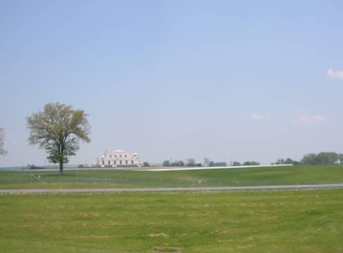
This is all you see of Fort Knox!
Continuing north, we came to West Point, where the Salt River, which starts at Danville, joins the Ohio River. There was a cheap camping place here, but we pulled in to have lunch, having found nowhere beforehand.
It was pleasant sitting out at a picnic table, under the shade of a tree.
We thought that we could stay here tonight, but first thought that we would see a bit of Louisville, which was a bit further on. It is here that the Kentucky Derby is held, but we were more interested in Lewis and Clark sites.
It was a dreary long drag through the worst American grot ever to reach Louisville. This was a busy and unattractive large city anyway.
It had been the point where Lewis and Clark and their initial party had set sail from in October 1803.
Go west!
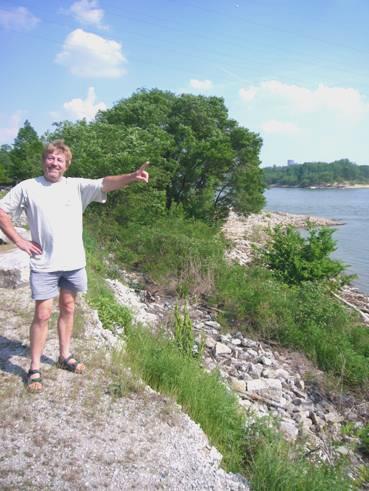
Clark’s older brother George, a revered officer from the Revolutionary War, had lived here. We discovered that this site was across the Ohio River, in Indiana, in Clarksville, named after George Clark in 1783. We crossed the wide river on a large bridge, and found our way to a visitor’s centre where we grabbed a few leaflets. We now followed signs to the Falls of Ohio State Park, which is where George Clark’s home had been. After much inadequate signposting, we came to the area where there were several markers about the Lewis and Clark expedition. Much had been done a few years ago for the bicentenary of the expedition – 1803-6.
There was a reconstructed cabin like the one George Clark had lived in on the banks of the Ohio. At that time, there were 2 mile long falls at this point, but now the river is dammed, so it is not so impressive.
It was really hot now – 90ºF, and we had to decide what to do. We couldn’t see any nearby possibilities for anywhere to stay tonight, and as it was so hot, we knew that we would have to be able to sit and cook outside. There were other sites of interest in Louisville, but now we knew that we needed to get back to West Point as easily as possible. We took the motorway for some distance, then followed a winding hilly road until we arrived back feeling pretty weary at West Point at 6.30. By now it felt cooler in the shade.
We cooked and ate outside, and sat out until the fireflies and then the stars came out. It was hardly a quiet place – the few people here seemed to have come to play their radios loudly, or to sing along, karaoke style.
Added to this, there were 2 separate rail tracks, with occasional long trains, but most significant were the short, sharp blasts of engine noise, which we had put down to either speed boats or motorbikes. It was only when we walked down to the river late in the evening, that it dawned on Adrian that it was drag racing, just out of sight across the river! The noise didn’t stop until after we had gone to bed, but then the night was very quiet.
Sunday 13th May Along the Ohio to another of Lincoln’s homes 131 miles
Another lovely sunny day, but with a cool wind at first.
We started by driving along to the area of Fort Duffield, a significant fort during the Civil War. We then drove across the road to the delightful small town of West Point, which dates from 1796, when it was the most westerly English settlement. Boats used to leave from here and sail down the Ohio and then the Mississippi to New Orleans. Lincoln’s father Thomas was one person who had done that – taking a load of wood, which he sold in order to earn enough money to marry Nancy Franks, Lincoln’s mother.
There were numerous markers in the town, telling other items of note. One of Lewis and Clark’s original group came from here.
We received a message from Simon to say Happy Mother’s Day (American style).
We travelled on to Brandenburg, where we mistakenly drove across the Ohio bridge into Indiana and back, then continued through pretty country to Hawesville. Here we intentionally crossed the Ohio, and stopped by the river in the nice little town of Cannelton.
We constantly review our travel route when we see things which we want to visit. This time we saw that there was another Lincoln home site – the farm where he lived from age seven until he was 21. We headed there after lunch, which we enjoyed in the warm sunshine, watching one or two enormous coal barges go by. There was even a long swing seat to relax on.
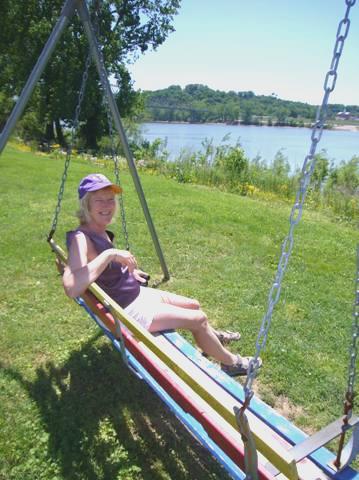
Nice spot for lunch!
To get to Lincoln City, we had to drive through a town called Santa Claus! We were now in Central Time, having swapped back and forth a bit. We had been enjoying Indiana’s rolling hills, after the flat fields of beans and corn which we had driven through last year in northern Indiana.
Our visit to this Lincoln site was excellent. They had a nice visitors building, with information about Lincoln’s life, set out in an unpretentious but informative way. It is still amazing to think of someone from such humble beginnings educating himself enough to become President of the United States. His life wasn’t easy either – his young brother died, his mother died when Lincoln was nine, and later his sister died aged 21 when giving birth. Two of Lincoln’s own four sons died during their childhood.
His mother had died aged 35 of what is called milk fever. It was caused by a poison from the snakeroot plant, which killed the cows which ate it, and also humans who consumed the poisoned milk. At the time, people didn’t realise what was causing the problem. Lincoln’s mother Nancy had been buried here.
Nothing of the original farm buildings remain now, but there was a superb reconstruction of the cabin and farm buildings.
Future President Lincoln’s boyhood home, Indiana
People were employed to work on the farm, dressed as in Lincoln’s day, and using the same methods. We chatted for a long time to the young girl weeding the rows of potatoes. She was from Los Angeles, but had been working for the National Parks for two years, straight from college, and loved it. She told us that the recently appointed director general of National Parks is a British woman.
In the fields, a young lad like Jonny Makepeace was planting sweetcorn, and gave us some seeds.
We intended heading west from here on the I64, but when we reached it, a dilapidated piece of cardboard was covering the sign, and we found that the sliproad was closed! We had to backtrack a few miles and find another way onto the motorway further on.
We turned off at Lynnville, where we stopped at Lynnville City Park, which was a campsite rather like a French municipal one. It was another of those places that people come to for fishing, and there seemed to be areas of water all around.
We ate outside. The stars were really good tonight.
New River, West Virginia to Lynneville, Indiana


