
Saturday 1st July Goodbye to Labrador 35 miles
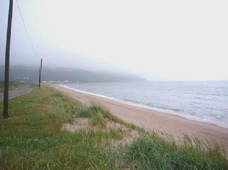
Our last day in Labrador was sadly ‘fogged out’! Not much of a day here for Canada Day!
It seemed incongruous to be both windy and misty, but that’s how it was. At 8.30 we started driving back, hoping to log in. After a hundred yards, we passed the spot we had originally pulled into last night, and found that we had an internet connection!
This is where our last email came from – in Labrador
Thus we spent the rest of the morning! During this time, we did manage to speak to all 4 of our children. Emma was preparing for Felix’ 6th birthday party and Tom was getting prepared for a barbecue tonight. We were made aware that England were playing Portugal in the World Cup today, but later found out that they lost!
We spent a long time sorting the website, but things became difficult when the computer logged out at the vital moment! We were becoming aware of people driving along to the pile of rubbish on the beach where we had been parked, and imagined that they were preparing for a bonfire this evening. We decided to move off, and try our luck further on. This we did, but I had been in the middle of preparing bacon pancakes for lunch at the time!
After more difficulties, we got the website set up, and sent the email. We spoke to both Paul and to Simon on the internet phone. We had also telephoned Lena earlier, and wished her well for her forthcoming operation.
By the time we had done all this, it was 3.30, and Adrian was exhausted!
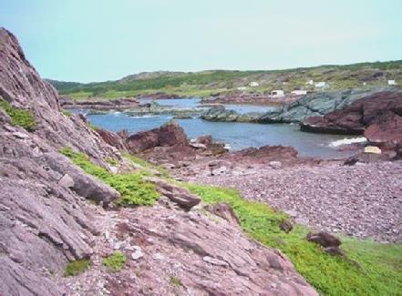
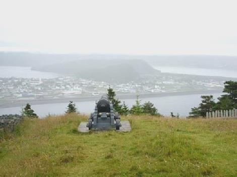
We drove on through the fog, turning off soon on a bumpy, sandy track to L’Anse Amour (pop 8)!
Having passed the couple of houses at the little cove, we drove on, wondering where on earth we were going, as we couldn’t see anything. Eventually we saw another small group of houses, and wondered where the lighthouse was that we had come to see, apparently the tallest in Labrador/Newfoundland. Suddenly out of the fog, I could make out the shape of the lighthouse!
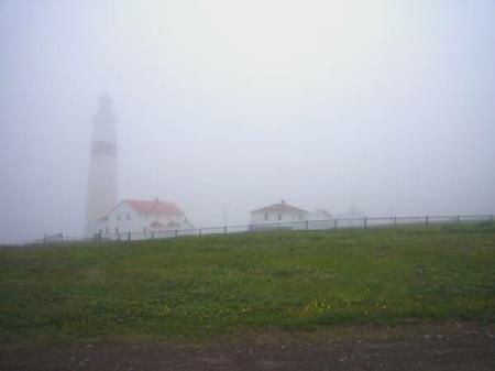
L’Anse Amour lighthouse appears out of the mist
It was one that you could visit and climb up, but there was no point in doing that today! Two plaques outside told us that there had been a former transatlantic telegraph station here, and another told of the attempt to build a tunnel to take an electricity cable to Newfoundland from the Hydroelectric station at Churchill Falls. Ironically, 30 years later, they are thinking about trying to do it again!
Driving back to the road, we stopped by an ancient burial mound – seemingly 7,000 years old.
We were so annoyed at not being able to see the pretty coastline that we were passing, but the fog was really thick. Forteau looked a nice little village, and so did L’Anse au Clair – the first, or last village in Labrador.
We now entered Quebec, as the ferry to Newfoundland leaves from Blanc Sablon, a couple of kilometres along the road. We stopped to get some fuel, and heard the unwelcome news that the weather forecast didn’t sound good.
These few Quebecan villages along this 50 mile stretch of road are isolated from the rest of Quebec, and very different – not French at all. We would love to have explored them more.
We drove to the port, to suss out the ferry, knowing that there wasn’t another one tonight. The ferry operates on Newfoundland time, but Blanc Sablon is on Quebectime, which is 1½ hours back!
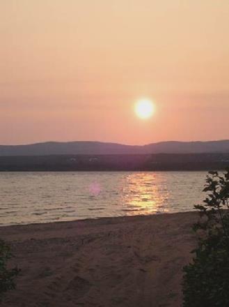
We drove on a bit and found a place to stop for the night just south of Blanc Sablon de Lourdes and directly above a lovely sandy beach – idyllic in fine weather! We donned extra clothes and had a bracing walk along the flattish rocks.
After supper, the sky miraculously cleared briefly, and we saw the sun peep through, and some blue sky! We rushed out, but by the time we had dressed up again, the sun was just disappearing down into a large bank of cloud, and never reappeared. Still, it was nice while it lasted!
Sunday 2nd July By ferry to Newfoundland 103 miles
The rain in the morning didn’t augur well for today but better was to follow.
We left at 8.15 for the dock – this was 6.45 local time. We were able to see the attractive bare, rock-strewn hills as we drove back into Blanc Sablon.
At the ferry dock, Adrian purchased our tickets, and I bought some expensive postcards, which I wrote while we waited to board.
The ferry left at 10.30, as the sky was clearing, and we could see some blue, but we soon went back into cloud as we headed across the Straits of Belle Isle. We were delighted to see dolphins playing, and seals and sea birds as we stood on deck.
We went inside when it got a bit blowy, and sat in a window seat in the bar at the front of the ship, enjoying a good tea/coffee, but we didn’t see any more wildlife.
The crossing took about an hour and a half, and by midday we were on our way driving northwards near the tip of the long northern ‘finger’ of Newfoundland.
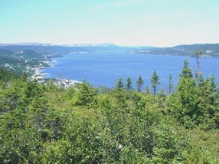
We were pleasantly surprised by what we saw! Everywhere was very low key. The land was green and low-lying, and initially we drove up beside a delightful stretch of coast, with a succession of small coves and tiny villages.
Fir trees abounded, and the stony shore was mixed with areas of grass – often long and velvety-looking in the blowing wind – and flowers.
As in Labrador, we passed small isolated ‘allotments’ – roughly fenced areas where potatoes and other vegetables were being grown, miles from anywhere.
Slowly the mist lifted, and the day brightened.
We pulled in after Bear Cove, and had our lunch sitting above the beach, before venturing out onto it. The flatness and simple dwellings made us think of parts ofGuernsey.
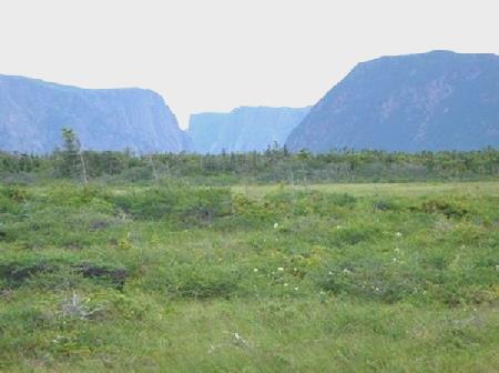
Typical Newfoundland scenery
We drove by the coast as far as Eddie’s Cove, and from here the road went inland, and across to the other side of the peninsula. It was a pleasant road, with no development, and was in fact ‘protected’.
We continued to St Anthony – the first ‘town’ we have seen since Goose Bay! We were in great need of food supplies, and were pleased to find that Foodland was open today, even if it wasn’t very inspiring!
We had no luck with the other things we needed – water (desperately), booze, and a dump, but we continued to Fishing Cove – a really pretty area at the end of the bay, where there were several trails, supposedly to see whales and icebergs. There were no sign of either - we were glad that we had seen the icebergs at St Lewis. We enjoyed the trails – as well as irises and dogwood, clumps of hare bells were growing amongst the rocks. When Adrian had asked the girl in the information if there were maps of the trails, she had said ‘no’, and offered him a map of Newfoundland!
We drove back through the town – its ‘fame’ being the place where Sir Wilfred Grenfell established his medical mission in 1892 for Northern Newfoundland and Labrador, the legacy of which still exists today.
We needed somewhere to stop for the night, but were well on our way to L’Anse aux Meadows at the northern tip when we pulled into Gull Pond Municipal Park at 6.30.
Some hardy kids were swimming about in the lake as we arrived – it was beautifully sunny now, but not that warm!
We were in such need of water, that Adrian filled two plastic bottles and a bowl from the lake, so that we could wash!
Monday 3rd July The Vikings were here! 143 miles
We had more trouble with mozzies in the night. It was a rainy morning, and stayed that way for most of the day.
We set off at 9.30 northwards, enjoying the really pretty coast, with views every way you looked of inlets, steep green headlands, rocky outcrops, fishing boats, nice little houses amongst the buttercups.
We drove through St Lunair Griquet, and Adrian was able to buy some expensive beer and tonic. Noddy’s Bay was another pretty little cove.
St Lunaire Griquet
We arrived at L’Anse aux Meadows, an apt name, as there were meadows of buttercups and irises all around.
This is at the northern tip of the long ‘finger’ of Newfoundland. The reason for coming here, was that it is the site of a Viking settlement 1,000 years ago. This is another ‘National Historic Site’, so we proceeded to the Visitors Centre. Here we watched a film telling the story of the discovery of this settlement. It was due almost entirely to a Norwegian historian/explorer Dr Helge Ingstad and his archaeologist wife Anne. They had spent a long time here, following up his theory that the Vikings might have come here. At the time of their work, 1960, L’Anse aux Meadows was a tiny fishing village (it still is), unconnected by road. There was a local fisherman, George Decker, who agreed that there were ancient grassy mounds nearby.
After many years of research by the Ingstads, and later by Parks Canada, the story was pieced together, and in 1978, the site was designated a World Heritage site.
After looking around the various artefacts in the museum, we set off in the drizzle to explore the site. A reconstruction of the village had been built, and guides in Viking costume acted the parts.
L’Anse aux Meadows Viking site
We walked back past the foundation of the original buildings, having had a really good visit.
We drove on past the present village of L’Anse aux Meadows to the ‘end of the road’, before beginning our return journey.
Back at St Lunaire Griquet, Adrian got some fuel, and was able to fill up with water, which was a great relief!
We took a different route southwards, making a loop, but this road wasn’t as attractive as the one up the western side of the peninsula yesterday. The continuing rain didn’t help! The joy though was that we saw our first moose of this trip! We have seen plenty in Alaska and NW Canada, but none on this side. In fact, moose are not indigenous to Newfoundland, but were introduced in the late 1800s, and are thriving. Later we saw a second one.
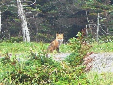
We arrived back at the western side of the peninsula and continued south, stopping at 5.30 overlooking the sea at St John Bay, in a newly built and unfinished picnic area. We immediately made our way (with difficulty, as they had built up the picnic area and left it high above the beach) on to the shore, where we had a nice little wander, and saw another delight – a fox which had come out scavenging.
The day was now brightening as we returned to the Bam and looked out over the water.
The evening had become really lovely, and we enjoyed looking at the changing colours of the sky, venturing out once more before bed.
Tuesday 4th July Even more ancient cultures 70 miles
Our thoughts of sitting outside on the new picnic seats were doomed when we awoke to rain and grey skies! Adrian printed out the last part of the diary, hoping that the weather might clear up, but by the time we left at 9.30, it hadn’t!
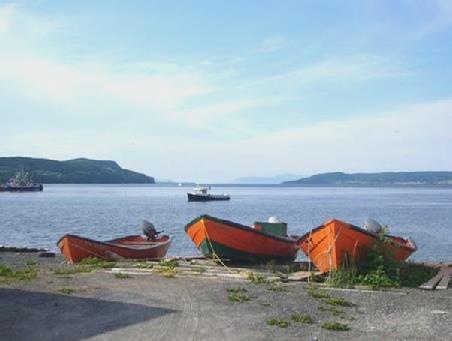
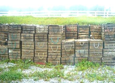
We drove south, turning off to Port au Choix, but stopping first at the small fishing village of Port Saunders. Here we were able to log in, and use our internet phone and speak to Emma, to wish her a Happy Birthday for yesterday, and Felix for today.
Fishing boxes at Port Saunders
Adrian also telephoned the ferry company about our crossing from Newfoundland to Nova Scotia, and delayed it for a few days. We both felt great relief at this, as we had been aware of how short of time we are in Newfoundland.
We contined to Port au Choix, and proceeded to the Visitors Centre, as this is another National Historic Site.
The reason for this one is that there is evidence here of 4 ancient cultures which had settled here, the oldest, the ‘Maritime Archaic Indians’ being from 3,500 BC. The others were the Groswater Palaeoeskimo, the Dorset Palaeoeskimo and the Recent Indian (AD 0-1200). After that came the French, from 1700, and the English, from 1800. This area had been argued over between the French and English for many years. The Treaty of Utrecht in 1713 gave Britain sovereignty over Newfoundland, but the French had fishing rights to this shore, but couldn’t settle permanently.
We found all the different cultures and sites rather confusing. We drove down on a very rough track to the lighthouse, which didn’t look as it should, as the top was off, and men were working on it. Adrian had thought at first that it was visitors who had climbed up! This was a site of the ‘Dorset’ people (named after Dorset Bay in Greenland).
We now drove back through the town – still a very important fishing town, and stopped by another ancient ‘site’ where 117 skeletons of the ‘Maritime Archaic Indians’ had been found in 1967. This was next to the Heritage Centre. We were admiring a newly made chalupa (Basque fishing boat), when the lady came out of the Heritage Centre and told us about it. Apparently 3 had been built recently, to Basque specifications. She also told us that a Basque chalupa was at the moment being rowed across to Atlantic, arriving here in 10 days time, before going on to Red Bay. She encouraged us to go inside the Centre, which was run by students and local volunteers. It was a delightful, low key museum, with all sorts of artefacts of interest. There were 20 or more ‘potted histories’ of local people, which made interesting reading.
We were really on our way to walk to ‘Phillip’s Garden’, the site of many of the excavations. It was a most enjoyable walk. By now the day had cleared, and we walked along a path over limestone paving, a bit like the Burren in Ireland. There were wild flowers everywhere – this area is known for its diversity of plants –and all the time we had views out over the water. Not much could be seen of the sites of the dwellings, but just the setting was enough.
Wild flowers at Port au Choix
We now left Port au Choix and drove the 18 km back to the highway, and then continued south. At Hawke’s Bay, we stopped at Torrent River, one of the many salmon rivers in this area. We had seen a lot of men fishing. There was a boardwalk along beside the river, called the Hogan Trail. It went for 3 km, but we didn’t walk that far. By now it was really warm and sunny, and a few hardy kids were splashing around in the river. Uggh! I must be getting old!
Continuing south, we pulled in right above the sea, which was now as smooth as glass. We had just seen an owl fly off. We walked out briefly, but couldn’t get down to the beach. The sky now was completely blue.
As the sun went into a small cloud just before descending to the horizon, we both were excited to see a green flash! We had thought that this was only visible further south.
Wednesday 5th July Into Gros Morne National Park 106 miles
It was a beautiful morning, with the sea really calm. We set off south, enjoying the wealth of wild flowers beside the road. We passed through the pretty fishing villages of Daniel’s Harbour and Portland Creek.
We had views of the Long Range Mountains, of which Gros Morne, where we are heading, is part.
We stopped by ‘The Arches’ – just that – large arches in the rock beside the sea, and looking very photogenic.
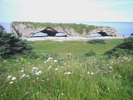
The Arches
We entered the National Park, and stopped at Shallow Bay. There was a trail here, following the old mail route. We set off on it, but were besieged by mosquitoes, so dashed back.
As we drove on through Cow Head, we were able to get an internet connection, and had a message from Paul to say that Lena was ‘as well as could be expected’ after her operation.
Beside the church here, there was a little garden called St Mary’s Walk. We wandered amongst the flowers – most of them familiar to us, but happily growing here.
Back in Gros Morne N.P, we stopped by Western Brook for lunch, sitting outside at a picnic table for the first time for ages. A ringed gull was showing its dominance all the time we were there, with its squawks and hisses. It was lovely to be sitting out in shorts, with no mosquitoes to bother us.
Afterwards we walked a nice little trail down to the mouth of the meandering Western Brook. A contraption was set across the end of the river to count the number of salmon coming through. It was a lovely walk down to the sand dunes and across to the beach. We hadn’t realised the significance of this river, which actually flows through the main fjord of the park. We stopped a bit further on, where walks start from, to arrive at the departure place for boat trips on the fjord – THE thing to do in the park.
Western Brook fjord
We continued to the Visitors Centre, some miles further on. We had come from the north, but most people would arrive from the south, and find out all the information on the way. We updated our ‘Historic Sites’ pass to a National Parks pass, and then booked for the fjord boat trip tomorrow.
We continued to Norris Point – in a wonderful position at the end of another river outlet/lake called Bonne Bay. The views were great across all the areas of water. It was difficult to make out what was what. There were red and white rugosa roses to add the right touch to the photographs!
Bonne Bay from Norris Point
We headed back to Rocky Point, where there was an indoor swimming pool, apparently Olympic size. The pool was crowded with children, many of them leaping off from a diving board, into the swimming area. Now I know why those kids can leap around in the rivers and the sea – the water in the pool was freezing – so they must be used to it! The saving grace was a large hot tub, which we immersed ourselves in afterwards.
We had called into a campsite on the way down, but as we didn’t need the facilities of a large campsite, we headed for a smaller one at Green Point. We found a position right behind the barrier of ‘tuckamore’ (stunted seaside shrubs), and walked down to the beach. This was made up of large boulders, but each one was of a different mixture of colours. It was really lovely.
It was still beautifully warm, but a storm appeared to be brewing. We got the fire going early – our first for ages!. We had a good meal of steak, mushrooms, corn on the cob and baked potatoes. It was lovely to be sitting outside to eat. We chatted to 2 chaps – one from Connecticut, who was motor biking around, and another from Montreal, but originally from Nova Scotia.
We had joked about the rain coming, and had just put on some more wood, when at first a sprinkling, and then steady rain, descended, so we made our way inside.
We had a short walk out to look at the beach before bed.
Thursday 6th July More of Gros Morne National Park 88 miles
There can’t be many places in the world where the only access to a scenic boat trip is after a 3km walk across limestone ridges and peaty bogs! And then when you get there, to find that the trip isn’t running because of the bad visibility!
We had been disconcerted to hear rain in the night, and to awake to a damp, misty morning. We drove back the 10 miles to the parking area for the walk to Western Brook Pond (they are all called ponds, although they are really large lakes). Another visitor assured us that the boat would be going, but when we reached the lake at 9.40 for the 10 o’clock trip, we were told that it was unlikely to run. We had to wait until 10.15 before the man officially cancelled it. There was another trip at 1 o’clock, and another scheduled for 4 o’clock, but we were pleased to find out later that neither of these ran either.
We were naturally disappointed, as the trip is supposed to be spectacular, as you are taken up the steep sided fjord. As the man said though – it would be an expensive boat trip, as you wouldn’t see anything!
At least we had enjoyed the walk, and on the way back, we made a longer detour, enjoying the variety of plants, and seeing one or two birds. Just as we neared the end of the walk, we saw 2 moose feeding in a meadow. We watched them for some time.
It was now midday, and the mist had thickened rather than cleared.
We set off southwards again, enjoying the wealth of wild flowers beside the road, and pulling in to see the ruins of the S.S. Ethie, a ship which had sunk in stormy seas in December 1919. All the passengers had been saved, including a baby, who had been brought ashore in a mail bag. There is a song written about this disaster. While we were there, terns were expertly diving for fish.
The wreck of SS Ethie
A bit further south, we pulled in by Lobster Cove Lighthouse. In clear visibility, there would have been wonderful views across Bonne Bay, and the dramatic mountains beyond. We just got one or two glimpses, when the fog lifted a bit.
After having our lunch – no sitting outside today – we went into the lighthouse, where there were some nice local exhibits, including the mail bag mentioned earlier. There was a splendid navigation chart of Newfoundland, which Adrian took several photos of, so that we could locate the actual spot where my great great grandfather George Thompson Lawson had rescued the occupants of the Spanish ship ‘Eulalia’ which had run into an iceberg in 1847.
After a little wander around outside, wishing that we could see more, we continued southwards, stopping to get fuel at Rocky Harbour, and to call into the Visitors Centre again to book for a different boat trip tomorrow, when we hope that the weather will be better.
We walked a short trail with information boards on Mattie Mitchell, a much respected Mikmaw Indian guide who, apart from other things, had done much to map Newfoundland.
There was a sudden short shower as we returned to the Bam, but generally the weather brightened as we continued around the eastern arm, and then up beside the southern arm of Bonne Bay. This is the only true fjord in the park, as the others are now land locked, so contain only fresh water. Bonne Bay is of great scientific interest because of its deep water and diversity of marine life.
The paramount thing of interest in the park though, and the reason for it being a World Heritage Site, is the ‘Tablelands’, which we were now approaching. These barren pinky orange mountains were formerly part of the earth’s mantle, forced upwards when the 2 tectonic plates collided. We stopped for a quick look, hoping to see more tomorrow.
We unfortunately went back into fog as we neared Trout River Pond, where we located the campsite – down a long, rough road - and got settled in. The damp evening wasn’t as enticing as last night though! Even so, Adrian lit a campfire.
The fire and the evening were surprisingly good. We cooked salmon, and were just finishing this, when the young ‘warden’ came around with our receipt. A bit later, he came around again, saying that there was going to be a ‘campfire’ at the day use area – a couple of miles down the rough track, at 8 o’clock.
Leaving the last of our fire, we made our way there, and were entertained at what would appear to be the first ‘do’ of the season. One chap excellently played guitar, and sang Newfoundland songs, some of which he had written. Two other chaps acted out the stories of 3 people paramount in the formation of Gros Morne National Park. The first one was Mattie Mitchell!
There was an audience of about 20, many of them children. We declined the hot chocolate on offer, and made our way back to our pitch to clear up.
Friday 7th July Discovering some of the earth’s mantle 56 miles
This was a better day for a boat trip!
After our breakfast of bacon and egg, sitting outside, it was time to head off for the boat jetty, back at the area we had been to last night.
It was a small boat, and at first it seemed that there would only be five of us on the trip, but 4 more arrived at the last minute. The skipper was a man about our age, who gave the shortest safety demonstration ever –‘this is a life vest, you put it over your head, and tie it up at the front. The best viewing is from upstairs’ – and that’s all we heard from him!
The boat was ‘run’ by 2 young girls. One gave the commentary, just reading it off a sheet, and you felt that if you asked her anything else, she wouldn’t know the answer!
The trip was pleasant, but unremarkable – there’s no doubt that the one we wanted to go on yesterday was more scenic. This one travelled the length of the small ‘pond’, through some very narrow and shallow narrows, and then the length of the second, and much larger, lake, right to the end and back again. The whole thing took nearly 2½ hours.
Trout River Pond
What we had really come to see was the ‘tablelands’ – the hills made up of the earth’s mantle, which had oozed out millions of years ago when the tectonic plates collided. It was certainly an unusual orangy colour. Nothing can grow on it, as there are no nutrients, and the ores present in it deter or poison plant life. Lower down, some soil had formed, and plants were growing – we were to see more of them later.
The orange ‘Tablelands’
We stayed on deck the whole time. It was mostly sunny, and admittedly a bit blowy, but not unpleasantly so. Early on, we saw a moose silhouetted against the sky, high up on the vertical cliff top. Later we saw a bald eagle fly off from one tree perch to another.
It was 12.20 when we returned. We ate our lunch at a picnic table near the lake, surrounded by wild flowers.
We drove on down to the little fishing village of Trout River, set where the river meets the sea at a pretty little bay, reminiscent of places in Yorkshire.
Simple fishermen’s huts lined the waterfront, men worked on nets in tiny front gardens, lobster pots were stacked up beside the water, people walked about in the warm sunshine – it was like a scene out of bygone times, and quite delightful.
Fishing huts at Trout River
We walked along the little board walk next to the beach. Part of it was still being worked on. There were signs saying that this was a spawning area for capelin – we presume a type of fish (and nothing to do with me!)
We now had to begin retracing our steps of this southern part of the park. We stopped to walk the ‘Tablelands trail’, a 4km return walk up the side of this ‘mantle’ rock. We walked as far as a pretty little waterfall, enjoying the flowers beside the path all the way. There were ox eye daisies, potentilla, achillea, brave little harebells, and lots of wonderful pitcher plants. Stunted alder bushes lined the pathway.
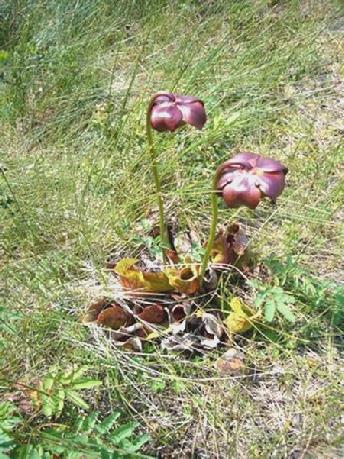
A pitcher plant – Newfoundland’s emblem
At the waterfall Adrian spoke to a couple from Michigan who were here on a week’s holiday (poor Americans!) They had flown into Halifax, caught the ferry to Newfoundland, and were visiting the west coast. They had been on the other boat trip this morning, which had also ended at 12.30. They would then have walked the 3 km back, driven the 60 miles here, walked this 2km trail, and it was still only 3 o’clock!
Having enjoyed the orange rock now from ‘all sides’, we drove on a bit to the so-called ‘Discovery Centre’ – a modern ‘hands on’ museum featuring different aspects of the park. The young girl at the desk recognised us from last night, and asked if we’d enjoyed it.
There were beautiful views down the southern arm of Bonne Bay from here. After calling in briefly at the small village of Woody Point, which we didn’t think as nice as Trout River, we set off out of the park, driving back down beside the South Arm, and leaving the park at Wiltondale.
We passed another small lake, with several old caravans beside it. It would have been nice to have stopped there, but we couldn’t find anyone to ask, so continued on our way, finally finding a spot beside a logging road just before Deer Lake at 5.40. Once more we were surrounded by wild flowers.
Saturday 8th July Blow Me Down, it’s Captain Cook again! 104 miles
A clear blue sky, and a beautiful day! We set off at 8 o’clock, stopping at Deer Lake where there was water and a dump we could use. We drove on past the long actual Deer Lake and then followed the Humber River to Corner Brook. The gorge scenery was quite stunning. This is a ski area in winter, despite being almost at sea level.
Corner Brook has a vast paper works, which dominates the whole town, but cannot detract from its wonderful setting at the inner end of the ‘Humber Arm’.
We soon found the shopping mall, and set about the ‘useful things’. We got a whole lot of photos printed at Walmart, did a big grocery shop and Adrian looked at technical things in Canadian Tire.
We found the town difficult to find our way around, despite our maps, partly because of all the hills, and partly because it just seemed a difficult town!
We knew that we would be returning here, as we had come south especially because of the connection with Captain Cook. There is a memorial to him high on one of the hills, but finding our way there was a puzzle in itself – we had to resort to asking the locals!
The memorial, commemorating the fact that in the 1760s, Captain Cook mapped the coast of Newfoundland, stood in a fine position overlooking the Humber River (named by Cook) and the town. It looked as though it could have done with a bit of upkeep! Nevertheless, it was a pleasant place to sit and have our lunch, in the warm sunshine.
The Humber River from Captain Cook’s Monument
The town hadn’t been forthcoming with the other things we needed – a liquor store, as we were down to the last half bottle of our wine, illicitly brought in from USA – a laundrette, and an internet connection, as we now wanted to phone Simon to wish him well for his marathon run tomorrow. Also we planned to phone Tom’s mobile to wish all the Cape’s well at Ruth’s party, which was taking place in Wales.
We set off to drive the 50 km along the southern side of the Humber Arm, with the ‘Blow me down’ mountains behind. It is called the Captain Cook trail. The views were out of this world, on this glorious day, but sadly our thoughts were overtaken by trying to get an internet connection. And we got absolutely nothing, as we drove right down to Lark Harbour, at the sea end of the ‘Arm’
It really had been a beautiful drive, with attractive little fishing villages, especially the further west we got.
Fishing boats by the Humber Arm
We now began our return journey, stopping at 4 separate small stores to see if they had a phone card – to use coins would have been extortionate – but the shopkeepers all just looked at Adrian in amazement!
We stopped by Blow Me Down Brook to walk a trail - a so-called nature trail, but it was a really rough path littered with large stones, and often boggy. There were plenty of pitcher plants again, and brilliantly bright pink roses. We could see an attractive waterfall high in the cliff face. The path divided, one way going on into the woods, the other leading down over rough rocks to a water hole, where local kids were sunbathing, and others were leaping off rocks into the water below. It looked more like Hawaii than Newfoundland!
We set off to walk back, and all was well, until we were a few feet from the Bam, crossing the last boardwalk over the boggy ground, when Adrian got stung on the leg by wasps which swarmed up from underneath! Calmed with an anti-histamine, we continued driving back towards Corner Brook, turning off in one of the more urban settlements, where we finally got an internet connection, and were able to phone. The sad reality of it was that we had a really bad line to Simon, and only got the answerphone from Tom! After all that!
We had passed a large parking area a mile or two back, so returned there for the night. We hadn’t realised that there was another babbling brook here, and yet another swimming hole for the locals! Being Saturday night, it was pretty busy, but we still had to tell ourselves that we were in Newfoundland and not the South Seas!
Is this Newfoundland?
The lovely setting seemed the right place to have our first actual barbecue. We ate succulent T bone steak with mushrooms, squash and good baked potatoes (the last lot hadn’t been much cop). We finished with strawberries and cream, and nibbled chocolates and other goodies. It was lovely to indulge, after our rather spartan time further north!
Later, we walked right up to the falls. It wasn’t an easy route, being along steep slatey shale at the water’s edge, and over occasional stepping stones along the edge of the river, ending with an almost vertical climb up a large rock. The stony path went on further, beside a series of rapids. As we began our return, we saw that a group of people had come down to swim. There was Roger and his 5 year old son Anthony, a young girl Jennifer and her friend Lindsay, plus a couple of blokes who didn’t feature. Roger got chatting to us, and gave Adrian a beer. He said that he had counted over 30 salmon by the falls earlier today. He said that the salmon wouldn’t get up the falls until after more rain. Like all the ‘Newfies’, they came with little extra clothes for their trip. Jennifer swam in her white bikini, lending her top and shorts to Lindsay to wear, as she had nothing but jeans. After their swim, they just wrapped a towel around themselves. Anthony was in and out of the water all the time, wearing trunks and a life jacket, but never put anything else on.
Roger went in for his swim, later than the others, as he had been chatting to us. By now it was 10.15. Jennifer said that it gets really busy during the daytime, which is why she liked to come down later. She and Roger seemed quite close, and Anthony seemed very fond of her. We heard nothing of Anthony’s mother. Roger invited us back to his home to experience ‘Newfie hospitality’, but we thought it time to come in and wash up!
Sunday 9th July Waterfalls, railways, and a son running a marathon! 50 miles
Another fine and warm day, but rather windy. After breakfast we walked across to see the river on the other side of the road, near where it reaches the inlet. There were falls here too, and it was another swimming place, but again very ‘rough and ready’. We saw a yellow warbler.
We started driving on back. As we neared Corner Brook, we found all the roads closed for a triathlon today (although the signs said 23rd July!) This was annoying, as we had wanted to drive along beside the water, which we hadn’t done yesterday. It also meant that it was impossible to plan a route through the town to do the things that we wanted to! Road works added to the confusion. We arrived back at the shopping mall at 9.30, to find that Canadian Tire didn’t open until 10 o’clock, and Staples (which I wanted for some photo labels) until midday!
We decided to have an early coffee, with what would have been a nice view down to the river, if it hadn’t been for the construction site in front of us!
Adrian made his visit to Canadian Tire, buying a new roof vent cover, as ours has ‘disintegrated’. No luck with finding a laundrette, so we made our way to the ‘RailwayMuseum’. This had the grand entry fee of $2 each! It was very small, but contained a fine steam engine and several carriages and rolling stock. There is no railway in Newfoundland at all now, it was dismantled in 1989/90. It had been a narrow gauge, and ran across the island to St John’s and down to Port aux Basques. This southern section was very windy, and there had been times when the train was blown off the tracks! A local chap would go outside his house, and if he could stand up in the wind, he would let them know that the train could run! Trains often got stuck in the central section, over the hills, and had to be rescued by snowplough. We were shown around by a young girl (why are they all so young?) who seemed to know her stuff! It was a nice visit, particularly for Adrian!
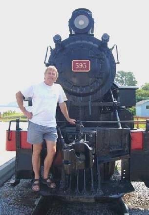
Adrian by the ‘Newfie Bullet’
Not having been able to walk the trail through the town beside the stream, because of all the difficulties with road closures, we set off for Steady Brook, a ski resort on Marble Mountain a few kilometres out. There was a walk here (almost vertical) to some impressive falls, so this is what we did next.
As we drove back past the petrol station/shop etc, we noticed a liquor store, and the good thing was, it was open today (Sunday). Replenished with (expensive) booze, we stopped to have lunch by the nearby ‘heritage tree’ – a tall totem pole, carved from a tree over 400 years old, and erected in 1999. There were carvings of John Cabot and of Captain Cook. It was really windy as we sat there, but still warm.
We retraced our steps now to Pasadena, turning off for the ‘beach’ I had read about. We had great difficulty in finding anything – there was a lot of private housing beside the lake - but eventually we succeeded in parking by a little track down to Sandy Cove. While Adrian set about fixing the new roof vent cover, I had a lovely laze on the beach. It was warm but breezy. Lots of people were enjoying the water of the lake.
We continued back to Deer Lake (town), where we got an internet connection and phoned Simon in Calgary, who had just finished running his marathon, and was at home, about to celebrate with a whole lot of friends. He was obviously feeling exhausted, but elated, and we felt very proud.
We returned to yesterday’s dump/water site, and made use of the facilities. We were right by the beach at the end of Deer Lake, but the wind was blowing right down the lake, so it was too windy to enjoy. Instead, we walked a little trail through the woods, before finding a spot here to stay for the night.
Adrian cooked halibut for supper outside, but we ate in.
We hadn’t realised that this was where everyone parked to go on to the beach, so lots of vehicles came down during the evening – the kids didn’t appear to mind the wind! We ventured out once or twice, to see the sun on the water.
Deer Lake
I finally got round to looking at the photos we’d had printed yesterday, and was dismayed to find that, firstly, there was no printing on the back, except for some almost intelligible numbers, and secondly, the photos were all out of order – quite a problem when there were nearly 200 of them!
Monday 10th July Goosey, Goosey Gander 257 miles
The day started cloudy, but the wind had dropped, so the lake looked very different. It became very warm later.
We left just after 8 o’clock, stopping to get some fuel, and then heading east on Highway 1. The scenery was of forests, lakes and streams, and the road was good. We started listening to our recording of our trip to USA in January 2002, when we bought the Bam, and drove Route 66.
We drove through Grand Falls / Windsor – twin pulp making towns. At Notre Dame Junction, we went into the Tourist information to pick up leaflets on the northern area here, which is supposed to be pretty. Adrian said to the woman ‘I think it’s a nice area’, and she just said ‘yes, it is’, with no further help!
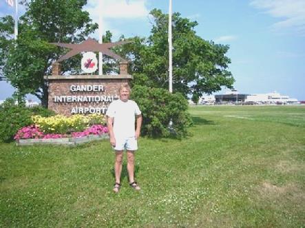
We had a dilemma, because, if we took the coastal road, we would miss out Gander, which Adrian wanted to visit. We solved the problem by driving the 43 km to Gander, and then back again, in order to drive north to the coast.
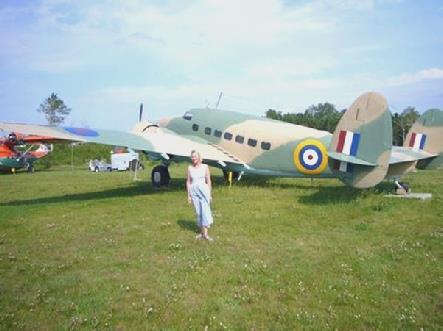
The reason that Adrian wanted to visit Gander was that it has been an international airport since 1939, even though it is in the middle of nowhere. The British chose the site, for strategic reasons, and it became the ‘stopping off’ airport between Europe and the Americas, where planes could refuel.
A small town has evolved near the airport, and we stopped in a pleasant rotary park to have lunch, sitting at a picnic table beside a pond. On driving through the town to the airport, we spotted a laundrette, so knew that we had to stop, as we were in desperate need of one!
While the washing got done, we found that we had an internet connection, and were pleased to finally be able to get hold of Tom. We also phoned Lena, who was just back from hospital.
Having got up-to-date with family news, we set off, with our clean load of washing, towards the airport. I photographed Adrian beside the sign and we made our way back to Route 1 to retrace our steps.
We stopped at the ‘North Atlantic Aviation Museum’ – a grand title for a rather low-key but interesting museum. We both liked the cockpit which extruded from the rear of the building, while the tail protruded from the front!
There was a wealth of information on the history of the airport, and all sorts of exhibits linked to it. A large old chap got chatting to me – it seems that his father came here from Scotland and had later worked at the airport, and this chap had always lived here. He told me what it was like living at the airport, before there was any town. He said that all sorts of passengers could be see here, as planes took off from New York, and stopped here to refuel – his sister had even seen Einstein!
The most recent importance of Gander was Sep 11 2001, when about 40 planes were diverted here as they couldn’t land in the USA, and Gander had had to host all the passengers (6500 of them!).
Rosie at the North Atlantic Aviation Museum
Having viewed the small collection of vintage aircraft outside, we set off for Notre Dame Junction, then took the road north towards the coast at Lewisporte. This is where the ferry we had taken from Goose Bay to Cartwright ends up. We didn’t stop at Lewisporte, as we wanted somewhere to stay for the night. The coast was busier than we have been used to, with the only pull-offs being drives to people’s houses. It was nearly 6 o’clock when we pulled into an unfinished skateboarding park at Birchy Bay.
Tuesday 11th July Lovely Twillingate, but no whales or icebergs 85 miles
The morning was grey, but by lunchtime the sun had come through to give a warm and sunny afternoon.
We were driving up to Twillingate on a route which took us over several causeways, linking various islands. It was all very pretty and photogenic. I took photos at Hillgateof the lovely, calm setting. We drove through Little Harbour, which was really peaceful.
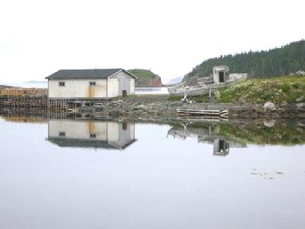
Reflections at Hillgate
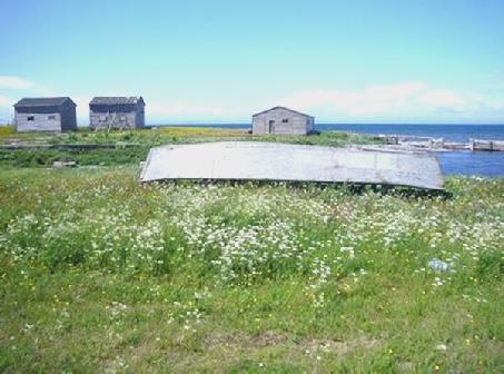
When we reached Twillingate, we turned off first to the peninsula which housed the scattered community of Durrell with its atmospheric log jetties. The road just wound on and on. We stopped when we got as far as we could go, and had coffee sitting with a lovely view over the cove, surrounded by harebells. It was still a bit nippy then.
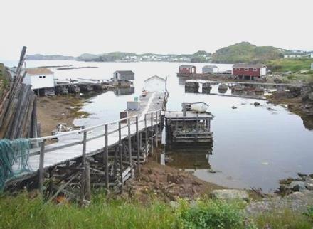
Log jetties at Durrell
We drove back, and through Twillingate, right up to Long Point, where there is a lighthouse. You are supposed to see both icebergs and whales from here, but they were elusive. In fact the girl in the lighthouse said that they have seen hardly any icebergs in recent years, which is a shame, because that is what the tourists expect to see. We were so glad that we had seen some from St Lewis.
We were plagued by a coach party today – we had seen it earlier, and it had pulled in here, with its engine running all the time the tourists were visiting. This is our pet hate, as it so disturbs the tranquillity.
We enjoyed the views, and the visit to the lighthouse, which was free. We had to be ‘guided’ up the steep stairs, by a young girl who had just finished school, and was going to study psychology at Corner Brook University. The light here is now automatic, but when it was manned, the lighthouse keeper had to crank it up every 45 minutes!
We drove back, marvelling at the profusion of wild flowers – dense pink clover, white ox eye daisies, yellow buttercups and blue vetch.
We stopped by St Peter’s Church, and the adjacent museum, in the old rectory. Of course the coach had got there first! We went into the church first (Adrian even suggested going into a church!), hoping that the group would have left. The pretty white, wooden church was very large, with a balcony upstairs, which isn’t used now. It looked really well loved, but the congregation isn’t very large now, the young lad told us.
Of course the coach party hadn’t yet left the museum, but at C$1 each, it was certainly worth our visit. Each room was crammed with artefacts of local events and notable people. There was even a section on scouts and guides, as a chap, fresh out from England, had started up a scout troop here, and asked Baden Powell for advice.
We had been surprised in the church to see that the last entry in the visitors book was a couple from Herts, when we had an even closer encounter. We heard a very loud, English sounding voice, and the owner of it asked where we were from. He, and his wife, were from Tadley – just a stone’s throw from us! He had retired 3 weeks ago from working at Aldermaston, and had been on a conference for the ‘Lions’ at Boston, before coming on here.
We had passed a seafood place on the way up, so stopped on our return (we saw that the coach had stopped elsewhere!) as it advertised ‘Fish and Chips’. We had to ask the young girl serving to repeat everything she said, but did manage to order fish and chips, and also some crabs legs for later.
We hadn’t expected the lady to start by peeling the potatoes, so we were in for quite a long wait! At least it was beautifully warm now, so we sat outside in the sunshine until they arrived. They certainly tasted fresh when they came!
We were opposite the library, so logged into the internet, and were very disquieted to hear of several bombs going off on trains in Mumbai (Bombay), where we had been only a short while ago.
We now passed a place advertising propane, so called in. Sometimes we have to be lucky – the man had just that minute finished adapting the tank so that it could be used to fill RVs!
Next Adrian stopped for petrol, and I thought that I would polish the inside of the van. He had just gone in to pay, when all the alarms in the van went off – whether from the polish or from the petrol I don’t know. Whereas he was oblivious to it, I was trying desperately, and without success, to stop the dreadful noise.
We now headed for Boyds Cove, where there was a site of Beothuk Indians, who lived in these parts, but sadly all died out after contact with white man. The coach was just leaving as we drove down the road! There were 3 things you could do here – watch the video, look at the exhibits, and walk to the actual site (1½ km each way). We had a look around until the video was being shown, and were going to watch it, when we heard that a French speaking woman was going in too. She had the most dreadful cough, so we thought it not a good idea to spend half an hour close to her, so set off on the walk. We had heard that the ‘bugs’ were bad, and they certainly were! Any pleasure from the pretty walk was lost in the agony of the bites! Yes, we had sprayed ourselves too. Adrian seemed to get stung by a nasty horse fly again, and I had several mosquito bites. To add insult to injury, we saw the woman and her husband on the walk, so they couldn’t have stayed for the video anyway!
It was now time to push on a bit, and we hadn’t travelled very far, when at 5.30, we found a nice spot off the road and backed up by a stream. Adrian made a poor prediction when he said that nobody would be using the little track behind us, so backed right up. Before too long, 2 fishermen arrived (separately), donned their waders, and plodded off to fish – like most Newfoundlanders they weren’t at all bothered by us being here. They carried on a conversation from their distant positions in loud shouting voices, sounding a bit like Cornish!
Wednesday 12th July On Terra Nova 177 miles
The day started fine, warm and windy, but didn’t stay that way!
One or two fishermen had come down to fish during the night (4.00 am!). We left at 8.15 – and passed another pull-off almost immediately!
We drove down one side of the ‘V’ of Gander Bay, passing lots of little villages, but driving up the second side we were slightly inland, which wasn’t so attractive.
We turned off to Musgrave Harbour – a low key and low lying area looking a bit like Hunstanton. We looked across to the genuine looking fishing harbour, but the town was very spread out, and we didn’t actually get there. I stopped at the post office, where the woman said that it seemed that we were in for rain, and sadly she was right – but not until later.
Lumsden was another olde worlde place with an archaic fishing harbour, and lots of lobster pots and wild flowers, but nowhere to stop to explore the long sandy beach, and the locals stared at our strange apparition!
We turned off to Cape Freels where there were more fishing communities of a bygone age, and no access to the numerous beaches. It was flat and desolate, with virtually no trees. We drove down a sandy track and stopped by the cemetery, before walking on to the beach, looking across to Cape Island.
Looking across to Cape Island
The next place was Newton, dating from 1853, and the start of the so called ‘New-Wes Valley’ – the next place is Wesleyville – but as everywhere is flat, there IS no valley! There just seemed to be more houses, most of them smarter than we had been seeing.
Newton was very pretty – it was all islands, streams, bridges, churches. There was a heritage village here which we didn’t visit, called the Barbour Village, on the Barbour Tickle (the name for a stream). There were rocks lying everywhere in this area, both in the bays and in the fields.
We had lunch at unlikely named Wareham, and as we left is when the rain started. This was a shame, as the next place, called Dover, was somewhere we wanted to stop to see. This was because it apparently lies on a fault, caused when the tectonic plates (Laurentia and Gondwana) collided 500 million years ago. The fault cuts right through Newfoundland at this point, but is most easily seen here. We looked at some explanations inside before setting off on the ‘trail’, in the rain. We wore caggies over our shorts, and walked the trail in double quick time. Had we not been told what we were looking at, we would never have known – the facts were more interesting than the physical appearance!
We were now heading for Terra Nova National Park, but stopped by the entrance for some time, as the rain was so torrential. I had planned on staying at a campsite near this end, but there was not much point with the weather being as it was, so we continued to the Visitors Centre, which we thought was something to do in the rain! It didn’t help that they decided to call it ‘Marine Discovery centre’ at the last minute, and not Visitors centre, which confused us. We couldn’t believe that a coach pulled in as we did, and out came all its passengers – but it wasn’t the same one as yesterday. There were just a lot of large people who spent their time buying coffees and icecreams, which they moped about imbibing, and putting us off! I quite fancied an icecream, but we waited until they had left before we bought one!
The thing that interested us most in the visitors centre was a map showing the watersheds of the Canadian rivers – Adrian photographed it.
We made our way to the next campsite, Newman Sound – dearer than the first one, and no reduction for annual pass holders like at Gros Morne. We were both feeling annoyed at having to pay money to stay in a campsite, when we couldn’t make the most of it because of the weather. Perhaps it was lucky that it was raining, as charcoal barbecues were not allowed, and there were no fire rings, and no wood!
We drove up to the shower block, and while we were having showers, the rain just bucketed down. We consoled ourselves that it would have been difficult to find somewhere safe from flooding tonight, had we travelled on.
It did actually stop raining, and we ventured out after supper into the cool air.
Thursday 13th July Magic Moments 116 miles
The night was really cold, but the sky was blue when we got up, and we ate breakfast outside in the sunshine.
We drove on down to the shore, enjoying the stillness. The water was really clear, and there was nobody else about.
We stopped to walk the loop trail around Sandy Pond. We left just after 9 o’clock and walked for about an hour. It was a lovely walk, as it was a pleasant temperature, there were hardly any mosquitoes, and there were no other people about. That is until we were nearly back. We walked across a boardwalk, frightening off a whole lot of Canada geese which were hiding in the grass. A voice spoke, and a man appeared and asked if we owned the RV in the car park. He said that he had just parked his bus next to us, with a group of birders from Philadelphia. They had gone off birding, so he had come for a walk. Then we met 2 chatty little girls who had come to the sandy beach with their parents for the day. We had heard frogs croaking, but had seen no other wildlife, but it was a nice place to have coffee after our walk.
We drove to the village of Charlottetown, on the edge of an inlet, and just outside the park. It looked quite idyllic in the early morning stillness, with the reflections on the water. My day of taking many photos had begun!
Charlottetown
As soon as we left the park, the ‘Discovery trail’ began. We had a booklet telling us of some of the delights – and there certainly were many as we set off up the Bonavista peninsula.
We had hoped to complete visiting this peninsula today, as, even with our extended time in Newfoundland, we haven’t many days left. It soon became apparent that this wasn’t going to happen, so we set about enjoying the things we were seeing.
There was a road which turned off for 8km to Tickle Cove, which would mean driving the 8 km back. It sounded nice, and it turned out to be an absolute winner!
The road passed through two small communities first – Open Hall and Red Cliff – both of which were attractive. There were a few pretty gardens, some with deep orange lilies growing in them. Plants here are further on than in the west.
At Tickle Cove – the end of the road – there was supposed to be a sea arch. We came to the silent little fishing community – not a soul about, so we stopped to have lunch. We were enjoying the amazing deep pink/purple rock, which was sometimes interspersed with a whitish and blue/green outcrop.
A lone fisherman came by on his ATV to work on a boat. We stopped and asked him about the arch. Adrian understood enough of what he said to find the way! He also said that lobster fishing was over for the season, so there will be nothing until perhaps a bit of cod fishing!
Following his directions, we parked by the sign, which seemed to be in someone’s back yard, and followed the path.
What we saw was out of this world! It brought tears to my eyes and a lump to my throat! The contrast of colours – the deep red of the rock, with the white/blue/grey; the blue of the sky and the sea; the bright green vegetation; the spectacular rock formations making wonderful patterns. The arch itself was great, but almost superfluous! There were sea birds on offshore rocks, lobster pots piled up with their coloured hand made netted ends, and with green and yellow rope inside. The simple small wooden houses were painted white with red. Everything was so beautiful that I had a field day with my camera to try to remember as many of the wonderful images as possible!
Wonderful Tickle Cove
We tore ourselves away, and drove back to the highway. A few miles further on was another turn off for 8 km – unfortunately the two roads didn’t link up! This road produced delights, but nothing could compare with Tickle Cove! We did see a moose though.
There were more pretty villages – Duntara and Keels. At Keels there was something called the ‘Devil’s footprints’. We located them with help of another couple of tourists who passed us. They were large circular holes in the angular, slatey rock, and certainly strange!
We returned to King’ Cove, at the start of the road. There was a walk here to the lighthouse – nearly a km each way. It was pleasant walking along the side of the inlet, looking across to deep caves in the cliffs opposite. We reached the lighthouse, where we could see across to the town of Bonavista on the end of the peninsula. More excitingly though, we could see whales cavorting out to sea. We watched for a while, before walking back - it was now 4.30. We drove on a bit, stopping beside the sea just after Knights Cove.
After a bit, we thought that it was a shame to be sitting inside. We walked out, and realised that we were right by a lovely beach, hidden from our view. Adrian set about collecting up firewood, and after a bit of discussion, we decided to have a fire on the beach, and cook sausages for supper. We toasted bread too. (Adrian had just found some ‘toasting forks’ which we didn’t know that we had, in the outside locker). This turned out to be another magical moment!
It was windy where we had parked, but down on the beach it was wonderful! We took our food and drink down there, in our isolation, and had an evening to remember! One to be treasured! The sun went into cloud, but emerged again at the right moment. We sat out until 10 o’clock – one to be put in the memory books!
Friday 14th July Puffins, gannets, John Cabot and a top walk. 74 miles
We left at 8.30 to discover some more of the Bonavista peninsula, driving past dramatic coastal scenery to the town of Bonavista. Our first stop was at Dungeon Provincial Park, where we were able to see this coastal scenery close up. There were twin arches carved into the cliffs, but although the weather was windy, the sea here was really calm.
We drove on up to the end of the bleak and barren peninsula, making me think of Lundy – there were even sheep! We stopped by the statue to John Cabot – the man who started it all! He sailed from Bristol in 1497 in his ship ‘Matthew’, looking for a route to Asia, but coming to ‘New Founde Lande’, and to ‘seas teeming with fish’. Thus started the rush to Newfoundland, and the ‘battle of the cod’, which has been going on for more than 500 years.
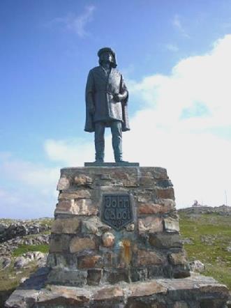
The man who started it all
Near the unmistakable red and white painted lighthouse was an offshore rock which was home to absolutely hundreds of puffins. It was really cold and windy, but we were so keen to have a look. There were black guillemots too, with their funny orange feet, and gannets flew overhead. Apparently there were also murres, but we couldn’t make them out.
We just viewed the lighthouse from outside – it was now 10 o’clock, and you could go inside to visit, but we made our way back to Bonavista to visit the National Historic site of ‘Ryan’s premises’. This visit took the rest of the morning! We had stopped to look at the replica ‘Matthew’ and photograph it on the way.
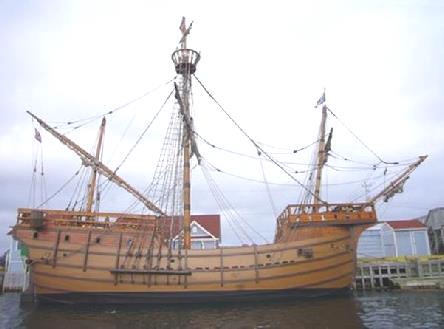
Cabot’s ‘Matthew’
The bridge between the ‘Matthew’ and the Ryan buildings was closed, which meant a long detour through the town each time. Bonavista is quite large and spread out, but the houses are all attractive – there are apparently 1,000 listed buildings!
The Ryan buildings were opened as a museum by the Queen in 1997. There were several buildings comprising the museum, with helpful staff wanting to tell us about things. Ryan had started a flourishing fishing business here, and the museum told of different aspects of the fishing community of Bonavista. It was interesting that most of the early fishermen came from SW England and southern Ireland.
We could only think what a hard, and often dangerous, life so many fishermen led. Women too were very involved, as the fish was salted (like in Portugal), and much of the work fell to them. The cod here was laid out on ‘flakes’ (wooden platforms) to dry. One of the lady guides told us how she hated salt cod, and said that most people did! With the decline in the cod industry, she said that there was little for the youngsters to do, and many left the island. She also confirmed what a safe and happy place it was for children to grow up in.
We now headed off to visit some of the other nearby coves. From Spillars Cove we had a good view up to the lighthouse, although by now it was getting misty, along with the cloud.
At Elliston there were lots of ‘root cellars’ – earth mounds, where vegetables were stored in the past. Most people grew their own vegetables – they salted the cabbage, but stored the rest in these cellars. They have now become a tourist thing, but today wasn’t an enticing day to go visiting!
Root cellars
We drove as far as Maberley. There were more off shore islands with bird colonies, but we had had the best view by the lighthouse.
Our next stop was Port Union – a planned town, established by Sir W.F. Coaker in the early 20th century. He founded the Fisherman’s Protective Union in 1908, and had been an influential and respected man. Coaker had hoped to break the monopoly of the merchants like Ryan, whose businesses ran on the archaic ‘truck system’, where they bought the fish at their prices (low) and paid for them in goods (at inflated prices). Coaker wanted to place the control in the hands of the fisherman to be able to sell their fish where they wanted. He even managed to get a limited bill through parliament to ban the ‘truck system’, but fierce opposition by the merchants diluted it and it took a long time for the system to finally disappear.
In 1910, he began publishing the ‘Fisherman’s Advocate’ newspaper as he saw it as the means to spread the word against the system. We saw a past copy, which announced the opening of the bridge in Bonavista, which is at present being rebuilt!
You could only visit the ‘factory building’ by guided tour, which we didn’t want (especially as the woman had ‘flu’ she said!) We walked along the street of ‘Union built houses’, and saw ‘the Bungalow’ – Coaker’s former home – and visited the small museum in the old station (the railway had been extended to here). We weren’t sure whether this museum came under our ‘Historic Places’ pass, and the 2 plump young girls, who looked like sisters, had never seen a pass before, but let us in! The museum was very old fashioned, with difficult-to-read handwritten labels, and we were only the second names in the visitor’s book today! There were some nice old railway photos for Adrian!
Next stop was East Trinity. There was a walk here called the ‘Skerwink Trail’, which was supposed to be ‘one of the best walks in Canada’, or to be more precise ‘one of the 35 best walks in North America and Europe’. Although now 4.30, we decided to do it. It was only 5.3 km, but was supposed to take 2 hours. It was basically a walk around a dramatic headland, but the first little bit – along the old rail path, belied what was to follow! It was rather like British coastal paths – lots of ups and downs – but we did have lovely views.
On the Skerwink Trail
It would have been nicer with blue sky, but at least it had brightened a bit, and the earlier drizzle had stopped. Gannets flew offshore, and there were lots of ‘stacks’, some with seabird colonies. When we looked back afterwards, we realised how sheer the cliffs were, and how high up we had been! The walk ended by a little beach, with a pool trapped by the shingle. We were left ‘high and dry’, and had to guess our way back from there!
Being now 6.30, we set off to find a stopping place for the night, but first did a trail of the town, as there was only one road out! Soon after Trinity, we pulled off the road above a pond for the night.
Saturday 15th July A great arctic explorer 168 miles
Any site we saw today was either through heavy rain or mist!
We first drove back a few miles to the actual fishing village of Trinity, as it was renowned for its attractive historic houses. Even in the rain it looked lovely, but it was no good for the photos!
Now it was time to head off the Bonavista peninsula, which we had found really nice. We stopped at Shoal Harbour, overlooking Random Island. At Clarenville the reflections in the still water were lovely.
Reflections at Clarenville
We travelled across the isthmus to the Avalon Peninsula on Route 1. We noticed a lot of RVs on the road today – up until now we have seen hardly any.
We turned up towards Dildo on the so-called Baccalieu Trail. It was too misty to enjoy the pretty scenery. We crossed the peninsula, passing lots of lakes, to the eastern side. For the first time in Newfoundland we came across some suburban grot, and habitations were getting denser.
There were still pretty fishing villages though. We turned off to Brigus, which was another village of beautifully painted clapperboard houses, and with lots of character.
Brigus
We visited Hawthorne Cottage, a ‘National Historic Site’. It had been the family home of Captain Robert Bartlett, a polar explorer of repute in the early 1900s, although he hadn’t stayed here much. The house contained all the original furnishings and furniture, so had a very ‘real’ feel. We enjoyed finding out something of this great and highly respected man, of whom we previously knew nothing. The house had been moved 10 km from its original location, by being pulled over ice, in the early days. It had been extended since then, and was apparently an unusual looking house for this area, but was very attractive. The garden looked really English, with philadelphus, honeysuckle and hawthorne. As it was ‘Parks day’ we were offered blueberry tea and muffins. The tea was good, but American muffins I find disgusting!
By now it had stopped raining, and the sun was even shining. We drove on a bit, stopping beside the river at Avondale, where a young lad came and told Adrian about the fishing here. Later he arrived with two tiny fish that he had caught for us, but they wouldn’t have fed the five thousand!
Sunday 16th July To the most easterly point in Canada/North America 88 miles
We left at 8 o’clock, so were able to enjoy the peace and quiet of a Sunday morning, with no-one about. The early morning reflections at Lake view were lovely. We stopped at Holyrood by a wide bay, and watched the people ‘jigging’ (fishing) for squid from little boats. The fisher people had told Adrian about this last night. Next weekend is the ‘jigging festival’. We could see that some of the people out ‘jigging’ were women. The railway had passed through here, and now it was a pleasant walkway by the beach.
Jigging for squid Holyrood
We soon reached Conception Bay, with its modern suburban superfluities, of which we have seen hardly any in Newfoundland.
We continued to Topsail, pulling into a pleasant ‘Rotary Park’ above the beach, looking across to Bell Island. This island, and 2 smaller ones, looked very like Lundy, in that they were steep sided ‘bombs’ in the ocean. They kept appearing and disappearing from the mist.
There was a small oceanside open air theatre at Topsail, with a sign saying ‘Shakespeare by the sea’. Lovely for a balmy evening, but we wonder how many they get here! This morning it looked wonderful in the beautiful stillness.
A bit further on was Portugal Cove, where the ferry leaves from for Bell Island. It is obviously a popular place to go to on a Sunday, as there was a long queue for the ferry. We could only see 3 places where you could get down to the sea on the island, but it must have been worth it. The coast north from here was really steep cliffs, with no access, so we drove across the peninsula to Torbay, on the other side, just north of St. Johns. We followed the road above the cliffs to St John’s, making our way first to Signal Hill.
We went into the Visitors Centre, which had just opened yesterday, so was free anyway, although we had our passes. The sign on the boards still said ‘closed’ though! We had just missed the tattoo re-enactment, but weren’t too worried!
We visited the Cabot Tower, constructed in 1897 to commemorate Queen Victoria’s Diamond jubilee, and 400 years since Cabot’s discovery of Newfoundland. As the mist lifted, we could look down to St John’s, in its wonderful situation with its ‘L shaped’ inlet and steep sided hills.
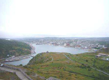
St John’s from Signal Hill
It was here that Marconi received the first trans-atlantic wireless signal in 1901, from Poldhu in Cornwall. We enjoyed the exhibits about that, and could imagine the excitement when he had heard the first morse code sounds.
Signal Hill has long been a strategic site, and from here we could see Cape Spears lighthouse on another peninsula. We were to visit that later, but first we stopped at the Geo Centre nearby. This museum was fascinating as it had loads of information on the geology of Labrador and Newfoundland. It had been opened in 2002, so was very modern in its approach, and we found masses to interest us. The real reason for us coming, though (and paying real money!) was that it also had a thought provoking exhibit about the Titanic.
The museum pulled no punches in explaining the negligence of the captain and shipowners in the contribution to the tragedy. There had been 9 separate messages sent to the Titanic warning of the imminent danger of icebergs, which for various reasons had been ignored. One couldn’t help but be moved by the terrible outcome of the story, which had been explained in such detail. Of course we had the added interest of knowing that my great great grandfather George Thompson Lawson had rescued the occupants of a Spanish ship which had similarly ran into an iceberg in the same vicinity.
Now it was time to visit Cape Spears. We were able to see some of the attractive town of St John’s, with row upon row of pretty pastel coloured clapperboard houses and some fine buildings.
It was a long and winding road to Cape Spears, another National Historic Site. The lighthouse here had been restored to its 1840 appearance. It was ‘stuck out’ in a chilly position, as all lighthouses are, but here we were at the most easterly point in Canada and North America, so braved the wind to have a walk around the windy headland.
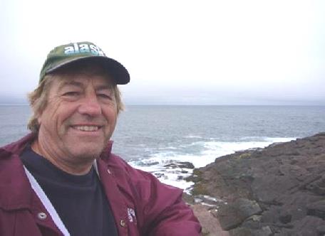
Adrian at Cape Spears – most easterly point in Canada
There had also been WW2 gun emplacements here, so plenty of interest around. No icebergs of course, but we were thrilled that we did see whales, which was an unexpected surprise.
Now needing somewhere for the night, we drove on a bit, through really pretty Petty Harbour (should be called ‘pretty’). There was a spot right by the harbour which looked lovely, but a bit too ‘close for comfort’, so we drove on a bit, past the HEP pipe, and stopped by a little lake at nearly 6.30.
Monday 17th July Our last day in Newfoundland
We left at 8.15 and drove back down to have another look at pretty Petty Harbour.
We drove on, stopping to get some fuel, but neither of Adrian’s cards would work, so he had to pay with Canadian and US cash! There was a supermarket nearby, and we needed some shopping, but it didn’t open until 9 o’clock, but by the time we had sorted the fuel money scenario, and got some more money from an ATM, it was open.
Having got enough stuff for today, we were on our way at 9.30, heading towards Placentia, and the ferry terminal for Nova Scotia at Argentia.
We stopped at Salmonier Nature Park, where we walked the 3 km boardwalk through native swamp, viewing some of Newfoundland’s and Labrador’s birds and animals. These were ‘housed’ in settings like their own habitat, and were usually rescued animals. We saw snowy and great horned owls, a bald eagle, peregrine falcon, a red and an arctic fox, and a male, female and young caribou. The moose and the beaver were elusive, and we didn’t need to see Canada geese, but the long line of them swimming across the pond was amusing. We read that they are good to eat, so why hasn’t someone caught on to that in England, where we are over populated with them?
We drove on now, stopping for lunch by an inlet at Colinet. Soon after here, we had a long stretch of unsurfaced road, which rattled everything about. A short way along we stopped at ‘Cataracts’, where we walked down many steps to view some very brown waterfalls.
Just before the end of the unsurfaced section, the misty day turned to torrential rain for a while, so we were glad to get to the tarmac again just before Placentia.
This fjord like bay looked really pretty – we wished that the visibility was better. We were making a visit here to Castle Hill, another National Historic Site. Placentia, under the name of Plaisance, was a French town when they were occupying this area. After much battling, the Treaty of Utrecht, 1713, gave sovereignty to Britain, and the French retreated.
Placentia from Castle Hill
There were interesting exhibits about the cod fishing here – the reason for all that Anglo French battling. There was part of the old fort left, and we set off with personal headsets telling the story, but the heavy mist took away from the attraction!
We drove on to Argentia, to check out the ferry. Just before there we stopped at the Visitors Centre. We’re glad that we stopped, as there was a special display on the role of Argentia in WW2. This was something we knew nothing about.
It transpired that the site of Argentia was needed as an air base, and the occupants of the town were forced to leave, and their houses were demolished to make way for the base. There were a lot of personal stories, which were distressing to read.
It was in Placentia Bay that Winston Churchill and Roosevelt signed the Atlantic Treaty in 1941 – the forerunner to the United Nations being formed. There is a marker to this at a point further north around the bay.
Having checked out the ferry (and paying the high price for the ticket) we returned to Placentia for the evening, before returning for the midnight ferry.
Newfoundland


