
Tuesday 18th October 2011 Into Scotland 34 miles
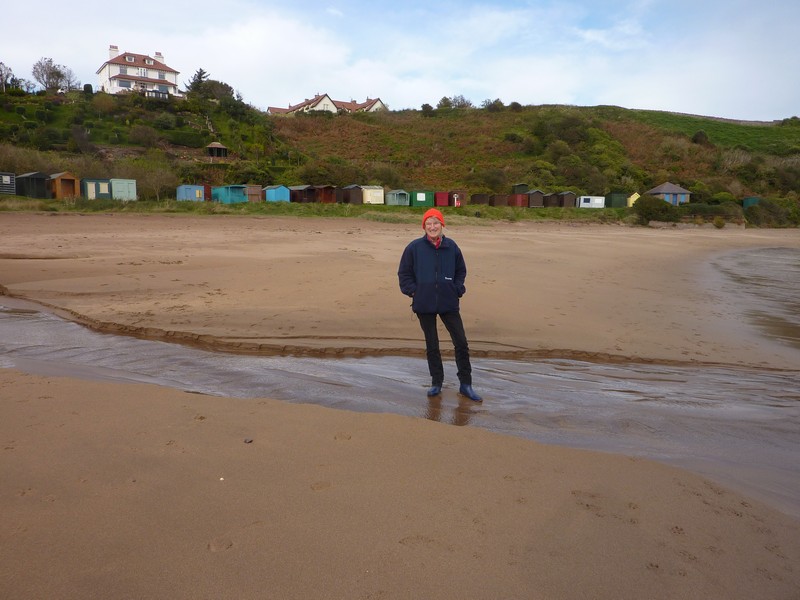
We had a day of blue sky, but with strong gusts of cool wind. The black cows looked in to greet us, but we moved up to the higher viewpoint to have breakfast, moving back down to have a last ‘blow’ on the beach of our English ‘RoAd ARound Britain’.
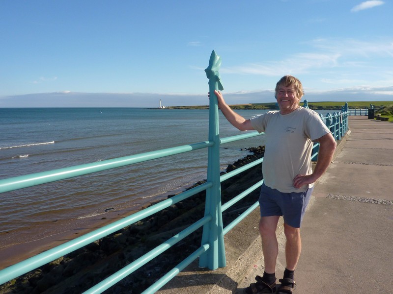
We drove on past Berwick, stopping at the border with Scotland for ‘We have made it’ photos! We have completed our journey around the English coast, which we started in 1996. We have already completed the Irish and Welsh coasts, so only have Scotland left. We intend doing a bit more this time.
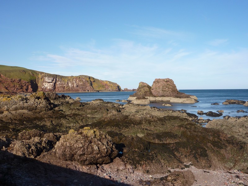
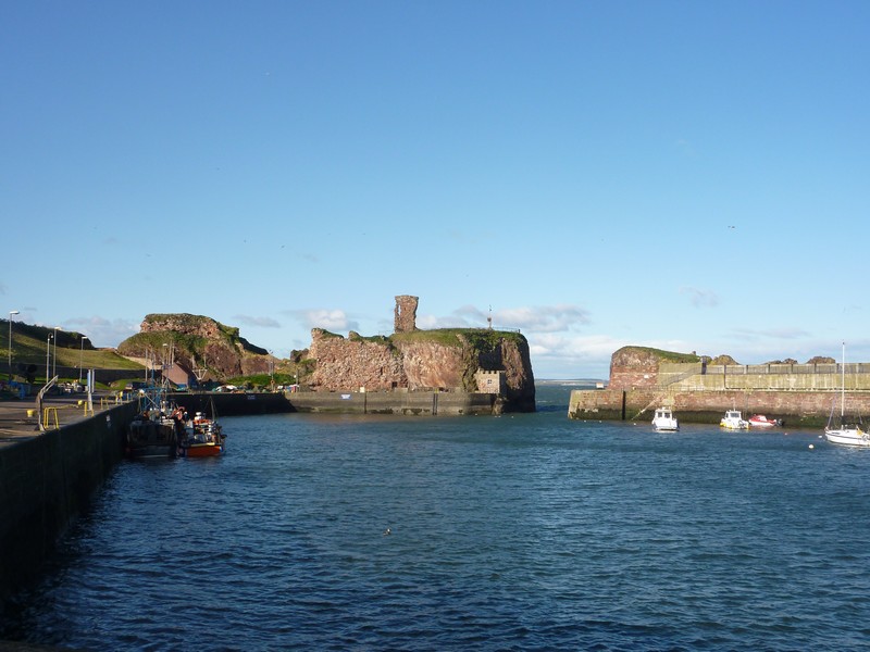
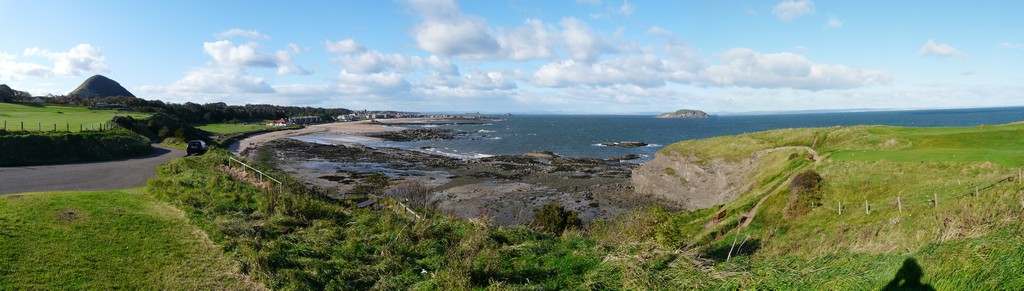
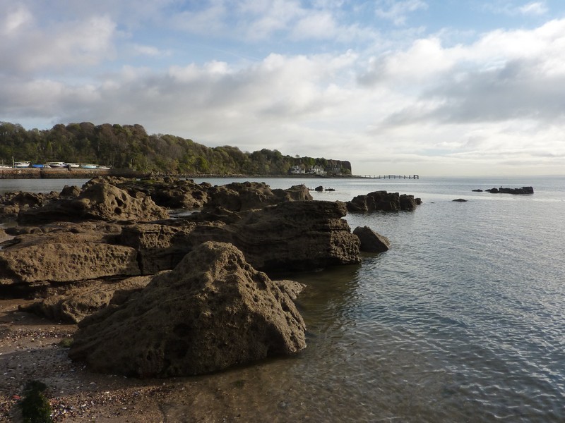
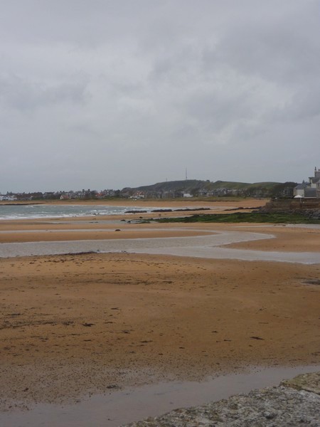
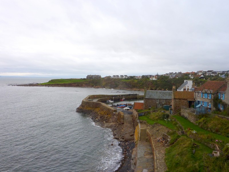
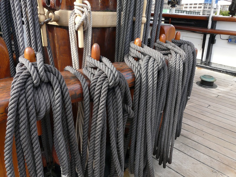
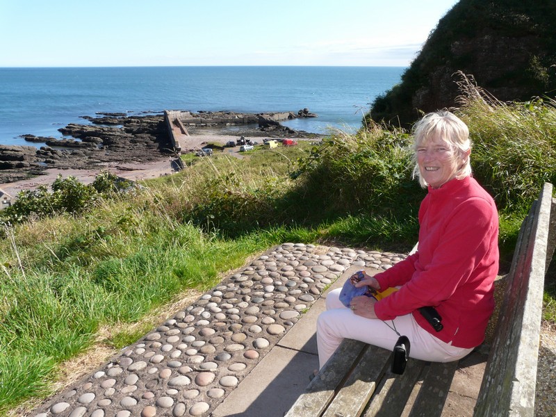
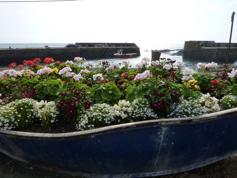
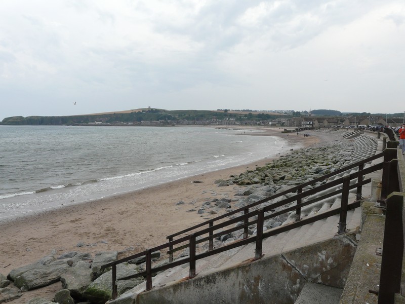
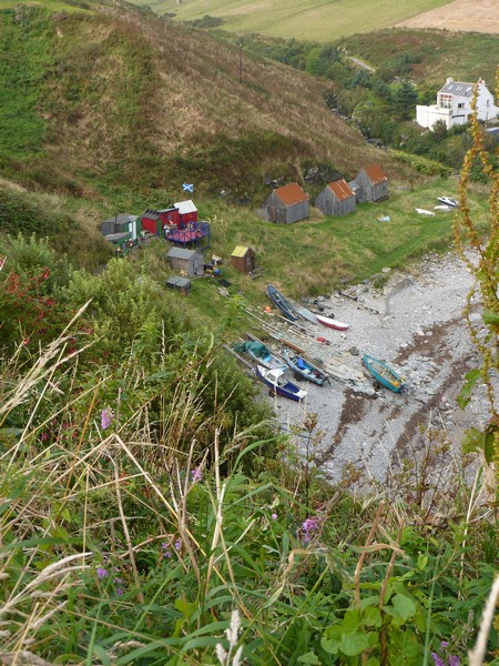
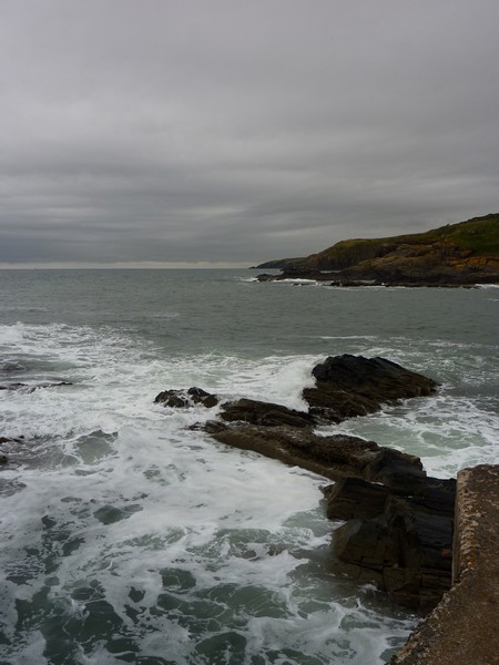
The first place we came to in Scotland was Burnmouth, a charming little fishing village which we reached after driving down a very long and steep (1 in 5) narrow road. The cottages were nestling beneath high vertical cliffs, there was a dear little harbour, and ‘scars’ stretched out into the sea.

This is a continuation of the trip where the English East Coast North Northumberland finished
Scottish border at Berwick on Tweed to Aberdeen
Berwick on Tweed to Aberdeen
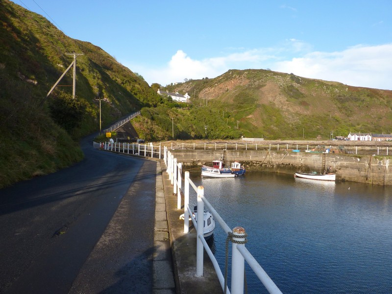
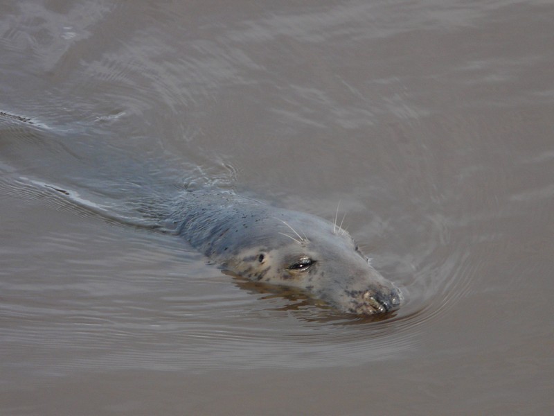
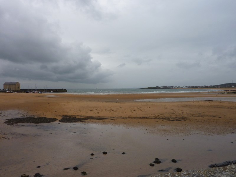
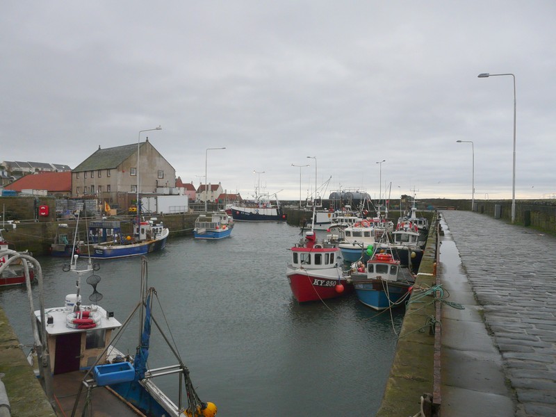
Just on from here was Eyemouth, a much larger place, but very much a busy fishing harbour. We approached it first on a recently built road which swung down to the eastern side of the harbour, but then drove down on the western side, where we parked right on the harbour. We looked out to the harbour with its fishing boats, and a few ducks and gulls. We both then saw first one and then another seal right in front of us! A local told Adrian that in the summer, kids throw in odd bits of fish from the (now closed) seafood stall next to us. We braved the really strong wind to walk onto the lovely sandy beach adjacent to the harbour.
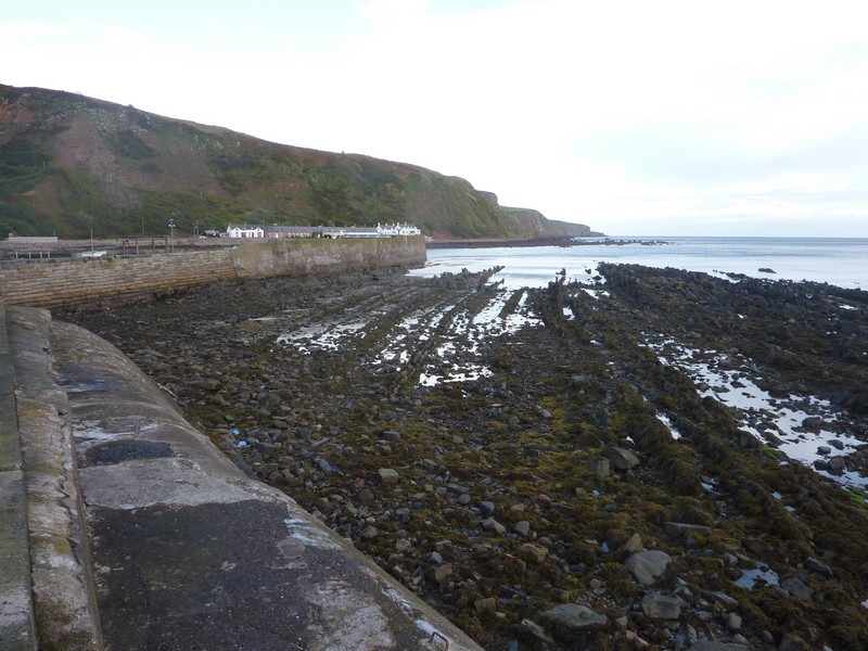
Burnmouth - the scars and the steep hill from the harbour
We had a mission to accomplish now, as we needed to get propane gas, and this town had a place where we could get some. We located the petrol station, and Adrian filled our gas tank. A bonus was that there was also a hand car wash here, and ₤2 and some damp minutes later, we had a much cleaner van. Adrian had managed to wash off a great deal of the thick mud which had been coating it.
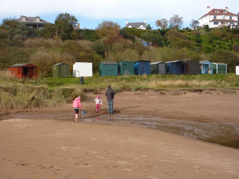
We drove back through the pleasant main street (EEC improved) and drove on to Coldingham, turning off towards St Abbs, but diverting first to drive to nearby Coldingham Bay. The walk to this from the car park was further and steeper than we’d realised, and we had to battle the excessive wind. The beach however was wonderful – a vast sandy cove, surrounded by rocks and completely unspoilt. A little stream flowed across the beach. There was a selection of very simple beach huts. A family arrived at the time we did, and after opening up their hut, the two young girls and dad immediately set about diverting the stream with their spades! It was the sort of beach we would have loved when our children were young.
Eyemouth
One of the two seals we saw - it's not a dog!
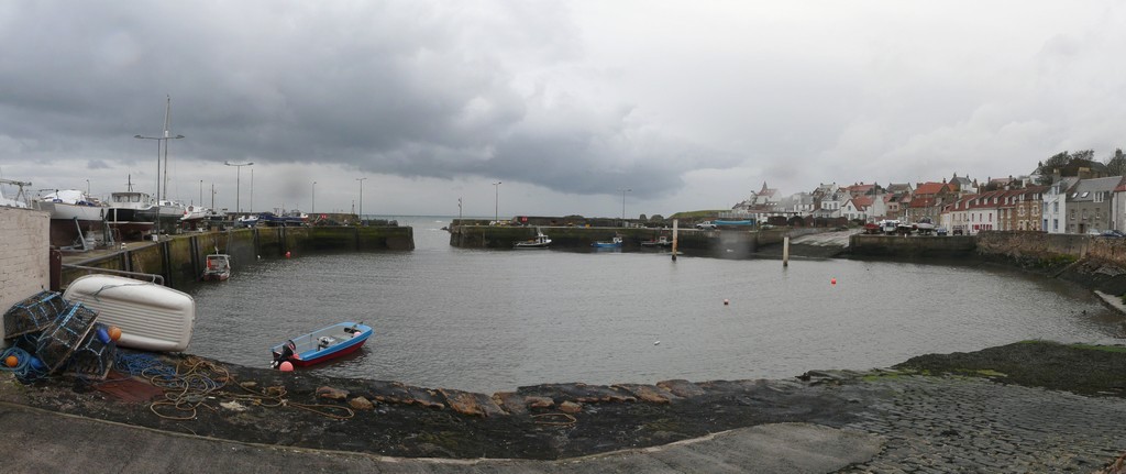
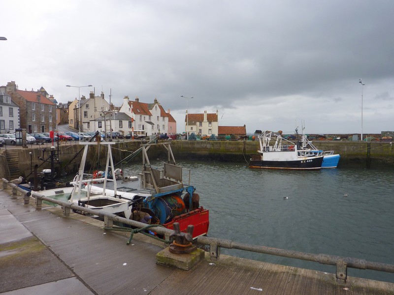
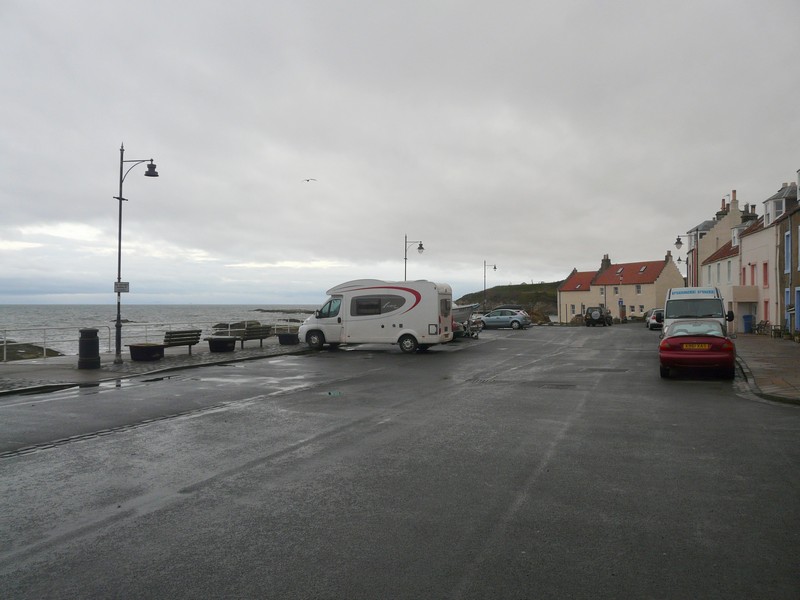
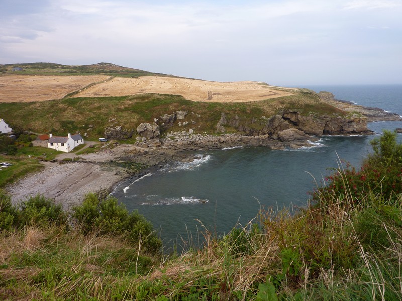
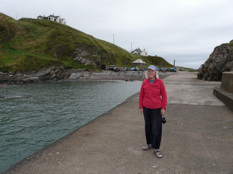
We drove back – there was a caravan park crammed full with touring caravans at the road junction – and took the branch of the road to the village of St Abbs. This was a really pleasant surprise – an attractive village with a nice little harbour and a sandy cove surrounded by rocks. We ate our lunch here before having a short walk around by the working harbour. This village has become a centre for scuba diving. We got an internet connection, and sent a message to ‘our 4’ to say that we had completed our RAB of England.
Coldingham Bay
We were amused on our way back to the main road to pass a sign, in several languages, saying ‘Drive on the left’.
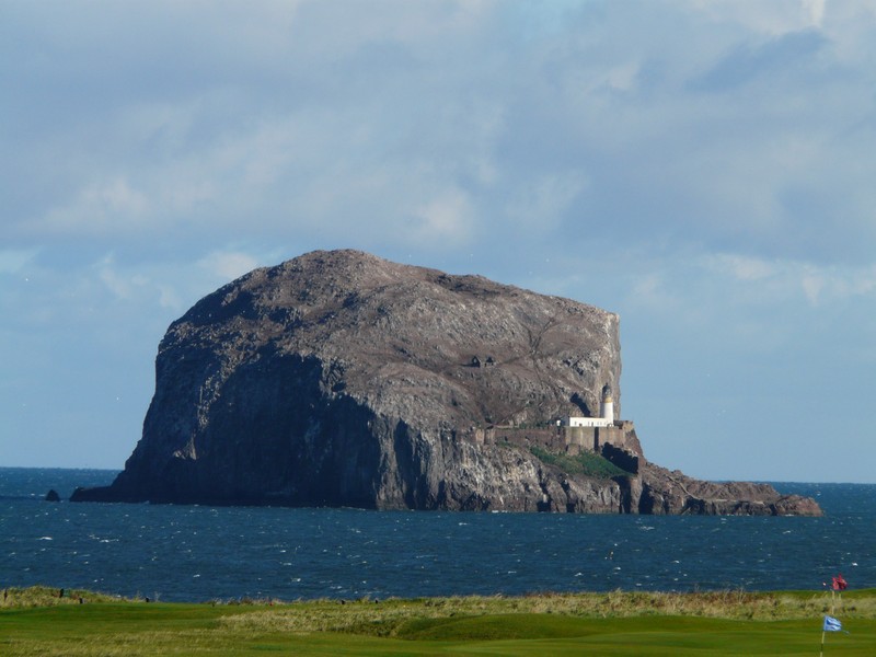
Soon after this, we took a road near the coast, towards Dowlaw farm. Along here we saw a pull-off partly sheltered by hummocks, and although still early, decided to stop for the night. The wind continued to howl as we looked out to conical shaped North Berwick Law and to Bass Rock, off shore in the distance.
Luckily the wind dropped a bit during the evening.
In an old quarry on the road to Dowlaw Farm, nowhere near anywhere
St Abbs
 from near Dowlaw Farm.jpg)
Looking north to Bass Rock and Torness Nuclear Power Staion from our overnighter
Wednesday 19th October Height barriers hinder our parking 80 miles
We left at 9 o’clock on a bright and sunny morning but with a really strong wind. Our road descended a very long way, and we realised that we had been quite high up last night!
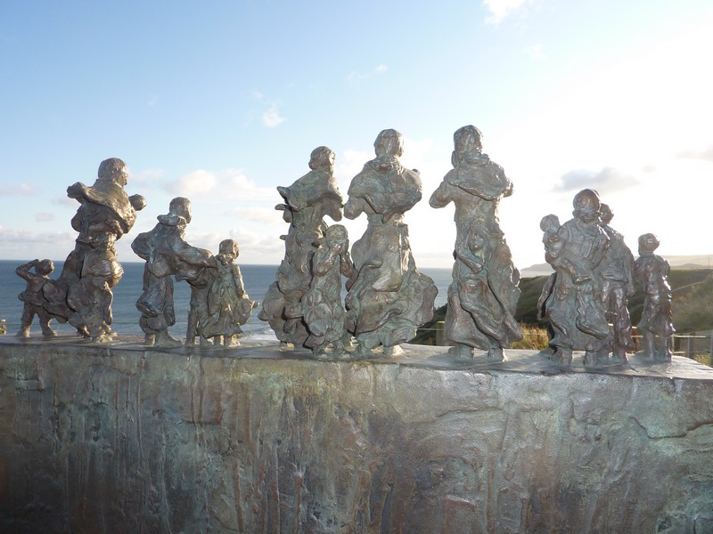
We were disappointed to see that the whole of lovely Pearce Bay was taken with a massive static caravan park. Nearby the tiny fishing hamlet of Cove was too far for us to walk down to. We read information boards that told of the terrible disaster here in 1881 when 11 of the 20 fishermen were lost. 187 men were lost from Eyemouth, Burnmouth and St Abbs during the same storm.
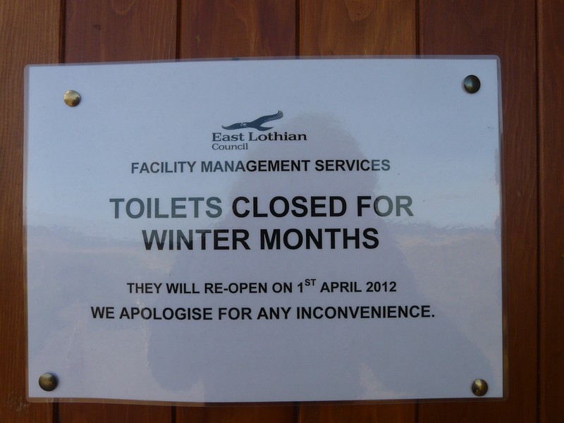
We passed Torness Nuclear Power Station, just after a caravan park at Thorntonlock. Just afterwards we were stopped by a height barrier at Skateraw, so had to return on the narrow road. We took another narrow road to White Sands, beside huge cement works, but once again were prevented from parking because of a height barrier – this was the case at a lot of places today. We were amused at the toilet block here which had a sign saying ‘Closed for the winter. Sorry for any inconvenience’!
Emotive statue at Cove to drowned fishermen
Now we came to the town of Dunbar, with its attractive stone houses. It showed little sign of the many battles of old. We parked down by the 19th century harbour – the older harbour was next to it. The entrance to the newer harbour had destroyed some of the ancient castle, which looked an evocative sight. Dunbar had been an important port in the past, handling in particular herrings and also potatoes. There were still fishing boats here now. We walked out briefly, but the strong wind sent us back inside!
To the west of Dunbar is John Muir Country Park. John Muir, the great conservationist who did so much to help establish the National Parks in USA, had been born in Dunbar. (there is a museum about him, which we found on a later visit). We found our way to the park, on the estuary of the River Tyne. We saw birds, including curlews and oystercatchers, then drove off to another part of the park, but were disappointed to find that this too had a height barrier, and was overshadowed by a family theme park, which cars were flocking to, making the single- lane drive back difficult.
We passed Tantallon Castle, looking impressive with Bass Rock nearby. There were never pull-offs when we wanted to stop and photograph.
Dunbar harbour
In the other direction was North Berwick Law, the high conical hill which overlooks the town of North Berwick. When we were able to stop, we could see the whale bones on the top of the hill.
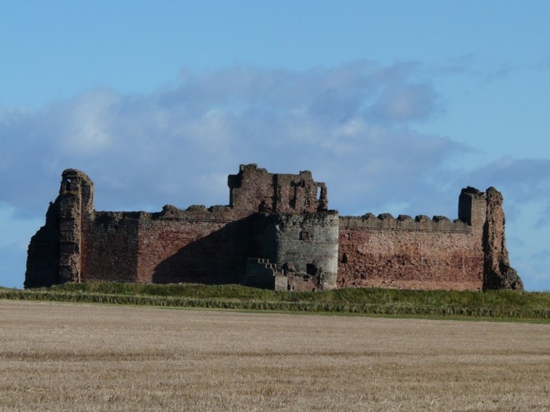
Tantallon Castle
Bass Rock
We drove to the promontory above North Berwick, looking to Bass Rock, and other isolated islands in the Firth of Forth. Golf courses abounded everywhere. We had lunch of soup which I made before driving back through the town, but the one-way system meant that we couldn’t get to the front.
We diverted to Dirleton Castle, said to be NT on our map, but in fact it was run by Scottish Heritage, so we didn’t go in. The next place Gullane, again had a height barrier which prevented us from taking the road to the Firth. As we proceeded towards Edinburgh, height barriers stopped us from pulling off at all.
At Seton Harbour, there were still lots of fishing boats, and the town seemed greatly improved from the description in our 70’s book of the coast, which said that it was very polluted. We had been impressed by the colourful flowers everywhere – the pink nerines looked especially pretty.
We passed Cockenzie Power station before coming to Musselburgh, a large town on the River Esk. After that it was the long haul through Edinburgh itself. We have been to Edinburgh several times in the past, so today we were just driving through, trying to keep as close as possible to the shore. We followed in vain signs to the Royal Yacht Brittania – the vast amount of traffic around the huge shopping mall was too much for Adrian!
We did pass the working harbour at Leith, and just before Cramond, we were able to park right above the Firth and look down to the derelict foot-causeway to Cramond Island, and across to the other side of the Firth, in the bright sunshine. Cramond village looked nice too, but was too narrow to drive to, and the free parking would have entailed a long walk.
North Berwick, with the law (hill) on the left
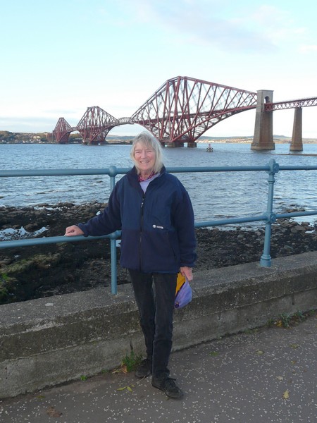
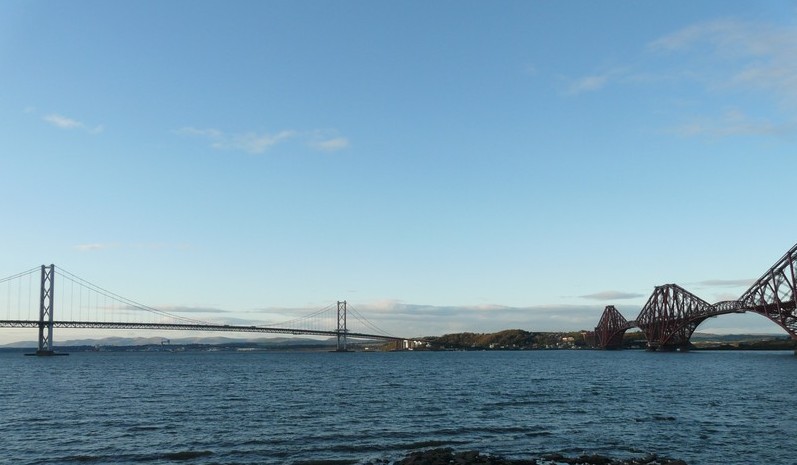
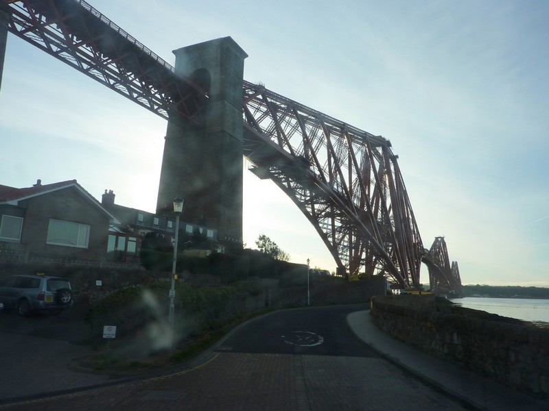
Now we made for Queensferry, but the slip road from the fast road was closed! Also there are roadworks on the bridge today & tomorrow! We drove along the cobbled street through the lovely village, and stopped by the Forth rail bridge to take a photo like the one of me taken in 1962.
Cramond Island
Now needing somewhere to stay for the night we ended up at Dalmeny on a bit of ‘stopped-off’ road right above the railway! Lois phoned, so we arranged to go there on Friday.
Thursday 20th October Lovely villages along the north shore of the Firth of Forth 59 miles
The night was very cold, with a touch of frost! We’d had disturbances during the night – at about 2.00 am we heard hammering and drilling which we thought must have come from railway workers in the cutting below.
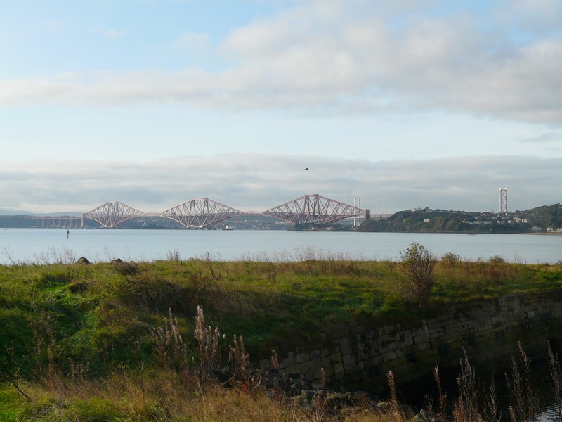
We’d already decided to go back to the spot down by the two bridges at Queensferry to have breakfast. This was really beautiful, on this glorious morning.
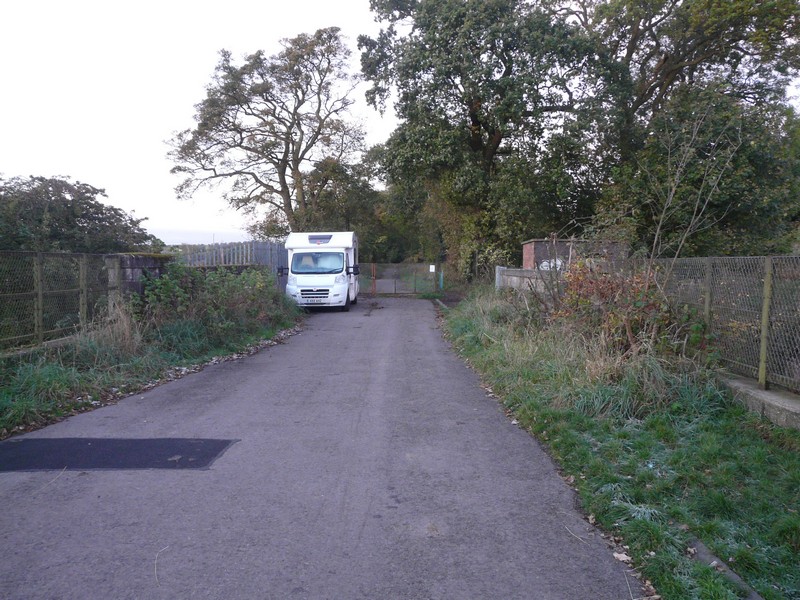
Nightstop above the railway cutting
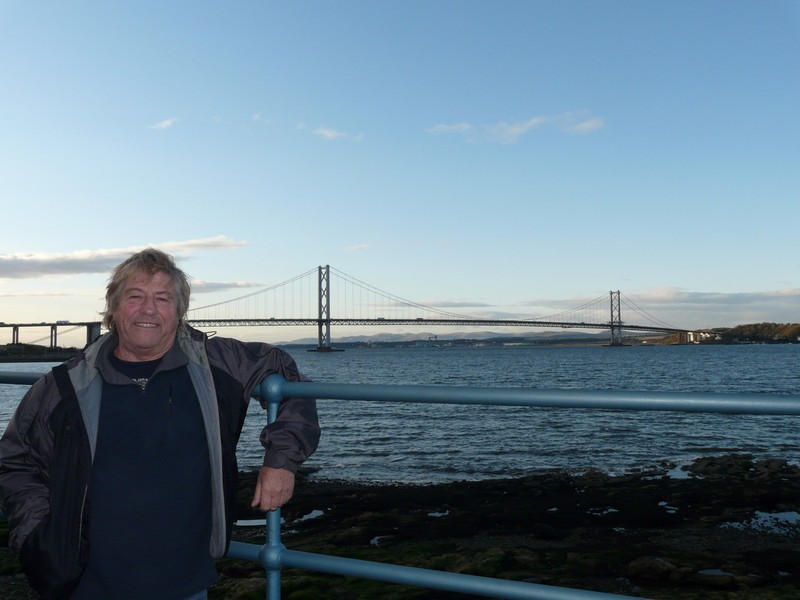
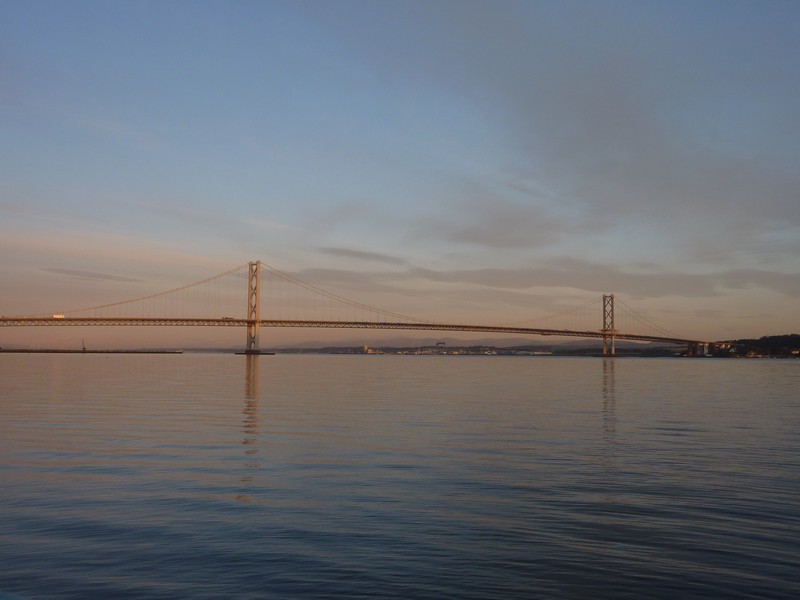
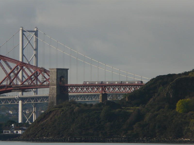
Afterwards we drove back through the lovely main street of Queensferry, which was almost devoid of traffic at this time of day, before driving over the bridge. This was really magnificent with the bright blue sky. We discovered that the bridge no longer had a toll!
At North Queensferry we drove to a ‘bridges viewpoint’, but this was just a car park by large Queensferry Hotel, with no views at all. Down under the bridge though, we did come to an excellent viewpoint. North Queensferry was attractive, just spoilt by a few ‘modern’ buildings.
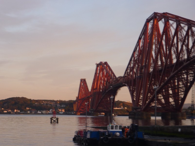
The Forth Bridges in the early morning
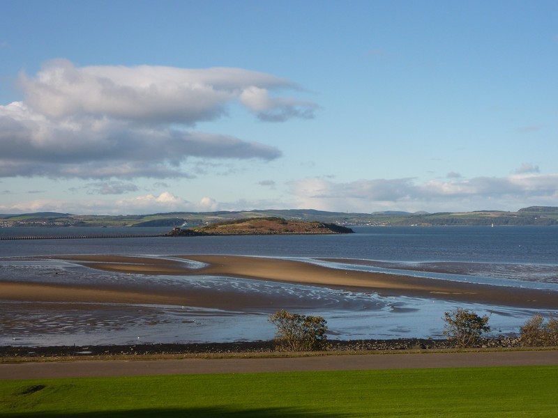
Next was Inverkeithing, which was busy and had some nice buildings. Just past here we drove down to St David’s Harbour. A smart new development filled this former simple bay, but from the shore we did get a different view of the rail bridge.
We drove though Dalgety Bay, which consisted of a great many ordinary houses to Aberdour, coming down to the shore at what was called Black Sands. This was a real top spot! There was no wind, so we sat on a seat, enjoying the view across the Firth in the sunshine. We could see across to Edinburgh Castle, and to many of the islands of the Firth. We walked onto the sandy beach of the cove - there were rocks covered in barnacles and limpets, and gulls and oystercatchers on the shore.
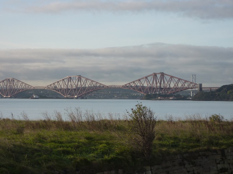
The Forth Bridge from North Queensferry
As we walked back to the van a young girl of about ten was leaving the beach with her mum(?) The girl’s jeans were soaked! A dustcart had come down, but had expertly reversed through the narrow gap which we’d left in the road.
We got an internet connection, and got hold of Angus, arranging to meet him and Sandra at their house in Dollar tomorrow afternoon.
We stopped at another good viewpoint on our way to the grey town of Burntisland where there was a nice main street, with just a few unattractive buildings. There was a lovely sandy bay, where we saw oystercatchers again. A good children’s play area occupied the corner of the large green by the shore.
Aberdour -a top spot!
Next we came down to Pettycur. We had lunch here beside the lovely old harbour – shame about the huge holiday/static park up behind. We saw a lot of birds here – gulls, oystercatchers, cormorants and – a delightful group of eider ducks, the males white and black, and the females looking like mallards.
Kirkcaldy was a large town, formerly known for its coal industry and linoleum production. We stopped by the sandy beach, but it seemed fitting here that the birds were just gulls, crows and starlings!
West Wemyss was a mixture of ‘mistakes’ and attractive old terraced houses, with a clock tower jutting out from one. The beach here, and at the former coalmining town of East Wemyss was of reinforcement rocks. The lovely day had deteriorated, and it was now raining.
Buckhaven and Methil merged into each other, and seemed as dreary as the weather had now become! There was a green by the shore, and then a sandy beach along to Largo. Golf courses surrounded this area, but we managed to find our way down to Largo’s nice harbour, which had a stream flowing down into it, and a grand railway viaduct up behind.
Earlesferry and Elie both had nice terraced houses, many of them prettily painted, as well as larger houses. We stopped by Elie harbour - the sand here was a bright tan colour.
Edinburgh Castle from Burntiland
Forth Bridge from Burntiland
We drove through St Monance which had really attractive twin harbours and neatly painted houses.
The tan coloured sand at Elie
Next came the delightful working fishing harbour of Pittenweem, with nice cottages again. We stopped for the night by the front, as a wet evening set in.
We had an internet connection and phoned Emma before reading through the diary of this trip
St Monance
Pittenweem Harbour
Friday 21st October To the Tay Bridge 102 miles
There was rain in the night, followed by a grey day. We enjoyed our last waterside breakfast, with views to Bass Island and Berwick Law to the south. We watched fishing boats leaving and arriving, and as we drove off, saw the lorries loading up with the boxes of fish.
We drove first through Anstruther, both Wester and then Easter, where the harbour was full of pleasure craft in this former herring fishing port. There is a fishing museum here. I walked on the tan coloured sand, looking across to May Island 6 miles off shore. We came to the small harbour of Cellardyke where a new estate of ‘toy houses’ was being built.
At Crail there was no vehicular access to the harbour. We walked along by the castle walls to view the harbour way below. There was a pleasant wide main street with nice houses. The town had a Robin Hood’s Bay feel, with its steepness and pretty cottages with red tiled roofs.
Overnighter at Pittenween
We looked back at the town again from Roome Bay. We were now at the end of the Firth of Forth.
We drove down to the point at Fife Ness, where the whole area was a golf course, with a small sandy cove beneath.
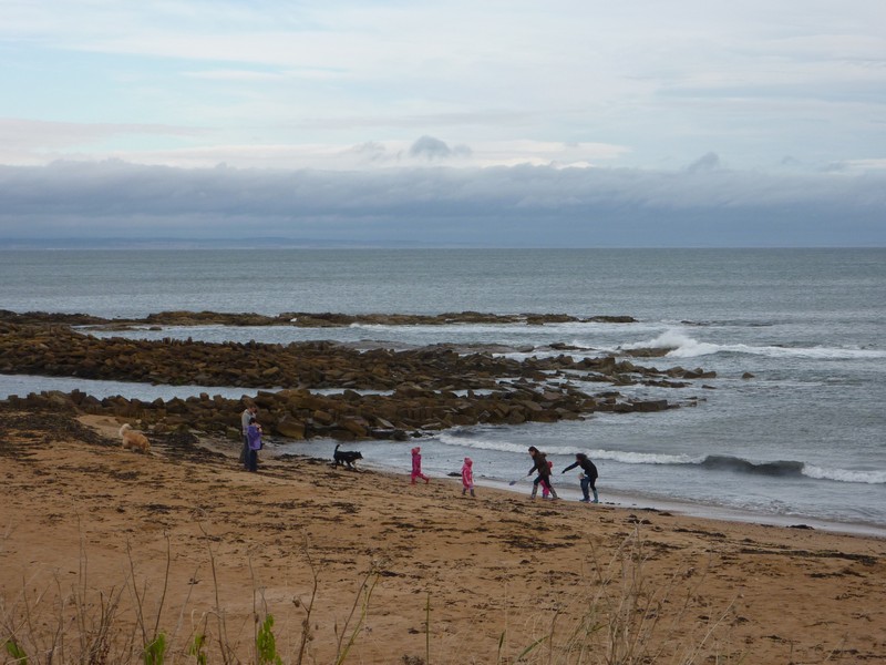
We drove along to Kingsbarns, coming down past another golf course to Cambo Sands where we walked on the beach of ‘builders sand’ splattered with seaweed. We watched birds diving, which we thought were shearwaters, as well as seeing cormorants. Lots of people were arriving by the time we left, including a family with 3 little girls dressed in pink.
Crail
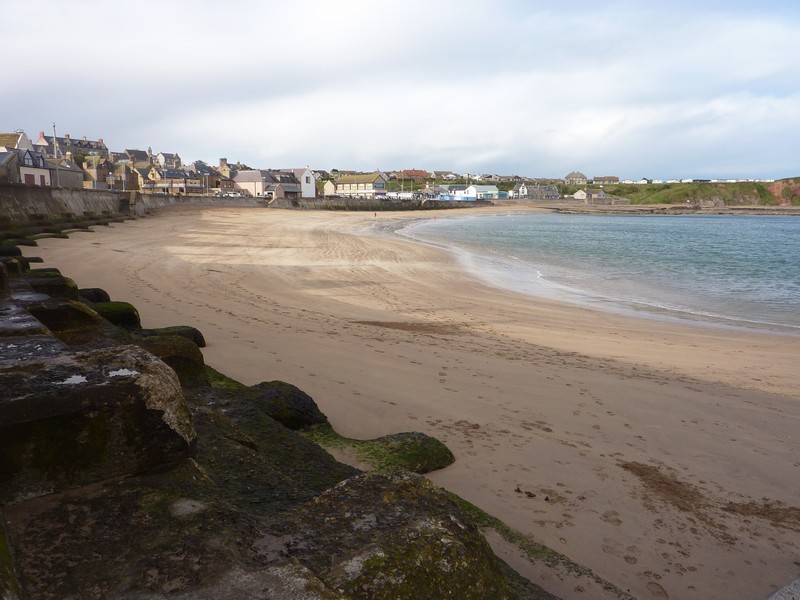
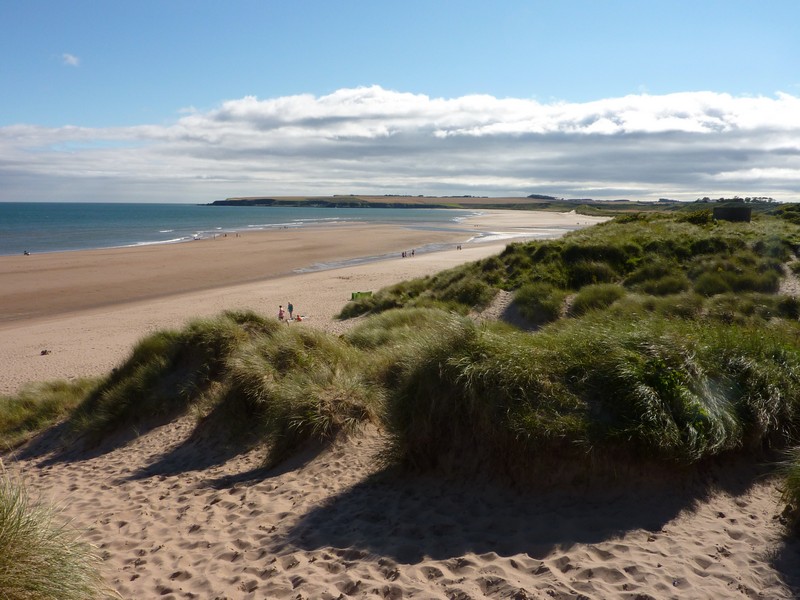
Next came the grand old town of St Andrews with its plethora of nice buildings, its church ruins and castle walls. We couldn’t enjoy it properly, as the central part of the town was closed with roadworks, so driving was chaotic and very difficult as everywhere was so busy. We did manage to find our way through to view the long sandy beach.
Golden Cambo beach
We drove on through the ugly RAF town of Leuchars, remembering Louise and David living here when David was stationed at Leuchars. The grand medieval church made a big contrast!
We drove on to Tayport, which had been the ferry port across the River Tay before the railway had been built. There was a nice main street. The harbour is now filled with pleasure craft. We looked across to Broughty Ferry, on the northern side of the Tay.
The beach at St Andrews
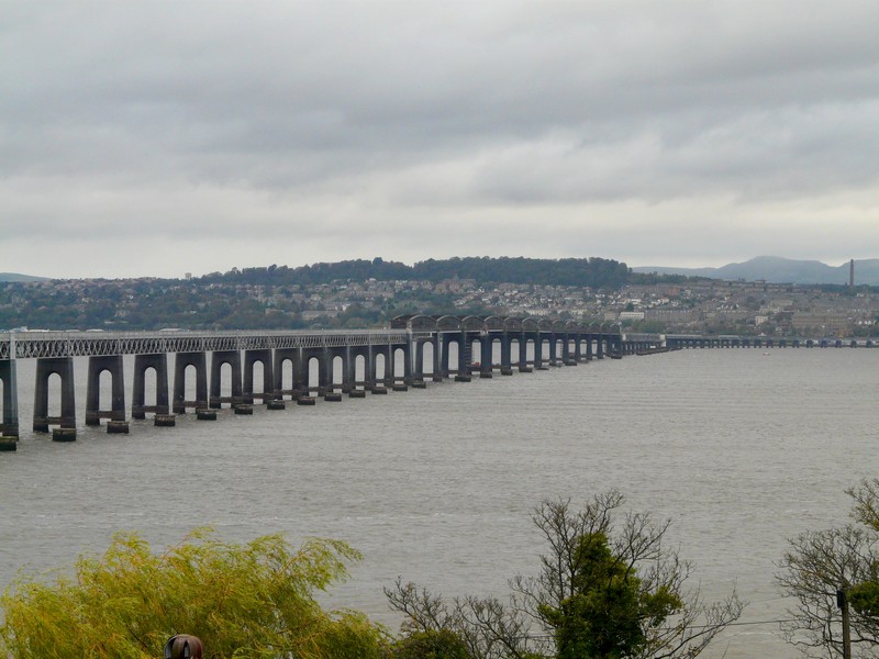
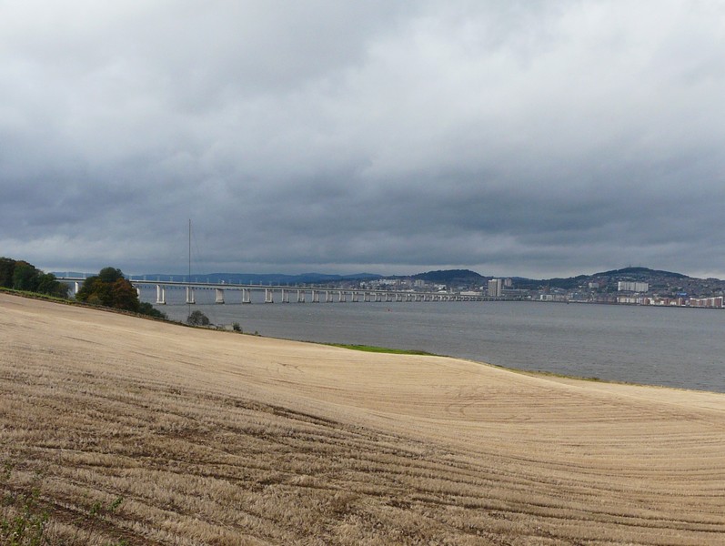
A bit further along, we passed the Tay Road Bridge, which had been opened in 1966. There were views across the Tay to the sprawling city of Dundee. We pulled into a newly made layby, where it was difficult to find a good place to take a photo.
Tayport
At Newport on Tay we got our first glimpse of the Tay railway bridge, built in 1887. Eight years later there was the infamous Tay bridge disaster, when the bridge became unstable during a violent storm. The train had plummeted into the river below, with all 88 passengers and crew losing their lives. This disaster has become a family ‘legend’, so it seemed a good place to end this part of our ‘RoAd ARound Britain.
Looking across to the Tay road bridge
The Tay Rail Bridge

Friday 7th September 2012 Back to ROAD ARound Britain 64 miles
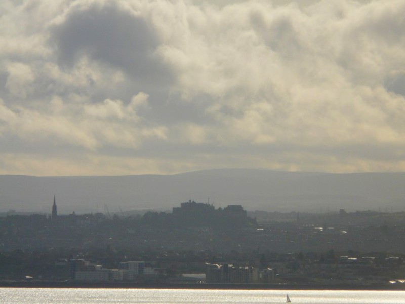
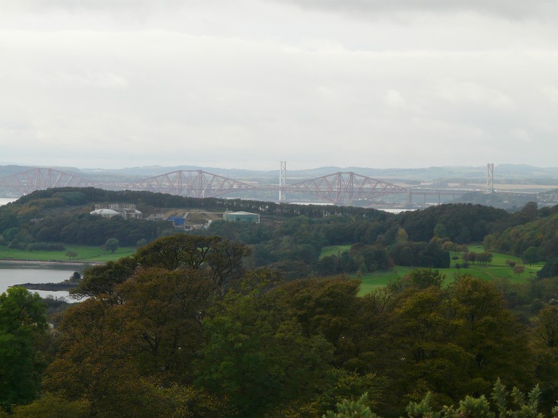
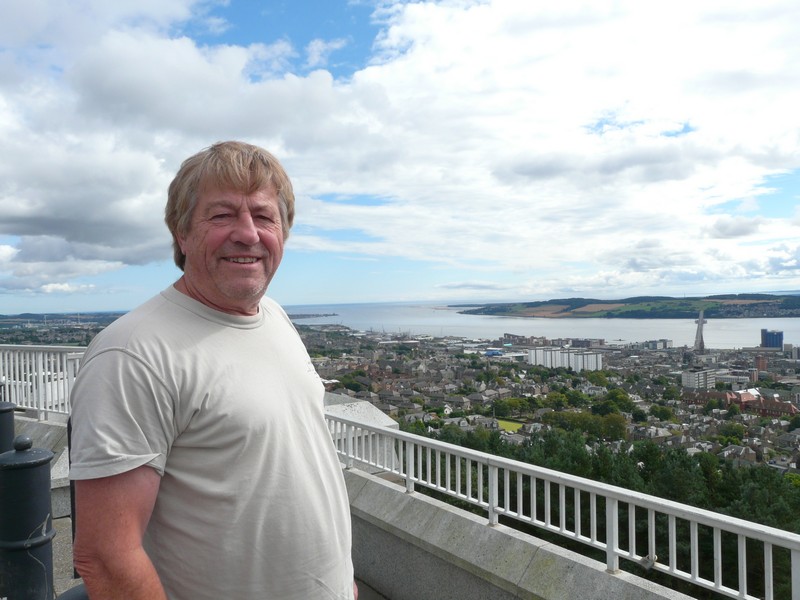
Now we headed for Dundee, which had a lot of dour buildings. We drove up Dundee Law (571ft), which gave us wonderful views down over the Tay estuary and the town. We could also see the Tay bridges (road and rail), and the land south of the river, which we had explored last year. We had lunch here, parked beside the large war memorial.
On this trip we now returned home Via John & Lois's to Hermitage
This is now a year later and the start of our Scottish trip of 49 days (all free camping)
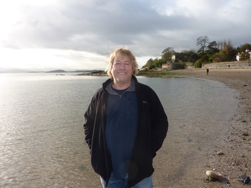
Rosie at the Forth Bridge 2011
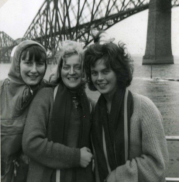
'Pykey', Rosie & Angela by the Forth Bridge 1962
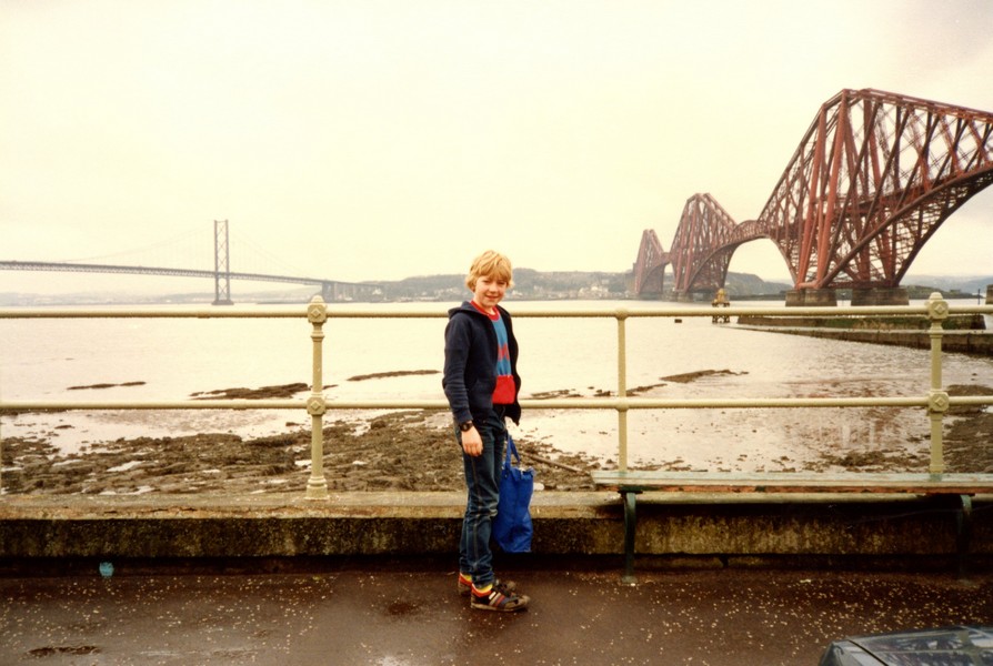
Son Simon by the Forth Bridge 1985
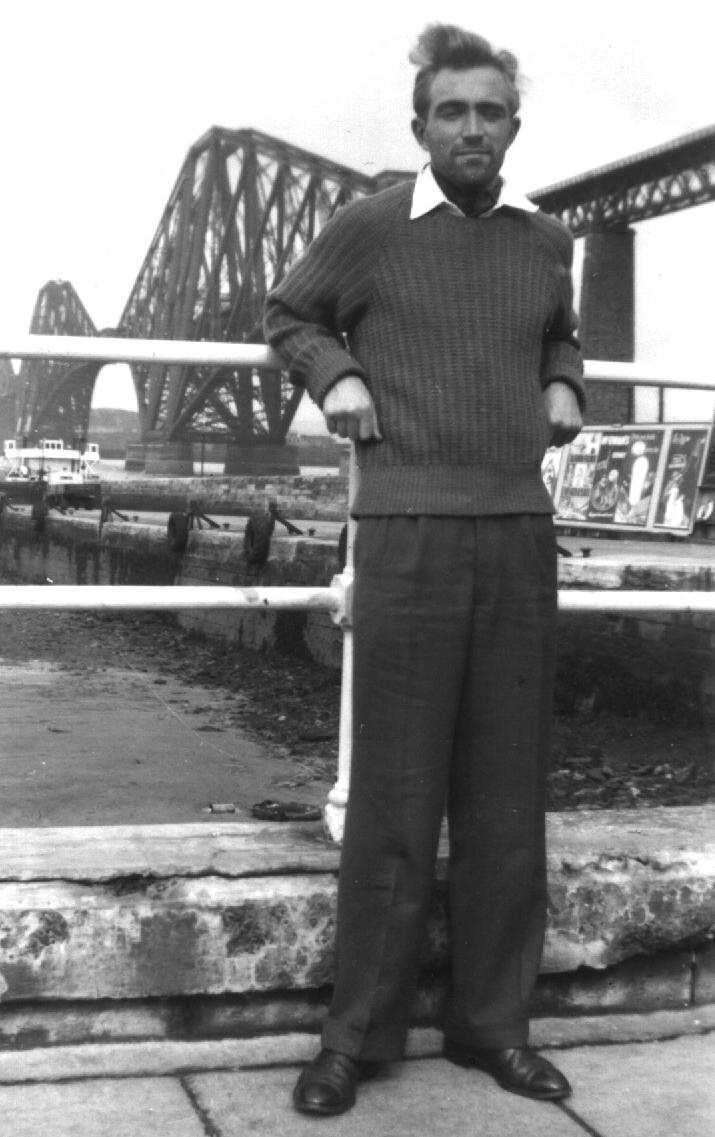
Rosie's brother Norman by the Forth Bridge 1959
Everybody's been to the Forth Bridge
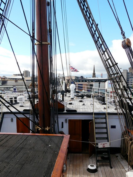
We then headed back down to the waterfront, where we had an excellent visit to the Discovery Museum, which included RRS Discovery, the boat built here, and used by Captain Scott for his Antarctic Expedition of 1901. It was good to further our interest in Antarctic exploration.
By the time we’d been into nearby Tesco’s for a few food items and for diesel it was 5 o’clock.
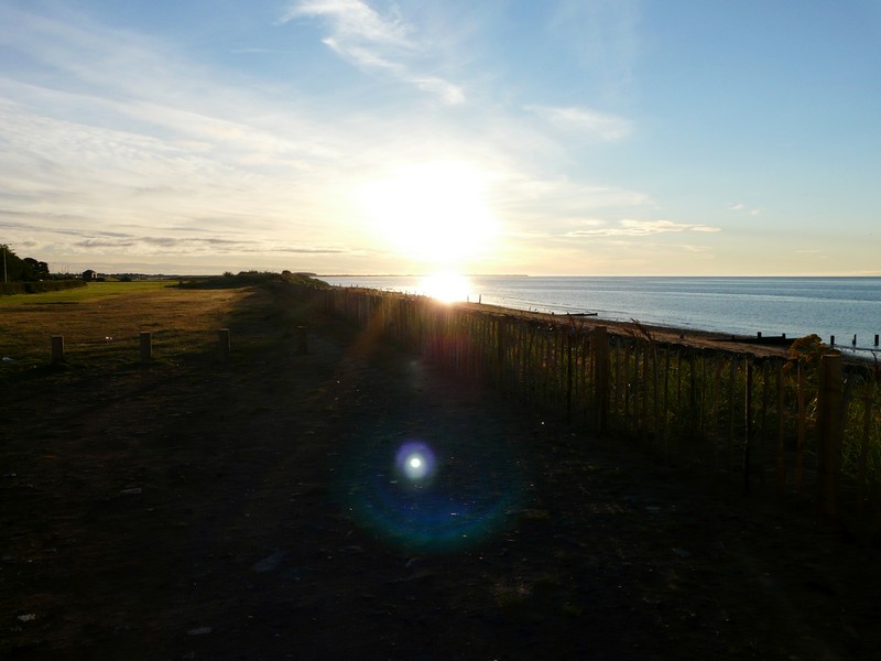
We drove out of Dundee, and on to Broughty Ferry, parking by the sandy beach and having a ‘quick blow’ to start this part of our ROAD ARound Britain, looking across to the south of the river, where we’d ended our RAB last year.
Very soon afterwards we pulled into a carpark above the sandy beach
Saturday 8th September Arbroath and Montrose 50 miles
We woke at 7.00am to a beautiful morning, and blue sky which stayed all day.
We left at 9.20, driving through Monifieth and Carnoustie, which both had amazing floral displays. We couldn’t access the beach at Carnoustie, as the bridge under the railway was too low for the van.
We drove on to East Haven, where we parked and walked under the 6’ 6” railway bridge to a sandy beach with rocks. A nice blue tractor was pulling a matching coloured boat out of the water. The small fishing village of plain houses was right at the end of the Tay Estuary.
I cooked venison burgers for supper, bought at Tebay Services.
We refreshed our memories of our RAB in this area last year
We drove on to the town of Arbroath and parked by the harbour. There were only one or two small fishing boats in the harbour, the rest were pleasure craft. After sitting on a bench overlooking the harbour, we walked around the harbour beside the pleasant houses, some painted. We were disconcerted to see that some luxury apartments are going to be built by the harbour.
We had read of Arbroath being renowned for its ‘smokies’ – traditionally smoked haddock, and had wondered if they still did them. We came to a narrow alley, with a sign advertising smokies, and past a lovely little garden full of flowers we came to ‘Spinks’. A dear gentleman in cloth cap told us that he had smoked the haddock himself. He came from a family of fishermen, and had been interviewed by Rick Stein a few years ago. We bought a pair of smokies, and after a chat, Adrian took a photo of me with ‘Mr Spink’ (we read later that this is a local name)
We walked on now to the Signal Tower – a lighthouse, which contains an excellent modern free museum about Arbroath’s fishing and history, and also about the Inch Cape Rock, which is 12 miles off shore. The Inch Cape lighthouse had been built by Robert Stephenson, grandfather of R.L. Stephenson. Prior to that numerous ships had been lost on the treacherous rocks.
We drove on a short way and parked by ‘Victoria Park’ – a nice green area beside the sea, constructed for Queen Victoria’s Diamond Jubilee. We sat on a bench, and could see the Inch Cape lighthouse through binoculars.
The countryside around here was all agricultural. There were large plastic greenhouses, open to the air, and appearing to house strawberries. Also there were fields of netted vegetables which looked like yellow flowering cabbage. There was a lot of wheat being grown too, and the tractors and combined harvesters were being busy.
We followed small roads to the tiny village of Auchmithie, where we walked down a gravel track to view the small harbour far below. This had been an important fishing place in the past. Today it was busy with people enjoying the beach.
North of here we came to Lunan Bay - a beautiful bay of fine sand. The beach car park was teeming with cars, but there was room for us. We walked up over the dunes to join the other people scattered on this fine bit of sand to laze away a bit of the amazingly warm and sunny afternoon.
We took small roads to Boddin Head, at the north of the bay, but there was nowhere to pull in here. A tractor driver told us that we could drive right on to the end of the road, but all we could do here was turn round in a farm parking area.
North of here we tried the interestingly named Mains of Usan, and actually stopped by some farm buildings, with a view to the lighthouse south of Montrose.
Then it was across the bridge of the South Esk River to Montrose itself. We found a carpark above the long sandy beach and watched two kids having fun in the sea. We could see the lighthouse on the headland south of us. A couple in the car parked next to us showed interest in our motorhome.
We had been hoping to overnight in a car park by the St Cyrus nature reserve just north of here, but when we reached it, we found the car park packed, and with a height barrier, so weren’t able to stop.
We now had to think what to do, and decided to take a road inland, hoping to find somewhere to stop. Things were not looking good, as it was all farming country, but at 5.20 we unexpectedly came to a parking area with picnic tables! It was too windy to sit out, but at least it was somewhere to stop! Picnic Site, Hill of Garvock
It was 7 o’clock when we moved to our final position, as a car was parked just where we wanted to go. We then ate our Smokies for supper.
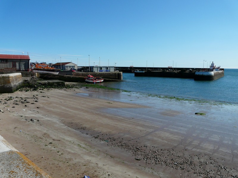
Sunday 9th September Stonehaven revisited 54 miles
We left at 9 o’clock on a fine morning and drove back by a different route to St Cyrus reserve. We were able to park by the visitors centre – the old lifeboat station – for our walk through the reserve. We mostly followed the Tyrie Trail, but diverted to walk along the fine sandy beach. We then had to cross the dunes to return to the trail, at the foot of the high cliffs where apparently peregrines and fulmars nest. The reserve is home to a myriad of wild flowers, including harebells, geraniums and bellflowers. It is also a haven for birds, which we heard rather than saw.
When we got back, we headed northwards. We drove through the village of St Cyrus, and next drove down a small road to ‘Seagreens’, where Adrian’s GPS erroneously showed him that we could travel on to Johnshaven.
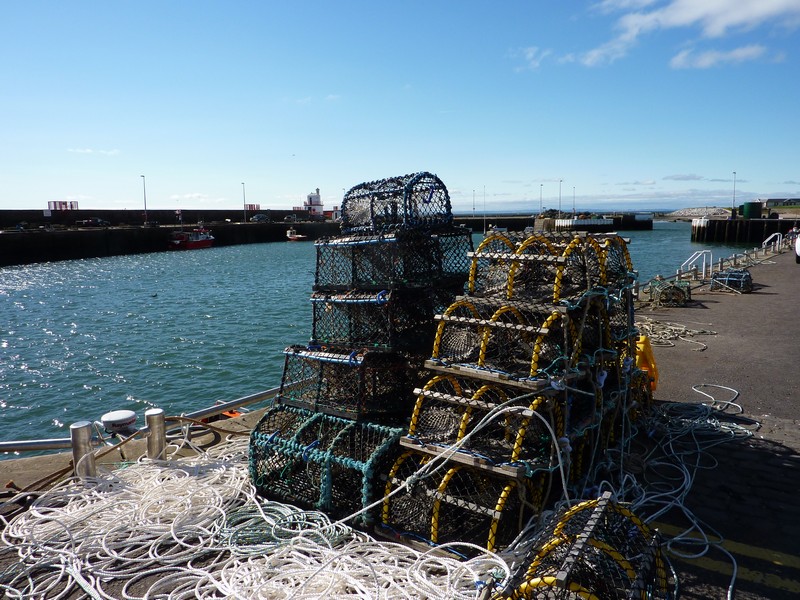
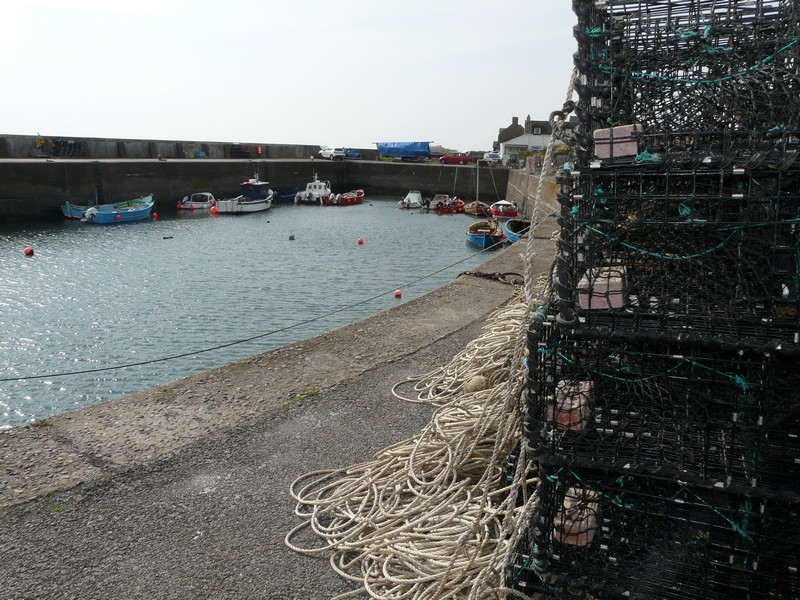
We travelled back to the main road, and then down to the lovely working fishing village of Johnshaven. In the past, they fished for lobsters and crabs here, and judging by the new delivery of modern lobster cages, and the stacks of fish boxes, they still do.
We walked around by the harbour, with its variety of small houses. There was a well looked after floral display in a little boat. It was just a shame about the cool wind.
We drove on to the fishing village Gourdan, nestled between the cliffs and the sea. The houses were of dark stone. We drove along to the end of the road, and ate our lunch sitting on large rocks, with the rocky beach beyond the grass. There were lots of birds on the water.
The nearby town of Inverberbie had similar dark houses, but the car park by the beach was busy, so we didn’t stop. You could walk along the shore from here to Gourdan.
Next came Catterline, which both Jon & Lois had spoken so highly of. We followed a very steep road beside the little stream to a tiny harbour with a small car park. Unfortunately, being Sunday, it was very busy, particularly as the scuba divers were here, so we weren’t able to stop.
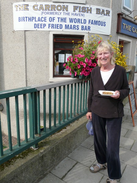
Now we headed for Stonehaven – a town I hadn’t heard of until a week ago, when Renee mentioned that we had come here from Aberdeen during the war (1944), when we had come for a holiday as Dad was stationed at nearby Dyce. Then a couple of days later, we had heard on the radio that ‘deep fried mars bars’ had originated here. There had been some dispute, as Mars didn’t want its name to be used for this apparently unhealthy snack. Someone had phoned into the programme, and had said that he was working in the fish & chip shop in Stonehaven 22 years ago when they had unwittingly ‘discovered’ the deep fried Mars bar.
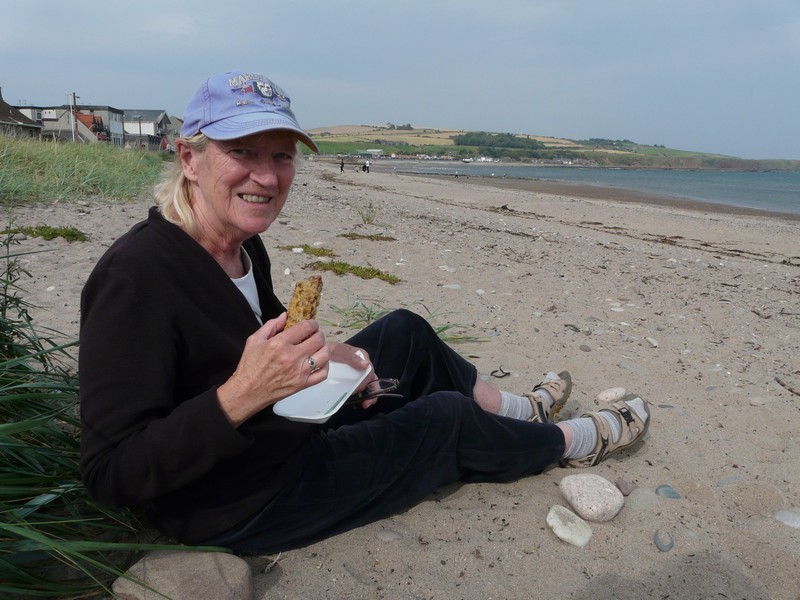
I had thought that it would be fun to buy a mars bar from the original shop, if we saw it, and as we drove through the town of Stonehaven, there it was ‘Carrons – home of the deep fried Mars bar’. We managed to park in a nearby street, and make our way to the shop. We were politely served with our freshly cooked Mars bar, and walked on to the nearby coarse sandy beach to eat it! Mission accomplished!
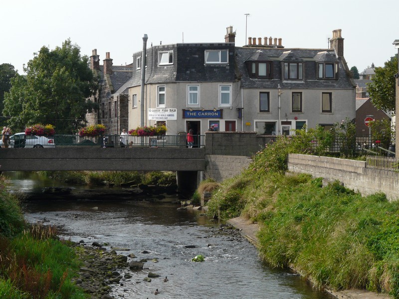
We had a little walk around. Renee had said that I had fallen in the water here, and that she had got cut off by the tide. The Carron Water runs to the sea, passing right beside the fish and chip shop. At the northern end of Stonehaven, Cowie Water reaches the sea. We proceeded there, and had a quick blow along the beach, but the huge stone steps down left something to be desired! The wind was now quite fresh, we warmed with a cup of tea.
It was good to have visited Stonehaven – a very ‘low-key’, no frills resort. Gardens with tubs of flowers brightened its otherwise sombre appearance.
We now had no alternative but to take the fast A90 northwards – quite busy on this Sunday late afternoon. We turned off to visit Muchallls, a village of small houses close to the sea. We were able to park beside the road, in the only available spot, and had a pleasant little walk around, but found no access to the beach, and none of the interesting things mentioned in our 1970s coast book!
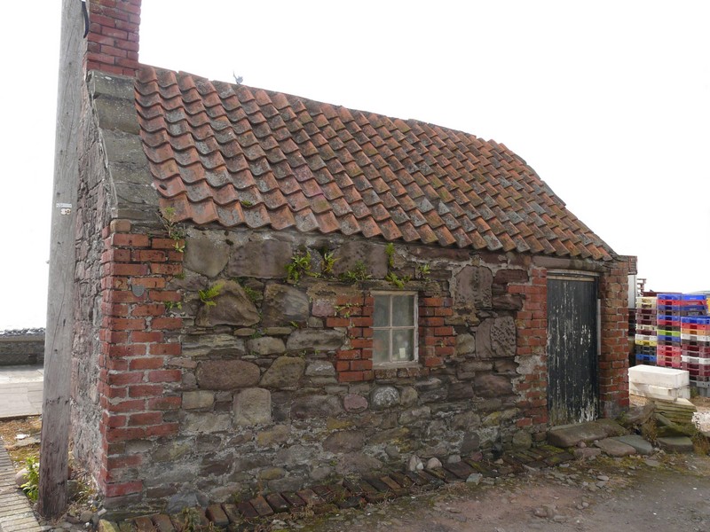
Aware that we needed to find somewhere for the night, we made one last visit – to Newtonhill, a once simple cliff-top village, now expanded to be a dormitory town for Aberdeen. From the end of the road, we had a view down to a little fishing cove with fishing boats and 3 old fishermens huts.
We now took a road cross country inland to a forested area west of Aberdeen, where we stopped at Forestry Commission car park Foggieton Woods just after 5.30.
We phoned Tom to wish him a happy birthday.
Monday 10th September Aberdeen after all these years! 81 miles
We started the day with a walk through the woods of ancient and newly planted trees after breakfast. As always, it is the doggy walkers who use these recreation areas.
We drove into the outskirts of Aberdeen in order to cross the Bridge of Dee and then drove south on the main road, turning off to continue our ‘RAB’. We turned off first to the village of Porthlethen. The first road we took ended at a garden garage on top of the cliffs, and the next at a cul-de-sac high above the rocky coastline. Both necessitated difficult reversing manoeuvres for Adrian, so we moved on!
The sea had looked like a dark grey wall, reflecting the bank of cloud in the sky, which was bright just above the horizon. As yesterday, we saw lots of dark orange montbretia everywhere.
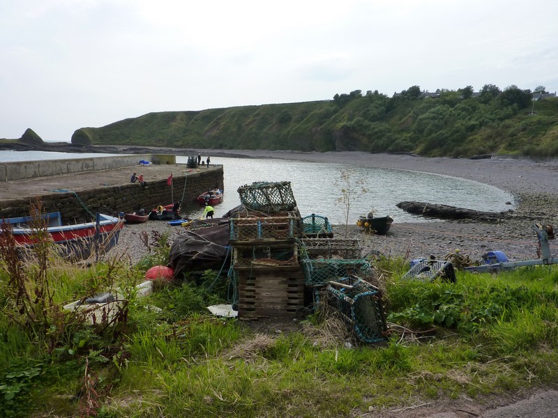
Findon consisted of sombre houses, we didn’t stop. Cove Bay was an unexpected delight, especially being so close to Aberdeen. We drove down a long steep road to a tiny natural harbour, where a few little boats were pulled onto the beach in front of a collection of lobster pots. We walked along the concrete quay to view the lovely wild coastline.
A friendly young woman with her little toddler son passed us. Back in the van, it began to rain. The day continued grey, with occasional rain.
We followed the small coastal road into Aberdeen, finding it surprisingly rural, with undeveloped land between the road (and railway) and the shore.
Now we came to the large and sombre city of Aberdeen – the Granite City. The dismal day added to its grey image. There were floral displays, but even these were in dark purple and red.
We had a short ‘tour’ of the centre of Aberdeen with its fine buildings, passing the vast dock area where everything was geared to oil rigs. We thought of Janet and Margaret when we passed the ferry terminal from Lerwick. We thought too of our neighbour Rosemarie, who had lived here for some years as a child, and of Renee, who had memories of coming here when we had a ‘holiday’ in 1944, when dad was stationed at Dyce.
We drove through the area called Footdee, and parked above the long sandy beach. We walked down onto the beach (which we almost certainly couldn’t have done during the war), where there were oyster catchers and plovers. It felt quite emotive, as I always knew that I had come here as a baby (18 months), and had wanted to return.
I had wanted to have fish and chips (mum’s favourite) for lunch, but amazingly we hadn’t seen any fish and chip shops, and Adrian’s sat-nav didn’t come up with any nearby. We continued along by the coast, coming to Bridge of Don in the north, but no luck here either. We made a short tour of so-called ‘Old Aberdeen’, by the university, then headed towards Dyce, stopping in a precinct by Asda on the way. Here we were able to buy our fish & chip lunch from a shop which was geared to serve the local school kids with their burger & chips!
Afterwards we had a short shop in Asda, and got some diesel before heading for Dyce, now in the rain.
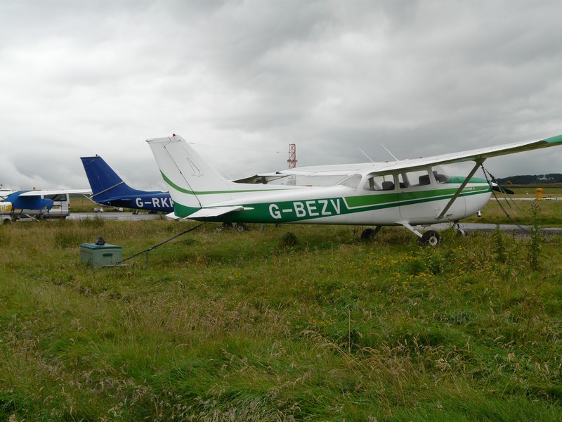
We were able to stop near some small aircraft by the airfield (now Aberdeen Airport), and imagine dad getting a ride on a plane from here at the start of his journey south on the day that I was born. We took a photo to remember
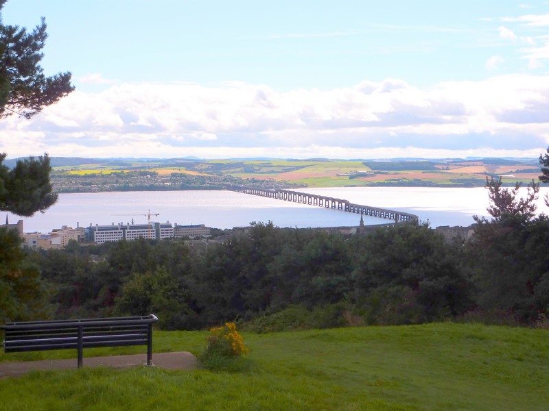
Looking down on the Tay River and railway bridge
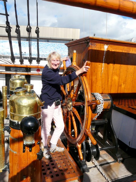
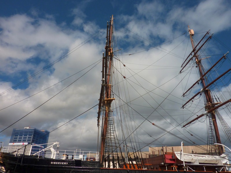
We visit Scott's 'Discovery' in Dundee
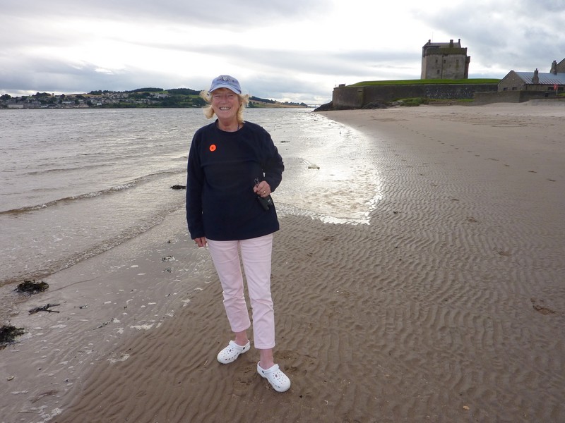
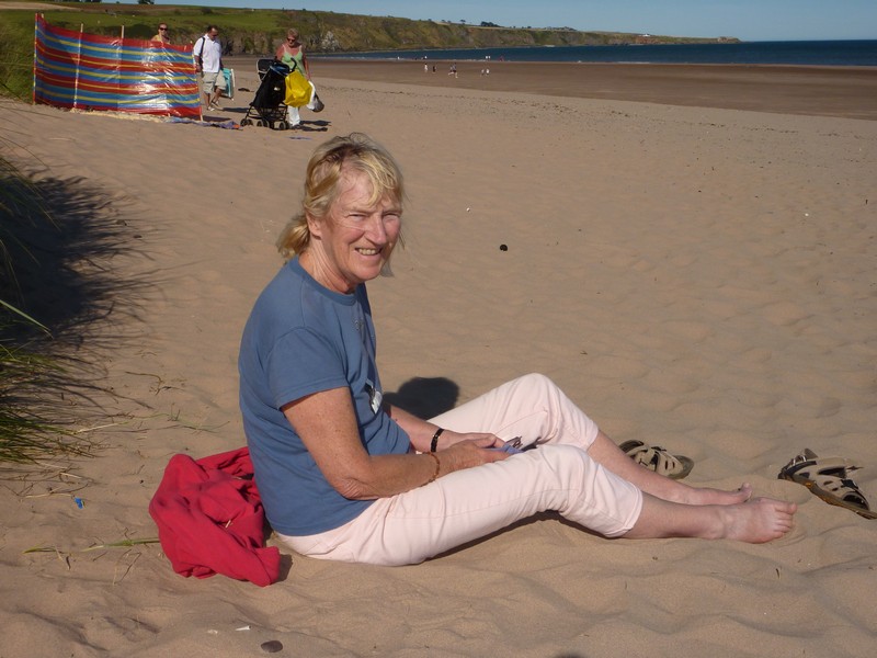
Rosie on the beach at Broughty Ferry
Sunrise at Broughty Ferry


Fishermen at East Haven
Arbroath - the harbour and Rosie with 'Mr Spink'
Signal Tower Lighthouse and Arbroath Harbour
Rosie at Auchmithie
Lunan Bay
Adrian at Montrose
St Cyrus Nature Reserve
Attractive Johnshaven
Catterline
Deep Fried Mars Bar, and the shop it came from, and the stream that I fell into
Stonehaven from the other end
Newtonhill
This day will be continued in the section of Road Around Britain Aberdeen to John O'Groats
The next section is Shetland Islands


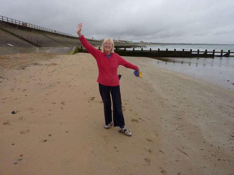
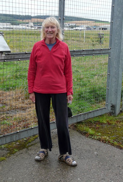
Rosie at Aberdeen (Dyce) Airport waiting for a lift to Hillingdon, like her Dad did
Rosie on the beach at Aberdeen celebrating after 68 years
Cove Bay

