
Friday 14th October 2011 To the east coast, and a bit more family history on the way 82 miles
On this trip we had travelled up the west coast from Liverpool -Stranraer and then this diary starts as we cross England to continue up the North Northumberland coast, which we had not been able to do in 2010 because I was unwell. I had now been on chemo for 6 months. We left Gilsland, Northumberland at 9 o’clock and continued travelling east, following the scenic route of Hadrian’s Wall, and occasionally glimpsing remains of it and passing one or two walkers. We drove past the places called Twice Brewed and Once Brewed! We stopped briefly at Housteads Fort, but it was too early to be open.As we neared Newcastle, Adrian remembered that my great grandmother Alice Cape had lived at nearby Newburn. We were very close to there, and quite easily found the house that she had lived in, arriving in 1900 when she was 56. She was with her husband John Hancock, and 3 of her children – Reginald, Alice and Edward. It was a terraced brick house in a steep road, and although, like most of the houses, the windows had been changed, it hadn’t been covered in pebbledash or false stone blocks, like some of the others. Newburn still remains a village, and the street looked over the fields around the River Tyne, even if they now contain industrial buildings and electricity pylons.

North Northumberland Coast
We now drove around Newcastle, to Seaton Sluice, to the north, to continue our Road Around Britain of the Northumberland coast – the only part of England left to do. We’d had to abandon it last year when I became unwell.Just before Seaton Sluice we passed the National Trust property, recently acquired, of Seaton Delaval. We decided to make a brief visit. The hall had been destroyed by fire in 1822, and the National Trust was trying to restore it. The actual hall is only open for a ‘scaffolding tour’ (extra fee) to see what is being done. We didn’t want that, but were able to see a few rooms in the west wing, and to peep in at the scaffolding. We liked the huge, stark stone stables, and wandered around the formal gardens. Afterwards we ate lunch in the van in the car park, which is in the former large walled garden.
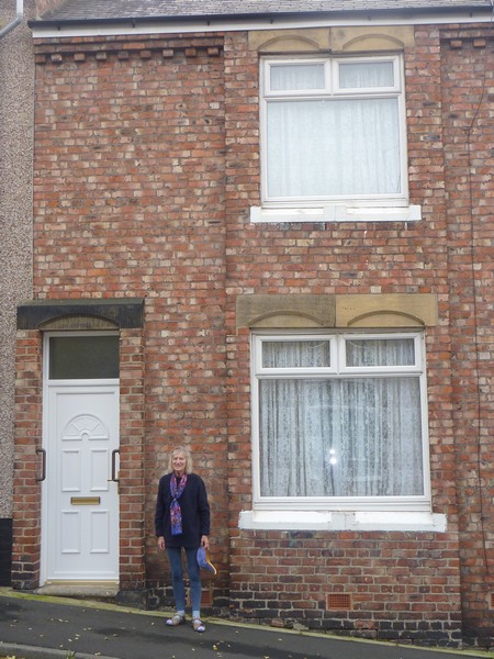
Rosie outside great grandmother Alice Cape's house, Newburn
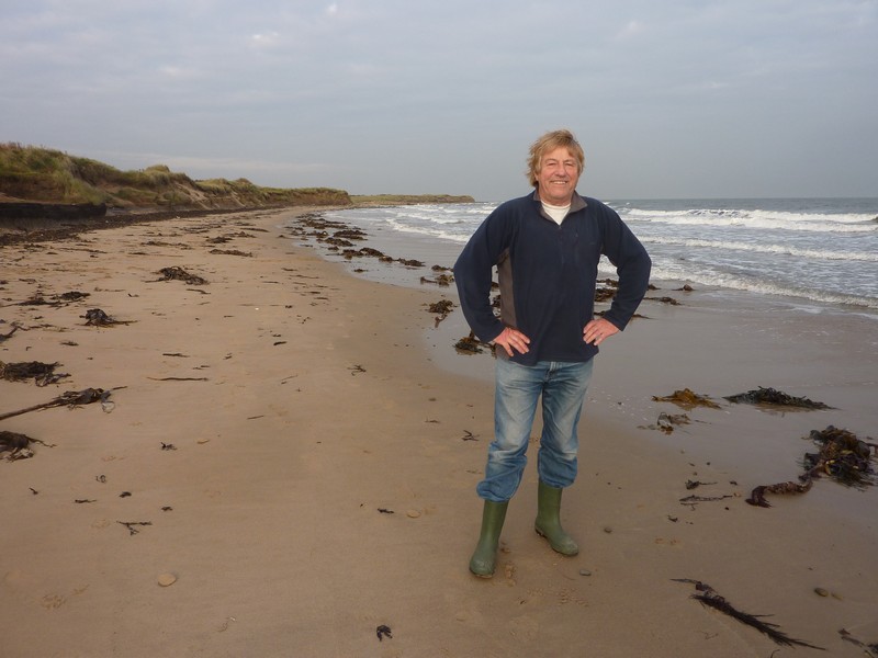
We left soon after 2 o’clock, and made for the coast, walking onto the long and windy sandy beach between Seaton Sluice and Blyth to start this section of our RAB.
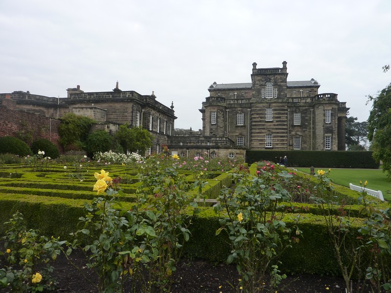
Seaton Delaval
Blyth seemed pleasant and smart, despite still being a port. At Newbiggin it was difficult to get to the beach, as houses fringed the front. We stopped in a car park at the north of the town, walking down onto the crescent shaped sandy beach. A prom ran along beside the beach and a tall-spired church overlooked the bay – more inspiring than the adjacent static caravan park!
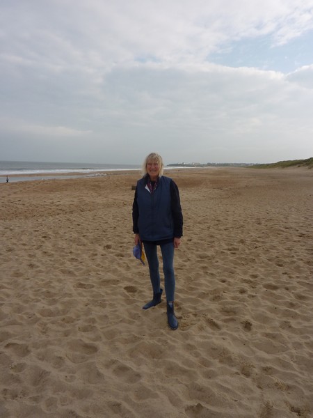
Rosie on the fine sandy beach near Blyth
We drove on past Lynemouth, with its dominating power station to Creswell, where we parked above another fine sandy beach. We had just passed temporary traffic lights and lots of large vehicles, where a film shoot was taking place. Just north of here, at Druridge Bay, we pulled in by a lovely beach of pebbles and sand. It was 4.40, but not wanting to repeat the difficulties of the last two nights, we decided to stay for the night. After walking onto the beach, the man from the other camper parked here came to ask if we were staying, as they were new to wild camping, and were still a bit unsure about it. They seemed very pleasant, apart from having three dogs!
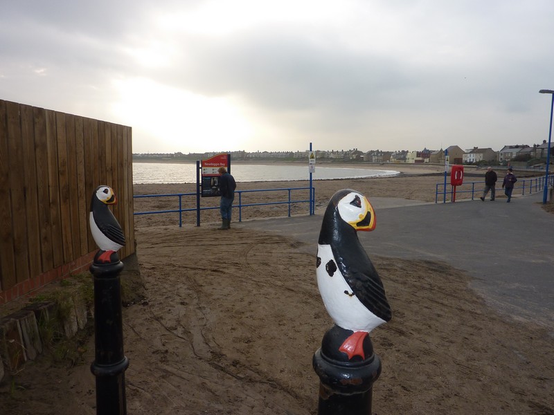
Model puffins, Newbiggin
I made a tasty soup for supper, then we listened to more of our Australian travels, including our idyllic spot at Stokes Inlet.
Seafront parking area on Druridge Bay
Adrian on the nice beach at Druridge Bay
Saturday 15th October Some very different gardens 30 miles
As we lay in bed, we watched the pink glow before the sun came up, and then the sun rising magically over the sea.
We left at 9 o’clock and stopped a bit further north at a beautiful spot at Hauxley with a sandy beach, and views of the coast to north and south, and also to tiny Coquet Island, with its lighthouse.
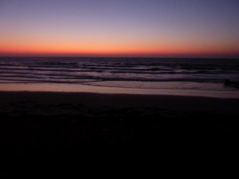
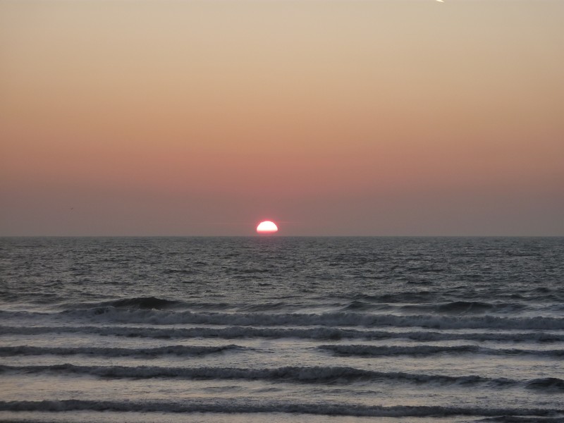
Magical sunrise at Druridge Bay
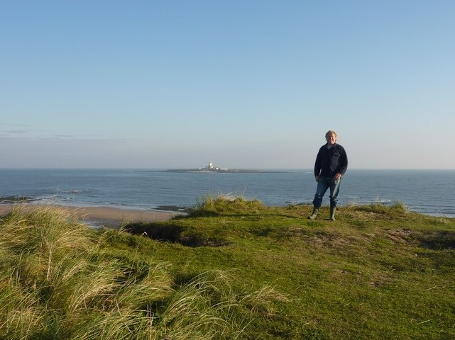
Adrian at Hauxley, with the lighthouse in the distance
We then drove inland a few miles to Alnwick. There was a low arch to drive through to the main street, but we were able to park in a nearby carpark, where it was free with a disabled badge. The way down to the main street was along a narrow alleyway with high walls, and then steep steps. Alnwick was a very attractive and busy town. We found the Tourist Information, and Adrian enquired about a folly, which he had been told his grandfather had helped to build here. He didn’t get any conclusive answers as to where it might be, but came away with one or two ideas. The Tourist Information was next to a small market, so we had a look around, sampling some cheese, and buying some fresh bap rolls.
Back at the car park, we got an internet connection, and spoke to Simon, Paul and Tom on the phone.
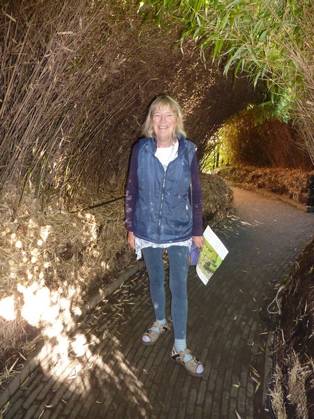
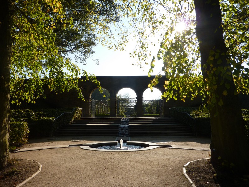
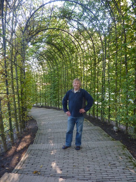
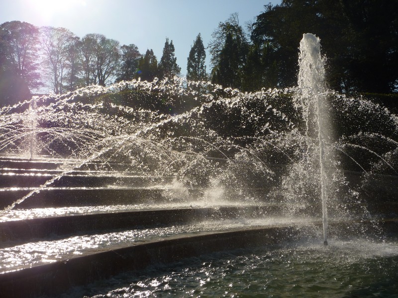
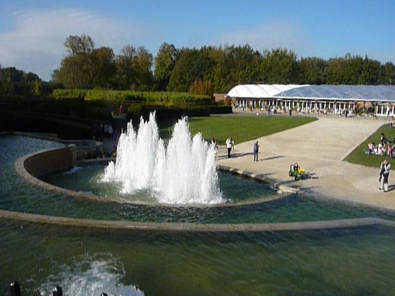
Now we made our way to Alnwick Gardens, which are adjacent to Alnwick Castle. The car parks seemed a long way away, but the disabled one was closer. The helpful attendant wasn’t sure about the size of our van, but we found a suitable spot, and had lunch before going into the gardens. These gardens, opened in 2002, are certainly different, and very innovative. Being a sunny Saturday, they were pretty busy, but all the children were really happy. The central area was occupied by a large water cascade, with fountains which ‘performed’ every half hour. Other features were the ‘serpent garden’ – an area divided by hedges, and with wonderful fountains hidden individually, each different from another; the bamboo labyrinth – a sort of maze through tunnels of bamboo; a peaceful and still flowering rose garden; a large, formal but attractive ornamental garden and a ‘poison garden’. This could only be visited with a guide, and we had a delightful young woman who hardly stopped for breath as she told us all about the plants. We hadn’t realised how poisonous oleanders were, so are quite relieved that our plant has died! The wonderful weather made our visit extra enjoyable; it was nearly 3 o’clock when we left.
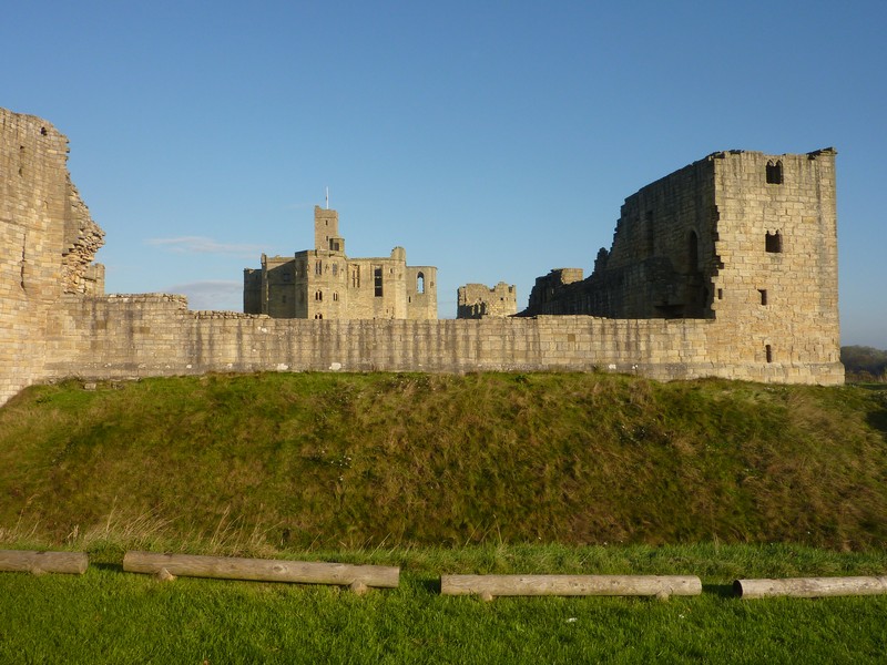
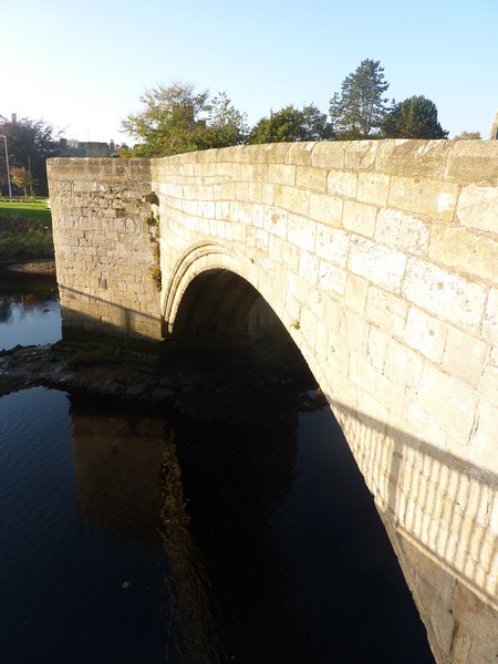
Warkworth castle and Old Bridge
At Warkworth the castle ruins looked good against the blue sky. The village had attractive old stone houses and a lovely old bridge.
We drove back to the coast at Alnmouth, but this was too busy for us, and too difficult to park. A little further north we came to a rough parking area above a sandy beach, just south of Boulmer. We pulled in next to another motorhome, but moved soon afterwards to a more suitable spot, as we intended staying for the night. We were most annoyed when the other motorhome moved in next to us, blocking off our view and sunlight! Its occupants were 4 young lads, playing loud music! When a parking spot appeared further along, we moved back! Adrian was delighted to find that we had an internet connection. We were able to speak to Emma (and Ruby) on the phone, which we’d been unable to do earlier. He also looked into the ‘folly building’ story – we had driven past a large castle-like structure near Alnwick (Ratcheugh Observatory), and tried to find out about it, but he discovered now that it had been built too early to be the one in question.
Earlier, before we had a walk on the beach ourselves, we had watched as two little toddler twins, dressed in all-in-one waterproofs, had sat in the edge of the waves, and played with the sand as mum & grandma watched!
Seafront carpark near Boulmer
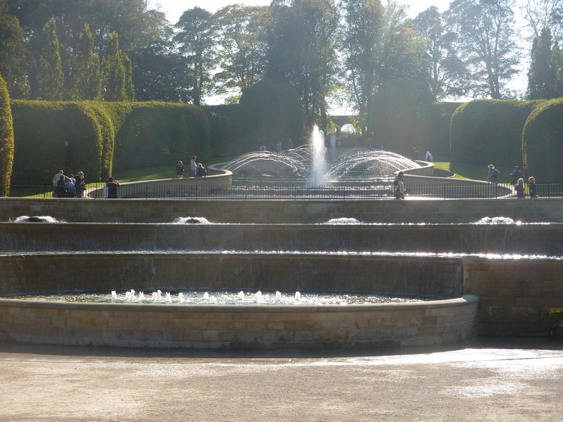
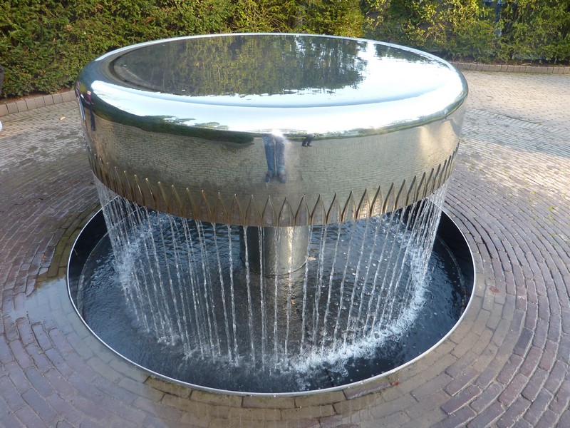
Amazing Alnwick Gardens
Sunday 16th October Lovely beaches on a beautiful day 53 miles
We were surprised and disappointed after such a lovely day and moon-filled evening sky, to hear it raining hard during the night. However, it was dry before we left at 10.00am, and we had a short walk on the beach.
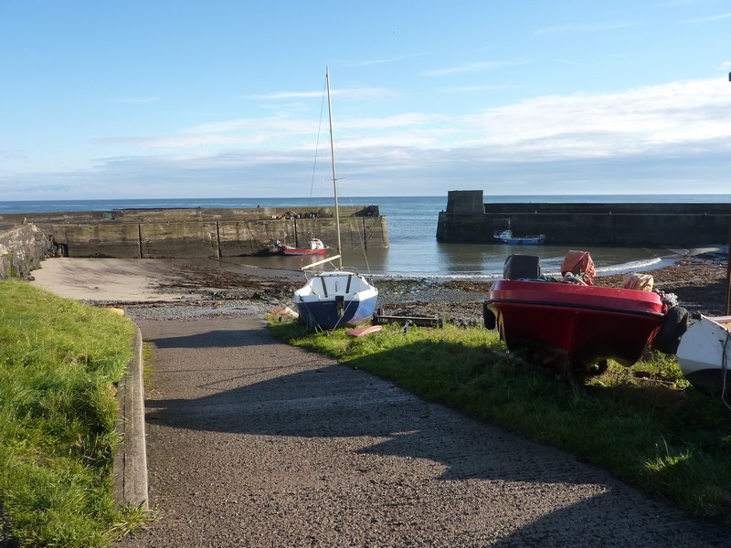
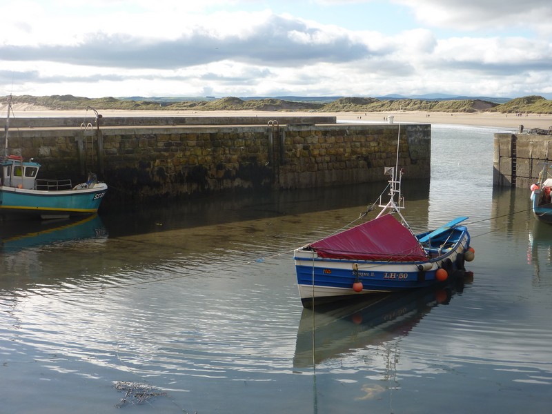
Just north on the coast, we came to Craster, having to divert initially as there was a low arch. Craster had a lovely little harbour with a few fishing boats, but there was nowhere to park.
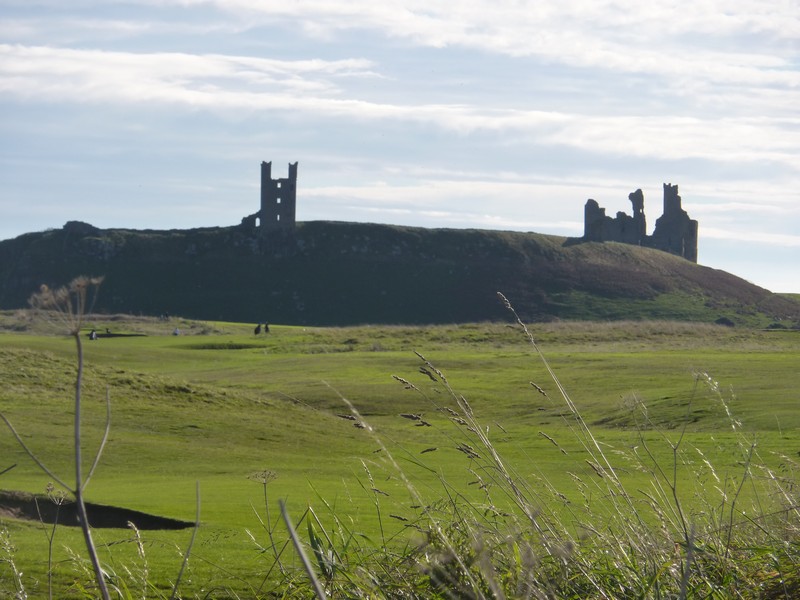
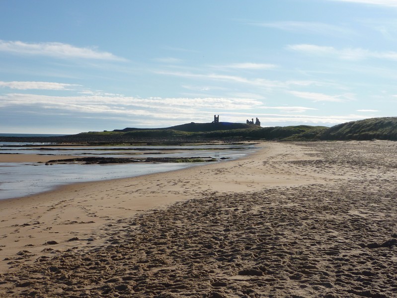
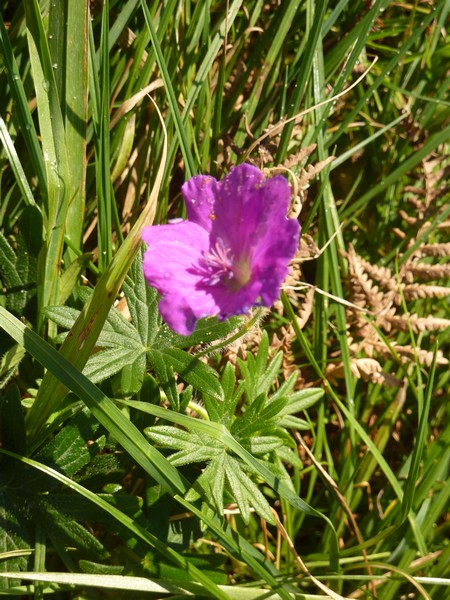
We drove on to Dunstan Steads, on Embleton Bay, using the new OS map which Adrian had bought yesterday – we’d had to use atlas maps for the previous part of the north-east coast. There was a very small parking area, but being early in the day, we were able to park and walk through the dunes to the lovely sandy bay, which was quite busy already with dog walkers. In the dunes were one or two bright magenta flowers of bloody cranesbill (a wild geranium). A ¾ mile footpath would lead you to the ruins of 14th century Dunstanburgh Castle, owned by the National Trust now. It looked very dramatic, silhouetted on the skyline to the south.
Craster Harbour and bloody cranesbill
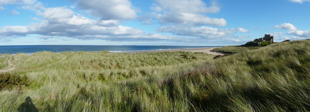
At the northern end of the bay, at Newton by Sea there was a lovely sandy cove, but no parking nearby, so we took another lane to Newton Links, on the southern end of the next bay, Beadnell Bay. This proved to be a top spot for us! We walked through the dunes in the warm sunshine to a long sandy bay. Being almost lunchtime, Adrian returned to the van to make up rolls to bring down for lunch. There were a scattering of people on the beach – besides the ubiquitous dog walkers, there were people enjoying themselves. One large family group were just having fun on the sands, and had brought their lunch down. A father was flying a kite with his two young daughters. It was lovely to see people just making their own fun.
Dunstanburgh castle silhouetted
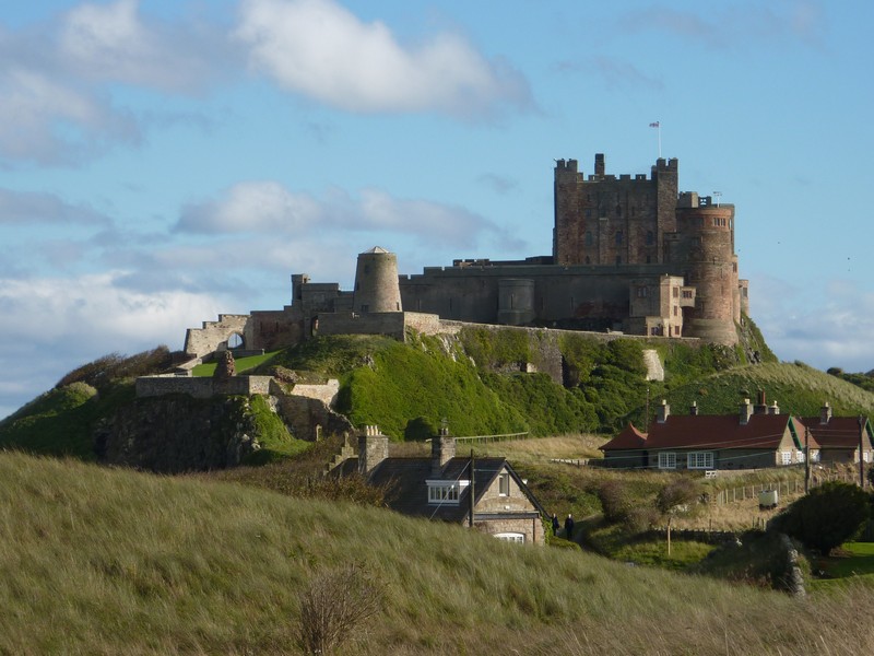
As we drove north from here, we could soon see the impressive outline of Bamburgh Castle, which we remember photographing in 1969. Where we stopped first, the dunes seemed rather wide to walk across to the beach, so we continued past Bamburgh, to view it from the northern side. The beaches and car parks were busy on this sunny Sunday afternoon, and we thought that the village seemed rather touristy – it made us think of Goathland in North Yorkshire.
Beadnell harbour
We drove on now past Budle Bay, where we looked out to hundreds of birds on the mudflats.
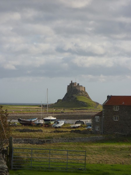
A short way on from here was the causeway to Holy Island. We thought that we were too late to visit today, but stopped at the Visitors Centre to find out the time of the tides. It was at this point that we decided that we are out of synch with the modern world! The so-called Visitors Centre consisted of a large (admittedly pleasant) eating place and a fee-paying birds of prey area. We searched for some time for anything useful, resorting to asking where we could find the causeway crossing times. We found out that they were in a small black frame at the back of the cutlery table! All around were the various blackboard menus, prominently displayed! Anyway, the causeway closed at 4 o’clock, and as it was now 3.30, we hope to return tomorrow.
We needed a campsite tonight, as we are desperately low on water, so headed for a CS a few miles inland at East Allerdean. It didn’t look far on the map, but was actually a long way on country roads. It was not very obvious when we got there, and we missed it first time. There was nobody else staying, just a couple of unoccupied caravans on the far side of the wet field. The tap was deep in the corner – difficult to get to - and the wind was howling, although it had been calm on the coast! No wonder we prefer free camping!
Rather despondent, we cheered ourselves with a cup of tea, before Adrian attempted the ‘filling and emptying’ tasks – collecting several containers of water rather than drive across the dangerously wet grass.
He was just finishing this when we heard voices, and two elderly gentlemen appeared – the owner of the site and his cousin. While the owner chatted to Adrian about the water tap, his cousin came to the van and, handing me a ‘Famous Grouse’ whisky bottle with a small amount in the bottom, said ‘here’s the whisky to go with the water’. It put a smile on our faces!
C.S. at East Allerdean
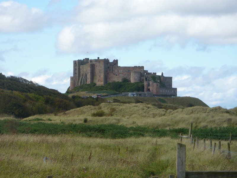
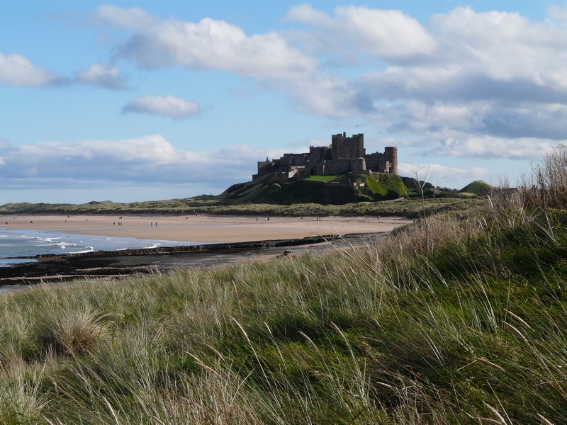
Bamburgh Castle
Monday 17th October Windy Holy Island and Berwick on Tweed 43 miles
There had been some light rain in the night, but the morning was fine with extremely high winds. Adrian went to refill the water tank. Mr Younger, the owner, came along and chatted while Adrian was doing this. He hadn’t had many visitors to his site recently – most people, as we know, seem to want electricity, often just to run their televisions. When we do go into a site, this one is the sort we want – simple and inexpensive, but we are obviously in the minority.
It was nearly 10 o’clock when we left, warmed by our encounter with this ‘last of the line’ character.
We drove back to the Holy Island causeway. By now it was an hour since the causeway was supposedly ‘driveable’, but there was still a great deal of water surrounding it.
We knew that the castle (NT) was closed on Mondays, and hence the shuttle bus wasn’t running. Luckily the car park was free with my ‘blue badge’, so we walked into the village. We were surprised how many people had also arrived. We found the whole thing too touristy for us. We went into one or two pleasant little shops, and walked down past the ruins of the priory (English Heritage), looking in at large and impressive St Mary’s church. We had good views to Lindisfarne Castle, and tried to shelter from the wind to see it.
We left at 1.30, driving on to the northern end of the bay at Beadnell, a village of nicely done up holiday homes, with a little harbour with a few old boats. Behind were three atmosperic limekilns built in 1790.
Seahouses was a busy holiday town – we didn’t stop, but this is where trips leave from for the Farne Islands.
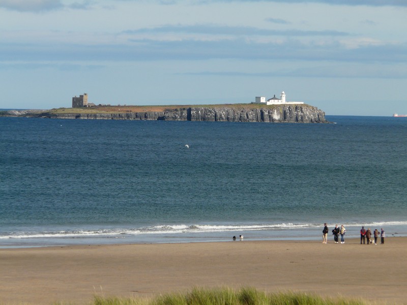
Looking to the Farne Islands from Seahouses
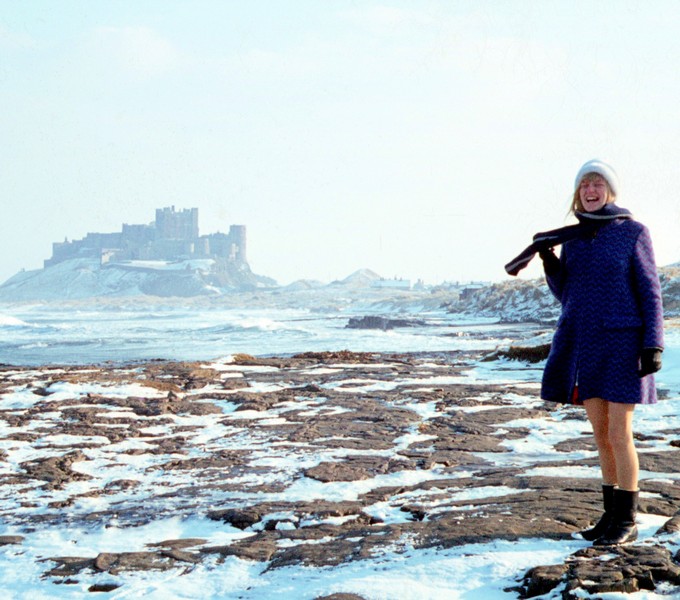
Rosie at Bamburgh Castle in the snow Feb 1969
Just before we got back to the car park, an elderly gentleman was setting up a vegetable stall outside his house. We bought a large cauliflower (freshly picked from his garden) and some Maris Piper potatoes. He didn’t seem too bothered about the strong wind.
When we were about to set off, we saw the couple who had free camped beside us the other night – they had said that they were heading for Lindisfarne. It was now gone midday, and I discovered to my dismay that my watch had stopped, and I hadn’t brought my spare one.
We stopped to have lunch at a pull off on the long causeway, but were sorry not to see any birds.
We now drove northwards, taking a small road to Cocklawburn beach, just south of Berwick on Tweed. We looked down on a beautiful unspoilt sandy beach, but the strong wind prevented us from walking down onto it.
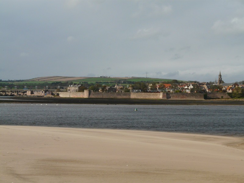
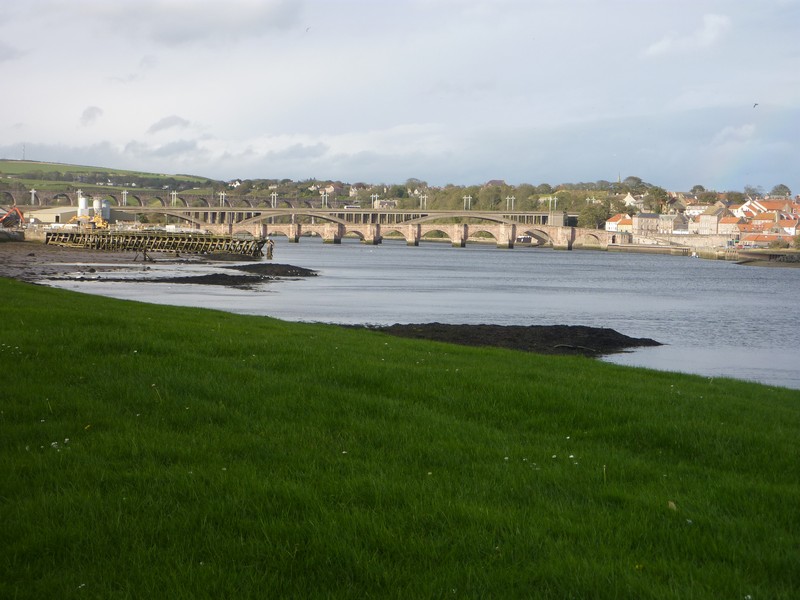
We made our way to Berwick, firstly taking a long, steep and narrow road past a static caravan park. We passed one or two difficultly parked cars outside houses, and then came to a level crossing with closed gates! We made our way back and came down to Berwick at Sanstell Point, at the southern side of the Tweed estuary, with a view across it to the lighthouse on the end of the pier, and to the three bridges crossing the river – the old bridge, the newer bridge, and the beautifully arched railway bridge. We could also see the medieval ramparts. A board told of the association that Lowry had with the town, spending many of his summers here, and doing lots of his paintings.
We drove on into the town, but the low arches made it difficult for us, and it wasn’t a day to relish walking around! Our impression however was of a very nice town. Needing to replenish our stocks, we then located Morrisons and did a shop.
We now made our way to a superb viewpoint above the town, beside a radio mast. We had this as an ‘overnighter’ spot, but today it was too windy. We stopped to look down over the town – the bridges, lighthouse and river, and to the coast beyond. It began to rain now, although it still looked sunny further down the coast.
We had decided to return to , where there was a fairly sheltered pull off with grassy dunes one side, and the railway embankment on the other.
We had a problem in positioning ourselves, as I could smell burnt gas, which would seem to be from the wind blowing in past the fridge. Adrian decided to turn the vehicle round, and just as he went to do this, a violent but short-lived hailstorm arrived! The black cows in the field next to us were most disturbed! A bit later we moved back again, as we were parked in the lowest spot and the puddle seemed to be getting bigger very quickly.
The rain stopped and the wind dropped as we enjoyed a supper of calamari and dab fish.
Tuesday 18th October We complete our RAB of England! 34 miles
We had a day of blue sky, but with strong gusts of cool wind. The black cows looked in to greet us, but we moved up to the higher viewpoint to have breakfast, moving back down to have a last ‘blow’ on the beach of our English ‘RoAd ARound Britain’.


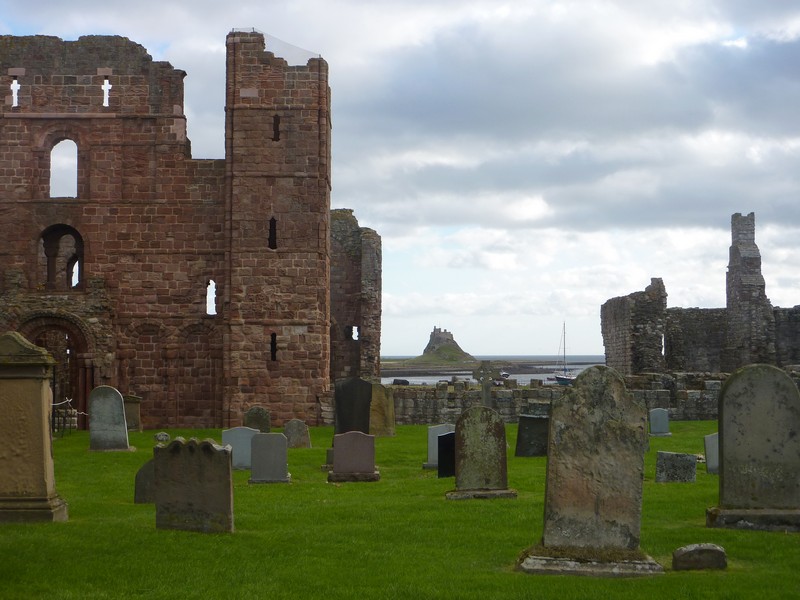
Lindisfarne Priory and Castle
Looking across the River Tweed to Berwick
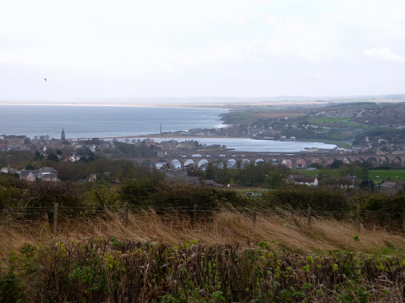
Looking down to Berwick on Tweed from the viewpoint
We drove on past Berwick, stopping at the border with Scotland for ‘We have made it’ photos! We travelled onto Dundee this time (but this in our next project - Scotland)
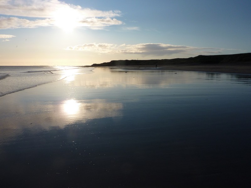
Goodbye to England's beaches at Cocklawburn beach
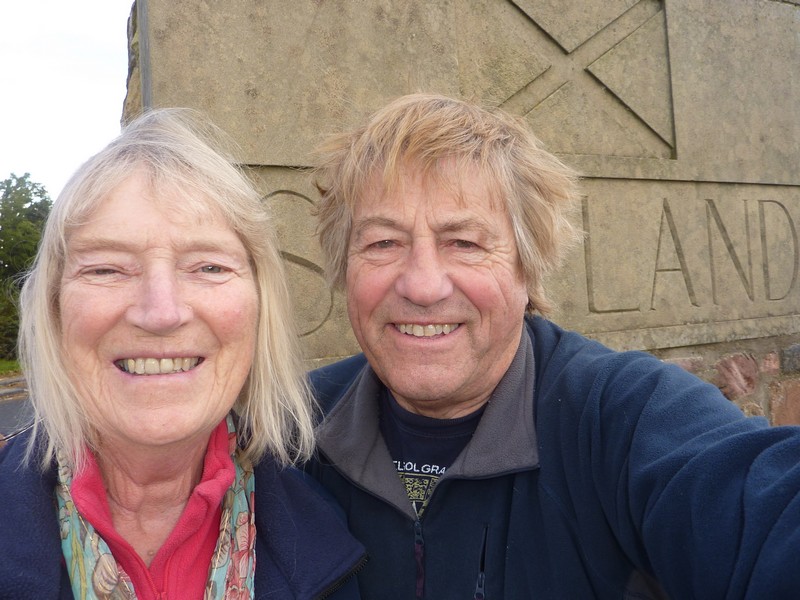
At the border with Scotland
