
Wednesday 2nd March To North Island 42 km
There'd been some loud trains right behind us during the night.
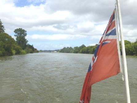
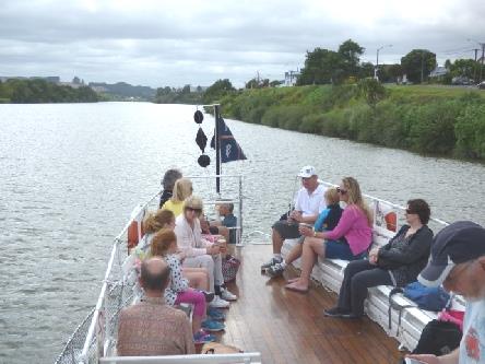
We prepared for our 10.45 (we had to be there at 09.45) crossing to Wellington on the North Island. The ferry was half an hour late in leaving, but once on board time passed very quickly. We were amused at the announcement as we set sail. It said that the shop had postcards for sale and sex (we both heard it as). We think that he must have said 'sets'!
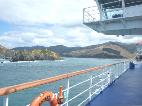
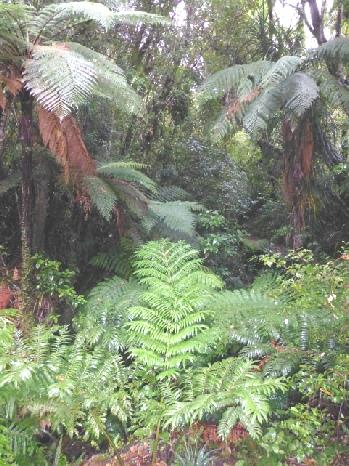
For the first part of the journey we had views of the forested slopes as we journeyed down Queen Charlotte Sound, then as we approached Wellington, there were headlands again. We utilised the time in between finalising our website and writing the email to go with it.
The headland at the end of Charlotte Sound was treeless. I had been disappointed in 1995 to have crossed in the dark, so I was very pleased that this time we could see the great scenery. It felt a bit choppier when we reached the open sea, but really the crossing was pretty calm.
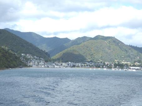
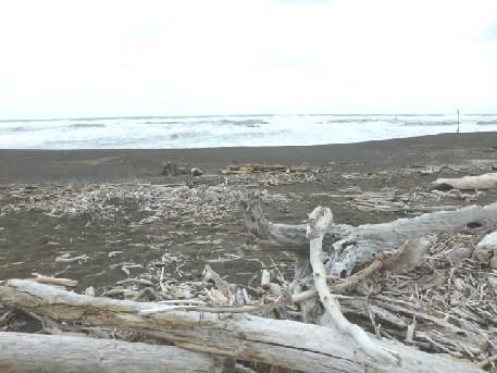
Leaving Picton
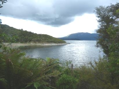
Charlotte Sound
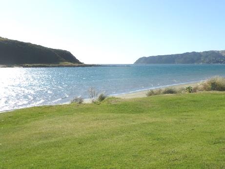
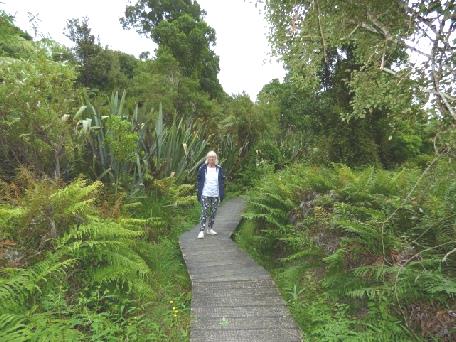
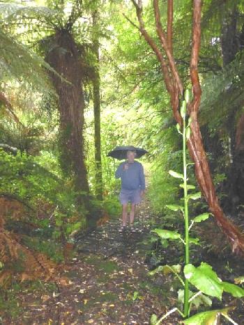
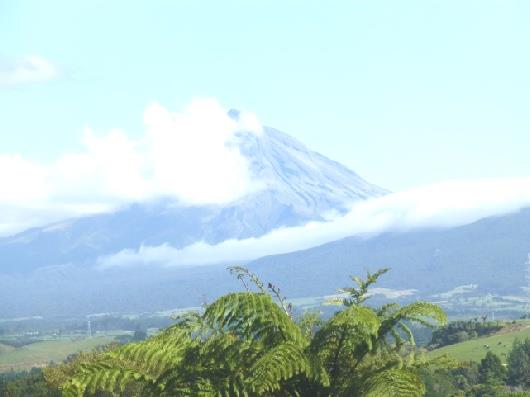
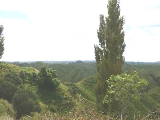
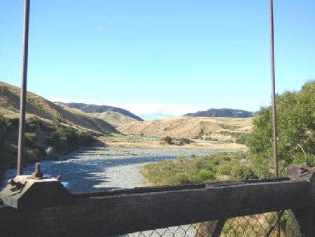
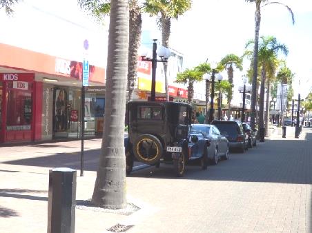
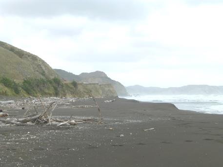
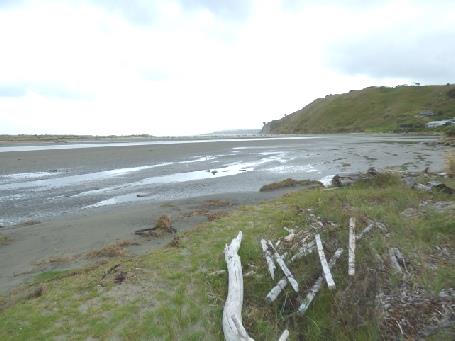
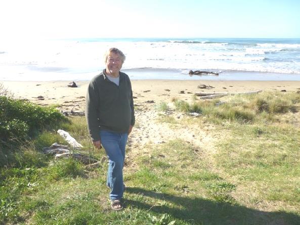
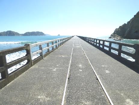
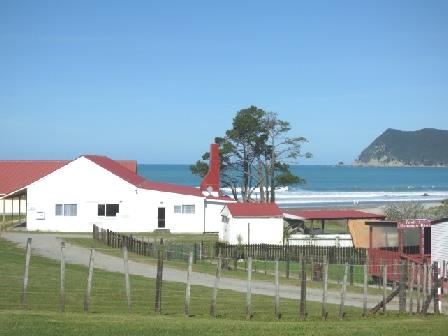
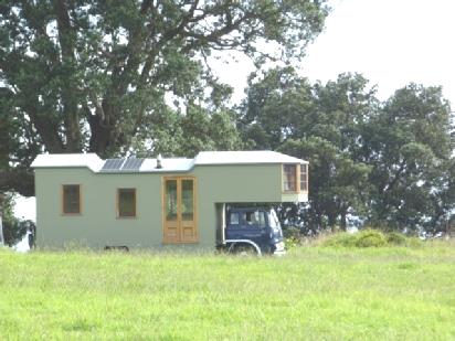
View from our van, Porirua
Thursday 3rd March Old cars and more wildlife 73km
The night was cold but the day became beautifully warm and sunny.
We'd heard noisy trains close by. Once more we had a lovely view from where we were overnighting.
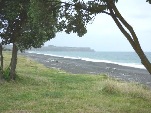
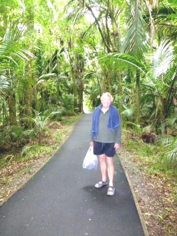
We left at 9.15, stopping to get fuel before continuing north beside the beautiful coast, with the nature reserve of Kapiti Island offshore. The hills around were forested on the lower slopes, but bare higher up.
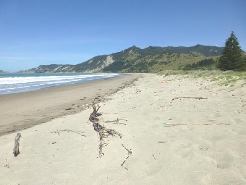
We drove through quaint Paekakeriki to the long sandy beach, where we had camped in 1995.
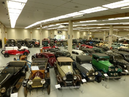
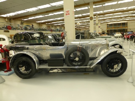
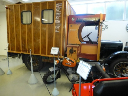
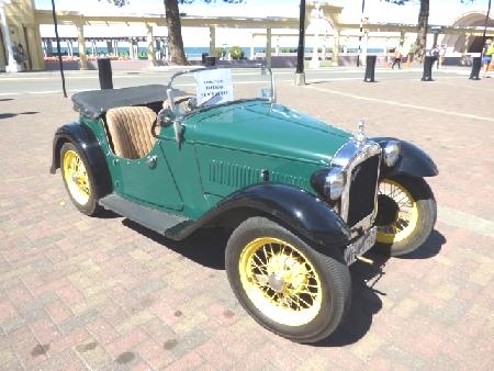
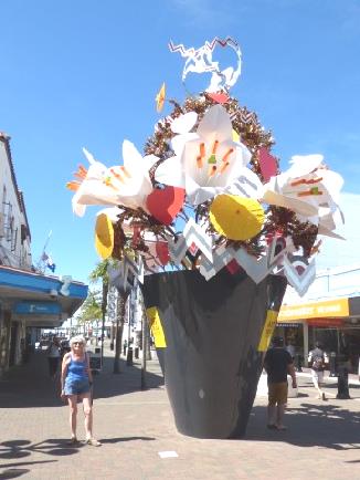
At Paraparaumu we located Southward Motor Museum - a real gem of a collection of vintage cars and motorbikes plus extras like model cars and bits of engine. It was created by a man called Len Southward and was certainly an A1 collection! There were 250 cars well laid out, and all with labels. We saw some familiar, some unknown names and a few long since forgotten.
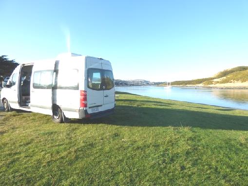
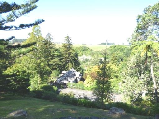
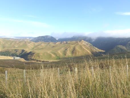
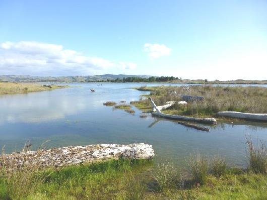
Morning view, Porirua
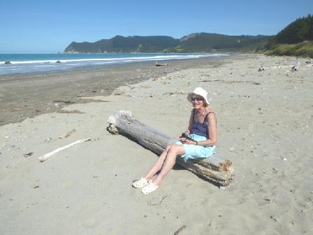
It was midday when we left, finding our way to Waikarae Beach, where we ate lunch sitting on a bench beside yet another vast, empty, sandy beach, looking across still to Kapiti Island.
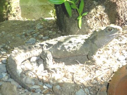
It was 2 o'clock when we left here and made our way to Nga Manu Nature reserve. We'd had to drive past massive roadworks, where they are extending the motorway section. This came right up to the boundary fence of the reserve. The noise from the workings did disturb the peace and tranquillity. The reserve was large, with paths around and enclosures for some species. We even saw a sleepy kiwi in the nocturnal house, as well as a Little Owl and Tuatara (the endangered 'prehistoric' lizard) again, and in the park we saw (and heard) tui, fantails and takare. When we arrived, we were just in time to see the eels being fed in one of the many ponds. We walked the 'Swamp trail', through lush forest with a variety of trees, many of which were labelled.
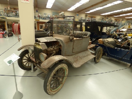
Len Southward’s first acquisition - a Ford model T
An early well travelled Chevrolet motorhome
A Prince Henry Vauxhall
Part of the collection
We also saw lots of monarch butterflies, feeding on the nectar of a plant looking like giant cape gooseberries.
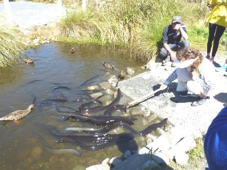
The eels being fed
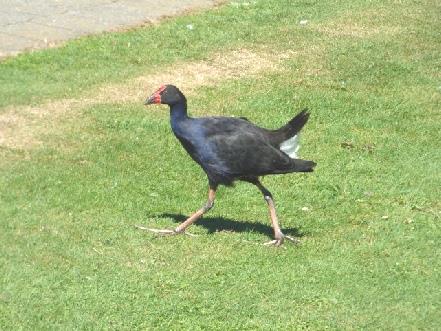
A pukeko
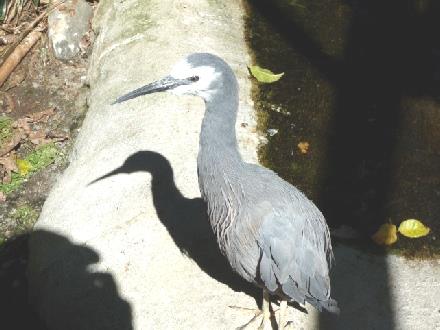
A white faced heron
A prehistoric Tuatara
After our visit, we drove a short way to Otaki Beach, where there was a free motorhome overnighting place right beside the sandy/pebbly beach, and still looking back to Kapiti Island.
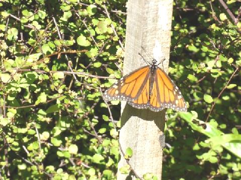
A monarch butterfly
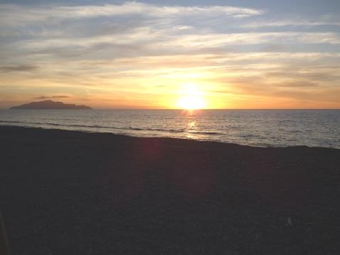
Sunset from Otaki beach, looking back to Kapiti Island
Friday 4th March Friends 18kms
It was really pleasant looking out to the rough waves. The day was windy, with sun and cloud.
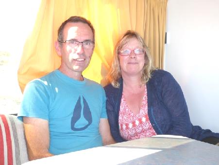
We went to say goodbye to Richard and Val, and chatted until 11 o'clock!
Then, when we were just leaving, we received an email from Mary to say that she and Roger were at her son's house, very close to where we were! What a coincidence – we had no idea. We got in touch, and arranged to meet up later.
Meanwhile, we walked down onto the beach before locating the nearby dump and then doing a shop in Countdown.
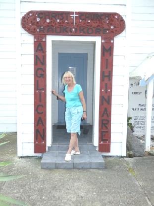
We stopped beside the immaculately white painted rebuilt Maori church, but didn't go inside.
We returned to beside the beach for lunch, watching a few of the kites preparing for the weekend festival.
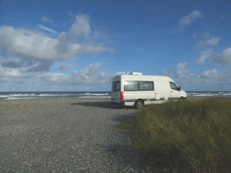
Our van at Otaki beach
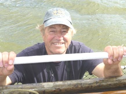
Richard and Val from Nelson
At 3.30 we had a phone call from Mary, so found our way to their son's smallholding, where they are staying. The family had gone off camping for the weekend.
We lost no time in getting chatting, later opening some bubbly to celebrate meeting up. We had first met Mary & Roger in the Cascade Mountains in USA in 2008, when they were travelling around in a camper, rather like we were. We kept in touch – and met up once in Scotland, as we came off the ferry from Orkney!
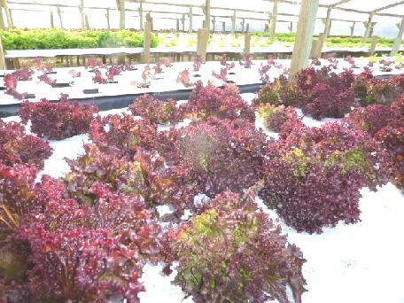
We looked at the greenhouses full of flourishing lettuces, and saw the sheep and the inky black cat.
We enjoyed supper together before going back to the van.
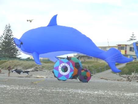
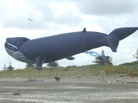
Practising for Otaki kite festival
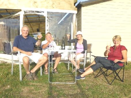
Cheers with Roger and Mary
Some of the healthy lettuces grown by Mary’s daughter-in-law
Saturday 5th March North to Wanganui 127km
We had a long breakfast with more chat with Mary & Roger. We'd really enjoyed meeting up.
It was cloudy and damp when we said goodbye at 10.30, but later became warm and sunny. We stopped at New World, where Adrian bought a French loaf.
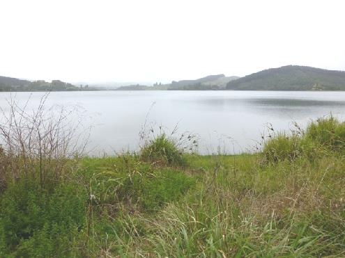
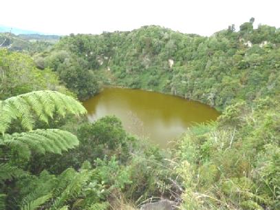
We continued north, turning off to Papaitonga Scenic Reserve where we had a delightful walk through the lush rainforest, mostly on a boardwalk, to a view over Papaitonga Lake, where we could see swans and ducks. It was really peaceful.
This was farming country. We stopped at a large fruit and vegetable stall, where the quality of the goods was rather disappointing, but we did buy several things.
At Levin Adrian went into a large car parts shop and got the socket he wanted. This shop wouldn't have been out of place in a major town in England with the amount of goods in it, but this was in a tiny town in New Zealand!
We now left our route of 1995, and took the road nearer the coast, stopping in an English looking layby for lunch, where 2 chickens befriended us.
We left at 2 o'clock, coming to attractively proud Foxton. We stopped by ‘de Molen’, a replica Dutch windmill. The flat land around had a big Dutch influence.
Walking to Papaitonga Lake
There was a low key flax museum here, explaining the production of articles made from New Zealand flax – very different from the flax we know. A bare footed local man enthusiastically gave us information on the flax.
We continued to Wanganui, crossing the wide Whanganui River (with an 'h', but the town hasn't).
There was a free motorhome overnighter right beside the river, feeling rather French.
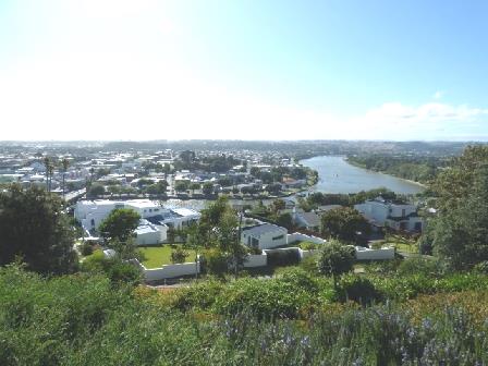
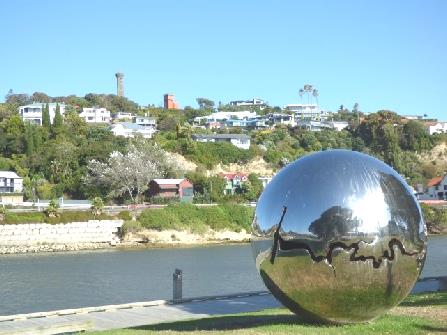
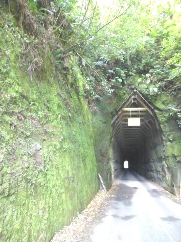
Across the river from us was the Durie Hill Elevator, built in 1919 to promote the building of a suburb above the hill. We'd arrived at 4 o'clock, but the elevator stopped at 5 o'clock, so we walked right across the City bridge, over the river, and then through the 213m long white painted tunnel to the foot of the elevator.
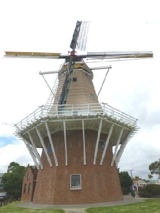
‘De Molen’ at Foxton
For $2 each we were whisked to the top, where there was a memorial tower, and views down over the river.
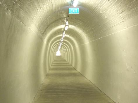
The tunnel to Durie Hill elevator
We didn't stop long, but soon descended the 191 extremely steep steps, and several slopes, down the 66m height to the river again.
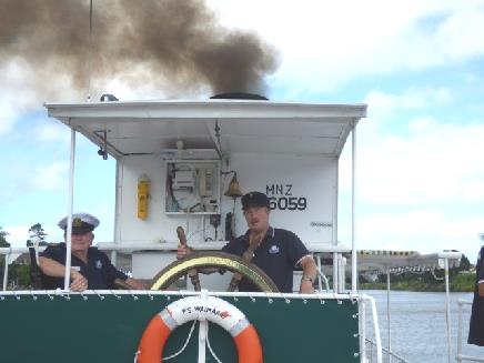
We crossed back over the bridge, walking on past our motorhome to look at the Waimarie, the last surviving paddle steamer in New Zealand.
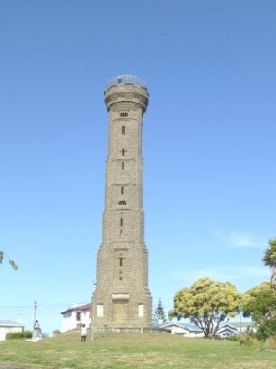
The memorial tower and the view over the Whanganui River
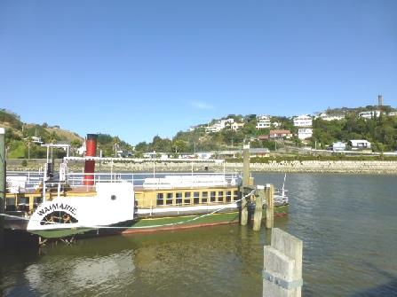
The Waimarie and the view back to Durie Hill
Despite being Saturday night, it was really quiet.
We started the next website.
Sunday 6th March A ride on New Zealand's last steam paddle steamer 133km
The day started with emails from Paul and Simon wishing me happy mothers day, which we hadn't realised! We phoned Simon who had been at home with Millie while Laure and Manolo went skiing.
We had mushrooms on toast for breakfast, sitting in our nice situation beside the river, which still seemed very French.
We walked along and got tickets for the sailing on the Waimarie at 11 o'clock. We looked in at the workshop/museum, which had another partly restored boat in it. Floods in June last year had greatly damaged the area, including the tram which previously ran a short distance along the river-front.
What we loved from the very beginning of the trip was the enthusiasm of the crew, and of some of the passengers. The scenery wasn't stunning - it was a bit like going for a trip on the Thames - but the whole experience was wonderful, especially for Adrian.
We were seated beside two couples from Napier. One, called John, said that he was a Pom - he had come out from Wigan in 1964! He and his wife last went back to England in 1992, and have no desire to go again. He was an unlikely looking accountant, but also drove a small steam engine giving people rides and drove buses part time. His round face was constantly smiling and alive. He was also a fountain of knowledge, and passed on much information to us.
The boat had a really homely feel - passengers were welcomed into the boiler room, and could chat to the crew.
A pleasant recorded commentary told us some facts about the boat. It had been built in 1899 in London, and shipped out in kit form and rebuilt. It was one of 12 steamers on the Whanganui River, running from Wanganui to Pipiriki - there was no road at the time. It ran for 50 years, and sank in 1952. It lay buried in silt until 1993, when it was salvaged by an enthusiastic group of volunteers. In 1996 they started restoring it, and in 2000 it was back on the river, giving tourist trips.
Early on, homing pigeons were used as communication, and the crew still used these as an attraction - bringing them around for all to see, and then setting them off at the turn around point, an hour upstream.
We arrived back at 1 o'clock having had a really enjoyable trip.
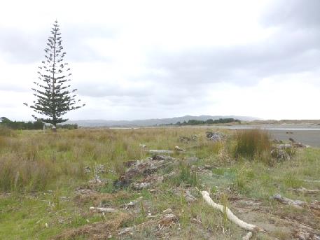
Opunake
Monday 7th March Two fabulous gardens and a view of the mountain 134km
It was a disappointingly greyish day which proved itself later!
We received Mothers Day messages from Emma and from Tom..
We left at 9.30 and drove back to Opunake beach, which was of greyish sand again, and very low-key. There was a place in the town where we could dump and get water.
Continuing on the 'Surf Highway', we turned off to Egmont Cape lighthouse, the most westerly point of the peninsula. We thought it rather unimpressive, but on discovering that it had been built in London of cast iron and shipped out in segments in 1865, we thought more of it!
We looked out to the rough sea on this surfing coast.
The flat land around here was scattered with dozens of grass covered, ridged mounds. These puzzled us, but we later found out that they were formed by ancient lahars (mudflows), flowing from volcanic Mt Taranaki and covering boulders.
Further on, we turned towards the mountain to reach Pukeiti, superb vast gardens, which were free. Unfortunately it had now come on to rain. We ate lunch, but as it still rained, we walked around with an umbrella (Adrian) and caggie (me). At least it wasn't cold! Much of the garden near the entrance was being replanted, but we just had a 'taster' of the magnificent rainforest, with no-one else about.
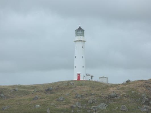
Cape Egmont Lighthouse - built in London in 1865
Luxuriant Pukeiti Gardens
We left the gardens at 4 o'clock stopping to sort out tonight's stopping place. We now had more views of Mt Egmont/Taranaki.
Lovely Tupare Gardens in the sunshine
Adrian found a place to stay at Stratford, a 'workaday' thirties looking town where at 5 o'clock we pulled in beside Victoria Park.
We enjoyed watching the few children who came to play and although we were half way across the world, we felt that we could be anywhere. It particularly reminded us of a place we'd stayed at in America. A few older boys played on their skateboards, and a white goose seemed to have imprinted itself on a large group of ducks.
Mt Egmont
Tuesday 8th March The incredible Forgotten World Highway 138km
When we left at 9.30, we had a clear view of Mt Egmont on this fine morning.
Adrian drove back a few miles hoping for a better view, before we set off on the 'Forgotten World Highway'.
This amazing road had been built from Stratford to Taumarinui (155 km) through difficult country with four 'saddles' (passes) and one tunnel. The road was a continual bend, with almost vertical sides falling away from it. In fact, in many places, the road had crumbled away, and make-shift barriers were in place. We tried to envisage the problems that building the road must have caused.
Early on we stopped to look back to Mt Egmont/Taranaki, with a view so clear which we couldn't have imagined yesterday! Clouds did come and go as we stopped at Strathmore Saddle, but the views of green slopes all around were stunning.
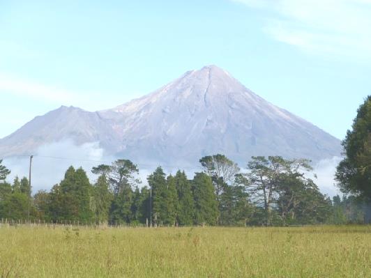
Morning view of Mt Egmont
We stopped for lunch at Whangamomona, sitting at an octagonal picnic table beside the railway (which had also been built through this terrain.) It was really peaceful.
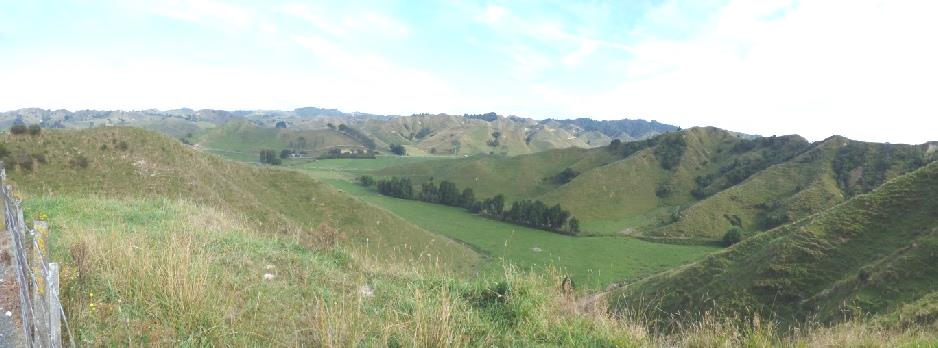
View from Strathmore Saddle
As we drove on, we felt on top of the world as we looked down to green slopes all around us. We passed a couple on a tandem!
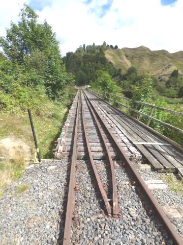
The railway at Whangamomona
The road went through the 180m roughly hewn Moki Tunnel and then we had 12 km of unsurfaced road through the Tangarakau Gorge Scenic Reserve which made a dusty mess of the van.
A world of green before the Moki tunnel
We stopped by the Tangarakau bridge, where there was the grave of Joshua Morgan, the first surveyor of the road, who had died there of peritonitis in 1893, aged 35.
We came across the road grader, and were able to pass it just before we came to the surfaced stretch again. After that, we had to stop for a huge herd of sheep on the road.
The dusty, unsurfaced road
Crossing the Tangarakau River
At Otunui landing, we stopped for me to recover from dozy giddiness after all the bends. Several cars arrived to collect their children from the school bus in this remote area! A sign told of nearby Ohinepane free campsite on the Whanganui River, where we now headed . At one time, the Whanganui steamers had come as far as this (240km by river).
It was a lovely spot in warm sunshine with swallows swooping down over the water.
Grader ahead!
And now hundreds of sheep!
Two of the people we met on the boat on Sunday were kayaking down the river from Taumarinui and we think they must have stopped here last night, as it it the first night's stop on any trip down the river.
We got up to date with the website.
Beside the Whanganui River again!
Wednesday 9th March Railways, bridges and peaks 193km
It was cool until the sun came up, but then it was beautiful. The night had been clear, with lots of stars. When we left at 9.15, the only wildlife we'd seen was a song thrush.
We drove through green and pleasant land, with blue sky and no traffic, passing a very occasional house. We came to the town of Taumarunui and shopped in 'New World' - an incongruous shop. There were disinfectant wipes to clean your trolley handle - a new idea to us, but everything inside the shop seemed back to front, not like the usual layout. Adrian got most things he wanted, but when he asked for 'sting relief' or something similar, the assistant said 'oh, we just use calamine, but we're out now'!
We pulled in by a 'picnic' sign soon afterwards to have coffee. It was beside the entrance to a campsite, but was a separate large grassy area by the river. There was a place to dump and get water, so we did both, and used the opportunity for showers/hairwash.
There was a fine grove of tall trees, and an adjacent scenic reserve which I wandered into. A sign said that it was a sawmillers site.
We drove south, turning onto a side road at Kekahi, where the book of maps marked 'glow worms'. We had no luck with that, just a road which turned to gravel.
Back on our route, we could find nowhere to stop until we turned off by the 'Spiral Tunnel' lookout.
We needed to eat lunch by now, so afterwards set off past the picnic tables which we hadn't noticed along a pathway lined by rails, and then up a wooden lookout. From here we could see nothing except trees and a model of the spiral railway, with a log for the tunnel - I thought that it was an aerial with a log stuck in it!
Adrian couldn't work it out, and decided to drive a bit further, winding up a gravel road to where the spiral tunnel actually was, but there was no lookout. Civil Engineers rave about this spiral railway, but at the same time (1908) in British Columbia they built the spiral tunnels to get over the same problem and much more impressive! A bit of a waste of time!
Our route now took us through the interestingly named tiny town of National Park, past Tongariro National Park with its three clear peaks, Mt Ruapehu streaked with snow. Pampas and heather lined the road.
We stopped beside the great structure of Makatote Viaduct where men were working high up repainting it - not for me! The structure was impressive though.
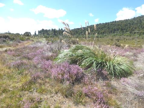
Heather and pampas beside the road
A bit further on, the map book noted 'last spike', and sure enough, the rest area we pulled into was marking just that, although nothing told you so on the road. Having seen the Last Spike in Canada, and also one in USA, we were happy to see this one, and to think of all the difficulties of building the railroad here.
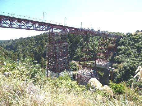
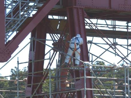
Repainting the impressive Makatote Viaduct
When we set off again, we could see Mt Ruapehu reflected in our mirrors. We managed to pull off the road to take a photo, then just after that, our road turned off, and we could see the mountain anyway!
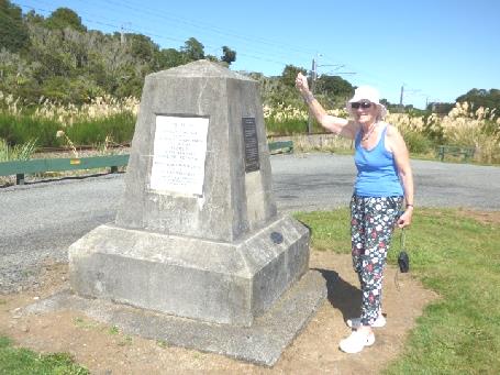
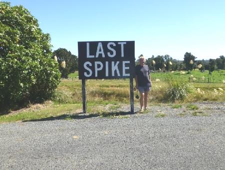
The New Zealand last spike
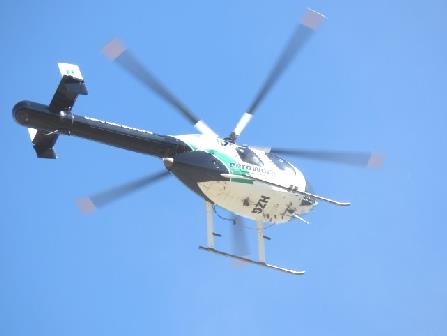
A mark on the map saying 'Tangiwai Memorial' couldn't have prepared us for what we found out and experienced there. We discovered that on Christmas Eve 1953, a mud slide from Mt Ruapehu had washed away the bridge just as a train was about to cross it. 150 people had been killed. There was an elaborate memorial, with the names of all the victims, and the Lions Club had recently restored this. There is going to be a ceremony this Saturday to commemorate it, with 300 relatives of the victims attending. We had seen a man talking to a couple, but he, it turned out was partly responsible for the commemoration ceremony. We had just gone to look at the innocuous looking river, when a helicopter buzzed low overhead, and eventually landed close by. It was practising for the ceremony, when they were hoping that a white tarpaulin draped over the memorial would be removed by the helicopter. It didn't happen like that - the man we had seen was holding the tarpaulin over the statue, when the helicopter tore it from him, sending him crashing to the ground, chipping his tooth and gashing his lip. He was fine, (just a bit bloody) but they were going to change that part of the proceedings! We just found the van very dusty inside from the helicopter rotors!
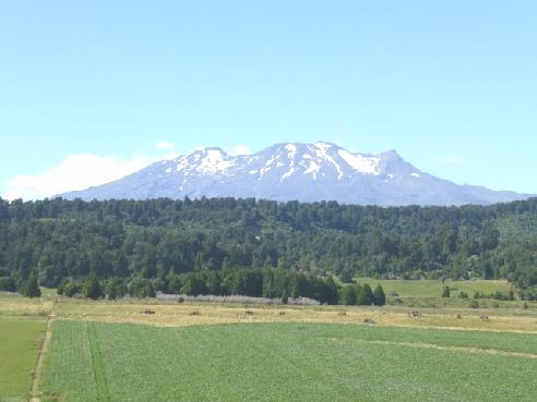
Snow flecked Mt Ruapehu
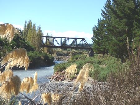
We continued to Waioru where we got more diesel before setting off on the 'scenic route' towards Napier. The land now was hilly and very dry, but there was nowhere at all to pull off. We were giving up hope, when just before 5 o'clock we came to a nice 'Community project' area at Springvale beside the river, adjacent to an old suspension bridge. The sun was hot, and the only annoyance was the flies! We walked down to the river, and across to the suspension bridge, realising how much difference having a road through here must have made a hundred years ago.
It became very cold after the sun went down. The stars were good though. We lit our night-lights at supper-time.
The Tangiwai bridge where the disaster happened
The helicopter descending causing chaos!
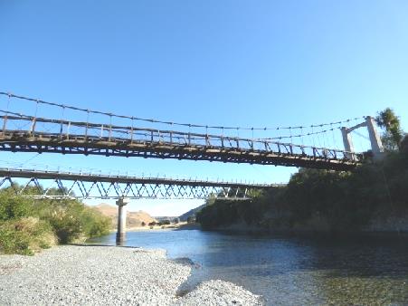
The suspension bridge at Springvale
Thursday 10th March From mountain cold to the heat of Napier 130km
The night and the morning were really cold. The mist was still hanging when we left at 9 o'clock. We had a mixture of sun/mist and cloud. The sun looked beautiful on the treeless mountainsides.
The countryside was made up of vast farms - we saw lots of sheep and cattle and the very occasional house. It surprised us that the school bus had come into our parking area to collect someone for school - where were the people and where was the school?
Our road had no number. It seemed to be known as 'Gentle Annie'! We climbed to almost 1,000m on a constantly winding road. We descended very steeply, and then came to a second 'pass', before making a long, gradual descent. The slopes here were forested - stunted fir trees, palms and pampas. We were really pleased to find that the road was tarmacked all the way, as maps had shown it to be partly unsurfaced (we had been assured by friendly John on the boat on Sunday that it was surfaced all the way).
We'd seen almost no other traffic, so we were surprised when we came to roadworks and were asked to stop. We found out that they were laying a couple of patches of bitumen, and the men were actually working on it, so had just closed the road.
We now came down to the dry, rolling lowlands, and the weather had become hot! Crops were being grown - vines, fruit trees and sweetcorn, sometimes behind tall evergreen hedges as a windbreak.
We reached Napier, a town which had been destroyed by an earthquake in 1931, and had been rebuilt as an art deco town. It appeared very clean and well looked after, with a well used cycle/walkway all along the front, edged by a stretch of green with lines of Norfolk pines. Flower beds were really colourful and well kept. We had lunch by the front, noticing that a bit along from us was a place for 'freedom camping' - how nice, and how different from Queenstown!
We walked into the centre of the town. When we crossed the road at the zebra crossing, two people held out poles until it was free to cross. A group of vintage cars had taken our eye - you could go for tours in them. The town appeared very smart and well cared for. We stopped to get my first ice cream of this trip, and were amused when the girl said 'we haven't any cones, we'll be closing down for winter soon'!

Remote country in the early morning
We could see Cape Kidnappers way off to the right. We drove up Bluff Hill to a lookout which was supposed to have a good view of the cape. It was a steep, winding road up there. There were beautifully kept flower beds, but the actual lookout was a let down, as you couldn't see much from it. All you looked down to was the port, with its stacks of wood, and a massive cruise ship! There were views of Hawke Bay in the other direction. It was very hot, and very windy!
We drove on through Ahuriri, where Captain Cook had arrived in the Endeavour, but the area had recently been redeveloped and wasn't very attractive to us.
We'd passed places where we could free camp, but we thought that after a week of free camping, we needed a campsite to have electricity to fully charge the main battery & computers, and also to do the washing.
The one we came to called Hawke Bay Holiday Park, was fairly open, but was also beside a busy road and under the flight path for the airport! It did have washing machines though, so we set to with that. With the warm sun (28°C) and incredibly strong wind it seemed a good time to do it!
While I was busy with the washing, Adrian looked up the hotel in Tokyo, which had been booked up on one of the days we wanted, and was able to now book it, so we have 3 days in the same hotel, which is great news!
There was a nice sky.
Clean and well kept Napier
Friday 11th March The Pacific Coast Road 160km
There were no planes in the night, but the road behind us was incredibly noisy. The wind had dropped, but the night was still warm, although we woke to a cloudy day, which stayed that way - nothing like the nice day which yesterday had become. We both had showers - there were rosebuds in the washrooms and music was playing! The site was very much cared for, just the positioning by the road was unfortunate. By the time we'd done the 'emptying and filling', we didn't leave until mid morning.
When we stopped beside the black sandy coast for coffee it was cool, grey and windy.
We now left the short bit of route which we'd done in 1995, and continued on route 2, the Pacific Coast Highway.
Our road wiggled inland and up to a pass, seeming to be called The Devil's Elbow.
We pulled in by Lake Tutira, which was also a DOC campsite. It was a really pleasant area even on this dull and drizzly day. We saw a black swan, little shags and dabchicks.
Black beach at Hawkes Bay
We wound on, pulling in to have lunch near another massive viaduct even bigger than the Makatote Viaduct - a sign said the tallest in Australasia, but nowhere to photograph it. Not much had been made of this parking area, unlike the previous one.
We reached Wairoa, on a river close to the sea. We passed a Pharmacy, and went in to get some antihistamine cream for our annoying bites. A tiny tube cost $13, so we'll use it sparingly!
We had been following the railway nearly all the way. When we came to Whakake lagoon, we couldn't get to it as the railway was always beside us.
At Nuhaka we continued on the road to the Mahia peninsula, stopping beside a black beach where the waves were really rough. After walking on to the beach, which was strewn with a mass of driftwood, we enjoyed a cup of tea with cheese and biscuits, leaving at 4 o'clock.
Lake Tutira
We drove across the peninsula, which made us think of Portland Bill in its situation, coming to a lovely spot at Oraka Beach, beside the calm lagoon, where we could camp amongst the Norfolk pines.
We walked out enjoying the quietness and seeing oystercatchers and shags. It began to 'damp' as we returned. Several other campers arrived on this Friday night.
Later we walked out again and this time were delighted to see a kingfisher.
Black sand beach looking to Mahia peninsula
Peaceful overnighter at Oraka Beach
Saturday 12th March A hot pool soak on the way to Gisborne 96km
Sunshine and high tide meant that the lagoon looked absolutely beautiful when we walked around before leaving reluctantly at 10 o'clock.
We drove back across the peninsula, stopping by another pleasant free camping place at Opoutama, but on this side the waves were rough, and might have given us an anxious time last night! The clouds were now coming up.
High tide and blue sky at Oraka
We were amazed to see a couple in swim suits having an outdoor cold shower!
We stopped again just along the coast where the lookout seemed most unstable, and was falling away. It was sheltered here.
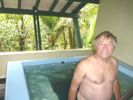
We now took the road inland towards Gisborne, soon coming to Morere Hot Springs. This attractive place is set in amongst a large area of rainforest, with walks you could go on. We opted to have a 30 minute 'private pool', which cost very little extra, and gave us a really different experience! From the pool you could look right out to the lush palms while you soaked. Half an hour was plenty for me, as I tend to feel faint in warm temperatures such as hot pools and saunas. (many years ago, I did faint at the Olympic pool in Helsinki, after having a sauna). There were 3 small pools set in the forest, a 10 minute walk away, so we made our way there. We didn't go in, as they were busy with groups of people. The walk through the verdant 'jungle' was lovely though.
Opoutama
Back at the main area, there was a large hot pool and a cool outdoor pool. That didn't tempt us, but we did have a short soak in the hot one. By now the place was getting busy, being Saturday. It was time for us to go back to the van for lunch, but not before Adrian 'bought the T-shirt'!
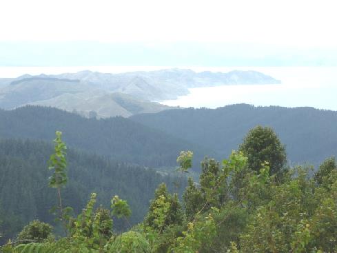
We set off again, ascending high into the Wharerata forest. We pulled into a layby at the summit with misty views down towards Gisborne and Poverty Bay. Adrian commented that he wouldn't want to be cycling this steep road, when an (older) cyclist, his bike laden with paniers, pulled in!
Morere Hot Springs
We descended to the flat productive lands, where there were extensive vineyards, and fruit trees sheltered by tall hedges again.
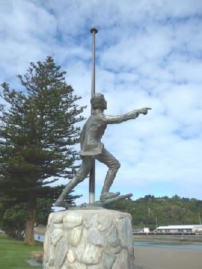
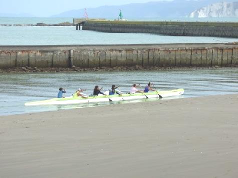
We drove into Gisborne where the road was lined with stretches of pleasant parkland. Everywhere was practically deserted. We parked under massive rubber trees near the front so that we could see the statue of Captain Cook, who had come here in 1769. The story goes that his young cabin boy Nick first spotted land near here, a long promontory known as 'Young Nick's Head’. There is a statue of Nick at Gisborne too, pointing towards the head. It was a pleasant area – outrigger canoe teams were practising in the river, but it was all very quiet.
‘Young Nick’s Head’, Poverty Bay
There didn't seem to be anything else for us in Gisborne - a vintage railway opposite seemed to be closed up - so we drove off, stopping at a little supermarket, which wasn't very forthcoming. We tried a second one, which wasn't much better! Nearby was a fish shop, doubling as a fish & chip/burger and everything shop! We bought some moki fish and some New Zealand giant mussels.
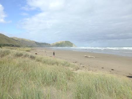
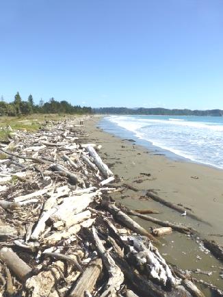
Northwards, we passed beautiful beaches, coming to the one we intended stopping at – Makorori beach. We had a few moments of sun before it went behind the hill. We wasted no time in walking onto the huge sandy, logstrewn, empty beach, with bare green hills behind, surprised that there were no other campers here.
Captain Cook’s statue at Gisborne
Cabin boy Nick pointing to Young Nick’s Head
Outrigger canoeists
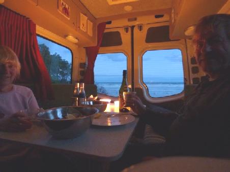
We lit our nightlights and enjoyed our mussels for supper before phoning our children.
Marvellous Makorori Beach
Sunday 13th March Stunning east coast beaches 176km
The night was unexpectedly cool, but we woke to a beautiful morning. We walked along the beach, avoiding the high waves, after our Sunday fried breakfast. We'd had a short phone call to Tom, who was just going out to supper with Mar!
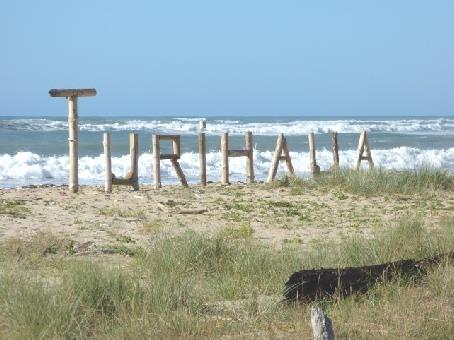
It was hot when we left at 9.30, driving up beside this lovely coast. We stopped at Turihaua beach at Tatapouri, where the waves were high and where a river came out. We saw a group of pied stilts.
Leaving Makorori Beach
Signs said to watch out for seals and for penguins! There was a campsite in summer, now closed, but like all of this coast, you had to get a permit.
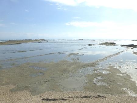
The road now left this lovely coast and we drove through pretty hilly country, coming down to the sea again at Tolago. This was another beautiful spot. There was a 660m concrete jetty sticking out into the sea from the vast sandy beach. There was a high cliff, where you could walk to 'Captain Cook's Cove', beside it. You couldn't imagine this wonderful spot as the busy place it once was. The jetty had recently been restored at a cost of $5.5m (£2.25m) - it had never been viable. After its completion in 1929 came the depression and then the second world war, by which time road travel was more profitable. Today it seemed idyllic as we had our tea/coffee sitting at a picnic bench, while two surfers had fun in the waves. There was an island out to sea, and rocky green headlands. We walked onto, but not to the end of, the jetty, where rails still evoked its past. The beautiful sandy beach was strewn with logs and debris. We tore ourselves away at 11.30.
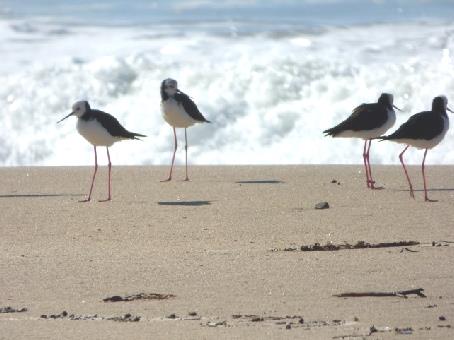
Pied stilts at Turihaua Beach
We drove through the small village set back on the other side of the bay, looking across an aquamarine river to the cliffs beyond. The large skateboard park was being well used. We pulled in to get diesel. A customer said 'She's just closed - 12 o'clock. (it was 11.55) her computer's down'!
We now had to drive inland again, coming back to the coast 20 miles on at Tokumaru Bay. The petrol station outside the shop appeared closed, but after stopping for lunch, we found that it was open. This was yet another beautiful deserted beach of fine sand - in fact there was one sole sunbather!
Tolago Beach with its long jetty
It was 2 o'clock when we got going again, leaving the absolute beauty of this coast and driving into the hills again.
At Te Puia springs there was a really peaceful pond with ducks on it.
Tokumaru Beach
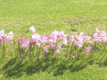
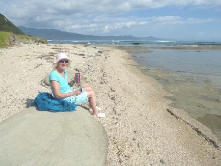
We took a side road down to Waipiru Bay, which was just as lovely as the others! I even had a short paddle. There was a line of pink lilies at the edge of a garden, as we've enjoyed seeing a lot in North Island. A white house with red roof looked photogenic in front of the beach, as did the simple brick church.
Peaceful pond at Te Puia
I at last saw two mynah birds - Adrian has seen lots ever since we were at Cape Egmont!
The road back to the 35 (Pacific Coast Road) changed from gravel to tarmac every few hundred yards!
We continued on the highway until we cam to Tikitiki, where we stopped to go inside the simple cream painted wooden church with its green roof. Inside, the ceiling and pews were all intricate Maori carvings decorated with paua shells.
At Waipiru Bay
We drove on to Te Araroa, where we found the largest Pohutukawa tree, estimated to be over 350 years old. It certainly was massive. It was set in the edge of a school field, right by the sea. It had finished flowering now.
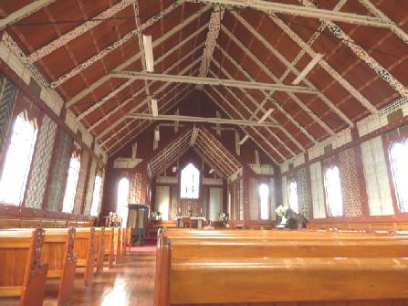
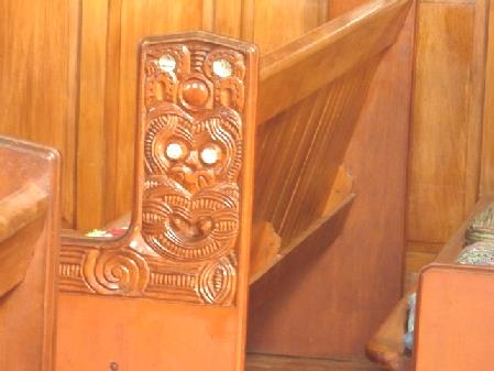
Inside Tikitiki church
We headed on to Te Araroa Holiday Park, as there wasn't any free camping here. It was quite an informal place, with a variety of large trees.
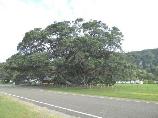
Giant Pohutukawa tree at Te Araroa
Monday 14th March The very different area around East Cape 108km
It was a nice morning but Adrian had been troubled by mosquitoes. This was a very pleasant campsite, but there was no dump, and a sign said to boil water - two of the things we come into a campsite for! (The other thing is electricity, at least that was OK!)
Our Rough Guide book confirmed what Adrian had thought, that this area is predominantly Maori - 80% of land is Maori owned. It certainly has a very different feel - it made us both think of the Marquesas.
We had to drive back into Te Araroa to use the dump there. We had wanted to drive a part of the road to the East Cape anyway - not the whole 20km (and back) of unsurfaced road, said in our book to be a cliffhanger anyway!
The scenery was fantastic - my idea of beauty! We drove for a few miles, then pulled in beside the sea. This was paradise! Waves flowed in over the flat rock 'scars'. Two oystercatchers performed a mating dance, a white faced heron watched out sedately.
It was pleasantly warm as we sat on the shell fossil-embedded rocks with our morning drink. It was so peaceful - heaven!
Idyll on the road to East Cape
We continued around the coast, with few place names to say where we were, but we were now in Opotiki district and not Gisborne. There had been no pulloffs or lookouts so when we came to one at Te Kaha, on a little promontory jutting into Maraetai Bay we stopped. We were surprised to find that if was a free camping place - the first we'd seen, so we decided to stop for the night
It was cloudy now, but we walked out, first onto the dark gritty beach beside us, with orange coloured rocks, and then past a clump of very large trees to the lighter sand on the other side. Once again, there were just sandflies to spoil things.
Raukakore church, with an interesting notice!
The disastrous thing was that we'd run right out of water, not having filled with the 'boil first' water this morning (the gauge in the van always says at least part full!) We only had what Adrian had put into large bottles, which made things very difficult!
Maraetai Bay at Te Kaha
Tuesday 15th March Along the Bay of Plenty 121km
It was a fine morning. We were surprised to realise that we were now travelling southwest down the coast, so we saw the sun rise where we didn't expect it!
Adrian filled another large container with water from a tap in a 'private' area before we left another top spot at 9 o'clock.
As we drove on through the lovely scenery, we saw kiwis being grown, often protected by netting.
We turned off at Omaio to Hoani Waititi Reserve, which was another free place we could have camped at. It was a really nice spot too, by a forested headland. It was unusual here to have free camping, as a nearby sign stated 'Absolutely no overnight camping'. We saw two interesting large motorhomes, and we later saw more.
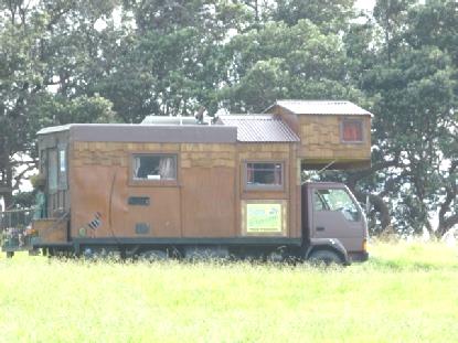
What are these?
We had now left the predominantly Maori lands, with things looking more 'western'. We thought through some of the things that had made the Maori areas look different. One was that there was none of the 'poseyness' that more developed places have.
When we drove on a scenic route around the Ohiwa River, the high tide was lapping the shore. At a place called Cheddar Valley(!) we stopped at a walk to saltmarsh. It had been set up nicely, but hadn't been well tended. The views weren't very exciting anyway.
Maori gateway at Waiotahi
We were now feeling desperate to get some drinking water. We joked about a time in USA when we were in a similar situation, when we had then passed a sign saying 'WATER' beside the road with an arrow to a tap, which had ended our trauma! This time was almost as good - Adrian found a 'water' sign on his app, and sure enough, we came to a sign saying 'free spring water'! Other people knew of it too, and had come with their bottles. I felt a bit greedy as we linked up our hose, but we did put some coins in the pot, towards the victims of last year's cyclone here.
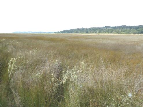
Cheddar saltmarsh
Now we could think of finding somewhere to stay tonight, and 4 o'clock we came to a free overnighter at Maraetotara Reserve right by the beach at Ohope. After walking onto the fine sandy beach, with views to Whale Island, we walked back through the 'playground'.
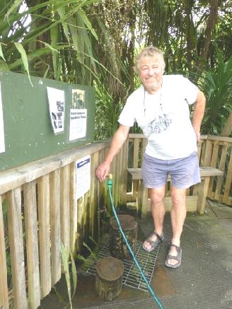
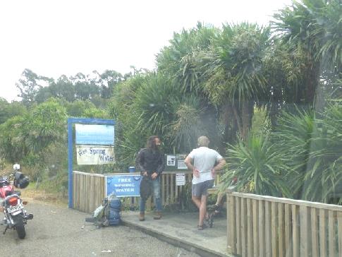
Our water problem sorted!
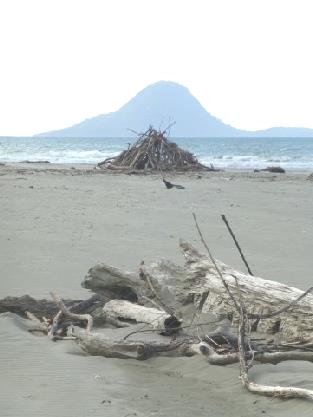
Whale Island from Ohope
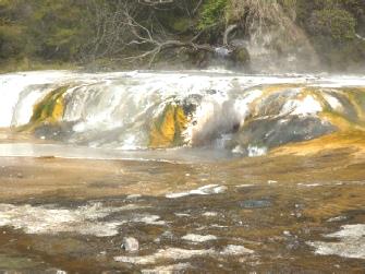
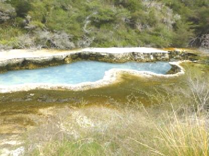
Wednesday 16th March Waimangu Thermal Valley 128km
We came to Waimangu Thermal Valley. We'd visited much of the thermal area around Rotorua on our previous visit, and have also seen a lot in USA and Iceland, but thought that we ought to see something else here. We had been discouraged by what appear to us to be high entrance prices. When we were told that it was slightly less for seniors ($30 each instead of $37) we went for it!
It was now 2.30, and the day was pleasantly warm and humid. What you did, was walk on a rough path mostly downhill for 4km towards Lake Rotomanhana, where you caught the (free)bus back. The area was well laid out, with numbers at viewpoints corresponding with those on the informative brochure. Although the path was said to be 'easy - downhill or flat', there were some 'ups' too, and steps! Luckily we remembered our hiking sticks!
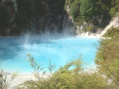
It was fun seeing the various fumeroles and bubbling pools, and different coloured lakes. Our favourite was intensely blue Inferno Crater Lake, worth the long flight of steps to see.
Waimangu is the most recently formed thermal area, dating from a violent eruption in 1886.
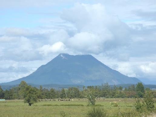
Mt. Edgecombe
The last part of the walk was just a nature trail to the lake (where earlier in the day, you could take a 'cruise') It was nearing time for the last bus back, so at 'bus stop 2', we caught the bus down to the lake, and then were brought back to the entrance. The workers had been gathering up any 'stragglers' who might still be around. It was now 5 o'clock, and the place was closing (we were offered a free sandwich as we left, which we heated for supper!)
We couldn't stay longer in the car park (they needed to be sure that no-one was left in there), so we drove off towards the main road. Just before reaching it, we came to Lake Okara, with a place where you could camp.
Waimangu Valley, ending at Lake Rotomanhana
This was a delightfully simple haven - a normal little lake with ducks and swans - really tranquil after all the thermal activity.
Later it rained heavily for a while – we had been lucky at Waimangu!
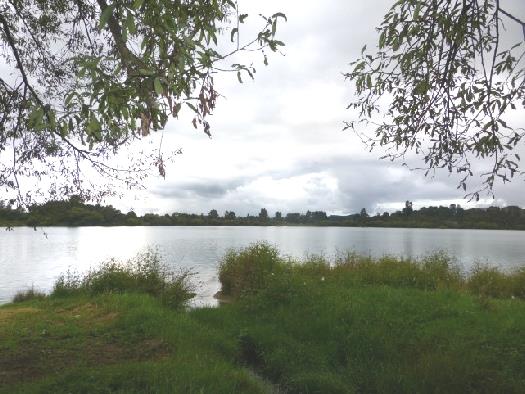
Lake Okara
Thursday 17th March More geothermal activity 67km
It was a greyish morning. Four black swans and a scaub entertained us, and then a heron arrived. The two little German boys from another camper were playing by the water's edge again when we left at 9.45.
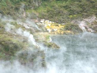
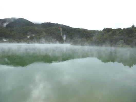
We turned off very soon to Kerosene Creek, following a rough unmade road. We stopped to look at a thermal, steaming lake, with lovely reflections. It seemed to be called Rotowhero or Great Lake.
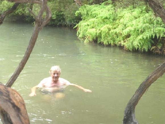
We continued on the dirt track to Kerosene Creek. We knew this to be a place where there was a thermal stream you could soak in. We walked on a rough path through brambles and ferns until we reached the hot water stream, which had a little waterfall in it. The difficult bit was getting in, and the water was a bit warm until you were used to it! Then it was lovely! A bit further on was a bigger 'pool', with a higher waterfall behind. Another lovely soak! It reminded us of similar places (not thermal) near Cape York in Australia. There were just one or two other people - we chatted to a couple from Brisbane. By the time we left at 11.30, it was getting quite busy.
Thermal Rotowhero or Great Lake
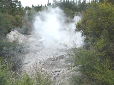
We drove back on the rough, potholed road, stopping next at 'Mudpool'. This again was free, and you could even overnight here. There was a lookout over a large bubbling pool of mud, with lots of spurting, bubbling 'blobs'. We have seen many of these now, but they are always entertaining and fun. Lots of other people were enjoying them too!
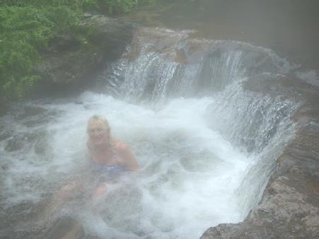
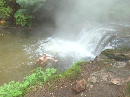
Wonderful, steamy Kerosene Creek
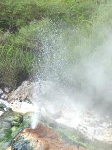
Next came Lady Knox Geyser. We were surprised to see nobody else parked here, until we found out that it erupts everyday at 10.15, after being 'fed' by one of the staff! It is then part of fee paying Wai o tapu, but we just liked seeing it steaming, all on our own!
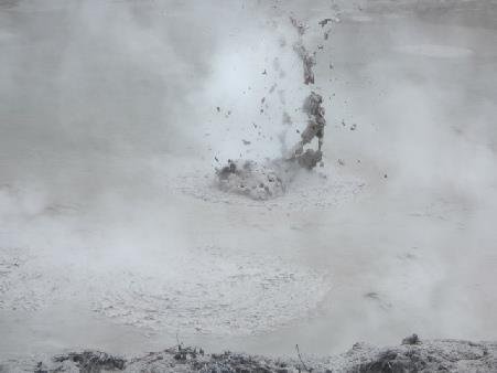
Mudpool - much better as video!
Driving on, we came to another free pool, 'Natural Warm Pool', where Kerosene Creek (now cool), met with a hot stream, forming an idyllic pool surrounded by lush vegetation.
We ate our lunch before going for another pleasant soak. We chatted to a young local couple, dairy farmers, who were enjoying a beer (or two) while soaking. They really liked coming here in winter. We were joined by a lone girl traveller from Finland, who had been hiking trails in New Zealand since November. A nice time!
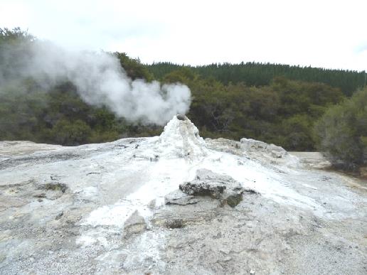
Lady Knox Geyser
It was now nearly 2 o'clock, and we had driven 14km!
We set off towards Taupo, stopping to dump at a petrol station, where we had a long wait for other users.
Now it was time to visit 'Craters of the Moon', which we had visited and enjoyed in 1995.
At that time, we hadn't seen much thermal activity, so it was all new to us. It didn't have quite the same excitement this time, but was still enjoyable. Although free then, we couldn't argue at the price of $8 each now. We walked for an hour on a boardwalk/cinder track around a steaming landscape, which was fun.
Another superb soak!
Craters of the Moon
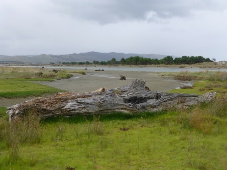
Waikato River from our spot at Reid’s Farm (free) campsite
We landed at Wellington and immediately noticed how vast and busy it was. Adrian hates driving in cities now, but we did try to locate the cable car, which I had been sorry not to have gone on last time, as we couldn't find anywhere to park. It was no different this time, but Adrian had the added problem of his satnav playing up and not working. We tried the top cable car station, but had no better luck there. I had note of several places we could visit in Wellington, but Adrian felt hassled by the busy roads, steep hills, narrow road lanes & absolutely nowhere to park and just wanted to get out! We did pass an old steam crane as we set off northwards on a fast road.
We turned off at Tawa where there was an outlet village and therefore a carpark.
We pulled in to recover with a cup of tea, working out which way we wanted to go. We had a quick look in the shopping mall, but it didn't interest us.
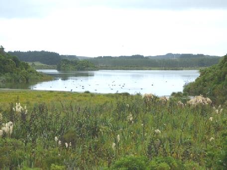
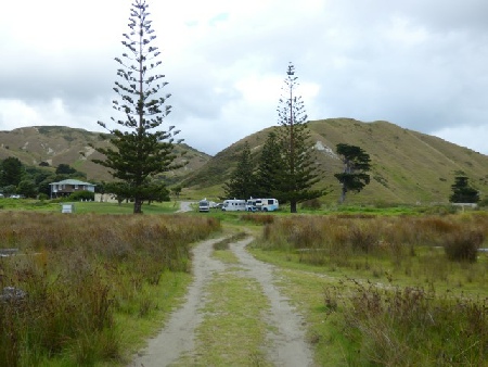
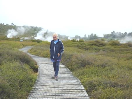
A bit further on, we stopped at a freebie campsite overlooking the lagoon at Porirua, arriving at 4.50. It was a pleasant view, but very windy. We had a relaxing evening, discussing our future route
We turned off at Tawa where there was an outlet village and therefore a carpark.
We pulled in to recover with a cup of tea, working out which way we wanted to go. We had a quick look in the shopping mall, but it didn't interest us.
A bit further on, we stopped at a freebie campsite overlooking the lagoon at Porirua, arriving at 4.50. It was a pleasant view, but very windy. We had a relaxing evening, discussing our future route
Adrian spoke to a couple Richard and Val in the next motorhome, a 'Coaster'.
Later they came into the van and we drank and chatted. They live in Nelson, but Richard had been born in Cardiff and Val in Westport in Ireland.
Later they came into the van and we drank and chatted. They live in Nelson, but Richard had been born in Cardiff and Val in Westport in Ireland.
We had our lunch, and set off at 2.15, by which time it was hot.
We drove down the long main street of Wanganui, which Rough Guide accurately described as having an 'old fashioned charm'. There were masses of pretty pastel flower beds and hanging baskets, and a thirties feel about the place. Adrian stopped to get some money before we headed towards Egmont.
The countryside was pleasant but unremarkable. Mt Egmont, also known as Mt Taranaki, is a 2518m dormant volcano, jutting into the sea, with masses of tracks and streams emanating from it. Although the weather was fine, the mountain was covered by cloud.
We stopped in the small town of Manaia to decide where to stay tonight, while we had a cup of tea. Kids who had been swimming in the pool opposite were happily playing in the street on their bikes and scooters. Many were barefooted, and some wore shorts, with their towel around them.
At 4.45 we reached the beach at Opunake - a free overnighter. It was a delightfully quiet sandy cove, surrounded by rocky cliffs. We had a walk down onto the beach.
We ate salmon for supper, followed by a strange elongated sputnik looking fruit.
As we descended to New Plymouth, on the north of the peninsula, the skies cleared. We found the town to be very large, and you had to pay to park, which we didn't like! We stayed long enough to see the 'Wind Wand', a long, thin waving carbon fibre pole with a light at the end, and to get fuel and to shop in Countdown. We now had a view of Mt Egmont, although clouds often shrouded the top.
We headed for our second superb free garden, Tupare. This was delightful, and again we were the only visitors. It had been built in 1932 by Sir Russell Matthews, a road surfacing magnate, after he and his wife returned from their honeymoon in England and America and had been inspired by gardens which they'd seen. It was set on very steep, undulating ground, with great trees and lovely vistas surrounding the house and cottage. The couple were particularly fond of hydrangeas, which grew superbly here.
We headed for our second superb free garden, Tupare. This was delightful, and again we were the only visitors. It had been built in 1932 by Sir Russell Matthews, a road surfacing magnate, after he and his wife returned from their honeymoon in England and America and had been inspired by gardens which they'd seen. It was set on very steep, undulating ground, with great trees and lovely vistas surrounding the house and cottage. The couple were particularly fond of hydrangeas, which grew superbly here.
Retracing our steps, we stopped at the manuka shop beside the small factory. There were 'samples' of skin products you could try, but all a bit pricey!.
The road now ascended into the hills, densely forested and interspersed with tree ferns. We came down to the coast again at Hick's Bay, described in Rough Guide as having 'one small general store and not much else'! It was difficult to find anywhere to park by the beach. In the end we parked right on the sand at Onepoto Bay, at the far end. The beach was deserted except for several large boat trailers. After we'd eaten lunch, a chap got into one of the huge tractor loaders, and expertly brought in the fishing boat which had just arrived back.
We left here at 1.30 - we were only a few miles on from last nights stop! We ascended once again into the densely forested hills, interspersed with the occasional white and pink pampas. As we descended to Whangaparoa, we had a few minutes rain, which washed the windscreen! We pulled into Waihau Bay at wide, shallow, sandy Oruaiti Beach, where we both had a paddle.
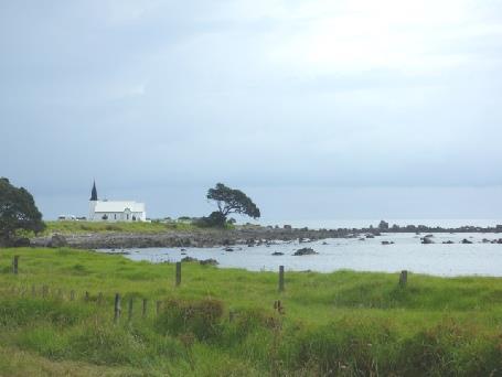
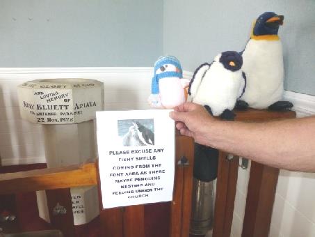
Soon afterwards we stopped at Raukakore church, a delightfully simple white painted wooden church in a superb situation right by the shore - really photogenic, with Norfolk pines beside it. A sign inside read 'forgive the fishy smell, penguins are nesting under the font'!! We didn't see any, but we did love the place. The simplicity made us think of Iceland. We stopped to have our cup of tea, sitting outside, but sandflies were there to spoil it.
The road now ascended into the hills, densely forested and interspersed with tree ferns. We came down to the coast again at Hick's Bay, described in Rough Guide as having 'one small general store and not much else'! It was difficult to find anywhere to park by the beach. In the end we parked right on the sand at Onepoto Bay, at the far end. The beach was deserted except for several large boat trailers. After we'd eaten lunch, a chap got into one of the huge tractor loaders, and expertly brought in the fishing boat which had just arrived back.
We left here at 1.30 - we were only a few miles on from last nights stop! We ascended once again into the densely forested hills, interspersed with the occasional white and pink pampas. As we descended to Whangaparoa, we had a few minutes rain, which washed the windscreen! We pulled into Waihau Bay at wide, shallow, sandy Oruaiti Beach, where we both had a paddle.
Soon afterwards we stopped at Raukakore church, a delightfully simple white painted wooden church in a superb situation right by the shore - really photogenic, with Norfolk pines beside it. A sign inside read 'forgive the fishy smell, penguins are nesting under the font'!! We didn't see any, but we did love the place. The simplicity made us think of Iceland. We stopped to have our cup of tea, sitting outside, but sandflies were there to spoil it.
The road now wound high up above the sea. We managed to pull in, and could see both White Island and Whale Island in the distance.
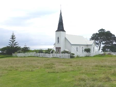
At Hawai(!) we pulled in above a grey grit log strewn beach, but Adrian was bothered by sandflies again, so we had our drink inside. A bit further on, at Torere we stopped by a pretty white wooden church.
We stopped again just before Opotiki at Tirohanga, which was also a really nice overnighter. The fine sand here was lighter coloured. I had a paddle.
We now came to Opotiki, where we had fond memories of visiting an old friend Jimmy Pyke in 1995. Nothing was quite as we remembered it! We shopped in New World, finding it much more like supermarkets that we were used to, and hadn't seen around the East Cape. We thought it was new, until we reread our diary of last time, and discovered that we had shopped there then!
Now with food, we needed somewhere for lunch. We drove down towards the beach, but couldn't actually access it, so stopped in the sand dunes behind.
To the west, we stopped at Waiotahi Beach, beside a large carved Maori gateway.
Another fine morning and view! We were saddened to hear that Sir George Martin had died - he always appeared such an upright and trustworthy person.
We were amused to see a lady, joined by 2 others, setting up cones and mats on the grass by the sea - we thought perhaps for school sports - but then they performed exercises by them!
We left at 9.15, but it was gone 10.00 by the time we left nearby Whakatane, after Adrian had got diesel, gas and had pumped up a tyre.
We'd found the roads really busy after our quiet time in East Cape, but it was much quieter after we turned off on to the valley road to Murupara. We stopped for coffee at Lake Matahina, by the dam. The road onward was pleasant, but not exciting and with nowhere to pull off. We stopped to have lunch beside the Rangitaiki River, when the road had reached Murupara.
We left here at 1.30, following an uninspiring road through conifer plantations towards Rotorua. By this time we'd only taken one photo today - of Mt Edgecombe near Whakatane, but things were to change!
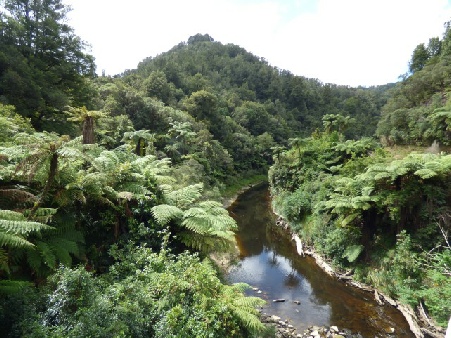
Now time to stop for the night, we drove past Huka Falls - visited last time and hopefully in the morning – to Reid's Farm - a wonderful free campsite (run by Taupo council!) right beside swiftly flowing Waikato River. The two German lads beside us had fun floating down it.
We were surprised at how busy it was, mostly with young people - some in small tents but lots in ‘camping cars’.
We were surprised at how busy it was, mostly with young people - some in small tents but lots in ‘camping cars’.


Picton to Taupo, New Zealand


