
Tuesday 27th March From hellish Heathrow to cold Calgary
We left on a beautiful day, after an early frost. The spring flowers were wonderful, and I was sorry to be leaving them.
We had spent a few days with Emma, Felix and Ruby last week, and also with Paul and Nicky. Tom had phoned from Barcelona last night.
Hil drove us to Heathrow, having come for supper and stayed the night. We had a trouble free journey, and got there in just one hour.
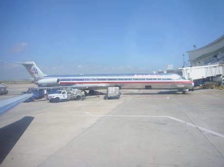
The airport was jam-packed, and there was queuing everywhere. We found that our reserved seats had been over-ridden, and we had been allocated centre seats, which didn’t suit us. Luckily we were relocated window seats, but these were over the wing, so we couldn’t see a lot.
The visibility was clear as we took off, but cloudy for much of the way. We had glimpses of Iceland and Greenland, but were disappointed that there were no individual screens, so no flight map. Because of this, the flight dragged, particularly for Adrian, as there were no films worth watching. The food was good, and it was nice to enjoy wine with our meal – something you don’t get on American Airlines. Mid flight we were given an ice cream. We had picked up several free magazines before boarding, which helped to pass the time.
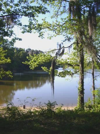
As we descended to Calgary, we saw that it was covered in newly fallen snow.
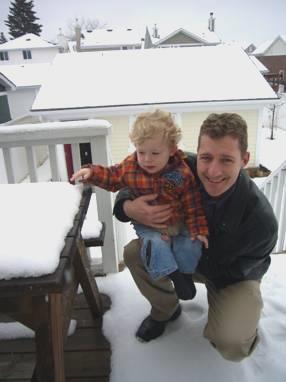
We got through immigration quickly, but weren’t pleased to have to wait ¾ hour for our luggage to come. Once through customs we were greeted by Simon, who drove us back to their place, picking up Manolo from his daycare on the way.
Tuesday 3rd April 3 hours to the heat! 15 miles
We spent a lovely week in Calgary. We had some warm sun after the snow, but new snowfalls returned for the last couple of days.
Simon and Laure had a good trip to San Francisco, and we had a delightful time with Manolo. We went to the park, took him swimming, went for walks and shopping, and spent a lot of time playing at home. He loved playing with all his toys, and we had fun with the train set we had bought him.
Adrian had a good excuse to busy himself on the computer, and I enjoyed having plenty of time to cook and potter. We particularly enjoyed our evening meals, looking out over the rooftops, knowing that Manolo was safely sleeping upstairs.
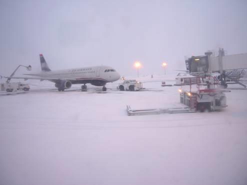
On 3rd April we got up at 5.00 am to find that it was snowing heavily. It had snowed all the day before, and was already 6 inches deep. The temperature was -9ºC as Simon drove us to Calgary airport. The roads were already busy.
We said our goodbyes and went on through all the formalities, including a very gruff U.S. customs official.
About to leave Calgary
Our 7.40 flight actually left at 8 o’clock, as Adrian had seen on the airport web site last night – they must have accounted for the de-icing time for the plane – something we had not experienced before.
Our flight was pleasant and uneventful. We were glad of the turkey sandwiches I had made up, as no food was provided, only drinks.
It was snowy for a long way, until we reached the flat, dry prairies. As we neared Dallas, the landscape became greener.
3 hours later we land at Dallas/Fort Worth
We landed at Dallas/Fort Worth airport at 12.15, having moved on one hour in time. The sky was blue, the temperature 81ºF and we could see large patches of Texas bluebonnets as we landed. Later we saw many more, and other flowers too – something that was totally missing in Calgary.
To make up for all our troubles on recent flights, our luggage arrived swiftly, and by 12.30 we were getting a taxi to Colleyville. By 1 o’clock we were back at the Bam, feeling excited about the next part of our travels, and pleased not to be feeling jet-lagged, as we usually do when we fly out from England.
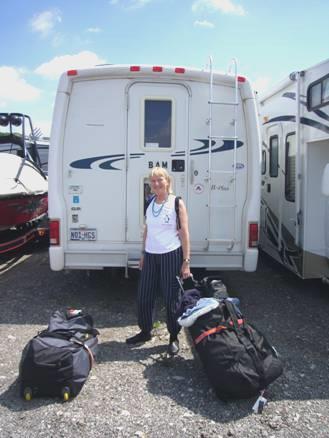
We arrive back at the Bam
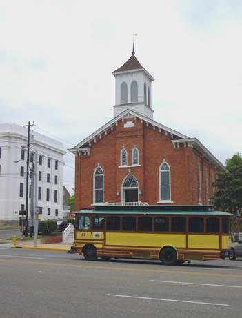
We had to drive back through Grapevine to collect the new wing mirror for the Bam, after our disaster at the end of our last trip. It was good to drive through the Historic District of Grapevine, which was really nice. We eventually located the repairers, and they fitted the wing mirror.
By now it was past lunchtime, so we pulled into a ‘breadhaus’ – an organic bakers - where we were able to buy a good loaf, which we ate with a tin of tuna which we had. Then it was back to Colleyville, as one item of post hadn’t arrived earlier.
Having collected this, we drove back to Walmart at Grapevine. We filled up with petrol and then did a big shop. We had decided to stay here, and set off early tomorrow. Another RV was here, and the driver, Paul, came along to say hello, being a fellow Escapee member. They were off to Alaska for the summer.
After unpacking our bags, and sorting the shopping, we enjoyed a salad supper (too hot to cook), while a storm raged nearby, but mostly missed us. We telephoned Simon, who was in a very different temperature from here!
As the van hadn’t been anywhere for a long time, the house battery was flat, so we had no lights! We managed with our head torches for a while, then had an early night.
Wednesday 4th April Time to smell the roses 154 miles
The night became surprisingly cool, and the day was windy, and much cooler than yesterday, although I did see a sign saying 69ºF later on.
We set off soon after 9 o’clock, and decided that we should drive through Dallas, as we have been to Dallas/Fort Worth very many times, but have never driven through the city of Dallas.
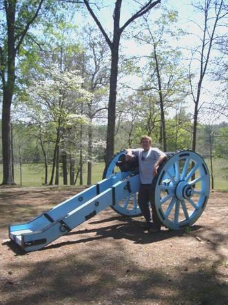
We navigated our way through, and, as we had expected, the centre wasn’t much to shout about – just a lot of high buildings, and big spaces where other buildings had once stood. We did see a few really nice old houses. We stopped by Pioneer Park, where I wandered off to view and photograph a superb statue of dozens of charging lifesize cattle.
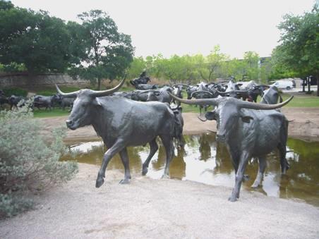
Cattle stampede in Dallas
We drove southeast out of Dallas, turning off the main highway at the attractive town of Kaufman. We continued to Canton – a small town on the map, but obviously of importance once a month when a huge market is held here. The vast parking areas were unbelievable. The reason for us coming here was that Adrian needed to renew his driving licence. It had to be done in Texas, where he had originally taken his test, and this was one of the towns with a licensing office. We located the office, and were delighted that the woman efficiently renewed his licence, so we could now relax.
We had lunch in a picnic area soon afterwards. We had been enjoying the wild flowers today, and the fact that trees are in leaf. Also, many of the houses had pretty pink azaleas growing around them.
We came to Tyler, which we knew from our first visit to Texas in 2001 was a rose growing area. We followed signs to the rose centre, and spent a pleasant time wandering around the gardens, smelling and viewing the many different rose bushes. There were other flowers too – antirrhinums and pansies. The soil around here is sandy, and there is year round rainfall (everywhere is lush and green), which suits the roses. The nice thing was that it was free.
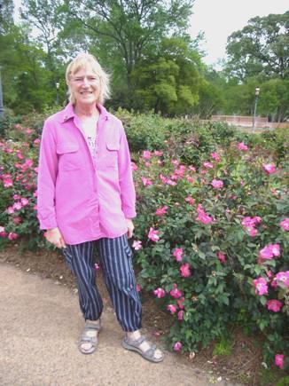
A rose is a rose
We drove on through Tyler, and at 4.30 passed Tyler Lake East, where there was a large parking area beside the lake. We had been heading for a picnic area a bit further on, but decided to stop here for the night. We pulled in and enjoyed a cup of tea sitting beside the lake, watching the many birds, including egrets and white fronted geese, also pretty eastern bluebirds.
The wind dropped. Many fishermen came down, but not many stopped. We cooked the fish outside, but came inside to eat it, partly because there were 2 geese and 2 cats who we thought would like to join our supper. We went back outside, and Adrian collected up some wood, and we sat out by our campfire, revelling in this delightful situation as the sun went down and the sky darkened.
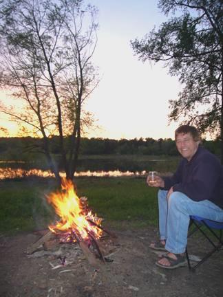
Life is good!
Thursday 5th April The largest oilfield and the end of Bonnie and Clyde 238 miles
A beautiful day, with clear blue skies, but still a bit windy. It was 9.45 when we set off again on this rural, tree-lined road. We soon came to the picnic site we had been heading for, and found a marker to the site of the largest oilfield in the world, which had been discovered nearby in 1929. Soon afterwards we turned off onto an even prettier road, finally coming to the actual ‘Daisy Bradford’ well. A nice start to the day!
Just before we reached the Texas/Louisiana border, we stopped at a picnic area set in the middle of a large road junction at Joachim. It was nice to sit outside for lunch, but this was rather marred by ants, broken glass and the occasional strong gust of wind.
The first town we drove through in Louisiana was Mansfield, which seemed to be all churches, but then we remembered that we were in the ‘Bible Belt’!
The countryside continued to look lovely in its ‘spring green’. Yellow coreopsis had now replaced the Texas bluebonnets beside the road, as well as dark red clover.
We crossed the Red River at Coushatta, which was a few miles north of Natchicoches, which we had visited 2 years ago. (At Henderson we were just north of Nagacdoches, which we had visited in 2001).
We now took a cross country, rural route towards Gibsland, changing our route several times. It was therefore a surprise to pull in by yet another marker, and discover that this was the spot where Bonnie and Clyde were gunned down in 1934! We had read that it was near Gibsland, but this was an isolated spot on a country road.
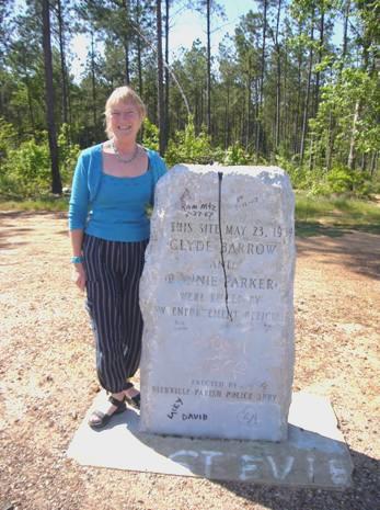
The end of Bonnie and Clyde
From here we joined route 80, which runs parallel to I20. It was another really rural road, but sadly there was absolutely nowhere to pull off. We reached the large and sprawling town of Monroe and drove right through the centre where the road was all dug up. As we passed Walmart, we reluctantly pulled in for the night. It was now 6 o’clock. Adrian went in – he also wanted to replace our battery - but got no sense about that, or about whether we could stay here tonight. Luckily I had seen a security van driving around, and the driver said that it was OK for us to stay.
In fact it was about the most frenetic Walmart carpark we have ever stayed in – drivers were driving in at a vast speed, crossing all the parking lots, and coming from all directions. A far cry from last night’s peaceful stop!
Friday 6th April - Good Friday A new battery, and ancient civilisations 162 miles
The night was incredibly noisy. The sweeper swept the whole carpark during the night – it seemed as if he went around us a dozen times! We had breakfast, including a hot cross bun bought from the German bakers in Dallas – nothing like that here!
Being in need of a new battery, we headed out, but then turned down a road, hoping to come to more shops. As if by magic, we ended up at Sears, and drove into the auto section. As in everywhere we have stopped at this time, it all seemed completely disorganised, and nobody seemed to know what they were doing, but we did get the battery replaced.
It was now 10.45, so to make up time, we now took the I20 eastwards. We turned off at Delhi, heading for Poverty Point, which was the site of an ancient settlement.
I stopped to buy some postage stamps for postcards to England – or was it to the moon? The very nice black lady, and the white male worker went out the back to consult their book. They decided that it cost 70 cents, but they had no stamps for that! With a great deal of input from me, we managed 40 plus 3 tens to make 70! As 12 cards meant 36 stamps at 10 cents, this took a lot of working out too, and when she found a sheet of 20 stamps, she was glad of my help to tell her how many more I needed!
We soon came to Poverty Point State Park. We were rather confused, as there was also Poverty Point State Historic site some miles further on, and also we had it marked as a National site. This State Park was mostly a campsite, but the chap let us in when we said that we just wanted somewhere for lunch. Having had lunch, we wandered off on a so called nature trail, and then found ourselves on a trail of ancient mounds, long flattened. This turned out to be a second site, the main one was still further on.
This turned out to be a vast area of former ridges and mounds, dating from 1350BC! We first visited the museum, which had dozens of artefacts – spear heads etc, and we watched a video (but dozed a bit). There was a shuttle bus tour of the area, which we went on – we got the last tour of the day. Apart from one other couple, there was a family with an overseas student from Ukraine. They had a boy of about 10, another of about 2, and a teenage girl. The boy said that they were considered a really well travelled family – they had been to Boston, Martha’s Vineyardand Niagara Falls (with their student).
It was a bit chilly on the bus (only 53ºF today), but it would have been too far to walk – and not madly exciting, as not a lot could be seen. One of the mounds resembled a bird in flight from the air – we wondered how they knew that, all those years ago. We climbed up it, and could only visualise how it might have been then.
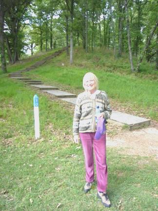
Imagining ancient civilisations
Now it was time to head back to the I20, and head for Vicksburg. We stopped briefly here – we had visited 2 years ago – but the visitors centre was already closed. We did pick up a map of Mississippi State, which we were now in. We headed south to Port Gibson where we hoped to join the Natchez Trace Parkway. We had enjoyed driving along here 2 years ago, and remembered a free campsite called Rocky Springs. We reached Natchez Trace, but as we arrived at the campsite at 6.15, we could see that it was overfull, so there was no way we could stop there!
We returned a short way, and turned off onto an equally pretty road, the Old Port Gibson Road, where we soon stopped on an odd bit of verge. Just as we were getting settled in, a chap turned up and said that we were on private land – a shooting area, but after making a phone call, he told us that the bit actually beside the highway is council land, so we moved ourselves there and decided to stop.
Saturday 7th April Into Alabama, with steak cooked on the fire 199 miles
Last time we drove along the Natchez Trace, which was in late January 2005, it had been really wet, so we were looking forward to seeing it in the sunshine. The road follows an old Indian route, and there is no development along it at all. Today the problem was the intense cold! I drove the short distance back to Rocky Springs, where we headed for the Historic Area – the site of a former large town. Now all that remains is the church and cemetery, and one or two artefacts.
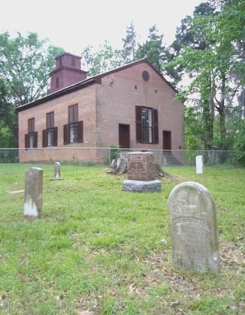
Rocky Springs church and cemetery
We didn’t visit it last time, because of the rain, but today we couldn’t believe how cold it was. We enjoyed the short walk, and tried to visualise the busy town that once was here. As we returned to the Bam, there were even a few flakes of snow! The temperature was 42ºF (5.9ºC)! Later the sun did come out, but it remained a very cold day.
We continued driving along the Natchez Trace as far as Jackson – a section we had missed before. At Jackson we took the I20, as we had driven through the rather rundown town last time.
Back on route 80, it was pleasant enough, but again we could find nowhere at all to pull off. We ended up having lunch in the deserted carpark of the Mississippi transport district office at Newton!
We drove back onto the I20 to drive past Meridian, and stayed on it into Alabama, so that we could visit the Welcome Centre, and pick up some leaflets to help us with our ongoing route. Having done this, we needed somewhere to stop and look at them, so headed for Demopolis, where we found a Corps of Engineers campsite at Foscue Creek.
We were delighted that the wind dropped enough for us to enjoy our first campfire which we cooked on – steak too. We sat out, in this lovely situation, until 8.30.
Sunday 8th April - Easter Sunday Civil Rights protests of the sixties 110 miles
After a cold night, it was a beautiful day – cool, but sunny. After hunting for our Easter eggs, we enjoyed breakfast of ruby grapefruit followed by boiled egg. Adrian was concerned that we had a puncture on one of the inner rear tyres, but fortunately it was only a flat tyre caused by a faulty connection.
The temperature was 7ºC, 45ºF as we set off for Selma, but later it was 55ºF, and felt warmer in the sun.
As we drove through Uniontown, we were playing Roy Bailey singing ‘Suicide Town’, which seemed to sum up this sadly run-down town, with houses boarded up and windows smashed. There were dozens of cars outside the church though. Later, at Selma, we saw a large congregation of black people leaving the Easter Day service, all dressed in their best clothes.
Once more there was nowhere to stop for lunch. We found ourselves at Selma, and got hopelessly lost, finally pulling onto a verge to eat our lunch of egg sandwiches.
Selma has an interesting history, having been inhabited by Indians for centuries – we saw a monument to Bienville, the French Governor of the Province (Louisiana) in 1714, meeting with the Alibamo Indians.
One of the last battles of the Civil War took place in Selma in 1865. Selma had become an important cotton town, and still has some fine buildings from that time.
More recent history is of great interest and importance. It became the centre for voting rights, and in March 1965 Martin Luther King led a protest march from here to the state Capital, Montgomery, 54 miles along route 80.
We now set off along that route, stopping about midway at Lowndes Interpretive Centre, where we were able to see, in this newly opened ‘museum’ some of the atrocious events which happened in the sixties.
It was on the site of ‘Tent City’ where many black people lived after the march, having been evicted from their homes by white landowners, who protested at them registering to vote. All in all, a pretty sobering visit on this Easter Sunday afternoon, but one which had to be made.
Just before Montgomery we turned off to another Corps of Engineers campsite at Gunters Hill, on a lake of the Alabama River. We had a pitch beside the water, and sat in the sun to enjoy our Easter eggs. Adrian had begged some wood from the camp host, and soon lit the fire.
Our spot at Gunters Hill
It was a beautiful evening. We cooked chicken on the fire, and enjoyed our isolation and our wonderful view down over the lake. We watched the stars come out, and could see Orion above us. We walked down to the lake and could see it reflected in the water, and could see the Great Bear too.
So stars really did fall in Alabama!
We came in reluctantly at 9.30 – a memorable Easter day.
Monday 9th April Inspirational men and memorials 70 miles
A mostly cloudy day, but a bit warmer – lower 60’s F. We set off at 9.45, taking the old Selma Road into Montgomery. It was a pretty route.
We managed to find our way into the centre of Montgomery, where the Visitors Centre is housed in the attractive old Railway station. There were displays on the various aspects of Montgomery’s history. Adrian asked about a Chevrolet dealer, as he had been worried by a warning light coming on.
We decided to see a bit of the centre of the town before heading out, and were lucky enough to find a 2 hour parking space in Dexter Street, the main road.
We had passed Court Square, where Rosa Parks had boarded the bus on which she refused to give up her seat to a white man in 1955, initiating the year long bus boycott which Martin Luther King organised.
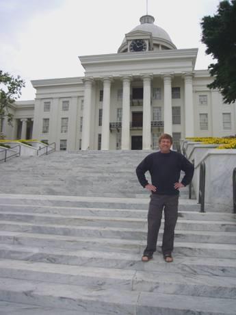
Just along the road, we passed the Baptist church which Martin Luther King had been pastor of at the time of the Civil Rights protests. At the end of the road was the imposing Capitol building, where the Selma to Montgomery march had ended in 1965.
Dexter Street Baptist church
The capitol building – where the Selma Montgomery march ended
We walked back by the Civil Rights Memorial, and went inside the modern museum centre. Here we saw more displays about the civil rights movement, and I watched a film which was more moving than yesterday’s. At the end of the displays there was a ‘wall of tolerance’ – a screen with lit-up names of those people committed to standing up against hatred, injustice and intolerance, and supporting justice and equality. I was happy to add my name to the list, and watched as it appeared almost immediately on the large screen.
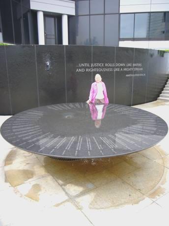
By the Civil Rights Memorial
We now set off out of town, and – guess what – the warning light now went off (it had been on for 2 days)! It was fitting that the Chris be Burgh song ‘One World’ was playing on our CD player. Still the warning light wasn’t lit up, but we did make our way (with some difficulty) to the Chevrolet garage, where, as we expected, we were told to ‘wait and see’.
We continued along route 80 to Tuskagee, where we located the University – formerly called the Institute. This is now a National Historic Site, because of 2 men, with confusing names – Booker T. Washington and George Washington Carver. In the Museum we saw a film about the latter man – and what a man he was! He was born in 1864, as a slave, but had a real lust for learning. He became an inspirational agricultural chemist and also an artist. He was asked by Booker T. Washington to be head of the new Department of Agriculture at Tuskagee, and spent the rest of his life there. He was an outstanding man, who lived a humble and frugal life, seeking neither fame nor fortune. We both thought that with his tall gaunt figure, he resembled Gandhi. He never married, devoting all his time to his learning and teaching. One aspect of him that appealed to me was that he always wore a fresh flower in his buttonhole. He died just before I was born.
In the campus we saw both his and Booker T Washington’s graves. Both men were an inspiration.
Now it was time to find somewhere to stay for the night. We took small roads northwards out of Tuskagee, and at 5.30 pulled off the road beside a deserted house.
Tuesday 10th April The battle of Horseshoe Bend 116 miles
We left before 8.30 on a fine morning and followed a pretty route past Lake Martin to the pleasant town of Dadeville. Here I spied a hardware store, which Adrian had been searching for for a long time. He needed to replace his ‘Boy’s own’ axe, which has done sterling service, but has now given up the ghost. It was a splendid, well organised store. Adrian bought the axe (rather expensive) and also a bolt which he needed. The Family Dollar store next door was just the opposite – an absolute mess of rubbish, with a disinterested, unattractive lad at the till. I bought nothing!
We continued through this pretty countryside to Horseshoe Bend National Military Park on the Tallapoosa River. This battle was between the Americans and the Creek Indians in 1814, and in fact ended the war with the Mississippi Indians. We had seen on our last visit to Alabama the site of the Fort Mims massacre, where the Creek Indians had slaughtered a whole village. The small Visitors Centre here explained about the war between the Indians and the Americans. The American General in charge was Andrew Jackson, who went on to annihilate the British in the Battle of New Orleans, and later to become President of the United States It was under his rule in 1829 that all Indians east of the Mississippi were ordered to leave on the ‘Trail of Tears’, and to settle in Oklahoma.
It was hard to imagine all the horrors of the fighting here, on this beautiful day, where everything was in its fresh spring green. There was a 3 mile walking trail around the park, which we set off on, and thoroughly enjoyed.
At Horseshoe Bend Battle site
It was warm and peaceful, with swallowtail butterflies, birds and flowers. The dogwood trees were in their full glory with their wonderful white flowers, and there were tiny purple violets on the ground.
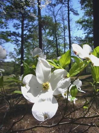
Dogwood
We drove on now to Linesville, a nice town. We had trouble finding the road out which we wanted, so had to resort to the computer. We eventually got ourselves in the right direction – we were trying to get to the Talladega scenic drive. Our logic found us the right way, but we couldn’t defy the ‘road closed’ sign which we finally came to! We continued, attempting to locate ‘Skyline Drive’, which we had marked on one map. When we did get to it, it was a crumbling 4x4 track, so we had to admit defeat!
We retraced our steps through this lovely hilly country, eventually getting to Cheaha Sate Park. Cheaha Mountain (2,405 ft) is the highest point in Alabama, and in the area of the Talladega National Forest. We enquired at the campsite, but the fees were more than we wanted to pay. The chap said dryly ‘you can camp for free at the car park outside’. This was at the trailhead for walks into the forest. We decided to stay there, but first drove the 8 miles to the end of the road. The well surfaced and well marked road just ended.
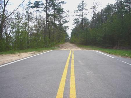
The end of the road!
However, to the side was the partly resurfaced road which we had wanted to take earlier. A few more weeks, and we might have made it!
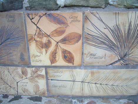
Back at the Bam we spent a long time discussing our onward route before having a short walk along the mountain trails. The entrance to the walks had beautiful casts of local trees and plants etched into the stone.
Wednesday 11th April Waterfalls named after a legendary princess 89 miles
We were glad that we had our little walk last night, because later it began to rain, and then we woke to thick fog! This wasn’t what we wanted for our views from the Talladega Scenic drive!
We set off at 9.30, and although the fog sometimes cleared a bit, it seemed to get thicker whenever we stopped at a viewpoint!
We left the parkway and continued north through Piedmont (where the sun almost came out) to Gadsden. We had come to view the Noccalula Falls. These fall 90ft into the Black River, and are named after a legendary Indian princess, who leapt to her death here rather than marry the chief chosen for her, who she didn’t love.
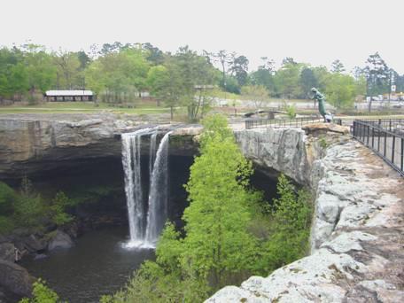
Noccalula Falls
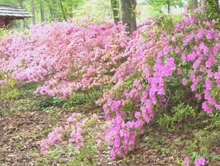
The day had now darkened, and as we went to pay our $4 entrance fee, the man said that heavy rain was forecast, and they might have to close the park. We went ahead – practically the only visitors, and had a lovely visit. It is azalea time, and azalea plants were flowering all around the attractive grounds.
Lots of wooden pioneer homes had been relocated here, and although looking rather dusty and unlooked after, were fun to walk around. Also there were a lot of animals – one of the assistants told me that it is really busy in summer, but the ‘Spring breaks’ have just ended, so it is quiet now. There were enclosures with goats, all sorts of small birds and animals, including 2 cockatiels, and an area where young animals could be ‘petted’.
The fun thing was a little train, which we rode on around the park. The falls could actually be seen better from outside the park, so the engine driver opened the gate by the station to let us out, then opened it again on his next drive around ten minutes later to let us back in!
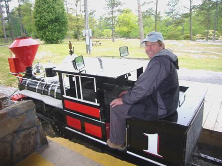
Adrian the driver
The whole place was really low-key, and as we had it to ourselves, was really enjoyable. As we left, the train driver and gate man told us that a tornado was forecast, so we drove on northwards along the Lookout Mountain Parkway rather cautiously. When we pulled into a gravel area at 3.30, and it began to rain heavily, we decided to stay put! In fact we had some thunder, but all was clear by bedtime. It must have been worse in other areas, because the next day a chap asked us where we were during the rain.
Thursday 12th April Two Grand Canyons in one day! 90 miles
The night was cold, but the storm must have cleared the air, because today was a beautiful day with a cloudless blue sky.
We set off at 8.30 for Little River Canyon, dubbed the ‘Grand Canyon of the East’. When we finally found our way, it was wonderful – a steep tree-filled canyon with several points to stop and view it. We were the only people about, and there were just turkey vultures above us. At the actual Little River Falls we set off on a lovely walk above the canyon. We were hoping that it was a circular walk, as shown on the plan, but soon realised that it was a walk along above the canyon. We enjoyed the fresh green of the leaves, and the wild flowers as we returned to the Bam.
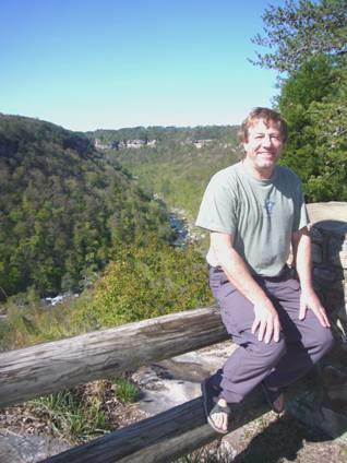
Little River Canyon
We continued now to Fort Payne, where we shopped in about the tattiest supermarket we have come across for a long time!
After that, there was nowhere to stop for lunch, of course. We finally stopped in a boat ramp car park by Lake Guntersville, just before Scottsboro.
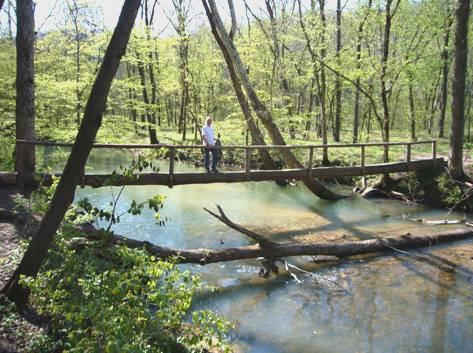
We continued now to Hytop, and ‘The Walls of Jericho’. This is also known as the ‘Grand Canyon of the North’, and there is a trail down into it from a new carpark beside the road. We set off at 2.30, and walked on a pleasant trail through the trees, gradually descending into the canyon. We had wondered how difficult the path would be, and then we passed a father with 3 small children on their way up, so we thought that it would be OK (but then we remembered Felix clambering down the steep, muddy cliffs at Port Mulgrave!)
The leaves on the trees at the top were not as far out as further south, but as we descended there were more leaves. The path was edged with violets, wild phlox and other flowers, and at one point a stream spurted out from the hillside. The path was well marked until we reached the floor of the canyon. We had crossed the stream twice on log bridges, and finally reached the cemetery where there was a lone grave to Joseph Clark, who had lived and farmed here in the past and died in 1881.
On the way to the Walls of Jericho
From here there were still red markers, but nothing to say where you should be going, and the path along beside the stream was very rough. We continued further and further, hoping to come to something which told us where we were, or if ‘this was the place we had come to see’.
The scenery was pretty, but not stunning, and we kept hoping for better. When we came to a sloping path high above the stream, I stayed put while Adrian went a bit further. Unfortunately he was gone a long while, and I became panicky, as I didn’t like the situation that I was in. My frantic calls to him went unheeded, as he couldn’t hear me. Eventually a father and his son who had also been walking the trail caught up with me, and the father was about to go on and locate Adrian, when he reappeared, unaware of my distress.
We now decided to return on the long trail back, but this was made difficult for me as my left knee was playing up. We just trailed on and on climbing back up the 1200ft (400m), and it was with relief that we got back to the Bam at 6.20, well ready to relax and enjoy a beer. We had decided to stay in the car park here for the night.
NB The father and son hadn’t returned by dark. The son, Scott, a young chap with lip and nose rings, had said that his dad was a real explorer, and drove his mum mad by going off. They got back to their car at 9.00pm.
Calgary, Canada to Winchester, Tennessee


