
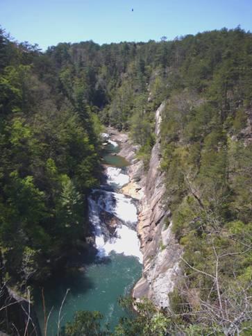
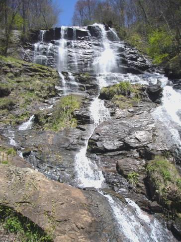
We continued towards Chattanooga, having climbed back up into the hills again – Winchester was down in the plain. The area was nicely forested, so when we saw a sign to Foster Falls we turned off. It was a wildlife area, and the falls were really pretty, in a spectacular setting. There was a campsite here, and as it was nearly 5 o’clock, we pulled in, although having just got water, we didn’t need one.
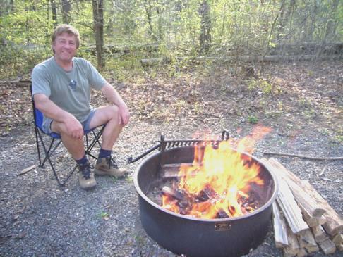
Adrian decided to get the fire going early, as he feared that it might rain.
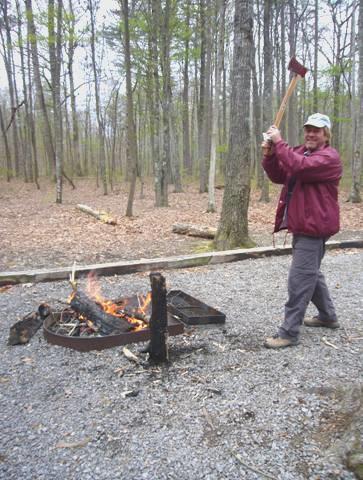
Adrian tries out his new axe
He was pleased to be able to use his new axe, but just as the fire was going nicely, and I had got all set up to write the diary outside, the rain started! Adrian hurriedly moved the Bam and put out the awning, so that I could sit under that. At that moment the lady came to collect the money!
Things got better – the rain stopped, and we had a lovely evening sitting by the campfire. The stars came out, but then it clouded over again. We cooked steak on the fire, and had an ambitious bread and butter pudding which I had made for ‘afters’. We didn’t come in until gone 9.00pm.
When we left just before 9 o’clock, the blue sky was clouding over. A few minutes later we crossed into Tennessee, and came to another parking area for the Walls of Jericho. We went in, and at least could see from the map here where we should have gone yesterday – we just hadn’t got quite far enough. We thought we’d do a short walk here, hoping to get a view from the top, but the mile long trail just wound through some woods, and the temperature was freezing! It had begun to rain lightly just as we set off.
We drove on into Winchester, where we found that the town was setting up for the ‘International Dogwood Festival’ this weekend. The roads in the centre were all closed, and there were all sorts of stalls lining the streets, and a couple of stages being set up for music. We were able to park right in the centre, and began sorting out our first email and website while we had coffee.
We walked around viewing all the stalls, then moved to a different spot, where Adrian was able to send the email. The weather brightened as we drove around some more, trying to find our way, with all the road closures. We found ourselves back by the petrol station which we had stopped at on the way in, and had got both water and petrol. We pulled into an area beside the garage to have lunch, and found that we had a good internet connection here!
We managed to find the right road out, and stopped a few miles on at Cowan, where there was a small railway museum, with a fine old locomotive, but it was closed! We had got the right day, but it didn’t open until May! Adrian climbed up into the cab anyway.
Friday 13th April Waltzing into Tennessee 60 miles
We were glad that we enjoyed yesterday’s wonderful weather, because today the weather was less than desirable!
Saturday 14th April Wet,wet,wet! 25 miles
I had heard a lady at Winchester yesterday say that it would rain all day today! Well, that was about right – we later saw a forecast saying 100% rain!
There had been some rain during the night, and more in the morning.
We didn’t leave until 10.15, driving through dramatic steep scenery to Jasper. Here we stopped, and were able to log in (by the graveyard) and read and send some more emails. We also phoned our ‘kids’, but Paul and Nicky were still away. It was warm and sunny in England, rainy in Spain, and finally not snowy in Calgary.
There was a heavy thunderstorm while we were there, but the outlook for tomorrow was worse – freezing cold with vicious winds.
We drove on a bit further, pulling into Marion County Park on Nickajack Lake, just before Chattanooga. There was a campsite here, and we were able to use the dump. We pulled into the picnic area to have lunch. The rain got worse – the only good thing was watching the birdlife – dozens of strange light coloured coots, swallows, and what we thought was an osprey.
The weather didn’t entice us to travel any further, but we did drive out to locate the Welcome Centre to pick up leaflets on Tennessee. Armed with these, we drove back to the campsite, and hoped for better weather!
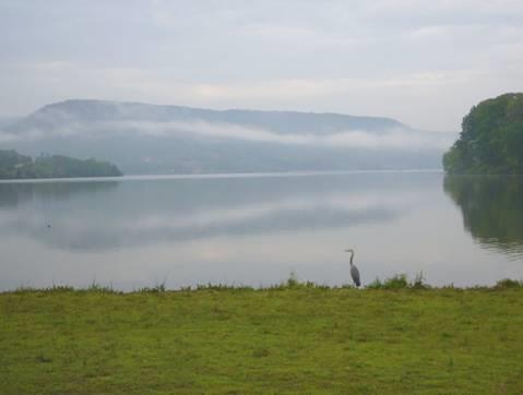
A heron surveys Nickajack Lake after the rain
Sunday 15th April Chattanooga Choo Choo 51 miles
The morning was grey and cold. The high today was 42ºF! We left at 9 o’clock, although we soon moved on an hour into Eastern Time, and followed a lovely leafy route to Chattanoooga.
Chattanooga nestles on loops of the Tennessee River, with hills all around, but the outskirts of the town were really dismal. We drove on to the centre – deserted on this cold Sunday morning – and arrived at the station of the ‘Chattanooga Choo Choo’ – now a Holiday Inn, where you can stay in the ageing carriages. A free shuttle bus left from here to the riverfront, so we parked the Bam, and got on the shuttle. The centre of the town looked as uninteresting as most U.S. towns, large gaps where buildings once stood. We alighted and braved the cold to walk across to the river. This area had been ‘tarted up’, with weird constructions which we didn’t understand. It was from here that huge numbers of Indians had left on the so-called ‘Trail of tears’ – their enforced removal to Oklahoma. Ross’ Landing, where they were put onto boats, bears no resemblance to the place it was then. On a warm day we would have walked along by the river, but now we returned on the shuttle, and spent some time looking around the Chattanooga choo choo and the former station.
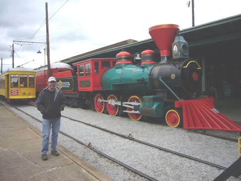
Chattanooga Choo Choo
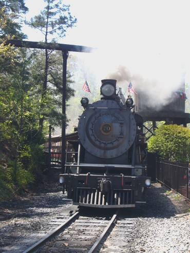
There is still a steam train that runs in Chattanooga, so we now made our way to Chattanooga East station, which was much further than we thought. We had a timetable, which showed only one journey on Sundays in April, and we arrived to see the train return. Adrian went off to have a look around, and found that another trip was running at 2 o’clock.
We couldn’t miss that, so off we went for a 6 mile round trip, which was very enjoyable. It included a look in at the workshops, and watching the huge engine being turned around on the turntable. It is nice to see that volunteers and enthusiasts are the same whichever country you are in!
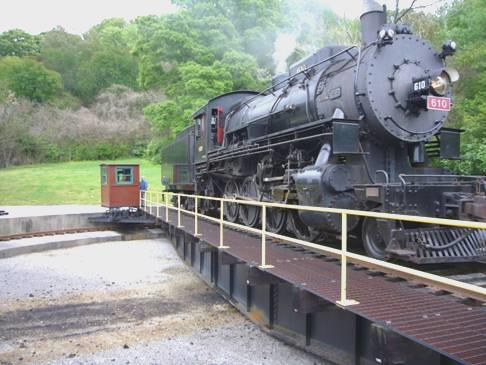
Engine 610 on the turntable
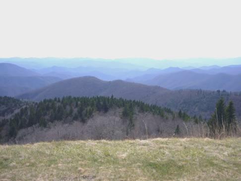
There are numerous attractions you can visit in Chattanooga, but we had now decided to follow Missionary Ridge down to the site of a major Civil War battle at Chickamauga. We nearly came to grief at the beginning when we found ourselves going through a tunnel barely high enough for the Bam, on a route we hadn’t intended being on! All was well. We continued along the Crest Trail, which afforded splendid views down over Chattanooga, but also was the site of part of the Civil War battle, and there were plaques all along the route – some of them (plus cannons) in people’s front gardens.
We finally reached Chickamauga Battlefield site, having crossed into Georgia. We spent some time in the Visitors Centre, trying to sort out what the battle here was all about. We then drove around the battlefield site, stopping at the various markers, but not being enticed outside! As at Vicksburg, there were memorials all around the route to the various regiments. I can never get into the intricacies of a battle, I just take in the lovely surroundings, and think of all the horrors of the fighting. The highlight to me was seeing a group of deer standing amongst the trees.
Tonight was another Walmart night, and we now made our way there. The sky cleared, and the sun came out for the end of the day.
Monday 16th April Thar’s gold in them thar hills 115 miles
Blue sky heralded a lovely day, after a cold night. We left at 8.45, stopping to get some petrol, which had gone up since last night!
We were soon driving through lovely hilly country, and stopped briefly at Ringgold Gap – a gap in the hills which was made use of during the Civil War.
We drove on through Dalton, which had a pleasant Historic District. We were amused at the Dollar Zone store which was advertising things for $1.25, and by a sign which read ‘Dalton’s Children Resale’!
We were looking for a post box, which we found, and a liquor store, which caused more trouble. We finally located one, but the sign said ‘Opening Soon’! On the way out of town, on Walnut Street, the answer to everything, we found Cox’s Liquor, which sufficed our needs.
We now ascended into Chattahoochee National Forest, where there were fresh dustings of snow! We stopped to climb up to Cohutta Lookout, where we looked out onto miles of wilderness forest.
We descended to drive through the smart little town of Ellijay, the centre of an apple growing area and then made our way to Amicalola Falls State Park. This is the southern end of the Appalachian Trail (2160 miles), but you have to walk over 8 miles through the park to get to the start!
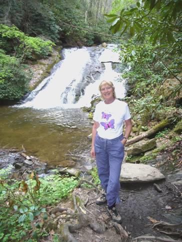
Our walks were shorter! We walked along a fairly level trail, the spongy surface of which was made up of 1300 car tyres, to see the falls. These were quite spectacular, as they are 729 ft high. We crossed them on a little bridge, then descended 175 steps to a lower lookout. The falls trickled down, so were really pretty. When we drove up to the top of the falls, we found that the stream that feeds them is quite small.
Pretty Amicalola Falls
While at the viewpoint, we got chatting to a couple who had recently moved to Georgia from Alabama, and preferred living here.
It was now pretty warm, so we were into shorts, having viewed the falls from all angles. We had looked at a large relief map of the area in the visitors centre, and realised that the ‘Lookout Mountain’ at Chattanooga is the end of the long Lookout Mountain range which we had driven along to Little River Canyon in Alabama.
We set off now, stopping at Dahlonega, which was the site of the first U.S. goldrush in 1828. The handsome courthouse in the centre of the pleasant town square now serves as a museum about this time. It was interesting to find out about this early discovery of gold. The quote by Stephenson, of the mint in Dahlonega, when trying to stop men going off to the Californian Goldrush 20 years later was adapted by Mark Twain as – ‘Thars gold in them thar hills’.
The sad part of this story is that it precipitated the removal of the Cherokee Indians from this area – their former land - on the ‘Trail of Tears’.
Across the road from the courthouse we walked into a wonderful General Store, packed full of all sorts of goodies and gifts.
We left Dahlonega, and drove a few miles north, where we pulled in beside the road for the night, amongst the trees.
After supper we transcribed one of the letters from my great great uncle William Lawson, written in 1853 from California, where he was prospecting for gold. It seemed appropriate!
Tuesday 17th April You can’t always get what you want, but So glad we made it! 81 miles
We were awoken at 7.15 by a bus turning round in our space! We’d heard the wind blowing through the trees in the night.
It was a frustrating morning!
The frustration was the 3 different parks which we stopped in, on this beautiful day, but in none of them did things work out. But everything comes to he who waits, and it all turned out well.
We were driving along the foothills of the Appalachians, which we found pleasant but rather manicured. We drove through the pseudo Alpine village of Helen, on the Chattahoochee River, which the Americans seem to like, knowing nothing better, but which we found very false.
Near here was Unicoi State Park, where the unmarked information centre wasn’t open, so we had difficulty in finding out about the trails. We decided to drive on through to the Anna Ruby falls – this turned out to be on National Forest land, but you had to drive through the State Park to get to it – all very confusing! When we reached it, the gate which stated ‘open at 9.00am’, was closed. It was 9.30! We thought that we’d have an early coffee. One car was already waiting, and gradually more arrived – about 6 in total. They were from an Atlanta walking group, and were meeting up here to go walking. We got chatting, especially to the first arrival – a nice chap who had visited England several times.
After about ¾ hour, we decided to head off, as the gate still wasn’t open. We took a diversion around large dammed Lake Burton so that we could visit another state park, and hopefully do some walking there. The road was narrow, winding and with a very uneven camber. There were a lot of fishing lodges by the water, but when we eventually reached Moccasin Creek State Park, it just appeared to be a campsite – we could see no evidence of the advertised trails.
We wound on and on, and finally came to Tallulah Gorge State Park at about midday. There was a campsite here, so we pulled in and found a spot.
It was lovely to sit out at the picnic table in the warm (hot) sun to have our lunch, surrounded by trees.
At 1.30 we set off walking. The gorge here is pretty impressive, with a series of attractive waterfalls. There are overlooks from both sides of the gorge. We walked along one side, climbed down hundreds of steps to a suspension bridge, crossed it, then climbed back up the other side. ‘not for those with health problems’ the sign stated!
Tallulah Gorge
We so enjoyed walking along in the hot sun, wearing our shorts. Lots of flowers lined our path – all kinds of violets, tiny irises and more.
We looked into the Interpretive Centre, which had lots of information on the history and geography of the gorge. It had been a very popular place to come to in the late 1800s and early 1900s. A dam was built in 1913, and we read a lot about Helen Dortches Longstreet who tried to prevent the dam being built, and who wanted the park to be kept as a special area. She was thwarted in her plight, but the area did become a state park in the 1990s.
An amazing feat to us was a man, Karl Wallenda, who walked across the gorge on a tightrope in 1970. We had seen the remains of the tower which the end of the rope was attached to. Even more amazing was a man who had done the same in 1888! I shivered just thinking about it!
Rosie the tightrope walker
After returning from this walk, we set off on another, driving a short way in the Bam first, and enjoying a cup of tea overlooking pretty Tallulah Falls Lake. This second walk was not very taxing, being on the route of the former Tallula Falls railway. It was a pleasant and relaxing 3 mile walk through the trees, and by the river. We saw some pretty pink flowers like hanging lanterns.
Back at the campsite it was still warm. We enjoyed a beer as Adrian lit the fire.
As we’d been travelling along today, we’d played both songs in the title, and they both seemed appropriate!
Wednesday 18th April Heading for the Smokies 60 miles
We were disappointed to wake to a cloudy morning, but the sun peeped through a bit, and we ate breakfast outside, enjoying the birdlife.
We passed Black Rock State Park, and as yesterday’s State Park permit was valid for today as well, we thought that we’d drive in. We hadn’t expected to wind up and up into the hills, but we reached a good viewpoint. The Visitors Centre was closed, but we looked at a map outside, and thought that we’d walk to Ada Hi Falls – apparently ¼ mile. I think that it was quarter of a mile downwards (and then back up), and all we saw was a little trickle! I had made the walk longer by starting at the first sign that we saw, which trailed through the woods for quite a way first. We had enjoyed the peace and quiet, and the views over wilderness hills
At Dillara, just before we reached the boundary with North Carolina, we went into a ‘Piggly Wiggly’ supermarket. It wasn’t very exciting (and neither was the cashier). We had read that Piggly Wiggly was the world’s first supermarket chain, started in 1916.
We came out and Adrian put on the computer to read the news. We were upset to read of the shootings in nearby Virginia, where 30 people had been shot dead at a college campus on Monday. We had seen a flag at half mast and wondered why. We were surprised that we hadn’t heard anything about it.
At 2.15 we left and crossed into North Carolina, stopping at Franklin, where Adrian went into a hardware store to get some metal to try to mend the back door lock, which broke (again!) a couple of days ago, so has been very inconvenient.
From here we took a winding road through the hills, above the Little Tennessee River, stopping at 4 o’clock in a layby with wonderful views down over the river and the remote hills.
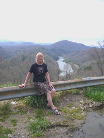
Our spot above the Little Tennessee River
After supper we transcribed a letter from Thomas Lawson, trying to get his parents to come out to the Marquesas Islands in 1850. We discovered that his brother William Lawson had already visited the Marquesas Islands before going to America and then returning to Ua Pou.
Thursday 19th April Black Bears end a wonderful day in the Smoky Mountain National Park 72 miles
Or ‘On top of old Smoky’
We started the day looking down onto the magical view of the Little Tennessee River valley filled with mist, and just the mountaintops peeping out. We watched as the mist gradually cleared as the sun appeared.
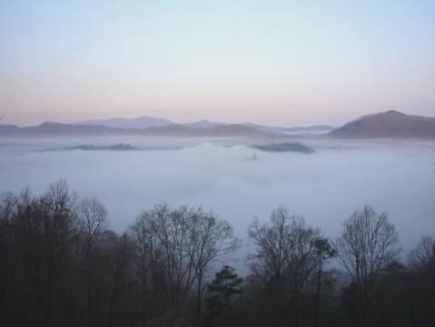
The early morning view
We left at 8.45, following the pretty Tuckasagee River through Bryson City to Cherokee. This town, at the entrance to the Smoky Mountain National Park, is in the small Cherokee Reservation. When all the Indians were ordered to leave, on the ‘Trail of Tears’, a few hid in the Smokies, and their descendents now live in this reservation.
It was a sadly tacky town, with all sorts of unnecessary attractions, but at this time of year, and at this time of day, nothing much was happening.
We pulled into Oconaluftee Visitors Centre to pick up a park map, and after chatting to the pleasant young ranger, who said that they had had an unexpectedly heavy snowfall recently, we started talking to another couple. They were originally from England – Liverpool and Norwich – but had lived in Vancouver for 35 years. She had a brother who lived in Tennessee, so they had been visiting him. There was much to chat about, but we left, and looked around the beautifully set out pioneer farm buildings outside.
Soon afterwards we stopped by Mingus Mill, which had been restored in the thirties and now grinds wheat into flour, but was used to grind corn in the past as well.
We set off to drive the 30 miles of the only road which actually crosses the National Park. There was plenty to do on the way!
We stopped first to have a pleasant walk, after crossing the Oconaluftee River which the road follows for much of the way. Violets lined the path, and we saw 2 dark eyed juncos (small birds) as we walked as far as the remains of former conservation corps buildings.
Soon afterwards we had another walk on a bit of the old road, now grassed over. We saw pockets of snow still lying, and were to see much more later, as we got higher.
We turned off the main road to drive the 7 miles up to Clingmans Dome. This is the highest point in the park (6,643 ft), and the highest point in Tennessee, but not in North Carolina, which has Mt. Mitchell, which is slightly higher. The two states meet at the crest of the Smokies, the boundary forming part of the Appalachian Trail.
‘On top of old Smoky’
When we reached the car park at the end, we were surprised at how many cars were there. This National Park is the most visited in USA, and we had been wondering how busy it would be, but luckily we are in the ‘off’ season.
After having lunch, we walked the half mile paved trail up to the lookout. It was pretty chilly up here. The Appalachian Trail goes right past, so we had to walk down to it, and stand amongst the snow! We chatted briefly to a family from Alabama who hadn’t seen snow before.
We had good views in all directions, but the sad thing here is the number of dead fir trees – about 70% have been killed by a beetle, rather like our elm trees.
We started driving back towards the main road, stopping to walk a bit of the Appalachian Trail, at Indian Gap, as it was close to the road. The path was strewn with debris from broken trees and with pine leaves. We realised that the storm on Sunday night had caused tremendous damage. The ranger said that they had been closed for a couple of days, and the Blue Ridge Parkway still is closed. (We hope that it opens soon, as we plan to drive some more of it).
We spoke to a couple who had been walking, and they said that the going was so slow, as they had to climb over and under fallen trees all the time. Another young chap, who intends walking the whole trail (2,160 miles), said that he had resorted to walking along the road at that point.
The road rejoined the main road at Newfound Gap, so we pulled in there, and saw the couple we had seen at the Visitors Centre, who were giving a lift to another couple we had passed. They were driving them to get food, so that they could come back and continue their walking. It had taken them longer, because of the difficulties. They were intending to walk 500 miles, into Virginia.
We walked another short stretch of the AT here, then thought that it was time to make haste towards the campsite we were planning to stay at. We hadn’t accounted for bears though!
The first we saw had gathered a crowd of onlookers, and we joined them. At one point he posed beautifully for the crowd! It was now that it started to rain, but even Adrian didn’t move!
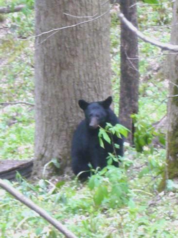
Black bear posing
Some way along the road, we came to another lot – a family of four. Again we watched for a while, so we didn’t reach Elkmont Campsite until 5 o’clock. The weather was still damp, but later we decided on a fire, in our nice little position beside a stream.
The evening cleared, and we sat out, enjoying our situation as the tiny crescent moon rose, and we heard the sound of frogs.
Three separate campers arrived back in the dark to their tiny tent/ teardrop caravan/ pop up tent as we sat by our fire.
Friday 20th April More of the Smokies 35 miles
We didn’t envy the tent campers during the cold night!
It was a beautiful day. We set off at 9 o’clock on a wonderful 3 hour walk.
At first we walked along a former railtrack beside the Little River, which tumbled continually over huge boulders. The sun peeped through the trees, which were just getting their new leaves, and violets, dogwood and trillium fringed the path. It was peaceful, with just the occasional birdsound.
Us posing by Little River
After about 2½miles, we left the river, and followed a more uneven path, crossing a rocky stream a couple of times. The last part of the walk was down the valley, and through the former village of Elkmont.
When the park was formed in the thirties, there were 1200 families living in it. The National Park bought their homes, but some of the occupants negotiated to live in them for the rest of their lives. This ghost town of derelict houses was quite evocative. We saw 2 deer here, and later saw lots more.
We got back to the campsite at midday, and set off towards Cades Cove. We now drove beside the Little River, instead of walking – it was really pretty.
We stopped at ‘Metcalf Bottoms’ picnic area for lunch – well, we had to, didn’t we? It was a vast picnic area, but we were able to have a table right by the river. How different it would be in the summer! The group next to us seemed to be a family group of 10 – made us think of our own family gatherings.
I saw some little flowers growing by the river, called bluets, and looking like tiny blue stars.
We drove on to Cades Cove (cove means valley in the Smokies), where we located a pitch in the campsite, and had a cup of tea before setting off on the 11 mile scenic drive. Along the way, there were lots of places to stop off and visit – all reminders of the former community which was here. The scenery was delightful, as we stopped off by the houses, churches and mill.
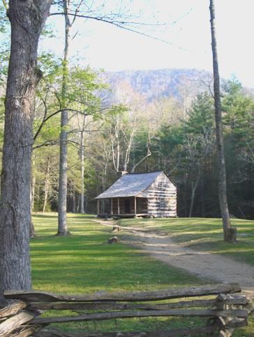
Carter Shields cabin in Cades Cove
Sometimes quite a long walk was involved, so this all took the rest of the afternoon, and we didn’t get back until 6.40. By then the camp store was closed, and we couldn’t get any firewood.
Once back in our place, we got a barbecue going instead, and put on the steak. It has been a long time since we’ve been in a busy campsite, full of families and groups enjoying themselves.
There was enough firewood for us to have a fire to sit around after our meal – we didn’t come in until 9.40.
Saturday 21st April Four bears at the end of the Rich Mountain Loop Trail 25 miles
After a milder night, it was a beautiful day. We ate breakfast outside – it was still a bit cool, but we enjoyed the fact that there are no mosquitoes at this time of year.
While we were dumping and getting water, we chatted to a widower of 81, who still looked hale and hearty. We were amazed that only one water tap was open – they haven’t opened up for the season yet, although there are crowds of people about. We called briefly at the camp shop, which had virtually no fresh food – a couple of apples and bananas. We were able to get a sliced loaf to make up sandwiches, as today we planned a long walk.
The walk we intended doing was about nine miles long – virtually 1500ft (500m) up a mountain track and back down again! We set off at about 10 o’clock, and returned at 3.30. It was a perfect day for it, and we soon got very hot walking.
Soon after starting off, we passed behind the first cabin we had visited yesterday on the Cades Cove Loop Trail. Then we began the ascent, having forded a wide stream, where I got a wet foot! We crossed many more streams, and often walked up some too.
I found the going up pretty tough, but a young couple we had met at the start walked the other way around – we met them near the top, and they had found it even tougher!
Lower down there were tiny flowers lining the path – violets, cinquefoil, dwarf irises and several little white flowers. Further up there were less flowers, and the leaves weren’t out on the trees. We sometimes had misty views through to the mountain slopes and down to Cades Cove. Near the summit, we could see down to the valley on the other side as well, as we walked along a ridge.
On top of Rich Mountain
We passed only a few people all day. Early on two chaps on horseback passed us. The men were wearing all the gear, and we could imagine a western being enacted here. We passed them a couple more times, and exchanged a few words, but they were very difficult to understand!
The cowboys pass by
While we sat near the top to eat our lunch, a couple walked by, and it turned out that they were from Swindon! They now live near Granada in Spain, but their sons still live in England – one on Swindon and one in Portsmouth. We spent some time chatting!
The other people we passed were 2 chaps who were camping near the top, and were walking down and then back up. They said that they plan to walk all the trails in the park – 800 miles of them!
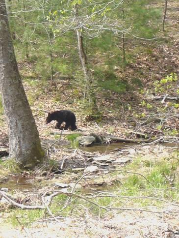
The descent was much easier for us, and we even passed a couple of waterfalls. As we walked along, we joked that the dark tree stumps looked like black bears. Then after we had completed the loop, and had just joined the ½ mile track back to the road, we saw a family of four bears grazing by the stream, just across the meadow. It really made our day!
One of our own bears
Feeling exhilarated, we reached the Bam and drove back along the road to Elkmont campsite. It was such a pretty ride, beside the delightful tumbling Little River. The constantly winding road, with overhanging rocks, and the large amount of traffic on this Saturday afternoon made it quite hazardous though.
We found that they had opened up more of the campsite, but it was still very full. We managed to find a pleasant spot near ours of two days ago. It was now 4.30, so we sat in the sun to enjoy a cup of tea.
And later we had a fire, and sat out in the relative warmth and the quiet.
Sunday 22nd April A fun day at Dollywood 33 miles
We were up early, before the sun had reached us. It was a lovely drive back out of the park, but it was sobered by listening to a radio report on last Monday’s killings at VirginiaTec.
Once out of the park, it was a huge contrast when we reached Pigeon Forge. The whole town is just a mass of ‘American Grot’ – Motels, outlet shops, attractions – and incredibly busy at 8.30 on a Sunday morning. The reason for this, we found out, was that this was a ‘Car Weekend’. The sides of the road were lined with old or hotted American cars – hundreds and hundreds of them.
Our reason for coming here was that we wanted to visit Dollywood – yes, really - us going to a theme park. We have become interested in Dolly Parton during the last few years, having heard her talking on radio in Britain, and we also love her music.
First we wanted to suss out a campsite for tonight, as there is no free camping in Pigeon Forge. We located the campsite – which looked like a typical RV park, except that there was one row beside a small river – Walden Creek. The site looked pretty full, but would be quieter tonight, as the car show was finishing today.
We made or way to Dollywood, which didn’t open until 10 o’clock today, but when we arrived at 9.40 there were already dozens of cars arriving.
We are pleased to say that we had a really great day. This is the first, and maybe the last, theme park which we have visited in U.S., but we really did enjoy it. Most of the rides didn’t interest us – or at least me – but we did go on a few – cars, galloping horses and a very wet water ride. Also Adrian was delighted that there was a ‘proper’ steam train which took us for a ride for several miles into the hills.
Fun at Dollywood
We spent a lot of time in a sort of museum about Dolly Parton – a bit like seeing about Elvis at Graceland. There was all sorts of memorabilia from her childhood, hundreds of photos, lots of her costumes and many of her sayings.
We had hoped to hear country music, but as they were celebrating a ‘Festival of Nations’ this month, most of the music was from other countries.
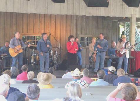
The Kinsfolk – members of Dolly Parton’s family
We did watch part of a performance by members of Dolly’s family, but other musical items we saw were an Ecuadorian group, male singers from Zambia, and performances from the National Dance Company of Ireland, and also one from the Russian National Theatre. Some did pander a bit to the American audiences, but the performances were excellent. We couldn’t believe the huge audience for the Irish performance, which was a bit like Riverdance, and the Russian one was wonderful too.
A fun thing we did was to have a lesson on playing the bodhran, the Irish drum. Ireland featured more than other countries.
After our very full day, we didn’t leave until 5.45. We headed for the campsite and positioned ourselves by the stream, and watched the birds as we had a barbecue and later a campfire. It was much warmer now that we had come down from the hills a bit.
Monday 23rd April A British defeat in the French and Indian war 63 miles
Although booking out time was 11 am, it was nearly midday by the time we had done all the ‘jobs’. Having electricity and a wi fi connection meant that there was a lot that we could do! We were able to speak to both Emma and Paul on the phone, and I sent several emails too.
It was by now sunny and hot. We were driving westwards initially, just north of the National Park, on a pretty but winding road. Once more we were following theLittle River, and stopped to have our lunch sitting right beside it, in a very lovely situation.
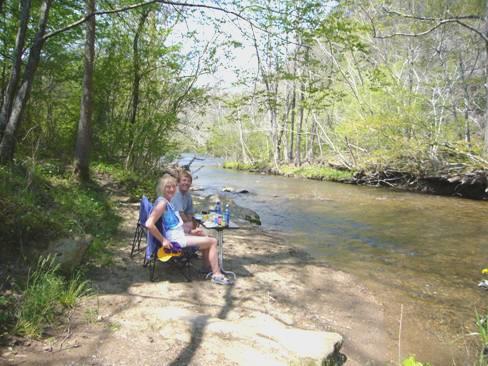
Lunch by the Little River
Soon after that we joined the Foothills Parkway, which is a National Park road, with lots of stopping places with views of the Smokies, and of the valley to the north.
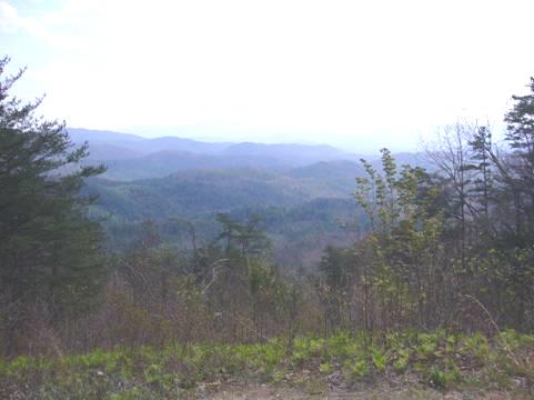
View of the Smoky Mountains
The parkway ended just to the west of the National Park, and we now drove along beside the dammed Little Tennessee River. We crossed Tellico Lake, and took route 360 south, very soon coming to Fort Loudoun State Park.
It was still a beautiful day, and the fort was in a wonderful situation (although there would have been only a river, and not a lake in 1756, when it was built).
Fort Loudoun
After wandering around the buildings of the excellently reconstructed fort, we went into the visitor’s centre. It was now 4.25, and it said that it closed at 4.30, but we were welcomed by a very genial and chatty ranger, who asked if we would like to see the video. As we had seen that the fort had been built by the British, in the war against the French for the control of eastern America, we said yes. We usually find that these videos are a really good way of understanding about the history more easily.
This was the case here. Both the British and the French were trying to get the support of the Cherokee Indians. The end result at Fort Loudon was that, partly because of misunderstandings in culture between the British and the Indians, the British were surrounded by the Cherokees, and were finally slaughtered. Had this not happened, there could have been a very different outcome to North American history.
The ranger was happy to chat to us after the film, but then we left, and drove on a short way, before stopping beside the road at about 5 o’clock.
It was a warm evening. We went outside to look at the stars at bedtime.
Tuesday 24th April Cherohala Skyway, and back into the National Park 109 miles
The night was warm too. We left at 7.30 on a grey morning, which accentuated the reflections in the water.
We headed for the Cherohala Skyway - a National Scenic byway through this southern part of the Appalachians, with no development along it. There was also hardly any traffic. We saw a few bikers. Yesterday we had seen a lot, and later found out that this is a big biking (motorbiking) area.
We stopped to have breakfast near the start of the trail, overlooking the tumbling Tellico River.
There were numerous viewpoints along this 40 mile route, with forested mountain views. This area of the southern Appalachians is noted for its diversity of plant life, being on the limit of both the northern and southern vegetation areas. The whole area here had been logged out during the late 1800s and early 1900s, which so upset a number of conservationists that it started the move for Smoky Mountain National Park and the Cherokee & Nantahala National Forests.
View from the Cherohala Skyway
The road ascended to 5,390 ft, by which time we were in thick cloud. We had crossed the state line into North Carolina at Beech Gap, at 4,490 ft.
We descended now to Robbinsville, by which time the weather was quite damp.
We continued eastwards, crossing the route of the Appalachian Trail once more.
We had difficulty in finding a stopping place for lunch, having now left the byway, and turned off at a sign to a picnic area, which entailed driving several miles down and down to a boat ramp by Fontana Lake – a dammed part of the Little Tennessee River. We couldn’t get to the lake, so had to make do with sitting amongst the deep forest.
We drove back to the road, and had now come full circle – we had driven across the Smoky Mountain National Park, and right around the western end, and now we were back at Bryson City.
There was a road here which led back into the National Park at Deep Creek, so that is where we now headed. We located the campsite, which was almost deserted, and found ourselves a pitch.
Booking in here was done by self registration on an automatic machine. You had to make sure that you got the details right! Only later did we find that the 2 pitches either side of us both had their registration forms out from several days ago! Also the notice board had rules and regulations, plus a list of events – for 2005!!
I went to suss out the ‘conveniences’ – just 2 loos and 2 washbasins, no showers – but sitting by the sinks was a lady who was eating an orange, reading a book, and with her computer set up! ‘It’s nice to have electricity’ she said.
At abut 3 o’clock we set off to walk on a trail which passed by 3 waterfalls.
Indian Creek Falls
The afternoon had become warm and sunny again, and I felt too hot, particularly on the ‘ups’. A few flowers lined the path, including cranesbill (geraniums). We were both startled at one point when a wild turkey flew up from the undergrowth immediately in front of me.
Once back at our spot, we refreshed with a cup of tea. We had collected up some firewood from a large pile of logs, and Adrian began chopping it for a campfire. We sat out by the campfire until late.
Adrian’s T-shirt says ‘Life is good’
Wednesday 25th April Cherokees and blue ridges 83 miles
We were up early, when it was still cool. There was near disaster when I put the oven on to do the toast, forgetting that I was storing a large cake, in plastic bag, in the oven! All was well.
We breakfasted outside, then drove back into Bryson City, buying a few things in a rather tatty IGA store, before retracing our steps of nearly a week ago to Cherokee.
Here we visited the Museum of the Cherokee Indians. We were keen to find out more about the life of the Cherokee Indians, and the Trail of Tears, but we found the museum less than brilliant. Partly this was because it was very cold inside (the day by now was warm) and also it had really low lighting. Also, the sound exhibits overlapped each other as we walked around, which I found distracting.
We had been welcomed by an older Indian, who signed our leaflet for us. We think he was someone important. He told us that he had been to England - Weymouth and Falmouth, some years ago.
It was midday as we made our way to the Oconaluftee Visitors centre to get a leaflet on the Blue Ridge Parkway, whose southern entrance is here. We were pleased to see that the road was open, but later found that part of it is still closed (routine repairs to a tunnel).
We started our drive along the Parkway, stopping at most of the numerous viewpoints, where we had views out over the forested ridges. The visibility today was excellent. Beside the road were patches of the tiny bluets – the little 4 petalled blue flowers with yellow centres.
View from the Blue Ridge Parkway
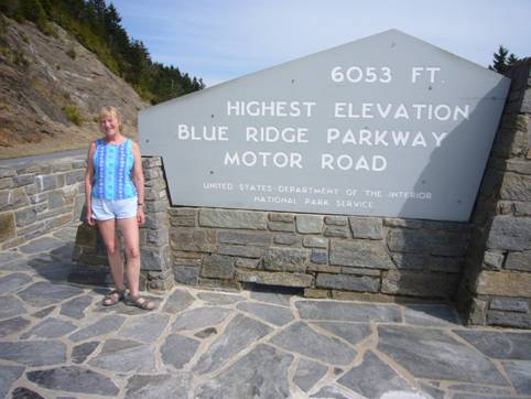
We stopped at the highest point on the parkway – 6053 ft. The sun was really warm. As in the Smokies, there were lots of dead trees, killed by the tiny bug.
We continued to Mt Pisgah, where there was a campsite we intended staying at. We hadn’t expected that it would be closed!!. A couple driving the other way told us that only one campsite on the Parkway is open – they are all still closed ‘for the season’. Cuts, it seems. We had been less than impressed by the facilities and maintenance at Deep Creek campsite – the water and dumping facilities were particularly bad.
We drove on a short way, and turned off onto a side road at Elk Pasture Gap. It was a very steep road, but we soon found a place to stop beside the road. Adrian was upset, as earlier he had loaded two huge logs into the van, hoping to chop them up for firewood. He managed to chop up one, but had to discard the other for lack of room, as we now had no chance of a campfire tonight. However, he couldn’t face leaving it behind, so later he cut it into smaller pieces with the hope of finding somewhere to put it in the morning!
Thursday 26th April More of the Blue Ridge Parkway 104 miles
Back on the Parkway we headed for Asheville, where we had to turn off to get some provisions (mostly wine!) We chose not to visit Biltmore Estate, the vast extravagant Vanderbilt ‘palace’, thinking that we couldn’t justify the large entrance fee.
A section of the Parkway is closed north of Asheville, so we made our own diversion via the I40, turning off at Old Fort after a long steep descent.
We hadn’t been able to find a post box or an internet connection in Asheville, but in much smaller Old Fort we got both!
We now followed a steep and winding road back up to the Parkway, rejoining it at 12.30, right after the closed section. (the few diversion signs sent you on a much longer route).
We pulled in almost immediately to a view of the Black Mountains, with Mt Mitchell (highest point in North Carolina, and east of the Mississippi.) We had lunch here, while the weather was in its changeable mode, and the view kept coming and going.
We drove on northwards, passing through several tunnels (there are 26 in total on the Parkway). We continued to pull in at the various viewpoints. Some had information boards, and you would never know which might be a really interesting one. One of them told us that someone had had an idea in 1906 of building a road from Virginia to Tallulah Gorge, as the advent of motor transport could bring tourism to the area! The road was begun and 8 miles were built, but WW1 put a stop to it. In 1935 the building of the Parkway was started.
We stopped at Chestoa View, where the still erratic weather meant that we saw the strange sight of a rainbow down in the gorge below.
The flowers to note today were the trilliums, often in large patches. As well as the large flowered trilliums, we saw the smaller painted trilliums. They looked stunning with their 3 white petals, tinged with red in the centre. We also saw the first of the pink rhododendrons, and thought how lovely it would look in a week or two.
We now reached Linville Falls campsite – the only one open on the Parkway at the moment. After selecting a pitch, we went off to walk to the falls. The small visitors centre, although manned, was closed – it was just after 4 o’clock!
The falls were certainly delightful. The unassuming Linville River went through a dramatic gorge, and we could view the falls from several different viewpoints as we wandered on through the forest.
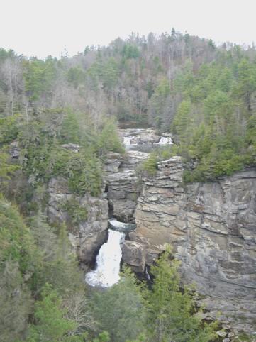
Linville Falls
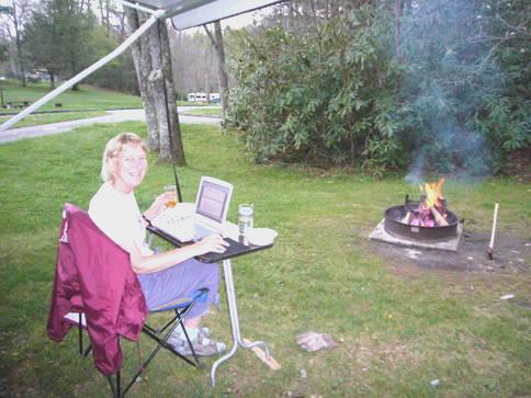
We returned to our campsite, where Adrian put out the awning, as the weather was still variable. He found that his ‘newfound’ wood was rather slow to get started, but he triumphed in the end (free wood and a lot of lighter fuel!)
Writing the diary
We sat outside to eat, under the awning – it had decided to rain at that point - but then we sat around the fire until 9.30, enjoying the stillness and quiet.
Friday 27th April Our last day on the Blue Ridge Parkway 93 miles
It was a fine morning, and we enjoyed sitting outside in the sun for our breakfast.
Our first stop, driving on northwards, was to walk the Flat Rock trail, which led gently up to some flattish quartzite rocks, where we had views down into the valley and a glimpse of Grandfather Mountain. There were information boards about the trees, but all had either died or had fallen.
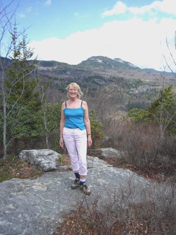
Beacon heights
Soon after this we had another climb – up to Beacon Heights. This walk was longer than the suggested 10 minutes, but again gave us great views from the top, particularly of Grandfather Mountain again. This mountain is privately owned, and although it is reputed to have excellent walks, we didn’t bother to visit, as we are finding plenty of free walks.
The path was rough, and we’d had to negotiate a newly fallen tree near the beginning. There was a lot of tree damage in this area, presumably from the storm they had about 10 days ago.
We stopped soon after at Linn Cove viaduct. This bridge was the last part of the Parkway to be completed, 20 years after the rest of it, in 1987. It resembled many Italian bridges, but is something of a rarity here, and they are very proud of it. There was a small visitors centre, which was just opening up for the season today. Adrian asked the lady why it was so late, and she replied that at this altitude (4,500ft) it can often snow in April, and they, like the Smokies, had had 8 inches of snow early last week.
Our next stop was at Julian Price Park – an area which had been the retreat of a former insurance executive who had donated it for the public to enjoy. We had our lunch in a pretty picnic area where the tables were scattered beside the pretty stream.
After this we had a pleasant 2½ mile walk around Price Lake – a bit like a walk around South Lake, but rather longer. We saw evidence of a lot of beaver activity – gnawed off trees and a dam. We had seen tiny dark blue speedwell flowers, as well as the lighter blue bluets – it was like Oxford and Cambridge, but both were pretty.
This park led immediately into Moses H Cone park. This had been the country retreat of Mr Cone and his wife at the turn of the 20th century. He had earned his money in textiles – denim. He had owned this large estate, and had built 26 miles of carefully designed and manicured carriage drives through it. He had built 2 lakes, and set out vast apple orchards and had used scientific farming methods. We walked a short trail, said to be a favourite of the Cones. Again there were markers on many of the trees, but we were saddened to see that most were now dead, and the whole place needed an overhaul. We were led to believe that the Cones would have liked things to be well looked after. The house – a colonial revival mansion – now housed a collection of superb but pricey craft items.
We were heading to the point where we had started our drive of the Blue Ridge Parkway in August 2005. Unfortunately along this last section, the markers at the lookouts had been taken away, to be renewed. They seemed to have been missing a long time, and it detracted a lot not knowing what you were supposed to be looking at!
At Deep Gap we turned off the Parkway, and were back onto ordinary roads. Finding anywhere to stop for the night proved extremely difficult, and after about 20 miles we were into Virginia. This did give us the chance to drive through the strangely named town of ‘Mouth of Wilson’!
We continued to the Mount Rogers foothills (highest point in Virginia), where we pulled in beside the road just after Trout Dale at 5.30.
Saturday 28th April Into West Virginia 147 miles
We were awake early, so left by 8.15. The Appalachian Trail passed by a few yards further on, and also there was a National Forest campsite!
We drove on northwards to Marion – we are crossing this western end of Virginia into West Virginia – we have visited quite a bit of the eastern side of Virginia before.
We drove along the pleasant brick built Main Street of Marion – dating from the early 1800s, and site of a Civil War battle, but were amused at the signs ‘A Virginia Main Street Community since 1995’! Wow!
We drove on past Hungry Mother, apparently named after a legend of an Indian child, whose mother had died, and who could only say ‘Hungry Mother’.
We now wound up into the mountains again, and had views of Mt Rogers, which we hadn’t had last night. We saw a marmot beside the road. Just after that we passed a chicken farm where the coups were made of upright cylindrical plastic rubbish bins, in blue, yellow and white. It made an attractive sight.
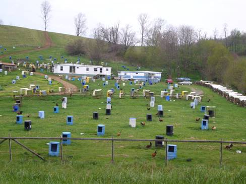
Unusual chicken farm
Just before the attractive town of Tazewell we stopped to get some petrol, as Adrian noticed that the price was good. He couldn’t believe it when the man changed the price on the sign while Adrian was filling, and charged him the higher price!
We now drove up a pretty green valley, with a delightful little stream, making us think of the Yorkshire dales. We had expected to be in forest, as this was part of Jefferson National Forest.
We joined the motorway for a short section, driving through a longish tunnel into West Virginia at Bluefield. We kept on the motorway for a few miles to Princeton, as we wanted to visit the welcome centre to get maps and information.
Everywhere seemed very busy, but we soon took a quieter road, and enjoyed the patchwork of greens of the various trees with their new leaves.
We stopped by Pinnacle Rock – a huge natural structure looking like an enormous piece of wall jutting up. We had started on the ‘Coal Heritage Trail’, and turned off to visit the small town of Bramwell. This had been settled at the end of the 19th century by the wealthy mine owners, and became known as the ‘Millionaires Town’. Several of these smart homes remain. The main street had some nice brick buildings. There was also a reconstructed station building, which housed information on the coal mining era. Adrian was annoyed that it was closed, although it stated that it was open.
Just as we were about to drive off, and old chappy hobbled out of the house beside us, and asked if we wanted to visit the ‘Depot’. He then walked over and unlocked the place, which was crammed with artefacts of a former time. He had worked for the mines himself for 38 years. He was amazed that we were from England. He had noticed that our van was registered in Texas, but said that he would have no idea of what a Texan accent was like!
The town used to stage huge annual street parties until the seventies – Dolly Parton even came to one.
The single item in the museum which affected us most was the certificate of a family with 16 children, 11 of whom died within one month in 1862 – in fact all of their children at the time, as 2 had already died in infancy, and one was married. Two more were born after the tragedy, and descendants later lived in this town.
There is still some coal mining carried out in the area, and soon afterwards an enormously long train of coal wagons passed us. A pretty waterfall was positioned behind it. It seems as though it has been very wet here recently, and water was spurting out of the hills in several places.
Much of the country we drove through now was pretty, but many of the houses were decrepit or derelict, and it seemed to be a poor area.
We reached the town of Welch, which had become important in the coal era, as the railway ran through it. The name was appropriate, as the setting resembled the Welsh mining area, with steep narrow valleys filled with houses.
It was here that we had a difficult experience which turned out to be very funny. We came to a sign saying ‘low bridge – 9ft. Trucks use bypass’. As our van is 9ft 11ins, we turned around and drove back out of the town, finally stopping to see where we had got to. Adrian got out the computer, and found that we were going south, whereas we wanted to go north. We could see no bypass on the map, and could only see the road which we had come on. After many problems (computer difficulties), we decided to drive back into the town, and see if there was another road. In the town, Adrian noticed a large truck behind us, so pulled over so that the truck could overtake. We neared the low bridge, and the truck just kept going! Just before the bridge, we saw that there was a second adjacent bridge, with high clearance! This was the so-called ‘Bypass’! We pulled in so that we could stop laughing enough to continue on our journey!
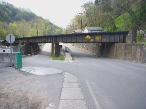
The Welch ‘Bypass’
It wasn’t long afterwards, soon after we had crossed into Wyoming county, and just before Wolf Pen, that we found a large area suitable to pull into for the night.
Sunday 29th April Lovely rivers 96 miles
There was some heavy rain in the night, but it was a beautiful day, after a misty start. Continuing on the ‘Coal heritage trail’, we came to Pineville, where we turned east to follow the very pretty Guyandotte River. The early morning sun looked lovely on the fresh green of the trees, and shone on the wet rocks beside the road. There were patches of cultivation on the rich flat floor of the valley.
We were amused at the road direction sign which read ‘Route 10 South; Route 16 North’ for the same road.
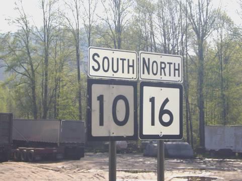
Confusing!
We drove through Mullens, which had some neat, well looked after houses. The town had suffered from floods and fire in the early 1900s, and the centre was now all brick built.
We see very little wildlife as we drive around, so we were surprised to see a deer spring up, really close to the town.
We had a long stop for coffee, just before the atmospheric town of Sophia, while we worked on the website.
After that we joined a wide road to Beckley. We ended our ‘coal route’ here, and were looking out for the mining museum. It was a large town, and as we saw no sign of the mine, we gave up the idea. Later we saw a leaflet on the mine – ‘Reopening in 2008’!
We stopped on the outskirts to shop in Food Lion. Adrian had chosen several bottles of wine. It was just gone midday, but we couldn’t purchase the wine until 1 o’clock!
We decided to have lunch and write some emails. By then it was time to buy the wine. In fact we didn’t leave until 2 o’clock.
We joined the motorway east, descending on a very long hill to New River gorge. We turned off to go into the visitor centre to find out about the National River Park. The building was all ‘green’. We watched a short film about the Watershed of the river – what we would call the catchment area. The centre was nicely done – what we both liked best was a large map of the New River, set into the floor of the building. The river starts near Blowing Rock by the Blue Ridge Parkway, and flows through North Carolina and Virginia, reaching the Gawley River at Gawley Bridge, about 20 miles north of here.
There was also a large 3D relief map of this area of the Appalachians, so we could follow our recent route.
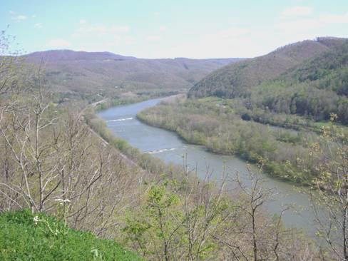
The New River
We now followed the New River southwards, stopping to view Sandstone Falls. At Hinton we crossed the river, and continued to Bluestone State Park. The road into the park took a long and winding route. We drove further and further on – we actually missed the campsite and continued to the second one, which was closed!
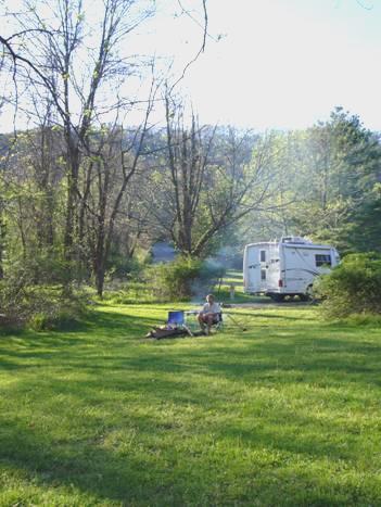
We returned and selected a pleasant pitch above the river. There were some delightfully scented bushes with tiny white flowers.
Back at the office, the man wrote out the permit. When Adrian indicated that he was asking for ‘seniors rate’ (over 62), the man said he hadn’t even thought about it, as Adrian couldn’t possibly be over 60!
We had a lovely evening sitting out by the fire on our remote ‘lawn’ above the river. We had to disguise our drink in cups again, as no alcohol was allowed in the park at all!
Winchester, Tennessee to New River, West Virginia


