
Tuesday 18th July We arrive in Nova Scotia 34 miles
We located our bunks on the ship, and lost no time in getting into them! We both slept like logs – perhaps it was the travel pills we had taken. We didn’t stir until about 9 o’clock, and didn’t rise until nearer 10.00.
We made our way upstairs to have breakfast, which was better, and less expensive, than on most boats. We had a table by a window at the rear of the ship, and stayed there until it was time for lunch!
We were still eating this, when it was announced that there would be ‘live entertainment’ in the bar. This turned out to be 2 chaps – Ray Lake, and a chap on squeeze box – playing ‘Newfie’ music, some of which Ray had written.
The audience wasn’t that large, or enthusiastic, but we thought that they were great. We told them so afterwards, and bought a couple of Ray’s CDs. We didn’t have enough cash on us - the ATM didn’t work, and we didn’t have access to the Bam for more, but Ray was happy to take what we had. We chatted to them for a bit. The squeeze box player (whose name I can’t remember) didn’t look like a musician at all, more like a builder. He had lived in Wabush in Labrador for 14 years, and said that that was enough for anyone, it was so cold!
By now the misty day had become clear, and the last bit of the journey, as we came into the bay at North Sydney, was really enjoyable as we watched from on deck.
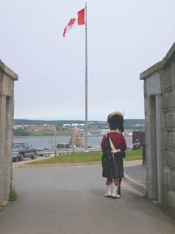
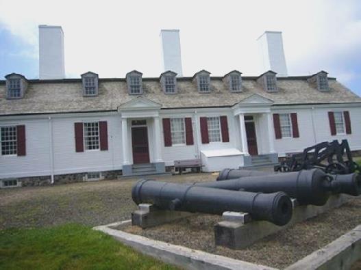
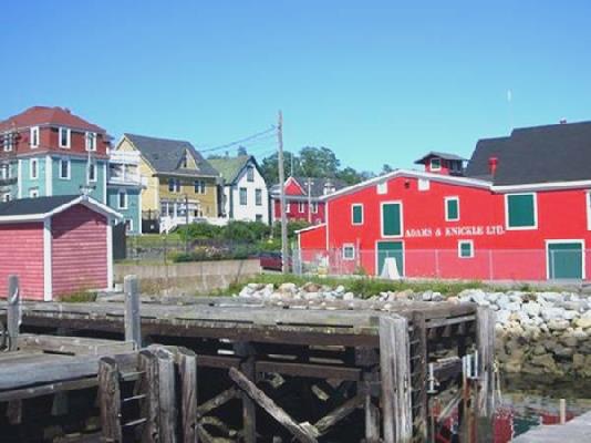
By 4 o’clock we were driving out on our way past Sydney towards Glace Bay. We followed signs to the Marconi site – where he had sent his first message from, to Poldhu (he had already received one at Signal Hill, St. Johns) - and the heat suddenly hit us. It was windy, but oh so warm!
We viewed the artefacts in the small visitors centre, and saw the foundations of the four towers which had stood there, before driving on into the town. We noticed that Nova Scotia is busier, and has more of the modern ‘trash’ than Newfoundland (at least this part has).
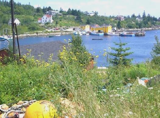
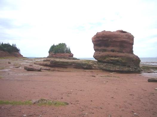
We had decided against visiting the mining museum which was here, as we were both feeling on overload, but we stopped in the town and were able to send our latest email and website. A bit further on, past the hospital, the road ran out right by the sandy beach of ‘Glace Bay’, and we decided to stop.
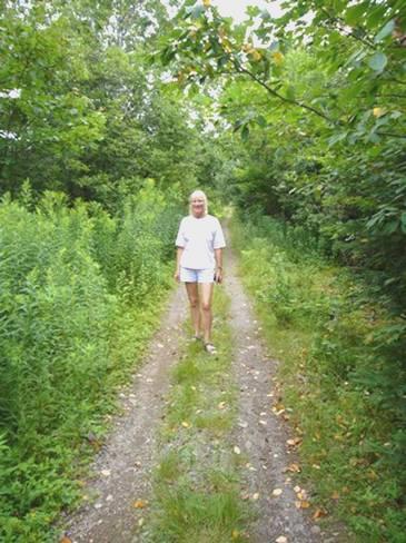
We walked onto the beach, where there were a lot of jellyfish.
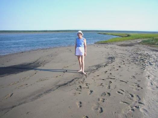
Rosie at Glace Bay
We soon realised that this is where everyone drives down to! Some stop a while, others just turn round. Adrian got chatting to 2 men, Arnold and Russell, who had both been coal miners. They gave him some of their rum.
After supper we walked out again onto the beach, but by now it was much cooler.
Wednesday 19th July The reconstructed former French town of Louisbourg 103 miles
We left at 7.45 new time (half an hour earlier than Newfoundland). We had seen a heron in the water, and noticed lots of flidgies about.
We made our way to Louisbourg, stopping at Port Morien, which is where Marconi had moved his station to, but nothing remains of it now. An information board told us that both the first Boy Scouts, and the first coal mine, in North America were here. Now it seems to be fishing.
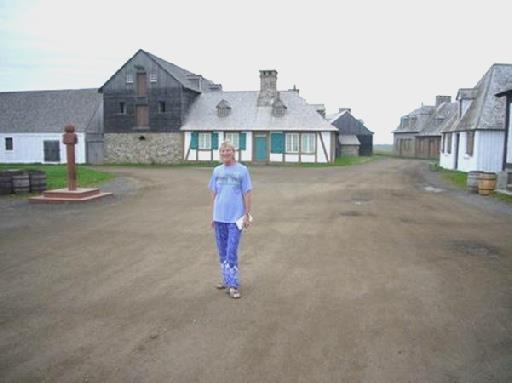
Early morning in Louisbourg
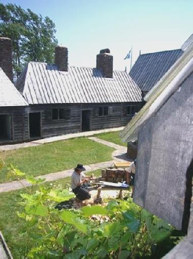
We were early arriving at Louisbourg (pronounced Lewisburg here). Louisbourg had been a large French town in the 1700s, but there had been nothing remaining of it. In the 1920s, some local people built a museum to house something about the former town. Then, when the coalmining in the area stopped in the 60s, the Government used the labour to reconstruct the French town to look as it would have done in 1740. It is now one of the most visited sites in Canada. It is run rather like ‘Plimoth Plantation’ and Williamsburg, in that people in period costume act the parts. Even the food served in the restaurants is 18th century fare. We ate pea/vegetable soup, sitting at a rustic table, with a sturdy spoon being the only implement (whatever you ordered). We shared our table with firstly a young couple from Quebec University – he was doing a Masters on Canadian literature, which didn’t appeal to Adrian! Later we were joined by a young couple, both teachers, and their 2 young children, from near Toronto.
There was much to see in the village, so the morning had vanished, and as we were about to leave at 1.30, there was a re-enactment with pipers and drummers, ending with a cannon being fired - all good touristy stuff, but well done.
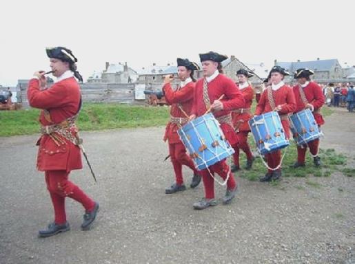
Fifes and drums at Louisbourg
It was 2.15 as we headed back towards Sydney, stopping to do quite a large shop (they had taken my remaining potatoes at Argentia, as there is some bug in Newfoundland which isn’t on the mainland). We tried to get an internet connection, but weren’t able to receive the messages we had got word of on the phone. A man had stopped his car and reversed up to us, but he only wanted to see if we were lost and needed help!
Everywhere seemed very busy after Newfoundland. We headed off down the eastern arm of the Bras d’Or lakes, but were very disappointed to get only occasional glimpses of the water, with absolutely nowhere to pull off.
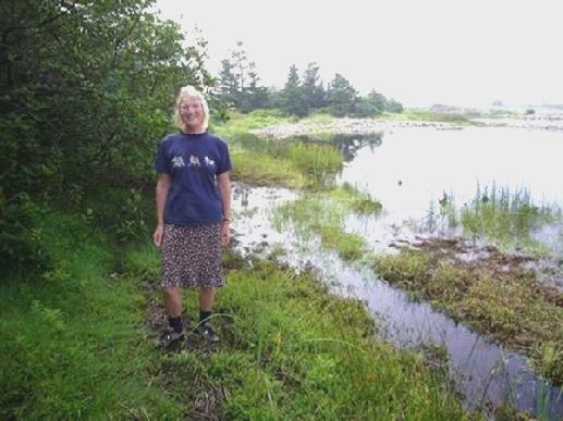
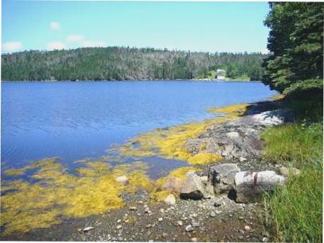
It was 5.15 when we crossed the Barra Straits on a bridge, stopping on the ‘dock’ at Iona on the other side. We walked along the pleasant little beach in the sunshine while a couple of kids leapt off the jetty into the water and others came to swim from the beach.
My idea of a quiet time, listening to our new CDs by Ray Lake were thwarted when a man came to do some strimming!
We set about the task of labelling the last lot of photos. Adrian cut and pasted, and I stuck them on. However, it was all a bit of a disaster, as the glue didn’t dry, so the photos ended up sticking together, and we were both exhausted!
Thursday 20th July Alexander Graham Bell 106 miles
After the swim - Iona
A day that starts with a swim in the sea must be good! The day was beautiful. While Adrian tried to sort out the problematic photos, I had my first open air swim. It was refreshing and lovely. We had breakfast sitting on rocks outside, while the men returned to re-roof the adjacent Catholic Church.
We drove on to Little Narrows, where we had to take a ferry across to the next ‘branch’. The ferry had landed almost before it began – it just cost us $5! We were driving around the Bras d’Or lake, which is really a lagoon with many ‘fingers’, joined to the sea in 2 tiny places, one south and one north, making the eastern side of Cape Breton Island a separate island.
We stopped at Wagmatcook, where the Mikmac Indians who reside on Nova Scotia had a small museum. In fact they were preparing for a big festival tomorrow, but we did have an enlightening walk around, looking at some old photos of how they used to live and reading about how children were taken to be ‘educated’, and forbidden to speak their own language – rather like the aborigines in Australia.
Then we came to Baddeck, and the National Historic Site commemorating Alexander Graham Bell. And what a man he was! Born in Scotland, his family had moved to theUnited States after his 2 younger brothers had died from TB. He subsequently came to live here in Cape Breton for much of his time. He saw himself primarily as a teacher of the deaf, following his father’s expertise in this line, and being asked to advise in the education of Helen Keller. His wife – a talented lady herself – was deaf, and a former pupil of his. All his life he was an inventor. One of his quotations is ‘An inventor can no more help inventing than he can thinking or breathing’. He is known primarily, of course, for inventing the telephone, but he also made discoveries in medicine, aeronautics, genetics and electrical science.
It was fascinating and humbling to walk around the museum and find out a bit about the man and his discoveries. As we were about to leave, we got talking to one of the guides, who pointed out Bell’s home Beinn Bhreagh across the water. The guide told us that last winter was much milder than they were used to.
We had lunch sitting at a picnic table in the shade, in these lovely grounds, surrounded by flowers. It was now 2.00pm. We drove around the town and finally got an internet connection and were able to read the messages we had, and to phone Tom, who has his last day of teaching in London tomorrow.
We continued through pretty scenery, now following what is called the ‘Cabot Trail’. We arrived at Cape Breton Highlands National Park and stopped at Ingonish Beach where we had a delicious icecream and then walked a short and pleasant trail by Freshwater Lake.
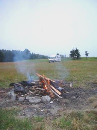
We continued a bit to Broad Cove campsite, where we found a sunny spot to camp. We enjoyed sitting outside with a beer before cooking supper on the barbecue and later lighting a fire (not allowed before 8.00pm) We sat out enjoying the warm evening until it was time to come in and clear up.
Friday 21st July Walks in the Cape Breton Highlands 44 miles
It was a warm day with periods of sunshine and varying amounts of wind. We ate our breakfast outside in the sunshine before wandering through the campsite, down to the pink sandy beach, where the Warren Brook reached the sea. By now it was cloudy, but our excitement was seeing a bald eagle flying just overhead – we have never seen one so low. Another camper chatted to us – he said that he went to Spain most years for his holiday.
We had joked about the booking out time being 11 o’clock, and would we still be here then, but in fact we didn’t leave until nearer 12.00!
We drove on through the park, looking out from various ‘lookouts’ at the dramatic pink rocky coastline. We walked a trail through Jack Pines – a rare type of tree – and spruces, around a little headland. When we got back to the Bam, about half a dozen children were waiting by 2 cars parked beside us. They asked if we had seen 2 ladies on the walk, which we had. They were the mothers of 2 of the children, and had become separated from them. We could well understand this, as the path kept dividing – we think that they were rerouting some of it – but there weren’t any signs. We filled the children’s water bottles and chatted to them, and luckily, as we were about to leave, the 2 mothers appeared.
We made our way to the nearby Black Brook Cove beach, and had our lunch at a windy picnic table. It was a nice sandy beach beyond the pebbles, and a lot of people were enjoying the water, but it didn’t entice me in!
Continuing north, we took the ‘scenic’ route through Neil’s Harbour and New Haven, with lovely views up to the northern peninsula called Cape North, but there was the usual problem of no pull-offs. This bit was out of the park, but we soon returned to it, and into great scenery by North Mountain – a steep forested valley along a fault line, with hanging valleys.
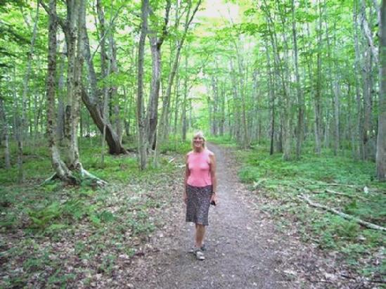
We stopped to walk another trail – the Lone Shieling - this one was through ancient sugar maples, some said to be 350 years old, and at the northern limit of their growth.
Rosie amongst the sugar maples
We passed a small Scottish crofters cottage, built in the 1930’s at the request of MacIntosh, who had died in 1934, and bequeathed some of his land here to be kept as a park. This was presumably the beginnings of Cape Breton Highlands National Park, which dates from 1936.
Adrian by the crofter’s cottage
At Pleasant Bay, the road left the park briefly. Although it was only just after 4 o’clock, we decided to stay by the pretty fishing harbour and continue through the park tomorrow. We walked along the sandy and pebbly beach, where it was warm and still.
Adrian’s idea of cooking outside and having a fire on the beach were thwarted when rain began to fall, and continued for the rest of the evening. The rain didn’t deter the kids who came down noisily at bedtime, and were still noisy at 1.00am!
Saturday 22nd July Goodbye to Cape Breton Island 126 miles
The morning started grey, but became warm and sultry.
We left early, and drove back into the park and continued south through dramatic coastal scenery and forested inland wilderness.
We had planned on walking a long trail, but at that point, we went into cloud. We settled on walking the shorter ‘Le Buttereau’ trail, which was both pleasant and interesting as it followed the route where a small group of Acadians had lived prior to the park being formed in 1935. Only the foundations of the simple homes remained. The men apparently spent all week away fishing, but each family had 9 or 10 children! There were good coastal views too. When we got back, a ranger pulled in to check that we had a Parks pass. We have already got more than our value out of our annual pass.
We next stopped at Cheticamp, which had very much the feel of a French Acadian harbour town. There had been gypsum mining here in the early 20th century, but after many difficulties, it finally failed during WW2, when the British requisitioned all their boats.
Just past here we came to a strange site – it looked at first like a barn dance taking place in a field, but then we realised that all the figures were ‘scarecrows’. They were fun to see – some were supposed to be politicians, others were made to represent all sorts of locals. It was certainly an eye catcher.
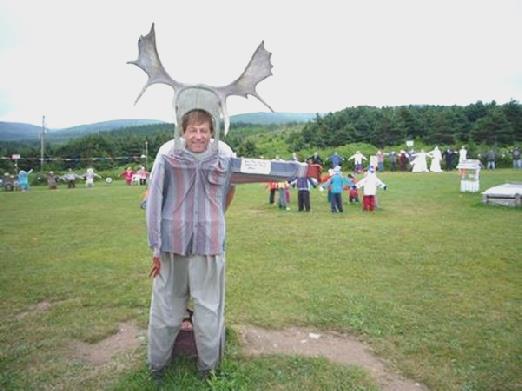
Adrian the moose
We followed the Margaree River inland for a way before coming back to the coast at Inverness. We had lunch sitting on the beach, before having a pleasant laze on the sand, as it was now very warm. Afterwards we visited the Miners Museum, set up in the former railway station. The place was crammed with stuff about local things as well as the coal mines.
We were driving what is known as the Ceilidh Trail, but even though it was Saturday, we didn’t have any luck in coming across any Celtic music. There was supposedly a festival taking place at Mabou, but the Ceilidh was from 10.00pm – 1.00am! All that was happening this afternoon was a beer tent, hot dogs, children’s games, and some very untalented musicians performing on the small stage! We didn’t linger long!
We thought that we’d call in at the much advertised ‘Celtic Music Interpretive Centre’ at Judique. We arrived at 4 o’clock, and they were just opening the doors. However, there was nothing inside – things don’t happen on a Saturday, it seems!
Before we knew it, we had arrived at the causeway which connects Cape Breton Island to ‘Mainland Nova Scotia’. After a quick look at the canal which was formed to let the ships through, after they built the causeway across the inlet in the 50’s, we drove across.
At Mulgrave, we stopped at the Visitors Centre at Venus Cove. Adrian asked if we could stay in the car park outside, and the helpful lady said that she wouldn’t advise it, as the kids get noisy, and directed us to a bit of land across the little inlet, next to her brother-in-law’s house! She even rang him to check!
Here we sat out, enjoying the warm temperature and watching the world and the shipping go by.
A nice place to write the diary
Adrian cooked halibut for supper outside, and we ate outside, but a shower of rain fell just as we finished our meal.
Sunday 23rd July Lots of history as we travel around the coast 106 miles
A warm and muggy day.
We followed the pretty coastal road. At Boylston we went into a little store to buy some milk. Adrian bought some rabbit snare wire (might be useful!) and the chap told him that rabbits are prolific now, but a couple of years ago there were hardly any. We have seen quite a few as we travel about. Around the inlet from here we turned into a park, as we had read that there was a monument to Prince Henry Sinclair, a Norwegian who apparently came from the Orkneys to Nova Scotia in 1398! We read about him with interest. We saw another monument to him further around the coast at Halfway Cove.
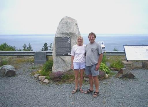
By the monument to Prince Henry Sinclair
We stopped at Guysborough, which was originally home to Loyalists after the American Revolution. The Visitors Centre, in the Old Court House, was also a museum of local artefacts. We chatted to the attractive young chap in charge. He was studying medical faculties at Antigonish, but hoped to come back here to live, as he loved it. It was very quiet and laid back, he said. He told us that there is a grant available for young people to work at the Visitors Centres, parks etc. which is why we see so many. He loved football, but we couldn’t converse much about that!
We had seen that the Trans Canada Trail starts (or ends) here, and thought that it would be fun to walk a short stretch. We located the end, but the final section was completely flooded!
The start of the Trans Canada Trail – but it did get a bit drier!
We did have a pleasant walk along what was a former rail track, but don’t envisage walking the rest of the trail! (when it’s finished it will be 15,000km – 9400 miles long)
Continuing along the coast, we stopped at Hazel Hill, site of the Commercial Cable Telegraph Office from 1884 -1962. It was here, at the end of one of the trans-atlantic telegraph cables, that this company’s telegrams were received and transmitted from North America. It was a high tech facility in its day and was a major operation. The company owned the ‘town’, employed high class workers and paid very high wages.
We carried on to the most easterly point here – Canso. This small former fishing village is home to the Stan Rogers Folk Festival in early July. The town has a long history, and we visited the National Historic Site of Grassy Island. Normally a boat carries visitors across to the island, but today it was supposedly too windy for it to run. It was another of those Anglo- French battle areas, over the fishing. The French and Basque had been fishing here for centuries, but the treaty of Utrecht in 1713, although decreeing mainland Nova Scotia to England, didn’t make clear who Grassy Island at Canso belonged to. There were complicated trade agreements between Europe, New England and Canada, and even more complicated battles, which ended the fishing industry and occupation on Grassy Island, which is now uninhabited, and a National Site.
Unable to visit the island, we had to make do with the video and exhibits.
We now drove to the south of this peninsula, reaching the sea at attractive Port Felix, looking more like a Newfoundland fishing village. It was unfortunately misty as we drove westwards along this pretty coast, stopping at around 5 o’clock at a remote grassy area by the beach at New Harbour.
After supper we walked out onto the beach. The mist had lifted and we could see the other side of the inlet. We collected up some wood and came back and had a fire, sitting outside until 10 o’clock in the dampness.
Another nice fire
Monday 24th July Rain, rain, go away! 104 miles
We’d heard rain in the night, and when we woke at 7.15, the rain became torrential. Not wanting to be stuck down this sandy track, we jumped up and drove back to the road, stopping a few hundred yards further on to pack the bed away, and have breakfast. We were actually looking across the river to where we had been camping. The rain continued hard all the time we were having breakfast, and for much of the day.
We left at 9 o’clock, continuing around this pretty coast, which was all inlets and headlands and bays. We were sorry not to be seeing it in better weather. At Country Harbour we unexpectedly came to a ferry across the river ($5), and had to wait 20 minutes. (It was marked on the map, but we hadn’t understood) The man was the first to tell us that today’s weather was unlikely to get any better.
Just before Sherbrooke we pulled in beside pretty St Mary’s River. Outside everywhere was very wet!
We stopped to get some much needed fuel, then stopped at a nice little park at Marie Joseph, where we had views to the bays and islands.
At Sheet Harbour – another town originating from the Loyalists, and becoming prosperous with timber production – we located the visitors centre, once again with a small museum attached. The 2 young girls said how they would like to visit England and Scotland. We asked if there was a Laundrette in the town. No wonder we hadn’t seen it – it was at one end of the discount store at the far end of town! I went into the store, and round the corner found a few machines and driers!
We finally left at 5.30. The rain had stopped briefly but had started again, and was torrential just after we stopped for the night 10 minutes down the road, but it did stop raining later.
Tuesday 25th July Heading for Halifax 77 miles
Blue sky when we awoke, but by the time we had driven down a long track to Taylor Head, it was misty. We had hoped to do a walk here, but the flooded ground meant that we had a nice walk along the beach, which was of fine sand with interesting pebbles. We saw terns and other shore birds as we made our way along.
Another damp walk!
Our next stop was at Prince Alfred Arch – an arch erected in 2001 to commemorate the visit of Prince Alfred, Queen Victoria’s son, in 1861. It was in the small village of Tangier, which at that time had just started goldmining, the first gold mining town in Nova Scotia.
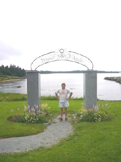
Underneath the Alfred arch
A bit further on we stopped at the ‘Fisherman’s Life Museum in Jeddore. This small museum celebrated the life of Ervin Myers, who lived here with his wife and their 13 daughters in the early 20th century. The ‘guides’ were dressed in costume, and ours, Janette, was very chatty. The now beautiful day made the visit much more enjoyable – we had lunch afterwards sitting by the inlet behind the house, known as Navy Pool. There was a fish house by the water’s edge, with all it paraphernalia in it, and a barn with sheep and 2 small kittens. We had been enjoying this beautiful coast today with the lovely blue sky.
The Fishermen’s museum – beside the ‘Navy Pool’
We stopped at Musquodoboit Harbour, where the tourist information this time was in the old station, with lots of railway artefacts for Adrian to enjoy! Afterwards we had ice-creams, which we both enjoyed!
Now we hotfooted it towards Halifax, stopping at Dartmouth, on the near side of the harbour. It was time to do ‘useful’ things, like seeing to the van. After a few tries, we did get somewhere to service the Bam, and do some other necessary and expensive things. We were also able to get some water there.
We had enjoyed seeing the attractive clapperboard houses in the old part of Dartmouth, but now found our way to the newer, less attractive part, with its modern malls and precincts. There was a Walmart here, so for the first time in Canada this trip, we made our way there for the night.
Wednesday 26th July Halifax, Nova Scotia 27 miles
We both got up early, preparing for what we thought was going to be a busy day, but it didn’t go quite to plan!
Adrian had been increasingly bothered about the engine of the Bam misfiring, so we made our way to the first ‘repairer’ we had visited yesterday, who was too busy to do anything then. He wasn’t there when we first arrived, but when he returned, he was sure that the plugs needed changing. He said that he could do them, but needed the engine cool first. What he really meant was that he had other work he was doing!
So it was, that we spent the rest of the morning waiting! Luckily we found that we had an internet connection, so spent some time looking at websites and sending a few emails.
By midday he had opened the bonnet, so we went off for a little walk around – unfortunately these places are never in the pretty parts of town! We spent some time in Canadian Tire and then made our way to a seafood restaurant for lunch, which the man had recommended. The scallops/prawns and chips were excellent, but my orange juice tasted off, so I asked for water, but that tasted dreadful too, so I ended up sharing Adrian’s tea.
When we returned to the Bam, the man had nearly finished, but it was almost 2.30 by the time we left – many dollars poorer (platinum plugs C$80!), but hopefully safer!
We drove down to the waterfront at Dartmouth but were disappointed to find that there were mostly modern buildings there, and we just got glimpses of pretty clapperboard houses on the side streets.
We were soon crossing the harbour on a fine (toll) bridge to Halifax. As we drove through the town, many of the buildings seemed like London, but perhaps not surprising when there has been such a long connection. Britain finally left in 1906.
We found our way to Pier 21, and paid $1 to park for an hour. The lady had asked if we were staying longer than 5 hours, as it was only $5 for all day. She then said ‘Be back by 7 o’clock, as we close then’. It was now 2.50, so our quick maths told us that she couldn’t have been thinking!
Pier 21 is to Canada a bit like Ellis Island is to USA. It is where the immigrants came through, from 1928 until the early 70s. It is a National Historic Site, but the ‘museum’ part is private, so our passes didn’t count! The girl said that she would let us in as ‘seniors’ (Was that a compliment or not – over 65 in Canada!), but we said ‘No thank you’. The place was being ‘knocked about a bit’ anyway, so we gave it a miss.
Instead we walked along what is called the ‘waterfront walk’. Halifax disappointed us rather, as it seems to enjoy being ‘modern’, and the old bits took some looking for. However, it was pleasant walking along beside the harbour in the warm afternoon sun – the early morning mist had long cleared.
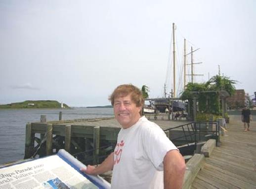
Adrian on the Halifax Waterfront
We now headed for ‘The Citadel’ – the large fort set above the town, and apparently one of the most visited sites in Canada. This time our passes did work, so we set about enjoying our visit.
We started with the ubiquitous film, but this is often good in setting the scene. Halifax has an interesting history, being founded by the British, and the fort being built originally to offset the French port of Louisbourg.
Its population includes Acadians, Africans, New Englanders and a small group of Germans, as well as British. It was an important port to Britain for centuries, and played a part in both world wars. There were 2 great tragedies associated with Halifax, which aren’t widely known. The first was the sinking of the SS Atlantic in 1873, when 562 people lost their lives – the worst disaster off Canadian coast until the sinking of the Titanic.
The second tragedy took place in 1917, when 2 ships passing close to the town collided, one of which was loaded with explosives. The ship exploded in one of the biggest explosions ever. Much of the town of Halifax was gutted (25,000 houses), with the loss of almost 2,000 lives. Another 9,000 people were wounded, many of them blinded. Somehow the town pulled through.
As we wandered around the fort, we had to remember which country we were in as with guards in Scottish gear, and bagpipes playing, it was hard to think that you weren’t in Britain!
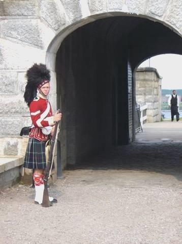
Halifax Citadel
We now drove out of Halifax, and just after 6 o’clock, found a nice little spot to stop at, beside Whites Lake. We sat out, enjoying the early evening sun.
Thursday 27th July Perfect Peggy’s Cove and Listed Lunenburg 125 miles
We were up early and left at 8 o’clock. The reflections on the lake as the mist began to lift were lovely.
We saw more reflections as we made our way to Peggy’s Cove, arriving at 8.30. It had become more misty here, but that added to the charm.
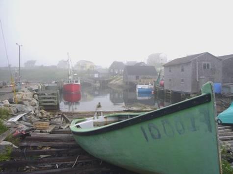
Peggy’s Cove is said to be the prettiest place in Nova Scotia. Things like that always make us wary, but in this case it is true! It is a delightful small fishing cove, with a small population of fishermen who carry on their job as usual, while all the visitors come and rave about the charm. We had read to arrive early, before the throngs come, and we had a delicious few moments seemingly on our own. We viewed and photographed the boats, nets and buildings, as a fishing vessel, dragging 3 small boats behind it, returned. It felt like being in a small Cornish fishing village, as the men chatted and went about their work.
Peggy’s Cove in the early morning mist
We wandered on through the village to the lighthouse, which is unbelievably the post office! It stands near the entrance to the hidden harbour on the large granite rocks.
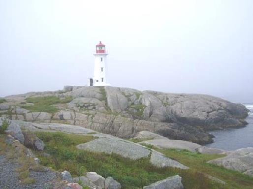
Peggy’s Cove lighthouse, alias the Post Office
The whole village is surrounded by granite boulder strewn marshes, which were protected in the sixties, so that nothing can be built there.
There were numerous information boards telling of the geology, history and interesting facts about the cove. A lovely surprise was to come across a huge beautiful monument, carved into granite by an artist called de Garthe, depicting the life of the fishermen.
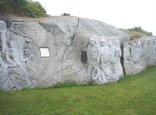
De Garth’s sculpture of the fisherman’s life
By the time we left, at 10 o’clock, the place was beginning to get busy but none of the many gift shops had been open when we visited.
We had only gone a short way when we saw a sign to a Swissair crash memorial. We turned in, and found out that on 2nd September 1998, a plane had crashed out in the bay, and all 229 people had died. There was a monument here, and one at Bayswater, across the bay, both sites making a triangle with the actual site of the crash. We were surprised that we had seen absolutely nothing about it in all the different leaflets that we had.
Sobered by this, we continued around St Margaret’s Bay, which was pretty, but more busy than we have seen. This is a dormitory area for Halifax, with many second homes, and we had trouble finding anywhere to pull off. We stopped in the end near Head of St Margaret’s Bay, turning off to sit on rocks by an overfull pond for coffee. We enjoyed the warm sunshine, as dragonflies flew over the water.
We pulled into a sandy beach at Queensland, but the water was very seaweedy. A bit further on, we stopped again, by another sandy beach, and here I had a delightful swim. The water was a dark colour, but there was no seaweed.
We headed around the next peninsula, called Aspotogan, and this was a real delight of tiny fishing villages, each with a church, the prettiest being North West Cove. There were fishing nets laid to dry along the side of the road, and continual lovely vistas.
Pretty North West Cove
At Bayswater Beach we stopped to have lunch, at a picnic table overlooking a small lake by the sea. The mist had been coming and going, but I had a nice visit to the sandy beach afterwards.
As we left this spot, we passed the other memorial to the Swiss air disaster, again with no mention. The memorial also honoured the local people who had helped in the salvage operations.
We continued around beautiful Mahone Bay, with its numerous islands, but it all felt busier. The actual village of Mahone Bay looked delightful as we drove through.
We were heading for Lunenburg – a World Heritage Site, with dozens of listed buildings. We made our way to the visitors centre to get a map. This was a good move, as the building was set high between the 2 harbour inlets, and from here, we could walk on through the town.
There was no denying that it was all very pretty – the houses were lovely, and there were lots of attractive churches. One of these, St Johns, had burned down in November 2001, but had been rebuilt and reopened last year. We went inside – it was very lovely.
Down in the harbour was the Bluenose 2, a well known sailing vessel which you could visit, but we just photographed. There was a memorial to fishermen lost from here over the years, and there were a lot! There was also a memorial to the first settlers here, who were mostly German.
Lunenburg harbour
Somehow, the atmosphere didn’t work for us. The cars everywhere, and worse still the heavy overhead lines, made photography difficult. And the Post Office, built in the fifties, was the ugliest building we have ever seen!
We continued driving around this peninsula, which was really pretty, but was too inhabited. We had hoped to find somewhere to stop for the night, but ended up in Bridgewater, beside the public wharf. There were 2 old ships tied up beside us, and a plaque told us that one was used during the Cold War. They seemed to be restoring it to keep it here permanently. After supper we walked along beside the river, and at bedtime we saw the thin slice of a moon, and lots of stars, including the Great Bear and Cassiopeia – for the first time for ages.
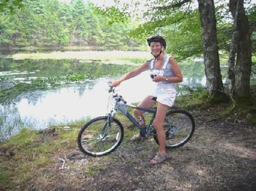
Friday 28th July Canoeing, cycling, swimming and walking in Kejimkujik National Park 66 miles
We were off early, at 8 o’clock so that we could do some shopping and use the internet before making our way to Kejimkujik National Park. We had decided not to travel any further westwards, but to cut across to the North Shore, stopping at this park, which is about half way across.
It was about 10.30 when we reached there. We booked into the campsite – this is peak time, and we had heard that it gets booked up quickly on a Friday. We were very disappointed to find that our pitch looked very dark and dreary under the tall pine trees, and that the mosquitoes were about in their hundreds. We had seen a deer when we first entered the park, but we didn’t see much other wild life.
The park is vast, and only a small part is accessible by road. There is a huge lake, and a lot of backcountry trails for those with lots of time.
We made our way to Jake’s Landing, where we hired a canoe for an hour, and had a fun time paddling down the Mersey River. It was lovely to enjoy the stillness. We heard frogs and saw dozens of pond skaters and white waterlilies.
We returned to have a late picnic lunch before setting off on the next thing – a cycle through the woods and beside the river.
Off for a cycle in Keji Park
We were on a trail which was also a footpath and very bumpy and winding, which Adrian loved. Sometimes we had to cycle over boardwalks which were most uneven and sometimes very wet! We realised that the water level is rather high!
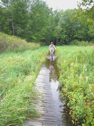
But it got a bit wet!
Returning from this, we felt like a bit of relaxing, so made our way to Merrymakedge beach. The wind was blowing across the lake, but the water was warm, so as well as a short laze on the gravelly beach, I swam across to the buoys and back. The sun had taken some time in chasing the clouds away this morning, but it had been a nice temperature for all these activites.
On driving back to the campsite, we stopped to walk a short trail by Rogers Brook. This turned out to be fun, as after crossing the brook and walking through a bit of forest, we came down by the river. We had noticed a sign in the water when we were canoeing this morning. We now realised that it was on this walk, and that much of the boardwalk was under water! Luckily we had worn our sandals, as we had a good paddle! Little green frogs leapt off in front of us as we walked along, and we saw the same cormorant standing on a rock as we had seen this morning.
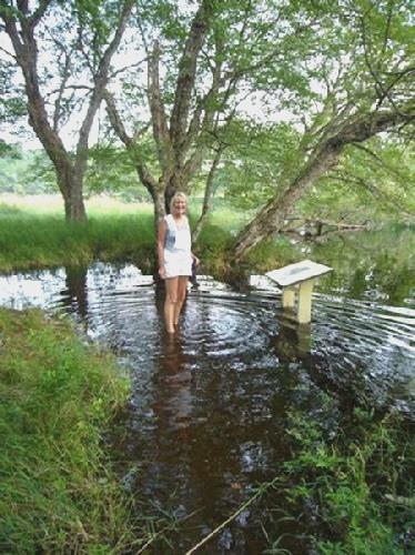
So did the walk!
Much exercised, we returned to our pitch, which didn’t look quite so gloomy with the sun shining, and Adrian lit the fire.
We ate our barbecued meal outside, trying to ignore the mosquitoes. We sat by the fire, but it was really too warm to need it. A couple from Halifax got chatting to us – they liked the size of our van!
About 9 o’clock we made our way to the amphitheatre, which wasn’t well advertised like in other places. One of the young rangers called Ashley was giving a performance, telling stories of the park, accompanied by songs that she had written. She sang, played guitar and mouth organ, and showed much talent. It was just a shame about the mozzies. It would appear that it is not usually this humid.
Saturday 29th July Port Royal and Annapolis Royal 69 miles
We walked down to the lake before coming back to eat bacon sandwiches for breakfast, sitting outside. The sun was shining, but it was still dark in the forest. We made our way to do one last walk, called ‘Flowing waters’. Both the unsurfaced track there, and the walk itself, were longer than suggested, but it was a pleasant walk through a bit of forest to the swiftly flowing Mersey River. Once more we had to wade through water half way up our legs, which was OK for me, but Adrian had put on his jeans to deter the mozzies! Actually it was flies buzzing around our heads which were the nuisance.
We now drove north to Annapolis Royal, a pretty little town beside the Annapolis River. We stopped first at Fort Anne, yet another National Historic Site. This, together with Port Royal, a few miles away, which we visited later, has a complicated and embattled history. The town had been founded by the French in 1605, but had changed hands and venues many times. It had been both the French and the English capital at different times.
Fort Anne is now laid out as a 17th/18th century fort. The officers quarters building is set up as a museum, the most impressive item in there being a mosaic tapestry depicting the life of the fort over 4 centuries.
The Officers quarters at Fort Anne
The attractive tapestry was worked on by 100 volunteers, using a variety of coloured wool and other materials. It took 4 years to make, and was completed in 1995, for the 400th Anniversary. Our young ranger gave us a whistle stop description of it, which included the Queen adding a few stitches when she visited Nova Scotia!
The Acadians featured a lot in the history of this area, having settled here, but being evicted when they refused to support the ruling British, which would have meant fighting against France. We visited the Melanson Settlement – site of an Acadian habitation, afterwards. The Micmac Indians had lived in this area for centuries, so were also very involved in its history.
We had often wondered about the name Acadians, but it seems that Nova Scotia was called Acadia, and the French people who settled here took that name.
After visiting the fort, we had a short walk around the town, where the farmers market was beginning to close up, but we did buy some delicious local raspberries. We ate some with our lunch, sitting at a picnic table by the HEP station on the causeway across the Annapolis River.
We visited the exhibition inside the building, which doubled as a visitors centre. The super high tide variation of the Bay of Fundy is used to produce electricity in a tiny version of the River Rance scheme in France.
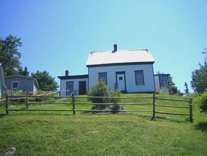
The Annapolis River runs parallel to the coast for some way at this point, and we had to cross it to visit to Port Royal, a few miles west. This was a reconstruction of the original French habitation built in 1605. It had been reconstructed in 1939, after a lot of pressure from one particular woman, Harriette Taber Richardson.
The reconstructed site at Port Royal
We decided to drive across the long, narrow finger of land to the north shore, but were disappointed that there was too much habitation for us to actually view the coast. We were about to drive back south again, when we came across a road signposted to Hampton Beach.
The harbour at Hampton Beach
We came to a delightful little fishing cove, and a long pebbly bay. We walked along the beach, and enjoyed relaxing on it. There had been just one car when we had arrived, but as we returned from the beach, dozens more began to arrive – 4.45 seemed a funny time to come to the beach, but none stopped very long.
It had become windy, so we ate our meal of prawns, followed by raspberries, inside. We saw the sun go down like a red squidgy ball.
Other people had come down – some let off fireworks, and others had fires. We walked out, and joined a couple by their fire. She was from Annapolis, and ran a tourist shop there, and he was originally from New Brunswick. We sat chatting until 11 o’clock.
Sunday 30th July The shame of Grand Pré 87 miles
We walked out on to the beach, enjoying the clear blue sky and beautiful morning. Another couple were sitting on the logs we had sat on last night, and we got chatting. They had come down late last night, as we were leaving the beach, and taken over our fire. They must have slept in their van. She was a delightful lady. His parents had come out from Bristol about 50 years ago. I said that I had ancestors from Bristol, and asked what his surname was. He said Hibbs – the name of my grandmother!
She said that she had always worked with animals, often alongside vets, and was now a dog ‘trimmer’. I said that the only person that we knew of in Nova Scotia was a vet in Wolfville. ‘Oh, she said, that must be Peter Bligh’. ‘Yes,’ we said! This was our friend Trish’s brother, who we had hoped to visit later today.
We drove back ‘over the hill’ to Bridgetown, where we phoned Peter and arranged to visit. We also got hold of Tom at last – just about to leave Scotland after a few days holiday.
We headed now for Wolfville, mostly on the fast road, but turning off to Kingtson to have coffee and a delicious pastry bought at the market yesterday.
We sat at a table by the station on the dismantled railway line. We found later that Peter used to practice here in Kingston.
We drove on to Wolfville and located Peter’s house, and were greeted by his wife Ismay and his son Matt. Matt’s girlfriend Sheena was there, with her parents Alex and Gracie, who live in Toronto. I was wearing my Indian skirt, and Adrian his Indian T-shirt, so we soon got into conversation about India. Alex and Grace came from Kerala, the area of Southern India we had visited earlier this year. We had much to chat about as we enjoyed a pleasant lunch sitting on the deck. Matt was doing a Masters at Halifax in so-called Mechanical Engineering (mechanics on a micro-chip!), and Sheena was studying speech therapy. Matt’s younger sister Sarah was also there, but his brother David and his girlfriend had just left. There was also a spaniel puppy called Rosie, who took a fancy to my skirt, with its little bells and mirrors!
We left mid afternoon to visit the Historic Site at nearby Grand Pré. This site commemorates the deportation of the Acadian people from this area in the 1750’s. The Acadians, mostly French Catholics, had settled here and farmed the lands, building dykes against the high tides so that they could cultivate the land behind. Britain was given Nova Scotia in the Treaty of Utrecht in 1713 and the Arcadians were mostly left in peace, but with the outbreak of war again in 1754, the Arcadians were asked to confirm their allegiance to Britain, as the British were worried about them helping the French. For many reasons the Arcadians failed to do this. Britain decided therefore that they all had to leave. They had their animals taken from them, their homes were burned, and they were deported to various places, mostly in America. Often families got split up. Some returned years later to their native home. Longfellow’s poem ‘Evangeline’, published in 1847, although fictitious, brought the attention of the world to this earlier disaster. It (she) has now become a symbol for Acadian people’s perseverance. We had first come across this story while we were visiting Louisiana last year, where many of the Acadians settled, becoming ‘cajuns’.
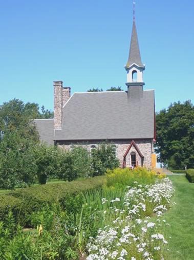
The memorial church at Grand Pre – and the statue of Evangeline
The site was set in lovely grounds, with a church built in the 1920’s on the site of the church where all the men and boys of the village had been assembled to be told of the declaration to leave. There were many moving exhibits and sound recordings, which made one ashamed for the authorities of the time.
There is a day set aside – 28th July – each year, started last year with a charter by the Queen, to commemorate this shameful occurrence. We had had a beautiful, but sobering, visit.
We drove on down past the cultivated pastures to Evangeline Beach, where we would liked to have stayed, but there was a large caravan park adjacent. The tide was right in, so although we had wonderful views across the Bay of Fundy, the millions of sanderlings which are supposed to congregate here at this time of year, were absent!
We continued around the bay, stopping at about 6 o’clock at Windsor, in a parking area beside the visitors information. From the dyke behind us we could look out over the flats. In the other direction was the blockhouse – the only remaining thing from the time when the British had a position here when they were deporting the Acadians.
Tonight was the night to eat the crab which we had bought at Twillingate, and had put in the freezer, but cracking the legs with Adrian’s pliers is not our best talent! Still, it was fun, and the crab tasted good. We looked out at the stars at bedtime.
Monday 31st July A fun day at Fundy - the highest tides, but oh, what a bore! 95 miles
We left early, soon after 7 o’clock, just as a truck had come in to unload its huge block onto another vehicle!
We found our way out of Windsor and onto the ‘Glooscap Trail’ (named after a Micmaw legendary figure), around the Bay of Fundy.
We stopped to have breakfast at Cheverie, at a lookout point (called ‘Look offs’ here) over the Minas Basin to dramatic Cape Blomidon and the coast to the north of theBay of Fundy. This whole area had been a shipbuilding place in the 1800s, but now it is just pleasant rural land, often looking rather English.
What we did see here were millions of sanderlings, flying in a ‘swarm’, like oversized mosquitoes, dashing this way and that, and occasionally landing. It was quite a sight to see. These tiny birds are amazing, as they fly from the arctic to South America, stopping off here to rest and feed.
We didn’t leave until 9 o’clock, stopping next at Walton, where there was a little lighthouse which we could climb up, on the very steep stairs. There was also a pleasant little trail to walk around and view the splendid red rocky cliffs of the bay.
Now we headed for Burncoat, taking a track which looked as though it was somebody’s garden, but which led to a nice little park with picnic tables set amongst trees which were all labelled. There was a replica lighthouse here, with exhibits about what this place is renowned for – the highest tides in the world (40 – 50 ft). We walked through the park and down on to the beach, with the tall red cliffs up behind us, and a couple of impressive stacks just offshore. The beach was of red rocks and mud, often covered by bright green mossy grass. It was warm now, and really enjoyable, as once more we looked out across the bay.
Stacks at Burncoat – site of the highest tides in the world
A bit further on we pulled into Anthony Park, at Lower Selma where we had lunch sitting by the wide red ‘beach’, beside a little wharf, and watched as the tide began to come back in.
Lovely colours of the Bay of Fundy
We moved on to Maitland – the first ‘town’ in Nova Scotia to have its houses recognised as ‘heritage buildings’. There were some pleasant houses, but so many of the towns have nice houses. Apparently the largest wooden ship was built here, and its owner’s house is now a museum.
Maitland is where inflatable dinghies can take you for a trip to ‘race the bore’. We weren’t going to do that, but we watched them all getting ready to set off. A young lad of about 10, with glasses and curly fair hair, was collecting up rocks and throwing them from the end of the wooden jetty into the thick red mud below! He asked if we wanted to help him. He said that he had once waded out in the mud up to his knees, and thought it fun. I asked if he thought that it was dangerous, and he said ‘yes, but that adds to the fun’.
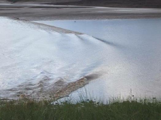
We left him, as we wanted to find out more about the ‘bore’ that you are supposed to see when the incoming tide meets the current from the river flowing out. There are several places where this can be seen here, and one is at Maitland. The lookout for this was behind a little herb nursery, so we parked there, and while we were waiting had ice creams – lavender and basil flavoured! We then waited in the hot sun for the bore to appear. There was one other couple waiting, from Ontario, but although we waited until well past the allotted time, all we saw was a nice little ‘ripple’. The size of the bore depends partly on the state of the moon, and we had just gone into a ‘fallow’ phase!
Unperturbed, we drove the few miles to South Maitland, where the appearance of the bore was about an hour later. We walked onto the viewing place – actually part of an old bridge, and as we waited, we were joined by dozens more people, including the Ontario couple, but also a very nice couple from San Diego, although he came originally from Ealing! It was very pleasant waiting in the hot sun and chatting. There were a couple of bald eagles in the trees to add interest, but once more, all we really saw was another ‘ripple’! although there was a raging current following it.
We thought that we’d give it one more try, so made our way to Truro, on a different arm of the Bay of Fundy. This time, there were loads of other people waiting! We stayed in the van, busying ourselves, and had just gone outside when along it came! It wasn’t huge, but there was a definite wave which ‘slid’ down the river in a ‘v’ shape.
The bore at last!
The beautiful day had become rather stormy looking, but it was still warm, and there was a convivial atmosphere amongst the onlookers. Two ladies came up and admired my Indian skirt, which was nice.
We now headed out of Truro and drove a short way along the north shore of the bay, stopping in a parking area at Lower Onslow beside a memorial which said that the Micmaw, French and British had all used this way as a through route.
We couldn’t believe it when soon afterwards a chap drove along the road on a mower and came to cut the grass all around us – how do we do it?
As we got supper, the storm finally came, but the sun was following close behind.
Tuesday 1st August Our last day in Nova Scotia 138 miles
It was a beautiful day, but started with problems, as the connections on Adrian’s computer, which have been playing up, finally broke, and so needed attention! So, at 9 o’clock, we left to drive back into Truro. Adrian needed a soldering iron, and managed to buy a ‘battery’ one in the first shop he tried. He then had to get the batteries! It didn’t work very well, but after a frustrating time, he got the computer working again, even if it is rather fragile!
We tried for an internet connection, and when we had got one, tried phoning Tom, as he was going to be at Elm Gable today, unloading some of his stuff. We got the answerphone, but after Adrian had spent longer than he’d hoped buying some bread in the supermarket, we still had a connection, and this time Tom was there. We were able to have a last chat before he goes off to Spain on Thursday. We had seen the BBC news headlines, which said ‘Surprise thieves at Hermitage’! It was referring to the Hermitage art gallery in St Petersburg, not to our village!
We now set off to the north of this peninsula, following the route 2 North (which was going west) and the route 4 West (which was going north)!
We drove through pretty forested hills, coming to Wallace, and then driving around the Malagash peninsula, which was supposed to be nice. We found our way to Blue Sea Beach, having lunch first at a shaded picnic table, as it was hot in the sun. Unfortunately, mozzies must have flown up out of the grass, and we both got several bites. There was a bay here with a narrow beach, but the water was too shallow to swim in, so we just had a paddle.
At Tatamagouche we were able to get booze and money, but no propane, which we needed. We eventually found Rushton Beach – mentioned in Lonely Planet, but it was not where it said! There was a long walk from the car park to the beach, some of it on a boardwalk across the swamp, so another place for the mosquitoes to thrive! The water here was still shallow, but just about deep enough to swim in, so we both had a swim. The water on this coast is supposed to be the warmest in Nova Scotia, and even Adrian thought that it was pleasant.
We drove on to Pictou, site of the first landing of the Scottish in Nova Scotia in 1773. A group of Scots came across on a boat called the Hector, and a replica of it had been built between 1990 – 2000. It was set in a fine position in the harbour.
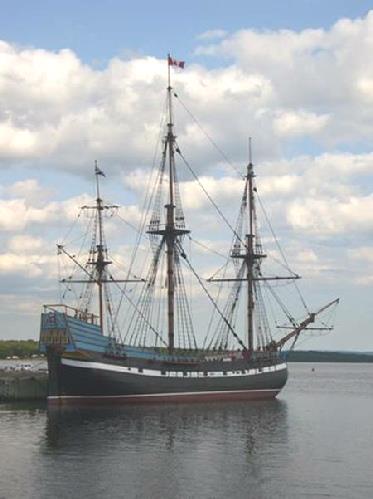
The reconstructed ‘Hector’ at Pictou
The waterfront had recently been restored, and had a nice feel, with pleasant buildings. It made me think of a ‘living’ Lunenburg, which had seemed so static.
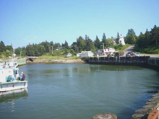
There were several places where we could have stopped around Pictou, but after a little waterfront walk, we decided to move on towards Caribou, a few miles away, where the ferry leaves from for Prince Edward Island. We plan to catch the ferry in the morning, so thought that we would find somewhere to stop nearby. This wasn’t to be, though, as there was absolutely nowhere to pull off the road. We reached the ferry site, and the road just led straight on to the ferry, so no chance of staying there! We took a small road going back westwards, where we had originally come from – but still nothing! We ended up back on the road into Pictou (where we had been a couple of hours ago), and at 7 o’clock found a place where we could pull off for the night, and take a road up to the ferry tomorrow.

Argentia, Newfoundland to Pictou, Nova Scotia


