
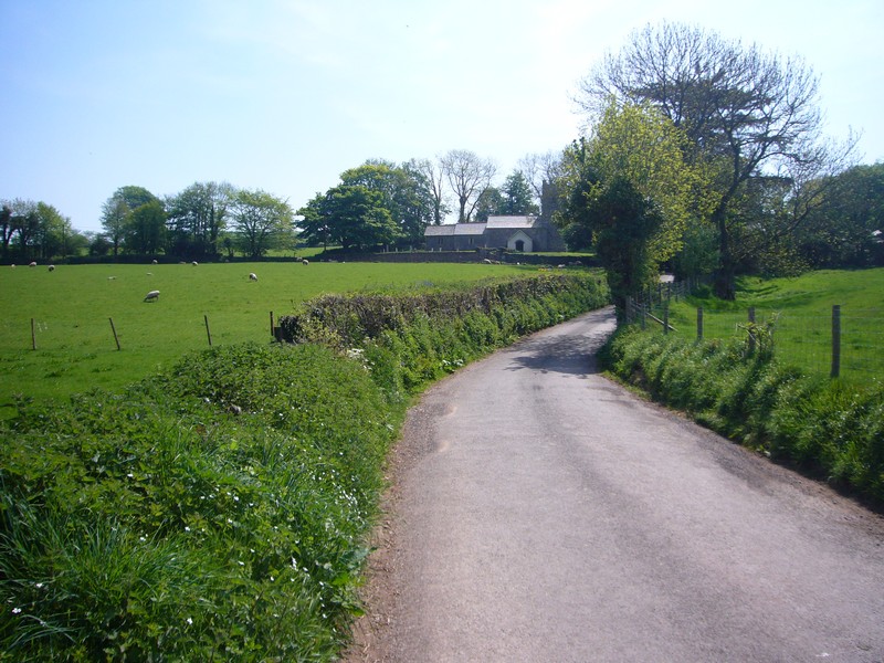
Bude to Severn Beach
Friday 23rd November, 2001 45 miles
This is a short stretch of our Road Around Britain. We had come to Otterton on 13th November, when Emma and Stuart's baby girl Ruby was born (she was 18 on her last birthday!). We had spent most of the 10 days looking after Felix and taking him out. Now Maveril, Stuart's mum, was visiting for a few days, so we decided to do a bit more of the coast.
We left Otterton late morning on Thursday 22nd and spent the afternoon in Exeter – supposedly to do some Christmas shopping. We didn't manage that, but did have quite a successful time – getting some photos developed, visiting the library to receive our emails, buying Adrian some walking boots and even seeing Princess Anne arrive to open (we think) the Save the Children shop! It was dark when we left, consequently finding anywhere to stop was really difficult. We finally found a pull off beside the road between Ashwater and Beaworthy at about 6.30 pm.
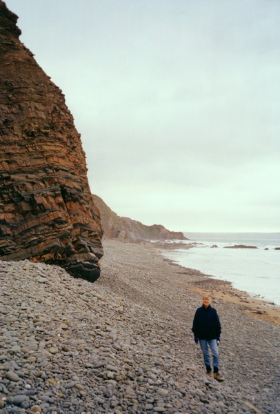
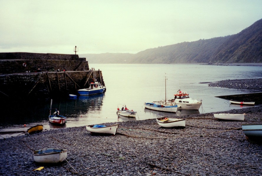
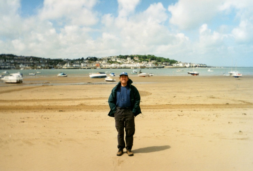
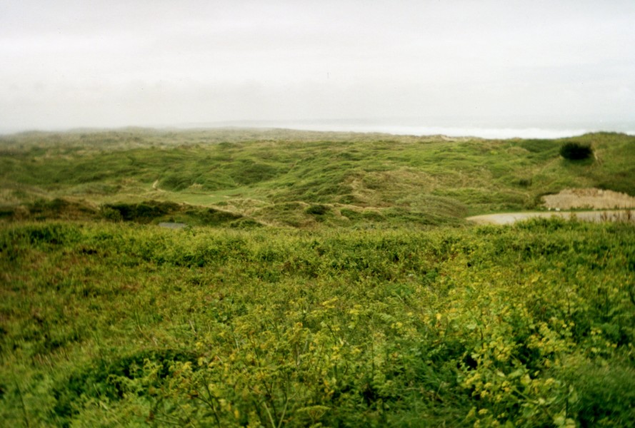
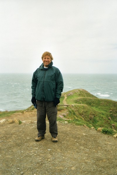
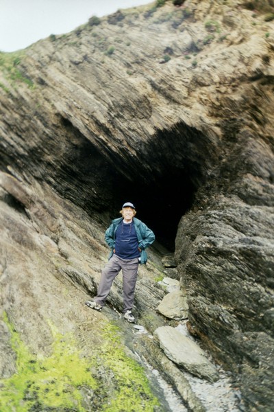
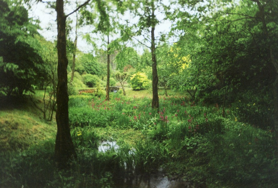
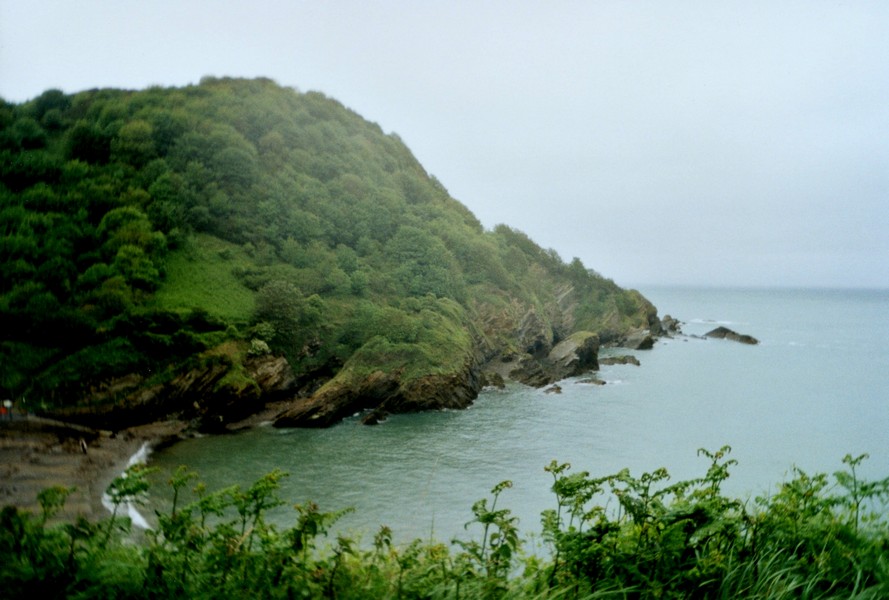
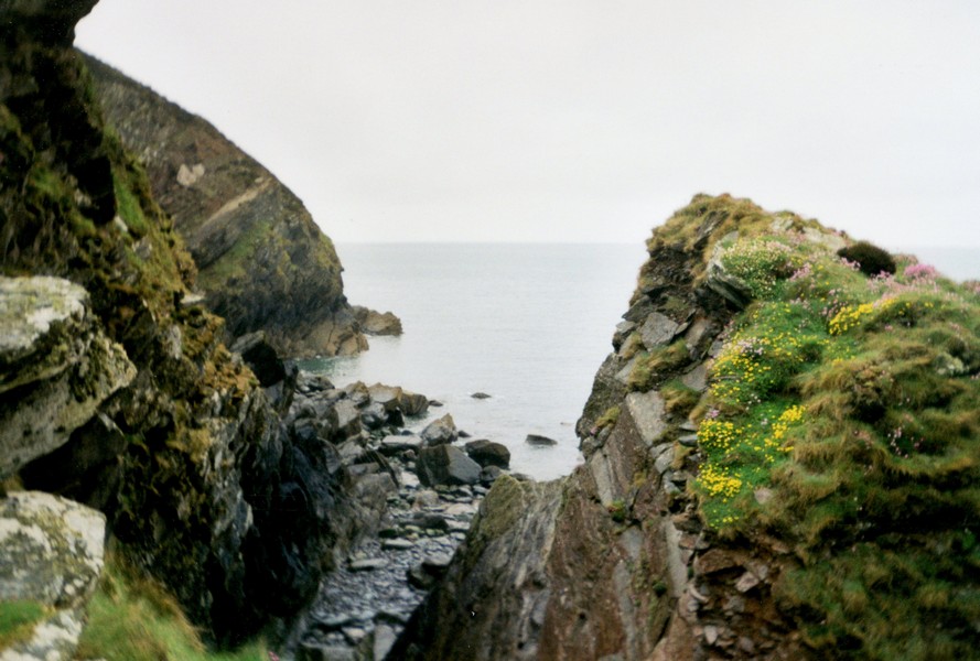
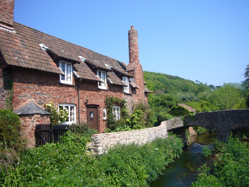
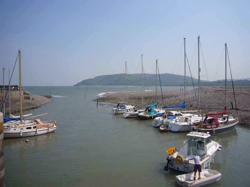
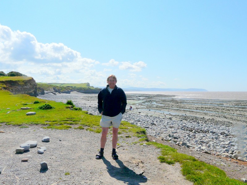
We left here after breakfast and headed for the north Cornish coast, just north of Bude, where we had finished in March this year. We drove through the village of Kilkhampton, past Stibb, to Sandy Mouth. We walked down to the cove, dressed up in our winter woollies, as two chaps donned their wetsuits to go surfing!
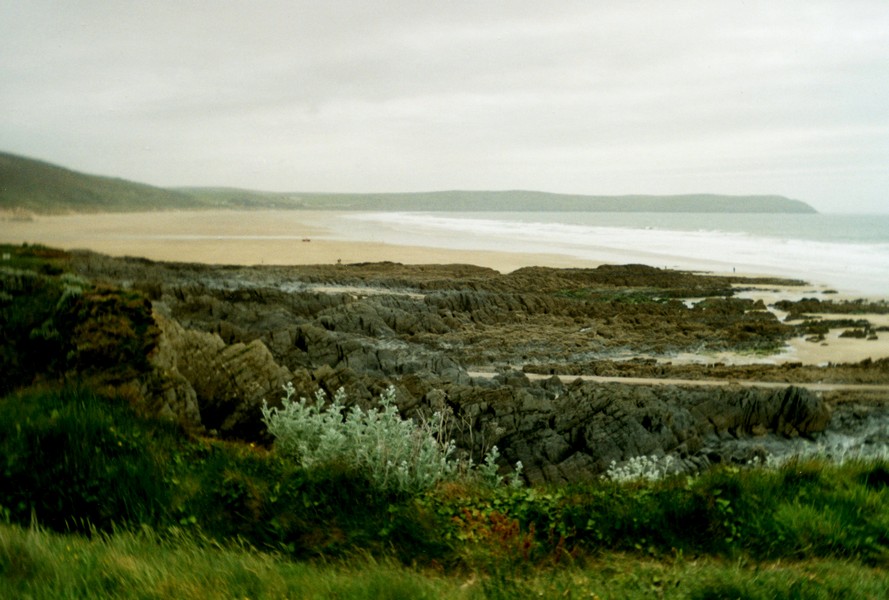
The cliffs here are craggy, with formations practising for Hartland Quay. The beach was of large pebbles, but we think it must be sandy when the tide is out (hence the name!). We voted it too difficult to walk along the beach – Adrian is still being careful after his sprained ankle last August. A couple with a large dog arrived as we were leaving.
We drove back up the road, then stopped at Coombe Valley, where we had a really pleasant autumnal walk. It wasn't windy here, as it had been at the beach and the colours of the trees are really late this year.
We drove down to Duckpool and parked by the beach but again there was no beach to walk on, with the tide in. It was a pretty cove, in a nice setting – apparently it had been an iron age forge. The weather had now turned to fine drizzle. We had beans on toast for lunch, looking out to sea.
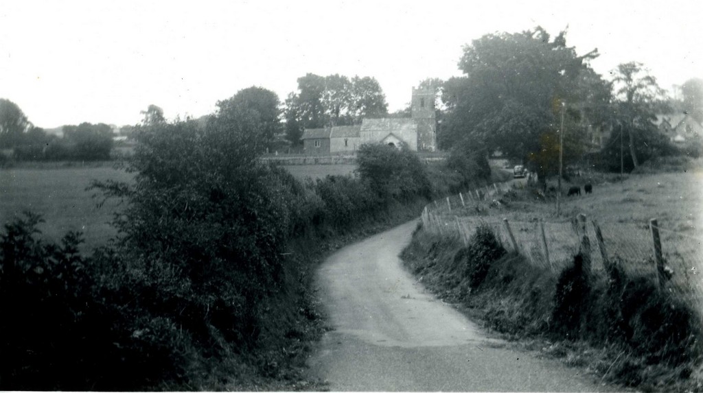
We now drove north to Morwenstow, visited in 1968!
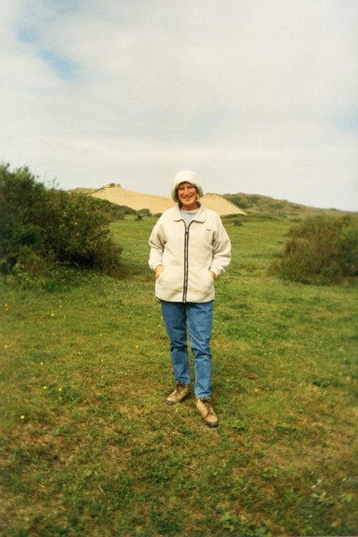
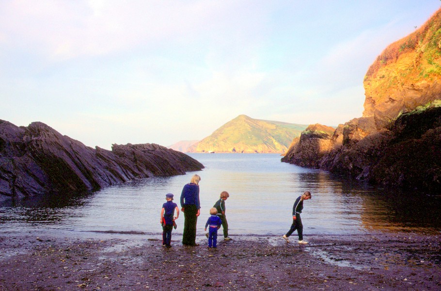
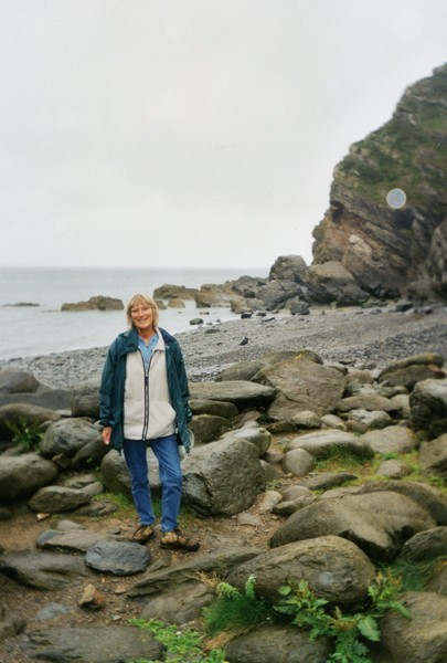
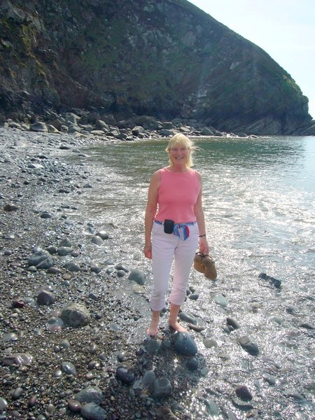
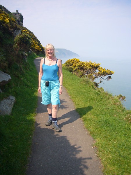
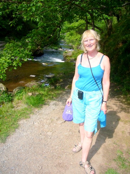
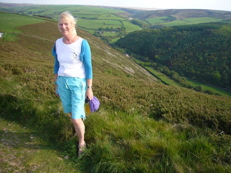
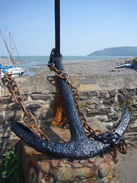
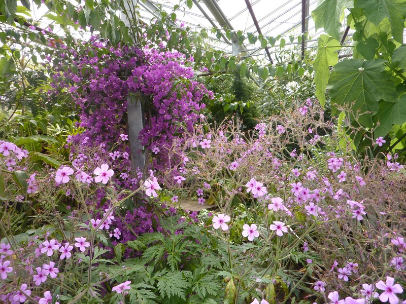
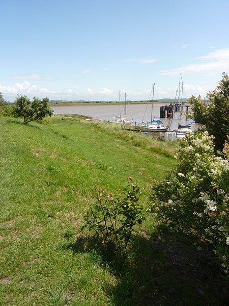
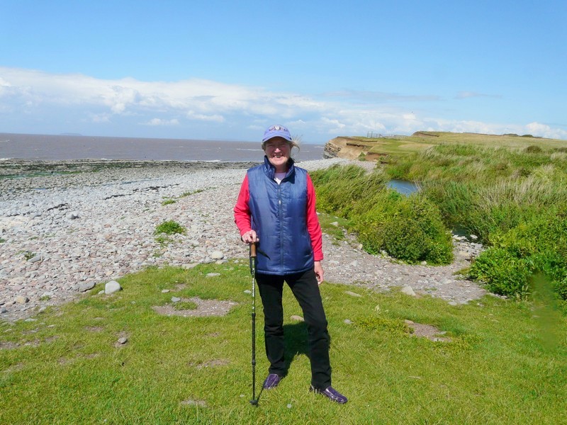
Rosie at Sandy Mouth
Unfortunately the drizzle now became "Devon mist" and visibility was poor. We reluctantly decided against a walk here, and continued past a place called "Shop" towards Eastcott but came to a 6 ft width restriction, so took the alternative road. This was also narrow and Adrian was annoyed to come across an oncoming bus, so we had to reverse! We then continued to the A39 then turned off towards Welcome. We were upset that the poor visibility prevented us from enjoying this wonderful area (now Devon).
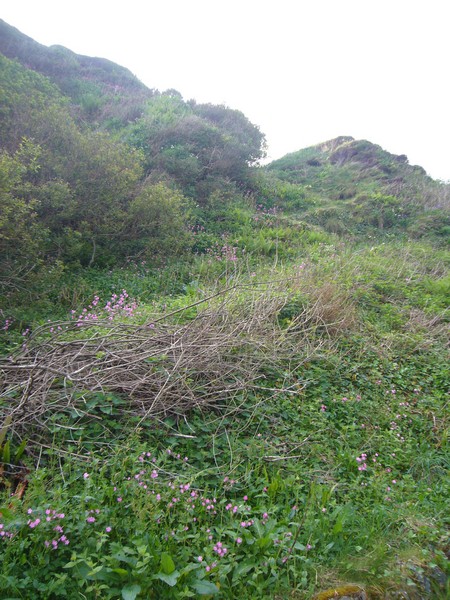
There was a track down to Welcome Mouth, past the house called "The Hermitage". The track was really narrow and after a bit was unsurfaced and really bad. There were huge holes, but we managed to get to the small car park by the beach. There was a chap there with the van – he was breaking up wood and making a fire so we imagined he was staying, despite the "no camping" sign. We wanted to be sure to have got back up!
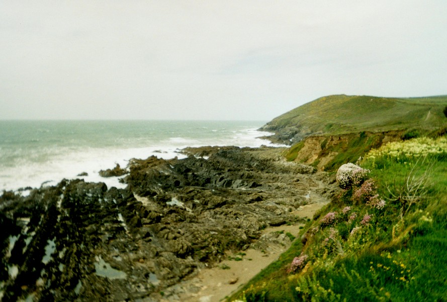
Despite the drizzle, we made our way down the steep, rocky path to the beach, which had long horizontal lines of rocks out to the sea, rather like Ravenscar. Again the rocks were really "twisted" with wonderful formations – one part like the roof of a house.
Also, there was a delightful waterfall. A really lovely beach, despite the weather. We returned to the Tiv.
Adrian skilfully manoeuvred us back up the rougher than rough track, then northwards to Elmscott, still annoyed at not being able to appreciate the scenery because of the weather.
We decided to head inland a bit towards a CL, as the roads were really narrow and all the verges thick mud (we're not sure why – the weather hadn't been particularly wet). However just before we reached it, we found a perfectly suitable pull off on a little side road, somewhere between Welsford and Boxworthy Corner. Although not much after 3.30, we stopped for the night. The night closed in early. We spent a busy time tidying up our South Africa diary and preparing for our North American venture starting in January.
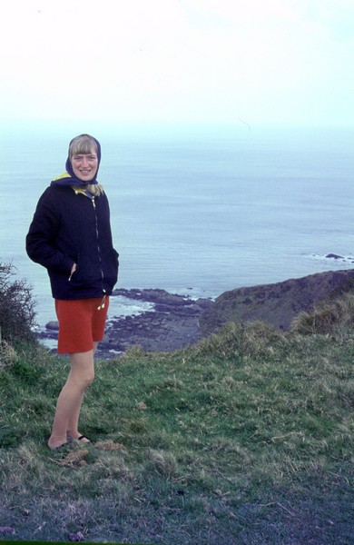
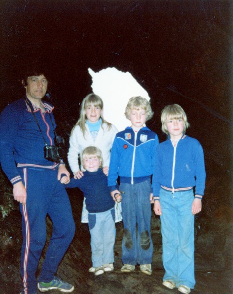
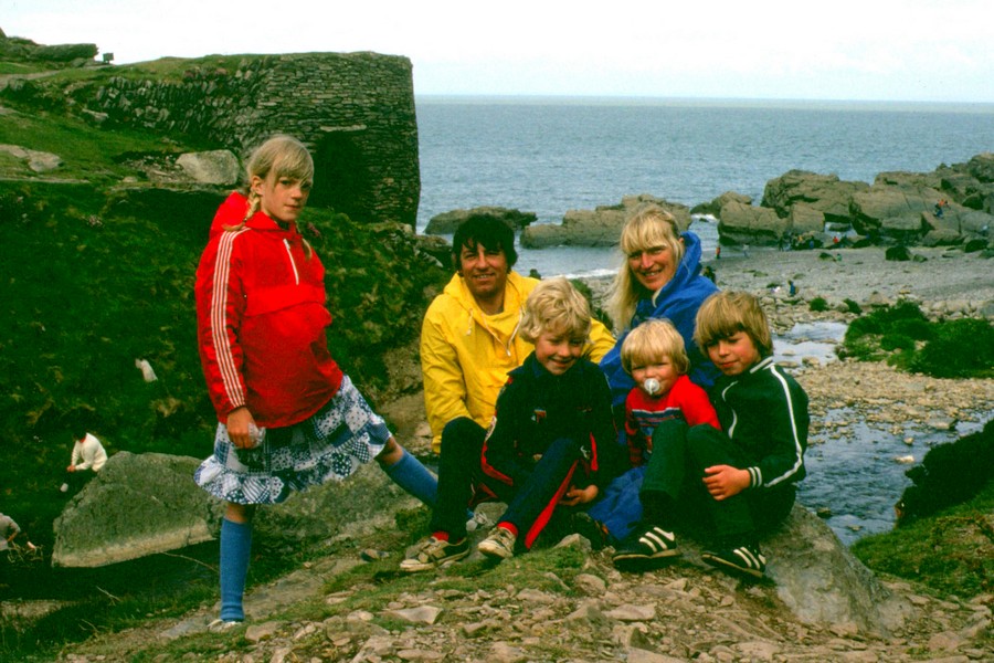
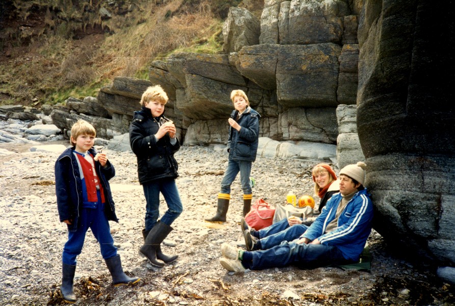
Rosie at Morwenstow 1968
Saturday 24th November 20 miles
It was windy in the night, but there was a beautiful sky in the morning, with a golden sun peeping through the dramatic clouds. We breakfasted on bacon and left at 9.30.
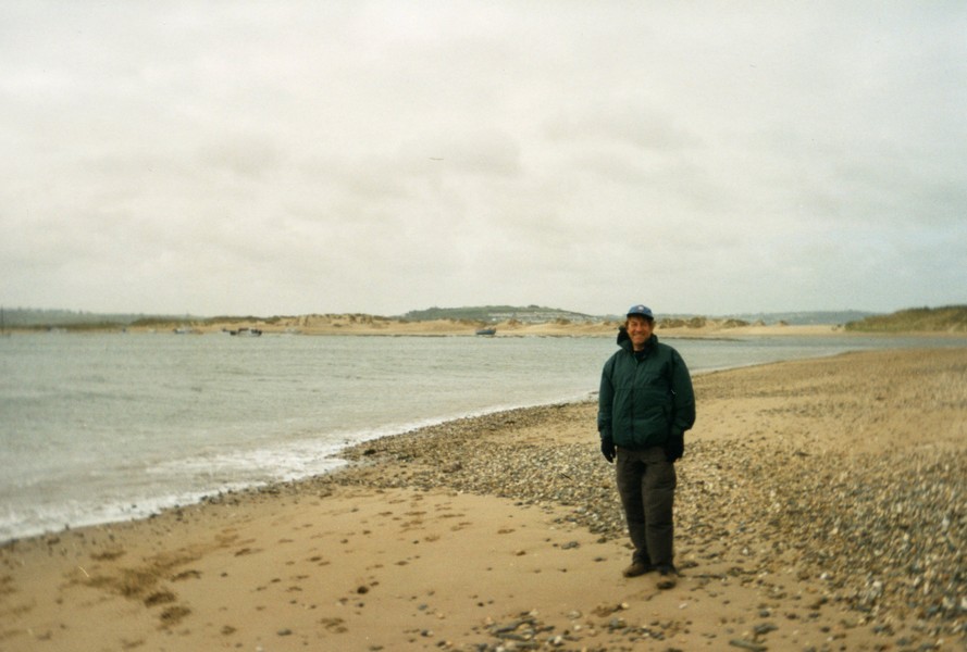
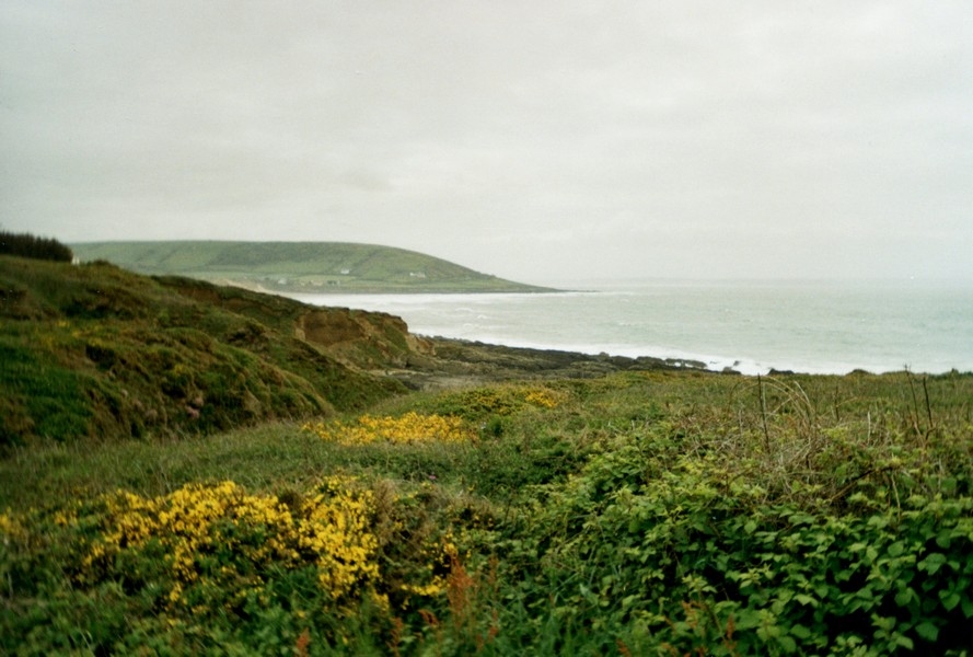
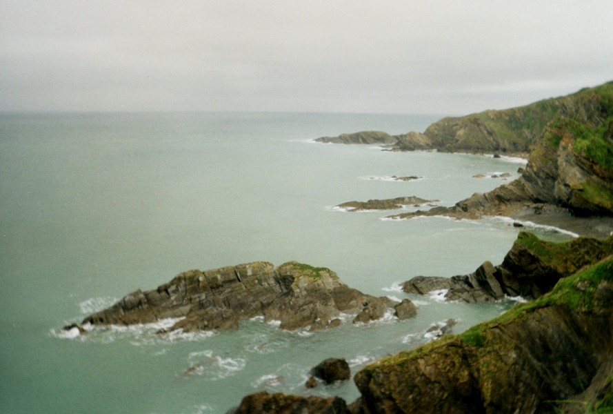
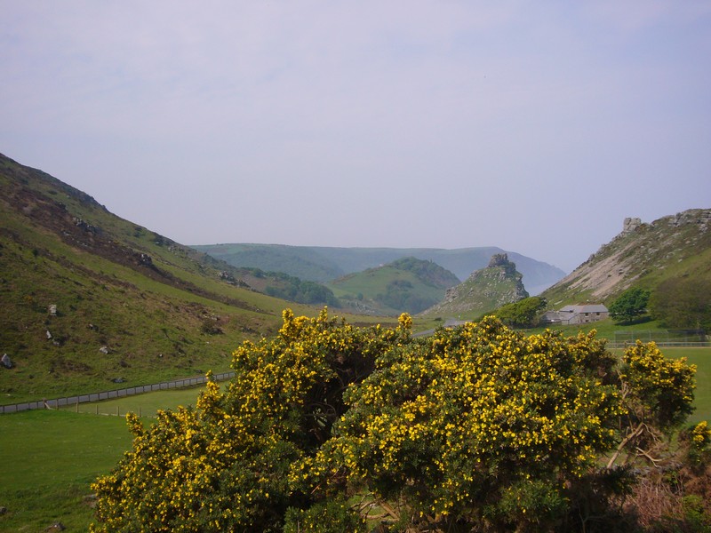
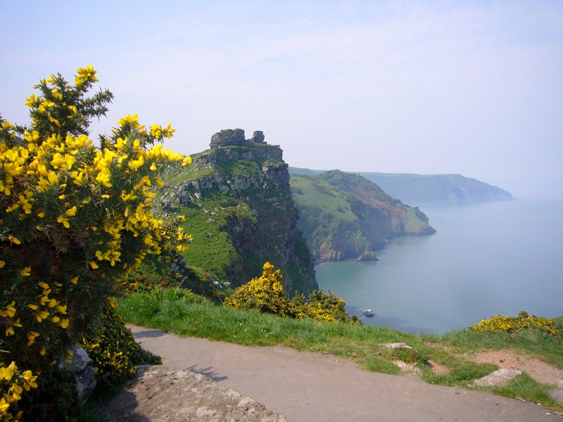
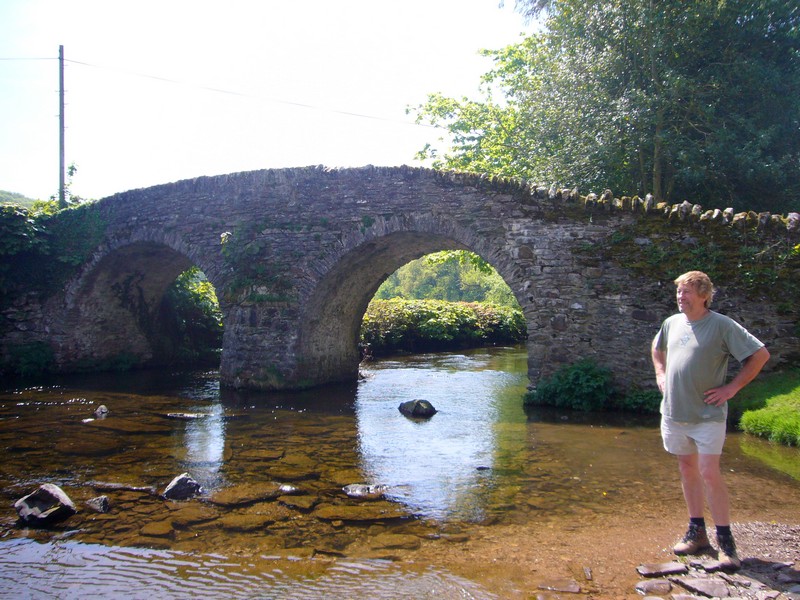
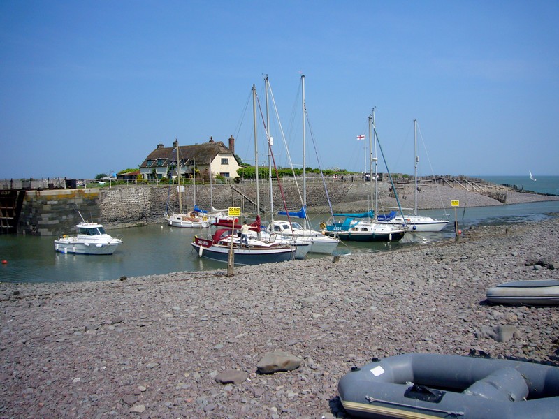
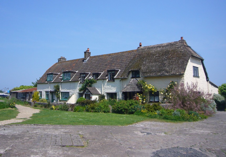
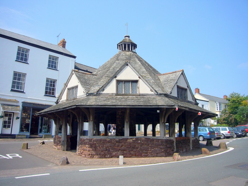
We drove through the village of Stoke, with its enormous church, to Hartland Quay. We have visited here before, more than once, many years ago and were surprised how little we remembered of it. The only thing there, is a hotel – formerly coastguard cottages, but we imagine that in the summer months, it is quite alive with outside refreshments etc. It hasn't been used as a harbour there since the late 1800s.
We walked down to the beach – the tide was in again – and marvelled once more at the corrugated rock strata.
This was something we did remember! It made us think of the similar formations that we had seen in South Africa recently – the Swartberg Pass and Kogmanskloof.
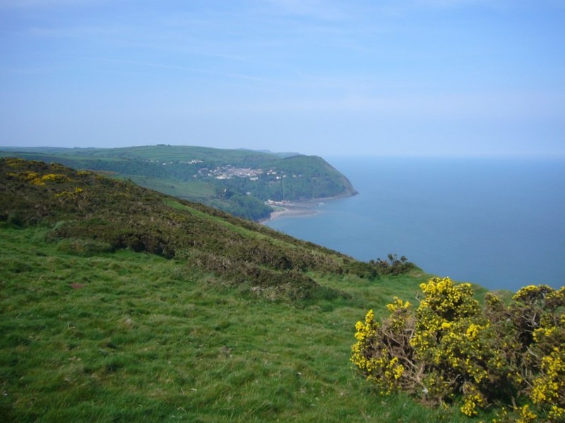
We drove up above the quay. We had seen a headland lit up by the sun and realised after a while that we were looking across to Lundy!
We returned via Stoke again and drove on to Hartland Point.
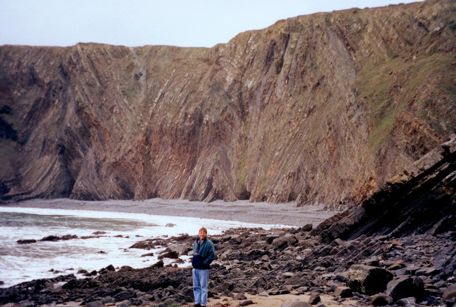
Hartland Quay
We have had trouble in finding any litter bins for our rubbish and as we had eaten fish for supper on Thursday, we were in need of one!
We had the route of a walk to do from here, so set off with our lunch in the rucksac and leaving our bag of rubbish outside so that it didn't stink the van out!
It was a fine pleasant day – fairly mild and a bit blowy in the wind. We had a really lovely walk following the Coastal Path south towards Hartland Quay but turning inland before then.
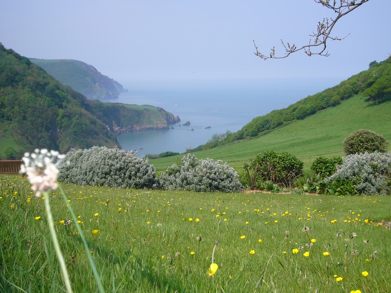
There was plenty of gorse in bloom, but we were delighted to see lots of herb robert and red campion as well. Being the coastal path, it was uphill and downhill all the way! We descended to a stream and then came to a valley almost parallel with the sea, reminding us of the Valley of Rocks near Lynton. We ate our lunch here, above the beach, at a place called Damehole Point. The coastline was suitably dramatic, with much evidence of slumping.
We crossed a second stream, Blegberry Water, then made our way inland, past an isolated cottage, to near Berry Farm and then northwards. For the most part we followed old "tracks" – unmade roads between high banks. It caused us to wonder again how some ancient tracks stay that way and others became roads as we know them.
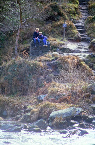
We passed Blegberry then made our way to Blagdon Farm, reaching the Tiv at 2.15. As I collapsed my hiking stick, a small boy said to his father "look dad, that ladies got a gun!"
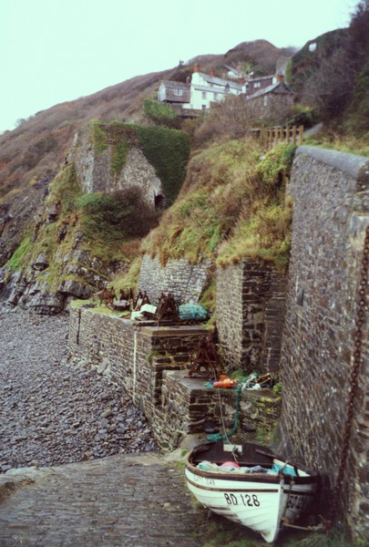
We drove on now the 6 miles to Clovelly, there being nothing but small tracks to the coast in between. In the car park was a litter bin (just one), so at last we could get rid of our rubbish!
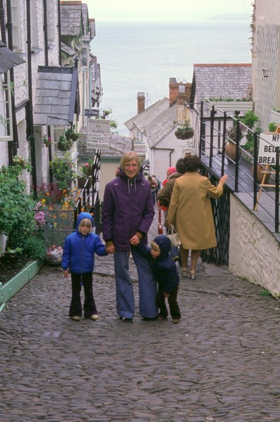
We remember from our last visit, that you now have to enter Clovelly through the visitor centre (and thus pay!) Adrian had other ideas, and we walked back down the road until we came to a pathway through the woods (National Trust). It was still a long way, with very difficult and steep cobbled steps – slippery with coverings of damp leaves.
We reached "Up Along", but it was still a long way down to the bottom. Was it always so steep and such a long way? I must have been much fitter and more agile when we used to bring the children here!
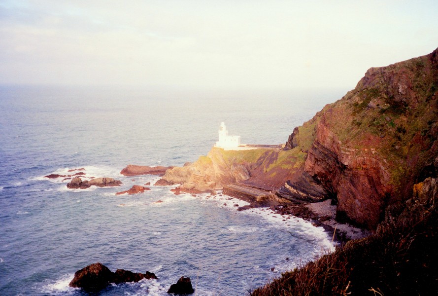
Hartland Point
We walked along the quay and I managed to get a couple of photos with the autumnal colours, before the mist came in and the drizzle started. It was a long walk back up. There were no little shops open today to delay us – we looked in briefly at the pottery at the top, before making our way back to the Tiv – now 3.40. It had been a pleasant visit and nice to revive some memories of long ago – one of the most vivid being of Paul falling asleep as he climbed back up – we were not surprised!
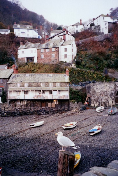
Clovelly
Sunday 25th November 26 miles
There was rain in the night and we awoke to a grey day. We listen to an interview on radio with John Bird, founder of "the Big Issue" magazine, for the homeless. He sounded a very nice and sensible man. We left just after 9 o'clock and took the A39 past the Clovelly turn off and turned off a couple of miles later to Bucks Mills. As we did so, the song on the radio went "the road is narrow and long". This was absolutely true, but it was also very beautiful and descended steeply through tall banks of trees in their autumn colours.
After about mile of this heaven, we came to the car park, but the entrance was too narrow for us. We managed to park at the side of the entrance and from here we walked on down to the village to the steep path down to the sea. As it said in our "coastal" book, it is a bit like Clovelly without the crowds. The situation was certainly similar. We could see Clovelly in the misty distance. There were the remains of two limekilns and a bank of stones where the ancient quay once stood. A nice information board told us about the history of the village and another sign told people to enjoy the beach for walking, fishing and swimming.
The beach was of large pebbles, but we did cross it to the patch of sand known as "the gut". In the past they had blasted away the rocks which formed the beach here to allow boats to land. The harbour dated from the 1500s. We really liked this little fishing village with its attractive houses and with names like "Smugglers Cottage" and "Mill House". There were some parallels with the North Yorks and Robin Hoods Bay. Apparently a Spanish ship had sunk off shore many years ago and the villages were supposed to be descendants of the survivors (and local women!).
We walked back up to the Tiv – the land around was "Woodland Trust" and it looked a lovely area to walk on a brighter, less damp day.
We left now, driving back through the tunnel of trees beside the steep banks, to the A39 and continued towards Bideford. We turned off to drive through "Ford" (the road went through here on our ancient OS map!). This was a tiny hamlet, but it did have a road called "Tom's Lane"!
We now turned off through Abbotsham to Westward Ho! We had been here very many years ago, but remembered nothing of the town, which perhaps we wanted to forget! We headed for the Northam Burrows Country Park (no charge in winter) and stopped there. The drizzle began and turned to rain! We telephoned my cousin Janet who lives in Bideford – we had last met 32 years ago briefly and a few times in our childhood. After a quick dash up the pebble ridge in the rain, we made our way to Janet and Michaels, where we spent a few pleasant hours chatting! We left some time after 3 o'clock and headed for Safeway to get some supplies and fuel before setting off southwards towards Otterton, stopping for the night at a parking area adjacent to the Tarka Trail. The rain more or less stopped, so before darkness set in, we were able to have a delightful and unexpected walk along the former rail track of the Tarka Trail to view the River Torridge in the glory of the autumn trees. We had really enjoyed the few days of our "Road Around Britain" in this beautiful part of the country.
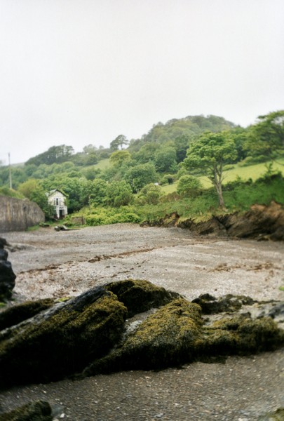
Buck's Mills
Monday 19th May
We now took the winding and narrow A388 (how would the Americans cope?) through Holsworthy and on to Bideford. Here we crossed the River Torridge on the old bridge to continue our ROAD Around Britain. It was now 12:15. We stopped at Instow, near the mouth of the river, looking across to Appledore. The sun was shining and it looked beautiful - we had visions of having lunch sitting outside on the seat, but when we got out of the Tiv, we found how strongly the wind was blowing!
We settled for a bracing walk on the lovely sandy beach, followed by lunch sitting in the Tiv enjoying the view!
The next section was carried out after our 'West Country Garden Tour' in 2003 visiting some of the gardens we couldn't visit in 2001 because of 'Foot & Mouth'. We join it after leaving Launceston and driving up the A388

We now had a quandary, as we needed both food and water and neither were very evident! We reluctantly drove back a few miles on the winding A39 to the CL we were heading for last night. This was adjacent to a cafe, so we could get both water and food – we just had to pay the £5! Adrian did the water filling as the drizzle turned to rain!
About 5.30 we walked across to the restaurant and were served a pleasant meal (Gammon A, Scampi R) and a beer by the chatty owners – a couple about our age who moved down from Shropshire a year ago. They had spent a very busy year getting the place going and were going back to their daughter in Shropshire for a week on Monday for their first break! We didn't envy them all their troubles in getting people to do things (jobs) for them to get the place running.
Paul falling asleep in Clovelly 1974
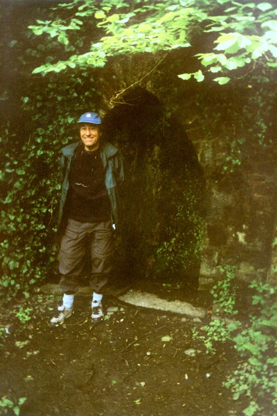
On the return journey, we diverted to walk the short distance to the ‘dripping well’ and back. Soon after this, we were overtaken by a whole group of cyclists. Just before we got back to the Tiv, it started to rain heavily. Adrian loaded the bikes back on the Tiv.
We now drove on in to Barnstaple, and at last we were able to have our swim! This was after we had parked right outside the car park, which had a height barrier! I asked for ‘2 seniors’, and the woman replied ‘senior citizens? Really? This made us feel good!
I was wearing my new 2 piece cozzie, like the one Trish had in America. The pool was pretty large, and was set up in lanes, but we both had a really good swim, then of course a shower and hairwash, which is always a bonus when we are motorhoming.
Adjacent to the pool was a shopping complex with a Lidl (and a PC world). Adrian went in the latter, while I shopped in the former, and then he joined me. Some things in Lidl are so amazingly cheap that we then had to find places to put the things we had bought!
Now it was time to make our way to a CL near Braunton. We needed water (and also to dump,) so we had to find somewhere tonight. We located Marstage Farm, and pulled in to the large field, where Adrian got the water, then walked to the other end of the field to dump, as the grass was rather long, and we weren’t sure how firm the surface was, and we didn’t want to get stuck!
We positioned ourselves, as the wind continued to howl around us.
I cooked pork chops for supper.
We drove on now towards Barnstaple, stopping at Yelland Post Office for me to post a 60th birthday present to Little Val. The Post Office part was really closed, being lunchtime, but the lady kindly took my small parcel and stamped it.
We were wanting to cycle some of the Tarka Trail, and were looking for somewhere suitable to park. We found the ideal place at the end of a track at what is called Fremington Quay. Adrian first had to fix his new chain on his bike then it was off for the 3 mile cycle to Barnstaple and then back again. We enjoyed the fact that the track, being an old railway line, was pretty flat, and also the fact that it was traffic free. We had views out over the estuary of the River Taw, and were generally sheltered by trees.
Tuesday 20th May 30 miles
A mostly grey day, with a very occasional glimpse of sun, but always a strong cold wind. We left at 9.15 and took the toll road (£1.50) to the far southern end of Braunton Marsh, as it is called on the map. This involved driving over numerous ‘topes’ (humps). We saw lots of yellow irises beside the channels, swans were nesting, and there were several ducks. Sheep and cows grazed in the meadows, in this area which used to contain a great many small farms. We saw a nicely restored ‘linhay’ - circular stone shelter.
Having parked the Tiv, we had a very breezy half hour walk along the beach towards Crow point, looking across the estuaries of the Taw and Torridge to Instow and Appledore. As we ascended a sand dune, the sand was blowing into our faces, making it difficult and unpleasant with my lenses, so we returned to the Tiv
It was now just after 10.00, as we drove back up the toll road, then west on another small road to have a walk on Braunton Burrows. Here the sun did peep out occasionally, but we didn’t tackle the long walk we had in mind, but returned to the Tiv and left at 11.30.
We now drove on to Saunton Sands, but as the car park here cost £2.50, we had to suffice with a photograph!
We viewed a couple more times as we drove on to Croyde, where the traffic held us up for a while, and the new car park had a height barrier.
We continued round to the NT Car park at Baggy Point, where we set off at about midday to walk the mile or so to Baggy Point itself.
We took the lower path on the way, and returned on the higher path. It was extremely windy, and it really tested my dislike of heights, but there were some great views, enhanced by the pale pink thrift, the bright yellow gorse and the purple foxgloves.
We got back to the Tiv for lunch at 1.00, then afterwards I scrambled over the rocks to Croyde Bay and walked across some of the vast sandy beach.
We now drove back to Croyde, then on very narrow roads to Putsborough, noticing the red, pink and white valerian growing profusely in many of the gardens.
We drove down to the beach, which is the southern end of Woolacombe, but again the car park was £2.50, so we didn’t stop! We drove back up and then through Georgeham to Woolacombe, where we have spent many a happy time with our children in the past.
Car parks here were even more expensive - £3.50 for one - but we were able to park beside the road at the northern end of Woolacombe and walk down to Barricane beach, where a dad and his 3 young children with fishing nets brought back memories, and on to Coombesgate Beach, then climbing back up to the Tiv.
We now drove on through Mortehoe, where Adrian was able to reminisce about his holidays with ‘the lads’, and then on via a very narrow road ‘unsuitable for long or wide vehicles’, which we managed well until just before Lee Bay, where a truck parked in the road left us with not enough room to get past. I went and called the men from the house they were working on, and they moved forward a bit. At Lee Bay (not the one we used to visit with the children, which is the other side of Ilfracombe), there was nowhere to park at all, so we had to suffice with just a view of the beach at low tide.
Now it was on to Ilfracombe, a place well known to us in the past, but which we haven’t visited for many years. It was busy as we arrived as schools had just turned out. We parked in ‘Jubilee carpark’, in front of a building housing the tourist office and several other things, but new to us. We set off to wander through the streets for an hour and kindle a few memories.
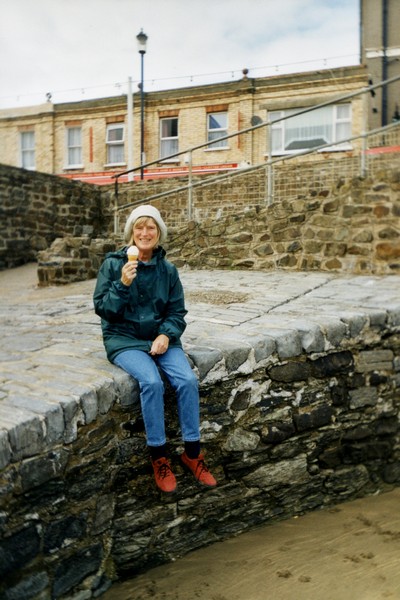
We walked on Capstone beach which I don’t really remember, then , despite the chilly wind, just had to buy an icecream (with cream) to eat sitting by the harbour, as we had done 30 years ago.
We lastly walked down onto the Town beach, but we didn’t find the ball which Simon buried in the seventies!
Adrian suggested staying at Berrynarbor, for old times sake, but I didn’t feel up to doing that, so we turned inland and found a layby beside the road near Two Pots at Horse Down Gate. I cooked turkey steaks for supper.
Wednesday 21st May 34 miles
Well, the wind had dropped, but instead we had heavy Devon mist! There had been more traffic on the road than we had expected - we realised that it was used as a short cut. We had spent much of yesterday and this morning looking for my viewer. We were just about to leave when Adrian spied it - right over the top of the dashboard! I was very grateful and relieved, as I find map reading very difficult without it. Mind you, I had found a shoe of his outside the door on the grass - it must have fallen out when we threw out some water, as we hadn’t ventured out for anything else.
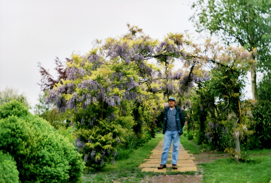
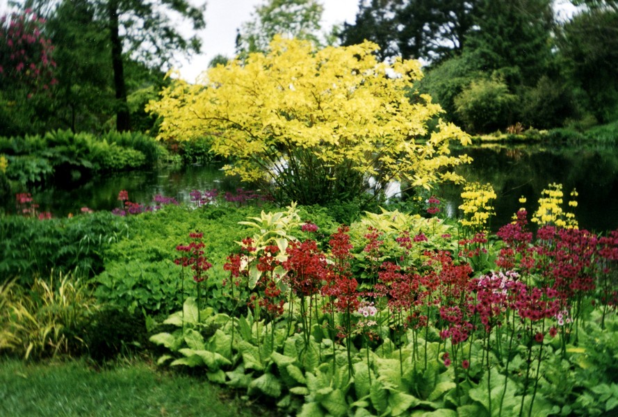
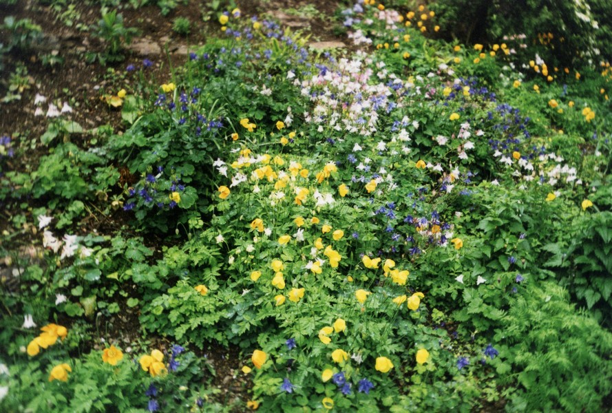
We drove south for 5 miles to some gardens I had wanted to visit at Marwood. We got caught up with the library van as we tried to find the gardens. We discovered that the only place to park was beside the road. By now the mist had turned to rain, which it did for much of the day. Even so, the gardens were thoroughly enjoyable. There were so many beautiful vistas and flowers. The gardens were larger than we had imagined, and had that wonderful feeling of looking just right, disguising the amount of work that must be involved to keep them like that.
Much of the planting was centred around the ponds - candelabra primulas were again wonderful, and the hostas were really happy here. The bluebells were almost over, but there were one or two meconopsis flowering, my favourite. There were a couple of statues, which complemented the gardens, and the tunnel of wisteria was just as it should be. A real favourite garden, and one which would appear to be good at other times of the year, as there was evidence of daffodils early in the year, and the gardens have the national collection of astilbes. A top spot! We finished our visit by walking along to the 13th century church.
We took a different route back to Ilfracombe, where again we got caught up in the traffic which has to find its way through the town. We drove on to Hele bay, just to the east of Ilfracombe, and were pleasantly surprised to find a large FREE car park by the beach. We had a good walk on the beach, but didn’t enjoy the rain - we had thought that the day was brightening up, but it never did! We also didn’t appreciate the static caravan site adjacent to the beach.
Now it was on a bit to Watermouth, an area we know well from our many camps at nearby Berrynarbor. However, parking was £1, and Adrian didn’t fancy a walk in the drizzle, so we will have to leave that for another time.
We noted that camping in the ‘Big Meadow’ was only £4.50.
We just had to drive up through Berrynarbor, passing Mill Park Farm, where we always camped. It seemed to be quite busy. We came out to the coast again at Coombe Martin, much visited by us in the past, and the place where Mum and Dad Cape spent their honeymoon in 1931.
We were able to park beside the road, and after having our lunch, we walked down to a cove at the western end which was new to us. A little house was tucked in at the end of the cove. We walked along to the main beach, down some steps which had a sign saying, ‘These steps are not a good access to the beach, they were built in the past for people from the cottages opposite to get water from the stream’!
We now took the narrow road over Knap Down to Hunters Inn. We were lucky in that we didn’t meet too many cars in awkward places! We were not lucky in that the cloud was so low that visibility was minimal.
We didn’t take the little road up past Trentishoe Church, which Adrian thought now says ‘not suitable for motors’. We parked in the National Trust field at Hunters Inn, and set off to walk down to Heddons Mouth, a walk which we have made numerous times in the past with our children. They had changed it a bit (how dare they?) and built a new (but old looking) bridge, which had us a bit confused at first! It drizzled all the way, but we enjoyed reliving old times.
, Devon.jpg)
By now the weather had really closed in, and we pondered what to do. There didn’t seem much point in continuing along this lovely bit of coast, as we could see very little. Likewise, a walk at Parracombe which we had considered doing seemed rather pointless too, even more so when we neared Parracombe and got into really thick cloud.
We were contemplating what to do, and considered driving south to see Emma when we came across a suitable lay by to stay in (although it was only 4 o’clock), and the phone came into contact briefly. However, despite us driving along the road first in one direction and then the other, we couldn’t get phone contact again. Frustrating, but we decided to stay put, so pulled into the layby again just north of Parracombe.
We started listening again to the cassette ‘Dear Joyce’ - wartime letters between Joyce Grenfell and her friend Virginia Graham. We had eaten our supper of turkey and pasta, and were just enjoying strawberries and clotted cream for afters, when a farmer chap who had been walking his dog (in this fog?), came up and knocked on the window. Contrary to saying what were we doing there, as we might have imagined, it turned out that he was really interested in our van, and wanted to know all about it. We had quite a long conversation with him. He was 65, and had a genial Chris Lane type face. We wished him luck. He said that no-one would bother us where we were, and they didn’t!
Thursday 22nd May
We awoke to find that we were still in thick cloud, but were pleased that the cloud had lifted by the time we had breakfasted, so decided to set off on the walk we had planned, which actually went past where we were parked. However, we had only been walking for a few minutes when the drizzle returned, and soon the cloud descended again! We therefore shortened the walk, but were still out for nearly an hour and a half, setting off at about 9.00, and returning at 10.20. We took off our wet gear, and drove the short distance to Woody Bay station, which we had seen last night. This is on the Lynton and Barnstaple Railway, which closed in 1935, and which some enthusiasts are hoping to partly reopen.
Adrian ventured out to see what was happening. He was actually gone for ¾ hour, as he met a chap from Wokingham! - who liked to chat!
As the day had not improved in the slightest, we knew that there was no point in trying to do more of the coast, so set off cross country over Exmoor for our planned visit to Paul and Nicky at Parbrook, Somerset later today.
Adrian on the beach at Instow
On the Tarka Trail
Adrian at the 'dripping well'
Braunton Burrows
Looking to Saunton Sands
Looking to Croyde
Baggy Point
Woolacombe
Barricane beach
Coombesgate Beach
Capstone beach
Marwood gardens
Hele bay and looking towards Rillage Point
With our children at Watermouth in 1980/1
Coombe Martin 2003
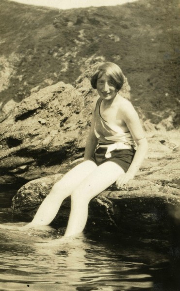
Mum Cape on Honeymoon at Coombe Martin 1931
Heddons Mouth 2003
Rosie at Heddons Mouth 2003
With our children 1980, Heddons Mouth
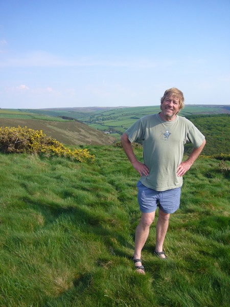
Saturday 10th May 2008 Return to Heddons Mouth
This few days of our ‘ROAD ARound Britain’ fits in with our visit to Paul and Nicky at Longview, St. Giles in the Wood after their little daughter Louisa was born on 29th April. Simon & Laure had had a little girl Millie on 4th April in Calgary, so we are yet to see her!
We left Longview at about midday, and stopped off at Sainsbury’s in Barnstaple, where, after eating a pleasant lunch, we stocked up with food for the next few days.
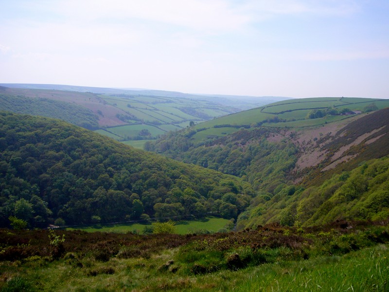
We headed for Parracombe, where we had ended this part of the coast in May 2003, in very miserable weather. Today it was glorious, with everything in its best spring glory.
We pulled into the parking area which we had stayed at on our previous time here while we decided which walk to do. On our last visit, we had walked out around Parracombe in heavy drizzle, and had thought of repeating the walk. However, the call of the walk down to Heddon’s Mouth, which we have made numerous times over the years, won.
We drove down the narrow Devon lane, between high banks full of spring flowers, to Hunters Inn. Luckily we met few vehicles, and none in the really difficult parts. The Tiv just made it through the narrowest places.
We set off at about 4 o’clock, revelling in what must be the loveliest weather we have done this walk in. In 2003, we had again walked it in the drizzle, and in 2006, when we walked it with Paul& Nicky and Emma, Felix & Ruby, it was bright but cold and blowy.
The flowers were a joy – bluebells, primroses, stitchwort, violets, campion and more.
When we reached the mouth, we walked across the pebbly beach to the waters edge, where I had a short paddle. On our return journey, we were able to cross the river on stepping stones – the first time for many a year that we have been able to do that. The limekiln by the beach had been recently restored and looked very smart.
We crossed the stream by the (fairly recently) constructed bridge, returning on the other bank, and arriving back at Hunters Inn at 5 o’clock.
We enjoyed an icecream sitting outside the inn, then drove up the long narrow road again beside the delightful, tumbling Heddon River to our parking place at the top, a layby on the lane to Heddons Mouth near Parracombe. Adrian walked over to the small railway track (the Lynton & Barnstaple Railway!), which last time we had seen a few enthusiasts were hoping to open, and found that a short distance has indeed been opened.
Later we read through our diary of our RAB in 2001 in Cornwall & Devon, when the foot and mouth outbreak disrupted our plans.
Sunday 11th May Re-living memories, and making more
There were no trains until 11 o’clock, so sadly we didn’t have a ride on the railway. It was only about 1 mile anyway, and we were ready to leave by 9 o’clock.
It was a fine and dry day. We followed the narrow road high above Woody Bay, but didn’t stop to walk. We remembered having walked down to Woody Bay once in the past.
We arrived at Lee Bay, which we had visited so many times in the seventies/eighties. We walked down to the beach but the zigzag path down the cliffs has been blocked off now. There were a lot of youngsters on the beach, presumably staying at the abbey, which is a Christian holiday centre.
We drove on through the toll road (£1) to the Valley of the Rocks car park. Again we had to pay here.
We walked for nearly 2 hours. The weather was perfect, and the scenery glorious. First we walked high above the sea on a tarmacked path, which challenged my vertigo! When we reached Lee Bay, music was emanating from the abbey. It was the Sunday morning worship, and sounded wonderful, with drums as a backing to the singing, which was really vibrant. With the fantastic scenery of the north Devon coast, it was quite overwhelming. We stopped to chat to another couple of walkers, and a chap who had come out from the abbey.

We now took a path through the woods, returning to Lee Bay, and taking the path above Wringcliff Bay, which it seems you can now not get down to. There were carpets of flowers along his beautiful walk, and the weather was really hot.
We drove on a short way to the so-called picnic area, which was apparently being refurbished, but just looked messy. We ate lunch sitting on a couple of logs before driving on to Lynton.
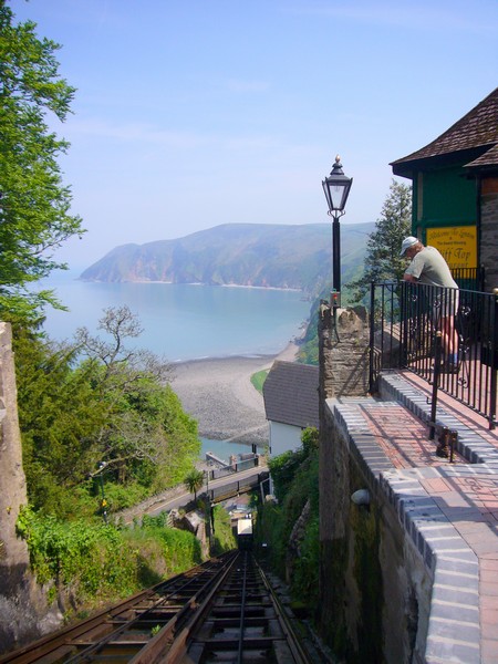
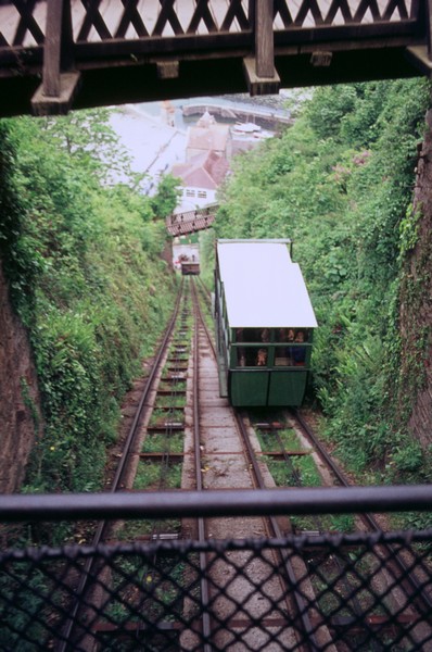
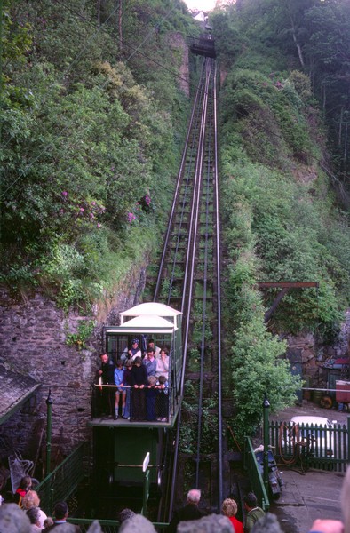
We managed to park beside the road here, and walk along to the Cliff Railway, which we have travelled on so many times before. It looked really smart now (with prices to match!). We stood outside on the platform for our ride down to Lynmouth, which we then enjoyed walking around.
We looked at the display about the 1952 floods, and about the 1999 re-enactment, 100 years after the Lynmouth lifeboat was taken the 14 miles over Countisbury Hill to Porlock to rescue a boat, when it was unable to launch at Lynmouth.
We ate delicious icecreams (ginger with clotted cream/ mint choc chip with flake) looking over the Lyn river, with all its ducks. A chap got chatting to us about the Harley Davidson motorbike parked by us, which he rather fancied.
We now drove to Watersmeet, where we walked down to the confluence of the rivers, and enjoyed the wonderful scenery of this area as we walked along beside the stream with its continual little waterfalls.

Now we made our way to Channel View Campsite, Manor Farm, Barbrook. This only cost £10, and was a very unassuming campsite, with no ‘don’ts’ everywhere. It was our answer to where to stay tonight!
After having showers (we felt very sticky after all this walking on a hot day) we later had a barbie sitting in the late sun above Lynton. We enjoyed our meal, but were surprised by a sudden shower just as we were thinking of coming inside.
Monday 12th May Enjoying Doone country
Another beautiful sunny day, but sadly too windy where we were to sit outside for breakfast. By the time we’d done all the ‘filling and emptying’, and had bought some more gaz, it was 10 o’clock.
We set off for Lynmouth, making it longer than it should have been by missing the turning. We drove up 1 in 4 Countisbury Hill, pulling into the car park at the top, opposite the Blue Ball pub. Two conflicting signs read ‘private car park, pub users only’ and ‘National Trust car park’.
We walked up through the churchyard and into the delightful little Countisbury Church, then onto the coastal path. We walked for a short distance along this, until my vertigo got the better of me! There were wonderful views back to Lynton and Lynmouth.
We saw a bird which we looked up to be a stonechat – at the end of the day we saw more.
We now turned off to take the steep road down to Brendon and on beside the pretty East Lyn River to Malmsmead. Here we pulled into the car park (£1 per day) beside the Lorna Doone Farm. We had passed one or two pleasant campsites today, and there was another one here.
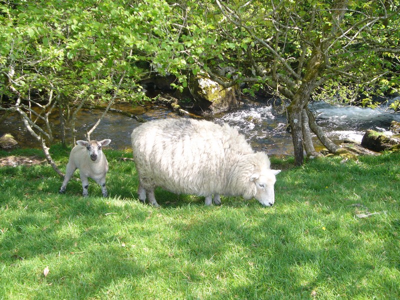
We set off to walk some of the way towards ‘Doone Valley’, along beside Badgworthy Water. We walked along higher up to the little bridge at Clouds Farm (another campsite), then back beside the river, enjoying seeing all the sheep with their little lambs.
We ate our lunch sitting on a bench in the field, having viewed the attractive stone bridge which I remember from our 1986 holiday near here.
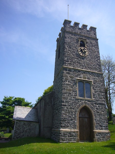
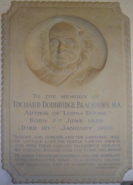
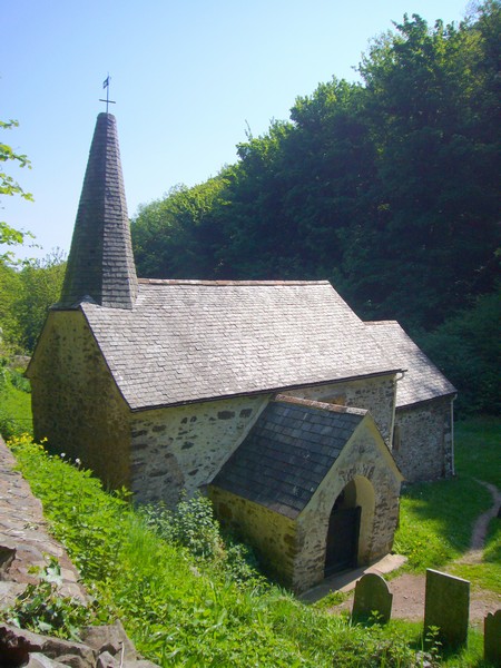
Our next stop was delightful Oare Church, where Lorna Doone was shot at the altar in the story. There was a plaque to R. D. Blackmore, who wrote the book.
Adrian remembered his parent’s photo of the church, and took one to match.
Now we drove up to the A39, and pulled into County Gate car park, on the boundary between Devon & Somerset. There was a so-called ‘Nature Trail’ from here down to Glenthorne Beach. The walk was 3½ miles long, but it descended 1000 ft, and then climbed back up again. We set off to walk some of it, but decided that our legs didn’t need to go right down to the beach. We walked for about an hour, it felt very hot.
We returned to the Tiv, looking down towards Doone Valley. We had decided to stay here tonight. We set off for one more walk – along Cosgate Hill, and back over the top, enjoying the view down to the road we had driven on earlier to Malmsmead, with the little river beside it.
We heard a bird singing, and on looking up, found it to be a stonechat.
We were able to sit outside with our aperitif, but came in to eat. We were surprised by a group of 30-40 young people who congregated near us, then appeared to make the same walk that we had, before disappearing again down the hill.
We moved to the back of the car park for the night, but it was still very windy.
Tuesday 13th May Via England’s smallest church and pretty villages to Minehead
The morning was sunny but still windy, so we ate inside before heading off, taking the WorthyToll Road down to Porlock Weir. We were hoping to walk to Culbone Church, supposedly the smallest church in England, which Paul and Nicky had told us about. They had encountered it on their walk of the Southwest coast path. We opted to walk from Porlock Weir, as the other approach road, from Silcombe, looked too small for the Tiv.
Having paid our £1.50 toll, we asked the lady if we could park there to walk to the church. We set off at 10 o’clock, and returned at midday. Although a lovely day, we were in trees for all of the way, so it felt cool, but it wasn’t windy. Deer leapt off soon after we started the walk.
It took us ¾ hour to walk to the church, the path altered a couple of times because of long term land slides. It was mostly up all the way there, and down all the way back. It was certainly an attractive little church, lost in time. Many of the surnames in the small graveyard were ‘Red’ – there was even an Ethel Red!
Back at the Tiv, we drove on to Porlock Weir – so pretty, but just a bit ‘smart’. I had wanted fish & chips for lunch, but there was no sign of that, just nice little restaurants. We hadn’t the right change for the carpark, so didn’t linger too long, just long enough to walk over the small bridge across the tiny harbour to the attractive cottages beyond.
We drove on through West Porlock to Porlock itself, where I wandered the streets, but found no fish & chip shop. I did find a bakers, so bought a nice loaf, which we ate for lunch when we reached the next lovely village – Bossington.
Here there was a free National Trust car park, so we sat in a grassy field to enjoy our lunch. There were lots of other ‘oldies’ parked up for the day it seemed, just enjoying the rural atmosphere. We set off to walk down to the sea, reaching it at a pebbly beach, where it was really windy. We returned to Bossington, walking past the delightful cottages with flowers growing up the walls. This really is a lovely area of England, which Americans must envy us for.
The next pretty village was Allerford, which we had to stop at, because the pack horse bridge features on the front of our map. As in other villages, some of the chimneys were cylindrical.
Now came Selworthy – we couldn’t remember how long ago it was that we had come here. The little green with its cluster of four or so houses is near perfect. I missed my cream tea though, as we realised that we had no money on us. Still, it’s a beautiful place.
Now it was on to Minehead, which was much more pleasant than we’d imagined. We drove right through to the little harbour at the western end, then came back to drive up North Hill. This was memorable to us, as we had camped here in 1964, along with John Ed and my digs mate Jane. We drove right on to the end of the track, which is above Bossington. Here it was really windy. We made our own ‘cream tea’ of fresh bread, banana and clotted cream.
It was then that we discovered that Adrian had 2 ticks on his leg. We managed to remove them, but it was an unpleasant experience.
We drove back towards Minehead, but when we passed the Camping Club site high above Minehead, we decided to pull in.
We found a sunny spot, and sat outside while the barbecue got going, coming inside to eat.
Wednesday 14th May Steam trains, Dunster Castle to Watchet
The dull start cleared to give another lovely day, but it meant breakfast inside again. We didn’t leave until after 10 o’clock, having done all the ‘jobs’.
We drove back down into Minehead and right along to the eastern end of the road, where we had a brief look at the lovely sandy, but very windy, beach.
At Marsh Street (a tiny hamlet) we drove down to what is known as Dunster Beach. The narrow lane crossed the West Somerset Railway, and just as we crossed it, a steam train was puffing along in the distance. We stopped for Adrian to get his bit of excitement, as the train stopped at Dunster station and then pulled off, with clouds of smoke and steam. It did look great.
We drove on to have our ‘elevenses’ looking out over the wide beach from the warmth of the cab – it was still really windy.
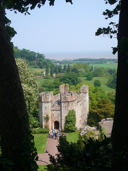
Now we made for nearby Dunster. We saw that the Castle was National Trust, so made our way there. It was good to make use of our membership, which we have had little chance to do recently. Apart from visiting the castle, it meant that we didn’t have to pay for parking, and after our look around, we were able to wander down into the little town with its renowned yarn market building.
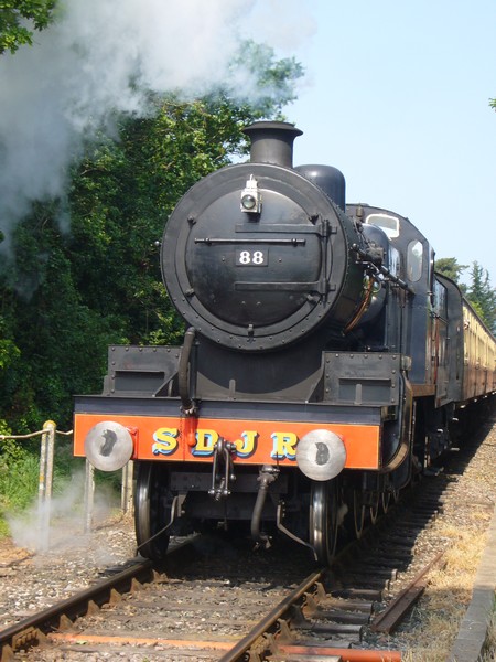
Part of the castle was being rebuilt, but we had our usual wander through the grand rooms and the attractive grounds. From the windows we could see the lovely sight of the steam train puffing along in the distance.
We ate lunch in yet another field, this time in the ‘overflow carpark’, which was a nice bit of parkland. We sat enjoying the warm sun in this sheltered position.
We next drove through the place known as Blue Anchor, where unattractive static caravan sites occupy the areas by the pebbly beach. We could see the steam train puffing along in the distance, before it turned inland on its way to Watchet. We have travelled on this railway a couple of times – the last being in 2004 when we met Emma and the children at Bishops Lydiard and caught the train (by the skin of our teeth) to Watchet to see Paul and Nicky’s (then) new house.
Now it was time to visit Watchet again. Our fist stop was to look at Paul and Nicky’s former home, which was still looking good, with nice tubs of plants outside. It was funny to be doing this, when their present house is just going on the market before their proposed move to Dorset.
It was really windy as we walked along to the railway station, where by a stroke of luck, the steam train was just pulling in. Adrian got another fill of nostalgia before we walked back through the pleasant little town, looking in at the small (free) museum.
We ended our visit, and this part of our RAB by looking at West Street beach, just opposite Paul & Nicky’s former house, and which we had visited when they were there.
Then it was from one house to the next, as we made our way back to Paul & Nicky at Longview, St. Giles in the Wood where workmen were just completing the work prior to mains water being connected to the house.
It had been a beautiful few days, with fantastic scenery and wonderful weather (it rained all the next night).
This next section starts 5 years later at Parracombe (Heddons Mouth again!) in May 2008
Heddons Mouth
Lee Bay
Old zigzag path from carpark
1986 at Lee Bay
The Valley of the Rocks
Lee Bay and the Abbey
The Lynton-Lynmouth Cliff Railway 2008
The Lynton-Lynmouth Cliff Railway in the seventies
With Mum Cape at Lynmouth 1993
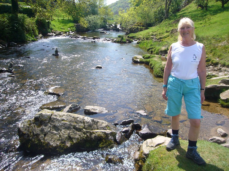
Rosie at Watersmeet 2008
1980 at Watersmeet
Simon & Tom Watersmeet 1986
Looking back to Lynton & Lynmouth from Countisbury
By Badgworthy Water
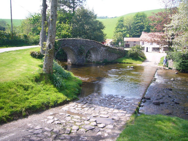
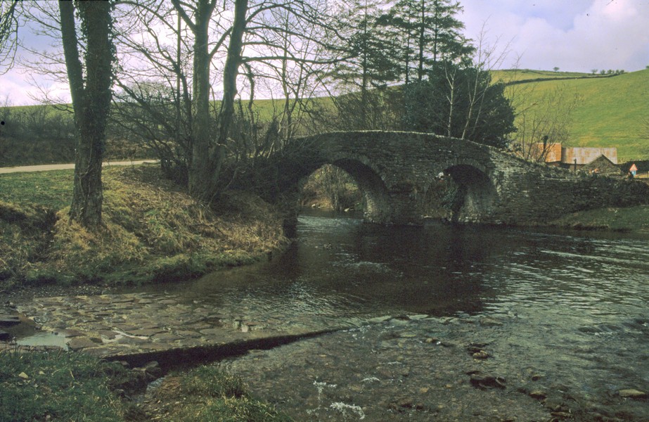
The East Lynn River at Malmsmead 2008
The East Lynn River at Malmsmead 1986
Oare Church with plaque to RD Blackmore
Oare Church 2008 and 1956 ish
View at County Gate carpark from Tiv
On our walk at Cosgate Hill
Tiny Culbone Church
Worthy Toll Gate
Porlock Weir
Bossington
Allerford
Selworthy
Looking down to Minehead from North Hill campsite
Rosie in 1964 cooking supper, North Hill
View from Dunster castle
The yarn market, Dunster
Outside Paul & Nicky's former home in Watchet
It's that train again! at Watchet
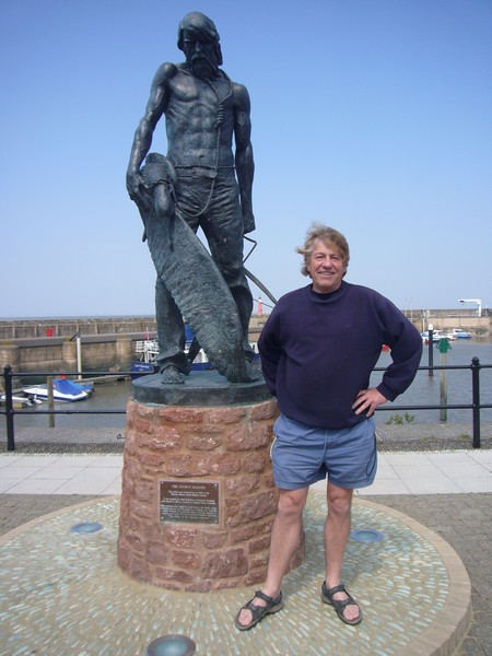
Adrian by statue of Coleridge's 'ancient mariner', Watchet
West Street Beach, Watchet
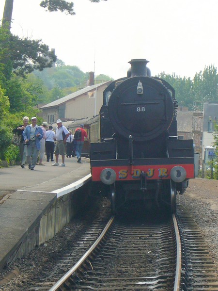
Somerset & Dorset Steam Locomotive no. 88
Tuesday 21st June 2011
This is a short part of our RAB, from Bristol to Watchet. Three years ago we reached Watchet from the west, thinking that we would easily do this stretch when visiting relatives, but it didn’t happen!
We left Stockcross today after my aromatherapy session, reaching the M4 at 2 o’clock. Near Bath we passed the scene of lorry on fire on the hard shoulder of the other carriageway. Traffic travelling eastwards was stopped, and we could feel the immense heat as we drove past in the far lane. Later we heard on the radio that traffic travelling west was also stopped, and the other carriageway was stopped for hours.
We turned off at Severn View Services (used to be called Aust), hoping for a view of the channel, as we’d had many times in the past. However, you now can’t get anywhere near the view!
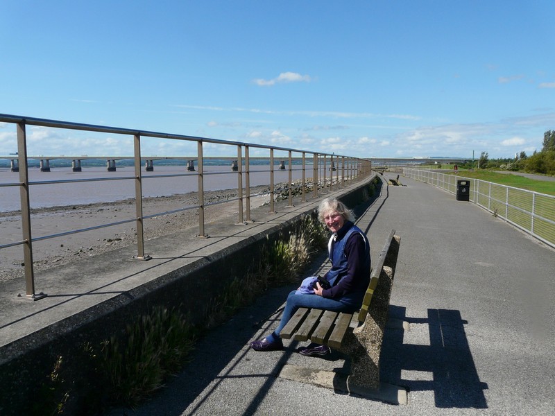
We decided to head for Old Passage, and turned off onto a 'No through road', which ended abruptly, but which offered nice views of the two bridges, one in each direction. It looked a good ‘overnighter’, but being still early – just after 3 o’clock, we carried on a bit further first.
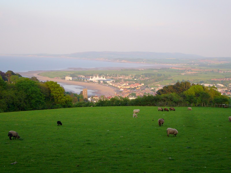
The last part of the Southwest of England is the 'correct' way we have chosen for the website of our Road Around Britain i.e. anti-clockwise - so it is the opposite to the rest of Southwest England. It starts at Severn Beach just north of the Second Severn Crossing of the M4 and finishes at Watchet.
We now headed back to the roadside at Old Passage, where we enjoyed the superb view across the water.
After supper of smoked haddock, we looked out to the dramatic skies and superb views as we looked at our diary and photos of our RAB of the Welsh coast, just across the water.
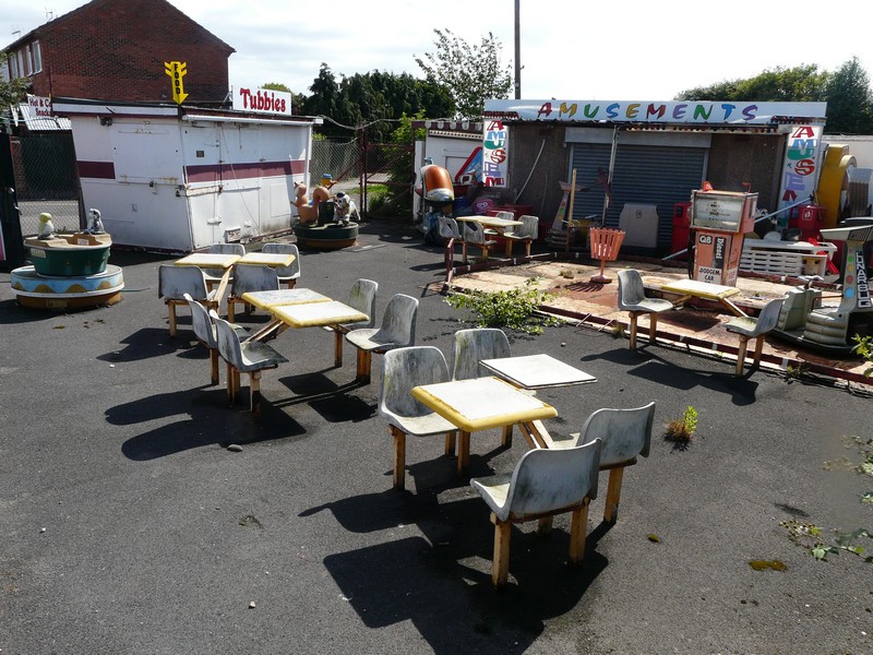
A fine Amusement Park at Severn Beach
We turned off to New Passage, a small hamlet of pleasant houses, but with no access to the shore. Two young boys were walking home happily from school – unaware we thought, of the lovely surroundings they were growing up in.
We crossed the motorway – ‘new’ compared with our ancient OS map - and made our way to the ‘village’ of Severn Beach. The signpost from the M5 had always intrigued me, but all we found was a modest housing estate close to the shore. ‘Beach’ was an imagination, as there was thick mud. We walked across a small grassy park area to the ‘prom’ atop the sea wall. It was pleasantly warm sitting in the sunshine and viewing the two bridges, and looking across to the Welsh coast, which we had ‘explored’ two years ago. It was windy – apparently a result of the high variations in tide level - but enjoyable after this mediochre June. We were amused at a small derelict ‘amusement park’, with a dodgem car circuit which may have accommodated two cars!
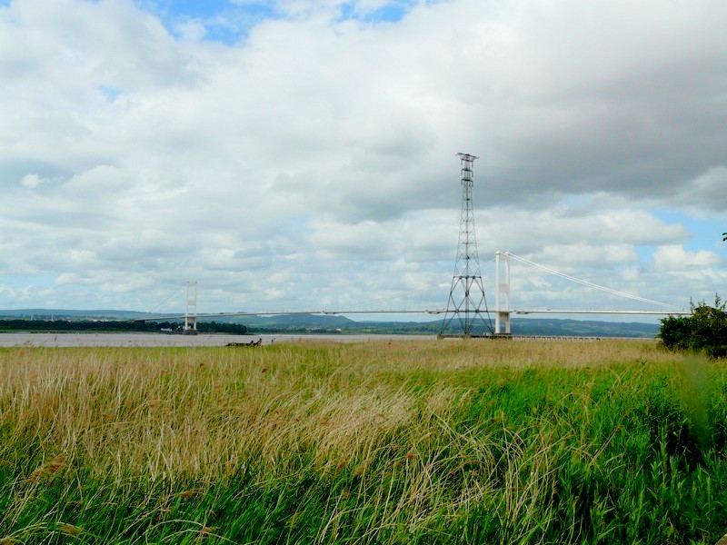

Old Severn bridge from Old Pasage
New Severn Bridge
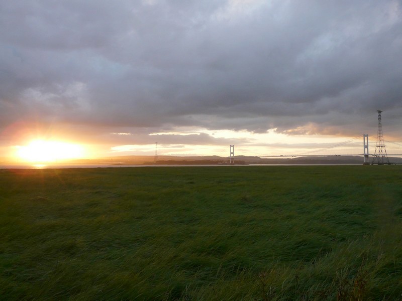
The sun goes down behind the bridges
Wednesday 22nd June
There were frequent showers towards morning, but the day was then fine and sunny, although very windy.
Once more we enjoyed the wonderful view as we breakfasted, listening to Radio 2’s ‘2day’ presentation, when the various presenters each teamed up to have an hour’s show, mostly with very pleasant music.
We set off at 9.30, and drove past Severn Beach, and then through the industrial area of Avonmouth before taking one section of the M5 to cross the River Avon.
We then turned off to Portishead, diverting through the tiny hamlet of Sheepway with its delightful houses. I had been enjoying the unkempt roadside verges, with the profusion of wild flowers.
In Portishead, Adrian popped into Waitrose to buy one or two bits, before we became entangled in the steep housing developments with a profusion of parked cars. At one point we had to wait a while for the recycling van to finish loading, as a large truck was parked opposite it.
We found our way down to the front at Woodhill Bay, beside a small lake.
We now left Portishead, with its attractive blue flower tubs filled with flowers of mostly red and blue, and travelled a few rural miles with very few houses to Clevedon.
Clevedon was hilly, and it was very difficult to get to the coast, but we did manage to get down near the pier.
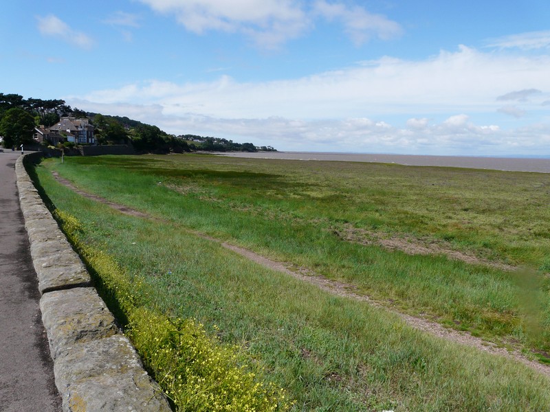
Woodhill Bay, Portishead
After this we had to take small roads which were not near the shore, and then drive inland to Yatton, where we had lunch in a car park which was for walkers to Cadbury Hill. Then it was through Congresbury before crossing the River Yeo, and then the M5, on a small road at West Hewish. We took a road through rural Wick St Lawrence to drive along the northern outskirts of Weston Super Mare, through Keystoke to Sand Bay. We drove northwards beside the sea to the rocky headland of Middle Hope, which is a nature reserve, owned by the National Trust. It was extremely windy here, and the tide goes out a very long way – a mile!
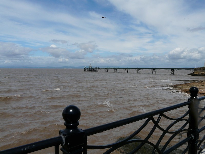
Cleveland Pier
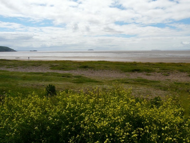
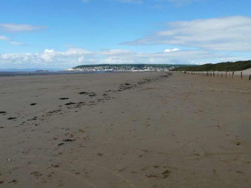
We now drove over Worlebury Hill to Weston Super Mare, but although it was very quiet here today, parking was all paying, with a minimum of 4 hours, so stopping was difficult. We pulled in briefly beside the vast sandy beach, and tried to remember previous visits here.
Sand Bay on the outskirts of Weston Super Mare
Continuing south, we came to Uphill, remembering cousin Gwen, who used to live here. We found our way to the huge sandy beach, and had views back to Weston Super Mare.
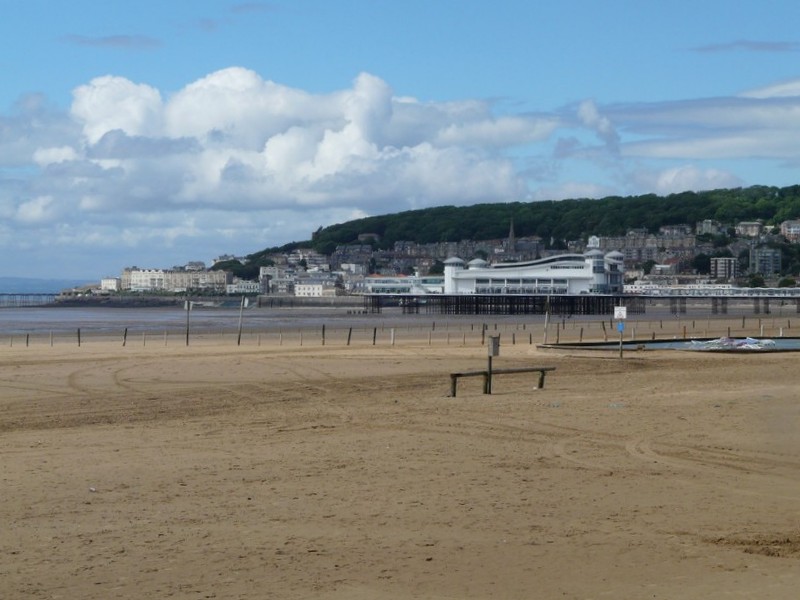
Weston Super Mare
We could also see the church, stuck right on top of the hill, which we have visited before to see Gwen’s grave. There appeared no road access to it.
Brean Down is very close to here, but getting there took a long time, as the roads are all inland to cross Bleadon Level. We turned off at Bleadon, but after several miles, found that the road was closed. We returned, and drove through Lympsham, and this time, despite the unclear signs, the road was open. The road to the coast was very winding, and we passed a huge number of caravan parks. Brean itself was full of more caravan parks. We drove up beside the sea to Brean Down, remembering coming here with Lena in the seventies. We stopped briefly in the car park before driving back south to Brean, turning inland to find a stopping place beside the road which Adrian had note of, at a place called Ford Common. It was now turned 5 o’clock.
Weston Super Mare from Uphill
Thursday 23rd June
After a few spots of rain, we had a mostly sunny, but windy day. The night had been very quiet. By 9.30 we were on our way to Burnham, and were pleased to see the tower on the beach. We found Burnham rather unexciting on this now grey and showery morning. Flower beds had been planted along the seafront, with the prom up behind, with seats for resting, but as yet they weren’t colourful.


The next sections are
We continued through Highbridge, turning off through the village of Huntspill, and then on rural roads. We’d had to cross the River Brue, and then headed for the River Parrett, through Stretcholt, and back towards Pawlett, picking up the A38 to Bridgwater. This town is now very industrialized on the outskirts.
We turned off on winding roads to Chilton Trinity, but the roads were narrow. We returned to the A38 into Cannington, which had an attractive centre. I wanted to visit the Walled Gardens here, but stopping proved rather difficult! The gardens are next to the Agricultural College, right in the centre of the small town. Parking was extremely difficult. Although there were a few parking spaces labelled for the Gardens, they were beside the road, next to a crumbling wall, and not wide enough for us. After almost giving up, we were able to find a nearby spot beside the road, and we had a really pleasant visit to the gardens, which had been reopened in 2009 by Prince Edward. The gardens nestle beside the church and ancient priory, and restorations of them is still ongoing.
We drove north from here to the delightful village of Combwich (which we found later to be pronounced Cummidge). We came down to a stretch of the River Parrett called Combwich Reach, and were able to sit on a bench in the warm sunshine to eat lunch, sheltered from the wind.
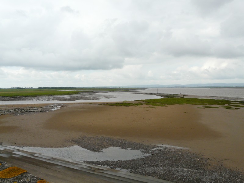
We left at 2.15, turning off to the remote hamlet of Steart, tucked into the northerly bit of land at the mouth of the River Parrett. There were some ‘works’ going on, and the road was blocked by a huge low loader transporting a gigantic bulldozer. Adrian had to reverse about ¼ mile when the vehicle eventually left. We looked out onto miles of mudflats (Stert Flats) – part of Bridgwater Bay, which is a nature reserve apparently known for its birdlife.
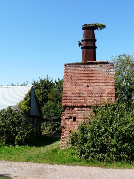
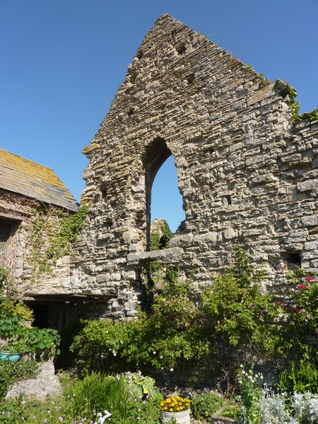
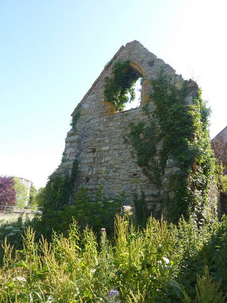
We returned along the long and narrow road, and took more small roads to Stolford, which was right by a muddy river. There was a view back to Burnham in the distance. We now continued past Hinkley Point Power Station to Lilstock, again on narrow roads. Adrian was glad that the hedges had been cut, making it easier to get through with the van. We were on the edge of the Quantocks, and the land had become hilly. We drove on over a hill towards the sea, reaching it beside the ruined chantry building at Kilve. Apart from the ruined chancel walls, there was a brick tower here, which was apparently built in 1916 as the first attempt in Britain to extract oil from shale! We were able to park and walk the short, and windy, way to the beach, where it seems that ammonites can be found in the cliffs – the first fossils of their kind to be found in Britain. A board telling us all this information also stated that the Quantocks are an Area of Outstanding National Beauty – the first in Britain. Quite a place.
From the rocky shore, we could see Minehead in the distance. A house had been built ‘into’ the chantry ruins, and this now served as tearooms. It was a lovely setting, with pretty gardens right beside the ruined walls. Dozens of sparrows were noisily flying around while we stopped to enjoy an icecream.
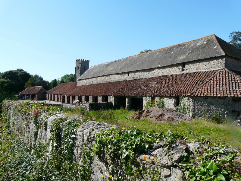
Nearby was the pretty hamlet of East Quantoxhead, with attractive rose-covered houses, and an ancient church with unusual long barns in front.
Now we made our way to Watchet, reaching it at 5 o’clock, and now completing this section of our ‘Road around Britain’. For old time’s sake, we visited Paul & Nicky’s former house in Watchet, but Adrian was sorry to have just missed the passing steam train.
We made our way to Renee & Lena’s for the night at Puriton, before spending the weekend with Paul & Nicky & family at Chantmarle, Dorset.
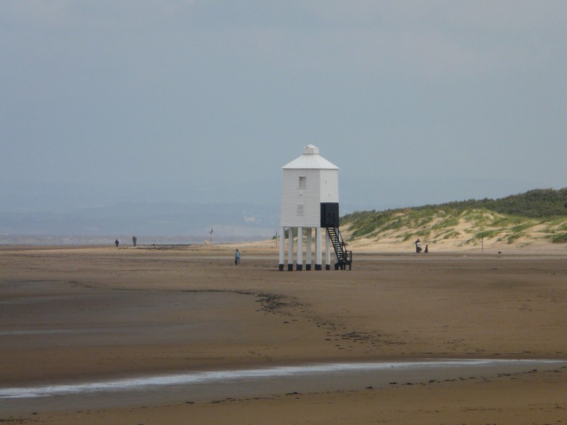
The lighthouse on the beach at Burnham
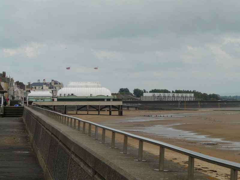
The pier at Burnham
Looking across the River Parrett at Burnham
Cannington Walled garden
Combwich Reach
Oil Retort tower at Kilve
Ruins of chancel at Kilve
Kilve beach
Barn at East Quantockshead
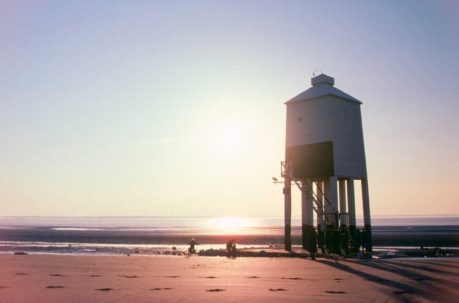
The lighthouse on the beach at Burnham 1979

