
Thursday 15th June Uppsala 63 miles
We had a 'useful' morning! It was a glorious day. We ate breakfast outside before busying ourselves with the website, and finally sending it. We sat out again for coffee, and had a little walk towards the beach, through lovely woodland, but the thought of walking all the way back uphill in the heat was too much for us this morning.
We didn't leave until midday, having done the 'emptying and filling'. We’d had a really good stop at Stockholm.
It always feels good when we have done all the 'jobs', and sent the website. We set off northwards towards Uppsala. As a teenager, the name had been a joke to me – I didn't know that it was a real place, and an important one at that, so I really wanted to see it!
At Marsta we shopped in Lidl, and ate our lunch afterwards. We were stopping next at Sigtuna, a pleasant, busy little town with supposedly hundreds of rune stones (we saw two) and two ruins of churches. It also has the reputed oldest main street in Sweden, hidden underneath the present one.
It was a popular place today, with crazy golf beside the water, where dozens of children were enjoying themselves. Having had our look around, we continued on country roads through pretty scenery to Uppsala. We drove through the ugly outer parts until we came to a nice bit by the canal. We had seen the vast red brick castle on the hill, and the massive twin-domed Domkyrkan, the cathedral church. Adrian was finding the driving very difficult, with many junctions not showing priority, and with hundreds of cyclists.
We managed to find a blue badge spot near to the church and university, but I had really wanted to visit Linnetradgarden, the garden of Carl Linnaeus, who in the 1700s had first classified plants. The gardens closed at 5.00. and it was now 4 o'clock.
We set off again, Adrian was reaching desperation point when I spied another blue badge spot.
We set off to walk to the gardens and paid our 80 krone each to enter. The ticket also included Linneshammarby, the later estate which Linnaeus owned, but we found out that this is several miles south of here. The gardens were very small, with a neatly laid out area with each individual plant labelled. The house where Linnaeus had lived was now a museum, so we made for that first, as that was the part which closed. Then we looked in at the orangery, but in summer this is only used as an eating area, so there was very little to see.
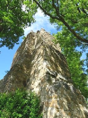
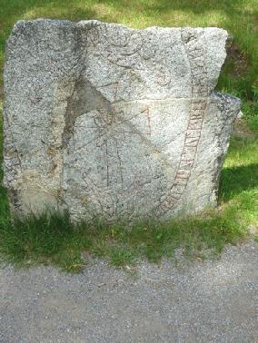
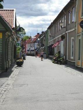
Sigtuna - an ancient street
A church ruin
A rune stone
It was at this point that Adrian enquired about my little blue rucsac, which I didn't have. Panic ensued – but I hadn't stopped anywhere to put it down. We asked the staff. We then remembered that we had gone back to the van when we doubted that we were heading for the right gardens.
We returned to the van, just as it began to rain, and sure enough, my bag was there! We drove back to tell the staff, who were just leaving, and had been concerned.
Now time to find our overnighter! We drove the few miles to Gamla Uppsala – Old Uppsala, where there was a place to stop. We hope to have a look at the ancient sites in the morning.
We had another long shower of rain, but we'd had a good day.
Around 9 o'clock, with a now fine evening, we decided to walk out around the area with the three royal burial mounds. It was glorious being out in the tranquil evening with hardly anybody else about. We stopped by the attractive church and graveyard on our way back.
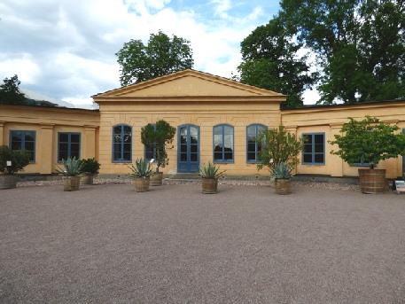
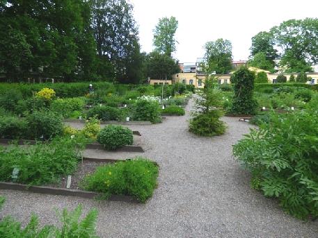
Linnaeus’ garden in Uppsala, and the orangery
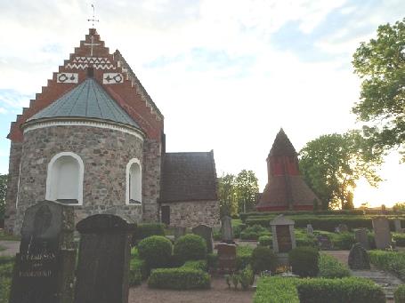
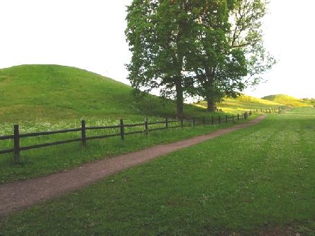
Gamla Uppsala - the three Royal burial mounds and the church with its bell tower
Friday 16th June Trains for Adrian! 150 miles
We were under trees, and the morning was cloudy, so we didn't have the light pouring in as normal. Adrian investigated a possible leak from the engine, and we didn't leave until 9.45.
We set off northwards towards Gavle on motorway type roads. Just before we got there, we turned off onto a small road to have coffee. There was a picnic table down beside a little pond, so we made our way there on a rough path through the grass. It was a peaceful stop. As we got back to the van, a small snake wriggled out!
At Gavle we explored the few cobbled streets of little painted wooden houses, many with colourful window boxes. There were virtually no other people about. Delightful! We passed the house of 'Joe Hill', now a museum, but not yet open for the day. He had been born here in 1879, and had emigrated to USA, where he had changed his name. He had become a campaigner for worker's rights, and had been executed for supposed murder in 1915.
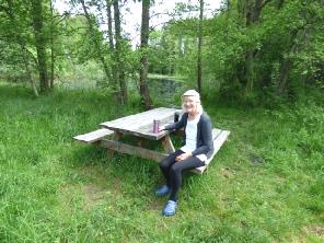
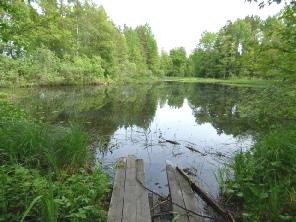
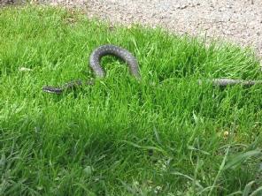
Nice coffee stop - 100m from the motorway junction
The other thing in this town – of particular interest to Adrian – was the National Railway Museum. Well, we had to go there! We ate lunch in the van first, then proceeded to the Roundhouse, where the museum is sited. The outdoor part opens for the season on Monday. As it happened , while we were in the museum, there was torrential rain, and we waded back to the van across a lake! And I had teased Adrian about taking our big umbrella! The museum had several full size engines, and masses of information, most translated into English. We were both taken by the fact that one of the 4 engines in the Rainhill Trials in 1829 was Swedish.
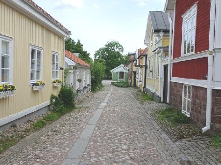
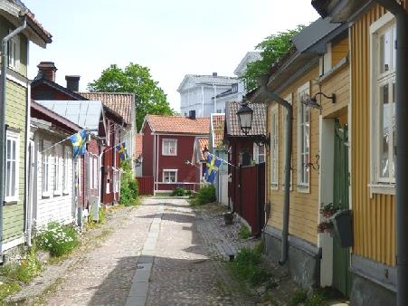
Lovely old cobbled streets in Gavle
We continued on our way, pulling in as the sky was very dark. However, we didn't miss all the rain as we drove on. The scenery was of forests and lakes, making us think of Finland.
We turned off to Hudiksvall, our stopping place for the night. After getting diesel, we made our way to our overnighter looking across the harbour. Unfortunately there was a fence in front of us for building work, but as it was now a lovely evening, we set off straight away to see something of the town.
We walked past the tall brown painted fishermen's huts, making us think of Hastings. then on past some smarter houses to the square, where we bought some strawberries from one of the only two stalls. We walked right up to the large white church, set on a grassy hill before coming back to the van.
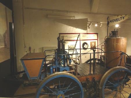
Novelty - the Swedish entry for the Rainhill Trials in 1829
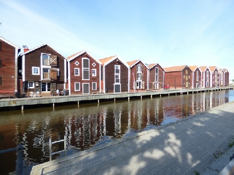
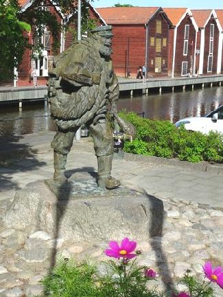
Fisherman’s houses at Hudiksvall
There were lovely reflections on the water as we looked out.
I was really pleased to put my lenses in and have no problem. We were able to dump here, and left at 9 o'clock.
We first went into a huge Co-op supermarket, and then had to find places to put the goods we'd bought!
We continued north on good roads through mostly forested country. We stopped for coffee in a busy picnic area and shared a table and chatted to a pleasant couple from Stockholm with 2 docile black dogs.
Soon afterwards we turned off to drive for about 5 miles down to the 'sea', although it was more like a lagoon with long grass and a few boats at a jetty. There was a round barbecue with tree stump seats.
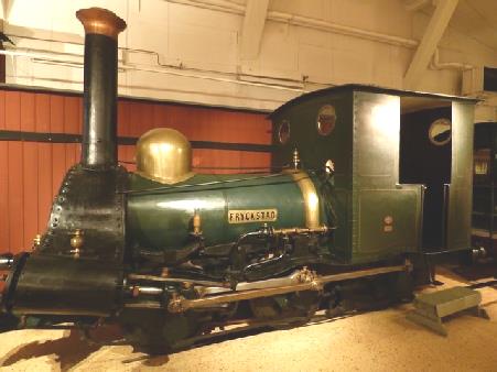
Fryckstad 1855 - the oldest preserved Swedish steam engine
Saturday 17th June Forests, bridges, islands and water 119 miles
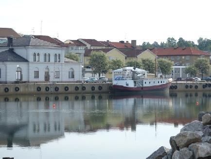
Back on the road, we soon came to Sundsvall, where I had stayed at the Youth Hostel in 1964.
It was a large city, and like Stockholm was surrounded by water and islands. It is known as 'Stone City', as the buildings are built of stone, following a disastrous fire in 1888.
We parked, using my 'Blue badge' again, and made our way to the vast main square. Sundsvall had an 'elegant' feel. We walked to the free museum, housed in two impressive old warehouses with a glass roof between them and on several floors. There were many historic artefacts, but this time not translated into English. Half of the modernised building was the library.
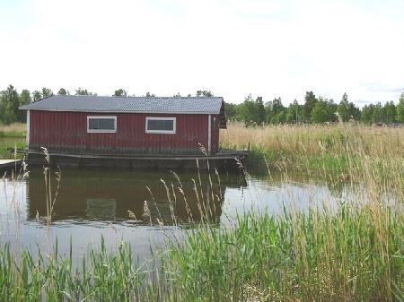
Fisherman’s houseboat on the water
We now drove a few miles north and crossed a big bridge onto the island of Alnon. We came down to the water, and ate lunch looking back to the bridge.
We drove back over the bridge to continue northwards, noticing more of the prolific lilac trees, mostly purple.
We drove on with the scenery of forests, lakes and inlets to Harnosand – on yet another island.
We parked by the large white cathedral church, where a wedding had just ended, the bridesmaids in a pretty lime green. A stretch limo waited nearby. We walked down to the main square, which was supposed to be impressive. We thought it rather boring, the nicest part being the large pots of pansies in shades of mauve!
After having a look at the water, we walked back up pretty Ostanbacksgatan with its wooden houses painted pastel shades.
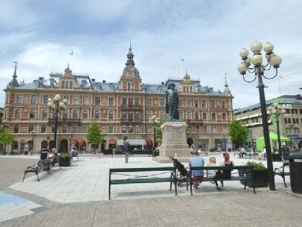
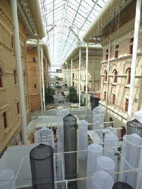
Sundsvall Main Square and museum
As we walked back to the van, we noticed more of the large old American cars which the Swedes seem fond of. We drove on another 20 miles through forested country to our overnighter beside Hogakustenbron – the magnificent 'High Coast bridge' which we had just driven over. This is the start of the High Coast, which is supposed to be more like Norway, with fjord-like scenery.
We had a wonderful view back to the bridge and the water and islands. Great!
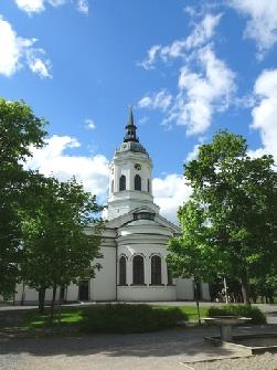
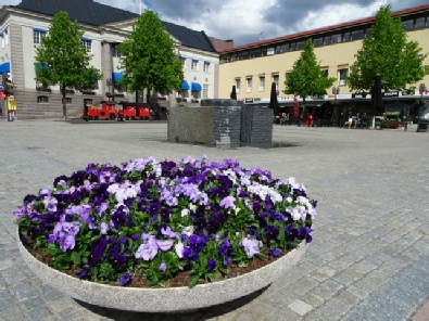
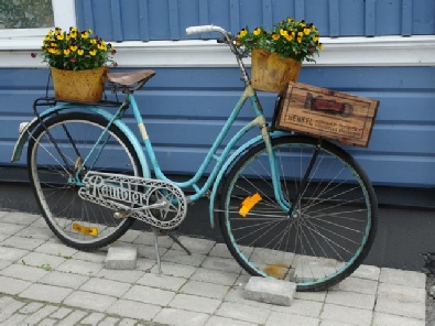

Images of Harnosand
We walked out around the vast carpark, which also has a hotel, and a nice children's play area. It had started at midnight and some of the 100 competitors had already finished, the first being one of the two young woman taking part.
After supper we started editing the second website. At bedtime we looked out at our stunning view.
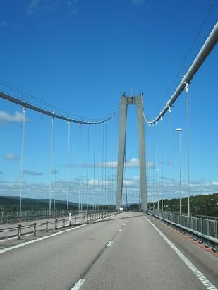
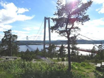
Hogakustenbron – the magnificent 'High Coast bridge'
Sunday 18th June From the High Coast to Swedish Lapland 176 miles
We had a good Fathers Day fried breakfast with our lovely view, and with Adrian's card from Paul & Nicky on the table. It was drizzling a bit, so we didn't sit out.
We set off at 9 o'clock to drive on the tourist route through the High Coast country with its hills and lakes and with meadows often filled with wildflowers. It was very peaceful when we stopped to take in the atmosphere at Fjardbotten.
We took an unsurfaced single lane road with passing places (marked by an M) for a short distance.
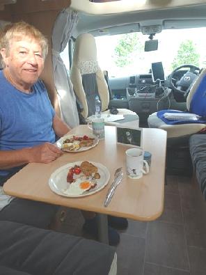
Happy Father’s Day!
At Asang, we came to a picnic table beside a little lake edged with wild flowers. Although it was only 10 o'clock, we decided to stop for an early coffee. It was really peaceful.
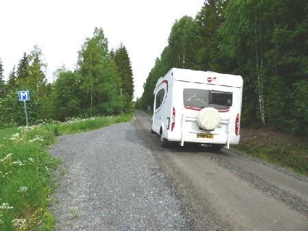
Single lane unsurfaced road with passing places (M)
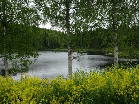
Peaceful coffee stop
Skuleskogan National Park
It was after 5 o'clock when we came to an overnighter at Meselefors, a few miles before Vilhelmina. We were close to a lake so took the rough little path down to it, but for the first time were wary of mosquitoes.
As we started our supper, another motorhome pulled in beside us, stopping our view to the lake.
Miles of this!
Pleasant place to stop for the night
Monday 19th June Enjoying Swedish Lappland 152 miles
We drove on up to the church, which was not where the former church had been at the time of the church town. It was attractive, with a Russian look, its spire having been added in 1924.
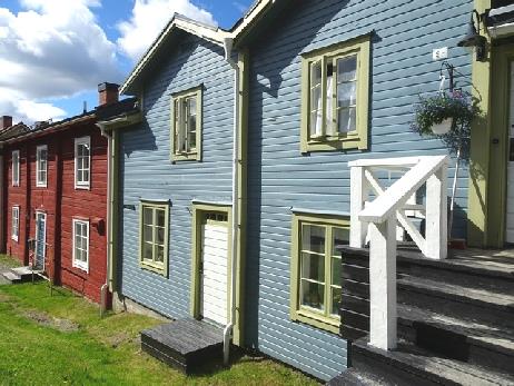
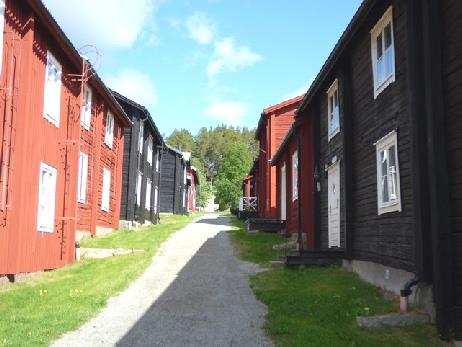
The ‘churchtown’ of Vilhelmina
Today was very much a day of forests and water, which looked lovely with the sun shining on it. Later we could see snow on the hills in the distance. Sometimes the trees were stunted, and the road very unlevel, which did make us think of Alaska!
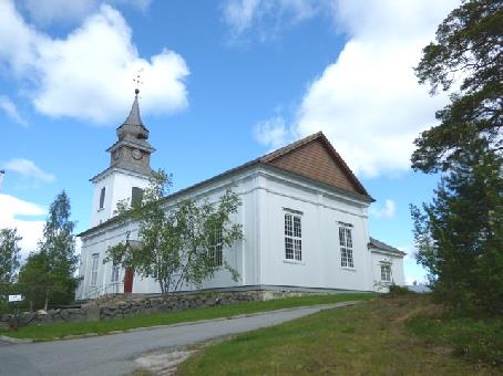
Vilhelmina Church
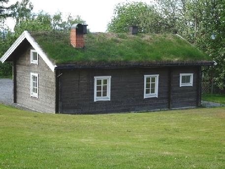
A nearby turf-roofed building
Near Ronnas we pulled in by a little tannin coloured lake for coffee, sitting on the rocks by the water, using our Danish seats.
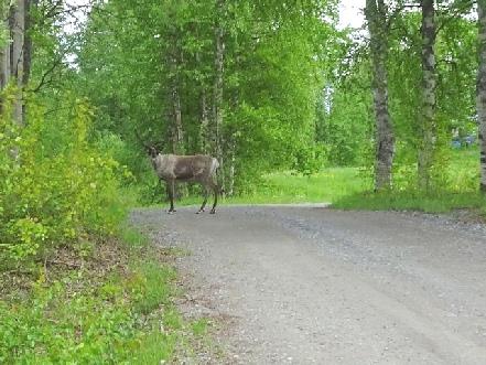
Our first reindeer in Sweden
It wasn't so easy at lunchtime to find anywhere to stop.
After Dikanas, we had to drive several miles of unsurfaced road. Near Gardjonas, now on a surfaced road again, we finally pulled in beside a bridge for lunch at a marked 'picnic site'. It was only as we were leaving that we saw the picnic tables – way up above us on a stony footpath! We'd had no real view from the van, but had walked onto the narrow old bridge and looked down to the swirling water.
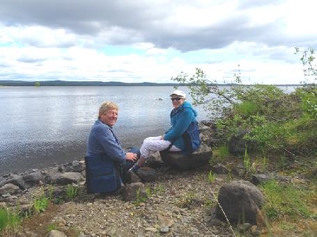
Coffee beside the water
Not long afterwards, we came across Slussfors, some impressive rapids on the river. We viewed them from a side road too.
As we drove on towards Dikanas, we were thrilled to see our first reindeer. We pursued it, until it stopped in the road and gave us its deer-like stare.
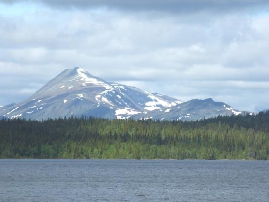
Snow on the hills
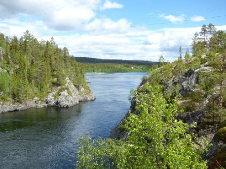
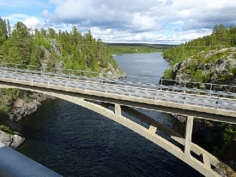
Lunchtime stop by the swirling water
It was 4.00 when we reached Sorsele, pulling into the car park by the Inlandsbanen, the Inland Railway which had been built between 1912 and 1937. We went into the station building, which is partly tourist information – mostly about fishing- and partly a small museum about the Inlandsbanen. The information was all in Swedish, but there was a fact sheet in English. We were pleasantly surprised to find that the museum was free.
After turning off onto a small road to Sorsele, we came across another lot of rapids. We had to walk a rocky path past a giant anthill to see them.
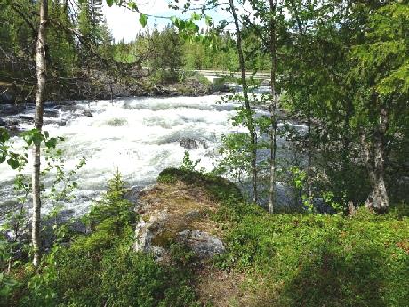
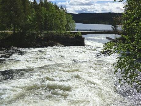
The impressive Slussfors rapids
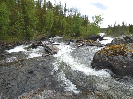
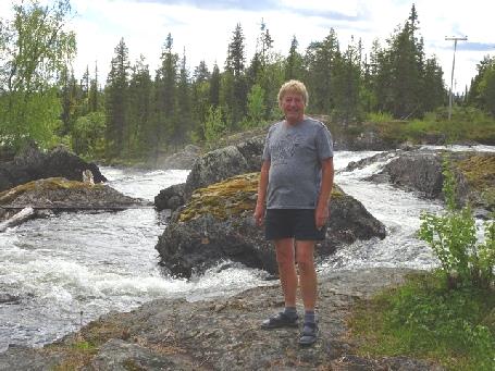
More rapids
Tuesday 20th June Reindeer, Rivers and the Sami culture 158m
It was a cold night, but the morning was sunny, and we had a nice day – but not as warm as at home, which is supposedly very hot at the moment. We did 'household' things and didn't leave until gone 9.00. We had been sorry to hear of the death of Brian Cant, much loved children's TV presenter of the 70s/80s.
Before leaving Sorsele, we shopped in a well stocked ICA supermarket. We had thought this little town a lovely welcoming place, situated by the Vindel River, and with simple picnic facilities. It had a very happy feel. It had come into renown for successfully opposing a proposed hydro-electric plan, which would have changed their cherished fishing river.
As we crossed the railway, we saw what we thought was a train at the station, so back tracked, but it was only a service engine!
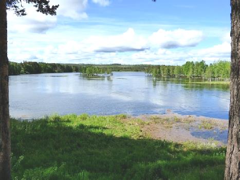
The Vindel River at lovely Sorsele
We now drove on towards Arvidsjaur, scanning the countryside for wildlife. The reed edged ponds looked ideal moose habitats, but we didn't see any. Then suddenly we came across a group of reindeer crossing the road. We stopped to view and photograph, but soon came across a family group, and then a young one on its own. After that we saw many more. We realised that we were in Sami country, where they herd reindeer (and don’t shoot them!)
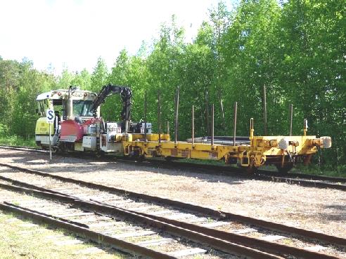
Not the once a day train we were hoping to see!
We were following the route of the Inlandsbanen. At Slagnas we turned off to drive through the sleepy little village, crossing the railway. We stopped by the Skelleftedlven River. It was warm in the sun as we had coffee sitting at a picnic table. We walked down through tall pines and moss covered rocks to look at the wide tumbling river. A fisherman stood in his waders – it was a scene that could have been the River Dee in Scotland.
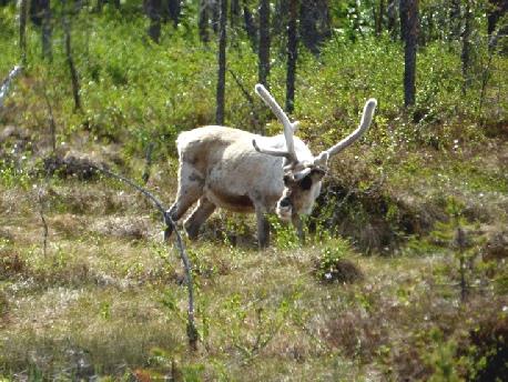
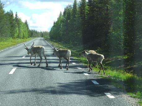
Sami reindeer country
We drove on to Arvidsjaur where we wanted to see Lappstaden, a collection of about 80 Sami log cabins. There were two different designs – one square, the other with a conical roof. Although not lived in full time, the Sami gather here annually to celebrate. There was a heavy shower of hail as we returned to the van for lunch.
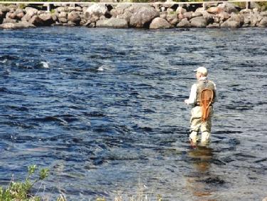
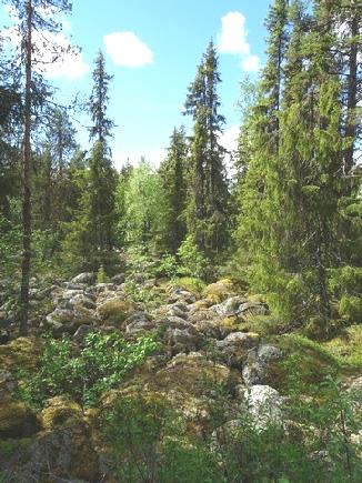
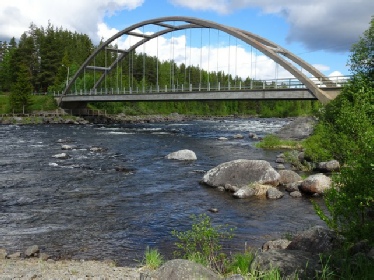
Peaceful scenes at Slagnas by the Skelleftedlven River
We left at 1.15, but just as we came to a roundabout for our onward route, we realised that the roof light above us was open – all the others have a warning alarm. At the same moment a cupboard flew open, just as Adrian saw a road closure sign! A moment of panic, but all was well – the closure wasn't today, so we continued on our way. Soon we had to pass 4 or 5 massive oversized vehicles with a pilot car! It was good to get past them!
At Ljusselforsen, we stopped by the old bridge over the River Pite to have a look. It would have made a lovely overnighter.
We now made our way to Storforsen, a popular place where there are amazing rapids on the Pite river. We followed the boardwalk to view the falls, which were a bit too scary for me! The volume of the water was immense. We walked back via an outside exhibition of old sledges and other equipment.
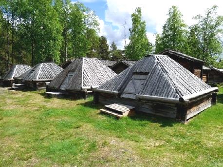
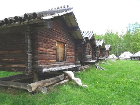
Lappstaden Sami log cabins
We investigated a possible overnighter near here, but that didn't work, so we set off again, initially with wild flowers and silver birches beside the road. We had come into more tamed country, with no suitable pull-offs. Leaving the Sami lands felt rather like it did in eastern New Zealand when we left the Maori lands – there had been none of the modern 'trappings'.
It was nearly 5 o'clock when we stopped at Alvsbyn in a parking area for walks into the hills. The big downer was that extremely noisy road works were going on right in front of us – we wondered for how long. Luckily they didn't go on all evening!
The fish we'd bought turned out to be salted – one bite was too much!
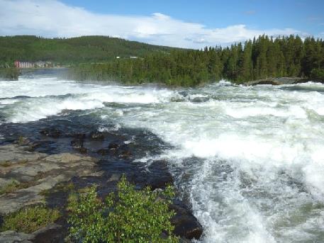
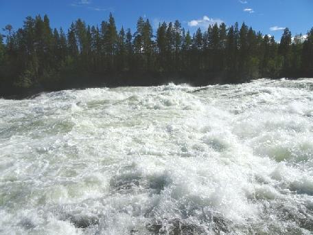
The tumultuous rapids at Storforsen
Wednesday 21st June To the border with Finland after a World Heritage Church Town 143 miles
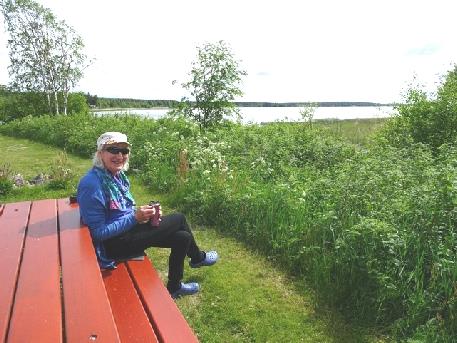
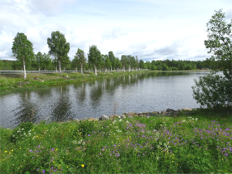
Delightful rest area right beside the road
The houses are privately owned, but nobody lives here permanently and they are only used when families come for celebrations. By tradition, these church towns were only used as ‘overnighters’, and that is how they want them to be preserved. One, owned by the town, was open, and was furnished with appropriate furniture. In one room, four young women were sitting making paper 'love tokens'. They of course spoke excellent English, and talked to us about the town.
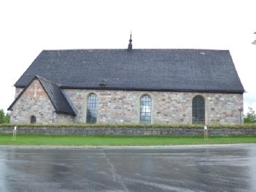
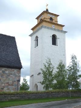
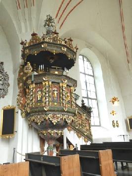
The church at Gammelstad
We'd taken our big umbrella, but it was hot in the sun as we walked round, and then on to the open air museum village of Hagnan.
This had about 40 houses of different uses, depicting Swedish life over the last two centuries. As we arrived, a musical rehearsal was just ending and the props were being removed. The recording crew had been busy.
In one cottage, a lady was carding wool. Again she spoke excellent English, and let me have a go – I was useless! Outside was a well, as there had been in Gammelstad, important for the animals as well as the people. Although the museum was free, we thought that they deserved our donation of Swedish coins, before we leave for Finland.
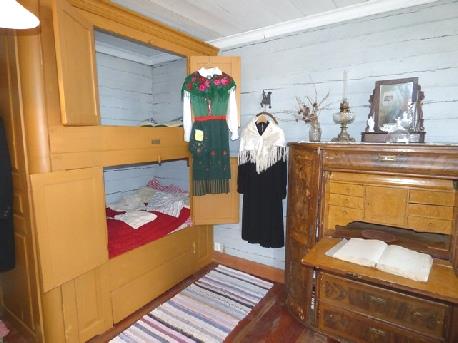
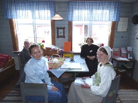
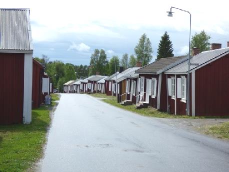
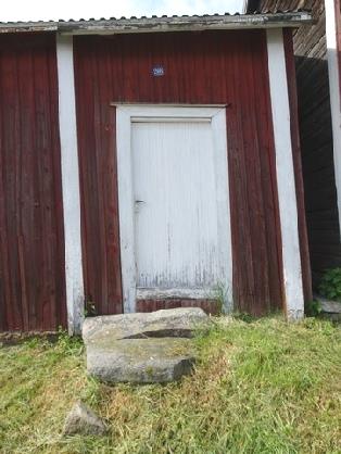
Gammelstad Church Town
We left here at 2.30, driving on to Haparanda, and the border with Finland. We arrived at our night stop just after 5.00pm. Haparanda is a nice sounding name, but as our book suggests, rather ugly! We arrived at our overnighter – amused that it is in Ikea car park! The most northerly Ikea in the world!
We were right by the border with Finland, with a lake just beside us. We walked along by the water, and could have walked on into Finland!
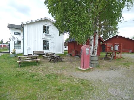
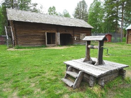
Hagnan open air museum
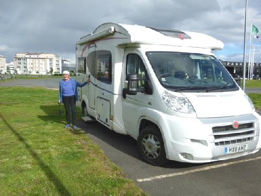
Overnighting in Ikea car park at Haparanda, with Finland behind us
Thursday 22nd June On past the Arctic Circle in freezing Finland 146 miles
We drove on through unattractive Rovaniemi to the 'village' of Santa Claus, on the Arctic Circle.
We have driven to the Arctic Circle in Alaska, when it was really warm, so this didn't hold much attraction for us! It held even less when we saw all the razzmatazz that was here! We looked into the large store, selling all kinds of grot, before crossing to the Post Office. This was better, and is where you can buy postcards and send them with 'Santa Claus, Lapland, Arctic Circle' stamped on them. Adrian persuaded me that we should sent postcards to our grandchildren, so this we did.
I realised that we were in Finland, when I asked the assistant if there was a toilet and she replied 'no'. I asked her where there was one. Her reply was 'in another building'! The Finns aren’t known for their charisma!
It really felt like the Arctic as we went outside to photograph by the 'Arctic Circle' marker.
Here we came across Matt, an American from Houston with long black curly hair. We took each others photos, and got chatting. He liked hearing of our travels and for a while we didn't notice the cold! We asked a Dutch tourist to photograph us together. She was reluctant at first, as she thought that you had to pay exorbitant prices to take photos. That was only if you took them with ‘Santa Claus’ so when we explained this she was happy to – and we took hers. It had made a memorable stop.
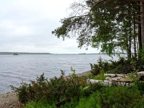
Lunch by the Kemijoki River
We continued north, pulling into a picnic site to warm up with a cup of tea. We were at the Vikakongas rapids on the swirling brown Raudanjoki River. A nice suspension footbridge led to walking trails.
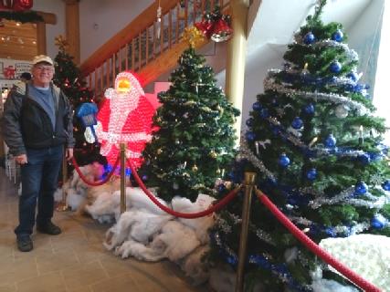
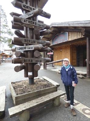
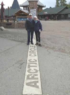
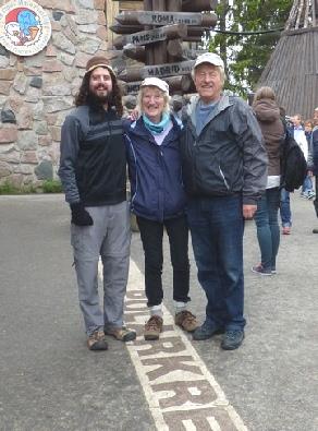
‘Santa Claus village’, Arctic Circle, Lapland
Continuing north on straight roads through forest, we stopped just after 5.00 at a picnic site at Torvinen and put on the heating! Finland's time is an hour on from Europe, but as we are only here for a few days, we aren't changing.
It was time to find my long nightie tonight!
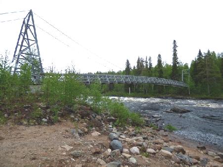
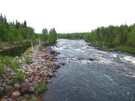
Vikakongas rapids on the swirling brown Raudanjoki River
Friday 23rd June On through northern Finland 137 miles
The day was grey and overcast, but did brighten a bit in the afternoon.
We had found that our purchase of loo rolls was as successful as the salted fish! They were grey and hard – not much better than Izal – and had no perforations. We decided that their best use was to drape on a wedding car (along with the fish!)
We found at the last minute that the internet was working this morning, so didn't leave until gone 9.00.
We drove north to Sodankyla, where we stopped to look at the pretty little wooden church, dating from1689. It was surrounded by a wooden roofed fence and was just plain wood inside. We just had time to enjoy it before two separate coachloads of people poured in. We made a hasty retreat, walking through the massive graveyard with its large plots bright with artificial flowers to look at the river.
It was still very cold – we saw the first of several piles of midsummer snow beside the road!
At Satanen we crossed the Sattasjoki River – a wide lake at this point – and stopped for an early drink to warm us. There was a memorial to a village here before 1944 but the Germans in their retreat carried out a scorched earth policy, burning all the villages in their path including this one – we hadn't realised how much the whole of this area had been affected.
We drove on, with trees lining the road, both coniferous and deciduous. We'd seen no wildlife, but then passed a group of reindeer beside the road.
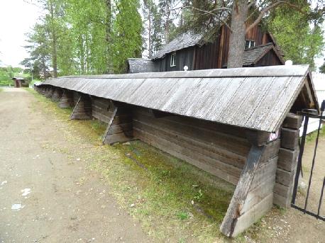
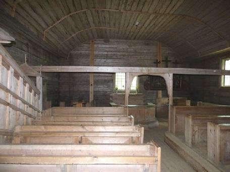
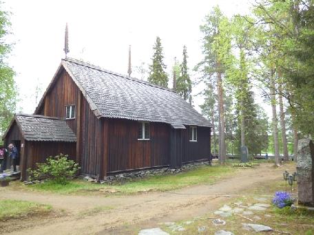
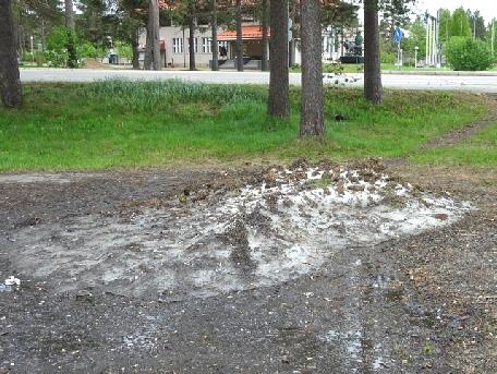
The pretty wooden church at Sodankyla, with snow as we leave
After stopping to have lunch overlooking miles of forest, we backtracked a bit to fill with water from a petrol station (€2). Two large reindeer munched grass as we turned round in the village behind.
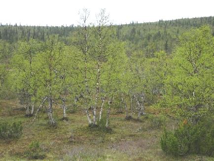
Finnish forest
At Ivalo we searched fruitlessly for a dump, but did stop to get more diesel.
A few miles on, before Inari, we pulled into an overnighting parking area surrounded by large boulders and with two attractive ponds. Although early, we decided to stop for the night. We talked about our onward route to Norway. After a cup of tea, we walked around by the ponds and met a friendly Finnish gentleman from the other camper parked here. He said that there were very few mosquitoes this year, although we had found plenty settled on our backs. He picked us a small white cloudberry flower which he said needs mosquitoes for pollination . At his suggestion we moved round to the area near him, which was further away from the road. We had a nice view of the smaller lake from here. The sun even came out!
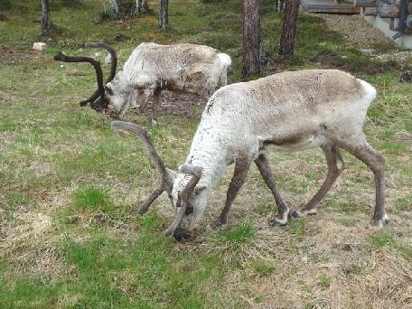
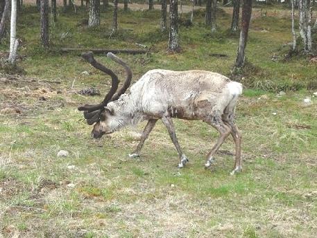
More reindeer
After supper we read our diary of 1995 when we went camping with Simon, who was in Finland for a year.
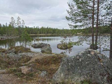
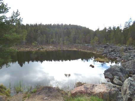
Beautiful overnighter near Inari
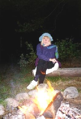
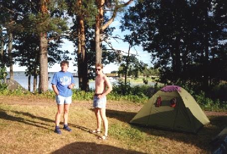
Flashback to 1995 with Simon in southern Finland
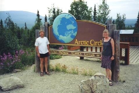
Flashback to 2002 in Alaska!
These were some impressions of Finland in 1995 - most of which still apply
Buildings – blocks of flats - not attractive from the outside
Very few flowers everywhere
Very expensive
Countryside flat but undulating
Market goods sold by litre – potatoes, fruit, peas (in pods)
Triple glazing
Winter sports in evidence – ski jumps etc
Language bears no resemblance to anything we know – even telephone (puhelin)
Cycle tracks everywhere
Forests everywhere – evergreens and silver birches
Long hours of daylight (in Summer)
Parking signs indicate how cars park in snow
Ladders on top of every house and block of flats
Ladies ride child type scooters (with one ski in winter)
More autumnal colours in south on silver birches (August) – not further north
Possessions and property safe – very little stealing and vandalism
A few impressions from Simon at the time (1995)
The Finns eat quickly, not for enjoyment
Specialities – Makkara – a frankfurter type sausage
Reindeer and moose meat
pea soup (very thick)
Food is stodgy – Finns don't eat many vegetables
Finns have mats, not carpets and beat them outdoors on stands
Burglaries are rare
Cycles can be left safely
Children (babies) can safely be left outside stores
Saturday 24th June Surprise, surprise, we're in Norway! 135 miles
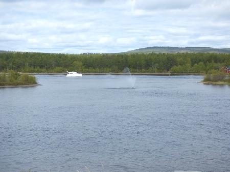
The lake at Inari
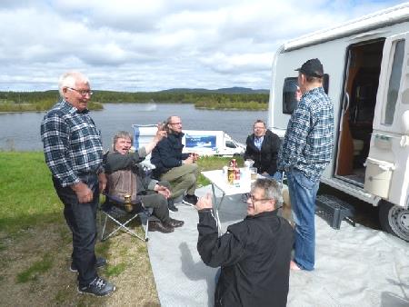
Happy Midsummer revellers
We took the 'green lane' and just drove along it across the bridge! There were no formalities at all. We now travelled eastwards on the Norwegian side of the Tana river. We stopped a little way along and looked at the raging river.
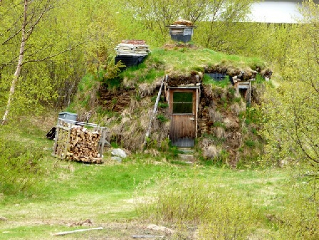
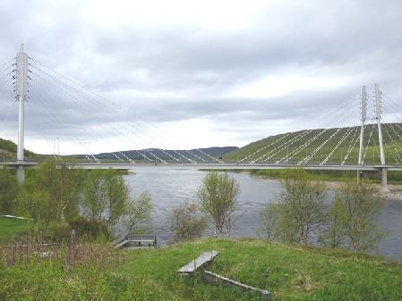
A house in a Sami village beside the Finland-Norway border bridge at Utsjoki
We could see patches of snow on the Finnish side. Small pink wild strawberry plants flowered on the ground. The road was often edged with pretty mauve flowers which we think was mountain milk vetch.
Just before the town of Tana Bru, we stopped at a picnic area for the night, with views down to the bridge we had originally intended crossing at, with much snow in the far distance.
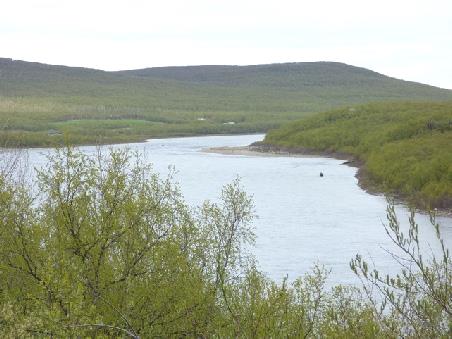
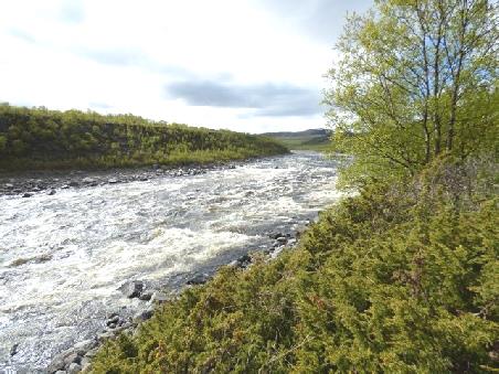
The Tana River
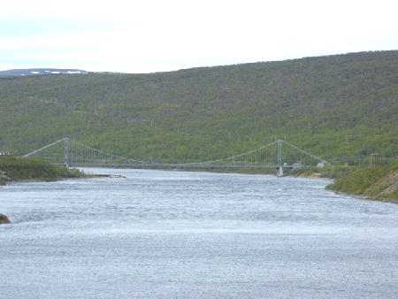
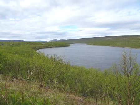
Overnighter in Norway by the Tana River
Some impressions of Sweden
Very easy going – laissez faire
People courteous, happy and practically all speak English
Countryside mostly low lying
Lovely sandy beaches in the south
Much forested further north
Lakes and water everywhere
Hundreds of islands
More expensive than England
We saw no traffic wardens
No bottled water to buy
Rest areas well looked after by road authority.
Often rest areas had a place to dump, and you could stay overnight
Very little sign of austerity
No sign of vandalism or crime
Lots of logging lorries in the north
It was very windy, but otherwise perfect. We got up to date with the website.
Sunday 25th June Snowy and remote north eastern Norway 157 miles
We enjoyed scrambled egg for breakfast in our beautiful situation. Adrian had heard a cuckoo.
We left at 8.45 and drove down into Tana Bru, crossing the Tana River on the fine suspension bridge. The foundations of a new bridge were being dug on either side of the river. I wanted to go a bit along the way towards Kirkenes (and the border with Russia) just so that we could see the east facing Varangerfjord. We first drove along the other side of the river, looking back to where we had stayed last night. At Skipagura, we drove towards Kirkenes for several miles. The countryside looked desolate, with most of the trees looking dead and with just a few coming into leaf. As soon as we had a misty view down to the fjord, we took a photo and turned around. It was very windy.
As we drove back, the countryside looked really pretty in comparison, with all the trees with their young foliage.
We crossed back over the bridge, and located the place where we could dump. From this point we had a really lovely view of the river, with its sandbanks and with snow on the green hills. There was a turf roofed hut, and an attractive blue and pink council building.
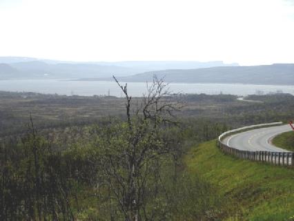
Looking east towards Kirkenes along the Varangerfjord
We now followed the Tana River northwards to Rustefjelbma passing trees and the snow-topped hills. We pulled off at a beautiful area with a view to the snowy mountains. Behind us was a steep rocky cliff face and we looked past the trees and river to the snowy hills. It felt really mild and pleasant.
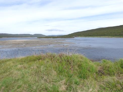
The river north from Tana Bru
At the village of Sofka, we passed the school, and thought how cold and dark it would be in winter.
There was an unusual modern church at Rustefjelbma, which is where we turned westwards.
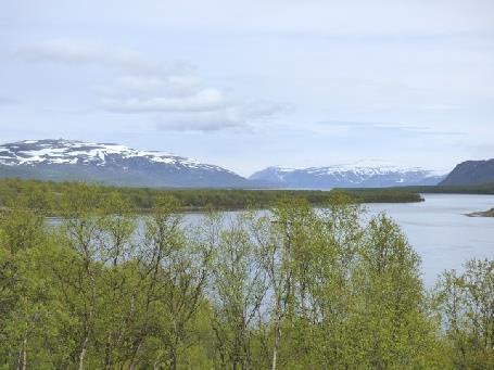
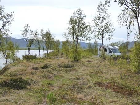
By the Tana River
As we drove along, we passed the end of several fjords which lead to the Arctic. We noticed that they were tidal, unlike the Baltic, which has very little tide.
We enjoyed the views across the water before ascending a pass after Vestertana where increasing amounts of snow lay. Trees here looked dead too.
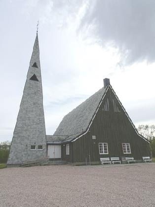
The church at Rustefjelbma
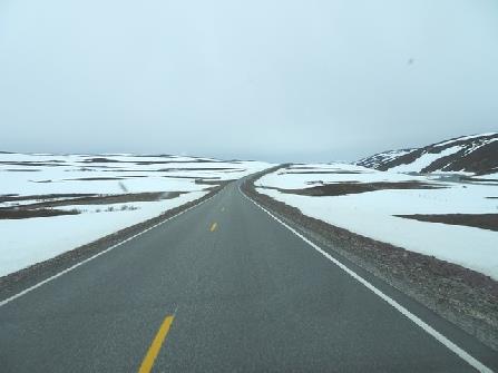
We pulled onto a large rough rest area for lunch, with snow all around. It was an image of various shades of black and white.
We drove on past an overnighter amongst all the snow. Very wintry! For a while we drove on a good newly surfaced road, but then it was back to the bumps!
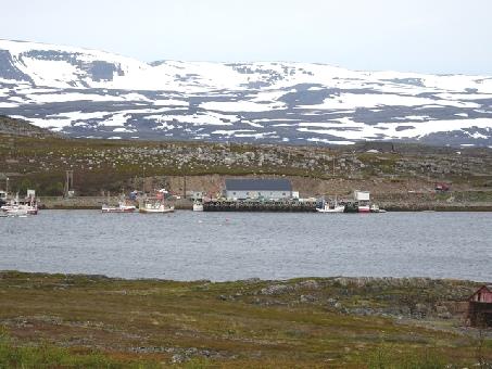
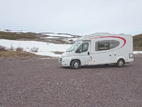
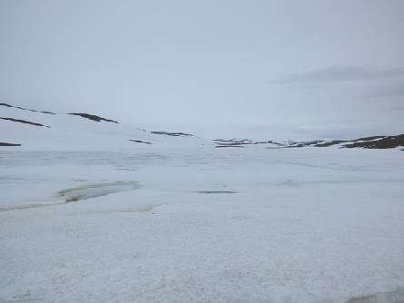
The snowy north east of Norway
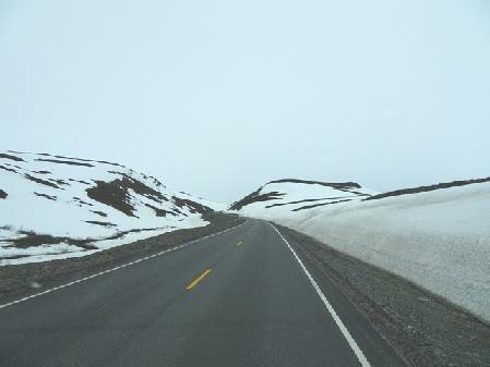
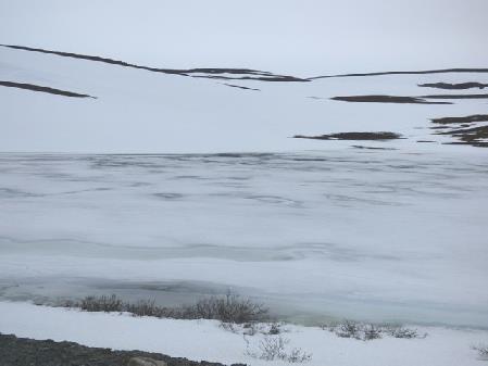
It’s six months to Christmas!
We were up early on an overcast but clear day, with much better visibility than yesterday evening.
We were thinking of Nicky, as it is her mum's funeral today.
We left at 8.20 to drive on around Porsangen Fjord, enjoying the long flat vistas, even more so when the sun came out. There were several rushing rivers and later waterfalls gushing from the hills. The rocks had been contorted suggestion great earth movement. We saw fish drying racks by the sea and passed lots of groups of female deer, with several 'bambis'. The red roofed huts made us think of Newfoundland. Then we saw our prize – a sea eagle sitting on the shore! Adrian had spotted it, and was able to photograph it from nearby.
Monday 26th June To North Cape – we made it! 116 miles
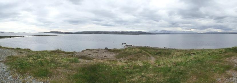
The view we couldn’t see last night!
We knew that there was a tunnel under the sea to Mageroya Island, which Nordkapp stands on, but were surprised to come to a narrow 3 km one before that. It was unpleasant driving through, especially when we passed a coach. We emerged onto a corniche road with steep rock on one side and the sea way below on the other. This was the only road up the peninsula, so any traffic had to come along this road.
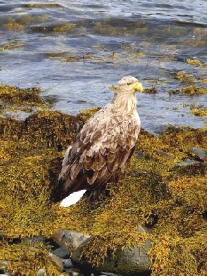
An obliging sea (white tailed) eagle
There was a second shorter tunnel before we reached the long one (7km) under the sea. This tunnel was an expensive toll tunnel until 2012, but the nice thing about Norway is that when a tunnel or bridge has been paid for it becomes free – UK take note!
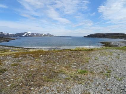
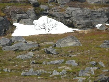
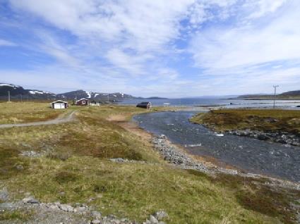
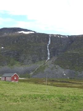
Views on the way to North Cape
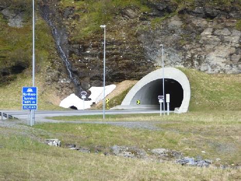
The entrance to the undersea tunnel
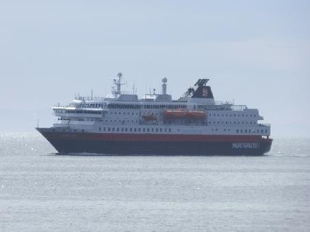
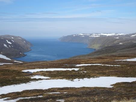
We pass the Hurtigruten coastal boat coming into Honningsvag
Good view just before we reached Nordkapp
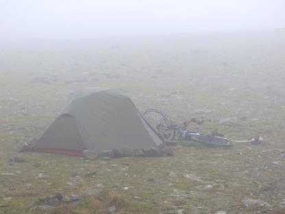
We didn’t envy him!
We drove on to a 'Naturuum', a visitors centre, before Skuleskogan National Park. The large car park was being rebuilt, so we had a long walk to get there. We liked looking at a 3D map of the park.
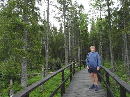
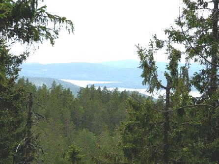
We now drove through forest to the park itself. We walked to the entrance, and then on mostly board walk for half a mile or so to a viewpoint – all we were going to get to in the park. We had views of miles of forest and lakes to the sea. We were surrounded by trees. The ground was boggy, with ferns and a few flowers We heard bird song, but didn't see any wild life! We'd have loved to have seen a bear or a moose (called elk here, which is quite different from the American elk).
We now drove through forest to the park itself. We walked to the entrance, and then on mostly board walk for half a mile or so to a viewpoint – all we were going to get to in the park. We had views of miles of forest and lakes to the sea. We were surrounded by trees. The ground was boggy, with ferns and a few flowers We heard bird song, but didn't see any wild life! We'd have loved to have seen a bear or a moose (called elk here, which is quite different from the American elk).
We left before 9.00 on a fine morning, having done the 'emptying & filling' (using the 'Harry method' – using a container , not the hose).
We drove first to Vilhelmina, where we got some diesel. We had passed a fox beside the road, and also a person doing 'ski blading.' We'd also come across the 'Inlandsbanen' – the inland railway, which we found out more about later. We were amused at the sign for 'traffic calming' – farthinder'!
In Vilhelmina, we wanted to visit the part known as the 'church town'. Sweden had separated from the Catholic church in 1527. Later it became compulsory for Lutherans to attend church. In rural districts, this was difficult, so if you lived more than 10km from the church, you only had to attend every two, or three weeks, according to distance. Church towns were set up for the parishioners to stay overnight.
The church town in Vilhelmina had been restored, and was now a delightful district, particularly as the streets were narrow, and there were no cars. The pretty painted wooden houses can now be rented. It was sunny, with a cool wind as we walked around.
In fact, the night was fairly quiet - we heard just one or two logging lorries rumbling over the noisy roadworks. The full ones were OK, the empty ones had made a dreadful row. We left just after 9.00 on a grey day, with a bit of 'damping'.
As we drove on, we passed no more parking possibilities, so we'd made a good choice. We were heading for Pitea, on the coast, where we hoped to get some LPG, not available in Finland. We need it for our fridge, cooking, and heating, which might be very necessary further north!
Our luck was in, and we were also able to get water too, a real bonus.
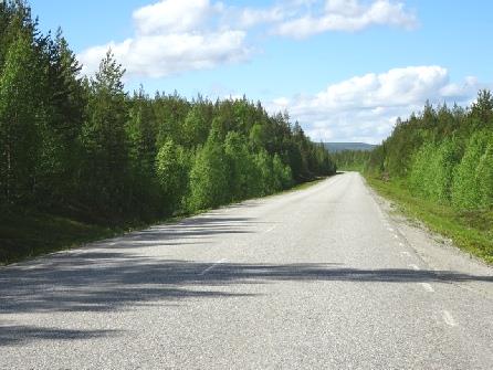
We now drove north towards Lulea on a motor road. Sweden has a lot of these good three lane roads, with a crash barrier in the middle giving alternate 2 lanes for one side then the other, which works well here.
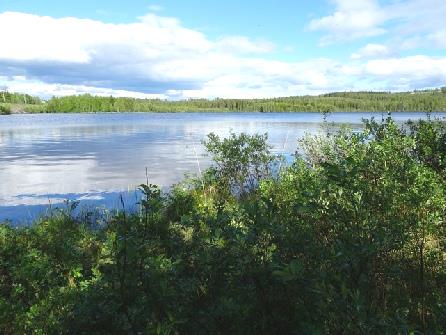
We pulled in to have coffee - mistakenly pulling in by a campsite first. Our pull-off was just a bit further. We sat at a picnic table beside a lake. These rest areas are usually well cared for and pleasant and often allow overnighting, something lacking in Britain.
The night had been very cold, and so was the day! A sign later said 7°C! The morning was wet, but brightened by the time we left just after 9.00. However, it stayed cloudy and grey all day. No sunglasses today!
Our first stop was in 'Maxi IGA'. We thought that we'd buy a few things, because although Sweden is expensive, we expected Finland and Norway to be even dearer. It was difficult in such a large store when we couldn't understand the food categories at the end of the aisles!
It was about an hour later that we headed off, and a couple of minutes later we were in Tornio in Finland – no formalities at all. In fact the two towns join themselves as one, and we passed several supermarkets on this side too, including Lidl.
First we stopped to get diesel, as this is one thing that is cheaper in Finland. Adrian succeeded at the second petrol station he tried, not being able to understand the instructions at the first. We were surprised to find that Finland deals in euros.
We soon pulled off at an adequate picnic area, with picnic tables, most covered, and a children's slide. It wasn't the day to sit outside for our drink though!
We drove on north towards Rovaniemi through flat, green countryside with a lot of trees, particularly silver birch. As in Sweden, we passed huge logging lorries. I remember from my 1964 trip that they call their trees 'green gold', as that is where their wealth lies. The verges here were mown, so there weren't so many wildflowers as we'd seen in Sweden. We also saw the huts with sloping roofs and sides as we had seen at Hagnan, and presumed that they were to let the snow fall off the roof.
We were following the Kemijoki River, but could only occasionally see it. Near Muurola, we turned down a bumpy lane to have lunch beside it. This was the day for soup!
It was a cold night again. We finally woke late and left this beautiful situation at 9.30.
We passed several more ponds, with more ripples – we had been sheltered. This was a pretty area, more undulating. We saw small groups of reindeer. We passed a cyclist on a 'lying down bike'. Later, after we'd stopped off, we passed him again.
We soon came to Inari, in a lovely situation beside the water. There was a pretty white painted wooden church. Wooden tubs of flowers decorated the area by the lake. We shopped in Kmarket, essentially for toilet rolls! The new ones had a better texture, but on opening them we found that each sheet had a picture of a light bulb and Finnish writing printed all over it! And we have six of them!
Inari is obviously used as a coach stop. There is a fountain in the lake – a smaller version of the one at Geneva - and also a river with rapids, so all very attractive, especially as the sun was out!
We had our coffee overlooking the lake. Afterwards, Adrian went out to take a photo and got talking to the group in motorhomes by us. It turned out that they were Sami people who had come down from Norway to celebrate Midsummer. They were already drinking beer. Adrian was pleased to hand over our cans of beer, as we have too much for the limit into Norway. They received it happily!
We had been desperately searching for a dump. Eventually we had to back track a short way and pay €5 to use a dump in a campsite.
Our onward journey was through flat land with lakes, tundra and silver birches. We pulled in beside a lake for lunch. It was sunny, but by the time we'd prepared lunch, and gone out to the picnic table, the sun had gone in! We still sat out in the peacefulness. The silver birches looked as though they were just coming out.
We drove on past more stunted silver birches, and the occasional conifer. We could see patches of snow on the distant hills.
Before we reached Utsjoki, and the border with Norway, we'd driven through more hilly country, covered with conifer forest. We pulled in by the attractive bridge at Utsjoki, intending to drive eastwards along the south of the river, and cross into Norway tomorrow at Nuorgam, when we'd have drunk a bit more of our wine limit! We looked past the Sami village to the bridge, where we’d seen that there was a green lane and a red lane with no officials and made a sudden decision to cross now.
The weather now deteriorated, so it was difficult to appreciate the fantastic fjord scenery and the Silfard Gorge.
We passed two pairs of heavily laden cyclists. We pulled off to discuss how we were going to visit Nordkap tomorrow, while we had a cup of tea, then decided to drive on a bit further tonight. We passed the cyclists again. We were really feeling for them, but saw that one had stopped to take a photo!
We were rounding Porsangen Fjord. Lots of rushing rivers came down from the hills. Just after Lakselv we pulled into an overnighter beside the water. It would have been beautiful in good weather, with the snowy headlands and islands, but we could see very little!
Later it cleared a bit.
Having reached Mageroya island, we had yet another 4.4 km tunnel. I'd coped OK, which is lucky, as we have to do it all again tomorrow!
We really enjoyed the barren, treeless, rugged landscape. Now we ascended on a very winding road, where the ground was all snow covered. There were great views down towards the sea and vistas all around, but nowhere to stop.
We really enjoyed the barren, treeless, rugged landscape. Now we ascended on a very winding road, where the ground was all snow covered. There were great views down towards the sea and vistas all around, but nowhere to stop.
We'd passed groups of motorcyclists, and then a cyclist – we didn't envy him through the tunnels.
We reached Nordkapp at midday and paid our 540 krone entry (£54). We knew that it was ridiculously expensive, but were pleasantly surprised when we found that we could overnight here. The entry is valid for 24 hours.
The disappointing thing was that the sea mist descended, and we couldn't see anything!
We'd pulled in temporarily to have lunch, hoping to move to a better spot. While I got lunch, Adrian phoned our insurance company, as he wasn't sure about our green card. Then another motorhome left, so it all happened – while still on the phone, and with me trying to protect the lunch things, Adrian drove across the bumpy car park to the other space!
We now made our way in the Arctic wind to the North Cape 'hall'. We'd heard disparaging things about the venue, but gave it a chance! In the vast building, we watched the ubiquitous film – quite pleasant images of the area through all seasons. We then proceeded down a tunnel, passing 'dioramas' of historical scenes at North Cape, and the little chapel (we'd seen a wedding couple here), and a small 'museum' remembering a visit from the king of Thailand in 1906. We came to the 'recent addition' – a supposed 'sound and light experience' which was posey and rubbish. From here, we expected to walk out to view the globe, the monument erected in 1977 which has become the symbol of the North Cape – but there was no way out! A sign on a door said 'close for winter'! We had to walk all the way back through the tunnel to the main area! When Adrian complained to a member of staff, she just said 'oh, there's no view today, so its not open'!
So all this place was, despite the high entry fee, a large gift shop, a cafe, a restaurant, a bar and a post office!
We bought our stamps to send a few more cards and returned to the van for a cup of tea. The critics had been right!
We had difficulty in levelling the van. Walking round the van in the wind it felt like we were Shackleton or Scott.
Then behind us we saw the cyclist erecting his tent!
We came back to have lunch in the van. There was a rain shower – luckily not when we were out, as we hadn't gone prepared for a walk.
We wound our way on unsurfaced roads back to the road north, turning inland just before Ornskoldsvik on route 348 to drive north-westwards. This wasn't the winding road that Adrian had been expecting, but a wide, gently rising road past forests and meadows. There were occasional brown and white houses, and wooden sheds. It made us think of parts of Alaska and northern Canada. The countryside was pleasant, but rather monotonous. The only parking places were narrow pull-offs from the road. We stopped in one for a cup of tea, just before Halla where we joined route 90. It had become very windy.
We wound our way on unsurfaced roads back to the road north, turning inland just before Ornskoldsvik on route 348 to drive north-westwards. This wasn't the winding road that Adrian had been expecting, but a wide, gently rising road past forests and meadows. There were occasional brown and white houses, and wooden sheds. It made us think of parts of Alaska and northern Canada. The countryside was pleasant, but rather monotonous. The only parking places were narrow pull-offs from the road. We stopped in one for a cup of tea, just before Halla where we joined route 90. It had become very windy.
We didn't actually go into Lulea, but stopped just beforehand at Gammelstad, a World Heritage Church Town. There are about 400 houses here, all painted brown, with white window frames. Before walking around, we ate our lunch which was a good idea, as it rained at that point.
The homes were all centred around the attractive church which was built of different coloured stone blocks. The altar was quite ornate, and the whole church light and airy.
The homes were all centred around the attractive church which was built of different coloured stone blocks. The altar was quite ornate, and the whole church light and airy.
Stockholm, Sweden to Nordkapp, Norway


