
Uig, Skye to Dumbarton
Wednesday 10th October Sunny Skye 71 miles
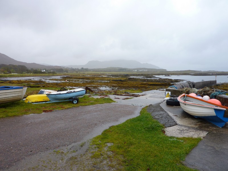
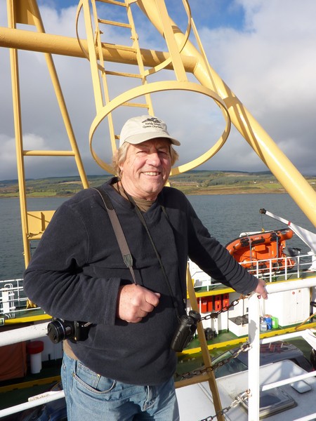
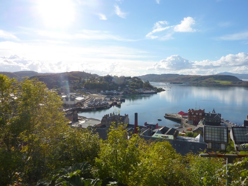
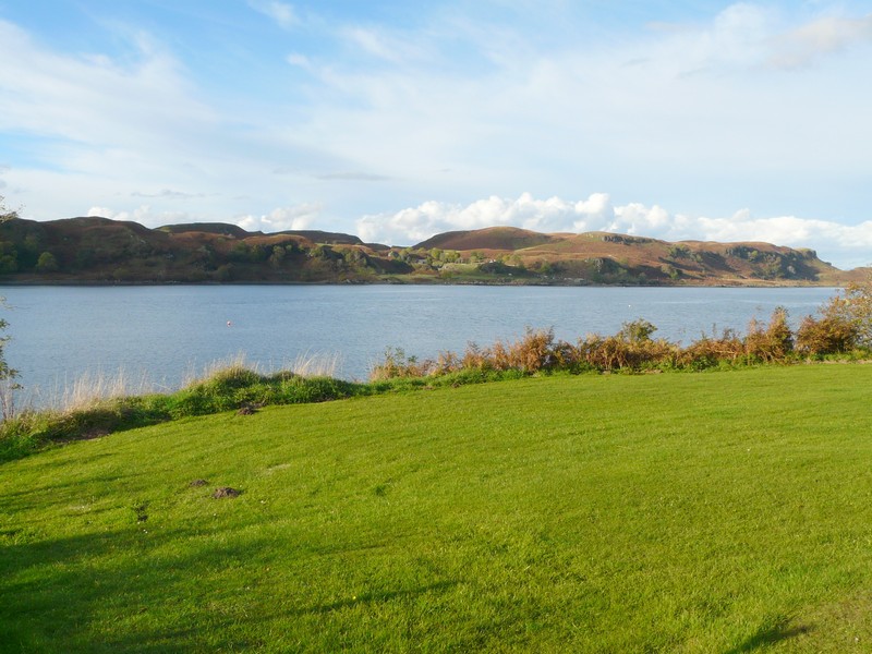
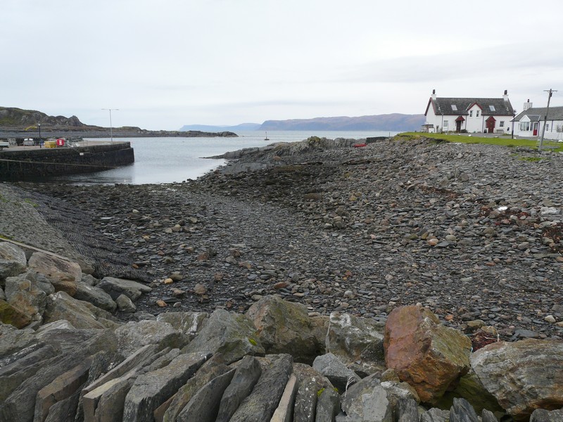
Then it was time to drive to the ferry for our 11.50 sailing to Uig, on Skye. It was a wonderfully calm crossing, rather sedate, with just a few passengers. We had views of various islands as we sailed. When we arrived at Uig at 1.30, the sun was shining and everything looked great.
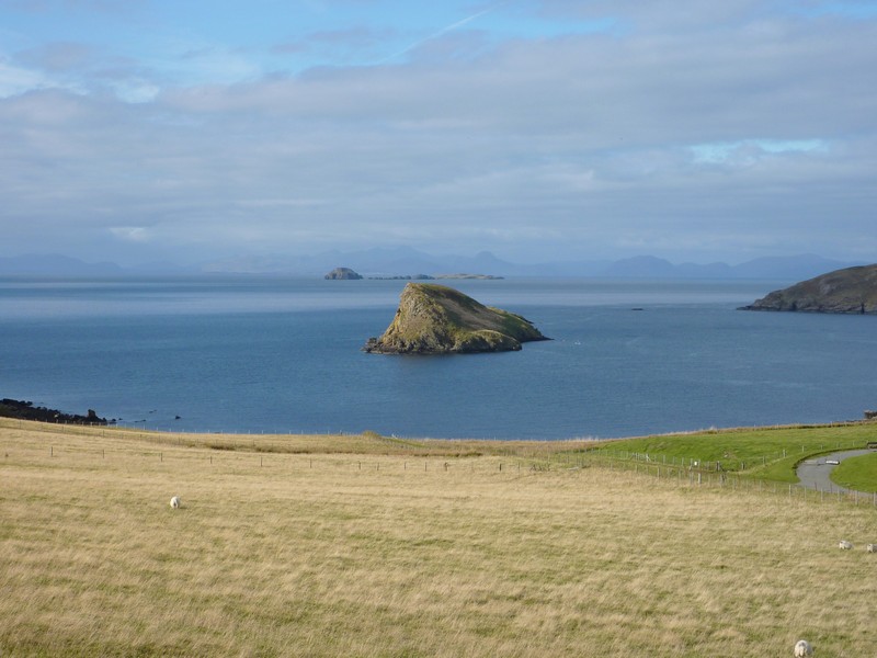
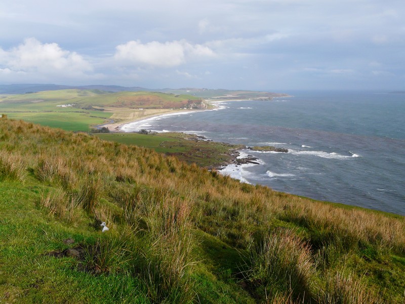
We stopped to get propane and water and by two o’clock we were taking the road high up around the Trotternish peninsula. From here we had lovely views of the various islands. Our book described this area as being the ‘breadbasket’ – the wheat growing area of the island, but now the gentle slopes above the sea were just grass.
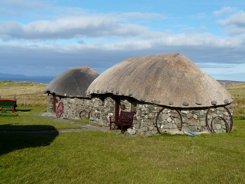
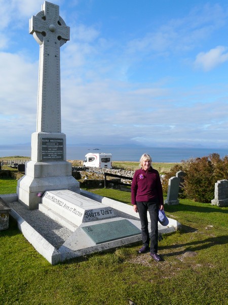
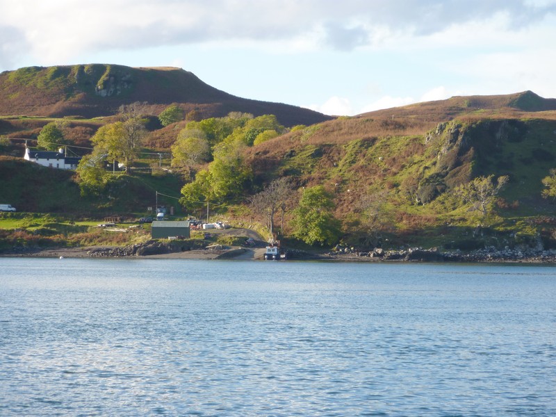
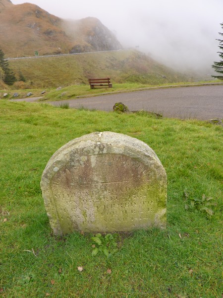
At Kilmuir there was a nice looking museum of croft houses, unfortunately closed, but nearby was the graveyard with the grave of Flora Macdonald, so we stopped to view that. The situation was beautiful. We could look down and see the ferry making its way back to Uist.
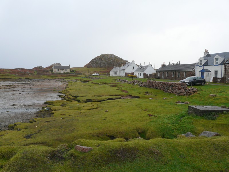
This section starts at Lochmaddy, North Uist as we catch the ferry back to Uig, Skye
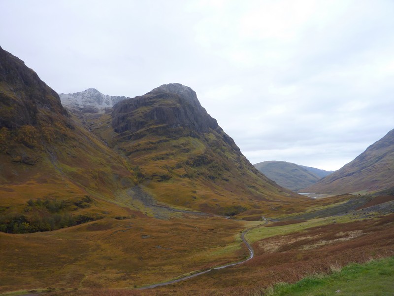
We carried on around the northern tip of Trotternish with the steep castle-like tops of the rocky mountains. There were beautiful views of the offshore islands and the mainland of Scotland.
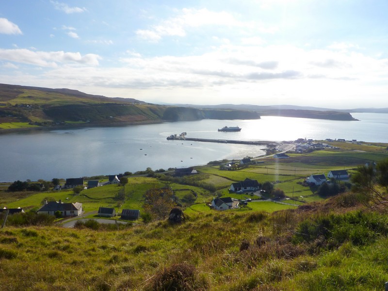
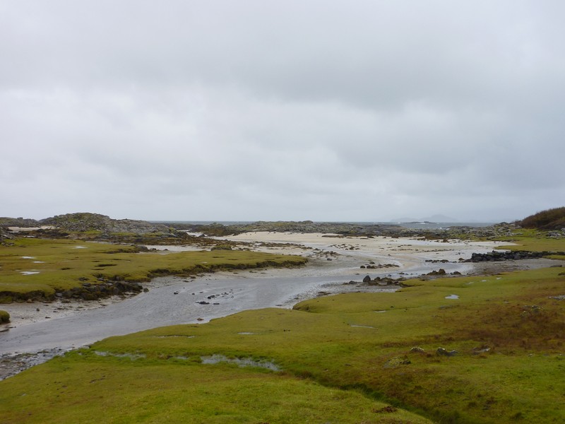
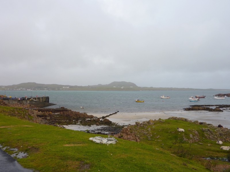
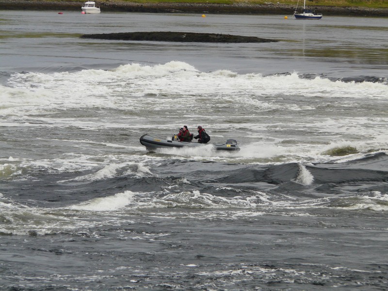
The ferry goes back to Uist
Croft houses, part of a museum
Flora Macdonald's grave
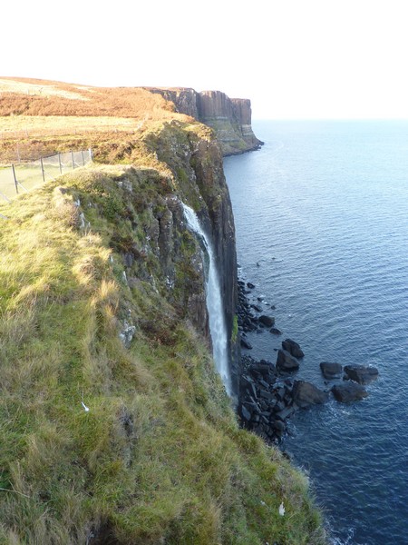
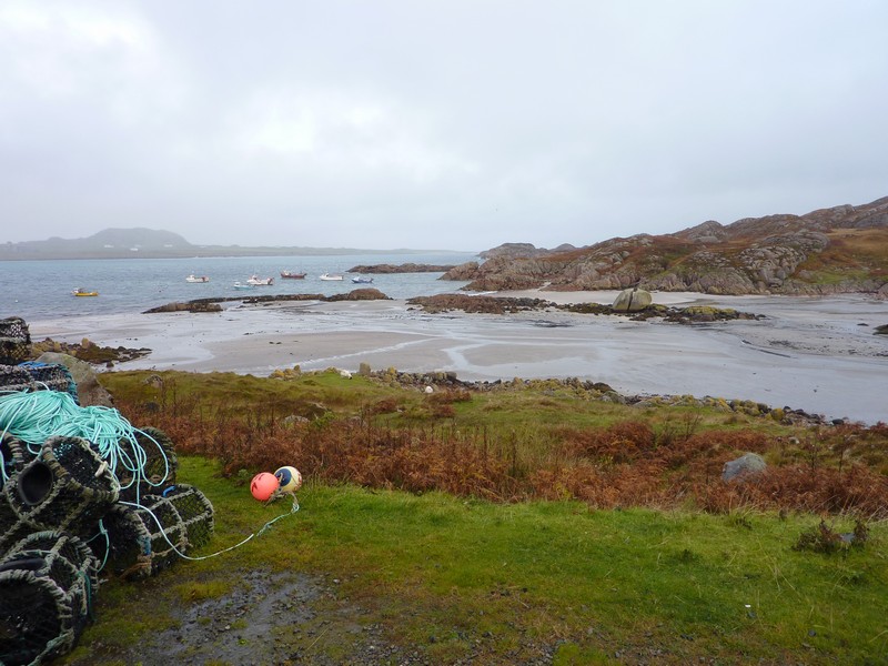
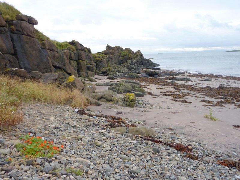
We stopped at a lookout by Kilt Rock, where from a great height above vertical cliffs we could look over to see a waterfall plunging into the sea. We were amazed at the number of people who stopped here, and realised with dismay that it must be half term in Scotland. There were information boards telling of the evidence of dinosaur habitation in these parts.
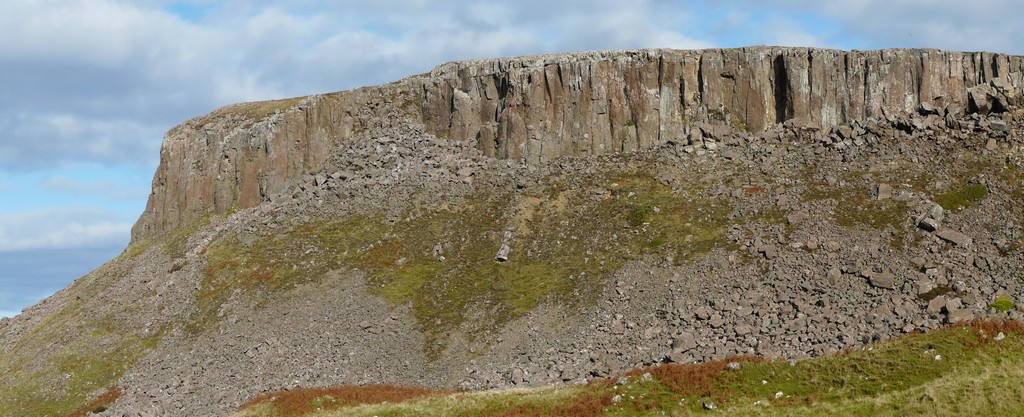
Basalt cliffs
We continued south to Portree with lovely mountain views and across to the mainland. We could see the tall pillar of the ‘Old Man of Storr’.
Thursday 11th October Back to the mainland in the wet 94 miles
Unfortunately the gentleman yesterday and the weather forecast were right – it was a wet, wet day! I still managed to walk a short way up the hill behind us before we left at 9.15. The Old Man of Storr was shrouded in cloud.
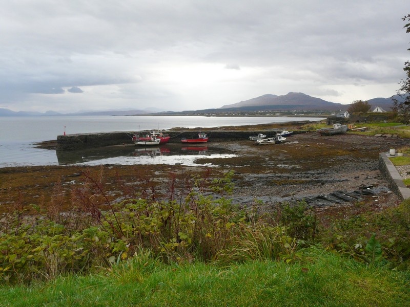
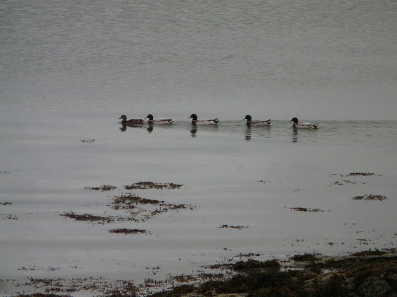
We drove south in constant rain, so we couldn’t see much of the wild, dramatic hills. There were extra waterfalls today! We stopped at Broadford and shopped in Co-op as before after getting more diesel. The shop seemed better stocked this time. By parking at the end of the car park, we could look down to the little harbour with 3 small red and white boats. A line of 5 ducks swam out into the loch. There had been a brief stop in the rain, but it returned for the rest of the day.
Offshore islands and a waterfall flowing into the sea
Just after Portree we turned off on a long narrow road (B883) which went to ‘The Braes’. We tried to get to the village of Camastianavaig, but the steep narrow lanes were too much for the van!
Along the road we found a place to pull off, with views back to Portree and the ‘Old Man’. While Adrian went to take a photo, a gentleman came to the van to speak to me. He just wanted to say that there was a lovely walk up behind us, with great views. It turned out that he had been in charge of Castle of Mey for many years, and obviously had a great affection for it, and for the Queen Mother. He told us many anecdotes (calling the Queen Mother ‘Self’). He told us of the local vicar, who, when newly appointed, had brought out his guitar. The Queen Mother had loved it, and invited him back to the castle. By the time we’d finished chatting, it was too late to attempt the walk.
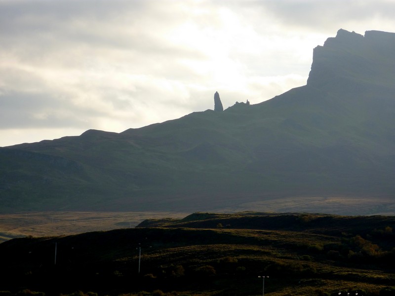
The Old Man of Storr
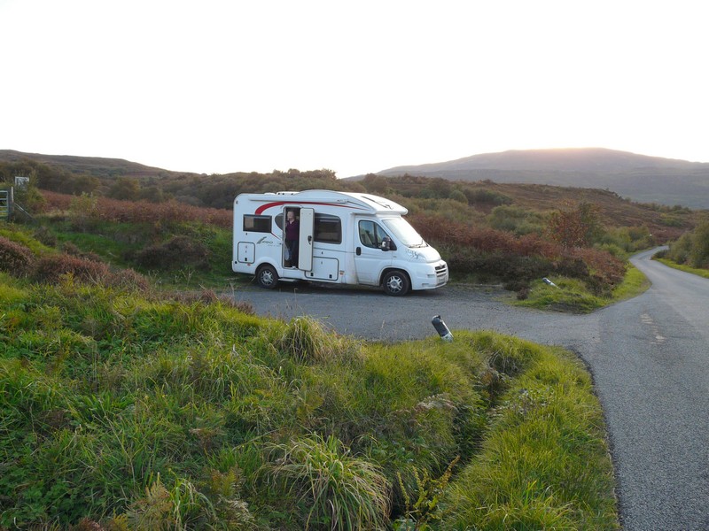
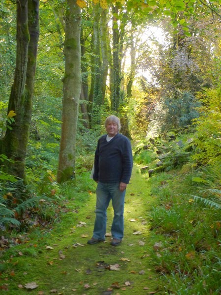
A good place to stop for the night, and the gentleman who spoke to us.
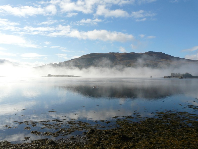
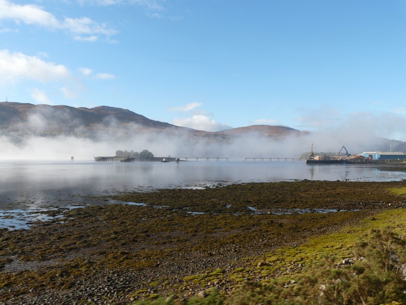
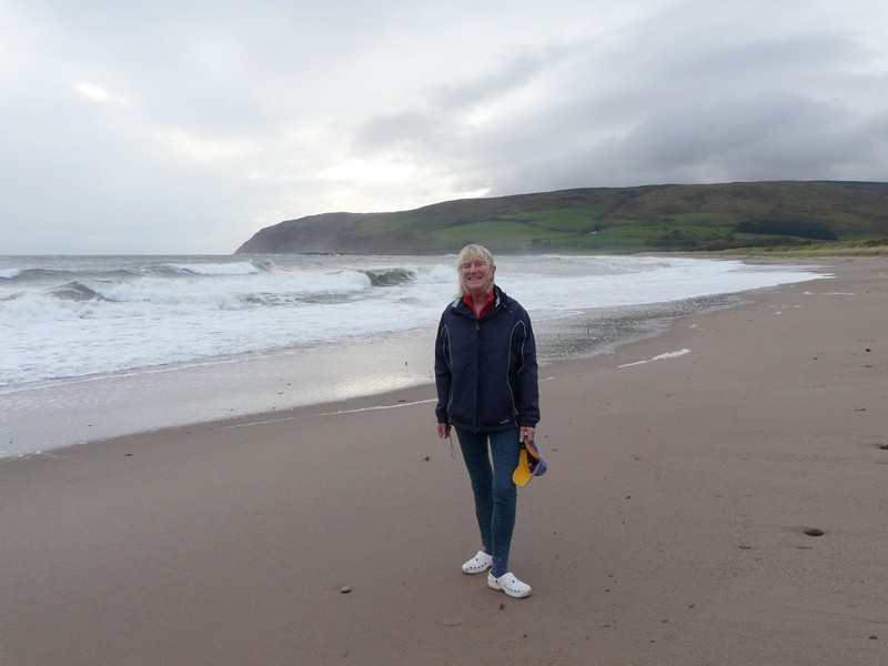
We took the road now to Armadale, where the ferry leaves from for Mallaig. We’d intended making a loop across the Sleat peninsula but the heavy rain and poor visibility stopped this. Armadale was pretty with a little harbour. There were a lot of autumnal trees which would have looked lovely in the sun. We arrived at 12.15, so ate a quick lunch while we waited for the 12.55 ferry. The sailing to Mallaig only took half an hour, and again was very calm. By 1.30 we were driving out of Mallaig, passing the steam train which Adrian still hopes to go on if we get to Fort William.
We set off southwards. At Morar it was really pretty where the B road joins the A road passing under a viaduct of the railway, and coming out by a white sandy beach. The small River Morar scrambled out from Loch Morar and the whole scene seemed very foreign.
We passed more lovely sandy beaches, but there was very little parking – not that it would have been much use to us today. The scenery appeared ‘tamed’ after the wildness of the Hebrides. We crossed the railway several times and stopped by Beasdale station and waited for the train to pass us. Not many things would get Adrian to stand out in the rain!
Broadford
Five little ducks
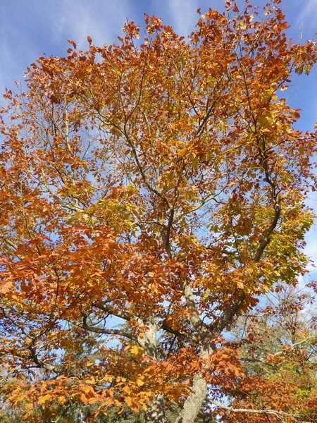
We continued through the lovely scenery with lots of deciduous trees around the Sound of Arisaig, driving a short way along beside the sound to Samalaman, where it was very pretty. The bracken and grass were golden here, unlike the dark brown on the Hebrides, and complemented the autumn tinges of the trees.
Along beside Loch Moidart we stopped by a reference to 7 men who had assisted Bonnie Prince Charlie, who is supposed to have landed here too!
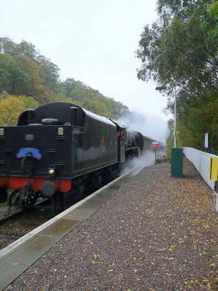
A 'Black Five' at Beasdale Station on the Fort William to Mallaig line
We followed the B road past Kentra Bay to Ardtoe, crossing through marshy bog which made us very wary today. There was some pretty scenery, but the road was really narrow, with no stopping places, not even at the end of the long road. We had no desire to be cut off, so made our return journey and stopped as the road joined the A road again. We were beside lovely mature trees, and as so often, beside a cemetery.
Loch Moidart - Bonnie Prince Charlie landed here too!
We’d attempted two roads just before this, either side of the River Shiel, but had to give up as they were extremely narrow and wet, with stone walls one side and unforgiving solid cliffs of rock on the other, and no passing places.
We continued to Loch Sunart and followed the road along beside the loch. We needed somewhere safe to stay tonight. Two seemingly suitable places were both Forestry Commission, with ‘no overnighting’ signs, but at 5.30 we came to a Parking Area on B8007 with no sign, above the loch just before Laga, as the rain continued to lash down.
Ardtoe Beach
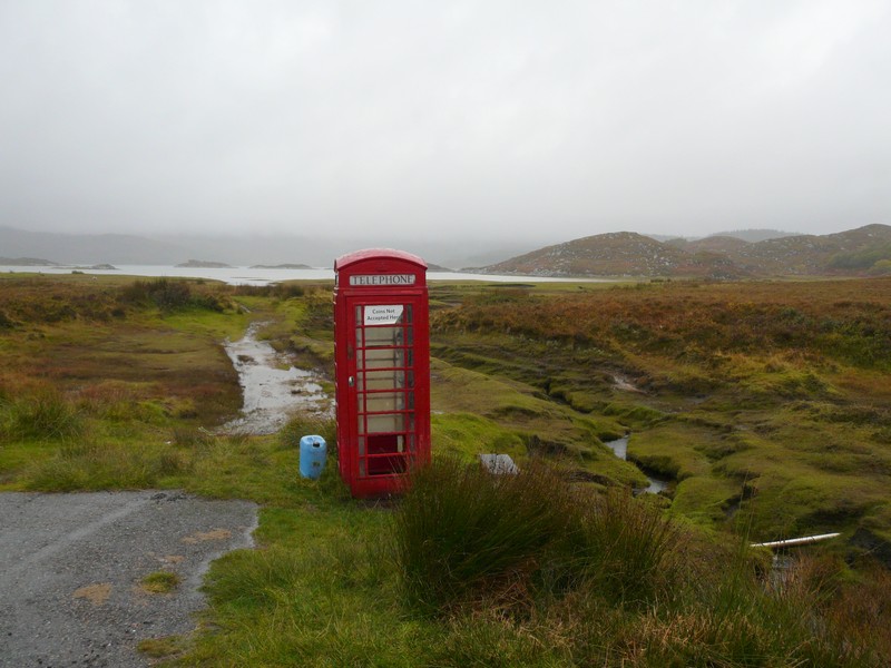
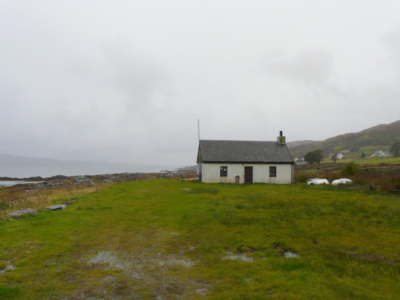
Another lonely red Telephone Box
Friday 12th October On-off-on to Mull 100 miles
It continued to rain all night and all day until the evening!
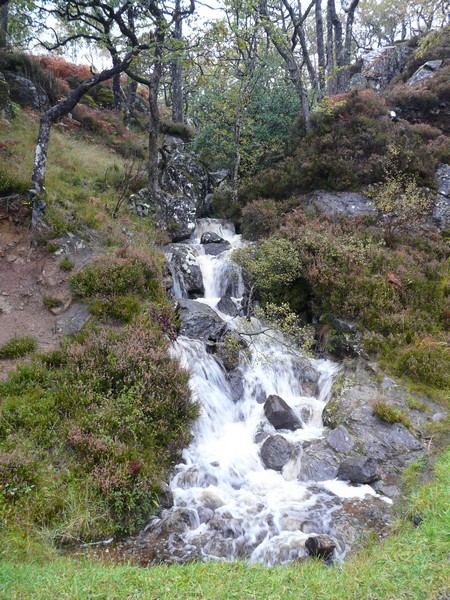
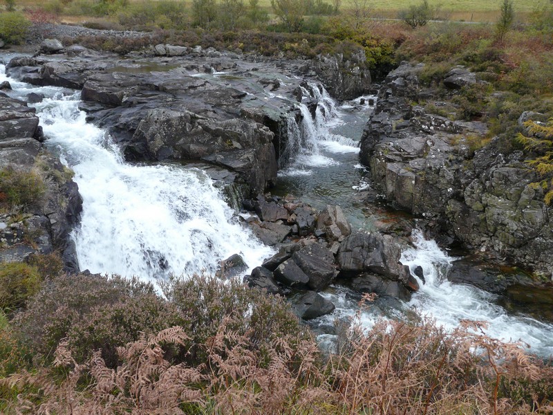
We left at 9.45 and drove through really beautiful country with a variety of colourful trees to Glenborowdale. The waterfalls were dramatic, and there were even more today.
We now had to drive inland around volcanic Ben Hiant (527m) and the scenery changed to barren grass-covered moorland. We drove across the Ardnamuchan peninsula to Kilmony along an extremely narrow and flooded road. All the rivers were overfull and gushing.
We drove back to Kilchoan on the south of the peninsula, then on a bit to Ormsaigmore. We stopped by the small jetty and a couple of little boats, all looking very forlorn today.
Waterfall and flooded river near Kilmony
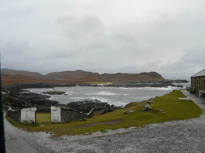
We now drove over rocky moorland sparsely covered by bronze coloured grass and brown bracken to Archosnich and on to the lighthouse. The road was really narrow, and just wound on and on. The last part was controlled by traffic lights as it ran between a stone wall and a sheer cliff (and then through a gate which was so narrow that we had to fold in the side mirrors.) This is the most westerly point on mainland Britain – apparently 20 miles west of Lands End.
Forlorn Ormsaigmore
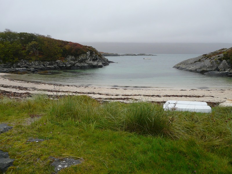
Having done our ‘bit’, we drove to the pretty beach at Portuairk, a village with a surprising number of houses, on the north of the peninsula at sandy Sanna Bay.
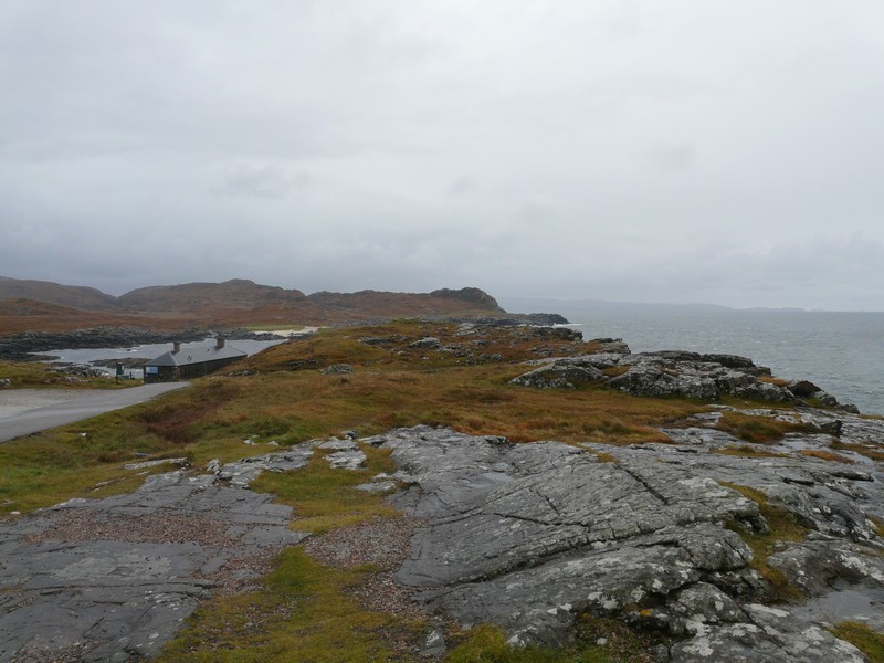
And then forlorn Archosnich Point
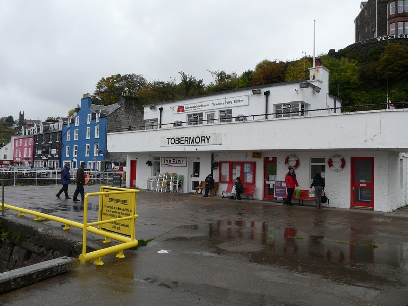
Now we drove back to Kilchoan in readiness for the 1.45 ferry to Tobermory, on the island of Mull. Once more we ate a sandwich lunch while we waited to board the ferry. There was nothing at the ‘terminal’ – just a jetty. An illuminated sign told of various facts, such as sailing times. While eating our lunch we noticed a bit which said ‘Tour of Mull rally, Fri, Sat, Sun, 12th, 13th,14th October’. Realising that this was today, and with no other information, we drove back the mile or so to the tourist information. The lady in there knew nothing about the rally! I suggested that we returned to the ferry and asked someone (who?) By now the ferry had arrived, and was due to leave very shortly. It was a ‘pay on the boat’ ferry, and the only person about was the man who had loaded the vehicles (just two cars). Adrian walked over to him, and they had a conversation on the footplate. The man said that only parts of the roads would be closed (there is just a ‘figure of eight ’road on Mull, with a ‘spur’ off to the bottom left of the island).
We drove on to the ferry, and it left. The man chatted to Adrian after we’d paid – this ferry (35 minutes) isn’t subsidised, and costs more than the one from Skye to Lewis. We couldn’t believe how it still runs, when the only approach is a very long and narrow road at the end of a remote peninsula.
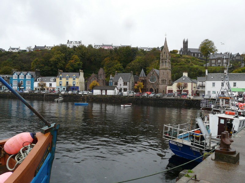
And so we arrived at Tobermory. We had both wanted to come here, and had been disappointed when we thought that we wouldn’t be able to. Adrian had memories of a boat trip as a teenager from Oban, and I had a vivid memory of seeing Norman’s slides of his trip here in 1959. We looked at these photos on the boat.
Even the pretty beach at Portuairk looked forlorn
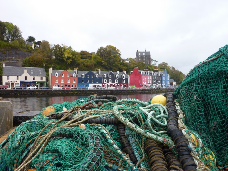
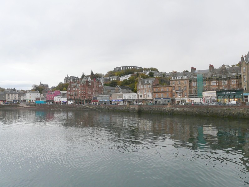
Tobermory really is a pretty town, with its line of pastel coloured houses along the quay. Today, of course, it was crammed with visitors because of the rally. Luckily we found a spot to park opposite the clock tower, so were able to wander along (in the rain) and recapture some of the pictures.
It was good to see that there are still plenty of fishing vessels and nets and pots. On the pier we went into the tourist information where the lady didn’t know much, but gave us a list of the road closures. Armed with this, we set off on our own ‘Tour de Mull’! Many of the stages take place overnight. It was difficult from the list to work out which bits of the road would be closed, but we thought that we had better try to drive as much of the ‘figure of eight’ today, before the closures.
Hence it was rather a race against time. The road started off across the north of the island, and was very narrow and winding. It didn’t help that many of the marshals must have been getting set up, and were driving in the opposite direction. The passing places seemed less frequent than usual!
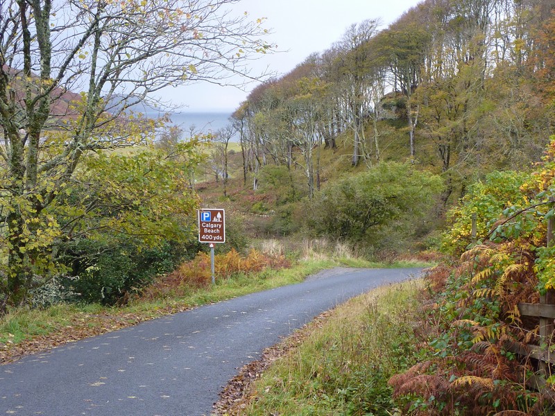
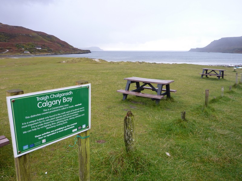
At the western end of the road we came to the tiny hamlet known as Calgary, after which Calgary in Canada is named. It was on a very pretty bay, with the island of Coll beyond.
We continued round the northern loop through fantastic scenery with dozens of waterfalls. We drove around Loch na Keal, with lovely views. We were looking in the direction of the island of Staffa, and imagined that we could see it.
The lower loop road was less busy. We reached the junction with the A road going south-westwards and hoped to find somewhere to stop for the night, but there was nowhere.
Calgary on Mull, after which Calgary in Canada is named
We had seen that some of the stages were being run near the end of this distant road. We reached Bunesson at 6.30 and saw several vehicles parked in the car park by the bay. As light was fading – there was a superb sky after such a terrible day – we knew that we had to join them. We also realised that this is where the stages start and end! The pub opposite, The Argyll Arms, was the place mentioned on the closure list!
If you can’t beat ‘em! We thought that this would be a chance to eat at the pub, so after a bit we headed there. It was a very basic pub, and felt cool. This, we found out, was because it had really closed ‘for the season’ and had just opened up for the rally night! The beer taps were covered up, and there was only bottled and canned beer! I ordered fish and chips, which were good, but Adrian’s ‘crofters pie’ was mediocre. The cooking had been done by outside caterers, as the pub was really closed! All in all, not brilliant. We returned to the van, as music started up from a nearby van, and the rallyers got going.
Having spent all afternoon trying to avoid the route of the rally, we ended up right in the thick of it! It was too much for Adrian to be near the action and not see it, so at bedtime he went off ‘up the hill’ to watch the cars cavorting about. Despite the rain, which had returned, he didn’t give up until about midnight!
Looking towards Staffa (nearly in sun!)
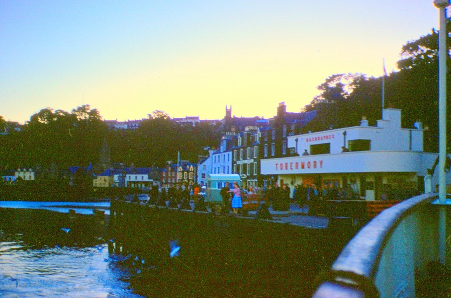
Tobermory 1959
Tobermory 2012
Saturday 13th October More cars before we leave Mull 64 miles
There was more rain in the night, and another noisy rally stage, but it didn’t really bother us. We awoke at 7.00 to hear the plaintive call of the curlew.
We left at 9.30 and drove to the western end of the road at Fionnphort, which is opposite Iona. We drove to the northern side of the peninsula first, coming eventually to a lovely line of cottages by the harbour at Kintra. It looked as though time had stood still here, and despite the poor visibility (no sign of Staffa today) it was really atmospheric.

Fionnphort was bigger than we’d have thought for being so far from anywhere, but is obviously a little tourist spot for visiting Iona. We looked across to Iona from a lovely sandy bay edged by rocks, and with lots of lobster pots.
Sleepy Kintra, Mull
We’d had the road blocked by a small herd of highland cattle on the way, reluctant to move, and after rejoining the main road, it was the turn of the sheep!
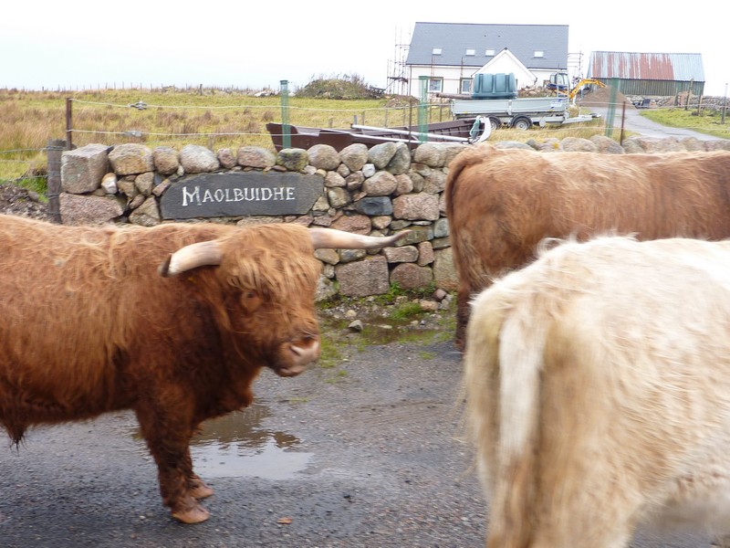
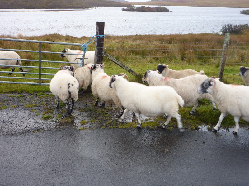
Cattle and sheep block the road, near Kintra, Mull
We now drove back towards Bunessan, taking a road south to a pretty sandy beach at Uiken, with lots of tiny offshore islands. As we walked across the beach, the drizzle returned.
The fittings of our upper bed then decided to break once again, meaning that it lowered itself while we travelled along. This caused Adrian a lot of work and worry as he tried to fix it temporarily. He was anxious too to get to the junction with the B road, just in case the junction was closed because of today’s rally stages.
As we drove back along the A849, water was gushing in streams everywhere from the hills above and the golden grass was almost luminous in the dismal weather, which did occasionally brighten. We passed the junction, seeing that the B road was firmly closed to traffic as we knew, in readiness for the rally.
This meant that the rally cars were driving along our (single lane A) road from the other direction. We pulled into a passing place to let each one pass, but sometimes they got to one first, and waited for us. Wanting to continue the fun of seeing them drive past, we managed to find an old bit of road to pull off onto to have lunch, as they roared past – all 120, or what was left of them!
Fionnphort, Mull
We continued on our way, turning off to drive to Loch Spelve on a very pretty road with lots of trees, looking lovely in the brief sunshine.
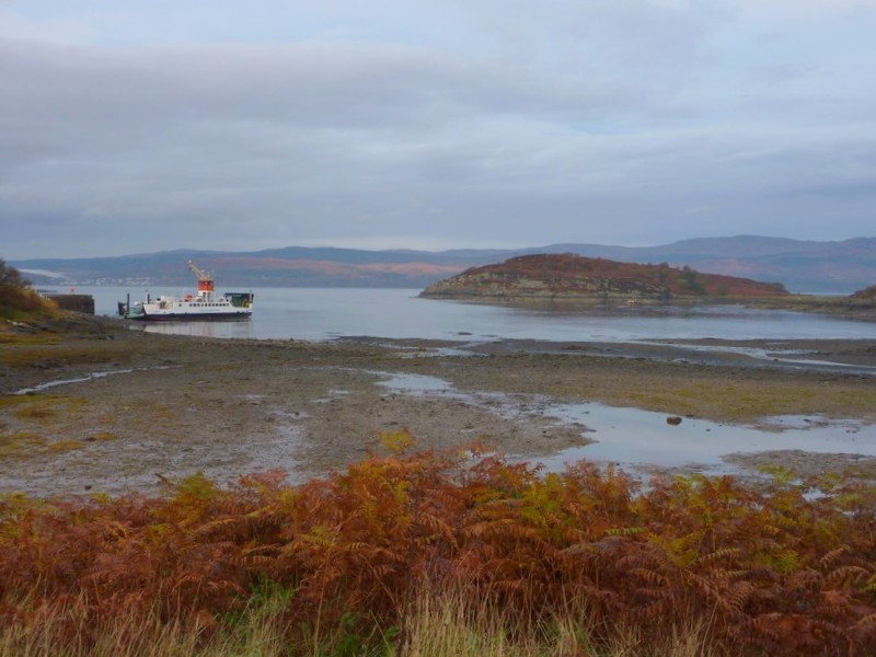
Then it was on to Fishnish, where we were catching the ferry across to Lochaline. There was no town here, just forest and a jetty. We’d got an internet connection after some days, and were disappointed to see that there were no seats left for the steam train on Monday.
We’d arrived at 2.15, and saw that the next ferry was 2.40. The sun was shining now, and we stood on the outer top deck for the short journey across the Sound of Mull to Lochaline. Once across, we used the internet to phone Emma’s, and spoke to her, and to Nicky, who was visiting.
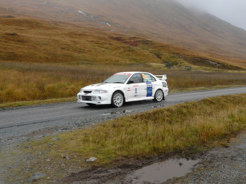
The Tour de Mull rally
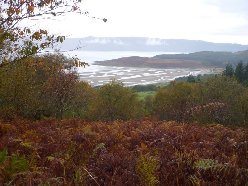
We then followed the A884 beside Loch Aline, and then to Acharn, where we pulled in by Rahoy Hills wildlife reserve. We had a short walk out over the very wet ground in the lovely forest location, and decided to stay for the night.
After supper we read through our diaries of our trips to Scotland with Tom in 1990 and 1992.
Happy Adrian crossing back across the Sound of Mull
The bridge by our nightstop near Acharn
Sunday 14th October Round the rugged lochs 85 miles
We had a short walk by the river, and then across a field to a lone brightly coloured tree, amongst the rocky, hilly country. The morning was fine and the day mostly sunny.
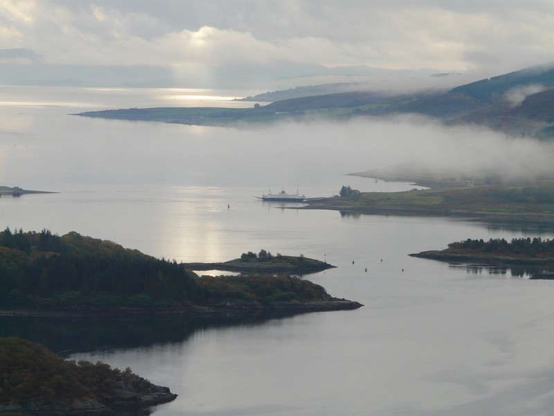
We drove across wild, remote country to Loch Linnhe. The road beside the loch was very, very narrow, between the steep rocky mountain and a stone wall above the loch. There wasn’t even room for passing places!
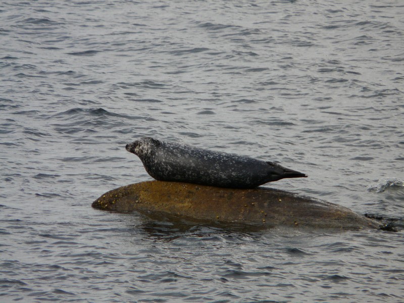
We stopped beside Loch Linnhe in the sunshine. There were seals on the rocks in front of us and one in the water. We also saw oyster catchers and a heron.
Back on the A road we were aware of lots of vehicles passing – some with trailers carrying rally cars, and realised that they must have come on the ferry from Mull, as the rally had now finished. We were intending taking the ferry across Corran Narrows to the other side of Loch Linnhe, so continued there. As we drove along, we could see snow-topped Ben Nevis up ahead, but as we now expected, when we reached the ferry, there was a very long queue.
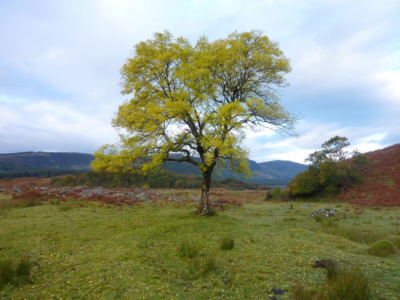
The lone brightly coloured tree
We decided not to wait, but to drive the 40 miles to Fort William around Loch Eil. The drive along the southern shore of the loch was quite delightful in the sunshine. We stopped for lunch before we reached the end of the loch.
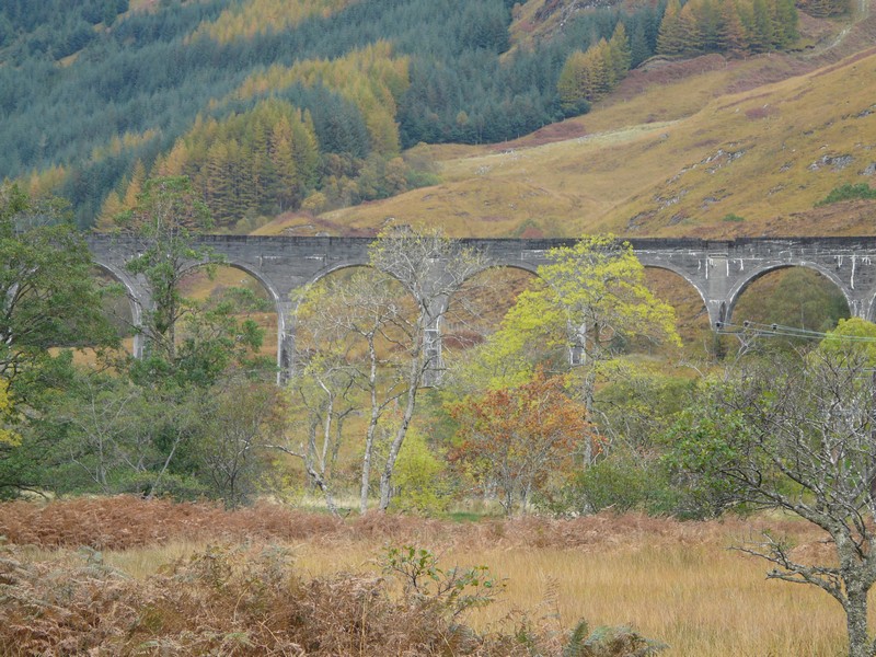
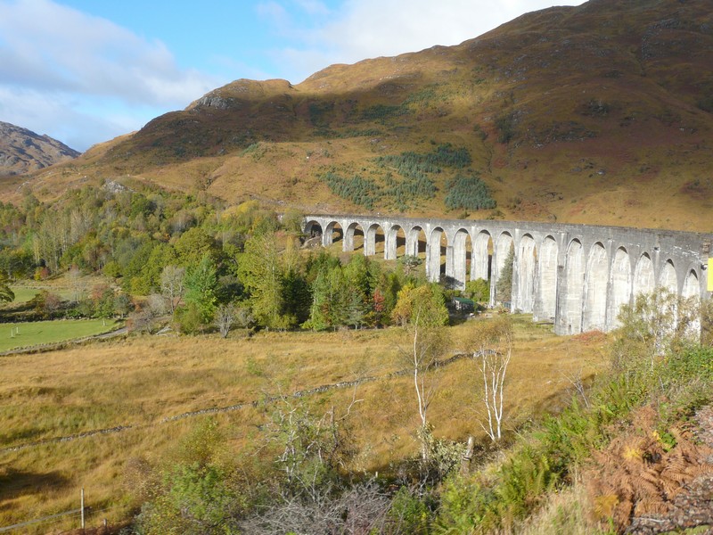
When we got to the junction with the A830, we turned left for a few miles as far as Glenfinnan viaduct. We had seen that there was a Visitors Centre here, and Adrian imagined that it was about the viaduct on the Fort William to Mallaig railway. He viewed the viaduct but then saw that the visitors centre was about Bonnie Prince Charlie – a tall monument stood nearby!
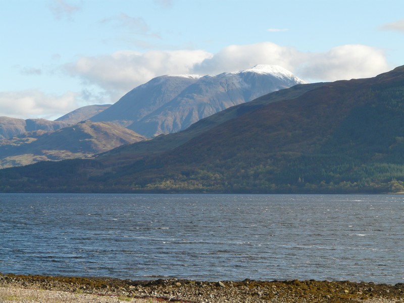
Snow-topped Ben Nevis
The road along the northern side of the loch was very ordinary. We drove on to Fort William for Adrian to suss out the railway station and parking for our last ditch attempt at travelling on the steam train tomorrow – all reserved seats are booked, but some are apparently kept for ‘on the day’.
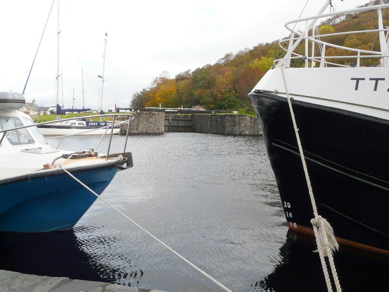
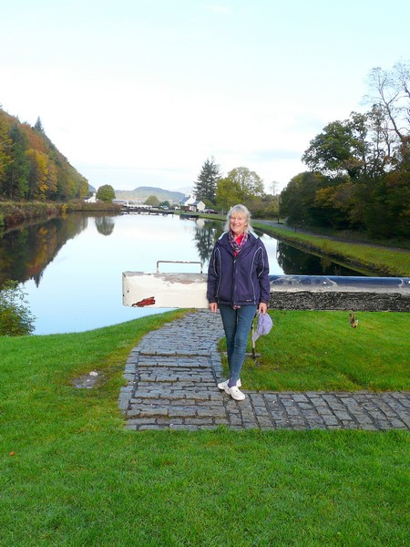
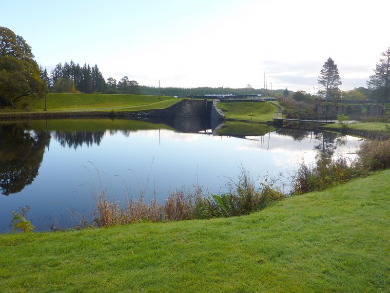
With this in mind, we needed somewhere to stop tonight. Adrian had note of a couple of places to the north. We decided to make it a ‘round trip’, so first drove back a short way to Banavie to ‘Neptune’s Staircase’, a series of locks on this end of the Caledonian Canal. The car park here didn’t allow overnight parking, but we stopped to walk over to view the locks.
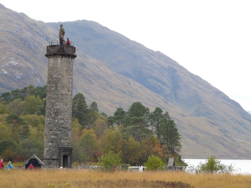
A monument to Bonnie Prince Charlie by the Glenfinnan Viaduct
We then followed a small road north along the western side of the canal to Gairlochy. The canal was often hidden from view, but we could sometimes see it below us.
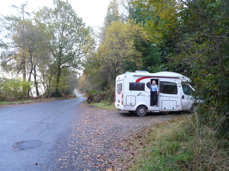
We drove across to join the A82 at Spean Bridge, turning off on to a narrow rural road, where we stopped at a ‘woodland walk’ parking area for the night.
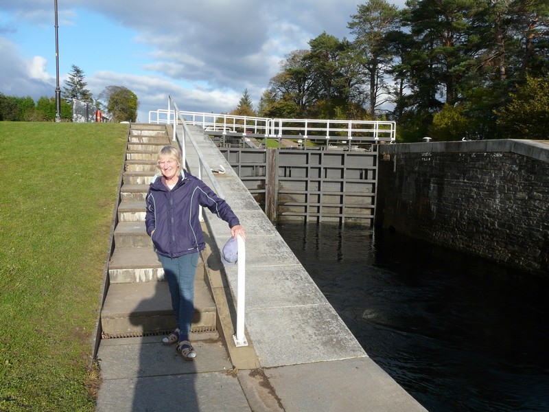
Rosie on Neptune's Staircase on the Caledonian canal
Monday 15th October Adrian gets his hard-won train ride 31 miles
We were up early on a fine, dry morning, hoping to have a final try at riding on the steam train from Fort William. We heard the travel news on the radio – first item – ‘the A82 north of Fort William is closed both ways after a lorry fire!’
We set off soon after 8.00 in the frost and fog! We hoped that the road closure was north of Spean Bridge as we drove south to Fort William. Convincing ourselves that all would be well, about 3 miles north of Fort William we reached it! A policeman told us that the road would be closed for at least 2 hours (in the evening we heard that traffic lights had been installed, as the carriageway had to be repaired).
The only thing to do was to turn round and drive back. We could have taken the road we had travelled up yesterday, but opted for a third road, which ‘wiggled’ constantly around the countryside. It was a single track road, and was being used by the other diverted traffic. We passed one car which had swerved off and turned over – the driver appeared OK. The going was extra slow, but we did reach Fort William at 9 o’clock.
Using my blue badge, we were able to park right by the entrance to the station. Adrian went off to find out how to get tickets, and found that you just waited outside the guard’s van, and hoped to be lucky! There was a long queue! We were told later that 50 seats are left for ‘on the day’. Well, we were lucky, so gathered our things and went across to Morrisons to buy a sandwich for lunch.
After that, the day was brilliant! We were allocated seats near the buffet car, where the dour chap was wearing a kilt! We had pleasant travel companions – a couple from Suffolk – and the weather was fantastic so we could see the beautiful scenery at its best.
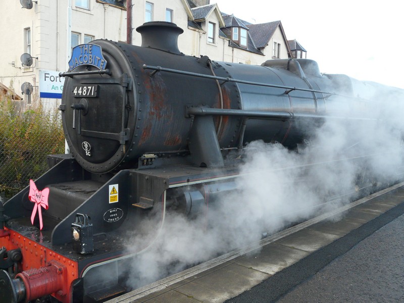
Stannier Black 5 44871 at Fort William
The journey to Mallaig took just over two hours, with a stop at Glenfinnan station on the way.
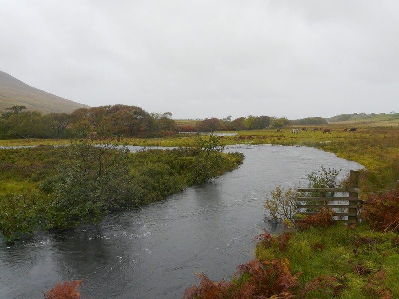
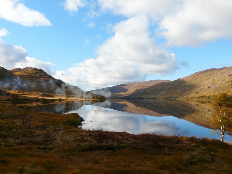
The morning sun shines on Loch Eil
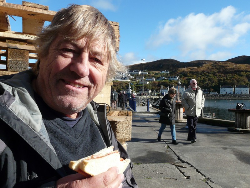
There wasn’t a great deal to do in Mallaig. We walked down by the harbour, which still has several fishing vessels. We sat on some wooden pallets to eat our sandwiches before having a wander around.
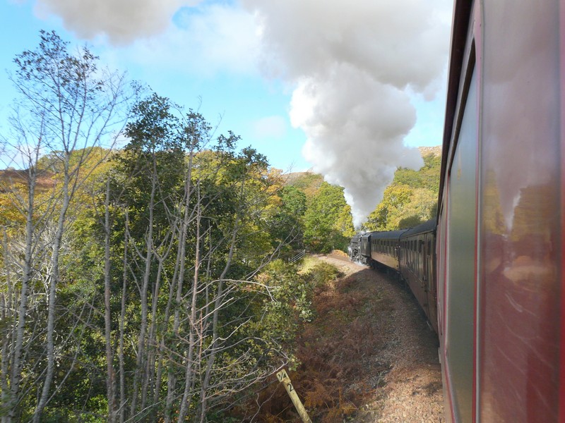
We approach the Glenfinnan Viaduct
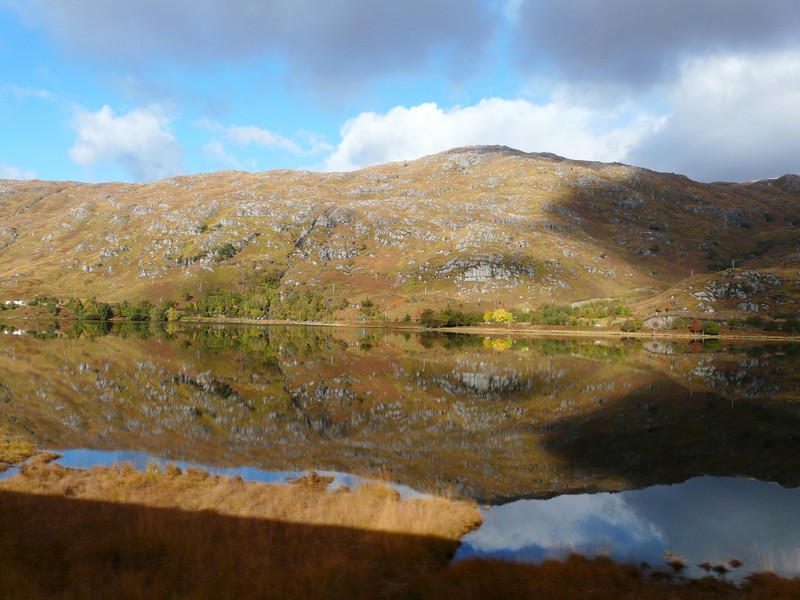
For the return journey we were sitting on the other side of the train. The reflections in the lochs were amazing.
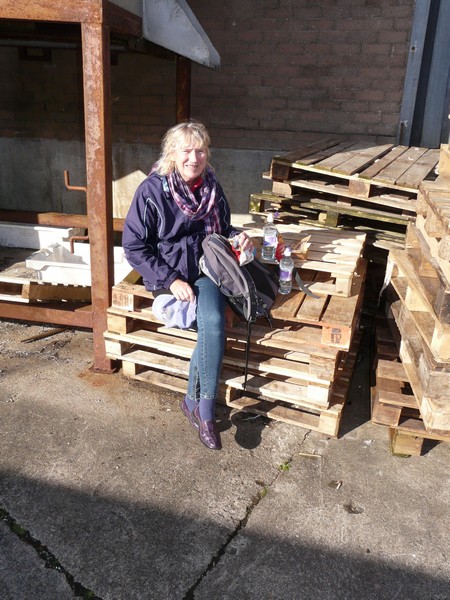
Lunch sitting on pallets at Mallaig
We arrived back a bit early, at 3.50. After a cup of tea, we shopped in Morrisons, buying more than we’d intended, including fireworks for Adrian’s birthday celebrations.
We now dove south beside Loch Linnhe. Driving was very difficult because of the bright sun shining on the water. Just before 6 o’clock we stopped at a car park by Ballachulish Visitors Centre.
Reflections on the journey back to Fort William
Tuesday 16th October Memories rekindled of Glencoe and Oban 73 miles
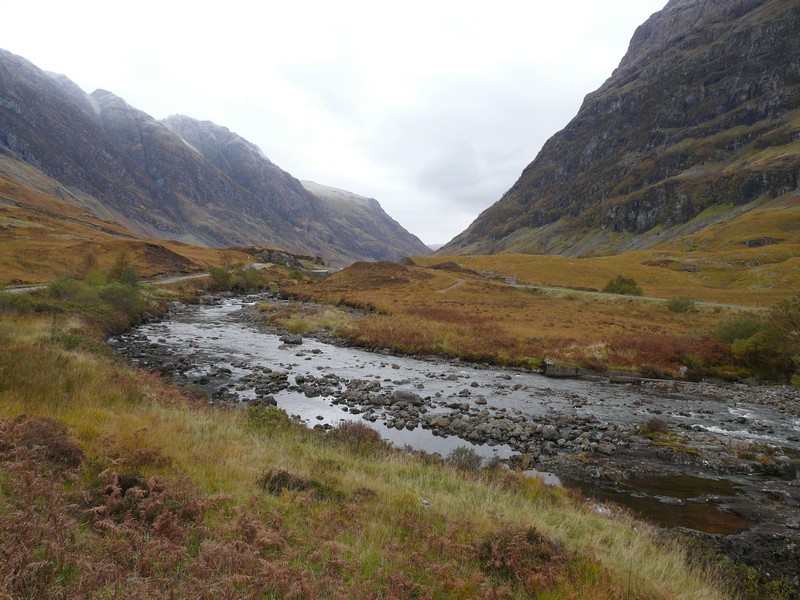
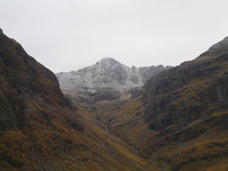
A beautiful day! We started with a diversion from our coastal route, so that we could drive up some of Glencoe. We took the old road initially until it joined the A82. The scenery was gorgeous, with the little gushing stream below us and mountains towering above. We had heard on the weather forecast that there could be snow on the Scottish hills, and sure enough the tops of the hills had a dusting of fresh snow.
We drove back to Ballachulish and then south beside Loch Linnhe, stopping opposite Shuna Island.
We then followed a small road to Port Appin. A ferry leaves from here for nearby Lismore Island, which is fairly low lying. We were greatly surprised to see dozens of people, many with bikes, walking towards the ferry. There were a lot of cars parked – this quiet little backwater was busier than we’d expected!
We continued on a road around this fist shaped peninsula. The trees looked really pretty, but the road was very narrow, with very few passing places. Luckily we didn’t meet many cars!
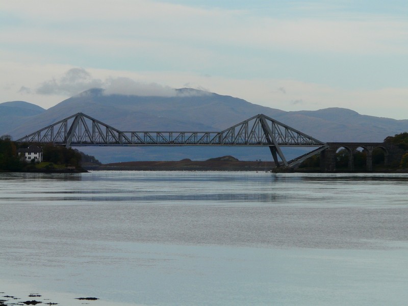
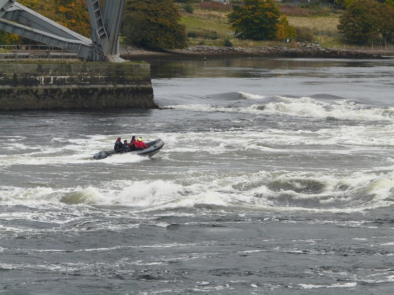
We drove on down to Connel where the bridge over Loch Etive uses the old railway line. Adrian was remembering coming here as a ‘lad’, and we had also driven over it with Tom in 1990. It is famous for the ‘Falls of Lora’ - spectacular rapids where the river reaches the incoming tide.
We drove back up the loch for Adrian to photograph the bridge as he had done before. This was difficult as there were road works, with traffic lights. Also two vehicles – a bus and a large truck, had had a prang. Nobody appeared hurt, but there was debris over the road, and the bus windscreen was shattered.
We then had to drive back along the road and this time we were able to find a spot in the car park by the falls, where, having viewed them, we had lunch.
We take a diversion to drive through Glencoe
Now it was on to Oban, where Adrian had holidayed with his family, and also we had camped nearby with Tom in 1990. Adrian wanted to revisit Ganavan Bay, which he had been to before. It was a pretty route, and there were lovely views from the sandy/pebbly bay. Adrian, however, was distressed to find a small estate of large ‘posey’ white houses right beside what had been a very natural beach. We walked on to the beach, where several young children were enjoying themselves with their families.
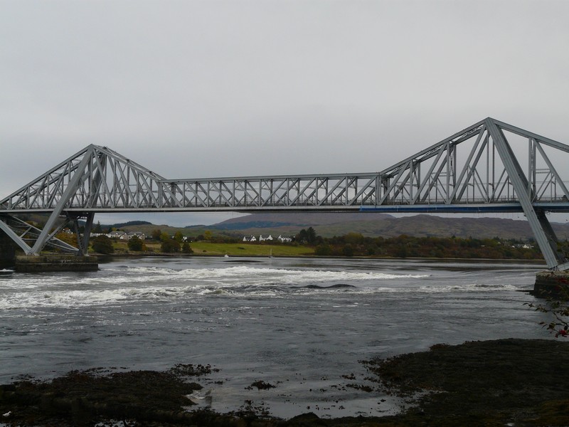
Connel Bridge and the Falls of Lora
We drove back into Oban, hoping to find a laundrette. We did three circuits of the centre, finally finding that the ‘laundry’ only had a ‘serviced’ laundrette service, where they did it for you (at a price). We decided not to bother.
We found our way up to McCaig’s Tower – a folly built as a copy of the Colosseum in Rome, standing on the hill above the town. We both remembered visiting it before. Today was a real winner, as the weather was sunny and still, so the views down to Oban and the Sound of Kerrera with all the islands and headlands were superb. There were some nice fishing boats too.

We had to follow the difficult narrow road back round and down again. We then set off to look for water, and managed to get some from the second Gleaner garage, where we also got some more diesel.
We headed off beside the loch now to Gallanachmore, where we had camped with Tom in 1990. I didn’t remember how narrow and dramatic the road was. We drove to the spot where we had camped beside the loch, looking across to the island of Kerrera. The campsite was much more organised now than the simple one we had stayed at then.
Ganavan Sands, Oban 2012
Ganavan Sands, Oban 1959
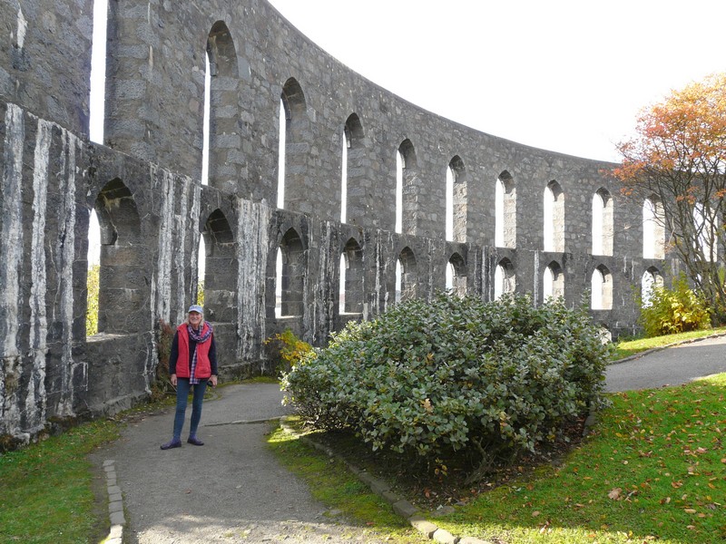
Rosie at McCaig's Tower, Oban 2012
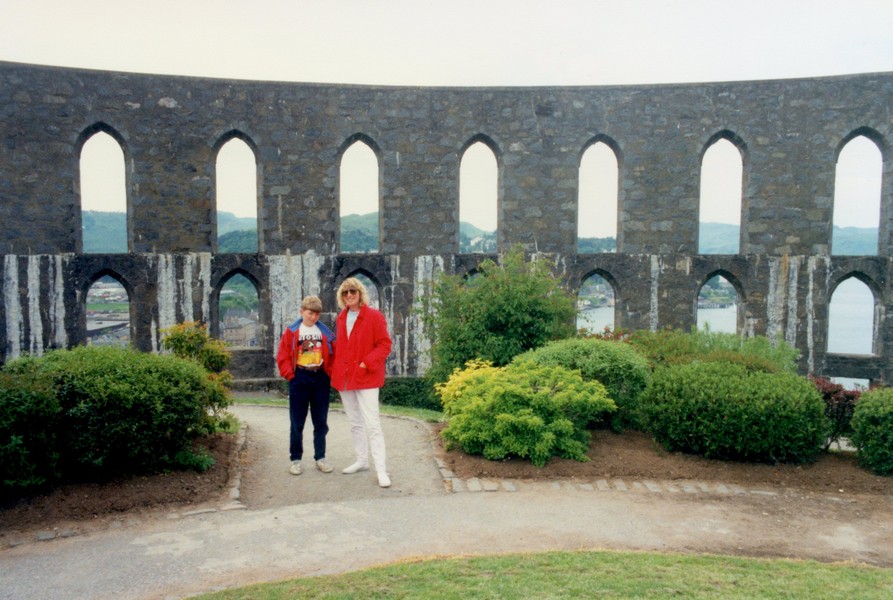
Tom & Rosie at McCaig's Tower, Oban 1990
McCaig's Tower, Oban 2012
There is a small ferry which leaves from about half a mile up the loch. We had walked to the ferry point with Tom, and then spent an idyllic day walking around the island of Kerrera – a fond memory. There is now a car park by the jetty at Gallanach. We returned there and decided to stop for the night at this beautiful spot.
Later we phoned Tom and reminisced about our time camping here.
The ferry and our view at Gallanach
Kerrera from where we camped in 1990 and the ferry terminal


Wednesday 17th October An interesting bridge and canal 86 miles
We didn’t leave until 10 o’clock. The day was lightly overcast.
When we got back to Oban, we drove around for Adrian to take photos to compare with past ones he’d taken.

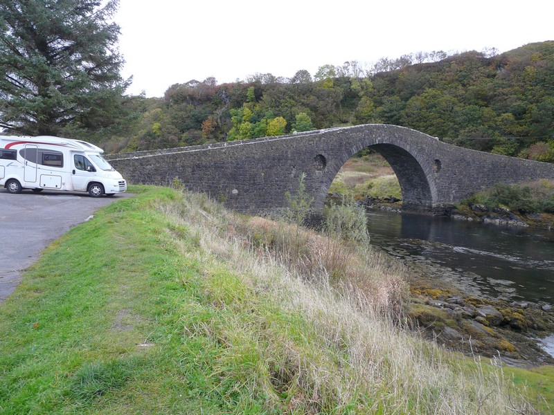
We then drove south, turning off to Clachan and the ‘Bridge over the Atlantic’ – an attractive stone bridge built by Telford. We had been here before with Tom, and Adrian with his family. Adrian wandered around taking photos. The bridge joins the island of Seil with the mainland.
McCaig's Tower and the Ixi at Oban
We continued to Easdale on the western side of the island. A ferry joins the small island also called Easdale. It was very pretty, nestling under towering cliffs with rows of terraced white houses by the harbour. It was nicely touristy and certainly had character.
The 'Bridge over the Atlantic' at Clachan
We drove back to Clachan and from here the road south went inland, often through forest. When we reached the coast again, we had lunch opposite the island of Shuna. The road now went inland for a bit, through humpy hills. We turned down to Ardfern, which had a busy marina. We continued south beside Loch Craignish, then drove across the peninsula to overlook Loch Beag, where there was a lone stone house. The sea looked aquamarine, dotted with islands. On our way back up we hit a protruding branch, and both mirrors on my side fell out. Luckily Adrian was able to fit them back in again.
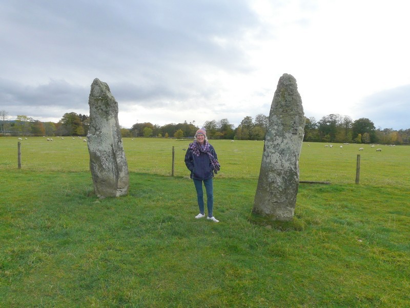
We drove on down towards Knapdale and Kintyre. Around Kilmartin there were a lot of standing stones. We stopped to walk across to some. It felt very cool.
Easdale
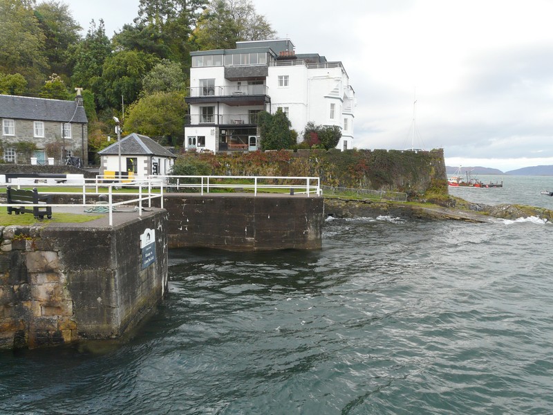
There was a weight limit on the road we were intending to take, so we took the longer way round, which went along beside the Crinan Canal. This had been built in 1801. There were a lot of locks. We continued to Crinan, where there was a sea lock. It was a very pretty and photogenic spot with some nice old fishing vessels. Adrian went out snapping, but it was chilly.
We drove on to Crinan harbour which looked really pretty with its cottages and boats, especially as the sun had come out. The road to a swing bridge on the canal was not as successful, as it ended by the bridge with nowhere to turn round.
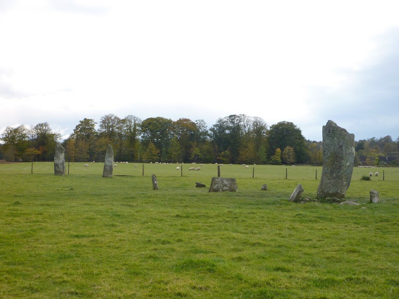
Standing stones at Kilmartin
We now took the B8025 south beside narrow Loch Scotnish as far as Tayvarlic, which looked very pretty across the bay. We drove across the peninsula to Carsaig Bay – a lovely bay, looking across to the island of Jura.
We now retraced our steps back up towards Bellanoch, stopping in a forest carpark near Barnluasgan at 5.20.
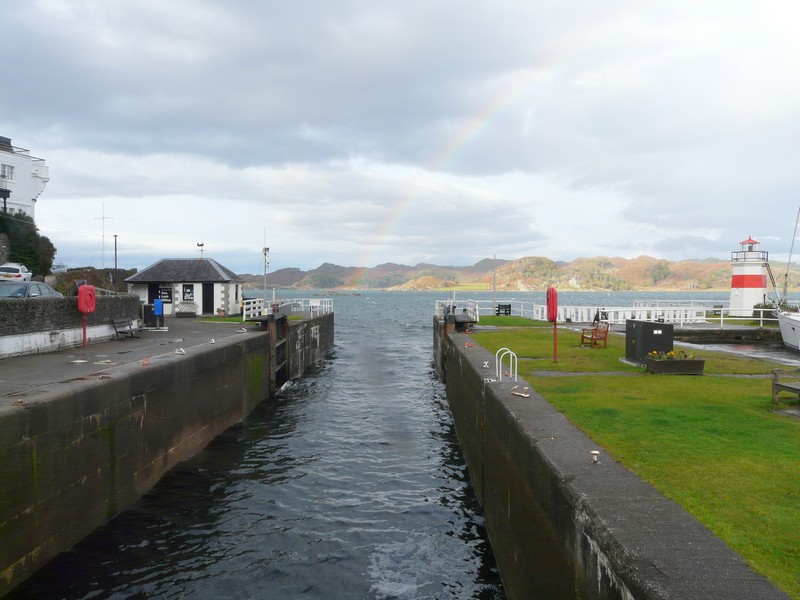
Crinan Canal and Harbour
Thursday 18th October Mull of Kintyre 122 miles
We’d had rain last night, but the day started fine. We left at 9 o’clock, stopping at the other Forestry car park to have a short walk past ancient oak trees with moss covered ground to a small freshwater loch. Apparently this area is where beavers were first reintroduced in Britain.
After Bellanoch, we joined the Crinan Canal again. We stopped by one of the many locks. It was really still and peaceful with lovely reflections.
On the outskirts of Lochgilphead we stopped at a petrol station and got diesel and propane and bought a few things, including lemons for Adrian’s G&T. At Ardrishaig we came to the end of the Crinan Canal, where it reaches Loch Gilp.
We now took the B8024 across to the western side of the peninsula in order to make a circle of Knapdale, the northern half of this peninsula. The country was often forested, but the road surface was variable.
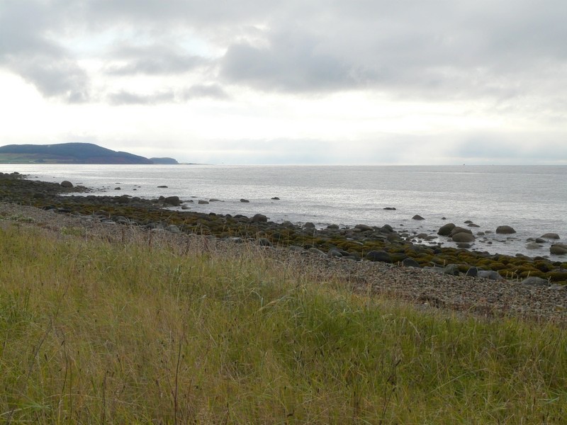
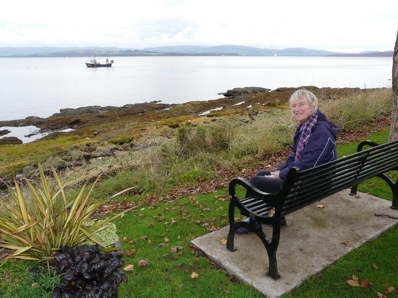
We stopped overlooking Loch Caolisport. We saw 2 herons, a curlew and an oystercatcher. Soon afterwards we saw several seals lying on rocks.
By the Crinan Canal
We carried on round Knapdale enjoying the autumn colours. We saw a herd of deer in a field, but thought that they were farmed, not wild. At West Tarbert we started on the Kintyre ‘island’ (there is a mile of land joining it at Tarbert). We were surprised to find that the coastal area is low lying.
We had lunch looking across to Gigha Island, then drove past Campelltown airport, to Machrihanish, on the western side. There was a rough sandy beach with much seaweed. We were surprised to learn that there had been a radio mast here where the first voice message with America had been made in 1906. There was a long sandy beach to the north, dominated by a golf course dating from late 19th century.
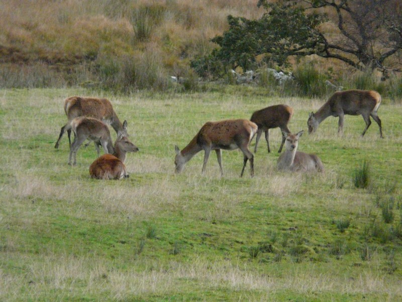
One seal and a herd of deer
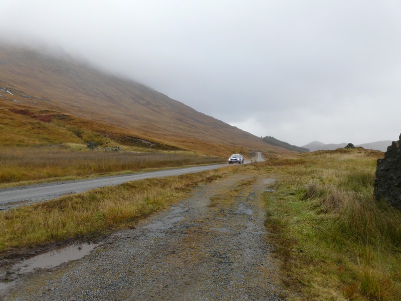
It had now become rainy as we drove south towards the Mull of Kintyre. We came to a sign saying ‘Mull of Kintyre lighthouse 7 miles.’ We started on the narrow, uneven and difficult road, with some very steep sections. Judging by the state of the road, it had rained much harder here. At one point there was a flood across the road. We came to a gate across the road, beside a house which had ‘no turning’ written up outside. We had decided that the road wasn’t for us, but at that point another car arrived from the other direction. We had to pull into the small driveway for it to pass. A lady came out from the house, and contrary to what we expected, said that she was just going to help us reverse. She assured us that the road was OK, and that several campers had gone up it. Taking her word, we set off, but had only done 1½ dodgy miles, which had taken an eternity, when we came to a house and driveway where we could turn round with difficulty - after the only other car had passed!
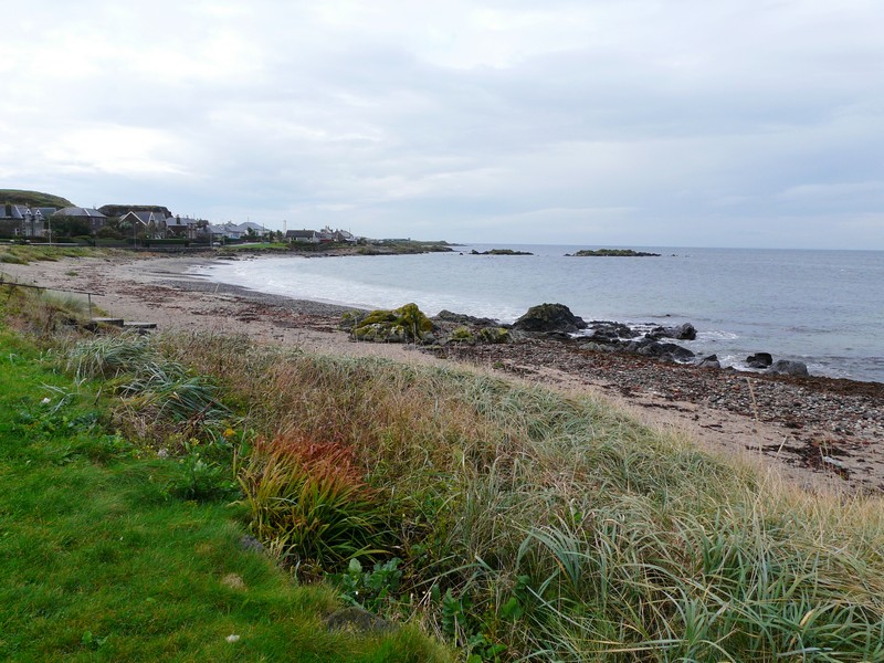
We now precariously made our way back – there were almost no passing places. Once we were back to the relative safety of Carskey Bay, we stopped to watch the waves crashing onto the base of the Mull of Kintyre. We walked onto the pinky coloured sandy beach, looking across to two offshore islands. This southern tip of Kintyre is called Southend – not much like the one we know!
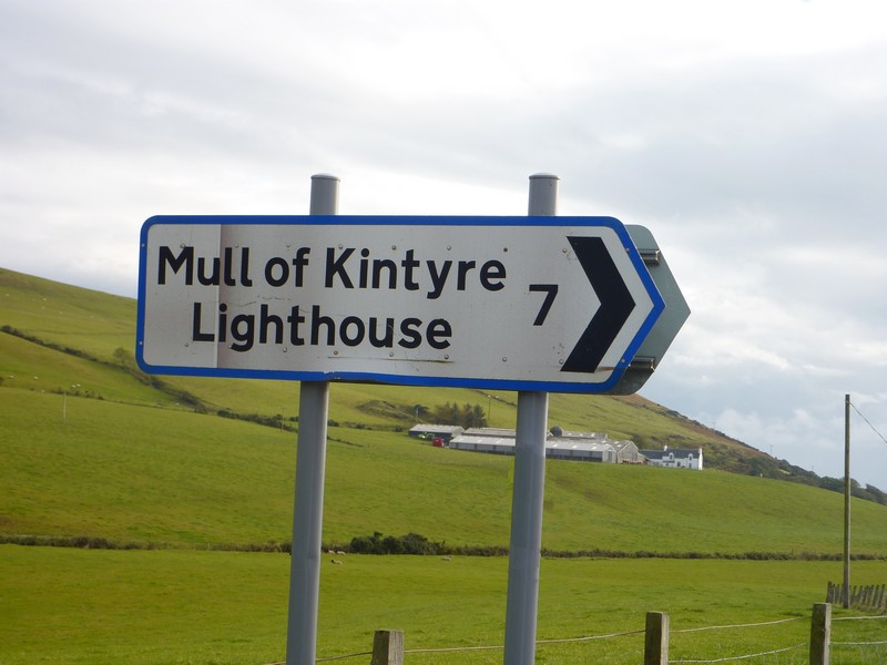
On to the Mull of Kintyre
It was with some trepidation that we started on the road around the eastern side of this bottom section, to Campbeltown. A flock of small birds looking like chaffinches flitted about us. There were some very steep sections on this narrow, badly maintained and potholed road too.
At Campbeltown – a surpisingly large town – with a laundrette, but too late in the day for us – we could look across to steep Davaar Island. This island protects the natural harbour of Campbeltown, which had some large fishing vessels. It used to be a whaling port.
Continuing up the eastern side, we came to Peninver at 5.50. We pulled into the village carpark between messy road works and static caravan parks, overlooking grass to the sea.
We were both feeling disappointed that we hadn’t found Kintyre to be the wonderful place conjured up by Paul McCartney’s evocative song.
Carskey Bay, Mull of Kintyre
Friday 19th October A lovely drive around Arran 89 miles
The evening had become very wet. The morning was dark, grey and damp, but the road had been very quiet.
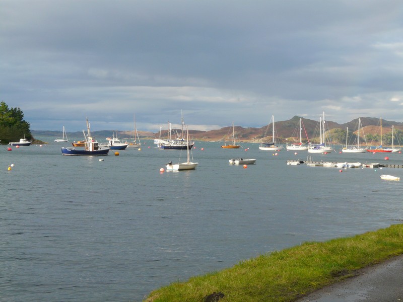
We left at 8.30 to drive up the coast, with many ups and downs and some nice autumn colour, to Claonaig. We arrived here at 9.40, in good time for the 10.05 ferry to Lochranza, on the island of Arran. There was nothing at the ferry point except the slipway.
There was only one other vehicle on the ferry. Adrian chatted to the chap running it as we crossed to Arran. Once there we set off in an anti-clockwise direction around the island. A two lane road runs right around the island, sometimes high up because of the terrain. It looked as though there had been much heavy rain recently – at one point we passed a landslide. We immediately felt how unspoilt Arran is.
We saw a line of four geese in the road, with hens in the yard behind. We loved seeing the simple playgrounds – a patch of grass with a double swing and a bench. There were frequent seats at pleasant spots too.
From Sliddery we caught our first misty glimpse of Ailsa Craig, and then the sun came out for a while.
We stopped for lunch above a sandy, seaweedy beach at Kildonan, in the southeast of the island and later walked down onto the beach, which was surrounded by rocks.

Wild Arran
We watched oystercatchers, several seals, and one otter! We saw quite a few red squirrels. It seemed an idyllic place to live, but the number of houses for sale suggested that perhaps it had some drawbacks.
When we reached Whiting Bay, on the eastern side, we could see steep Holy Island, which protects Lamlash, a bit further on. On the island were just two lighthouses and two jetties.
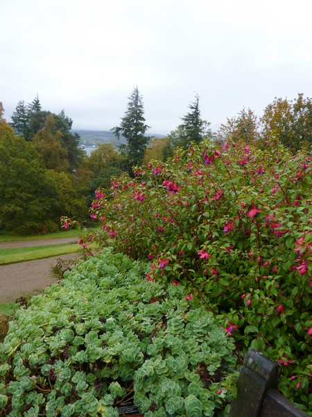
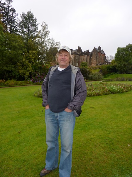
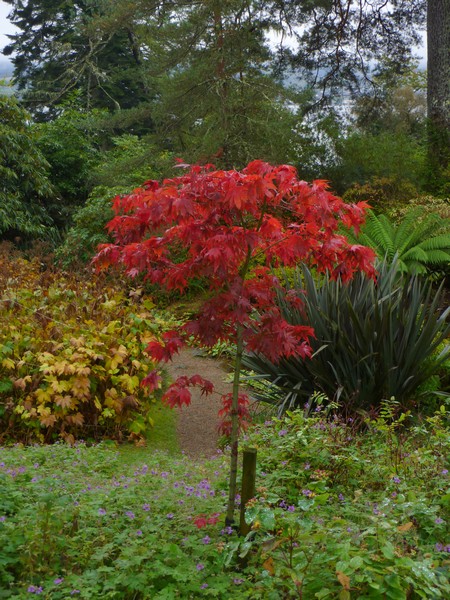
We continued up the eastern side of the island, stopping to visit Brodick Castle (NT). Brodick itself is the only village of any size on Arran. The actual castle was closed when we got there at 3.15, but we wandered through some of the gardens, which were in a superb location beside the sea (Firth of Clyde). The gardens were very attractive and we enjoyed our short visit.

Kildonan
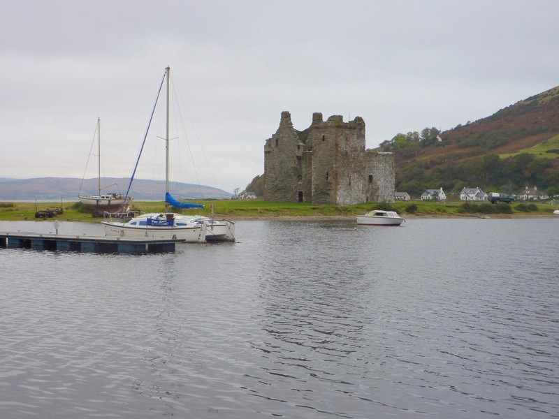
We continued round to Lochranza, the last bit through the hills, arriving at 4.40. We’d passed the impressive ruins of the 17th Century castle, set on a strip of land at the end of the inlet.
Brodick Castle (Nat trust)
The ferry back to Claonaig left at 5.15, but by now the weather had closed in. Once across, we drove the couple of miles to Skipness, where there was a line of grey cottages by the water, but we didn’t see the castle which is here. There weren’t any suitable places to pull in for the night, particularly with the saturated ground, so we returned to Claonaig, where we stopped in the small car park by the ferry at 6 o’clock.
The ruins of Lochranza castle
Saturday 20th October Bute in beaut sunshine 112 miles
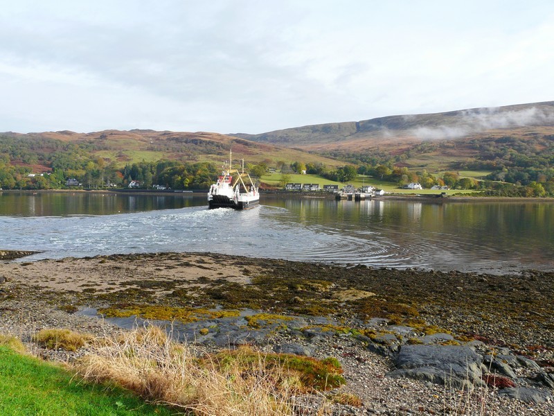
We got up early with the intention of catching the 9 o’clock ferry to Portavadie. It was still dark as we left. The hills were misty, and it felt quite eerie, with just the sleepy sheep in the fields. We drove down to West Tarbert Loch, where the lights on the ferry terminal to Islay looked like fairyland.
It was beginning to get light when we reached Tarbert. We could see that it is still a fishing port. As we reached the ferry terminal at 8 o’clock, a boat had just arrived, so we were able to catch this earlier ferry. We hadn’t stopped for breakfast, so ate some cereal on the half-hour crossing. When we reached Portavadie, we stopped to have our tea and coffee with a Sharon fruit – we had no bread left for toast. We had come here in 1992 with Tom, and had had a walk in the forest. This looked too wet today. The large new hotel wasn’t there then, nor were the modern pleasure boats.
We followed the road around the southern tip of this peninsula, as we had done on our earlier visit, down the centre to Kilbride Bay and then as we drove back up the eastern side by the Kyle of Bute we watched several seals basking on the rocks.
Near Tighnabruanich we joined the main road. We stopped at several viewpoints, trying to locate the one we remember from 1992, where we had looked down to the Isle of Bute, and I had wanted to visit. Trees had grown up since then, but the setting was still as peaceful.
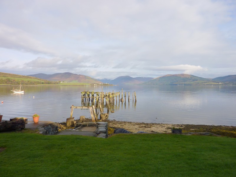
Looking back to the ferry at Portvardie
Kilbride Bay
The autumn colours were beautiful as we rounded Loch Riddon and came down to Colintraive, for the five minute ferry crossing to the Isle of Bute. Once there, we stopped on a little jetty. A group of men had loaded up a small dinghy with diving equipment, and had gone off to dive.
The ferry to the Isle of Bute
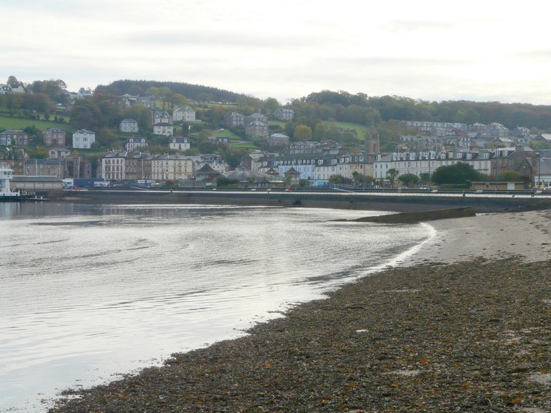
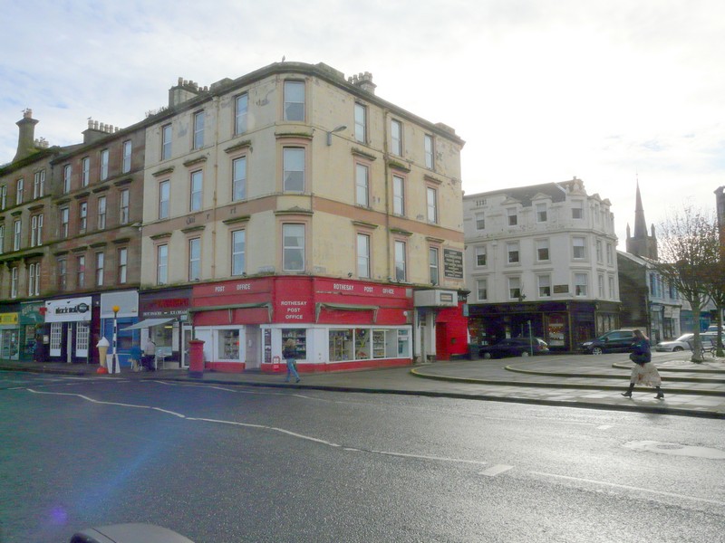
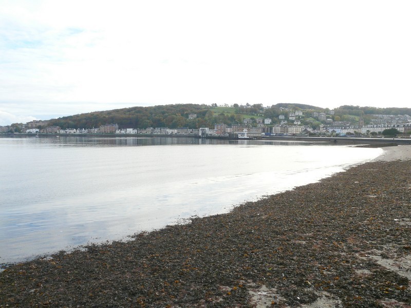
We set off southwards to drive around Bute. We came first to Port Bannatyne and then on to Rothesay. This appeared a nice old fashioned resort, reminding us of Douglas on the Isle of Man. There were a lot of tall stone buildings. We took a road beside the water, stopping at the Co-op to buy some bread. The town was busy on this Saturday morning.
Men set off to dive, while we have our coffee
Continuing south, we took a very muddy and narrow road before Kingarth. We continued down to Kilchatten Bay – the sun had now gone in, but it was just warm enough to sit outside to eat our lunch, sitting on a seat above the water. There was just one fishing boat. This place had been a resort in the past. The once smart but now rundown hotel behind us was testament to that. As we drove back to the A road, to continue to the western side, hundreds of birds – gulls and crows were ‘swarming’.
Port Bannatyne
Rothesay
At Scalpie Bay we could look across to Kintyre. We stopped at Ettrick Bay and walked on to the beach. It was really still, with no wind.
We drove back across the island to the east coast, reaching it at Kames Bay. We saw a group of oystercatchers as we stopped to look across to Port Bannatyne.
Kilchatten Bay
We got to the ferry terminal at Rhubodach at 3.30, just as the ferry arrived, so were soon back at Colintraive on the mainland. It had been a good visit to Bute.
We took a narrow road beside Loch Riddon and stopped to peruse our final onward route.
We followed a road through Glen Lean, then past Holy Loch to Dunoon, which seemed a busy, happy town, but with nowhere for us to overnight.
We drove back around Holy Loch – on the other side of the loch, there was a continual line of houses. We drove up past Strone, at the southern end of Loch Long, and finally found a small space to pull off the road near Ardentinny for our last night of our RoAd ARound Britain, which we have now almost completed.
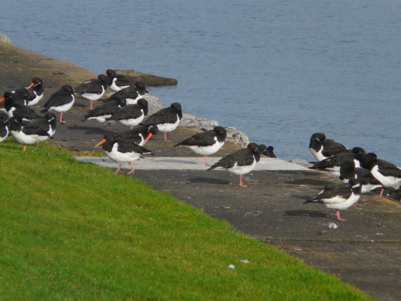
Back at Kames Bay we see oystercatchers
Sunday 21st October A glorious day to end our RoAd ARound Britain 114 miles
Looks like we’ve made it, Look how far we’ve come my baby
We left late for our last day of our RoAd ARound Britain. (As we are doing this website geographically, and not chronologically, we still have a long way to go - Wales, the West Country and the South plus Ireland).
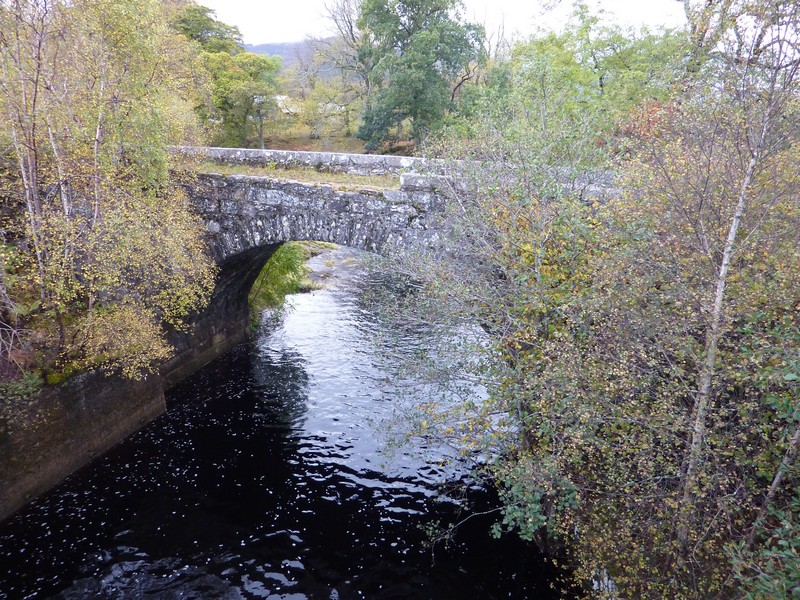
The trees, especially Adrian’s favourite beech, looked wonderful in the sunshine as we set off on the 40 mile route to come back down to the other side of Loch Long. The golden yellow larches amongst the evergreens made us think of Canada. We drove up beside the loch and then through Glen Finart to Loch Eck and then Loch Fyne. From here we followed Glen Kinlas to the wonderfully named Rest and be Thankful. We should have stopped beside the water, because when we reached the summit, it was thick cloud and fog looking down to Glen Croe. We had driven this dramatic road several times on our previous trips here. We walked over to see the stone placed by the builders of this road in the 1700s, giving it its name – obviously fitting after climbing all the way up.
We leave for our last day of RAB
We could see The Cobbler, a large hill which Adrian and Tom had climbed in 1992, when we were camping at Ardgarten. We then drove through Glen Croe, passing the campsite, and then past Arrochar and down the other side of Loch Long. We were driving right beside the water, but frustratingly there was nowhere to stop and take in the view at all.
After Garelochhead we crossed back from Gare Loch to Loch Long. At 12.15, we were opposite the spot where we had stayed last night!
We continued to Kilgrennan, where we had lunch, looking across the Firth of Clyde to Gourock. Five lochs all converge here. There were smart houses along the route. We drove back up Gare Loch, heading down the eastern side of the loch. The huge area of Faslane Nuclear Submarine Base is fenced off all along this shore.
We drove on down to Helensburgh, which was busy on this beautiful Sunday afternoon. We walked on to the pebbly beach. There was a plaque to Logie Baird, a native of the town.
We’d hoped to view the loch from a nature reserve on a small peninsula, but saw no signs to it. Just afterwards we made an unexpected flying visit to Geilston Gardens (NT). These were delightful, with a large walled garden and a woodland stream with lots of little waterfalls. It felt warm and the autumn colours were stunning, as they have been for all of today.
Rest and be Thankful
We now reached Dumbarton, where the River Leven reaches the River Clyde. There were some lovely old boats in the water, and the reflections were wonderful.
Geilston Gardens (NT)
We found our way to Dumbarton Castle, set dramatically on a huge basalt rock ‘lump’ beside the river. We stopped to take our final photo at the completion, after 16 years, of our RoAd ARound Britain. A nice young girl came to take a photo for us.
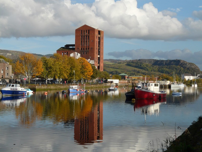
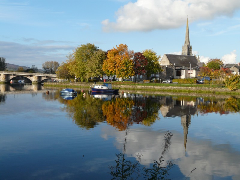
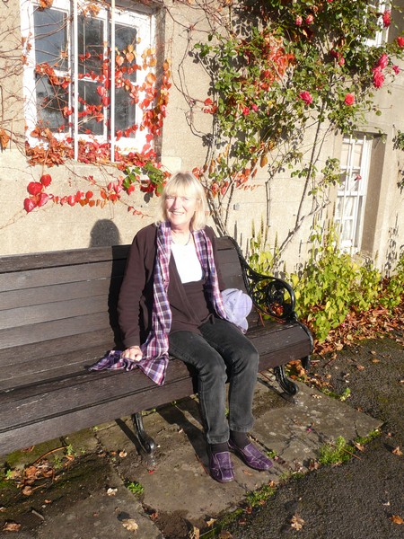
Lovely reflections at Dumbarton
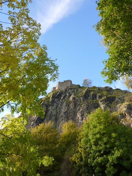
We finish at Dumbarton Castle (but still have a long way to go, on the website)
The website now carries on with Glasgow to Gretna Green