
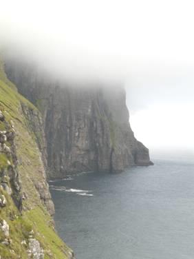
Friday 5th July We arrive in the Faroes 41 miles
We had about an hour’s sleep before having to vacate our cabin ready for our arrival at Torshavn at 3.00 am. It was almost dark – something we hadn’t seen for 3 weeks. We took our bags down to the van – they’d opened the doors to the car deck briefly. Foolishly we left our coats there, thinking that we’d be sitting in a warm lounge. We wandered around the deserted ship and finally found somewhere to sit in the ‘sun lounge’. Other people were here too, and some had a desire to wander outside – each time the door was pulled back, an icy draught blasted in.
The seats looked comfortable – appearing like solid black foam, but were in fact hard and very uncomfortable. After suffering this for a long time, we tried wandering about again, and then did find that one of the lounges was open. There weren’t many seats left, but this was a bit better, and it wasn’t long before we were called to go downstairs to our vehicle.
In fact, we were off the boat by 3.00 am. What to do now? We followed several other motorhomes, hoping that someone would know a place to rest up for a few hours. We started driving out of Torshavn, and the other vehicles started to scatter. We followed two, but they didn’t know anything either, and ended up stopping where we did – a parking area for Effo offices – a local petrol concern.
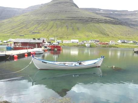
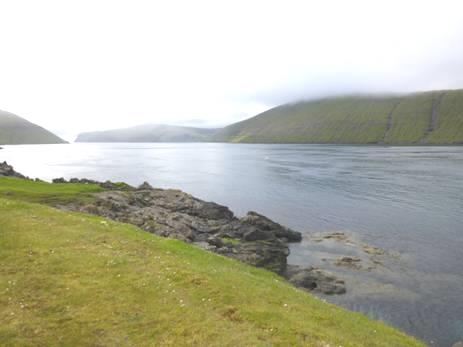
We managed to get a few more hours sleep, then drove back down into Torshavn to have breakfast. We parked opposite the pretty harbour, which we’d enjoyed on our brief stop here on the way to Iceland.
We had got the website ready to send, but things were difficult in setting it up.
We sent the email, and received several replies, including one from Hil, saying that she’d broken her arm badly.
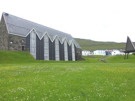
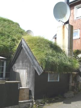
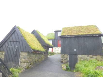
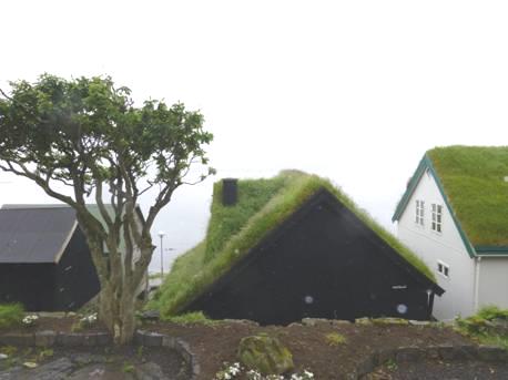
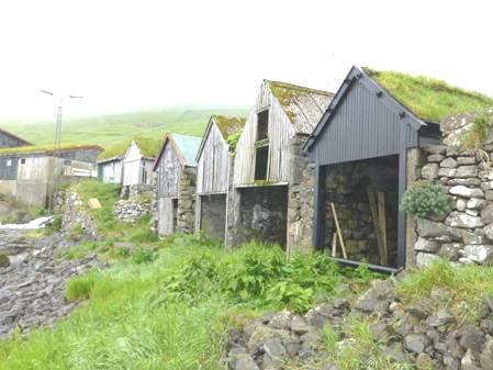
As we’d walked around Torshavn on our previous visit, we didn’t have the feeling of excitement of coming to a new place. We did enjoy all the turf roofs, and the number of trees. We located a shopping mall, as we needed to stock up. The outside looked like giant black painted warehouses, but inside we found a vast mall, on three floors, with all sorts of shops, and the supermarket we needed. All very nice, but just like anywhere else.
We’d heard that there wasn’t much fresh fruit/veg in Faroes, but this place at least had some. We were even able to buy fresh fish, which we hadn’t done in Iceland.
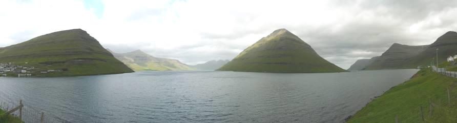
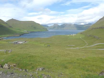
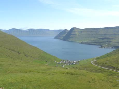
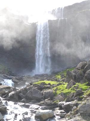
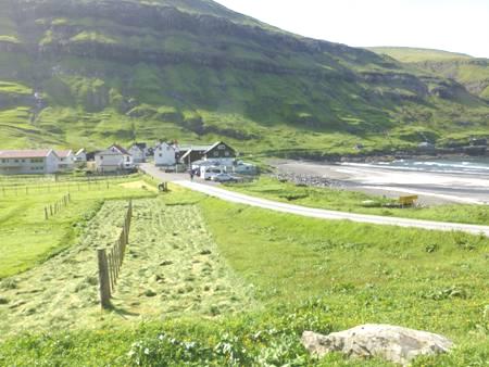
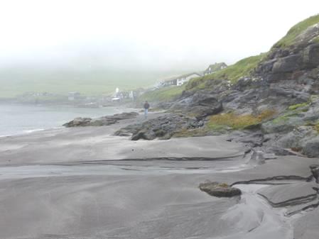
Now it was time to leave Torshavn, so we headed out. At first sight, it was like Iceland without the snow! There were just as many waterfalls – we wondered where they all came from, and decided that it must just be from the rain. Like Iceland, there was nowhere to pull off. Things are worse here, as free camping is apparently not allowed, and there is no ‘public land’.
The Faroes consist of 18 islands, nearly all of which are inhabited. Many are connected by bridge or tunnel, the outlying ones by ferry.
We immediately noticed more traffic on the roads, with impatient drivers. Everywhere was very green. Cloud cover was low, masking the top of the hills. We noticed that the many garden trampolines were weighted down with large full water containers – the windy weather explained that!
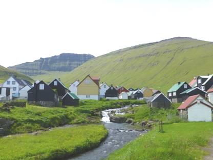
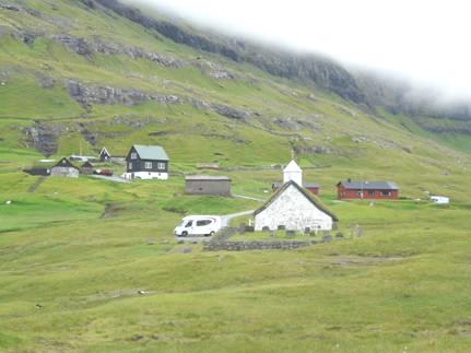
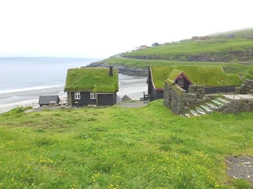
The road went through a 3km tunnel under the steep hills and came to Kollafjordur. The wooden houses were painted bright colours, and the little wooden church was painted black, with a turf roof and a tiny white tower.
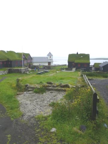
Our book said that a key could be obtained from the shop opposite, so we went and asked. A very helpful young lad and girl, who spoke good English, immediately tried to phone to get hold of the ‘little old lady’ who had the key.
Soon afterwards, the little ‘Olive’ type lady appeared, at the same time as 4 other tourists arrived to have a look. The lady didn’t speak English, but we made her understand that we had asked to look inside.
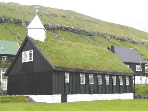
Kollafjordur Church
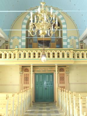
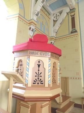
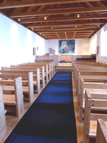
It was quite delightful, with rows of wooden pews, and a nicely carved screen. It seemed really well cared for. Like those in Iceland, steep stairs led up to a little balcony, where there was a tiny organ. There were two models of old ships near the wooden rafters. Adrian liked the wooden window shutters.
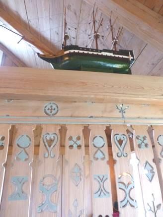
Carved screen and model ship, Kollafjordur Church
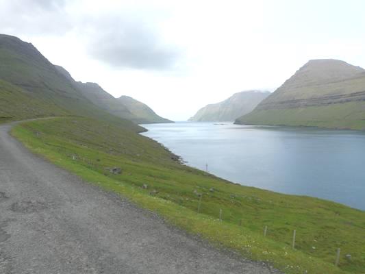
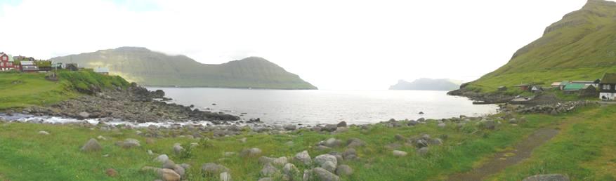
Now it was time to decide where to head for. There are not many campsites, so we drove up the eastern side of Streymoy (Torshavn’s island) and headed for the adjacent easterly island, Eysturoy. This is joined by a short bridge – another ‘bridge over the Atlantic’, and then entailed yet another tunnel (2.5km).
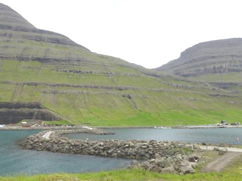
After following along a valley, we drove down the western side of Skalafjordur to Skala. The ‘campsite’ here was a parking area beside the stadium – very uninspiring, but at least looking across the fjord to another village, Skipanes.
A couple we had seen on the ship pulled in just afterwards, looking as unimpressed as we were.
We read through the last week of the diary, and then had a fairly early night after the disturbances of last night!
Saturday 6th July ‘Faroes – strong winds becoming gale force’! 77 miles
Well, most people only know the Faroes for the shipping forecast, and it always seemed to be associated with gales. We now know some of the reality! The rain lashed, and the wind blew all night. Sometimes there would be a moment’s lull, and then an almighty blast would engulf the van. It was quite scary.
We left early, before breakfast, not thinking that this forlorn place deserved the price it might have cost if someone had come. The only thing was, we really needed to get water, but hoped for the best.
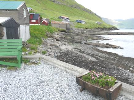
We drove south, through the pretty village of Innan Giyvur with boldly painted houses and church, and a harbour, but nowhere to park.
At the next place, Strendur, we drove down to the harbour and parked there to have breakfast, while the rain still lashed down. Another motorhome had overnighted here.
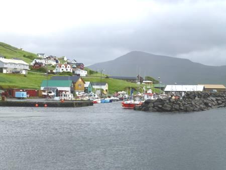
Strendur Harbour
Waterfalls were gushing everywhere, sometimes the water was spraying upwards with the wind! Some looked like giant waterslides.
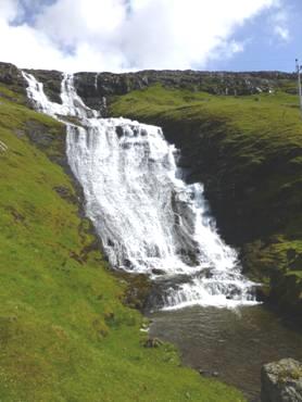
‘Waterslide’ waterfall
We drove to the bottom of the peninsula and rounded it, driving up to the end of the road at Selatrad. This tiny place (population 65) was really busy, with tents everywhere. Adrian spoke to one of the campers, and discovered that it was a scout campground (as we knew), and this was the annual camping get together for families. They all seemed to have survived the night OK, and the man did say that the weather had been extreme.
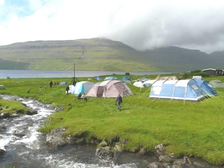
Happy campers at Selatrad
Water was streaming down the steep hillsides every few yards. We began our return journey, looking across Sundini to Kollarfjordur, on Streymoy, where we’d looked at the little church yesterday.
The weather now brightened, and the sun came out!! Everywhere looked much better!
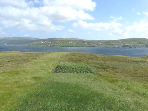
At the southern end of the peninsula we drove on to the extremity called Raktangi, from where we had wonderful views all around. We were amused at a little patch of potatoes being grown among the moorland grass. There was a monument erected in 1976 to all those lost at sea.
‘Potato patch’!
Back at Strendur we searched in vain for the knitting factory mentioned in our book – the Faroes, like the Scottish Islands, are known for their home made jumpers.
We drove back up the eastern side of the peninsula to the head of Skalafjordur and down the western side of the next peninsula, eating our lunch looking back to where we had stayed last night.
We drove right on down to Nes, where there was a cannon erected in 1990 remembering the British operations here in World War 2. A family came to eat at the picnic table, despite the strong wind!
The road now led across moorland on a very narrow track with a high drop off, to the other side of the peninsula. We drove down to Aeduvik, where there was a campsite, completely empty, at a lovely rocky cove. It was very blowy as we looked at the cove with just two small boats.
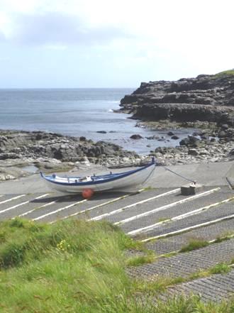
Aeduvik
We drove north to the small village of Ritvik, in a nice situation above the rocky coast before joining the road back to the western side.
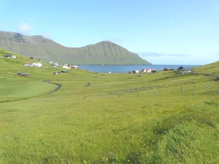
Just before we reached Runavik, we came to a lake set in the moors, with a gravel path surrounding it. It seemed a good place to go for a walk – most walks here entail continual steep ascents and descents. It was windy, but pleasant walking through the peaty, boggy ground, dissected by wet channels. We could see ducks and greylag geese on the lake.
Walking around Lake Tortavatn
We started driving back up the peninsula, taking a road across to the hamlet of Lambi, beautifully situated at the end of Lambavik between steep, grassy slopes.
We now drove north to the fishing town of Fuglafjordur, where we were hoping that there was a campsite, as one map suggested. There wasn’t one, or any real accommodation, despite this being the fourth largest town in the Faroes. We couldn’t even drive through the town, as a fete was being held, and the main road was barricaded off! It wasn’t the weather for a fete, being extremely gusty, and often raining.
On the other side of the bay, a road led to the only hot spring in the Faroes, although it is apparently only warm, and not inviting for a soak! We found the location of the spring, but it was way down on the shore, a steep climb. At this point, there was a whirlwind gust, and Adrian just wanted to get back to the bigger road. We looked down to the sea, and saw two ‘tornadoes’ in the water.
Having found nowhere to stop for the night here, the other option was to take the undersea tunnel to the next island, Bordoy, and head for Klaksvik, the second largest town after Torshavn. We had to drive through a 2.5km tunnel to Leirvik before getting to the 6km underwater tunnel. Adrian stopped at a petrol station to pay the toll, as he’d read, but this petrol station didn’t have tickets; you had to pay afterwards in Klaksvik!
At Klaksvik, we located the ‘campsite’ an odd bit of tarmac outside a kindergarten! Nobody else was here, although a car came later and a man asked Adrian about camping – there was a grassy area behind the building where there were a couple of tents.
Finding it all very strange, we tried to settle down to enjoy the lovely view across the fjord and down to the town while the weather continued to be variable!
Sunday 7th July Warming to the Faroes – and happy news, hard won! 32 miles
There were more violent gusts of wind during the night.
We left at 7.45 and drove down into Klaksvik, the second largest town in the Faroes, but the only life this morning was a person walking their dog, and a lady on a bicycle.
Klaksvik is in a wonderful position, on an isthmus between two fjords, with steep mountains all around, including the end of the island of Kunoy to the north. The houses, painted white mostly, were in tiers up from the harbour.
We had our breakfast looking to the harbour, and then made for the petrol station to buy our ticket for the tunnel. Adrian was asked if we were returning today. As we didn’t know, he couldn’t buy a ticket!
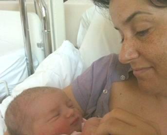
We then had a very difficult time trying to get an internet connection. We received a message on the phone from Tom saying that they were at the hospital, and that Mar was in labour.
At the point of giving up, we succeeded in getting a connection, and spoke to all our other children and grandchildren except Ruby, who was at the beach on this hot day in England!
We drove just outside Klaksvik and had late coffee sitting on a seat outside with sea and peaks all around, including the islands of Kunoy and Kalsoy.
Looking out from Klaksvik
We now drove north and crossed on a causeway to the island of Kunoy. There were a few houses at Haraldssund before a 3km tunnel, and then a 3km stretch of road to the only other village on the island, on the western side.
The causeway across Haraldssund
We didn’t bother with this, but drove back over the causeway, soon taking the 2km tunnel across Bordoy Island, emerging just above the tiny fishing village of Arnafjordur.
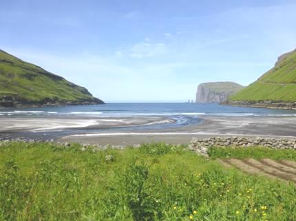
This little village is set between two tunnels, at the head of Arnafjardavik fjord. Although hardly given a mention in the guide books, we thought it the most atmospheric of any village, here or in Iceland. The houses were either white or rust coloured, with grey roofs. There was a beach of light coloured sand. Up behind were enormously steep green hills, with waterfalls gushing from them. Behind the beach, several picnic tables were weighted down with heavy rocks! A grandma and two little girls, reminding us of Louisa & Joanna, were enjoying the beach before sitting at one of the tables. They had written their names in the sand – Daniella, Hanna and Omma.
Atmospheric Arnafjordur
We would like to have had our lunch here, but there was nowhere level enough for the van. Not wanting to enter the second tunnel yet, we managed to pull on to a rough bit of ground just before it.
Then we entered the second single lane, unlit 2km tunnel, coming out south of the village of Norddepil. This is joined by a causeway to Hvannasund, on Vidoy Island. They are two pretty fishing villages, run as one village, although Hvannasund is much older, with more attractive houses (and a brightly painted children’s play area – stripey).

Hvannasund, with typical fishermen’s huts
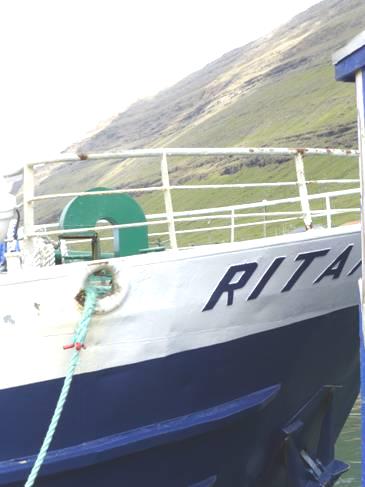
We drove across the causeway and parked by Hvannasund harbour and went for a walk around. It was sunny, with just a light wind. I had spotted a boat called Ritan, and as Tom & Mar’s chosen name for their baby is Rita, wanted to photograph it. The captain was on deck and called hello. He asked if we were going on the boat today. What we had taken to be a fishing boat, was actually the ferry to two of the islands – Svinoy and Fugloy. (no signs at all, of course). The boat was leaving in half an hour, and would take about 1 ½ hours today, he said. We were tempted, but as we had read that it is often very rough, and you might not get back, decided no!
‘Rita’ and the captain
We explained our interest in the name, and took a photo. The captain said that it was the name of a bird, but didn’t know it in English. We walked around some more – a few cars had arrived and unloaded several passengers – there’s a tiny bit of road and two villages on one island, and one small village and no roads on the other. We’d just got back into the van, when the captain came and knocked on the window – he had written down the name of the bird in Latin – it was a kittiwake, as we’d thought, the same as in Iceland. What a nice man! He said that he lived at Toftir, where we’d been yesterday. He was impressed that we’d been there, and knew where it was (near where we’d walked around the lake.) He said he went home every night; it was about half an hour away. It might be, but included four long tunnels!
We now drove north on Vidoy, on a road set high above the fjord, to the only other village, Vidareidi. This village, the most northerly in the Faroes, is again set on an isthmus, and is a surprisingly ‘normal’ village for such a location. The views are fantastic – to far northern parts of other islands to the west, and to the amazingly steep island of Fugloy to the east. To the north is the high headland, which ends in Enniberg the highest sea cliffs in Europe, possibly the world. Not for us to view – there are no roads there.
We made our way down to the shore on the eastern side – it was a bit like walking down to a cove in Devon or Cornwall. A row of tiny boats lined the track. In the steep cliffs flowers were growing – buttercups, marsh marigolds, daisies, ragged robin, thrift.
Line of boats at Vidareidi
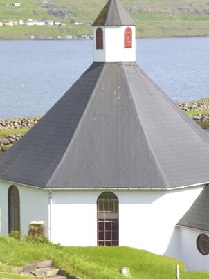
We made our way across the isthmus to the other side, where a tiny white church with red window frames, and a pretty grey tiled roof, stood. The vicarage was painted black, with a turf roof. Nearby was a nursery school, painted in bright colours.
Now it was time to return to Hvannasund along the road set in the steep green mountainside, but at least with a crash barrier.
We crossed on the causeway, back to Bordoy Island, intending to drive up the road on this shore to the supposedly abandoned farm of Muli. We started off on the narrow, badly surfaced road, high above the fjord – this time there was no crash barrier!
From the other side of the fjord, the place had looked inhabited – we had thought that it might have been somewhere to park for the night. As we couldn’t see much evidence of places to turn round, we thought it wise not to proceed!
Luckily, just before getting back to the village of Norddepil, we found a level place to pull off. Shaggy sheep greeted us. We had fantastic views of the steep hillsides, with the fjord below. Young boys came to play on the football pitch by the school just below us – it could have been Felix and his friends.
View from our overnighter, Norddepil
An old chap drove along the road and stopped to feed his sheep. Although the road seemingly only went to the derelict hamlet, several cars drove along it.
It was mild enough for Adrian to cook the fish for supper outside – the first time this trip. It tasted good, but we didn’t know what it was!
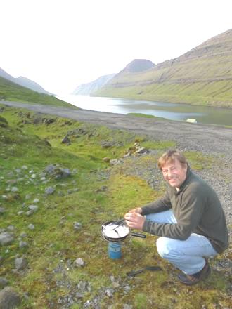
Happy Adrian!
An elderly couple walked a long way along the road and back. Adrian greeted them, but they hardly responded.
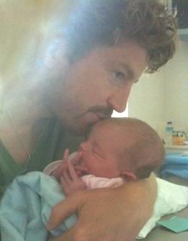
We’d received a message on the phone from Tom, but couldn’t read anything. We tried phoning him, but our phone wouldn’t work. We tried texting, but that said that it didn’t work either. Luckily it must have done, because we’d asked Tom to text us, which he did.
Our granddaughter Rita had been born – by Caesarean, but all was well!
We drank her health and were able to rest happy!
Monday 8th July Back through the tunnels 56 miles
The night was mild, but the gusty wind returned. It was a nice morning, but still gusty, so we ate breakfast inside.
Before entering the tunnel, we drove to Nordtoftir, which was just a few houses by what seemed to be a fish plant. We had a nice view back to Norddepil and Hvannasund, and could see a waterfall above us, right beside the tunnel entrance. Now it was back through the two 2km single lane unlit tunnels, with a brief glimpse of Arnafjordur in between. It wasn’t pleasant driving through the tunnels, as we had to give way in this direction, and Adrian found it difficult to see. At least there was ‘the light at the end of the tunnel’, as both tunnels were fairly straight.
We arrived back in Klaksvik and tried again for the internet connection we’d got before. We were lucky, and soon saw the photo of Rita that Tom had sent. We phoned him, and were able to share in some of their excitement – a special time. Tom sent some more photos, then it was time for us to move on.
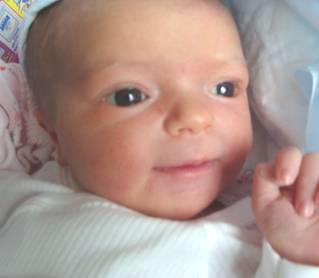
Rita
We located the Post Office, and sent off our card to them. This was opposite the church, Christiankirkjan – the only ‘sight’ in Klaksvik. It was a modern church, built n 1963, and yesterday had been a special service to celebrate 50 years. It was extremely high, with long windows in the simple wooden building. There was a very ancient font, and an attractive fresco behind the altar which used to be in the church in Torshavn. The verger was very pleasant, and chatted to us. Hanging high (too high to see properly) was a sailing vessel which had been used by the minister in the past to visit the outer isles, and had also survived a ferocious storm when two other boats with it had perished in 1913.
In the crypt were a series of relief pictures of the parables. It was nice to have visited.
Christiankirkjan, Klaksvik
We had no luck in finding the ‘booze shop’ to buy some bubbly to celebrate Rita’s birth, despite having the shop marked on a map. Alcohol can only be sold at official shops in the Faroes – there are 6 in the whole islands!
We drove south a short way to Nordoyri where there were just a few houses – presumably people who had moved out from Klaksvik. We had lunch beside the fjord near the ‘campsite’ we’d stayed at a couple of days ago. Afterwards we had a short walk though an area with trees to a little park.
Now 2.30, we drove back through the 6.3km under-sea tunnel – Adrian had bought a ticket at the petrol station - and arrived at Leirvik, on Esturoy Island. There were some Viking remains here. We had some trouble in locating them, and more trouble in getting there. There was no parking, and the nearby road was closed. We tried a car park by the church, but a funeral was taking place (presumably somebody important, as the flag was at half mast), and the car park was full. The bell tolled solemnly.
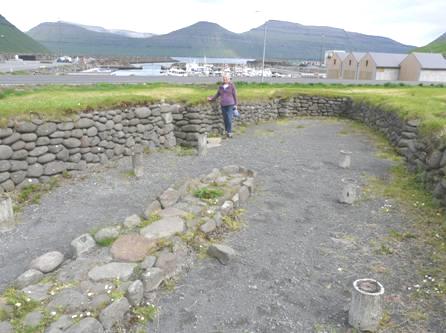
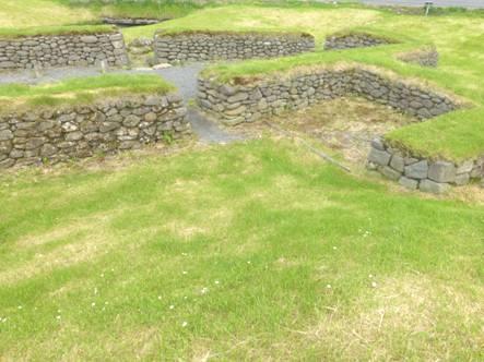
Viking ruins at Leirvik
We did find a spot – beside the Scout Hut! – so had our wander around these 10th century building remains, set in grass beside the water.
Now it was back through another tunnel (only 2km), then following the road round until we turned off to two villages in the north, driving down a long series of bends. We visited Oyndarfkordur first, a proud village of brightly painted houses, with simple tubs of flowers. The turf-roofed church here was painted white, not black, with green window frames. There were a lot of children and young people about, seemingly following some sort of paper chase. Noisy oystercatchers were on the beach. The thing to see here is the ‘rocking stones’ – two large boulders just in the sea, which apparently ‘rock’. We walked down a steep, rough path to just above the boulders, but the wind had become violently strong, so we didn’t linger.
Oyndarfjordur and Hellumar Oyndarfjordur
Hellumar, on the other side of the bay, was just a small collection of houses painted white, green or black – most were two colours. The small church here was white too, with red window frames and a green corrugated roof. We walked down to the shore. There is no sign of fishing now, but a few old fishing huts remain. It made us think of some English fishing villages.
We had to drive south from here, before taking the road back north to Elduvik on the eastern side of Funningsfjordur. The weather, which had been pleasant today, now deteriorated, and became really wet. We arrived at a simple little campsite by the shore, with a cluster of houses around, painted in black and rust, some with turf roofs.
It rained and blew all evening. We started editing the Faroes part of our trip.
Tuesday 9th July Enjoying villages in the sunshine 44 miles
The night was calm and mild, and the morning pleasant - not warm enough to sit outside for breakfast, as we’d hoped, especially as there was a picnic table by us.
Panorama from our campsite at Elduvik
Adrian filled the water tank (it was too wet to do so last night)
The sun now came out, so we set off to walk around this lovely area. First we walked along above the sea on a track, which ran out when we came to a stream. Beside us grew ragged robin, buttercups, marsh marigolds and a few wild orchids. We then walked along the valley until the track ended, passing a potato patch. Oystercatchers stalked us noisily, and whimbrels were circling. It was beautiful and peaceful. We didn’t leave until 10.30. It had been a lovely place to stay, and as Adrian had thought, seemed to be free.
Looking back to Elduvik from the valley
We drove back up the hill, stopping for coffee with a view to Funningur, across the fjord. Again it was beautiful, with sheep around us.
We continued driving high up, down to the head of Funningsfjordur, through a village of the same name, then up on the other side of the fjord on a lower road to Funningur. We walked around the village in the pleasant sunshine. The houses were painted in muted colours – black, white, red, green or brown. There was yet another black tarred, turf roofed wooden church beside the sea. A man was strimming the churchyard. Cornflowers were out, and there were tubs of dianthus. Old fishermen’s huts stood near the harbour, but fish farms were the thing now.
Looking down at Funningur on the way to Gjogv
We zigzagged up to a single track road, amazingly high, and drove on to Gjogv, in the north of Estoroy. This is supposed to be one of the prettiest and most visited villages in the Faroes. The houses were smartly painted in similar colours to Funningur, and the whole village was pleasant, if a bit smart. We sat on rocks by the van to eat our lunch. A stream ran down through the village, opening to a small pool just below us. People were playing here. A couple of small boats had been made out of opened-up plastic barrels and wood, and children were having a great time being pulled across the water. Young mothers were walking with prams – something very common here, despite the terrain often not being suitable. It was a nice village, making us think of popular villages back home (but no ice-creams or tourist shops here).
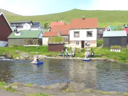
Colourful Gjogv and its fun pond
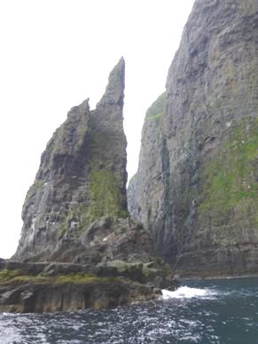
We ascended from Gjogv, taking the road across the high barren green hills to Eidi, on the western side of the peninsula. Shortly before reaching there, we stopped by a splendid viewpoint to two tall offshore stacks, Risin and Kellingin, beside the giant perpendicular cliffs.
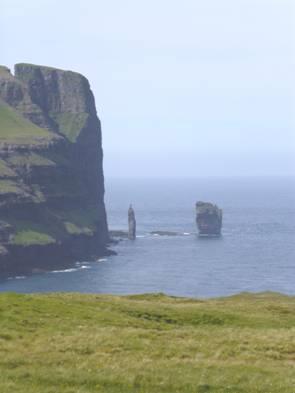
Rock stacks Risin and Kellingin
As we proceeded towards Eidi, a lorry blocked the road while it was being filled with earth by a digger. We had to wait until he was ready to go.
The houses in Eidi were mostly painted white, with coloured roofs.
Keeping up with the times!
We parked beside the white stone church, with green paintwork and a pretty grey tiled roof. Inside it was delightfully prettily painted. The wooden pews and pulpit were carved and painted, and two model boats were suspended from the ceiling.
Prettily painted Eidi church
After a short walk around the village, we drove south around Sundini, crossing the bridge to the western side of the fjord, on Streymor Island.
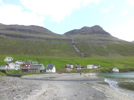
We drove northwards here, passing Haldorsvik, with its octagonal church, and houses painted in white, green and black. We’d passed many waterfalls, one was the highest in the Faroes, 140m, and was quite splendid.
Haldorsvik octagonal church The Faroes’ highest waterfall
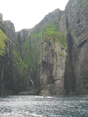
The road now became very narrow in places as we drove on high above the fjord to Tjornuvik. This little village must rate as one of the loveliest in the Faroes. It is hemmed in by tall, steep mountains on three sides, with the sea at the other. Waterfalls cascade down from the high mountains, and a stream flows out across a wide beach of mixed black and white sand. Looking back across the water, we could see the two huge rock stacks - a hole in one of them was visible from this side.
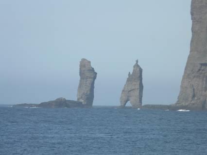
Top spot Tjornuvik with another view of the rock stacks
There were just a few houses, and behind the beach two people were busy stacking grass on to racks to make hay.
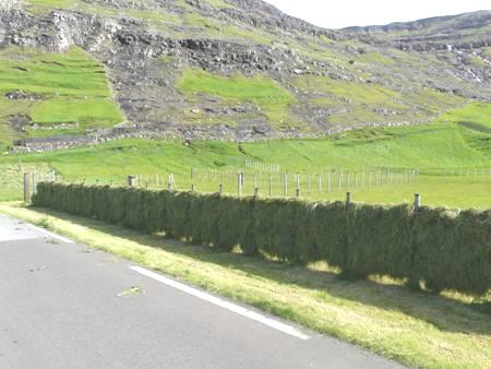
Haymaking Faroese style
We had a lovely wander around in the sunshine, scrambling over rocks to the beach, as there wasn’t any access. We walked on to see some Viking burial chambers in a tiny corner beside the road – but like everything here, without great signs telling you!
We now drove back along the narrow road, luckily not meeting any other vehicles, stopping just before Haldorsvik at a parking area we’d noticed earlier, beside the fjord.
Wednesday 10th July Wonderful places in variable weather 83 miles
We left just after 7 o’clock, as we had a lot we wanted to fit in today. There was low cloud, but it was still, so the reflections in the water were good.
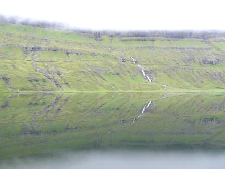
Early morning reflections in Sundini Fjord
We drove south beside Sundini Fjord to Hvalvik, here we took a road going across Stremoy to the tiny place of Saksun (pop 30). We followed Saksunardalur, where there was nothing except the steep grassy sides of the valley.
It was a strange sensation as we followed the stream which was flowing south eastwards, as we appeared to be travelling downhill! We then joined the stream which flowed north westwards, having started as a waterfall. Saksun is set in an amazing situation, like a giant amphitheatre, with steep sides towering above with dozens of waterfalls. There was a tiny turf-roofed white church sitting in prime position above a lagoon. We walked out over the boggy ground, where small buttercups and other tiny yellow flowers covered the ground, with white cotton grass in the damper places. Oystercatchers noisily flew about and shrieked if we got near to their nests.
We sat on two rocks to have our breakfast amongst our green, black and grey world. It was a magical place, which can’t be captured by photos, as the view was all around.
Saksun in its beautiful setting
It was drizzling as we returned along the valley which turned to rain. A rabbit ran across our path – and then we saw a police car parked on a track – both such unusual sights here.
Back at Hvalvik, we drove south on the road we had travelled up on our first day in the Faroes, passing the little church at Kollarfjordur which we had visited, before taking the 5km undersea tunnel toVagar island. We arrived here in thick mist, with an eerie rainbow.
We headed for the airport to enquire about helicopter flights to the island of Mykines – a bird paradise. We found out that no flights were going today presumably because of the weather – in fact you can only fly there and back on a Friday! We drove on to the town of Sorvagur, where a ferry leaves from for the same island. We drove down to the harbour, but saw no signs of a ferry boat, and no signs whatsoever. On investigating, we found that no sailings were going today, so our idea of going to Mykines was off! We had read that you might not get back, even if you got there, because of unpredictable weather.
We found a place to stop near the football pitch, in front of the sea, and had an internet connection, so were able to phone Tom again. By then, it was time for lunch.
The mist lifted and then returned, as we drove on past Bour to the 1.7 km barely lit, single track tunnel to Gasadalur. This hamlet is set 150m above the steep cliffs. Before the tunnel was built in 2003 it was only accessible by the ‘post route’ – climbing up over the steep, high hills. The few houses, mostly turf roofed, are set on the only ‘flattish’ ground. In one of the buildings was a tourist information. We went in and spoke to the young girl, Elisa. She is studying linguistics in Copenhagen, and told us that young people had to go outside the Faroes if they wanted to study. Many don’t return, but she hopes to, although she doesn’t know what she might do then. She said that only about 10 people resided and worked in Gasadalur, the others were retired, or had holiday homes.
Remote Gasadalur
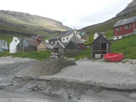
We drove back through the tunnel to Bour, where we parked and walked through the narrow streets of the little village set above the sea. Many of the houses had turf roofs. A waterfall reached the sea beside the little church (1865). There were small pots of flowers. It would have been even lovelier in the sunshine.
Turf roofs at Bour
We found our way down onto the beach of dark/light sand and walked along in the ‘mizzle’. There was just one puffin in the water, and two razorbills. The drizzle got heavier, and the visibility came and went – mostly it went! We could just make out the two tall sea stacks, but couldn’t see the island of Mykines.
Bower on the beach at Bour Old fishermen’s huts
A group of young people were clearing up – we imagine that there must be an employment scheme like in Iceland.
We didn’t leave here until gone 5.00 pm, as we’d agreed to go back to our lunch spot at Sovagur to overnight, and were pleased at the thought of having an internet connection there. Imagine our surprise and dismay to reach the parking area beside the football pitch to find it busy with people setting up a ‘fete’. On looking through our books, we found out that it must have been the two day ‘Western Isles’ festival which is held in mid July! Incredulous, we recalled other similar times on our travels, but now we had to think what to do.
There was a so-called ‘campsite’ at nearby Midvagur, but this turned out to be just a small area of grass, and a tiny bit of tarmac. We carried on through neighbouring Sandavagur, turning off to visit the site of Trollkonufingur (lady troll’s finger). This entailed 2 km on a hardly surfaced road and then a ’10 minute stroll’. The surface of the road deteriorated, until we stopped high up on a headland, and then walked across a field way up above the sea (luckily with a fence at this point.) We could see no evidence of the ‘finger’, although the weather had brightened quite a bit. Not wanting to give up, we continued on a tiny vertiginous path, reaching a stream which cascaded into the sea. We had to cross this stream on a few boulders (much assistance from Adrian) before the path continued. Still no sign of the ‘finger’ – but a bit further on, we could see the base of a large rock – the mist was still on the upper part – so we never did get the sight of the troll’s finger!
All we could see of the ‘Troll’s finger’
We drove back down the track, and across to the north of the island, where the tunnel goes back to Stremoy. In the other direction was a short bit of road which had led to the ferry at Oyrargjogv before the undersea tunnel was built in 2002. We thought that this might be a good place to stay. There are just three buildings here now, but there was a group of young people about playing – we thought that maybe it was a hostel. A little way back, there was a place beside Vestmannasund, so that’s where we pulled in. It was now 7 o’clock, and the sun was shining! It was very beautiful, with just green slopes and sea all around us.
View of Vestmannasund from our last overnighter
Even so, we were surprised by the number of people running up and down and the cars which went past.
Thursday 11th July A foggy Faroes farewell 67 miles
We were disappointed to wake to a morning of low cloud, as we intended visiting the bird cliffs at Vestmanna today. We left at 8.45 and drove through the tunnel under the sea to Streymoy island, driving on up to Vestmanna over the hills. These were in thick fog, but when we reached Vestmanna, it was clear, with low cloud.
As usual, there was a lack of signposting to tell you where to go, but we located the tourist information, and had to wait a seemingly long time while others were being seen to. When our turn came, the efficient young lad said yes, there was room on the 10 o’clock trip, and the weather was good!
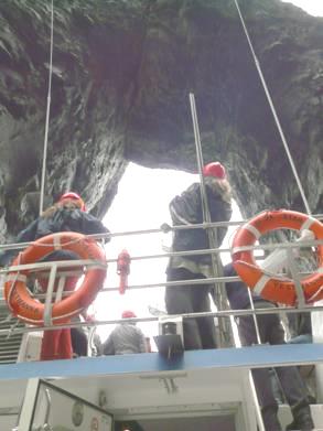
It was now 9.40, so we prepared ourselves for the two hour trip, then made our way to Silja Star, the little boat that was going to take us up the coast.
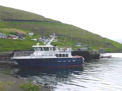
The Silja Star
At about 10 o’clock, two chaps arrived and then we were on the boat, and off on our trip – no formalities or safety warnings. The trip was good, but more of a tourist trip than a bird spotting adventure. The scenery is certainly phenomenal, with sheer cliffs, enormously high. Any slightly level bits had grass on them, and we were amazed to see sheep grazing at these ridiculous heights.
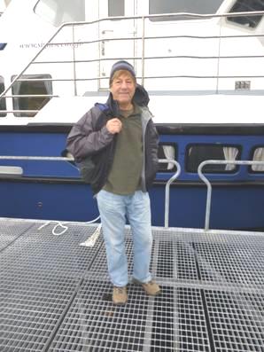
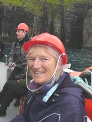
Off on a boat trip We had to wear hard hats
We first had to sail out of the lovely long inlet which Vestmanna lies in, then it was up the northern end of Vestmannasund and out into the sea. We could see birds nesting high above us – guillemots, fulmars and kittiwakes, but it was difficult to get a close look at them from low down. We didn’t see any puffins, so we were glad that we’d had our super viewing in Iceland.
The Vestmanna bird cliffs
The real excitement of the trip was dashing in and out of the ‘grottos’, in places which seemed much too narrow for our boat. Twice we went under high rock arches. We had started off sitting inside, but spent all the ‘action time’ outside at the back of the boat – we didn’t venture on the top deck.
We returned inside for the journey back, arriving just after midday, where the next group – a coach party – were waiting.
We’d seen T-shirts in the tourist information, so went back to have a look. None really appealed to us (and they were expensive), but we did see that lunch in the cafe was reasonably priced for fish soup and salad, so that’s what we did, and it wasn’t bad.
Now it was time to leave Vestmanna in its attractive bay, with a waterfall cascading at the end.
The weather was even foggier on our return journey on the high mountain road. We turned off to drive down to Kvivik, an attractive village with pretty houses mostly painted white at the base, with rust coloured or black upper parts. The little church here is renowned as the place where the priest in 1855 gave his sermon in Faroese, not Danish, which shocked everybody. It was about a hundred years later that Faroese was accepted as the official language. The foggy weather didn’t entice us to explore, but there were more Viking ruins here.
The road we took out of the village wound steeply up the high hillside, with no barrier. In the poor visibility, it was quite scary. We’d back-tracked on ourselves, so then had to drive once more along the densely foggy mountaintop.
We were now near the tunnel entrance, but took a road going south, and soon came to a delightful little village called Leynar. This was less foggy. Black turf-roofed houses stood just behind the sandy beach. We walked down and right along the beach, as whimbrels called and other birds circled overhead.
Leynar
We left this lovely place, and started to drive on to Skaelingur, where the road ended, but we were higher up, and it was in thick cloud so we saw no point in continuing. We took a short tunnel towards Torshavn, stopping at the petrol station to buy our ticket for the sea tunnel we’d been through. We were taking the old road back to Torshavn, which winds high up in the hills. In good weather this must be glorious, but in thick fog, we couldn’t see a thing - it could be anywhere. Just a couple of times, the fog lifted briefly and we glimpsed the wonderful sight of the ends of fjords far below.
We tried turning off to Nordradalur, but it was too foggy to see anything, so we continued towards Torshavn. Just before there, we came across a digger and JCB blocking the road with road works – extremely scary in weather like this.
We drove on past Torshavn to take the road to Kirkjubour, in the far south of Streymoy, turning off first to zigzag down to Gamlaraett. There is nothing here at all except a harbour for the ferry to the islands of Sandoy and Hestor. The good thing was, the weather was clear. A ferry arrived while we were there, and a lot of vehicles came for it.
Then it was on to Kirkjubour, which is supposed to be a tourist destination, as it has the remains Magnus Cathedral, dating from 1300. For a tourist spot, it doesn’t go out to woo the crowds – there are virtually no facilities. All the houses are turf roofed and painted black, with red window frames. Ancient walls have been built on during the centuries, and the cathedral itself is under scaffolding at the moment.
Kirkjubour
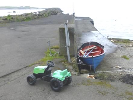
It appeared a very ordinary little village. We went inside the church – typical of so many – beautiful in its bare simplicity. It’s apparently the oldest church in use in the Faroes, dating from the year 1111. Outside, young boys were noisily playing with pretend swords. By the shore, a family of ducks and 2 swans swam about. A tiny boat was tied up, with a child’s tractor beside it, and other kids toys were scattered around. This seemed a fitting place to have our last memory of the Faroes – wonderful even in the drizzle.
Old and new
We drove back up the coast to Velbastadur, a workaday village above the sea, where even the school was turf roofed, but it was too foggy to go further. We resorted to Adrian’s satnav to find the road back to Torshavn.
Then it was down to the practicalities of our ferry journey to Denmark. We found a small shop to buy one or two goods, sorted the ‘emptying and filling’ of the van, and generally got ourselves organised for our 3.30am (!) departure, eating our supper overlooking the sea.
We drove down to the harbour, and both managed a bit of sleep (it was actually quite dark at eleven and was still not light when we boarded).
Friday 12th July Sailing back to Denmark
When the time came, we boarded the ship and climbed the never ending stairs to our cabin. We found it with no problem, and we were in bed by the time we left at 3.45am.
We slept some more, and woke to find it still foggy. There was no stool in our room, and Adrian had just gone to ask about it for the second time, when someone arrived with it (I had just gone into the shower).
Our cabin was positioned near to the lift which went straight down to the swimming pool, which was handy – but it was a long way from the car deck!
The sea was calm today, so the pool wasn’t sloshing about like before!
The captain announced that the crossing would be calm, and that the fog might clear by late afternoon. It cleared much earlier, and we were able to see the Shetlands quite clearly as we passed at about 1.30. It was sunny on deck, but very windy, and also very busy. We didn’t stay long. We looked in at the shop, where once again we weren’t inspired by the T-shirts, and just bought some wine!
Sailor stripes
We carried on editing the website diary and soon it was supper time. Where to eat? None of the options attracted us, but we settled on the ‘Dimmer Sin’, where we ordered just starters – lobster soup for me and seafood tapas for Adrian. This turned out to be half a lobster, king prawns and several other delicacies. With a small salad, it made a nice meal, and was beautifully presented. We ordered aFaroes beer, which I liked. With the last swig, Adrian encountered a tiny bit of glass. On bringing this to the attention of the staff, we were given another beer, and vouchers for a drink in the lounge each! We proceeded there, and ordered a Bacardi & coke and a tequila (the voucher wasn’t valid for more expensive cocktails).
We enjoyed these while listening to the male singer/ guitarist, who was joined by a lady vocalist – mostly Beatles songs, with one or two from the Faroes. They finished after 11.00, and we came up to our cabin.
Saturday 13th July We arrive back in Denmark 125 miles
While clearing up the cabin ready to leave, Adrian discovered that the bottom bed folded up to reveal a sofa! We had joked about us finding that the table folded up to reveal a sink at the end of a six day train trip in South Africa, but this was as good!
We had to leave the cabin by 9.30, two hours before arrival, so got ourselves organised, and found places to sit in the lounge, amongst the noisy hordes of Faroese going on holiday. We spent any spare time trying to finish the website.
We have been really lucky that the boat journeys have almost all been smooth
We were off the boat by 11.15 (12.15 Danish time). We had a glimpse of the turquoise sea and white beach as we made our way to the motorway.
We wanted somewhere to stop for lunch, but didn’t pass any rest areas, so turned off, and stopped near a roundabout.
The sky was blue, and the slightly undulated scenery very green as we continued - passing lots of rest areas now!
We made our way to my old Bishopshalt school friend Val and her husband Erik’s home at Silkenborg, where we sat outside in the garden, and later ate supper outside. I’d had a skype conversation with Kath in South Africa – another school friend.
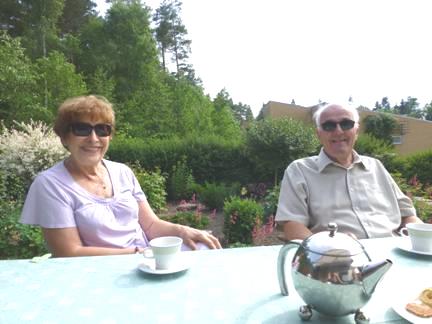
Val and Erik in their garden
After more chatting and reminiscing inside, we came out to sleep in the van.
Sunday 14th July A great day spent with friends
We enjoyed a lovely long breakfast with Val & Erik before going out with them in their car.
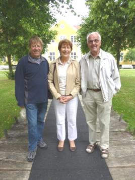
Adrian, Val and Erik at Silkeborg museum
We drove down into Silkeborg and visited the museum, which had a lot of interesting things, the most important being the amazingly well preserved ‘Tolland Man’ – an ancient figure dating from the 5th century BC.
There was a special ‘blue’ exhibition, which I really loved, so it was a real treat for me – blue glass, blue material hangings, blue and white china – an absolute delight.
Part of the blue exhibition in Silkeborg museum
We were then driven to the local beauty spot - Himmelbjerget near Ry – very busy today – an area of lakes and trees, with one of the highest points in Denmark, which we walked to. We ate lunch in the superbly sited restaurant/hotel, where Val & Erik had stayed after their wedding. There were wonderful views down over the lake. We sat inside, as the weather was a bit windy, but still had good views, and the food was really nice, including raw herring.
At the highest point in Denmark
We came back to the house for more chat, looking at some of Ken Pearce’s books on Uxbridge and Cowley.
We had a chat on skype to Tom & Mar, seeing little Rita, which was great. We also chatted to Paul & family on skype. All were experiencing really warm weather.
After another lovely supper, we chatted until time to come out to the van.
Monday 15th July Last Ferry Journey 107 Miles
After another lovely breakfast, Erik drove us down into Silkeborg to buy two ‘beach seats’, like the one he had just shown us.
It was 11 (10) o’clock when we said our goodbyes, after a really lovely visit.
We drove through pretty country, pulling into a layby near Ry, where the air felt warm, and the vegetation looked far more English that that we’d been seeing for the past month. We could imagine that we were on our way through France.
Soon we reached the motorway.
We stopped at a rest area near Horsen for lunch. It was busy with families – the children were making good use of the play area.
Then it was on to Esbjerg, where we joined the queue for the ferry.
All went well – there was even someone directing us to our cabin.
We settled in, then went on deck as we left Esbjerg. Our fish and chips meal in the cafeteria could only be rated as average. A person dressed as a pirate was trying to enthuse children about various activities, but as they were speaking English, and the children appeared to be Danish, it was rather painful.
The sky was clear, and we were looking forward to a sunset, but the sun went into cloud just before setting. It was dark by 10 pm.
Tuesday 16th July Home to Hermitage 158 miles
It was a misty morning, but the sea was really calm – we have been so lucky with all our boat journeys.
We must be getting used to all this sea travelling, because before we knew it, we were arriving at Harwich at midday. We’d been trying to get the website ready for when we got home.
We were struck by all the trees everywhere and by the vibrant floral displays as we drove towards Farnham Common, where our friends John & Judy just happened to be having a barbecue today! We spent the rest of the afternoon with them and other old ‘Bishopshalt’ school friends, sitting in their lovely garden in the warm sunshine. We’d arrived back in England during a heatwave, but we weren’t complaining! At 7 o’clock, we left for home, arriving back in Hermitage at 8.00 pm after a superb six weeks in Iceland and the Faroes.
Impressions of Iceland
Amazing scenery
Waterfalls!
Snow lying everywhere
Sheep everywhere
‘Laid back’ feel
Vistas
Sagas (legends), poets and writers
Museums
Swimming pools in every village
No darkness
Glaciers
Geysers
Arctic terns
Rivers/streams
Lakes
Lovely camspites
Days start late (most shops open at 11.00 am)
Impressions of Faroes
‘Iceland without the snow’
Very pretty - need good weather
Incredibly steep
Amazingly high winds
Much drizzle, fog, low cloud
‘No free camping’ (but we did!)
No real campsites – just parking areas by school etc
The Faroes to Home


