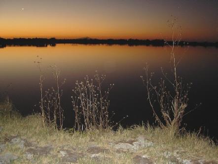
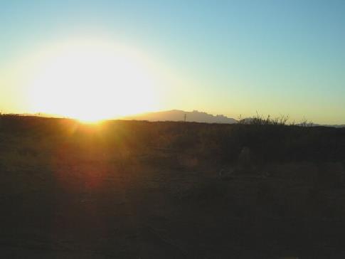
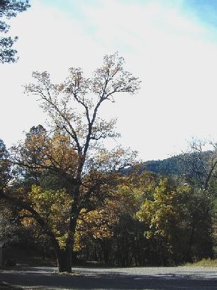
It was a warm but grey morning. I had slept well, but a lorry had come in and was running its engine – luckily it wasn’t there all night! We tried listening to American radio but it was all rubbish! We had breakfast, and left at 8.45. We had seen a stick insect outside.
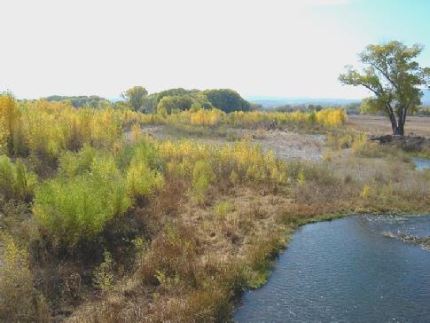
We drove through Coleman, which looked like so many country towns. We took a different road out of it, but were pleased that we did, because soon afterwards we saw a beautiful scissor tailed fly catcher. We had seen one in Texas last April. Later we saw a whole flock of them.
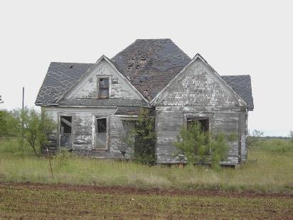
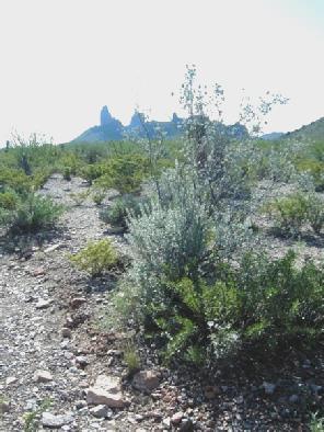
It still looked very wet everywhere, with signs of having been flooded. On one of the smaller roads, Adrian took a photo of a once fine, but now derelict house. Nearby was a flower looking like sea holly, which he also photographed.
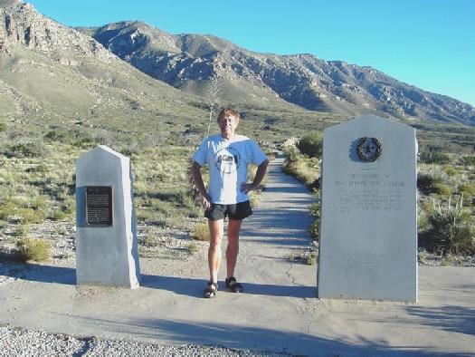
We joined the 283 south, and were excited to see our first ‘Historic Marker’. (we had always had a joke about these) This one was on the Western Cattle Trail, and was really interesting. The drizzle turned to rain briefly, but the day stayed mostly dry, and nicely warm.
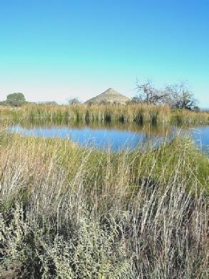
We took a small road to Brady Lake, where we sat outside on our seats to enjoy our tea and coffee. It was pleasant and quiet and we saw several birds, including a grey heron. You could camp here for $2.50.
We carried on south past Brady, on smaller roads. We came to another Historical Marker, but both felt sleepy, and slept for half an hour!
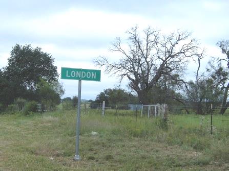
We should have had our lunch here, as we now found it hard to find anywhere to stop. We finally pulled off onto the verge and had lunch, just before we joined the 377 at a little place called London! I had to photograph this! Apparently it was named after a homestead called London, in Kentucky.
Saturday 11th October 52 miles
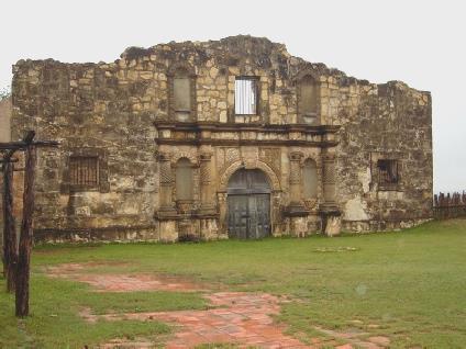
A very wet day! It was grey when we awoke, but by the time we wanted to go into the Alamo village it was raining really hard. We had busied ourselves with various cleaning jobs, washed our hair, and enjoyed a breakfast of the last of the French crepes.
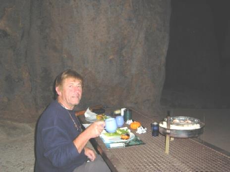
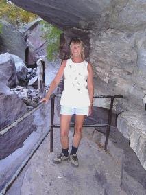
As there was no point in rushing into the village, we worked on editing and amalgamating the videos of Simon and Laure’s wedding. By about 10 o’clock, the rain had eased off a bit, so we proceeded the 2 miles of mucky dirt road into the ranch. We looked around the mock Alamo setting first, treading carefully through the glutinous mud. The only people about were 2 workers from the site, who we chatted to briefly.
Seen better days!
We drove on through interestingly named Junction, then took a road following the South Llano river. We stopped briefly at the State Park, but didn’t go in. It is noted as the home of wild turkeys.
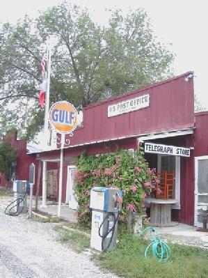
Another interesting place name was Telegraph, where I took a photo of the ‘historic’ (1900) Post Office.
A bit different from its namesake!
The ‘historic’ Post Office at Telegraph
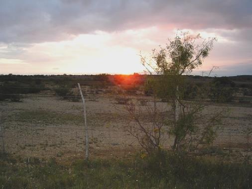
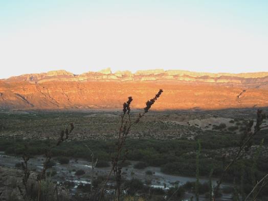
After an erratic day of weather, the sun peeped out gloriously before it set. We enjoyed a supper of Mahi mahi fish, which we had never heard of before!
Surprise sunset after all the rain
The film-set Alamo
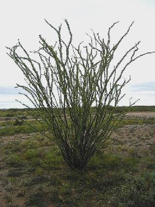
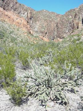
I also photographed a strange looking bush which attracted me.
We enjoyed a meal of fish, vegetables and rice, while the rain continued, then we did some more editing of the wedding video.
A beautiful black swallowtail
We soon find out what this strange bush is
Sunday 12th October 185 miles
It was grey and drizzly. We had breakfast and left at 8.30. We were pleased to see several deer as we set off to drive the mile or so of very wet unsurfaced track back to the road.
We were able to dump at another Park area nearby before continuing westwards through this remote country which reminded us of the Karoo or the Nullabor.
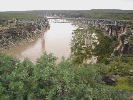
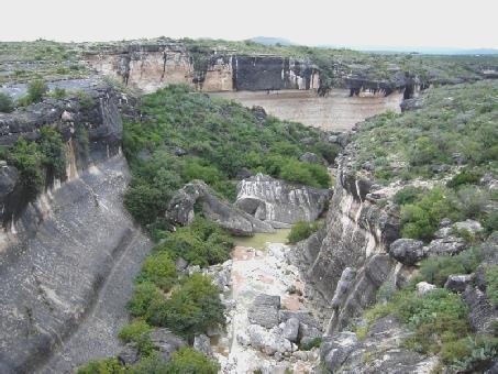
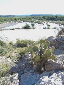
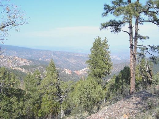
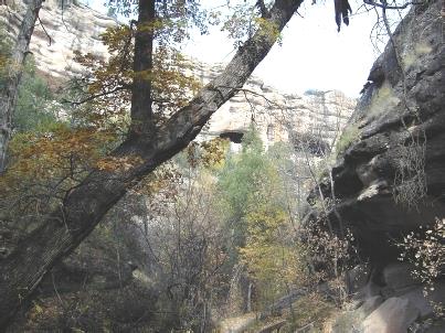
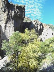
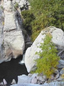
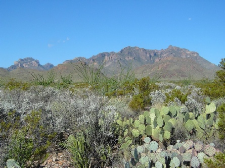
We stopped at Seminole Canyon and went into the excellent Visitors Centre, where there were detailed exhibitions of the area. There are apparently many ancient rock paintings in the canyon. There were walking trails, but the canyon itself could only be visited by a guided walk. Although one should have been leaving at this time, I don’t think it was running because of the ‘inclement weather’. We decided not to linger here, and so made our way a bit further along the road where we stopped at an overlook to the ’highest road bridge in Texas’, over the Pecos River, just before it joins the Rio Grande. The views were great, but it was still very grey. We had our tea and coffee sitting in the cab before driving down to another viewpoint of the gorge. There was a huge parking area here, but we were virtually the only takers! We walked along a short plant trail, the surface of which had been partly washed away by the rain.
Back on the road, we stopped once more – by the bridge itself. It was now midday.
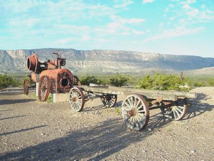
A bit further on was another viewpoint where we were able to look out over 360 degrees of wilderness. We stopped again by Eagles Nest, where I took 2 photos of the scoured out rocks from the bridge, which shook like anything when lorries drove over it.
We turned off now to Langtry to visit the FREE ‘Roy Bean’ centre. This man gained fame, or notoriety, when he acted as self styled judge of the town of Vinegaroon which came about when the railway was being built in the late 1800s.
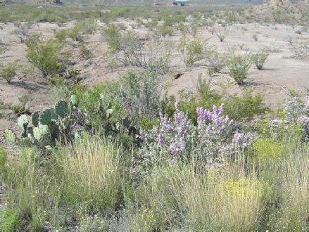
This ‘museum’ got full marks from me – there were dozens of free Texan leaflets as well as exhibits about the man and the ‘town’. Outside, 2 of his original buildings remained – the saloon, and his house, which he called the ‘Opera house’. There was a nicely laid out plant trail here too. We had heard conversations saying that they had had a whole year’s rain in the last few days, but this had meant that things were flowering.
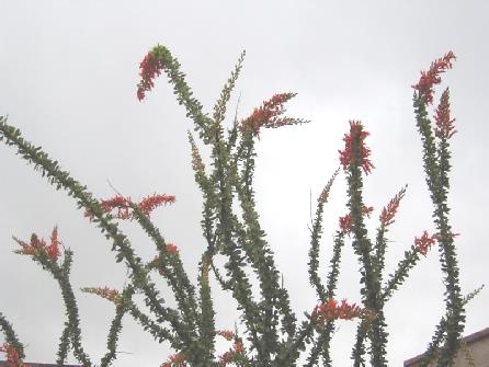
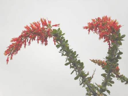
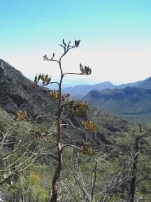
We had found out that the plant I had photographed last night was called Ocotillo, and in the grounds, one had burst into flower with long bright red racemes which looked quite stunning.
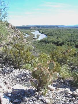
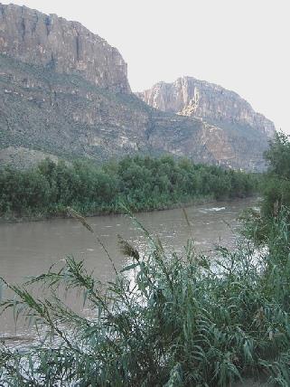
The Pecos River just before it joins the Rio Grande
Before we went in, we were able to get through to Emma on the phone, and speak to both her and Felix (who said ‘I’m not going to America, I don’t know America’), so that was a bonus.
Now being nearly 2 o’clock, we ate our lunch in the Bam outside the centre, and while Adrian snoozed afterwards, I looked through the newly acquired leaflets.
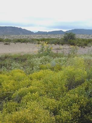
We left here at 3 o’clock and drove through more miles of nothingness looking even more like the Karoo. Often the ground was a yellow carpet with the wild flowers.
We drove through Dryden, which was like a ghost town, and Sanderson which wasn’t much better. We had stopped just before here for a cup of tea.
More wilderness miles, then at Marathon we got some fuel, as we were turning off to Big Bend National Park.
At 6 o’clock we pulled into a rest area for the night, surrounded by this ‘splendid isolation’.
We ate minced beef tacos then edited more of the wedding videos.
Rest Area on the 385 to Big Bend south of Marathon
Ocotillo in its full glory
Monday 13th October 92 miles
We awoke to a greyish day but the clouds broke up a bit, and we couldn’t have imagined what a hot and sunny day it was to become!
We had breakfast and left just before 9.00. The lighting on the hills was wonderful – at one point, the hills ahead were lit up and it felt like travelling to the land of Oz!
We reached Big Bend National Park and in the Visitors centre purchased an Annual Parks Pass for $50, and as it was $15 for this park, we are sure that we will get our value from it.
We found that many of the roads in the park were closed because of flooding. We tried to stop at a picnic area just after the centre, but discovered that the road to it had been washed away!
A bit further on we stopped by the trail to Dog Canyon and had our tea/coffee. We thought that we would walk the 2 mile trail to the canyon, but after only a few yards we found that the track was so muddy (I slipped and nearly fell), that we returned and continued on our way.
It was now 11.30. We soon came to a site of fossil bones from several now extinct animals of this area and we enjoyed walking out in the sunshine. Soon afterwards there was a trail to the grave of Nina Hannold, whose husband had tried to make a homestead here. She had died in pregnancy while still very young. It was really hot as we walked out amongst the cactus of the desert, and we wondered at anyone trying to eke out a living here.
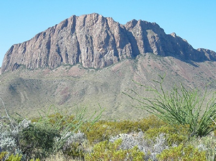
Desert scenery in Big Bend National Park
A few miles on, at Dugout Wells, we had lunch at a picnic table before setting out on a trail through the desert in our isolation, in this warm sun.
Now it was on to Rio Grande Campsite, stopping briefly at a viewpoint first. We saw several comical looking roadrunners on the way and afterwards.
We found a pleasant spot at the campsite, with views up to the Boquillas mountains, and had a welcome cup of tea. We set off again, stopping at the small shop to buy bread and milk, and to put some washing into the machine here.
We drove to the trail to walk to the Boquillas Canyon. This started off magnificently, as we walked up and over a small bluff, but as we got to the river, we found that it was still all flooded, so we could go no further. We returned, and spoke to a chap from South Carolina who was hoping to be able to walk the trail.
Former homestead site, Dugout Wells
We stopped at a viewpoint to the canyon on our way back to the shop, where we were able to have much wanted showers, and then collect our washing.
We drove back to the campsite, where Adrian busied himself pumping up the tyres. Our South Carolina man (who reminded us of John Bateman), told us of a short trail to view the sunset. We had hoped to do this, but set off a bit too late to catch the actual sunset, but the colours on the Boquilla mountains rivalled those at Ayers rock, and the Chisos mountains made us think of the Olgas. Altogether a magical time.
On the Boquillas Canyon trail
Our South Carolina man was there, and obviously loved this area so much that he was thinking of moving here.
On our return, we watched a turtle which had climbed on to the boardwalk.
Back at the campsite, we toyed with the idea of having a barbecue, but things proved too difficult and instead we ate ‘spaghetti Bolognese’ inside, in this extreme heat. We walked around the silent campsite before bed, marvelling at the brightness of the stars.
The ‘streaky bacon’ Boquillas Mountains at sunset
Tuesday 14th October. 35 miles
We woke at 6.30 to see the large moon still in the sky. The weather soon became very windy, but we still had a cup of tea and went ahead with our idea of walking to the top of the bluff to see the sun come up. However, this morning it didn’t really happen (memories of Byron Bay)! There were ominous clouds all around, which fortunately didn’t materialise into anything. Our South Carolina chap followed us up there, so we chatted some more. On our way down, we diverted to walk towards the Rio Grande, but the thick mud from the recent flooding prevented us from getting too close.
Back at the Bam, we enjoyed pancakes for breakfast, and left just after 9 o’clock, stopping at the shop for Adrian to buy some barbecue and lighter fuel.
We drove a short distance to another view of the Rio Grande, but this too was very muddy from the flooding. It was extremely windy now.
We drove the 20 miles back to Panther Junction, revelling in the wonderful views of the Chisos Mountains. We saw one or two ocotillos in flower.
Adrian waiting for sunrise which didn’t happen!
Saturday 18th October 74 miles
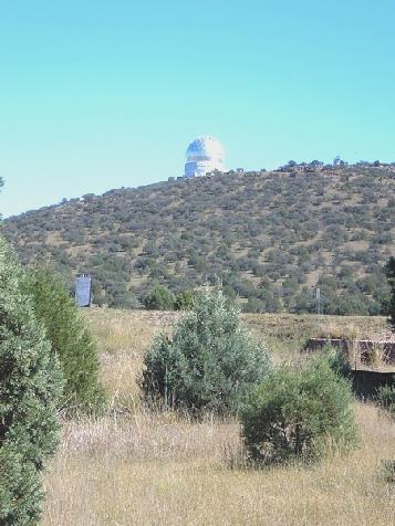
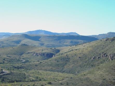
We left at 9.50. We soon got to the McDonald Observatory and went in to find out about it. We didn’t expect to still be there at 2.15!
We opted for the $7 tour, as it was $5 to go in anyway. We started with a video (of course) and then had a presentation showing live images of the surface of the sun. Our guide was a rather tight-lipped chap called Joe, and once we had got into his broad Texan drawl (s-a-an for sun), we found that he was full of facts, but seemed to have been wound up by clockwork!
We were able to visit 2 huge telescopes, one of them, the Hobby-Eberly was the third largest in the world after 2 in Hawaii. They prided themselves here on the relative cheapness of this telescope ($20m). The technical points were all beyond me, but I enjoyed the fantastic views from this high elevation over miles of unspoilt beauty. One of the reasons for placing the observatory here is the lack of habitation, and therefore the clear skies.
The day was perfect, and in fact the skies here are clear for at least two thirds of the time. We found things generally expensive here, but did buy a few attractive bookmarks and postcards.
Back at the Visitors Centre, we looked around the exhibits which were interactive, rather like at the ‘Dome’, but way beyond me! We had found out that they hold ‘Star Parties’ on certain evenings, so that was why so many vehicles passed us late last night.
It was now 1.15, so we had lunch out in the Bam, before continuing on our ‘scenic loop’, which took us back to Fort Davis. I even drove for a short while. This was supposed to be a wildlife viewing area, but all we saw was one deer! I did photograph a cane cholla cactus with its yellow fruits.
The McDonald Observatory
A cane cholla cactus
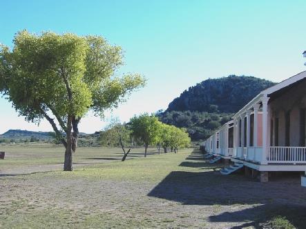
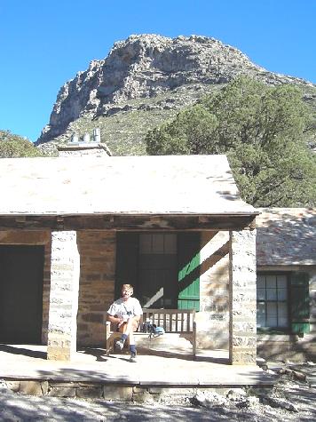
Back at Fort Davis we visited the fort, dating from 1854. This is a National Park, so we were able to use our permit. It was a very enjoyable visit, with the weather being perfect, and the site being in a really attractive situation. Several of the many buildings had been restored and refurbished. A recording of the 1875 Retreat Parade was played over the loud speakers (Tony would have loved it!), and there were bugle calls played too (including the last post at closing time). We spoke to a pleasant couple from near Dallas, who were really interested if the fact that we were travelling. The Park Ranger – who looked like Margaret Massialas – was very enthusiastic. We left at 5 o’clock, as the park closed.
Sunday 19th October 176 miles
We now took the same road as last night, as I had wanted to visit Davis Mountains State Park. On the way we passed a parade of vintage cars. We couldn’t believe how many people were camping at the Park. We drove in, and cheekily used the dump, then drove on the scenic loop, but had no intention of staying. We did see several deer here.
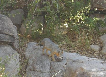
We drove back along the road for a short way and pulled into a pretty little picnic area beside the road. A grey fox seemed to have made this his stomping ground, and didn’t seem in a hurry to go!
Fort Davis with the view back to the McDonald Observatory
After last night’s disaster with the video, we were keen to get it sorted, and luckily we were able to, plus a little bit more editing too. Greatly relieved, I quickly got some scrambled egg on toast for supper, followed by Adrian’s favourite – cheese and biscuits.
Layby near Fort Davis
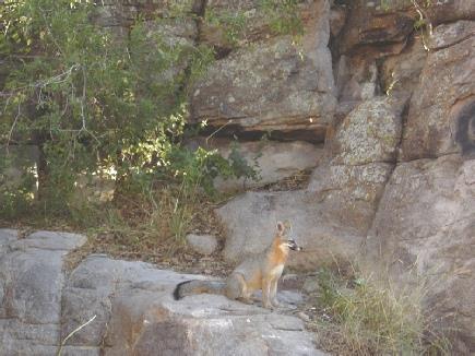
A grey fox at our night stop
It was lovely wild remote country. We joined the I-10 freeway westwards and had coffee at a not very pleasant picnic area watching the multitude of lorries - even on a Sunday!
We continued to Van Horn which was like shanty town and consisted of petrol stations and not much else. We needed petrol, water and propane, and succeeded in getting all eventually - the propane thanks to an elderly gent who suggested we try KOA Campground, when the other propane place wasn’t open. As we drove out of the town, there were a few unpretentious houses. We stopped beside the road for lunch, with desert scenery all around and mountains to either side.
We stopped at a Historical Marker where a woman had also parked. She told us that she had never driven this road before, but was taking a different route to visit her daughter in New Mexico. She was excited because she thought that she was related to the rancher mentioned in the description on the marker. Her surname was Daugherty, as was his. It was lovely to share that moment with her, and she was pleased too.
We very soon came to the Guadalupe mountains, looking very majestic and barren. We now had to change to mountain time – one hour back. Only later did we realise that this meant that it would get dark earlier, not later, as Adrian had thought.
We stopped at a rest area to view Mt. Guadalupe – the highest point in Texas, and looking very majestic. There was amazing desert scenery and salt flats all around.
We came to the Guadalupe Mountains National Park, and the inevitable Visitors Centre. We proceeded to the campsite, where pitches were $8, and found a spot for ourselves.
We drove the 3 miles to the start of the trail to the Smiths Spring. This was a delightful walk over very rocky ground with great views to the plain below, and coming to a narrow valley full of colourful trees. This contrasted with the desert all around. There were some really attractive trees called Texas Madrone, which had bright red berries, which looked beautiful against the blue sky. We came down to another lot of springs called the Manzanita Springs, and nearby were a group of deer. We had seen no people on the walk.
Stunning Guadalupe Mountain scenery
An attractive Texas Madrone tree
We got back just before 6(5) o’clock to the little homestead where the Smith family had lived, then returned the 3 miles to the campsite.
The sun had gone behind the mountain now. I prepared a meal of minced beef with tacos, which we ate inside, watching the beautiful colours of the sky.
Adrian at Smith’s Spring
Manzanita Spring
We walk to Manzanita Springs
Monday 20th October 73 miles
We saw the sun rise as a red mass which soon turned yellow, at 7.00.
(The notice said 6.00, so they must have got it wrong, as we had changed our watches!) However, the sun didn’t reach our spot, so we had breakfast inside and left at 7.45.
Our first stop was to walk the short Pinery Trail to the ruins of an old Butterfield Trail stage post. This was an early overland mail route, started by a John Butterfield in 1859, which sent twice weekly mail coaches from St.Louis to San Francisco in 25 days (2800 miles) at a time when hardly anyone had even travelled across the continent. We thought that Val and Mike would be interested.
We drove on a few miles to McKittrick Canyon to walk the trail here as far as the Pratt Lodge. This was a nearly 5 mile return walk, and was easy walking, although the path was very stony. We left at 8.50, and only took an hour to walk each way. As we neared the homestead, there were autumnal colours of the maples, contrasting again with the desert surroundings. The landscape was dotted with numerous sotol plants, their dead spikes looking like dozens of spent sparklers.
We saw several scrub jays, glinting their beautiful blue colour, and I photographed a pretty blue/green lizard, which we think was a collared lizard.
The stone house had been built by Wallace Pratt in 1931 having purchased the land after falling in love with McKittrick Canyon on an oil surveying trip from Houston. We couldn’t go inside, but sat on a seat outside for a while before setting off back. We reached the Bam at 11.30, just in time for a cup of coffee.
We headed off again at midday, through this empty land, and after a few miles crossed the boundary into New Mexico. After a few more miles, we turned off to Rattlesnake Springs, which was a very green picnic area, supposedly with much bird life, but all I saw was a couple of sparrows!
We sat at a picnic table in the hot sunshine, surrounded by colourful maples, and with no-one else about.
We left here at 2 o’clock and drove back to the road, and then on to Whites City – this consisted of a line of shops, a couple of motels and some RV Parks – it is a convenience place for Carlsbad Caverns. We looked around one of the vast souvenir shops, which advertised Tourist Information, and after a while, the Roly Brown lookalike man asked if we had visited the caves. When we said ‘no, we were on our way’, he said to hurry, as the last admission was at 3.30. We thanked him and left – it was now 2.40, and we had to drive 7 miles up to the caverns.
All was well, and as this is a National Park, again we could use our Pass.
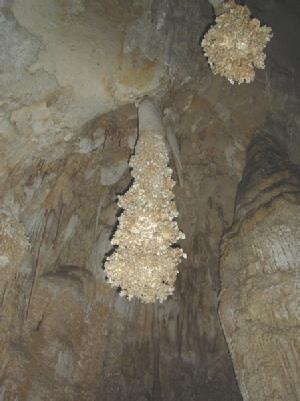
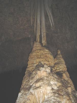
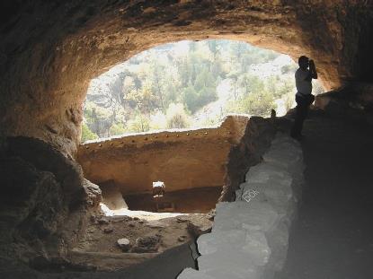
The first thing we did was to travel down 754 feet in a lift. After this, it was a self-guided walk for a mile and a quarter around this enormous ‘Big Room’. We have visited many caves, but this surpassed anything in its size and in the beauty of its formations. We walked around, marvelling at the hundreds of stalagmites, stalactites, curtains, straws. It was so superb, that I didn’t want it to end, despite my claustrophobia.
Adrian at the Butterfield overland trail
Adrian making himself at home at the Pratt Lodge
After about an hour and a half, we arrived back at the elevators. The snack bar here had now closed – I was amused to think of a snack bar 750 ft underground!
Back at the top, we looked around the exhibits (there are bats in part of the cave system, and in the past they collected guano from here!), and the gift shops – I bought a few postcards.
We reached the Bam and looked out once more at this splendid view – we could see over the vast desert plains, and to Rattlesnake Springs, which was way down below us.
We then began the 7 mile descent – we had time to stop at the several viewpoints this time, and had a cup of tea at one. We needed somewhere to stop for the night, and both remembered a picnic site a few miles back. In fact, it was about 7 more miles back, but we arrived just in time to see the sun set behind the mountain range, followed by the beautiful pinky/blues of the sky. After supper we did more editing of the wedding video.
Picnic site on 62/180 7 miles south of Whites City
The marvellous Carlsbad Cavern
Tuesday 21st October 54 miles
Again we woke at 7 o’clock to see the sun rise on another beautiful day. I made bacon pancakes for breakfast and we ate them sitting outside at the picnic table which had a vast structure but a missing roof.
We drove back the 7 miles to Whites city, then on 22 miles to Carlsbad through very flat and empty scenery. We did pass another rest area where we could have stayed, and then came to Walmart, where we could also have stayed, had we needed to.
We decided that it was time to try out printing my photos. We knew that you could do this at Walmart. Unfortunately someone was using the machine where you can insert your own disk, so we had to wait. When we had done ours, we still had to wait an hour. We did some much needed food shopping, then came out to the Bam for tea/coffee and a donut while we were waiting. We went back in and collected the photos (116 of them)! They were well printed, but for some reason they were sorted and numbered in a completely random order, with no date/title on the back (as we have often had in England,), so sorting them all will be difficult! I bought a photo album for them and Adrian bought a new inexpensive road atlas of USA/Canada/ Mexico.
We got some petrol, then found the place where we can dump. We were near the town park, beside the river, so we thought that we would have lunch here. Unfortunately the water was rather smelly and green, and it was some time before we found a shady seat in a pleasant spot.
We left here at 2 o’clock and located the Tourist office where we enquired where the library was. We made our way there and were able to use the internet for half an hour to send our first email. We had received messages from all our children.
We drove north a few miles to an Escapee ‘Ranch’ at Lakewood, where we were given the usual OTT welcome. We made our way to our ‘spot’ overlooking the flat desert – free for the first night. We had loaded some washing into the machine. We then went to the clubhouse for ‘Happy Hour’ – not my idea of fun! Everyone sits around while announcements are made, jokes are told and new people are welcomed. We escaped as soon as we could!
I put the washing into the drier (always a shame in hot weather, but there wasn’t enough time for it to dry before night-time), then went back to get all my photos in order. This was a lengthy process, so our supper of chicken had to wait. I had suggested that we give our spare printer (one that John Plaxman had given us) to the ranch, so Adrian took it over. I collected the washing, and was even able to iron the things that needed it. After supper we did more video editing, but just as we were finishing, the house battery failed, so we had to resort to candles and torches to get ready for bed!
Wednesday 22nd October 84 miles
Thursday 23rd October 122miles
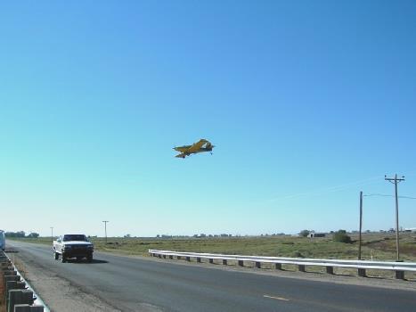
It was a cold night, but with the thicker duvet on I didn’t wake until 8 o’clock. Adrian said that the bikers left at 5.30. The sun was shining, but the air was still chill. We breakfasted sitting at the picnic table looking out to the tranquil lake. We got some water and left at 9.15, taking the back road up behind the lakes, so we didn’t have much view of them until we came back to Lazy Lagoon. A small plane took off from nearby and zoomed over our heads.
A crop spraying plane near the dry Felix River
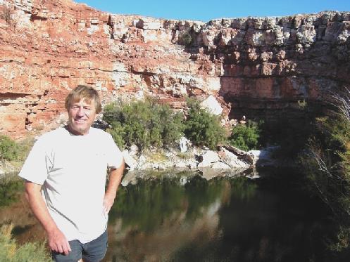
We drove on past several more lakes, stopping to look at each, then came to Lea Lake, the deepest and largest, and the one where you could swim and camp. We found a nice little spot near the water with a lovely view of the lake, at a ‘no electric’ site. The camp host soon came by on his buggy, and thought that we must have made a mistake – no-one camps there, he said! In fact, later, a group of bikers came next to us – how do we do it?
We both walked round to the swimming area and had the most delightful swim – the first since we have been away. The lake is very salty. Afterwards we had really pleasant showers in the ‘bathhouse’. I came back and cleaned some of the outside of the Bam. There were an annoying number of flies, some of which seemed to bite. We had planned to have a barbecue, and I began preparing stuff, but was upset to find that we had not enough barbecue fuel, so we had to have a change of plan.
We watched the sun set over the tranquil lake, which looked really wonderful, then enjoyed a meal of steak, which Adrian cooked outside, followed by a pud of mango and banana. Afterwards we looked at more of the wedding videos.
We looked out at the stars at bedtime.
Adrian by one of the ‘Bottomless Lakes’
Saturday 25th October 98 miles
Another cold night and the morning was actually partly cloudy for the first time for ages. We still had breakfast outside, then got some water and left at 9.40.
We drove south through the flat desert, with the distant mountains looking very misty. At Tularosa we took highway 70, which we had travelled on further north yesterday. We stopped to shop for a few necessities, then stopped for coffee and blueberry pie a bit further on. There were some nice splashes of autumn colour as we climbed higher.
We drove back towards Roswell, then followed signs to Bitter Lakes National Wildlife Refuge. Here there was an 8 mile ‘auto trail’ around these shallow salty lakes and pans in the Pecos valley. We were told that sandhill cranes come to winter here, and we saw flocks and flocks of them noisily soaring in and landing. There were several stopping places along the trail, which as we so often find, didn’t tie up with the map we were given!
We stopped at one place and sat and had our tea/coffee – it had now become hot. Another time we walked a short trail, and once we walked to an unforthcoming hide. There are supposedly hundreds of dragonflies in summer, and there were still quite a few about. We saw more waterbirds, particularly coots, which are so easy to recognize. The best thing though, was the coyote which wandered around just as we were nearing the end of the trail.
We left the refuge at about 12.30 and headed west, skirting the north of Roswell and taking a smaller road. We pulled off the road for lunch, sitting in the Bam in the midst of this barren landscape. We continued through miles more dry scrub, enlivened only by the numerous cane cholla cactus with their pale yellow fruits.
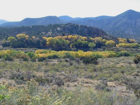
The, scenery had become much more attractive with tree covered hills, some a lovely golden colour. We reached the road 380 at Capitan, and crossed it. Not long afterwards we found a nice pull off, which appeared to be a memorial area to Forest Firefighters – we were in Lincoln National Forest. In Capitan we had seen the ‘Smokey Bear’ museum – the symbol of forest fire prevention. We had views to Sierra Blanca (12,000ft), so although not yet 5 o’clock, we decided to stop for the night.
We enjoyed a meal of chicken in bacon. While I finished putting my photos in the album, Adrian printed out the diary so far, then it was more of the wedding video editing.
Picnic Site on 380 south of Capitan
Lazy lagoon
Friday 24th October 125 miles
It was a cold night again. The morning started cold, despite the clear blue sky, but soon became hot. We watched the sun rise, had breakfast and left at 8.30. The road had been surprisingly busy before we left.
We drove south to Ruidosa, which was a ski resort, and seemed like many places we had seen in Europe. It was in real contrast to the dry desert we had driven through yesterday, and had more shops than we had seen in the whole of New Mexico! We did get some inexpensive petrol though.
We took the road back up to Lincoln, as we intend driving a loop around this area. This valley was green and tamed. We turned west towards Lincoln where the hills were much drier again
In Lincoln, we walked up and down the ‘historic’ main street, which had some nicely restored buildings. This is ‘Billy the Kid’ country. Continuing west, we drove once more through Capitan, from east to west this time, stopping to shop in a small supermarket, where we got the barbecue fuel that we needed, amongst other things. Soon afterwards, we had lunch beside the road, as we hadn’t seen any picnic sites.
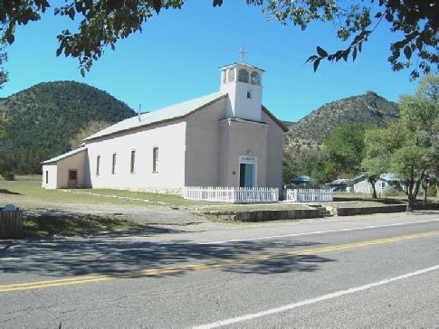
St John’s church, Lincoln, New Mexico
We came back and had a cup of tea at our picnic table, before walking in the other direction for a short way to see the site of a former Indian village.
We had a nice barbie, with pork, mushrooms, potatoes and courgette, sitting outside at the picnic table to eat, by candlelight, as we still couldn’t get the lamp working. Afterwards we actually got to the end of the wedding videos, so now need to check through it all.
Petroglyphs at the Three Rivers site
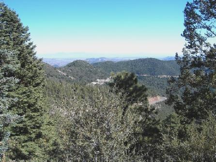
We turned off on to a winding road through an Indian Reservation to Cloudcroft. This small mountain resort is 9,000 ft above sea level.
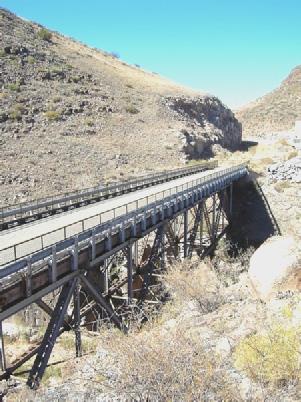
We stopped to view an old wooden trestle railway bridge, and discovered that a 2½ mile trail through the forest started from here. We ate some lunch, then set off. This walk was different for us because it was actually cool! The colours didn’t match our autumn colours, and the aspens had almost all lost their leaves, but there was colour from the oaks and the maples, interspersed with the green pine trees. Two extra pluses were a small snake, which slithered away early on in the walk, and a white breasted nuthatch which was cavorting down a tree trunk. The weather had become really cool and crisp, so that it felt like an English autumnal walk.
We now had to drive the 16 miles down to Alamogordo, apparently at 4,300 ft! We stopped part way down at a viewpoint, where the golden deciduous trees filled the small gully between the barren mountain sides.
There should have been good views down to White Sands (a huge area of gypsum, resembling a beach), but the visibility was not good. In fact, the weather deteriorated, and instead of being struck by the heat of the desert, it continued to be cool and windy.
Alamogordo was another large, unattractive town, but we located the library and were able to send our email to those who had been missed off the list last time. We also had a few to read, including a long one from Helen, who said that she had seen the report of Simon’s wedding in the Newbury Weekly News.
We sent a short email to our ‘kids’. It was now 4.30, so back in the Bam we contemplated what to do, as it was too late to go on to White Sands today. As the weather was not enticing, we thought that we might just as well make our way to Walmart for the night. Adrian went back into the library to locate where it was, and we made our way there. The weather had become even more windy, and most unpleasant.
We thought that we would get some more of our photos printed. Adrian braved the wind to take the disk over, and found a more suitable place for us to park for the night, so we moved there. It was quieter and more sheltered. I cooked a meal of liver and bacon, and after we had eaten it we went to collect our pictures. We bought one or two things, including a new saucepan. When we came out it had started to rain, and later rained quite heavily. We settled in and began checking through the wedding video (will this ever end?)
A splash of Autumn colour
Sunday 26th October 82 miles
A cold night again, and Adrian even resorted to putting the heating on in the morning, but we were delighted to see that it was a clear sky. A beautiful day followed. I cooked bacon and mushrooms for breakfast and we left at 8.45.
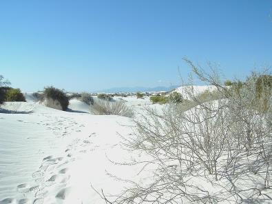
We drove the few miles to White Sands National Monument, going first into the Visitors Centre to find out about it. We then drove into a wonderful area of dunes of fine white gypsum sand. We made a short walk to a dry lake, then went on a delightful one mile walk through the dunes. The sun was hot, but the air was cool and clear. It was exciting to see the tracks of various small animals. We watched a large beetle trying to burrow into the sand. Yesterday’s wind and rain had made the sand look pristine. Not many people had been about this morning. We saw the few plants which had adapted to live in this shifting dune environment. When we got back to the Bam, we had coffee and a small pecan pie sitting in the sand in the sunshine.
We drove on to the next walk – a short ‘interdune’ board walk – but before setting out on this we spoke to 2 different couples. The first was a couple now living in Ontario, but originally from England. She had been born in Ealing, and had lived in Devon. He had worked at Shrivenham for a while, and she had taught at Faringdon. They had come to Canada in 1963, and their son (called Adrian) and their daughter naturally thought of it as home. They said that they would never go back to live in England.
They had been speaking to two English chaps who now walked up (there was nobody else about). Pete was from Bournemouth, and was married to a French woman. Steve was from Bromley. They were both into military medals, both as a job and as a hobby, and travelled to the USA for fairs, but always travelled around when they came. They were so easy to talk to that we talked for ages, and could have gone on longer.
After the short walk, where we did see a small lizard, we drove on to the picnic area. This was the most surreal picnic area that I have ever seen! Numerous picnic tables were positioned in a huge circular area, surrounded by a hill of glittering white sand. Each table had a curved metal shelter – our table could actually rotate, to protect from sun or wind! By now, quite a few people were around, being Sunday, and children were sliding down the slope on trays. (We tried it, but didn’t get very far!) The colour of the sand, and its virgin appearance, meant that we expected it to be snow!
We ate at the picnic table, where the sun was hot but the wind cool. I sat in the fine sand, enjoying this huge ‘beach’, all to myself.
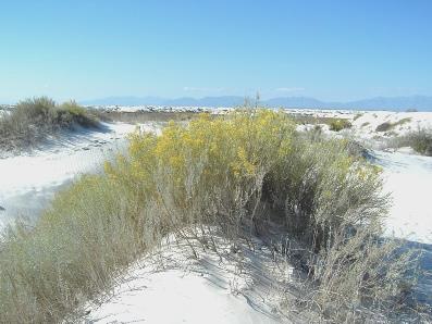
We left here at 2.30 and drove on to the start of the 4 mile trail through the dunes. We walked up over the dunes for a short way, marvelling at the vast unspoilt dunes and revelling in the colours – the white sand, the blue, blue sky and the few brave plants – an artists dream!
We now drove back to the entrance. We had really enjoyed our visit, but wondered how flies and ants had managed to survive here, when so little else can!
We had a cup of tea sitting at a table outside, deciding where to go from here. We were heading for El Paso. There was a road shown on some maps, but it was a military road, and no-one could tell us if it was open. We decided that it was better to drive the 13 miles back to Alamogordo, and take highway 54 to El Paso. We hadn’t expected this to be such a big road, and missed the one picnic site shown on it as we didn’t recognise it as such!
We were wondering what we would do, as we didn’t want to arrive in El Paso tonight. At about 5.30 we drove through the one ‘town’ marked on the map – a few buildings and a petrol station, under the name of Orogrande. Beside the petrol station we spied a spare bit of land at the end of a ‘future’ bit of road. Ideal for us, and the views to the distant mountains were superb tonight. Another lovely sunset! Then a tiny moon. We ate chicken ‘Maryland’ before continuing with sorting the video.
Wonderful White Sands National Monument - nowhere near the sea!
Super sunset again
Monday 27th October 126 miles
It was the coldest night yet – we had the thick duvet and the blanket! The sky was blue with high, wispy clouds. Two trains had been noisy in the very early morning.
We left at 9.30 and continued through the flat, dry countryside to El Paso. This was much bigger than we had imagined, and was a maze of fast roads and flyovers. We joked about finding ourselves in Mexico by mistake, when suddenly that’s just what did happen! We were trying to get to Chamizal Memorial Park, but must have missed the last vital sign! We were able do a ‘Uee’ or ‘retorno’, but not before we had joined the 9 lines of cars coming back into the United States! We had crossed the (small at this point) Rio Grande, with a sign similar to that in Laredo. When our turn came, we explained to the official, who peered into the van whilst constantly chewing gum. He then pointed out the park – just across the road – but said that it was very hard to get to from here! He gave us detailed instructions (which were correct) of how to get back there, ignoring all the queues of cars behind us!
When we got to the park, we had coffee sitting outside in the sun, but the wind was still chill. We made our way to the large and imposing Visitors Centre, where we were greeted by an oversized Dave Bakker look alike with a very gruff manner. He said ‘the floor’s wet, that’s why there’s that sign there’. Later he said ‘nothing happens on Mondays. It’s dead. Thursday, Friday, Saturday - that’s when things happen.’
This park was set up to commemorate the end of the long conflict between Mexico and America about the position of the border between them, caused by the shifting course of the Rio Grande. There is a similarly named park in Mexico, which you could walk to across the long bridge – we decided not to! We felt that if all people had a manner like this ‘Dave’ man, no wonder there are conflicts!
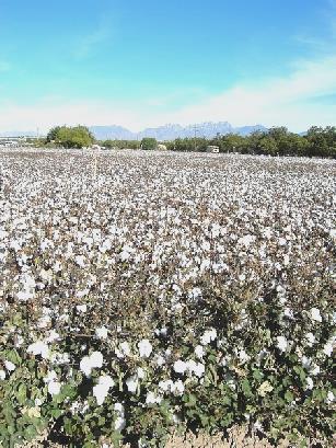
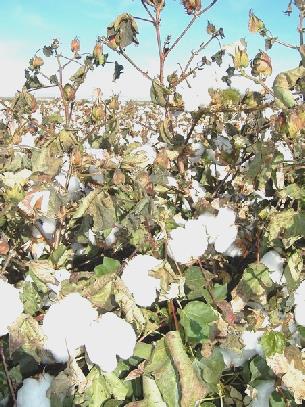
We thought that we would head out of El Paso – it was much too large for us, but in doing so we intentionally drove many different areas, including one of ‘budget’ type housing – surprisingly surrounded by high barbed wire fences. We drove very near to the Mexican border, so could get an impression of the poorer areas of Cuidad Juarez the Mexican half of the city). After driving past the unattractive industrial part, surrounded by dry desert, we came to the more pleasant ‘suburb’ of Sunland, (after an enforced diversion), and then Santa Teresa. By now we were reaching agricultural lands, passing fields of cotton and plantations of pecan trees. Later there were rows of chillies.
Wednesday 29th October 92 miles
We woke late to a sunny morning and left just after 9 o’clock. We drove past Elephant Butte reservoir, which reminded me of Lake Argyle in Oz.
We took a small road through remote desert scenery to the former mining town of Cuchillo. We drove on several miles, hoping to take a back road which was only marked on one of our maps. We came to road works, where they were resurfacing the road by throwing down tar, then putting a surface on top. We were in for a long wait! We looked again at our map, and found out that the road we had wanted to take was really a four wheel drive track, so thought better of it and returned to Cuchillo.
We drove back south on the I25 for a few miles, turning off to Hillsboro, another ‘ghost’ mining town – gold and silver were mined in the nearby Black mountains. We drove through here and stopped by Percha Creek, beside an old (1927) steel truss bridge, apparently the oldest in New Mexico.
Tuesday 28th October 66 miles
The night wasn’t as cold either, but we had woken in the night (someone actually left at about 4.00 a.m!), so woke late. There was some light cloud, but the day was warm and sunny.
We had intended spending the morning here to work on getting all the video on to tape, but discovered that as we had feared, the first little bit of the recording, with the titles, had not recorded. This meant doing the whole first tape again! We set to, and interspersed with short walks around this desert campsite, and having coffee and later lunch outside, and with the editing of the second part, we finally finished ‘videoing’ at 1.30.
By the time we had done the ‘emptying and filling’, and had a quick shower, we left at 2.30.
We drove past the adjacent Fort Selden, but it was closed on Tuesdays! so we continued north on the 185, following the Rio Grande.
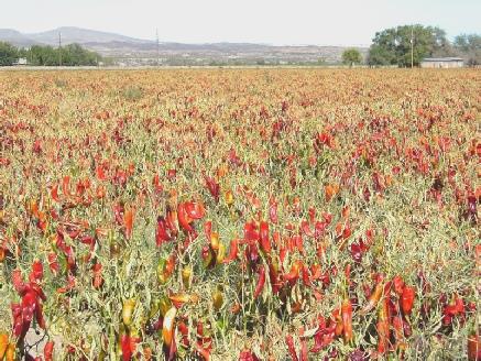
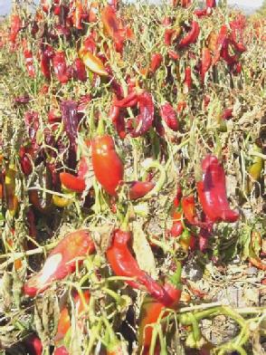
We passed more fields of chillies, and came to Hatch, apparently the centre of chilli growing. We were amused at a notice advertising ‘Halowen Punkens’ for sale!
Thursday 30th October 62 miles
It wasn’t as cold as we thought it would be, considering we are over 7,000 ft up, but the sun couldn’t reach us deep down in the forest, so we were in no hurry to get up.
We left at 9:40 and continued through this splendid, remote mountain scenery. At Mimbres we stopped at the tiny Post Office and sent the wedding video off to Simon and Laure. The lady said ‘Is that France Monaco?’!
We stopped further on and sat on our seats in a pleasant bit of forest to have our coffee. This was just before the Continental Divide, which wasn’t at all dramatic at this point, but it always fills us with a sense of wonder to think of each little trickle of water heading for either the Atlantic or the Pacific (or the Carribean or the Arctic, or wherever!) We were also at the end of the road that we had contemplated driving along yesterday, and think that we made the right decision!
Later we stopped by Lake Roberts and walked a short trail to the site of an ancient Indian village.
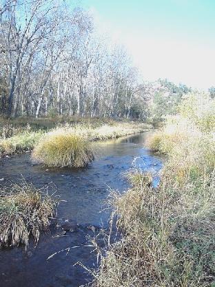
We now took the road for 20 miles or so to Gila Cliff Dwellings. This was through Gila Wilderness Area, and was quite stunning. The road ran along a ridge above superb steep mountain sides, with wilderness all around and occasional views down to the pretty Gila River. The road ends at the Dwellings site, and I had wondered about taking this extra trip, but it was worth it for the scenery alone, and I wouldn’t have missed it for the world.
Saturday 1st November 125 miles
Friday 31st October 86 miles
It was really quiet in our isolated spot. A small motorhome had arrived last night, but had left before we were awake. We watched the sun come up from behind the hills on a beautiful morning before eating bacon and eggs for breakfast sitting outside in our splendid isolation. We walked across to look at the river, and left reluctantly at 10.15 (9.15).
Finding a stopping place for lunch was again difficult. We finally pulled on to a spare bit of land by a road junction at 1.30. We were outside a derelict looking house, which could have been the one the family left in ‘The Grapes of Wrath’!
Continuing north on a smaller road, we stopped at St Miguel for me to buy some more stamps at the Post Office. Again the woman had to go to a drawer way back in the corner to get them!
Just in time, I read of the town of la Mesilla, which was set up in the 1850s for Mexicans to live in at the time of the border conflict. At the time they thought that it was in Mexico, but it seems the map they were using for the peace settlement was wrong, and so they ended up in the USA. There was an attractive ‘Old Square’, surrounded by adobe buildings, reminding us of Alberquerque.
Cottonfields
We wandered around here in the sunshine before continuing north to Leasburg Dam State Park to camp for the night. We even had a site with electric, as Adrian wanted to get the wedding video onto a tape, and didn’t want to risk flattening the battery.
The camp host came over. He said what we have heard before – when people he meets find out that he is from New Mexico, they don’t realise that it is part of the United States! – what hope have we!
Adrian lit the barbie. The mountain scenery around us looked wonderful as it was lit up by the setting sun.
It was not as cold as last night, but we ate inside – the fresh corn on the cob was particularly good. Afterwards we put the first half of the wedding video onto a tape.
Former Mexican la Mesilla
We came to the town of Truth and Consequences, which we wanted to visit because of its ridiculous name! It seems that there are hot springs here, but we didn’t find any. We got some much needed fuel, and then some shopping – at the second shop we tried, as the first was pretty useless. The town itself seemed to be very run down and tatty, consisting of low price housing and storage places! We drove out a short way towards Elephant Butte (another good name) and stopped at 5.30 on a spare bit of land beside the road for the night. We had a nice meal of pork, accompanied by some nice ‘French’ bread, then continued with more refinements to the wedding video!
Roadside land between Truth and Consequences and Elephant Butte
Fields of chillies
We stopped a bit further up the Emory Pass, (8,000ft) to have lunch, sitting inside as the sun was too hot, and there were sudden gusts of wind. The views down from this mountain range were great.
The 1927 bridge over Percha Creek
We carried on over the summit, and came to Iron Creek campsite in Gila National Forest. Although only 2.30, we decided to stop. It was a strange place, as all the paths only led to more picnic tables! The whole area seemed to have a fence around it, so you couldn’t walk off anywhere. We walked around for a while, then came back to have a cup of tea, sitting outside in the sunshine, enjoying the autumn colours.
We had been working on trying to get the wedding videos on to tape. This had not been without its problems, but we finally got to the end, and hope to send Simon’s copy off to him.
We congratulated ourselves, and Adrian lit the barbie, and we enjoyed chicken and fresh corn on the cob.
View from Emory Pass
Iron Creek campsite
We came to the Visitors Centre (of course) and had lunch outside in the Bam. The sun was shining through a hazy sky, but again there were occasional sudden gusts of wind.
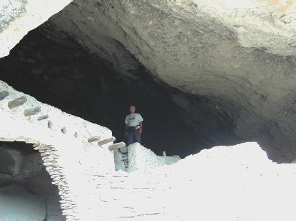
From the Visitors Centre we had to drive on a short distance before walking to the dwellings themselves. It was a really superb visit. The trail wound up through a lovely valley, looking extra attractive with the autumn colours. It was like a pleasant autumn day in England. The cliffs towered above us, and we eventually found our way up to them. We were surprised that there was no safety rail at all, considering how high and steep the sides were. Nevertheless I coped with it all, and enjoyed getting a glimpse of how these people must have lived in the late 13th century.
Gila Wilderness Area
What made the visit even more enjoyable was the people we met. Firstly a chap from Michigan, who was of Czech descent, and returned there often to visit. He was interested in our travels, and was hoping to retire to this area. Secondly was a young Volunteer ‘ranger’ from Southern California who was travelling to Australia soon for 2 months to work as a lifeguard in Victoria.
We could easily imagine that he was a surfer, with his tall, blond good looks. After that he was going to study in Vermont, which he knew was going to be rather a temperature shock! He told us that there have been devastating forest fires near San Diego (where we fly home from in December).
The lady ranger suggested we walk the short trail at Lower Scorpion campsite a short distance back. This we did, and viewed some petroglyphs and another cliff dwelling. We decided that it was pleasant here, and we would stop for the night. We had found out that ‘daylight saving’ had ended last Sunday, which explains quite a few things, but means that it gets dark even earlier! Adrian lit the barbie. We ate our meal of steak, corn on the cob, baked potatoes and mushrooms sitting inside.
Gila Cliff dwellings
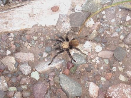
We drove the magical 20 miles back to the junction where we had joined the road, then continued towards Silver City. We had coffee sitting high up with a wonderful view, and as I looked out, there was a tarantula wandering along the ground outside the Bam.
We continued on this attractive winding road, stopping to look at some antiquated gold mining gear at a site called Arrastra. We drove through the former mining town of Pinos Altos, then once again crossed the Continental Divide.
We carried on to the very spread out town of Silver City, where we had a lot of trouble in locating the library. We finally stopped at the City Hall Annexe, and asked a woman who was just leaving her office.
We couldn’t use a computer at the library until 2.00 – it was now 12.15 (their time). We had a bit of lunch in the Bam, then drove out a couple of miles to Walmart to take in some more photos to be developed. We shopped at nearby Albertsons, before returning to the library, where we sent our latest email.
Back out to Walmart to collect our photos. We bought a CD of Dolly Parton, with her version of her own song ‘I will always love you.’ We also bought a CD storage case for $2.50! We put on the CD and had a cup of tea in the Bam, then got some petrol and headed out south on the 180.
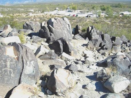
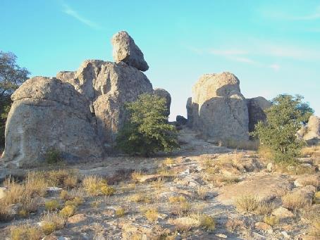
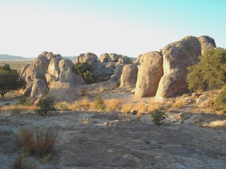
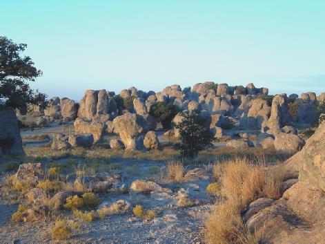
We drove across flat desert, with hills in the distance, to the ‘City of Rocks’ State Park. I had wanted to camp here, but hadn’t realised that it was so lovely. It was like Devils Marbles (in Oz) Mark 2! An isolated group of rock boulders in the desert. Camp pitches were set at individual spots amongst the rocks. We found one for us then wandered out amongst the rocks, filming and photographing before the sun went down.
The tranquil Gila River
Then I prepared a Pumpkin Pie and mulled wine to celebrate Hallowe’en. Adrian lit the barbie, and we ate a mini pumpkin with potato and prawns and a delicious French loaf (hooray for Albertsons!) sitting outside in this beautiful spot.
It was lovely to have an evening warm enough to sit out – we didn’t come in until 9.00 (8.00), after we had looked at the stars and the moon.
Stupendous City of Rocks
What a setting for Hallowe’en!
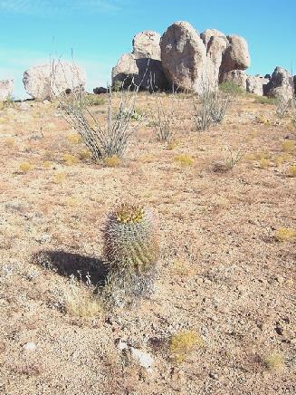
We walked up amongst the rocks as the sun rose, enjoying the lovely early morning lighting. We came back for breakfast, sitting outside at our picnic table by the rocks in the already warm sunshine. We left at 9(8).20 and got some water, then drove around the track which went right around the rocks, stopping once or twice to walk out amongst them. The ocotillos here were not in leaf, and looked quite dead – obviously there had been no rain here.
We drove up to a viewpoint high above the rocks before leaving the park at 10.20.
We took the longer but prettier route back to Silver City, following the Mimbres River. The contrast of the autumnal trees beside the water with the arid desert was lovely.
The last bit of the route to Silver City passed the gigantic Santa Rita Open Copper Mine. Memories of the ‘Big Pit’ in Oz, as we sat overlooking it to have our coffee and another piece of the excellent pumpkin pie.
Back in Silver City, we this time located the Historical District, made important as a mining town, but now rather an arty centre. We saw quite a few ‘alternative’ people as we wandered around. We walked along ‘Big Ditch’ park – formed when the level of the main street dropped 50 ft following heavy floods a hundred years ago.
We now headed west on highway 180, stopping soon for lunch on a bit of waste ground by the road. We took a short diversion to drive through the small town of Gila, and to cross the Gila River once more with the splendid autumn colours.
City of Rocks in the morning sun
We continued now to Whitewater Canyon, where there was a ‘catwalk’ along this majestic gorge. The catwalk followed the course of a water pipe built to bring water down to the small mining village called Whitewater (alias Graham) around 1900. It was a superb walk for just over a mile, partly on a catwalk clinging high up above the Whitewater River, with the steep red cliff faces towering high above us.
The Gila River again
Again, the autumn colours were wonderful. Being Saturday, there were a few other people about, but we felt very fortunate, as the walk had only recently been reopened after some rebuilding. It was quite a strenuous walk, with several ‘hairy’ bridges over the gorge, but thoroughly enjoyable. We walked the mile or so back, reaching the Bam at 5.30 (4.30) for a cup of tea, before driving back a few miles to the main road, stopping at Bighorn campsite at Glenwood, where Adrian soon got the Barbie going. We ate tilapia fish and prawns with baked potatoes and green beans – all pretty nice. It was cooler tonight, so we ate inside. Later we watched through the second video of this trip, which Adrian had finished today.
Wonderful Whitewater canyon
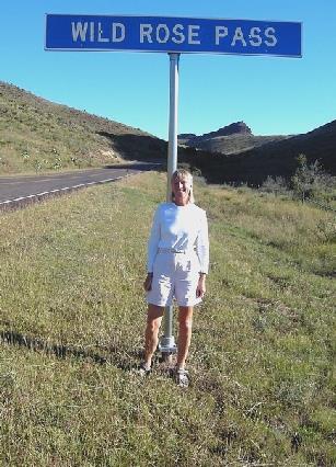
It was very cool in the shade, and the sun didn’t reach us, so we had breakfast inside (of the nectarines we had bought, which weren’t very good), and left at 9.30. We should have moved down the road to a sunnier spot! We drove through a gorge which we think was called Limpia Gorge and came to Wild Rose Pass, where Adrian just had to take a photo!
It was a very cold night and the morning started windy, but with the same clear blue sky. It became pretty hot later. We had breakfast inside, then when we were ready to leave, we tried ringing Simon, but couldn’t make the phone work. However, we were able to get hold of Emma, so had a chat to her, even though Ruby was having a bit of a paddy. Felix asked us what we were doing in America. We chatted a bit to 2 ladies here who were sort of interested that we were from England! We were about to leave at 9.45 when Adrian found that there was a air pump that he could use, so he was really pleased to be able to pump up the front tyres, which needed it. It was therefore nearer 10 o’clock when we left. We soon came to Artesia, which was as unattractive as most U.S. towns, and was surrounded by flat scrub desert.
We came to Dexter, and tried to find the road out to Bottomless Pits State Park, but there were no road names or numbers, and all the maps we had were inaccurate! We had coffee by Lake Van, sitting inside again as it was still a bit blowy, and there were no seats. This was in fact on the road that we wanted, but we didn’t know it, so continued on the main road to Roswell. While driving through here, Adrian spotted a Sears Store, and stopped to see if he could get a new house battery from the motor dept. We were in luck – we got a new battery, and they fitted it (an almost impossible task), and it all took a long time. I spent the time labelling the back of all my photos. It was now 1.30, so we made our way to a nearby town park where we had lunch sitting at a picnic table. We left at 2.30 and headed out to Bottomless Lakes State Park, well signposted from this direction! We drove through flat desert scenery, with a red cliff ridge after crossing the Pecos River. We came to the first lakes, called Lazy Lagoon, and stopped to look. The lakes in the park are all between 17 and 90 ft deep. We stopped by the new adobe looking Visitors Centre, and decided that as it cost $4 for a day permit and only $10 to camp, we may as well camp. First Adrian had to get change so that we could get our permit!
Fort Worth, Texas - Glenwood, New Mexico
Wednesday 8th October 2003 6.6 miles
We had been back for just one week from France, where we all celebrated Simon and Laure’s wedding in grand style. We had had no time to rest on our laurels!
We had met up with Emma and the children at Renee and Lena’s on Saturday to look at some of the photos and video. Paul had also called in there briefly. Tom and Nuria had just started their year of teacher training in London.
We had got ourselves very organised, and I had managed to complete the diary/scrapbook of our month in France before we left, which I was really pleased about.
We were up at 5 o’clock for our supposed 6 o’clock pick up by taxi. Adrian had telephoned them last night to confirm, remembering a time two years ago when the taxi (from a different firm) didn’t arrive. How could we imagine that the same thing would happen again?
At about 6.10, Adrian telephoned them, and a taxi arrived about ten minutes later. This didn’t leave time to get to Savacentre for our 6.30 airport bus, but our driver tried hard. However, roadworks and extra traffic lights at the M4/A34 junction were against us. We arrived at Savacentre to see the bus just driving round the little roundabout – we had missed it by even less than last time! The only thing to do was to ask our driver to take us on to Heathrow, where we could pick up the airport bus to Gatwick.
This he did – it cost us another £40 or so (of our first-time used bus tokens!) Adrian hurriedly wrote a note of dissatisfaction to the taxi firm!
We were only a few minutes at Heathrow when a bus to Gatwick arrived – we are not sure whether it was our intended one or not. Adrian chatted a bit to the chap in front of us who was off to Cyprus. He was mad on football and followed the English team everywhere and was hoping to get to the Lebanon to see a match.
We arrived at Gatwick North terminal at 8.30, to find a long queue for booking in. When it came to our turn, we were told that our seats hadn’t been booked (only requested) and we were given 2 different ones. We said that we had wanted window seats, and she said that she would ask for them to be changed if possible. When we got on to the plane, we did indeed have window seats, admittedly over the wing, but they were in Club Class! A first time for us! Although the extra space was welcome, I didn’t find the seats comfortable, and got quite a crick in my neck.
Back at security, we had another problem – despite Adrian having his Swiss Army knife taken away on a previous flight, as it had been left in his hand luggage, his replacement one (another present from Paul and Nicky), had been left in the rucsac! The men were very kind, and allowed Adrian to take the rucsac back to check-in. This meant cramming everything else in from it into my hand luggage bag. While Adrian was escorted back, I sat on a seat and waited!
Reunited, we thought that we would have a coffee, but at that moment our flight was announced, so we made our way to the departure lounge. While waiting there, we ate the rolls that I had made at home.
We took off at 10.30 into partly cloudy skies. We were pleased to find that we had free drinks on this flight, unlike last time, and I really enjoyed my whisky, and Adrian his gin and tonic at this early hour! Lunch followed, but unfortunately for Adrian, the chicken dish was curry. However, the salad and profiteroles were good. (I usually prefer the cold food on a flight.)
There didn’t seem to be any films of interest showing, but we did watch a bit of the Discovery Channel, with a really interesting programme on DNA and the associated ethics. The rest of the time we spent reading various magazines.
The skies cleared a bit as we flew over eastern Canada/America, and we were surprised to see how mountainous it was, before we came to the flat agricultural fields. Everywhere looked very dry and brown.
We were given some sandwiches about an hour before landing, and came down through cloud to Dallas/ Fort Worth at 2.30 local time (6 hours back).
By 3 o’clock we were getting a taxi to Colleyville, and by 3.30 we were back at the Bam, which appeared to have survived its 6 months in the Texan heat well. The temperature now was 84°F, and it was very humid.
While Adrian went to do the ‘official bit’, I cleaned out the fridge, which was the only thing in need of a clean-up.
Some post had arrived for us (including a dental reminder from the dentist Adrian had visited in California in March of last year, and several communications from a Casino in Oregon, whose car park we had stayed in on the same trip!) However, the mirrors that Adrian had ordered hadn’t come, and should be arriving tomorrow. Adrian filled the water tank, and then we made our way to a nearby Walmart Carpark at Hurst for the night, arriving at about 5 o’clock.
We were both feeling pretty weary by now, but still managed to unpack most of our stuff. I got some cheese on toast for supper (with bread and cheese from England), and we both fell into bed exhausted – after we had put the duvet covers back on!
Thursday 9th October 183 miles
Yes, we can still make it rain anywhere! It poured all night long! However, we both slept long – with a few disturbances when we thought that it was morning (there were bright lights all around) - the first at 9.00 pm!
We got up at about 5.30 and I caught up with the diaries and Adrian did some sorting. We had a slice of toast for breakfast with the last of the English bread – Walmart was not a 24 hour one, and opened at 7 o’clock.
We made our way there at 8 o’clock, and stocked up with food. We came back to the Bam and had tea/coffee and a very sweet donut (we are back in U.S!)
We left at 10.45, stopping to get some fuel, then making our way back to the storage place at Colleyville. We were pleased to find that the mirrors had arrived, so Adrian fitted one to my side and off we set again. We stopped at Albertsons (where we had shopped in January), and bought a few bottles of wine. We tried phoning Emma, but having managed to make the number work, it was annoyingly engaged.
We had noticed what a big thing Hallowe’en is – there were pumpkins and decorations for sale everywhere already.
We drove around the loop road (freeway) westwards around Fort Worth, then took the I 20/I 30 west. There were no picnic areas, so we finally turned off at Willow Park, where there was a lake shown on the map. All we did was drive past spread-out houses, with nowhere to stop! We continued on the service road to Hudson Oaks, and despite following a sign to the lake, never got there! We stopped for lunch on a newly built bit of road waiting for a development to happen! We both had a snooze, leaving at 2.40 to continue west. The country now was more undulating, and quite green. We turned off at Cisco to discuss our ongoing route and decided to have a cup of tea. The cloud had broken up and it had become very warm. We drove through Cisco, which had some nice old buildings, but was in need of a facelift, then we drove southwards, coming to another pleasant town – Cross Plains. It was very wet beside the road, showing signs of the recent heavy rain.
Soon after 6 o’clock we stopped at a picnic area near Coleman for the night, with gnarled old oak trees and large prickly pear cactus surrounding it.
We had a meal of prawn tacos, while listening to the sound of the crickets outside, followed by another early night.
We had a cup of tea at a picnic site above the South Llano River. The view down would have been nice, but they had put up a high chain link fence. Also, a lorry came in, and the driver left the engine running, spoiling our peace and quiet!
We continued through Rocksprings, taking the 674, which was through remote and attractive limestone country. Several peaks were marked on the map, but we didn’t see any, only hills!
There were no pull-offs at all on this road. The weather had become very variable, with heavy rain in the distance. We had rain for a short while, and as this road was an area liable to flooding, crossed by numerous streams, we didn’t dare pull off on to the verge! We saw some wildlife along the way – emus and unusual antelope, in enclosures, and lots of lovely large butterflies. The crown of it all, though, was the armadillo which wandered across the road – the one thing I had really wanted to see!
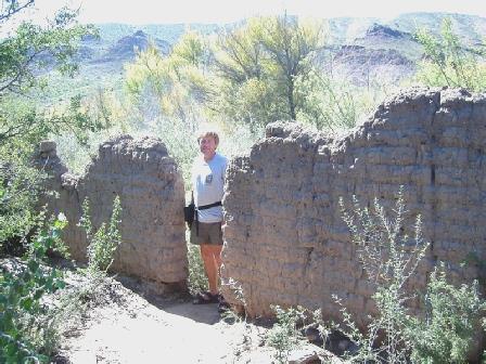
At 6 o’clock, we came to ‘Alamo village’ – a mock village of the Alamo, built in the 50s for John Wayne’s film, and subsequently used as the set for many others. We had wanted to visit this, so decided that the only thing to do was to park outside for the night, ready to visit in the morning.
We had our tea and coffee in the Bam before walking around the rest of the site in the rain! The village resembled many museum villages that we have visited, and was very atmospheric, despite being assembled solely as a film set. The people working here (there were no other visitors!), were really pleasant, and the gift shops sold a lot of inexpensive gifts, so we bought several things in readiness for Christmas.
We arrived back at the Bam, and decided to have lunch before leaving. At this point it began raining torrentially, and the skies were uniformly grey. A school bus arrived, plus several other vehicles, and we thought how fortunate we had been for our visit.
We left at 1.15, and drove the 2 miles of mucky track back to the road, and then proceeded the few miles to Bracketville. As we reached there, we saw workmen busy in the middle of the road. They were actually erecting signs to say that the road we had travelled on was closed, due to flooding! Thank goodness we hadn’t stopped further back along the road yesterday! We had wanted to, and I thought that Adrian was being over cautious for not stopping.
We stopped by a small food store and braved the torrent to go in and buy a few food items, and afterwards we got some much needed fuel.
As we drove on to Del Rio, the weather deteriorated even more! It was quite abysmal, with torrential rain, flashes of lightning and dreadful visibility! Floods were appearing everywhere, and we ourselves drove through many stretches of water.
As we drove through Del Rio, the rain had subsided a little, and Adrian braved it to cross the road to a liquor store to replenish our gin and whisky.
On the western side of Del Rio is a huge reservoir surrounded by the Amistad National Recreation Area. This we knew had several places to camp. We passed the Park Headquarters, which were closed at the weekend, but Adrian had read that we could get water here. It did seem ironic that we were in need of water when there was so much around us!
Having got the water, we proceeded to San Pedro campsite. This was down a long unsurfaced track, and wasn’t beside the reservoir, as we had expected. There was only one other caravan here – we had thought that it might be busy, as this is apparently a holiday weekend for Columbus Day.
We found a pleasant spot, and actually sat outside under the picnic shelter for our cup of tea. Jackrabbits were running around everywhere.
We walked over in the now light rain to the self registration area, but the envelopes were locked up, so we hung on to our $4!
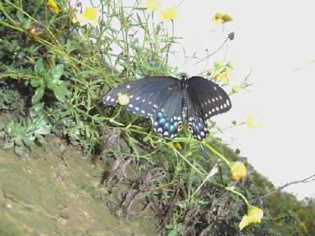
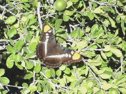
A beautiful butterfly was hovering on a yellow daisy plant. Adrian went back for the camera. We had seen a very wet camping pitch cordoned off as we came into the site, but when we read the sign, it said that it was closed as it was a breeding area for monarch butterflies! This, however, didn’t look like a monarch. (We found out that it was a black swallowtail).
We drove through Carrizozo to Valley of the Fires, which is an area of lava flows (called malpais – badlands). We had visited a similar site a bit further north when driving Route 66 last year, and as the site now required a fee to both visit and camp, (our leaflet said ‘no fee’), we didn’t stop.
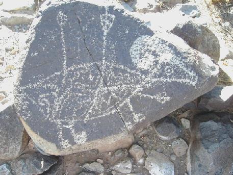
We returned to Carrizozo, then south a few miles to turn off to the 3 Rivers Petroglyph site. We had to cross a railway line (no gates), and I gave it my usual cursory look and was more than shocked to find a huge long American train thundering down on us!
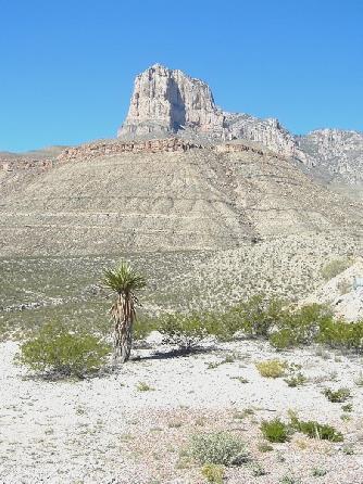
When we reached the site, we found that it cost $2 per vehicle to visit, and this included dry camping! We felt that we could run to that! We walked the little trail to more than 21,000 petroglyphs, scrambling over rocks, and wandering anywhere we chose. It was a beautiful spot, with Sierra Blanca up behind us (we had camped the other side of it last night), and the San Andres mountain range to the other side.
Wild Rose at Wild Rose Pass
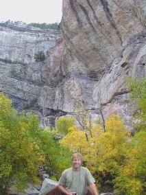
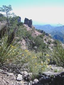
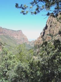
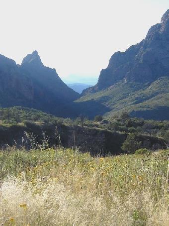
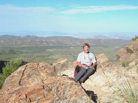
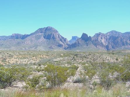
We sat outside the Visitors Centre for our tea and coffee, before going in and buying a few postcards. We walked the short trail around the Centre before setting off to drive the few miles to Chisos Basin. We stopped by the trailhead to Lost Mine Peak. We hadn’t expected to walk this, as it was a 5 mile return walk, ascending 1100ft, and we thought that it might be steep and difficult. But of course, the best things are the unexpected! We ate an early lunch of salmon sandwiches, sitting on a low wall, then set off on the trail, wearing our Adventure Caravan jackets.
Chisos Mountain scenery
On the remote and wonderful Lost Mine Trail
We decided to drive the short distance to walk a little trail to view what is known as ‘The Window’. We hope to walk to the Window tomorrow, but this was to see the view through a gap in the rocks to the plains below. Just as we left, we saw a deer. It certainly was a stunning view. We photographed, then returned to our campsite, where Adrian got the barbecue going. However, unlike last night, as the sun went down, it became really cool. Because of this, and as the camp light refused to work, we ate inside – tasty pork steaks with various courgettes and baked potato. Afterwards we did venture out before bed to view the brilliant stars.
A view of ‘The Window’, Big Bend NP
Wednesday 15th October 53 miles
It was very cool in the night, but a really beautiful day followed.
We had breakfast then left at about 9 o’clock to walk to ‘The Window’. The path there was all downhill, which meant, of course, that the return would be all uphill! Again, I had imagined that the way might be difficult, but in fact most of it was just wandering down a green valley, with the superb bare red mountain peaks around us. Quite early on, we had the excitement of seeing a tarantula walk across the path. We enjoyed seeing lots of butterflies, and later numerous crickets again, and also a couple of praying mantis.
We didn’t pass any other people on the way down. Not long before the Window, there was a track going uphill which you could take to a viewpoint. This we did, and it was the one part of the route which really taxed my fear of heights! The view from here was superb, but then I had to make my way down again!
‘California Sister ‘ butterfly
Tarantula
Then it was on to The Window itself. The last part was quite tricky, as we had to negotiate a sort of gorge, climbing over rocks and across water from an unexpected stream. Just after reaching the end – or as far as you could go! - another couple arrived and offered to take our photo. We then passed several other people as we began our return trip, stopping to eat a well deserved biscuit. It was now really hot in the sun, and we were glad of the occasional shade! We got back to the campsite just after midday and ate our welcome lunch sitting at our picnic table.
I spied a phone up behind us, and we managed to phone and speak to both Tom (who had just started his teaching placement today) and Paul.
We did the ‘emptying and filling’, and left at 1.20.
We drove back to the junction, then turned left to Santa Elena Junction. From here we drove the ‘Ross Maxwell Scenic Drive’, stopping soon to look at ‘The Window’ from this direction.
The walk to ‘The Window’, Big Bend NP
Our next stop was at Sam Nail Ranch – the remains of the home of one of the early homesteaders. Walking through the intense heat to see the wind pump, the adobe walls, and the shady pecan and fig trees that he had planted was really emotive. They must have been pretty tough!
A bit further on, we stopped to look down to another early rancher‘s home– Homer Wilson – but we didn’t walk down to his ranch. Another viewpoint was looking down to Santa Elena Canyon, where we are heading.
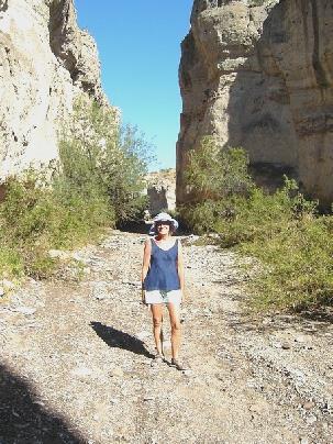
Our last stop was at Tuff Canyon, where we walked down a rough path into a canyon, which not too long ago had been filled with flood water! We scrambled along the base of the canyon, but although it said it was a ‘loop trail’, the only way back was scaling the canyon walls, so we returned the way we had come!
Looking back to ‘The Window’
Adobe walls at Sam Nail’s Ranch
It was now 4.45, so we proceeded to our campsite at Cottonwood, shaded by Cottonwood trees, on the banks of the Rio Grande. It was very quiet and empty here, apart from a group of motorcyclists! Now 5 o’clock, we had a cup of tea sitting at our picnic table, then set off to see how far we could drive along to the Santa Elena canyon. The road had been completely closed when we entered the park a couple of days ago, but we had heard that it had been partly opened. We soon saw why it had been closed, as thick mud surrounded the road, and often completely covered it. Unfortunately, the road was still closed before the canyon viewpoint. We pulled into an area which would normally be used as a canoe launching site. Everywhere was thick mud.
In Tuff Canyon
We looked for a while, then began driving back. On our return, we saw what we thought was a peregrine falcon, and also a little ground squirrel, different from anything we had seen before.
We got back to the campsite at 6.15 and Adrian lit the barbecue. We ate our meal of Tilapia fish, acorn squash and baked potatoes inside as it rapidly became dark, but when we went outside later, the stars were even more amazing than on other nights.
The muddy Rio Grande
Thursday 16th October 72 miles
We woke at 7 o’clock and ate our breakfast outside, just as the sun was coming up behind the hills. We left at 8.30, stopping to view the former town of Castolan. There was a nice display of old photographs of the area, which conjured up the atmosphere of what life might have been like here in the past.
We stopped again to view Castolan Peak before driving on to park and then walk the ‘Mule Ears Spring‘ trail. The Mule Ears are 2 large rock stacks which look just like their name suggests!
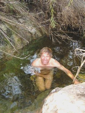
We set off at 9.40 for this walk across the desert for about 2 miles. Soon after we started off, we saw a group of deer, which manage to survive in this inhospitable atmosphere. Otherwise, the walk might have been unremarkable, with numerous small lizards tearing along; a few butterflies, and several different flowers from ones we had seen – more mallow-like, and in a variety of colours. The thing that made the walk memorable though, was that when we finally reached the spring, there was a deep pool between the rocks, and we were both able to immerse ourselves for a delicious cool down!
Old steam engine, Castolan
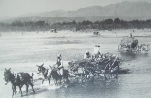
Crossing the Rio Grande, 1916
There had been one or two clouds earlier on, but these had dispersed, and it had rapidly become extremely hot. We would have liked another cooler when we returned to the Bam! We had only seen one other group of people during the whole time. On our return walk, we saw what we think is a loggerhead shrike, perched on the top of a cactus spike.
It was now midday, and we were feeling very hot! We drove to Burro Mesa, and ate our lunch in the Bam, as it was much too hot to eat outside.
There was a short walk from here to what is called Burro Mesa Pouroff. We had imagined that some of it would be in the shade, as we were walking into a canyon, but in fact it wasn’t. We just walked to the point in the high cliff walls where water would run off after heavy rain. The exciting thing on this walk though, was that apart from the numerous lizards again, we actually saw a snake! It was curled up on the path, and slithered away after I had nearly trodden on it!
Cooling down after our hot ‘Mule Ears Spring’ walk
It was 2 o’clock when we got back to the Bam, and time for us to leave the park. We reached the exit at 2.45 and very soon came to Study Butte/Terlingua. This was a very unattractive town, set in a barren area of desert. We stopped long enough to get some fuel, then headed off towards Lajitas. We turned off to see the apparent ‘ghost town’ of Terlingua, which was more like a shanty town, as people had re-used some of the old adobe buildings, and adapted them for their own use. Everywhere looked very hot and barren, but we could see places where water had rushed across the road recently.
We were now reaching Big Bend Ranch State Park, and so stopped at the Visitors Centre, where we found out that camping permits cost $6 each. We decided to wait and see what happened.
We were surprised at the town of Lajitas, which was very ‘posey’. The ‘hotel’ seemed to encompass a line of old looking stores, newly built. It all seemed rather incongruous in this remote area.
We heard a rumble of thunder, and there was a flat looking rainbow amongst the few angry clouds, but for us it remained hot and sunny.
We looked into one of the camping areas, but found it to be very uninspiring, but we unexpectedly came to a normal picnic area, with its usual signs saying ‘no staying for more than 24 hours’, so this would seem ideal for us. It was just above the Rio Grande, and even had little ‘wigwams’ set up to shade the picnic tables. Beside each one was a barbecue, so what more could we ask for? While I typed the diary, Adrian lit the barbecue. Okay, its only frankfurter sausages tonight, (no shops here) but the setting is perfect!
Burro Canyon and ‘Pouroff’
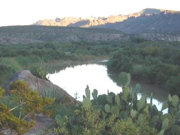
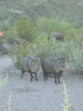
While we were getting things ready, a group of javalinas (peccaries) walked past. We enjoyed our meal, sitting outside in this superb setting. We sat right above the Rio Grande to sup the rest of our wine. What could be lovelier?
We came in when it got dark, the stars were amazing again. It was still very hot, and an annoying number of flidgies came in, reminding us of Dawson River in Oz!
Madera Canyon - Big Bend State Park
What a wonderful overnighter! Big Bend Ranch State Park
We even had a visit from some javalinas
Friday 17th October 134 miles
Marfa - we come across a low-key American parade
It was warm in the sun, but not so hot as previously. Adrian had lit the barbecue, and we enjoyed our meal of pork, courgette and potato, sitting outside at the picnic table, with this lovely view. A group of bikers had come in noisily, but had left again. They seemed to be riding up and down the hill for fun ! It was cooler tonight, but after dark, the stars were once again fantastic. We spent a lot of time editing the wedding video, but annoyingly it crashed just as we were finishing. A great many vehicles went by at bedtime, although it had been quiet all evening.
A barbecue beneath the McDonald Observatory
We very soon discarded them, as the wind dropped, and the sun became very warm. We had the most delightful walk with views that were out of this world. The wild flowers were superb – lots of yellows of coreopsis and a tiny golden rod looking plant; reds; occasional blues, and even a peach coloured verbascum. The trees were interesting – we had picked up a leaflet which gave us information on them. But best of all were the crickets, which were numerous and diverse, and in all shapes and sizes. My favourite was a dark coloured one which was bright red when it jumped, and sounded like a fire cracker!
It took us over 2 hours to reach the top. We felt that we were on top of the world, with spectacular views all around. The beauty of it all took my breath away! Now it was time for the descent, which took us about an hour and a quarter, so we reached the Bam at about 4.30. It must rate as one of the most fantastic walks that we have ever done, reaching near perfection. The weather was just right, there were hardly any other people, and it was simply beautiful!
So now we drove on another mile to the campsite (Chisos Basin Campground), where we settled ourselves in, and enjoyed a cup of tea, sitting at the picnic table, in the warm sunshine, with this spectacular scenery all around us.
We awoke to a clear blue sky and had breakfast under our ‘teepee’. I washed up outside too, and we left at 9.45. We drove on up through Madera Canyon, enjoying the splendid scenery with the red vertical faces of the rock and the numerous ocotillo plants, several of them in flower. We saw a tarantula on the road! We stopped before Redford, as Adrian was feeling dozy, and made this our coffee stop. Just before Presidio, we stopped by Fort Leaton, but Adrian got attacked by mozzies, so we didn’t hang around. Presidio was not an attractive town. It was hard to believe that we were in USA, as it seemed so Mexican. We went into a supermarket for some much needed replenishments, and found it very different! We managed to get most things that we needed, and the people seemed pleasant enough. We went into the post office to buy stamps, and they had to get another person to come and serve me, and they asked me how much it cost to send to Europe! However, we did find that our phone logged in, but we didn’t have many new messages. We needed somewhere to stop for lunch, so pulled of the road onto the track to the cemetery, and stopped beside the road and ate lunch in the Bam, surrounded by the desert. Soon afterwards we passed the ‘International airport’, and saw one tiny plane in the arid desert! There were a few isolated shacks and caravans which were obviously homes to people – made us think of Woodhaven in Oz. We came to a ‘US Border Control.’ The young chap asked us if we were American. When we said that we were English, he asked if we had our passports and visas. We went to get them and he said ‘I believe you, sir’ and off we went! We now came to Marfa, and in contrast to Presidio, this looked a really pleasant U.S. town, with a splendid Town Hall. We spied a library, so went in there to use the internet. We had a few messages, and sent one to our kids. We came out to where we had parked in the shade, and had a cup of tea, and re-read our emails. When we came to leave, we realised that something was going on – there were police cars stopping the traffic, and people lining the streets. We joined them, and were treated to one of America’s low key town parades. We are not sure what it was all about – something to do with the local football team – the ‘Shorthorns’. There were several floats, and everyone was wearing purple T-shirts. Sweets were thrown to the children. As the last vehicle went by, everyone dispersed, and that was the end of that!
We now drove on to Fort Davis, which we had planned to visit, but it was now after 5.00, so had just closed. We thought that we would stay at one of the many picnic areas marked on the map, but ended up several miles out, beneath the McDonald Observatory. We were at a picnic site with splendid views down over this mountain landscape, looking more green than we had seen, and with quite a few trees. I decided that this was the time to trim Adrian’s hair. While I was doing this, a man stopped and came to empty the bins to collect the aluminium cans, presumably to get a bit of cash.