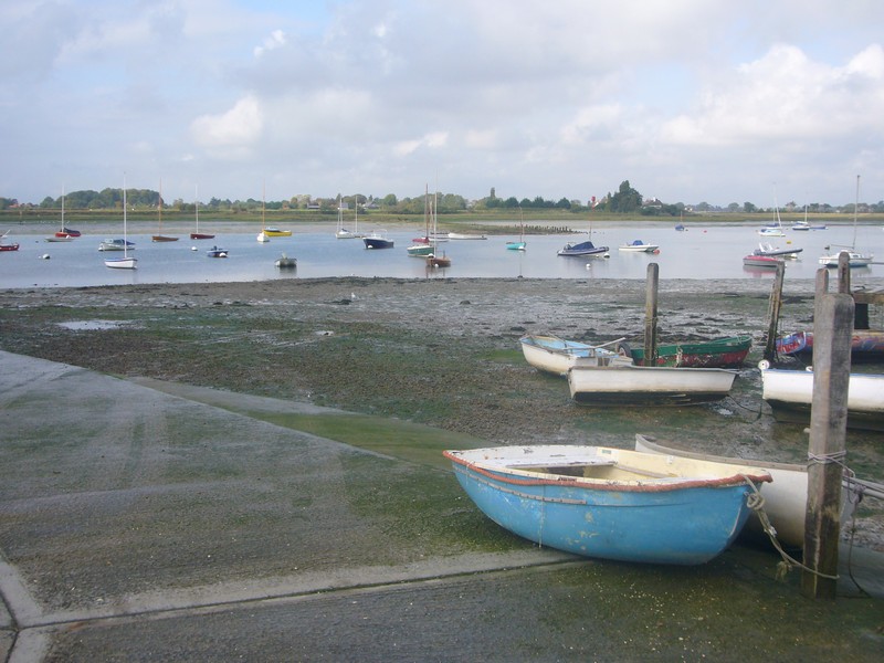
Monday 10th May 2004 60 miles
This is a short bit of the coast, which we are fitting in as we hope to meet up with Anne Dolby tomorrow in Portsmouth after nearly 40 years.
We left Newbury at 1.30. We drove through the pretty countryside, with everywhere in its fresh spring green, to Southampton, arriving at about 2.30. We manoeuvred the heavy traffic, and pulled into Mayflower Park, next to the Red funnel ferry point to the Isle of Wight.
Southampton to Dover
After a couple of weeks of rainy weather (we had returned from Mexico nearly 3 weeks ago, and after the first few days, the weather had been very mixed), it became really warm in the sun. We bought delicious and inexpensive ice creams from a very pleasant vendor, and ate them sitting at the water’s edge. The only annoying thing was the number of flidgies which descended on us!
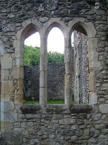
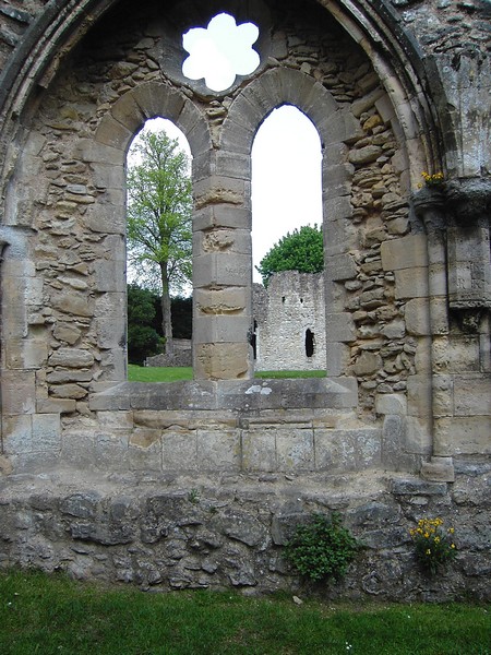
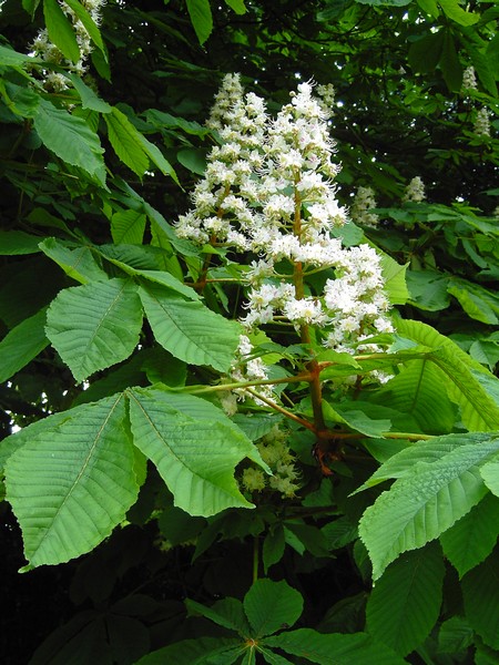
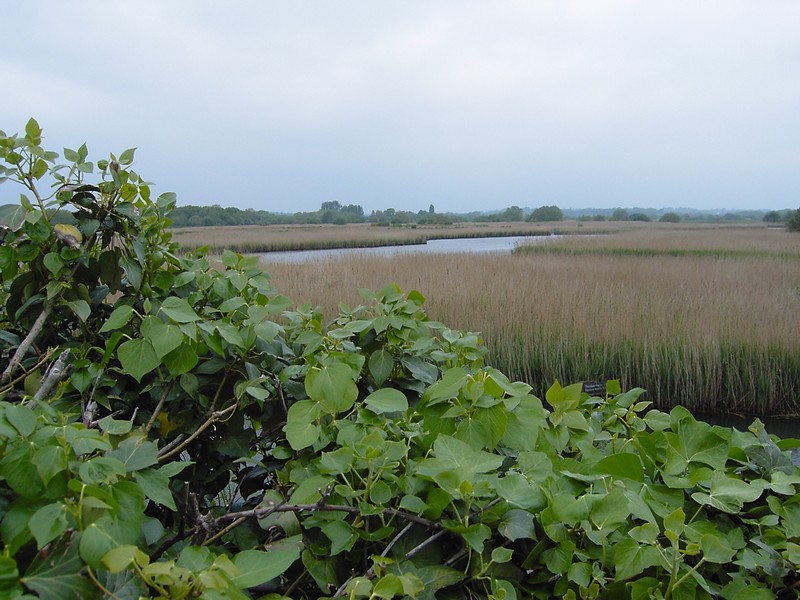
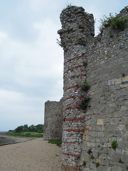
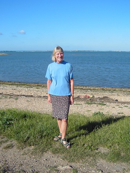
We now went over the toll bridge (only 50p) and found ourselves by Woolston jetty. We parked here, by the yacht club, and walked onto the long pier, and then for a short distance along the coast. We now drove on through Weston, along a pretty, leafy road beside the water’s edge. Through the hedge, I espied Netley Abbey. We pulled in there (parking and entrance free), and spent a delightful time wandering around these attractive ruins. The Abbey had been built for Henry 111 in 1239. I found the huge ruins very photogenic, so it was perhaps not surprising that we later found that all sorts of literary and artistic figures who had waxed lyrical about them! Wallflowers were growing from the gothic windows, and a huge horse chestnut was in glorious flower nearby.
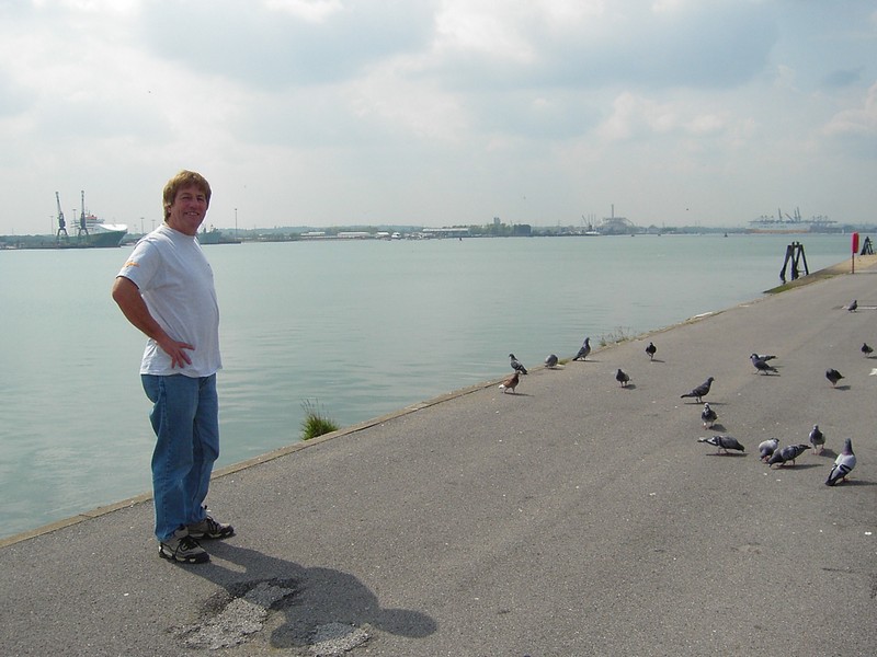
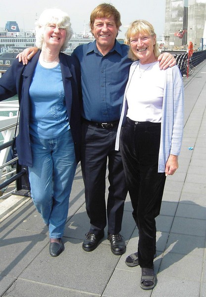
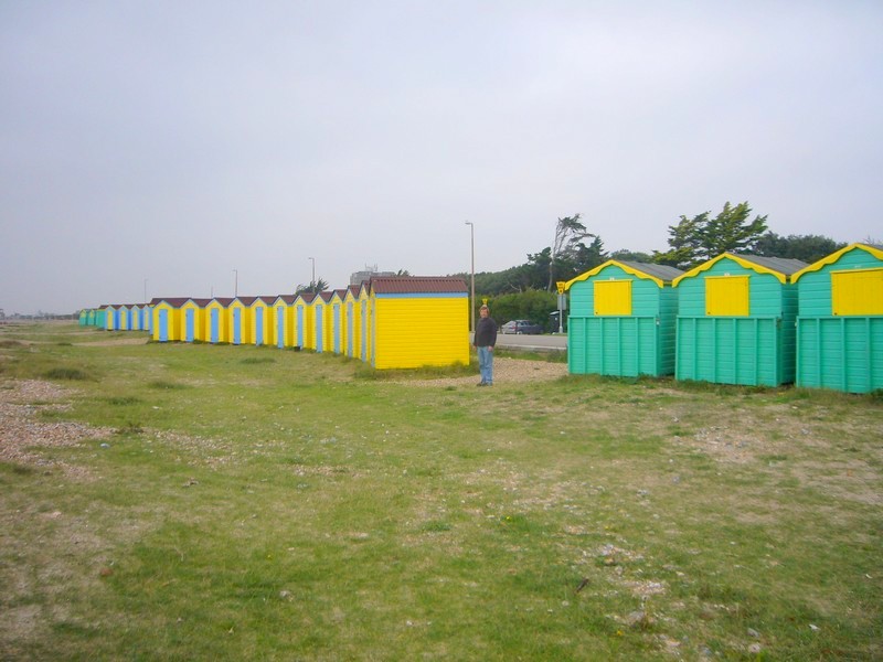
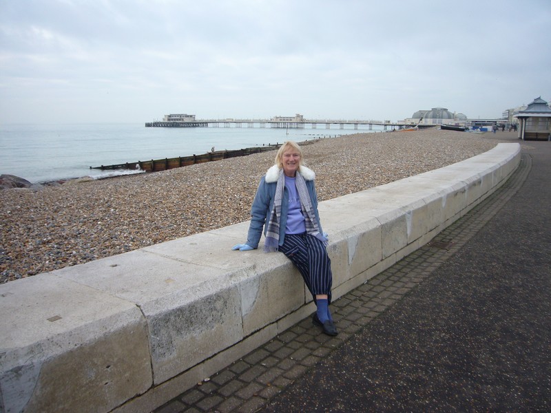
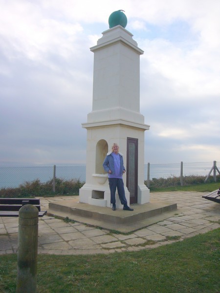
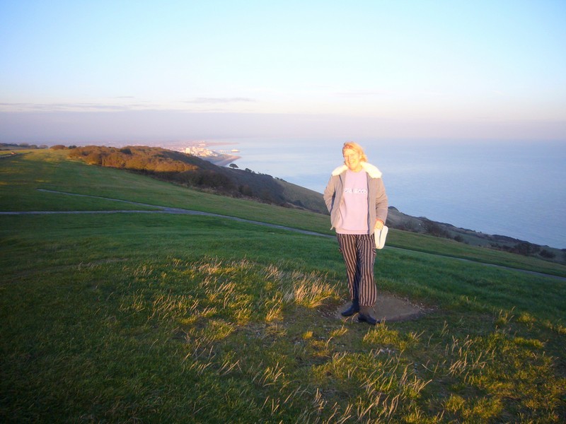
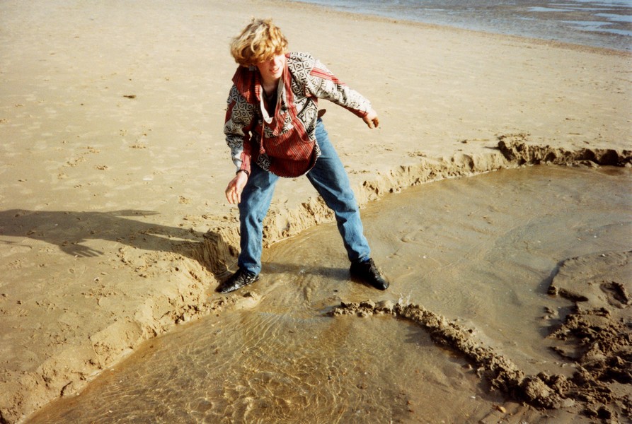
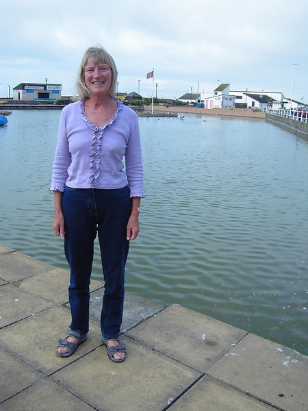
Adrian in Mayflower Park, Southampton
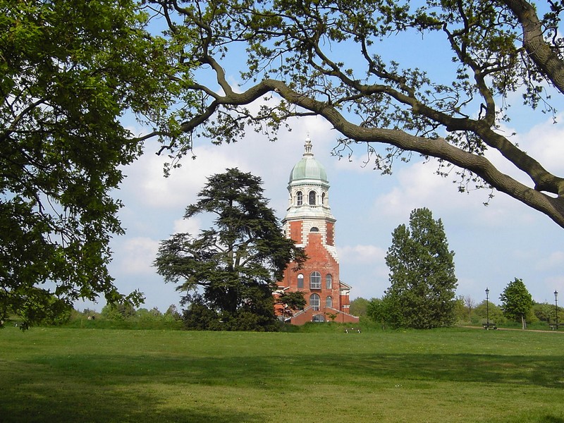
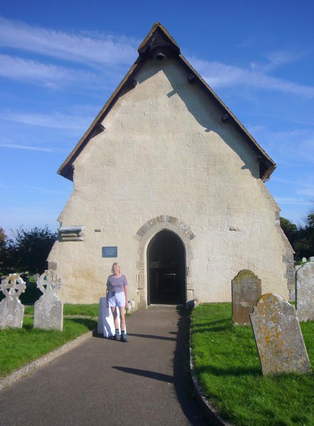
We drove on past the pretty pastel houses of Netley village and soon came to Royal Victoria Country Park. We decided to go into here and pay the £1.10 parking fee. The only building left standing here is the superb chapel and tower. The enormous hospital was demolished in 1966. It had been built in 1861, and used to care for injured soldiers from the Boer, 1st and 2nd World Wars. We walked along beside the shore to where the pier once stood, then visited the chapel, which now serves as a museum. We paid our 35p each OAP fee, and wandered around the interesting exhibits, and up the high tower, which gave superb views down over Southampton Water.
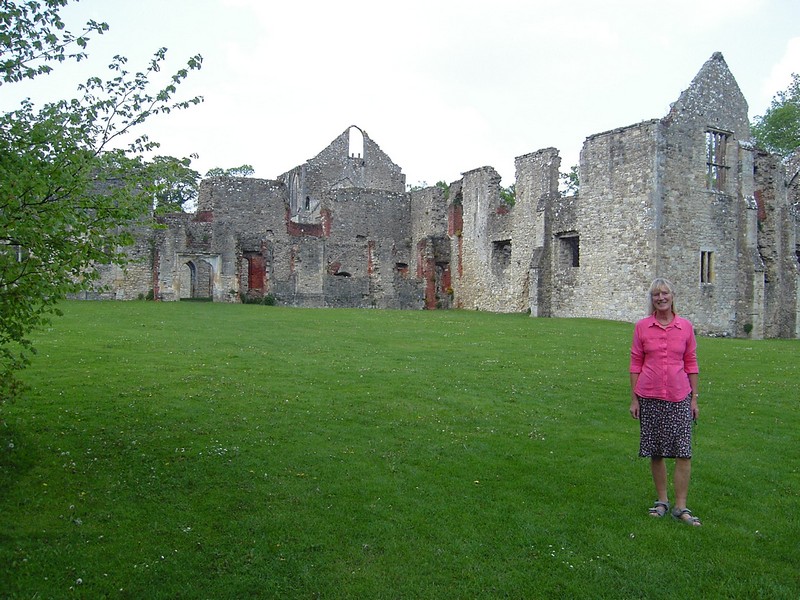
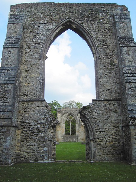
Photogenic Netley Abbey
While Adrian bemoaned the fact that the buildings had been pulled down, we were glad that the area is now a really attractive place for people to enjoy themselves.
We now drove on to Hamble (le Rice), past the common, to Hamble Point. Here we were delighted to find a small parking area, with no signs saying no overnight parking. It was at the water’s edge, with views across to Fawley, and looked ideal to us. On a board was the route of a short circular walk across the common, so we set off, in the pleasant late afternoon sunshine.
It was beautiful walking through the leafy trees, and was a really nice walk, except for the thick mud, which we often had to negotiate!
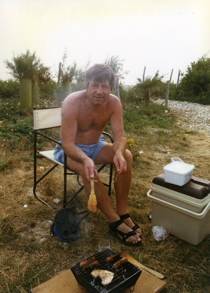
When we got back to the Tiv, I thought that it was ideal to have a barbie on the beach, but as we had no barbecue fuel, I had to cook the spare rib pork chops inside. This was perhaps just as well, as, by the time we had finished eating, the lovely afternoon had turned to heavy cloud, and a dramatic thunder and lightning storm followed. The rain didn’t amount to anything much, and we were able to walk out afterwards along the shore, marvelling at the myriads of lights everywhere, with the lightning still flashing in the distance. The quiet car park had become much busier than we had expected as young people came down to fleetingly enjoy the atmosphere.
Royal Victoria Chapel
Tuesday 11th May 48 miles
We left our lovely spot at 8.45 on a misty but fine morning. We made our way to Bursledon, amidst the busy early morning, school time traffic, and tried to locate 2 pubs remembered from our youth – the Fox and Hounds and the Jolly Sailor. We followed signs to the Fox and Hounds, which had a lot of tables outside. We did a real circular tour (finding ourselves back at the Fox and Hounds!) before reaching the Jolly Sailor, which I remember visiting while on a canoeing trip from college, but Adrian couldn’t recollect at all! The River Hamble here was just chockablock with sailing craft – it wasn’t like that in the early sixties!
We now crossed the Hamble towards Fareham, and had a pleasant walk initially beside the river, and then back by Holly Hill reserve.
It was now time to drive to Portsmouth to meet up with Anne Dolby, my college friend who we hadn’t seen or heard of for nearly 40 years! After meeting at her house, very near to the college, she drove us to Gun Wharf, a shopping/restaurant development on the site of HMS Vernon, near Portsmouth Harbour Station.

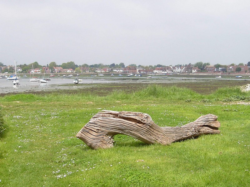
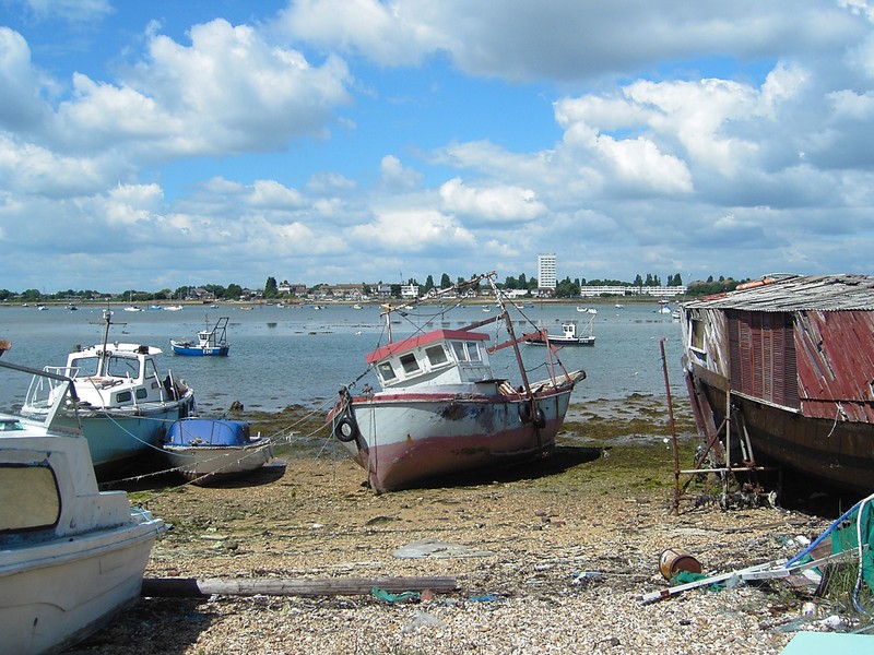
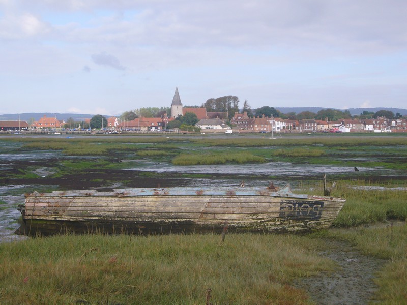
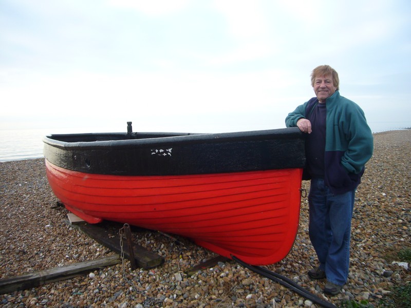
The remains of an old boat
Having revived many memories, we said goodbye to Anne, and drove back to where we had left off this morning. At Warsash, we stopped to look over the River Hamble at a point where there is a memorial to the D Day landings. We tried the road south from here, but it became a potholed track, so we returned through Warsash to Hook, where we pulled into a CL beside a nursery at Lower Gubbles with loads of large greenhouses. We took advantage of the pleasant evening and had a walk along the road and back along a footpath and track to the Tiv for supper.
With Anne at Gun Wharf
Here we enjoyed a self service Chinese meal, and much chat, before returning to Milton. Here we looked at the old Foster Hall (where I lived while I trained as a teacher in the sixties), about to be demolished, to be turned into a housing development.
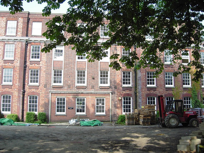
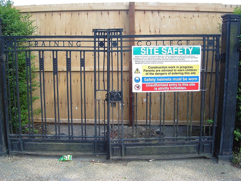
Foster Hall and its old entrance gates
Wednesday 12th May 42 miles
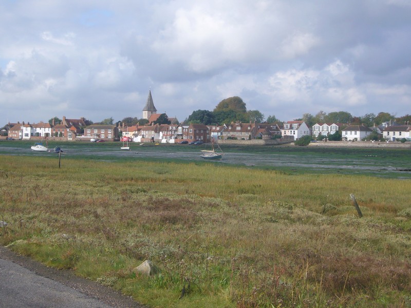
We left just after 9 o’clock on a dull day, which stayed that way all day. We hadn’t found anyone to pay, despite trying at the house 3 times, so had a free night. We drove past Titchfield and down to Titchfield Haven. This was of special significance to me, as it was the mouth of the River Meon, which we studied intensely at college.
Despite this, nothing struck me as familiar. We walked up by the old Meon ‘canal’, then came back to view the haven, with its water birds, and the harbour. We then drove past Hill Head towards Lee on Solent, stopping briefly between the two to walk on the pebbly beach.
At Lee we were pleasantly surprised to find that parking was free, so we stopped and walked along the shore. In the past, it had been hoped that Lee on Solent would become a resort to rival Bournemouth, but this didn’t ever happen. There had been a pier and a tower, both now demolished, and a railway to bring the holidaymakers. It now looks like many of the south coast low key holiday towns – a place for the ‘oldies’ perhaps, not unpleasant but unremarkable.
East of here we came to Browndown and Stokes Bay. Beside another (free) car park, there was the remains of an old battery. A small ‘cabin’ in the corner of the car park was serving lunches. It seemed very popular, but had no fish and chips, which we had decided on for today. We walked on the pebbly beach here before driving over Haslar Bridge into Gosport, where I bought 2 OAP portions of cod and chips. We couldn’t find any where to park nearby, and ended up driving back over the bridge and eating our fish and chips sitting in the cab in a car park next to the prison! Afterwards we walked over the large car park to the shore, where we saw a hovercraft heading for the Isle of Wight. It would all have looked so much lovelier in the sunshine!
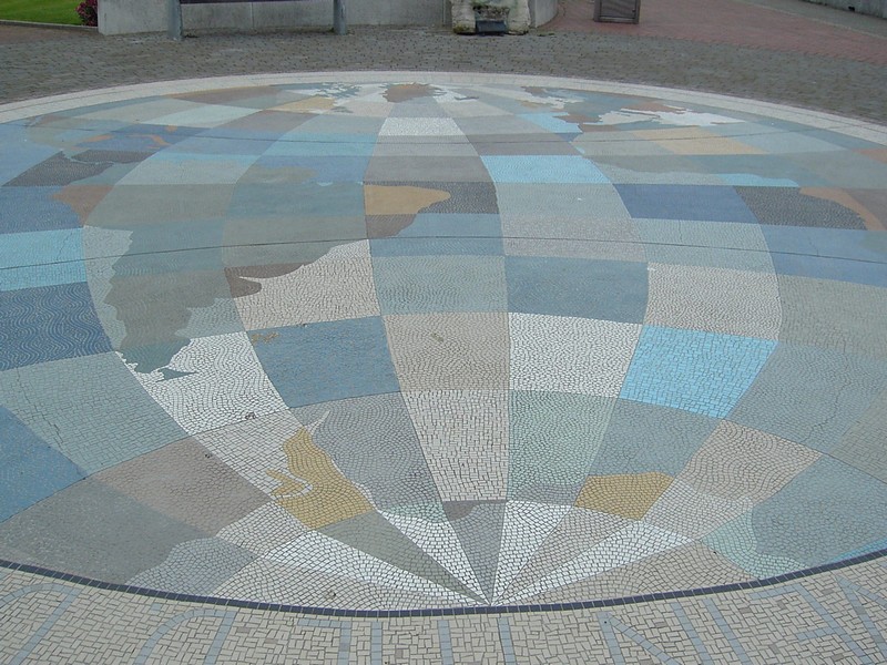
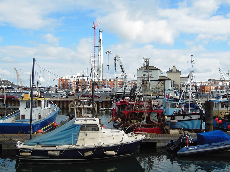
We drove back into Gosport via a different route, and parked beside the road near to the tall blocks of flats, which I remember visiting when on teaching practice in the early sixties when my class teacher invited me for supper. From here we were able to walk along the shore, looking over to Portsmouth, where we had been yesterday. We saw HMS Warrior and the Victory and the huge partly built Spinnaker tower. Along the path were several memorials – I really liked a mosaic map set in the ground as a Second World War and Falklands War Memorial.
Rosie at the mouth of the River Meon
Titchfield Haven
We drove a short way north and turned off on a small road which led to a pedestrian bridge to a former Naval site, which is now the location of a museum of naval firearms, called ‘Explosion’. We didn’t visit the museum, but had a good look around the area (visited 2017). With the thick muddy inlets beside the water, it had a Dickensian feel.
We now drove through Brockhurst, where I did my first teaching practice. We passed the Infant and Junior schools, but it didn’t look quite as I remembered it! We saw the huge Brockhurst Fort, surrounded by a moat – I remember nothing of that!
Now we headed out of Gosport and took the road to Portchester, following the road down first to the western end. We walked out along the shore and back over the fields. We then drove through the housing estates until we came to the pretty little village of Portchester, and the castle. This looked much bigger than I remember from when I cycled there from Portsmouth with Angela in the early sixties. We walked right around it, in its splendid shore side position, but didn’t go into the paying part. You could, however walk right into the central area.
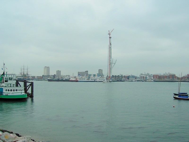
The Spinnaker Tower being built, Portmouth
A mosaic map of the world, Gosport
We were now out into the busy homegoing traffic. We decide to miss Portsea Island, as we are returning to Portsmouth next month, and head for Hayling Island to find somewhere to stay for the night. At Stoke we came to a CL adjacent to a riding stables called Wescrofts . We pulled in there, but immediately set off to walk up the road to join a track beside the sea. This is where the Hayling Billy railway ran in the past, but is now a walking/cycling trail. It was good to look across to the sights of Portsmouth, especially as the sun was now trying to peep through. The bit of road walking back to the site wasn’t much fun, but we then settled down to supper, as the sun descended behind the trees.
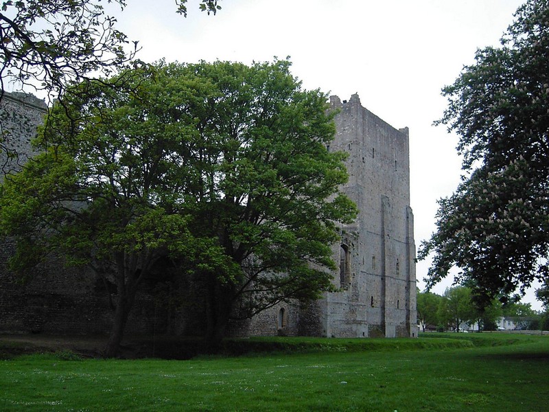
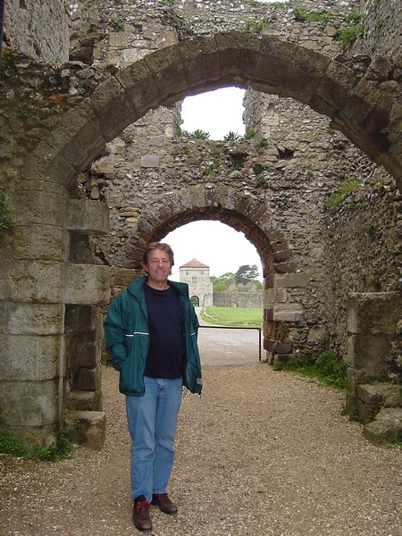
Porchester Castle
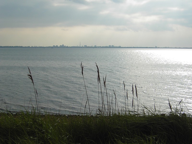
Looking from Hayling Island to Portsmouth
Thursday 13th May 91 miles
It was a cold night, and we woke late. We left at 9.30 on another grey day. We drove down past Sinah Warren to the ferry point to Portsmouth, but didn’t stop here or anywhere else on Hayling Island. In fact we found Hayling Island a disappointment. Adrian had spent happy times here as a child, and had come to Sinah Warren many times for courses when he was with the SEB, and a few years ago we had come here for a college reunion. These were happy memories, but now all we found was houses, houses, houses, and no access to the coast.
The wind seemed to be blowing in our face all the time! We ate our sandwich lunch in a disused hut, out of the wind, but afterwards, as we walked up the eastern side, it was less windy. We could see the small Pilsey Island to the SE of Thorney, but signs told us that it was a Nature Reserve, so there was no access, except for a limited area accessible by boat on the far side.
The path needed a bit of imagination in some places, despite signs saying that it was clearly marked. We passed the only habitation, West Thorney, and arrived back at the Tiv at 2.40. We set off for home at 3.30, diverting to drive through Emsworth, which looked very attractive, and we hope to visit again. The only hold up was at the A34/M4 junction, which they are ‘improving’, just before we reached home. We had really enjoyed our few days away, continuing our ROAD ARound Britain.
Friday 13th October 2006 36 miles
Another short part of our RAB after visiting Emma and the children in Devon, and before visiting Little Val in Littlehampton on Sunday.
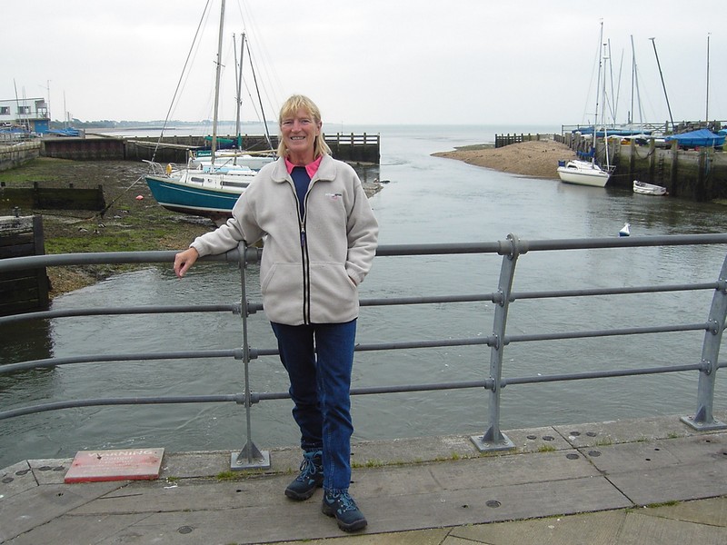
We had driven to Langstone Harbour last night, and stayed beside it in a small carpark at Stoke, on Hayling Island, where we had stayed on our last visit to this area.
We had enjoyed the lovely view across to Portsmouth in the distance and had had a walk out by the harbour, while little rabbits jumped about.
Saturday 12th June 2004
As we were coming to Portsmouth for a ’40 years on’ College reunion, we fitted in our RAB of Portsea Island. We have obviously visited Portsmouth many times over the years (since we were both at college there for 3 years in the early sixties - and where we met at Manfred Mann), so this was just an ‘official’ addition to our Road Around Britain.
We travelled down on Friday afternoon/ evening, through dreadful traffic jams. We found out later that some of it may have been caused by traffic for the rock festival on the Isle of Wight.
When we were doing this bit of the coast a few weeks ago, we drove briefly through Emsworth, and thought that it looked nice. Therefore, on Friday evening, we had a pleasant walk around the ancient millpond before heading to a beachside parking area at Stoke, on Hayling Island, which we had seen on our previous visit.
We returned to Portsmouth a month later for a College Reunion for Rosie's Milton Training College
Looking to Emsworth from Thorney Island
'The great deep'
Saturday morning was beautiful, but windy. Strangely there were no windsurfers about.
Emsworth 'millpond'
We had a ‘Curtain Springs’(Oz) feel as we arrived, and found the parking area full of vehicles belonging to the many windsurfers! Nevertheless, we managed to find a spot big enough for us, and spent a really pleasant evening, enjoying the lovely view over the water, looking back towards Portsmouth. Gradually the windsurfers left, and we had a short walk out along the shore at sunset, as little rabbits scurried away across the grass into the bushes.
Sunset at Stoke, Hayling Island
We left at 8.30, and headed back to Portsmouth, driving down the western side, past the Channel ferry terminal. We saw the Tricorn building being knocked down – and that wasn’t even there when we were at college! (‘They’re knocking down buildings that I watched them build – Time, just time’ – from a song sung by Hank Kerr)
We drove past Gunwharf, which we had visited with Anne Dolby recently, and the ‘Warrior’ and the almost completed Spinnaker Tower.
Taking the road towards the Isle of Wight ferry terminal, we came by chance to a parking area next to Lombard Street, where Adrian used to eat his lunch at the CEGB headquarters. Parking here was free for 3 hours, so was just right for us to use, as we set off for a delightful walk around Old Portsmouth. We first passed the old fishing harbour, which I didn’t even know existed! It was good to see how many old fishing boats were still being used.
Looking across to Portsmouth from Stoke, Hayling Island
Then we looked around the recently renovated ‘Point’, adjacent to the well loved ‘Still and West’. There were many information boards explaining the history of Portsmouth, and additional ones about D Day, which had just ‘celebrated’ its 60th anniversary. One board explained that the ‘Still and West’ was the combination of two neighbouring inns, the ‘Still’, and the’ East and West country house’.
The Fishing Harbour at Portsmouth
We walked past and around the Round Tower, and right along the front to Clarence Pier. We were now at the small, tatty, commercial part of the front.
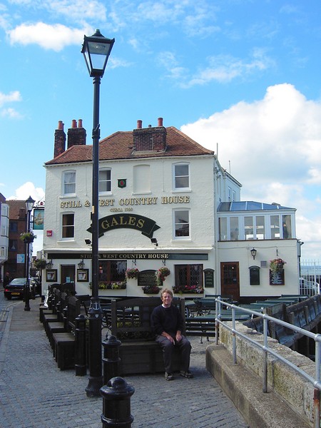
The much-loved (from our college days) Still and West
We passed the Hovercraft terminal to the Isle of Wight, remembering the trip we made with the children, soon after it had opened.
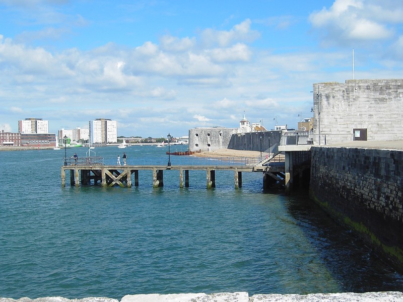
Past the Round Tower
The sun was hot, but the wind cool, as we walked as far as the large war memorial, then back across the edge of Southsea common and to the cathedral. This had been enlarged since ‘our day’, and a ‘nice’ lady guide gave us a leaflet, and a short chat about it. We reached the Tiv and drove back along the front, passing the castle, South Parade Pier, the boating lake and the barracks. All the parking was now ‘Pay and Display’, so we didn’t stop until we came right down to the Hayling Island ferry crossing point at Eastney. Here we were able to pull on to the beach, and get ready for the grand reunion, enjoying views to Hayling Island one way, and Furze Lane – our imminent destination - in the other.
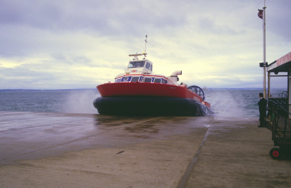
The hovercraft at Portsmouth 1986
On Sunday, after a superb reunion, culminating with a group of us gathering outside the Thatched House on Langstone Harbour for a drink and more chat, we drove up the eastern side of Portsea Island, along Eastern Avenue, completing our Portsmouth Road Around Britain.
Looking to Furze Lane (tower block) from near Eastney Ferry
Adrian looking to Hayling Island from near Eastney Ferry
The next part of Road Round Britain is Emsworth to Anmering
We could have stopped at the ferry point, and at several points along the southern shore (for a fee), but the pebbly beach and grey sky didn’t entice us! The wildness of the past had become the golf course of today! We drove right around the island, but didn’t get out of the van once.
We thought the village of Northney, towards the north of the island, pleasant, but by 10.30 we had had enough, and drove back across the causeway, heading for Thorney Island. We had seen from the map that there was a footpath right around the ‘island’, so parked in a small lane, and set off at 11.20.
Thorney Island had been an island until 1876, reachable only by a causeway. Then they built 2 sea walls to enclose the salt marshes. The island was owned by the RAF until 1976, and later by the army. We still had to get permission to walk around it, by calling through on a telephone at the gate. The island was described in our ancient coastline book as being featureless. It was certainly pretty flat, and was unremarkable, but it was pleasant walking, with the bonus of skylarks above us.
We looked out over the mud (it was low tide) to firstly Emsworth, and later to Hayling and Wittering.
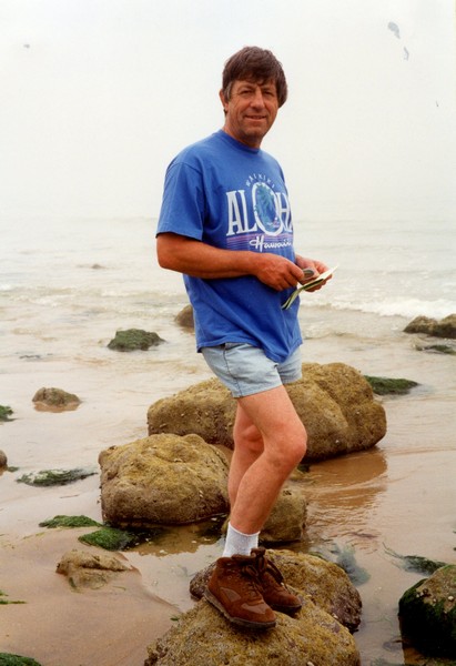
Us on Hayling Beach in 2001
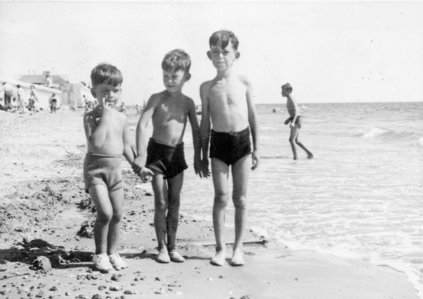
Adrian (in the middle in his sexy knitted trunks with his friends Howard & Michael Carter on Hayling beach in 1949 (see Bexhill to Dover part)
This section from Southampton to Dover starts with us returning to Mayflower Park, Southampton

One windsurfer had come down late, and had had to go out a long way before he could surf.
This morning it was people coming down to walk their dogs. It was almost 10 o’clock by the time we left. The weather was still really mild, and today turned into a beautiful day.
We drove through the pretty village of Emsworth, and past Thorney Island, turning off to the first delight of the day – Prinsted. This is a small village of lovely thatched cottages. We were able to park by the harbour and walk along beside it, making a circular walk back to the Tiv. We passed a large group of happy walkers – 27 of them – going in the other direction. The sun was already warm.
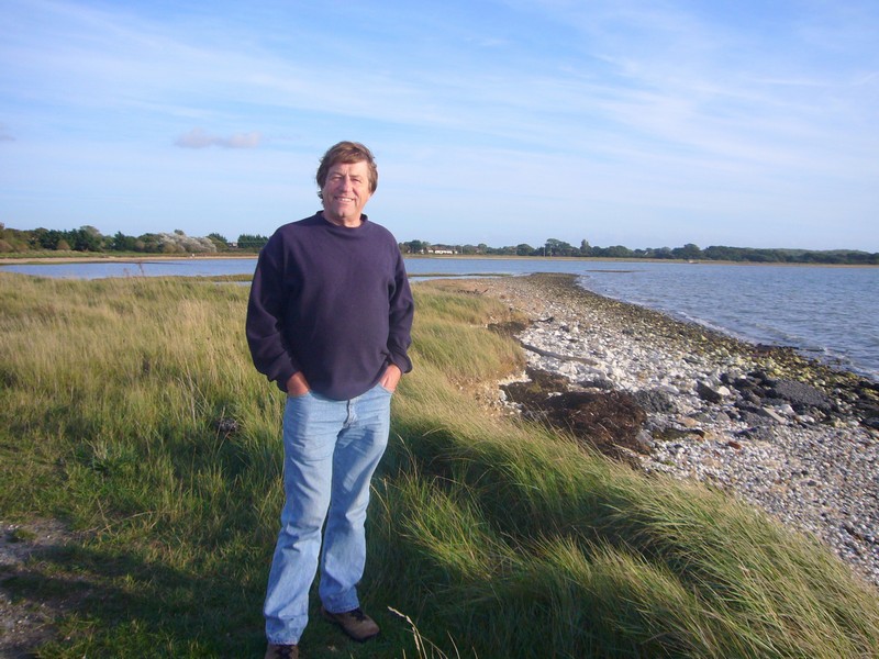
Adrian at Stoke
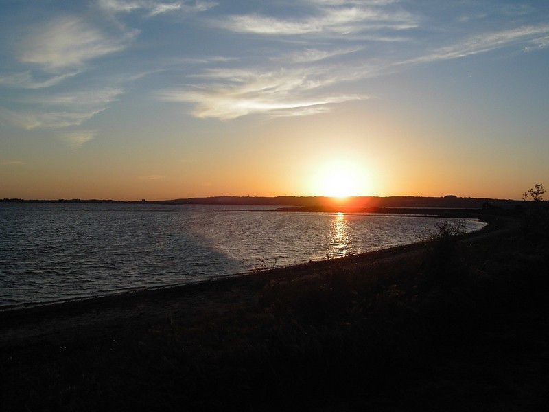
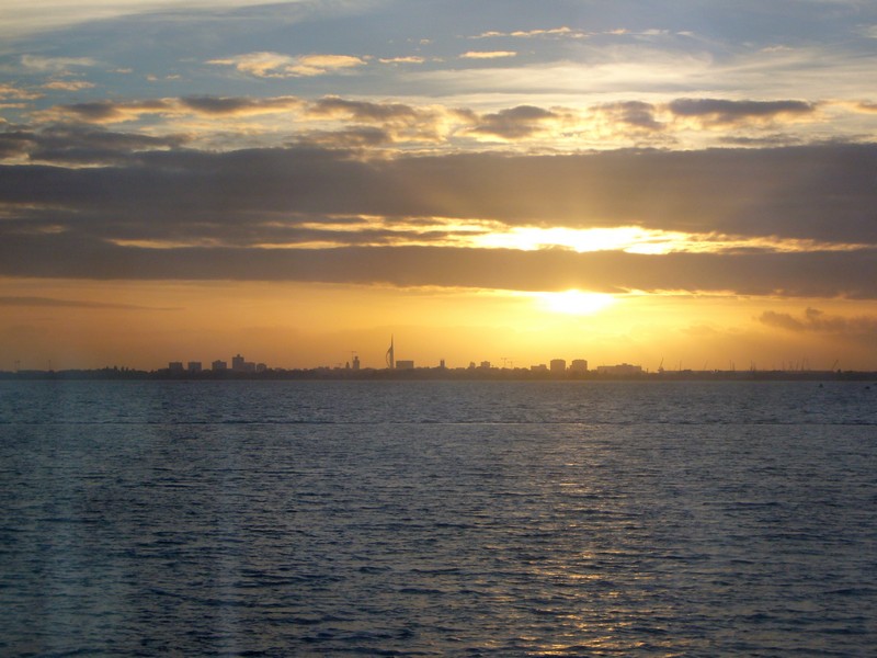
The sun goes down over Portsmouth
We drove on to Chidham and stopped beside a small pond – by now it was really warm. We bought a bunch of alstromerias for £1 from one of the many roadside stalls.
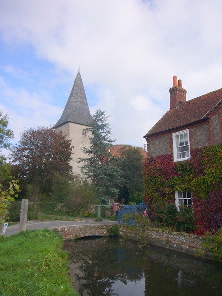
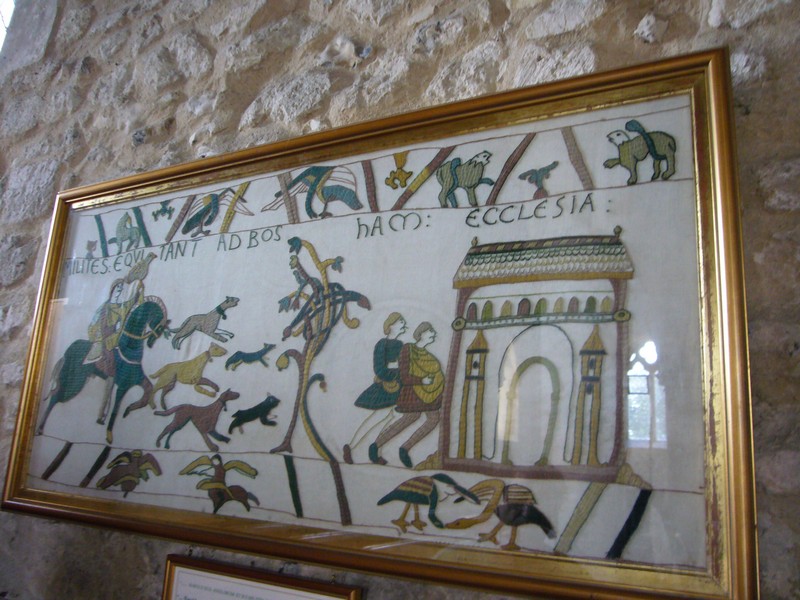
Now we continued to Bosham, where we had to pay 40p to park for an hour, but we couldn’t miss seeing the place where King Canute supposedly held back the waves! It was also here that King Harold set off from before the battle of Hastings. The delightfully simple stone Saxon church is featured on the Bayeux tapestry.
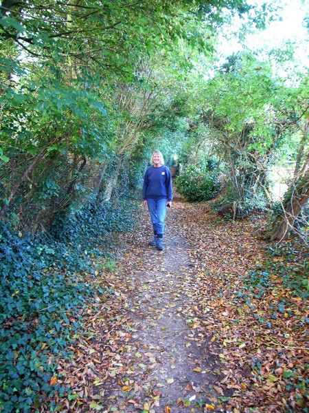
Our walk at Prinsted
The road at Bosham floods at every tide, but it was low tide as we walked around. Even in mid October, there were a lot of visitors, so it must get very crowded in the summer. We ended our visit to this lovely village with a delicious icecream, before driving on along the tidal road, which gave us good views back to Bosham.
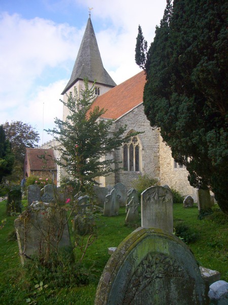
Bosham
We drove on past Bosham Hoe, but there was no shore access here.
We skirted Chichester, and turned off to drive down to Dell Quay, where the road just ended by the harbour beside a very busy pub.
We wanted to do a longish walk at Pagham Harbour, so now made our way through Sidlesham to park at the nature reserve carpark to start the walk. We had lunch first, sitting outside at the picnic table in the hot sunshine. Then it was shorts and T-shirt for our walk – we set off at 1.30, and didn’t return until gone 4.00pm.
Much of the walk was beside the harbour, looking out over the mudflats, where we saw (and heard) curlews, herons, egrets, oystercatchers and many other birds. We passed lots of birders with their enormous scopes and tripods. In the hedgerows the sloes were prolific.
Looking back to Bosham from the tidal road
The special reason for me wanting to do this walk was that I had camped in a field here in 1955 with Mum, Dad, Val, Do, Ed and Jon (aged one year). The field was at Church Norton, and Val and I had swum in the sea, and had also scared Do by singing the spooky song ‘Woman stood at the churchyard door, ooh aaah.’ Sure enough we found St Wifred’s chapel – the rest of the church had been moved to Selsey in 1865! We also found the shingly beach which we had swum from.
The beach at Church Norton 2006
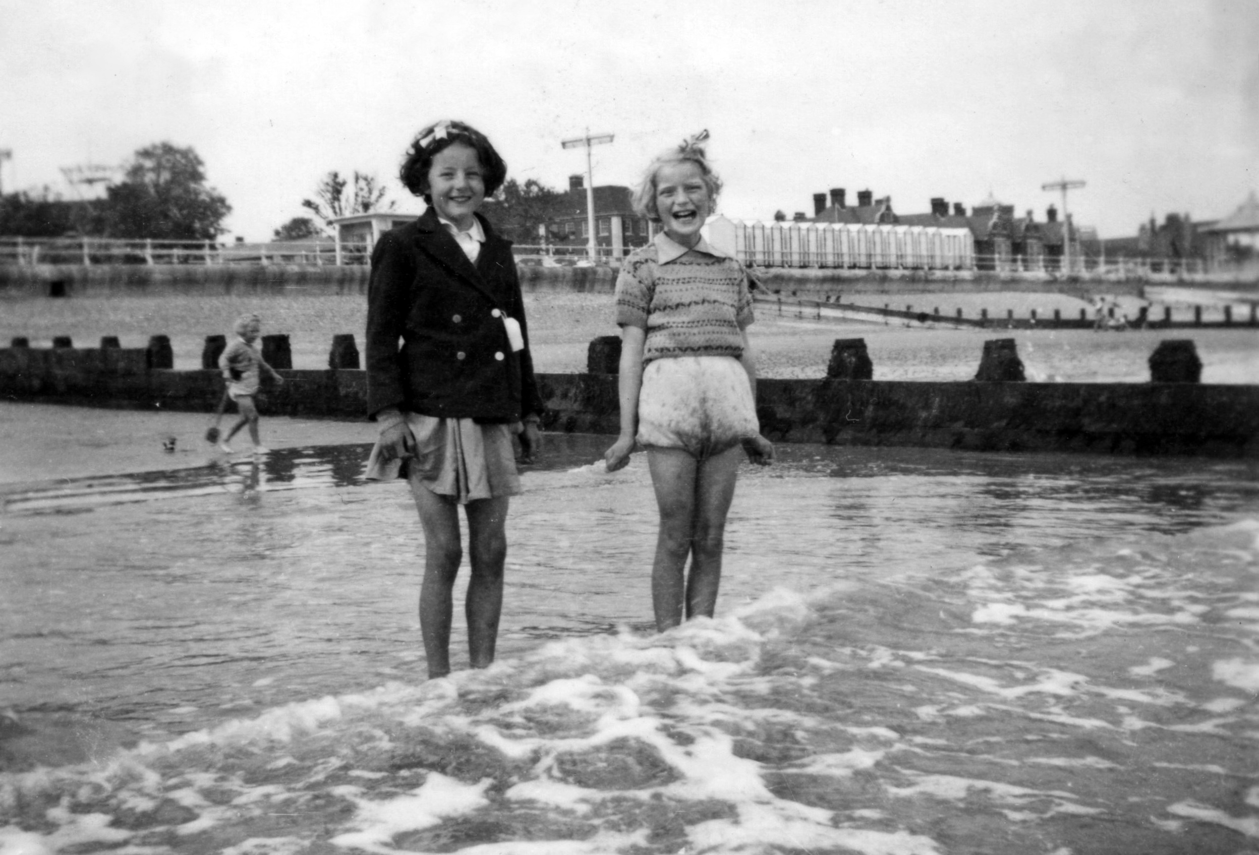
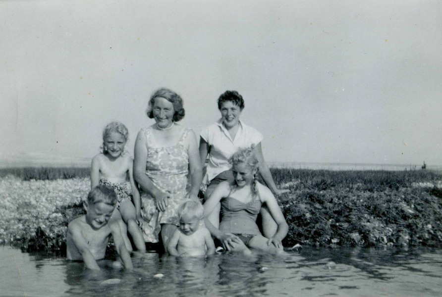
Us on Church Norton beach 1955 - Do, Mum, Val, Ed, Jon & Rosie
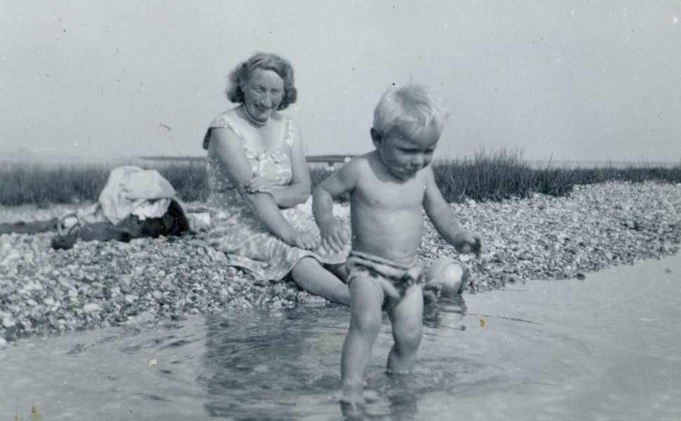
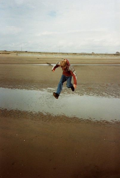
Jonathan escapes
What I had no recollection of was the remains of a Norman Castle near the chapel.
Being warm and sunny added to the enjoyment of this walk – the only downer was the short bit of walking at the end beside a narrow busy road, with no footpath.
Back at the Tiv, we decided to drive on into Selsey – Selsey was once an island, and the road goes a long way inland before linking with Wittering, which we will return to tomorrow.
We stopped at a farm shop and bought some pork chops, hoping to barbecue them later, but this didn’t happen – days are short in October, and it soon gets dark! We also bought a cauldron of flowering plants, which we will have to store carefully while we are away.
We drove first to Selsey’s East Beach, where the carpark had no access to the beach walk, so we had to climb over a fence. The wind was cool here, and the pebbly beach didn’t hold much attraction for us! We continued to Selsey Bill itself, where we had another walk along the pebbly beach. The seaweed was lit up gloriously by the lowering sun.
We drove on to the Coastguards station on the western side of the peninsula. From here we could see across to the Isle of Wight, and to the Spinnaker tower at Portsmouth. Apparently the rate of coastal erosion here is the fastest in the country, and we certainly saw evidence of it as we walked along.
The sky was still clear and blue as we drove back to Church Norton – site of my 1955 camping holiday – and pulled into the small carpark for the night at 5.45. We walked down to the harbour once more, where the tide was slightly higher than before.
.jpg)
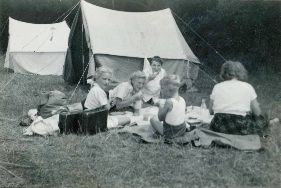
The 'Cape's' camping at Church Norton in 1955
The field we camped in and St Wilfred's chapel, 2006
Saturday 14th October 69 miles
Not such a good day – either for the weather, or for the places that we saw.
The day was mostly cloudy, with the sun only pushing through a couple of times, but at least it stayed dry.
We left at 9 o’clock, and drove back across the peninsula to Birdham, visiting the places which we had omitted yesterday, so that we could do our walk at Pagham Harbour.
Birdham is at the end of the Chichester Canal, and is adjacent to Chichester Yacht Basin, so the pretty village (with its village pump) must be inundated with visitors in the summer.
We drove on to West Itchenor, where the passenger ferry leaves from for Bosham Hoe, which we had passed yesterday. There were a lot of small craft here, and again we wondered at how busy it must get in the summer. We were able to enjoy the pretty houses as we drove down to the harbour, and realised that we had known nothing of this place, although we have visited nearby West Wittering dozens of times.
We now headed there, turning off into the village, full of delightful thatched cottages, and parking by the school and church. From here we walked down to look out over Chichester Harbour, with its numerous small craft parked up in the mud.
Both East Wittering and adjacent Bracklesham were a disappointment, as there was very little of interest to see, and the only parking at East Wittering was in a paying carpark. At Bracklesham there appeared to be no access to the sea. We hadn’t realised how many private estates there were along this part of the south coast – by the end of the day, we had had more than enough of them!
We drove right round now to Pagham, which is on the eastern side of Pagham Harbour. We managed to park beside the road so that we could walk down to the harbour. Along the wooded footpath we saw a really strange tall toadstool. There were a lot of waterbirds on the mudflats, but perhaps the strangest site was another birdwatcher, a gentleman who looked as though he might have been King Canute himself. He wore a white sweatshirt and light-coloured shorts, huge welly boots, with a cape hanging from his shoulder. Curly grey hair appeared from beneath his black beret, and he had a little goatee beard.
We saw on the map that streams here were called a ‘Rife’ – a term we haven’t come across before. Another thing to note today was the bad driving – on two separate occasions, someone pulled out dangerously in front of us, and on two other occasions, a 4x4 would not pull into the side of the road to let us pass.
We now drove on to Pagham itself, where parking of any sort was more than difficult. Signs said that the roads were private, with no parking. With our obstinacy and tenacity, we drove on through, and came to a parking area for the harbour reserve. From here we were able to walk along the pebbly ridge to the mouth of the harbour.
We didn’t drive down the toll road to the beach – site of many outings for us with our children, and for Adrian with his family before that.
We drove on through Bognor, passing Butlins, which occupied much of the front, to Felpham.
We hadn’t expected to be able to stop here, but did find a spot by the front, where a row of little shacks were hidden behind the sea wall. Much of the parking was only prohibited until the end of September, so we were often in luck.
After another ‘quick blow’, we continued through Middleton, where ‘Sea Lane’ gave us no access to the sea. We continued to Elmer, which again was a mass of private estates, but we were able to park by the road and walk between the houses to the otherwise inaccessible beach.
We were surprised by what we saw. Large groynes had been erected offshore in the nineties, and the beach here was pleasant and sandy. Fine, we thought, but who can use this beach, if there is no access?
The next surprise was a pleasant one! We turned off to Climping Beach, which appeared to be called Atherington. Our 1970s ‘Book of the coast’ had said that it was quite unspoilt, and we were pleased to find that it still is. A board said that it is the only bit of undeveloped coast between Bognor and Brighton. There was a grassy carpark, but we were able to park by the road. Behind the sea wall, it was just a grassy area. Apparently the River Arun had flowed across here in the past, and it had remained as an undeveloped flood plain.
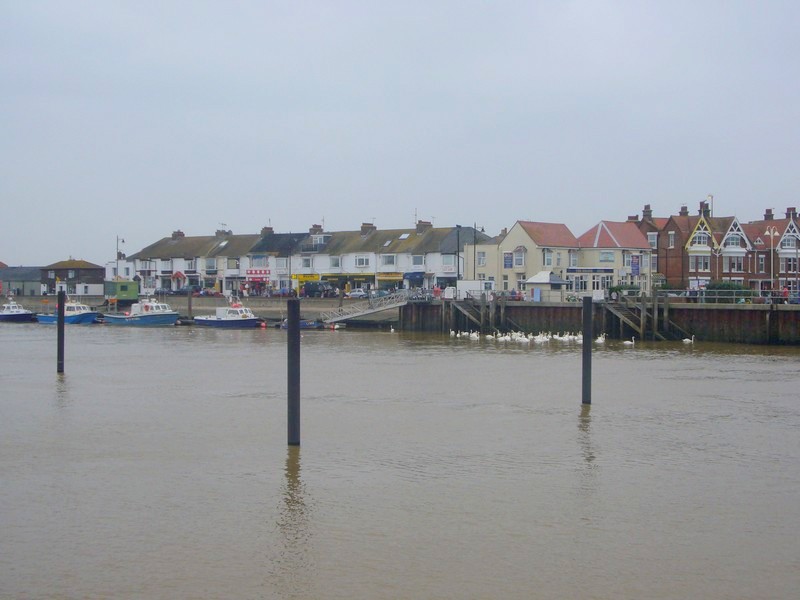
A short way further on we turned down to the west side of the River Arun at Littlehampton. The water at the mouth was a thick brown, merging with the grey sea, but it was a pleasant view across to Littlehampton on the other side.
It was pretty blowy, but there were a lot of birds on the water, particularly on the lagoon.
We stopped by a fish and chip shop we had seen earlier, and after buying our lunch, drove on and ate it beside the pebbly beach. Afterwards we had a short walk along it. The houses came right down to the beach, with gates which opened on to it.
Now we came to the western end of Bognor, stopping by some beach huts for another blowy walk on the pebbly beach.
We have visited Littlehampton many times – in recent times to visit Val Kennedy, which is where we are going tomorrow.
Today we just drove through it, thinking that it hadn’t got a lot to offer, but at least the beach here was partly sandy. We parked behind the brightly painted beach huts and had another walk onto the beach, remembering that Val and Dave had owned one when thy first moved here.
We had nice views of the beach as we continued to Rustington, but then again there was no more beach access as we drove on through Anmering on Sea. The last straw was Kingston Gorse, where we drove down a long country lane before coming to the ‘Private estate’ sign. It was time to call it a day. We looked up the nearby CLs, and were heading for one slightly inland, driving through the pretty village of Anmering itself, when we came to the A27. At this point it was a dual carriageway, so we had to turn left. We changed our mind, and headed for a CL at Lyminster, just outside Littlehampton. We found this with great difficulty, and even then most of the camping area was taken up with a horse, so we had just enough room to pull off!
Next day we visited Val Kennedy and other college friends at Val’s house in Littlehampton. It was another glorious day. We had enjoyed our couple of days on the south coast.
Monday 26th November 2007 126 miles
We fitted in this day between visiting Val K on Sunday, and taking the ferry to Calais for a ‘wine top-up’ on the Tuesday.
We left Val’s soon after 9.00 am and drove to Ferring where we stopped by a grassy area at Goring on Sea.

Chichester Harbour
Two of many visits to Wittering (1984 & 1995)
Looking across Pagham harbour to Church Norton
Adrian at Bognor
Littlehampton across the river Arun
With our children and Val Kennedy's two at the beach in Littlehampton 1984
Rosie on the beach at Littlehampton with Dorothy Hines - Do in background 1952
The brightly coloured beach huts at Littlehampton
This is where naturalist/writer Richard Jeffries, whose home we had visited at Swindon earlier this year, had spent the last years of his life. We couldn’t find out where he actually had lived, but did find a reference to him having lived here. The spot was called the Goring Gap, just like the one near us at home!
We continued to West Worthing, which had a wide promenade, but big signs saying ‘No Cycling’. We looked at a ‘Water garden’ set up on the pebbly beach. A sign stated that we used 50% more water than 25 years ago, which is a sobering thought.
Adrian at Goring by Sea
We drove on past Worthing itself, which even on this greyish November morning looked attractive. We stopped past the pier, and walked back to a spot where fishermen had brought in their haul, and the fish was being sold. We bought some Dover sole – not cheap – but it made an excellent meal for tonight, when we were actually at Dover. The road didn’t continue by the beach here, but cyclists could at least use the prom!
The Water Garden at West Worthing
We drove on through Lancing, which had little to offer. At Shoreham by Sea we drove onto the peninsula to what is called Shoreham Beach, formed by the River Adur running parallel to the sea. There was a lagoon called Widewater Lagoon, but as there was a height barrier, we couldn’t park there, and had to reverse. Houses surrounded the lagoon, and also the shoreline. We stopped at the river side of the peninsula by a sign which read ‘No overnight camping by the law of 1994’. We looked across to the industry of Shoreham, before walking out to the lighthouse at the mouth of the river.
Rosie at Worthing
Fishermen at Worthing
As we drove on through Shoreham, the view looked better from the ‘land’ side. Shoreham itself was nice. We came into Southwick, with Portslade on Sea on another peninsula across the inlet – and it was all port!
Soon we were in Hove, and along into Brighton. The road works here detracted from the enjoyment, but it was good to see the line of smart hotels. We had decided not to linger in Brighton, and hope to visit it another time.
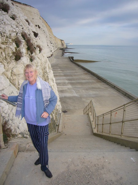
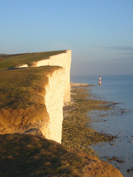
We drove on past Roedean, where we reached the white cliffs, and Rottingdean with its windmill. At Saltdean we walked down to the beach beside the towering white cliffs.
The lighthouse at Shoreham
We ate lunch in the Tiv by a grassy area just before Peacehaven. We had wondered why there was a double fence here above the cliffs, but realised that erosion was taking away the cliff edge. We had read that there was a monument on the cliff edge marking the Greenwich meridian. We tried taking the rough tracks above the beach, and came out just by the monument! It had been erected in 1936 to honour George 5th. There was a list on it of many towns of the commonwealth, with their distances from here. Nearby we found a way down through the cliffs to the pebbly beach.
Saltdean
A few miles on at Newhaven, we drove a couple of miles north to the delightful little village of Piddinghoe, beside the River Ouse. The church here had a cylindrical tower. This village was said to be far enough away from the sea in the 18th century to spot people coming for the ‘pressgang.’
We drove back to Newhaven, which, despite all the traffic and confusion, still looked attractive. We followed the River Ouse to its mouth, but a height barrier prevented us from stopping and exploring the old fort.
We continued to Seaford, where we had a short walk with views of the white cliffs, and could see back to Newhaven.
We now had to drive inland past Cuckmere Haven, where we could look down over the meanders to the sea looking quite wonderful, but we weren’t able to stop. We drove past Friston Country Park and the Seven Sisters Country Park, which we have visited before, so now had to give a miss this time.
We drove through Friston to East Dean where we turned off to Birling Gap. We stopped by the Coastguards cottages beside the cliff edge, wondering how long before they might start slipping into the sea. We walked down steps to the dark pebbly beach, looking great in the afternoon sun.
Meridian Monument at Peacehaven.
Rosie at Peacehaven
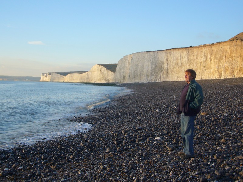
We pulled in again and could look to Beachy Head, looking stunning with the sun shining on the cliffs, and the lighthouse down below. We stopped once more at the actual Beachy Head car park, and walked across to the cliffs, but the day was fading fast, so we had no time to linger. Just before Eastbourne we stopped and had a lovely view as the sun shone from a wintry blue sky.
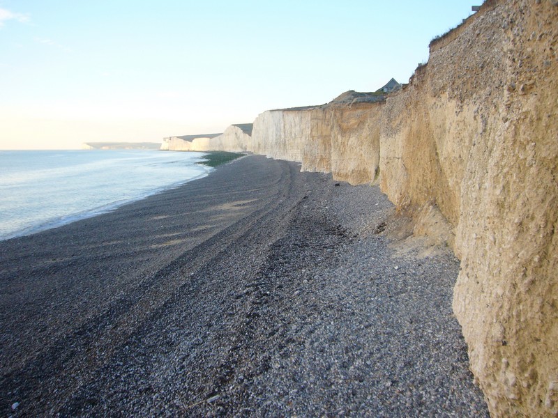
Severn Sisters from Birling Gap
We drove on through Eastbourne, passing the pier which looked really attractive in its white and blue paint with the blue sky and turquoise sea – we had been so lucky to have such a good day in late November to see this bit of coast.
Rosie at Beachy Head
We continued to Pevensey Bay, but the coast road from here said that it was a no through road, and we didn’t dare risk it at this time of day, so had to drive inland to Pevensey and then on past Norman’s Bay. We were a bit worried here too, in case there was a low bridge, but it was a level crossing. We pulled in by the beach, and were able to look back to Norman’s Bay, which is supposedly where William the Conqueror landed in 1066.
Beachy head from Rustington Walk, Eastbourne
We drove the short way on the Coodens Beach at Bexhill, where we had started this section almost exactly 2 years ago. It was now 4.20, and beginning to get dark. The 50 mile drive to Dover was slow and wearisome, but we arrived at the CL at Hougham which we had stayed at 2 years ago. It had been a really lovely day.
Looking back to Normans Bay
Monday 28th November 2005
This is just one day of our ’Road around Britain', fitted in before a day trip to France to replenish our wine stocks! We had visited Tine (Robina - Adrian's Dad's cousin) on Saturday, and Adrian's childhood friend Howard (after nearly 40 years!) yesterday. We were eagerly awaiting news of Simon and Laure's baby, due yesterday.
We drove from Hove to Bexhill. where we pulled in by Cooden beach and had our breakfast before walking along the pebbles.
Emma had phoned as we had arrived there. They had had snow in Devon a few days ago, and Cornwall had had really heavy snow, but we were pleased that the weather for us was better than we had expected - just cold and grey, but dry.
We drove past Bexhill's pretty clock tower, commemorating Edward 7ths coronation. There were boards advertising a New Years Day dip in the sea, for those mad enough! (although Emma & I swam on Boxing day at Sidmouth in 2007)
We drove on to Hastings and had a short walk along the prom at the western end. Traffic and road works meant that the onward drive wasn't very pleasant. We could see the silhouette of the castle on the cliff top.
We stopped at Fairliqht Country Park, and had a short walk here.
We have visited much of this coast several times in recent years, as well as in the distant past, so today we were just doing the ’official' RAB.
We drove on to Winchelsea, where a ’dyke' prevented us from seeing the actual beach. On the landward side we saw lots of birds, particularly lapwings, on the flat meadows.
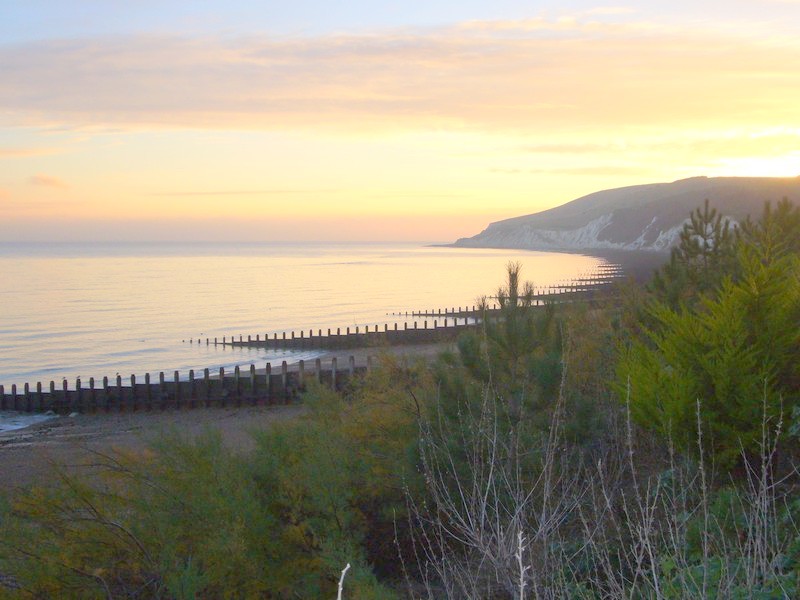
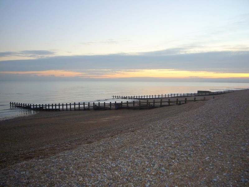
We drove down to Rye Harbour, passing an unattractive industrial area before we came to the tiny village with its unusual church and waterside pub. The road ended at a ’holiday village', so we retraced our steps and drove on through the attractive ’Cinque Port' town of Rye to Camber Sands. This wasn't very attractive, with its treeless caravan parks, but we did manage to park beside the pebbly ridge, and walk on to it to view some of the sandy beach as we looked back towards Hastings.
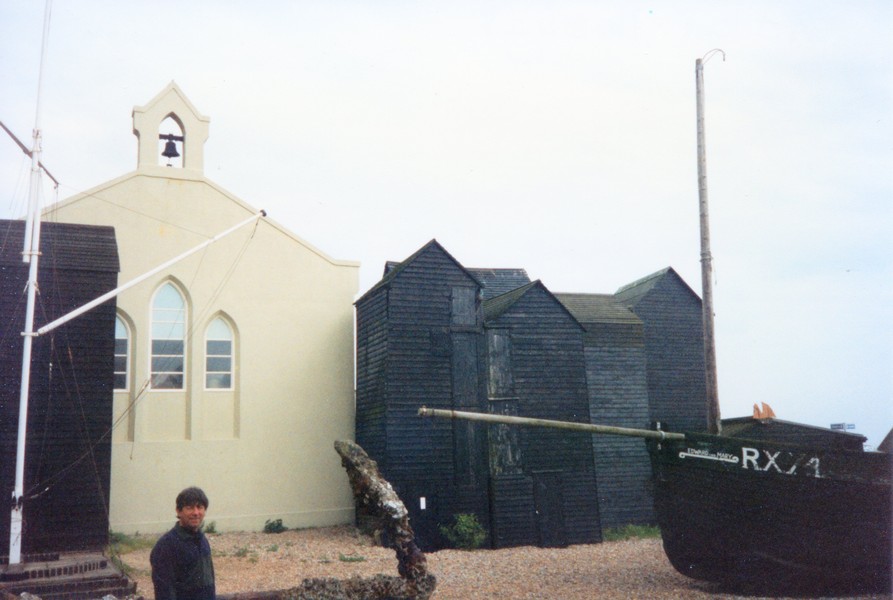
, Hastings, Kent.jpg)
Everywhere looked pretty bleak as we continued past Lydd to the ’Pilot' Pub near Dunqeness to enjoy our fish and chip lunch. I remember eating here some years ago, but Adrian didn't really remember it. The original building was constructed from a ship which was captured here in the early 1600s.
This whole area around Dungeness was a great smuggling haunt, partly as it was so remote and inaccessible.
We drove the short way to the Dungeness lighthouse, passing the numerous evocative shacks and small boats. I even drove the short distance back, before we continued up the coast to Littlestone on Sea, passing mostly uninspiring houses with just a few huts and fishing boats hauled up onto the shingle beach.
We couldn't find anywhere to park and view the beach as we drove on through Dymchurch.
Soon we were driving through Hvthe to the large town of Folkestone. This was difficult to navigate, but we did manage to come down by the shingly beach near the old harbour. There was a cliff lift opposite us, but as we had a quick walk across the shingle ridges to the waters edge, everywhere looked very grey, and not particularly attractive.
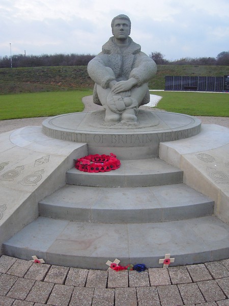
A nice bonus as we drove out of Folkestone was passing the Battle of Britain memorial. We knew nothing of this, but the statue of an airman here had been unveiled by the Queen Mother in 1993. The wall of remembrance, with names of all the airmen lost in the battle, was only unveiled on July 3rd this year.
A short distance from here, we arrived at Hougham CL, where the farmer came out and welcomed us, charging us only £3, which was a good find! It was just gone 4 o'clock, and soon became dark.
Next day we drove along to Dover, and had a calm crossing to Calais to stock up with wine. The return crossing was also calm.
PS Simon and Laure's little boy Manolo was born on 1st December.
The next part is 1 day from Bexhill to Dover in 2005
The next part is 1 day from Littlehampton to Bexhill


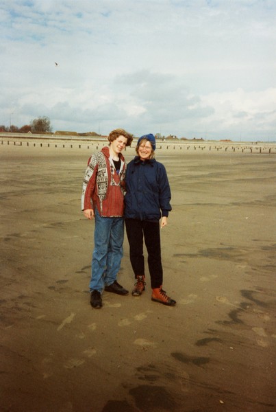
Adrian on cold Cooden's beach
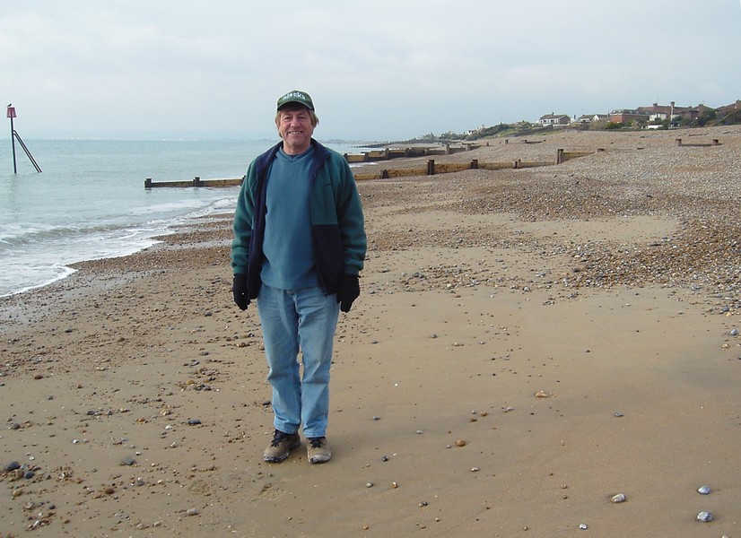
Rosie at Hastings in the cold, 2005
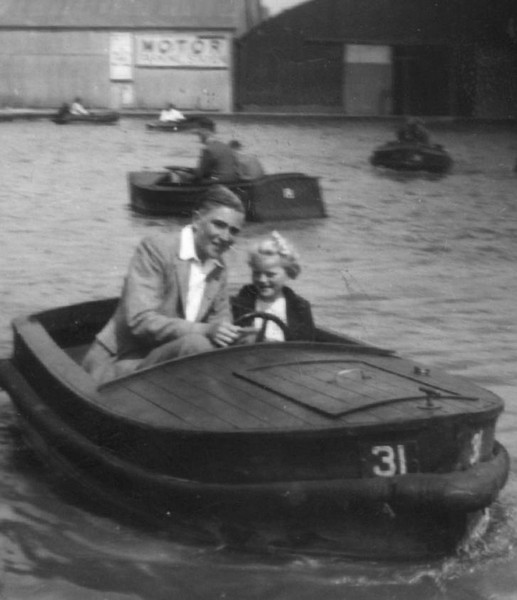
Rosie with Norman on the boating lake, 1948
Rosie by the boating lake 2003
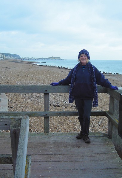
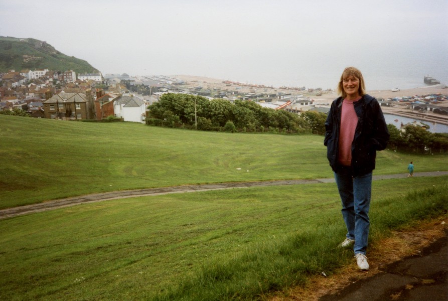
Rosie above Hastings 1994
Adrian by the fisherman's huts 1994
Fairlight Glen 1996
Tom on Camber Sands 1993
With Tom at Dymchurch 1993
Airmen memorial, Folkestone


The next section is