
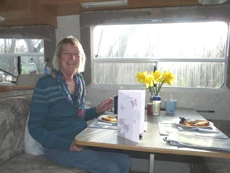
Sunday 7th March A second wet Sunday
The day stayed wet until the evening. Being in this dry climate, they were pleased to have rain. For us, it meant that we got on with sorting things – we finished the website, and sent the first email. Adrian spent a long time looking up the various websites which the sale of our Bam was on. Later on, he phoned a firm in Seattle which dealt with Bam sales, and discovered what we half knew - our dear van is not worth as much as we’d like. Adrian then spent a long time reducing the price on all the sites.
The grey day hadn’t enticed us to move on, and when we eventually found out the price of any camping possibilities near here, we asked Peter if we could stay on his drive for another night. We’d spoken on the phone to Deidra – Peter’s niece, who had become really interested in the history of Lawson family.
We shared a Chinese meal with Peter and Wendy before watching a reality type TV race programme.
Monday 8th March Back into the desert 234 miles
The day started grey and wet. We said goodbye to Wendy as she went off to work. Peter said that he had heard from his son Nick, who was planning to fly out from Gerona, Spain, that it was snowing there! We phoned Tom, who said that the snow had now turned to rain. It had been good to meet up with Peter, and to share our family history interest.
We travelled north on the I15, enjoying the swathes of bright orange California poppies which often lined the road. The road went through nice countryside, but the area was too busy for us. The road too was often busy.
We stopped at Lake Elsinore to have coffee, and to get fuel.
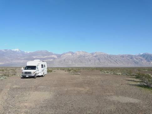
At 1.00 pm we turned off the motorway, but couldn’t find anywhere to pull off for lunch. The area was dry, with lots of Joshua trees, and although rural, it was still busy. The weather was now sunny and warm, but there was snow on the nearby hills, and we wondered about our onward route.
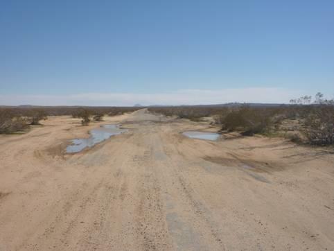
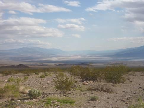
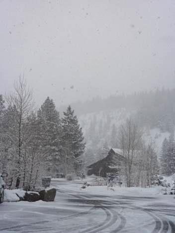
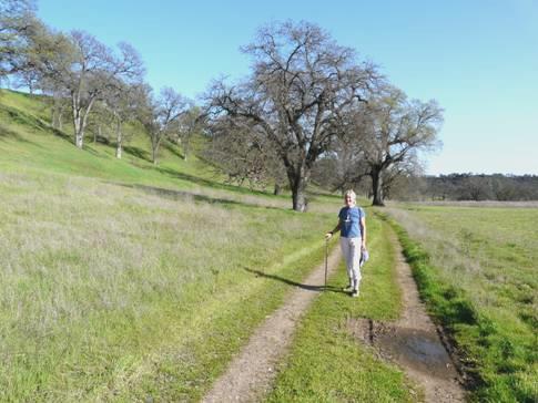
In fact the way that we had intended going went through Edwards Air Base. We found when we got there that it was a ‘no-go’, so we diverted through Rosamond to California City. This western part of the Mohave Desert was rather bleak, with nowhere to stop. In trying to find our way, we stopped by the Desert Tortoise habitat at the start of the Twenty Mule Trail. (This leads to Death Valley, and we remember seeing about it when in Death Valley in 2002) This was an area for ATVs, but there was a small picnic area which seemed a suitable place to stay for the night. We had a quick walk out – no tortoises, and it was very blowy.
Tuesday 9th March More desert adventures 99 miles
It was a cold night, and extremely windy – the van was blown and buffeted. I made blueberry pancakes for breakfast. We set off on the ‘Twenty Mile Mule Trail’. The sky was blue, but the wind was strong and cool.
We hadn’t gone far, when a sign said that the road beyond was ‘not maintained’. There was a surfaced road off to the left, so we took that. Adrian looked up on his computer map, and saw that the whole area was traversed with roads, all bearing names. The truth was, there was nothing but desert, with the occasional sandy track going off!
The road that we were following soon became a sand track as well. We found an adjoining road to link up with the original ‘mule trail’ road. Where were all these grandly named roads? Such and such Avenue, Road, Boulevard, Parkway, Lane, Street. Somebody’s pipe dream of a vast urbanization which never happened.
A great desert urbanisation?
Our road now was OK until we reached a dip, as these contained large pot holes, most full of water from previous unusual rains. Adrian drove carefully around them as we traversed the desert. After many a mile, we came to a boundary marked on the map – a different county – and I mentioned that the road name changed. So did the surface! Now, it was just sand. Traversing the potholes was more serious now, as we didn’t want to get stuck! The road seemed to go on for ever, but finally we reached the tarmacked road north. We pulled off and drank a well deserved coffee/tea. A passing road truck stopped and asked Adrian whether the road was go-able! And he had a 4x4!
We now drove on to the remote desert town of Ridgecrest, which we had stopped to shop at in 2003. This time we managed to get an internet connection and receive our recent emails, and talk to ‘our 4’. By now it was past our lunchtime, but we made our way to the nearby launderette first. It was the most run down launderette we have ever been in. At first we rejoiced in seeing how large it was, but then we found that at least half the machines were out of order, as was the ATM, television and most other things. There were very few tiles left on the floor. We managed to find enough working machines for us, and at least the change machine worked, so we could get enough quarters. Rubbishy as it was, it enabled us to get all the washing done and dried while we had lunch, so after getting some more fuel, it was almost 3.30 our time before we left the town.
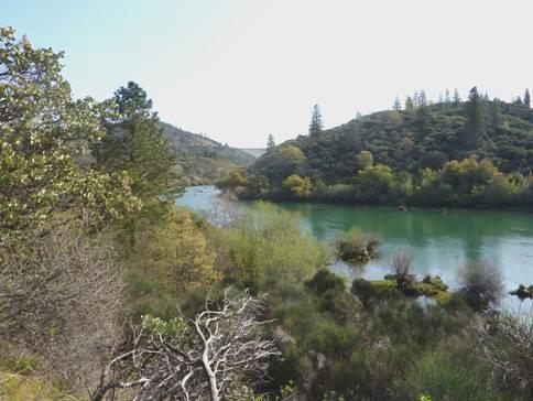
The road headed straight out into the desert, passing through an area of barren hills, and later coming to the town of Trona. This remote town edged dry Searle Lake. It was the centre of a borax extracting industry. The vast piles of impure salt, from which the borax was extracted, matched the snow on the peaks of Telescope Peak in neighbouring Death Valley. We stopped by a little rest area which had information boards telling of the development of the valley and its mineral industries. We had noticed a board advertising the 9 churches of the town. We wondered what else people did here, so far from anywhere.
We carried on through the lonely desert, stopping just before 5 o’clock with views across to Death Valley, and with wilderness all around. We both had a little walk out, our peace being shattered by the occasional noisy fighter plane from the nearby air base.
Just before Death Valley
Wednesday 10th March Return to Death Valley by an obscure route 142 miles
It was a beautiful morning with a blue sky but a cold wind. We had seen the mountains lit up just before the sun rose.
A few miles along the road, we stopped by a track to the ghost town of Ballarat (named after the town in Australia.) It had been a gold mining town from 1897-1917. Up in the hills above it was site of the former silver mining town of Paramint.
Soon after this, we turned off onto a remote and sparsely surfaced road into Death Valley. On the map we had photographed yesterday it was labelled ‘rough and winding road’, which was about right!
We stopped by some picnic tables hidden amongst the rocks (about the only picnic tables in the park).We thought that it must be the site of a former mine. It was still very cool, as we were in shade, but there were a few California fan palms growing here.
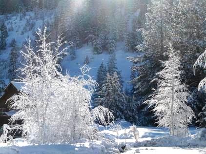
As we ascended, to Eureka Pass (5,318ft), there was snow beside the road, and sometimes on it. There was snow all around on the high slopes. The remote, barren mountain range, dredged with snow, and with Telescope Peak (11,049ft) up behind, looked wonderful.
We had visited Death Valley in 2002, and discovered about the borax mining, the twenty mule trains and the 49ers. This time we realized what a ridiculous feat this all was.
We enjoyed seeing the coloured rocks as we descended 9 miles to Stovepipe Wells. We were now at sea level.
We picked up a park leaflet, and opted to walk to Marble Canyon. This entailed two and a half mile drive along a very rough road to the start of the walk. It was certainly worth it, as it was a superb walk through a narrow canyon of marble interspersed with a conglomerate ‘puddingstone’ rock. Sometimes we had to scramble over the marble – on the way back down, I slid down some. It was a popular walk – two little kiddies particularly were enjoying it.
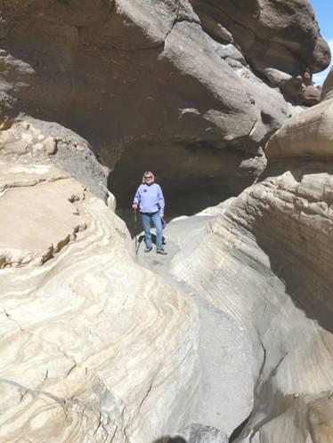
In Marble Canyon, Death Valley
The temperature was now warm, but there were almost no places to pull off, and no picnic areas. We reached the main road through the park and turned south to Salt Creek, where we remembered having a pleasant walk before. We did again this time, having first had lunch in the van, and then spying a surprise picnic table. Once more, we had forgotten the long bumpy drive to the start of the walk.
We had remembered that the creek is the home to little pupfish. These fish (Cyprinodon Salinus), which look like large transparent tadpoles (although the breeding males are very colourful), can survive salinity far greater than the sea, and temperatures from freezing to 100°F. We saw hundreds of them on our walk around. At one point, four people were watching and commenting on the fish. We stopped, and were able to see the ‘mating’ of a male and female. The female entered the male’s domain, both ‘wriggled about’, the female laid her eggs and the male dropped his sperm.
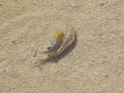
Spawning pupfish
It was now quite hot, and we changed into shorts, but it was still windy.
Now it was time for us to leave Death Valley. We had decided to drive out into Nevada, so took the ‘Beatty Cutoff’.
Looking back to Death Valley
We stopped at the junction known as ‘Hell’s Gate’, and looked back down into Death Valley before driving over Daylight Pass and into Nevada. It felt cooler again now. We drove past Rhyolite – a ghost town which we had visited on my birthday in 2002, to the tin shack town of Beatty.
Now it was 35 miles north on a road through the desert to Scotty’s Junction. The very strong wind was against us, so it was hard going. The road was too fast and straight to contemplate stopping beside, even if there had been anywhere to stop. We knew that we had stayed at Scotty’s Junction in 2002, after leaving Death Valley from the northern route. We hoped that the pull off was still there. We remembered it well, as it had been the day before my birthday. Luckily, the space was still there so at almost 6 o’clock we pulled in.
The stars were good, but it was very cold!
Thursday 11th March Desert, snow, mining towns and petroglyphs 247 miles
After a long, cold night, there was a clear blue sky.
We left at 9 o’clock and drove northwards through sparse desert dotted with small Joshua trees. There was snow on the peaks, and then on the ground around us. We crossed ‘Goldfield Summit’ and then drove through the former mining town of Goldfield, looking as it must have done in its heyday, when gold and silver were discovered in 1902.
We continued on to Tonapah (6030ft), which we had driven through in the heat of last September. This time, snow ploughs were clearing the snow from the centre of the road. We had remarked last time that the town didn’t have to try to look like an old mining town, it just was!
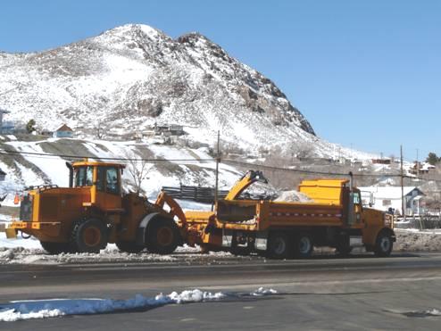
Snow clearing, Tonapah
Now we repeated the 40 miles to Coaldale which we had driven then, across flat desert with tufts of plants. This time we had the bonus of the snow topped pinky mountain range before us, and then a higher snowy range beyond.
Coaldale Junction consisted of just a derelict motel and petrol station – lucky that we hadn’t waited to fill up there!
Vast Columbus Salt Marsh shone white, matching the snow of the mountains around as we took the road northwards through more former mining areas, stopping to have lunch of enchiladas beside the road at the shack town of Mina.
We continued to Hawthorne, where we visited the free county museum. This was housed in a large hall, and contained everything from tatting to barbed wire, and from local fossils to full sized vehicles. I always enjoy these local museums, as they contain such a variety of interesting artefacts.
Our route now went past Walker Lake, which has long been the recreation spot for the area. It looked startlingly blue, contrasting with the colourful barren rocky hills around, making us think of PyramidLake, a little further north.
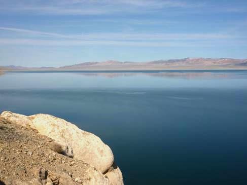
Pastel Walker Lake
We continued on to Fallon, which again we had visited, from a different direction, last year. We arrived at 4 o’clock, and drove through the town.
We had decided to make for Grimes Point, a rest area on Route 50, known as ‘The loneliest road’. It was further out of town than we’d remembered, but once we’d got there, we set off to walk the short trail through the petroglyphs.
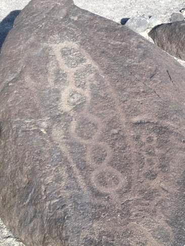
Grimes Point petroglyphs
We declined the further trail to the viewpoint, but enjoyed walking around the rocks in the opposite direction from last time. Then, it was very hot, whereas now it was just pleasantly warm.
The only ‘fly in the ointment’ was the roar of the very noisy planes from Fallon Naval Air Base.
Friday 12th March Back to California - in the snow! 117 miles
We left at 9 o’clock on a cloudy morning and drove the 10 miles back to Fallon. Our first stop was to shop in Safeway. While in there, we received a message on the phone from Doug, who with his wife Carol had been on our Ecuador/Galapagos trip. They used to live in Reno, but now live in Napa
Adrian had hoped to get an oil change for the Bam. We pulled in to ‘Jiffy Lube’, and the helpful man told us that although their workshop door wasn’t high enough for the Bam, there was another place in town that was. He kindly gave us directions, and after making a false start, we found our way there. As efficiently as always, the oil change was done, and we made our way to the nearby ‘Fairgrounds’, where in September we had been able to get water and to dump. No such luck this time – both had been shut up for the winter. We had already heated the water for a shower, so had to give that a miss. We next made our way to Les Schwab to get the tyres balanced. We had to hang around a bit, so by the time we were done, it was our lunchtime. The man hoped that we’d get through the mountains before the storm came – we had heard and read of this storm coming in today, with snow forecast.
We left Fallon, and pulled off to have lunch by the few shacks beside the railway at Hasen – all that is left of a once sizeable town built just over a hundred years ago, initially to house workers for the irrigation scheme across the valley.
Now it was on past Fernley to the I80 west. As we reached it at 2.30 our time, there were a few gigantic drops of rain. We very soon pulled off at a Rest Area, as Adrian had seen that you could dump here. This we were able to do, and also get the much needed water.
We now felt equipped for anything!
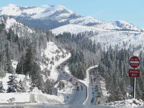
We drove on past the vast yukky towns of Sparks and Reno, with all the fast traffic, and into California. We were following the Truckee River, which we had come across last year while in this area. The forested mountain scenery was lovely – what we could see of it, as by now it was raining heavily, and visibility was pretty low.
But worse was to follow – the rain turned to snow. Memories of crossing the Alps in 2000 came flooding back! We had no snow chains, and hoped that we wouldn’t need them. A neon sign said to tune to the local radio for weather/road update. We knew then that things were serious, and we still had a pass of over 7.000 ft to go over.
As the snow became heavier, we turned off at the town of Truckee, which we had driven through last year in different weather! We just needed to stop for the night, but this town, far from welcoming vehicles, only had paying parking. The snow was getting even heavier – we had passed kids with sledges and a large snowman. Hoping for inspiration, we drove around various streets of the historic little tourist town, coming to a sign saying ‘Maritime Museum’. (yes, we were surprised too!) Being desperate for somewhere to stop, Adrian went in and eventually found somebody to ask if we could stay outside. Luckily he found a lady who agreed to us staying, so with the snow still falling thick and fast, we got settled in. ‘Nobody will bother you’, the nice lady said.
Snowed in at Truckee
Saturday 13th March Oh what a night! But then what a day and evening! 172 miles
But she didn’t say anything about snowploughs! We woke up at 3.00 am to a loud noise, which we found out was the snow plough coming to clear every bit of road surface, including this remote car park. It went right around our vehicle, so close to it that I thought that it would scoop us up too. The bad thing was that my back, which had been giving me a problem for the last ten days or so, now became an excruciating reality. Thankfully, with pain killers and the Tens unit, I slept until morning.
We awoke to a beautiful blue sky. We turned on the local radio, hoping for information on the road conditions, but all we got was the conditions of the snow for skiing in the locality! It said that there had been 12-15 inches where we were.
Oh what a beautiful morning!
We had been really pleased to receive a message from Tom, saying that he had met up with distant cousin Nick (Pete’s son).
We left at 8.45 our time (tomorrow the clocks go on one hour, so it will be the same time). We quickly joined the freeway, but were astonished at the long queues in the other direction, presumably heading for the ski slopes. We had heard on the radio of the Squaw Valley, and the wonderful conditions there.
We hadn’t gone far before we came across problems ourselves. First there were queues of trucks, and then we saw that you had to have snow chains. A chap told us to wait, and maybe the snow chain sign would be lifted. We waited, hemmed in by dozens of trucks. In front of us, a young couple were trying to fit their snow chains. A coach driver was doing the same. After about 15 minutes, an official came by and all the truck drivers who had congregated accosted him. Very soon afterwards, they rejoiced, as they had heard that the snow chain sign had been dropped. There was a mad dash now to get off. We passed the young couple taking off the chains which they had spent so long fixing!
Soon we passed the Donner Pass (7,240ft) and the Rest Area that we had been tempted to head for last night. Thank goodness we didn’t – it was snowed in, with no hope of pulling off.
A sign now read ‘Downgrade for 40 miles’. Apart from two lower passes, this is what it was. The going was very difficult, as the windscreen was blurred from the frequent passing of other vehicles and the washers had frozen up. We pulled in at Emigrant Gap for Adrian to recover from his exhaustion. We had driven only 30 miles, but it seemed like 300!
The worst is over!
We felt tremendous relief as we descended from the snow to 3,000ft, and then we saw trees in leaf, and blossom.
At midday we reached Auburn, and turned off to walk around this former gold mining town, dating from 1848. It may have been touristy, but in the (still cool) but lovely spring sunshine, after what we had been through, it was wonderful. There were magnolias blooming, and everywhere looked so pretty.
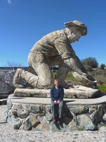
Adrian and a gold digger, Auburn
We took route 49, continuing some of the gold mining route we had followed last summer. We soon stopped for lunch above a valley. Having eaten, we set off to have a walk, and really enjoyed seeing the trees just coming into leaf, and the flowers – periwinkles and dodecatheons. It was lovely in the spring sunshine. When we returned to the Bam, which was looking extremely mucky after our time in the snow, a couple had stopped in their car and asked us about it.
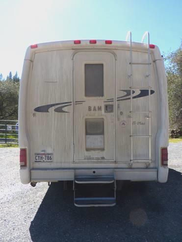
Is this our Bam?
They were Joel and Heather, and they really liked the van. They obviously hadn’t been together very long, as he was getting divorced in 2 weeks, so couldn’t commit himself until after that. We chatted a lot and it would be wonderful if it worked out.
We drove on to the town of Cool, where two forks of the American River join. There were a lot of cars parked beside the road. It was very pretty, and seemed to be a white water rafting area.
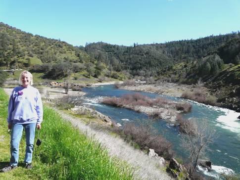
The American River
However, we soon came across runners, and had to wait for a while until they crossed the road.
Next we came to Sutters Mill, near Coloma. It was here that in 1848, a man called Marshall had found a piece of gold which set off the Californian Gold Rush.
We stopped to have a look, but as we had seen so many gold mining towns last year, didn’t stay long.
Soon we reached Placerville, and found ourselves on the motorway and heading for Sacramento. We had visited this last year, so just drove on past the town, and past the area of swamp land to the west of it.
We turned off to get to Winters, where Adrian had note of a campsite which we might stay at. In one garden we passed, there were oranges on the tree and daffodils in the ground!
It was now 5.30. The campsite, after several miles of straight road with nowhere to pull off, was an absolute dream. Better still, it was half price for ‘Seniors’! We found a nice spot surrounded by long green grass (none of the State and National Parks tidiness). We cooked lamb on the barbie, and then had a lovely campfire, gathering up wood from roundabouts.
Several young lads – grandsons of the camp host it seemed, had been collecting wood from round about us. They said that they wanted to have a campfire and sit out until 9 o’clock – sadly this didn’t happen for them, but our campfire was great! After last night, it was especially wonderful.
The most notable thing here was the peacocks. They were everywhere – one haunted our pitch. Their plaintive cry permeated the sky, and we hoped that they would stop at darkness.
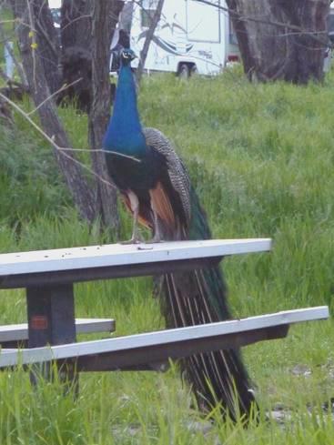
Who’s your friend?
Sunday 14th March A different Mothers Day 33 miles
Well, yes they did, but they were awake bright and early in the morning.
As the clocks moved forward one hour last night, we were on the same time as everybody else, so didn’t have our extra morning hour.
Happy Mothers Day
Today is Mothers Day in England. I opened my card from Emma, and received a message from Paul and later one from Simon. I cooked us a fried breakfast, but although a beautiful morning, it wasn’t quite warm enough to sit outside. I did take my coffee out, and enjoyed the bird life. As we walked out along by the river, and back through the campsite, we saw two blue jays. On the river we had seen ducks including buffleheads.
We had enjoyed this happy and ‘not too smart’ campsite.
We were driving to the town of Napa today, to meet up with Doug and Carol, who we had met on our Ecuador trip 3 years ago. The road we took was very pretty, winding through the hills, and making us think of an English road. There were often flowers beside the road, including lupins, and there was Spanish moss on the trees.
We had hoped to stop and get the van cleaned, as it still looked disgustingly dirty from driving through the snow. We didn’t pass a car wash, and just before midday, reached Carol and Doug’s house. They both greeted us, and we went immediately into their lovely garden to sit and chat in the warm sun. Carol said that this was the first time that she’d sat out this year, but now the good weather seems to be staying. We enjoyed their flowers, particularly a clematis armandii which was fragrantly flowering up behind us.
Carol’s brother Tom called in – his daughter is living in Kensington in London. He went to have a look at the Bam, and a passing couple stopped to have a look too. We ate lunch with Carol & Doug, but then Carol had to go to work. We set off with Doug to walk to the top of a nearby hill, where we had great views down over Napa, and right down to San Francisco Bay.
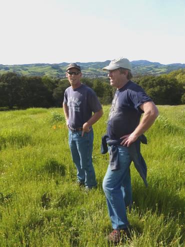
Adrian and Doug on top of the hill
We walked back through a small property where Carol & Doug both volunteer. It was like a little farm, where school children come to visit. We looked in at the animals in the barn – donkeys, a cow, goats and a pig.
Back at the house Adrian set about cleaning the mucky Bam. Doug got the barbecue going, and when Adrian had finished his job, and with the Bam looking much more like its normal self, we sat out in the garden and enjoyed supper. We came in and chatted until we went out to sleep in the Bam.
Monday 15th March A necessary evil 29 miles
We slept late, then went in and chatted to Doug & Carol. She soon left to go horse riding. We chatted some more to Doug, and left at about 11 o’clock. It was a beautiful morning, but the wind was quite cool.
We took a pretty route to Petaluma. We drove through the town, which had a lot of attractive brick buildings, and headed for the KOA site. We needed to have an internet connection so that we could do some more work on trying to sell the Bam. It may have been a free wifi connection, but the price of site was exorbitant. Not only that, the swimming pool and spa were both being rebuilt. At least there were a lot of trees around, and consequently some birds.
After having lunch, we phoned Simon, and then Emma, and found that Felix and Ruby had both had excellent school reports.
Adrian did some phoning, with plans to visit a couple of consignment places in the next few days.
We had a good barbie, and with wood that Adrian had collected up, we had a wonderful fire – sitting out, when everybody else was inside in their vast RVs.
When we came in at 8.30, there was a message from somebody in Australia interested in the Bam.
Tuesday 16th March A glimmer of hope
We enjoyed the spring sunshine and Adrian chatted to a Danish couple staying on the site, who (like us) were amazed at how expensive campsites are here.
It was after midday when we set off northwards on the motorway, turning off just after Santa Rosa. We were heading for an RV dealer who dealt with consignment – selling your RV and taking a percentage.
We took a pretty, rural route now to Calistoga. We had followed this road, in reverse, in 2002. We both remembered shopping in a supermarket in Calistoga where there was a great choice of goods, particularly cheese. We managed to park, and Adrian went into the supermarket to buy a fresh loaf. This was a double disaster – firstly the ‘Artisan’ loaf was very expensive ($4.95), then when he came to cut it, there was a whole garlic clove inside!
We stopped to have lunch beside the winding road out of Calistoga. Lots of butterflies flew over. The road wound down again to Lower Lake, where we located Brown’s RV, and the owner Jeff Brown. Although he had a pleasant face, he was so overweight that he had trouble moving about. This put us off initially, but he came to have a look at the Bam, and seemed genuine enough. What’s more, he thought that he’d be able to sell it at a price more to our liking than other dealers have offered. We both left there with a feeling of relief, that at last we had an option which might work. There would be difficulties – like transport back down to San Francisco for us after we had left the van there, but at least we had something to go on.
Now 3.30, we had to think what to do. We had arranged to see another person with regard to selling the Bam tomorrow morning at Livermore, east of San Francisco. For the moment we decided to continue with that plan, so followed a pretty route which would lead towards the motorway south. Half an hour later, we came to a large parking area by BLM land at the trailhead for the Judge Davis Trail. This seemed ideal to us, and we couldn’t believe our luck.
We very soon set off to walk some of this trail. We could see from the map that we could make it a circular walk, but as so often, it wasn’t that simple! It was really quiet and peaceful, with just a few birds, but a lot of butterflies, and myriads of pretty purple dodecatheons (shooting stars).
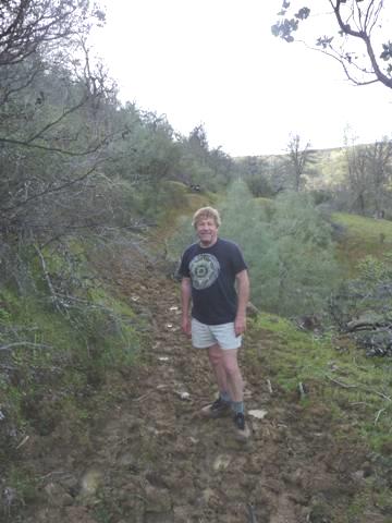
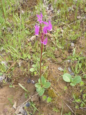
Adrian on the muddy path Dodecatheons
The path wound up a hillside, with glorious manzanita trees with their stunning deep red bark. However, the path was used by animals – some horses, but mostly cattle, and was pitted with deep hoof prints often filled with water. Sometimes the mud around had baked hard, but other times it was soft and mucky. It made the going slow and difficult. We turned off on what we thought was the return route, and eventually found our way back to the Bam about an hour and a half later. It had been lovely to be out in the pleasant spring evening, but it would have been nice if the going had been a little smoother!
After we returned, Adrian got the barbie going.
Wednesday 17thMarch To the Sacramento Valley 73 miles
We had made the decision not to go south to San Francisco to see another RV dealer. After much discussion about our future plans, we drove through lovely country to the flat Sacramento Valley.
At the small town of Williams, beside the I5, we went into a little supermarket and thought that we were in Mexico! The labels were in Spanish, and everybody was speaking Spanish. The goods for sale reflected this, with a variety of tacos and other Mexican foods.
We needed to get an internet connection to further our plans, but spent a long time in finding one. Once we did, we set to work, booking our flights from San Francisco to Seattle, and car hire from there to Vancouver. We received another email from the chap in Australia, and sent several ourselves about our future plans. By the time we’d had lunch at a nearby spot, it had become very warm.
We now travelled northwards near the Sacramento River, passing orchards of all sorts, and acres and acres of trees, which we couldn’t identify, but later thought must be walnut trees. As yet they had no leaf or blossom. We had seen a variety of birds – 2 osprey, 2 scrub jays, and flocks of birds, some of which were red winged blackbirds.
We drove through Butte City, with just a couple of simple buildings, and stopped at Ord Bend Park. This was a large parking area for people to use when launching their boats. There were some picnic tables, and trees and grass. We walked over to the river, and saw dozens of terrapins in the water. It seemed a good place to stay for the night.
Terrapins What a lovely spot!
Adrian cooked fish on the barbie, and we sat outside at the picnic table to eat supper – it was lovely as the sun went down. We could hear the birds, and the very noisy frogs, and we saw a bat flying. The moon was like a tiny sliver of lemon.
Thursday 18th March Enjoying more of the Sacramento River 63 miles
It was a lovely sunny day but very windy.
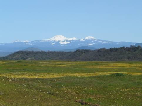
Looking to Lassen Peak
We drove on northwards, with views of Lassen Peak (which we had visited last year) looking glorious with its snow covering. Later we saw superb Mount Shasta (14,162ft), looking like an upturned white cone, standing way above anything else, rather like Denali.
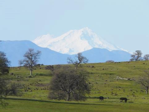
Magnificent Mount Shasta
We drove through an olive growing area, and stopped at the town of Corning, close to the I5. We then managed to find our way northwards on small roads to the pleasant town of Red Bluff, which had brick buildings, and a clock tower.
After this, we headed for a place called Bend. We had been following the Sacramento River all the time, and place names reflected this. We now took Jellys Ferry Road, and stopped by the river at a BLM picnic area right beside the bridge. The river looked wonderful here, but the leaflet we picked up suggested that this was not an area where they liked you to camp. Not far along the road, however, was another parking area at what was called Oak Slough Trailhead. This looked pretty nice too, and from here, we set off on a really lovely walk, along the ‘slough’ (valley) – pronounced slew – and back by Osprey Pond. Although it was still really windy, it was warm, and the first part of the walk was sheltered anyway.
A lovely walk at Oak Slough
It felt like going on a nice English walk with green hills and old trees. There was so much birdlife too, from tiny birds to large birds of prey. We had trouble in accurately recognising any of them, but did see a white-breasted nuthatch when we returned to the van. We had seen blue jays and two different woodpeckers, and had glorious glimpses of both Lassen Peak and Mount Shasta in the distance.
Friday 19th March Wonderful wildlife, with an unusual ending 82 miles
The early morning was surprisingly cool, but it was a beautiful day, and we enjoyed seeing the birds again – particularly woodpeckers and juncos before we left at 9 o’clock.
As we drove on, we again could see magnificent Mt Shasta up before us. In one of the fields, a dry stone wall had been built using scattered rocks. Later we were to pass miles of this beside the road – about 3 ft high and 3 ft wide. It seemed very un-American.
We very soon stopped by an old bridge over Battle Creek. It was the first of many fantastic wildlife stops today. The whole area was very unkempt, being run by the state, and not BLM. The trees were old and wild, which seemed to suit the birds, and we spent ages watching them high in the trees through our binoculars, particularly the woodpeckers again. The prize though was by the river. We’d wandered through a rough path for Adrian to photograph the old bridge. We could see movement in the water, and when we got there, we watched transfixed as two river otters cavorted back and forth, with their sleek movements. Sometimes they brought their catch out to enjoy on an isolated rock in the river. What a privilege it was to see them.
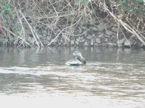
A river otter
We now turned off to drive along a road by Battle Creek, stopping when the road ran out, and pulling into a fishing parking area. By now it was warm as we sat on rocks with our tea/coffee, surrounded by miniscule pink flowers amongst the grass. A belted kingfisher flew off from its perch high in a tree.
As we drove back along the road, blue scrub jays showed themselves in the bushes.
We stopped at another parking area on our way back – and what a treasure this turned out to be! We wandered across fields with huge trees on what was called Oak Tree Trail. Everything was very low-key. We reached the river a couple of times, and enjoyed views to the snow covered peaks in the distance. The sun was really warm now. Once more we became avid birdwatchers – the prize being a rare Lewis Woodpecker, which we were finally able to confirm after Adrian had photographed it. We had thought that we had seen one yesterday.
When we returned we sat for lunch at a rough picnic table amongst long grass, in the now hot sunshine. It had been a wonderful wildlife morning, and at 1.30 we had driven just 11 miles!
We continued on a pretty route, with the meadows covered in swathes of yellow and white flowers amongst the green grass, and with knobbly trees, and the beautiful blue sky of course, and the distant snowy peaks.
We joined a busier road to Redding, but still through lovely scenery. Redding is right beside the I5, but we managed to pull off and find the Visitors Center, and get a bit of information on nearby Lake Shasta. One leaflet showed the BLM land around the Sacramento River south of Shasta Dam. There was a walking trail, called the Sacramento River Rail Trail, following the route of a former railway beside the river. This seemed ideal, so we thought that we’d drive up on the western side of the river, and hope to stay there tonight.
That didn’t work out, though. All the parking areas for the trail heads had ‘no camping’ signs, and it was now too late in the day to set off walking, if we had nowhere to stay. It was a very pretty area, enhanced by all the manzanita bushes in flower.
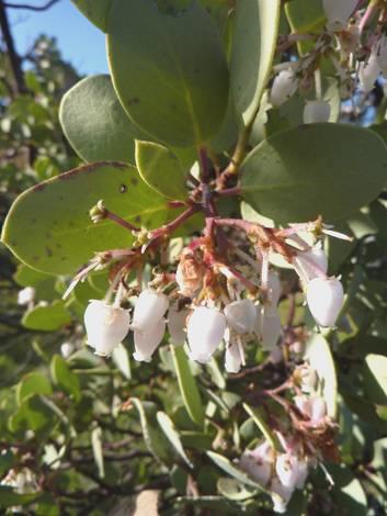
Pretty Manzanita flowers
We drove back to Redding, passing one trailhead which we could have stayed at, but it was right in the town, and seemed a little vulnerable, so we continued up the eastern side of the river through what we hoped was remote country, but the town was already stretching out with its secluded houses.
We knew that there was a campsite near Shasta Dam, but didn’t like to chance there being any spaces on a Friday night. We made our way towards it, coming to a fantastic view of the lake, with brilliant white Mt Shasta beyond. The lake, formed by a huge dam, spreads out with lots of fingers, the total shoreline being 365 miles long! It was while helping to build the dam in 1939 that Woody Guthrie wrote the song ‘This land is your land’.
The campsite was on the other side of the dam. When we saw the formidable barrier by the dam, Adrian thought that the road across must be closed. We drove up to the guard who told us that the road to the campsite went right across the dam. He could see that we were from Texas – ‘All the way from Texas to sell your van’, he said. He asked to see Adrian’s driving license, and had a quick peep inside the Bam, and then sent a message for the great road barrier to be lowered, and we were off across the dam, with instructions not to stop on the way, and to maintain a speed of 25mph. The gate would be closed from 10 pm until 6.00 am he said, so the only way out during that time is if there was a medical problem.
At the other side of the dam, another guard waved us through, and then we wound down to the small and informal (and very inexpensive) campsite, arriving at 5 o’clock. The sun was still hot, and we had views to the dam, and down to the very green Sacramento River.
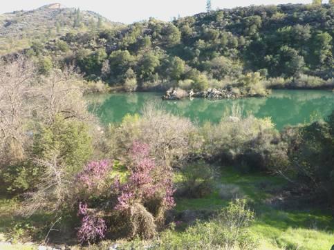
The green Sacramento River
All the other people staying here had ATVs or dirt bikes, so it won’t be a quiet night! We don’t think that we’ll have another route to a campsite quite like it though!
Adrian had seen some wood nearby, so went off to chat to the people there, and ended up with some lovely manzanita wood ready for our campfire. He had already lit the barbie, so he cooked the steak on that, then we sat by our campfire until 9.15, soaking up this unlikely and wonderful atmosphere.
Saturday 20th March Sacramento River and Shasta 49 miles
It was a fine morning, but cool, but we still ate breakfast outside. We had a discussion about our onward route – whether to go any further north, or west. We more or less decided to go west, but first we set off at 9.45 to walk some of the Sacramento Rail River Trail.
On the Sacramento Rail River Trail
This was a pleasant walk for just over an hour, beside the wide and green Sacramento River, with banks of manzanitas in bloom to the other side, and California red bud, with its deep pink blossoms, looking a bit like daphne, and with last year’s seed pods still attached.
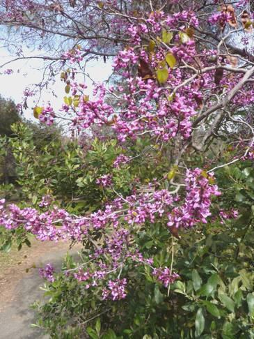
California red bud
A few ducks, including golden eyes and a cormorant were on the water, and we saw other birds, including a black- chinned hummingbird, and butterflies. We spoke to another couple who had been with the group when Adrian had collected the firewood yesterday.
It was now warm, as we came back to wind our way back up to the dam. We drove across and stopped to look into the Visitors Centre, but opted not to go on the free tour of the dam.
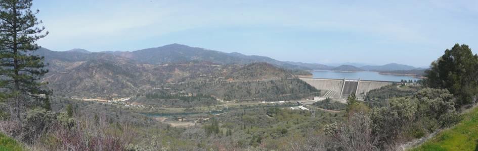
Shasta dam, campsite on the left
Now we drove back down to Redding, taking the scenic Shasta Dam Boulevard, with views back down to the dam initially.
Back in Redding, we located Safeway, and having bought a fresh, hot loaf, and having got some money, we stopped to have lunch in a park in the town.
Now we set off westwards towards the Whiskey Town Lake unit of the Shasta Lake park. We soon came to the State Historic Park of the town of Shasta. This was one of many former mining towns in the area, and had originally been called Reading’s Springs, after a man of that name who had found gold here in 1850 (not to be confused with Redding, a few miles east named after BB Redding, a Railway Surveyor). There were a lot of half restored brick buildings lining the road, which were fun to walk around, and imagine the former town which was once here.
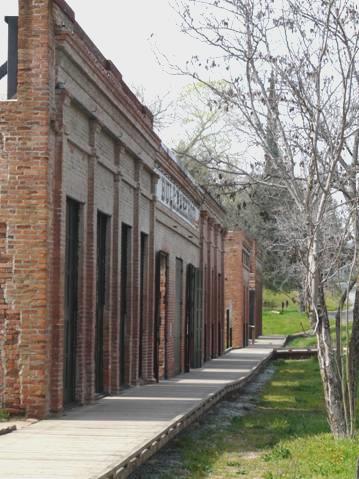
The former town of Shasta
We continued to Whiskey Town Lake, named after another former mining town. This was a National Park Recreation Area, existing mostly for boating. We stopped at the Visitors Centre, but couldn’t find the walk which was supposed to leave from here. We drove along the north shore, coming to the campsite at Oak Bottom, but the RV overnighting here was just in a tarmacked car park – not much fun! There were snowy peaks up behind, but the hazy day didn’t make for the good views we had been seeing.
We thought that we’d try the RV site on the southern side of the lake, so made our way there, arriving at 4.15. The site at Brandy Creek wasn’t a lot better – there was an occasional picnic table, but no fire rings, as Adrian had been led to believe. There was just a row of pitches beside the road – not busy at this time of year, but obviously crowded out in summer.
We drove right down to the lake, where we realized that the purpose of the site was for boaters – the boat park was enormous. We drove back up to a different spot, where we were just in time to enjoy ‘sundowners’, before the sun went down behind the hills. Disappointingly, we saw no wildlife at all.
Sunday 21st March West into the hills 54 miles
The morning was grey, and we even had some rain before we left at 10 o’clock.
We drove back to the end of the lake – the onward road was not suitable for us to drive, so we had to return by the northern road. By the Visitors Center this time, we finally saw the start of the trail which led from here (third time lucky). As we’d suspected, the path led quite steeply down to the lake, and back by a slightly different route. We hadn’t got a leaflet, so didn’t know which plants we should have been looking at! The overcast sky didn’t enhance the walk, but we did enjoy seeing lots of little dodecatheons once more.
We stopped towards the western end of the park to walk around Tower House Historic Area. Two enterprising men, Campden and Tower, had settled here, in the 1850s. One had built a hotel, and the other had built a toll bridge over the creek where gold had been discovered. Irrigation trenches had been dug, and the land had been farmed. The trail took us to ‘Eldorado Mine’ (what else?), and past information on the Indian people who had lived in this area for centuries.
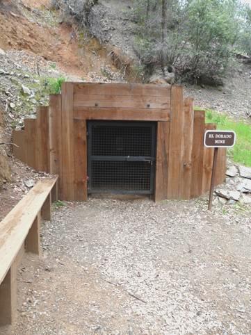
El Dorado Mine
We were able to eat our lunch outside when we returned, before another rain shower came, but by now we were leaving the park, and heading west into the hills.
The road wound up to Trinity Summit, at just over 3,000ft. We had decided to cross the mountain ranges and head towards the coast.
We came to a road which had a campsite notice on it, and drove down quite a way, passing a whole group of deer. We stopped at what was called Steel Bridge, beside the Trinity River. We found that the campsite was a bit further on, and was closed. We parked by the river just before it, and thought that we’d stay. We walked on through the site, beside the river. They had been chopping down lots of trees, and logs were stacked everywhere.
As we returned to the area we had parked in, a chap on an ATV got chatting to Adrian. He said that he had told them to cover up the campsite sign on the main road, as it was closed, but they’d taken no notice. ‘We get great big RVs coming right down here’ he said. He told Adrian of a couple of places further on where you could stay, so at 3 o’clock we set off again, turning off at Douglas City (grand name for a tiny one eyed town).
Once more there was a campsite sign, and a closed campsite. We continued along the road, but the places which the chap had suggested had an access far too steep and difficult for the Bam, so we continued on our way.
We came to the town of Weaverville, and when we turned on the phone we received several messages, including two enquiries about the Bam. We stopped to get an internet connection and read them properly, and reply to them.
Having initially thought of stopping for the night really early, time was getting on. Also, the sun had come out, and it was quite warm in the van.
A road went north from here to Trinity Lake Recreation Area – the third of the ‘Recreation sites’ in the ‘Whiskeytown, Shasta, Trinity National Recreation Area’. We didn’t want to go there, but hoped that we might find somewhere on the way. Once out of the town, we were in luck, as we came to Forestry Land. At first we found somewhere to stop beside the road, but on walking up a track opposite, found a more out of the way place there.
Monday 22nd March A very scenic route, but frustrations too 96 miles
It was a very cold start – there was even a light frost!
We had some beautiful scenery, but some frustrations today – the first being that the engine didn’t start! The same thing had happened yesterday morning.
After several attempts, it did start so we left at 9 o’clock and drove back down into Weaverville, getting propane and petrol, and then finding a garage to have the engine problem looked at. The man thought that it might be a problem with the starter relay, so changed this, and we have to hope for the best! We also needed a ‘smog’ (emissions) test done with view to selling the Bam, and he was able to do this too although the first time he did it, he made a mistake, and as it is all computerized, he had to start again!
Weaverville had been a very important ‘hub’ town during the gold mining era, and has been restored to be an attractive tourist town reflecting that. We walked up and down the main street – it was sunny, but still VERY cold! A lot of Chinese people had lived and worked here, and there was a ‘historic’ Chinese temple (closed today). Also there were one or two of the spiral staircases left from the time when different families occupied the ground and first floors of the buildings.
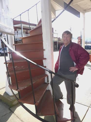
Spiral staircase at Weaverville
We now followed Trinity River on its magnificent course through gorge like scenery. There were several picnic areas and campsites, all with names. We stopped at Pigeon Point to have lunch, but the wind was still really cool. In the summer, the river is popular for rafting and canoeing, but today there was nobody else about.
A bit further on we stopped at White Bar, supposedly a good place for bird watching, as it is on the migratory route. We saw very few birds (except a beautiful but noisy stellars jay), but the sun here was warm, and I relaxed on the sandy shore beside the turbulent river, with towering cliffs up above and a variety of tiny pink flowers dotting the ground. Wonderful!
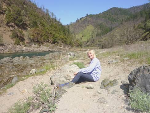
Relaxing by the Trinity River
We continued through this dramatic gorge-like scenery, passing many small campsites, and deciding to stop at the next one. However, we then reached Willow Creek, where the Trinity River turns northwards.
There was a small Tourist Information kiosk here – closed – but outside was a map. We had thought of turning north and following the Trinity River for a short way, and hoping to stop for the night, but the map showed two campsites further on the way we were going, plus one in the town. We followed a long track to this – down by the river, but the sign outside read ‘No RVs”.
We had just received emails from Renee and Lena, with the lovely news that Katy & Aaron are expecting a baby in October, and wanted to reply to them. This wasn’t as easy as it could have been, but having done that we set off again. Imagine our dismay and annoyance to find that both of the campsites we now passed were closed!
Now what to do? We began ascending into the hills again, but didn’t want to spend the night at high altitude, as Adrian thought that the engine’s starting problem might be linked to the cold. We ascended two passes – both under 3,000ft, but had now come out of the National Forest, and into the more habited area towards the coast, where we knew that it would be difficult to stop.
In desperation, we turned off on to the first possible road, which went into forest, but had its spread out plots of rural houses. In trying to turn around, as the road didn’t go through, we found a pull-off before a gate, and hoping that we would be OK here, we stopped at 5 o’clock.
Poway to Eureka


