
Tuesday 20th June Through remoter northern Maine 152 miles
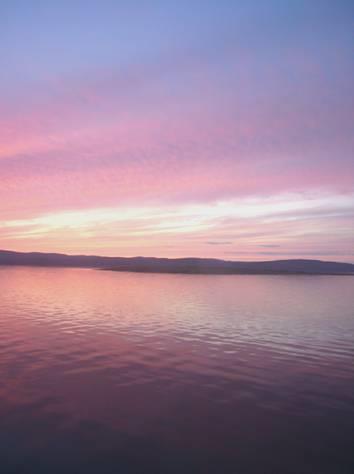
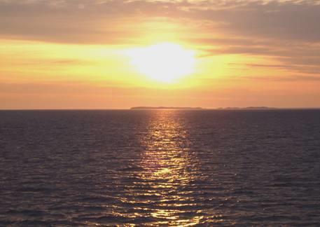
We enjoyed bacon and mushrooms for breakfast, looking out to misty views over the bay. Adrian took his first bit of video film, as we watched eider ducks swimming on the water before leaving at 8.50.
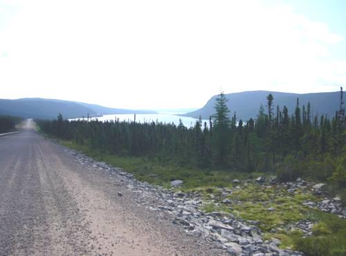
We had beautiful misty coastal views as we continued northwards. There were several nice rest areas overlooking first the sea and later the St Croix River.
We stopped to look around St Croix Island National Parks display. This is the site of the first French settlement, in 1604. Champlain had settled here before trying Nova Scotia, and then founding what is now Quebec. The statues in the display were extremely lifelike and attractive.
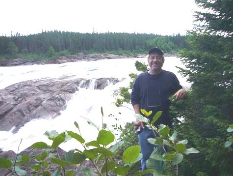
A bit further on, we pulled in to look along to Whitlock Mill lighthouse, before coming to the town of Calais.
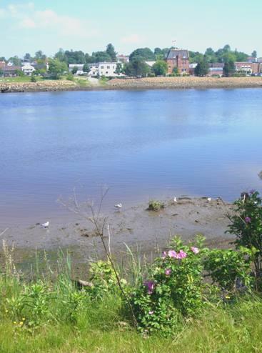
This town was named after the French one in 1805, to show allegiance to France after its help during the Revolutionary War. However, it is pronounced ‘Calless’, not ‘Callay’. With its neighbouring town St Stephens, New Brunswick, across the St Croix River, it was an extremely important logging port in the past, sending wood both by river and by rail. There is no sign now of the dozens of wharves which once lined the riverside.
Looking across the St. Croix river to St. Stephens in Canada
We enjoyed viewing the riverfront, but had other things which we wanted to do in Calais. As there was a Walmart here, and the last before we reach Canada, we were hoping to get our first lot of photos printed. This we were able to do, and I bought a photo album to put them in. We also wanted to send our first email, and we managed this too, while we were waiting for the photos to be ready. In the brief time we had been in Walmart, there had been an accident nearby, and the road was closed for a while. As we finally left, a Canadian lady parked next to us enquired about the van, and asked about our travels, wishing us well.
There was a border crossing with Canada here, but we were continuing further north, with plans to cross into Canada tomorrow.
We had lunch beside E. Musquash Lake, enjoying the warm sunshine as we looked across the lake to the forested shores, with no houses. As we continued, everywhere was very green, and sparsely populated.
As we approached Patten, it clouded over and began to rain heavily.
The scenery was really attractive, with lots of isolated hills, and Mt Baxter, where the Appalachian Trail starts/finishes, in the distance. The housing was still sparse, and many of the surviving houses were dilapidated or deserted.
At 4 o’clock, we found somewhere to pull in to beside the road, as the storm raged.
We cooked most of our remaining food for supper, as we will be crossing into Canada tomorrow, and don’t want to give it up to customs!
Wednesday 21st June Into Canada, then a ferry across the wide St Lawrence River 197 miles
The trucks were noisy going by, but we were pleased that the sky was mostly blue when we awoke. Clouds gathered, but by mid afternoon, it was warm and sunny.
We ate a different breakfast, finishing up bits of food, then left at 8 o’clock to continue northwards, mostly through forest at first. There were signs everywhere to say watch out for moose, but we didn’t see any, although the terrain looked suitable.
Sometimes we passed meadows full of flowers – buttercups and small brown daisies. The lupins here were shorter, and more varied in colour than further south in Maine. Logging was very noticeable – we passed a vast logging concern, and several paperworks. Also there were large fields of potatoes – we found out later that these were grown by the French Acadians who settled in this area.
We reached Fort Kent, on the St Johns River. This is the area known to still be the home of the French Acadians. We heard French being spoken – apparently it is a mixture of French, old English and Quebecoise.
At Fort Kent we located (with difficulty) the Blockhouse, which is a National Historic landmark. It dates from the time that the British and French were fighting over the land here because of its wealth of trees for timber.
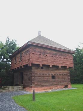
The Blockhouse at Fort Kent
It had recently rained heavily, so wasn’t very enticing. We had seen a sign noting the end of Route 1, which starts at the Florida Keys, and which we have driven much of.

The end of Route 1, which we first came across at Key West
We drove along St John’s Valley to Madawassa, where we got some fuel before crossing the Madawassa River into Canada, at Edmondston.
We were picked for a special inspection at the customs, and then had our vehicle inspected. Always a tense time, especially as we knew that we had more liquor than allowed, but luckily all went well, and there we were in Canada once again. We didn’t know whether to feel relief, as Canadians are more ‘Brit friendly’, or despair, as French Canadians aren’t!
We drove for a few miles through New Brunswick, which is actually in a different time zone, into Quebec, which has the same time as Maine, so we stayed put!
We stopped at a pleasant rest area above the river, and while Adrian went in for info at the tourist information, I cooked cheese tortillas, as we had very little other food left! We ate these sitting at a picnic table in the now warm sun.
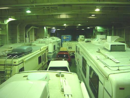
We drove on through attractive country of forests and lake to Riviere du Loup, on the St Lawrence River. There is a ferry crossing here to St. Simeon on the northern side. We had arrived at 3 o’clock for the 4.00 crossing, not daring to stop to shop on the way, but in fact there was no booking system – it was first come first served. The way to the ferry terminal was very strange, but it was certainly beautiful as we looked across to the forested hills across the water.
The crossing was supposed to be just over one hour, but was more like 1½ hours. The water was calmer than a millpond, and we could see seals playing, and shimmers of whales. The clear blue sky made it extra lovely. Adrian had hoped for an internet connection on the boat, but it was too slow to be of any use.
After we had landed at St. Simeon, we went in search of a shop, to restock. The one we found had most things that we needed. We had decided against staying in the campsite by the dock, but found somewhere to stop beside the road at 6.20, even if it is noisy from the traffic going to and from another ferry further up the road.
Thursday 22nd June Another ferry, and more beluga whales 122 miles
The traffic came sporadically in droves (as the ferry, just up the road, disgorged its hourly cargo), but the noisy trucks didn’t disturb us as much as we thought they would. In fact it was a mosquito buzzing which woke us in the night, and another in the morning.
By 8.30 we were on our way, driving through typical Canadian scenery – lake, forest, simple dwelling, ducks – lovely!
Sometimes we had views down to the St. Lawrence River estuary, as it widens to the sea. The lighting was beautiful, but we were pleased that we had made the long crossing yesterday with blue sky, as today the weather was grey, with worse to follow!
At St. Catherine’s Bay we stopped by the information place. We realised, as we had thought, that the whales we had seen yesterday were beluga whales, which we had tried to see without luck near Anchorage in Alaska. They certainly shimmered like white arrows above the water and we saw plenty more today.
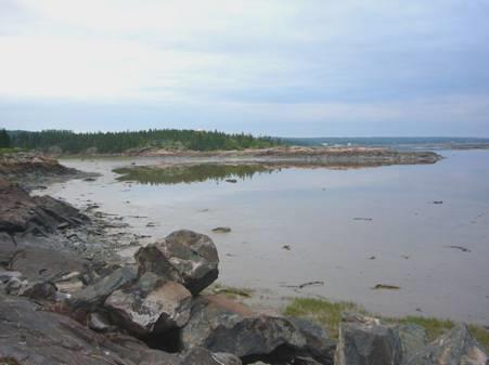
At Pointe Noir, a bit further on, we could look down to the (free) ferry across the Saguenay River from St Catherines to Tadoussac, but as we looked out at the whales, the rain began.
We reached the ferry and drove straight on, but we were in for a long wait before the boat left. We amused ourselves by looking out for the whales, moving to the upstairs lounge when the rain began in earnest. Almost everybody else was French speaking. Maybe we imagine it, but they seem to look at us as if we have two heads, and there isn’t the usual smile of recognition. We are still amazed that all signs in Canada are in both languages – English and French, but in Quebec Province they are only in French.
After disembarking at Tadoussac, we drove through the pretty little town and parked by the beach, right next to a tiny mission church – apparently the oldest mission site in Canada. We had coffee, and a delicious bit of cake bought yesterday – a good legacy of the French – while the rain poured down. We ventured out afterwards, and were amused at a group of 3 French speaking people sitting under the rain/sun shelter in front of us, and drinking beer beside the clearly visible ‘no alcohol’ sign! Like the drunkards in Finland, these people were friendly towards us, even if they, like most other people, speak very little English.
Looking to the earliest mission church in Canada, at Tadoussac
Tadoussac dates from 1565, when Cartier first arrived, and was for a long time important for the fur trade. We were sorry that we couldn’t enjoy it in better weather, but we did have lots of nice views. The queues now for the ferry, in both directions, were enormous. We didn’t ever find out what the problem was, as the ferry should run every 20 minutes (and we had waited at least 45 minutes). There is no other way for vehicles to go, as this ferry forms part of the main north/south route.
Unable to log in to the internet here, we continued onwards, turning off to a little quay after Cap Bon Desire to have lunch. We even had a cup of tea to warm us, as the rain continued. We watched the antics of cormorants while we ate.
We could hardly have imagined that less than an hour later, we would be walking in warm sunshine beside two rushing waterfalls on a little pathway which culminated in a small ‘Capilano’ type bridge over the river as it reached the sea. Wild flowers surrounded us, and lush ferns and birdsong. A beautiful spot. It was called Sault au Mouton. There had been a small information kiosk, and the roly- poly French speaking man rushed out to get us to go inside, so that he could give Adrian a leaflet (which we already had)!
Continuing onwards, we sometimes passed areas where the trees were very stunted, like in Alaska. Sometimes we stopped at viewpoints above the coast – at one a huge coach pulled in beside us and disgorged its passengers to queue up for the one loo, while the driver had a fag! Adrian could only get the Bam out by reversing the whole way onto the road.
At Forestville we were able to get some propane, which pleased us, as we will soon be heading out into the wilds.
At around 5 o’clock, we followed a signpost to a viewing area, taking a long unsurfaced track down to a ‘quay’ in a beautiful situation almost surrounded by water, and with hundreds of noisy gulls congregated on offshore islands. Although we had hoped to get a bit further today, it was too lovely a spot to pass up. We were disconcerted to see vandalism of the plaque and at the picnic area, and the whole place seemed rather that it ‘hadn’t happened’. There was a children’s play area being built further up the track, and what would appear to be huge flower containers half built and already broken. Perhaps most strange were two huge dinosaur models. The plaque (what we could read of it, as it was broken, and in French), seemed to liken the strength of the dinosaurs to the early explorers and a tall obelisk marked this.
After wandering around on the granite rocks, where a lone iris and myriads of tiny white flowers bloomed, we came in to enjoy the views from inside.
The water was as smooth as glass.
From our wonderful overnight spot at Ragueneau
Friday 23rd June Into the wilderness 258 miles
Several cars had come down last night, but there was no trouble. People were still around as we went to bed, with the sound of rain pattering on the roof. We heard more rain as we awoke, which made it easier to leave this lovely place.
We left at 7.30, heading for Baie Comeau, about 20 miles further on. We had several things we wanted to do here before we headed off into the wilderness.
The first was to buy a new windscreen wiper, as one of ours was on its last legs. Next we got some money, and then we had a shop. This was after having breakfast. We had trouble in getting an internet connection, but finally achieved this near Pioneer Park, down by the ‘front’ of this large, spread out town, and were able to read our recent emails.
The thing that we really needed was water, and as if by a miracle, as we started to drive out of the town, I spied a ‘dumping’ sign. Sure enough, there was a dump, and water, at an ‘Aire de service’, just like being in France. There certainly are some compensations to this Francophile place! We could even have stayed here for 2 nights! By now it was sunny and hot. As we drove out, we got our last necessity – fuel – and we were on our way.
We had read that Baie Comeau was an unattractive town, but it served our needs. It had become important in the 1930s for paper and pulp production, and later for aluminium and foil, using the power from the HEP from the dams along the route we were about to follow.
When we had shopped, we had seen a sign saying ‘open on Sat 24th ’. On looking this up, we found that it was ‘National Day’ in Quebec. In Pioneer Park they had been setting up a stage.
It was nearly midday as we headed off for a long trail into ‘unknown country’, en route to Labrador, 567 km away. A sign said ‘winding road 211 km’!
The only things marked on the map were Manic Dam 2 – 20 km, and Manic 5 Dam 195 km after that!
We drove through a countryside of forests, lakes and rocks, with the occasional addition of electricity pylons from the dams.
We pulled in for lunch beside one of the lakes, and realised that although the sun was warm, the wind was cool.
Just before we reached Manic 5, there was a large area that had been burned by fire. We stopped at the ‘habitation’ and got more fuel, as things were few and far between – signs said ‘Fuel and services 95 and 345 km’!
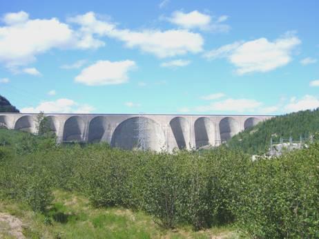
Manic 5 dam
We had travelled 214 km since Baie Comeau, and now things changed, as the surfaced road ended, and we now travelled on an unsurfaced road which shook and rattled us and the van to pieces.
We saw no visible wildlife, except for the occasional bird, and the annoying mosquitoes and large biting flies. We saw a sign saying 350 km to Fermont, the only ‘town’ on the route in Quebec.
We travelled on and on, listening to music when we could, but sometimes the corrugation made it too difficult to hear. Conversation was also difficult. The road just went on and on, with nowhere to pull off to admire the view, which was frustrating. When an approaching vehicle came, both it and us were enveloped in a thick cloud of dust, rather like smoke from a steam train.
We just drove on and on, hoping for somewhere to pull off for the night. This we didn’t find until 6.45, when we stopped by a small pull off for people to climb Mt Jauffret (1065m). We both felt pretty exhausted!
Having now got water, we were able to both have welcome showers. We were just finishing these when a car pulled up, and one of the 6 occupants – a rather smart looking lady in ‘safari’ gear asked Adrian if he knew where the campsite was, which was on their map. We couldn’t help – there was nothing here – and we wondered what these 6 people would do at this time of night – we could see no evidence of their camping gear. Finally they drove off.
Behind us was a large sign depicting an opened tin, with a line through it, which we decided meant ‘no littering’ (Adrian thought perhaps it could mean you mustn’t open tins here!). We had seen a sign like this before, usually accompanied by a picture of a hammer underneath, with ‘$100’ by it. It had taken us a long time to realise that this meant ‘if you litter, the penalty is $100’ – we had spent ages wondering why you couldn’t use a hammer!
Saturday 24th June Rattling and rolling along the Trans Quebec Highway to Labrador 140 miles
Splendid isolation – Mt Jauffret
The night was really cold. I had woken at 5 o’clock to see the sun shining brightly, but the sound like thunder was the trucks rumbling past!
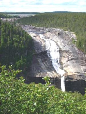
We wrapped up and left at 7.15 to walk into the forest on the trail towards Mt Jauffret. We walked on spongy moss where small Canadian dogwood were flowering. Several bridges had been made from wooden planks over the tiny streams and boggy ground. Apart from the mosquitoes, it was lovely. We saw and heard a few birds, and then came unexpectedly to a large, attractive waterfall. After investigating it from a very rickety wooden bridge, we returned to the Bam for breakfast. Although we were warm now, we didn’t dare take off any of our clothes, because of the mozzies. Even so, Adrian got bitten, and then he had to stay outside to check the tyres before their next onslaught!
We left around 9 o’clock, back on the gravel road, soon crossing the Beaupin River, and noticing again the splattering of rosebay willow herb beside the road.
We stopped after crossing the turbulent Hart Jaune River to photograph and video it. This almost became a disaster, as the back door lock, which has been playing up, locked itself while we were out, and we hadn’t got the key! Luckily Adrian was able to locate our ‘spare key’ system, and we were able to get in again!
We now came to Gagnon – and the start of 50 miles of tarmac! Gagnon doesn’t exist now – it is a deserted mining town, of which nothing remains – all the houses were removed 20 years ago. However, there is a short stretch of divided road, with drainage holes, and the road continues surfaced as far as the former mine at Fire Lake.
We had been amused at the odd ’bumpy road’ signs as we travelled the unmade road – but all the road had been bumpy! Funnier still, as we came to the tarmac, the sign said ‘bumpy road - 4 km’!
Having just got to the tarmac, we turned off to an area beside a lake, which would have made a good overnighter. Although early, we made it our coffee stop before continuing on the tarmac, where the kilometre markers passed much more quickly!
We drove on through the boreal forest, a large area of which showed signs of a past fire. We were joined by the railway, which is used to transport the iron ore from the mine at Fermont. The road crossed the railway continually, so we had to be on the look out for the long and unannounced trains. Similarly, we had to be on the lookout for oncoming large trucks when we reached a one-lane wooden bridge.
This road is not built for tourists, so there are very few places to pull off. Having missed a place at about midday, it was gone 1 o’clock before we found another. By now the day had deteriorated and was raining hard.
We had come to a long section where the grader was at work, but this had just heaped tall piles of sand into the centre of the road, which made the driving treacherous and unpleasant. By now the constant shaking and vibrating had got to us, especially as we saw signs of the mining operations which I always find ugly and distressing.
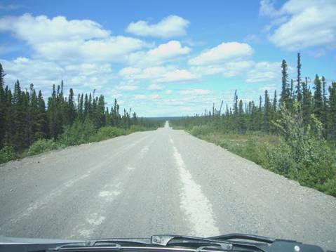
The main (only) road from Quebec to Labrador
10 miles before Fermont, the road was surfaced again. We turned off to this strange town – so far from anywhere (570 km from Baie Comeau). We were amused that the tourist leaflet had described it as a ‘Northern Paradise’. It called it a ‘Walled City’, but the wall was of flats and shops, a smaller version of the Byker Wall in Newcastle, which half surrounded the mostly army barracks type housing. We braved the rain to walk over and have a look, but there was no attraction for us, and it was certainly not ‘paradise’!
There were a couple of good things though – we were able to log into the internet, and receive some more messages. Also, there was a dump station, so we could dump again, and get more water. Nowhere to stay this time though.
By the time we left Fermont, at 4.45, the sun was shining from a blue sky. Just a few miles down the road we entered Labrador (now, since 2001, officially joined with Newfoundland).
We found a spot to pull off onto a few miles before Labrador City, annoyed that the mosquitoes piled in as we opened the door. It wasn’t long before we could have a drink, as Labrador is one hour on in time from Quebec.
We were prepared for a cool night, as tonight we were at 1913ft, and last night we had been at 1540ft and it was cold.
Sunday 25th June Rattling along through Labrador 171 miles
In fact it wasn’t as cold as the night before. There was a blue sky with fast moving clouds, and a cool wind. Being one hour on from Quebec time, it was 9 o’clock when we left.
We stopped at Labrador City to get some very expensive fuel. The young chap nearly filled the water tank instead of the fuel tank. Adrian was pleased to find that the chap spoke English and not French. He said that it got very cold in the winter, and that summers didn’t get much warmer than this.
As we left Labrador City, which was just as exciting as Fermont!, and the tarmac, a sign said 535 km to Happy Valley. The only place along the route is Churchill Falls.
We played ‘I spy’, but ran out after 6 goes – trees, road, sky, clouds, pylons, wires! These last two were a one off. We could have added ‘water’ later.
‘I spy’
We were able to pull in by a lake, so made this our coffee stop, eating the last of the excellent French pastry from Quebec, and sitting by the waters edge. Except for the mozzies, it was lovely!
While we were there, a fox sauntered by with something in its mouth. We watched as it wandered along the middle of the road, up the hill and out of sight.
Then it was a long wait until our lunch stop, but we were able eventually to pull in beside another lake. The road surface was now a bit smoother, and we were able to listen to music again. We drove through another vast area which had burnt in the past. The scenery was now scattered by large boulders, making us think of what Cartier said when he sailed up the coast of Labrador in 1534 ‘the land is composed of stones and horrible rugged rocks – I did not see one cartload of soil’.
We finally reached the Churchill River. We had read that there were some actual falls at ‘Churchill Falls’. Adrian had spotted a sign previously saying ‘trail – 2km’, but we saw nothing else. He did some investigating, and we set off in what we thought might be the right direction. It was a lovely walk through ancient forest (apart from the mosquitoes). There were wildflowers in profusion, including dogwood and clintonia (a pretty little yellow flower). We saw 2 large frogs, and the ground was covered in bright moss and lichen. And we did come out to some eye-catching falls. However, the sign by the viewpoint said ‘Hamilton Falls’, so we were confused.
The Hamilton – or Churchill Falls
We made our way back, feeling rather warm now, and continued for the 20 miles or so into Churchill Falls ‘town’. The only reason for this remote town’s existence is the nearby Hydroelectric plant, apparently one of the largest in the world. Rather like an army barracks, the town was bleak and unattractive. We stopped by the fuel station to refill, and Adrian asked the girl (who was about to come to England to study – at Harlow!!) about the falls, and yes – the so-called ‘Churchill falls’ were the ones we had visited. And yes, the mosquitoes were always this bad.
As we drove out of Churchill Falls, and left the short stretch of tarmac again, the sign said 285 km to Happy Valley/Goose Bay.
Soon afterwards we found somewhere to pull off the road for the night – it was now gone 6 o’clock.
Monday 26th June After 700 miles of wilderness, we reach Happy Valley/Goose Bay 182 miles
We were disturbed by a succession of mosquitoes in the night (how do they manage to hide themselves till night time!), so found it hard to get up, and didn’t leave until just gone 9 o’clock.
We set off on our last day of driving to Goose Bay, still on unmade roads. The road was smooth enough for us to listen to some of the delightful tales of Gervaise Phinn as a school inspector in the Yorkshire Dales. It helped to pass the time well, as there was very little change in scenery, and as before, virtually nowhere to pull off.
The excitement of the day was seeing a porcupine scurrying off from the road. Usually if we had seen something black on the road, it had been a piece of burst tyre, but this one moved!
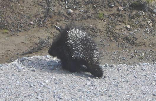
A porcupine scurries off
We pulled in early beside a pretty tumbling river to have lunch – we weren’t going to miss the opportunity of a stopping place today! Our view of the river was marred by dozens of large flying creatures which congregated around the van. Another car had pulled in, and a father and young teenage son got out – the son to fish, and the father to cook hot dogs for lunch in water from the river. The son got the line tangled in the rocks. They ate their food and left, but hadn’t seemed to be too bothered by the insects. We wondered where they had come from, being so far from habitation. We were at km 400, so another 140 to go!
On we travelled, and as we got nearer to Goose Bay, we began descending from the mighty rock of the Canadian Shield, and the fir trees were interspersed with deciduous trees on the sandy soil.
About 20 miles before Goose Bay, we saw a sign to Muskrat Falls. We followed the sandy track for 2 or 3 miles, glad that the weather was fine! We finally came to a handwritten sign saying ‘Lookout 40m’. We walked there, but it was a lookout over the pleasant steeply sided river valley, but no falls. For this, we set off on a much longer trek.
The weather felt really warm, and for the first time, we weren’t besieged by mosquitoes. There were some about, and several hovered around us as we returned to the Bam, but it was wonderful to relax a bit, and just enjoy walking along the rough sandy track. We saw several colourful toads again, camouflaged against the dead leaves on the ground. We had to do some detective work to find the viewpoint of the falls, which were more like rushing rapids than falls.
Muskrat rambling Falls
The falls here had considerably more water than the Churchill Falls, as the river had been rejoined by the water which had been diverted through the Churchill Falls hydro generators (3000Mw of it!).
We drove back to the road – everything is relative, and the gravel road seemed like heaven after the sandy track! A few more miles, and we came to the ‘Welcome to Happy Valley/Goose Bay’ sign, and soon after that to tarmac.
Looks like we made it! Look how far we’ve come my baby! (Shania Twain)
Well, it was 4 days and 700 miles of mostly unsurfaced road since Baie Comeau.
We had passed
2 huge dams,
Three isolated towns
Walked 3 difficult- to- find trails to waterfalls
Seen hundreds of rivers and streams
Thousands of lakes
Millions of fir trees
Billions of mosquitoes
1 fox with its catch, 1 porcupine, a few birds and several toads!
And not much else!
Now we’d arrived, we weren’t sure what to do! Our overnight ferry leaves tomorrow afternoon. We drove around a bit to the Happy Valley part of the town, finding a sandy place overlooking the river for the night.
It was a strange place, which seemed to have been used in the past as a dump, but now contained a couple of memorials to local people, with flowers and crosses.
Adrian was able to cook our meal of fish outside, for the first time for ages. We ate inside, but then took a glass of wine out to sit with the lovely view, but realised that mosquitoes were about!
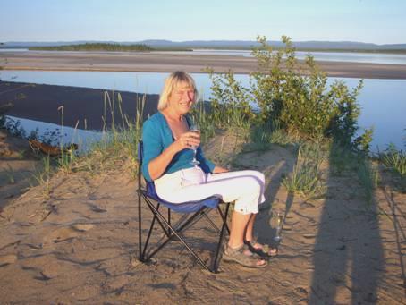
Happy Rosie at Happy Valley
Tuesday 27th June Mosquito nightmare, and then an overnight ferry 67 miles
Perhaps the less said about the night that followed, the better! The previous night’s mosquitoes were nothing compared with this! Having disposed of twenty or thirty mosquitoes before putting out the light at midnight, more bombarded us the whole night through! Each time we lay down again, another would come and buzz in our ear, or fly onto our face! Sleep was impossible. We had no idea where they were all coming from. Adrian tried all sots of ideas – the fans, mesh windows, possible holes. In the early morning, he took apart the whole air conditioning system, both inside and out, without coming to any real conclusions! Amazingly neither of us lost our cool, and Adrian made light of it when chatting to a couple from Quebec, who had stopped to have their breakfast, having come off the ferry from the other direction.
It meant that we didn’t leave until 10.15, having sat out in the sun to have breakfast. We spent the rest of the day in the Goose Bay area.
Goose Bay had been started as a Canadian military base staging post, on the way to Europe, during WW2. It became the Canadian and NATO testing site for low flying jets, and is also an alternative landing site for NASA space shuttle.
We stopped by at the Information Centre, where we were pleased to be able to pick up maps for the other maritime provinces. On asking about a laundrette, we were told of one miles back in Happy Valley, then we found that there was one just along the road! We used that later, but first went to the port to pay for our ferry booking. A chap who had just come off the previous ferry said to try to get a cabin. We asked, but were told that there were none left – we had been told this when we originally booked. The people in front of us were most upset – they had supposedly booked a cabin, but were now told that the boat was overbooked, and there were none available – and they were going on to Lewisporte, Newfoundland – 36 hours!
We drove back to visit a free ‘Military Museum’, but found it to be only a few exhibits in a large store! The model railway section that we had read about had been dismantled! Adrian did buy a Labrador T shirt, but they didn’t have the ‘I survived the Labrador Highway’ one in his size.
An hour later we returned to the laundrette, to find that the cycle hadn’t finished. Surprised at this, the girl said that the pressure must have been low, so it had filled up slowly! A nuisance to us, as we had decided to drive to the small habitation of North West River, 30 km away, before coming back for the 3 o’clock loading of the ferry.
We had lunch, and read a few new emails which had come, including some recent photos of Manolo, grabbed the washing from the drier, and set off at 2.10.
There was virtually nothing to see on the way, except for trees, and some pleasant shore views. When we reached the ‘village’ (pop 550) – a low key early settlement, first settled by a French fur trader in 1743, and with 2 small museums (one opened by the Queen, but closed on Tuesdays) we only had time for a quick drive around, and then a dash back to the ferry dock.
We reached there at 3.20. We’re glad that we didn’t rush to get there sooner, as they loaded the Lewisporte vehicles first, before we boarded.
Lucky we had booked!
The ‘Sir Robert Bond’ was a bit late leaving for its 5 o’clock departure. Having ‘bagged’ some reclining seats, we spent the first few hours on deck, watching the green wilderness alongside long Hamilton Inlet, which we were travelling down.
The sun was really hot as we supped a cup of tea we had brought with us, and then settled down on the uncomfortable plastic benches.
The boat spent most of its 12 hours sailing down this inlet, which gradually widened to the sea. We could see isolated bits of snow on distant mountains later.
We ate supper of chicken wings and chips (about the worst I have ever tasted, but the only other choice was equally unappetising fish). To make up for this, we returned to the Bam (allowed from 8.00 – 9.00) and enjoyed a beer. Adrian had turned off the propane, although the man didn’t seem to think that it mattered whether he did or not!
The ferry certainly had a carefree feel. It was very busy – we think with people from the Goose Bay area going south for their vacation. This would be their only way of travel, although a road is in the process of being built, scheduled to be finished next year. There were lots of children on board, and mothers were trying to get them off to sleep. There was an announcement that one of the children on board suffered from severe nut allergy, and asked people not to consume anything with nuts. We heard this just as we were tucking into a muesli bar!
It still felt warm when we returned upstairs, but cooled down a lot as the night went on. There was a beautiful sky, then as darkness fell, the ship became quiet, and we tried to sleep
Evening magic from our ferry
Wednesday 28th June We set off on the Labrador Coastal Drive 127 miles
We could never really get comfortable, but both got more sleep than the previous night! I looked out and saw the sunrise, but later it became cloudy.
And morning magic too!
We were lucky to have had such a lovely evening. We were now on open water (the Atlantic Ocean!), which was luckily calm. We could see lots of green, uninhabited islands, and then what we took to be an isolated Innu fishing village. As we got closer, we realised that this was our destination - Cartwright!
The grand metropolis of Cartwright
We arrived on schedule at 6.00 a.m. The driver of the car in front of us didn’t appear for ages, and when he did, he had a problem with his key, so we had to wait until almost last of those disembarking here. As we drove off onto the unsurfaced road, a young girl welcomed us and handed us a leaflet about the road south. This road is very new – before that access was by sea only, and further north this is still the case.
We pulled into the ferry carpark, looking out over the water, and while I prepared breakfast of bacon and egg, Adrian worked on making new mesh curtains to deter the black fly which we have been told are bad.
A man like an Irish leprechaun, and wearing a reflective jacket, had come running over – we thought to tell us that we couldn’t park there – but it was to say that he was the local guide, if we wanted any help. As most of the activities are fishing based, we don’t think that we will need him! We could just about understand what he said. The accent of the locals is like nothing we have heard before – Irish mixed with German perhaps, and a bit of west country.
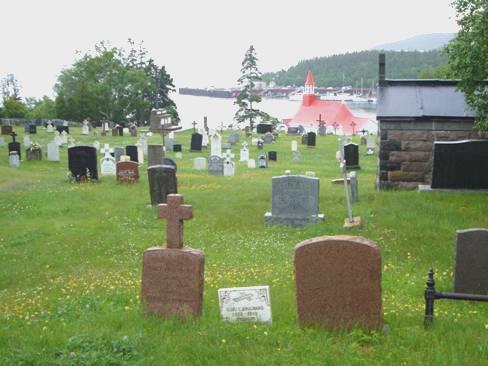
Cartwright (pop 628) was established in 1775 by Captain George Cartwright, an Englishman, who set up a fur and fish trading business.
We didn’t leave until 10.45 - or 11.15, as we are moving into Newfoundland timescale, which is half an hour on. Strange to think that Canada is so big that we are nearer to our family in England than to Simon and Laure in Calgary!
We soon found the small ‘Northern store’, and stocked up a bit. It made us think of shopping in Normanton in Australia – the shop stocked all kinds of goods, but the veg looked as if they’d been there all week! Many of the local people were oversized, with large, round faces, and not particularly attractive. We drove on round the ‘town’, passing the memorial to Cartwright in the cemetery, although he had come back to England to live, which is where he was buried. A few irises bloomed by some of the little houses, but mostly there were no gardens to speak of. We didn’t fancy the thought of living in a place which was frozen for eight months of the year, and full of bugs for the few months of summer!
We passed a lone petrol pump, but Adrian thought that it didn’t look too good, and that we would head for the one out of town, marked on the little map we had been given. We now drove out several kilometres, but when we reached the second pump, a man all dressed up in head/body anti-bug net eventually came over and said ‘We’re out. You can get some in town’. Well, we think that’s what he said, we couldn’t understand a word of it!
We knew that we should have filled up at Goose Bay!
Back we had to drive – we didn’t dare set off on another long and lonely stretch with the thought that we might not have enough fuel.
Finally we left with jokes about getting off before lunch time, but then we wished that we’d stayed. This newly built road was no better than the Trans-Labrador highway for having anywhere to pull off. It was just one gravel road, with steeply sloping drop-offs, and not a single place to pull off!
The scenery was more undulating, and there were swampy meadows, with cotton grass edging the road. We hadn’t passed any vehicles, but still didn’t think that we could just stop on the road itself. When we passed a grader, with his car parked actually on the road, we despaired of finding anywhere to pull off.
After 2 disturbed nights, we needed somewhere to stop! It was over an hour later that we came to a turn off to Paradise River. There was a former airfield here which we could have pulled on to, but we thought that we would drive along the track, imagining that we might be able to pull off by the river. No such luck! Paradise River (population 18, but there must be extra summer/winter/weekend cottages) consisted of sporadic simple dwellings each with its own drive, but nothing else. After 2½ miles, we came to the end of the road – where the snowmobile track continues over the river when it is frozen in winter. This is where we stopped to have lunch.
We drove back to the highway, and had just joined it, when we saw a suitable place by the river, where we could have stopped! We saw no more all afternoon, until we stopped at 4.50 (now 5.10) on a large, flat stony area just before Port Hope Simpson.
And we only passed 2 cars until then!
Earlier we had seen where the proposed road to Goose Bay was under construction. The completion date on the board said 2009, not 2006 as we had seen before. We wondered how different it will make life in this area.
As we settled in, rain began to fall.
Thursday 29th June Lovely fishing villages of Labrador, in the sunshine 121 miles
It was bliss to wake up after a good sleep, with the sun streaming down, and no sign of mosquitoes!
Nice views by the inlet
We didn’t leave until 10 o’clock, driving south beside a pretty inlet to Port Hope Simpson (pop 575), which had been started in 1934 as a logging town, and judging by the piles of matchstick logs beside the road, was still busy as that.
We passed the first of many sledges on the roadside. Often there were make shift log bridges across to them. We presumed that people used them to carry their logs home.
There were more cars in this area than further north, but the road here links many small fishing villages. We turned down to drive the 30 km to St.Lewis – supposedly the most easterly village in continental Canada. It was pleasantly warm and windy.
When we stopped at the viewpoint just before the village, a chap we had just passed on an ATV came by, and told us how lovely it was here. Once more, we had great difficulty in understanding what he said, but he did tell us that winters weren’t as cold now – only 2 months instead of five. He also told us that we should walk the trail to Deepwater Creek, which he had helped to build. Most people worked at the crab plant, he said.
We continued around the bay, passing all the simple little white wooden houses. At the far end was a gazebo, with views over the whole area – bays, inlets, hills, sea. The exciting thing here though, was that we could also see several icebergs out to sea, looking the colour of glacier mints. There were low growing irises in profusion around our feet, amongst the huge rocks.
It was quite beautiful. We continued driving up a very rough track to another viewpoint where we had our lunch, sitting at the picnic table, in our isolation, with bird song above. There were virtually no trees here. We thought it must be like the Hebrides.
This is where the walk started from, to Deepwater Creek, the place where 3 families fished for years, before the settlement around the bay in St Lewis started. We had read that it was a really inhospitable place in winter, but on this wonderful day, we couldn’t imagine it.
Lovely view on the walk to Deepwater Creek
We set off on the newly made trail – much of it a boardwalk, which seemed rather over the top to us. We soon came to hundreds of steps – going down – which meant of course that it would be all uphill on the way back. The views were delightful, with the icebergs out to sea, the rocks and lichen, the few stunted trees spurting out of the crevasses, the dogwood and kalmia flowers.
Once we had descended to the large pond, the trail wandered around it. At one place there was a rustic seat and picnic table, even a fireplace. Still the trail went on, over boggy ground, until we came to a roughly made arrow. I followed on in the direction of the arrow, but after climbing more steps, decided to return to the viewpoint below. Although the trail had been recently set out, it didn’t look as if anyone else had walked it.
We started our return, stopping by the rustic seat, where I had a quick cool off in the water, before the long ascent.
It was 3 o’clock when we reached the Bam, and now we drove back down the rough track, and on through St Lewis. We stopped a bit beyond the village, at Roundhill Pond, which had recently been set up as a picnic and swimming area, with a tiny bit of beach. Several teenagers were enjoying the water. We walked down to the water, before continuing to drive back to the main road, and on to Mary’s Harbour, the next pretty little fishing village – now involved with the shrimp and crab industry. The road down to the village was really corrugated.
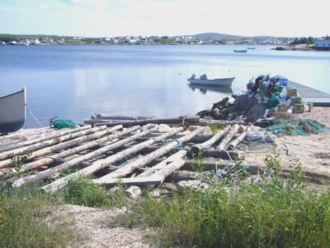
Mary’s Harbour
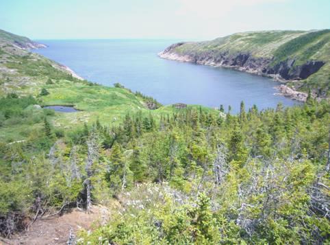
We drove around the bay to the jetty where a ferry leaves for Battle harbour. The island of Battle Harbour is a National Historic District. It had been established by British merchants in the 1700s, and was for many years the unofficial capital of Labrador because of its proximity to the cod and seal fisheries. We had decided not to visit, as it involved a long boat trip there, and would take up at least a day of our time.
As we drove back around the bay, we stopped by a sign for a walking trail to Gin Cove. We didn’t really need another walk, but once we set off – on another boardwalk similar to the one at St Lewis, we kept going – up over a hill, and down to a rocky, seaweedy cove – nothing special, but quite pleasant. We then had to walk back up, of course!
We didn’t find anywhere suitable to stop for the night in Mary’s Harbour, so set off southwards, soon passing the pretty little hamlet of Lodge Bay, but not finding anywhere to pull off. The road had become really corrugated, so we rumbled and shook our way onwards, despairing of finding anywhere to pull in.
It was 6.45 when we reached a flat area similar to last night’s, where there was a caravan and truck, belonging to one of the road workers, we imagined. There were lovely views down over a lake and stunted trees.
Friday 30th June The 16th Century Basque whalers of Red Bay 57 miles
We have become aware of the variability of the weather in these parts! After yesterday’s glorious sunshine, today started very misty, and it never cleared. Sometimes visibility was really low, other times the mist lifted a bit, before descending again! We were glad that we had made good use of the fine weather yesterday.
We left at 9 o’clock to drive the rest of the way across rockstrewn moorland, with a few stunted trees, to Red Bay. As we arrived there, 45 minutes later, it looked really eerie in the mist.
Red Bay in the mist
The momentous thing for us was that after nearly 800 miles of gravel road, this is where the tarmac begins! (The road only continues for 50 miles in Labrador, and then another 50 miles in Quebec, and then stops!)
We drove around until we found the National Historic Site. As we made our way to the entrance, we were bombarded by black flies. We chatted to the ranger inside, who said that they were expecting rain, and that was when the blackflies were worst. She said that she loved living here. In summer they worked, in winter was ‘playtime’. “We do a lot of ice fishing” she said.
We bought a ‘Historic Sites’ pass, as we intend visiting several more National Sites, then proceeded to find out something of the 16th century Basque whalers. It appears that in 1978, several sunken ships were discovered in the harbour. They turned out to be those of Basque men, who, starting in 1540, had come over for months at a time to hunt whales for their oil. This was for the European market, primarily for burning in oil lamps. The market died out at the end of the 16th century, partly because the Spanish wars with England and other countries left them without ships, and partly because the market had been depleted by over fishing, and possibly by climate change. Using the techniques learned by the Basques, Europeans turned their attention to the Greenland area for whaling.
After watching a film about the ongoing research, following the raising of one of the ships (which has now been returned to the sea), we viewed a chalupa, the small boat that the men would have hunted the whales from. In another part of the museum were all kinds of artefacts which had been found, including clothing and shoes, tools and pottery. We could see the Spanish influence.
The oil rendering sites had been across the water on Saddle Island. It would have been nice to have visited, but the promised rain had now come, so we didn’t make it.
After buying a few items of food from the limited selection in the little grocery store, we had lunch sitting with a view across the bay to another of the walks which we wouldn’t be making! I had made a note of several possible walks for today, but as the whole point of them would have been the views, and we could see hardly anything, we didn’t do any.
We soon came to the wonderful, rushing Pinware River. We could catch glimpses of it as we drove along. It was in a deep gorge, and tumbled continuously over rocks. It was so frustrating that there was nowhere to pull off and enjoy it.
We made our way to the Provincial Park, which seemed to be on a point, jutting out into the sea. It would have been lovely on a good day, but not today!
We drove on through more little villages, stopping by an evocative jetty at West St Modeste, which seemed to have smarter homes than other villages.
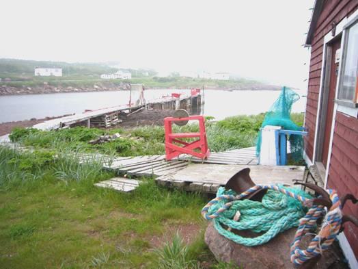
West St Modeste
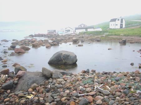
As the fog thickened , we turned down to L’Anse au Loup, stopping right beside the fine sandy beach. Deciding that it was pointless travelling further with such bad visibility, we stayed put for the night.
Cobscook Bay, Maine to Red Bay, Labrador


