
Outer Hebrides
Monday 1st October To the Outer Hebrides 47 miles
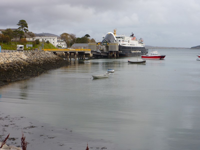
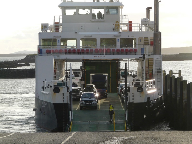
We made our way to the ferry queue, and were surprised that the boat left promptly at 2.00, having only arrived shortly before. We had a calm crossing, seeing some of the highland scenery of northern Skye as we left. After an hour and a half we arrived at yet another ‘Cartwright’ – Tarbert, on North Harris.
Continued from John O' Groats to Uig, Isle of Skye
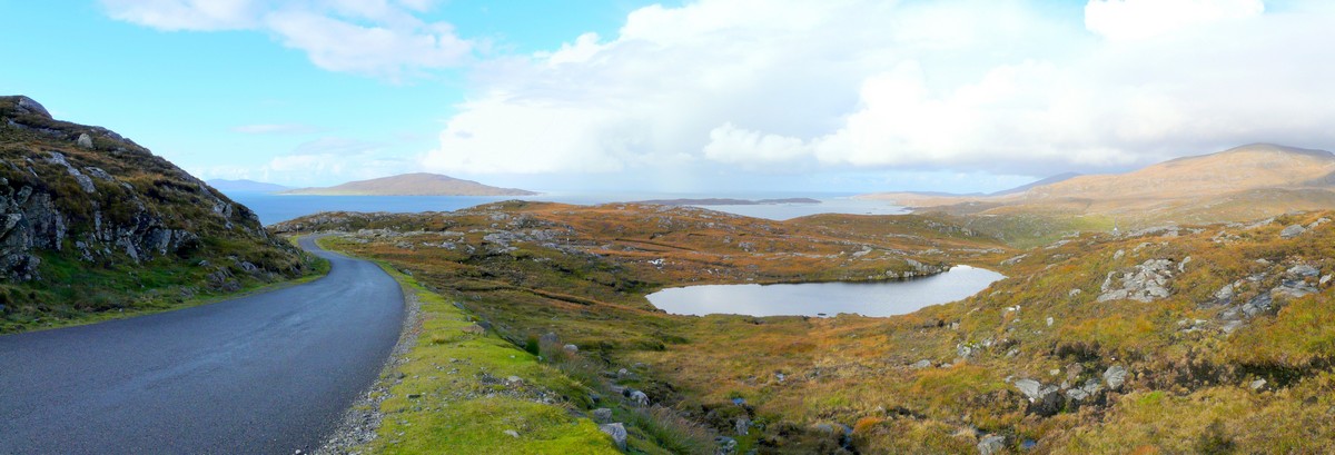
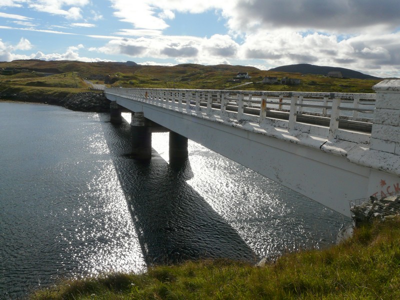
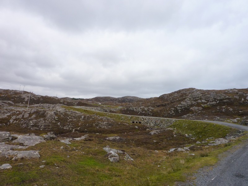
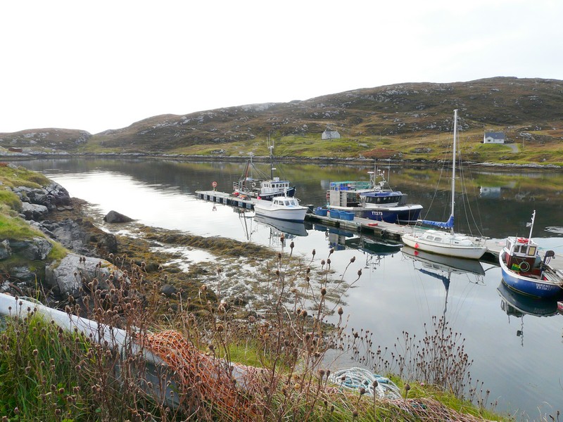
After pulling into the harbour car park to get our bearings, we drove along eastwards through the rocky, barren scenery with a surprising number of houses. We had expected the road to end after about 5 miles, so were surprised to find that there is now a bridge across to the island of Scalpay.
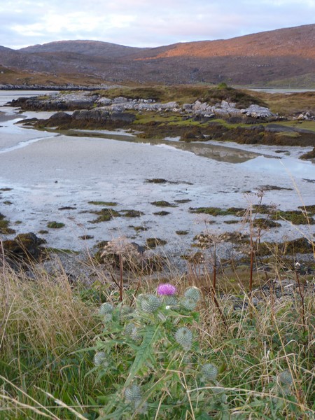
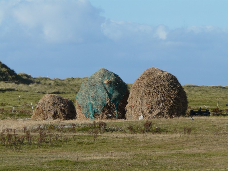
We continued on the long, narrow road, finding it densely populated with small cottages scattered everywhere. There were several pretty little harbours, and a double rainbow shone brightly for a while. When we had managed to turn around, we drove back onto Harris to one of several parking places amongst this barren scenery, looking out to Laxadale Lochs.
Our ferry arrives at Tarbet on North Harris
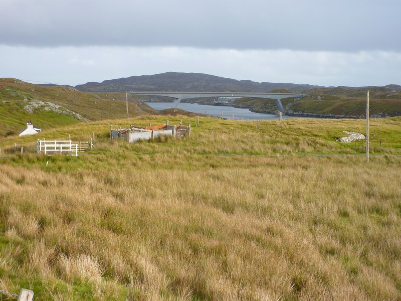
The bridge across to Scalpay
The island of Scalpay
We drove back onto Harris and stayed for the night above Laxadale Lochs
Tuesday 2nd October To Ruth’s in Stornoway 98 miles
It had rained heavily in the night, but the day started bright and continued with sunshine and showers.
We left late, having tried to take in the remote surroundings we were in, but the footpaths were flooded.
We drove back to Tarbert, then soon took a road which went a long way north westwards above West Loch Tarbert. The going was very slow, as the road wiggled constantly. We were most amused at a pristine tennis court set in a wilderness setting beside the loch. The sign said ‘Bunavopeador tennis court. Available for hire everyday of the year except Sundays’!
We returned to the main (only) road north, with views of Loch Seaforth to the east. We were now in Lewis (North Harris merges with the ‘Island of Lewis’)
We took a good road to the east, as far as Lemreway – it just ended at a fish farm, with nowhere to stop. We drove to another ‘hamlet’ called Orinsay, where again there was nowhere to stop for lunch, so we ended up by parking on a long ‘passing place’ above the water. This area is called Park. We returned to Gravir, where we followed a route through splendid, remote, rocky scenery to Calbost, in a pretty setting on a circular loch beside the sea. We’d only passed one woman on horseback, and a smiling elderly lady walking.
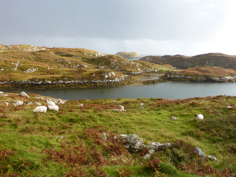
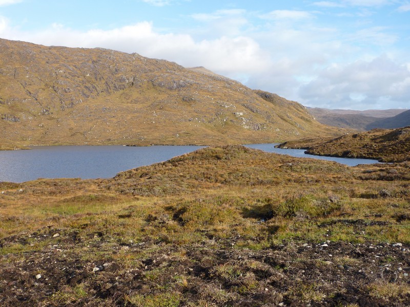
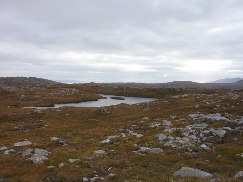
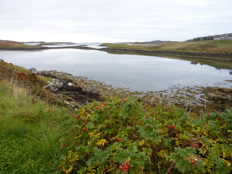
We had a nice view of Marvig in its scenic coast/loch situation before driving down to Cromore in its remote location on Loch Erisort, with water everywhere. The area from here northwards is scattered with dozens of small lochs, and is, in fact, called ‘Lochs’.
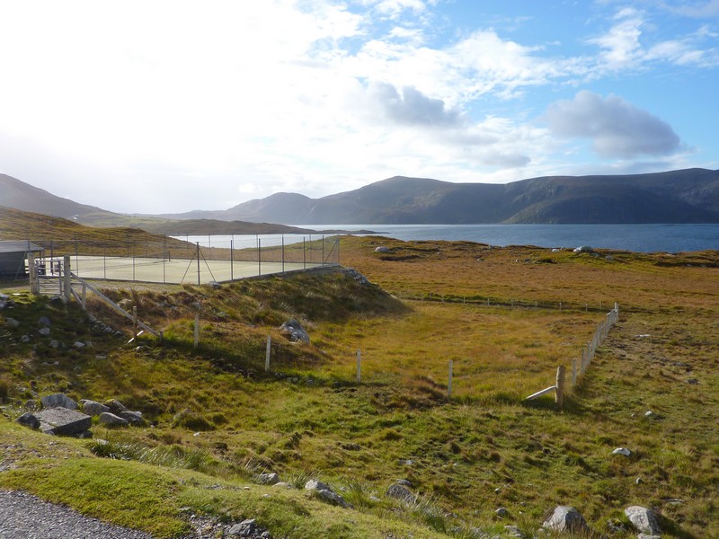
The remote tennis court on West Loch Tarbert, North Harris
Remote country near Cromore (Lewis)
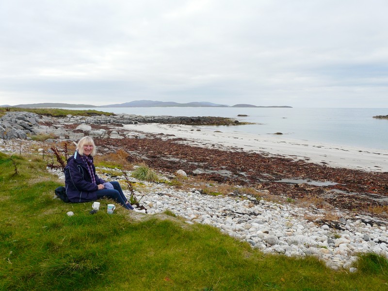
We wound on as far as Meavaig, but then decided to return. We stopped for coffee at a lovely spot beside the loch. It would have been nice to have sat at one of the picnic tables located here, but it was too windy, so we just sat inside with the lovely view of the loch and Taransay Island.
Looking down to West Loch Tarbet
We drove back to the A road, turning off next to Leurbost where there was a constant line of plain houses all the way to Crossbost. We had views south from here towards where we had been at Cromore.
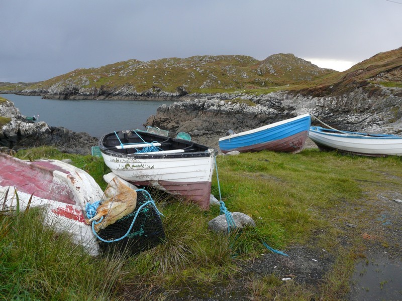
We ‘wiggled’ on to Ranish where 4 boats were pulled up from the shore, and there was a heap of lobster pots
. I spotted a tap on a derelict building, and when Adrian tried it, a voice from a nearby cottage asked ’Do you want water?’ He got his hose, and Adrian filled our tank. The man, who’d always lived in this area, then offered us 4 live crabs which he’d just caught but didn’t need. He said that when he was a child far more crops were grown here, particularly potatoes.
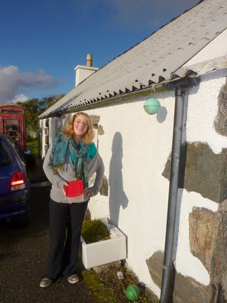
We wound on to the isolated houses of Grimshader before heading for Stornoway. We located Ruth’s road, just outside Stornoway, and pulled in beside what we thought was her house (no1) at the end of the road. While we waited, Adrian got busy in cooking the crabs. This was quite a feat – they were large. Also it started to rain really hard. Time went by, and when eventually someone arrived at the house we wondered if it was the right place, so rang Ruth (there were no house numbers displayed). No – her house was right at the far end of the very long road! Adrian had to finish cooking the third crab, and we set off. The place where Ruth is living was far more attractive – a rustic cottage which she is renting. The owner, Barbara, a lady in her sixties, has been cycling the ‘Camino de Compostela’ route.
Fishing boats at Ranish
A delightful evening followed, enjoying supper with Ruth, and her ‘neighbours’ – Sean (Barbara’s son) and his girlfriend Rosie (from Lyme Regis) (Rosie & Sean are now married). The meal included a tasty crab dish which Rosie & Sean had prepared. It was late when we came out to the van.
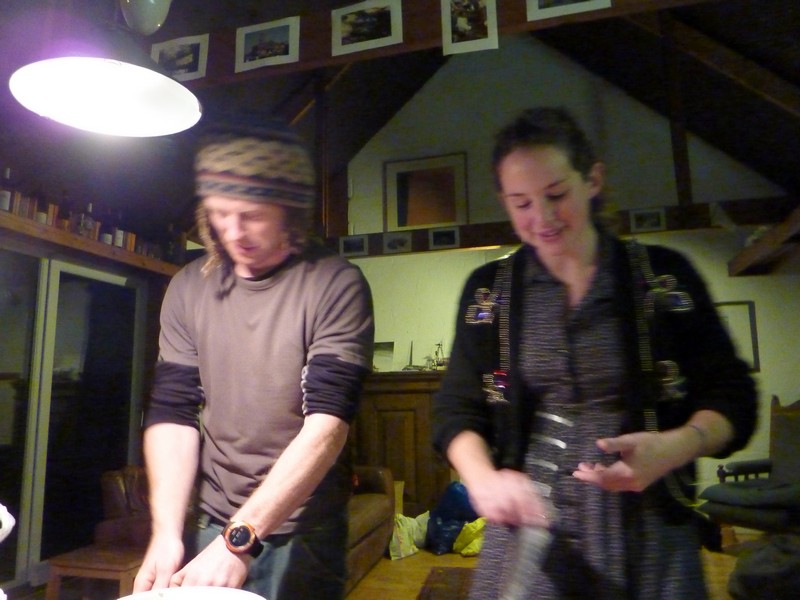
Sean & Rosie prepare the crabs
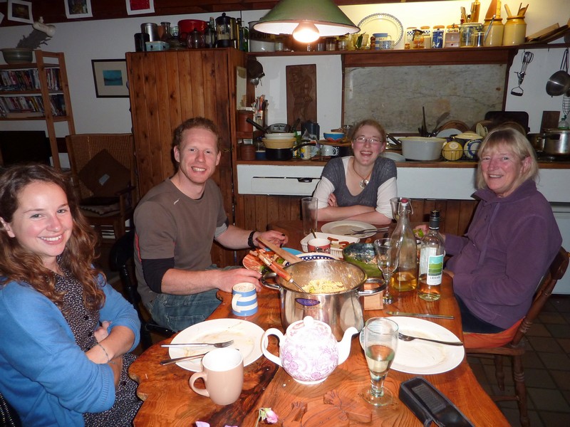
We all enjoy our supper!
We had a leisurely breakfast with Ruth, and didn’t leave until 10.30. It had been a lovely visit.
We drove back into Stornaway, and shopped in Co-op. Stornaway seemed a very ordinary town in such a distant setting. We set off to drive to the end of the Eye peninsula, just west of Stornaway. It was relatively flat with plain, grey houses, and remains of former houses. We drove all the way to the lighthouse at the end at Tiampan Head, where there was a pretty cove. We had lunch nearby before heading for rocky Port Nan Girvan on the northern side of the peninsula. There was a harbour here, and a few houses.
Wednesday 3rd October The bridge to nowhere 49 miles
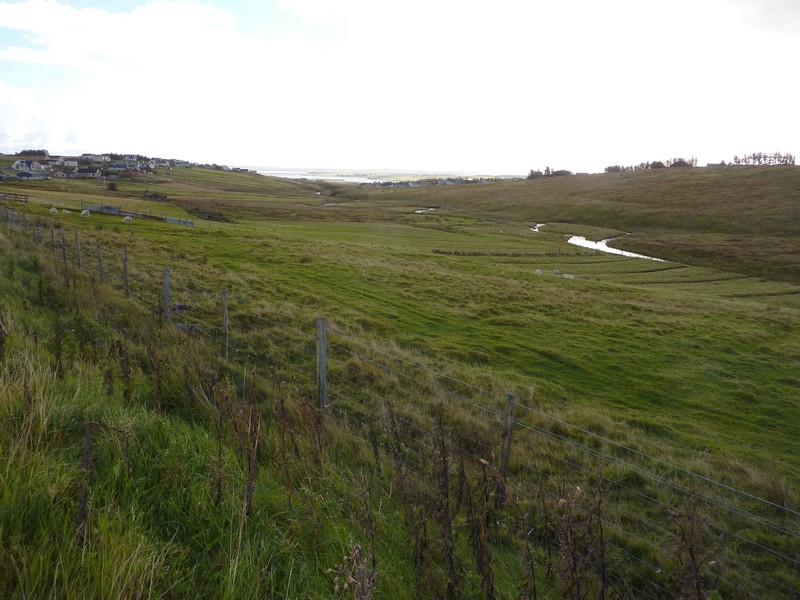
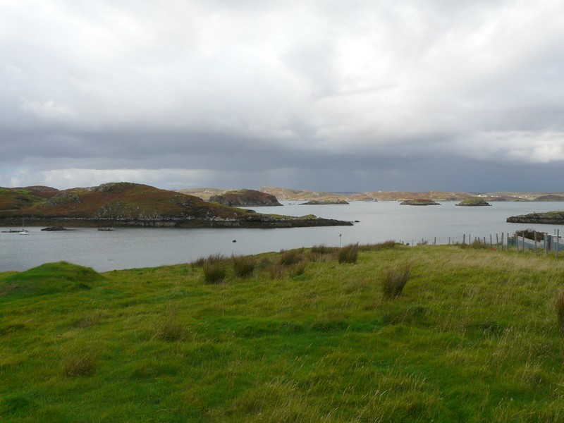
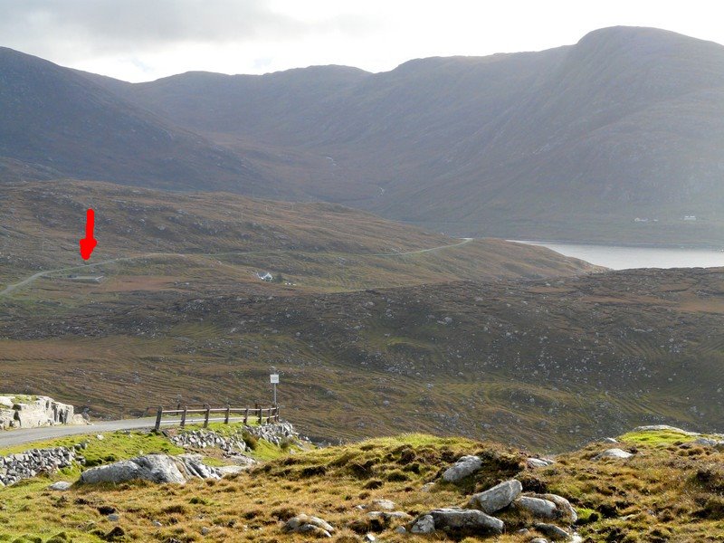
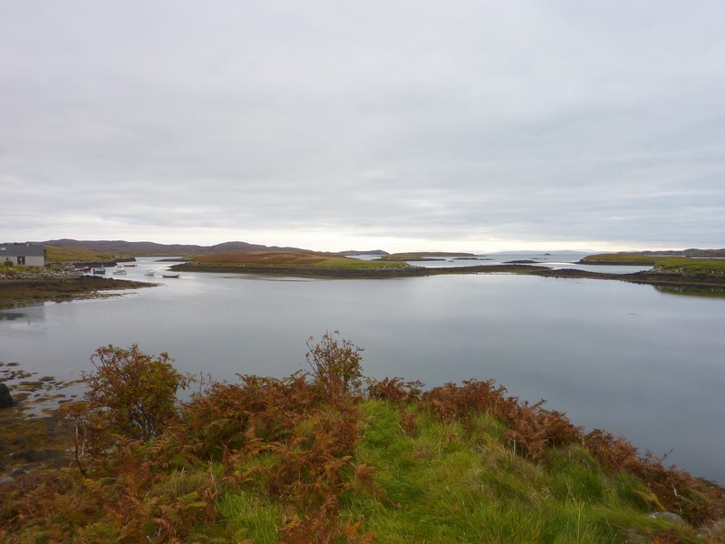
Leaving Ruth, and the view from where she was staying
On the way back, we drove via Seisiadar, where the ‘road to the shore’ didn’t lead to the shore! A bit further back, we drove down to Pabail Iarach, where we walked onto a sandy beach beside a concrete jetty on a pretty, rocky bit of coast. As Sean had said, the Eye peninsula didn’t offer much.
We drove back into Stornaway, driving past the harbour, which had both fishing and pleasure craft. We located a laundrette, and while the washing was doing, we walked down to Rosie’s shop, where she makes attractive articles using Harris Tweed.
I was 4 o’clock when we left, to drive along the northern side of Broad Bay through numerous small communities before a long stretch of peat moorland to Tolsta. We drove on as far as the ‘Bridge to Nowhere’ - a bridge built after the first world war with the intention of building a road to Ness. However the local men did not want to work on it and so it never got built (more’s the pity).
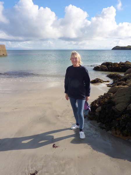
Rosie at Port Nan Girvan
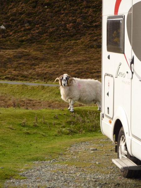
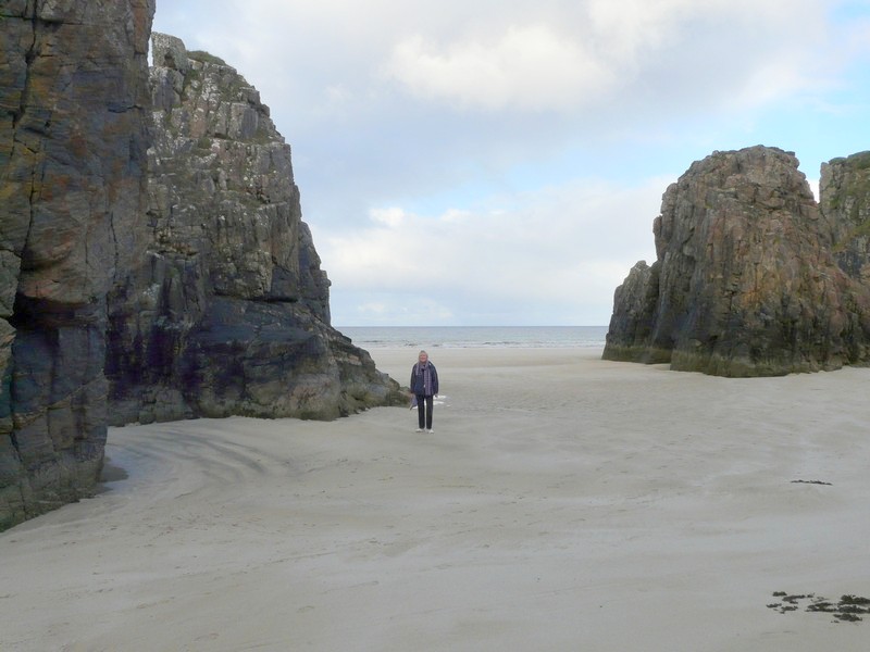
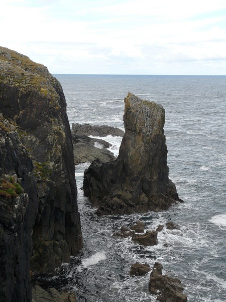
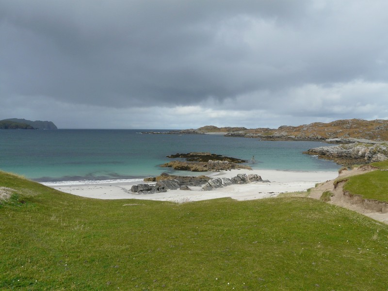
We unanimously voted to stop at this beautiful spot. We walked over the meadow where rabbits abounded, past a pond where 4 swans and 2 large cygnets were swimming, to the wonderful sandy bay. At one end were photogenic stacks, which we walked to. Sheep romped in the fields above. A real Top Spot!
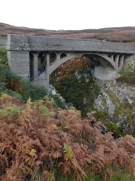
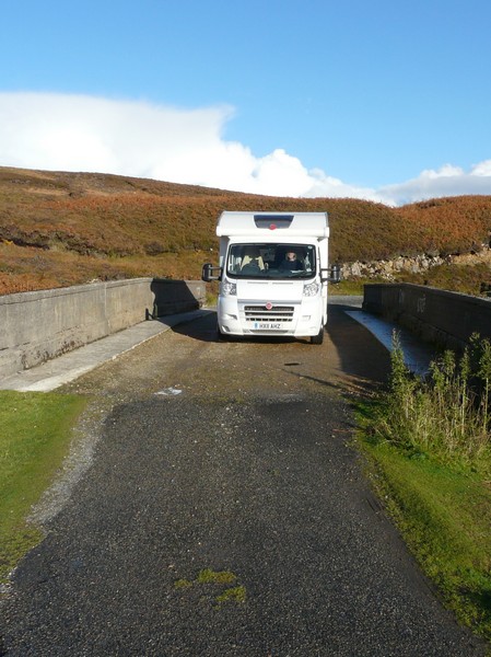
The 'Bridge to Nowhere'.
It was in a beautiful situation above a lovely sandy bay. After walking over the bridge, we decided to stop for the night above the nearby Garry Beach. We had planned to drive back to a spot near Stornaway, where we had internet connection, as this was the last night of our current wifi card.
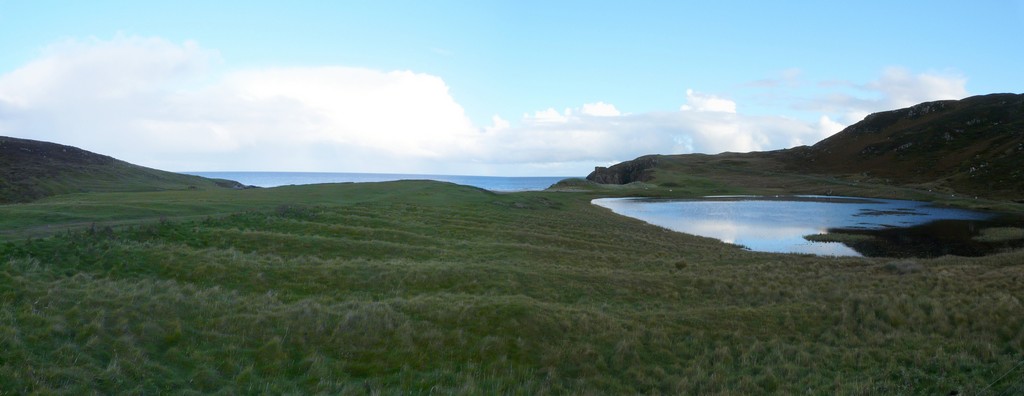
Wonderful place to stay - Garry Beach, Lewis
Thursday 4th October A Hebridean croft 82 miles
There had been some rain in the night, but it was a fine morning as we walked across the meadow and over the bridge to the bit of beach left, as the tide was in. We’d had only the sheep for company in this lovely place.
We left at 9.45 and drove back to Tolsta where we had a view down. A notice told of the earlier fishing, and of the Clearances, when many locals emigrated to Canada.
As we drove back through the moorland and then the plain villages, we had a view of the Eye peninsula, with mouse-like Tiumpan Head and its lighthouse.
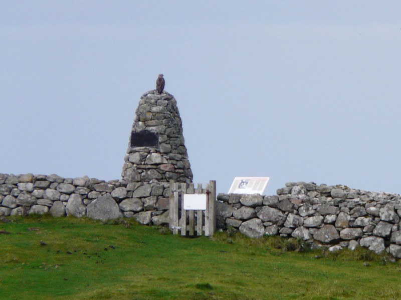
At Bac we stopped by the ‘Land Raiders Monument’. This was a monument like yesterday’s to the people who just after the 1st World war stood up to the owner of Lewis, Lord Leverhulme. He’d wanted to industrialise the island and wouldn’t allow the ‘locals’ to have their promised land for crofts.
We stopped just before Stornoway at the spot where we had originally planned to overnight.
We now drove across the barren wet peat moorland to the north-western coast of Lewis. We drove through many uninspiring villages right to the northern end of Lewis.
We’d driven down to Skigersta on the eastern coast, and could just view the rocky cove. Just north of here, Port Nis had plain houses with a complicated harbour and a nice sandy beach sheltered by low rocky cliffs. We had lunch here, watching what we thought were gannets diving. Later we saw lots of geese flying.
The actual Butt of Lewis had a wild beauty with swirling waves crashing onto the rugged cliffs of the coves. A brick lighthouse stood here, built by the Stevensons of the lighthouse building family. It was apparently in the Guinness Book of records as being the windiest place in Britain, but luckily that wasn’t true today.
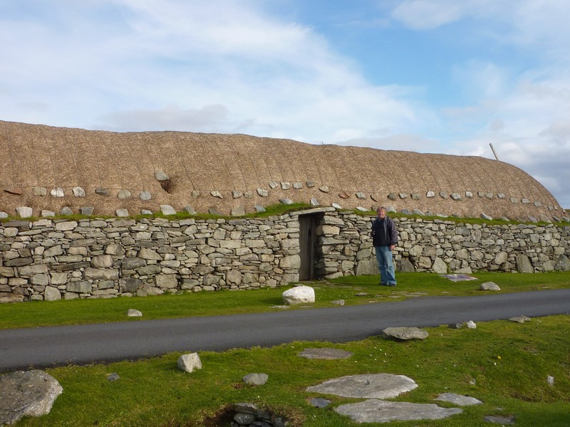
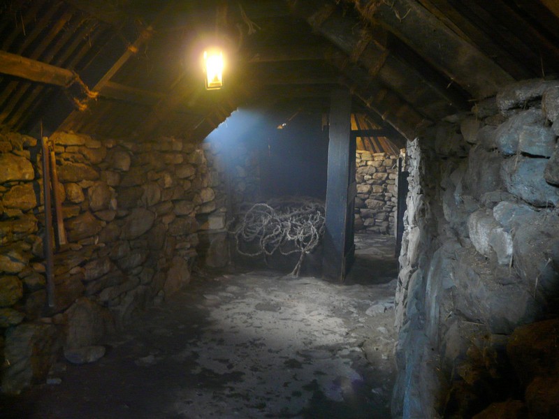
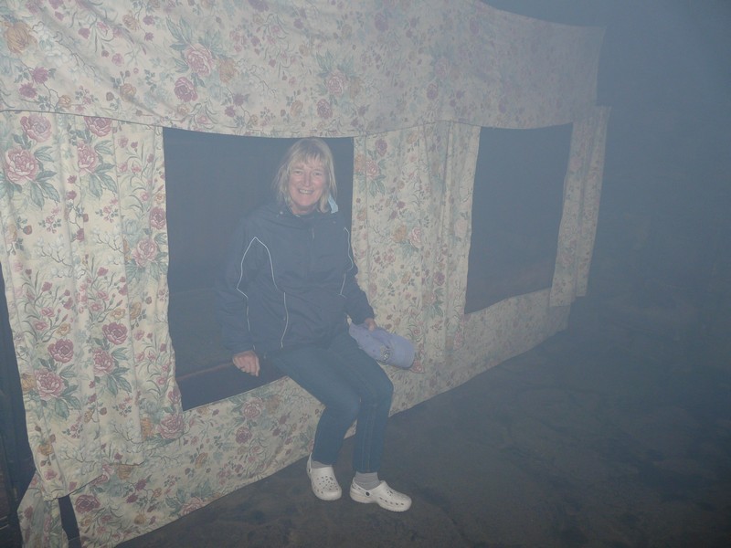
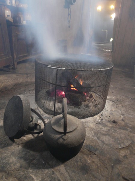
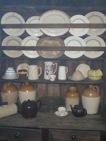
On our way back south westwards, we tried several roads off the main road, but without reaching the sea. At Arnol though, we came to a winner when we visited the ‘Black House’ – a traditional Hebridean stone house. This house has been preserved as it would have been. It had used local materials – stone for the walls, heather for lagging, straw for the thatch. As there wasn’t much local wood, drift wood had been used. A peat fire burned constantly, which made it really atmospheric. We viewed everything through the smoke, and came out smelling! Animals had lived in one area of the house, apparently adding to the warmth! We could imagine what life would have been like living here as we crouched low to get through the doorway .
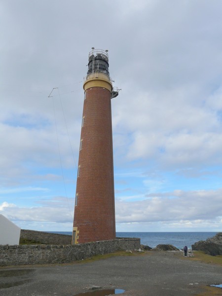
Butt of Lewis with its lighthouse
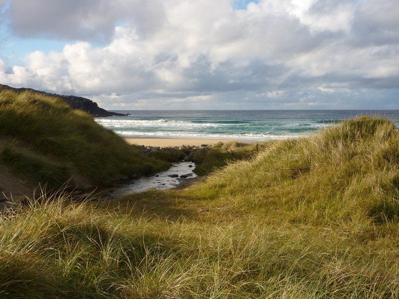
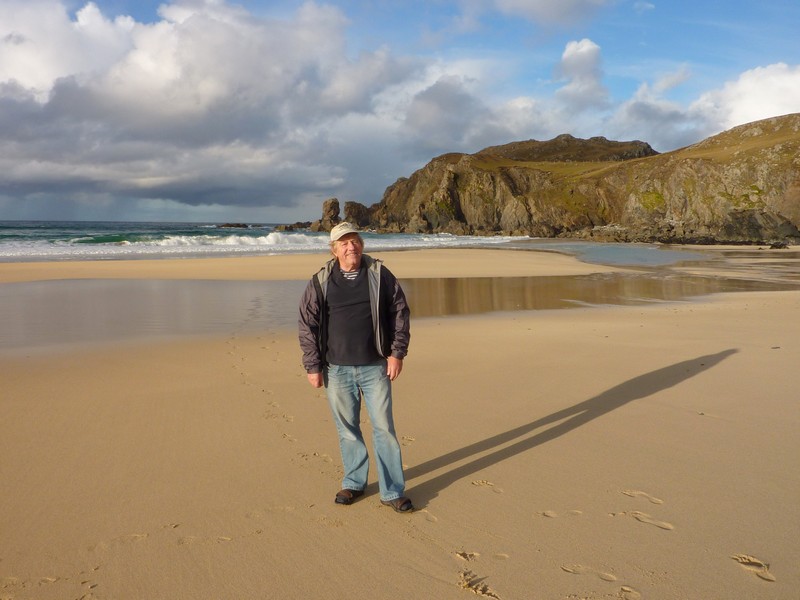
We turned down next to Dalmore, where the narrow road ended once more by a large cemetery beside the sea. One or two surfers were out in the waves. We debated for a while, but decided to stay for the night. We walked down over large boulders to the beautiful sandy cove enclosed by rocks. There was a stream coming out, which made for very plodgy sand and some wet feet!
There was another van parked here, and Adrian spoke to the couple to ask if they were staying for the night. They were – they had been surfing – so we invited them in for a drink after supper. They came in at 8 o’clock, and we chatted until almost midnight! They were Kevin – a keen surfer and outdoor man of 38 and his pretty wife Fiona, who surprisingly to us was a GP. They lived at Helmsdale on the east coast of Scotland.
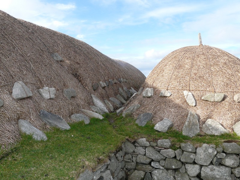
The Black House at Arnol
Adrian at Dalmore
Friday 5th October Ancient relics and wild scenery on Lewis 62 miles
We had a ‘busy time’, ‘filling and emptying’ (there was a tap on the toilets beside the cemetery) Two gentlemen came and fixed a sign saying ’Commonwealth War Graves’ on the gate of the cemetery.
Our first stop was at impressive Carloway Broch, a stone age lookout. It was sunny, but a bit windy.
At Calanais we enjoyed walking around standing stones, where the sunshine and lighting made it look really photogenic.
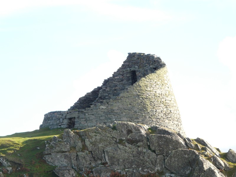
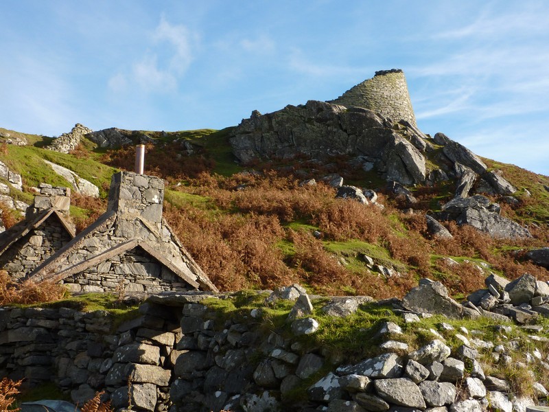
Carloway Broch
We headed now for Bernera Island, stopping to photograph the peaceful setting with a remote red telephone box. We crossed the ‘Bridge over the Atlantic’ and stopped to have lunch sitting at a newly built picnic table beside it. The bridge had been built in 1951, and the information stated that the island would probably be uninhabited now, like many of the others, if there had been no bridge built. The wind was a bit chilly, but the view wonderful.
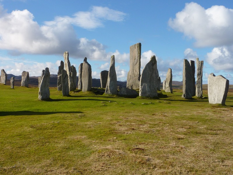
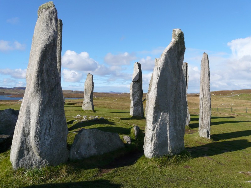
The Calanais standing Stones
We saw two men in a small boat lifting in their catch of crabs. Just afterwards we passed some highland cattle.
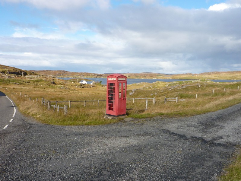
A 'remote' telephone box and the bridge to Benera island
We made a tour of the island, getting a glimpse of Kirkebost wooden jetty before driving across remote wet peat bog to the small village of Croir in the north of the island. The bay was inaccessible by road but had numerous islands and a far sandy beach.
We drove on to Bosta, where there was a stone age house (closed) but we were able to walk to it from a wonderful sandy beach, and see it from the outside. It was set in an idyllic situation by a small stream which reached the turquoise water in the rocky bay of white sand. The fine day had become erratic, and it started to rain hard on our return. On the beach stood a ‘time and tide bell’.
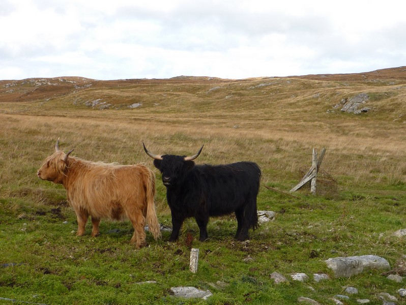
Landing crabs & highland cattle
We drove back down the island through a rocky landscape covered sparsely with heather and bronze coloured grass. We had to follow the road south to drive on towards Uig (where Ruth’s neighbour Sean is from). We drove through barren, remote country with many small lochs.
The road now went north to Miavaig, which was in an attractive setting at the end of Loch Roag. There were several large fishing vessels in the bay, and evidence of much fishing activity.
We drove a circular route at the eastern side of this peninsula, coming to exquisite beaches in the Kneep/Valstos area.
There were a lot of off shore islands, and it all looked very pretty. You could stay beside the beach at Cliff for a fee, but we continued a short way and stopped beside a small lake at 5.15.
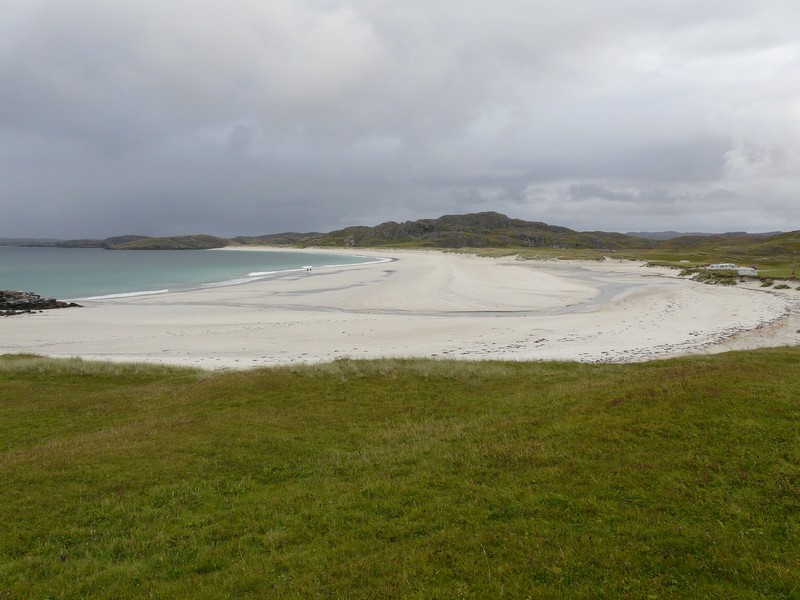
Kneep Beach - if only Scotland had Mediterranean weather
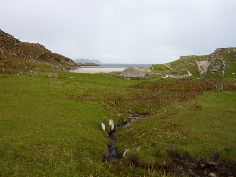
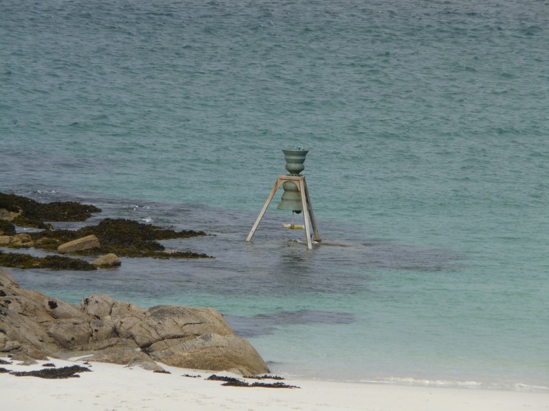
Bosta with its Iron Age house, its beautiful white sandy beach, and its 'time & tide bell'
Saturday 6th October To South Harris 92 miles
We left at 9.45 and were soon back in Malvaig. The road from here on towards Uig was through a deep, narrow, barren rocky gorge.
After a long time we came to the strangely remote community of Uig (same name as on Skye). There were just a few houses and a so-called hotel/restaurant. There was no obvious beach access, just a pretty cove amongst the rocky headlands and islands.
We drove through more barren country to Ardroil. On the way we came across the large carved figure of a chessman, a copy of one found near here in 1831 along with 92 others thought to be made in Norway in the 12th century.
The access to the sandy beach at Ardroil was through a gate, so we left and began our drive back across to the eastern side of the island and down to Tarbert. Here we stopped to get some more diesel and shopped in a tiny Co-op store where most things weren’t priced, and were expensive.
Now it was time to drive on to South Harris. Early on we had views of the bridge to Scalpay which we’d driven over on Monday. At Meavag we followed an extremely narrow and winding road above the coast through amazingly bare and rocky scenery with just a very few houses. Sometimes we spied a small boat in the water.
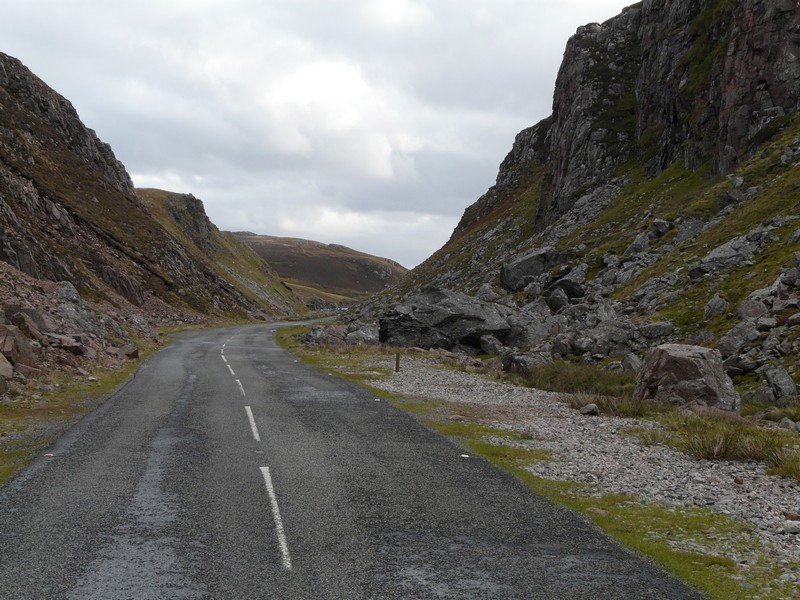
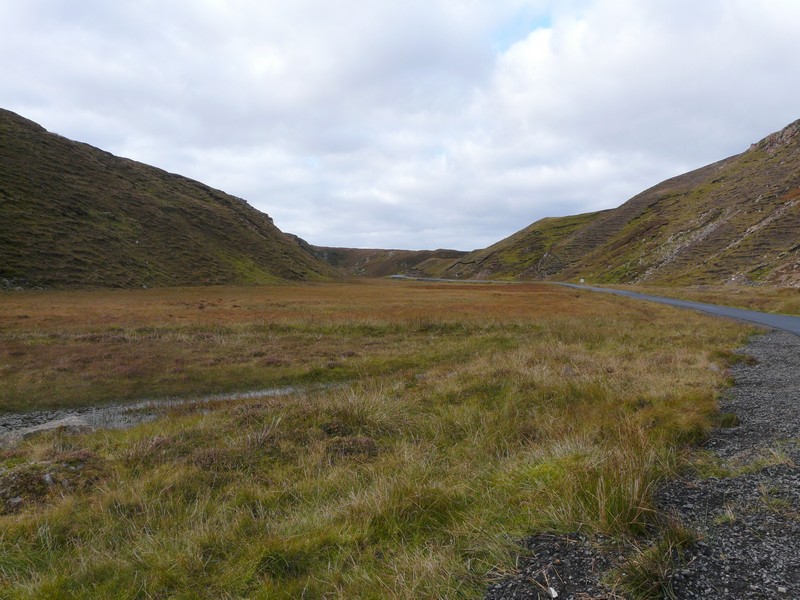
The barren rocky gorge to Uig
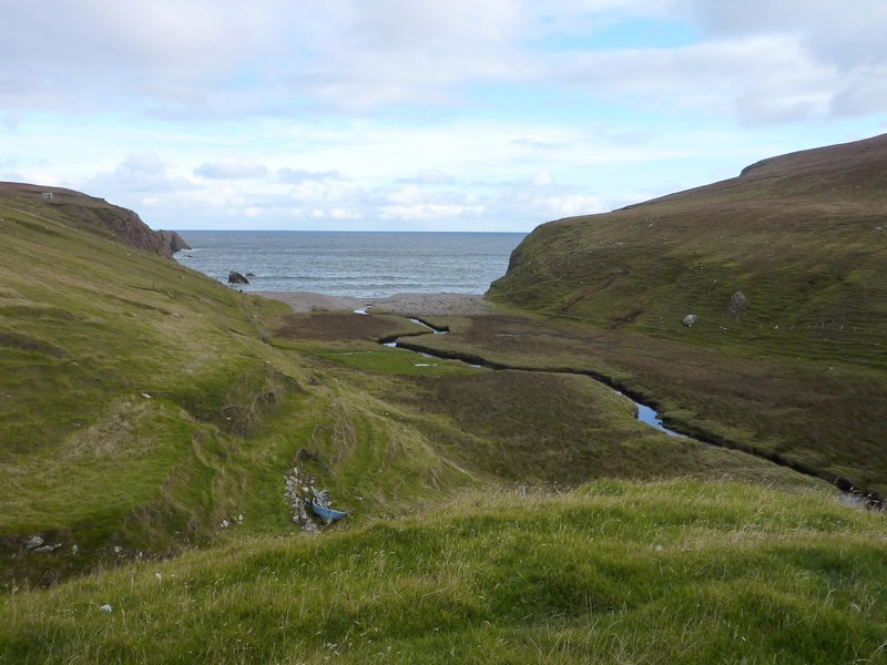
The 'beach' at Uig
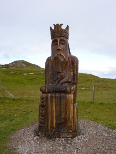
The Chessman at Ardroil
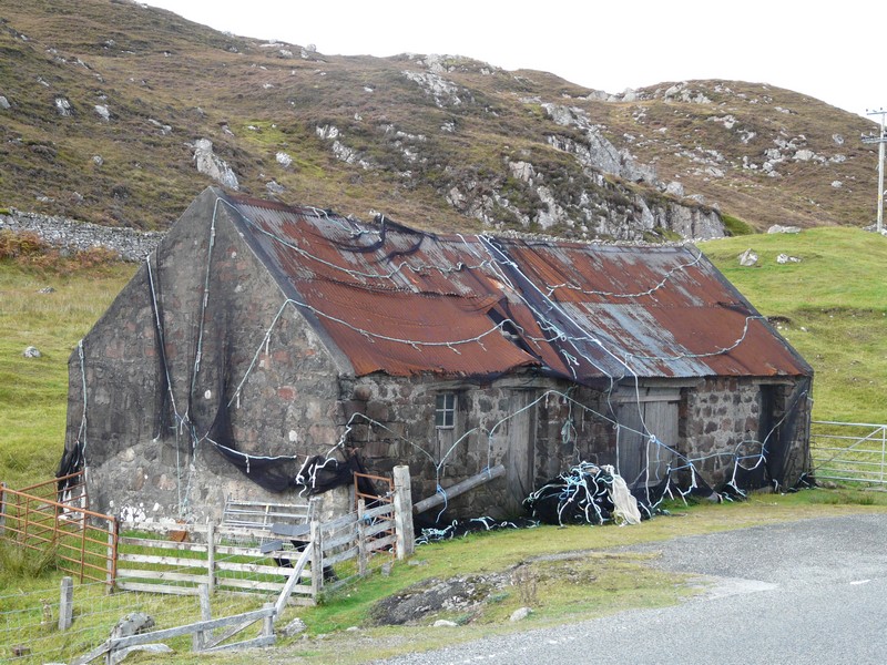
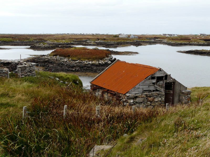
Fisherman's hut on the way to Ardroil
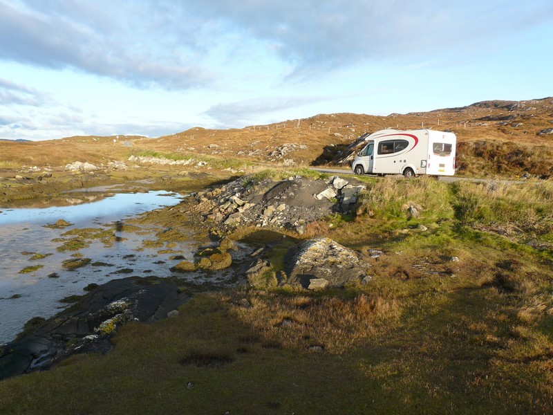
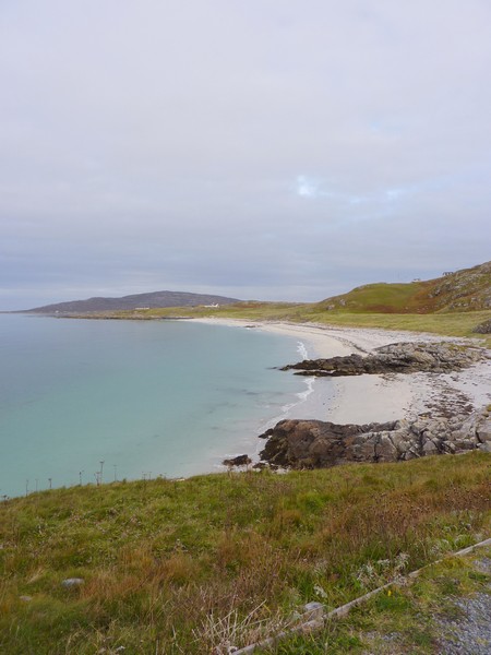
After Lackalee we joined the road to go to the northern side of Harris and soon turned off to drive along the northern side of Luskentyre Loch, which was a huge sandy bay. We returned to a spot above the water to stop for the night. A curlew strutted in the water below.
Remote landscape at Scadabay near Meavag
Sunday 7th October The Sound of Harris 44 miles
It was a beautiful morning. The sun shone on the rocks of the long sandy inlet. We were glad that the campervan which had pulled in right behind us yesterday had left early this morning.


We continued along beside the coast with fantastic views of the sandy bays. This side of the island is gentler than the south eastern side. We arrived at Leverburgh at 10.30. This is where we planned to leave from on the 5.30 ferry to Uist. Adrian was most upset and annoyed to discover that we had overlooked the 9.30 am ferry, which we could have caught if we’d realised. He phoned up and booked us on the afternoon ferry – which turned out to be more expensive than the last ferry as we were charged as a large motorhome.
Being Sunday, everything was closed here as elsewhere in the Hebrides. The place had a feel of Newfoundland about it, or again another ‘Cartwright’. There were large stacks of lobster pots.
We used facilities by the harbour to ‘fill and empty’ before setting off to drive a ‘go and return’ road by the south-west coast. The lighting on the water with the many tiny islands was wonderful. A flock of greylag geese took off and landed on the water. It was just a shame that the scattering of houses in such a lovely location were plain and unattractive.
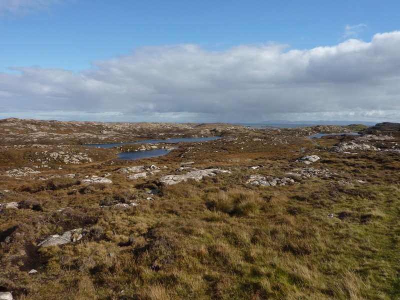
Back at Leverburgh we drove off on a loop of the southern tip of Harris via Rodel, enjoying the rugged scenery and marvellous views. The road was extremely narrow, with white lines on either side making it look even narrower. The terrain was of rocks and bogs, so there was no going off the road!
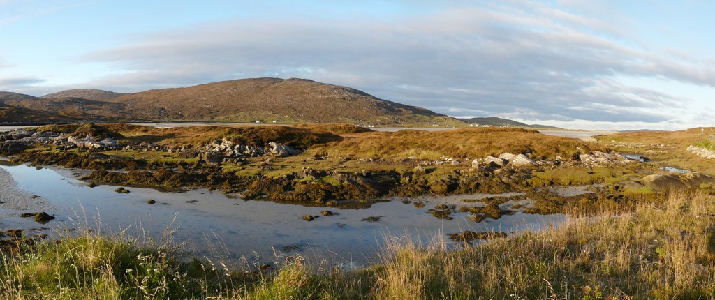
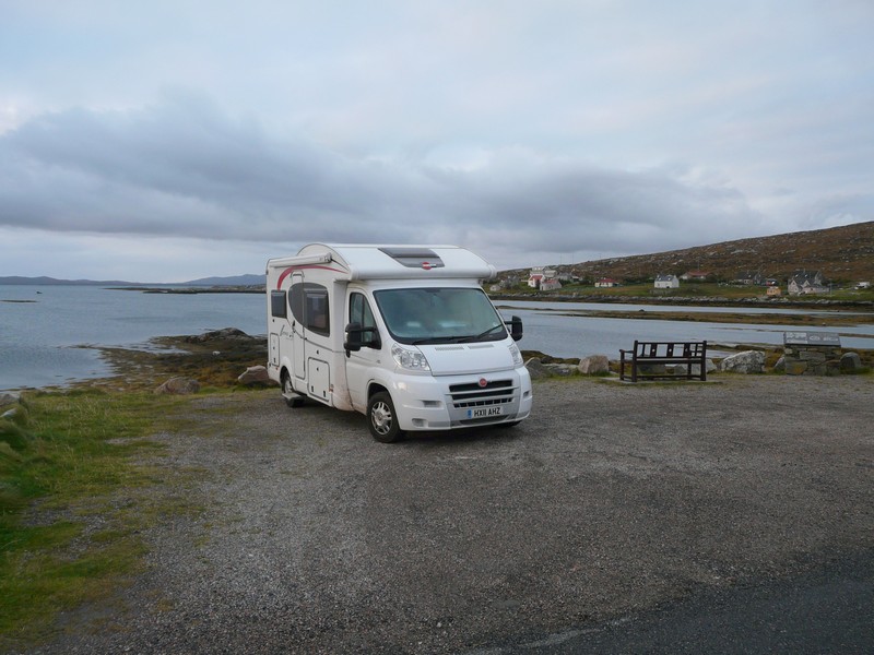
Wonderful scenery on South Harris where we overnighted
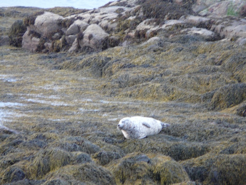
We stopped by Loch Finsbay where we were delighted to see seals lazing on the rocks and cavorting in the water.
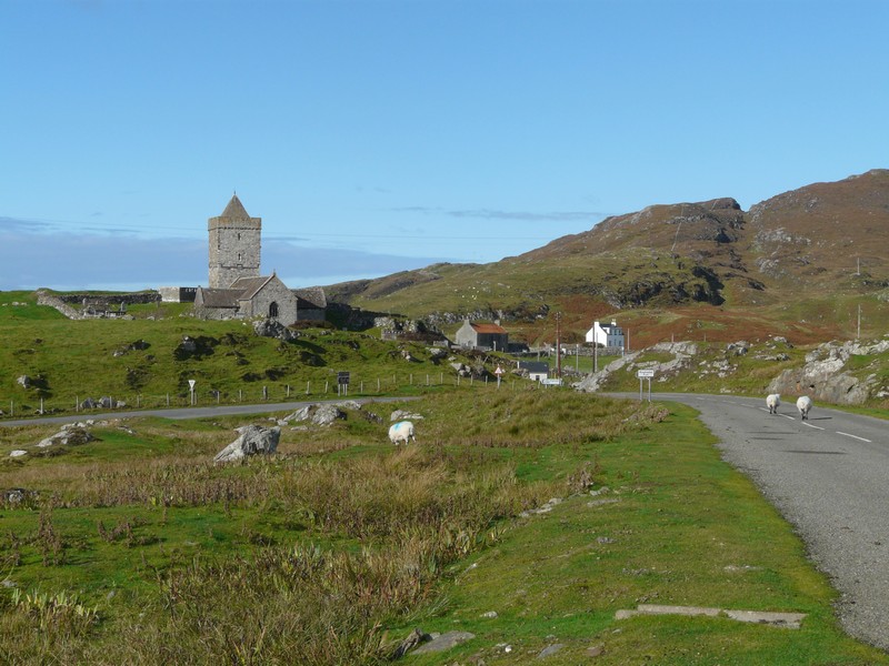
The church and harbour, Rodel
We stopped for lunch by a freshwater loch at Quininish before driving on through unbelievably desolate, rocky, barren scenery to Flodabay.
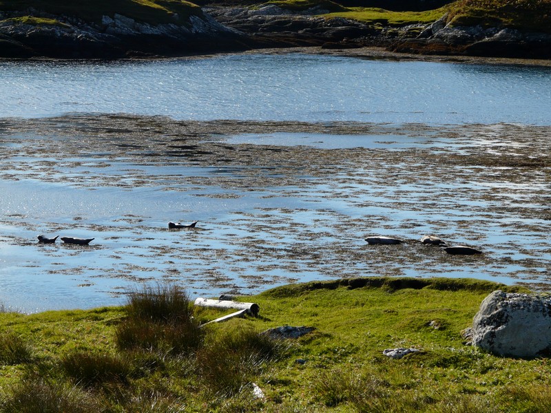
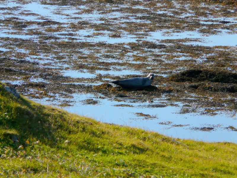
Seals in Loch Finsbay
We now drove back on the inland loop to Leverburgh. This passed many inland lochs including large Loch Langabhat, which appeared to have a thriving salmon industry.
The scenery of this remote road became more heather-clad as we neared Leverburgh, which we reached at about 3 o’clock.
We busied ourselves until the ferry arrived for our 5.35 departure. We boarded the ferry, and it left almost immediately.
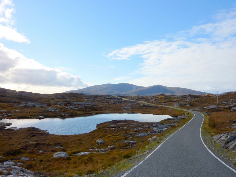
Wild desolate country on the way back to Leverburgh
There were only about half a dozen cars and a truck. It was rather an ‘elegant’ crossing. We sat in the ‘lounge’, and had views of numerous islands all the way. The crossing was very calm. We watched gannets diving for fish. The weather had deteriorated before we left. After an hour we arrived at Borve, Berneray Island, north of Uist, and joined by a causeway.
We drove north a short way in the almost darkness through a surprisingly populated area to Baile, where we parked above the sea.
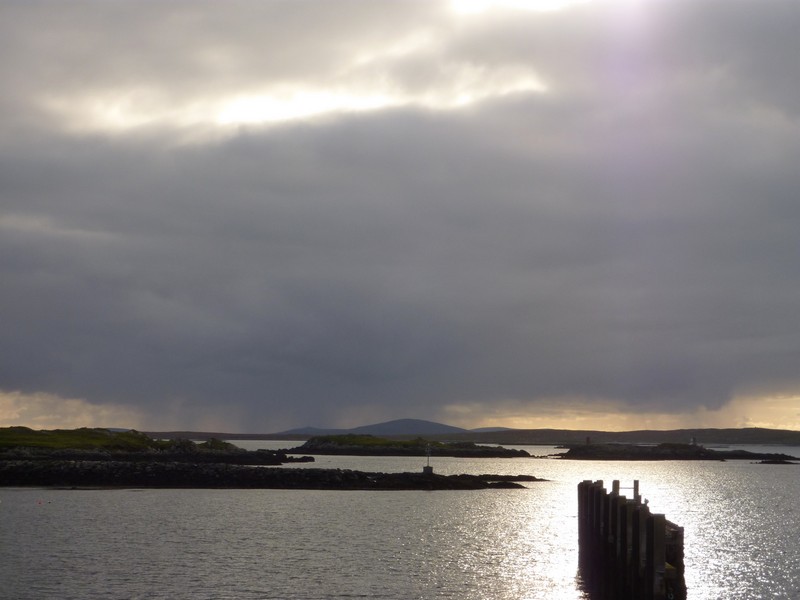
Leverburgh - waiting for the ferry to Uist
Monday 8th October Uist top to bottom 90 miles
For the first time it was dark when we got up. I went out to see what the information board was about, and found that this was a seal watching spot. When I told Adrian, we looked out, and there was a seal on the rocks in front of us!
We left at 8.30 and drove back to where the ferry arrives as there was a place to dump the loo. A plaque stated that Prince Charles had opened this ferry ‘terminal’ in 1999. By the causeway to North Uist, there was a ‘watch out for otters’ sign (we didn’t see any).
Once on North Uist we drove down to Newton Ferry (presumably where the ferry used to leave from). There were a couple of stone houses and some sandy beaches.
We started on the main road which makes a circle in the north of the island. At Solas we passed a small Co-op supermarket in its fairly remote location. We went in and found it quite well stocked, except being Monday morning there was no fresh bread or cakes. Adrian had wanted to buy some wine, but found that it couldn’t be sold until 10.00 am! It was now about 9.50, but by the time we’d organised the other shopping in the van, it was 10.00, so he went back in and persuaded the lady to uncover the booze!
Just the spot to see a seal! Baile, North Uist
We passed many sandy inlets as we drove towards the western side of the island, but as so often, no stopping places. On following one track down towards the shore, we had to make a '53' point turn when the narrow road stopped near a house! After this we came to a long sandy track leading to a ‘picnic site’. In the end we stopped at a sandy/ rocky shore near Tigharry. We had a short walk on to the windy beach where there were oystercatchers and other birds.
Back on the main road at Clachan we stopped at the Hebridean salmon smokehouse where you could view the ‘factory’ – we did, but they were just clearing up! In the shop we bought some smoked salmon and some salmon pate.
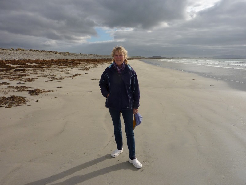
We drove on a causeway to the island of Baleshare to a spot above the Atlantic waves above a sandy, pebbly beach. We walked across the pebbles to the long sandy, seaweed strewn beach. The wind was cool.
Stone Croft, North Uist
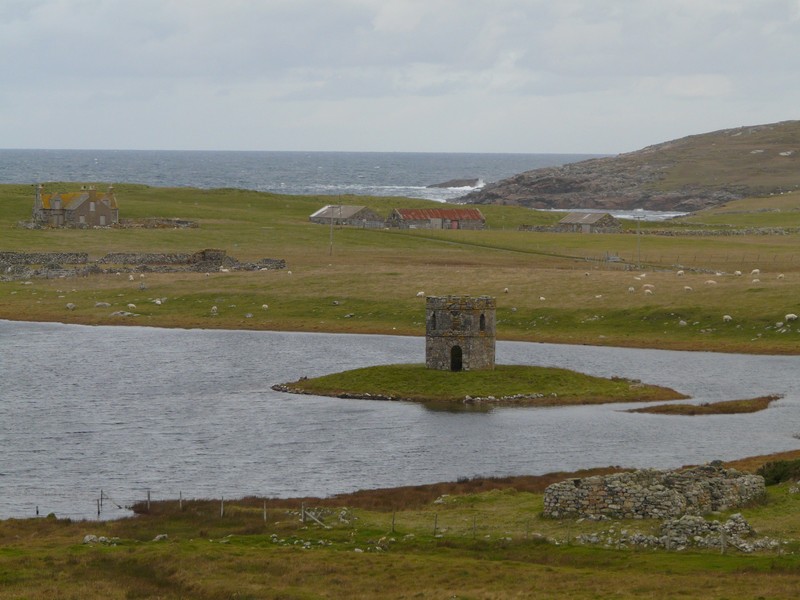
Scalpaig castle
We continued south, driving over the ‘stepping stones’ of several small islands joined by a causeway to the island of Benbecula. We followed the road around the western side, past the small airport, and then made our way across another causeway to South Uist.
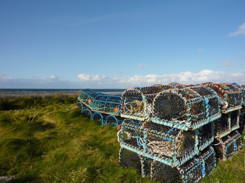
We took the road westwards to Aird a’Mhachair where once more we walked onto a large sandy beach, again with seaweed and birds, which we thought were godwits. There was a large stack of lobster pots.
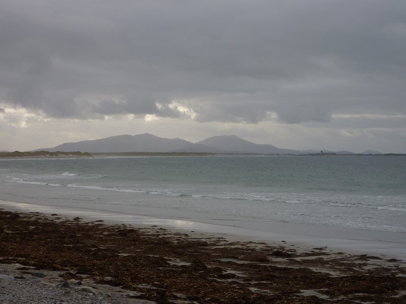
Looking to South Uist from the island of Baleshare
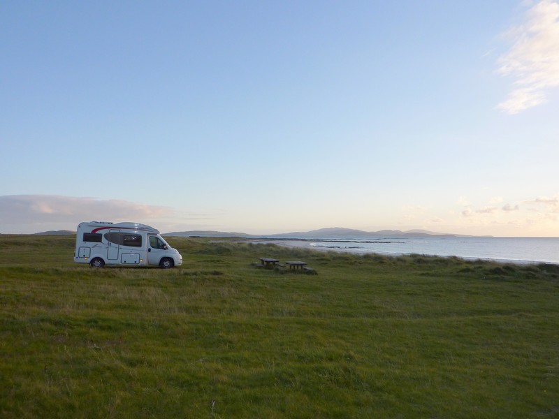
We continued south on roads near, but never by, the sea. In the extreme south, we took a road to Garrynamorie and at 5.30 came to a picnic site right by a beautiful sandy beach. The sun was shining, so we set off to walk onto the enormous exquisite bay of white sand.

Aird a’Mhachair
A few oystercatchers probed around by the rocks. We returned to the van at another ‘top spot’.
The stars at night were amazing!
Top overnighter at Garrynamorie
It was a fine, dry, still morning. The sun went in as we walked once more onto the idyllic beach. We left to drive the short way south to Ludag, where there is now (since 2002) a causeway over to the island of Eriskay. The water was so still.
Wednesday 10th October Sunny Skye
It was a fine, dry and still day. We left at 9 o’clock and drove through the brown heather and grass covered peat bog past Lochmaddy, taking the road towards Lochpurtain. The road went through constant boggy land, with dozens of islands everywhere. We came to just two isolated houses, before returning to Lochmaddy at 10 o’clock.
We drove first to the harbour, where there was a place to empty the loo, then went in search of a shop. We found the one tiny village store with difficulty, but the bakery van from Stornoway hadn’t arrived yet! The shop wasn’t well stocked. It wasn’t long before we saw the bakers van arrive, so went back into the shop and bought some rolls for lunch and one or two other things. The man tore 2 stamps from a book of twelve when I asked for just two!
We sat on a seat overlooking the bay with all its islands to have coffee. It was a bit chilly but beautiful. We watched a heron.
Then it was time to drive to the ferry for our 11.50 sailing to Uig, on Skye. It was a wonderfully calm crossing, rather sedate, with just a few passengers. We had views of various islands as we sailed. When we arrived at Uig at 1.30, the sun was shining and everything looked great.
Looking out at Lochmaddy
Tuesday 9th October Tranquil Eriskay before heading back northwards 94 miles
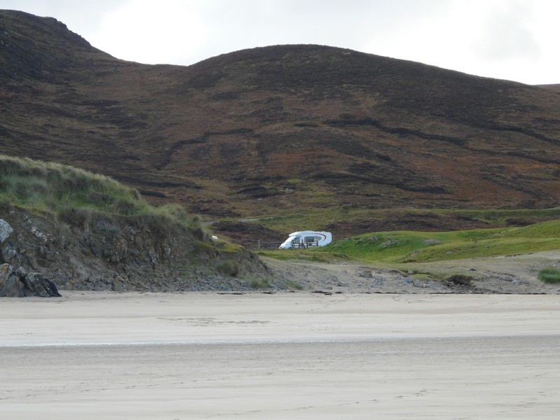
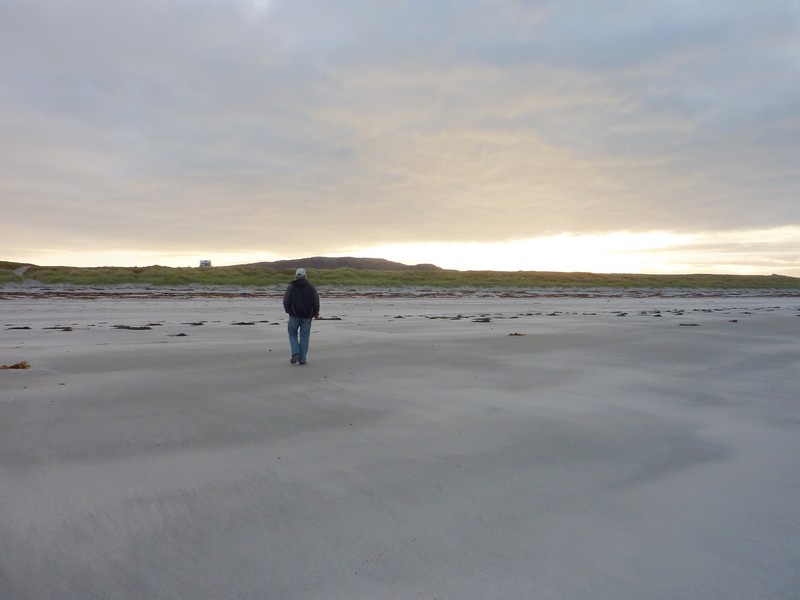
Walking back across the beach to the Ixi
Once on Eriskay we drove to the small harbour at Callaig where the ferry leaves from for the island of Barra – we watched it arrive.
From Ludag we drove across the causeway to Eriskay
We were by sandy Princes Bay, where Bonnie Prince Charlie is supposed to have arrived from France in 1745 – his first landing on Scottish soil.
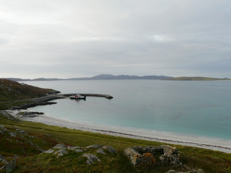
The harbour at Callaig, Eriskay
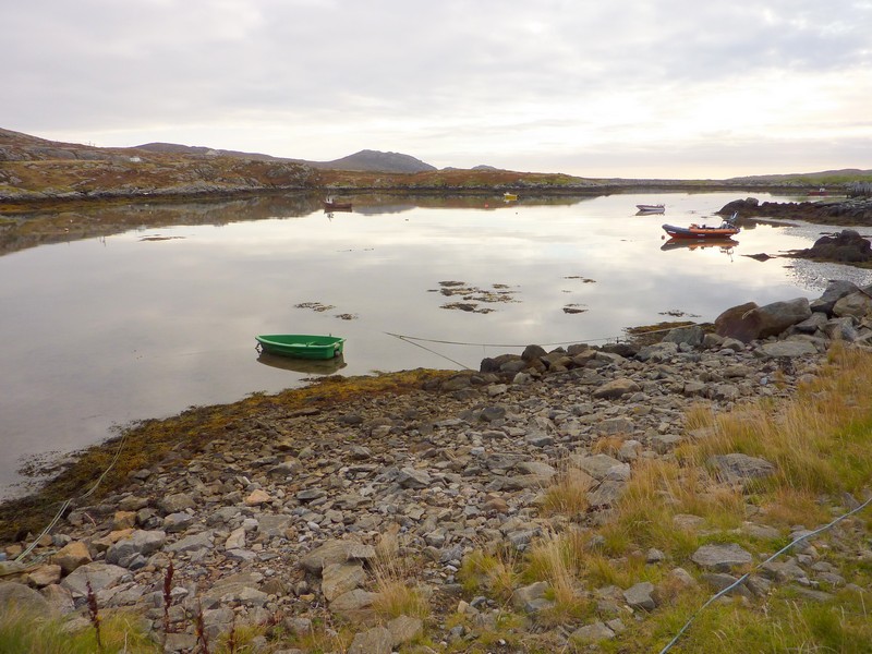
We drove on to the harbour at Acairseid, on the other side of the island. With the few fishing pots and boats and the turquoise water it looked very beautiful.
Princes Bay, Eriskay
We drove back to the causeway and walked onto a little sandy cove where there were lines of seaweed and lines of shells. It was really quiet – there were just sheep about.
We drove back to South Uist, making for Pol a Charra at the south western tip. It was so still that we sat outside on our mats with our tea/coffee, beside a sandy beach with pebbles and seaweed, and looking across to hilly Barra.
Acairseid
We drove back up through South Uist, driving down to Lochboisdale on the eastern side. We could see evidence of fishing here still, at this small town where the ferry to Oban leaves from.
As we continued north, we stopped to view Flora Macdonald’s birthplace from afar – it was down a long rough track.
Tea and coffee on the beach at Pol a Charra
We took another road to the eastern side, north of Loch Eyenort, and had to drive very slowly behind a ‘goose loose in the lane’ before we could turn round! In the loch was a scattering of small boats and fishing ‘gear’. On our way back we watched a harrier, and then a heron as we stopped for lunch by this quiet loch.
Marker to Flora Macdonald's birthplace
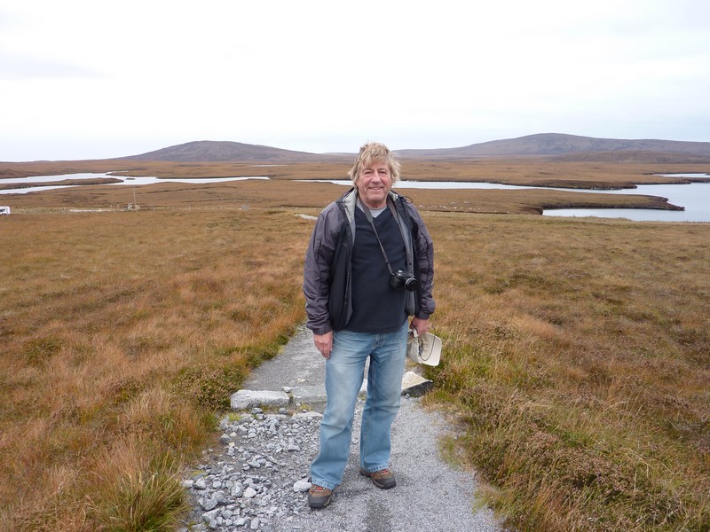
We followed the B890 to Sgioport, again on the eastern side. The surfaced road ran out just before our view of the loch, so we stopped by a flooded section of the track and attempted to walk the rest. This resulted in us both getting wet feet, as the boggy ground around the ‘flood’ was very wet! The view of the long inlet with numerous headlands was worth it. There was a derelict wooden jetty from earlier times. It was absolutely still and silent. Beautiful!
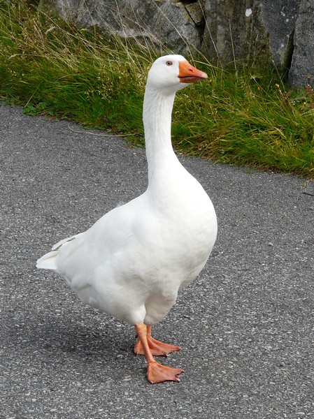
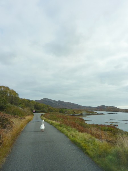
There's a goose loose in the lane! South Uist
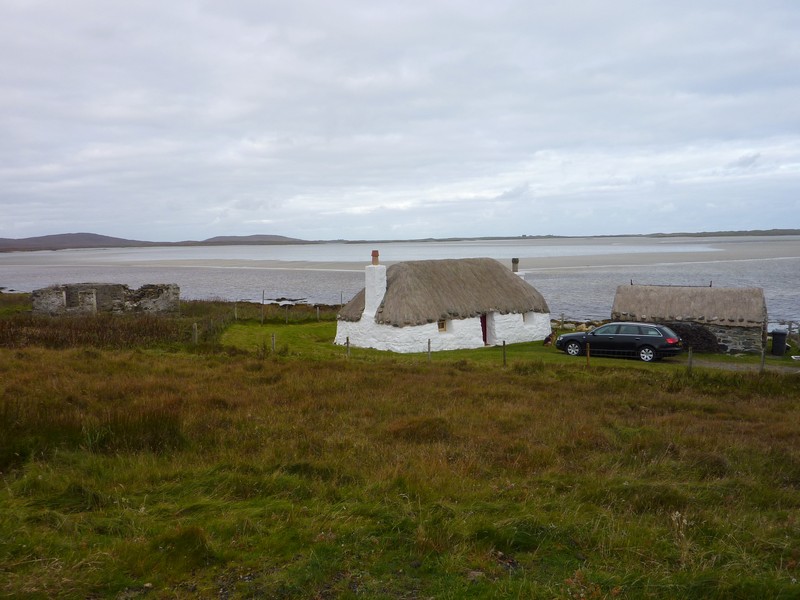
We took one more road to the east just before the causeway. There was water everywhere - bits of land joined the numerous lochs. We saw the statue to 'Our Lady of the Isles' and then photographed a beautifully restored croft.
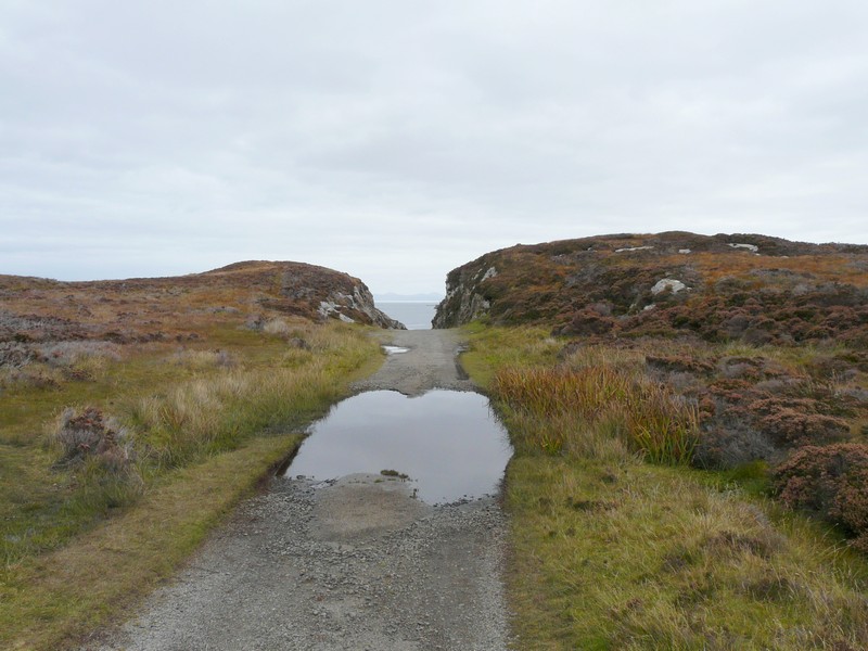
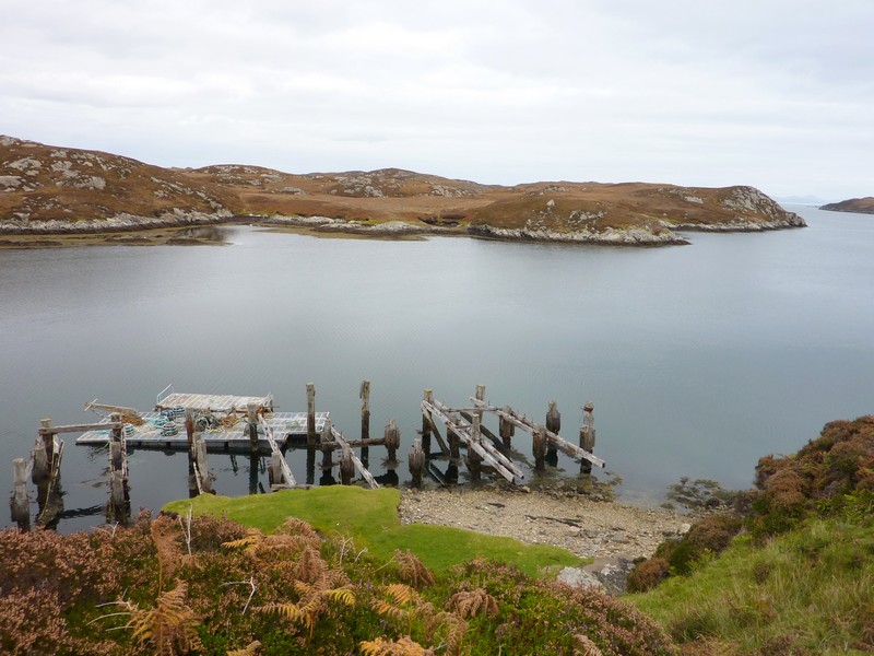
We got wet feet to view the derelict jetty
We drove over the causeway back to Benbecula and took a road a long way to the east, again with constant small causeways joining the lochs. It ended by a concrete ramp and a lot of fishing ‘bits’, with islands everywhere.
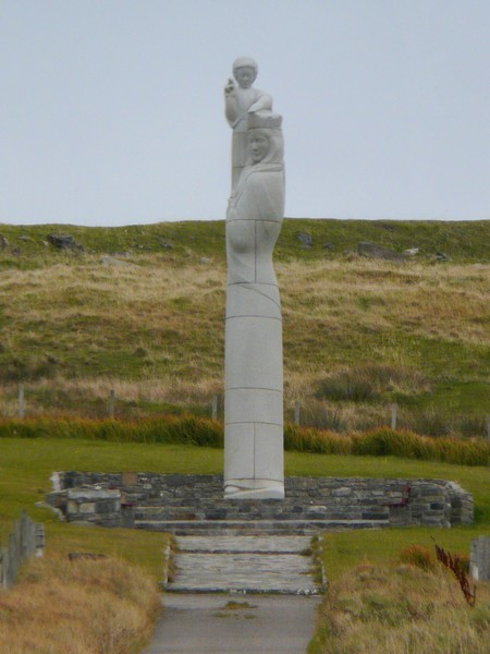
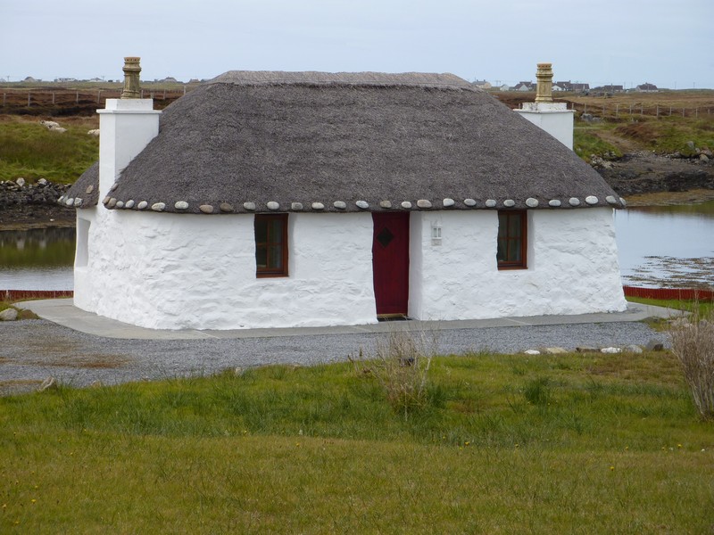
A beautifully restored croft
Our Lady of the Isles statue
We now took the causeway to North Uist, driving a loop on the ‘stepping stone’ island of Grimsay, with its varied scenery. At the harbour at Kallin there was a lot of evidence of fishing – a boat was just setting off. Our 70’s book stated that it was a lobster area, so maybe it still is.
In North Uist we drove back to the northern ‘loop’ road, stopping by the junction at Clachan at 3.30. We had an internet connection, so Adrian booked the ferry from Lochmaddy to Uig for tomorrow at 11.50.
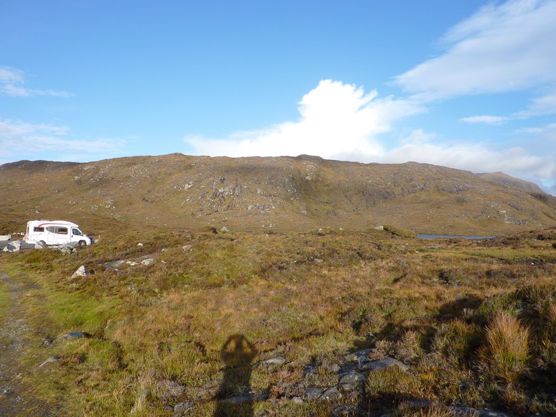
We drove the B894 along by Loch Euphort before continuing a short way on the ‘ring’ road. We found a place to stop for the night in the carpark by a ‘burial chamber’ site. This ‘pile of stones’ was set on the top of the hill behind. We trekked up there on a gravel path, looking down on the monochrome scenery all around of the brown heather covered bog.
Typical Benbecula scenery
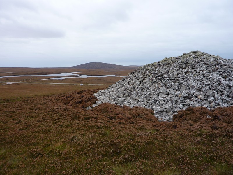
Boggy ground where we stayed near Barpa Langass burial chamber, North Uist
The route continues on Uig to Dunbarton