
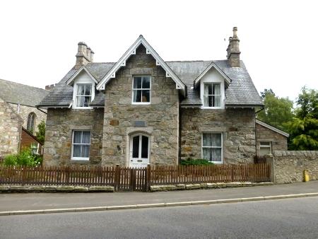
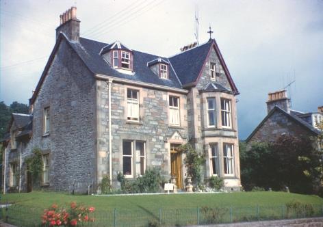
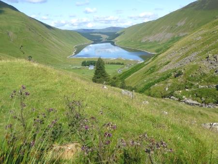
Overnighter near Beattock
Monday 7th July To Aberdeen and the ferry 194 miles
The night was quiet, despite the proximity of the railway and the motorway. It was noticeably cooler in the morning than at home.
We thought of little Rita, one today, and tried to phone, but got no reply from Tom. We found out later that he was out walking with her, and a sudden downpour had meant that he was trying to keep Rita dry, so couldn't access his phone.
We left at 9 o'clock and took a cross country road on the A702 to the outskirts of Edinburgh. It was a rural route through pretty villages and the pleasant stone town of Biggar. As Jon and Lois are away on holiday, there would be no calling in at Bridge of Allan.
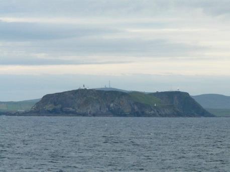
We made for the Forth Bridge, with all its associated memories - a photo of Norman beside the rail bridge in the fifties, and then of me in 1963 with friends, and again more recently.
We crossed the bridge, and found our way with difficulty to park under the rail bridge. We looked across to the nice stone buildings of North Queensferry, and the construction of the new bridge beyond. Adrian chatted to a local man, who told him that the new bridge is ahead of schedule, and was under budget (at £1.2bn!). The weather was sunny, but the wind was cool.
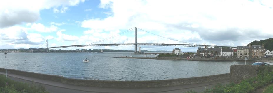
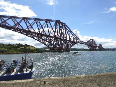
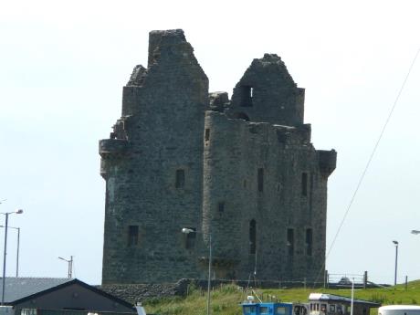
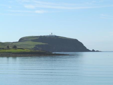
The Forth road and rail bridges
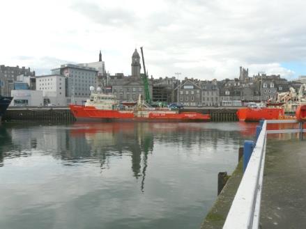
Aberdeen
Tuesday 8th July We arrive in Shetland 55 miles
I woke at 4.30 to see the sun just rising over the sea. Then at 6.30, when we got up, the sun was sparkling on the water, but by the time we reached Lerwick it had become misty. We had showers/hairwash, making the most of our facilities, then went to the Magnus lounge for our complimentary continental breakfast – we hadn't been expecting that, but managed to fit it in, ready to leave the boat at 7.30. (you could return for breakfast, but we didn't want to do that.)
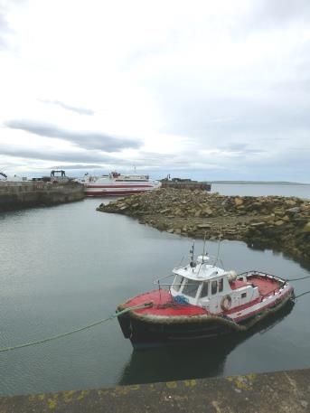
Our boat arrives in Lerwick, Shetland
Sunday 6th July 2014 We set off for Shetland 351 miles
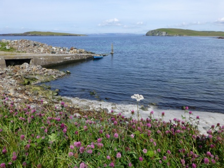
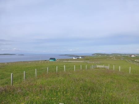
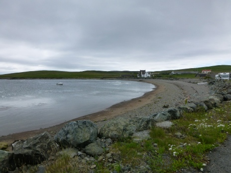
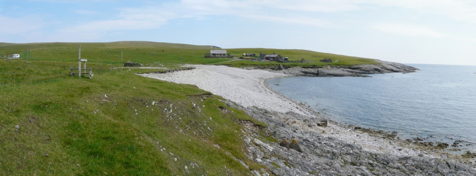
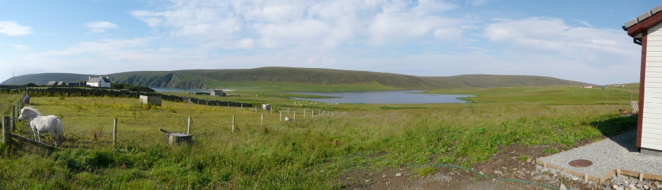
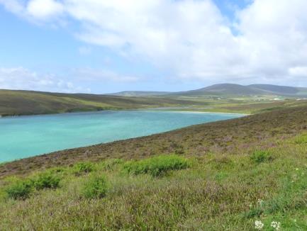
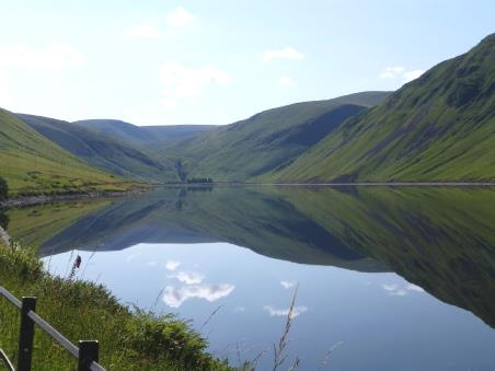
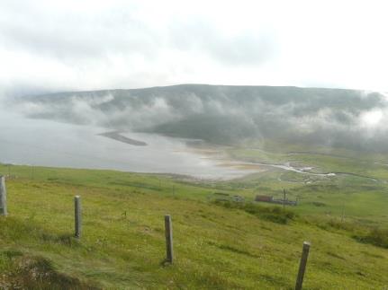
Looking down to Dales Voe
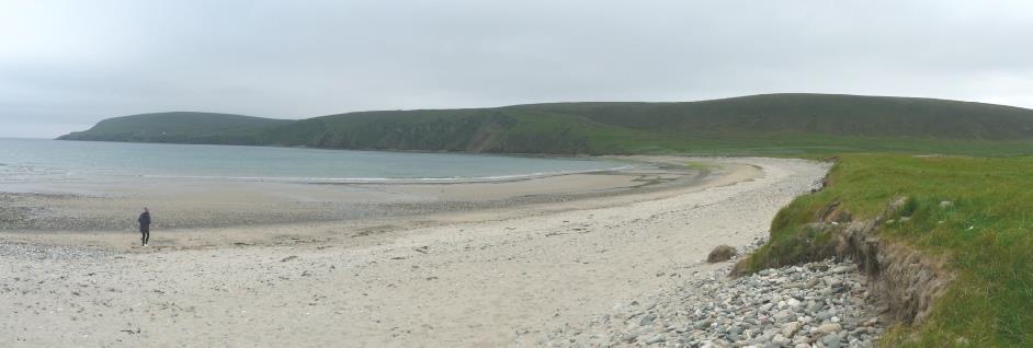
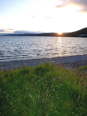
We often had glimpses of the coast, but rarely did the road go there. At one point we had a view to the island of Foula in the distance, then at Sandness to Papa Stour. The weather now was warm and sunny. We came to a lovely sandy beach at Melby, so this was the place to walk along.
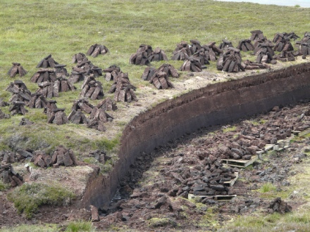
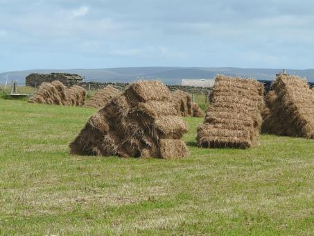
Cut peat being dried
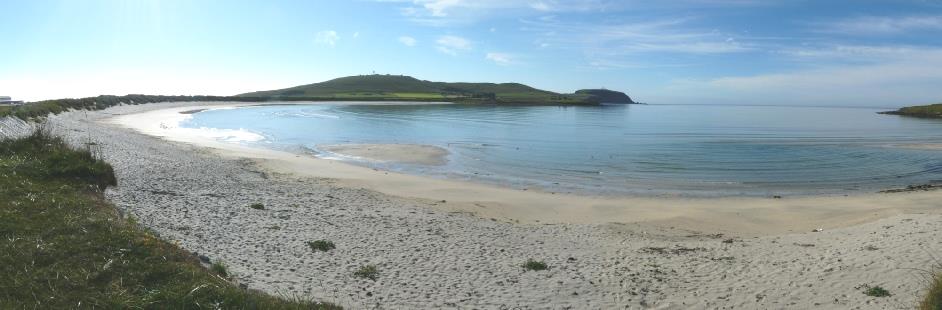
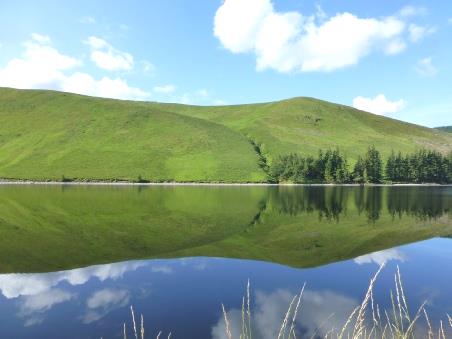
Pretty Melby beach
Unusual ‘Click Mills’ - horizontal water mills
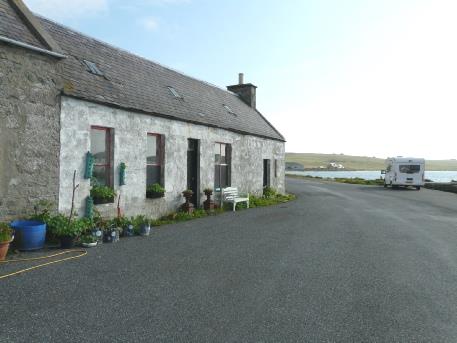
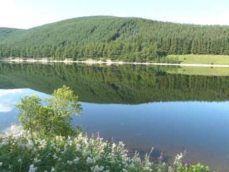
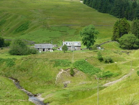
Overnighter beside the sheep pen, Huxter
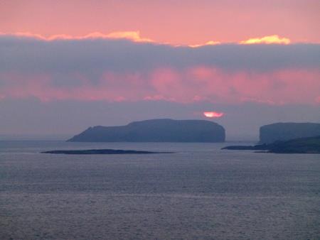
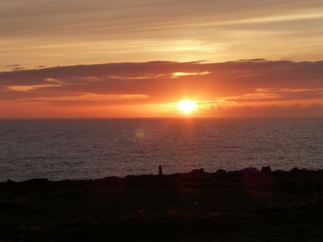
The red sun above Papa Stour
Wednesday 9th July From Westside to Northmavine 98 miles
Disappointingly there was rain in the night, and the morning was wet. Luckily the day improved.
We left at 8.45 and drove to Bousta on the eastern end of this promontory. We came to a secluded bay, where there was a seal symbol on our map, an sure enough, we saw a seal!
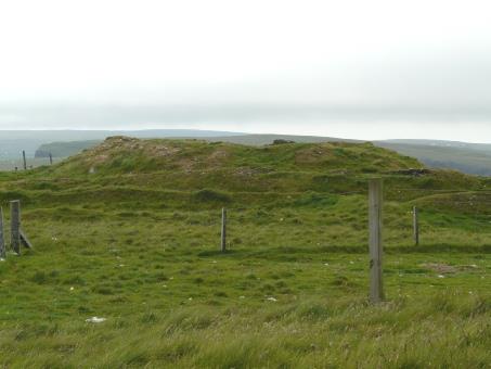
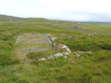
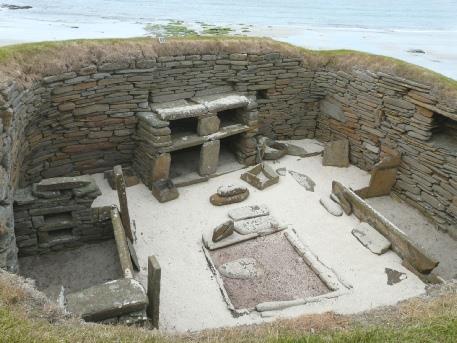
We returned and made our way to Scord of Brouster, where, after much difficulty in locating the site, we found the excavated ruins of houses dating from 3,000 to 1,500 BC. The climate was much different then, and the land was farmed. It was quite a trek up a hill, and 'a long way to see a rock'!
Bousta
We continued back to Bixter, then drove up to Aith.
Here we came across 'Michael's Wood', an inspirational area of planted woodland in memory of a local lad called Michael who had died in 1996. He had been a promising musician and a great thinker. The area was interspersed with picnic tables and with sayings by such people as Mandela, Lincoln and Will Rogers. It was called 'The Philosophers walk'. There was a pond, a bird hide, and play things for children, including a play house with a mock turf roof! Obviously a local project created with much love. We had coffee afterwards, but not at a picnic table!
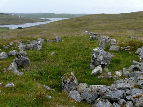
Ruins of ancient dwellings, Scord of Brouster
Soon afterwards we stopped to walk up beside the Burn of Lunklet, a pretty peaty stream, to an attractive waterfall. It hadn't said how far this was, but luckily we found it before we gave up!
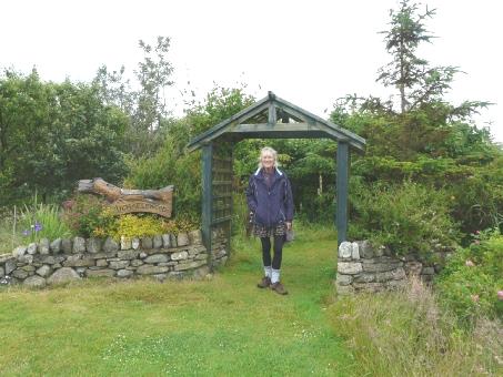
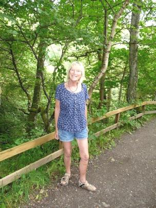
Rosie at the entrance to Michael’s Wood, Aith
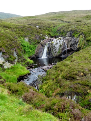
Lunklet waterfall
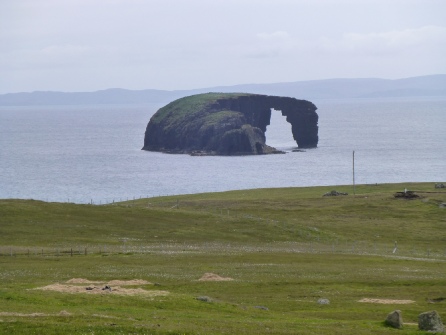
We now drove west to the lovely bay of Stenness. Just before there was a spectacular offshore rock called Dore Holm, with a large hole in it.
Hillswick Bay with its Cutch kettles
This whole area is volcanic. Just offshore was the tiny Isle of Stenness.
We drove on to Stenness lighthouse, where it was very windy, but there were great stacks just out to sea.
Dramatic Dore Holm rock, Stenness
We drove on north to the former home of Johnny Notions, now a 'bod' (booth), a simple holiday home. Johnny Notions was a local man who had invented many things, including an inoculation for smallpox. The area now was just one of derelict stone houses.
Now we continued to the north of Northmavine, through North Roe to Ibister, where the road just ended. Here in a garden was a French ‘Potez’ plane which the owner had rescued from Sunburgh Airport after it had crash landed and had been used as a ‘fire’ practice plane for many years. He is restoring it - though not to a flying state!
Now we continued to the north of Northmavine, through North Roe to Ibister, where the road just ended. Here in a garden was a French ‘Potez’ plane which the owner had rescued from Sunburgh Airport after it had crash landed and had been used as a ‘fire’ practice plane for many years. He is restoring it - though not to a flying state!

Atmospheric Stenness
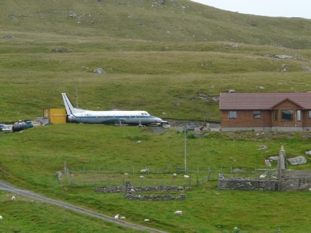
French ‘Potez’ plane
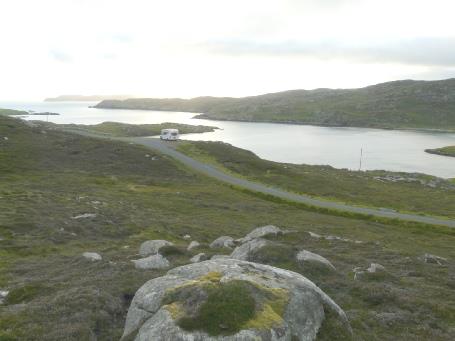
Beautiful overnighter near Nibon
It was now drizzling heavily, and this tuned to rain as we made our way back to Gutcher.
As we waited to board the ferry, Janet's grandson Oscar looked in the window to say hello. He had just come off the ferry, having been at Janet's. We didn't chat long, as it was now raining hard.
We were the only vehicle on the boat. As we drove off at Fetlar, Janet was there to greet us.
As we waited to board the ferry, Janet's grandson Oscar looked in the window to say hello. He had just come off the ferry, having been at Janet's. We didn't chat long, as it was now raining hard.
We were the only vehicle on the boat. As we drove off at Fetlar, Janet was there to greet us.
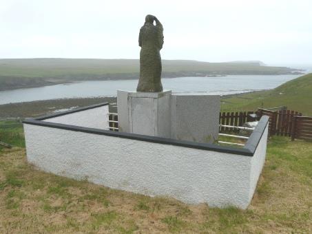
Memorial to lost fishermen, Gloup, Yell
Janet greets us as we arrive on Fetlar
We stopped by the Loch of Funzie, which is supposedly a good place to see the red necked phalarope - Fetlar is the most southerly breeding ground of the bird, which is very rare in Britain. We had seen one in Iceland last year, which was lucky, as we didn't see any today, despite walking across the field to the hide.
As we continued along the road, we found it blocked by a digger which a lady had been using to dig out ditches. It had toppled over! She did manage to right it after a while, and smilingly waved us on our way.
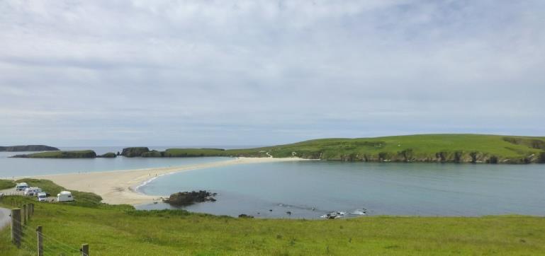
Funzie Bay, Fetlar
I had said that I'd like to send an email to Ruth to wish her a happy birthday for tomorrow. The internet at Janet's wasn't working. Not to be outdone, she tried phoning a 'neighbour', and asked her to ring back if her internet was working. It was, so off we set with Janet to 'Mother Mary's' house, up on the 'main road'. Mother Mary is an episcopal nun, and she greeted us in her paint covered overalls! They chatted while I sent e-mails to Ruth, and also to Elliott, who will be two the following day! After that, Janet drove on to show us the air strip, before coming back to her house. A bit later, she drove us to Margaret's, to have a chat, and say our goodbyes. More chat back at Janet's, and then we came out to the van at 10.30, with the full moon shining down, before the mist descended briefly.
Tresta Beach, in front of Janet and Peter’s home
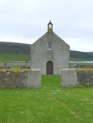
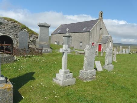
We looked in at simple Fetlar church (kirk), which Janet looks after (in her spare time!)
Fetlar kirk
Janet showed us over their new house, and after much chat, we went out to the Ixi at 10.45.
Papil Water from Janet & Peter’s house
Friday 11th July A Day on Fetlar 15 miles
We woke to a lovely morning. After breakfast in our van, we set off at 9.15 to drive the road eastwards on the island. We had arranged with Janet to have 'brunch' with them at midday.
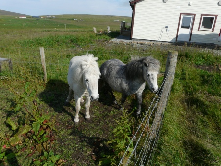
Janet & Peter’s beloved Shetland ponies
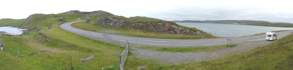
The narrow isthmus of Mavis Grind, between the Atlantic (left) and the North Sea (right)
Thursday 10th July Across Yell to Fetlar 64 miles
We enjoyed our lovely view, despite the greyness of the morning. It was almost 9 o'clock when we drove on down to Nibon - a total of 4 houses! There were plenty of sheep, and lots of little rabbits scurried off on our return.
We stopped by Mavis Grind, the narrow isthmus whose name means just that. There were two information boards about the geology and the two fault lines which occur here. Another board told how people in the past would manhandle their boats across the narrow isthmus - from the Atlantic to the North Sea - to save the long boat journey around the north of the island. There was a story of a family with two tiny children doing just that.
Saturday 12th July Unst, Shetland's most northern island 63 miles
We set the alarm for 6.45, as we were booked on to the 7.55 ferry to Unst. The sun was shining as we got up, but mist came and went. We left at 7.15, driving to the ferry at Hamars Ness, but turning off to look at the old jetty at Sands of Sand.
Sands of Sand, Fetlar
Uyeasound, Unst, Shetland
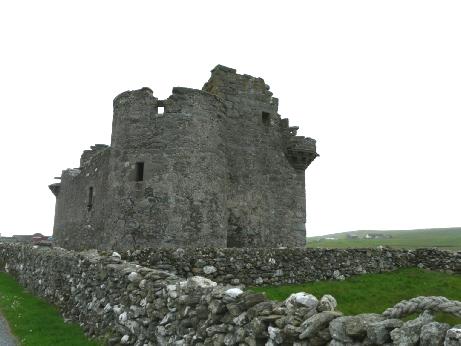
Muness Castle, Unst
Bus shelter decorated to honour Nelson Mandela
Lovely Northwick Bay. Unst
After that, things didn't go so well! We drove up to the former RAF site at Saxa Vord, where we were hoping for a view over Burrafirth to the island of Muckle Flugga. The fine day had turned to mist, so there was no view at all!
We drove down to Burrafirth nature reserve, in a very pretty location with a sandy beach separated from long Loch of Cliff by a narrow strip of land. There were no seaward views from the road, and no time for us to go wandering into the reserve today.
We made our way back to Baltasound, and found a spot to watch two races of the 'sixareens'.
Skaw, Unst, Shetland, most northerly place in the British Isles
Cars were parked haphazardly everywhere, but Adrian negotiated them all, and we continued south. We turned off to drive towards Westing, on the western side of the island, where there was the remains of a Viking longhouse, but it was too windy for me to enjoy!
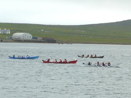
Sixareen boat race, Baltasound, Unst
We viewed Viking St Olaf's church ruins before making our way to the ferry to Yell at Belmont, passing the largest standing stone on Shetland.
It was 4.55 when we reached the ferry terminal at Belmont. We were planning to catch the 5.15 ferry, but were disconcerted to see the number of cars already there (they miss out the 4.30 boat on a Saturday!) with more arriving for the 'booked' queue We waited in trepidation. The ferry arrived, and cars began to board - more than we had imagined - but stopping just as it got to our turn. Adrian got quite anxious, as we need to get across Yell tomorrow and then on to 'Mainland'. He tried phoning, to book a place on the next ferry (5.55), but when someone finally answered, she said that the booking office closed at 4.30!
Anyway, all was well! We were first onto the boat for the short (10 minute) crossing, first off, and soon afterwards found a place to pull off for the night beside the road.
I cooked the kippers from Lerwick for supper.
Remains of Viking Broch and longhouse, Westing, Unst
Ready to drive across Yell
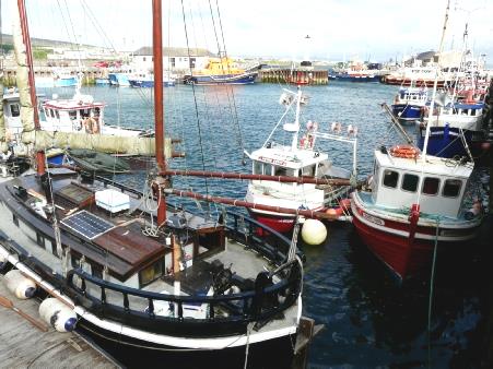
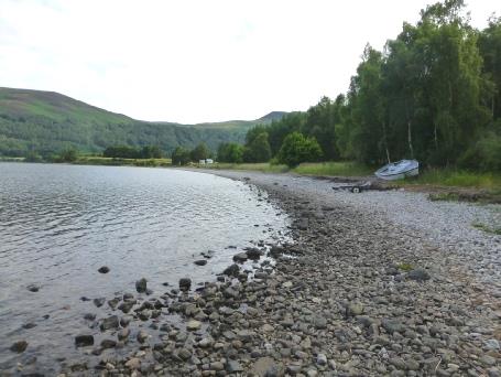
We came down to Scalloway, on the western side of the island. This former capital of the Shetlands is still a busy fishing port. It is situated in a very nice situation looking out over water and islands and had a large number of shrubs and trees - very unusual on Shetland.
Tingwall Kirk, Shetland
Scalloway Castle
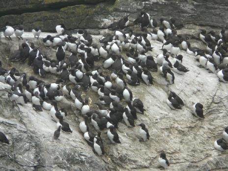
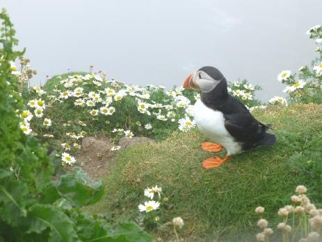
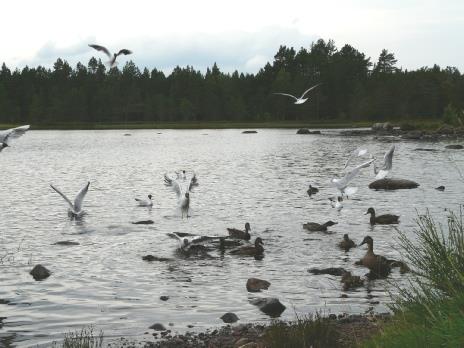
Crowds of guillemots and an entertaining puffin
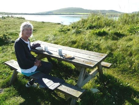
West Voe Beach near Sumburgh Head - lovely place for breakfast
Paddling at superb Sqiggie Beach
The perfect tombola to St Ninian’s Isle, Shetland
Some time later, we passed the island of Fair Isle.
We started working on the website for this trip, but it was hard work from the angle at the table.
Just before 11 pm, we arrived at Kirkwall, where it had just rained. We drove on to the harbour car park, where we had stayed two years ago. It was still just light.
Passing Sumburgh Head on the ferry to Orkney
Sunday 13th July Right down to the southern tip of Shetland 101 miles
Monday 14th July Goodbye Shetland 47 miles
We woke early to a really beautiful morning. We could see Sumburgh Lighthouse clearly as we sat at a picnic table to have breakfast, looking through grasses to the lovely beach. The idyll was only marred by the flies. The night had been quiet.
Tuesday 15th July A day disappears on Orkney 31 miles
Kirkwall harbour
We went into the craft centre opposite, and then into the tourist information, walking out of a different door and having a bit of trouble finding our way back to the car park. We then had a late coffee/tea, with a real 'cream bun', like from our childhood. We set off now, driving first to sandy Waulkmill Bay, which looked pretty through the purple heather. There was a long path down, which we didn't take.
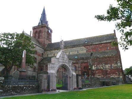
St Magnus Cathedral, Kirkwall
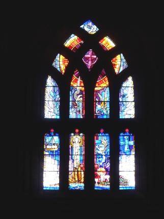
Window celebrating 850 years of the cathedral
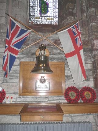
Memorial to men of the Royal Oak, sunk in Scapa Flow in 1939
Waulkmill Bay
We drove on past Kirkwall Loch, but the road didn't go right by the water, and there was nowhere to stop.
We drove back across the island to Finstown and pulled in by the front for lunch. We had found Orkney far less wild than Shetland, with more fields used for farming.
We drove back across the island to Finstown and pulled in by the front for lunch. We had found Orkney far less wild than Shetland, with more fields used for farming.
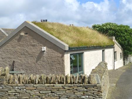
Turf roofed house

Lovely Skaill Bay, with Skara Brae beside it
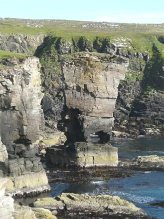
Yesnaby rock stack
Wednesday 16th July Back to mainland Scotland 55 miles (correctly guessed by me!)
I had wanted to revisit the Italian Chapel, which had so moved me in 2012. I found it equally moving this time. It had been built from two Nissan huts by the Italian prisoners of war. The sun had now come out, and it felt beautifully warm.
One of the Churchill barriers
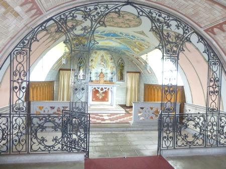
The evocative Italian chapel
We drove back to St Margaret's Hope, and to the ferry terminal for our 6 o'clock ferry to Gills Bay.
Our crossing was uneventful, and soon after 7 o'clock we arrived at Gills Bay.
Our crossing was uneventful, and soon after 7 o'clock we arrived at Gills Bay.
Hoxa Beach - goodbye to Orkney!
Gills Bay with our ferry in the background
Thursday 17th July We start our John o Groats to Lands End drive 72 miles
There were a few cyclists about, and I wondered if any had cycled from Lands End, with no-one here to greet them.
We drove back to Duncansby Head, which is actually NE of John o' Groats, so a better starting point. It was extremely windy as we set off to walk to the dramatic rock stacks.
We drove back to Duncansby Head, which is actually NE of John o' Groats, so a better starting point. It was extremely windy as we set off to walk to the dramatic rock stacks.
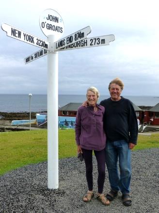
Where are we?
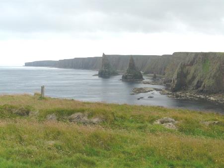
Duncansby Head
Dunnet Bay
Sandside Bay, Dounreay
We had supper, using the many veg we had bought, followed by delicious Scottish strawberries.
Pretty overnighter near Bettyhill
Friday 18th July We head southwards 91 miles
It was a beautiful morning. We enjoyed our views of the green hills all around, and left just before 9 o’clock. We followed the pretty Naver River with the sun sparkling on the water. There were lots of places where you could pull off. We continued past Loch Naver, which looked gorgeous.
When it came to coffee time, we drove through a vast area of felled, dead trees, but did find somewhere to stop in the end overlooking conifer forests. Soon afterwards, we stopped to buy some of 'Adams free range eggs' from a roadside box.
We continued south to Bonar Bridge, where we crossed on a fine bridge to a nice picnic area beside the end of Dornoch Firth. It was extremely windy as we sat on a bench to eat our lunch.
Lovely Loch Naver
Dornoch Firth
We wandered back on an unkempt footpath, often having to clamber over fallen trees with nothing to prevent you from slipping down the steep sides of the ravine. I wouldn't have wanted to be there with children! We walked on to see a long waterfall cascading down.
Very soon we joined the A9, and what a contrast - we saw more cars than we had seen in our whole time in the north of Scotland! Luckily we were only on it for a couple of miles. During that time, we pulled in beside Cromarty Firth, and with an internet connection had a delightful skype conversation with Tom, Mar and happy chuckling little Rita - a real bonus.
We drove on through Dingwalls, with some fine buildings, to Muir of Ord and soon came to Clash Wood forestry parking area. It was just after 5 o'clock. We set off on another walk into the mixed woodland on this pleasant evening. It had a real feel of Eastern Europe, particularly Poland, with its unpretentiousness.
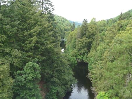
The bridge Black Rock Gorge
We ate excellent Scottish salmon for supper. It rained at bedtime.
A walk in Clash Woods
Saturday 19th July Inverness and Aviemore 105 miles
Lunch by Loch Morlich
Cottage near Tormintoul
Sunday 20th July Balmoral, Braemar and more! 87 miles
The morning was grey and dry, but very still. After enjoying a fried breakfast, we walked around this really pleasant picnic area.
Nice overnighter, Corgarff
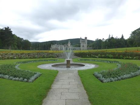
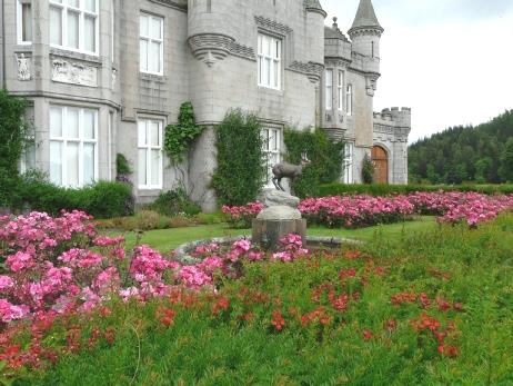
Images of Balmoral, with Brunel’s bridge over the River Dee
House where R.L. Stevenson reputedly wrote Treasure Island, Braemar
A bit further on, we parked with difficulty by a bridge over the Garry River where we walked back to look down once again, this time to a stony beach far below by the river.
Walking above the gorge at Killiekrankie
We drove on now to Queen's View - a splendid spot looking down to Loch Tummel, said to be a favourite place of Queen Victoria.
Looking down to the Garry River
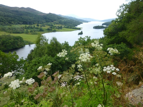
Loch Tummel from Queen’s View
We were able to get an internet connection for the first time today, and so phoned Emma, who is at Elm Gable for the weekend. It was nice to hear that our garden is looking good!
We could then sit and watch the sun go down across the loch. A top spot!
Top spot Loch Rannoch
Monday 21st July South past Glasgow 132 miles
We woke to an overcast morning which turned sunny later. After breakfast we walked along the pebbly beach as far as the dilapidated little pier with a couple of forgotten boats.
Looking back to our van from the little pier, Loch Rannock
After chatting for some time, we drove up the road a bit and parked (using our blue badge, as it was all quite busy) and walked back to 'The Bakehouse', hoping for some good bread. Unfortunately, this was more like an American style bakers – a cafe, with very little for us to buy. We settled on a couple of small 'prebaked' baguette rolls and a fresh cream éclair, which turned out to be not very fresh!
Adrian suggested driving on to the Falls of Dochart, just up the road , for 'elevenses', but we found that there was no parking at all here, so we had to return to our spot in the car park, difficult to negotiate! From here, we walked up to the Falls of Dochart - more tumbling cascades than falls.
Fairview, Killin, where Adrian had stayed in 1959, and how it looked then - just the same!
They were very pretty, but necessitated walking across the single lane bridge, where traffic came in both directions!
We walked back, passing many flowery gardens. It was now warm – we both changed into shorts.
We drove along Glen Ogle, then past Loch Earn to Loch Lubnaig. Here we stopped at a picnic site where we made up lunch to eat from a picnic table by the pebbly beach where families were happily enjoying themselves. One dad had a large bubble machine, which was causing a lot of fun. It was a nice stop.
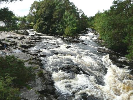
The Falls of Dochart, Killin
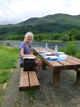
Lunch at Loch Lubnaig
Tuesday 22nd July Delights and memories of the border country 109 miles
Afterwards we sat on our Danish seats for our tea/coffee. It was peaceful, with just the distant bleating of sheep, the twitter of birds from the few trees, the chirping of a cricket, and a faraway plane.
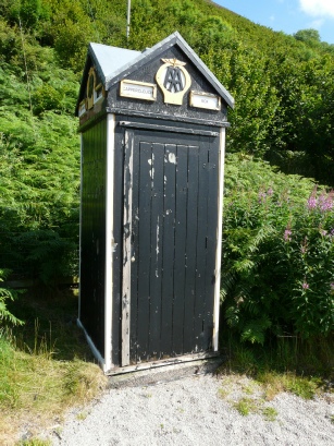
We drove across moorland to Cappercleuth, where there was an old AA box at the junction.
At the end of the reservoir, the narrow road climbed very steeply, with no passing places. Luckily we reached the top before we met a vehicle! Waterfalls trickled down, and there were harebells growing and sheep bleating.
Stunning reflections in the Talla reservoir
Our road now wound across moorland to Megget reservoir, being joined by another little stream. This reservoir wasn't so steep or dramatic, but we had a lovely stop, walking a short way to the ruins of Cramall tower.
Looking back to the Talla reservoir from the top of the hill
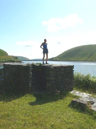
King of the castle at Cramall Tower on Megget Reservoir
Times gone by!
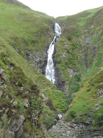
The Grey Mare’s Tail
Remote Foulbog, our 1985 holiday location
Superb last night in Scotland
We slept well, and we left John & Suzanne's at 8.15 on a grey morning, which soon brightened.
We drove right through Henley – peaceful at this early hour, with just a few joggers out.
The streets were bedecked with flowers and flags for the regatta, reminding me of the time I had arrived there with two friends as a young teenager on a cycling/youth hostelling holiday. The flags were out then to greet the Queen, who was visiting and we couldn't believe our luck! We had joked at first that the flags had been put up for us!
We travelled up to the M40, then M42, M5 and by the time we stopped for coffee north of Birmingham on the M6, it was fine and sunny. We had a trouble free day on the motorway, stopping at Charnock Richard for lunch, and then at Southwaite services near Carlisle , where we sat at a picnic table(!) in the sun for our cup of tea.
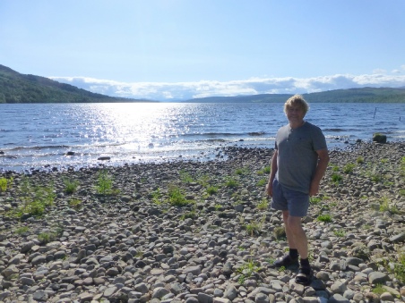
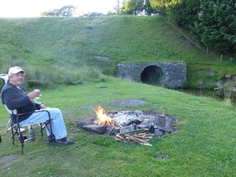
At 5.30 we turned off the M74 motorway near Beattock, stopping for the night beside an old bit of road in the Scottish hills, sandwiched near the motorway and the railway! It was now that we had some heavy drops of rain and a bit of thunder.
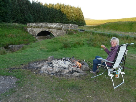
We noticed thousands of flidgies outside, but we were safely tucked inside,enjoying our first night of being 'away'. It was still light at bedtime.
At 5.30 we turned off the M74 motorway near Beattock, stopping for the night beside an old bit of road in the Scottish hills, sandwiched near the motorway and the railway! It was now that we had some heavy drops of rain and a bit of thunder.
We noticed thousands of flidgies outside, but we were safely tucked inside,enjoying our first night of being 'away'. It was still light at bedtime.
We had decided to travel from Lands End to John O Groats, then Adrian had the idea of extending it to visiting Shetland, which we haven't been to – only seen from a distance while on the boat journey to Iceland last year. We thought it would be better to drive straight up to Aberdeen, and take the ferry to Shetland, then saunter down slowly towards Lands End.
We’d had a busy time at home, with various building jobs being done outside, making a lot of extra work for Adrian. We’d just had an enjoyable reunion at Hillingdon for Rosie's school year, and a meet-up in Portsmouth with a few college friends. Last weekend we'd spent at Paul & Nicky's , celebrating Joanna’s 4th birthday, and also Emma's birthday.
Felix was 14 yesterday, and on Monday, little Rita will be one. Tom, Mar & Rita are coming over to England next month, and Simon will be bringing Manolo & Millie to Hermitage too.
We had left Hermitage yesterday to spend a short while at Shiplake, Henley with our Historic Caravan friends for 'Hooray Henley', which is always great fun. We spent a wonderful evening - after a barbecue meal (including Pimms!) on a fine evening, we enjoyed the rousing music of our former president Paul Genner and Andrew his son, and Colin his brother. This time another member, John Pettifer, joined in.
We danced, drank and chatted, wandering back to our van at gone midnight , with enthusiastic goodbyes from every one, as we planned to leave early in the morning.
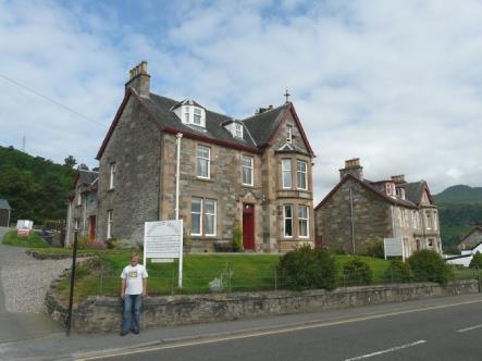
We now drove north, diverting through the sombre but pleasant old town of Forfar. We had lunch in a layby soon afterwards before driving on to Aberdeen. We drove right through Stonehaven, remembering our visit there two years ago, after I'd been reminded by Renee of a family visit there when I was two years old.
It was 3 o’clock when we reached Aberdeen. It was sunny, but we had a tiresome trail through the dark city to get some propane gas and then diesel and AA batteries. Just as we arrived at the dock, Tom phoned, so we were able to say (sing) Happy Birthday to Rita.
It was 3 o’clock when we reached Aberdeen. It was sunny, but we had a tiresome trail through the dark city to get some propane gas and then diesel and AA batteries. Just as we arrived at the dock, Tom phoned, so we were able to say (sing) Happy Birthday to Rita.
We then had a wait before boarding for our 7 o’clock sailing to Lerwick on Shetland.
When we had booked our crossing,a few weeks ago, we had been told that there were no ordinary cabins left. After some confusion, we took an 'executive' cabin at very little extra (£4.50) . This had tea/coffee facilities, and two vouchers each for drinks in the smart lounge.
We viewed our room, then set about getting something to eat, before we actually sailed. My small portion of fish and chips, and Adrian's salmon were excellent.
We watched as we set sail from Aberdeen, then later enjoyed our two drinks each – I had a really good dark beer 'White Wife' followed by a Baileys, and Adrian had a G&T then a glass of wine. We sat in our seclusion, enjoying seeing the sun go down from a blue sky, at 10 o'clock, when we returned to our cabin.

We were first off the boat, and drove onto the harbour where we got ourselves sorted. Mar had sent some photos of Rita on her first birthday.
We drove around Lerwick, which looked rather uninspiring on this greyish morning. Adrian was looking for a map to buy. The man in the shop where he inquired was rather bemused at anyone wanting a map, but after parking and walking around we came to the tourist centre where we resisted buying the 4 ordnance survey maps for Shetland, and settled on one which covered all the islands, and another one with walks.
Back at the van, we went into McNab's fish shop behind us and bought some kippers and haddock. It was 9.45 when we left here, and the sun was breaking through. A lovely sunny day followed.
We drove out of Lerwick and stopped at a viewpoint over the treeless grassy landscape , dotted with dwellings, surrounding the lochs.
The effect of the travel pills caught up with us! Much restored we had a late 'elevenses' sitting on a bench overlooking Whiteness Voe.
We drove on down to the water at Nebista, noticing the profusion of yellow irises.
This island is known as Mainland, and we now headed to the part known as Westside.
The road south to Skeld which we had planned taking was closed, so we couldn't make a round trip of the next part, so had to drive down towards Culswick, past a site of ancient temple at Stanydale, which we didn't walk to, but probably should have! There were numerous passing places, but no pull-offs, but we did find somewhere to stop for lunch on our return.
We continued now to Sandness, at the westerly end of this part, having driven a circular route through Walls. It was delightfully quiet, we just enjoyed the ponies, sheep, birds and flowers. These were prolific, and in such variety – buttercups, ragged robin, evening primrose and many, many more – even an orchid. Peat was being cut in the hillsides, with cotton grass growing in the swampy areas.
I got a wet foot in the process, when crossing a small stream hidden by seaweed! I was prepared by wearing my crocs! Earlier Adrian had done a dramatic acrobat (missed by me and luckily he didn't break anything like Hil!) when he went to take a photo.
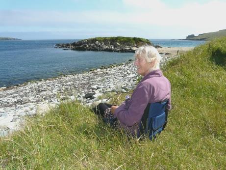
We looked out to the islands and headlands in this wonderfully simple setting. A couple with 5 young children enthusiastically enjoyed themselves too. Adrian talked to an older couple from Edinburgh who we have passed several times today. The man had just gone in for a swim, and then they both went off walking.
We had a cup of tea at a picnic table before driving a short distance to Huxter, where we walked to some ancient 'Click Mills' – horizontal water mills, unknown anywhere else in Britain, and used by crofters to grind their wheat into flour.
We made it a circular (rectangular) walk back to the van, where we had decided to stay for the night. It was peaceful, looking out over the water to Papa Stour, with just the haunting cries of the curlews.
We had been surprised to see an older man with a dog and a plump woman with a bucket. Now they started shepherding sheep into the fenced pen right beside us! Luckily they only stayed there briefly.
I cooked the haddock we had bought in Lerwick for supper and we enjoyed the wonderful views of the sea and of Papa Stour. The sky was still colourful at bedtime and we saw a pinky bit of sun. All we could hear was the bleating of sheep!
We now drove north through Brae and then south a short way to drive across Muckle bridge to the island of Muckle Roe, where we stopped for lunch beside the bridge.
We drove back and crossed the isthmus called Mavis Grind to the area known as Northmavine.
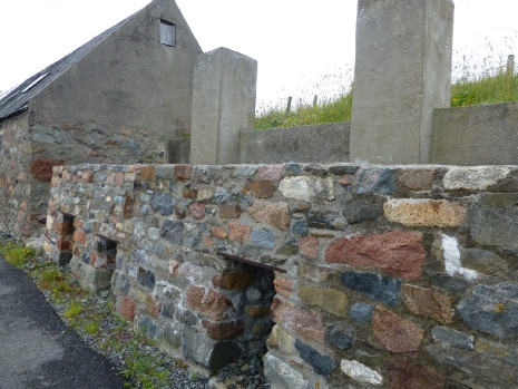
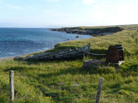
We made for Hillswick, and drove to the Ness of Hillswick. We came to a beach of sand and pebbles, but discovered that the pebbles were brought here as ballast from ships coming to collect herring. These were fished by local men, who went out in small rowing boats called Sixareens for up to 65 km to load up with fish.
Beside the beach were the remains of Cutch kettles. These were used to make a brown dye from a tree from India to preserve sails.
We drove back and crossed the isthmus called Mavis Grind to the area known as Northmavine.
We made for Hillswick, and drove to the Ness of Hillswick. We came to a beach of sand and pebbles, but discovered that the pebbles were brought here as ballast from ships coming to collect herring. These were fished by local men, who went out in small rowing boats called Sixareens for up to 65 km to load up with fish.
Beside the beach were the remains of Cutch kettles. These were used to make a brown dye from a tree from India to preserve sails.
We took a side road to Sandvoe where a man was just setting off in a small rowing boat from a nice little sandy beach. It was very windy here, and we had wondered whether to stop for the night, and afterwards thought that we should have, as we then had trouble in finding anywhere.
We drove back south down the peninsula, but couldn't see anywhere at all to stop. We turned off to Ollaberry, on Yell Sound, where there was supposedly a geological fault which continues to Inverness. We couldn't see evidence of it, and had no luck in finding anywhere to stop either!
We now joined the road south from this morning. In desperation, we turned off on the road to Nibon, on St Magnus' Bay, to the west, and finally we got our reward - a beautiful spot high above the wonderful coast just before Nibon. It was a bit windy, but the views were magnificent, with the Ness of Hillswick in the distance.
At Brae we shopped in a well stocked small Co-op store, getting everything except the lemon which we wanted! The weather now felt very cold.
We drove past Sullom Voe oil refinery to the ferry to Yell at Toft. There was nothing more than the ferry terminal here. We had coffee while we waited for the 10.45 ferry, watching the agile terns. Once aboard the ferry, we went up to the lounge and 15 minutes later we arrived at Ulsta, on Yell.
We took a small road to the east of the island, stopping at Burrravoe, which didn't inspire us as we parked by a decrepid building by a jetty. It still felt pretty cool. We tried without luck for an internet connection but then got one and Adrian decided to phone Janet, and we agreed to see them later today on Fetlar. ( Janet's [and her sister Margaret] father was my Godfather, and their mother had been secretary to my grandfather – the friendship goes back a long way!) Margaret also has a home in San Francisco, where we have visited on our trips to America.
Continuing on the eastern road, we found that most roads stopped well short of the shore.
From a distance we viewed the 'White Wife', the figurehead of a German ship which was wrecked off shore in 1924. It was the name given to the excellent beer which I'd had on the boat to Shetland.
Unable to get to a beach, we turned off to Lake Vatsetter, where we stopped on a grassy isthmus between the lake and the shore for lunch. Again we watched the terns swooping. We very briefly walked onto the beach, but my stomach had become very winded.
We drove to the ferry terminal at Gutcher, but could get no information, so hoped that our information of a 4.15 ferry to Fetlar was right.
It was now 2.30, so we drove up to the north of Yell, through more bleak moorland. We could see a nice sandy beach at Breckon, but once again the road just stopped.
We continued to Gloup, where there was a memorial to 58 local fishermen who had been lost in 1881.
We followed her back to Margaret's house and we stayed to have a cup of tea with Margaret while Janet prepared supper for us all at her house.
We drove Margaret back to Janet & Peter's and enjoyed the trout caught by their cousin Dave in the small lake in front of their house.
We drove Margaret back to Janet & Peter's and enjoyed the trout caught by their cousin Dave in the small lake in front of their house.
We stopped at the end of the road, at Funzie Bay (pronounced Finnie). This is famous for its rare conglomerate rocks, which we wouldn't have recognised! There are fault lines here too. We took our tea/coffee and sat on a little wooden bridge in the warm sunshine, watching a seal in the water. When we drove back past the Loch of Funzie, we saw two red throated divers (birds!).
Back at Janet's we enjoyed a large 'brunch' with them and Margaret, and also Janet's son Michael and wife Tamsin. The mist had now come down.
After lunch, we made use of the 'facilities', and both enjoyed a bath. Michael and Tamsin had busied themselves bringing up large items of furniture (two armchairs and a settee) from Janet’s previous house.
We set off to visit the 'Interpretive Centre', which had a surprising amount in it for such a small community. We chatted to the lady afterwards, who of course knew Janet & Peter (the population of Fetlar is about 60).
Driving back to Tresta beach, we passed Michael & Tamsin, who were just leaving for their B&B on Yell, before returning home tomorrow.
Tresta beach, just in front of Janet's new home (and their previous B&B), is an attractive sandy bay. We walked along, seeing two Great skuas.
This confused Janet, who had driven to the ferry to say an extra goodbye to us! - but we met half way.
The boat actually left early. We walked up some stairs, trying to find the lounge, and then up some further very steep stairs, until we saw a notice saying 'Crew Only!' The lounge was in fact downstairs, with no view out at all. We returned to the van, where we had no view, but it was better than the claustrophobic lounge!
When we reached Unst, we almost missed getting off (the boat goes on to Yell), as we couldn't see anything, and disembarking was backwards! Oh Mr Porter!
Once on Unst, we drove along to Uyeasound, where we had our breakfast beside a little harbour.
We drove along to the ruins of Muness castle, built in 1598. We actually got an internet connection here, and sent a message to our 'kids'. We then had a fun visit to the castle ruins, with its many dark chambers.
We drove on past the road to Sandwick, where there was a walk to an excavated but reburied Viking boat, which we didn't do! We drove back to the main road passing a standing stone.
We drove north now to Baltasound, where we stopped by a little store. It was quite busy here by the waterside, being Saturday morning. After going into the shop, we watched a group of oystercatchers while we had coffee. Next door to the shop was the Post office, said to be the most northerly in Britain. This area was once really busy with herring fishing.
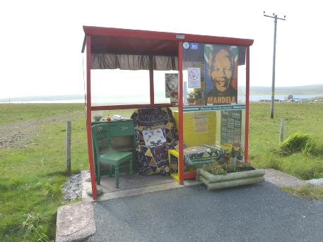
A bit further on, we stopped by a bus shelter which is always decorated – at the moment it was done up as a tribute to Nelson Mandela.
We drove north now to Baltasound, where we stopped by a little store. It was quite busy here by the waterside, being Saturday morning. After going into the shop, we watched a group of oystercatchers while we had coffee. Next door to the shop was the Post office, said to be the most northerly in Britain. This area was once really busy with herring fishing.
A bit further on, we stopped by a bus shelter which is always decorated – at the moment it was done up as a tribute to Nelson Mandela.
Just beyond here was Keen of Hamar Nature Reserve – an area of semi desert which contains rare and unusual plants. It would have been nice to have had time to explore, but we only have one day on Unst.
We drove on now to Norwick, a lovely bay with a sandy isthmus to a rocky outcrop. We used our Danish seats to sit above the beach and eat our lunch. We watched a seal and a diving bird, and also fulmars in the cliffs. Afterwards we walked onto the sandy beach where a marker told that this was the divide of the continental and oceanic crusts, with unusual rocks yet again. We voted it a Top Spot!
We drove on now to Norwick, a lovely bay with a sandy isthmus to a rocky outcrop. We used our Danish seats to sit above the beach and eat our lunch. We watched a seal and a diving bird, and also fulmars in the cliffs. Afterwards we walked onto the sandy beach where a marker told that this was the divide of the continental and oceanic crusts, with unusual rocks yet again. We voted it a Top Spot!
A man looking like a Viking, and with a European accent told us that there are races of 'sixareens' (six man rowing boats) at Baltasound today. We had seen a small marquee in a field there this morning.
Now we drove on to Skaw, the most northerly house in Britain, and a very pretty one, being painted white, with red window frames. A peaty stream lined with wild flowers flowed down to the beautiful beach of coarse sand. I wetted my feet in the sea!
Now we drove on to Skaw, the most northerly house in Britain, and a very pretty one, being painted white, with red window frames. A peaty stream lined with wild flowers flowed down to the beautiful beach of coarse sand. I wetted my feet in the sea!
We left at 8.20 on a sunny morning, racing across Yell on the main road to the ferry at Ulsta, just diverting to the pretty area around West Sandwick from where there were lovely views to small islands westwards.
We arrived at 8.50 for the 9.15 ferry. When it arrived, we made our way to the lounge for the 25 minute crossing back to Toft on Mainland. We could see various islands from the boat, and I saw a gannet.
As we drove south on Mainland, we had great views towards the islands of Whalsey and Out Skerries.
We reached Voe again, with its pretty painted houses and then Lower Voe with its little harbour.
We drove east to Vidlin, where the ferry leaves from for Whalsey and Out Skerries, then
made a circular tour through the area known as Nesting. The scenery was nice, but there were no pull-offs, only passing places. We had to wait until we reached the junction with the Main Road A970 for our coffee!
We now turned off to the Loch of Tingwall, stopping by the kirk, the Mother Church of Shetland. It looked very alive and much loved inside. There was a large graveyard, with many ancient gravestones. The weather was very warm, but also extremely windy.
We drove on to Trondra Island, just south of Scalloway, coming to the surprisingly large town of Hamnavoe on the western end. We drove south a short way, stopping to have our lunch above Meal Bay – a delightful looking beach of white sand, with turquoise sea. We sadly voted it too far to walk down to, as we leave Shetland tomorrow, and still have places to go. Adrian was able to empty the loo in the toilets here, even if it caused him some trouble. There were lovely views to the island of West Burra as we continued a bit further, but we then had to return to the main road so that we could drive down to Sumburgh Head, in the extreme south.
Unfortunately the mist descended now, as we parked to walk to the newly done-up lighthouse, built by Robert Stevenson – the first one in Scotland. The reason to come here was to see the birds – and there were plenty of them. The lighthouse is surrounded by an RSPB reserve to protect the millions of puffins, guillemots, kittiwakes, fulmars, shags and many more. The smell told us that they are here! We looked down from the enormously high and steep cliffs to see crowds of guillemots.
Unfortunately the mist descended now, as we parked to walk to the newly done-up lighthouse, built by Robert Stevenson – the first one in Scotland. The reason to come here was to see the birds – and there were plenty of them. The lighthouse is surrounded by an RSPB reserve to protect the millions of puffins, guillemots, kittiwakes, fulmars, shags and many more. The smell told us that they are here! We looked down from the enormously high and steep cliffs to see crowds of guillemots.
Further up we came to the entertaining little puffins. The weather now closed in, so it was quite eerie seeing the birds appearing through the mist! The noise was quite something too!
We were sorry not to see any whales, as many varieties frequent this area, but this afternoon wasn't the time to see them!
Having had our fill, we now needed somewhere to stay for the night. We looked in at a couple of places before settling on the car park beside nearby delightful West Voe Beach, with its white sand. One motorhome was already there (we have hardly seen any on Shetland), and another pulled in just after us, but soon left again. (It actually came back again, but we had moved to their position by then, which was more level, with a better view!) The only problem was that it is right beside Sumburgh Airport – we saw a small plane skim overhead on our way to the Head – the road is closed when a plane lands. We just hope that the Coastguard helicopters are not too active tonight!
Later the mist cleared, and we had a walk onto the beach before bedtime, seeing lots of ducks.
After breakfast we had a long walk along the beautiful white sand, which was interspersed with atmospheric large pebbles. There were lots of ducks and ducklings, and maybe a seal.
We left at 9 o'clock and drove back across the runway, where a sign said 'Ahead only', to stop you from driving onto the runway!
We drove to the Pool of Virkie, on the other side of the peninsula, where we looked across the mudflats, but didn't see any birds. We drove around to the little harbour before returning and driving to Quendale Mill, a water mill open to the pubic on the Bay of Quendale. They were digging up the road right by it – we didn't stop.
We drove on past Squiggie Loch, where we saw a group of whooper swans, to Squiggie Beach, a beautiful enclosed sandy bay. A dad and his two young girls were having fun in the water.
As we drove on, we had fantastic views back down to Squiggie beach and to Rerwick beach, also of white sand. In the distance was the island of Foula.
We drove down to St Ninian's Isle, an uninhabited island joined by a sandy tombola. We took our tea/coffee down onto the beach before walking across to the island and back. Fulmars were nesting in the cliffs. Several families were enjoying the wonderful sand.
We called in to the community shop before exploring some of the many little roads on the eastern side of the island, stopping to have our lunch at Leebitton, where the ferry to Mousa Island (RSPB reserve) leaves from.
We followed some more small roads on the eastern side before making our way to Lerwick. We dove down to the Ness of Sound and then onto the next promontory, the Knab. The road to this was closed, so we ended up beside the cemetery, where we watched gannets and skuas.
We now made our way to the fish shop (McNabs) where parking was a problem, but we nipped in and bought some fresh plaice and a homemade cake before making our way to the ferry terminal. For our crossing to Kirkwall, Orkney.
The ferry left at 5.30. We wandered around a bit trying to get settled – it was very different from our outward journey, when we had a cabin. We settled on the restaurant area at the rear of the ship, where we could use the computers on the table, and Adrian could 'plug in'. We ate fish and chips for supper, and watched as we left Shetland. We had really enjoyed our time there.
There was a squally shower just before morning, and it was very windy. Apparently the weather had been good here last week. Adrian was able to log in, and booked our ferry back to Gill's Bay for tomorrow at 6.00pm - there was nothing before. We had hoped for an earlier crossing, as we had visited Orkney 2 years ago and explored a lot then. The day soon disappeared though! After 'chasing our tails' ever since we had left home, we now had time to relax. We walked past the harbour into Kirkwall, along the narrow paved main street.

It was really windy. Large colourful hanging baskets of petunias decorated the streets. We enjoyed the many shops - lots of little touristy type shops, but many familiar ones like Edinburgh Woollen Mill and Boots.
We went into the bank, where we were served by a cheery southern lady. Many of the assistants in the shops had southern accents, although a few were local.
We went into the vast and impressive dark stone St. Magnus Cathedral, dating from 1137. Somebody was playing the organ, which sounded very atmospheric. There were some stained glass windows, including a lovely one from the 80's, dedicated by the Queen to celebrate the 850th anniversary of the cathedral.
We were sorry that we had forgotten to bring our OS map of Orkney, and had to manage with an 'artist's impression'.
We now made our way to Maeshowe Mill, an old mill used as a visitors centre for the nearby vaulted grave. This was by guided tour only, and the oriental lady at the desk told us that all the tours today were fully booked. The young chap nicely asked us to move our van, which Adrian did, but we weren't stopping anyway, and it wasn't in the way!
We decided to head for Skara Brae, passing the Standing Stones of Stenness and the Ring of Brodgar, which we'd stopped at last time. We had found Skara Brae too cold and windy to visit then. This time, Adrian was following signs, rather than the satnav, and ended up missing it! We were close to the Orkney brewery, so called in there and bought a couple of beers for later(Dark Island and Corncrake – which apparently frequent the fields round about)
When we did get to Skara Brae, we were moaning that they didn't have a sign, when a car slowly approached down the drive, and told us that this was the exit!
We finally got there, and visited this site of homes from 5,000 years ago – older than the pyramids and quite a bit before Stonehenge. It is in a beautiful situation, beside lovely sandy Skaill Beach.
It was windy enough today. There were two coach parties going around, and Adrian had trouble with this! Our ticket also included nearby Skaill House, where William Graham Watt, the man who had 'uneartherd' Skara Brae had lived. The tour groups got a bit much for Adrian here! It was interesting to see some china which had belonged to Captain Cook in one of the cabinets.
Now we made our way to Yesnaby, on a dramatic bit of coast. We had driven here in 2012, but it would have been too windy then to walk out. By now the wind had dropped, and we walked quite a way along above the cliffs to view the stack just offshore. From the angle we were at, it was hard to see it as a stack. We enjoyed the sight and sound of birds – fulmars, kittiwakes, oystercatchers.
Now we made our way to Yesnaby, on a dramatic bit of coast. We had driven here in 2012, but it would have been too windy then to walk out. By now the wind had dropped, and we walked quite a way along above the cliffs to view the stack just offshore. From the angle we were at, it was hard to see it as a stack. We enjoyed the sight and sound of birds – fulmars, kittiwakes, oystercatchers.
It was after 6 o'clock when we got back to the van for the night, with the sun shining down on the sea.
I cooked the plaice we had bought in Kirkwall for supper. We watched the sun set over the sea, going down at 10.15.
I cooked the plaice we had bought in Kirkwall for supper. We watched the sun set over the sea, going down at 10.15.
There was a shower of rain in the night, and the morning was grey and windy – a far cry from the high temperatures of southern England! We braved the wind to walk along the cliffs in the other direction, as far as a large hole in the horizontal rock strata.
We left at 9.15 and drove back towards Finstown. We'd hoped to have a walk in Biscarth Woods, an area of broad leafed trees, very unusual here, where there are virtually no trees. The footpath shown on the map didn't seem to materialise so we continued to Finstown. We stopped to get rid of our rubbish, and found that we had an internet connection. We logged in, and received an email from Richard, saying that he and Teaney had had their little boy (Dylan) on 14th, the day after Elliott's birthday.
We took a minor road to Kirkwall, turning off to drive to Wickford cairn. We didn't find it, but eventually arrived at the top of the hill, where there were lots of radio masts. A sign said that names ward or wart indicated a beacon from ancient times. There were great views of Orkney all around. We stopped for coffee and some of the moist fruit cake (called huffsie) we had bought in Lerwick. On our way down the hill, we spied a sign for a 2km walk including the cairn. It was incredibly windy – we didn't go!
We descended to the outskirts of Kirkwall, seeing the massive red cathedral soaring up through the grey stone town. We drove across to Scapa Bay, stopping by a simple little park there commemorating the 834 men who had died on the ship Royal Oak at the beginning of WW2. It had been hit by a torpedo from a German submarine – all the other ships were out on manoeuvres. It is what initiated Churchill to have the barriers built between the small islands. The actual memorial is in the cathedral. We walked through the small garden to the hut, where there was a display about the Royal Oak. It was very sobering.
Also in the bay is the sunken remains of the Vanguard, which sank in 1917, with the loss of 843 lives. It's a beautiful bay, with such dreadful associations.
We had lunch before making for the Churchill Barriers which were constructed on the orders of Churchill after the sinking of the battleship Royal Oak. The barriers totalling 1.5 miles in length had been built by Italian prisoners of war using 66,000 concrete blocks weighing between 5 and 10 tons. These were 'craned' into four channels between the islands, some of which were up to 60 ft deep.
We stopped at the little 'shop' nearby and enjoyed an Orkney icecream.
We continued across the causeways, driving into Burray village with its little pier. The water here, and all around, was turquoise, and really clear.
We drove on past St Margaret's Hope to Hoxa Beach (as in 2012) for a last walk on the sand, but had to brave the wind again!
We continued across the causeways, driving into Burray village with its little pier. The water here, and all around, was turquoise, and really clear.
We drove on past St Margaret's Hope to Hoxa Beach (as in 2012) for a last walk on the sand, but had to brave the wind again!
We remembered arriving back in 2012, and being greeted by friends Mary & Roger, who just happened to be in the area then.
We had difficulty in finding somewhere to stop for the night – the roads we tried were straight and narrow, with passing places but nothing else. After a while, we headed for a car park beside small Dunnet forest, arriving at 7.45.
I walked outside, and a couple from another motorhome, which was just leaving, started to chat. They were local, and had just come to walk their two small 'Westie' dogs. The lady made me think of Janet o'Gormon.
There was greenery all around us, and a beautiful evening sky.
We should have gone for our walk in the forest last night! We had heard rain in the night, and the morning started wet and windy. Quite galling, when there was a heat wave in the south! Luckily things got better!
I cooked pancakes for breakfast, then we set off for our walk. The weather was now only 'mizzling'. Black cows greeted us, looking like a Veterano bull, and a little rabbit scampered off. It was an unkempt coniferous forest, and we walked through long grass. My legs and feet got soaked – annoying when I had put on clean jeans and had waterproofed my walking shoes recently. We did enjoy the myriad of flowers though, especially orchids and harebells.
At 9 o'clock we set off back to John o Groats, to begin our 'trek'. We passed the Castle of Mey, which we had so enjoyed visiting 2 years ago.
We then passed Gills Bay, where we had arrived yesterday from Orkney. We saw a lay by which we could have stayed in, and remembered pulling in there with Mary & Roger, but had forgotten.
We arrived at John o Groats, very quiet at this time of day, and had the inevitable photograph.

This time I had put on over-trousers over my clean leggings, and walking boots with more dry socks. We saw lots of birds in the cliffs, particularly fulmars. There must have been some sort of incident, as there were two police vehicles, and a coast guard boat down below. We came back to enjoy welcome tea/coffee and cake, watching a variety of seabirds soaring up. The sun was shining as we set off at 11.45, driving along the lanes lined with meadowsweet.
We stopped at the western end of Dunnet Bay by the wide sandy bay. There were large stones on the beach, some of them very flat - we remembered visiting the nearby flagstone quarry of Castlehill last time.
We stopped at the western end of Dunnet Bay by the wide sandy bay. There were large stones on the beach, some of them very flat - we remembered visiting the nearby flagstone quarry of Castlehill last time.
We walked along the beach, where eider ducks were swimming in the water, and came back to have our lunch. A lot of cars stopped in the car park – it was nice to see a family eating their picnic lunch sitting on flat rocks – it was now pleasantly warm and sunny.
We drove on past Castlehill heritage trail, which we'd walked before. The area seemed lost in time, but then we came to the very plain village of Castletown. We stopped at MacKays garage, a 'Gleaner' garage, where we got fuel, but also water, so essential for us. The proprietor was chatty, and interested in our trip. He told Adrian that he had recently walked from Duncansby Head to Cape Wrath.
We drove on to the very floral town of Thurso, which made us think of the 'ville fleurie' in France with its colourful displays and hanging baskets.
We shopped in Lidl, which had prime position overlooking the bay. We did a big shop. An efficient male checkout assistant came running down the aisle when he saw us waiting behind a lady with a large trolley full of shopping and opened another till.
We drove on to Sandside Bay, a beautiful sandy bay right beside Dounreay nuclear plant.
We walked onto the lovely sandy beach, and I even sat on it for a few minutes, watching a pied wagtail. Two ginger haired children were gleefully running naked into the sea, watched by their mum and grandpa. They spoke to us afterwards (people do seem very friendly). They had lived on Shetland until recently.
We continued along the Sutherland coast, passing pretty leafy Bettyhill, and turning off just afterwards onto the B871, where we found a spot to pull off for the night. It was 6 o'clock, and warm and sunny.
We surprisingly had an internet connection here, and received several emails, including one from Katy with photos of beautiful baby Camille.
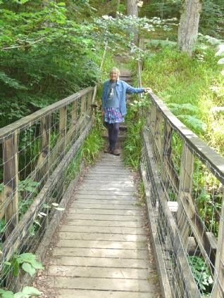
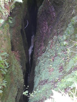
Just before Cromarty Firth, I saw a symbol on the map for 'Black Rock Gorge'. We didn't know what to expect, but set off to walk through rough woodland until we came to a little wooden bridge. Then it was 'wow', as we looked down to see a stream gushing through a deep deep dark chasm! It seemed very 'un-British', much more like something you would see in America or Canada.
Just before Cromarty Firth, I saw a symbol on the map for 'Black Rock Gorge'. We didn't know what to expect, but set off to walk through rough woodland until we came to a little wooden bridge. Then it was 'wow', as we looked down to see a stream gushing through a deep deep dark chasm! It seemed very 'un-British', much more like something you would see in America or Canada.
We spent a 'useful morning'. We drove through flowery Beauly into Inverness. Here we located the laundrette which we had been glad of in 2012, and were equally pleased with today! We parked in small Tesco carpark across the road, buying a few items in there while we were waiting. It was a cloudy morning, but not the dire weather of our last visit, when we had struggled to cross the road even.
With all our laundry done, we drove around Inverness, colourfully decorated with flowers, seeing again the pedestrian bridge which Adrian remembered from his childhood visit. We made our way to the large Tesco on the other side of the town so that we could fill up with diesel, and had our tea/coffee afterwards.
Now we took the A9 southwards as far as Aviemore. We drove through the town, which of course was very touristy! We drove on through Glenmore Forest to Loch Morlich. Parking here cost £2, but free for blue badge holders, so we happily settled in beside the lake. We enjoyed lunch sitting on our 'Danish' seats , watching the many ducks and ducklings and the black headed gulls. It was lovely - very still and warm, although overcast. There were large patches of snow on the Cairngorms opposite. It made us think of Canada, with the evergreen trees coming right down to the water's edge, and being completely unspoilt and unbuilt up.
We drove on up the hill to the skiing area of the Cairngorms. Nothing much for us there, but pleasant enough. We had decided to drive around the eastern side of the Cairngorms, so descended again, taking a pleasant road through Nethy Bridge, turning off past Bridge of Brown. The scenery was very wild and open. We were driving around Glenlivet estate, with its many little parking areas for walking etc.
We drove on through Tomintoul, which was one very long street of grey houses right on the road, looking very French. We could hear a loudspeaker, and saw that today was Tomintoul's Highland games. Cars were parked in a field, but nothing caused us any problem.
We ascended now into thick cloud, which wasn't much fun, but at least we had had virtually no rain today, when the whole of Britain was forecast with torrential showers. We descended a bit, and it was less foggy.
Soon after 5 o'clock we pulled into a picnic area at Corgarff near the River Don.
Soon after 5 o'clock we pulled into a picnic area at Corgarff near the River Don.
We drove towards Balmoral, across wild moorland with some conifer forests, passing sheep, rabbits and grouse. We got to Balmoral at 9.20, and found that it opened to the public at 10 o'clock. I didn't even know that you could visit it, but you can from May to July.
We walked up to little Crathie church, and walked all around it, but this also opened at 10 o'clock. We walked back, and across the River Dee. By now Balmoral was open, and I decided that I would really like to visit. It cost £10 each for oldies, and was a superb visit. We were taken by land-rover with trailer across the grounds, although we walked back through the wonderful trees, planted by Prince Albert.
We had audio guides for the tour, which took us around the gardens and many outbuildings, with interesting information, and options to listen to more if you wanted to. The gardens were really attractive and productive – no mean feat, when we were told that August is the only month when you can be sure of no frosts! In the flower gardens, I was able to buy a bunch of gorgeous sweet peas for just £1!
The weather was warm and sultry, but we didn't have any rain. This area was forecast to have torrential showers today. Adrian had the added bonus of seeing a group of old cars (many English) belonging to a German group who were on a tour of Scotland. He chatted to one of the drivers.
After our visit, we crossed back over the River Dee, and sat at a picnic table in the car park for a late coffee/tea, underneath the fragrant lime trees (my favourite).
It was midday when we left, following the River Dee to Braemar. We drove past the castle, which was partly under scaffolding, stopping at the town car park. Here Adrian was able to empty the loo and get water. We were opposite the ruins of Kindrochil Castle. We then walked across the River Dee and back. We glimpsed a group of people in costume, and saw that today there was a re-enactment of the Jacobite uprising.
A house in the town had a notice saying that Robert Louis Stevenson had lived there in 1881 while writing Treasure Island. By now the weather was really warm. There were lots of tourists about.
Driving along past Loch Tummel, we passed the scene of a minor accident which had just taken place between a motorbike and two vehicles. The bus driver in front of us would have appeared to have witnessed the accident. We were held up for a little while, but nobody seemed to be hurt.
We drove on to Loch Rannoch, where we found a delightful spot, designated as a free camping place, at the end of the loch. It was now 5.30. There were a few tents here, and a group of people were enjoying themselves on the little beach, as we walked along. (Later we could hear their music!)
We walked back along the road, and I walked up to the war memorial which had lots of names from both world wars on it from this rural area. By the time we got back, the sun was coming out, and so were the campers from their little tents (and the flies).
We left before 9 o’clock and followed a pretty route through hills with ferns and trees and moss covered dry stone walls before going through more open moorland.
We came to Loch Tay, and drove along to Killin, at the western end, where Adrian had stayed in a B&B in 1959. After locating the house he had stayed at, with his parents and sister Hilary, he knocked on the door and spoke to the present occupant. She was a youngish lady who had moved up with her family from West Sussex 18 months ago. Her husband (a builder) was doing up the place, so it wasn't being run as a B&B at the moment. They also had a dog, and were 'dogsitting' others, as well as fostering children, so they had their work cut out. She said that they all loved it up here, and found the village much friendlier and happier than the south.
We drove on up into the hills, stopping for lunch amongst the long horned sheep, who stared and bleated as though we were intruding!
It was so warm now that I put on my shorts! We drove on past the Glenshee skiing area. There were traces of snow higher up.
We now descended a long, long way on winding roads through the barren hills. Eventually we came to flowery Pitlochry, which was very busy with tourists on this fine Sunday afternoon. There was nowhere for us to pull in. We drove on to nearby Killiecrankie, the name of which we knew well, but didn't know why.
We pulled into the National Trust for Scotland carpark, amongst many other vehicles, and walked around. We discovered that there was the battle of Killiecrankie in 1689. We walked along for a way above the deep gorge.
Driving on, we pulled in briefly by Loch Venachar, which mostly seemed to be for fishing.
There were a lot of parking places as we drove on round Loch Achray. We were now in the Trossachs, and it seemed a popular area. Aberfoyle was too busy for us to stop at – there were double yellow lines everywhere. I had a feeling that we had been here before, but didn’t know when. Later we found out that it was in 1992,when travelling from Bridge of Allan to Ardgarten with Tom. After that, the countryside became more arable as we made our way south. At Fintry there were colourful kerbside flower beds.
As we drove through the Campsie Hills, we stopped by a car park which was very full of cars. We realised that we are not far from the busy area around Glasgow. A board told of glaciation in this area in the past.
From here, we took a route east of Glasgow, trying to find as rural a route as possible. We did pretty well, although at Kirkintilloch we did come across a large lorry unloading and blocking the road, which didn't seem to go through anyway! We found another route, on past Airdrie. At Newmains, we went into an Asda store for me to buy a couple of vest tops, as I had unwittingly not brought any with me! The shop didn't impress me. It seemed tatty and unfriendly.
We drove on through Lanark, which once more appeared French, with its long street of grey house right on the road.
We crossed the River Clyde and at Thankerton stopped in a car park in the Tinto Hills. It was 5.45 and very sunny.
We sat out to eat our feta salad supper, staying out until the sun went down behind the hill at 9.15, with just the bleating of lambs and mooing of cows.
It was a beautiful morning. We sat outside for breakfast, with the sun shining through the myriad of different grasses and purple thistles. I was pleased to have bought my new vest T-shirts, as it was vest & shorts weather!
We left at 9 o'clock, driving on through the dark stone town of Biggar and then pretty Broughton with its flower bedecked cottages lining the road.
We were in lovely border country following the young River Tweed. Rosebay willowherb, which we know as fireweed from our time in America, often lined the road, sometimes alternating with creamy white meadowsweet.
At Tweedsmuir we crossed the River Tweed, where they were working on the bridge.
We now drove past Talla reservoir, with its wonderful reflections in the water
We had decided to drive the 7 miles to the Grey Mares Tail waterfall, remembering our visit here in 1985 with the children. The rain then had been torrential, and we well remember getting 6 drenched people back into the car, having got out of our soaked clothes! Today the weather was rather different!
We drove past St Mary's Loch and the Loch of the Lowes, coming to the Grey Mares Tail, where sheep were wandering all across the road. The area around the Mares Tail is now owned by the National Trust(for Scotland), and is a Nature Reserve.
We walked to the view of the falls, and then a bit further up some steep steps. There are steep walking trails which take you much further.
On our return journey, we stopped at the little beach area between the two lochs, but Adrian voted it too busy for us to stop for lunch. This was perhaps a mistake, as we then had difficulty in finding anywhere at all to pull off. We ended up beside Ettrick Water at a small parking area said to be for Ettrick Marshes. We'd have liked to have sat outside for lunch, but as I stepped out, I was attacked by a horsefly, and I knew that Adrian wouldn't like that!
Instead we sat inside, with all the windows open and the flyscreens up. While Adrian rested, I walked across a little wooden bridge over the peaty water and into some woods. They were sawing up felled trees opposite, so it wasn't quiet!
We drove on now, looking for the cottage we had stayed in when we came up for Jon & Lois' wedding in 1985. It was called Foulbog – an unforgettable name, and a memorable time – much of it of the cold and wet! Suddenly we both saw the little remote cottage way down a track.
We stopped to reminisce, and the memories came flooding back! No wonder we had wondered if we'd get out for the wedding, when it had snowed the day before (it was Easter). How different the weather was today – really hot! We drove on, past the Buddhist Temple that we both remembered. It is now called the Tibetan Centre, and much enlarged, but still seems to be in a strange location.
We drove on to Langholm – 22 miles. When we had come here in 1985, we had picked up a box of groceries from Langholm. With 6 of us in the car, plus a suitcase of our wedding clothes, there had been little room for food! The woman we had ordered it from had asked for the time we would be collecting it. I had guessed at 4 o'clock (we had driven up from Hermitage, and even called in at Carnforth for Adrian to enjoy the trains!) As it happened, we did arrive just before 4 o'clock, which was lucky, as the shop wasn't open on Saturday afternoon, and she had come down especially!
We drove down the main street, not really finding the shop, but we did see the petrol station where we had been able to get some fuel after the garage had closed.
We stopped by a pleasant little park beside the river and enjoyed an icecream. Children were having fun in the water. It felt really hot!
We now drove across the grassy moors to Newcastleton, a long street of houses made pretty by flowers. From here we drove north east a bit to take a road into the Kielder Forest. We knew that we had been once before – we found out that it was in 1985!
After a while we came to an ideal spot beside a little bridge. Some people in a car were there, and we hoped just leaving, which they were!
We got settled in – it was now 5 o'clock. The only problem was the noisy cattle grid, so we hoped for not too much night traffic!
Adrian was able to find a little bit of firewood so that we could have a camp-fire after supper.
We sat out – it was wonderful - only coming in at 9.30 when the midgies descended. A couple with two boys had parked behind us, and gone off for two hours at least. They arrived back in their swimming gear, having walked through the stream in the tunnel. The dad said that they came from North Shields, and that he used to come here as a kid, and that there were a lot of waterfalls on the walk. They rushed into the car, away from the midgies, for their drive back home.
Once inside, we read through our 1985 holiday diary, which gave us a few surprises!
Once inside, we read through our 1985 holiday diary, which gave us a few surprises!


Shetland to Kielder


Haystacks Orkney style

