
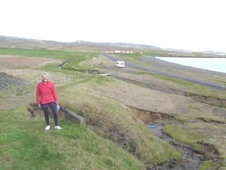
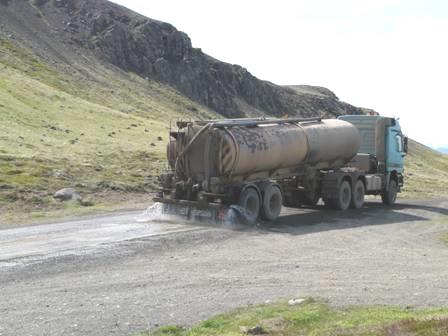
Thursday 6th June 2013 We set off 120 miles
Here starts our account of our trip to Iceland.
N.B. All Icelandic names have been anglicised, as Iceland has additional letters in their alphabet.
We left Hermitage at 11.15 on a beautiful day which had started cloudy. We’d had a few days of lovely weather after an extremely cold winter and spring. The only other nice weather was at May Day, a month ago, when we’d held a fabulous celebratory weekend
following our 70th birthdays at Elm Gable, attended by a total of 100 people including all of our children and grandchildren except Tom & Mar, who are expecting their first baby in July.
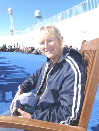
I’d recently stopped taking chemo – after 22 lots – and had had an intensive course of intravenous Vitamin C. The result of my scan yesterday showed very little change in the size of the brain tumour, but at least it wasn’t growing.
We took the M4, followed by the M25, enjoying the fresh green of the countryside, with the verges a frothy mass of white ox eye daisies.
We stopped to eat lunch at South Mimms, then we diverted slightly as signs said that the A12 was blocked, and took the M11 to Bishops Stortford then on A120 & A12 past Colchester to Harwich. Towards the end the journey the going was a bit slow. At Harwich we stopped briefly at Morrisons for fuel and to buy one or two things, [found later that we had overnighted here in 2001!] then we were soon at the docks, and hanging around with the many other vehicles to wait for our 5.45 departure.
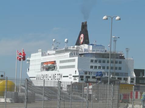
Once on board, we immediately made our way to our cabin before looking over the ship. Then promptly at 5.45 we were on our way. It was nice to see land for quite a way as we sailed out past Felixstowe, heading for Esbjerg in Denmark, where we’ll arrive at lunchtime tomorrow.
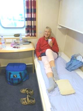
Our cabin was right at the back of the ship, looking out to the deck bar in front of us. There were not many takers, as it was pretty chilly and windy here – we thought that the bartenderWe had thought the restaurant rather pricy when we looked it up, so opted for the cafeteria, where we ate some passable fish and chips before coming back to our cabin to open our bottle of wine! must have drawn the short straw!
following our 70th birthdays at Elm Gable, attended by a total of 100 people including all of our children and grandchildren except Tom & Mar, who are expecting their first baby in July.
I’d recently stopped taking chemo – after 22 lots – and had had an intensive course of intravenous Vitamin C. The result of my scan yesterday showed very little change in the size of the brain tumour, but at least it wasn’t growing.
We took the M4, followed by the M25, enjoying the fresh green of the countryside, with the verges a frothy mass of white ox eye daisies.
We stopped to eat lunch at South Mimms, then we diverted slightly as signs said that the A12 was blocked, and took the M11 to Bishops Stortford then on A120 & A12 past Colchester to Harwich. Towards the end the journey the going was a bit slow. At Harwich we stopped briefly at Morrisons for fuel and to buy one or two things, [found later that we had overnighted here in 2001!] then we were soon at the docks, and hanging around with the many other vehicles to wait for our 5.45 departure.
Once on board, we immediately made our way to our cabin before looking over the ship. Then promptly at 5.45 we were on our way. It was nice to see land for quite a way as we sailed out past Felixstowe, heading for Esbjerg in Denmark, where we’ll arrive at lunchtime tomorrow.
Our cabin was right at the back of the ship, looking out to the deck bar in front of us. There were not many takers, as it was pretty chilly and windy here – we thought that the bartenderWe had thought the restaurant rather pricy when we looked it up, so opted for the cafeteria, where we ate some passable fish and chips before coming back to our cabin to open our bottle of wine! must have drawn the short straw!
Later we went up to the Columbus Lounge to enjoy the music of a young chap singing with guitar.
Friday 7th June We arrive in Denmark 183 miles
After a look out on deck we ate breakfast in our cabin – cereal and tea, using the new kettle which Adrian had bought specifically.
The weather was calm and clear – we couldn’t have hoped for more.
As we approached Esbjerg we enjoyed the warm sun on deck as we looked out at the flattish Danish scenery.
Approaching Esbjerg, Denmark
It was midday when we arrived – 1.00 pm Danish time, but we don’t think it necessary to change for one day!
We seemed to hang around for a bit while waiting to disembark, but stopped just afterwards to have lunch beside a small park which we walked out into. Adrian had got some Danish Kroner while I prepared lunch. There was a prolific wisteria outside a town house opposite.
As we set off on the motorway eastwards and then north, we were aware of the masses of wild lupins beside the road. We passed Kolding and then turned north past Vejle. We had travelled a short bit of motorway here in 1988 with our boys. The landscape was very green and pleasant, slightly undulating. The roads became increasingly busy, but we had to remember that it was Friday evening. We were pleased to pass many picnic areas – not service stations. We stopped at one for our cup of tea, and sat on the grassy area, watching numerous small birds.
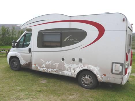
At Aalborg we took a road north westwards, stopping at a picnic area soon afterwards for the night, just before 6 o’clock. We enjoyed the pleasant sun as I prepared the evening meal for our first night in the Ixi this time!
We seemed to hang around for a bit while waiting to disembark, but stopped just afterwards to have lunch beside a small park which we walked out into. Adrian had got some Danish Kroner while I prepared lunch. There was a prolific wisteria outside a town house opposite.
As we set off on the motorway eastwards and then north, we were aware of the masses of wild lupins beside the road. We passed Kolding and then turned north past Vejle. We had travelled a short bit of motorway here in 1988 with our boys. The landscape was very green and pleasant, slightly undulating. The roads became increasingly busy, but we had to remember that it was Friday evening. We were pleased to pass many picnic areas – not service stations. We stopped at one for our cup of tea, and sat on the grassy area, watching numerous small birds.
At Aalborg we took a road north westwards, stopping at a picnic area soon afterwards for the night, just before 6 o’clock. We enjoyed the pleasant sun as I prepared the evening meal for our first night in the Ixi this time!
Saturday 8th June A slow boat to Iceland 53 miles
I had a disturbed night – the road was busy, and the birds were singing as it didn’t get dark.
The sky was blue, but it was windy. We had a difficult time trying to sort out what to take on the boat with us for 3 days.
By 9.30 we were driving through the pleasant but unremarkable Danish countryside, noticing the purple lilac blooming in the hedgerows. We were heading for Hirtshals to catch the ferry to Iceland. The road passed the coast at the little village of Lokken. It seemed to be a place of summer homes, a few of them thatched. After a bit of a search, we found the road which ended right on a vast sandy beach – no car park, you just drove on to the beach. We joined the few cars there, although Adrian was a little reticent at first – it was not the time to get stuck! A line of uninspiring white huts lined the dunes at the back of the beach.
On the beach at Lokken, Denmark
After a quick blow on the sand, this made a nice coffee stop before we headed for Hirtshals. Just before there we drove through the pleasant village of Tornby, where a fete was taking place, with a large fire engine, and a cart pulled by two horses giving people rides.
We needed to get some fuel at Hirtshals, as the tank was low, and finally located a petrol station. Hirtshals seemed a nice place, with a harbour filled with small fishing boats.
We made our way to the ferry terminal – right beside a large sandy beach. Despite arriving early, there were already a lot of vehicles, and a long wait.
Iceland here we come!
Then the fun started – we were at last directed to a line of motorhomes, and I started to prepare lunch, as we slowly crept forward. We were just ready to eat, when the young lad on a bicycle who had taken our tickets asked me to go to the terminal building and then on to the boat – taking my luggage with me! Only the driver was allowed to stay in the vehicle. As this was a long walk, I didn’t relish the idea! Adrian went and spoke to him, explaining that I couldn’t walk far, so he said OK. Almost immediately we realised that our line was embarking – we were going on first! I hurriedly stuffed the lunch things into a bag as we drove on to the boat.
Here we were greeted by a scene rather like our journey from Greece to Italy in 1967! The vehicle lanes were clearly marked out on the floor, but the men were fitting an extra line of vehicles in! There was no room to get out of our door! Luckily by leaving a space in front of us, there was a gap between a car & its caravan so that we could get out (the assistant was a bit reluctant about this!)
Then it was really difficult to locate our cabin – there was nobody around to help. We got to the right deck, but there was no indication of our number. Adrian left me with the luggage while he went searching. Our cabin was right at the other end, with no way of knowing how to get there!
Finally we made it, and were at last able to have our lunch. Adrian went on a search for a fridge, as the one in the room was a mini bar only, and came at a fixed price. He finally secured a mini fridge, large enough for two bottles of medication and not much more!
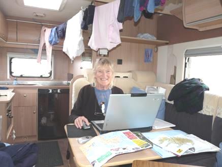
The cabin is similar to the one on the last boat, but this one has only two beds, one above the other whereas on the other one we had the two bottom bunks with the other two folded up.
There was then an announcement – the ship would be an hour late leaving because of what sounded like ‘a car bomb’ A further announcement said that we would be another half hour late in leaving.
Having looked over the ship, we went on deck to watch us finally depart at 3.30 Faeroes (and our) time before coming back to our cabin for a cup of tea.
It wasn’t long before we investigated the small swimming pool, situated as always on the lowest deck. We both enjoyed a short swim in the pool – our first swim since Lake Geneva last year!
Later we had supper in the cafeteria. My salad was reasonable, except for the quantity of red onion which I had to remove. Adrian had a large pizza.
Back in our cabin we could look out to the coast of southern Norway – Kristiansand, which I had visited in 1964.
We were aware of live music below, so soon made our way there. The music was fun as we sailed on past the coast of Norway, where the blue sky merged into pink before the darkness, when we could see little lights twinkling.
Sunday 9th June A long day at sea
We woke up late – perhaps due to the travel patches which we reluctantly were wearing.
We enjoyed breakfast in our cabin, with our calm sea view on this partly cloudy morning.
Soon afterwards we returned to the swimming pool, where the water was swishing from side to side, in spite of the calm sea. I ventured into the gym area, where I spent a few short minutes on an exercise bike.
We decided to visit the shop, but found it full of highly priced perfume, clothes, toys and drink, none of which interested us!
We returned to our cabin for lunch, watching the first of many gannets flying past our window.
We returned to the deck as we sailed past the Shetland Isles, amused at the fact that after 4 days we were passing British soil a couple of miles away!
We pass by the Shetlands
We went down to the cafeteria, where the only opportunity open to us was chicken and chips. The chicken wasn’t bad – first meat I’d eaten for several months – but the ‘French Fries’ left a lot to be desired!
We enjoyed the live music downstairs again.
Monday 10th June First impression of the Faroes
There was an announcement over the loudspeaker at 4.00 am telling those getting off at Torshavn to vacate their cabins! I had only slept lightly, wondering all the time if we might be passing land. It never really got dark.
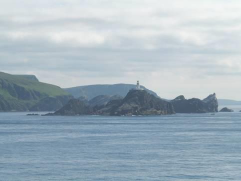
It was grey and misty as we arrived at Torshavn on time at 5.00 am. I had watched from our cabin as we passed the low green treeless hills. We weren’t due to leave here until 2.00 pm so went off to see some of the town.
Torshavn
We actually spent most of the time trying in vain to get a wi-fi connection. There were a lot of tourists around – we had seen a large cruise ship.
We had heard that there was internet connection at the library and managed to find our way there along the little lanes with some simple painted houses with turf roofs.
It was now 9.55, and the library opened at 10 o’clock. In a little park opposite we spoke to a German chap who was equally trying to get a connection. It turned out that he had been touring the Faroes for a week, and was now going on to Iceland on the Norrona, like us. He said that the weather had been mixed, and that he thought a week too long – we hope that we don’t think the same when we return.
Despite the library assuring us that there was a link here, none of us could get one. We toyed with the idea of using a cafe with internet, and having a drink there, but £6 for two teas seemed an expensive way of getting an internet connection!
We opted for returning to the ship, and having our own cup of tea in our cabin – it had been cold & grey walking around, so we were glad to warm up.
Adrian went down to the van, as we had access to the car deck while in port, and brought back a couple of things. Next thing was to try the swimming pool, but that was thwarted, as it seemed to be not in use while in dock. The hot tubs on deck were also not in use.
We then thought that we’d try lunch in one of the diners, as we’d seen fish there yesterday lunchtime, but no luck – it was all meat, so we came back to have lunch in our cabin!
We went on deck to watch us depart Torshavn at 2.00 pm, passing masses of treeless grassy hills and headlands.
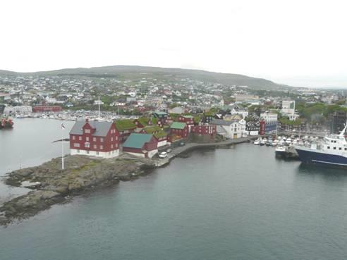
Leaving Torshavn, Faroes – note the turf roofs
We tried the swimming pool once more. This time we were in luck!
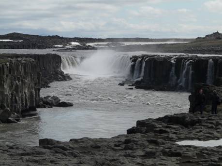
But then we realised that the ship was travelling up between some of the Faroe Islands, so hurriedly made our way back on deck. We were treated with fantastic views of the incredibly steep slopes and cliffs, with just the occasional small village. We happened to be by the German man from earlier. Adrian chatted to him quite a bit – they are going to Iceland with their motorhome for 3 months!! They pointed out some of the places we were passing.
The sun was now shining from a clear blue sky, so it was lovely being on deck.
We ate in the place called ‘The Diner’ tonight – an ‘eat all you like’ buffet. We ate fish and vegetables, which looked nicer than they tasted.
We returned to our cabin for wine, while we thought about our itinerary. Later we went down to hear the live music in the lounge. Tonight it was a different musician – our singer/guitarist must have got off at Torshavn. This one was a brilliant keyboard player, but soon after we got there, he went off for his ‘break’.
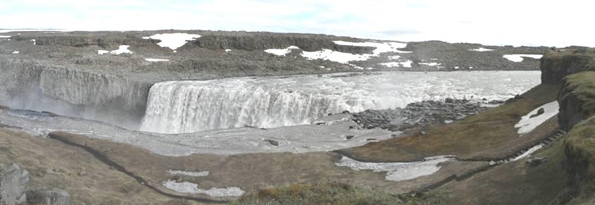
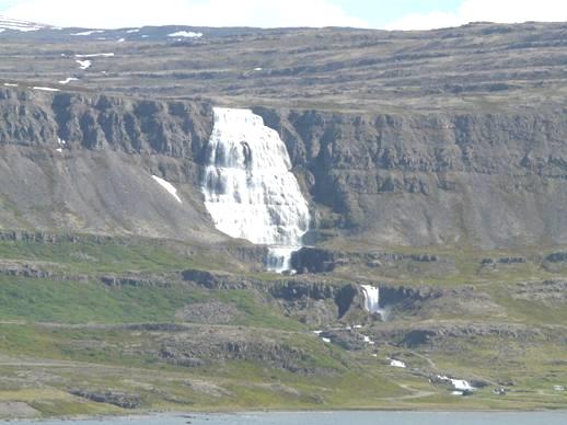
Tuesday 11th June Iceland – Waterfall wow 101 miles
We were awake early on a misty morning. After breakfast, we went on deck where we had our first view of Iceland’s snow covered peaks. It was a bit chilly on deck, but we still had that ‘Wow’ feeling.
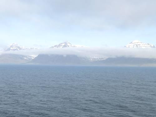
Our first glimpse of Iceland
The sun did come out a bit, as we alternated between being on deck or in our cabin to watch the view. The stark scenery with snow in every crevasse and hundreds of waterfalls emanating from the steep hills was quite overpowering.
Wow!
As we docked we returned to the car deck, where all hell let loose and it was quite chaotic. Everyone had difficulty in getting to their vehicle as they had crammed so many cars in.
By 10.30 we were on to Icelandic soil, and marvelling at the vertical green cliffs. The little houses – often white with red roofs - reminded us of Newfoundland.
On driving out of Seydisfjordur we passed a supermarket so went in to see what we could buy. As the pricing was difficult to work out, when we could find it, and knowing that goods were likely to be expensive, we had quite a hard job! We bought a small warm French loaf, and came out to have some with our tea/coffee while we sorted out our stuff from the boat. A crocodile of nursery children in fluorescent vests made us smile.
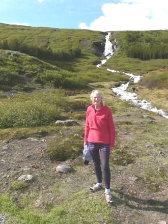
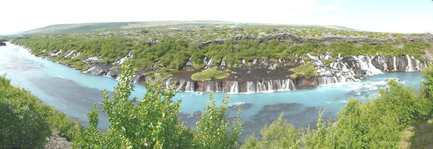
As we drove up the valley, there were waterfalls everywhere. I had just said that I wouldn’t take any more photos of waterfalls when we came to the big one, so we pulled in and walked to it. On the ground there were some little white daisy/anemone flowers (mountain avens) and humps of pink starlike flowers (moss campion), all very pretty.
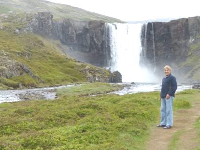
Wonderful waterfalls!
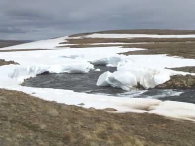
The waterfalls continued as we drove on, but as we climbed higher, there was more and more snow lying. We now went into fog, which wasn’t pleasant.
We pulled in at the top for lunch, with views down to Egilsstadur on Lagarfliot – a long narrow fjord which supposedly has a giant ‘worm’ or serpent, like our story of the Loch Ness monster. There was some sun now, and the rest of the day was quite pleasant. A group of German cyclists, who had been on our boat, stopped off to don more clothes before cycling down the long hill. Adrian spoke to one of them, and he told him that some had cycled from Frankfurt! They were heading for Reykjavik.
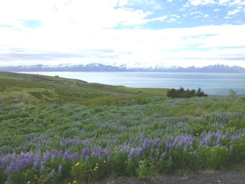
We descended to Egilsstadur, where we looked into the Tourist Information and picked up some leaflets. The sides of the road were a mass of blue lupins which contrasted beautifully with the bright yellow dandelions.
As we drove on, we passed several swans in the fields, and were delighted to see two whooper swans.
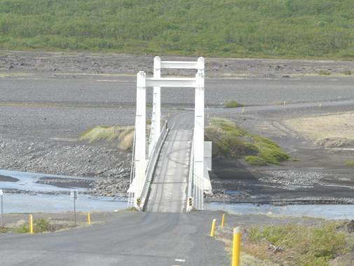
We pulled in by an interesting bridge and walked across in warm sun to view the River Jokla below with yet another waterfall. We were following the Jokla River upstream through brown, barren scenery with lots of snow around. It was really wild and bare. Sheep and lambs were everywhere. We passed one lamb lying on the road, while its mother and siblings looked on. It appeared just like a naughty child having a tantrum!
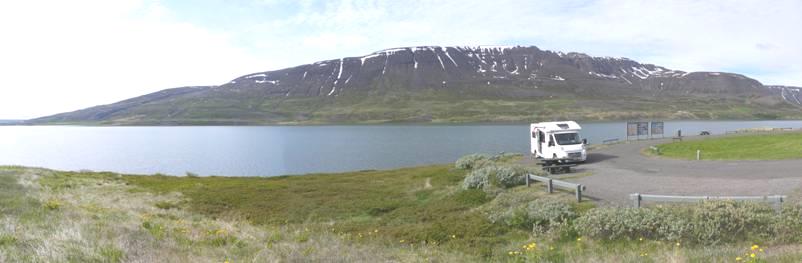
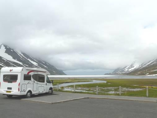
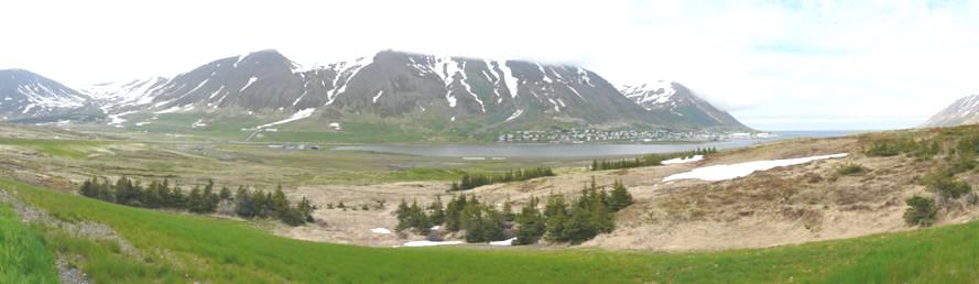
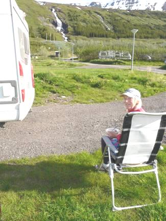
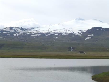
We now made our way down to the coast at Vopnafjordur – a village still involved with fishing - and located the campsite here. We settled in with wonderful views down to the sea and the black and white mountain range beyond for our first night in Iceland. It was now 4.30 (5.30 English time), but it was still light at 10.30.
Wednesday 12th June Two free museums 99 miles
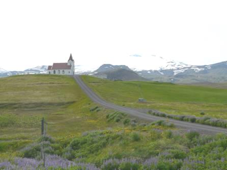
What a wonderful view to wake up to, even if the weather was cloudy. We left at 9 o’clock, stopping for me to photograph the little church and for Adrian to try to get petrol (he couldn’t make the pump work). A group of people were gathering up grass for hay from a grassy area near the shore.
There was quite a lot of snow lying on the ground as we drove on to Bakkfjordur, which consisted of just a few simple houses and some rusty buildings. There was a view from here to the Langanes peninsula which we won’t be driving along as it only has a rough track.
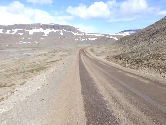
We didn’t see so many waterfalls today, but did pass an amazingly wide one as we drove on to Porshofn. We had to travel three long unsurfaced sections, and wondered how we survived the 700 miles in Labrador! We stopped along one of the unsurfaced sections for coffee – there was a picnic table, but it was too windy to sit out. A girl later told us that it has only been windy for the last couple of days.
There was a small monument by the picnic table to a man who’d died in 1996. Opposite was a derelict house. Adrian thought that the inscription was to a local man, who’d lived in the house and farmed this area.
Lupins were still often lining the road, and there were numerous little humps of the pink starlike flowers. We saw plenty of eider ducks, and even more sheep and lambs.
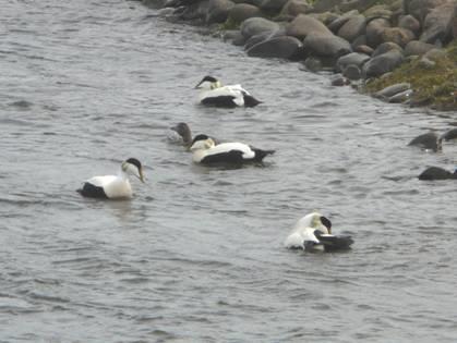
Eider ducks We saw horses too
We stopped at the fishing village of Porshofn to eat our lunch by the harbour, but couldn’t get an internet connection. Adrian was able to get some fuel here.
There was an enormous hidden tope just outside the village which jumped all our crockery out of its fittings, but luckily nothing was broken.
We drove through lava fields across the Melkrakkasletta peninsula on a road only recently built, stopping at a picnic site, but the strong wind made reading the information boards difficult.
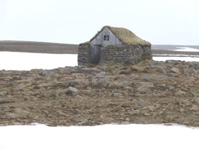
We came to Kopasker on the western side of the peninsula – a village which had been severely damaged by an earthquake in 1976. We had read that there was an earthquake museum (free) here, but first we came to a folk museum adjacent to the simple church. This was also free, and we had a delightful time walking around it. The young female guide was happy to talk to us – I don’t think that she’d had any other visitors today. There were a lot of examples of embroidery and knitting, and models wearing traditional Icelandic dresses (in black, but attractive) and a wedding dress made by a 17 year old bride in the early 20th century. Also there was a massive library which had belonged to one man, who had bound all the books. There were artefacts of many sorts, including early wooden ice skates. Our young lady took us into the pretty little church afterwards, before saying that we should visit the earthquake museum, which is what we’d intended to do.
The folk museum and church at Kopasker from the campsite (taken at 10.15pm)
It was 4.45 when we got to the earthquake museum, but the young girl here was happy for us to visit, but probably cursed us, as we stayed until well after 5 o’clock, when it supposedly closed.
Two free museums in a small village (pop 140) and what’s more, a free campsite! We opted to stay there, but first drove around until we at last got an internet connection (after a week), so we could let ‘our 4’ know that we’d arrived in Iceland. Back at the campsite we had supper before reading through our diary so far, and reading some of Paul & Nicky’s trip to Iceland in 1997.
Thursday 13th June A peaceful and delightful canyon 81 miles
We were up early as it was already light – it hadn’t actually got dark. It was cloudy and cool. A lady had come across to clean the toilets, and to water the nearby flower beds with a watering can.
We couldn’t get an internet connection this morning where we had got one last night so continued on our route southwards beside Oxarfjordur. It looked lovely with the blue lupins, green vegetation,black beach, metal looking sea, charcoal coloured cliffs and white snow. The ground was a mixture of alluvial soil with small trees growing and lava beds.
Bridge over the Jokulsa River
We crossed a dramatic bridge near Asbyrgi over the Jokulsa River and made our way to the visitors centre. This contained masses of information on volcanoes and earthquakes which kept us entertained for some time. There were some beautiful but very expensive books. Adrian chatted to the young assistant who was from Oxford! She was married to an Icelander and lived in Kopasker.
By now we had realised that this was an important area geographically as it was situated on the fault line which runs right across Iceland. We had already admired the deep canyon sides, and now we drove a short way into the gorge where a pleasant walk through low birch trees brought us to a little lake at the base of the vertical cliffs.
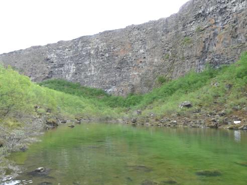
Lava Cliffs at Botnstjorn
There were waterbirds – wigeon and mallards, and the cliffs were home to fulmers who were noisily flying about above us. We walked back to the van by a different route which had markers showing some of the flowers which grow here, including purple cranesbill and lady’s mantle.
Back at the van, we had our morning drinks sitting on our bum mats amongst the young birches in the sun! A lovely visit.
We drove on past lava fields, stopping for lunch just before the Tjorness peninsula which we then proceeded to drive around. There was a viewpoint near the beginning, high up, so that we could see the coastline in both directions, and small Lonsos Lake which had apparently formed after the 1976 earthquake.
It was really windy. The fulmers here floated up in front of us.
We continued around the headland, stopping just north of Husavik at a viewpoint to Lundey Island, where there are colonies of puffins. AcrossSkjalfandi Bay we could see the high barren snowy peaks of Ifjordur peninsula.
View near Husavik with lupins in the foreground
Husavik was situated in a similarly lovely location. It seemed a bustling little place and is the centre for people to make whale watching trips, and trips round Lundey to see the puffins. Our uses were more down to earth! We visited the splendidly simple church, built with Norwegian timber, before we located the bank to at last get some Icelandic money. After that it was a necessary shop, but despite our best efforts we weren’t able to get an internet connection. We lingered for a cup of tea (it was now warm and sunny) before setting off southwards to find our campsite for the night. This was at Heidarbaer, and was rather like a CL, but with views to the superb snowy hills.
There is an outdoor pool here, and two hot tubs (for an extra charge). We chatted to the ladies at the reception. One spoke English, and was with her 13 year old son who was travelling to England soon with the school (Manchester), and to the USA next year.
Later Adrian spoke to a British couple now living in Australia. Last year they had come over and walked the SW Coast path (with rain every day) and this year they were camping in Iceland and Greenland!
Friday 14th June A great folk museum, gorgeous waterfalls, a hot pool soak and mudpots 144 miles
It was a bright morning, so we enjoyed our lovely views. There’d been no darkness. We sent a longer email to ‘our 4’ before leaving after 9.30. We’d toyed with the idea of swimming here, but the pool didn’t really open until 11.00, and we hoped to visit another pool later today anyway.
Our first stop was Grenjaoastadur Folk Museum, housed in several turf-roofed houses. The road there was partly unsurfaced, but we arrived just before 10.00, when it opened.
A really superb visit followed. The warden was a ‘Jonny Makepeace’ young man, who set the scene for us, giving us a plan of the various rooms so that we could wander around. The rooms were full of artefacts, some familiar to us, and others not. We were particularly taken with the expanding beds, some of which contracted widthways and some lengthways to give more room during the day.

A contracting bed
There were extremely steep stairs to climb to some of the attic rooms, where there were spinning wheels, making it feel just like a sleeping beauty story!
The downstairs rooms felt rather like the smoke house we had visited in Scotland last year. After our visit, there was free tea/coffee in another building, and opposite was a delightful simple church – the houses had been home to the rector. With fields of lava all around, bright yellow marsh marigolds, and snow covered hills as a background, it was extremely atmospheric.
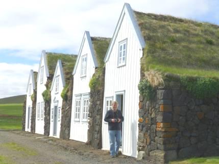
Turf roofed Grenjaoastadur Folk Museum
Despite the warm sun, it was cold inside the buildings, so we were glad of the hot drink before we set off towards Lake Myvatn. We were making first forDettifoss, a well known waterfall which was quite a way past the lake. The scenery was out of this world, with water and lava everywhere. We drove on past Lake Myvatn and came to some really desolate barren volcanic scenery, brightened by an amazing turquoise lake. We stopped at a viewpoint close to here to have our lunch, with our stunning view heightened by the blue sky and fluffy clouds. It was warm in the van, but the wind was strong.
We now made the long trail across the desert scenery to Dettifoss. This is on the Jokulsa River, south of Asbyrgi where we were yesterday. In fact you can hike there (32km), but both of the direct roads (one just a track) either side of the river are still closed because of snow!
It was 1.45 when we set off from the car park to walk the 1 km trail to the falls over very uneven ground. It seemed that the whole of Iceland was here, but really it was just several coachloads of people. The path was often wet or snowy, and the picnic area and toilets at the beginning were under water, so we had to take a diversion to start the walk.
The falls themselves were very impressive, like a smaller version of Niagara or Victoria Falls.
Dettifoss
Being gluttons for punishment, we walked on to a second lot of falls called Selfoss which weren’t quite so impressive, but still good.
Selfoss
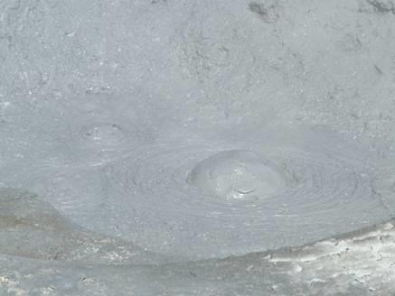
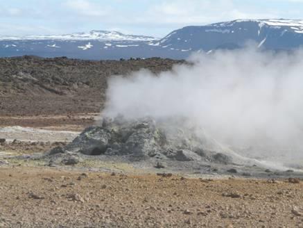
We left Dettifoss at 2.45 and drove back towards Lake Myvatn. Just before reaching there, we stopped at another ‘wonder’ at Hverira. This was like a mini ‘Yellowstone’, with fumeroles and gurgling mudpots – fantastic! Unlike Yellowstone, there was just a low rope to deter you from getting too close, and no ‘don’t’ restrictions. An altogether wonderful place in a fantastic setting. The sun was warm but the wind cool as we walked around, with me trying out taking a bit of video of the bubbling pools.
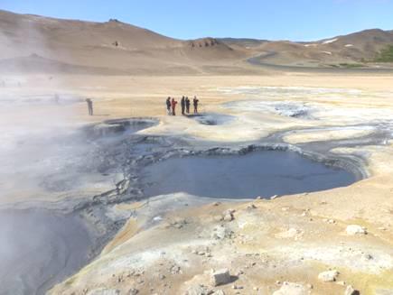
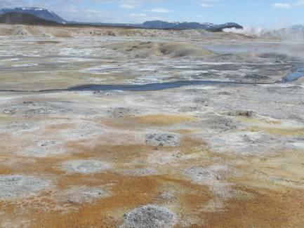
Hverira
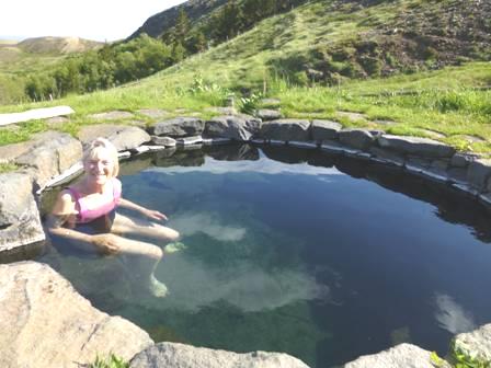
Near the bright turquoise lake we saw earlier was a thermal ‘nature pool’. This was a large outdoor pool surrounded by rocks, where, for a price, you could laze in the warm water, which we did! For about an hour we soaked in the warm ‘bath’, smelling strongly of sulphur.
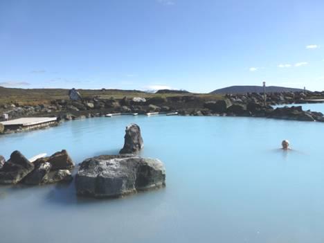
Relaxing in the thermal pool
Now 6.00, we set off to drive along Lake Myvatn on the southern side, travelling between areas of irregularly shaped lava. We needed somewhere to stop for the night, but had to wait until we were out of the National Park. After that, we couldn’t see anywhere to pull off at all. We had a card which entitled us to use any of 46 campsites in Iceland, but there were none near here.
We came to the site of another impressive waterfall called Godafoss, and stopped to have a look Again it was wonderful – a bit like ‘Rheinfall’.
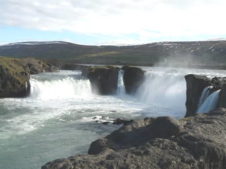
Godafoss
As it was now 7 o’clock, we needed to eat, so it was ‘beans on toast’, while we pondered what to do. We wondered whether to stay in the car park here, but it was very busy, being on a road junction, and a popular spot. Our nearest campsite was 50 miles further on but as we’d now eaten, it didn’t matter if we arrived late, as it wouldn’t get dark. We started on our way, but didn’t have to do the 50 miles, as we came to a picnic area beside Lake Losavatn, which was very quiet and seemed just right for us.
Saturday 15th June Botanic gardens, dramatic fjords, much snow and some tunnels 85 miles
The night was quiet, and we woke to a fine morning so ate our breakfast outside at the picnic table, plagued a bit by midges, or at least flying things, that this region is renowned for.
Our overnight spot by Lake Losavatn
At 10.00 we set off on the beautiful journey to Akuryeri, the second largest town in Iceland. We were following a steep valley with snowy slopes either side.
There was a wonderful view across Eyjafjordur to Akureyri, which is in such a fantastic setting. Lupins lined the road. We sat at a sheltered picnic table to have our morning drink, looking across the fjord, but it was still pretty chilly!
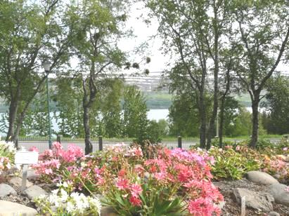
In Akureyri we headed for the Botanic Gardens, which are free, and were really enjoyable. They were started by a group of local women in 1910, and have been extended over the years. They are situated in a stunning location above the fjord, and were really great to walk around. Adrian particularly liked the fact that the flowers were grouped in families, and all clearly labelled. There was plenty of colour, ranging from the fading daffodils and narcissi to pansies, poppies and many more. Our favourites were the pretty pastel lewisia.
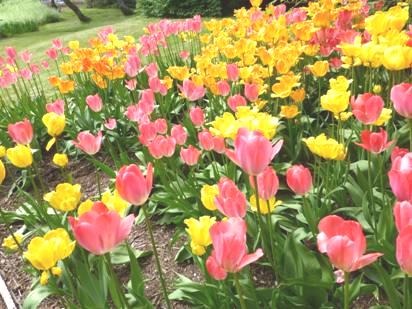
Akureyri Botanic Gardens – Lewisia and tulips
After we’d finished in there, we thought that we’d drive down to the fjord to have lunch, but couldn’t find anywhere to pull off. We ended up near the small airstrip – a runway situated in the fjord – looking up to the snowy mountains.
Next thing was to visit a supermarket, as this is a bank holiday weekend as Monday is Iceland’s national day. We located a mall looking much like one anywhere else, and shopped in Netto. We were amazed at the amount of health food stocked. There was more than we might get in a supermarket at home – at a price, of course.
Now we headed out of Akureyri – Adrian had had enough of ‘busyness’ – and drove up the western side of Eyjafjordur with its dramatic scenery. We drove through Dalvik and the scenery became even more dramatic. There were areas of thick snow beside the road, with waterfalls gushing into them. One waterfall fell vertically into the sea. We could look across Eyjafjordur to the snowy slopes of I Fjordum.
We didn’t know how far along this road we would be travelling, as there were several tunnels on it, which I didn’t know if I could cope with because of my claustrophobia. The first tunnel was only 3km long, but was single track! (with passing places). We were glad that there was someone in front of us! When we emerged from that, we were at Olafsjordur, an ordinary looking little town with a trampoline and slide in the garden of a house we passed.
After that it was a 7km tunnel – two lane. We emerged from this at a gap in the steep snow covered hills. The temperature felt freezing, which is not surprising as the sea was actually frozen, but the view was stunning!
The frozen sea near Siglufjordur
Now it was only another 4 km tunnel to Siglufjordur. There were steep snowy slopes here too. We looked across to the town from a picnic area which had small fir trees standing in deep snow.
Looking across to Siglufjordur
The town faces northwards at the end of the peninsula, and was once a thriving herring port with 3000 inhabitants and 10,000 workers. All that came to an end in 1968 when the herring just disappeared. There are still a lot of fishing boats in the harbour, but the town only has 1300 inhabitants now.
We planned to camp in the municipal site here – and it was just that – lots of motorhomes and some small tents packed onto a piece of grass in front of the church and beside the harbour!
There were brightly coloured corrugated huts around – red, yellow and blue – now cafes. A few people were sitting outside, but as we had a little walk around, we found it VERY cold, but then there is snow on the hills all around!
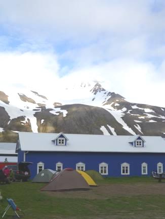
Siglufjordur campsite
Later we started editing the diary for the website.
Sunday 16th June Shoals of herring 98 miles
A beautiful day for Fathers Day with sunshine and blue sky all day (as it had been when I got up at 4.00 am).
Adrian had a message from Paul to say happy fathers day, and a present and card from Emma. Later Simon sent a message, and we spoke on the phone to Tom & Mar.
After scrambled egg for breakfast, we set off to find the Herring Era Museum. This was housed in 3 large nearby sheds, and was really great. There were loads of artefacts, with information written in English as well as Icelandic. One shed had an atmospheric scene of herring boats displayed. The herrings had mostly been used for herring oil and meal, with a huge variety of uses including animal feed, polishes, creams. The herrings disappeared in 1968, but now they fish for capelin.
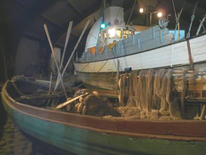
Inside the herring era museum, Siglufjordur
After our visit we had our tea/coffee in the warm sun before locating the Folk Music museum, which was included in the ticket price. It was now midday, and the museum had just opened. The assistant was a nice young woman who was studying for her BA in Folk Lore at Reykjavik, and spending the summer here. The museum showed the work of the local pastor who had collected the folk music of Iceland, which was being neglected. He had to go to Denmark to get funding for this. We weren’t that enamoured by the music we heard, but could appreciate the relevance of what this man BarniThorsteinsson had done. He was also a benefactor of the town, having set it up with electricity, rebuilt the church and inspired the herring industry amongst other things. He was known as the father of the town. There were videos playing, and I particularly liked the one of a grandma singing folk songs with a self conscious grand daughter and a little grandson who kept forgetting to sing. Our lady told us that the winter had been particularly long and cold from September to May, with thick snow.
After our visit, we made our way out of Siglufjordur to a picnic table above the town beside a little pool at the foot of a waterfall. Three young boys in Tshirt & shorts came by to go exploring in the hills above. We thought what a lovely relaxed and laid back feel there was, a bit like Newfoundland.
Lunch near Siglufjordur
We enjoyed the warmth and the clear skies, with fantastic views, but then descended to Siglufjordur again, as it was now 2.00 pm, and the third ‘museum’ should be open. The problem was, we didn’t know what it was – just a mark on the ticket which the young lad had given us. We went down to the harbour area and looked around, and were about to give up, when a young girl came and unlocked a door near a small boat. Sure enough, this was the place – a shed where they were restoring boats. We had a look, and then finally left Siglufjordur.
Our onward route entailed a 800m single track tunnel and then a road high above the sea to come down the western side of the peninsula. The land was wild and remote, with some rough stretches of road waiting to be resurfaced. Below us we could see the calm blue sea.
We were now travelling down the eastern side of Skagafjordur. We didn’t visit Hofsos, where many people emigrated to the New World from, or Holar, the former religious centre, but came down to the southern end of Skagafjordur where the views across to Saudarkrokur were stunning with the clear blue sky and the sparkling blue sea. It had become very warm in the van, and I was pleased to see that Lonely Planet showed a free campsite at Saudarkrokur. It was 5.30 when we reached the site, but we were dismayed to find that it is not now free! What a bummer!
So – on we drove for almost an hour to the next campsite on our list, across the Skagi peninsula. This was hampered by a section of roadworks (on a Sunday) where the going was slow and rough. At the western side of the peninsula we drove up to Skagastrond, where we found a delightful site – very low-key, like an English site of old. It was set in a field of lush grass, with hills around, and views through to the sea. Also it was pleasantly warm, so we sat outside on our seats for the first time and enjoyed a drink.
Father’s Day cheers
We ate supper inside, as it had cooled down a bit. After two young girls had come to collect the money (we still have to pay tax of about 60p), we went into the new wooden ‘service building’ to use the washing machine. As this was only in Icelandic, it was a bit of a challenge, but at 11.00 pm we went over (in the light) to collect the damp washing – there is no drier!
Monday 17th June Towards the remote west fjords 138 miles
The morning was unfortunately cloudy and cool, which didn’t bode well for drying the washing! We had woken late after a night which wasn’t so cold, and went over to hang out the washing on the lines while we had breakfast and did the ‘filling and emptying’. It was windy, but when we collected the washing at 10.30, it hadn’t really dried at all. Hence we had to resort to ‘knicker line’ drying in the van. By the end of the day, it was practically all dry.
We drove down first into quirky Skagastrand with its weird church and stopped for our morning drink. This town is known as the country music capital of Iceland, and has a country music museum which we didn’t visit.
We drove on down to Blonduos, a town divided by the strong River Blanda, and with another strange church. We continued to Hvammsstangi, disappointed that we saw no waterfalls which the book said were along this route. We had lunch looking across to the low lying peninsula, while eider ducks swam around in the sea below.
Lunch stop at Hvammsstangi
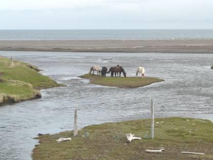
It was very quiet – the only activity was at the petrol station where we stopped to get some morediesel. There were plenty of horses in this area.
The sky had become quite blue, and it felt warm in the van, which was good for drying the washing.
We now crossed the low Hruta peninsula and had to drive south to cross Hrutafjordur and drive up the western side in order to explore the remote area known as the ‘West Fjords’.
The roads now alternated between being surfaced and gravel and the area was very wild and remote. Sometimes there was a little church right by the shore. There were little clumps of the pink moss campion, which we haven’t seen for a while. We stopped by a little pebbly beach and walked on to it, enjoying the peace and solitude. It was very tranquil, with just a few sea birds.
Just stopping by the road to explore the beach
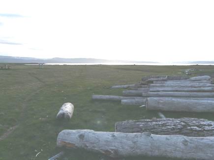
As we drove on, we noticed the large amount of driftwood, particularly logs, by the shore, and wondered where they had come from.
At 5 o’clock we pulled in to a small and remote rest area beside the water near Kirkjubol, on Steinsgrimsfjordur for the night. We had a short walk around, although it was now chilly. There were lots of birds including terns, which were nesting here, and eiders, and also some black guillemots, which we had trouble in locating in our bird book. Sea thrift was growing in the grass.
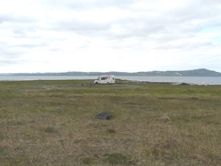
Aspects of overnighting
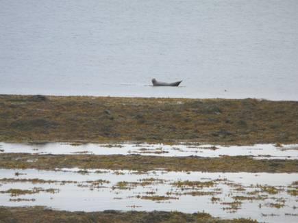
We enjoyed our wonderfully isolated view as we had supper, and Adrian commented that the driftwood logs looked like seals. At that point I said ‘one over there looks even more like a seal’. On looking through binoculars, we found that it was a seal! Adrian went out to look closer, but the terns got very excited. The seal looked like a large slug, or a baby’s double ended feeding bottle!
Tuesday 18th June Around the fjords 153 miles
We enjoyed our lovely setting with the guillemots and oystercatchers, and would like to have sat out for breakfast, but the cloudy morning made it too cool for us. It was quite pleasant by the time we left at 9.00.
We soon stopped by a little stream with a waterfall, where wagtails were bobbing about.
Stopping for a quick walk
We continued to Holmavik – a big fishing village with a large harbour with a few boats. We looked into a supermarket, but found nothing that we wanted, despite Lonely Planet saying that it was a good place to stock up (there was a lot of health foods though). Also we could get no internet access here. It was now 10.15, and a sign said that the temperature was 9°C.
We now followed the remote and desolate Steingrimsfjardarheidi valley where a stream emerged from the snow and tumbled over endless waterfalls.
Remote and snowy country!
There were large areas thick with snow, otherwise the ground was just barren - we passed one lone turf-roofed hut. There was nowhere to pull off – presumably building the road was enough. We stopped for coffee when the road reached sea level at the end of Isafjardardjup and then began driving around the first of many fjords, Isafjordur. The fjord was edged with green hills and waterfalls with just a couple of huts.
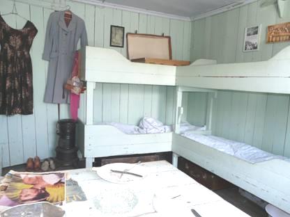
We had continual views to Drangajokull, the glacier on the most northerly peninsula, stopping for lunch at the end of the fjord, before continuing around the next one, Skotufjordur which had water gushing from the hills, and waterfalls everywhere. There was no sign of habitation until we came almost to the end of the fjord at Litlibaer. Here there was a lone dwelling which was formerly the home of a fishing and farming family, and is now part of the National Museum.
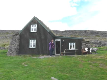
The former farmhouse at Litlibaer
The house was open for viewing by a lady whose father had been born there. She and her husband and young daughter were here for two weeks, normally her mother would be opening it to visitors. The house was quite small, with steep stairs to small upper rooms. We realised afterwards that all the photos and memorabilia must have belonged to the family of the lady we spoke to. They were happy to chat – their 14 year old daughters were in England – Broadstairs – for 2 weeks at an English school.
The next fjord, Hestifjordur had more waterfalls. Sometimes the road was high above the water, with no barriers!
There was warm sun now as we came to the end of the next fjord (past a home which had belonged to a Magnus Magnusson in the 1600s)!
We had magnificent views all around us from the picnic spot here, we sat at a picnic table for our cup of tea. We then continued to Isafjordur where we visited a rubbish ‘Bonus’ supermarket. We had trouble in locating the campsite here – it was just outside the town at Tungadalor, beneath a magnificent waterfall Bunarfoss. It was now 5.30. I even sat in the sun for a few short minutes.
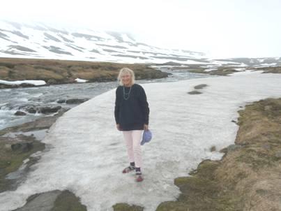
Rosie by Bunarfoss
We’d walked up to view the waterfall from close up, glad that the coach party had left. We later found out from the camp attendant that 10 coach loads had come from the cruise ship anchored in the bay.
After supper we sat in the van with our exquisite view up to the dramatic waterfall.
Wednesday 19th June More spectacular falls and fjords 90 miles
I put up the blind to see our wonderful view of the waterfall. We sat out on our chairs for breakfast in the sunshine and left at 9 o’clock.
Breakfast by Bunarfoss
We drove down into Isafjordur and finally got an internet connection – the first time since Sunday morning. At last we were able to read our recent emails, and reply to some of them. Tom had sent a photo of Mar and her large ‘bump’!
We actually had a few spots of rain at this point – our first this trip, but the day brightened again as we returned to the (empty) Bonus car park to have coffee with a view.
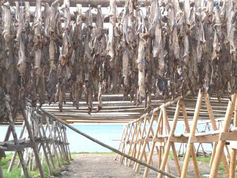
Now in sun, we headed for the tunnel – 6km, single track, with a junction in the middle to another fjord! We then drove across the Vatnadalur peninsula and up to Flateyri. There were magnificent views across Onundarfjordur to the next peninsula. Just before Flateyri we passed a large wooden fish drying rack. We stopped on our return, and found it to be atmospheric, but very smelly!
Fish drying
Flateyriwas lovely, in a magnificent setting. There were lots of old fishing boats in the harbour. We saw flowers in the gardens, which we hadn’t seen much of before. In 1995 an avalanche had killed 20 people – there is now a protective barricade. There were markers around the village, telling of its past. In 1816, 52 fishermen had been lost one night in storms. Despite its past tragedies, Flateyri seemed a loved and proud place.
Flateyri
We drove back down Onundarfjordur and crossed it on a bridge at Holt. We had a lovely lunch stop here, sitting at a picnic table with superb views down the fjord. I had walked on to the little beach of light and dark sand, and had sat in a sheltered spot on the bank. In front was an oystercatcher, and we were surrounded by snowy peaks and waterfalls. We saw snipe here, as we have in other places. The wind was quite gusty, and blew away a plastic bag, which Adrian had to go chasing after.
Adrian caught the plastic bag!
We went across the next peninsula and round Dyrafjordur to Pingeyri, again in a lovely remote situation. It seemed even more remote as we drove across the next peninsula on a gravel road. We had to ascend a hairy pass through desolate rocky ground – only the lower slopes had grass. We then descended to Hrafnseyri – a hamlet where Jon Sigurdsson (1811-1879) had been born. He is the man most responsible for Iceland having its independence, and it is his birthday – 17th June – which is the national holiday.
We drove on around the fjord – often high up, with no barrier. And then we came to road works – and had to pass the large vehicle on the outside! They were in fact grading the road, which was in a really mucky state. The van got absolutely filthy, and driving wasn’t pleasant.
On the other side of the fjord we saw the incredible sight of Dynjandi Falls, and finally we reached there. These falls are 100 metres high, and very wide, with five more falls beneath the main lot. It was a magnificent sight. We walked up beside the lower falls, and then had a cup of tea sitting on a low fence by the van with the lovely view of the falls and Dynjandsvogur Fjord.
Dynjandi falls
As we left and drove on, we passed more wonderful falls, before driving over the desolate, lunar landscape of Dynjandisheidi moor with its bare, rocky ground.
Desolate Dynjandisheidi moor
At 6 o’clock we reached Flokalundur, on the southern coast of this area, with wonderful views across Vatnsfjordur. There is very little here except a campsite and a summer hotel, but the position is superb.
The sun was now shining, so we sat outside, and for the first time ate our supper outside, not coming in until 8.30. A family with 3 children (and a dog) had arrived and put up their trailer tent. We likened their children to Felix (he was called Thomas), Ruby & Manolo. The two younger ones attempted to play badminton and boule. It took us back! The father came and spoke to us. They were from Reykjavik and had come by ferry across from Snaefellsnes peninsula to the south.
Thursday 20th June Harlequins and Hot Pool 128 miles
I had woken at 5.00am to hear something ‘nibbling’ – I assumed it to be a bird. In the morning we discovered that it must have been the sheep which had been around last night – nibbling the salt from the mud on the side of the van – thrown up from yesterday’s mucky road! One side of the van had great areas etched out of the mud!
Who’s been nibbling my van?
It was a fine but partly cloudy morning. We left this lovely campsite at 9.30, and immediately came to the surfaced stretch of road. We passed the parents from last night- out for a run with their dog – in shorts!
We found our way to the shore, where we had read that there was a natural hot pool, but had no way of finding where it was. We managed to walk down to the beach from a steep slope which had a sign for camping, and had two football goals.
A sign said that the temperature was 8°C. We drove along the coast, which is all a nature reserve, and looked across to Lake Vatnsdalsvatn where all we could see was a ‘rock’, but then as we crossed the bridge, we caught sight of something, and managed to reverse. We walked back to the fast flowing river, and sure enough, there was a group of six harlequin ducks, which breed here, and nowhere else in Europe.
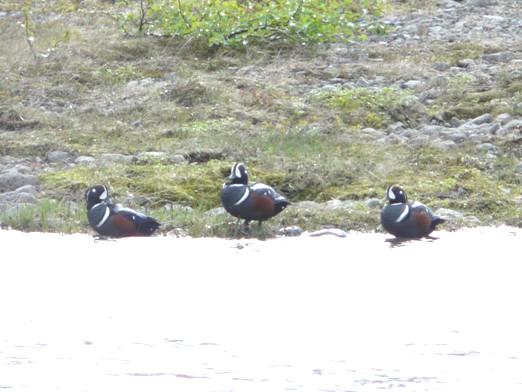
Harlequin ducks
We watched for some time, and also spied a great northern diver (loon) which also lives here. It was sunny, but the wind was icily cold, but we felt really pleased with our observations.
We continued driving along beside the beautiful shore, but there was never anywhere to stop. In the end we parked by a little waterfall which we walked to before having coffee.
Around the next inlet, the road became unsurfaced once more. A new road was being built, which meant mess and confusion! At one point we went the wrong way and ended up by the shore where a boat was loading hardcore for the road further down – and us nearly!
After an eternity, we came to tarmac again. The vistas were spectacular, with snow on the mountains, and waterfalls and inlets, but again there was nowhere to stop.
At 12.30 we found a place to pull in, high up, where arctic poppies lined the road.
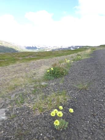
Brave arctic poppies
We now went on to barren moorland, where snow filled all the hollows. Once more we came to an unsurfaced section through remote, uninhabited land, driving across more headlands, finally reaching the tarmac again at Porskafjordur.
We had a discussion about where to head for tonight and decided to drive the 14km to Reykholar, on yet another peninsula. It sounded nice, being a great place for bird watching, and with geothermal activity, so the hope of a hot pool. In reality, it was a flat, windswept area with a pocket handkerchief sized camping field adjacent to a (paying) swimming pool. Admittedly, the views were nice, but it had none of the things we wanted – electricity was an expensive extra, and there were few facilities. We booked in, but almost immediately felt that we would be better driving on to the place originally intended for tonight, so stopped long enough to have a cup of tea and then got on our way.
We drove back to Route 60, and then through green countryside and over a long causeway and on to Laugar.
This consisted of a hotel, a swimming pool, and a pleasant campsite. On enquiring about the pool, the man told Adrian that there was a free thermal pool just up the hill, with a little hut for changing. We made our way there, changed in the tiny turf-roofed hut, then lazed in the lovely warm pool! Just what we wanted! The pool did have rather a lot of green grunge in it.
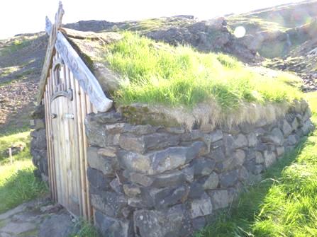
‘Gudrun’s hot pool’ and changing hut
There was quite a history to go with the pool. The area was the home of Gudrun, the most celebrated of Icelandic heroines, and apparently she had used a pool here. There has supposedly been a pool here since the year 1,000.
In the surrounding grass there were tiny violets and violas.
Back at the campsite, Adrian spoke to an Icelandic couple who told him that school holidays here last from June to August, and that the hotel is a school during the rest of the year, and used as a hotel during the summer.
Friday 21st June Bird life as we reach the Snaefell area (and the midnight sun) 108 miles
We woke late to a cloudy morning, which soon cleared to give a very sunny day. We left at 9.50 and drove south beside lovely Hvammsfjordur, through the small town of Budardular and on to the Snaefell peninsula.
We drove westwards along the north shore on an unsurfaced road. The flat landscape was often traversed by ravines containing tumbling rivers.
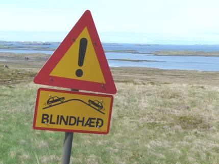
Blindhead – keep right!
There was nowhere to stop, as so often, particularly on dirt roads, but we managed to pull off onto a rough track facing the bay where we saw a feast of birds – redshank, black tailed godwit, dunlin and more. We had already seen a golden plover. We are pleased that our excellent aged bird book covers Iceland, so we can see which birds might be here. Little mountain avens sprouted brightly from the barren rocky ground.
We continued along our dirt road, stopping for lunch at a ‘picnic site’ – we did see the picnic table later – on the other side of the road. We had pulled onto a rocky promontory where we could look over the myriad of little islands to the end of Felisstrand and across Breidafjordur.
We made a hasty retreat after the water tanker had gone by, and Adrian could see the grader coming!
The dreaded water tanker – watch out, the grader is on its way!
Just before the turn off to Stikkiisholmur we came to the tarmacked road, so glided smoothly along the 10 km into the town, which is on a small peninsula jutting out into Breidafjodur. Ferries leave from here to visit various islands, and to go to the West fjords, docking just near where we had stayed at Flokalundur.
We drove down to the harbour which was edged by a dramatic basalt cliff with thrift and sea campion growing from it.
Thrift growing in the basalt cliffs by Stikkiisholmur harbour
It was a lovely busy harbour, but when we walked around we didn’t find the small town as charming as we had read. There were some well restored and painted wooden buildings but it certainly wasn’t pretty.
The good thing was, we got an internet connection and actually spoke to Emma on the phone, and received several emails – one from Lois had a video clip of Jon addressing the Scottish Parliament with a ‘moment of reflection’ about climate change!
We left Stykkisholmur and drove back to the road westwards. The next part we drove through was very different, as we drove across lava fields with lava of all shapes protruding from the ground. We stopped to take it in. The ground was very springy and spongy to walk on.
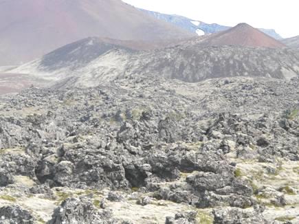
Crossing lava fields
We continued to Grundarfjordur, a tiny place in a fantastic situation, with a huge dramatic ‘lump’ called Kirkjufell and known as Sugarloaf. This area is rich in birdlife, and with snowy corrie like mountains up behind was very attractive.
Kirkjufell
We carried on now to Olafsvik, our stopping place for tonight, and found the little campsite just before the village, surrounded by lovely scenery. There was a hose for washing vehicles at the entrance to the site, so Adrian was pleased to be able to wash all the muck from the dirt roads off the van.
It was now a beautiful evening, so we sat outside for supper and then decided to walk into Olafsvik. This was supposedly 10 minutes, but in fact took much longer. We walked along by the shore, but there was no way of getting down on to the beach – it was all barricaded off by a huge rock seawall. When we reached the village, we came to a silent harbour, with large and small fishing boats. There was no sign of life at all in the village. We walked past the uninspiring little houses, each with a garden of just grass, and made our way back on a track which went up and over a small hill. Here we came to the life – bird life! There were masses of noisy terns, snipe, and oystercatchers. The terns bombarded us as we walked by – one actually pecked at a sheep which must have come close to its nest. We returned to the van, wondering how noisy the night would be.
As this is the longest day (not that it matters much here, as it doesn’t get dark) we thought that we would wait for the midnight sun. We were amused that a couple of children were playing out in the sun at 11 o’clock, but they were still playing at midnight – kicking a ball around the motorhomes!
Several people had arrived really late – a small tent came in beside us not long before midnight, and had left before 7.00 in the morning!
At midnight, one group was still sitting out! We photographed the sun, and then came back to go to bed.
The midnight sun!
Saturday 22nd June Around Snaefell 88 miles
The sun was still shining, so we ate breakfast at the picnic table outside and left at 10 o’clock. As we drove through Olafsvik, there was still no sign of life. We drove the short distance to nearby Rif (pop 157), past a sheer mountain. Rif had a silent little harbour, but had formerly been an important fishing port. It was in a wonderful setting, with snowy Snaefell up behind it.
Our first sight of Snaefell
We stopped by a nearby lake, where boards told of the local birds. Besides the terns and eiders, we saw a red necked phalarope and a dunlin. The sun was now hazy, but we had coffee at a picnic table before driving a couple of miles inland to delightful Ingjaldsholl church, set on a small hill amongst crowds of lupins, with Snaefell up behind. We peeped through the windows to see the simple church with rows of pews, a balcony, and two stained glass windows. It is apparently the first concrete church built anywhere.
Charming Ingjaldsholl church
We drove on to Hellissander, which still seemed asleep. The only life we saw was someone was washing their car. In one garden I spotted a couple of daffodils, and in another a few tulips and one had a whole mass of bright poppies.
The road now skirted Snaefellsjokull through beds of lava which protruded from the flat, grassy ground. We were now rounding the western end of the peninsula, and once on the southern side, we turned off to a picnic site, which was actually a couple of kilometres off the road down a very bumpy track. We doubted the wisdom of continuing, but did eventually come to a picnic table in amidst a whole sea of lava. It seemed to be calledKlofningur. We ate our lunch here before continuing eastwards, passing two huge lava pillars at Londrangar.
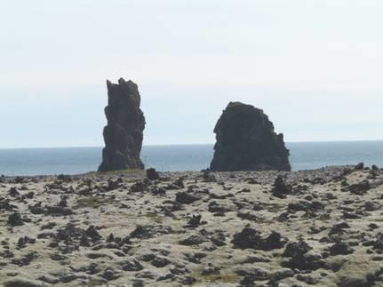
Two huge lava pillars
We stopped by the information board at Langurbrekka, which had been the birthplace of Gudridur Porbjarnardottir, a woman traveller in the year 1,000. She had travelled to both North America and Rome, and was, is seems, the first woman to give birth in America. Her first husband had been the son of Eric the Red. It is said that all Icelanders can claim that they are descended from her.
We turned off now to the tiny village of Hellnar. From here there is a delightful coastal walk to nearby Arnastarpi. We found the start of the walk, and were dismayed to see a coach disgorge its passengers, who all set off to walk down to the nearby cafe, along the path!
We started off on the walk, which was very rough, with continual ups and downs, but was quite lovely. Flowers popped up from the barren ground, including little violets.
On the lovely coastal walk from Hellnar
Coastal views were superb, with lava all around. We walked for about a kilometre before returning and driving to the other end of the walk atArnastarpi.
Here we walked to a strange monument to yet another poet, and on to the coast, where kittiwakes were noisily flying about their nests in the cliffs. The wind had got up now – it had been very warm walking. We wanted to find the monument to Jules Verne, whose book ‘Journey to the Centre of the Earth’ started at Snaefell. We drove down towards the little harbour, and hidden in a field located the strange memorial – a lone wooden pole above a small dip, with a signpost to various places around the world (but not London) beside it.
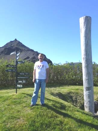
Adrian by the Jules Verne monument
Now it was time to continue eastwards, on flat, level ground, lava strewn at first. On the landward side, the hills were a myriad of different colours. We passed several waterfalls, including one at Bjarnfossural, then continued through sometimes agricultural land until we reached Eldborg, where we were staying tonight.
The campsite is in a large field adjacent to a hotel, and like the other sites, no signs to tell you anything. We walked around the area after supper, but were none the wiser!
Later there was an eerie full moon.
Sunday 23rd June Basalt columns and more impressive falls 109 miles
It was a lovely morning so we sat outside for breakfast, and I even washed up outside. It was only marred by flidgies flying in our faces.
The group of six young people camping in small tents beside left just before we did, soon after 10 o’clock. We could see snow crowned Snaefell as we set off.
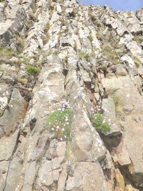
We drove back to the main road, then took a track opposite to view the impressively tall basalt columns at Gerduberg. Brave little flowers emerged from the barren lava ground – moss campion, mountain avens, and something that looked like stitchwort.
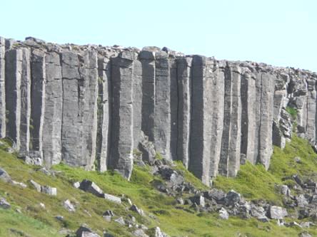
The huge basalt columns at Gerduberg
We now drove through flat land, sometimes with lava fields, but with no places to pull off. Coffee was had in a parking area beside piles of gravel while we pondered our onward route.
We soon came to the town of Borganes, in a lovely situation between mountains and sea. We passed a Netto supermarket at midday, when it opened, so were able to get some much needed shopping (At suppertime, we found that the frozen peas we had bought were whole large pods of peas!). Afterwards we drove back a short way to have our lunch beside the sea, in what was actually the campsite! The tide was out, and it had become very windy.
We had decided to drive up the Borgarfjordur Valley, which we found very pastoral. We stopped at Reykholt where there was a large building containing a tourist information, and supposedly a museum about one of Iceland’s important sagas, but this appeared to be closed. Nearby was a dear little church, beautifully restored, and containing a 600 year old organ which used to be in Reykjavik Cathedral. We climbed the stairs to the small balcony.
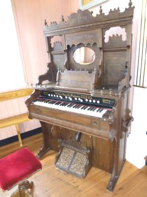
The ancient organ in Reykholt church
We continued driving along the valley, which we found very tamed after the wildness we have been visiting.
It was a surprise to come to Hraunfoss, where we had to join the other tourists on a Sunday afternoon. We walked around the area which had wonderfully photogenic falls emanating for a long way along a cliff top of lava into the turquoise milky water of Hvita River.
Hraunfoss
The path went on to further falls called Barnafoss, reminding us of waterfalls in the Rockies in Canada. We were amused by the low ropes to keep people from walking on the surrounding soil, but absent right above the vertical drop to the river! There was a little bridge across the falls, and very rough steps on the other side.
We now drove on past Husavell, which we hardly noticed, to the end of the tarmacked road. From here there were vast lava fields and a massive area of glaciers.
It was time for us to return, back past Reykholt and then by a road north of the Hvita River to Varmabad, which we reached at 5.15.
Monday 24th June A mostly useful day 86 miles
We’d worked on the website until very late last night, so didn’t rise very early! We did some more work on it before leaving, soon stopped at a viewpoint where we climbed up to see a rather cloudy vista of mountains.
We continued to Akranes which is now connected to Reykjavík by a 6km tunnel under Hvalfjordur, avoiding the almost 50km circuit. We made our way to ‘Iceland’s beach’ – a light brown beach in not a very pretty position! It is fringed by the chimneys of the fish works at the adjacent harbour with some unattractive flats up behind! Parked on the road was a trailer tent, with gas bottles still attached – it looked like its permanent parking place!
Gushing constantly onto the beach (deserted on this cloudy day) was a shower of geothermal water!.
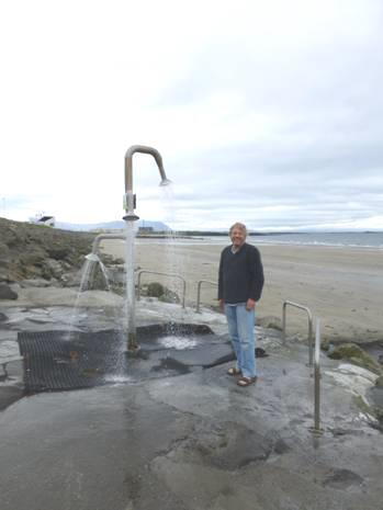
Adrian by the geothermal shower
We walked across the wide sands to the water before coming back for lunch
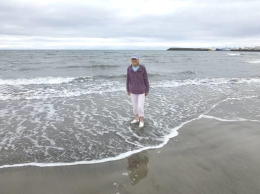
Rosie paddling on a beach in Iceland!
A young lad in wet suit then came down and enjoyed the water.
As we left, a large group of young people were haymaking just behind the flats.
We had a problem to solve, as a light had been coming on in the van, and Adrian wanted to get it serviced. His manual indicated a Fiat dealer on the other side of Reykjavik, although the campsite we intended staying at tonight was this side. We thought it best to head for the garage to try to get it sorted, so made for the tunnel.
This tunnel has a toll – we were glad that it was only 1,000 krone. Then it was on past the urban sprawl of Greater Reykjavik, looking much like any large town, despite its lovely location.
When we reached the trading estate and found the address, we discovered that it is now a rental car hire place! The very nice gentleman in there located another address for Adrian (which was problematic for his satnav, as it started with an Icelandic letter!) so back we came to the near side of Reykjavik. At least this time we drove along by the front, which was more pleasant.
This wasn’t actually a Fiat dealer (it seems that there aren’t any in Iceland now) but a tyre place, however the man said that they could do an oil change. He said that we would have to wait half an hour, but in fact it was an hour before they started it, which was a bit frustrating, as we couldn’t settle to anything. Then it was a half hour’s job and we were on our way to the campsite at Mossfellsbaer, where we arrived at 5.30.
Hermitage to Reykjaik, Iceland


