
Saturday 1st September On the road again 100 miles
We left Calgary late pm.
Once out of Calgary, we drove through fields of golden corn glistening in the sun, under the pale blue sky.
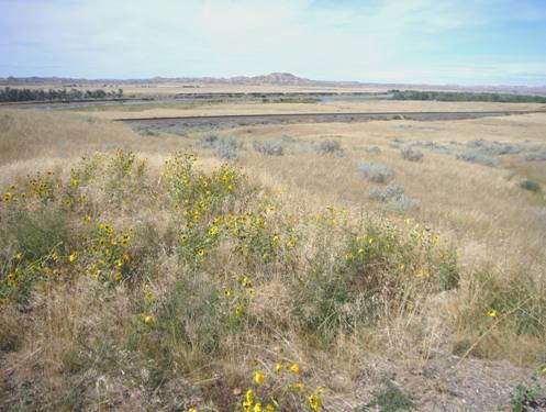
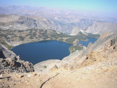
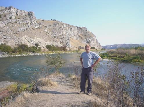
Absolutely nowhere to pull off. Last few miles to Dorothy on unsurfaced roads, then came to Red Deer River, looking dramatic as it carved through the green hills. We remembered the scenery from when we visited this area with Simon in 2001.
Stopped under the bridge by the river.
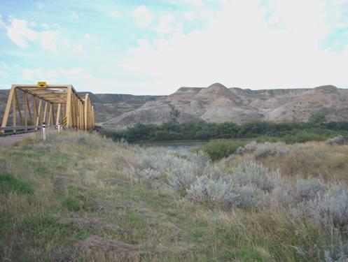
By the Red Deer River near Dorothy
We heard a lot of animal sounds when we looked out at bedtime.
Sunday 2nd September Into Saskatchewan 227 miles
We left at 9.30, leaving the area of the Red Deer River, and driving east across the flat, empty grasslands. Just a few derelict wooden shacks dotted the landscape.
We came into Saskatchewan at Alsask, where there was nothing but a petrol station and a large rest area. It made us think of places on the Nullabor, where there was only a road house. We got petrol from the chatty lady at the petrol station, then had lunch sitting at a picnic table in the rest area, so we utilised all the services! It was very warm, but windy.
At Kindersley we went into the tourist information to get a map of Saskatchewan. The little old lady was a ‘stand in’, but tried to be helpful, and was fascinated by our travels. The map cost $1.75. Adrian went out to get some money, and had just paid for it, when I found a voucher for a free map in a booklet. The lady wasn’t sure what to do, but gave us our money back!
We continued through the empty countryside.
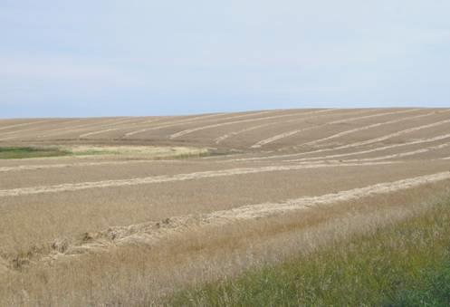
Patterns of Saskatchewan wheat
The new map had rest areas marked on it. We didn’t find one at Rosetown, as marked, but some miles further on at Harris we came to a large grassy rest area, just right as an overnighter. We sat out in the hot sunshine for a cup of tea, before walking around the area and seeing lots of deer footprints.
We had a barbie, and enjoyed our quiet situation.
Monday 3rd September The ‘Pretty City’ of Saskatoon 86 miles
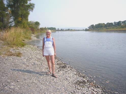
It was a lovely morning. We sat outside to have breakfast, then drove the fifty miles into the so-called ‘pretty city’ of Saskatoon. The outskirts certainly didn’t deserve that title, being the usual ‘American grot’, but the centre surrounds the South Saskatchewan River, which is flanked on both sides by green parkland and trees.
We had coffee above the river – being Labour Day, we could park easily and for free. We watched a large fluffy yellow caterpillar crawling through the grass, looking like a moving catkin.
We found that Saskatoon has free internet connection, so we received a few emails. The Ukranian Museum was closed on Mondays, so we set off to walk along beside the river. The town had a very low-key, laid back feel. We called in at the Meewasin Centre, where we saw a bit about the history of Saskatoon. It dates from 1883, when a group of the Temperance Colonisation Colony from Ontario founded a settlement here. Their colony didn’t survive, but the town did!
We returned to have lunch at a picnic table above the river. Everything was perfect – it was beautifully warm – but we had the usual wasps and mosquitoes to annoy us.
We now made our way to the Western Development Museum, using our ‘2 for 1’ voucher to get in. It was an excellent visit. There was a ‘mock up’ of a 1910 Saskatchewan town, with superbly done-up houses and businesses. It was set out as a street, rather like Beamish in England.
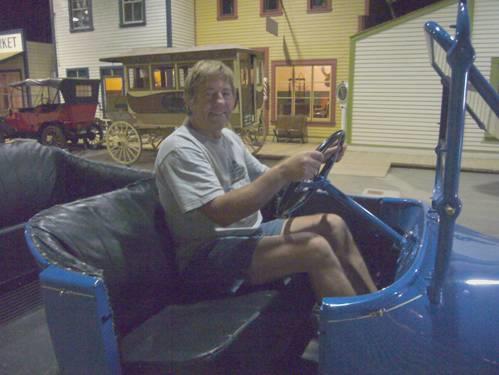
Baby I can drive my car!
There were extra areas of farming machines and of vintage cars, and a newly done section on the settlers of Saskatchewan. It was interesting to see the similarities with other places – the effects of World War 1 and the Spanish flu which followed it, and the devastating damage of the dustbowl of the thirties, followed by World War 2.
We spent the rest of the afternoon here – a shame on such a lovely day – but at 4.30 we drove out of Saskatoon, stopping at around 5 o’clock at a lovely informal rest area at Elstow. We walked around, seeing a group of Northern flickers (birds), and enjoying this rural setting in the lovely weather.
Sadly our idyll was ruined by flies – hundreds of them. We were killing them ten at a time, and although we cooked our meal on the barbecue, we had to come inside to eat.
Tuesday 4th September Healing Waters 140 miles
We decided that it was too windy to eat breakfast outside, so we don’t know how bad the flies would have been! We were able to dump here, and left at 9.30.
At Plunkett, we took a road south towards Manitou Lake. The surface left much to be desired, and after a while, it became an unsurfaced road. We came to a diversion sign, lying on the ground, and just before we reached Manitou Beach, the road was closed! We had driven across a causeway over the end of the lake, and could see that the water had been very high. We now made quite a long diversion (unsigned), and finally came down to the small ‘town’ of Manitou Beach. Lonely Planet had said that you could swim in the lake, which had underground springs exuding health-giving minerals. I felt the water, and it felt quite cool. Also it looked very mucky with weed. We had coffee sitting by the lake – the weather was warm and very windy, making us think of Namibia.

A bit too cool for a swim!
We made our way to nearby Manitou Springs Spa, which had several indoor pools filled with the ‘health-giving’ water. It was a mucky brown colour (golden yellow on the notice!), and was considerably more expensive than our 2 year old book suggested, but we still decided to give it a go. I had asked if there was a seniors rate, which was rather a joke, as all the other ‘guests’ were of the white-bodied, Zimmer frame brigade!
You couldn’t swim in the water, as, rather like at Droitwich in England, your legs rose to the surface. We enjoyed floating in the various pools, managing to float a bit on our backs.
Feeling rejuvenated, we came out, and realised that there had been a sudden storm – we had heard noise while we were getting changed, but until then there had been no suggestion of a storm.
As we left, we got an internet connection, and received a message from Hil with the sad news that Doug had died today. We immediately rang her, and although the connection wasn’t good, we were able to tell her that we were thinking of her.
We now drove south in sombre mood. The weird lighting of surrounding storms adding to it – a deep grey and yellow sky, looking eerie above the fields of golden corn. Every now and then, lightning would flash across the clouds. We passed a ‘breakers yard’ selling old parts – of combine harvesters – it could only happen in Saskatchewan.
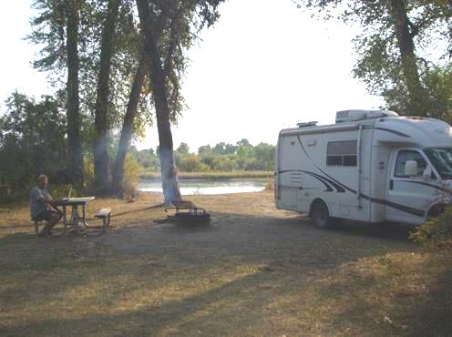
At 3.15 we came to a rest area at Arm River, which cut a deep swathe through the otherwise flat landscape. Adrian thought it too early to stop, so we ‘proceeded on’ getting some much needed fuel at Findlater (the only service of that ‘place’). It had just started raining and so Adrian said to the woman attendant that he bet that people were glad for some rain as it was so dry. Just to confirm that everything here is farming, she said ‘it’s too late for us now, all it’s doing is stopping the harvest’! We continued to another rest area a few miles on. This was less attractive, being close to the main road, and even had a ‘no camping’ sign. We had a cup of tea while we contemplated what to do – the lightning was still flashing, and thunder crashed above us.
We decided to return to Arm River, where the storm had passed by the time we arrived.
In fact we had an unexpectedly wonderful evening. Someone had left some wood, so we lit a fire and cooked our chicken and potatoes. It was still and calm and peaceful. As dusk fell, we had the sounds of nightfall – dogs howling and cicadas. We came in at 8.45.
Wednesday 5th September Regina and Moose Jaw 162 miles
We ate breakfast outside on a fine morning before heading for Regina, the Provincial Capital of Saskatchewan. As we crossed the Qu’Appelle River Valley (whatsaname), we noticed the autumnal yellow of the trees.
We reached Regina soon after 9 o’clock, but by lunchtime hadn’t got much to show for our efforts. We passed a liquor store, which wasn’t yet open, so went on to get an internet connection so that we could send the emails I had written yesterday. By then the shop was open, so armed with a couple more bottles of wine, we made for Safeway opposite, where we bought some fresh bread and donuts. We didn’t get round to eating these, as, after a quick visit to the adjacent drug store, and speaking to the pharmacist, we decided to visit the Doctor’s clinic next door. I felt that I needed confirmation that my eye was OK after the shingles I’d had a couple of weeks ago.
These clinics are never quick places – even when you’re shown to a consultation room, you have to wait there for ages. I could hear an amusing conversation between another patient – a lady of 81, who was getting hot flushes, and the tall Indian doctor. The lady was very deaf, and the doctor’s pronunciation slightly different, so the whole conversation was interspersed with ‘eh’’ and ‘what did you say’.
Eventually I saw Dr Das, who had been born in Calcutta, but had practised in Britain for 25 years. He was very pleasant, and assured me that everything was OK. He only charged a small fee.
We drove on through the centre and out to the green space of Wascana Park, and had lunch beside the lake. It was a bit like Hyde Park, but without the character. Afterwards we visited Wascana Place, the administrative building, from the balcony of which there was a view across to the Legislative Building (like a US capitol building).
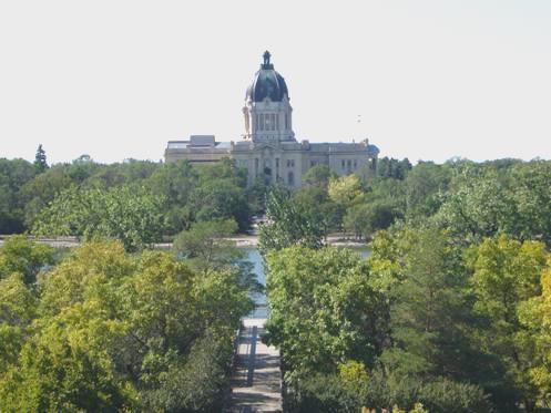
Regina
After looking out again from the lake, we left Regina at 2 o’clock and drove the 50 miles to Moose Jaw. This town apparently had a colourful past, but although there are a good many brick buildings, the place didn’t come alive to us. We walked around the central area, and stopped to enjoy an icecream, sitting in the warm sunshine. It amazed us that all parking was by meters, both beside the road, and in the car parks. We solved the situation by parking in Safeway! Even there the parking limit was 1 hour.
We now left to drive south, as we intend visiting the so-called badlands of Saskatchewan. We needed petrol, but hadn’t stopped in Moose Jaw, as we also needed water, and Adrian was hoping to get both together. However, we drove on through more and more rural areas, with barely a house, let alone a petrol station. As we saw no chance of getting any petrol en route, we reluctantly turned round and drove the 15 miles back into Moose Jaw. Even then things weren’t easy as the machine at the garage didn’t recognise Adrian’s card, so paying took a very long time!
Eventually we set off south again, pulling off beside the road in the middle of nowhere at around 5 o’clock, near a derelict house some miles from Spring Valley.
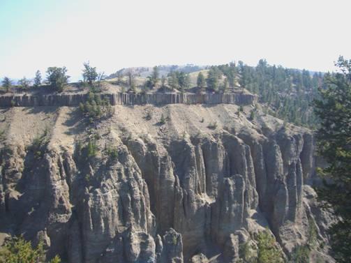
Thursday 6th September Badlands not as good as we’d hoped 191 miles
The few drops of rain in the night became heavy rain in the morning, and it remained a mostly wet day. We didn’t leave until gone 10 o’clock, but soon stopped to eat the donuts which we’d bought yesterday.
At Willow Bunch, an attractive little town, lost in time and remoteness, we tried unsuccessfully to get an internet connection. As our mobile phone has stopped giving us notice of emails, we needed to know from Trish and Pat that our plans to visit them were OK.
There was a road off here to some petroglyphs, but we didn’t fancy the 18 km of unsurfaced road to get there!
We pulled in for lunch beside piles of road chippings – these rural roads have nowhere at all to pull off – they are just straight roads crossed by occasional tracks.
At Coronach we did get an internet connection, and luckily our plans are alright. Adrian went into the small store and was able to get some drinking water – we are desperately low on water, but have found nowhere to get any. I photographed here one of the old wheat elevators, of which we have seen several today.
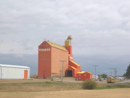
Colourful Wheat Elevator
We had seen 2 deer, and several birds of prey, which we imagined might be prairie falcons.
We had been hoping to see something of the Badlands – our reason for coming this way – but although we saw some hills in the distance, there was nothing of the badland feel, which was disappointing. The scenery was pleasantly rural, but nothing more.
We had missed seeing from the map that we had to drive along some gravel sections – in fact one stretch of road with several unmade up bits. This added to the muckiness of the Bam, on a damp day!
We turned into the charming little town of Torquay, but could see nothing of the advertised picnic site, so continued towards Estevan through more affluent countryside now.
At 5.20 we pulled into another area with piles of road chippings. Unlike the one at lunchtime, this one didn’t have a ‘No Trespassing’ sign, so we settled in for the night.
Friday 7th September A day with friends 24 miles
We left at 9.30 on a fine morning and drove into Estevan. The centre of this small town was dug up with road works, so this detracted from any attraction it might have had! We did find somewhere to leave our rubbish, so it served a small purpose!
We headed out now to Trish and Pat’s place near North Portal. We had first met Trish and Pat on our Central American trip in 2003, and had visited their house 3 years ago. That was the last time we had seen them, until they happened to be in Calgary when we were at Simon’s 10 days ago.
We had forgotten that this whole area was a coalmining area, mining for lignite – in fact this is the name of the town just over the border in USA.
We arrived at Trish and Pat’s a little earlier than we’d said, and both were still out (in Estevan)! Pat returned first, so we chatted to him, and then to Trish when she returned.
After lunch we all walked out around their land, right down to the pond, where beaver activity was very apparent! One tree was newly gnawed through, and another was half gnawed.
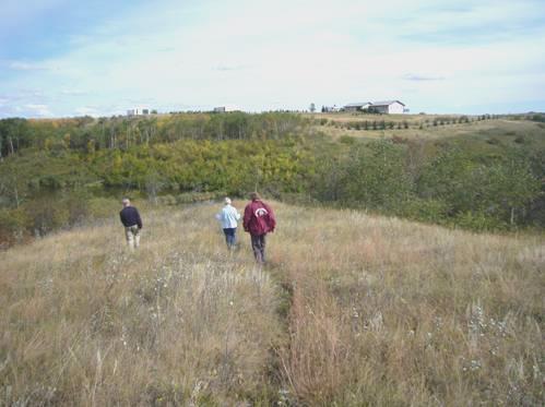
Walking around Trish and Pat’s land
We returned for drinks on the terrace, and after supper all had a sit in the hot tub before retiring for the night.
Saturday 8th September Back in the USA, and to the Lewis and Clark Trail 145 miles
We left at 10.30 to start out on the next phase of our trip – the continuation of our trail, following the Lewis and Clark expedition of 1804-6.
We had phoned Tom to wish him a Happy Birthday for tomorrow.
We drove the few miles to North Portal, and then entered the USA at Portal, ND. Being a small border crossing, the border guards had plenty of time, so one inspected our van, but we had eaten up almost all of our food, so all was well.
We soon turned westwards, through flat, agricultural scenery looking very similar to that just north of the border! We stopped for coffee, while we got ourselves back into our USA mode – trying to find relevant maps etc.
As in Canada, it was impossible to find anywhere to pull off the road for lunch. The marked picnic site north of Williston didn’t exist, so we found ourselves in Williston, where Adrian spied a sign to Spring Lake Park, which made a pleasant lunch stop. There was nobody else about, despite being Saturday, and we missed not having Ruby and Felix with us, to make use of the large children’s playground!
We drove on in Williston, where we made our first visit to Walmart for a long time. We stocked up on food, got some of our photos printed, and had a general look around. Williston is in western North Dakota (and actually in a different time zone). Montana, a few miles west, doesn’t have sales tax, so we were amused at the checkout to find that Montana residents were exempted from sales tax when they showed their address. The lady asked us if we were from Montana, and when we said that we were from England she said that it brightened her day!
It was now 4.00 (our time) so, after getting some petrol (cheaper than Canada) we drove out of Williston to the confluence of the Yellowstone and Missouri Rivers, where we pulled into the boat park, with a lovely view of the rivers.
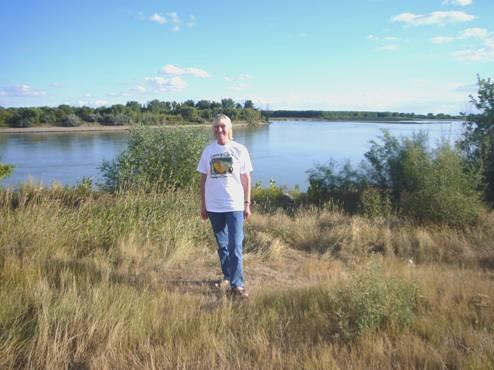
The Yellowstone River joins the Missouri
Sunday 9th September Fascinating forts – in and out of Montana and North Dakota 87 miles
The stars had been wonderful at bedtime, but that meant that the night was cold! At least it was quiet, despite being Saturday night.
It was a beautiful morning, and warm in the sunshine, so we ate our breakfast outside in this splendid situation above the Yellowstone and Missouri Rivers.
We went on into the Confluence Interpretive Centre, where there was a well stocked gift shop, and maps to intrigue us, including a copy of one made by David Thompson, and used by Lewis and Clark for their expedition.
Just close to here was Fort Buford. We made our way there for a quick look, as it dated from after L&C’s time, so we hadn’t bothered with the ‘tour’.
We hadn’t bargained on Arch, the guide for the fort, who approached us, and held forth with info on L&C for the next ¾ hour! I was wearing my L&C T-shirt, and he soon realised that we were really interested, but he was happy to chat on anyway! He was very knowledgeable about the expedition, and had played the part of Sergeant Ordway (the only member to write a journal every day) in the bicentennial celebrations.
Fort Buford had some renowned ‘prisoners’, including Chief Joseph and is remembered as the place where Chief Sitting Bull surrendered.
Another couple arrived, so we said farewell and went off to have a late coffee. There was a little free campsite here – it was where we should have headed for last night, but at least our view was nicer! After having coffee here, we wandered across to the old cemetery – in fact, we had to drive around to it, as we discovered a deep canal in the way, dating from an earlier irrigation scheme.
A few miles further on was Fort Union – a National Historic Site, as it is the oldest trading fort in USA. To access it, we had driven just into Montana. We had to walk quite a distance from the car park, and walked back into North Dakota again!
We had an excellent visit here. Lewis and Clark had suggested this as a suitable site for a fort, and it had been used to trade with the various Indian tribes from 1828 until the 1860s. It was fascinating to find where goods had come from to be traded for the furs – steel knives from Sheffield, woollen blankets from Witney, beads from Venice, little bells from Leipzig. The costumed guide here again chatted to us for a long time – only one other person visited while we were at the fort. The fort had been reconstructed, using the foundations as a guide. Numerous artists and writers had visited during the steamboat era, including Audubon, Bodmer and Catlin, and their work had been invaluable in the reconstruction of the fort, and the furnishing of the rooms.
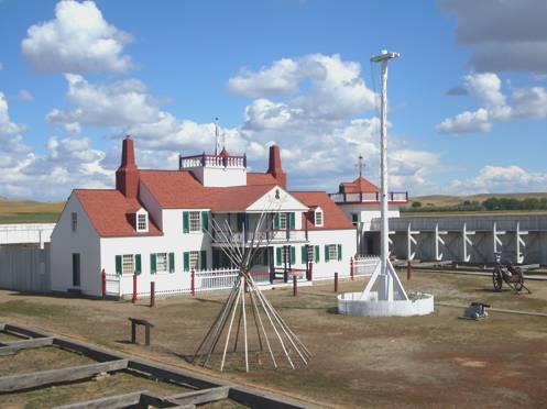
Fort Union
By now it was past lunch time, so we returned to the car park (back in Montana) and had lunch at a picnic table. We had seen a sign saying ‘Lewis and Clark Legacy Trail’, so before leaving, made our way back there (in North Dakota!) We imagined that it went right down to the river, which was now further away from the fort than in the time of its heyday. The path started off as a newly concreted track, which soon became a wide grassy track – and then ended after about 50 yards! This was where the river bank had once been, but we could see nothing!
Back to the Bam (Montana), then Adrian decided to drive back to the confluence, as he could then start videoing the L&C expedition again, after our month’s absence. This was into N. Dakota once more, and theoretically on Central Time – now 4.00pm. We ignored this, and finally left, crossing the Missouri River, and after a few miles crossing our August route at Fairview, where we came into Montana once more. We drove down beside the Yellowstone River, through a wonderful area of badlands, to make up for those we didn’t see in Saskatchewan.
We caught the edge of a rain shower on this otherwise fine day, and arrived at Glendive, where we pulled into a little ‘City Park’ near the Yellowstone River, but separated from it by a levee.
Monday 10th September Wide Montana Skies 164 miles
The fine morning started cool, but soon became warm.
After breakfast we visited neighbouring Albertsons, which we found to be good and fairly cheap. We spent the rest of the morning in Glendive – getting an internet connection, finding the post office, obtaining more money and phoning Seattle about storage for the end of this trip.
We had trouble finding our way out of the town, when the perfectly good road suddenly ended, so we returned and took the motorway south, following theYellowstone River.
We turned off for lunch at a rest area on the ‘Bad Route Road!’ It was warm, but very windy, so we reluctantly sat inside. At least then we couldn’t hear truck engines running, and the man mowing the grass!
We set off again and crossed the Yellowstone River. Unlike the Missouri, the Yellowstone is a wild, untamed river, so we could get more of an impression of what it was like when Clark returned this way from their coastal winter camp.
What we really enjoyed was the splendid ‘badland’ scenery, and the open prairie countryside.
Scenery near Terry
At Terry, we turned off the motorway, and near where the Powder River joins the Yellowstone, we came across an unmarked pulloff with views over the railway and across the Yellowstone River to the never ending empty hilly country beyond. There were boards telling of the past history of this area, including the passage of Clark, the bold early settlers, and of Custer, who had camped here prior to the Battle of Little Bighorn. (We had visited that site, about 100 miles from here, on our return from Alaska in 2002). In 1938 there had been a terrible rail tragedy, when a flash flood arrived just as a train was crossing the bridge over the Powder River. About 48 people died, and many more were injured.
We continued on the motorway, turning off to drive through the small prairie towns of Miles City and Forsyth. Montana is the fourth largest state in USA, but has a population of only one million!
At Hysham, where Clark remarked that he had at last lost sight of the snow covered Rockies, we followed directions to a free camping spot, but in not finding it, we actually made our way down a gravel track to stop right by the Yellowstone River. We walked around as much as we could, revelling in our warm and peaceful solitude.
We were just cooking the steak on the barbie, and enjoying sitting outside with our drinks, when along came Jake in his mucky pick-up. He was off to collect some wood. He was a good looking young chap, who had moved here from Utah 5 years ago, and now farms sugar beet. He told us lots of details about sugar beet farming. He said how much urbanisation was affecting Utah – at least here it was still really rural.
By the time he had left, the flies had moved in, and also the mozzies. We had decided to eat indoors, but afterwards Adrian had got a fire going down by the river, with wood that he had collected.

Top spot - Hysham
A treasured evening followed, as we sat out in our isolation, as colour faded from the sky, and myriads of stars came out. We had seen a lone white pelican on the water. Top spot!
Tuesday 11th September Pompeys Pillar 104 miles
It had become really cold just before morning, but a beautifully hot and sunny day followed. We sat outside to have our breakfast – perfect – no flies, no wind, no noise, just us and the peaceful river.
As we drove back through Hysham, we passed the ‘City Park’ which we had been looking for last night – it was south of the town, not north! Anyway, our spot was nicer!
Continuing down the motorway, we turned off to visit ‘Pompey’s Pillar’. This place is of interest, as it is the only remaining physical sign of the L&C expedition, as Clark had carved his name on it in 1806, and it is still there. He had in fact named it Pompys Tower, but Biddle, who transcribed the journals in 1814, had changed it to Pompeys Pillar. It is always said to have been named for Sacagawea’s young son, who Clark supposedly called Pomp. An interesting alternative to this is that it was named after Pompeys Pillar, a 90ft red granite column dedicated to Pompey in 297AD, which had been discovered in Alexandria, Egypt in 1803.
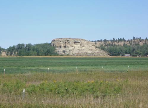
Pompeys Pillar
This ‘pillar’ is 150 ft high, and is now mounted by a solid wooden staircase. We climbed to the top, from where there were excellent views, but not the thousands of bison and elk which Clark had seen. We could see Clark’s signature, covered now by a glass plate.
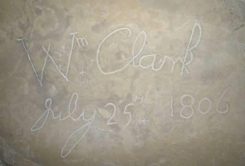
Clark’s signature
There was a recently constructed Visitors Centre, which to us seemed just ‘modern and posey’ – give us the plain and simple stuff. There was a film of this section of the expedition, unnecessarily romanticised. It was unfortunately positioned so that light shone onto half of the screen.
After climbing the tower, we climbed back down and viewed replicas of the 2 canoes which Clark had constructed for this part of the homeward journey. We walked on to the Yellowstone River, and back through the woods. The previous carpark was much simpler, with picnic tables nearby. Now there was a smart, tarmacked parking area. We resorted to having our coffee sitting on a large rock here before leaving.
We drove on the few miles to Billings – the largest town in Montana. We remembered driving past Billings in 2002 on our journey from Calgary to Dallas. Our visit this time was a functional one, as Adrian wanted to see a repairers about a problem with the Bam engine. He had been concerned about a warning light which has frequently come on. Hence we drove through much of this vast and spreading town, searching out one repairers after another. The end result was that we could have nothing done today The last place we visited had connected a computer to the engine, and found that it had been misfiring a great deal, but they didn’t think that it would cause us too much of a problem.
Now 2.45, we decided to head out, stopping at nearby Laurel. It was really hot now (84ºF), so when we crossed the Yellowstone River, and saw a sign saying ‘Riverside Park’, with camping, we pulled in. It was a rather simple and run down place, and it was difficult to find out who was in charge, but we finally found a lady to pay our $10 to, and sat under the huge cottonwood trees with a cup of tea.
There were showers here, but you had to get a key from the lady, which Adrian did. We felt very refreshed afterwards, on such a warm day!
We cooked our meal on the barbecue, but Adrian had found some wood around, so afterwards we lit a fire. The surroundings were not as attractive as last night – we looked out to chemical works – but the sky was a lovely colour. Again it felt very ‘French municipal’. Quiet it wasn’t though – a boat had sped around noisily, a game of American football had been going on, and at bedtime there were trains!
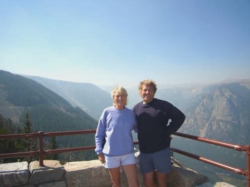
Wednesday 12th September Breathtaking scenery on the Beartooth Pass 103 miles
Today we are leaving the Lewis and Clark trail for a while, as we want to make o return visit to Yellowstone National Park, as in 2004, we had rushed the northern part. L&C hadn’t come across the geysers which now form the park, and when one of the men, Colter, visited the geysers after the expedition, the people he came back and told just ridiculed him!
We planned to take the road over the Beartooth Pass, and couldn’t have wished for a better day. After breakfasting outside, we set off for Red Lodge, following up beside aptly named Rock Creek, which joins Clark’s Fork and then the Yellowstone River.
Red Lodge is an attractive town, which began its life as a coal mining town in the late 1800s. After the coal deposits diminished, a road was built in the early 1930s, as a job creation project, linking it to Yellowstone National Park. This sounds quite simple, but we were to find out that it traversed amazing terrain, and went through a pass at nearly 11,000ft. Red Lodge would seem to have got a new life now as a ski centre.
We sat on rocks beside the creek to have our elevenses before setting off from Red Lodge on our spectacular journey. We wound up and up through the alpine scenery, stopping several times to enjoy the beauty and grandeur. Many of the slopes were scree covered, where ‘falling rocks’ signs seemed very relevant!
On the Beartooth Pass
As we neared the summit, the land was fairly flat and barren, sometimes rock-strewn. Tall flimsy-looking snow poles lined the road. We saw large patches of snow in areas sheltered from the sun and some freshly fallen snow lay beside the road.
Lakes on the Beartooth Pass
There were numerous small lakes – we had lunch beside one, and afterwards walked around it. The path only went halfway around, so we made our own way through the boggy ground. We were delighted to see a Clark’s Nutcracker (named after William Clark – it was one of many birds which he had first identified). The scenery made us think of the alps. Beartooth Pass is actually in Wyoming. We stopped briefly by Bearpass Lake, and were now in the Shoshone National Forest. As we descended a bit, a few aspens in their autumn colour contrasted beautifully with the evergreens.
We stopped again to look down to Clark’s Fork of the Yellowstone, which starts its life near here. We looked up to Pilot Peak (11,708 ft), and stopped by the delightful creek.
Pilot Peak
We would have stayed here for the night, but a caravan and tent were already here, so we drove on a short way to Fox Creek Forest campsite,
where we pulled in and enjoyed the hot sun and wonderful mountain scenery.
Everything was ‘closed’ – toilets, water, dump, but we did have electricity. After the sun went behind the mountain it became rapidly cold, and I got quite chilled as I tried to finish labelling the photos outside. Adrian had enormous trouble getting the fire to light, and then the smoke kept moving around, and really stung our eyes. Finally it was a really good fire, and we sat out in the quiet until quite late.
Thursday 13th September Many delights in Yellowstone National Park 91 miles
When we looked out, heavy cloud hung low, so we couldn’t see the mountain top. It felt very cold, but the drear morning was brightened by seeing a mule deer grazing close by. We braved it to eat breakfast outside and then saw another deer soon after we left.
We drove along, on the grey morning, but as we crossed Colter Pass (8,000ft), we had a wonderful vision of mountain tops in the sunshine – it made me think of the Land of Oz.
The road now went for a few miles through Montana, before returning to Wyoming. We came to the pleasant little alpine town of Cooke City, where almost everything was closed, or about to be. The sun was breaking through, but it still felt very chill as we walked around – we resorted to wearing socks for the first time for ages.
Very soon we came to Yellowstone National Park – an area of it that we hadn’t visited before. Almost immediately we saw a large bison. Although we saw hundreds more later on, this one gave us quite a thrill. In fact there are apparently 2,000 bison in the park, but in the 1880s there were only 40 left.
We pulled in beside pretty Soda Butte Creek for coffee while we discussed our proposed route through the park. The sun was still battling with the cloud, and it felt cool.
Soda Butte Creek joined Lamar River (which then joined the Yellowstone River). The Lamar River was obviously a prime fishing location, but we just loved this beautiful, unspoilt valley. There were no buildings at all – except for a few rustic wooden huts, now used as a ranger station. It was here that we saw the vast herds of bison. While watching them, we heard people talking, and realised that there was a grizzly bear in the distance, just across the river. We watched for some time, using our binoculars. We had also seen a herd of pronghorns grazing in the grass.
We now turned south to take the road towards Dunraven Pass, which had been closed for roadworks last time we visited. This time roadworks were still a problem. We had come across some before entering the park, and were delayed by some unexplained hold-up while ascending the pass this time. On our return about an hour later, a whole section had been resurfaced. A flotilla of trucks were reversing up the hill, and laying the surface at a rate of knots!
A short distance along the road we came to a superb area of beauty and geological marvels. We were disappointed with the Parks leaflet, which didn’t mention many of the ‘sights’. We pulled in to walk a short trail which gave views down to Calcite springs in the river below. We could see (and smell) them, and the surrounding area was bleached pinky white. The scenery of this gorge was fantastic, although it doesn’t rate as one of the popular places in the park. Basalt columns surrounded the top of the deep, steep sided gorge. My camera was doing its work!
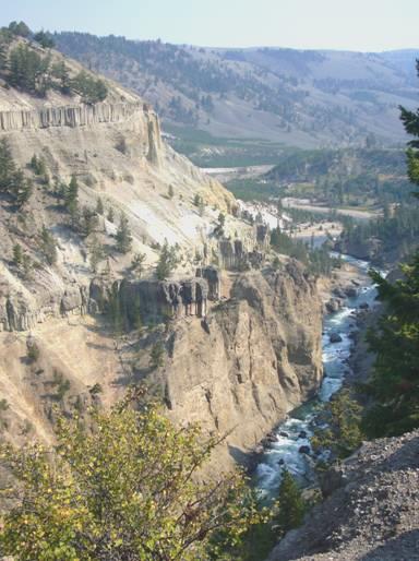
Gorgeous scenery!
We carried on up the pass, intending to have lunch in a picnic area on the other side, but in fact we stopped before that. While I cooked bacon and egg, Adrian read out our 2004 diary. We had been delighted then with the scenery, and had noted the number of buffalo. Then, like now, we hadn’t enjoyed the number of dead trees left standing and lying around from previous fires.
We hadn’t found this road as scenic as others, so having reached the top of the pass, we began our planned return journey.
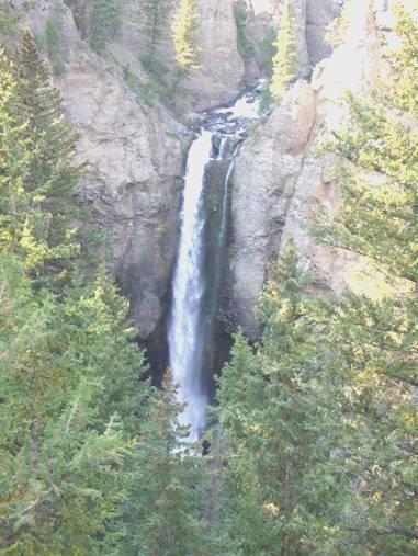
Tower Falls
We stopped this time by Tower Falls, close to the gorge area we had stopped at before. The water from Tower Creek drops 132ft, and looks quite spectacular as it makes its way through an area of hoodoo type formations.
Having enjoyed our view, we sat and ate an icecream on this now hot and sunny day.
More of the basalt wall
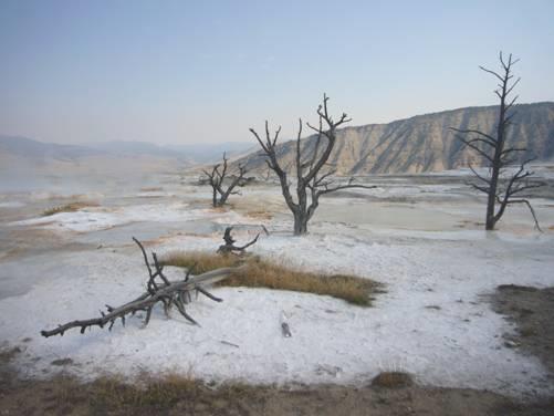
We stopped several more times to view and photograph the basalt formations before heading off towards Mammoth Hot Springs. We turned off to look at an ancient petrified tree, and later walked a pleasant boardwalk trail before making for the campsite at Mammoth Hot Springs. As we drove through the small town, an elk was grazing in the village square! When we reached the campsite, there were dozens of them!
The campsite had a ‘full’ sign up, but on enquiring, Adrian was told that there were still a few places. We chose a sunny one, but found that by now the wind was quite chill.
We deliberated for some time, but finally bought some firewood and sat out and enjoyed a campfire (once a noisy generator had been switched off). The elk still wandered around the site – I walked over and saw about 20 of them. The babies were calling to their mothers with a voice which sounded much more like a bird. The stars were wonderful when we came in, but it was quite cool!
Friday 14th September More joys of Yellowstone 96 miles
It was a cold night, but a beautiful morning, cold at first. We ate breakfast outside, but our departure was delayed when the elk returned, along with the male with his enormous antlers, and walked right by our van.
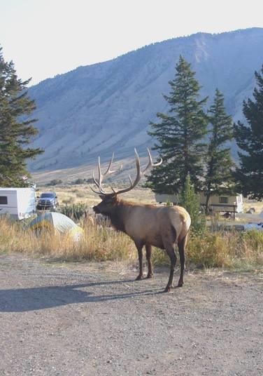
Good morning Mr Elk
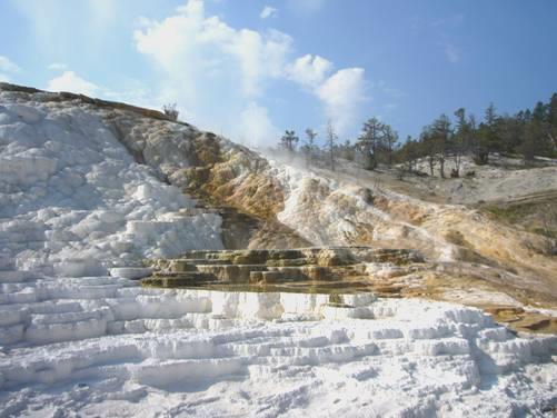
Many photos later we departed, only to see another male as we reached Mammoth Hot Springs. We couldn’t get an internet connection here, so went into the visitors centre, and by then it was time to walk around the lower terraces of the hot springs. We hadn’t visited these before, but were bewitched by the pools, colours and formations as we wandered around the area. By now it was already hot.
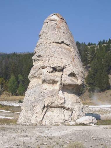
Liberty Cap
No, it’s not snow!
We drove up to the upper terraces, where there is a short auto route, which RV’s aren’t allowed to drive around. Adrian had asked, and it seemed that there was only one really interesting spring, which could be accessed from the start of the trail, so we made our way there – Angel Spring, before continuing south.
We had driven this route (northwards) in 2004, but had been rather rushed, as the campsites were full, and so we had had to leave the park (See Diary 4 - 9th August 2004). This time we had more time to enjoy the scenery. We drove through Golden Gate, through steep gorge scenery, stopping to have lunch at the picnic area at Apillonaris Springs. This had been a stopping place in early travels to the park, but the water is now considered ‘unsafe to drink’. A few aspens in their autumn glory made a delightful show.
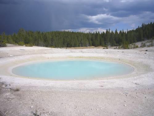
We saw more thermal activity as we drove on south and stopped at the Norris area. We had stopped here before, but this time we walked the trail around the Porcelain Lakes, where the blue pools contrasted with the white surroundings. The image was enhanced by the surrounding thunderstorm, and the colours, with the black sky beyond were outstanding.
Congress Pool
We stopped next at the area called Artists Paintpots, where, after a long trail, we came to some superb formations of pools, spurting up steam, bubbles and odours. The trail was quite rough, but the sight of the pools in iridescent blue, brilliant red, and some just mud coloured brought smiles to our faces. The glug glug of the muddy ones just made me laugh. In fact I had had a smile on my face since early this morning when we first saw the elk.
At Madison we followed the attractive Madison River to leave the park at West Yelllowstone (Montana). It was now 5.30. We got an internet connection and received a few emails, then decided to drive north following the Gallatin River. We pulled into a forest campsite but didn’t really like it, so continued north. The scenery was wonderful, but we hadn’t realised that the road went for 20 miles through the edge of Yellowstone Park so no chance of stopping, and we had to drive slowly because of the speed limit. What a bummer! After that, it was National Forest, and every pull-in had ‘no camping’ signs. It was almost 7 o’clock when we reached Red Cliff campsite, and so we pulled in. There were very few ‘non-electric’ sites, so we had to have electric, so we enjoyed an evening inside, reminiscing over our wonderful day.
Saturday 15th September To the three forks of the Missouri 81 miles
We got up late after an unsettled night, but there was still no sun in the valley, despite the blue sky, so we had breakfast inside. We spent a ‘useful time’ so were then able to have coffee outside, before leaving the campsite at about midday. Adrian had tried the water taps earlier, but when we came to leave, there was no water. It turned out that there had been a pipe burst somewhere, and the whole system had been shut down! Luckily we were able to get water from another campsite further on, as we had got seriously low.
Today we were able to enjoy the delightful Gallatin River valley. It seemed to exist for fishing and ranching. We pulled in for lunch above the river, in what would have been a great overnight spot!
Soon afterwards we came out of the gorge into the wide open plains, with fields of green and gold. We soon reached Bozeman, where we stopped at Albertsons, and were able to replenish our dimished stocks! As we walked around, the radio was relaying an American football match. Workers kept cheering as a goal was scored, and the cashiers couldn’t believe that we weren’t interested!
We now had to decide where to stay tonight. There was a Walmart opposite, but it was much too nice a day to stop in there. We considered a few free camping spots, but ended up at Missouri Headwaters State Park. It was here that the Missouri River split into 3 forks. Lewis and Clark had stopped here, while they deliberated over which river to follow. They called the three rivers after statesman of the time – Jefferson, Madison and Gallatin.
Sunset at Missouri Headwaters
It was good to be camping in an area which they might have camped in – watching a sunset as they might have done – and finding mosquitoes, as we know that they did! We had no firewood, but lit a barbecue, and sat out until it was dark. We saw a tiny sliver of moon before coming inside.
Sunday 16th September Three forks of the Missouri 35 miles
Again a cold night, but another beautiful day.
After eating breakfast outside, we set off at 9 o’clock to walk to the confluence of the 3 rivers. It was a superb day to be walking, and we didn’t return until midday, when we were well ready to eat our lunch!
We had a rough map of the walking trails in a park newspaper we had bought. There was no idea of scale on it at all, and although the trails had different symbols on the map, there weren’t any on the paths!
Nevertheless, we had a wonderful time walking in this arid landscape, with hardly another soul about. We saw lots of birds, including a catbird and a towhee, and the tracks of deer showed up in the dusty ground.
The Madison and Jefferson Rivers join
As we reached the place where the Madison and Jefferson rivers join, 3 white pelicans were gliding down the river! It was a splendid sight! We continued to where the Gallatin River joins, walking past a rocky area where we saw some Indian pictographs.
The Gallatin River joins them to form the Missouri River
The views all around were splendid. There had once been a small town here, called Gallatin City – in fact they had moved the town to another location nearby – where the campsite now is. Neither towns had thrived, although some people had thought that this would become a large and prosperous city. We had really enjoyed soaking up the atmosphere of this important Lewis and Clark site.
After lunch we drove along to the town of Three Forks, and then northwards. The fields of stubble were a dazzling yellow.
We followed a Lewis and Clark symbol, which went down a bumpy track to the Missouri River. The area was called York’s Islands, after Clark’s black servant York, who had accompanied him on the expedition. There was an informal campsite here, primarily for fishermen. Although only 2.30, it was such a lovely spot, that we decided to stay, particularly in view of the fact that tomorrow is Adrian’s birthday.
Opposite Yorks Islands
We had a good wander around, and collected some firewood from along the river bank. There was one prime camping spot by the river, which was occupied by a caravan and tent. The other riverside spot was reserved for handicapped, which rather annoyed us, as it looked as though it had never been used. We settled on another spot, and waited for the several Sunday boaters to leave. We were busily reading through the diary for our website, when we saw that the other campers were leaving! We lost no time in swapping places, to this idyllic one beside the water. We had forgotten though that we had driven over the railway to get here, and the sound of the train bells and sirens was as loud as anywhere we’ve stopped!
What a spot!
We enjoyed a beer, sitting beside the river, and as the last boaters left, and we were left alone, we sat out by our fire and ate a splendid meal of T-bone steak and baked potatoes. Another top spot!
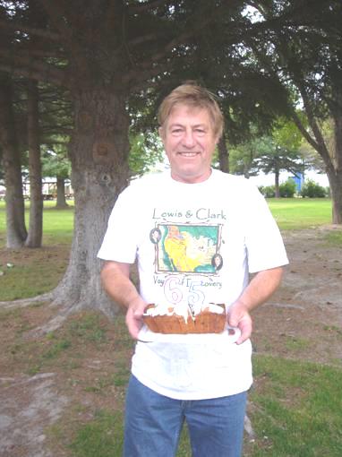
Monday 17th September Adrian’s 65th Birthday 66 miles
After Adrian had opened his presents and cards, we ate scrambled egg and bacon for breakfast, sitting outside in the sunshine. I had given him a CD of music supposedly like the fiddle playing of Pierre Cruzatte, on the Lewis and Clark expedition. It certainly sounded atmospheric.
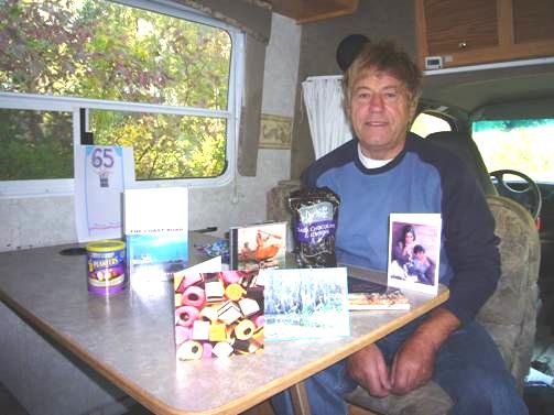
Happy Birthday Adrian
We drove the few miles to Townsend, where we busied ourselves – sending confirmation to the storage place at Seattle, and then getting an Internet connection. We spent some time talking on the phone, as this was the day of Doug’s funeral. We spoke to Hil, Jill, Emma and Tom. In between, we had Adrian’s birthday cake in a little park, where I spoke to 3 children who said that they were picking up litter to keep the place nice!
How old?
We drove north a few miles and stopped by some little ponds close by the Missouri river. We walked around, and were delighted to see several turtles on logs above the pond. The day had become quite unsettled, so we ate lunch indoors, enjoying several different cheeses.
A few miles north we came to Helena, the State Capitol. We did useful things like getting more propane, and a bit of shopping, before driving through the centre, which was more attractive than most US cities.
As we left northwards on the motorway, we passed a small herd of pronghorns.
We turned off to the ‘Gates of the Mountains’ – named by Lewis and Clark because of the steep gorge-like valley. We had hoped to have a boat trip through here, but had found out yesterday that it isn’t running on Mondays and Tuesdays.
We drove down to the river, but there was nowhere to stop, so we drove back up to a parking area by an exhibit about the early farmers here, where there was a large parking space.
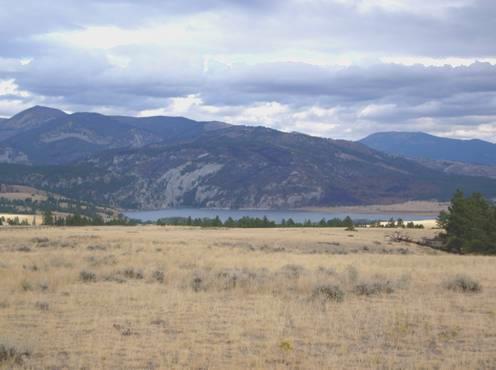
Looking down towards Gates of the Mountains
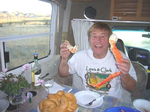
We soon opened the bottle of bubbly. It made us both jump when the cork popped out on its own, just as I was giving a rendering of ‘Happy Birthday’ – I thought that one of the balloons had burst!
We ate a delicious prawn salad, followed by mighty king crab legs – more than we could eat!
Adrian voted it a very happy birthday!
Calgary, Canada to Helena, Montana, USA


