
Monday 19th September
Simon and Laure both had to work today, so we spent the morning at their house writing the email and sorting the website.
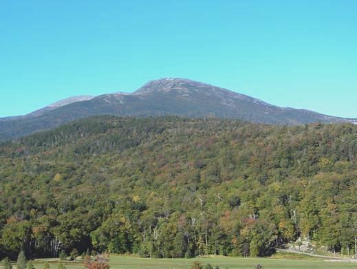
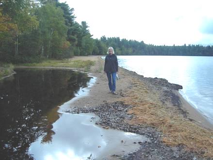
In the afternoon we drove out to Bragg Creek Provincial Park in Laure’s car. We walked the short but pleasantly autumnal Alder Creek trail. It was sunny, but the wind was cool. There seemed to be more fresh snow on the peaks in the distance. We collected Simon from work then came back to get organised for leaving tomorrow morning. We had beef on the barbecue for supper.
Tuesday 20th September 25 miles
We were up at 6 o’clock and after breakfast said goodbye to Laure, before Simon drove us to Calgary Airport.
The traffic was heavy. We said goodbye to Simon, then went to check in. For the first time ever for us, there were 3 separate people with dogs checking in.
Our 10.10 flight was delayed by half an hour because of strong headwinds on the inward flight, but we caught up most of this time, as the wind was behind us for our flight.
We had a really jovial crew on board. This made up for the fact that we didn’t have any TV screens on this flight! We could see snow on the Rockies as we took off, but then we went into cloud for a while.
We passed over vast areas of wilderness with lots of surface water, and the occasional large river. Later there were miles of cultivated fields, then an enormous icy looking, watery wilderness with the occasional track.
We reached Lake Superior, then went into cloud for a while, but we could see the Parliament buildings in Ottawa as we descended, at 4.15 local time.
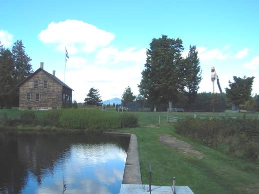
After landing, and collecting our bags, we walked across to the Bam.
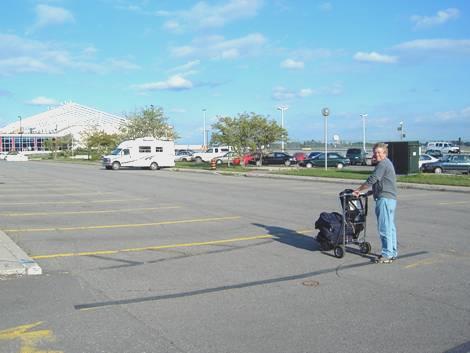
Back to the Bam in its isolation at Ottawa Airport
After a quick pump up of a flattish tyre, we left at just after 5 o’clock and drove south from Ottawa, finding a ‘car pool’ car park to stop in at 5.50.
Wednesday 21st September 140 miles
We left at 8 o’clock, heading for the St Lawrence River, which we reached at Cardinal. We drove through the pleasant towns of Johnstown and Prescott each proud of their history. We stopped by a tiny wooden chapel known as the Blue Church, where there was a memorial to Barbara Heck, who apparently founded Methodism in Canada.
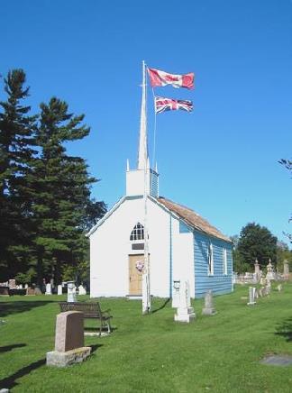
The Blue Church
We stopped at Mallory Landing, an early resort on the river, and now an area of recreation. The weather was warm and sunny, but also windy.
At Rockport the coach tours were unloading their hordes for tours of the 1000 islands – there are actually apparently 1800 islands in this part of the river, some of them very small!
We left Canada on a long bridge over the St. Lawrence River, on to first a Canadian and then an American island before reaching the USA‘mainland’.
We called into the ‘Welcome Centre’ to get a map of New York State before making our way to Alexandria Bay. The town was rather like an old fashioned English resort. From a little park by the river we could see across to Heart Island, with fairy tale looking Boldt Castle on it (all the tours go there).
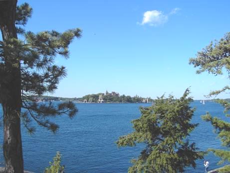
Boldt Castle on Heart Island in the St. Lawrence River
We now drove south through a small town called Philadelphia, hoping to take a smaller road where we might find somewhere to stop. We had great trouble in finding the road (unmarked), and when we eventually did, there was a sign saying ‘Road Closed’!
We continued through the army reserve of Fort Drum finally pulling into a rest area after Natural Bridge.
Thursday 22nd September 99 miles
We left at gone 9 o’clock and turned off a short way to Bonaparte Lake. This was in an area which was once owned by Bonaparte’s brother, and he had planned to get Napoleon Bonaparte to escape here. Unfortunately the area is now highly populated, and we couldn’t get near the lake.
We drove on into the Adirondacks – a vast State Park with lakes, rivers and forests. We found it difficult to find our way about – nothing seemed to be signed, and there were few pulling off places.
We turned off at Cranberry Lake, and managed to find 2 short trails to rapids on the Raquette River – the Jamestown Falls and Moody Falls. Both trails were unsigned, but we were able to find them using a booklet we had picked up at the Visitors Centre yesterday. It was pleasant and autumnal in the woods, and we met no other people.
We turned off to the Massawepie area, hoping to have lunch here, but the rules and restrictions were so complicated that we left and pulled in beside the road at a parking area, and ate our lunch beside a small river. This stop was nearly a disaster, as when Adrian backed in, we stopped inches away from a huge jib on a truck behind!
Next we turned off to climb Mt. Arab – again there was nothing to tell you where the track was. Out leaflet described this walk as an easy 2 mile return trip. We won’t be trying any of the ‘difficult’ trails, as this one was a long, steep and uneven assent to the top of the mountain! At the top, we were rewarded with fine views for 360º, over forests and lakes. That was after we had climbed up the restored 1918 fire tower!
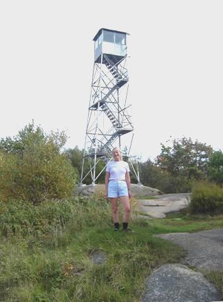
By the Fire Tower on Mt. Arab
We made the long descent, then drove on through the pleasant town of Tupper Lake, where we stopped briefly in a nice parking area beside the lake.
A bit further on, we pulled into Fish Creek Campground, but after waiting the usual long time to book in, it was now gone 5 o’clock, and the man said to find a place and come back tomorrow!
We had no plan of the campsite, but found our way to a position beside the lake. It wasn’t long before Adrian lit the barbie.
After our meal we lit the fire and sat by it until late, in this lovely situation. We had seen stars, but when we came in it was cloudy.
Friday 23rd September 52 miles
Those clouds heralded the rain which began at 1 o’clock and continued all night!
We stopped at Lake Clear – a lovely spot, which we found with the help of our leaflet. We took our coffee down to the lovely sandy beach beside the pleasant lake – absolutely deserted! It was cool, but later the sun came out and it became really warm.
By Lake Clear
We drove on to the town of Saranac Lake, apparently a former recuperation place for tuberculosis. This is why Robert Louis Stevenson had come here for a while in 1887, and we tracked down his former home. This is now run as a small museum, and was absolutely crammed with information on him. The man running it (his grandparents had been ‘keepers’ of the museum, and he had been landed with taking care of it) talked to us for a long while, especially when he found out that we were really interested. We hadn’t known that Stevenson (born in Edinburgh), had lived in Bournemouth before coming to Saranac. We knew that he had visited the South Seas, including the Marquesas, and had died in Samoa. We had also come across him in St Helena, California.
We pored over scrapbooks of old letters written by Stevenson and his wife, and saw the bed he had slept in and the desk that he wrote at. It was a gem of a visit.
We stopped to have lunch afterwards, sitting on rocks above a small river. The computer had logged in, so amongst other things, we looked up about Hurricane Rita, which is now devastating parts of the south east.
We now headed for another ’goodie’ – John Brown’s farm at Lake Placid.
Having become interested in John Brown at Harpers Ferry, it was good to see where he had lived before, and how he had come to be involved in the fight against slavery. His grave is here, along with many of his followers, who were also killed as a result of their anti slave beliefs. John Brown fathered a total of 20 children – 7 from his first wife and 13 by his second, although several died in infancy. Two were killed in the battle at Harpers Ferry. An ironic sight adjacent to this rural area was the huge Olympic ski jumps. Lake Placid hosted the winter Olympics in both 1932 and 1980.
John Brown’s farm (and the ski jump)
We took a pretty road beside a river, stopping to buy some firewood for tonight, before making our way to Wilmington Notch Campsite, arriving at 4.15.
Adrian lit the barbie. It turned really cold, but we lit the fire and sat by it after supper until the embers died.
Saturday 24th September 78 miles
After a really cool night, the sun was shining on what turned out to be a beautiful day. It was still cool for breakfast, but we sat outside. We drove off to Whiteface Mountain. The $14 fee for driving up the Veterans Memorial Highway was worth it for the wonderful views. We were lucky to have such a good day for it, and at first there were very few other people. We stopped many times at viewpoints, each time looking out over the forested mountain slopes of the Adirondacks for as far as the eye could see. It was cool at first, but hot by the time we left the mountain, and the visibility was excellent.
Just before the summit, we stopped to look out, and were surprised at a voice from below. A climber was on his way up on the walking trail! He had walked from the ‘bottom’ – a lovely day for it.
We had coffee at the ‘top’, sitting in our cab, with the wilderness view before us. To reach the actual top there are 2 options – either a steep and rugged climb (26 storeys high it said) or a walk through a tunnel for 400 ft, and then a lift up through the mountain! We opted for the lift up, and the climb down. The views from the top were ‘out of this world’. We really felt that we were ‘on top of the world’. 360º of wild mountain scenery, dotted with lakes. Lake Placid, with its unmistakable H shape, was most prominent.
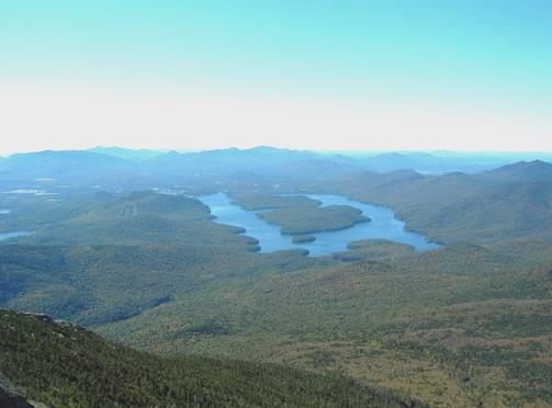
Lake Placid from Whiteface Mountain
Having feasted on this beauty, we made the ‘hairy’ descent to the Bam, and began driving down the mountain, stopping to have lunch at a picnic table on the way down. Further down still, we had a pleasant walk around tiny Lake Stevens. It had been a lovely visit. The road had been built in the thirties, backed by Franklin Roosevelt. It was dedicated in 1935 to Veterans of the First World War, but has been rededicated to honour American soldiers killed in all wars.
We pulled in at ‘North Pole’, at what was called ‘Santa’s Workshop’, but this wasn’t a Christmas store like the one in Alaska, as we had imagined, but an old established theme park. We didn’t stop!
We continued along beside pretty Ausable River and on to Ausable Chasm. From the road bridge we could see dramatic waterfalls.
We took a pretty route to the town of Essex, on Lake Champlain. This is a long (160 mile) thin lake dividing New York State from Vermont. The whole village of Essex is on the National Register of Historic Places. There were some very attractive houses, and it was surprisingly quiet for a Saturday afternoon.
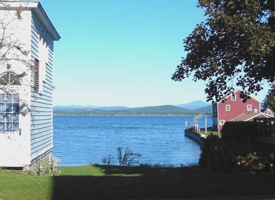
Lake Champlain from Essex, looking to Vermont
Down by the water’s edge, a chap asked us if we were local. He said that he had seen something really strange in the water. We watched with him, and joked about the Lock Ness Monster, and he joked about ‘The Champ’ – a similar legend of Lake Champlain. After watching with him for a long time, as strange bubbles moved around in the water, we found that the ‘monster’ was 3 scuba divers down below! I think he felt a bit silly!
We drove on to Westport, where we pulled into a large boat parking area beside the water. It looked ideal for us, but the small print told us that we couldn’t stay!
There were nice old houses here too, but as we drove out of the town, we passed a ‘County Campground’. We couldn’t find anyone to ask about it, but pulled in and parked with a view down to the lake and hills beyond. As the sun went down, the changing colours of the Vermont hills matched those of Ayers Rock.
We’re glad that we enjoyed them, as the following morning the sky was grey!
We tried ‘scrapple’ for supper, and thought that it was rather like haggis.
Sunday 25th September 53 miles
There were 2 very noisy trains in the night!
We headed off at 7.30 and almost immediately passed a place where we could have pulled off last night! Then we passed a second, so pulled in to have breakfast of bacon and mushrooms. We passed 2 more places where we could have overnighted as we continued along the road – and last night we travelled for 2 hours without seeing anything!
Near Keene Valley, we stopped at a small Farmers Market, where we bought some rolls and some really expensive cheese! This was a very pretty area, and much less inhabited than around Lake Placid.
We had wanted to do a ‘real’ walk before we left the Adirondacks, and had planned to walk a trail at Round Mountain. We should have known better, as it was marked as ‘moderate’ in the same leaflet that described the ascent to Mt Arab as ‘easy’.
We left at 10 o’clock for the 5 mile walk, and didn’t return to the Bam until gone 2.00! The plusses were that it didn’t rain, we saw no other people, and the trail was well marked. The bad thing was that the path was steep in the extreme, and really rugged. Much of it was climbing up bare granite rock! I was just pleased to be managing it, but did wonder how I would get on on the descent!
Towards the summit, we kept wondering if we would ever get there – it just went on and on, up and up. We felt a spot or two of rain, but luckily no more. (After we had returned to the Bam, it did rain lightly for a while).
Once on the top of the mountain, it was open, and the views were good. They would have been better on a sunny day, but it was still lovely in our isolation.
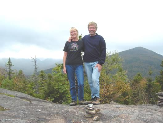
On top of Round Mountain
The descending route was slightly less steep, but there were still plenty of bare rock sections. We walked down and down - again it just went on and on. We were disappointed not to see any wildlife, except for a couple of birds, and although it seemed really autumnal, there wasn’t very much autumn colour. Despite this, it was certainly a memorable walk!
Just after leaving, we stopped by Chapel Pond, and looked up to the vertical barren granite rocks of Round Mountain. Did we really climb that? I must say that I felt very pleased with myself, but we did both feel pretty tired.
It didn’t stop us from making one more ascent, this time up an easy fire road to Mt. Belfry. From here there were views to forested mountains all around, and to Lake Champlain, but again it would have looked better on a sunny day!
We now neared Lake Champlain, but just before leaving New York State to drive into Vermont, we found a place to pull off for the night near Crown Point.
Monday 26th September 48 miles
Again there were some noisy trains in the night, but also there was rain! That’s why the night had been so mild!
We spent some time looking at our proposed route through New England and didn’t leave until 9.30.
We drove across Lake Champlain on the only bridge, and were now in Vermont. We immediately noticed how rural it looked, with lots of cows – rather English!
We stopped in the attractive small town of Vergennes, and Adrian bought some wine, but we didn’t pass any food stores. This was going to be our day to stock up, but before we knew it we had reached Shelburne Museum, just south of Burlington.
This is a vast museum, started as a private collection by a lady called Electra Havemeyer Webb. Its high entrance fee allows for 2 days entrance, so at 11 o’clock we set off to see what we could see.
The day wasn’t at all nice – not cold, but grey and windy, but not really a problem, with so much to see!
We started by viewing a house of the 1950’s, and then a quirky house made in a ‘container’.
Several of the houses were set up as art galleries. One housed furniture of the museum owners, moved from their New York apartment into a purpose built Greek Renaissance building. There were paintings in it by impressionist artists – Monet, Manet and others, and we really enjoyed it.
By the time we had looked around the lighthouse, full of old maps of Lake Champlain, it was time to walk back to the Bam for our lunch.
As we wandered back into the museum, it began to rain, and continued to rain lightly all afternoon, but became torrential as we left the gift shop at 5 o’clock – remnants of hurricane Rita perhaps.
Everything in the museum was so well and so nicely done. There were lots of things left around, so it didn’t have the ‘Don’t touch’ feel. There was also so much to see! There was a blacksmith at work, whose products were sold in the gift shop.
A huge semicircular building housed a long model circus parade; there was a railway engine and station, numerous houses and shops – the general store crammed from floor to ceiling. One item we didn’t recognise looked a bit like a woven hammock. The lady told us that it was a cover for a horse – the frills swayed and kept the flies off. Later we saw one on a model horse, but wouldn’t have known what it was before.
The carriage collection was the largest we have ever seen – dozens and dozens of all different sorts – a surrey (with a fringe on top), phaetons, and all sorts of carriages on sledges – something novel to us. They were housed in an enormous horseshoe shaped barn.
Something that really took our fancy was a huge steamer – the Ticonderoga – which had been transported here in an amazing fashion in the 50’s, by dragging it 2 miles across the land from Lake Champlain. We watched a film of this fascinating story before wandering around the lovely steamer, apparently the last one of its type left.
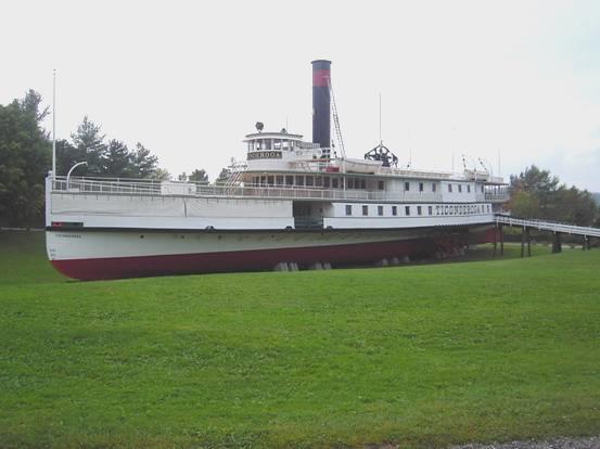
The Triconderoga
We felt pretty weary as we wandered back through the attractive gift shop. I bought a few cards, and then we dashed out through the lashing rain to the Bam. We headed off for a horrendous drive in dreadful weather and through a long section of mucky roadworks with heavy traffic, often at a standstill, to find Walmart at Williston, just outside Burlington. It was still tipping down, as Adrian took in some of our many photos to be printed.
Tuesday 27th September 50 miles
Happy 2nd Wedding Anniversary to Si and Laure and Happy Birthday Jill.
The mild night became colder towards morning, and the sun was battling against the tumultuous dramatic clouds. Luckily the sun won, and the day became really beautiful, so that we could at last see Vermont in its true colours.
We drove a short way to a pleasant large store called Hannafords where we stocked up again. We were even able to buy wine. Afterwards we phoned Simon to wish them Happy Anniversary. We returned to Walmart to collect a second lot of photos which Adrian had taken in late last night, only to find that, as on a previous time, the machine had broken down, so no photos!
We headed into the University town of Burlington. We were looking for a place to get our flat tyre fixed, but had to trail around half a dozen places before we found someone who could do it.
With this finally accomplished we headed back through the dreaded road works and heavy traffic to Shelburne museum. At least it was nice weather today, unlike last night.
We had lunch before heading back into the museum, to complete our tour. How different it all looked when the sky was blue, and we could see to the distant hills.
Once more we were impressed by this museum. We saw demonstrations of printing, weaving and boat building. We saw more houses crammed with vast collections of dolls, toys, glass, china, tools, furniture and even bird decoys – a whole houseful of them!
We saw an exhibition dedicated to children’s illustrator Rosemary Cooney, which I really enjoyed.
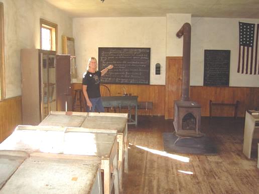
Once a teacher.....!
It was certainly an amazing place, and well worth the visit.
We now took a cross country route, through Richmond, with a stunning round, white wooden church, and a place called Jericho. Everywhere was very pretty, but it was just as difficult to find a place to stop as anywhere else.
We ended up at a village called Underhill Center, in a car park by the church in the centre of the village, just as the sun went down behind the hill.
The stars were clear at bedtime, but it was cold.
Wednesday 28th September 50 miles
It was a bright morning, and a pleasant day. We realised that we were very low on propane, so Adrian looked up places on the computer where we might be able to get some.
We drove out of the pretty village of Underhill, and through lovely scenery to Jeffersonville. This place solved most of our problems! Firstly there was a laundrette, so we were able to do some much needed washing. While this was being done, and after a little trail around, we did manage to get some propane! There was even a Post Office here, so Adrian could send off some things he had wanted to.
We now started on the scenic Smugglers Notch drive, stopping by ‘Smugglers Cave’, which had apparently been used for that purpose at various times, between USA and Canada. It must have a long trek up to hide anything!
This whole area around the small town of Stowe, is a big skiing area. Hence there was a gondola up Mt. Mansfield, the highest in Vermont. We took the gondola up, ate our sandwich lunch at the top, then made the long, long, steep descent by foot – 2100 ft.
From the top of Mt. Mansfield
It took us over an hour, and was not the prettiest walk we have been on, being rather overpowered by the gondola run. We often had to walk zig zag on the already zig zag path, it was so steep!
Next stop was the Trapp Family Lodge. This is where the von Trapp family, of ‘Sound of Music’ fame, settled after coming to America. It is now run as a luxury resort. However, it was very attractive, looking rather Austrian of course, and very accessible – you could wander around the outside freely.
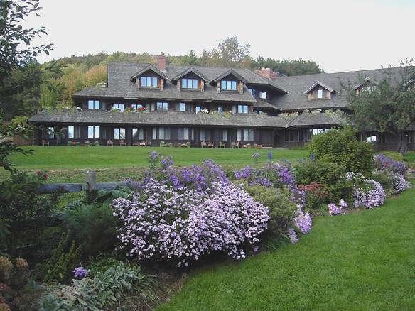
The Trapp Family Lodge
As everywhere here, there were displays incorporating pumpkins outside the house. Pumpkins grow prolifically, and can look quite attractive as part of an Autumn display.
There were 2 gift shops, with lots of ‘Von Trapp’ associated things. There were some fascinating books on both the family and the film, and we spent a long time browsing.
Afterwards we had short walk along the ‘Recreational Trail’, beside a stream.
We now headed out of Stowe, and on taking a road unintentionally, came across Elmore State Park, so pulled in there to camp. The sun was shining down over the nice green grass and trees – we’re still waiting for that autumn colour!
We cooked on the fire tonight, enjoying a local pork, wild cranberry and maple sausage with our pork. It had become really cool, so it was a while before the fire warmed us. Even so, we sat out until 9.15.
Thursday 29th September 75 miles
The night was mild with violent winds, which continued during the day. Unfortunately, rain joined the wind, and the temperature dropped too. Altogether, a pretty horrid sort of day!
It was not the weather to explore any of the trails in the park. We did have a quick dash across to the lake, which would have been lovely in sunshine, and with more autumn colour.
We were able to get water (after Adrian had asked for the ‘tap’, but had to change it to ‘faucet’!)
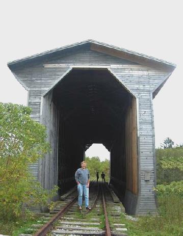
As we drove along, we saw lots of branches which had broken off, and some whole trees blown down. We stopped by Fishers Bridge near Wolcott. This is a covered rail bridge, built in 1908, and one of only a few left remaining. The railway ran through it until recently.
Fishers covered rail bridge
We drove up a very pretty route beside the Black River. The trees showed promise of what is to come (we hope!).
We pulled in beside Lake Willoughby. The scenery looked rather Scottish, when we could see it – the heavy rain often obscured the view! We marvelled at an older gent who had just brought his boat in. Shoeless and hatless he was securing the boat onto his vehicle, while the rain lashed down, and the wind blew a gale!
In the comfort of the Bam, we enjoyed pancakes for lunch, and Adrian worked on mending and cleaning the ‘hatch’ in the roof.
We did other useful things, like printing the diary and labelling the photo album, and didn’t leave until gone 3.00, by which time the sky was clearing. We drove down to the southern end of the lake, and the sun was shining! We even had a little walk along the shore of the lake, with its dramatic steep valley sides.
We continued driving through this pretty area for another hour, when we found a place to pull off beside the road.
Friday 30th September 90 miles
The morning was cool and partly cloudy, but today we at last saw the colours of New England that we had been hoping to see!
We left at 8.30, and soon afterwards were thrilled to see a moose – the first time on this trip. We stopped at Island Pond – where there was an island in the pond!
The trees looked really pretty as we left Vermont and drove into New Hampshire at North Stratford and followed the Connecticut River south. New Hampshire struck us initially as being poorer and not so pretty as Vermont.
At Groveton, where there were paper works, we walked over a covered bridge to look at a steam engine. We were surprised at Stark to see that there had been a German Prisoner of War camp here – you couldn’t imagine it now.
We drove through Milan (bearing no resemblance to its better known namesake) to Berlin. This was a large town, by New England standards, and not very pretty, although the surroundings were lovely. It was again a big paper works place. We shopped for fresh bread, which we enjoyed for lunch later. There were huge car and RV sales places – also snowmobiles and ATVs.
We were now in the White Mountains, and stopped at the National Forest information to get maps etc.
We had lunch just afterwards at Dolly Copp Picnic area, above a pretty stream. The sun was shining, but it was cool.
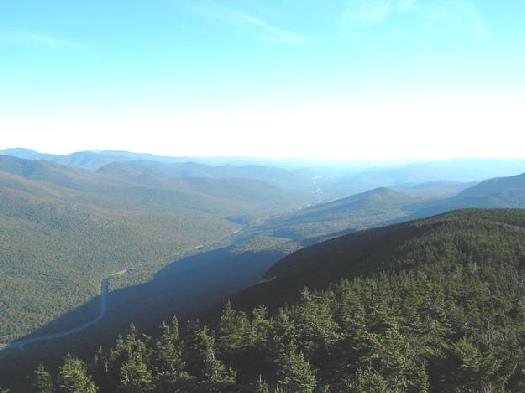
Just afterwards, we came to the road up Mt Washington itself – the highest in NE USA - 6288ft. We knew of this from Bill Bryson’s book ‘A Walk in the Woods’. There was a road up there, but only for cars, so we settled on an ‘Autotour’.
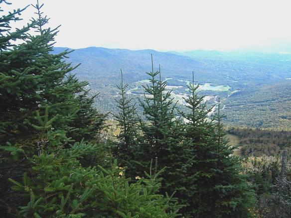
Mt Washington in the far distance (left)
We were driven up by our competent guide, and soon we were glad that we weren’t able to drive up ourselves, as the road was extremely steep and difficult and partly unsurfaced. The 8 mile road went from broadleaf trees through stunted trees to no trees at all. The views were magnificent, and we could see in all directions for miles – 100 miles our guide said. This was very unusual, as the mountains were normally in cloud. We could see north to Canada, east to Maine and the coast, west to Vermont, and south over the rest of New Hampshire.
The journey up took half an hour, then we had half an hour before the descent. We knew that it would be cold up there – 28ºF (-2ºC)! We had driven through bits of snow, and there was rime ice – beautiful shapes of ‘ice’ - on all the posts.
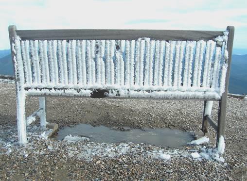
Rime ice on top of Mt. Washington
With our fingers frozen, we tried to photograph the wonders before us, and take in this unique and wonderful situation, but it was oh so cold! A little bit of heaven, with a bit of hell thrown in! The Appalachian Trail passes through here. It is always cold – (30ºF lower than the road down below), so we wouldn’t want to be walking that!
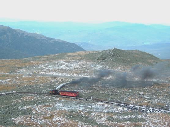
The cog railway on Mt. Washington
On the descent, our driver told us of the ‘races’ held on this mountain – the record for running up the mountain is 56 minutes (8 miles and 4500ft). For cycling up, it is 49 minutes. For driving up, it is 6 minutes - an average of 70 mph! Staggering, when you see the terrain.
Back at the Bam, we warmed up with a cup of tea, before driving back to Dolly Copp Campsite. Having found a pitch, we walked a short trail before Adrian lit the fire.
Saturday 1st October 88 miles
A beautiful day in the White Mountains! The night was cold, but not as cold as we’d expected. We had a walk along the pretty Peabody River before breakfast – the temperature was 37ºF (3ºC)!
The sky was clear blue all day. We set off, and pulled into Pinkhams Notch huge parking area at 9 o’clock to find it already almost full (200+ cars)! We realised that this is the starting point to walk up Mt. Washington, (and also on the Appalachian Trail) and that’s what most people seemed to be doing! We felt a bit inadequate as we set off to walk to nearby Crystal Cascades! Having photographed these – a small tree had kindly turned a wonderful red as a foreground – we returned, and walked for a short way on the other side of the road. We walked past beaver ponds and scrambled up to ‘Lady’s Lookout’, which gave a nice view of Mt. Washington. The trees looked brilliant against the blue sky.
A bit further along the road, we walked to impressive Glen Ellis Falls.
We now drove south as far as North Conway, as a tourist train ran from here. A train was just about to leave, but it wasn’t a steam train, and wasn’t going as far as we’d hoped, so we gave up the idea. We bought an ice cream from ‘Ben and Jerry’s’, which we’d read so much about, and enjoyed it sitting out in the warm sun.
We took the 302 road, along the other side of Mt. Washington. The scenery was lovely again. We stopped right by the Saco River, at what was called Pleasant Valley, to have our lunch in the now hot sun.
We stopped a bit further on at ‘Willey house’. This was a lovely area, with steep mountain sides and a little lake. The story that went with it was very sad – The Willey family lived here in the early 1800s. There was a huge landslide, and although the house survived, the family were all lost as they seemingly had climbed up higher to escape the hugely rising flood waters.
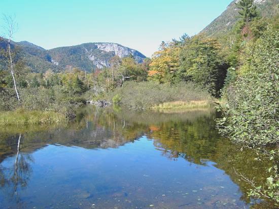
Willey Lake
We had a really nice walk behind the lake before driving off, and then pulling into the parking for the ‘Old man of the Mountain’ site. I had read of this – a profile of a man formed out of rock, high up on the mountainside. It was the symbol for New Hampshire. We walked the trail to it, reading more about it on boards as we went. When we got to the right spot, we looked up and saw - nothing! We were feeling slightly perplexed, when a chap called Peter and his wife started talking to us. They were local, and told us all about it. It turned out that the rocks forming the feature had fallen down 2 years ago! We now saw a board explaining this. It was obviously devastating to the people of New Hampshire, who held the image dearly.
We chatted to this couple as we walked back up the trail. It transpired that they had come to London 27 years ago, before going to France, and then to Italy, where they had got married. They were very easy to chat to, but now we had just time to go up in the Cannon Mountain cable car nearby.
View from Cannon Mountain
From the top we walked a ‘Rim trail’ to the lookout tower to view 360º of wonderful mountain scenery, before catching the last cable car (which holds 80 people) down at 5.15. It was good to make the most of this beautiful day, when the visibility was so good, but now we had to find somewhere to stay.
We drove on as far as Lincoln, where Adrian remembered seeing that there was a ‘freebie’. We arrived in a parking area near the centre of the town at 6 o’clock.
Calgary to Lincoln, New Hampshire


