Durham & South Northumberland Coast
Monday 24th May To Hartlepool 283 miles
This is part of the NE coast, fitting around a family celebration in Scotland for Jon & Lois’ Silver Wedding, Doug’s 18th birthday, and Ed & Liz’s 60th birthdays.
Various commitments prevented us from leaving until today. We had returned from USA 6 weeks ago, having finally sold the Bam, after 8 years of travelling, and over 1,000 nights spent in it.
We left Hermitage at 9.30 am, and had a good journey northwards, though slow in places. The countryside looked lovely in its fresh spring green, with fields of bright yellow rapeseed and buttercups.
The motorway rest areas were disappointing. At Warwick we sat behind the van to have coffee, and at Trowell we sat on the one small bit of grass to eat lunch. We had had a short ‘heatwave’, and knew that it was about to end, so wanted to be outside.
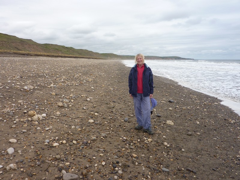
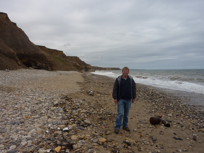
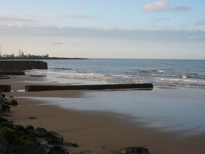
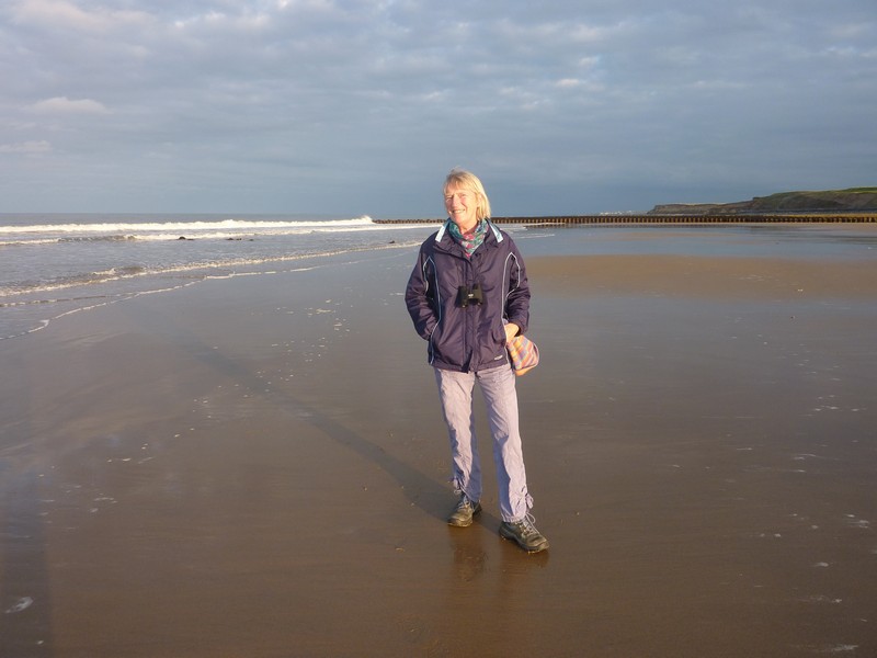
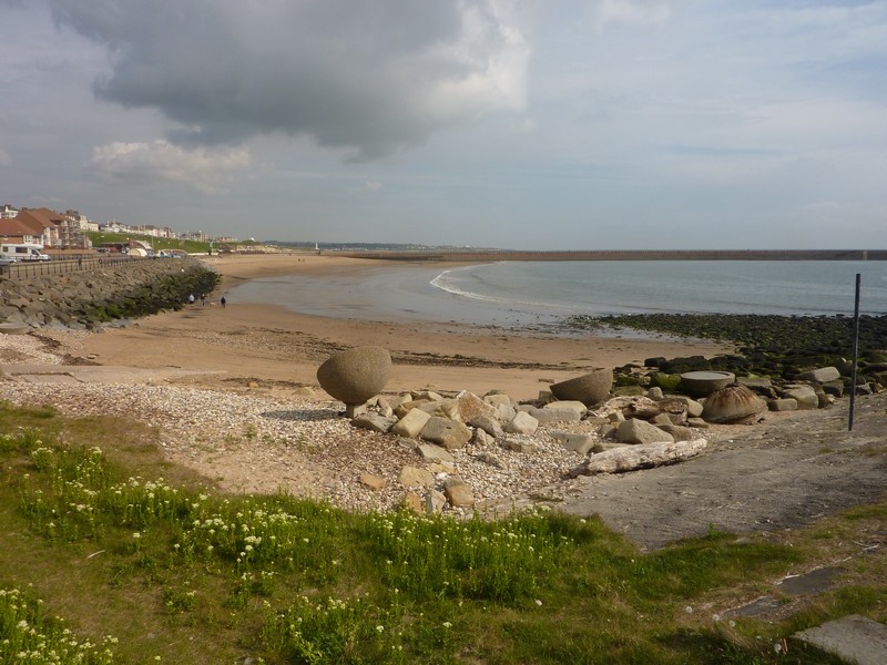
Adrian had phoned the small certificated site at Crimdon House Farm, just north of Hartlepool to book for tonight. We had stayed at this pretty site above the beach last year, and also in 1997. We arrived at 4.40, and immediately set off to walk down to the sandy beach, as we had done before.
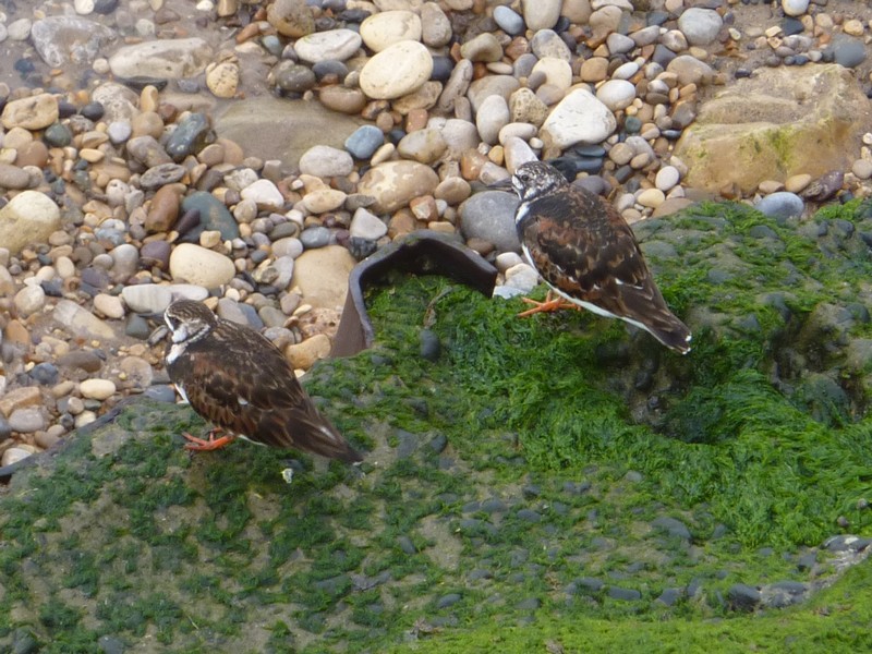
We noticed straight away the difference in temperature – the wind felt really cool. Once more, we walked around the enclosure where the little terns nest on the beach. They were being quite vocal! Many of them seemed to have fish hanging from their mouths.
Our previous thoughts of having a barbecue had vanished with the cool wind, so we settled ourselves inside with our lovely view down to the sea.
The beach near Hartlepool
Tuesday 25th May Up to Sunderland 27 miles
It was a cool and cloudy day – such a shame after all the hot weather. We looked at the photos we took here last June – walking down to the beach in vest and shorts, and paddling in the sea!
We left at 9.45 to continue exploring the Durham coast, where we had left off in 1997.
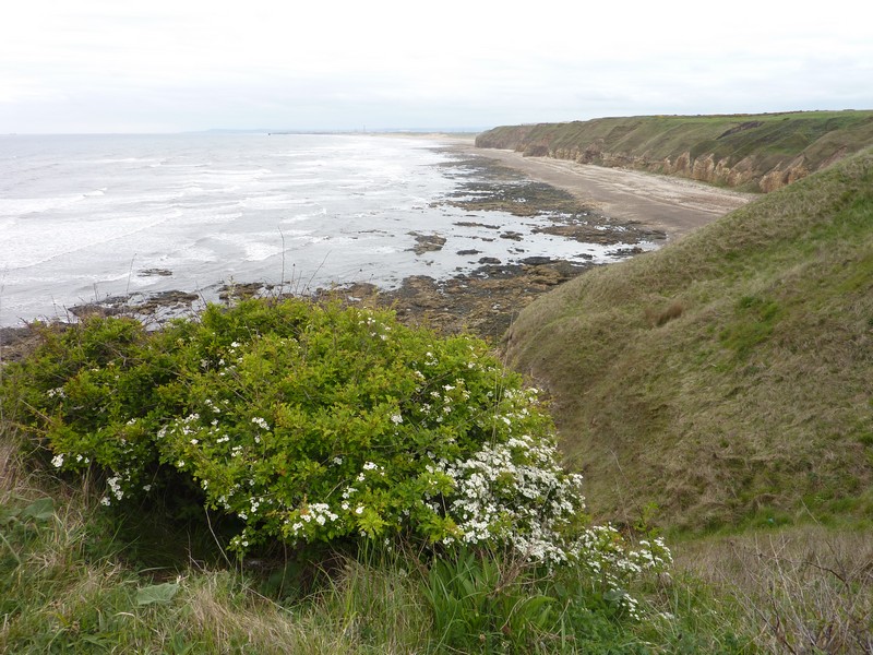
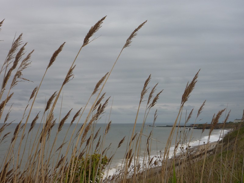
Our first stop was at Blackhall Colliery, where we had a short walk above the cliffs of this very unspoilt bit of coastline. We could look back to Hartlepool to the south, and up to Seaham in the north. We were just sorry about the cold wind! We passed other people today in just tee shirts, so they obviously didn’t find it cold!
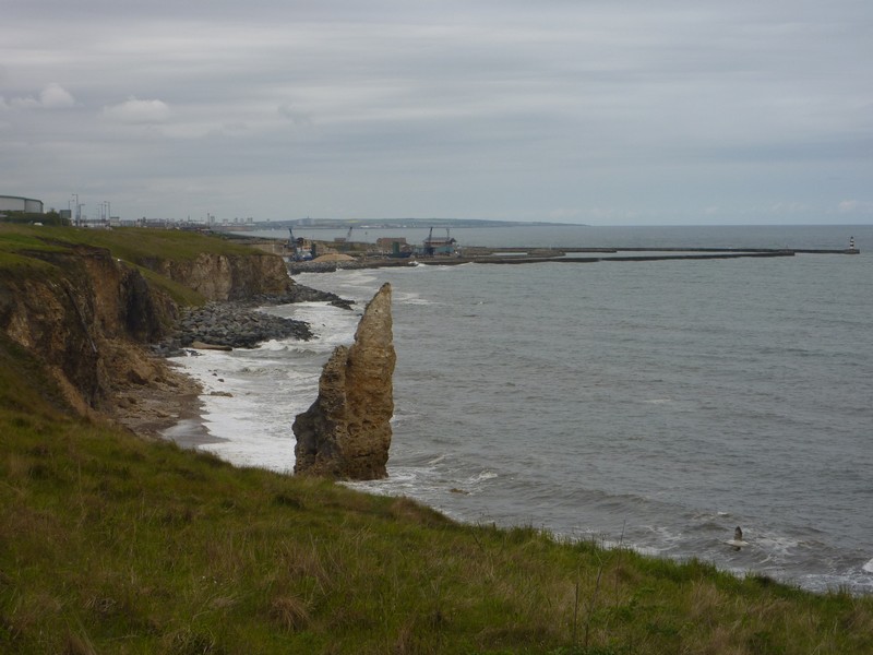
We drove on through the former colliery town of Blackhall to Horden. Both towns had streets named like in USA – second, third, fourth etc. The houses were of utility brick, but there were signs of modern times with a ‘tattooist’ and a Chinese restaurant. The primary school had flowers around the little grass area in front of it, with tables around the trees. We managed to find our way through to a track down to the beach at Dene Mouth. The denes are a feature of this bit of coast – narrow, steep sided ravines, formed by the last ice age.
Blackhall Rocks
The adjoining land was National Trust. We parked where a small track led on to the beach, which was formed by a strange layer of rocks. We couldn’t decide whether it had been dumped there, but concluded that it was probably colliery waste. Close to the water’s edge, the beach was of sand and pebbles, with evidence of coal dust. All of this coast has little to show of its former industrial past, and has now been made into an unspoilt wildlife reserve. Skylarks flew above here, and at other places where we stopped.
We had our mid-morning drink afterwards, sitting in the van, but looking straight out to the rough waves. We saw no evidence of the caravan park mentioned in our 1970’s book, until we looked back from much further north.
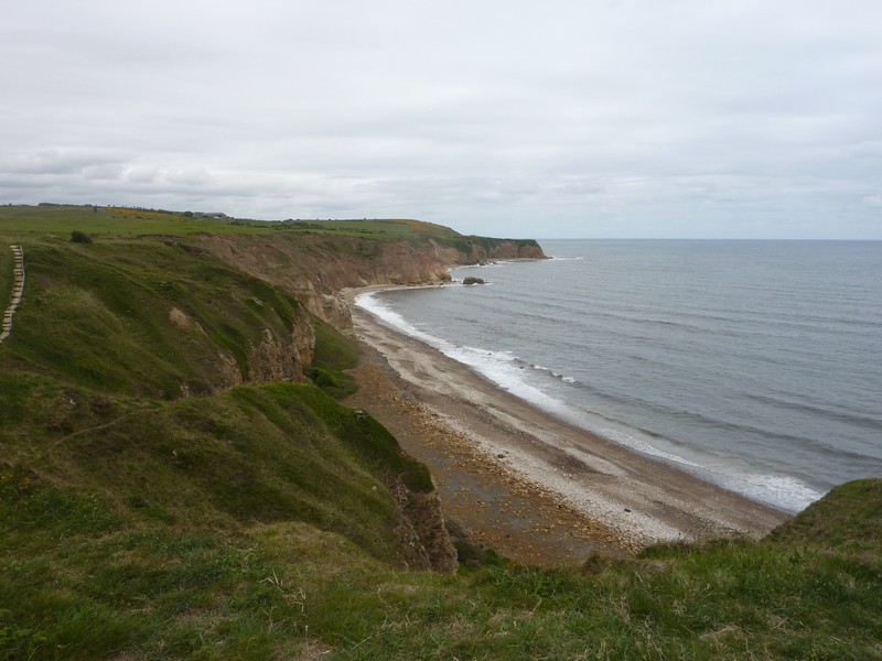
We next stopped at Grants Houses, just before Easington Colliery. From here we walked down to the coast beside Fox Hole Dene, making it a round trip by walking along above the cliffs and back across a field near the railway line. The railway running up beside the coast has appeared to leave the bit of land next to the sea free of development.
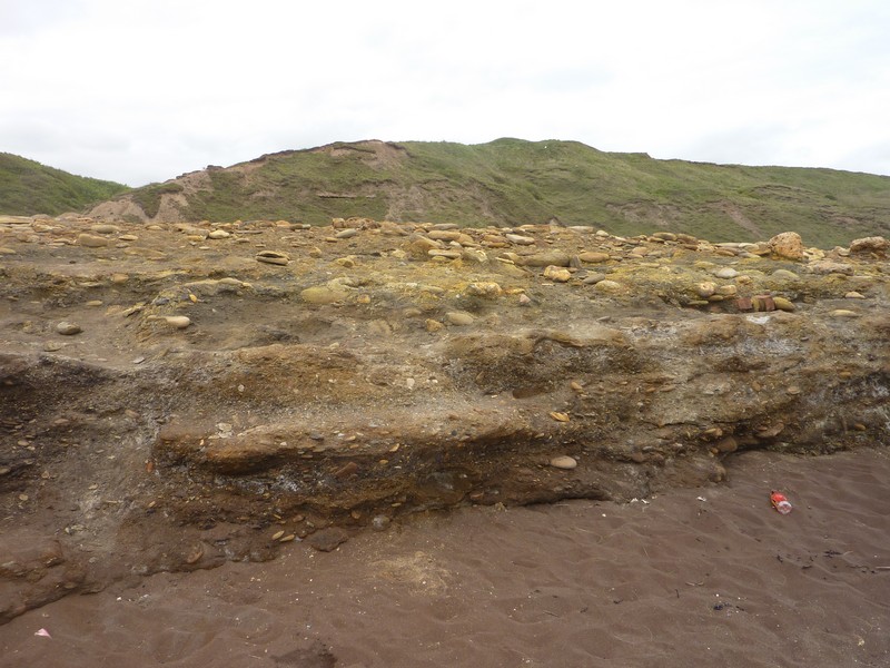
Dene Mouth
We now made our way to Seaham on a road which had been completed since our OS map was printed. We ate lunch in the van at Nose’s Point, before braving a walk out around the point. In the past, both coal and limestone were mined here. It is now a bit of Heritage Coast, with paths, and information boards telling of its past history, and present wildlife.
Fox Hole Dene
Seaham itself seemed pleasant and neat. We had read of a terrible mining disaster in 1880, when 164 people and 181 ponies had died. In 1962, there was another disaster, when five lifeboatmen, and the 4 people they had rescued were all drowned.
Nose's Point
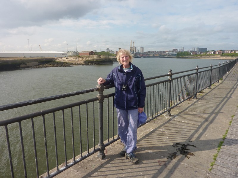
From here we drove along near the sea to Sunderland. Although I’ve never had any strong feelings about Sunderland, it is where my great grandfather Thompson Oliver Lawson was born. After sussing out an overnighting spot, we drove into the town, and headed for the library. We were amazed at how quiet the town was, with plenty of parking spaces.
We located the library, but were disconcerted to find that there were no microfilm readers available. We knew that you had to book, but had hoped that there would be one free when we happened to call.
We were in luck though, because before too long, the other people all left. Our task wasn’t easy, as the reel which we wanted had been put into the wrong box. We had some dates of baptisms of the Lawson family, and wanted to confirm them, but our information didn’t state which church they had been baptized in.
Eventually we did find the baptism of four of Thompson’s siblings, and then later we actually found the entry for him, and then of two other siblings. We were able to print off this information, which will save us having to return in the morning.
The library closed at 5 o’clock today (which is also when our parking time ran out), so we returned to the van. I looked in at a very pleasant park with a large pond. The park had been set up for the enjoyment of local people in the 1850s. The adjacent museum and large conservatory were free.
We returned to the spot by the sea, near to the harbour, and had a short walk out before settling ourselves in.
After supper of excellent omelette, made with eggs from Nicky’s neighbour, the sun appeared. We managed to find our way down to the beach – all entries to it had been blocked off, so we had to climb through the fence. We couldn’t understand what this long parking area was for, if not to access the beach! We saw 2 ringed plovers as we climbed down.
Sea Front Carpark, Sunderland
Seaham
We stopped again to the north of the town and walked down to the beach, and then to the quaint church, which dates from the 7th century! This was situated in what would have been Old Seaham.
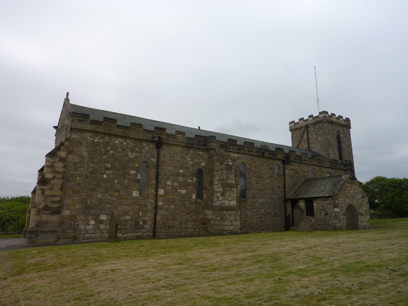
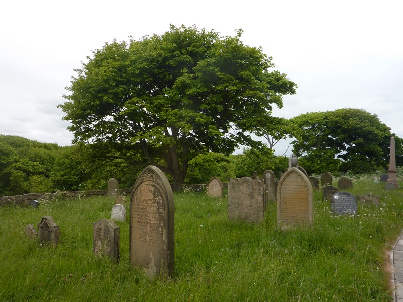
Seaham Church and graveyard
The beach below us, Sunderland
Wednesday 26th May Through Tynemouth to Whitley Bay 41 miles
The sun was shining down onto the sea when I looked out at 6.00am. Sadly the good day didn’t last – it became cloudy, and in the afternoon it rained.
We had breakfast with our lovely view out to sea. It had been so quiet, with no other cars at all.
We drove back through Sunderland, although there was nothing left of ‘Old Sunderland’, where my ancestors would have lived.

We crossed the River Wear to Monkwearmouth, and then on to Roker, just north of the mouth of the river. We walked back to look at the harbour, thinking of the number of times that my great great grandfather George Thompson Lawson would have sailed from there. We then had a pleasant walk in the sun along the wide sandy beach. I thought that it was still cool, but other people were wearing t-shirts and shorts. Adrian was reminiscing about his visits to see his friend Kas in the early 1960s.
Rosie by the River Wear at Monkwearmouth
We stopped again at Seaburn, at the southern end of Whitburn Bay. We walked across the wide sandy beach to the water’s edge and back. Certainly everywhere seemed very pleasant.
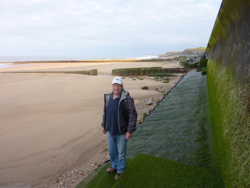
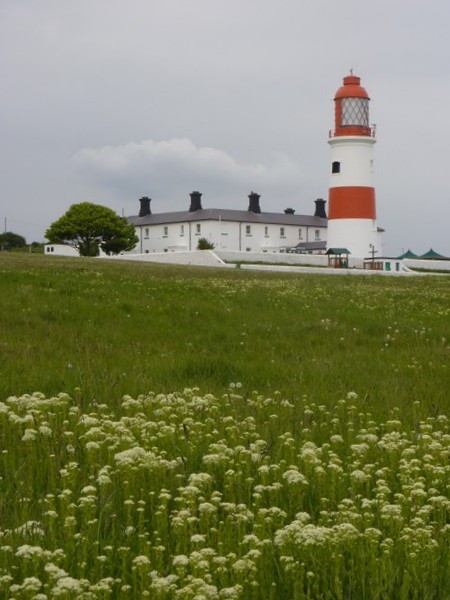
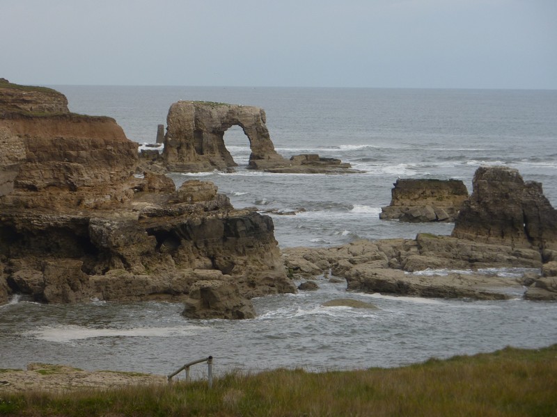
We now drove on to Souter Lighthouse, parking at a carpark to the south, and having a drink sitting outside on the grass before walking up beside the splendid bit of coast to the lighthouse. There were offshore stacks and arches, comprised of manganese limestone, and looking very photogenic. A lot of the area was fenced off because of erosion.
Roker
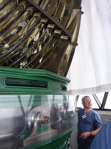
It started to rain just as we left, and the rest of the afternoon was unpleasantly wet. We drove down to Trow Point, at the norWe had an enjoyable visit to Souter Lighthouse (pronounced Suter). The lighthouse is by Lizard Point, but is named after Souter Point, a bit further south, because of the Lizard lighthouse in Cornwall. It was the first lighthouse in Britain to be powered by electricity. It was decommissioned in 1988. You could only ascend the tower with a guide, and we had a pleasant young chap called Kevin. We raced ahead of a party of young schoolchildren, and ascended the 76 steps, the last section of which were incredibly steep.
Kevin had just time to give us all the info before the children arrived. They all coped with the steep stairs, except one little girl, who hated it, and looked really scared, even after she’d climbed down again.
Back on the ground floor we could look around other rooms with exhibits and artefacts, and into the keeper’s cottage. Grace Darling’s nephew had been one of the early keepers.
It was cloudy and cool as we walked back to the Tiv.
We decided to drive on to have lunch, which was perhaps a mistake, as the first car park was closed, and after that they were all paying carparks. Up until now we had been enjoying all the free carparks, which makes such a difference if you’re only stopping for a short while.
We stopped briefly to look at Marsden Rock – a large rock stack which is home to hundreds of cormorants and kittiwakes.
and to Marsden Rock, and to the lift down to the beach to a restaurant built inside a cave. This large area of parkland by the sea, so close to South Shields must be a real asset.
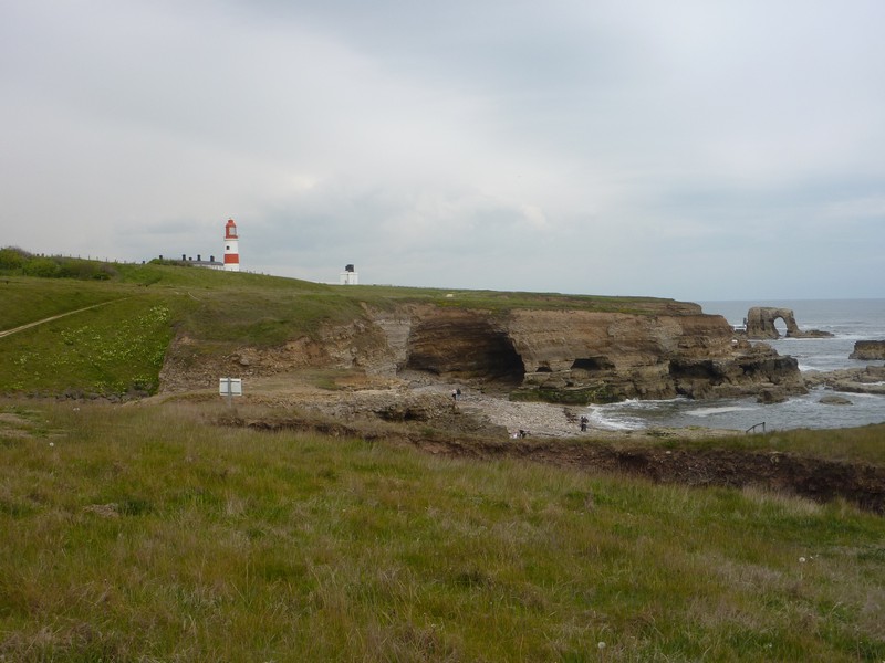
North of here is a large area known as The Leas – a grassy area owned by the National Trust. We were able to park beside the road to have lunch before walking across the meadows to the cliff tops. From here we could look back to the lighthouse and to Marsden Rock, and to the lift down to the beach to a restaurant built inside a cave. This large area of parkland by the sea, so close to South Shields must be a real asset.
It started to rain just as we left, and the rest of the afternoon was unpleasantly wet. We drove down to Trow Point, at the northern end of The Leas. There was a wonderful long sandy beach here, and a pub, which must be really popular in summer. Huge amounts of sand had been washed or blown into the car park, but we only stopped briefly, because of the weather and the paying carpark!
South Shields had some very nice beaches, and, apart from the paying carparks seemed a really nice place.
We now made our way to the tunnel under the River Tyne, and once in North Shields, which looked rather unexciting in the rain, we found our way to the Fish Pier. We’d loved to have stopped and looked around here, but parking was difficult, and so was the weather! There were dozens of small restaurants, and places selling fish, and we could just glimpse the fishing boats and the port area. It seemed to have real character.
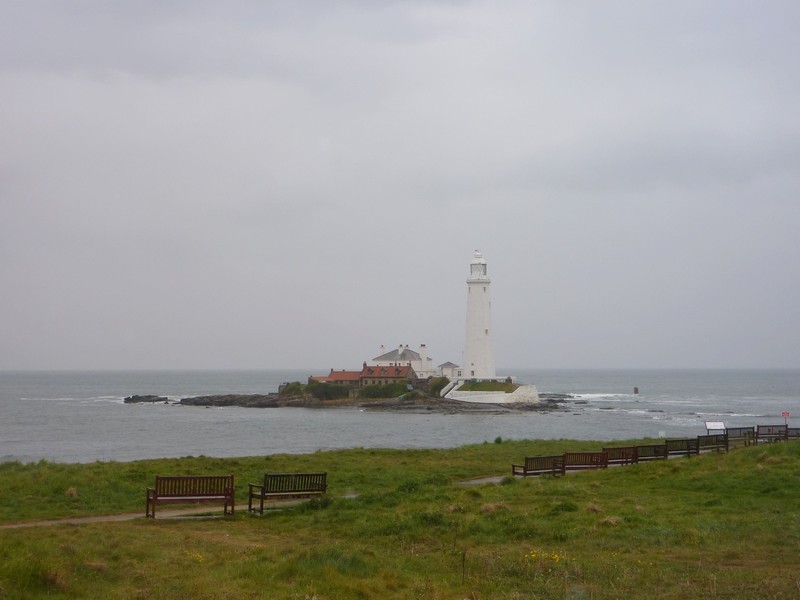
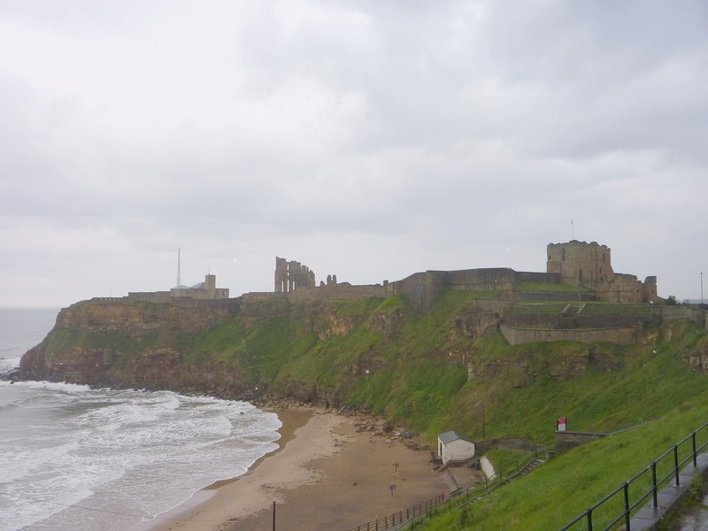
We drove on to Tynemouth, at the mouth of the river, and found our way up to the ruins of the 11th century priory, set above a lovely sandy beach. Because of the rain, we didn’t linger, but drove on past the elegant buildings towards Whitley Bay. We drove right past the long and sandy beach as far as St Mary’s Island. You can walk across to this tiny islet with its lighthouse at low tide, but it was high tide, so in the rain we just stopped long enough to view it, and to consider our plans.
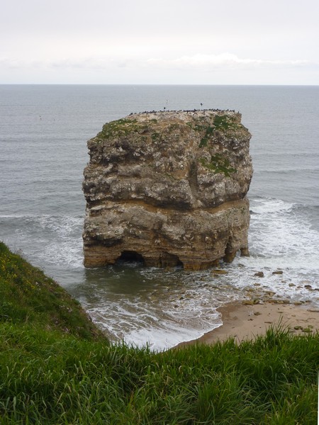
Marsden Rock
It was now 4 o’clock. We plan to arrive at Jon & Lois’ in Bridge of Allan tomorrow, and continue with this part of the coast after the family weekend. There didn’t seem much point in continuing with our coastal trail in the rain, so we thought that we’d stop at a point where we could head for the road northwards.
Just north of here, at Hartley, there was a carpark above the coast with no signs about not overnighting, but it was right beside an uninspiring and packed Caravan Club Site (which we no longer belong to).
We drove on a short way to Seaton Sluice, which once had a busy little harbour, and then headed inland. We stopped beside the road near Brinkley, at 5 o’clock, and by now the sun reappeared for a short while.
By the side of the road near Brinkley
Next day we headed for a wonderful celebratory weekend at Jon & Lois’ at Bridge of Allan. Unfortunately I was very unwell with what the doctor blamed on a virus, so we weren’t able to continue with the Northumberland coast afterwards as planned.
A whole 7 months later, Rosie was diagnosed with a brainstem tumour.
Ruins of the 11th century priory at Tynemouth
St Mary's Island
Souter Lighthouse