
Tuesday 24th July Off to Calgary
The taxi arrived early, so by 5.30 we were off to Calcot, as the sun was just rising from a clear blue sky. We had been home for just under 7 weeks – 6 days of sunshine followed by 6 weeks of very mixed weather with torrential downpours and the odd bit of sunshine.
We had experienced floods in Missouri before leaving USA, floods on the M5 near Bristol, followed by floods at Hull, and then floods at Hermitage. As we left England, huge areas of Gloucs and Worcs were under water, with thousands of homes flooded and without drinking water and power.
We dozed on the bus journey to Gatwick Airport, which was very busy, being the beginning of the school holidays. We were disconcerted to find that we are allowed only one piece of hand luggage each – no separate concession for computers etc, so we had to do a bit of reorganising.
Our flight was very straightforward, although a little cramped. We flew up the eastern side of England initially, so saw no sign of the floods. After that we had a glimpse of Greenland, and of Hudson’s Bay, and later the agricultural plains as we neared Calgary.
A couple of light-hearted films helped to pass the time, but we did miss having personal screens! The third person in our row was a dour young chap who spent the whole time sneezing, sniffing and making revolting unpleasant smells, which rather detracted from our enjoyment of the flight!
We landed at Calgary at 2.15 local time, and were pleased that our bags were almost first to arrive, after our recent score of delayed luggage. We’d had a nasty moment at Gatwick, when only one bag appeared from the hold on the coach, and were relieved when the driver then opened a second locker.
Simon was at Calgary Airport to greet us, and speedily drove us back to his house, when it very soon began to rain heavily, with thunder and lightning. We have long thought that we have this effect on places! Simon drove with me to collect Manolo from his day care, and later we all had supper, after Laure had arrived home from work.
As Laure’s parents had only left the previous day after 3 weeks here, it was a little while before Manolo got used to us, but he was soon charming us with his delightfully bubbly nature.
Wednesday 25th July At Calgary
We looked after Manolo today while Simon and Laure went to work. We went for the obligatory walk to the park, Manolo toddling off down the road with great glee.
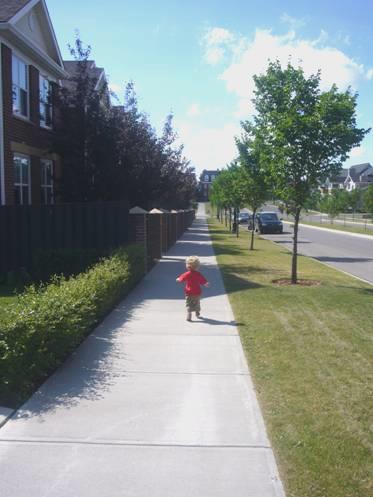
Returning via the back entrance there was the added bonus (for a 20 month old little boy) of a truck and digger working on the garden of a house opposite.
Thursday 26th July Back to Omaha 12 miles
We were awake at 3.45 am, before the alarm went at 4 o’clock. An hour later we were all on our way to the airport. Simon, Laure & Manolo were flying to California for a few days, making a short holiday out of Simon’s work commitment there. Manolo was incredulous of the dark sky, and stood with his nose pressed to the patio window, chatting constantly, not knowing what this darkness thing was! He remained excited all the way to the airport.
It was the usual long drag to book in, both groups of us arriving at the same time to then queue for US customs. We only had a short while in the departure lounge. Manolo spent all this time looking silently in wrapt wonder out of the large window to the activity of the planes on the ground below. It was now light, and the sky was blue.
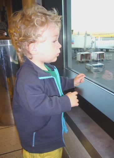
Manolo watching the planes
Soon it was time for us to say our goodbyes – their plane was scheduled to leave 10 minutes after ours from a neighbouring bay.
We had two uneventful flights to Denver, then on to Omaha, coming in to land over the Missouri River. Then the inevitable happened – no luggage for us once again! We found it hard to control our anger at this dreadful inconvenience, especially as we had no address to give for the luggage to be brought to.
We hailed a taxi, and the tall silent black driver drove us to our storage place. He looked in disbelief as we asked to be dropped beside the ‘dump’, where our Bam nestled amongst the collection of rusting, aged American cars. We knew that the lady wouldn’t be there, but she had told us how to get in, and asked us to pop the money into the mail box.
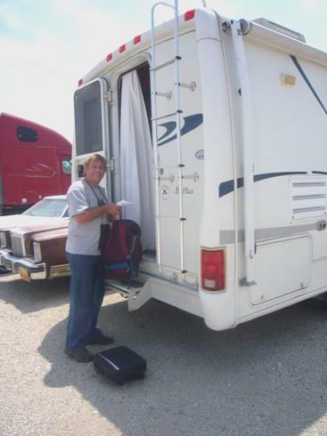
Back to the Bam
The temperature was very hot (94ºF) – we were glad that we both had a pair of shorts left behind in the Bam. Following our noses, we made our way to a large Kroger store, going under the name of Bakers, and stocked up on provisions.
Now we made our way to Dodge Park, where we had spent our last night 7 weeks ago. We were pleased that the campsite wasn’t full, and finding a shady spot, we had a late lunch, as planes above made their final descent to land at the airport. We had moved on an hour, and it was now 3 o’clock. We drove off to fill the water tank, and settled into the shadiest site we could find and got ourselves organised. It was difficult to settle with no knowledge of when we would get our luggage, and Adrian became very frustrated at not being able to get an answer when he tried to ring the airport. Around 5 o’clock we walked down to the Missouri River in the great heat, coming back to the relative cool (81ºF) of the air conditioning.
We both felt exhausted, with the extreme heat and humidity, our lack of sleep in recent days, and the annoyance of the missing bags. Adrian went over to cool off with a shower, but found that it was a fixed temperature, and unnecessarily hot, so not at all refreshing.
We finally cooked some tasty trout on the stove outside, and ate outside before coming in for a relatively early night. Adrian had left a message to say where we were staying, but we heard nothing at all from United Airways.
Friday 27th July Back on the trail, after a distressing start 144 miles
There were thunderstorms in the night. During the second downpour we woke up enough to close the windows! The morning started very grey, but became hot and sunny later, but not as oppressive as yesterday.
The ‘fixed heat’ shower was more welcoming this morning, but I had no hairbrush or comb. We ate breakfast outside, then Adrian phoned United Airways and at last got a reply to say that our bags had arrived – they had been there yesterday, but the people hadn’t rung us as it was an international call. Great!! It had cost us 50p to phone each time.
We set off in good spirits for the airport, but a bad time was to follow! We drove up to the entrance by United Airways, where the lady had said that our bags were waiting. Despite the ‘no parking’ signs, Adrian popped in to collect the bags. The lady had gone for a break, but a man was there, and Adrian soon had the bags. I had been waiting outside in the Bam – we couldn’t park in the short term parking, as there were height barriers. As soon as Adrian had gone inside, an airport policeman approached me and said that we couldn’t park there. I began to explain the situation, but he was extremely rude and uncompromising, and wouldn’t listen. I asked what we should have done, and he said we should just keep driving round (how I wish that I had gone in for the bags, and not Adrian, as I had suggested). I offered to go and get Adrian, but he just started writing out a ticket.
Adrian emerged with the bags, just as the policeman put the summons on the windscreen. Adrian removed it and threw it down in annoyance. As he started to drive off, the policeman dashed across to pick it up and put it back through the window. He then got very angry, and said that he should summons Adrian for assault of a police officer. We drove off in anger, and in my rage I tore up the piece of paper, and Adrian threw it out of the window.
Silently we drove north to Fort Calhoun, about 15 miles away. We turned into Fort Atkinson a large state park where a fort had been built in the 1820’s following the suggestion of L&C that it was a good place for one. It was in fact nearer here that the council with the Indians had taken place, leading to the name of Council Bluffs.
We went into the Visitors Centre, and the lady nicely explained all about the site, ending with saying that we needed an entry pass of $4. We were both in a very unsettled state, so Adrian said ‘no thanks, we’re haven’t much time and we’re in a state of shock’.
Once outside, we realised that our only option was to go back to the airport, and try to sort things out, as we could see that the thing could escalate, and we could end up in serious trouble.
It seemed a very long way back, and when we got to the airport, we couldn’t find any signs to Airport Police, so had to drive back to the same area as this morning. There was only a small booth (empty) saying Airport Police, but further along we saw a police officer. We thought at first that it was the same one as earlier, but it wasn’t. He sent for the sergeant, who eventually turned up, and we began to explain the situation. He had already heard about it (the officer’s version), and said that we should be in jail! However, he, and the second officer, had a much more pleasant disposition, and we could at least tell him our side of the story. He provided us with a piece of paper with the details of where to send the fine – it was only $16, and the address was to a school – it did strike us that this was all a bit of a joke, if it hadn’t been so distressing.
We left the airport, and pulled in to have a reviving tea/coffee, before continuing on our way. To prevent repeating the route to Fort Calhoun, we crossed theMissouri and drove up the Iowa side of the river, on the motorway.
We stopped at Lewis and Clark Park near Onawa, which is on an old oxbow of the Missouri, and near where L&C had one of their camps. We stopped first to have lunch at a picnic table by the water. It would have been really pleasant if it weren’t for the biting flies.
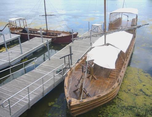
Lewis and Clark’s boats
There were 2 reconstructed boats in the water – representing the keel boat and the pirogue of L&C. You could climb into the boats and walk around them, which was quite atmospheric. Nearby we spotted the ‘beach’ area, and both had a delightfully refreshing cool off in the water. There were dragonflies – large white tipped black ones, and little blue ones. Swallows swooped overhead. We were beginning to relax.
We now crossed back over the Missouri to Nebraska, on a toll bridge, but it was only 75c. We then headed north through Omaha Indian Reservation, stopping by Blackbird Hill, where a viewpoint commemorated Chief Blackbird, who along with 400 of his fellow Indians, died of smallpox in 1800. The countryside was pretty, with rolling hills, and some agriculture. Everywhere was really tidy and well looked after. We drove on through Winnebago Reservation, and the actual town of Winnebago. The Winnebago Indians had bought the land from the Omaha Indians when they had been forced off their own lands.
At Dakota City (still in Nebraska), we pulled into Cottonwood Cove Park by the Missouri. It was like a small French municipal site, surrounded by local housing, but at $10 for a powered site, it was what we wanted! The genial camp hosts welcomed us, and chatted to Adrian as he was making new netting screens for the front windows. Later they came to tell us that there was a problem with the Ladies shower, so could Adrian stand guard while I showered in the Men’s! How nice to meet friendly people again, after our unpleasant encounter this morning.
We walked across to the Missouri River, where there was a picnic site and a boat ramp, and some Lewis and Clark markers telling of their journey through this part. It was around here that Sergeant Floyd became ill.
We came back and lit the barbie (too hot for a fire), and ate outside, enjoying this pleasant, low-key campsite.
Saturday 28th July Following Lewis and Clark in Nebraska, Iowa and South Dakota 105 miles
I did have my shower in the Men’s, then we ate breakfast outside in the early morning cool, and by 8.30 we were driving through pleasant Dakota City.
We soon crossed the Missouri again, back into Iowa, to Sioux City. It was near here that Sergeant Floyd had died in 1804, and had been buried on a bluff near the river. Now there is a huge obelisk marking his gravesite. It is thought that he died of appendicitis complications. He was the only man on the expedition to die, and by all accounts was a trusted and respected member of the expedition. His grave site had been moved, and the monument built, around 1900. It was quiet and peaceful as we looked around the area, with views down to the Missouri River and beyond.
We drove on through Sioux City, stopping next at a boat called the Sergeant Floyd, which had once plied the Missouri, but is now in dry dock, and is set up as a visitors centre/museum. It was a good place to wander around, the most remarkable item in there being a life size model of Floyd, the head having been created from an actual clay mould of his skull.
We each bought ourselves a T shirt depicting the expedition.
Nearby was a recently opened Lewis and Clark Interpretive Centre, which we were pleased to find was free to go in. It was an interactive set up – each place we go into has something different to offer. In here were life size ‘talking dummies’ of Lewis and Clark (and Seaman the dog). What amazed me was the fact thatClark’s eyes appeared to look right at you, but the more unstable Lewis’s eyes never did.
We watched a film in here about the Blackfeet Indians, and Lewis’ meeting up with them on the return journey. We hadn’t expected to watch it all, but it proved to be very well put together and thought provoking, with input from modern day Indians telling their side of the story.
We left Sioux City, and entered South Dakota, turning off to Elk Point in search of the Heritage Park. We found it after a couple of wild goose chases. The reason for wanting to come here was that this was where the Corps of Engineers stopped, and voted for a replacement for Floyd as the sergeant. Patrick Gass won the ‘election’. He lived the longest of all on the expedition, to the grand old age of 99 years!
We had lunch here before setting off for Spirit Mound – a ‘bluff’ where the Indians had told L&C that there were small devils with large heads. 13 of the men had trudged 4 miles in the heat to the top of the hill, where they saw no devils, just a large group of buffalo. We were not so bold, or foolhardy, and considered it too hot and humid to trudge the mile there and then back, with no shade at all. The surrounding area was very attractive, with flowers, birds and butterflies.
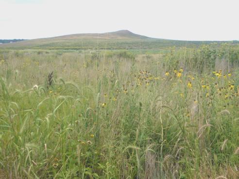
Spirit Mound
We continued now to the town of Yankton, where pretty gardens complimented the nice houses. We drove down to the Missouri, and crossed it, coming back into Nebraska. The river here is dammed, forming ‘Lewis and Clark Lake’. We went first into the Visitors Centre, where the remarkable thing was a recently discovered original copy of the speech which Lewis had made to the Indians in 1804 at Calumet Bluff, where the visitors centre now stands! Outside little finches were crowding around the bird feeders in the prairie garden above the dam.
We drove down by the dam, and were lucky to get the last site in Nebraska Tailwaters campsite – being Saturday night, and a fishing place, we weren’t sure that there would be any room.
It was nice to be surrounded by families enjoying themselves. On one side of us there was a group with several children, including a 16 month old little boy, and a young girl who came over to see what Adrian was doing when he lit the barbecue.
On the other side of us was very chatty Alex, and his partner. His son in law was visiting with his little daughter, aged nearly two. Alex thought the world of her, and kept saying how beautiful she was (in fact we thought that she was rather plain). Alex was 50, and worked as a DJ on local radio (104.1). He loved the Beatles, and couldn’t believe that we had once seen them in concert. He thought that Adrian talked like John Lennon! He invited us over for a beer, and got very excited when we showed him some English money. He said that he loved history. His great grandfather had come over from Germany after the first world war, and he also had Scandinavian blood.
We cooked on a barbie, but most people had lit a fire, even though not many used it to cook on.
Sunday 29th July On through rural South Dakota 139 miles
It was a lovely morning – a bit misty at first, but then another hot day followed. We drove on across the dam to the northern side. I had been hoping to have a swim, but having missed the first place, we realised that all the others swimming areas were part of State Parks, requiring a $5 entrance fee, which was rather annoying when we only wanted a quick dip.
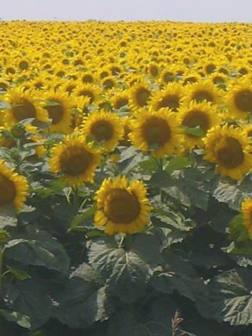
We drove on through rural, undulating countryside, which was often farmed. The fields of sunflowers looked really attractive, and made us think of France.
We never got very close to the Missouri River today. At one point we drove through the Yankton Sioux Indian Reservation, and found ourselves on an unsurfaced road by mistake. It gave us the chance to have views of the river, which was untamed at this point, but we couldn’t get to it.
We continued to Pickstown, which had been built when the Fort Randall Dam was built to form Lake Francis Case from another section of the Missouri River. We had late coffee here, looking down to the long lake, then went into the small visitors centre. There was a working model of the reservoir, which you could activate to see how much water you could let out of the lake to best serve all its needs.
We lost ourselves again in the small town of Lake Andes, but soon afterwards stopped at a little roadside park to have lunch. It would have made a good overnighter, but we decided to carry on through Platte, where Adrian bought some more barbecue fuel, to Snake Creek State Park, which is right on Lake Francis Case. By 3.30, we had settled into a shady spot with beautiful views of the lake, and both enjoyed a swim in the warm water.
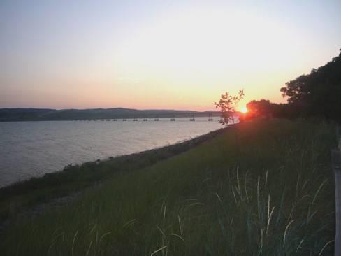
We sat out until late, having cooked our supper on the barbie. We watched the sun set, and before coming in, we walked across to the river to see the full moon rise.
Monday 30th July Lost in the Narrows of the Big Bend 171 miles
I started the day with a lovely swim in the calm water. We ate our bacon and mushroom breakfast outside, with our view to the uninhabited hills across the water.
We left at 9.30, and saw more of the wonderful fields of sunflowers as we drove north to Chamberlain. Hayrolls dotted the landscape on the golden fields of stubble. The last stretch to Chamberlain was by motorway. We pulled off to a rest area above the lake, where the Visitors Centre doubled as another museum to Lewis and Clark, who had camped on the opposite bank to dry out their things. The views down to the lake were supposed to be exceptional, but we thought that they were masked by trees. We drove down into Chamberlain. Adrian had noticed that we had a flat tyre, so we located a garage, where the chap said that he could look at it in ¾ hour. We had seen an unpretentious food store, the only one it would appear in this small town, so went in and got most of the things that we needed.
We went back to get the tyre fixed – something to do with the extension valves, and also got some more propane before heading off.
We saw a picnic area, which turned out to be in American Creek Park, part of a campsite we had thought of staying in yesterday. It was warm and windy as we sat overlooking the lake to eat our lunch. Nearby was a sandy swimming beach, where afterwards we both had a pleasant swim in the cool water.
Just along the road was the Akta Lakota Museum, which had much about the local Indians, and examples of their splendid craftwork. We looked around for about half an hour before driving on through the ever drier scenery, with grassy, hummocky hills and glorious views down to the river.
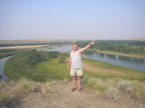
We crossed the river at Big Bend Dam. Just beyond here, the river makes a huge 30 mile meander, whereas the neck of land is only ½ mile wide. This fascinated us, and we had decided to drive up the western side of the river, as you couldn’t get very near to it from the eastern side, except by long unsurfaced tracks.
We soon came to the small town of Lower Brule, driving through the Lower Brule Indian Reservation. The road we intended following was the Native American Scenic Byway. We were behind a large truck, and were disconcerted when the road became unsurfaced, sending up clouds of red/brown dust. We came to an area of road works, and a short surfaced section, but then it was back to the ‘muck’, as the road was being watered to prevent dust. On and on we went, wondering when we would come to a surfaced stretch again, and bemoaning the fact that we hadn’t seen anything of the ‘Narrows’ – the long peninsula formed by the meander. After about 12 miles, we arrived at a huge quarry/works, filled with large trucks of all sorts – and realised that the road ran out here!!!
Adrian got out the computer, and it was then that he discovered that we had driven right up to the end of the Narrows peninsula, and the only way to go was back!
We began our return journey, bumping back through all the muck, and annoyed that we couldn’t see both sides of the Narrows, because of a ridge of hills to one side. When we reached the town, we came to a small, inconspicuous road turning off, which is the one we should have taken!
Off we set again, driving through the increasingly arid countryside, with occasional views to the river – which is called Lake Sharp at this point. We never did get our view of the Narrows!
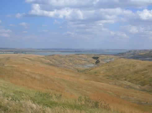
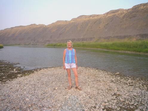
A glimpse of the Missouri River
We were heading for the town of Pierre, and were expecting to drive through it to a campsite a few miles south, on the other bank. However, when we reached the town of Fort Pierre at 5.45, on this side of the river, we spied a small ‘city campsite’ right beside the river. It was only $10, including electricity, so we pulled in. It was at the confluence of the Bad River. L&C had camped near here in 1804, and had held council with local Indians, but because of interpretation difficulties, it had nearly ended in bloodshed. They called their campsite ‘Bad Humour’, because of the bad mood it left them in.
It was a glorious spot, marred only by the strong wind, but it was still very hot – in the 90’s. It was only when we got out of the van that we realised the result of today’s escapade – our normally white van was a deep red/brown colour – and I had only cleaned it yesterday!
Adrian couldn’t bear the thought of sitting by such a mucky vehicle, so set about cleaning it. In fact it was so windy, that although we cooked our meal on the barbie, we came inside to eat it. Afterwards we walked across the footbridge over the Bad River into the small town of Fort Pierre, which was hardly bustling, in fact nothing was going on at all. It all seemed very French, including the temperature.
As we walked back, we saw the pinky full moon rising again, and could just make out the Plough
Tuesday 31st July On through the prairies of South Dakota 176 miles
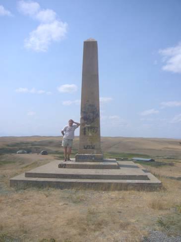
It was already hot when we went outside for breakfast. We drove first through Fort Pierre and up the hill to the Verendrye monument. This commemorates two French Canadian brothers who buried a tablet here in 1743, claiming the area for France. The slate was found by 3 young people in 1913. There were good views from here, down to the river. The small museum in the town wasn’t yet open, despite being past its opening time, so we drove across the Missouri River intoPierre itself (pronounced ‘peer’). This is about the most low-key State Capital we have come across – on a par with Frankfort, Kentucky, and Jefferson City,Missouri.
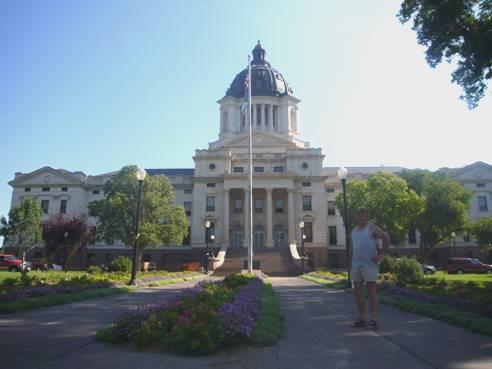
South Dakota Capitol building, Pierre
Its importance flourished as a steamboat port during the Black Hills gold rush. We saw the tiny early wooden school building, and stopped to look at the Capitol building.
Lonely Planet said that people would be pleased that you had stopped by, and we certainly found that when we went into Walgreens to buy a few toiletry items. The dumpy little cashier followed us around, thinking it quite ‘neat’ that we were here. She had to ask us about Princess Di, who she greatly admired.
We had coffee outside the Cultural Centre, before going in to visit. Although you now had to pay a small entrance fee (LP said it was free), it was well worth it, and contained far more than we could do justice to. Inside was the original tablet of the Verendrye brothers (we had seen a copy at the monument) and a Jefferson Peace medal like those that Lewis and Clark had handed out to the Indians. There were displays about Indians, exploration, settlers, and 20th century life. Much of it was interactive – I even milked a large model cow, and steered a steamboat. The 2 ladies at the desk, particularly one called Joyce, were very interested to hear of our travels. Joyce had been to South Africa, and would like to visit India. In a couple of weeks she was going to Alaska for a holiday with her children and grandchildren. Both women had been to England.
It was now past midday, and time to head off north. We had decided to take the faster road, and not bother with the one which went close to, but rarely near, the Missouri. We stopped in a shadeless truck stop to have lunch before driving off across the almost uninhabited prairie. The greens, golds and browns of the fields looked really intense with the sun shining brightly, and with the pale blue of the sky, dotted with little white clouds.
We continued to Mobridge, on the Missouri, called Lake Oahe at this point, as it was dammed just above Pierre. It is quite a large lake, being 230 miles long and 2250 miles around. We crossed to the western side as we wanted to visit a memorial to Sacagawea, the Indian girl who had accompanied Lewis and Clark on their journey from a point near here, and had often acted as their guide. We had to drive along several miles of barren, dry prairie hills to get to the monument. It is supposed that she died near here. Nearby was a monument to Sitting Bull, the great Indian chief who defeated Custer, and who went on to tour with Buffalo Bill. The area had a remote beauty, and it was really hot and windy (98ºF).
We had to return to Mobridge, and take a road northwards. We were aiming for Pollock, where we had note of a City campsite. We had driven through such barren country, that we wondered what we might find. Pollack (pop 379) looked like a blip in the remoteness! We located the ‘park’, and found a wild grassy area by Lake Pocasse, which flows into the Missouri. There were one or two RV’s around, which looked as though they had been there for years! We desperately needed electricity so that we could have air conditioning, because of the extreme heat. We toyed with the idea of driving on further, into North Dakota, where there was another site, but it was already 5.40. There were a couple of electric points – Adrian tried one and it seemed to work, so we got hitched up. We were quite close to the lake, and on wandering down, we found that there was a little beach area, and decided to have a swim, which we both felt in great need of! It cooled us off nicely, even if the water was a tan colour, and seemed to be full of pollen, which stained our costumes!
We lit the barbie, and sat outside to eat, being annoyed by the odd biting insects, but enjoying our isolation. The sky looked very stormy, but nothing happened.
Wednesday 1st August Into North Dakota 133 miles
There were just a few drops of rain in the night, and a short-lived thunderstorm in the morning, and the day was a bit cooler – 80’s rather than 90’s. It made a change to eat breakfast inside – we listened to a pleasant local country music station.
By 8.30 we were on the road, and soon came into North Dakota. We drove through empty, rolling countryside to the capital, Bismarck. It had been renamed in the late 1800s to attract German businessmen here. In fact North Dakota has a high population of Norwegian immigrants, as well as Russian and German.
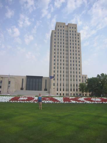
Rosie and North Dakota capitol building, Bismarck
The capitol building here is certainly different. Known as the ‘Skyscraper of the Prairie’, it is 19 stories high, and dates from 1932. Opposite is the North Dakota Heritage building, with a fine statue of Sacagawea outside. Inside, it was as impressive as South Dakota’s version, with exhibits going back to prehistoric times, with skeletons of dinosaurs found in the area.
We were shown around by an elderly docent, looking rather like George Giles. He offered to give us a tour, and we couldn’t really say no! Having spent some time pointing out exhibits relating to Lewis and Clark, he did leave us to wander around on our own, but not until he had shown us Sitting Bull’s decorated buffalo skin. Once more there were sections on Native Americans, settlers, and more modern times.
It was lunch time when we came out, but lunch had to wait, as we passed a place which could do a service on the van, and as one was needed, we pulled in. In fact, they didn’t think that they had enough headroom, but they did manage, and we were pleased to get it done.
We now made our way down to a park near the river, and after a late lunch, drove on beside the river, where there was another remake of a keelboat like Lewis and Clark’s. The relevance here is that some of the crew set off back with the keel boat to St Louis, after spending the winter months at Fort Mandan, just a bit further on.
We now had success, as we were able to contact Emma at the hotel she is staying in tonight, near Gatwick, and wish her all the best for tomorrow’s flight to Calgary.
We continued north, stopping to look at Double Ditch, a former Mandan village, which had been inhabited for 300 years, but was abandoned around 1780, when much of the population had died of smallpox. L&C had stopped here to see the former mound village.
Now it was on to Washburn, a small town which is near the Mandan villages where Lewis and Clark stayed for the winter from 2nd November 1804 to 7th April 1805. As there are several sites nearby which we want to see, and we had note of a free place to stay down by the Missouri, we headed there. It was a lovely spot, with the river, which is free-flowing and not dammed at this point, flowing right by. The slightly lower temperature made it possible to free camp, as we were able to survive without air-conditioning.
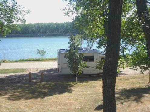
Nice spot by the Missouri, Washburn (before the crowds came)
Well, lovely it was, but this turned out to be another ’Curtin Springs’, or other places where we have had a surprise. We had thought what a quiet little spot this was. First one car arrived, and then another. In the end there were over 20 cars! People spilled out, and sat at the picnic tables – they were obviously here for some kind of get-together. We got on with our barbie, and sat outside to eat it. Fortunately several of the people came to chat to us before getting back into their cars. It was a sort of American Legion meet up. Of course everyone thought that we were from Texas, because of our van registration. Luckily conversation didn’t stop when we said that we came from England. One lady had ancestors from Liverpool, and her husband was of Norwegian descent (and looked it!) We spent a good time chatting to these convivial people. When they had all left, and we were on our own again, we walked along by the river, enjoying seeing the sun going down. It was so nice to be a little bit cooler. A great place.
Thursday 2nd August Mandan 69 miles
The night was cool – for the first time we’d had the duvet on. We sat outside to eat our bacon and egg for breakfast (the milk had turned to curds and whey!)
We drove back through the Main Street of Washburn. We had planned to make several visits today – the first was to yet another Lewis and Clark Interpretive Centre. This one was privately owned by the local historical society, along with reconstructed Fort Mandan, a couple of miles away. At first an elderly lady docent looking like Freda Jones chatted to us about the expedition. She didn’t have an easy rapport, but she did give the two different versions of the death of Sacagawea – one saying that she died in 1812, in her twenties, of putrid fever, and the other saying that she lived to her eighties, and died inWyoming. We wonder if the truth will ever be known.
The museum had a lot about William Clark’s family, as well as much about the expedition itself. There was a section on smallpox, which decimated many Indian villages – one village lost 90% of its inhabitants to the epidemic of 1837.
We proceeded to Fort Mandan. This – or the original fort of this mane, which was a few miles away, was where L&C had spent the winter of 1804-5.
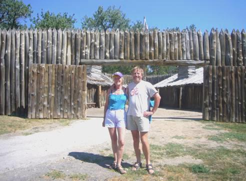
Fort Mandan
This time we were given a guided tour – just the 2 of us. The fort was reminiscent of Fort Clatsop, where the Corps spent their second winter, and was set up with all the things in the rooms which might have been there at the time. It was quite a structure to have built, and we admired the many talents which the men must have had to do so. We wondered how it would be to live for 5 months in such close company – it made us think of the Antarctic expeditions.
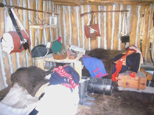
Reconstruction of Lewis and Clark’s quarters, Fort Mandan
This fort was in a pleasant location, near to the river, and we had a little walk beside it afterwards, before having our lunch in the picnic area. There was a nice statue of Seaman, Lewis’ Newfoundland dog, with interesting information about him and the species.
Then it was back to Washburn, where we picked up a bit of shopping, and then across the river to head for Fort Clark. We pulled in by a ‘Scenic View. All trucks must stop’ sign, which amused us, particularly as the view wasn’t very scenic!
Fort Clark, built as a trading post in 1830, and named after William Clark, was close to the site of the village of Mitu’tahakto’s where so many of the Mandan Indians later died from smallpox. Riverboats had started plying the Missouri, and when one stopped off here in 1837, passengers on it had smallpox. The Indians, with very little immunity to the disease, succumbed. The remaining few moved away. Despite the hot sun, we walked around the area of these two sites, where there is nothing left to see now.
We drove on a few more miles to the area of the Knife River villages. It was in one of these that Sacagawea was living at the time of Lewis and Clark’s stay. The villages had been large, and consisted of earth mound homes, an example of which was excellently reconstructed here. We did walk along beside the Knife River to the site of Awatixa village, but time was getting on, and the sun was still hot, so we didn’t stay any longer.
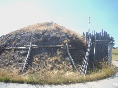
Reconstructed earth mound home
We drove on to Garrison Dam, which forms Lake Sacagawea – the largest man-made lake in US. We headed for Downstream campsite, which was below the dam, and having booked in, drove off to the swimming beach at the area called Spillway Pond. On the way we saw several deer. Suitably refreshed by a swim, we drove up to the top of the dam, hoping that our phone would log in, so that we could ring Emma at Calgary, but we were out of luck. After having a glimpse of the huge lake, we drove back to the campsite.
We sat outside, looking through the trees to the sun going down over the Missouri River. The T-bone steak we cooked on the barbie really did ‘fall off the bone’ – delicious!
Friday 3rd August Into Montana 329 miles
I was awake early, so having eaten our breakfast outside, we were on the road by 8.30. We had a long way to go today!
We drove back through Pick City – rather a grand name for a few shacks! – then continued westwards. We passed a huge open cast coalmine, but luckily we couldn’t see too much of it.
We continued through wide, empty countryside, the only thing we passed being numerous small cemeteries. We wondered where the people had come from!
At Kildeer we drove a repeat 20 miles of our 2004 route, although we didn’t recognise anything. We were driving through the National Grasslands, but were surrounded by Badland scenery, and soon came to the northern section of Theodore Roosevelt National Park. We had left our previous route now – that time we had visited the southern section of the park.
We drove 5 miles of the 14 mile trail into the park, following the Little Missouri River, and enjoying the unusual, dry, stripy hills of this badland area. A herd of buffalo crossed the road in front of us – they had just left the picnic area, so we were able to have our coffee in peace!
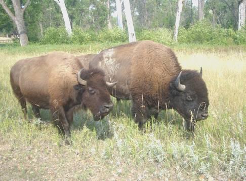
A couple of Buffalo Bison
On our return drive, we stopped to view the interesting ‘cannonball concretions’ - large round ‘balls’ in the rock. Wonderful scenery!
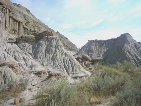
Cannonballs concretions in the Badlands
Driving through the small town of Alexander, we spied a ‘City Park’, with picnic tables, so stopped to have lunch. We had just set off again when we saw a sign ‘Lewis and Clark Trail Museum’. We thought that we ought to have a look. It was housed in an old 1914 brick built school, and was a real treasure! The four floors were stashed with memorabilia of all sorts, mostly local stuff. There was one room set aside for L&C things. It had been set up long ago, before L&C became ‘popular’ because of the bicentenary. The title of the museum was because the road had been called L&C Trail. The displays had been so simply and lovingly made that they brought tears to my eyes. There were beautiful statues and paintings of Sacagawea, and models of Fort Mandan, and of the Missouri landscape and animals.
Outside were more exhibits – vehicles and a log cabin. The fee was $2 – £1 each – worth every penny!
We soon now crossed the Yellowstone River – where the rocks really did look yellow, and came into Montana, and Mountain Time, although we had been driving in and out of it for some time without realising.
We pulled in by a marker which told of the decimation caused by the 1837 smallpox outbreak in this area too. One Indian group of people had lost 94% of their population.
We drove for many miles through Fort Peck Indian Reservation, where we really got the feel of ‘Big Sky Montana’. At the tiny film set village of Nashua, we turned off to Fort Pick, hoping to camp there tonight.
With the air conditioning on, we hadn’t realised how hot it had become, until we saw a sign saying that it was 97ºF! When we passed a swimming area, we pulled in to refresh ourselves, but the cool water of this part of the Missouri River refreshed us more than we had expected!
There was a dam built at Fort Peck, forming yet another long lake from the Missouri. We pulled into the first campsite, to find that it was full, as were all the others, we were told. Friday night!
The man told us of places where we could pull off for free, but no air conditioning of course, so we hope that it cools down!
We passed the Lewis and Clark Interpretive Centre, but it closed at 5.00pm, and it was now 4.55, so we had to give that a miss.
We drove up to the dam – a vast earth filled dam – and saw a marker telling of the tragic subsidence of the dam wall just before its completion in 1938 – 8 people were swept down into the dam, along with the dam walls.
At the end of the dam we pulled off to the free camping area, with a magical view down over the turquoise blue lake.
A large RV with ‘toad’ pulled in, and Adrian feared that they would be running a generator, but on the contrary, they had solar panels, on the roof. They were soon joined by other vehicles, presumably family. One couple started erecting a tent, and we later got chatting to the woman. She said that she loved camping. She and her husband were very large, but they had a tiny little girl of 2¾ called Callie, who was really excited, as she hadn’t camped before. Her mum told us that she weighed under 3 lbs at birth. She was a dear, perky little thing. The woman also had 2 grown up daughters.
The wind got up, which cooled things a bit, but then it dropped, and so we had our barbecue, enjoying the lovely view. Adrian chatted to another couple who had been canoeing on the Missouri, but they said that it had been too hot. They seemed very nice, except that they had 2 silly little dogs, which were sitting on their laps when they drove off next morning.
The real pain was the RV which came in beside us late in the evening, and started to run a very noisy generator. We were considering asking them to turn it off, but luckily they did so before we went to sleep.
Saturday 4th August Across the Montana Plains 269 miles
The morning was overcast and windy, with a misty sun. We ate breakfast inside, partly to block out the noisy generator, which had started up again, and listened to John Denver singing about ‘Wild Montana Skies’.
We set off at 8.30, driving back over the dam, as Adrian wanted to video. This meant that we did get to the Interpretive Centre, which opened at 9 o’clock. There was very little about Lewis and Clark in there, but there were displays of the local wildlife, information on the reservoir – with tanks of large fish, and skeletons of the huge dinosaurs which once roamed this area.
Once we had found our way out of Fort Peck, we continued to Glasgow, where at last we were able to get in touch with Simon. He had sent us an email, which we hadn’t received properly, so we were pleased to hear that Emma and the children had arrived safely, and that they were all enjoying themselves.
We saw an Albertsons store, for the first time this trip. It did us quite well for the few things we needed (including delicious donuts), but there was no wine to suit us.
We set off across the flat Montana prairie, although the scenery was pleasant. The small towns we passed through again looked like film sets. At Saco we pulled in at a little park area by the railway, and Adrian thought he’d have a little rest. The sudden sound of the mighty train going by, with bells, sirens and alarms going was enough to wake the dead!
We stopped for lunch in the town park in Malta – how nice that almost all towns around here, even small ones, have these little parks for everyone to use.
The town we didn’t enjoy was Havre, which was large, busy, and full of American ‘grot’. On top of this, there were road works all down the main street, which made the going slow and difficult. Adrian tried in several places to get some wine, and ended up with just one bottle. We did have a successful shop for drinking glasses in Walmart, so we will be well stocked when camping with the family next week.
We turned south now, and drove through very flat and monotonous countryside, until we reached Loma, where there was a lovely panoramic view. The importance of this place to us, is that the Marias River joins the Missouri here. Lewis and Clark had stopped here, and pondered which of the rivers was the main one. They separately explored each river, taking several days to do so, and finally decided on the correct one.
Which river shall we choose?
We walked up an arid hill in the hot sun to a viewpoint over this confluence. The Teton River also joins here, and the whole area is very attractive.
We drove a few more miles to Fort Benton, also on the Missouri River. Adrian got some much needed petrol – he had tried several times at Havre, but ‘regular’ around here seems to have a lower than usual octane rating so he hadn’t bought any.
We knew that there was a lot to see in Fort Benton, including the actual old fort. Adrian had info on a free camping place, but we couldn’t locate it. Two ladies had chatted to me when I was looking at tomorrow’s opening times. We met them again while searching for a camping place, and they told us of a camping area on the ‘Fairgrounds’. We headed there, and when we finally found our way in, saw that it was called a ‘canoe camp’ (it was beside the river), but cost $15 without electricity!
It was too late now to do anything else, so we pulled in. The river wasn’t suitable for swimming here, but after a bit of trouble, we found that there were some showers, so both refreshed with that.
By the Missouri at Fort Benton
We had a barbie, and a enjoyed our meal with a view across to the cliffs, which looked like shaggy buffalo hide.
Sunday 5th August Going to the sun 246 miles
There was a cool wind, but we still had our breakfast ou tside.
We stopped first at the BLM interpretive centre, which was a grand new building with not much inside.
We moved on to the long Riverfront Park, which had markers all the way along, telling of the history of Fort Benton. It was lovely to be out in the early morning cool. We enjoyed looking at all the markers, which had photos of what the buildings used to look like. There were some really nice buildings, many of which hadn’t changed much and the old-town feel was lovely. We walked as far as the old fort, which in the past had linked with Fort McCleod in Canada on the Whoop up trail.
We drove north to Chester across the dry, yellow plains. We saw a couple of pronghorns, and crossed the Marias River.
We now drove west to Shelby, on route 2, which we had been following before diverting to Fort Benton. We noticed again how many RVs were using this route. At Shelby we stopped to have lunch in a little park near to Albertsons, where Adrian was able to get a couple of bottles of wine.
We had driven through Shelby in 2002 and 2004, but not stopped.
As we drove on to Cut Bank, we could still see the Sweet Grass Hills to the north of us, giving promise of things to come. Cut Bank often has the coldest winter temperatures of anywhere in US, but the weather was fine and warm today as we drove through.
We pulled off at the marker to Camp Disappointment. This is where Lewis stopped on his return journey in 1806, hoping that the Missouri tributary of theMarias River would turn north into Canada, and so gain more land for U.S. (the Louisiana Purchase gave them all the land that drained into the Mississippi). When he found that it turned west, he knew that there was no hope of gaining any more land.
Camp Disappointment was a good name, as, after we had driven ½ mile up a rough, arid track, we found the memorial covered in graffiti, and the surrounding area covered in broken glass.
‘Camp Disappointment’ monument
We could now see the Glacier Mountains ahead as we drove on through Browning, which we had driven through in 2001, and this time felt that it looked just as unloved. It was in the Blackfeet Indian Reservation.
We continued on to St Mary, through an area which had recently been burnt by fire. We were now in Glacier National Park. We came to the campsite and were really pleased to find that there was still room. The ironical thing was that there was a total fire ban – we were glad that we hadn’t bought things to barbecue, but we still had some wood from ages ago which we wanted to use before crossing the border, and this was the first night which might have been suitable, as it was cooler.
Having chosen a pitch, we set off to drive the Going to the Sun road. We had been stopped from doing this in 2001, when we were in Big Bertha, before we bought the Bam. There is a 21ft length restriction. Our vehicle is just over that, but the lady told us that we would be OK.
It was a wonderful drive. We decided to drive straight over the pass and stop on the way back at the various lookouts. We drove almost as far as Avalanche Creek, where we had camped in 2001 on the western side.
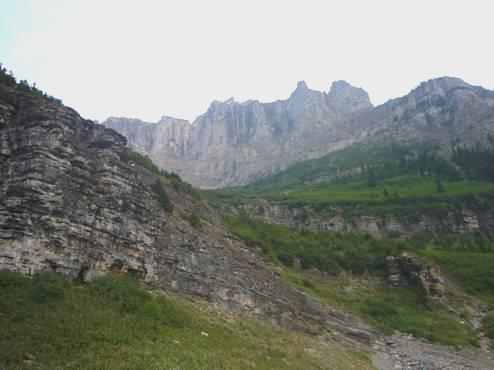
On the ‘Going to the sun road’
The scenery was fantastic, with the added bonus of beautiful wild flowers near the summit of Logan’s Pass (6646ft). We had lots of views of snow and glaciers. The length didn’t seem to be a problem, it was the width – the road was very narrow in places and there was a great deal of Sunday afternoon traffic.
By the time we got back to the campsite it was nearly 7 o’clock. It had taken us over 3 hours, but we were so glad to have done what had been deprived us in 2001.
Back at the campsite we enjoyed our views to the mountains around us.
Monday 6th August To Calgary 179 miles
There was apparently a storm in the night, but I didn’t hear anything.
The morning started cool but beautiful, so we ate breakfast outside, before going for a little walk down to the St Mary River. Hundreds of swallows were flying around under the bridge.
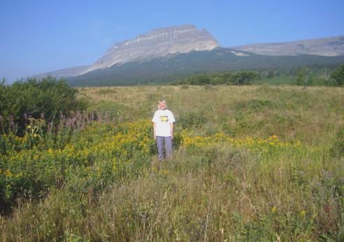
Walk to St. Mary River
We left the park, and initially drove along beside Lower St Mary Lake, and before we knew it we had arrived at the border with Alberta, Canada. Adrian hadn’t even been able to get any petrol, so we stopped to get some in Cardston. We then phoned Simon to say that we would be arriving later today.
We continued across the now flat country, with fields of golden corn on either side, glimmering in the sun. It was warm, as we stopped at Stand Off to have coffee, before continuing to Fort McLeod. It was good to see the fort here again, as yesterday we had seen about it while visiting Fort Benton.
We now followed the road to Calgary which we have travelled before, and enjoyed listening to the recording of our travels in this area in 2001.
We pulled in for lunch at Claresholm, in a delightful park which included a school room and log cabin from the early 1900s. After that it was full speed ahead to Calgary, to spend the next three weeks with the family.
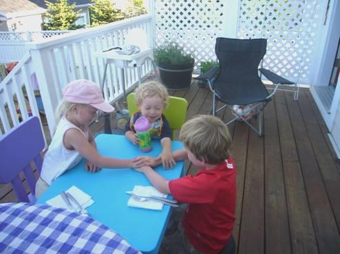
Ruby, Manolo and Felix playing ‘hands’
Omaha, Nebraska to Calgary, Canada


