
Friday 11th February 66 miles
It was a lovely morning. Opposite the campsite was a small Canary Islanders museum, set up by the descendants of the Canary Islanders who were sent over in the 1700s to guard Lake Borgne (the sea enclosed by this eastern end of the birdsfoot delta of the Mississippi) from the British.
The little old volunteer lady attendant was just arriving for the 11 o’clock opening. We had a pleasant chat with her, and told her a bit about the Canary Islands. The artefacts in the museum were not very different from other places we have visited, but it was an interesting diversion.
Now drove back towards New Orleans, stopping at Chalmette to shop. We now made our way to Fontainebleau State Park, on the northern side of Lake Pontchartrain, arriving just as it was getting dark at 6 o’clock.
Saturday 12th February 105 miles.
A cloudy/sunny day. Drove down to Lake Pontchartrain and viewed longest bridge over water – 25 miles! Very quiet there, but man with mobile phone appeared as Adrian was videoing.
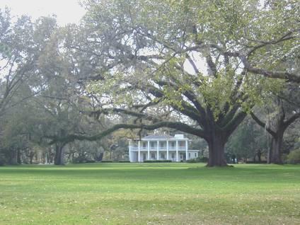
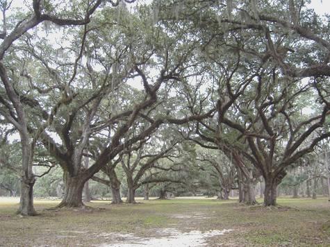
Stopped by ruins of old sugar plantation house and walked nature trail through forest and swamp.
‘Live Oaks’ at Fontainebleau
At Bogahesa left Louisiana and came back into Mississippi, across the Pearl River. Stopped at Trail-lite place at Poplarville – wanted new door lock, but they tried to sell us new van!
Difficult time finding Big Biloxi campsite, despite looking up map on computer. Finally got settled in there 5.30. Short walk out and down to Biloxi River (very acidic brown).
Sunday 13th February 151 miles
Woke early to a partly cloudy morning, but the few drops of rain which fell as we left at 8 o’clock were all we had, on this day which we had expected to be wet.
We took a route back to the coast, reaching it at Garfield Ladner Pier. We drove slowly eastwards beside the coast, enjoying the low-key feel, with fine houses set back behind trees. We stopped at Pass Christian – an early resort, with a yacht club dating from 1849. (Pass = channel; Christian was a man’s name) There were an enormous number of fishing boats in the harbour.
Just after this we had an unpleasant experience when we were stopped by the police. Apparently Adrian had pulled out (on to a clear road) without indicating, so the police took the chance to check up all our details.
The day had become beautifully warm, and we had a lovely walk in Shepard State Park, with the smell pine needles in the warmth of the sun.
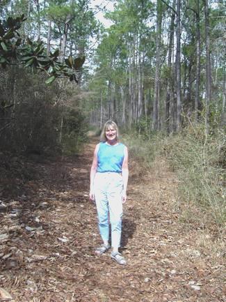
A walk in Shepard State Park
We came back to enjoy lunch sitting in the warm sunshine at a picnic table.
We now headed into Alabama, with no signs at all to tell us. We took a little scenic road down along by the sea, with even more fishing boats.
A very long bridge goes across to Dauphin Island, so we decided to take it. By now it was very windy when we stopped to see the beach.
A ferry goes from here to an adjacent peninsula, but not in winter it would seem. We stopped by Fort Gaines, but didn’t go in. There were some beams from an unidentified boat estimated to be early 1800’s, outside, washed up by hurricane Georges in 1998.
We pulled in by a jetty which was being repaired – presumably also damaged by the recent hurricane (Ivan, last September).
Monday 14th February St Valentines Day 273 miles
It rained well into the night, but we awoke early to a clear blue sky. After breakfast, and exchanging our Valentines cards and goodies, we had a little walk out before leaving at 8.30.
We drove back over the long causeway and on into Mobile. We toured around the centre, and passed a few nice old houses, but the town was too big for us, so we found our way out northwards. We had decided to do a little tour, so that we saw a bit more of southern Alabama, as the state is only about 50 miles wide near the coast.
At first we wondered why we had bothered, as the road was very drear, but after a place called Satsuma, things got better, although there was never anywhere to stop. We headed for a picnic symbol on the map, but the site was closed, with no signs at all.
We ended up turning off to drive through Jackson, and pulling on to a rough bit of ground at 11 o’clock. We drove on north for a few more miles before crossing the Alabama River and making our way south again. This was on a quieter road, through undulating, forested country. We stopped at Little River for some much needed but expensive fuel, then drove down to the Alabama River at Dixie’s Landing where we had lunch of feta salad in the Bam.
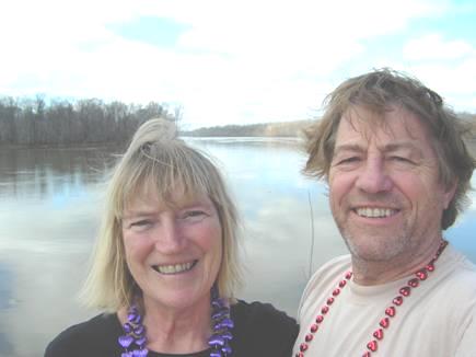
Valentines day
A bit further south we turned off to another little landing. Nearby was Fort Mims, which we walked around in the warm sunshine. This had apparently been the scene of the worst massacre in American history, when 500 people had been killed in 1813 by the Creek Indians.
Continuing south, we passed Mobile on the eastern side of Mobile Bay, stopping at Fairhope for a little more expensive fuel. There were beautiful flowerbeds along the street of daffodils, tulips and hyacinths.
The whole area was really busy, and we wondered if we would get into the State Park we were heading for, so when we came to a Walmart at Gulf Shores, we tried that. After getting yet more fuel (much cheaper here and we always forget if we leave it until the morning) we went in to buy a few things.
Tuesday 15th February 113 miles
A greyish start, with some nice sunny spells. We left after 9.30, and soon stopped at Alabama Welcome Centre to get a map of Alabama for when we return. The assistant, Barbara Owen, told us of the devastation caused by hurricane Ivan last September. We had seen some evidence of this, and were to see much more as we drove along. Dozens of homes were without roofs, and many had collapsed altogether. Apparently thousands of trees had been lost. It seemed that the older, more attractive buildings were the most damaged, making room for even more unattractive, tall condos and hotels to be built..
We pulled in beside the beach for coffee, but the beaches everywhere were just disaster areas, and cordoned off. We decided that we must now be in Florida, but there was nothing to tell us.
At Pensacola we located the Visitors Centre, beside the long bridge over Pensacola Bay. After collecting a few more leaflets, we sat outside at a picnic table to have lunch. We were aware of 2 very different people – a large woman, who shouted at her children before they had even got out of the car, and a lovely quiet man who picnicked happily with his 3 small children while they enjoyed watching the seagulls and pigeons.
After crossing the long bridge to Gulf Breeze, we had to pay a $1 to cross another bridge to Pensacola Beach. This was a long sandspit, with more tall buildings than we liked to see, but with even more devastation.
The road went along to Fort Picket formerly, but had been washed away in the hurricane.
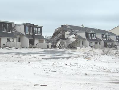
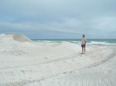
A glimpse of the devastation The normally flat beach
After a walk on to the beach of brilliant white sand, but all heaped up into unaccustomed dunes, we returned across the bridge and continued eastwards, stopping at Gulf Islands National Seashore Visitors Centre, where we could see pictures of some of the damage caused by the hurricane.
Continuing east on this fast and busy road, we stopped at a couple of RV places, hoping to get a new lock for the back door. We may have been near lovely beaches, but it was mostly built up, and the mist had rolled in, so it wasn’t at all pleasant.
Needing somewhere to stop for the night, we pulled into Henderson Beach State Park, but this was full, so we continued to Grayton Beach State Park. Finding this in the mist wasn’t easy, and when we arrived at 5.15, the gate was down. We managed to drive in through the ‘out’ gate, to find the ranger rather annoyed at first. She said that they were almost full, but gave us a pitch – at $21! We had been led to believe from our book that it was $14 normally, but $8 in winter. Wondering if we would cope with being in Florida, we made our way to our site. It was very pleasant, surrounded by palms and bushes. A bit warmer, and we would have enjoyed a fire outside, but instead we came in to look through all our leaflets, and it was soon dark.
Wednesday 16th February 92 miles
After a warm night, there was thick mist in the morning. We drove down to the beach area.
We walked a pleasant trail, partly through pine trees, and ended up on the beach, on a boardwalk, which was suddenly cordoned off (because of storm damage) just before the end. We climbed over, and walked along the beach and back to the Bam.
We now drove the few miles to Eden State Park, where a nice Victorian house stood in lovely gardens, backing on to Tucker bayou. The house wasn’t open today, but we enjoyed walking around the grounds, among the many camellias. The place had a National Trust feel, and the other visitors seemed like National Trust people too! All very nice!
Eden House
We drove on past the development called Rosemary Beach, which was rather posy, to Deer Lake State Park. The paved path here became a boardwalk which went high above the sand dunes to the beach – a huge construction which was quite over the top.
We continued in a southerly direction, taking the ‘Alternate 98’, supposedly the ‘Scenic Route’, but this just nauseated us, as there was non stop building of immense, ugly condos. When we could glimpse the sea, it was through the mist which had descended again.
At Panama City we took the ‘business 98’, which went through the town, and was a really pleasant surprise, as it was very pretty and low-key, with a historic feel. We pulled in by the water and decided to head inland for 20 miles or so to Dead Lakes campsite, near Wewahitchca. Driving through the countryside here was like entering a different world – it was just like the America we are more used to driving through – a world away from all the tourist hype of the coast.
We arrived at the campsite at 5 o’clock, and were surprised to be the only people here! We set off on a little nature trail through the woods, with the sound of frogs coming from the ponds.
Thursday 17th February 53 miles
A very warm night, but a grey start. We walked around the two small lakes. Lots of birds at one point.
We took a different route back through forests to the coast, reaching it at somewhere called Beacon Hill on the map. Totally unspoilt – just a few houses set back.
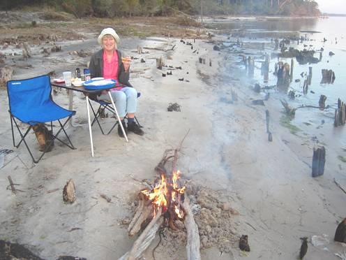
Continued down coast to Port St Joe, taking minor road by sea around St. Joseph’s Bay and towards Apalachicola. Found a remote spot beside the sea and backed down a short track. Delightful afternoon/evening spent here. Put out chairs and table and had lunch on beach. Sun came out. Watched fish jumping (high) and pelicans swooping down to catch them. Walked along beach – isolated and lovely, with offshore islands protecting beach, so really calm.
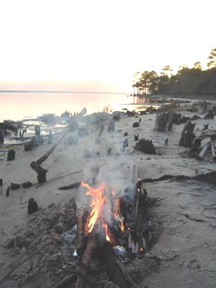
Had changed time zones when we reached coast. Knew that this was the place to have a fire, so Adrian gathered wood. Cooked our first food on a fire this time. Sat out in dark, enjoying our peaceful isolation. Top spot!
Friday 18th February 35 miles
After a really warm night yesterday, last night was amazingly cold! Woke late to clear blue sky, and found that tide had gone out a long way, although it had stayed the same all the time yesterday.
We walked along the beach in the other direction, noticing again the petrified tree stumps, sometimes embedded in black rock.
We left at 10.30 and drove on to Apalachicola, stopping to shop at ‘Piggly Wiggly’, which didn’t impress us much.
Now made our way to John Gorrie Museum State Park, a small museum dedicated to the doctor who invented an ice making machine, to cool the rooms of yellow fever sufferers. It is said to be the forerunner of refrigeration and air conditioning, but sadly his invention wasn’t recognised during his lifetime.
Apalachicola is now a pleasant small town, but was a huge cotton exporting port in the early 1800s – the third biggest on the gulf after New Orleans and Mobile. After the cotton transportation moved to rail travel, the town became important for its cypress log industry, and after that ended, (they had felled all the trees!) it returned to a fishing village, specializing in oysters. We drove down by the front – funny to think of the huge cotton warehouses dominating the now empty front. There were many antebellum houses left in the town, and we set off to visit one – Orman House. When we went over to visit the house, we saw that it was by tour only, the next at 3 o’clock (it was now 2.30). Undeterred, we spent a short while looking around the old cemetery, with graves to yellow fever sufferers and to confederate soldiers amongst others.
Returning to Orman House for 3 o’clock, the ranger told us that he would be about 10 minutes, as he was showing round a handicapped lady. Eventually we got our tour! The house had been built by a ‘cotton magnate’ in 1838, and lived in by his grand daughter after him, and then by his great niece until the 1990s. Then it had been bought up and restored by a couple who ran it as bed and breakfast for a few years before selling it to the state. It was therefore not particularly interesting inside, but our tour with ‘Tommy’ (we were the only people) was very valuable, as it added to our understanding of the history of this little town, and of the area.
Tommy was from Port St Joe, and we realised that the local accent here has a drawl stronger than Texas! As this was the last tour of the day, he was happy to chat, and we didn’t leave until 4 o’clock.
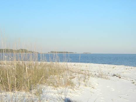
We now left Apalachicola, on the long ‘Gorrie bridge’ and drove for a few pleasant miles right beside the sea, until we came to Carrabelle Beach, where we took a little road right down to the beach. A couple arrived at that time to walk their dog, and told us that it was OK to stay here. We had quite a long chat to them as we walked along this beautiful white sandy beach. They were from Tennessee, but now lived here. They said that sadly this lovely area will soon be sold for developers to build yet more condominiums.
There were jelly fish in the water – 2 different kinds, but not stinging ones. We came back to the Bam as the sun set, the only thing to spoil the idyll being the horrid biting noseeums.
Carrabelle Beach
Saturday 19th February 156 miles
It had been cold and clear when we walked out at bedtime, and was another cold night. We awoke at 7.00 to see the sun rising over the sea like a big red ball. We walked along the beach before breakfast, meeting the couple from last night, who had come to walk their huge poodle Ozzie again.
We drove inland a bit to Wakulla Springs State Park, passing a lot of people setting up car boot type stalls beside the road. We arrived at 10 o’clock, and found that the next boat trip was at 11.00. The thing to do here is to go on a glass bottomed boat, but these aren’t running at the moment, as the water isn’t clear enough at this time of year, due to winter rain. The water is 150ft deep at the springs and its underground feeder caves are at least 3 miles long.
Being Saturday, there were quite a few other people, including families with children. Our trip along the Wakulla River was really enjoyable. The woman ranger had the usual amusing manner, and was excellent, until we returned, and her parting remark was how lucky everyone was to be living in America – the best country!
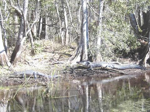
Along the way we saw lots of alligators, a few turtles, and all manner of birds – ibis, herons, wigeon, moorhens, wood ducks. Mullet were leaping high out of the water, and the red maple had brilliant deep red blossoms. All in all, a super trip, through primeval swamps, where many films, including Tarzan, have been filmed.
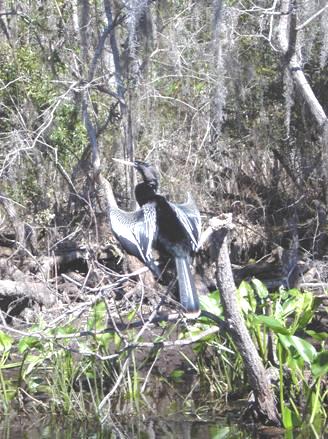
Anhinga
The water is a constant 69°F which felt warm today. In summer, it would be a nice place to swim. We looked into the lodge, where a huge log fire was burning, then came back to a picnic table to have lunch. We ended our visit with a short walk through the woods.
We now returned to the coast at St. Marks, and I explored this area, site of an ancient fort, and the confluence of the St. Marks and Wakulla rivers. It is an area that manatees frequent, but I didn’t see any.
The road now went inland to Perry, where we stopped for fuel, before turning off once more to the sea. We came to several ‘nice’ little communities, and stopped at Keaton Beach.
We drove on 17 miles to Steinhatchee – a little waterside town that our couple from last night had said we must see. We were pleased to find that there was a cheap ($10) campsite in our book, but when we finally located it, it was now $25!
We tried another place nearby, but that wasn’t on, and as it was now gone 6.00, we knew that we had to stop. We went back to Wood’s Gulf Breeze, a hotch potch of a campsite/marina in a lovely situation, so we paid our money and walked around to enjoy the sunset. There was a mixture of mobile homes/RVs here, and in trying to locate the laundry from the hand drawn map, we found ourselves inside someone’s mobile home!
Sunday 20th February 102 miles
The night wasn’t so cold, and we woke to see an orangey sky as the sun rose on a lovely day, with a cool wind.
We drove back to the main road, and on to Cross City, where we shopped in Foodland, as we had no bread left. We were pleased that it was open, being Sunday, and even more pleased when we found out later that Monday is ‘Presidents day’, so this is a long weekend. We weren’t able to buy wine today though! This caused some amusement at the checkout. The young girl serving us said that she would love to go to England.
At Old Town, a few miles further on, we turned off to drive the 24 miles of almost straight road through swampy forest to Suwannee, near the mouth of the Suwannee river. This is the ‘Swanee river’ of the song, but turned out to be ‘a long way to go to see a river’, particularly as we had enormous difficulty in finding the river!
The small ‘town’ of Suwannee is just a development of smart houses built around a canal system, with boating being the sole purpose of being there! We had given up any hope of getting to the river, and stopped on the only bit of spare ground we could find to have lunch. Persevering, and with the help of the map on the computer, we did eventually drive down by the river, but there was nowhere to stop! There seemed to be no ‘centre’ to the town, just one whole lot of ‘nice’ houses.
We now had to drive the 24 miles back to the main road, where we soon crossed the Suwannee River at Fanning Springs, and drove on to Manatee Springs State Park. We were pleased that there was room for us to camp here tonight, but amazed that it took the ranger about half an hour to book us in!
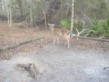
This really is a lovely park. We were soon aware that it seemed warmer (we are travelling south) – there were young leaves and catkins on some of the trees. A deer wandered through the trees beside our pitch, and squirrels abounded. The thing to see here, of course, is the manatees, so we soon made our way down to the river (the Suwannee). We had heard that there were 4 manatees around at the moment, so headed off down the long boardwalk. Looking for manatees is worse than watching for whales to surface, as they come up for air very briefly, with just their noses out of the water. We have seen them close up, in an aquarium, which is probably just as well! Perhaps more rewarding was seeing turtles and huge mullet, and up above both black and turkey vultures were once more very prolific.
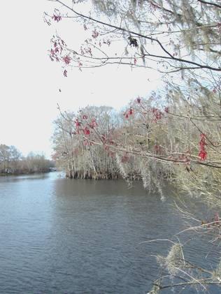
‘Swanee River’, where we saw manatees
Having seen what we had come to see, we wandered back to the spring, which is also a swimming hole (72°F). I decided that that would have to wait for the morning, and was sorry that the kiosk selling ice creams had just closed, so we came back to our spot for a cup of tea before Adrian lit the fire.
We enjoyed pork, baked potatoes, squash, cauli and mushrooms, with our wine decanted into a ginger ale bottle, as it says no alcohol in the park. Several deer and a raccoon came to visit. It was cool as we walked back to the spring before coming in.
Monday 21st February 99 miles
We ate breakfast at our picnic table, watching the deer and squirrels close by.
Adrian chatted to the neighbouring couple before I enticed him down to the spring for a swim. The water was bearable, but not warm – it would have been nice if the sun had been out to warm us afterwards, but today it was mostly cloudy.
We walked down to the river, where we were on our own, but we only glimpsed one manatee this morning. Back at the spring, we had ice creams, and watched a group of young people who had come to scuba dive.
We drove back to the main road, and off to Fowler Bluff, where we stopped for our last sighting of Suwannee River, but by now it was raining.
We continued towards Cedar Key, and stopped for lunch, looking across to miles of water. It had stopped raining, but came on again briefly as we walked around the pleasant little low-key town of Cedar Key. It made us think of an English resort on a bank holiday! We drove around this watery area stopping by ‘City Park’ (more like a village), where a large group of colourful black skimmers were lined up on the shore.
We drove back to the main road, joining it at Otter Creek. We drove on to Dunnellon, where we intended going to Rainbow Springs, but when we passed a Walmart, we drove in there, and as it was one that you could stop at, we settled in.
Alligators
New Orleans to Dunnellon, Florida


