
Tuesday 25th June Our most expensive bath ever! 58 miles
We woke late on a grey morning with even a few spots of rain. Three bored young workers had come to do some gardening around the site.
We found our way into Reykjavik, hoping to get an internet connection. We pulled into a car park and discovered that we were next to Hofdi House, which we had passed yesterday. This attractive house, looking a bit out of place among the modern blocks, was where Ronald Reagan and Gorbachev had signed the paper which ended the Cold War in 1986. A notice near it said that both Winston Churchill and Marlene Dietrich had come here. It was also the first international wireless station in Iceland and received its first message from the outside world on 26th June 1905 from Poldhu, in Cornwall.
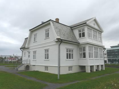
Hofdi House, Reykjavik
We drove on to the centre of Reykjavik, parking (with my blue badge) at the crossroads of the two main streets! We were not very impressed with the view, but we did get an internet connection here, and were able to send the email to go with our new website!
We drove right along the main street, which did improve as we went along. We were glad to be driving, but did think that the road should be pedestrianised.
Near the far end, we stopped by a pond which had mallards, gulls and greylag geese. It felt very cold. Opposite was a nice church (Frikirkjan) and a pleasant house with a neglected garden which had a small statue of a former mayor of the town. Next door was the Icelandic National Gallery.
We drove on through pleasant streets to Hallsgrimkirkja, the iconic church of Reykjavik. This enormous concrete structure can be seen from a great distance. It had a simplistic beauty both inside and out.
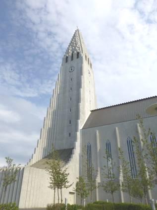
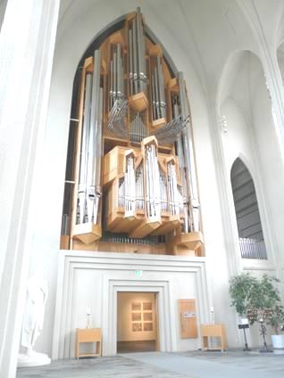
Reykjavik’s Hallsgrimskirkja and its organ pipes
There was a very plain modern looking organ in the church, but it had an astounding 5,275 pipes. To our delight, a man was playing for a short while, and although neither of us is very keen on organ music, it was really moving in this setting. At the other end of the church was a tiny organ. The font and pulpit were both rather futuristic, but I found the enormous bastion quite awe inspiring. As we walked around outside, the clock struck midday – not very impressively, but the few chimes beforehand were nice.
In front of the church was a statue to Leif Erikson, the first man to set foot in America.
We now drove to nearby Seltjarnarnes, which had beaches of lava, and was really rural for being so close to a city. We ate our lunch beside a large pond where mallards, gulls and two greylag geese resided.
Not far away was another beach – Nautholsvik Geothermal Beach. This was really a place for kids to enjoy themselves. It had imported yellow sand, with a rectangular and a round shallow pool of warm water, which trickled into the sea, making the water there quite warm.
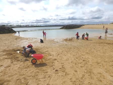
Nautholsvik beach with its imported yellow sand
Now we drove out of Reykjavik. We drove on across barren lava fields, the rock covered with a light coloured lichen or moss. We were making for the Blue Lagoon, the ‘must visit’ place in Iceland. We were a bit dubious about it, knowing that it was expensive, but still were knocked back by the 40 euro each entry fee! We’d had to walk quite a distance from the car park – not good if you’d forgotten something! In fact we’d not brought a camera, so Adrian did trek back afterwards to record our expensive bath place!
The whole area was made up of black lava, and the large pool had steam rising from it, making it difficult to see much. The water was a creamy blue, and was of course warm. We joined the crowds – people didn’t appear bothered about parting with so much cash for a short soak. There wasn’t much you could do in the water – I did manage a few strokes in the deeper part. The thing to do seemed to be to put some of the white silica onto your face – apparently it had rejuvenating qualities! The changing rooms were modern, with wrist bands which activated the lockers, and like other places in Iceland, the procedure was to shower naked before entering the pool.
We soaked for an hour or so, but we did wonder how this place has become such a ‘thing’ – it certainly isn’t pretty, with the geothermal power station, which provides the water for the pool (as a by-product!), visible up behind.
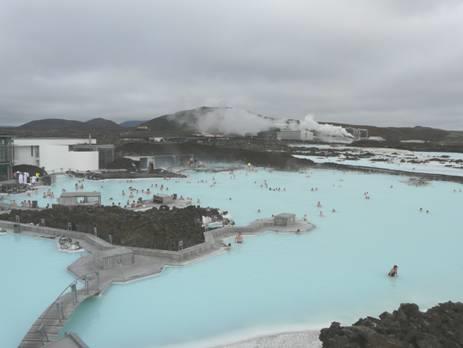
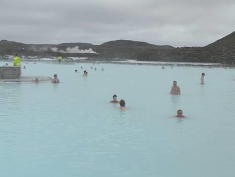
The Blue Lagoon
Not far away, in the prosperous fishing village of Grindavik, was our campsite, so we now made our way there. We were a bit unsure about this, as it was billed as one of Iceland’s posiest campsites, but in fact we found it to be quite pleasant. It had a washing machine (at a very reasonable price), in a room which the attendant had to unlock for us. One machine had English labelling, but it didn’t say how long it took. Hence our exercise for the evening was walking back and forth to see if it was finished – it had a very long cycle! (the lady told us afterwards that it was 1½ hours)
Wednesday 26th June A bridge between two continents 102 miles
The miserable evening became a really unpleasant night, with rain lashing and wind battering the van all night and into the morning. We couldn’t have believed the pleasant day that followed!
We didn’t leave until 10.15, driving along by the harbour of this flourishing but unpretentious fishing town. There were no signs of tourism at all, despite being so close to the Blue Lagoon.
We headed for the SW corner of this Reykjanes peninsula, turning off onto a cinder track, believing it to go to a geothermal area. (Gunnuhver) As usual, signs were noticeable by their absence. We asked a man at a lone works hut, and he directed us, or we’d have turned back. We came to a very low-key area of hot springs with cinder paths and some boardwalk to view the various ‘bubblings’ from the ground.
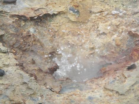
Bubblings from the ground
There was a bright turquoise lake from the nearby geothermal power station, like the Blue Lagoon. The weather had brightened a bit now, but it was still pretty chilly, so we were glad of our tea/coffee to warm us afterwards. We were practically on our own as we walked around, but we could see a large group of people arrive from the other direction as we were leaving.
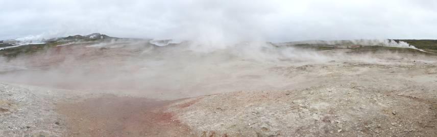
Gunnuhver geothermal area
The road didn’t go through now, as was shown on our map – the eruptions had disrupted it! The ground was of bare dark lava, but a few plants had taken hold, including the bright little moss campion, and evenlupins.
We found our way back to the surfaced road, and continued until we came to the ‘bridge connecting two continents’. This interested us, as it was a foot bridge over a dry gully, where one side was the European tectonic plate, and the other side was the American plate. From looking at it, you’d have no idea. We walked to the bridge, and were just enjoying this phenomenon in our isolation, when we saw acoachload of noisy young people arrive. Luckily they didn’t stay long, and we were able to savour our interest a bit longer! A group of geologists were unloading gear from a van.
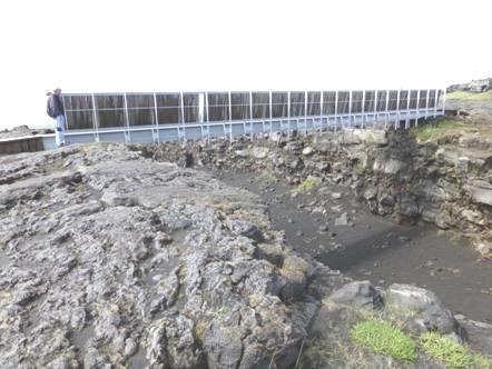
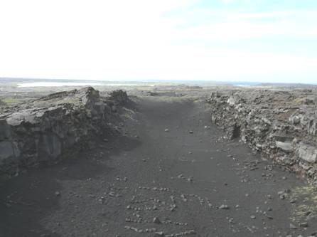
The ‘bridge connecting two continents’
We continued now northwards on this Reykjanes peninsula, next taking a narrow road to Stafes, stopping near to a lighthouse. We had our lunch here and then walked along a grassy path fringed with buttercups and seeming very English, towards the lighthouse. A bird flew up, we think it was a meadow pipit, and there was also a snipe. The sun was now shining. We were surprised at how different this area was from the stark lava we had been driving through.
We drove on now to the northern tip of the peninsula at Gardur, coming to the two lighthouses of Gardskagi. This is supposed to be a good place for bird watching, and we did stop for a while, but are aware of the passage of time, realising that we only have a week left in Iceland. It was a really pleasant place, with a free campsite. A gravel walk/cycleway ran along beside the road to Gardur, with newly laid turf, and boxes of pansies – a rare sight. We passed a group of young workers with lawn mowers – there must be a scheme here for youth employment, as we have seen so many.
Now we headed south to Keflavik, a very plain town whose inhabitants used to be employed by the USAF base which is now closed. The airport for Reykjavik is also here. Adrian was really pleased to spot aVinbid store, the only place where you can buy wine. Our reserves had just run out, so we were able to restock. Nearby we bought a loaf from a bakers. Bread is expensive here, but milk and butter aren’t.
Now it was on fast roads back towards Reykjavik, and on into the hills. At first the scenery was very green, with the blue/grey haze of lupins, but soon became moorland as we reached Mossfellsheidi, making us think of the North York Moors.
We needed somewhere to stop for tonight, as we were getting close to Pingvellir National Park, which we want to visit. Any pulloffs were very exposed, but at 5 o’clock we turned down beside Lake Pingvallavatn and found an ideal spot beside the water next to some corrugated boat huts.
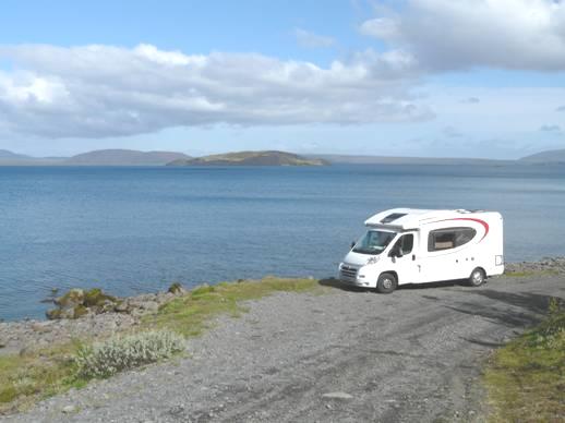
Night stop beside Lake Pingvallavatn
Thursday 27th June The Golden Circle (in the rain) 108 miles
At 4.00am we woke to hear the waves lapping noisily on the shore – the wind had got up! Then sheep were nudging the van, and bleating loudly!
We were still up early, at 7 o’clock on a grey and rainy morning. One or two cars had come over the cattlegrid. All we had seen on this large lake (the largest in Iceland) were two tufted ducks in the distance!
We left at 8.45, and were soon back on the main road and into Pingvellir National Park. This park has great significance for Icelanders, as it is where their parliament and constitution were founded. We arrived at the small visitors centre, which didn’t have much in it, and proceeded to walk out to see the rift between the two tectonic plates, which runs right through the park. The weather was cold, wet and windy, but we walked right down into the rift, marvelling at the sight. The rain held off mostly, so we were kind of lucky! Amongst the grass and mares tails, buttercups and cranesbill were growing.
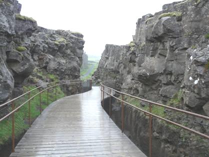
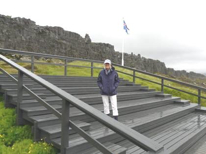
Pingvellir National Park – The Rift, and the parliamentary dias
We drove on through the vast wilderness of the park, making us think of Kakadu in Australia – a whole lot of nothingness! We had difficulty in finding the road that we wanted, as it wasn’t on Adrian’s satnav, and signposting in Iceland isn’t the best!
We stopped just out of the park overlooking Lake Laugarvatn, by now the rain was torrential. We drove down to the lake, where there was a newly made geothermal pool and beach – not enticing today!
Now we continued to Geysir, the second place on the ‘Golden Circle’. We parked with difficulty by the visitors centre/restaurant/shop complex, only afterwards seeing that there was another parking area nearer to the geysers. It was still raining, so we donned our wet weather gear, including waterproof trousers, hat and gloves! and headed for the geysers.

The old geyser at Geysir
Geysir (after which all geysers are named) only erupts three times a day, but neighbouring Stokkur erupts every 5 or 6 minutes. Hence we saw it erupt many times, but it just went with a whoosh, and then it was gone! Difficult to photograph! Geysir was ‘steaming’.
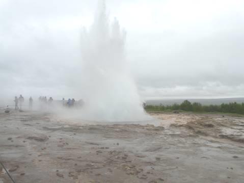
Stokkur performing
After viewing, we drove to the second parking area to have lunch – looking out for erupting Stokkur all the time!
Now it was on to the third sight on the Golden Circle – Gullfoss – the most famous and most visited waterfall in Iceland. Although it wasn’t really raining now, we still donned our full gear, which we were glad of, as it was very cold. There was a lot of walking to do – firstly along a path and then down many steps to view from below, and then back up the steps to view from above. The falls were certainly impressive – rather like a version of Niagara. They’d have looked better in the sunshine, and in better visibility instead of the greyness we had. Of course all these places were busy, as it’s where everybody comes if they come to Reykjavik. There were plenty of coaches, with people of many countries, but the Japanese were most prominent.
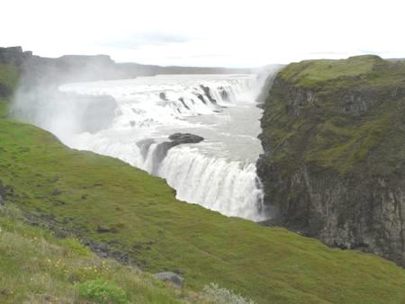
Gullfoss
Having done our ‘tourist bit’, we drove back a short way, taking a very badly corrugated gravel road for a few kilometres to connect up with a road south so that we could follow a road up the Pjorsa valley. At the turn off, we could still see Stokkur erupting.
We were disappointed that the countryside seemed very tamed, and were glad when we reached the wilder country. We needed somewhere to stop for tonight, and began ascending steeply, where we did find a parking area, but it was very exposed. Adrian had spotted somewhere at the foot of the hill, so we returned there. A side track led to Pjodveldisbaer – a reconstructed Viking Farm. The site closed at 6 o’clock, and it was nearly that now, so we pulled in.
After supper, the rain stopped and the weather brightened for a while, so at 8.30, we set off to look around the outside of this turf-roofed farm complex, in a lovely setting, with a waterfall in the hills behind. We had the best weather of the day!
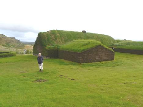
Pjodveldisbaer – a reconstructed Viking Farm
Friday 28th June The ‘Ash cloud’ volcano and more wondrous waterfalls 159 miles
We were awake, so got up really early (6.00 am) and left before 7 o’clock. We were really disappointed that it was raining, and were so glad that we’d looked at the Viking Farm last night.
We drove back up the big hill, but there were no views because of the poor visibility, and we were just driving across black, desolate land. We’d hoped to return by route 26, but after the first few yards of surface, this became the unsurfaced road we’d expected, and so was a no-go on a day like today!
We retraced our steps, and continued back to the junction with route 30, where we stopped for breakfast at about 8 o’clock. The weather was much brighter now, and there was even a glimpse of sun.
An hour or so later we were on our way, driving down the Pjorsa Valley. There were lots of the lovely Icelandic horses in the fields.
We reached route 1, Iceland’s Ring Road, and drove on to Hella.
We then drove on to Hvolsvollur, which served us well. We got some diesel, did some shopping in a nice, if pricey, small supermarket, including an Icelandic cap each, and found the Post Office. This was in a small wooden hut where we were served by a very polite lady who spoke excellent English, and we were able to get stamps for the postcards I’d written.
From here we took a road inland, as we were hoping to get a view of Eyjafjallajokull, the volcano which had disrupted life for so many with its ash cloud in 2010. Bad visibility meant that we could only see the foot of the mountain, but we had compensation by coming across Gluggafoss, a superb waterfall. It was in fact the third of a line of waterfalls. We walked up to the falls, scrambling over rocks for the last part. The waterfall fell in two main gushes, the last cascade falling into a pool. Part of it went behind a rock, making it really fun to watch. The nice thing was that we were on our own.
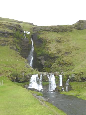
Gluggafoss
We’d had views just before of a photogenic ‘chopped off’ crater. From this point we were driving for a few miles on an unsurfaced road, but just beforehand we stopped to look at an arboretum with some very large trees (for Iceland).
The dirt road we now took was the worst ever, with dreadful corrugations. The land was very flat, with the mass of Eyjafjallajokull to one side. Soon after joining route 1 again, we came to another waterfall – Seljalandsfoss. Again this was the third of three waterfalls, but unlike Gluggafoss, this one was busy with people. It was, though quite dramatic, and fun, as you could walk up behind it, and many people were. The wind was blowing the spray up in the air, which added to the wild effect.
Seljalandsfoss
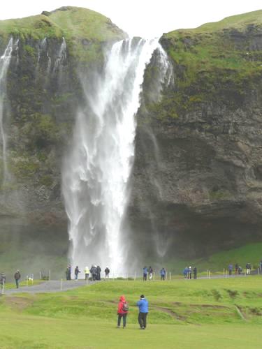
The countryside around was really flat, with craggy mountains to the side, and farm dwellings nestling at the foot of them. We were now passing Eyjafjallajokull from the other side, and stopped by a view to it, with an information board. Opposite was a small visitors centre, where, for an entrance fee, you could see about the ash cloud volcano. We hadn’t time to stop as we still had things to do. Next cameSkogarfoss, yet another waterfall, and once more very busy. This one was big and dramatic. You could walk on a steep path right up to the top (the waterfall was 60 metres high). We got quite wet from the spray just walking to it. The road nearby was a sea of blue lupins, which made a lovely setting.
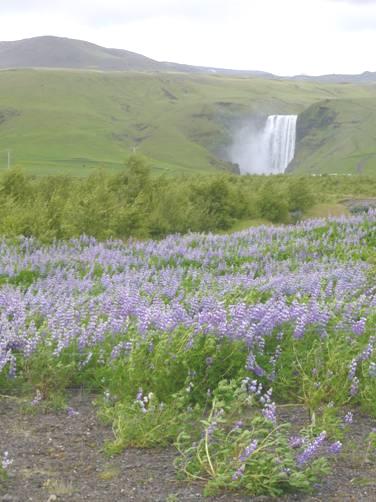
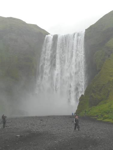
Skogarfoss
We then caught a glimpse of Solheimajokull Glacier, again through the lupins.
Our next ‘port of call’ was Dyrholaey – a spot on the coast in a fantastically beautiful location. The scenery all around here was magical - very green, with craggy mountains with little dwellings huddled at the foot. We were pleased to find that the road to Dyrholaey has now been surfaced. We arrived at the coast where numerous off shore rock stacks loomed vertically – apparently a haven for birds. It was now sunny, and amazingly beautiful, but it was frighteningly windy. We walked around a bit, hoping that we wouldn’t be blown over! We made our way down to a pebbly beach, where the sea was really rough as we looked out to two large stacks.
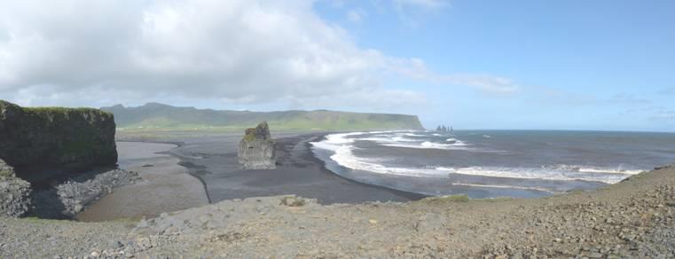
View from Dyrholaey
On the landward side we could see to Murdallsjokul Glacier. Terns were noisily nesting in the grass.
Having been blown to bits, we now made our way to the campsite at nearby Vik, with the lovely mountains up behind.
Saturday 29th June Miles of ???! 113 miles
We woke to a dry day, cloudy, but we did get a lot of sun. The campsite was quite bustling this morning – people going about with purpose, including several cyclists. We found out too late that there were free showers here. By then we were busy with the ‘emptying and filling.
We drove back into the little village of Vik, and managed to get an internet connection. We had mediocre success – the connection wasn’t good - but did get to speak to Joanna to say happy third birthday for tomorrow, and to Felix to wish him a happy birthday on Thursday. We spoke briefly to Tom & Mar.
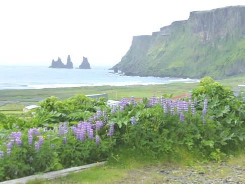
We drove on to the nearby beach – an attractive beach of black sand beneath towering dark cliffs with bright green vegetation. We saw kittiwakes, but no puffins. It was quite beautiful looking back to Vik, with its little red-roofed white church on the hill. We drove up to it later – it was very simple but lovely inside, and the views from there were magnificent. We’d really liked Vik and think that this area is the prettiest in Iceland.
View from Vik church
We drove back a few miles to drive along Reynisfjall, the large hill before Vik, coming down at the end to Reynisfara, a beach of fine black sand with light grey and dark brown boulders behind. The steep cliffs of Reynisfjall towered up above, reaching the sea by a small cave in the basalt pillars.
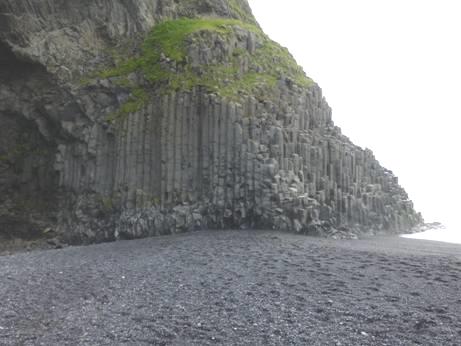
The beach at Reynisfara
There was a finger like stack just offshore, and views back to Dyrholaey, where we were yesterday. From here you could clearly see the large hole through the rock. It was beautiful, calm and misty – but still no puffins. This is the most southerly beach in Iceland.
As we drove back, a gaggle of ducklings crossed the road.
As we drove eastwards, we abruptly left the greenness and came to black lava. We crossed the first area where rivers washed across the ground, and then we drove thorough an absolute sea of lupins – miles and miles of them. Inland we had views to Myrdal glacier. Mt Katla is located just inland from here.
We stopped by a viewpoint which said that when the road was put across this stretch in the 80s, it was all just sand, but lupins and two types of grass had been planted, and it now looks completely natural.
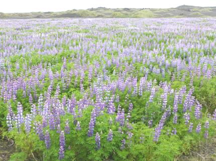
Just a little bit of the lupins
We drove across more flat dark lava, with more glacial views. At Laufskalavarda there were hundreds of small stone cairns. This followed a local legend, saying that passers by should leave a stone to wish good luck to the person in the saga. A pile of stones had apparently been left for this purpose, but must have all been used up.
Now the landscape became more undulating, with green moss, and then grass covering the lava.
We arrived at the small village of Kirkjubaejarklauster (pop 120) – a tongue twister of a name – church/farm/convent. This is the only village between Vik and Hofn. Here we got an internet connection and had a good skype chat to Simon & family, and also phoned Emma and wished her a happy birthday for Wednesday.
We’d earlier been into a building which said ‘farmers market’, but was just a tourist information, with weird, supposedly Icelandic music playing in the background. Later a whole lot of ladies in smart long skirts arrived – maybe a choir, but where did they come from?
It was sunny now, as we walked across fields to Kirkjugolf (church floor), the name given to a small area of basalt shapes which appear at ground level – the top of basalt columns, and apparently a national monument.
The basalt ‘church floor’ at Kirkjubaejarklauster
As we drove on, we passed some pretty waterfalls at Foss, and then came to miles and miles of Skeidararsandur. We had seen this area on the map, and wondered about it – dozens of lines of rivers crossed it, like veins. Nothing could prepare us for the absolute desolation – flat, barren ground stretching on for ever it seemed. This was traversed by streams from the many glaciers. In the distance we had dramatic hills with glaciers, and then just bleakness. It was both awful and awe inspiring.
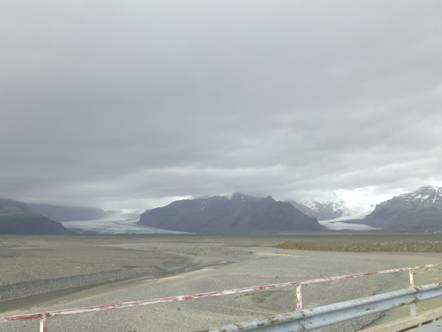
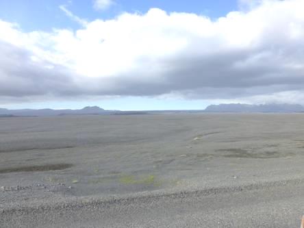
The barren and desolate country of Skeidararsandur (and amazing glaciers)
We drove over a 900m single track bridge across this wilderness before stopping by a picnic site with information boards. These told of a disastrous time in 1996 when the complete bridge, and two others, and 6.4km of road had been washed away by an enormous flood of glacial water. An exhibit of two huge twisted pieces of the bridge stood as a monument. It had a really eerie feeling.
We desperately needed somewhere to stop for the night, but this god forsaken, bleak place did not seem to be the place to stay!
We didn’t want to go far, as there were glaciers everywhere and we wanted to see more.
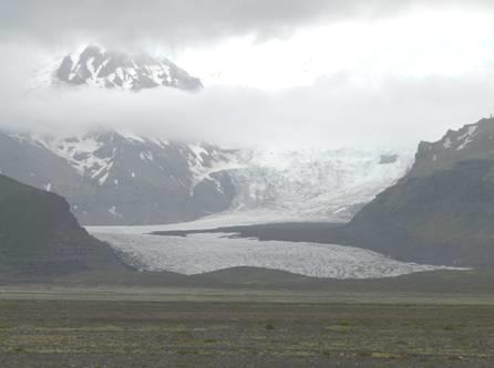
Svinafellsjokull glacier
Our map showed another picnic site a bit further on past Skafta, but reaching it seemed to take an eternity. Finally, around 7 o’clock, we reached a picnic site at Sandfell, well off the road, and at the foot of the massive Hvannadalshnjukur, the highest peak in Iceland (2119m). In front of us stretched the miles and miles of flatness before the sea.
Then it was beans on toast for supper!
Sunday 30th June Glorious glaciers galore (and some icebergs too) 50 miles
It was a pleasant, still morning. After breakfast we walked across to look at the derelict farm, which was very atmospheric, nestling with its one tree beneath the mountain.
The couple who had returned to their car from walking yesterday, and had supper at the picnic table in front of us before sleeping in their little tent nearby, were eating breakfast at the table at 7.00, and had now left.
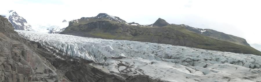
We drove back the 6 miles to Skaftafell, as we wanted to see the glaciers close up. We were amazed at how busy the car park was – glacier tours go from here – there were even a few yellow American school buses!
We opted for the ‘easy’ 2km walk to the foot of Skafta glacier. This was mostly on a tarmacked path, between low vegetation. There were some flowers – mountain avens, mini alchemilla, mountain thyme and beach pea. This reminded us of the desert pea in Australia. The last part of the path was over rough stones, as we came to the foot of Skaftafellsjokull. We couldn’t actually reach the glacier, as there was a wide glacial river in the way!
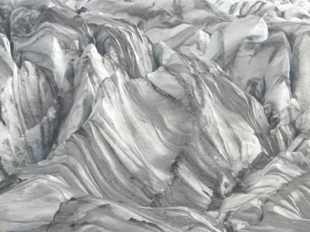
Skaftafellsjokull, the black streaks are volcanic ash
We walked back, seeing a female ptarmigan on the way, and had tea/coffee sitting on a stone fence by the van. It had been a pleasant walk, and a nice temperature.
It was now midday. As we went to leave, we were hampered by large road vehicles which had just arrived to resurface certain bits of the road, leaving us not enough room to get by.
Just along the road, we came to a rough track down to the next glacier, Svinafelssjokull. Other people had come here too. The path to this glacier was over rough ground, and not suitable for everyone!
Svinafellsjokull
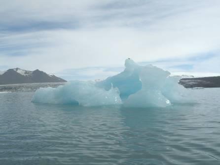
Again there was a river preventing you getting to the glacier, but there was a little lake with icebergs floating in it.
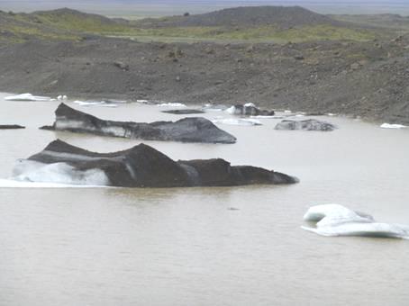
Icebergs in the glacial lake at Svinafellsjokull
We now continued back to Sandfell, where we stayed last night, and ate our lunch at the picnic table, although the sun had gone in at his point. We discovered to our dismay that the French loaf we had taken from the freezer was actually a garlic loaf! There were sheep around – a black and a white one came to watch us.
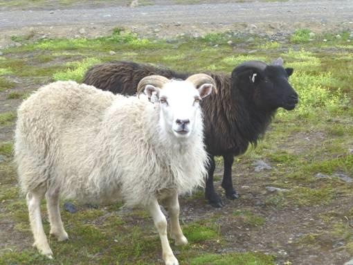
Sheep watching us have lunch
We were pleased to receive a message from Val Gam, saying that they would like us to call in to see them in Denmark on our return.
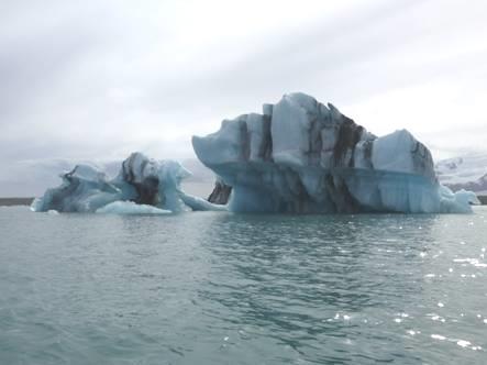
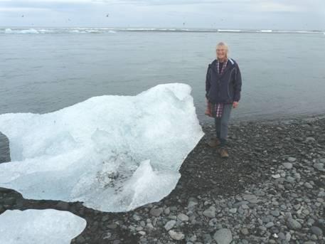
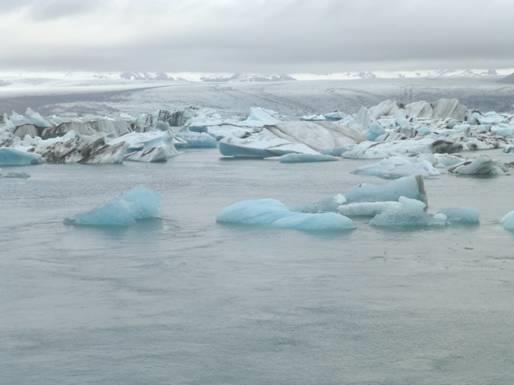
Now 2 o’clock, we started our drive onwards to Jokulsarlon, a lake at the foot of Breidamerkurjokull, which is an offshoot of Vatnajokull, the massive glacier from which many others flow. We passed lots on the way.
We wanted to have a ‘ride’ on the lake, which had dozens of small icebergs floating in it. There was a tour company either side of the splendid bridge over the Jokuls River, just before it reaches the sea. We tried both sides, but opted for the first one, which cost a bit more, but provided warm waterproof ’babygros’. Although we felt very bundled up in these, with a small lifejacket on top, it was good to be warm! Also the other one wasn’t going for another hour or so, and this one was going immediately. We had to walk down a steep scree slope to the zodiac – we had stopped just beforehand to view the lake, and I hadn’t liked the steep slope we had climbed up then.
Ready for our zodiac glacial lake trip
There were 10 of us in the zodiac, plus our pleasant ‘captain’, who spoke good English. Memories of Antarctica came flooding back, as we zoomed across the lagoon, stopping to view and photograph the most attractive ice flows. Our only complaint was that the icebergs always seemed to be on the other side of the boat! We went right across the lake – nearly 7 km - to the foot of the glacier, before returning. It was a great trip. We’d seen arctic terns diving, great skuas, and a snow bunting.
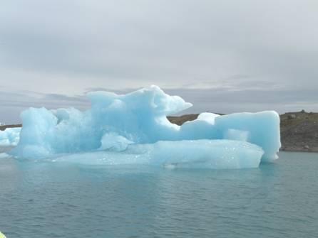
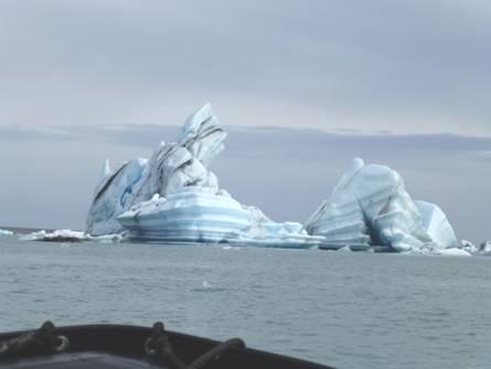
Icebergs floating in Jokulsarlon
Now we had a dilemma. We had a nice sounding campsite to head for 30 miles on, but we also knew that we could stay here – either by the river, or across the road by the beach, where the icebergs flowed into the sea. What a choice! We walked onto the beach of fine black sand, and looked at the views all around us, and then there was no choice! We decided to stay!
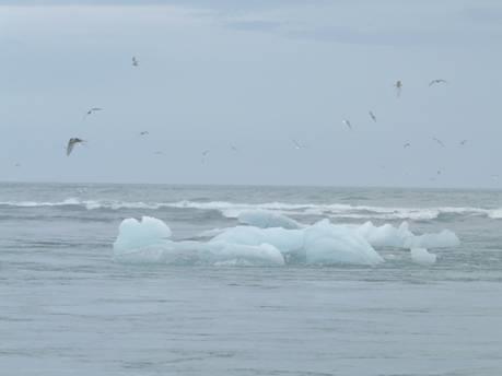
Icebergs floating out to sea Not going for a paddle!
Later the tide started coming in, and the icebergs floated back up the river! There was a strange bit of rainbow colours in the sky (but certainly no rain).
After supper we togged up and walked onto the black sandy beach strewn with its ‘pavement’ of light coloured large pebbles further up. The bits of iceberg left on the shore were a wonderful assortment of shapes and sizes. Up behind was the backdrop of mountains and glaciers. A real top spot!
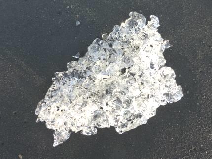
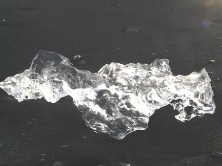
Nuggets of ice on the black sand
We started editing the next part of our diary for the website, before retiring to bed with our dreamlike view.
Monday 1st July No more glaciers 146 miles
We were awake before 6 o’clock, and looked out to our fantastic view – the icebergs were floating down to sea now. There was a lone log on the beach, so this was the place to eat our breakfast.
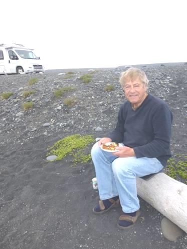
Breakfast on the beach
The glaciers were glinting in the sun, and sea mist was rolling in along the coast. A great skua came to watch us.
Morning glaciers
We set off to continue driving north eastwards, stopping on the lovely suspension bridge to photograph more icebergs on the lake. The car park there would have been a good choice to overnight too.
Farewell icebergs!
The sea mist became rain as we drove on, passing yet more glaciers. We passed the campsite we had been heading for yesterday, and that looked nice too. It was just below Flaajokull glacier.
We drove into the village of Hofn (apparently pronounced like a hiccup!) It looked lovely, even in the rain. It has amazing views, with four glaciers up behind, and lagoons all around.
There are four glaciers behind Hofn
We saw a Netto store, so went in to buy some bread from the excellent bakery. It seemed to be THE place to come today – or perhaps the only place.
We found an internet connection with difficulty, and received a message from Peter and Dianne to say that they have another little grandson., George, born yesterday
We drove on past the attractive large harbour, with its collection of fishing boats. This is apparently an important lobster fishing place, but we saw no evidence of any to buy.
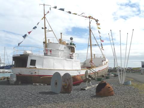
An old fishing boat by the harbour at Hofn
We drove up to a viewpont on a reserve south of the village to have lunch. The views in all directions were superb. There was a colony of noisy nesting terns, and a snipe landed just nearby.
We drove down to a little beach on the lagoon. It wasn’t raining now, but there was a cool wind.
We continued along the coast, beside very steep mountains with scree slopes stretching for miles under the rocky outcrops at the top. Sometimes the mountainside went down steeply to the sea, with the road in between – there was a crash barrier, so it must have been serious!
Coastal road through the scree slopes
We stopped above the sea by rocky cliffs, with stacks off shore. We watched kittiwakes gliding about, but still no puffins. We had now left the dramatically steep, barren mountains, and were driving through prettier mountain scenery, quite green.
We drove down into the pretty, proud little fishing village of Djupivogur, which had a harbour full of fishing boats, before driving around the last fjord for today – Berufjordur. Our campsite was on the far side of this fjord, but it took 30 miles of road - a long section unsurfaced, and this is Route 1! – to get there, through the towering, barren mountains. There was virtually no habitation and high above were snowy ‘cirques’.
We arrived at Berunes campsite, and positioned ourselves with views past the buttercups across the fjord to Djupivogur.
Tuesday 2nd July Full circle, and puffins at last!! 125 miles
We woke to a beautiful morning, and looked out to our lovely blue, green and yellow view.
Our view from Berunes campsite
We continued our wonderful journey along the coast, with the sea glinting in the sun. Swathes of Arctic cottongrass were brightening the side of the road, and there were still masses of long waterfalls.
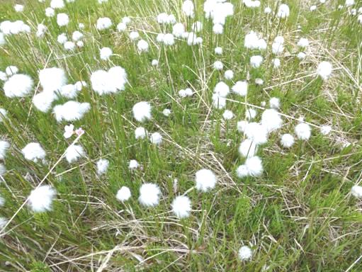
Arctic cottongrass
We came to the broad valley of Breiddelskik, which was very pretty, with rhyolite peaks and stark, beautiful mountains with snow. There were roadworks and the digger hardly gave us room to pass.
We drove around the lovely fjord of Stodvarfjordur.
The cirque at the end of Stodvarfjordur
And then through the pretty village with its two little harbours and its blue roofed church, which is now used as a hostel. The newer church was not so attractive! I noticed a lot of flowers in gardens here, including beautiful blue meconopsis. There is apparently a museum of stones here – the life work of a very old lady named Petra! We passed a football pitch, with nets to stop the ball going into the sea, and the campsite here is supposedly free. A nice place!
Next came Faskrudsfjordur, which had a tunnel at the end of it, cutting off the 50 km drive around the headland. I would have liked the drive, but time decreed otherwise, and we went through the 6km tunnel, coming out at Reydarfjordur, at the end of the next fjord, and looking very similar!
From here we took the road along the valley to Egilsstadur. Long waterfalls were everywhere, coming from the melting snow. There was no sign of people or habitation.
We reached Egilsstadur just after midday – three weeks after we had started out – we had come full circle!
We got some diesel, then wasted a lot of time trying fruitlessly to get an internet connection.
From here we were taking the road north to Bakkagerdi, much of which was unsurfaced. The reason for us going this way, was that we were still on the search for puffins, which had eluded us so far. We knew that we could have gone on an organised boat trip to a puffin venue, but wanted to find them for ourselves.
The problem on this road was that there was nowhere to pull off, and we needed lunch. Eventually we stopped in front of a gateway, just as the surfaced section ran out!
We now drove through lower land with flatter, snow-streaked hills, beside ponds from the Lagarflot River. On the other side of us, a river meandered with huge bends. There was almost nothing in this valley. We then had to ascend a long, steep gravel pass, with dark mountains zebra-streaked with white snow.
Descending the Vatnsskard Pass
The road now went along above the sea, with no barrier. We were glad to come to the surfaced section as we descended to Borgarfjordur, with the small town of Bakkagerdi (pop 100) at the end of it.
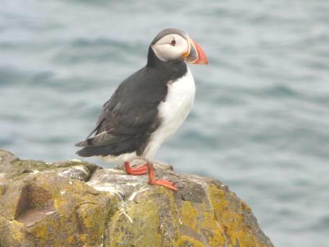
We drove on the few miles to the puffin site at Hofn. This was a small rocky cliff, Hafnarholmi, once an island, but now joined by a causeway past the pleasant little harbour.
All very lowkey! We parked right by the rock, with puffins up above us. We dressed up warmly – it was very blowy here – and climbed the steps to look down on all the birds. Puffins were flying off, like bulldozers, and sitting perched, or strutting about. It was great to watch these comical creatures – they could only make you smile.
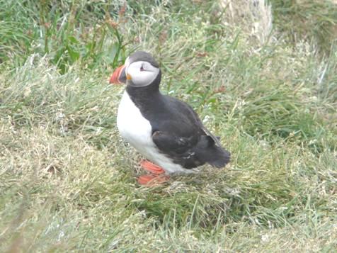
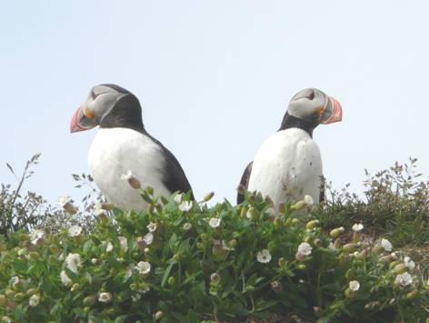
Comical puffins
We came back to the van for a warming cup of tea before going for a second look!
We found another little platform, and this one gave great views of the dozens of nesting kittiwakes (which we found are called Rita here!) There were baby birds in the nests, so we had the privilege of watching this wonderful bit of nature.
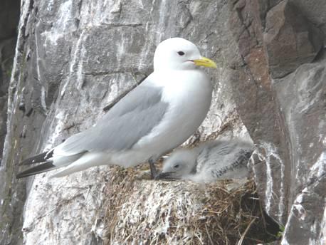
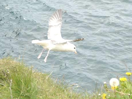
Kittiwake and young A fulmar flying
Other nests contained fulmars, so we had a real bonanza! Adrian exceeded even the number of iceberg photos he’d taken!
What a site! It was very pretty, with the harbour below, and great scenery all around.
Having had our fill, we drove back a few miles to a lovely spot beside the water just before Bakkagerdi, with rhyolite mountains up in front of us.
Wednesday 3rd July Our last day in Iceland 108 miles
Another place with a beautiful view to wake up to all around, from snowy cirques up behind to the calm lagoon and then the sea in front.
Another lovely overnighter!
We drove back into pretty Bakkagerdi. We stopped beside a little turf house which is still lived in by an old lady. It’s almost completely covered by turf. It isn’t open to the public, but interesting ‘bits’ were outside it.
The turf house in Bakkagerdi
The houses in the village were simple, and painted in bright colours. The gardens were looked after, and there were washing lines with washing blowing in the breeze. There was a dear little church.Bakkagerdi seemed a loved and proud village.
We now began our perilous journey on the gravel road back towards Egilsstadir. We stopped by a board saying that the road is much safer than it used to be. It had always been troubled by landslides.
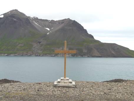
The dodgy road from Bakkagerdi with its cross
There has been a cross beside the road since 1306 with the tradition that passersby should bow to it. The present cross looked very new.
We stopped when we reached a view down to the wide valley of Heradssandur, with its three rivers flowing to the turquoise sea at Heradsfloi. The valley was flanked by snowy mountains, ending at arhyolite hill. We met the grader and water tanker at the end of the gravel section.
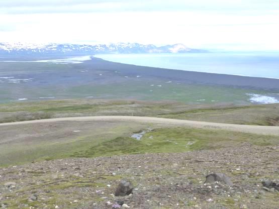
Looking down to Heradssandur
We opted to take a different route back to Egilsstadir. This was all unsurfaced, and we often wished that the grader had been through this way!
Our coffee stop was beside Lagarfoss, the only waterfall on the Lagar River, and now governed by a hydroelectric plant.
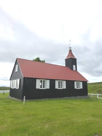
Just on from here we came to the delightful little black painted church of Kikjubaer, apparently one of the oldest wooden churches in Iceland. It was a lovely sight, with its red roof visible from quite a distance in this remote area.
The door into the nave was locked, but you could climb up some very steep stairs to the tiny balcony and look down. There was no rail, and you had to turn round to come down. The pulpit is 16th century, the oldest in Iceland.
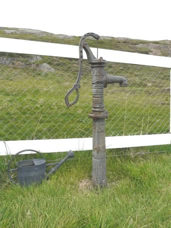
Kikjubaer church and its pump
In the grassy churchyard, edged by a white fence, stood an old pump. There were a few assorted graves in the churchyard, and all around was just miles of green grass, edged with the snowy white hills. A treasure of a place! As we drove on, we saw two skuas attack a young snipe and eat it – not a pleasant sight.
Just before our road reached route 1, there was a little track to the side which led over a tiny bridge. The River Jolsa, which flows gently across the plain went through a deep gorge here.
We reached Route 1 at a bridge we’d pulled in by on our first day. This seemed a good place to stop for lunch!
We drove back into Eglsstadur, and this time got an internet connection more easily. The connection wasn’t good, but we were able to phone Emma briefly on her actual birthday.
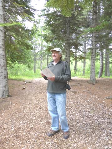
We decided to drive down beside Lagarfljot for a way, on this side, as the other side was mostly unsurfaced, and we’ve had enough of that! We didn’t see ‘Nessie’s sister’, the ‘Lagarfljot worm’, but drove to Hallormsstadaskogur, Iceland’s biggest forest. This isn’t large by other standards, but we did stop and walk through the forest, which was a different experience in Iceland! Evidently there is a tree here 22m high, massive in Iceland. The joke in Iceland goes - Question: what do you do if you are lost in a forest in Iceland – Answer: Stand up! There was a trail past some wooden sculptures, which we found rather weird – one was a tree painted bright pink - but there was some nice wood carving too.
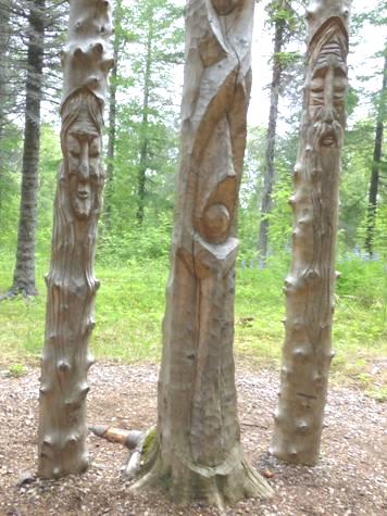
Hallormsstadaskogur, Iceland’s largest forest
Now it was time to return to Egilsstadir, but as we did so, it began to rain. The lupins beside the road were a darker blue here, and the dandelions have mostly finished, so there is a sea of fluffy heads. There are still plenty of bright yellow buttercups.
We drove through Egilsstadir and took the road to Seydisfjordur – back to the beginning. We wondered what we would think of the road this time – we had been so impressed when we arrived in Iceland.
It still was impressive! There was plenty of snow around, and fog on the top of the pass as before.
Going back over the pass to Seydisfjordur
There were waterfalls everywhere on our way down – no wonder we were impressed! We stopped by Gufufoss, which we’d photographed on our way up.
Then it was on to Seydisfjordur, where we arrived at the campsite soon after 5.00. It was already very busy, as everyone here must be catching the weekly ferry tomorrow too. We found ourselves a spot, looking across to the pretty pale blue painted church. We had read that there were music concerts in there on Wednesday evenings in summer, and were quite excited by that, but on investigation we found that they don’t start until next week. Instead we made use of the washing machine!
Seydisfjordur
After supper we walked around the delightful little town, with its tiny pale blue church and the towering mountains all around with their myriads of long, slender waterfalls streaming from them. The tall, steep slopes were masked by cloud. We walked beside a small lake fringed by brightly coloured houses which were reflected in it. A young man was setting up his camera to photograph the peaceful scene. A little girl of 8 or 9, all in pink, cycled by alone on her pink bicycle. Beyond lay the sea.
We came back to the van for our last night in Iceland.
Thursday 4th July Farewell Iceland, Faroes here we come!
It was a very wet morning! The mountains were shrouded in cloud. We realised how lucky we had been with our weather in Iceland.
We started to get organised for our ferry to the Faroes, which was leaving at 11.30. We were a bit disconcerted when the other campers all seemed to be leaving. We scanned our tickets, and saw the small print which stated that for Seydisfjordur, passengers should book in 3 hours before sailing time!! Other departures only required 1½ hours. Now we had to hurry a bit!
We arrived a good two hours before departure, and having booked in, a very young lad directed us to the waiting queue, along with many others.
Once on board, we found our corridor, but it wasn’t ready, so we had to wait outside the door. There isn’t a long turn-around time, and obviously not all the cabins were ready. Even so, the boat left early, at about 11.15.
Because of the low cloud, we couldn’t see much of the splendid scenery which we’d so enjoyed on our arrival.
We soon made our way to the cafeteria, where we ate pizza (A) and salad (R), with enough left over for later.
The sea was much choppier than on the outward journey. We did both manage a quick swim in the pool, with the water sloshing from side to side.
After that, the time passed very quickly, a good bit of it taken up by working on our website.
We went along to the lounge for a short while to hear the chap singing with guitar, coming back to our cabin at 11.30, wondering how we would cope with our 3.00 am arrival at Torshaven, having had to vacate our cabin 2 hours before!
Reykjavic to The Faroe Islands


Back to Iceland Main Page
Back to Iceland Main Page


