
North & Mid Wales
Wednesday 18th May 2011 182 miles
This part of our ‘Road around Britain’ starts a year after our last short section. At that time, I became unwell, and after many months of tests, it was discovered that I had a brain tumour, which unfortunately proved to be malignant.
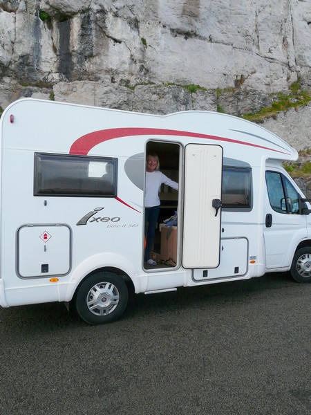
Having undergone an operation to remove some of it, followed by radiotherapy and chemotherapy, we decided to try out our new motorhome, a Burstner known as ‘Ixi’. This restricted some of the places we could go as our new motorhome was wider than the Tiv and we did not want to 'damage' it on very narrow roads. Also Rosie had trouble walking and so was in a wheelchair for longer 'walks' (which she hated)
( It is ironic that as we prepare this trip for our website 9 years later, that Rosie is again in trouble with her brainstem tumour, but this time because of the Covid-19 pandemic, she along with thousands of others, has been denied further treatment for her cancer)
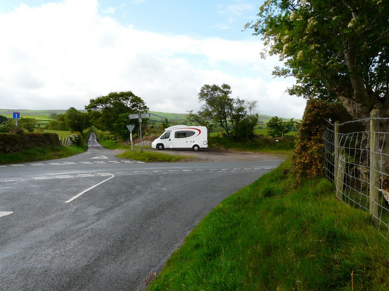
We had a relatively trouble free journey via the A34, M40, M5 & M6 arriving at Runcorn at 5.00pm, after our lunchtime start. We found a pleasant spot near a disused factory, with everywhere looking very green, despite the drought conditions we have been experiencing.
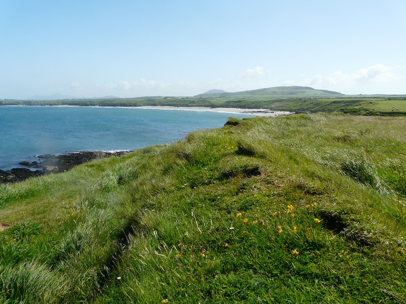
We look forward to exploring the Wirral peninsula before discovering some of the North Wales coast
Thursday 19th May 45 miles
It was a fine morning, and we got up early. We had slept on the ‘pull-down bed’ for the first time, and managed OK, but it wasn’t the best for my frequent night time ‘get-ups’!
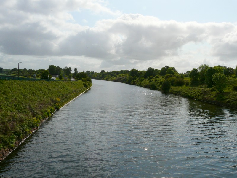
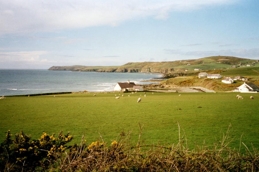
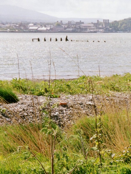
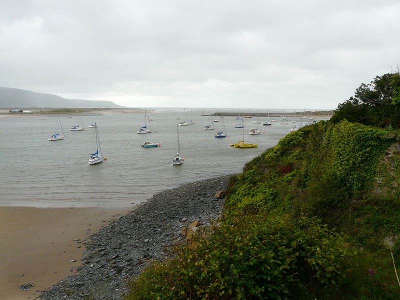
We left at 9.30, and found our way to cross the Manchester Ship Canal at a place called Wiggs Island – the site of an early copper and sulphuric acid factory. The owner had built a canal to ship his goods, and this later became part of the Manchester Ship Canal. The area of Wiggs Island is now a pleasant country park. We had views to Runcorn Bridge, which crosses the River Mersey. A bit further on was a bird hide, which had been opened by Bill Oddie. Some people with their dog admired our (new) van. The only birds we saw were Canada Geese and gulls! Still, it had been a lovely start to the day – we were particularly interested in the Manchester Ship Canal, as it had been mentioned in one of William Lawson’s letters (my Great Uncle) from the Marquesas Islands to his family, when it had just been built in the late 1800s.
We now made our way into Runcorn, which looked pleasant enough in the late spring sunshine. We stopped beside the canal/Mersey looking to the Runcorn bridge, and across to Widnes, with its stumpy church tower.
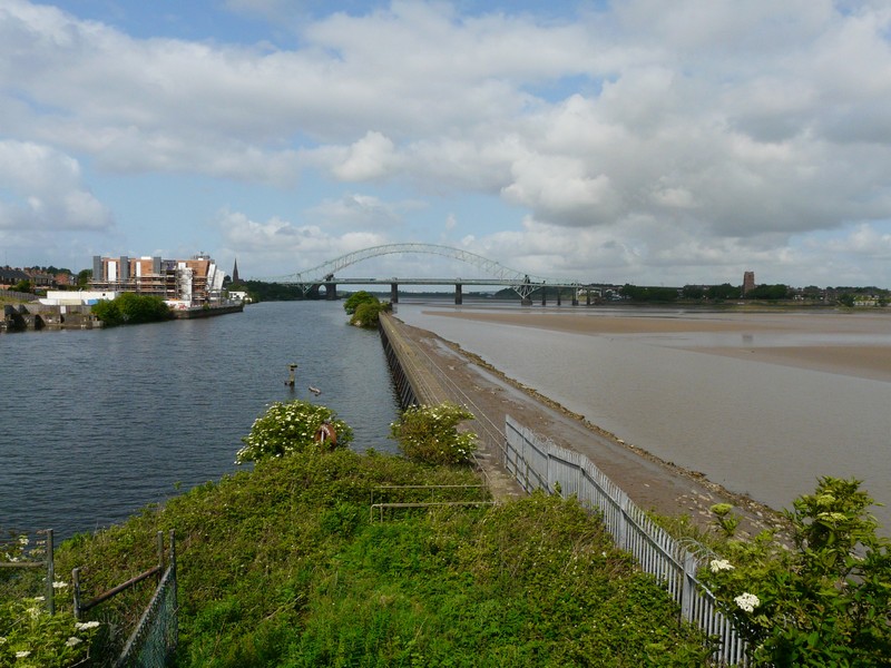
Runcorn Bridge over the Mersey River and Manchester Ship canal from Wigg's Island
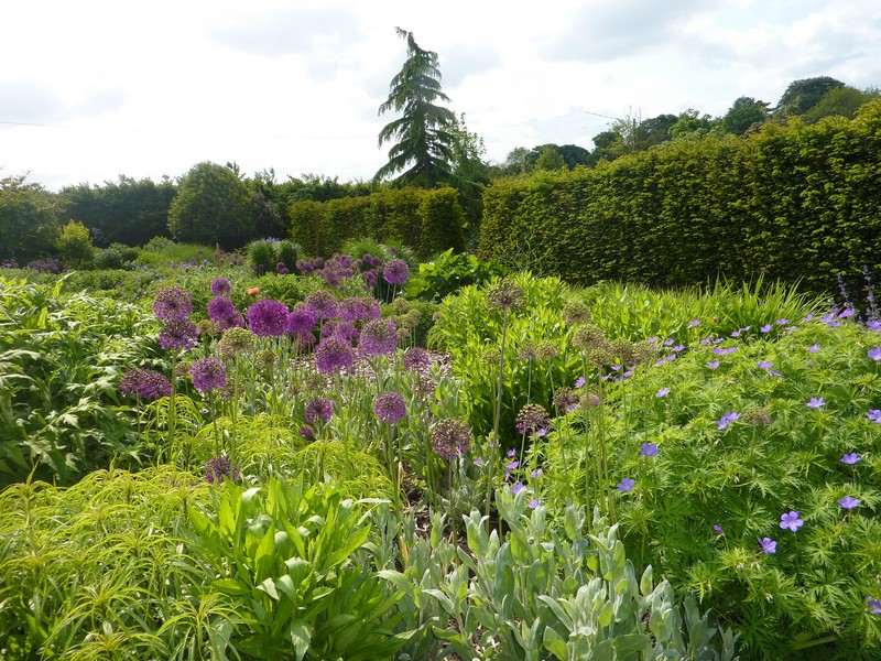
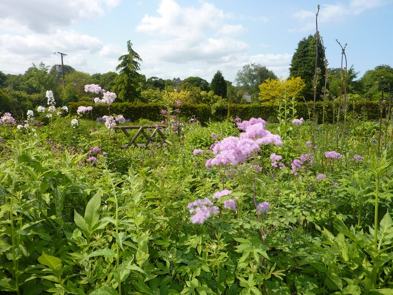
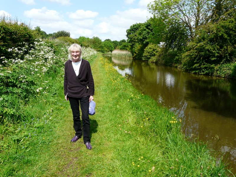
We were relying on the computer ‘track finder’ to find our route through the busy areas, but this often let us down today by suddenly not working, which was very frustrating. Nevertheless, we were able to find our way to Bluebell Cottage Gardens, in a rural spot near Dutton. We used my wheel chair for the first time. Wheelchair users were free, and Adrian had my RHS card, so it was extra good! The gardens were delightful, with lots of blue flowers, and some stunning crimson poppies. After our visit, we enjoyed lunch sitting at the table which Adrian had put together, at the edge of the meadow, which was full of buttercups. It was beautifully warm and peaceful.
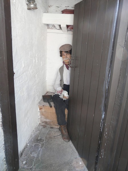
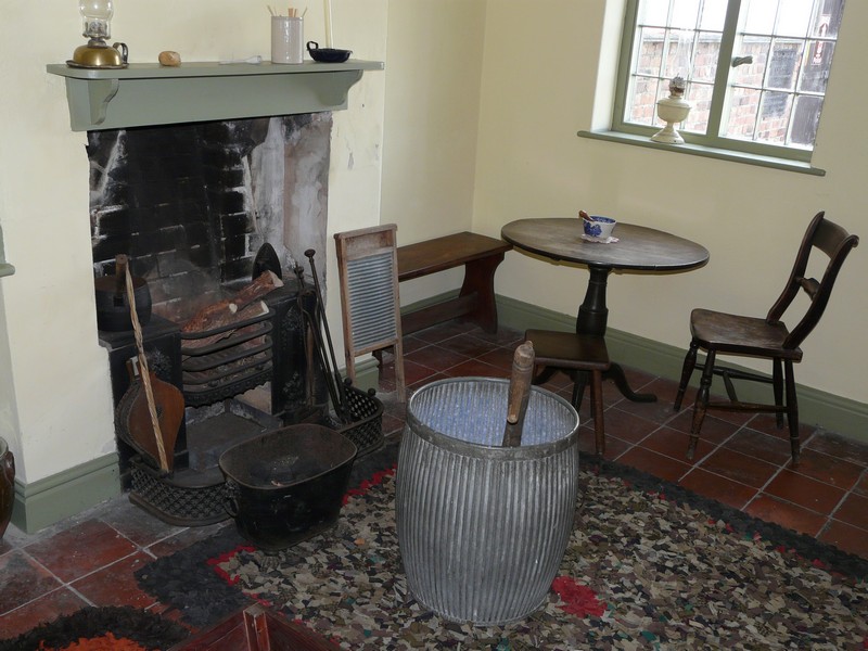
It was just gone 2.00pm when we left, and negotiated the fast and busy roads to Ellesmere Port. We had decided to visit the National Waterways Museum here. We had come before in 1985, but have little memory of it. Recently we had seen a television programme about the museum, and the financial difficulty it had in keeping going. Again we used the wheelchair, which meant that Adrian got in free as a ‘carer’. I didn’t like the fact of being in a wheelchair, and the wind was very chilly here, compared with the gardens earlier. Still, it was good to see the many canal boats and memorabilia. We particularly liked the little row of cottages, done up in eras from 1830 to 1950. In the outside ‘dunny’, we were amused at the figure of a ‘man’ sitting behind the half open door!
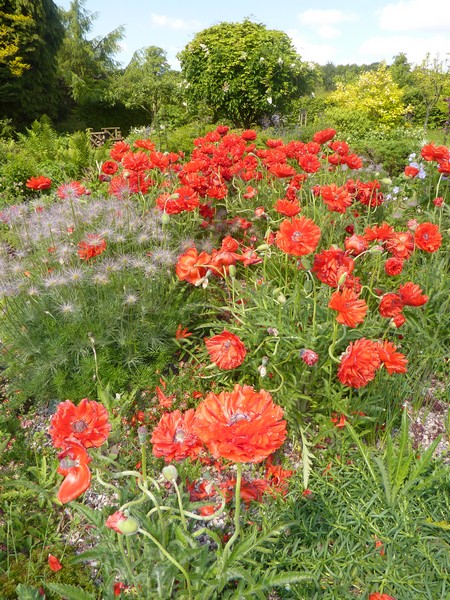
Bluebell Cottage with its lovely gardens
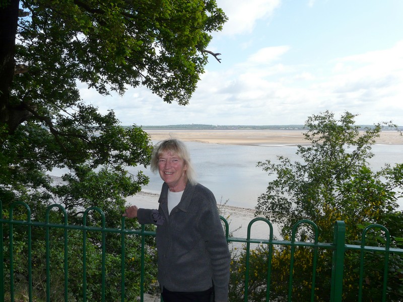
The café was closed as we left, so we warmed up with a cup of tea in the van, while Adrian looked up possible places to stay tonight. It wasn’t easy, as we were in a busy area. We settled on searching for a ‘free’ spot, mentioned in Adrian’s list of ‘overnighters’, but on the other side of the Wirral at Ness. We found a mostly rural route to it, and at 5.30, we settled beside the road at a spot used by birdwatchers, as it overlooked the RSPB reserve beside the marshes of the Dee estuary. We had to wait a while for the occupants of a car, which was just in the spot we wanted, to leave. Adrian then cooked supper, as we enjoyed our pleasant view towards the Welsh hills.
After supper we had a short walk out. Several little egrets flew up from the long grass, and we had seen a lot of small birds, but they were too quick for us to identify them.
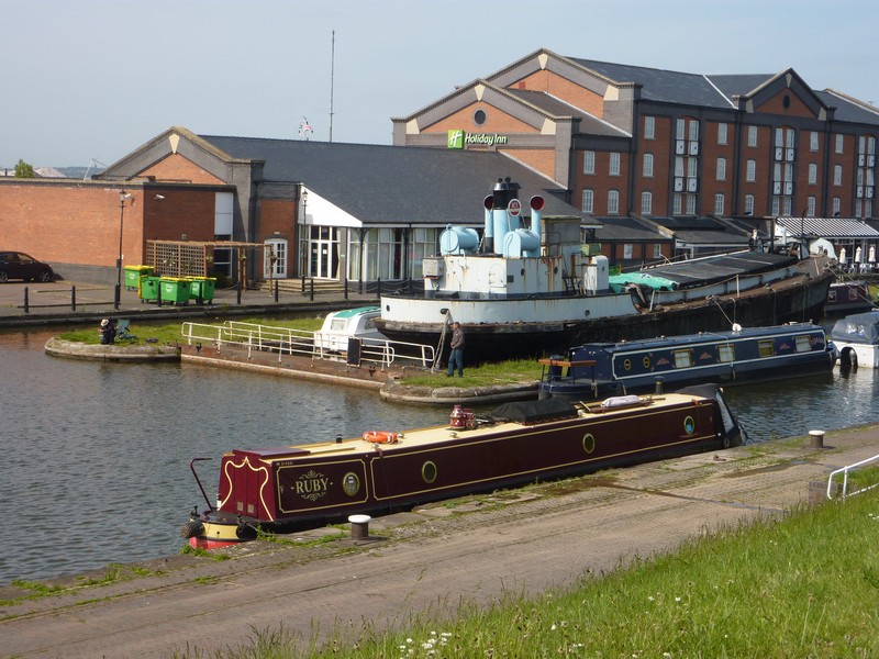
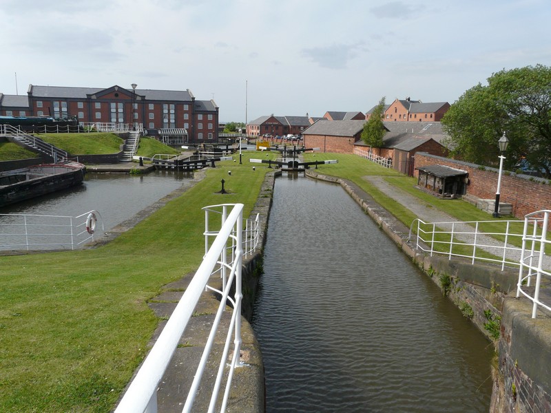
Ellesmere Port - Waterways Museum
Friday 20th May 48 miles
We were awake early to a fine morning. We enjoyed our lovely location, and left at 9 o’clock.
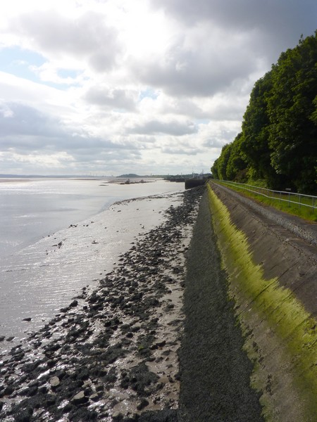
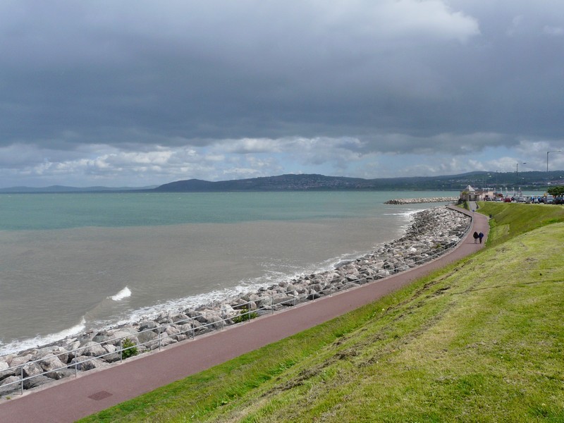
We drove back across the Wirral peninsula, coming to Eastham Country Park. Our 1970’s AA Book of the Seaside described Eastham as an ‘unexpected oasis of green amid industrial estates’. We would certainly agree with that. It was very quiet looking across the mudflats towards the Liverpool side.
We drove on through Birkenhead, which was a mixture of business parks, warehouses, historic buildings and modernity. The centre looked pleasant. We had to be careful that we didn’t take the route to the tunnel under the Mersey by mistake!
We stopped near to the ferry to Belfast. Large lorries were driving on, and later we saw the ferry leave. We could look across to the Liver buildings of Liverpool. We drove on to the Seacombe ferry terminal, where the River Mersey looked very grey!
We drove on through the suburb of Egremont, and thought of Paul. It looked very run down, but there was still a body piercing shop! This was another site of a former ferry.
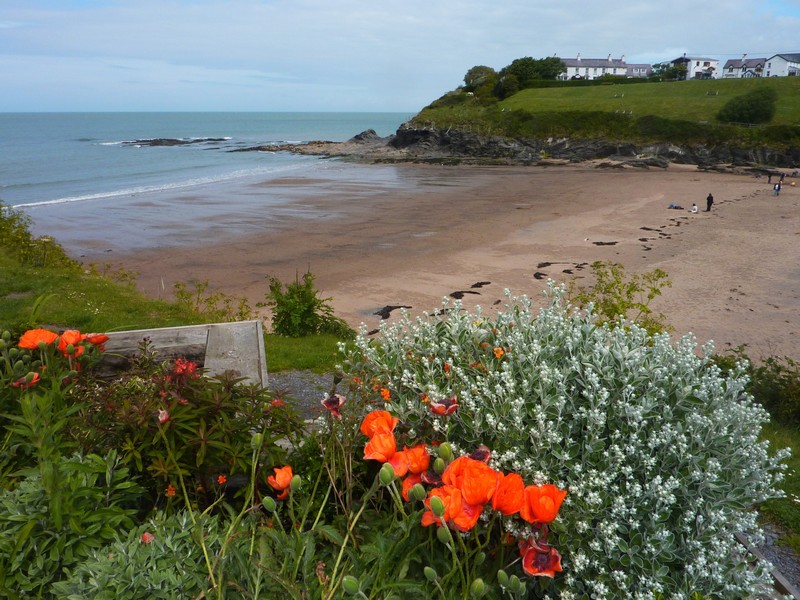
New Brighton was very ‘seasidy’, but had a wide sandy beach and a free car park! We walked across the sand to the water’s edge – it was extremely windy.
We had lunch by the sea, at the northern end of the Wirral in Wallasey. It had rained hard by the time we left at 2 o’clock.
We continued around the peninsula, coming to Hoylake, where it was raining again, and the sea looked very bleak.
We drove to the north westerly point of the Wirral, where the road just stopped. We could see the 3 small Hilbre islands which you can apparently walk to at low tide.
We continued down the western side of the Wirral through West Kirby, where a long wall enclosed 32 acre ‘Marine Lake’, which intrigued Adrian. It had been built for recreational purposes as the tide goes out for a mile.
At Heswall we pulled into a car park overlooking the mud flats of the River Dee, a bit further north from last night. It was raining as we arrived. We had a cup of tea, and then the rain stopped. We decided that we might as well stay here for tonight. In fact, it turned into a lovely evening, and we watched the sun go down.
Eastham Country Park and the end of the Manchester Ship canal
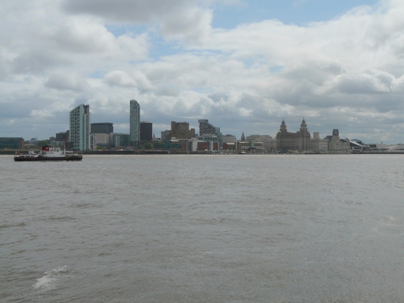
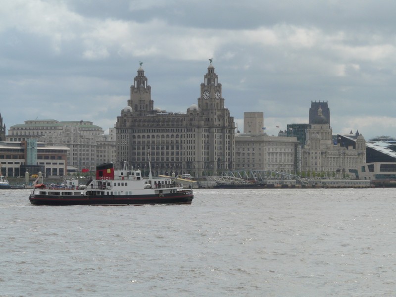
Looking across the Mersey to Liverpool and the Liver Buildings
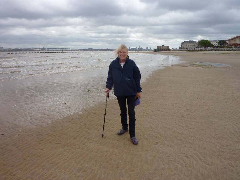
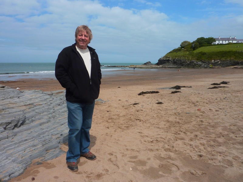
Rosie on the beach at New Brighton
The sun goes down at Heswall
Saturday 21st May 65 miles
It was dry but cloudy when we woke up. We left just after 9.00am to drive the last part of the Wirral peninsula. We drove through the pleasant ‘village’ of Parkgate, pulling in once more beside the reed beds. There were a lot of birds, and it all looked very attractive. The ‘town’ used to be a port, but apparently the estuary was artificially silted up to divert the river. We drove on through the spreading village of Neston, which looked very nice too – this was near where we had overnighted two days ago.
At 10.00 am, we passed the sign saying ‘Welcome to Wales’. We had a bit of confusion at Queensferry, so stopped to get fuel, and then took the rather unexciting road towards Flint. In fact the whole of this eastern shore was disappointing, as there were virtually no turn offs to the estuary, except for Business Parks. We tried one at Greenfield, and photographed some little boats in a muddy stream estuary, but any possible places to pull in had height barriers.
The second one we tried was just a huge wind turbine assembly area. Later, at Rhyl, we witnessed large wind farms out to sea.
While Adrian did a quick shop in Tesco Express in Flint, I listened to a programme on singer Francoise Hardy. Adrian had bought a pecan pastry for us to share for ‘elevenses’ , but it was 11.20 before we could find anywhere to pull off to eat it.
Soon after this, we turned off to Talacre - a holiday camp area, with all the associated shops and cafes. There was a free carpark, which even on this mediochre Saturday was almost full. We were at the north-eastern point of the Dee estuary, called ‘Point of Ayr’ (it seems that they are trying to confuse Wales with Scotland, with Flint & Ayr!)
You could walk across lots of sand dunes to the beach. We walked to a viewpoint, not far from a disused lighthouse. Back near the van, we couldn’t resist buying some chips from the café, and despite our late snack, we made this lunch, with the addition of a bit of tasty chicken left from yesterday, and fresh rolls which Adrian had bought.
Now we continued along the northern coast towards Prestatyn. We turned off to Gronant, which once more was a huge static caravan area, and not for us!
Prestatyn and neighbouring Rhyl did not excite us – we were glad that we had always had more exciting holidays!
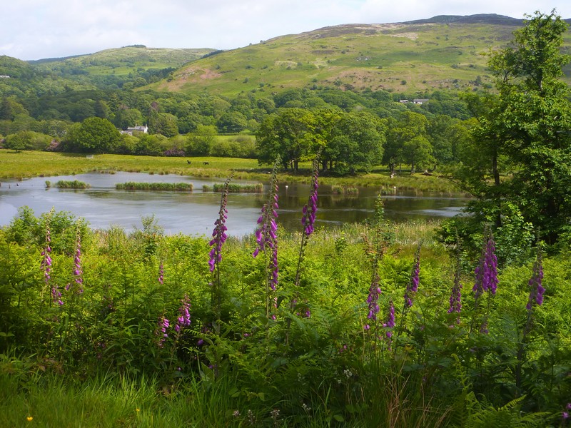
A bit further on, at Pensarn, we had note of a free onernighting place, but that wasn’t so now! We had decided to drive inland for a bit from Abergele. We ascended the Welsh hills, and the slight drizzle of the coast became heavy Welsh mist! The scenery was lovely, as the road wound up and down. With high banks of bluebells, campion and cow parsley, and everywhere very green, it reminded us of Devon. At 3.45 we stopped at a pull-off by a rural junction between Llansannan and Gwytherin. The banks here were scattered with stitchwort. We didn’t envy the sheep and lambs in the fields, as the evening became really wet.
Sunday 22nd May 51 miles
We’d heard heavy rain and strong winds in the night, but there was some sun when we woke up. We left just after 9 o’clock and continued on our steep and winding and very green route to Pandy Tudur, where Adrian had stayed for a family holiday in the fifties. We tried fruitlessly to locate the house which he had stayed in then. All that happened was that we got stuck n a narrow lane, but luckily managed to extricate ourselves.
We wound on down to the River Conway, reaching it at Llanwrst, where there was an attractive bridge across the river. We found a free car park overlooking the river.
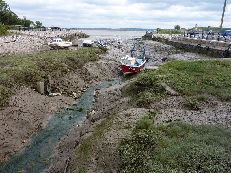
Boats in a muddy 'harbour', Greenfield
Rosie on the front at Rhyl
Our overnight spot (it was very quiet)
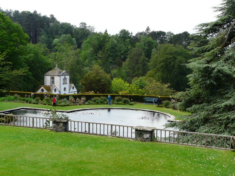
We now made our way to Bodnant Gardens, which we had visited with Val & Mike in 2002, but had very little memory of. We were amazed at how busy the gardens were. This fact, and the steepness of the valley, made us think of the Butchart Gardens on Vancouver Island.
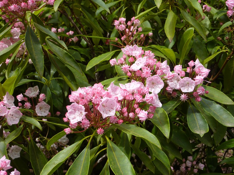
The most notable thing today was the wonderful laburnum tunnel, still looking splendid. Sadly for us, the rhododendrons and azaleas were almost over. We had some pleasant sunshine as we walked around, but the strong wind was very cool.
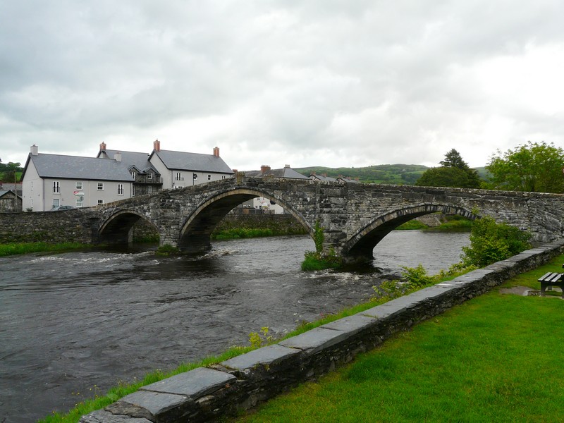
The nice bridge at Llanwrst
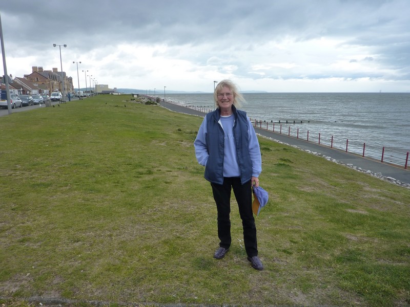
It was time for lunch when we came out, but as the van was parked on a steep bit of road, we drove on, stopping at Clan Conway, overlooking the river, to have lunch. Then it was back to our ‘road round Britain’, starting at Rhos on Sea.
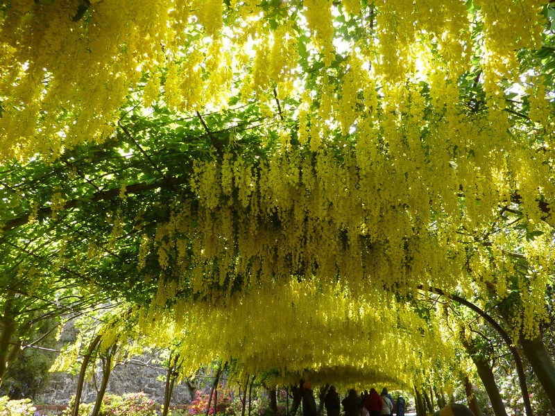
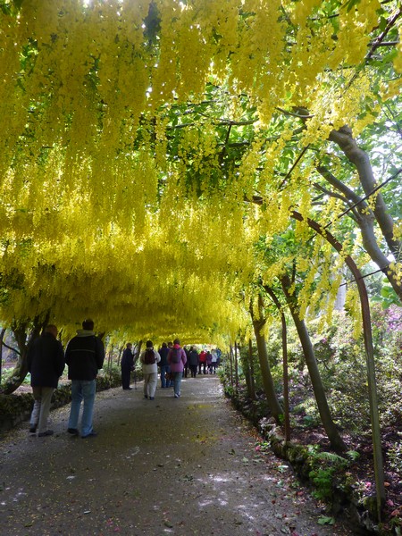
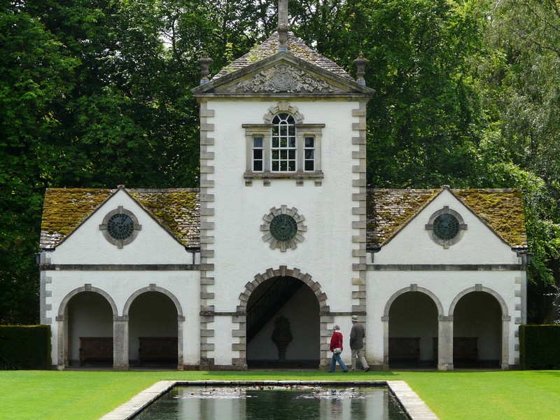
Beautiful Bodnant Gardens
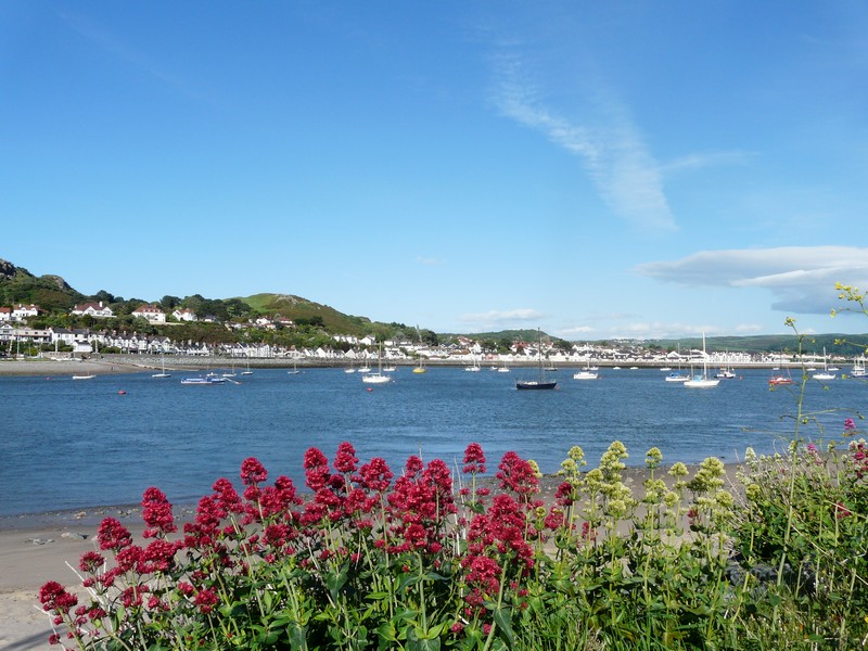
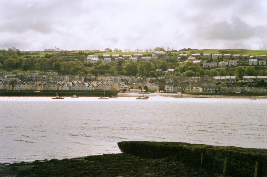
We liked the little upended boats on the shore, as we looked back along this north coast. We were soon passing the large ‘lump’ of Little Ormes Head, and then we reached the splendid up-market resort of Llandudno, with its pretty pier with railings of blue & white.
Rhos on Sea
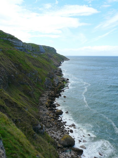
Adjacent to Llandudno is Great Ormes Head, and for a toll of £2.50, we drove around and up to the summit of this fine ‘rock’, stopping several times to enjoy the views. The weather now was mostly sunny, but there was a sudden sharp hail storm, so we were glad not to be outside!
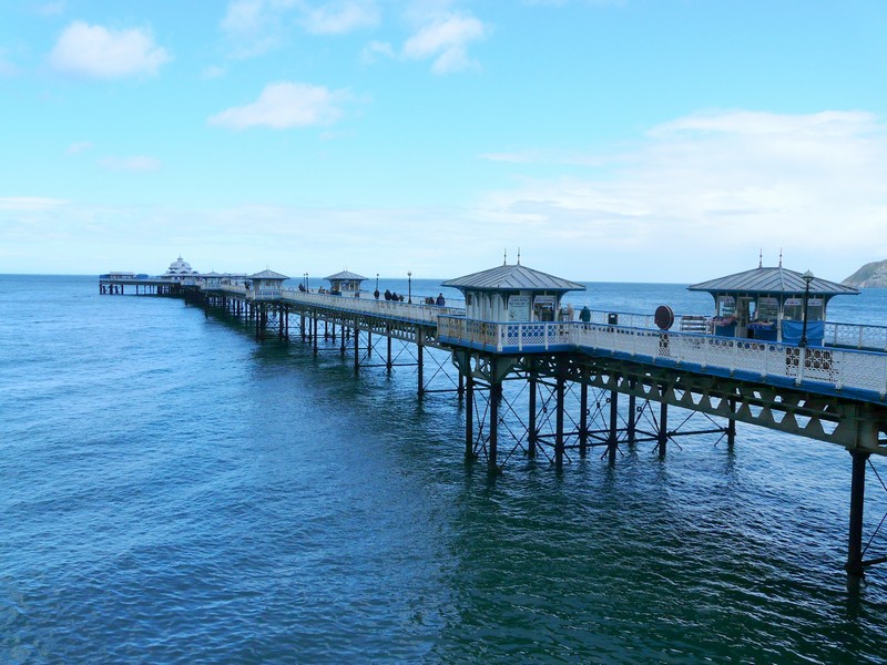
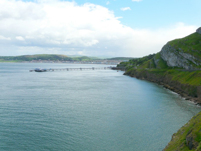
Llandudno with its pier
Now just 5 o’clock, we thought that we had time for a quick visit to Conway bird reserve, on the banks of the Conway. Having managed to find our way there, we discovered that it was closing at 5.00pm.
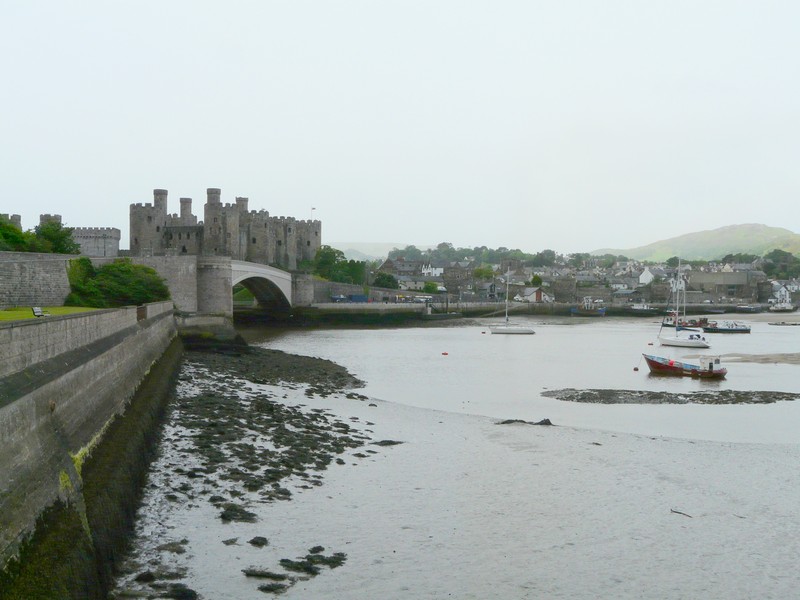
We were looking for somewhere to stay tonight, so made a return to a layby which we had passed this morning, in a lovely position overlooking the river. Unfortunately, it had a ‘four hour’ limit, so we tried some other options. We drove on through attractive Conway, enjoying Telford’s wonderful bridge, and the ancient castle.
We followed the way to an overnighter which we had note of, beside the Conway again, opposite pretty Deganwy, but this now had “no overnight parking”. Just back along the road was a spot where we could stay, but as this was overlooking the crowded marina, we decided to move back to the riverside spot for the evening, and move back to sleep. It had become a lovely sunny evening.
Great Ormes Head
Our nice evening stop near Conway
Monday 23rd May 55 miles
A day of mixed fortunes and weather! We moved back to our riverside spot for breakfast, leaving at about 9.45 on a grey and windy morning.
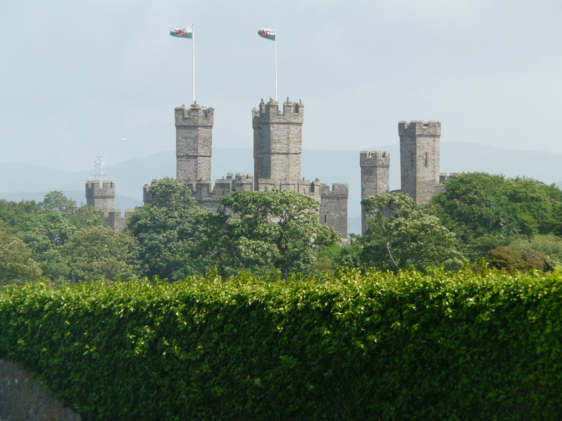
We drove back into Conway, with its wonderful castle walls. Adrian wanted to photograph the splendid bridge, but this proved very difficult, as there was nowhere really to park, and the adjacent castle (NT) didn’t open until 11.00am. We parked by the road, and Adrian walked back for his photograph, but at this point a torrential shower of rain descended, which didn’t please him!
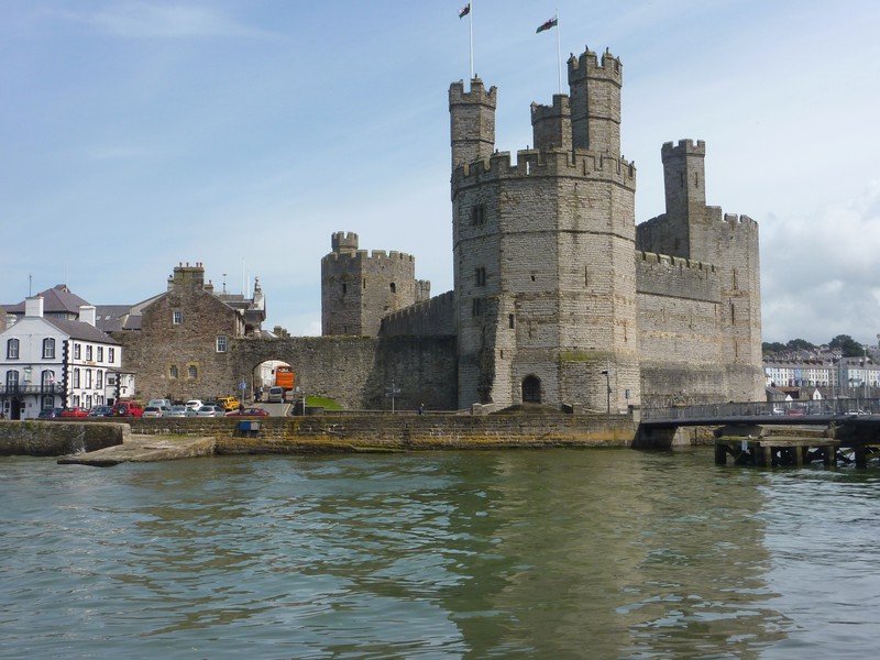
We continued on the fast (only) road to Caernarfon, where we pulled into a car park by the sea, overlooking the southern end of Anglesey. By now the sky was blue. We enjoyed a bacon & egg lunch. but it was still extremely windy when we stepped outside.
Caernarfon looked an amazing town, with its vast city walls, and its wonderful castle. It was difficult driving in a motorhome, and too chilly for me to contemplate walking far. We gave up, but took a small road just out of town, and found that this wound right down to opposite the castle, where we got a superb view. Even better, the road continued around the coast, right by the sea, with no habitation and virtually no other traffic.
Conway seemed lovely, but negotiating it means driving through the low, narrow arches in the ancient walls, which causes anxious moments! We were pleased to find our way out to the road over the Sychnant Pass, which we’d wanted to take. Our delight was short lived though, as we then came to a sign saying ‘limit 2 tons’, so we had to return and take the main road (A55), which had no turn-offs to the coast. This didn’t matter too much, as the weather had now deteriorated, and we had torrential rain with strong winds and very poor visibility.
We tried at Penmaenmawr to find a way to the sea without luck, as the railway was in the way. We did better at Llanfairfechan, where we found an almost empty car park right by the sea. We could see almost nothing, and the weather looked set for the day.
We continued on the A55 through the pouring rain to Penrhyn Castle, arriving at about 11.45. We had seen that the castle was closed on Tuesday, so were pleased to think that it was Monday, and that it would soon be opening (12.00). Imagine our surprise when a long faced young man stepped out of his booth to say that it was closed. ‘Why’ I asked. ‘Because of the weather, it’s too dangerous, with the trees’ was his reply. We were in disbelief – we had been so pleased with our idea of visiting on a wet day, as there was a railway museum, and a large exhibition of dolls, which would have suited us both!
We had nothing to do but continue on our way – through the large town of Bangor, which looked bleak in this unpleasant weather, particularly as we seemed to drive through the unattractive ‘out of town’ shopping malls, reminiscent of what we dislike about USA.
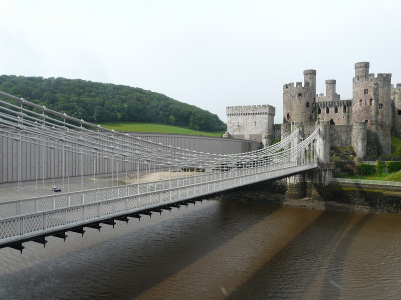
Conway - bridge and castle
At this point we are adding in our trip around Anglesey in 2002
Wednesday, 1st May 2002.
We crossed to Anglesey on the Britannia Bridge, and just had a glimpse of the Menai Bridge. We saw the statue of the Marquis of Anglesey on the top of a high column as we drove through Llanfair P.G. The country was pretty and rolling after the dramatic scenery of Snowdonia. We turned off past Plas Newydd National Trust property which wasn't yet open so we took the road down to look over the Menai Straits to Portinorvic.
This short section of Road Around Britain followed our visit to Betws-y-Coed for 30th April, which would have been Norman's
70th birthday (Rosie's brother). Norman died near the Conway Falls on 1st April 1961, and Val and I, with Adrian and Mike, revisited the site where he fell. It was a moving and a healing time.
We had two days before we had to head south to Taunton to meet up with our 'children' for a family camp, so decided to explore Anglesey. It was my first visit, but Adrian had been there as a teenager.
The weather was a mixture of cloud and bright sun. I had a little walk around and then we drove back to the A4080 to Brynsiencyn. We turned off past Sea Zoo looking across to Caernarfon Castle.
Looking across the Menai Straits to Portinorvic
We could see Snowdonia beyond. We drove back to the main road and on to Newborough. We made a short walk to a bird hide where we saw oystercatchers and coots and heard a curlew. It was a delightful time of year with bluebells everywhere and a lot of sheep with their little lambs.
It was a winding road to Aberffraw with stone walls and scattered buildings and then sand dunes - we thought it was like western Ireland. There was a lovely stone bridge at Aberffraw and we should have stopped to photograph it and explore this pretty town. At Porth Trecastell we stopped to look at a cove where people were out in canoes but by now it was grey and very windy and then it rained. Adrian thought he remembered visiting this cove as a teenager. We had lunch at Rhosneigr, overlooking the sea, but sitting inside as it was still raining. At Rhosneigr Station, we had to go under the railway - the bridge was very low - 9ft 6ins -and as the Tiv is 9ft 4ins, we had to go very slowly! We made our way to Holy Island. The scenery around Treaddur reminded us of Paternoster and Strandfontein in South Africa. We took a pretty road by the sea, but we couldn't see anywhere to park, but did manage to stop and buy an ice cream. We stopped again at a pretty cove and had a walk on the beach and also Adrian was able to get some water in our plastic container. We drove on to South Stack, the most northwesterly point of the island. There was a lot of gorse. We had a short walk, and could see the lighthouse way down below us. We viewed Holyhead with its harbour and very long breakwater then took the A5 back to Valley, and then a little road north. We wound on past Llanfwrog to "Sandy Beach" and had a walk across the wide beach. There were static caravans nearby and we could see Holyhead beyond.
We drove back to Llanfwrog and then north past Llanfaethlu then back to the coast where I took a photo looking north.
Looking across the Menai Straits to Caenarfon
We drove down to Porth Swtan and had a walk on the beach and then looked at the "last thatched cottage on Anglesey"
The north coast of Anglesey, near Holyhead
There were some very narrow roads near Rhydwyn (too narrow) but we found our way near Llanfairynghornwy and Cemlyn and Wylfa nuclear power station. We drove through the delightful little harbour town of Cemaes but we didn't stop as we were looking for somewhere to stay for the night. We made a narrow circular detour past Llanbadrig and eventually found a place as the road joined the A5025. It was now 6.45. I cooked pork for supper. It stayed light until bedtime
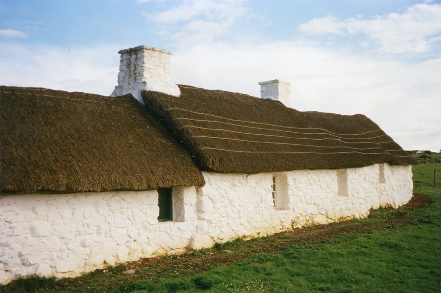
Houses at Port Swtan
Thursday 2nd May.
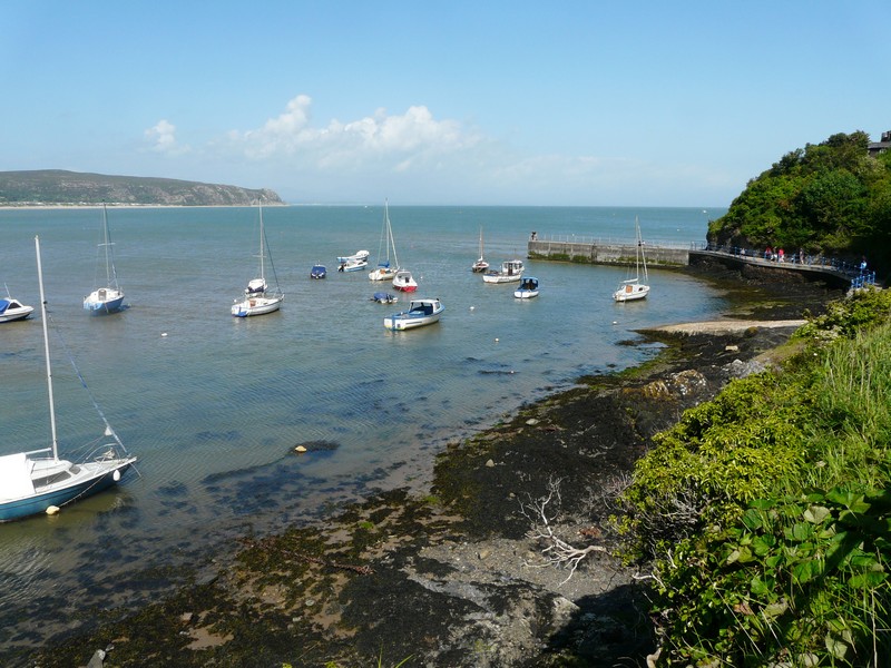
We slept well and woke to a fine morning. We had breakfast and then left just after 9 o'clock and had a short drive through gorse covered hills to Bull Bay. This was very pretty. We had a short walk on the pebbly/rocky beach. A bit further on was Amlwch, an old copper port with a long, narrow harbour. We had a really enjoyable walk around the harbour area then drove on to Llaneilian and down to Porth Eilean - a very pretty pebbly cove. We walked across the beach then came back. There were some mallards, which we had been watching in the foreground.
We had also seen mallards at Bull Bay and were surprised that they seem to adapt to salt water. We took small roads then the A 5025 to Traeth Dulas, which was almost a lagoon and we had memories of Cadiz! We had a lovely walk here on the mud to the remains of two ships (photo).

The beach at Porth Eilean
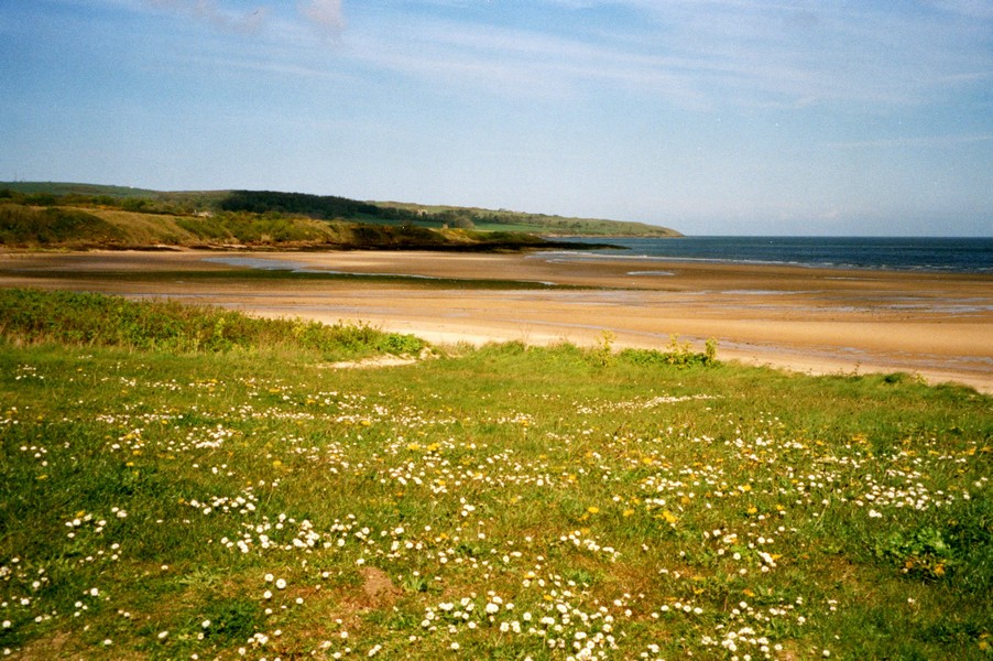
We thought it was like Stokes Inlet in Australia. We left at midday and came to Traeth Ligwy - a beautiful sandy beach but with a lot of caravan parks nearby. There were also a lot of large flies
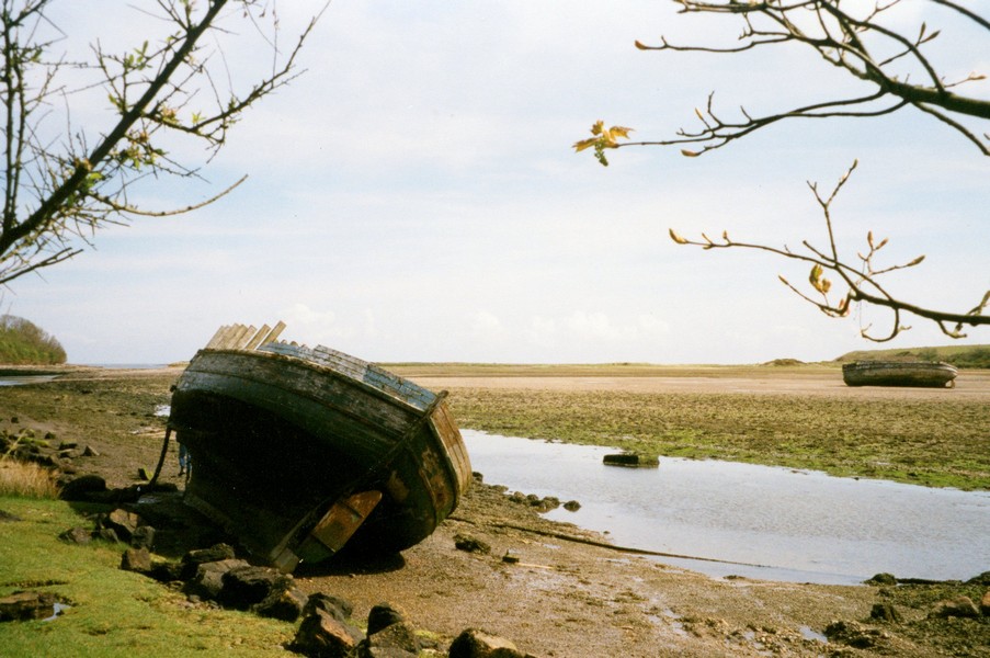
Traeth Dulas
. We walked across to the sea, reminding us of Wittering, and then had lunch in the Tiv overlooking the sea. There was a sign to say you could stay on the car park overnight for £5.
Moelfre was very pretty, with views across to Puffin Island and the mainland coast. I walked out briefly in the really warm sun. Traeth Bychan was a sheltered cove but we didn't stop. Again there were caravans nearby. Benllech had a lovely sandy beach and was very unspoilt, there was a small resort behind. We walked across the course golden sands, but the wind was very cold! It was a narrow road down to Red Wharf, and a "house" was being delivered on a huge lorry, with another vehicle coming the other way! Also they were resurfacing the road at the bay, but we managed to park by this very pretty inlet and have a walk in both directions. The weather was a mixture of sun, cloud and wind, but we thought this was a really pleasant spot. It made us think of Salcombe or Falmouth We drove on towards Puffin Island. We drove on tiny roads through Penmon, past the Tudor dovecote, to Black Point. We viewed the lighthouse and Puffin Island and the coastline of the Great Orme at Llandudno. We had a walk around, but before doing so a couple from Santa Fe in New Mexico (which we have recently visited) stopped to ask us about our camper. They originally came from Atlanta, Georgia, and like us didn't like cities. It should have been a £2 toll to come along this road, but there was no fee today. We drove back to Penmon again and stopped to view the 13th century Priory and the dovecot (1600) and I took two photos. By now it was calm and warm.
Traeth Ligwy
We came to Beaumaris reminding Adrian of his childhood visit. We were able to find somewhere to park and have a walk around.
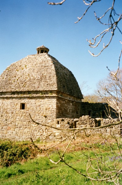
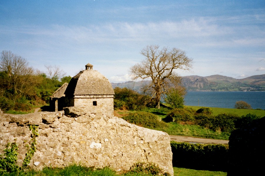
The Tudor dovecote at Penmon
We sat in the warm sun by the beach for a while, two young children were playing by the water and a toddler was walking on the beach with his mother. We inquired at the leisure centre, but there was no swimming pool here so we made our way to the Menai Bridge and viewed this before driving across it and viewing again from the other side. The weather now was warm, and the view really pretty, but I wasn't able to get a photo.
We had enjoyed our short visit to Anglesey and thought it was a very pretty and unspoilt island.
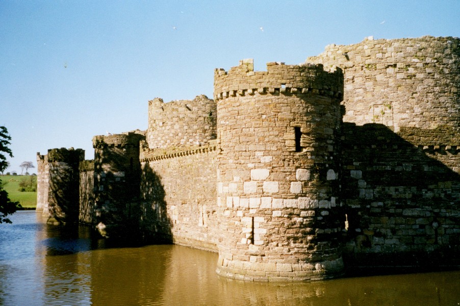
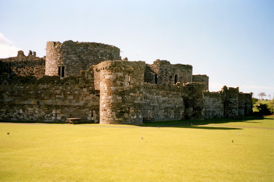
Beaumaris Castle
We return to Monday 23rd May, 2011 at the Menai Bridge
We took a second similar road from Saron, and then another to Dinas Dimle, which must be popular ‘in season’ – we guessed by windsurfers – judging by the number of car parks.
We returned to the main road, and turned off for a couple of miles inland, to Penygroes, as Adrian wanted to visit a trader here to look at a gas tank. We found the place easily enough, and to Adrian’s own surprise, he ended up buying a gas tank!
Another huge bonus was that he was able to fill the water tank, as we were desperately low on water (Adrian had looked up campsites, and they all appeared ridiculously expensive, even CLs)
On our way back to the coast, we found a nice little spot to stay for the night, with views right down to the sea near Pontlyfni.
It was a lovely evening – we watched the sun go down.
Tuesday 24th May 71 miles
We woke to a fine morning and enjoyed bacon sandwiches before leaving at 9.20.
We took the narrow road back to the coast at Pontlyfni, taking a longer route as we had come to a narrow bridge. Yellow irises were prolific in the meadows by the stream.
We followed tracks to the lovely beach at two locations – at the second, Aberdesach, there was an unexpected car park.
Next stop was Trevor, where we descended through steep narrow lanes, where a parked truck added to the difficulties.
Caernarfon castle
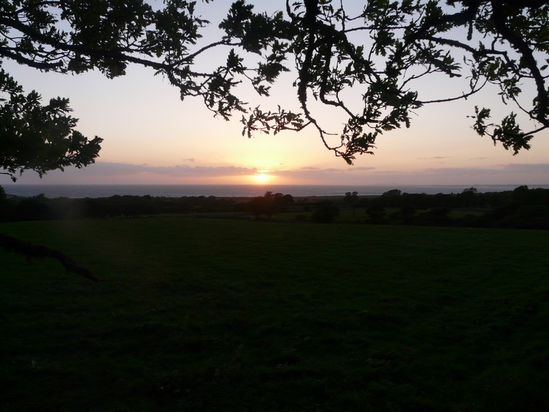
Nice evening view from our night stop at Pontlyfni


There was a little harbour – in the past granite, which had been quarried from the mighty Yr Gifl peak up behind, had been shipped out. We returned past the humble dwellings and continued along the northern side of the remote Lley Peninsula.
It was difficult country to explore by motorhome, as there were numerous tracks off, many of them proving too narrow for us, and others stopping some distance from the sea.
We found a lovely spot after turning off at Pen-y-graig – we stopped above a rocky outcrop, looking back to the long sandy bay of Porth Colman. I saw 2 shelduck, and Adrian saw several butterflies. There was one lone, very plain house. We had noticed how many of the houses had been newly whitewashed. We enjoyed the peace here, until other cars came!
Trevor Church
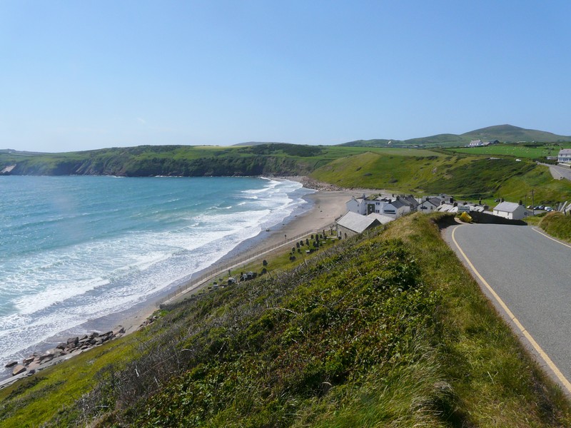
We continued on a rural route to Aberdaron, having not been able to locate any other routes to the sea, and missing ‘whistling beach’, where apparently the sand squeaks when you walk on it, similar to other beaches we have found abroad.
Aberdaron was a delighful ‘touristy’ village, with a nice sandy beach, but too windy for me! The day remained gloriously sunny, but with a strong cool wind. We had heard on the radio about high winds, particularly in Scotland, and also today about a renewed ash cloud from Iceland, which had grounded many flights.
Pen -y- Graig to Porth Colman
In the small shops in Aberdaron we bought local dressed crab, which we ate for lunch, with bread and a sausage roll from the bakers. We also bought Welsh cakes, which we ate later, and which seemed more like Eccles cakes. We were also able to get the milk which we needed.
Along the southern side of this peninsula we came to Abersoch, which looked very pretty, with a few local boats and a sandy beach. Again it was very windy.
Aberdaron
We soon came to Pwllheli, which looked a pleasant place for a holiday. We stopped in a car park beside dunes, and walked briefly to see the sandy/pebbly beach, in the wind.
We stopped in the small village of Llanystumwy, where Lloyd George had lived as a boy. We viewed his grave by the pretty River Dwyfor.
Little boats at Abersoch
Criccieth had an impressive castle above a beach of sand and shingle, and a long sandy bay as well. There were rows of neat B&Bs, many of them pastel coloured.
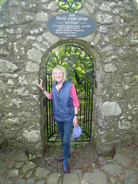
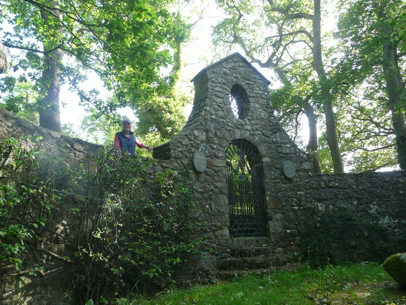
Lloyd George's grave
Just afterwards we came to a roadside layby, which Adrian declared too steep for us, but soon afterwards we found another long layby which seemed suitable to stay for the night just before Porthmadog.
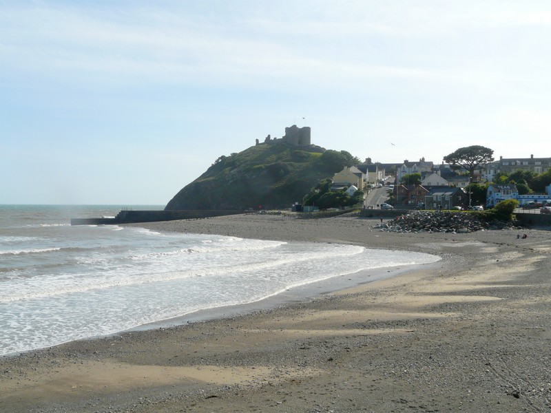
Criccieth
Wednesday 25th May 13 miles
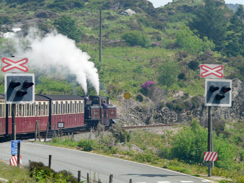
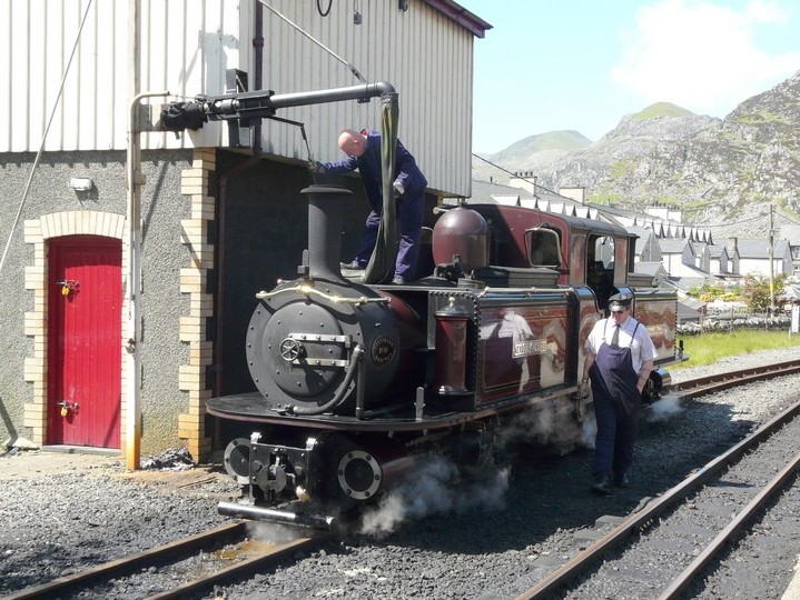
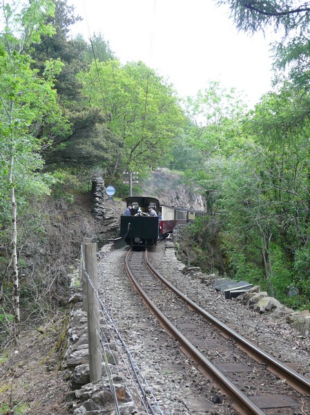
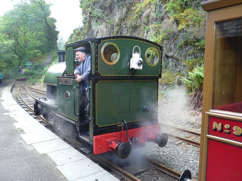
The morning started grey, which was a shame, as today we plan a trip on the Ffestiniog Railway. It was cool waiting at the station while Adrian parked the van. We had arrived at 9.15, and the train didn’t leave until 10.15, but the car park was already full. The reason for this was that a new railway has recently opened – the Welsh Mountain Railway – which now runs from Porthmadog to Caernarfon (we had seen it there the other day). It looks like a nice journey.
All went well for our trip. The sun soon came out, which enhanced the wonderful forested mountain scenery which we passed through. There were a few bluebells still to be seen, and lots of glorious deep purple rhododendrons. Adrian was doing his usual overtime in taking photographs, while I just sat and took it all in.
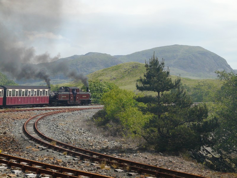
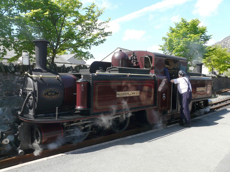
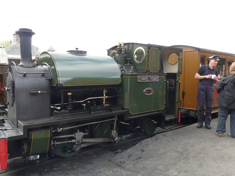
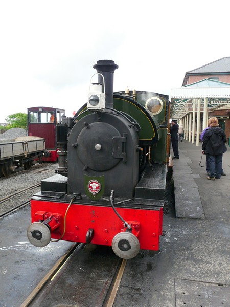
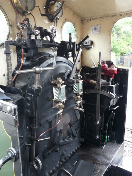
We reached Blaenau Ffestiniog and Adrian went to see our ‘push-me-pull-me’ Double Fairlie engine as it shunted to the other end of the train. The carriages we were in had been built in 2009, and had lots of windows, which made viewing the steep mountain sides easy.
We arrived back at Porthmadog at 1.00pm, right on time, and returned to the van to have lunch.
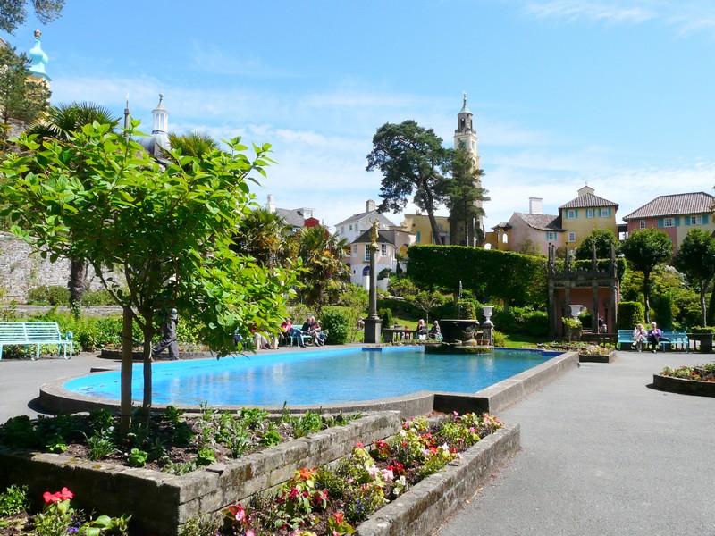
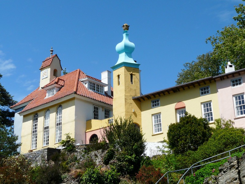
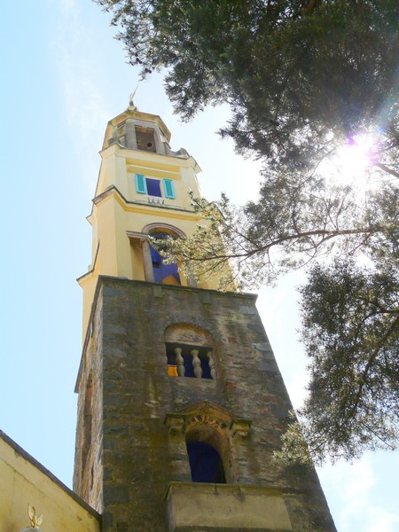
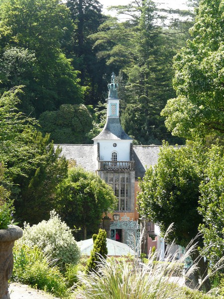
Now we drove the short distance to Portmeirion. This village, started in 1926 by Sir Clough Williams-Ellis, is like a hotel museum, which you pay a fee to visit. We were lucky, as wheelchair users were free, and we have one RHS pass.
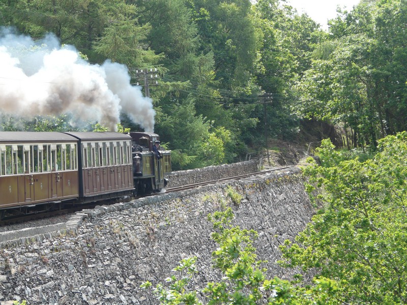
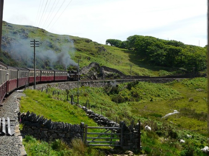
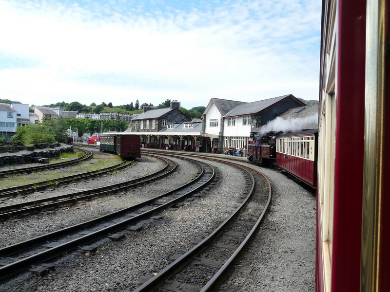
Porthmadog to Blaenau Ffestiniog Railway
The road was quite steep, and although it was sunny, the wind was still strong. It certainly was a pretty place – all the buildings looked Italian, and were painted in pastel colours – mainly turquoise, pink and white. There were lots of cafes – it is obviously the thing to do to come & sit in a café and enjoy the atmosphere – and a few select shops. We looked into the Portmeirion seconds shop, but didn’t buy!
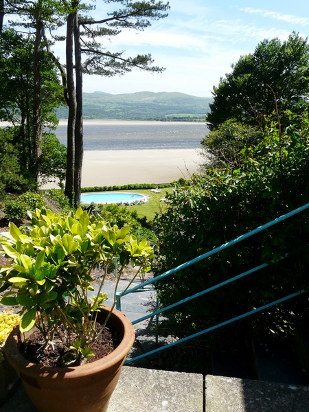
We couldn’t contemplate walking right down to the lovely sandy beach, or attempt the enticing woodland walks, which was a shame.
There was still time to visit another garden just a few miles inland, so we now made our way there. These gardens, called Plas Brandanw, had been laid out by Williams-Ellis, 17 years before he designed Portmeirion. The entrance and parking was very low-key, and the gardens were quiet and peaceful. Also it was not windy, but there was really not a great deal to see! They had been nicely laid out in front of an attractive house, and with views over the surrounding mountain scenery.
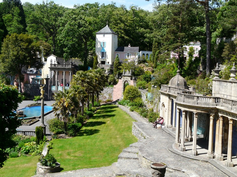
Portmeirion
It would have been different if I’d been more mobile, but having had a look around, we left and took the B road in the direction of Ffestiniog, as the only other way back to the coast was via a toll road.
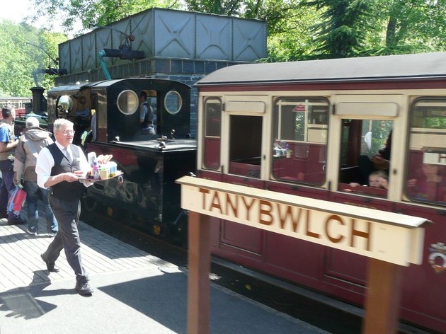
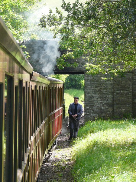
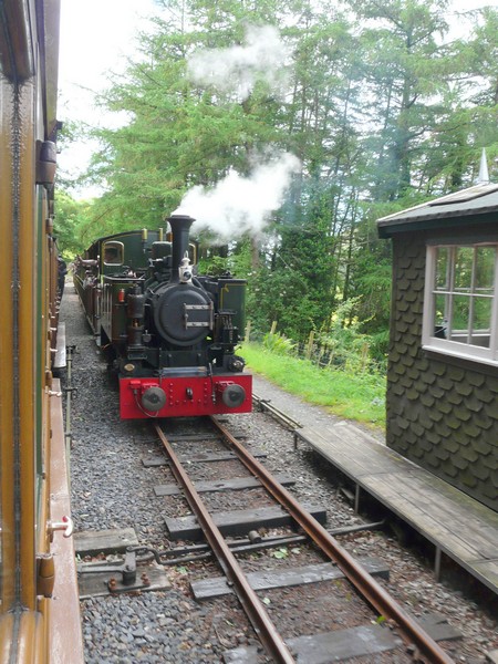
Not far along this road we pulled off at the edge of the forest, and could hear the hoot from the railway which was not far away at Tan-y-bwlch. Adrian couldn’t resist walking out to watch the approaching train go by, and take a couple more pictures!
Plas Brandanw
The train passes by our 'overnighter'
I wrote postcards to our grandchildren, and after supper we read through our diary of this trip.
Thursday 26th May 76 miles
We’d had some heavy rain in the night, and more in the morning, and the forecast didn’t sound good! We realized how lucky we’d been yesterday.
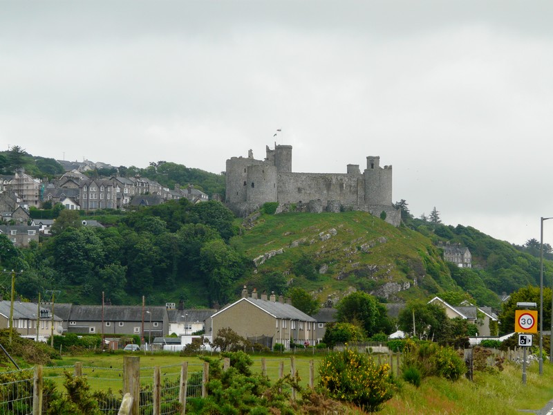
We left at 10 o’clock, and looked in at Tan-y bwlch station before continuing on to the Ffestiniog valley. It was a lovely route – everywhere hung heavy and green. We drove on across flat land to Harlech, seeing the castle up above looking very grey. Harlech is a World Heritage site. We drove right up into the town, and found a post office, so were able to get stamps and post the cards. I had come here on a guide camp in 1955 – I remember climbing up the steep (1in4) hill from the station.
We now couldn’t find anywhere to turn around, and ended up driving a long way back along the ridge through marvellous scenery to Glan-y-wern station, and then back across the flat land again.
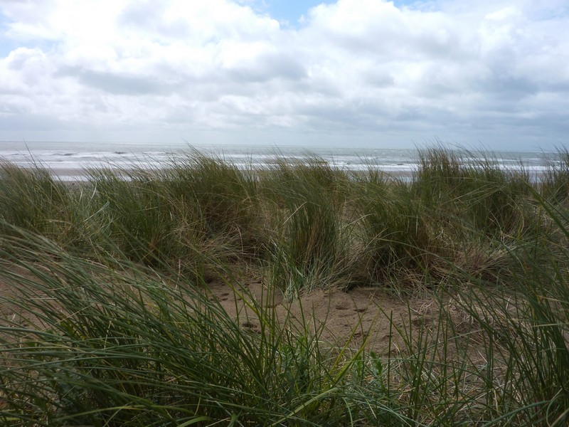
We drove on past Harlech – I couldn’t get any clues as to where I had camped – and then turned off at Llanpedr and drove right down to a lagoon, which we crossed (the tide was out) to Shell Island. This was some kind of complex, so we didn’t stop. The road continued inland, but just after stopping at a Spar shop to replenish stocks a bit, we turned off at Tal-y-bont and took a track towards the sea. After having lunch, we braved the wind and walked over the dunes on a walkway to view the superb long unspoilt sandy beach. Dark clouds threatened as we made our way back.
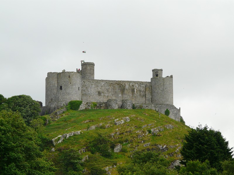
Harlech Castle
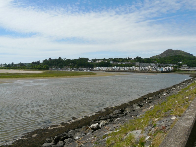
We now reached Barmouth, in a lovely situation at the mouth of the Mawddach River. I had visited here in 1955, but don’t remember much about it. There is a lovely sandy beach (deserted today), and mountains rise steeply up behind. It seemed a happy holiday town. The railway crosses the river on a fine bridge, which you can also cross on foot, for a fee!
The wild beach at Tal-y-bont
The road followed beside the Mawddach Valley to Dolgellau, and then back on the southern side. The views were wonderful, we just wished for better visibility.
Back at Fairbourne (where a small preserved railway runs) we found ourselves high up above the sea, with no chance to pull in for a view back to Barmouth. It was really windy when we did stop.
At Lleyngwril we could look down to ugly static caravan parks on the flat land by the sea. The fields here were all separated by dry stone walls.
We took a small road at Rhosletain, which was mostly very pleasant and quiet, but we suddenly found ourselves on a very narrow road with high banks. We were relieved to find ourselves back on the main road. We had no Ordnance Map for this part, and the road atlas map wasn’t brilliant! We had passed a place where we could have overnighted, and in retrospect we should have stopped.
We were now at Bryncrug close to Tywyn, where the Tal-y-lyn railway runs from. Tywyn was a busy town, we located the railway station and Adrian got a timetable.
We hope to travel on the railway tomorrow, but now needed somewhere to stop tonight. We took the road up the Tal-y lyn valley, and stopped finally at Abergynolwyn, in the car park for the railway.
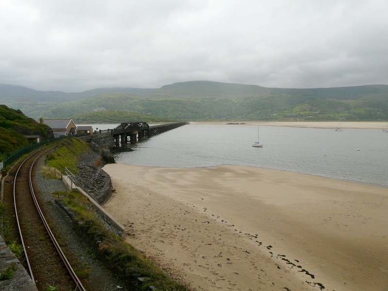
Barmouth rail bridge and harbour
Friday 27th May 51 miles
There was rain in the night, and the morning started very grey, which didn’t bode well for our proposed trip on the Tal-y-llyn railway today.
We left at 8.30 and drove back down the valley to Tywyn. We had been enjoying listening to Brian May and Roger Taylor, both of ‘Queen’, talking to Chris Evans on his show. As well as having no phone or internet contact last night, radio reception had been almost non-existent. It wasn’t much better in Tywyn, and we still couldn’t get radio 4, so couldn’t hear Debbie Harry on Desert Island discs.
The weather was already brighter as we reached Tywyn, and we had a day of super sunny weather for our rail trip.
The train left at 10.30, and we were in good time for that. We had time to look in at the museum on the station. The thing that interested me was the association that Rev Awdrey (of Thomas the Tank Engine fame) had with the railway. Apparently he had visited it, had fallen in love with it, and had become a volunteer. He had been looking for inspiration for more stories, and based 6 books on the Tal –y-llyn railway, calling them Skarloey. His study, where he wrote his books, formed part of the museum.
The narrow gauge railway is the oldest preserved railway in the world, it seems. It is certainly very sweet. We climbed into a small carriage, and had it to ourselves for some of the way. A lady joined us at Bryncrug, as far as Dolgoch, the next station, where she worked in the refreshment room. She lived on a farm in Bryncrug, so checked up on her sheep as we travelled past! On the return journey we had a couple with two small children in the other part of our carriage. In the neighbouring carriage was a party of playgroup children, who were very excited about their trip.
We left on time at 10.30, and returned at 1 o’clock. We hadn’t noticed the half hour stop at Abergynolwyn, the station we had stayed at last night. It felt rather chilly then, as we walked along the platform.
Our route had taken us initially through high banks, with wild roses, honeysuckle, campion, foxgloves and a few bluebells. It was all really pretty and rural, with green fields, and scatterings of sheep. Later we passed through wonderful forested areas with streams and waterfalls. Altogether a really enjoyable trip.
Back at Tywyn, we drove on down to the shore, and ate lunch looking out to the turquoise sea and miles of sand.
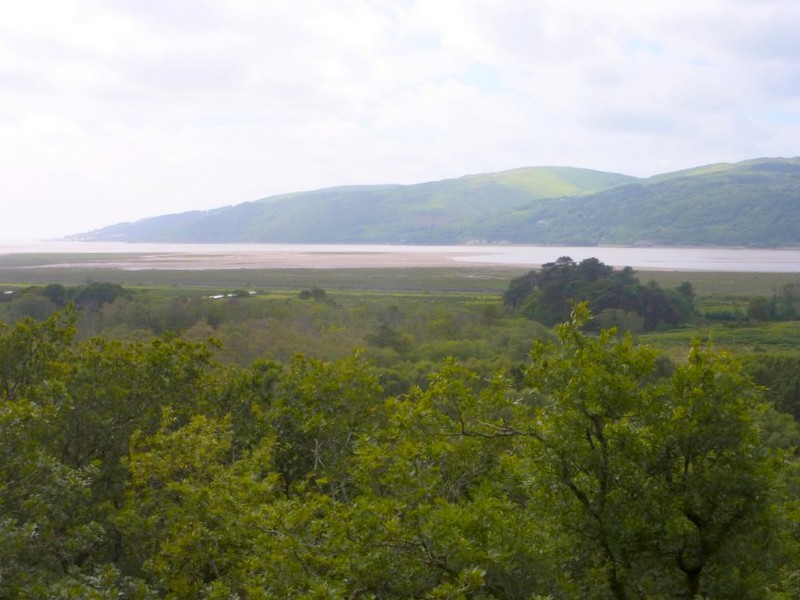
We drove on now to Aberdovey, situated in a lovely position at the mouth of the Dovey (Dyfi) River, and with a wonderful sandy beach. We looked across to the southern side of the river, with equally sandy beaches, but we had to drive several miles beside the river to Machynlleth – a nice town, but where we were held up by roadworks.
Driving back along the southern shore, we came to the RSPB reserve of Ynis-hir. We hadn’t taken in that this is where BBC Springwatch is being filmed. There were an enormous number of huge vehicles, all associated with the production, which is starting on Monday.
It is a vast area, very beautiful, but difficult for me with my restricted walking abilities. We did have a really pleasant walk around, and although we didn’t see any birds of note, we could hear lots singing from the trees. (We saw a red kite soon after leaving the reserve!) It had been a beautiful springlike interlude.
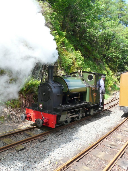
Tal-y-llyn Railway
We left here, and drove to the end of the River Dovey, where, passing lots of unattractive static parks, we stopped by the wonderful sandy vista, looking back to Aberdovey, on the northern side.
We now continued south, taking a smaller road, but were disappointed to find that a golf course ran for miles between the road & the sea, so there was no chance of finding a pull-off for the night. We drove on through the attractive seaside town of Borth, with houses on either side of the road, but with no ‘depth’ to the village. It looked a place full of character.
Continuing south, we turned off to Glan-y-mor, but this was just an area of statics at the mouth of the Stewi River. We even had difficulty in turning round. We tried taking a slightly inland route to the A487, but still found no stopping places.
Then, just as we reached the outskirts of Aberystwyth, we came to a long layby, and pulled in there for the night.
Saturday 28th May 64 miles
It wasn’t as noisy in the night as we might have imagined. The morning was grey and misty. We left at 8.30 and drove down into Aberystwyth, stopping by the front to have breakfast. We could have overnighted here, but the road was very sloping so it wouldn’t have been very good. Aberystwyth seemed a nice seaside town, but the very grey sea wasn’t showing it at its best.
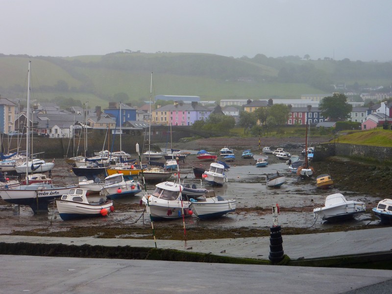
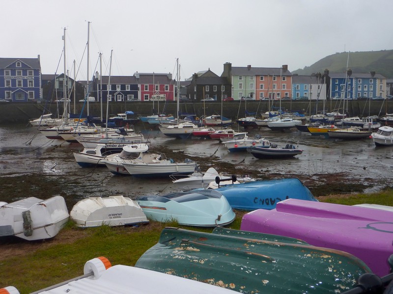
We drove south from Aberystwyth. It wasn’t a day to try dodgy roads. At LLanon we did take a track to a beach of shale, but at Aberarth we thought that the tracks were too narrow. We did drive down to Aberaeron, which was very pretty, with the houses painted in pastel colours. We drove down to the shaly beach, but visibility was very poor. We admired the harbour – this town had formerly been a port.
Ynis-hir RSPB Reserve
Looking across the River Dovey from Ynis-hir RSPB Reserve
The weather brightened a bit now, as we made our way to New Quay, which was very smart & attractive, but also very congested, and we couldn’t find anywhere to stop. We were beginning to feel frustrated, as we were aware that this was a Bank Holiday weekend, and there was more traffic about.
We’d have liked to have visited Cwmtudu, but the roads were too small for us to contemplate.
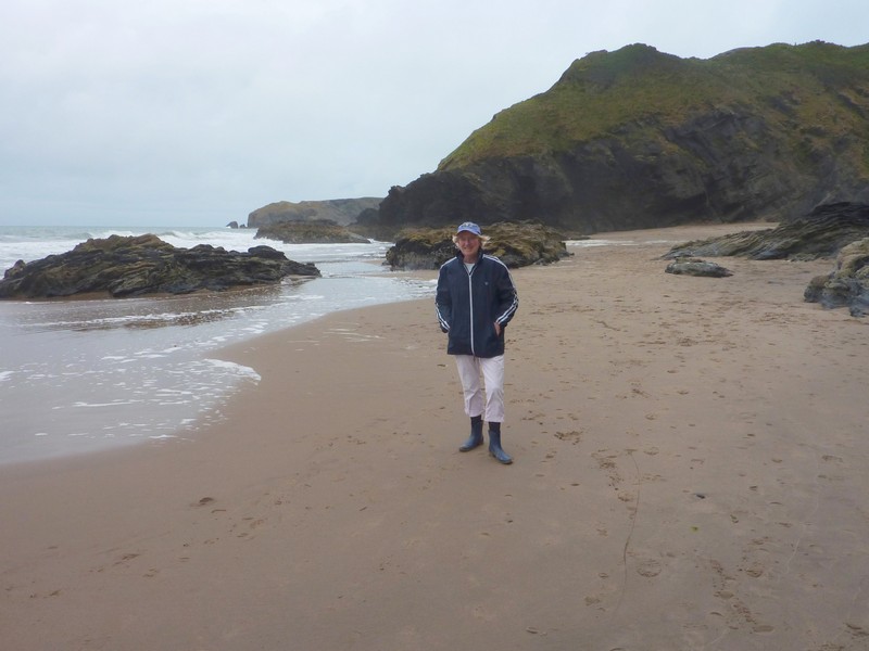
We followed a pretty B road to Llangranog, and came down a very steep and narrow road to a really pretty cove, enclosed by cliffs of dark rock. We walked across the sandy beach – the day was now dry and much more pleasant.
Aberaeron
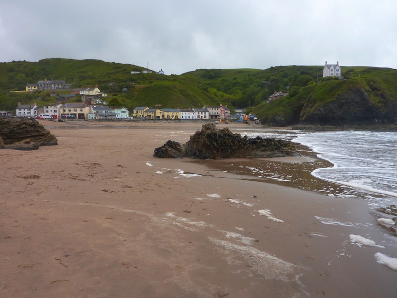
We turned off again to Aberporth and came to another delightful sandy cove. People were out enjoying themselves on the beach, some walking dogs, and one family group playing cricket. We bought fish and chips for lunch, and sat eating it in the cab, looking down to the beach. Afterwards we walked down onto the sandy beach, where it was pleasantly warm & sunny.
Llangranog
Despite this, we were finding it difficult to enjoy the coast, as the main road ran quite a way from the sea, and getting to the coast was proving difficult.
We made the decision to finish this part of the coast at Cardigan, and to then drive home.
We took the road to Gwbert, to the east of Cardigan, following the River Teifi to its sandy estuary, but the only car park had a height barrier, so there was nowhere for us to stop.
Hence we started on our return journey, initially taking a pretty cross country route through Newcastle Emlyn to Carmarthen, where we headed for the M4, and then home. Traffic was light, and there were virtually no lorries, so we made good time, arriving back at Hermitage at 6.40pm.
Aberporth


The next section is Cardigan to Magor (Welsh Border)
