
Friday 24th July On to meet up with old school friends 80 miles
At 7.00 am we moved a bit so that we could get an internet connection and phone Nationwide about our cancelled visa cards. It was a frustrating time, which ended in success! We were put on hold for absolute ages, and then cut off just as we got through. On the second attempt, Adrian was able to reinstate his card – apparently mine hadn’t been stopped, but it had been refused when we’d tried to use it.
Having completed our website, we sent the first email home to ‘Friends and Family’, then we relaxed and had breakfast, leaving at 9.00 am.
Our first stop was the pretty town of Chemainus. This had more or less ‘died’ when the logging mill had closed down, but has been resurrected as a little tourist town, with dozens of murals and lots of little boutique shops, and the mill has reopened.
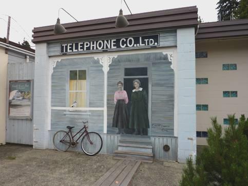
Nice mural at Chemainus
We were able to buy some stamps for the postcards I’d bought, and in the Visitors Centre we had a chat to the assistant, who was originally Swedish, with a Scottish husband. They were well travelled, and lived here for part of the time, and loved it.
We got some booze from the liquor store, and had a second walk around, meeting a smartly dressed 79 year old lady who welcomed us to the town. She lived in an old peoples apartment block, and was being visited by her daughter who lived in remote northern BC, and loved to shop.
We saw murals to the Japanese who had lived here prior to 1941, when they had all been collected up into centres. There seemed to be quite a Japanese population again now.
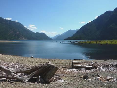
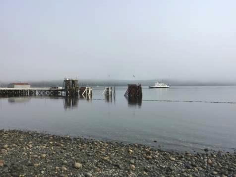
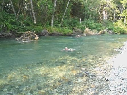
We had coffee by a pleasant little beach before driving on to Ladysmith. Here we stopped at Transfer Beach Park, where the sea water is supposed to be really warm. We had a nice swim, but it wasn’t that warm!
It was in a pretty little beach park, with a superb children’s play area, and water park. The beach itself was of seaweed -covered pebbles, so not very inviting. After our swim we had lunch, sitting on the little grassy bank behind the van.
We drove a coastal route towards Nanaimo, but didn’t ever get to the sea. Just south of Nanaimo we stopped by a small park where we walked to see some ancient petroglyphs before heading through the town. We drove another unforthcoming coastal route, but were finding everywhere very ‘busy’ with houses, and no sea access.
We continued to Rathtrevor Park, Parksville a really busy campsite, and here we were able to dump and get water – after paying $2.
We were still a bit early to meet up with Sophie, so stopped to have a cup of tea by the little Heritage Park.
We then made our way to Sophie’s, and with husband Don, went round the corner to park the Bam outside Sophie’s mother Thelma’s house. Then the 4 of us drove to ‘British Bobby’s’, where we had excellent fish and chips – the best of this trip.
Back at Sophie’s, we sat outside, and soon Nicola and her husband George arrived.
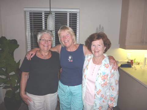
3 little maids from school!
There was much chat – some about Bishopshalt! - , wine was drunk, and cheese eaten before mosquitoes drove us inside, where we tucked into dessert, and chatted until 1.15am – Nicola and George had left earlier.
We walked back to the Bam under a star-filled sky.
Saturday 25th July Towards the west coast 42 miles
We were late in waking up, after our late night, but were in time to say goodbye to Thelma as she left for the local flea market/craft fair.
Adrian was able to scan in a school photo of Nicola’s which I didn’t have, and we gave her back her copy, when she unexpectedly came around to say goodbye. We then walked across to the beach, with its lovely view, before having a swim in the delightful pool belonging to the complex.
We called round to say goodbye to Sophie and Don, and chatted easily until it was 1 o’clock! It had been really nice to visit, and relive old times.
We stopped to get fuel, then set off westwards towards Port Alberni. We needed somewhere for lunch, but it was nearer 2 o’clock by the time we pulled into Little Qualicum Falls Provincial Park. It was very busy here, being Saturday, but we found a nice shady picnic table under the tall trees. Adrian had enjoyed seeing some old cars in the car park – they must have been on some sort of run.
There were walks to falls on the river – we realised that you could spend a long time here – but we did a short walk and enjoyed looking down to the impressively deep canyon with its gushing water and pretty falls.
We had to stop at Macmillan Park, to walk trails amongst the huge ancient trees of Cathedral Grove, as we had done with the boys in 1989. We walked trails on both sides of the road – the setting had lost none of its grandeur.
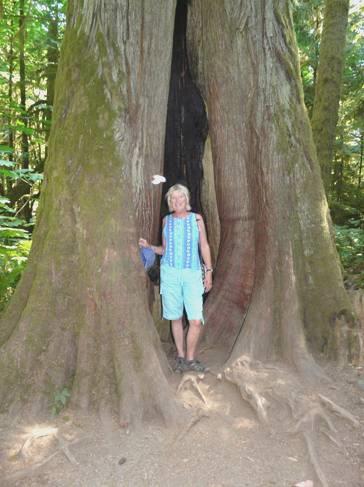
Rosie by one of the Giant Cedars
Driving through Port Alberni, we saw a sign to ‘Longbeach golf course and campsite’, which gave us a smile, as we remembered camping there when it had just opened 20 years ago. We still have the ticket for the round of golf, which was included in the price, and remembered the ‘I am not amused’’ lady, when Adrian had laughed and said that we didn’t play golf.
We had been enjoying the superb scenery, but knowing that it would be impossible to find anywhere to stay on the coast tonight, we pulled in to a rough piece of ground beneath the huge trees near Sproat Lake, the nearby campsite sign saying ‘full’.
The road had been incredibly busy – much busier than 20 years ago – and the temperature at 8 o’clock was still 30°C (85°F).
It was too hot to cook inside, so we cooked a simple bacon and pasta meal on the stove outside, sitting out in our lovely situation until it got dark.
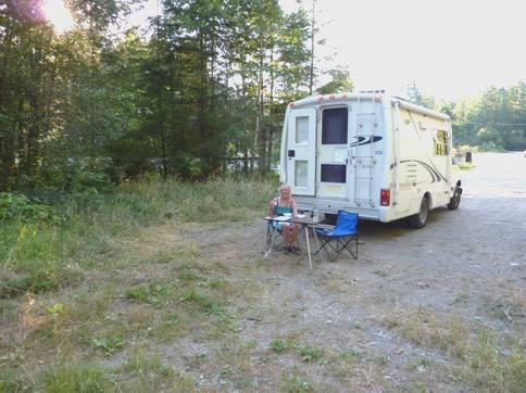
Our isolated spot near Sproat Lake
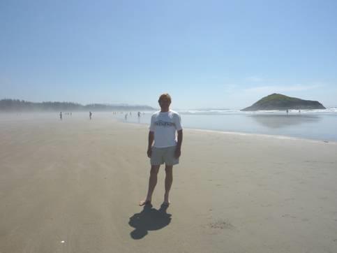
Sunday 26th July The Pacific Rim revisted 165 miles
We left at 7 o’clock on a fine morning, driving the scenic route to the west coast. Once we’d reached the Pacific Rim National Park, we headed for the campsite (which was full), where we were able to get our day passes. By the time we’d pulled into the parking area by Longbeach, the sea fog had moved in, so it was breakfast in the van anyway! We stopped first to walk onto the spooky looking vast sandy beach, backed by logs, but with mist swirling around.
We’d remembered this beach so well from our 1989 visit. We drove on to the town of Tofino, just north of the park – we hadn’t quite got this far on our previous time here. The town was bustling, even at this early hour on a Sunday morning. By now the sun was shining again. We shopped in a well-stocked Co-op store (except for fresh bread, being Sunday), and had coffee sitting by the marker saying ‘Pacific End of the Trans Canada Highway’. The views all around were superb, with inlets and forested islands. We saw a float plane take off, and enquired about a trip, but sadly we didn’t have time today.
We now drove back down the Pacific Rim road, stopping first to walk to Radar Hill – the site of a radar station during the Cold War. On our 1989 visit, we had noted the wonderful view in all directions, but now the trees had grown up, and we couldn’t see anything!
We then came back to glorious Longbeach, but being a beautiful Sunday, it was packed! At least it is so big, that there is room for everyone. Many were out surfing, others just enjoying the beach.
‘Packed’ Longbeach!
We walked along at the edge of the water, splashing through it before coming back to eat our lunch on the logs which fringe the beach. It was wonderful, but just a bit busy! It made us think of Cape Canaveral National Seashore, which also had lots of interesting trails, but almost all the visitors just come to sit on the beach!
Glorious Longbeach
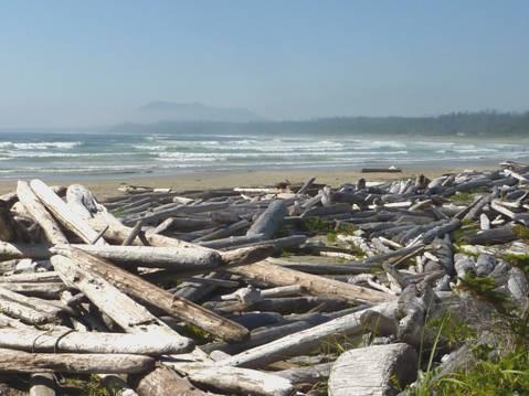
A bit further back we came to Combers Beach, where we had a nice walk through cool tall forests to a quieter, wilder beach, with a stream running into it.
After exploring that, we had a superb one km boardwalk through magnificent rainforest with huge trees and large ferns.
Our last walk was on a beautiful coastal trail at the southern end of Longbeach, coming out to pretty, shingly South Beach, with black rock stacks and hundreds of birds, and practically deserted.
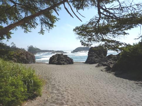
Pretty South Beach
We drove right on to the end of the road at Ucluelet, coming out by a lighthouse. We’d liked to have stayed longer, but being 5.15, thought that we’d better begin our return journey. We are leaving from Port Hardy (in the north) on Thursday, and have a lot left to see!
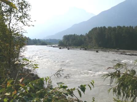
We began the scenic journey back, on the often narrow and winding road, which has been straightened and improved a bit since our last visit, but is still slow. We passed lovely, calm Kennedy Lake, and climbed Sutton Pass, but we ended up at last night’s spot near Sproat Lake, having looked in at several other places, but finding nothing suitable. Luckily nobody had moved into our space, but when we arrived at 6.45, the temperature was 87°F – much hotter than on the coast. It was far too hot to cook inside, so we sat out, and cooked a mushroom omelette – the temperature at 7.30 was still 85°F, and still 80°F at 9 o’clock. Will we be able to sleep tonight?
Monday 27th July Beautiful scenery and high temperatures as we head north 139 miles
Well, it was more the traffic that was a nuisance! We were surprised at how busy this road is, when it only goes to the west coast and then stops.
It was another lovely morning, with a blue sky, so we ate our breakfast outside in our own ’private campsite’, and left at 8.30.
We stopped beside the peaceful river in Port Alberni to look at the wooden carving of native Americans whale hunting by canoe, and then continued on the scenic route to Qualicum Beach. We drove right down to the water’s edge, where we got an internet connection, and spoke to Simon, who, with Laure, is in the final stages of packing everything up. Afterwards I had a swim, in pleasantly warm water, but it was a bit sea-weedy. We then had coffee with the lovely view across to islands and mountains.
We continued north on the coastal route to Fanny Bay, where we stopped to look across to Denman Island, which Karen in Australia had emailed and said that she had visited. Seals bobbed about in the water, and it was really nice.
Rosie at Fanny Bay
We drove further on up the coast as far as Royston, then cut across to the faster route 19 as far as Campbell River. We took a long time here getting some fuel, so by the time we found our way to Elk Falls picnic site, it was a late lunch. It was so hot now, that we didn’t walk to see the falls, but we could glimpse them through the majestic trees, with a dramatic gorge below. Now we headed inland towards Strathcona Provincial Park, on a winding road, often with views of lakes.
When we reached Buttle Lake campsite, it seemed a nice place to stay, so we found a spot. We were just across from a little lakeside beach area, but further along the track was a sign to the beach. We followed this, and found that it went for quite a way through the forest. By the time we got to the steep, pebbly beach, we were more than ready to cool off!
Lovely place for a swim
Having had our swim, with superb views all around, we started off back, but a neighbouring couple with two barking dogs asked Adrian to take a photo of him and his wife – we think that they hadn’t been married long. He said ‘It’s OK, the dogs might bark, but they’re on a lead’, but his wife let go of the lead while the photo was taken!
Back at our spot, we relaxed in the shade. The temperature was 94°F (34°C) - and we thought it was going to be cooler as we went north!
Although there is a campfire ban, we were able to have a barbecue, so cooked pork, baked potato, spaghetti squash and mushrooms. The only thing to spoil it was a noisy generator nearby.
We walked towards the park entrance, and got talking to a young couple from Quebec, who had driven right across Canada from there. He was playing a guitar – we had seen him from our campsite. We walked over a hill to another quiet little lake.
Back at our spot, we walked across to the nearby beach area for a cooling swim before bed.
Tuesday 28th July Early morning beauty before we continue north 192 miles
We ate breakfast outside in the early morning cool, with no generator to disturb us!
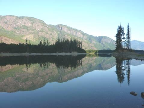
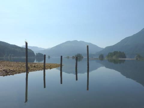
We left at 8.15, and drove to the other side of Lake Buttle, stopping beside it at a spot opposite where we had swum yesterday afternoon. The reflections were out of this world, with the mountainsides and the trees. ‘Paradise’, the only other person around said. It certainly gave me a lump in my throat - I felt as I had done in Yosemite – overcome by the beauty of it.
Beautiful early morning reflections
We continued a bit further beside the long ribbon lake, stopping to walk a short rough trail through the ancient forest to pretty, long and straggly Lupin Falls.
Back beside the lake, we watched a mother duck with her 8 young ones – it was all oh so peaceful!
We had only had a glimpse of the vast Strathcona Provincial Park, but had enjoyed what we’d seen. It made me think of Kananaskis – a long way from anywhere, but with lots to explore.
By 9 o’clock we were driving back up beside the lake, and then taking the winding road back to Campbell River. We stopped again at the Elk Falls picnic area, this time walking to the falls viewpoint.
With huge trees teetering above the deep, vertical canyon, it was an impressive sight. We had coffee before leaving, and then set off northwards.
We soon stopped to look down to the Seymour Narrows, a notoriously dangerous channel where many ships had come to grief. In 1958, twin Ripple Rocks, in the middle of the channel, had been blown up, to make the passage safer.
We turned off the main road to get to Sayward, on the coast. This little community of simple houses had a village owned campsite ($10) and an all-age school, but most other things seemed to be closed! We visited the small supermarket, where the cashier said that she loved living here, but the adjacent laundrette/video room had closed down, and even the estate agents was for sale! The logging business seemed to have seen better days, but there was a charm about the area, and the views were stunning.
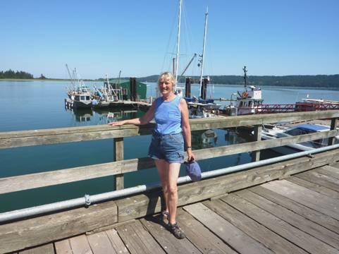
We drove past the town to Kelsey Bay, a little working harbour, the walls of which had been partly formed from former wartime ships in 1948. We ate our lunch here at a picnic table overlooking the harbour.
Kelsey Bay, Sayward
Back on the main road, we soon came to Elk Creek Forest campsite, which appeared to be free, but there was nothing like that when we wanted to stop!
We continued through the deeply forested mountain scenery, and when we reached long Nimpkish Lake, we thought that it would be a scenic drive, with plenty of places to pull off. Both ideas were wrong – the lake was far below us, and almost completely shielded by tall trees, and there was nowhere at all to pull off.
Hence we found ourselves at the northern end, and the turn off to Telegraph Cove.
The road here is now surfaced, despite how it’s shown on our newly purchased map. Everyone had told us that we must visit Telegraph Cove, but we had our misgivings, which were not unfounded!
The small community had originally been built as a telegraph station, with simple wooden houses built on stilts lining the little harbour.
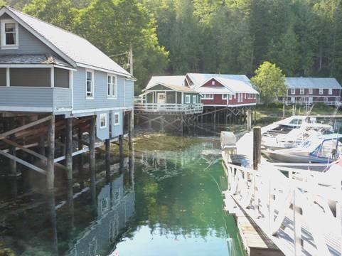
Telegraph Cove
These buildings have now been restored (new head and new handle mostly), with plaques telling about them. It is a prime place to go whale watching from, but to us it was much too touristy. We’d seen very little traffic today, but here the car park was packed, and there were two squashed-in and ugly campsites above the cove, and a marina in the harbour. You had to pay to park – although the machine was broken, so you could probably have got away with it.
Having had our brief look at the place, we now needed somewhere to stop for the night. We hadn’t passed anywhere really suitable on the road from the junction, but just after we had joined the road to Port McNeill, and wondering what to do, we came to a small rest area pull off, with a totem pole at the front. It was right by the Nimpkish River, which we walked down to. Being not so hot as last night, we felt able to free camp.
Wednesday 29th July Last day on Vancouver Island 117 miles
We left early and drove down into Port McNeill – but went into sea mist!
We had breakfast sitting at a picnic table at the water’s edge, watching the ferry arrive from Alert Bay. A seal popped up, and bald eagles made their strange noise from the trees above as the mist slowly lifted to give another lovely day.
The sea mist lifts at Port McNeill
We inquired about a float plane trip, walking first to the end of the long wooden jetty, but we had been given false information from the visitors centre, and the office was back on land. There were no suitable planes going today, only planes for six people, so we left and headed for Port Alice. This is situated on long Neroutsos Inlet which opens up on the west coast.
We stopped to have coffee by Marble River, but from the coltsfoot covered meadow there was no view of the river.
Port Alice was a pretty place, with neat houses and lots of flowers.
Reflections at Port Alice
We drove a long way down the inlet – to ugly works, with smoke billowing out, and after lingering a while back in the ‘town’, we began our return journey, stopping to have lunch beside a peaceful little lake where dragonflies and damselflies hovered.
We had thought of taking a logging road to connect with another little community, Coal Harbour on Holberg Inlet, further north, but decided that it was too risky – you were supposed to get permission – so we went the long way round.
We headed for Fort Rupert, near Port Hardy, and here we came to a beautiful sandy bay, where several locals were enjoying the beach. We joined them for a while, and then I ventured in for a swim, but had to go a long way before the water was deep enough. It seemed a nice little community, with an elementary school and a curling hall.
We drove on to see where the ferry will be leaving from tomorrow, and then made for Port Hardy, on the other side of the bay. The wind felt quite cool here. Having looked around, we did a bit of shopping, got fuel and propane, and made our last trip – to Coal Harbour.
We drove through tall forests until we reached this little community, looking idyllic beside a spectacular inlet. There was nowhere really to stop – just by the jetty, where we watched swallows, and saw a float plane being manoeuvred to the beach by a fork lift truck, and then take off.
It felt really hot here. We wondered what people did – if you didn’t like boating, there wasn’t much else. There were several ‘For Sale’ signs, so maybe it wasn’t so wonderful. The football field was overgrown, and there didn’t seem to be any meeting place – just one small shop.
Now we returned to Port Hardy. We had wondered whether to go into a campsite – we had managed to ‘fill and empty’ at Port Alice – but we needed to have showers and do washing, and hopefully have a barbecue. Hence we tried Quatse River campground, and were talked into having the last remaining riverside site. This was a bit ‘open plan’ with huge RVs and boats, but at least was quite light and airy.
I was keen to get the washing on, as there was a time limit on the laundry, so it was all a bit of a rush – particularly as a German woman (of course) had hogged both machines, then driers. She didn’t speak English, but as I found out that she will also be on the boat tomorrow, I didn’t let on that I spoke German!
Having hooked up to the electric (we need to charge batteries as we are on the ferry all day tomorrow), we relaxed in the warm, pleasant setting before lighting the barbecue. A bonus here is that we can have a campfire (with free wood) after 8 o’clock.
We had corn on the cob to go with our steak tonight, and then we lit the fire, and sat by it until gone 10 o’clock. It was our first campfire of this trip – because of the hot weather and the fire ban. Adrian enjoyed the smell of the red cedar wood. We ate blueberries, and thimbleberries picked from beside us. It was really quiet – few other people seemed to be outside. We thought of Simon & Laure on their last night of living in Canada, and all the times we have spent here since they first came in 2001.
Thursday 30th July A long ferry journey to Bella Coola 7 miles
We were up early in preparation for our ferry trip to Bella Coola. We sat outside in the sunshine for breakfast – the boaters either side of us had already left.
We drove the short way to the ferry terminal, arriving there at 8.15, ready for our supposed 10.15 sailing. In fact, we were an hour late in leaving – they were apparently still taking on water, and then they were waiting for an insurance certificate! We had been surprised to see that each vehicle was measured for length, and then fitted onto the boat accordingly.
As we sailed away from Vancouver Island, we passed non stop rocky, tree covered islands. There were birds on the water, and others skimming above it – we needed ‘Birdie’ to identify them for us!
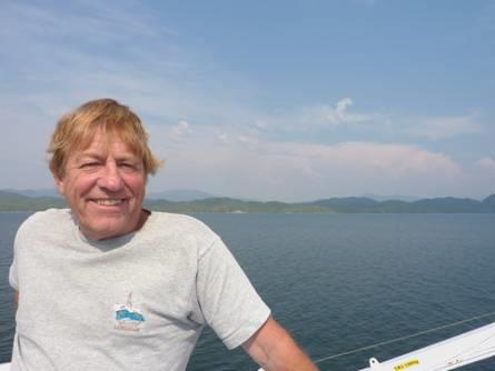
Adrian on the ferry to Bella Coola
The sunny day had become rather hazy, and it was now cool on deck. We ate the rolls I had brought for lunch, then found seats inside. After passing Pine Island, we travelled through a stretch of open water (the southern end of Queen Charlotte Sound), but it never got choppy.
As we reached Fitz Hugh Sound, and were once more surrounded by islands, we passed numerous hump-backed whales, with the evocative ‘swish’ of their tail fins.
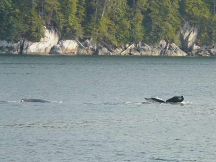
Hump-backed whales
We had earlier passed some Pacific white sided dolphins, but as we came into the even more enclosed waters of Burke Inlet, we saw lots more dolphins. One pod played back and forth like a moving vertebrae.
The food on board had looked as uninspiring as on the previous ferry, but we were in luck, as on Thursdays there was a barbecue. The crew turned the boat around for this so we were now going backwards, but it didn’t seem to make any difference. The chef could now cook outside on deck at the back (the front really!) out of the wind.
By now the haze had gone, and it was really hot. We sat on deck to eat our shared barbecued chicken meal. The chef took almost the rest of the voyage time cleaning up his barbecue!
We had been amazed at the number of Germans on the boat – it must be a route that they take.
The captain now made an announcement (in both English and German – not French!) The only road out of Bella Coola had been closed because of a forest fire! There is only one road out of Bella Coola – a 450km road – some gravel, and some very steep – to Williams Lake. We had heard of the unusually high temperatures in the area. We were glad that we were in no hurry to get away – but hope that we can eventually!
The sun now disappeared behind the mountains, and we watched a half moon rise above a snowy peak – later looking like a squashed luminous balloon. It didn’t get dark until we’d almost reached Bella Coola – I had just seen the first star.
Nearing Bella Coola
It was quite eerie arriving at Bella Coola in the dark. All day we had only passed one small habitation, and very few boats. Now in the darkness we saw one or two lights. The small harbour is situated a few miles before the town, and we could just see a feint glow of lights in the distance. We had to all stay on deck as the crew manoeuvred the boat into the harbour, and weren’t directed down to our vehicles until after we had docked.
We were almost the last vehicle to leave the ship, which we were glad of, as we needed to look out for somewhere to stop for the night. We know that it is difficult to find places in the dark, so were pleased when we came to a rough picnic area. We pulled in, and were soon in bed - it was now midnight.
We had been thinking of Simon and Laure, as they left Canada today for their flight to England, and their new life in Europe.
Friday 31st July Around Bella Coola 25 miles
We were soon asleep, but had a rude awakening at 3.30 am when a group of noisy young people arrived, with music blaring, seemingly having an all night party! The last thing that we’d expected in this remote little town!
In the morning we saw that we were right by the wide and fast flowing glacial Bella Coola River. Mist was rising from it as we sat out to have our breakfast, with tall mountains, some with snow, surrounding us, and a bald eagle calling from the top of the trees.
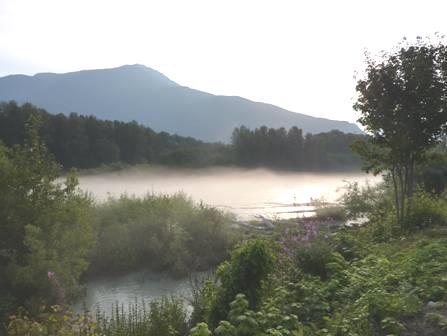
Early morning mist on the Bella Coola River
We drove back into the humble little town, desperately wanting to get an internet connection, but not holding much hope. We wanted to phone our ‘kids’, who, all except Tom, were meeting at our house this weekend before Simon & Laure fly on to France. We were in luck, and were delighted to talk to them all, and the grandchildren, who were having such fun together. We felt so pleased for them, but also so far away!
We drove back past the harbour to Clayton Falls Recreation Area, along a mile or so of rough gravel road. There is a hydro scheme here, but above that, the falls were really attractive.
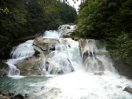
Pretty Clayton Falls
We spoke to an American who had been on the boat, and then enjoyed coffee sitting by the water’s edge, looking across to an old cannery, with steep mountains up behind, one with a glacier. There was a tiny little harbour here too. It was idyllic – spoilt only by the presence of mozzies – something we have seen little of until now.
The little harbour at Clayton Falls
By the time we’d caught up with things from yesterday, we had lunch here too, watching the harbour seals pop their heads up, and listening to them barking.
As we drove back into Bella Coola, we stopped to read a plaque to former Scotsman Alexander MacKenzie, who had travelled across the North American continent, arriving here on 19th July 1793 – 12 years before Lewis and Clark completed their crossing.
We stopped in Bella Coola to ask about the road out. The fire it seems has been put under control, but they are sweeping the road, which may mean a short hold up. We bought a few things in the Co-op next door, aware that there will be no shops from now on, and next Monday is a Bank Holiday.
We now left the town, stopping after a few miles to walk in Snootli Creek Regional Park. We walked through ancient huge cedars once again. This time, the forest was totally ‘un-manicured’, which gave it extra appeal. The trees were hanging with moss and lichen.
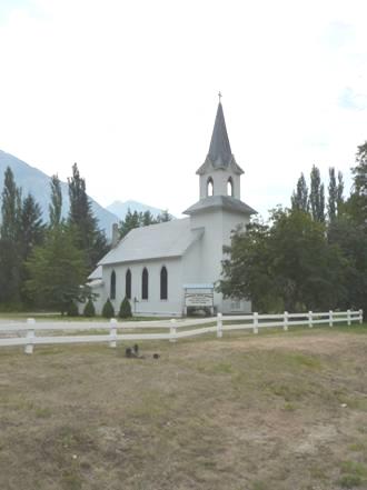
We soon came to Hagensborg, a small town started by Norwegians in the early 1900’s. The little white church looked very fitting. There were walks to two waterfalls, which we had voted not to do, as it was so hot, but we got excellent views of the falls from the road anyway.
We crossed the river and walked trails through more huge trees by the Saloompt River. We read of people who had built a small home here, but nothing remains of it now.
We walked across to the river, and got talking to a pleasant couple from Kelowna, who had just been on a trip to Europe. She had recently retired, and they had visited their daughter in Berlin. Another couple here had been enjoying the river – he came over and got talking.
His name was Doug Baker, and he told us that he had written the trail booklet that we were using – in fact his parents were featured on the cover photo, and he and his wife on the back. We had been impressed with the booklet, so it was nice to be able to tell him so. He ran tours called ‘Doug on the Trail’, which I had seen advertised.
After they had left, I couldn’t resist having a ‘swirl’ in the water, which was cool, but fun, and not as violent as the Bella Coola River.
Rosie swishing down the Saloompt River
We had seen a little pull-off back beside the Bella Coola River, so drove there now. It was still very warm (5.00 pm), so we knew that we wanted to be outside. Despite the spot being rather sunny, we decided to stop. We scrambled down the vertical bank to the river – you wouldn’t want to fall in there!
Adrian’s anxiety about the hot sun was answered as the clouds then came up, and thunder rumbled. It was hard to tell the difference between that and the noise of the occasional car driving over the adjacent Bailey Bridge.
Adrian put out the awning, so that we could still sit outside, as it was very warm, but it wasn’t long before we realised that this was a mistake – the sudden violent gusts of wind made it unsafe. As the storm neared, and rain fell, blowing straight under the awning, we hurriedly took it in again and went inside. The storm came and went for a long time, but by now at least it was cooler. We’d changed our minds many times about what to cook tonight, but with it now being a bit cooler, I cooked bacon and mushroom tortillas inside.
Our evening’s entertainment was watching 3 young people – a girl and two blokes, who arrived in 2 cars. The cars kept coming and going, much beer was drunk, and they seemed to be drinking it sitting on the abutments to the bridge – even the storm hadn’t deterred them!
Saturday 1st August Will the road be open? 25 miles
The storm returned in the night, but it was a beautiful morning – sunny, with mist over the river, which was even more full and rushing this morning.
The turbulent Bella Coola River
We sat outside above the river to have breakfast, before driving back the few miles into Hagensborg. Both the little village and the countryside could have been in Scandinavia or the Alps.
We were hoping to find out whether the road up ‘the Hill’ was open, so went into the exceptionally well stocked supermarket (just opening at 9 o’clock) and asked. We were told that the road was ‘closed’, and then ‘open’ – the two conflicting answers that we were given all day. A gent who had walked past us earlier had said that fires were burning, and that the air was smoky.
We continued along the scenic road, arriving at Tweedsmuir Provincial Park, where we stopped for coffee before setting out on the Burnt Bridge Creek Trail.
The trail ascended first to a lookout over the Bella Coola Valley, with its wonderful scenery, but looking very misty today. Mostly the 5 km walk went through woods and ancient moss covered forest, but there were one or two very steep sections, especially climbing up out of the valley when we had crossed the creek on a little suspension bridge.
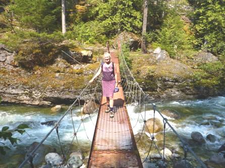
Crossing Burnt Bridge Creek
We saw a few birds and butterflies, and a lot of dragonflies. When we got back to the parking area, it was time for lunch, so we sat at the one picnic table, in the shade.
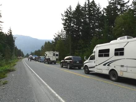
The interesting thing when on a ‘one way road’ is that you keep meeting the same people. Before the walk, we had talked to a couple in a small dormobile. They had been on the ferry, and at the campsite in Port Hardy. They came from Seattle, and were 85 and 83. They gave us hope for the years ahead! Back at the parking area, Adrian spoke to two brothers, who had also been on the ferry, and who we had seen yesterday. One lived in Sayward, Vancouver Island, and the other in Langley, near Vancouver. Each time, the topic of conversation was ‘Is the road open’. While they were talking, a fire warden came along. He asked if we had smelled smoke, as he’d heard that there had been some lightning strikes last night. He didn’t know whether the road was open or not!
Towards the end of our walk, we had passed a line of a dozen or so walkers, including, at the end, the German woman from the laundry at Port Hardy and her husband. Adrian guessed that they were all on the ‘Nature Bus’, which had been parked behind us on the ferry, and he was right!
We decided to continue on our way, and do another walk which I’d wanted to do – through glaciated moraine to a ‘kettle pond’. There was a huge erratic rock in the parking area, which had apparently split in two just a few years ago. Other erratics lined the path, and dozens of moss covered boulders.
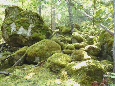
Moss covered glacial boulders
The walk wasn’t the flat easy path that we’d imagined, and was less enjoyable than we’d hoped because of the presence of mosquitoes.
We now continued to the bottom of ‘The Hill’ (where the surfaced road becomes gravel) arriving at 3 o’clock. There were a few cars waiting – the ‘Nature Bus’ was in front of us. Adrian went off to find out if and when the road would be opened, but found out that nobody knew. He stopped to chat to a local, who was setting off on holiday. The man worked as a counsellor, mostly with native people, and the picture he painted was a sad one.
After half an hour, we thought that we might as well return to the nearby campsite. The road hadn’t been open all day, and it was hot waiting in the sun. Atnarko Provincial campsite was sited beside the Atnarko River, a tributary of the Bella Coola, which the road was now following.
We found a pleasant spot near the river, and were pleased to find that there was a little side stream, where the water was not fast flowing, and deep enough for a swim.
The pretty young woman warden came along to collect the money, and later a nice male ranger came to tell us the state if the road – but he didn’t know anything, so it’s ‘wait and see’!
We did have a barbecue, and sat outside, but the mozzies were a nuisance.
Sunday 2nd August We’re not going anywhere! 43 miles
It was a beautiful morning, although still dark in the forest. We left at 9.45, and drove back to the bottom of ‘The Hill’, where we discovered that the road is closed ‘indefinitely’!
We drove the 40 miles back to Hagensborg, where we found that the shop was open. Last night, our outdoor stove had packed up – or at least, one of the jets was blocked, but we didn’t like the price of a new one!
The garage was open too, but only for petrol, so we got some of that (driving back and forth is using up our petrol). Adrian was concerned because the engine is misfiring, but there was nobody to see about it today.
He had spoken to the couple from Kelowna, who’d we’d met the other day by the river. They were staying in a hotel here, and last night had watched another fire from their window – in fact there had been two more fires.
There was a campsite here called ‘Gnome’s Home’, which we knew that the Seattle couple had stayed at. We pulled in, and the owner Karl, originally from Germany - a man with a strange sense of humour, and a liking for the sound of his own voice - welcomed us. He had bought this place in the eighties (a total of 70 acres), and made a small part of it into a campsite.
Having settled in – with electricity, which we need as we’re not travelling much each day to charge the battery – Adrian found that we had a good internet connection. We were able to phone Elm Gable again, and talk to Paul, Simon, Felix, Ruby and Manolo, which was a real bonus. Simon had sent a photo of them all.
While we were having lunch, the Seattle couple came along. They had already been booked onto tomorrow’s ferry back to Vancouver Island, which is another option of getting out of here but one which we don’t want.
We set off to walk the ‘Nature Trail’ which Karl had set up behind the campsite. It was a pleasant walk through ancient forest, crossed by clear streams – prime salmon spawning ground it seems. It gave an idea of the sort of terrain that homesteaders might have been landed with.
We walked right out to the road – the site is next to the pretty Augsburg church and also the Norwegian heritage house, which is open for visits by appointment.
Pretty Augsburg church, Hagensborg
Just along the road is a small open air swimming pool. I went to have a look, and was greeted by a small group of children who said ’have you seen the fire?’, and there on the other side of the valley, was smoke from yet another fire.
Back at our pitch, the air was often heavy with smoke, particularly when the wind blew. Later we walked out to the road again – everywhere was looking misty with the smoke. An RV pulled in with a Dutch couple and their teenage son. They had been staying at Atnarko campsite last night, and at midday today, everyone from there had been evacuated as a precaution against the fire.
Adrian worked on the misfiring engine, and we drove out for a short while – without any definite conclusions, but he may have solved something. The smoke was thick all around.
Back at our spot, we set the barbecue going. Adrian had worked on the outdoor stove too, and that appeared to be a success, and we cooked the veggies on it.
We had lost our view of the mountains up behind us, because of the smoke, but it was still pleasantly warm outside as we ate our meal, but the mozzies got the better of Adrian, so we finally came in.
Monday 3rd August Another day in the valley 6 miles
Woke late to theoretically another lovely day, but smoke filled the valley, with an eerie red sun glowing through.
We enjoyed blueberry pancakes for breakfast, and then worked on useful things like the website and printing the diary. We telephoned Elm Gable, and spoke to Emma, who had been out yesterday when we’d phoned. Simon & Laure had left on time for their flight to France.
Adrian spoke to a chap who had just driven ‘down the Hill’, having waited since Friday. Apparently just a few cars were let through early this morning, although the information on the computer still says ‘no intermittent opening of the road’. He gave some hope that the fire was burning out near to the road, but he also told us that there was another fire further on at Alexis Creek, which means that even if we get over ‘the Hill’ , we still can’t get through to Williams Lake.
After lunch we drove out, and found that the store was open, despite being British Columbia Day, and a bank holiday. We bought a few things, then started off down the road towards Bella Coola. I’d had one or two walks in mind, that we could do, but these were impossible because of the continuing forest fires. Just a few miles on, we came to a road block. Firefighting helicopters were flying overhead, so we thought that they’d just stopped the traffic for that, but later we read that the road had been closed here too because of the fires.
We stopped by the little open air swimming pool, just before the campsite. Here, for $1.50 each (senior rate), we had a pleasant swim – a strange experience, with the firefighting helicopters flying above through the smoke. The good thing was that we could have a shower afterwards – a swim (with the shower) was cheaper than a shower at the campsite!
We busied ourselves for the rest of the afternoon – Adrian was able to catch up with all sorts of maintenance jobs that he never has time for. It’s an ill wind (or something like that!)
Adrian being busy - smoke hides the view
We ate really excellent steak for supper. We had chatted to the Dutch family again, who had been out walking near Bella Coola, and had to plead to be let back through the road block. Apparently there was talk of evacuating Hagensborg – to Bella Coola – not what we wanted!
We agreed to leave early in the morning, in the hopes of being let ‘up the Hill’.
Tuesday 4th August Out of the valley at last! 243 miles
We hadn’t slept well, hearing the wind blowing strongly, which is the last thing that we (or the firefighters) wanted. Also we’d heard a low rhythmic sound like bass music, which we think must have been from a pump.
We were awake early, so got up before 6 o’clock, and headed for ‘the Hill’. We could see the mountains around us for the first time for days, although it seemed lightly cloudy. For a brief moment we saw the sun as a huge luminous red ball.
The (normally winter use) sign for Heckman Pass still said ‘closed’, but we continued until 7.00 am, when we reached the line of cars – some way before the Hill.
Waiting to go ‘up the Hill’
The BC Roads website had still said that the road was closed, with no intermittent openings, but word had got around that the road would be open early this morning for one convoy of cars. Apparently the road down to Bella Coola was still closed, with escort through by flagman.
Just before 9 o’clock, things started to happen, and slowly the line of cars moved forward. I must admit to feeling emotional about the possibility of getting out of the valley. We still had 10 miles of road to go before the gravel started, but then we started ascending on the steep, and sometimes narrow road with several hairpin bends. There was often a wall of rocks to the side, and a vertical drop for hundreds of feet below, the higher we went up.
Of course, we had to go at the same speed as the other cars, so there was no stopping, and we just hoped that the engine would behave itself.
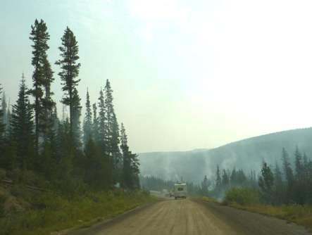
We reach the area of the fires
I tried taking a few photos through the windscreen. For a long while, there was no sign of the fire, but then we passed dozens of small fires beside the road, some just smoking, but others still with flames. It was a bit like driving past geysers in Yellowstone or New Zealand.
When we reached the top of the first long ascent, we all stopped, for the last few vehicles to catch up. The nice young ranger from the other day, who had been leading the cavalcade, drove back, speaking to everybody on the way. He looked quite careworn.
Before we ascended the second climb, we passed the vehicles coming from the other direction – not many of them, but including two huge lorries, presumably with supplies for Bella Coola Valley.
When we reached the summit of Heckman Pass (1524m, 5000ft), the convoy vehicle left. We drove on through a pretty area of small alpine lakes, with Indian Paintbrush.
We passed the fire fighting helicopter, parked by the roadside, and the collection of workers presumably waiting to continue fighting the fires. It made us think of Adrian, working to restore electricity after a big storm.
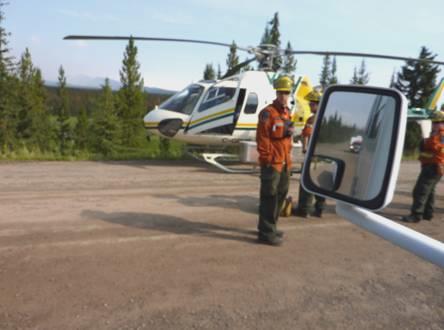
The firefighters
We let other vehicles pass, so that we now felt on our own again. After 60 km of gravel road, we finally reached the tarmac at 10.40 at Anahim Lake. It was 140 km back to Bella Coola.
We stopped to have coffee, and found the temperature much cooler than down below.
Although the scenery we now drove through was far less attractive – fairly flat, and with much evidence of dead trees from the pine beetle, we felt a great feeling of relief at having left the valley.
Even so, there were still no roads to turn off to, so we wanted to keep going, so that we didn’t get trapped again! We stopped for lunch near Tatla Lake – where the sign said the next picnic area was 130km! A group of people had met up here for a picnic lunch. An eagle flew overhead, squealing, and the temperature was quite pleasant. There were aspens amongst the fir trees. We began to return to normal!
We continued towards Alexis Creek, where the road had been closed a couple of days ago, so we wanted to get past there! This was a shame, because not long before it we came to a Provincial Park campsite at a nice looking place called Bull Canyon, by the milky-green Chilcotin River.
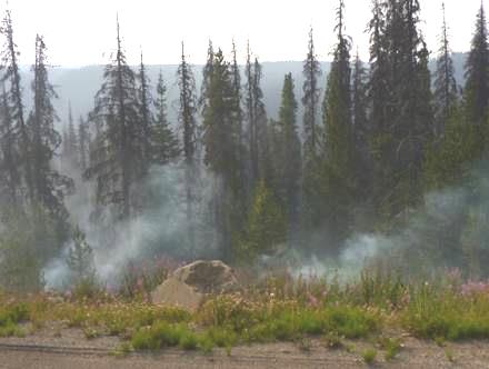
In fact the fire at Alexis Creek was up in the hills, and didn’t look as if it had ever been a problem to the road. It was still burning, and we watched the helicopter bringing the fire retardant.
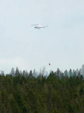
Firefighting helicopter at Alexis Creek
People had said that the authorities had been over cautious about road closures. It’s difficult to say. Certainly the worst thing for us was not knowing what was happening when we’d been in the Bella Coola Valley.
At 4 o’clock we pulled into the next rest area, near Hanceville. We had a cup of tea, and expected to stay for the night, but then Adrian saw of a campsite 20 miles further on at Bechers Pond. We decided to move on, and located the track to the campsite, but it was definitely a 4x4 job – a rough track, with many downed trees across it. We tried it for a while, but gave up. However, back at the start of the track was a suitable place to stop, at the end of the dam. Having pulled in, we walked across the dam, seeing little birds in the rushes, and a bald eagle above. Later it flew right down to catch a fish. The weather was overcast, and quite cool, but we are at 3,500ft.
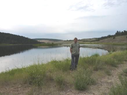
Back to normality!
Duncan, Vancouver Island to Williams Lake


