
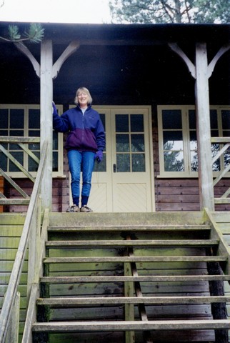
Wednesday, 18 April 2001 163 miles
We started this part of our ’ROAD around Britain’ on the Wednesday after Easter. We had enjoyed having Emma and nine-month-old Felix with us for Easter; with a visit from Tom. We were to be walking the last ‘Epilepsy walk’, but like many things, this had to be cancelled due to the disastrous Foot & Mouth epidemic.
We finally got off at about 11.40 on a very mixed day - as the forecast said ‘ Winter is back’’ but it never really left! There was some blue sky, but also wintry showers with a very cold wind & icy feel. The hedges were beginning to show their green, and daffodils everywhere were beautiful.
We stopped for lunch at South Mimms - not the most exciting place - remembering a time in 1996 when we had attempted to overnight here. We pulled in, out of the way, over the grass verge to have our lunch. It just happened that the strimmers were out, so as well as their well-known noise we had to pull forward to let the chap past.
We left here just after 2.00 pm and headed off past Chelmsford and then through Colchester (remembering our 96 visit, when we ‘did’ this bit of coast as our start of ‘ROAD around Britain). The roadside daffodils were just finishing here, but had been prolific.
We drove through Thorpe le Soken and reached the spot where we had stopped our "R.A.B." in 1996 and stopped beside the road for a cup of tea and piece of Easter cake.
Just along from here was a C.L. but ‘Foot and Mouth’ signs signified that it was probably closed. We drove down one track but encountered the disinfectant mat so returned. The site appeared to be down the next track. We telephoned, but got the answer phone, so continued towards Harwich.
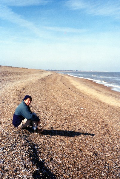
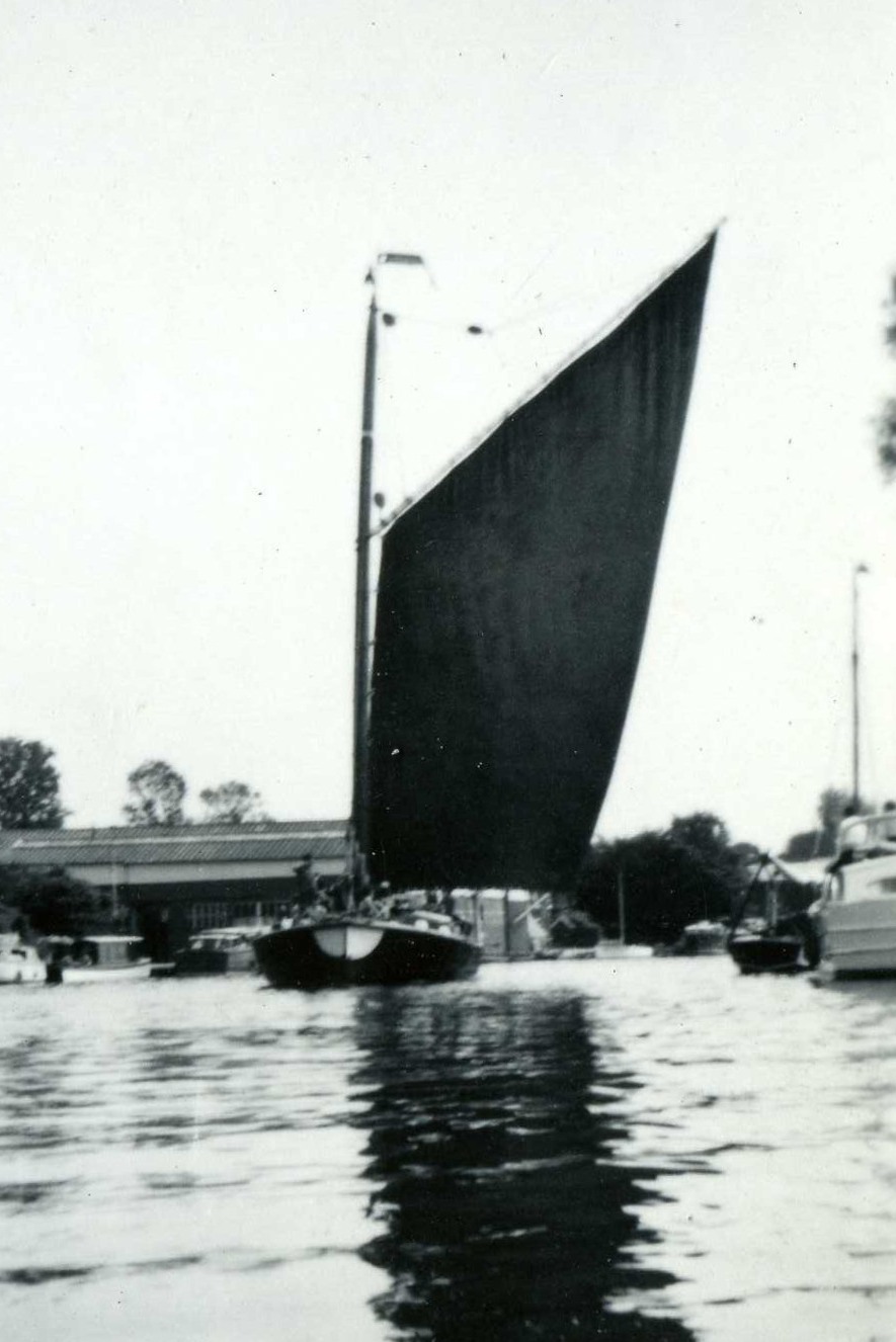
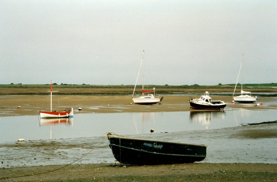
We drove down to the sea at Dovercourt Beach and parked briefly in the free car park, looking across the water to Walton on the Naze. A bit further on, at Dovercourt, I photographed the two old lighthouses as the start of this section of our coastal route.
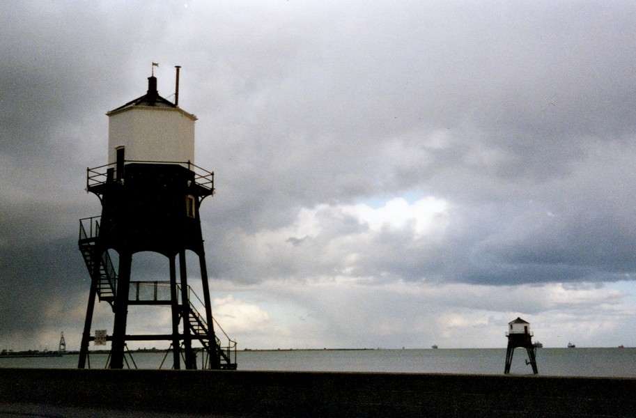
The two lighthouses at Dovercourt
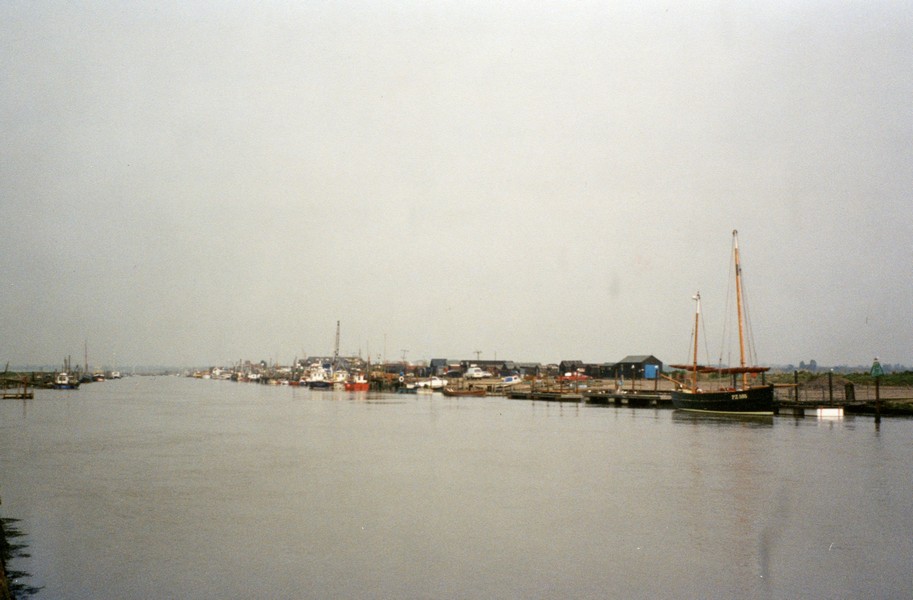
We thought that Harwich was a quaint little place, with rows of Flemish looking houses and neat parks with vivid flower beds. We stopped at Safeway, near the turn off to the ferry terminal, and got some fuel and some milk, and on a spare bit of road opposite found a suitable place to stop for the night.
We could see all the vehicles coming from the ferry and going round the roundabout. One or two lorries joined us. There was a lovely sky as the sun went down - how different it is with light evenings, compared with our recent time in Cornwall. After supper, including turkey soup, with remains of the Easter turkey, we sat watching the activity & the lights and listened to our tape of our travels in the South Pacific in 1998.
Before bed we sent a short email to Simon telling him of the dates of our proposed visit to Calgary in June.
Thursday, 19th April 37 miles
I only heard one lorry leave – at 2.30 am – but had rather a disturbed night on account of an unpleasant cold which appeared just before we left home.
We left at 8.45 to find a more suitable place for breakfast. There was some blue sky, but a strong freezing wind.
We turned off past the little village of Ramsey, along the south side of the long Stour estuary. We passed some very pleasant houses and the RSPB nature reserve of Stour Wood, the floor of which was white with a carpet of wood anenomies. Sadly it was closed (foot and mouth again). We drove through Wrabness and after taking a little road to view the Stour at Jaques’s Bay (a quick look, as it was so cold), we returned to a little car park by Oakfield Wood with views across fields to the Stour, to have our breakfast. The sun was shining in, it warmed our backs. The footpath from here to the river was open, but the look on the faces of the two people returning to their car after walking their dog assured us that we didn't want to brave the cold!
We continued westward, south of the Stour estuary. While driving through the little village of Bradfield, we became aware of a rattling noise towards the rear of the Tiv. We feared the worst but on inspection it turned out to be a large twig/small branch stuck by the rear wheel!
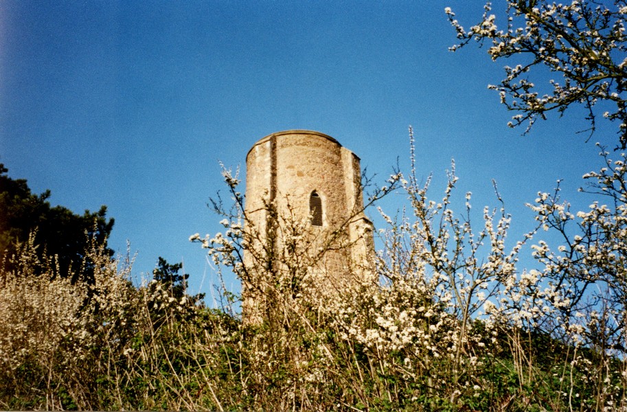
Just after this at Mistley, we saw signs to the "secret bunker" and decided to visit. It was billed as a great attraction for all the family. Although I found it interesting to fill in a gap in my knowledge – nuclear invasion never having been at the top of my interests list – I wouldn't have thought it very suitable for young children. Having said this, it was well displayed and signed. We did think that the steep entrance fee could have included heating in the cold building!
Now nearly lunchtime, we set off through Manningtree in its attractive setting beside the water. We crossed the bridge over the River Stour and were now in Suffolk. We were very close to Flatford Mill, which we had visited on our previous visit, but this time we continued driving eastwards along the north of the Stour estuary, passing Stutton with the Royal Hospital School, relocated from Greenwich in the 30s and with its distinctive tower.
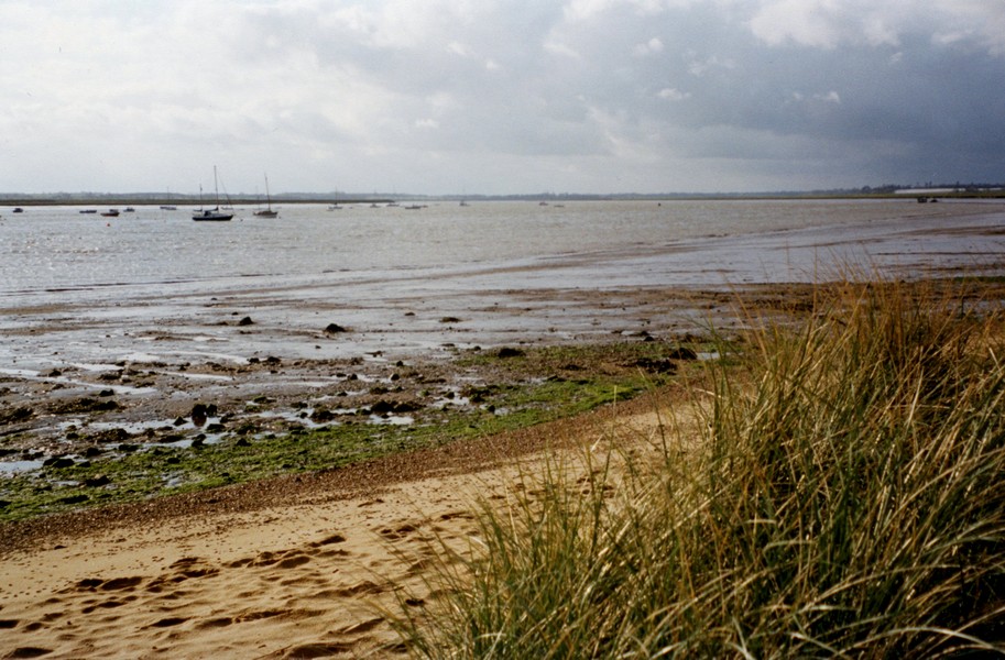
We were hoping to find a footpath by this part of the estuary called Holbrook Bay. We tried by Stutton Church then continued to Lower Holbrook where we found a free car park. There were frequent "wintry showers", but after having lunch, we set out on a very enjoyable walk along the beach of the estuary and back along the road through Harkstead
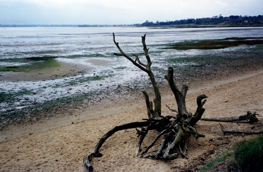
The beach near Lower Holbrook
We were lucky to have mostly sunshine – just one shower, but just as we reached the Tiv there was a really long and heavy hail shower. This bit of coastal inlet reminded us of Dunk Island (A) and Stokes inlet (R) – both in Australia – with different temperatures of course. We saw many birds, noticeably shelduck and I heard my beloved curlew.
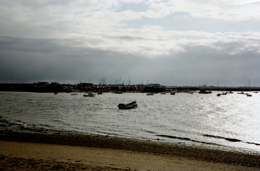
We drove on to Shotley Gate and stopped at the "front" looking across the River Stour to Harwich south of us, it looked nice from here too; and across the River Orwell to Felixstowe in the East (jokes from Adrian about Felix’ toe). Both places looked so near, but were a long way by road.
We now drove up past Shotley church on the western side of the River Orwell to Chelmoniston. We took the road down to the shore and parked then set off on a pleasant walk through the National Trust owned Pin Mill. The pub here, in its position beside the water, reminded me of Coombe Cellars in Devon.
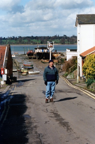
Adrian at Pin Mill
There were even some little houses beside the water, reminding me of the one we’d stayed in. We had mostly sunshine for this walk too.
We continued in the Tiv a couple of miles to Freston where we found a suitable layby/bit of old road to stop on the for the night. We set off immediately for a short walk down the shore, by Ipswich Yacht Club, but were pleased to find that there was a "permissive path" around the adjacent field, making it a round walk (or triangular anyway). The hedges of blackthorn beside the water looked lovely. The huge Orwell Bridge towered above the river.
Adrian cooked the supper, which I enjoyed. We talked about our planned trip to America and Canada this year, making use of Lonely Planet USA.
Orwell Bridge
Friday 20th April 58 miles
I was pleased to have slept well last night. I did often hear it raining hard in the night, and we awoke to a grey and uninviting morning which didn't entice us up!
We listened to Desert Island Discs with Ronald Blythe author of Akenfield – a village in Suffolk. We knew nothing of him or the book, but it sounded very interesting. We left afterwards and drove right into Ipswich. The centre didn't seem to have got itself together, but the pastel beds of spring flowers were wonderful. We didn't actually see a supermarket to do any food shopping, so continued down the northern side of the River Orwell through Nacton and Levington along little country roads and then down to Felixstowe right down to Landguard Fort. Here we looked across the water to Harwich with Shotley Gate behind it. There were a surprising number of cars in the car park. Several people braved the weather to get their coffees from the "container" snack bar. We received an email from Simon saying that he had received ours with our dates for arriving in Calgary. We saw several gulls, particularly black headed gulls.
On the other side of this peninsular we had a short walk on the Nature Reserve, walking across the pebbly beach then across the grassy area. The wind was cold and strong, but just as we reached the Tiv, another "wintry shower" arrived with great force! Lucky again!
We drove along the front at Felixstowe, looking like so many other seaside towns, but pretty devoid of people in this cold weather, despite being Easter week. At "Old Felixstowe" we found a rather tatty and unexciting Spar shop where we got a few necessities. We then had our lunch overlooking the sea and a line of deserted beach huts, before driving down to Felixstowe Ferry, just as another "wintry shower" arrived with full force, so we didn't get out to explore. From here a little ferryboat crosses the mouth of the River Deben to Bawdsey Quay. There is a footpath up this western side of the river.
We now had to return through Felixstowe and then turned off through Kirton and past Newbourne – a pretty village surrounded by glass houses, but we couldn't discover what they were growing. We turned off to a little place called Hemley – a no through road with a church and a couple of farms close to the river. "Foot and mouth" signs meant that we didn't linger here but continued north a short distance to Waddingfield. Here we parked – there was a pub beside the river – similar to yesterday's situation and walked northwards on a footpath on a raised bank beside the muddy banks. It was very mucky and muddy underfoot and the wind blew keenly in our faces. It made me think of the marshes in Great Expectations. We saw shelducks again and once more heard the call of the curlew. We were able to make our way to a little road called Sandy Lane, to make this a circular walk. The road was certainly living up to its name, the sandy soil having been washed down from nearby fields. We were lucky to have had some sunshine for this walk and again we didn't get rained upon.
We now drove northwards to Woodbridge (which we'd never heard of) and through it. It seemed pretty busy and there was always a railway line between the town and the water. We weren't able to stop, but it did seem an interesting place. We crossed the River Deben and drove southwards down the other side passing Sutton Hoo and stopping at a picnic site on the edge of Sutton Common. Here we didn't venture out as the wintry showers were rather dire! People caught out walking their dogs look very wind/rain blown!
We drove a little way south to Ramsholt where we parked in a pleasant grassy car park (unfortunately we picked up the "no caravans/campers" sign or we might have been tempted to stop). Here we set off on a pleasant walk up to Ramsholt church, with its round tower and back along beside the river.
Again the weather was erratic – we stopped once or twice and sheltered under our umbrellas, but as we passed the church, the sky was blue.
Ramsholt Church
The walk ended by a delightfully positioned pub, beside the water, but we weren't able to linger too long, as the next shower approached and we made a dash for the Tiv.
We now drove on through Bawdsey to Bawdsey Quay – the other side of the Felixstowe Ferry! Here we found a suitable stopping place beside the road. We had a final walk out along the shore beside the river, both upstream and down to the ferry. The sun sometimes shone but the wind also blew and we were glad to get back inside and enjoy the delightfully rural view in comfort.
I telephoned Emma and found out that the weather in Devon was much warmer.
I cooked pizza for supper and we ate it looking out to our lovely view across the water. It felt really cold tonight. We sat, still looking out, and listened to more of our tape of our time in the warmth of the Marquesas. We went to sleep listening to the water lapping the shore.
The River Deben Estuary
Looking to Felixstowe from Bawdsey Quay
Saturday 21st April 31 miles
We put on the radio to hear the National Anthem being played for the Queen's 75th birthday. We enjoyed listening to Brian Matthew with "Sounds of the 60s" then looked out at our "jigsaw puzzle view" of the little boats on the estuary with humpy clouds behind while we had our breakfast. Definitely a top spot!
We left at about 9.40 and retraced our steps to Bawdsey, then took the little road east towards the coast for about half a mile. The road was very wet and muddy and just before we reached the end it was completely flooded, so we backtracked to Bawdsey then drove north through Alderton and Hollesley to the Martello tower at the end of the road at Shingle Street. We had a quick "blow" on the beach, but the wind was still chill and we couldn't make it a circular walk, so we drove back up the road a bit. From here we had a pleasant circular walk – up the road and back down the raised bank between the marshes. We heard and saw skylarks and a flock of oystercatchers and later watched a kestrel hovering and then diving. The sky was blue with little fluffy clouds, not the angry clouds of yesterday. The wind was still fresh. We saw by the River Ore (called the Alde further up) reaches the sea after its parallel course along the coast, leaving the long sand spit of Orford Ness beyond it.
When we reached the Tiv, we thought it warm enough to drink our tea/coffee outside, sitting on our little mats. Our peace was shattered briefly by the arrival of two women, two girls and two large dogs. They left to walk on the beach and two young chaps looking a bit like Tom arrived and peered through their binoculars and then there large telescopes. It was so pleasantly warm that I didn't want to move on.
We did though and made our way to the delightfully peaceful village of Orford. We parked beside the road and walked down to the quay, looking across to Orford Ness.
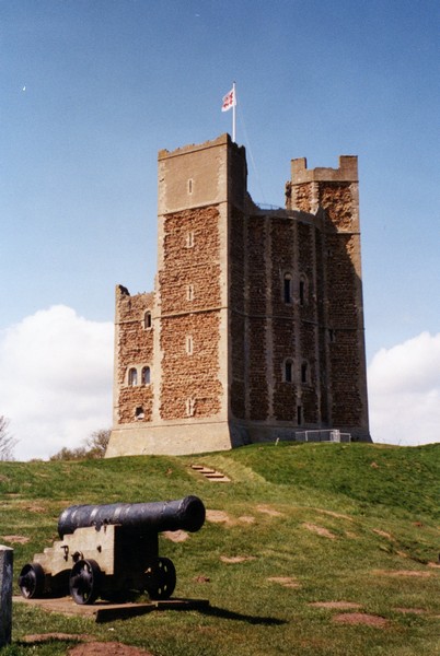
We then walked up through the village and past the Norman Church to the keep of the castle. We went in here and climbed up to the top, enjoying the views out and the many little passages and rooms which we explored on the way. We walked back through more of this lovely unspoiled village to the TIv. England at its best – rural and lost in time.
Our ordnance survey map had run out, so we had to follow the Atlas map. We drove through pretty country to Iken, which said in my "coastal" book had nice river walks, but we needed somewhere for lunch, so continued past it to the picnic site marked on the map. However when we got there, it was situated down a track between two fields of pigs. There was a height barrier and anyway it was closed! It could have said so at the end of the track!
We reversed and drove on a bit and stopped in a forest gate-way and enjoyed our lunch. It was 2.30 when we left. We soon came to Snape Maltings – these old buildings have been taken over by the Aldeburgh Festival and many of them have become little tourist/craft shops. We pulled in and enjoyed a wander around – it is obviously a popular place to come on a Saturday afternoon. We bought a couple of birthday cards and a tiny, strongly scented pink, then had a pleasant short walk along beside the river edged with its tall reed grasses. These looked wonderful against the clear blue sky. We then went to view an old wherry moored here. Altogether a very enjoyable stop.
Orford Church and Orford Castle
There was "C.L." just up the road, beside the pub. We needed water and to empty the loo so pulled in. Adrian couldn't find anybody about, so we did the "jobs", then pulled into the adjacent field. We walked up through the village, but sadly it was not pretty like so many we had driven through were.
On returning to the Tiv another motorhome arrived. The chap chatted to Adrian. It turned out that a friend of the man's had written a book about an event in the war at Shingle Street and tomorrow this chap and several others were going to Shingle Street to dress up as Germans so that a photo could be taken for the cover of the book!
Adrian went again to enquire about paying and just found the barman. He returned again to ask about food, but sod's law – they were fully booked tonight! Instead we enjoyed a meal of sausage, bacon, mushrooms and some colli from Spar – excellent at 59p. Afterwards we had strawberries – also from Spar for 59p and very good. Who needs a pub? (Next day we saw this pub – the Crown – in our "walks to pubs" book – perhaps we should have visited it!)
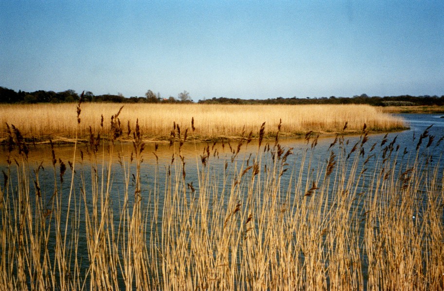
The reeds at Snape Maltings and the wherry
Sunday 22nd April 31 miles
We woke to a grey, cloudy morning, but the day stayed dry and we had sunshine for most of it. The wind had turned round to come from the south, but it was still very cold. After breakfast Adrian refilled the water tank. We stopped at the nearby shop and I bought pitta bread, fish and cream doughnuts.
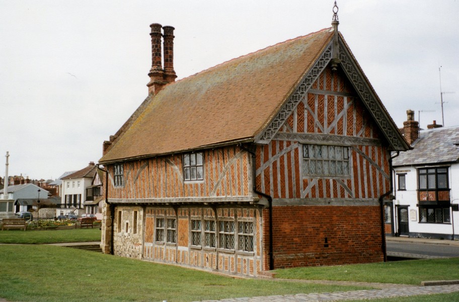
We drove down to Aldeburgh and parked down near the quay. We walked a short way along the pebble ridge – the river at this point turns a hairpin bend before flowing southwards several miles before entering the sea south of Orford. It is called the River Alde at this point and Ore further south. We perhaps should have walked further, but the wind was rather fierce. We drove back and parked near the town and walked up beside the front of this delightfully attractive town, crowned by its Moot Hall. This dates from the 1600s and looks like a fairytale building.
We walked back up the main street with its fine collection of buildings and just one or two mistakes. We lingered in a bookshop and were able to purchase the local OS map – hooray!
We drove to park beside the beach just north of the town to enjoy our doughnuts for elevenses and then listen to the highly entertaining Chris Tarrant on Desert Island discs. We drove the short distance north to Thorpeness - a strange village "conjured up" in the early 1900s as a holiday village. It contained houses of varying styles – Jacobean, weather boarded and the crown of it all – the water tower disguised as an ordinary house, set up high on its tower – beside it was a windmill. We walked briefly on the pebbly beach, and then by the lake and little pond, where there were a great many mallards, one with four little ducklings.
We drove through Leiston and to Sizewell and parked by the beach. In front of us two cars were parked and the owners returned with a total of nine dogs – four poodles (two which looked like baboons) and four "proper dogs" and one corgi. We walked briefly on this pebbly beach, but both felt that it was rather uninspiring. Maybe it was the greyness and the cold wind and the sight of the block of the Nuclear Power station up behind us.
We ate our lunch in the Tiv, then I telephoned Paul and found that they had a week of sunny weather in Wales.
We now drove back past Leiston and and up to Eastbridge, but all foot paths appeared closed. Here and at Sizewell were many "twitchers" with their large telescopes. On returning down this road, we passed a "two-ton" weight limit – we hadn't seen one on the way!
We took a narrow winding road to Theberton, which had a very pretty round towered church and past Westleton to the National trust car park at Dunwich Heath. This was very busy with cars and abounded with "twitchers" too. Adjacent RSPB Minsmere reserve was closed – hence all the birdie people elsewhere. There was a disinfectant "boot bath" which we dipped our feet into – intended for those visiting the beach (but not the Heath!). The beach area was still very blowy and we had visited many beaches so we had a lovely Heathland walk, practically devoid of people. Something about the bleakness, the grasses and the tree lined stream got us thinking about remote places in Australia – Litchfield National Park and Lawn Hill. Okay the temperature was different, but the wildness was reminiscent.
We drove the short distance to Dunwich. Again we parked by the beach. One of the walks in our books went from here, but it was too late to attempt 7 miles, so we walked up beside the sea, on sand, but with high pebble ridge behind and back the other side of the ridge.
Aldeburgh's attractive Moot Hall
Again we saw and heard skylarks and other birds – redshank maybe. We drove inland a bit and parked beside the road adjacent to Dunwich Forest (closed to walkers). We filled in our census form! and then rang Tom. We were delighted to see a group of large red deer cavorting opposite us in the field and to watch the bare trees silhouetted against the purple sky. As the light faded from it and the stars came out bats flew out. We ate fish followed by the rest of the strawberries and listened to lovely Sunday evening on Radio 2. Another top spot.
Adrian on deserted Dunwich Beach
Monday 23rd April 61 miles
A grey morning and a mostly grey day, but dry. We left at 9.00 am and headed for Walberswick. The road passed through fields of sheep and lambs and pigs with piglets – a delight to see.
Walberswick was also a delight, tucked away at the end of the River Blyth, on the opposite bank to the Southwold, but joined only by a passenger ferry and footbridge. We passed many pretty houses. One car park was filled with large caravans and vehicles from Anglia television and there were several people hanging around – we wondered what they were filming. We thought that the scene of fishing boats along the quay on the river looked suitably Dickensian! I took a photo, but was aware that it looked very grey.
We walked out onto the flat, sandy beach area, also beautifully quiet on this Monday morning and then around part of the village, with a green reminding us of Urchfont. On the way out we stopped at the Post Office and bought one or two provisions. We then had to return past the sheep and pigs and briefly join the A12 to cross the River Blyth at Blythburgh. In the 1920s the River had burst its banks and the surrounding area is now tidal, with large areas of water. You could see the original channel of the river flowing through it. We had passed a house called 'Elm Gables' and now past the imposing school of St Felix!
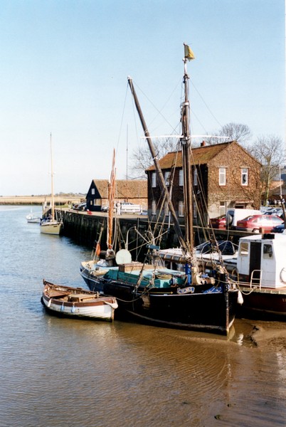
At Southwold we followed a small road down to the quay on the river, before walking along beside the river to the footbridge and back, delighting in the wooden jetties, the black wooden huts and the many boats – all so characterful.
We were able to drive along the bumpy track beside the river to the Southwold quay and at one of the little huts, Adrian was able to buy some gas. We then parked on this quay and walked over the pebbly and fine sandy beach, and looking across to Walberswick where we had walked earlier – on that occasion we had seen a group of oystercatchers fly off with their loud squawking.
There was an ornate lifeboat shelter on the beach and on looking inside the chap invited us in to have a look. Inside was a partly restored boat – originally a lifeboat dating from the 1890s and used for many years for that purpose, before being used as a private yacht. It had been rescued and was being restored by an enthusiastic group of people – our "guide" was 83, another chap was 85 and another man, a widower, had built a superb model of the boat, which was displayed in a glass case.
Southwold Quay
The "hut" housing the boat originally stood at the end of Cromer pier and had been moved down here. The whole story was one of inspiration and enthusiasm – rarely have we been moved by the keenness of a group of people so much. The sad sting in the tail to the story is that when we came back out, the chap was just writing out a parking ticket for the Tiv. Our jubilation turned to anger.
What a bummer! We drove up to Southwold and parked in a FREE car park to walk around the town. It was an attractive town but our hearts were still angry, so we didn't enjoy it as we should have. We drove down to the front to have our lunch, then wrote a letter to accompany the fine and vowed then to forget it! (N.B We are editing this 24 years later and we still haven't forgotten it!)
We set off northwards, taking the road down to Covehithe – the road ended abruptly before the sea, but just before it stood a large derelict church, with a newer thatched church built inside it – this had recently been restored. We had passed more fields of pigs.
We continued north, and reached Kessingland, but there was nothing for us to see here – there was a Caravan Club site by the sea, but otherwise access to the beach seemed difficult, or was not obvious, so we continued towards Lowestoft.
We turned off to the south of Lowestoft – an area called Pakefield and walked up towards Lowestoft on a concrete walkway – I walked along the low wall, then we walked back along the fine sandy beach, backed by a huge area of shingle. A horrid little dog kept going for us and tried to bite Adrian. We were not amused! Why do owners never apologise?
We made our way through Lowestoft now, following the one-way system and crossing the River Waveney at what is called Lake Locking. Lowestoft was too big for us to explore, so we reached the sea again just north towards Corton and looked down onto an unexciting area – static caravans and some sort of building work. At this point I referred again to the "coastal book" and found that Lowestoft Ness is the most easterly point in Britain! We managed to find our way back there. How underrated! We complain about other countries not making the most of things. This was hidden in an industrial area – behind Birds Eye/Walls and the waste disposal area and along a concrete sea wall with ridiculous signs depicting "no people" and "beware of slipping", but not saying that you could walk there! Hidden away was a large "compass" on the ground and sure enough a sign in the middle "the most easterly point in Britain"! How absurd! Hardly the prettiest spot!
 by the Alfred Corry, Southwold, Suffolk.jpg)
Adrian with the lifeboat and guide at Southwold
We drove back up through Corton – nothing to excite us there, and on through Hopton, where there was less (an assortment of static sites and holiday "villages" and no visible access to the sea).Nearby on an unused bit of road, we had a cup of tea.
We decided not to go any further north tonight, as we are almost into Great Yarmouth, so drove eastwards through the village of Blundeston, which I had read was the setting for an early part of Dickens David Copperfield. The village wasn't very forthcoming but did have another round towered church – apparently these are because it is easier to build a round tower with flints than a square.
We continued passed Somerleyton, with its Grand Hall to St Olaves where we couldn't find the row of 17th century houses. We crossed the New Cutt, built in the 1820s to bypass the many meanders of the Waveney River. Then finding nowhere more suitable to stop, returned to our "cut off" bit of road at Hopton. The sun now came out, making a nice contrast with the blue sky and the pinky – brown field and few naked trees.
Rosie standing on 'the most easterly point in England'
We were disconcerted to see a bonfire further along this defunct bit of road. Adrian went along to investigate – it appeared to be a large pile of rubbish which had been set alight. Luckily it burnt out later
Suffolk or Africa? - Hopton
Tuesday 24th April 49 miles
A grey morning, with a weak sun trying to come through, but the day deteriorated to become cold, grey and sometimes wet. We were listening to an interesting programme on Radio 4 (of which we have enjoyed many) about two people who had been undercover police/investigators. It wouldn't do for me!
We drove to Gorleston on sea - the southern extension of Great Yarmouth, south of the River Yare. We walked along beside the beach of fine golden sand to the mouth of the river. Here we saw an old lady – Mrs Pengelly look and sound like – who had walked out from her hotel and asked if we could help her to walk back. She was okay, but obviously felt weak – she said that she had had two bouts of flu since Christmas. She came from Leicester. Her husband hadn't come with her as he was still attending hospital. We walked back with her and saw her into her hotel – a sad figure on this bleak morning, with virtually nobody else about. What a cheerless holiday.
We returned to the Tiv and drove towards Great Yarmouth. We passed a Somerfield's and went in there to shop. A gas representative accosted us at the door and persuaded Adrian that the gas company could supply our electricity cheaper. Yes its Irish. We shall see. After a mediocre shop, we had tea/coffee in the Tiv, listening this time to a programme about the effect of the foot and mouth epidemic on nature in general.
We drove northwards and crossed the bridge at the end of Breydon Water, then found the place where Adrian had moored on a wherry when he was a young lad sailing on the broads.
With his memories revived, we continued southwards down the river side of the Great Yarmouth peninsula, occasionally catching glimpses of ancient bits of wall of the old town. We parked near the southern tip and walked down to the river mouth from the northern side. It had begun to rain by now, but we walked back on the beach of fine sand which stretches for miles. However this "South Beach" is really rundown and derelict – made us think of Italy.
We drove north now through the "resort" bit of Great Yarmouth, which was pretty horrid, with all the razzmatazz of so-called attractions which made us want to wince. The northern beach was more residential, the "nicer" area, and by now there was stretches of flat grassy dune area before the sea. Adrian had stopped to empty the loo, but we were having difficulty in finding anywhere to stop for lunch. We had joked that we would end up in Caistor and sure enough we did!
This was pretty dire – the dregs – all holiday villages and static caravan parks. However following our noses, we found a road which led to a parking area overlooking sand dunes to the sea. We had our lunch, then walked out across this pleasant dune area to the grey sea. Returning to the Tiv, we passed a lady walking her dog, who reminded us both of Renee, and soon afterwards we passed the "Haven" holiday village where she and Lena had attended a conference last week.
This whole area is absolute grot. We turned down to California, but didn't actually reach the sea, and weren't enticed out. A bit further on we did walk out in the damp, across and down the sandy cliffs to the sandy beach, the sea edge of which was lined with shingle. The sea was still and unexciting grey. Things became even worse at Hemsby – everything horrid one could think of summing up the English seaside holiday – static parks, glitzy rundown attractions and amusements – all looking so dejected on this dismal day. The car park said "pay and display" – we didn't bother to stop! Winterton on sea was a pleasant surprise – much of it was a nature reserve and the rest an area of dunes of "special scientific interest". We did venture out in the wet across the area of dunes to the sandy beach below, with a strip of pebbles like a road running down the centre of it.
We stopped briefly at West Somerton, where some nice houses edged the green beside the end of a water channel. It was still raining, we didn't venture out, but continued to Horsey. Here there was a windmill (or more correctly wind pump, as that is what it is used for) owned by the National Trust. We climbed to the top of the windmill and even ventured outside at the top!
Adrian reliving memories of a Sea Scout trip on a wherry on the broads, where they tied up at Great Yarmouth
There was a fine display of photos in the mill – a nice little stop. We walked along beside the channel to Horsey Mere, then returned to the Tiv.
It was still raining and cold. We took an unsurfaced bumpy track to Horsey Beach – a glorious beach of sand. We braved the weather and humped over the duney area to the beach. It reminded us of places in Australia – different temperature though! Even the track down was lined with trees in swamp, looking like mangroves. It was too wet and windy to linger on the beach.
We drove through Sea Palling, with some nice little houses, then were able to take a track parallel with the sea, edged with little huts and dwellings. We came down next to "Eccles on Sea" – an estate of small houses with unmade-up roads and nowhere for us to go, so we returned to the main road and turned down to Cal Gap, where there were fields of daffodils for cultivation. The beach here was again sandy, but with pebbles. We had a quick "blow" – it was still very grey, but not actually raining.
At Happisburg (pronounced Haisboro) with its tall church and red and white lighthouse, we viewed the beach below, with its many defences – there were apparently many wrecks off here in the past. The beach was sandy below the cliffs.
We took the road through Ostend! – just lines of unattractive houses, and we couldn't see the sea, but as we reached the sea at Walcot/Keswick we found a parking space above the sandy beach. We settled in for a wet evening! It actually stopped raining and after supper we walked out briefly along the sandy beach.
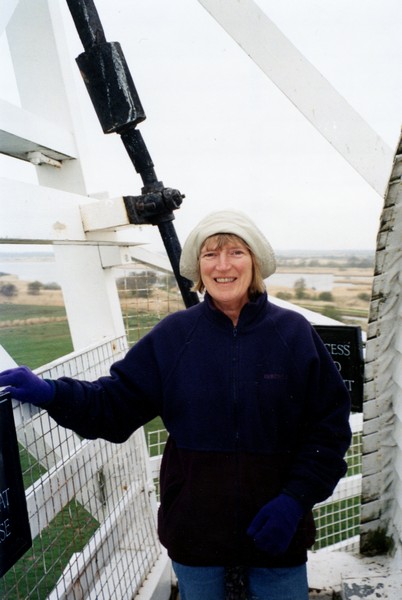
Rosie up the top of the windmill,Horsey
Wednesday 25th April 48 miles
Well our prayers were answered, in that we woke to see the sun shining on the sea. However, the day that followed was more than erratic weather wise! We had a walk along the beach after breakfast and left at 9.15 am.
We passed the Bacton Gas Terminal and then the thatched church of Paston. Mention should be made here of church, house, and roadside walls in this area all made of "stucco" stones – or at least stones stuck into concrete, all looking very bobbly.
As we approached Mundersley we passed the attractive Stow Windmill. We didn't seem to be able to get down to the sea anywhere here. Sidestrand had an attractive round towered church, hexagonal in places.
We stopped at Overstrand and were able to see the slumping that is occurring along this bit of coast. The promenade here was closed for rebuilding. High above it, we saw evidence of one house which had "slipped away", leaving others dangerously close to the cliff edge. Piles of lobster pots indicated that fishing is still carried out, but the village appeared to be prominently retirement bungalows, with many older people out walking their dogs.
Next came Cromer and the impression we got was of a very nice resort – well looked after, with pleasant flower gardens by the sea. There was just a small funfair on the front and a couple of low-key amusement arcades. It was raining a bit when we arrived so we had elevenses in the Tiv, by which time it was still raining! We set off, armed with our umbrellas, and walked along to the pier and along to the end of it. There was no razzmatazz on the pier, just the theatre and beyond it the new lifeboat station (the old one was transported to Southwold of course). All was attractively done. A group of schoolchildren were sitting on the pier, supposedly sketching. Nearby was a second old lifeboat station, now a small museum.
There were some derelict buildings near the pier, but generally the town was in good repair. We peeked inside the large light and airy Church of St Peter and St Paul. The churchyard was beautifully filled with bright spring flowers and neatly cut grass.
The weather became sunny and warm as we walked back to the Tiv. We bought a dressed crab each for lunch.
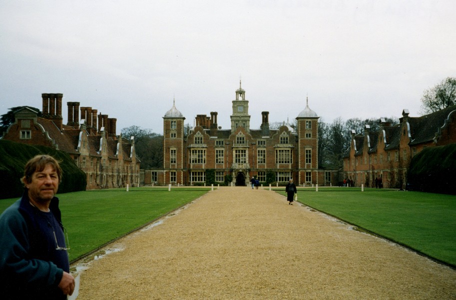
We did several tours of Cromer before we found the road to nearby Felbrigg Hall (National Trust) but when we got there, we found that it was closed (foot and mouth). We decided to make our way to another National Trust property – Blickling Hall – a few miles inland which we knew would be open.
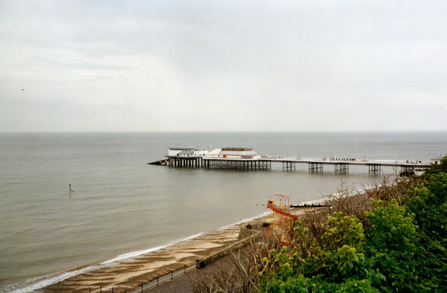
Looking to Cromer Pier
We ate our crab for lunch before visiting the hall – it was excellent. Blickling Hall is a huge, imposing and impressive brick building – Jacobean, with pretty shape to roofs and chimneys. Rain was hovering, so we visited the house first. I always find National Trust properties and their "guides" very stiff and starchy. Yes there are some wonderful things to see but I prefer to know about the lives of "real" people, not the select few. Adrian liked the map room. The kitchen (often the most interesting part) was closed for renovation.
We wandered outside into the gardens (the grounds beyond were closed). One of the really heavy showers arrived, accompanied by much thunder and some lightning. We had to shelter for a while, as the spots of rain were so large. Initially we sheltered under a little "Summerhouse" with a chap who was working on a sculpture of dozens of ceramic fish which made a sort of wind vane. Later we sheltered near some wonderfully shaped trees – Platanus Orientalis. These and other views in the gardens looked wonderful in the eerie light after the storm - the brightness of the sun contrasting with the deep grey sky, and the pale reeds around the lake. We ended our visit with a viewing of the exhibition about Lord Lothian who had given the hall to the National Trust and had died in 1940.
It was nearly 3 o'clock when we left and drove back to Cromer, passing areas which had had much heavier hail than we had – the ground was white with piles of hailstones.
We reached the sea again at Runton and at West Runton we pulled into a car park on the cliffs above the sandy and rocky beach. It was raining a bit, so we sat looking down over the beach and sea, with the end of Cromer Pier just visible in the distance. We started eating our "big" Easter eggs. The rain became a mighty hailstorm, with amazing thunder and lightning. We never got to the beach, but left amidst this mighty storm, water rushing everywhere down the roads, visibility very poor.
We proceeded to Sheringham, and managed to find a car park above the sandy beach here and sat in the Tiv reading until the storm abated and the sun peeked through again. On the outskirts of Sheringham was a swimming pool, but it didn't open until 6 o'clock and it was now only 5 o'clock, so we continued to Weybourne arnd found our way through rain soaked streets to the sea. We walked out briefly and were surprised to find that the beach here was a huge pebble idge.
The air still hung damp as we took an inland road fruitlessly looking for somewhere to stop for the night – saturated ground made it more difficult than usual. We had to give in, as we passed a "CL", on a potato farm and decided that we would have to stop there. It was a ramshackled place and we daren't pull off much from the track for fear of getting stuck. The sun now shone weakly from the grey streaked sky.
We sat enjoying this calm evening, watching the four young children from the farm playing and whooping with joy in this sodden landscape, looking like Shirley Hughes figures, while we listened to country and folk music and enjoying our chicken stir fry.
Adrian by Blickling Hall
The wherry Adrian was on about 1957
Thursday 26th April 20 miles
The sun felt warm through the windows as we had breakfast. We were surprised by the number of vehicles coming and going at this mucky farm – maybe some were buying the eggs and potatoes which were for sale. After doing the "water filling", it was 9.30 when we left. About 50 yards past the entrance was a gateway where we could have stopped for the night!
We soon came to the National Trust property of Sheringham. The house is privately owned, but the parkland was open "with restrictions". These restrictions made our visit very frustrating, as they weren't explained properly on the map at the entrance – it just said that the Park area was closed, so "bear this in mind when planning your walk" – difficult to do when you didn't know which part was closed! In reality all the walks were one-way, not circular. Why didn't it make this clear?
Having said this the grounds were lovely, with hundreds of rhododendrons – just a few were out along with some magnolias and two huge Pieris.
There were a lot of big old trees – oaks and beech among them and lovely views to the sea. With its boardwalks and wooden "viewpoints" it made us think of being in Australia. The weather was pleasant too – the warmest it's been so far and often sunny.
We returned to the swimming pool to find that it didn't open until midday – it was now 10.50, so we had "elevenses" in the Tiv, then returned to the town of Sheringham. We were surprised by the number of cars here and had difficulty in finding somewhere to park, but finally did and walked along the front beside the ridge of pebbly beach to the town centre, This area had been reinforced in recent years against the sea – rather unattractively Adrian thought. There was a "Museum lifeboat" here too. We walked up through the streets of the resort, buying a loaf of bread (the milk Adrian picked up from the refrigerated counter was not for sale – the lady said, but for their own use!). I bought some "canvas slippers" and we visited Budgens, where we could buy the milk! We also bought several other things, which was a nuisance when we got lost on the way back to the Tiv and had to return to walk along the breezy seafront.
We made our way back to the swimming pool – third time lucky! We had a really pleasant swim in this large, light and airy modern pool. The only "downer" was that the showers were at the far end of the changing area, but you couldn't enter the pool from that end. Still it was good to shower and wash our hair afterwards.
Now being lunchtime, we took a little road down to beside the sea at Salthouse. We are in a big "twitchers" area, on the way past the marshes we saw avocets. There were many other birds, but the serious people had spied a blue headed wagtail. We'd never heard of such a thing - but in looking in our bird book, we found a dozen or more "races" of yellow etc. wagtails, all looking remarkably similar to the novice – like pages of white umbellifers in the flower book. After lunch we walked up the higher shingle ridge.
The pieris in Sherringham
It had rained during lunch, but this didn't stop the twitchers!
On our way to Cley, Adrian spotted a newspaper hoarding saying "freak storm in Cromer – pictures" – so that's what it was.
Cley is big bird spotting country too. We parked by the visitor centre (free – the one by the sea was £1.50), and after looking in at the centre, set off to walk around this area of Marshland to the sea and along the pebble ridge by the sea and back – about 3 miles in total. Adrian said he felt rather naked with our "mini binoculars" when everyone else had whopping ones on tripods.
Two boats on the shingle ridge, Salthouse
There were numerous birds of all sorts, most of which we already knew – many waterbirds – ducks, swans, geese (Canada and greylag) avocets, peewits redshanks to name a few. We were pleased to see a wheatear and it was pleasant to hear that calls of many birds. Also pleasant was the weather – warmth even and still. The Ridge extends to Blakeney Point – a distance of about 4 miles, like Chesil Bank. We walked about 100 yards along it!
It was 5.15 when we reached the Tiv. We drove through the pretty village of Cley next the sea to the next village Blakeney, which was also very attractive with a very large church and a little quay down by the river. Beside the car park was a pond crammed full with ducks etc. of all sorts. It seemed a much cared for village – we might have lingered longer at a different time of the day, but we needed somewhere to stop for the night. We found a suitable large gateway to hide away in just outside Blakeney with views down over the flat marshy area to the sea beyond.
Cley marsh
Friday 27th April 48 miles
it was a very grey day and misty as we looked down over the marshes. As last night, seagulls followed the tractor working in the field.
We left at 9.15 and came immediately into Morston. We drove down to Morston quay, over the speed humps, to the National Trust car park (£2 if you had to pay). Everywhere looked very wet and desolate but attractive in its own way.
We drove past Camping Hill at Stiffkey (pronounced Stewkey). Instead of pebble-stuck houses, from now on it was flint embedded to make the surface of the walls.
We drove through the attractive town of Wells next the Sea – the only place on the North Norfolk coast with a "harbour" deep enough for boats of any size. We continued right down to the front, planning to walk on the sandy tree-covered ridge, but didn't like the car park charge of £2, so made our way back through Wells to the car park by Holkham Gap – this also cost £2!
We walked on the nature reserve here for about two hours. We set off walking westwards towards a hide, which we had difficulty in locating. In there (when we found it) was another couple. They told us of a hide further on which used to be used by the Royal Family.
Saturday 28th April 95 miles
It had rained a lot in the night and also while we had breakfast, listening to Brian Matthew. We left about 9.15 and soon arrived at Sandringham, taking the signposted "scenic drive", through beautiful tall trees, looking lovely with the sun shining through. The house and gardens didn't open until 10.30 and being now 9.40 we set off to explore some of the beautiful grounds. It was really lovely, with no one else about and the sound of the woodpecker (earlier Adrian had heard a cuckoo) and birdsong and the beautiful trees, particularly the larch and the horse chestnut and silver birch, all with their fresh green showing. We came back but by now a lot of people had arrived.
They said that they would point it out to us, which they did before they continued with their walk. It was set in this pleasant area of large conifers adjacent to a huge duney beach. We made our way through to the dunes and Adrian was just laughing about a sign he was reading, when I saw the evidence of the notice – it was an area used by naturists! The sun was weakly pushing through the mistiness and it was a very calm day, so presumably warm enough down in the dunes! We walked back to the Tiv by which time it was quite warm. We hadn't seen much of the promised bird life but it was pleasant enough. We continued west, through some of the many "Burnham" villages. Burnham Deepdale had a church with a funny squat tower and so did Titchwell, like stacking blocks collapsed.
We had lunch on the harbour at Brancaster Staithe. There were numerous little boats in the channels among the mud.
'Hide' used by the Royal Family at Holkham
We then drove down to the sea at Brancaster and parked beside the road (fee paying car park again, as all seem to be) so a plaque caught our eye, and we realised that this was where a little boy, Jake, was drowned last year on 13th August. It had been on the news a lot at the time, as they didn't find his body for some time. It explained why there were large new warning notices by the beach and it made me feel very sad.
We drove on to the RSPB reserve at Titchwell. Parking here cost £3, but included entry to the reserve. We joined the numerous "twitchers" and walked right down to the beach, past various ponds and marshy areas and visiting hides on the way. We saw a variety of birds – the warden at the Visitor Centre said that it was probably a Marsh Harrier that we had been watching earlier at Wells.
There were plenty of avocets about – this attractive little black and white bird is the symbol of the RSPB. A few other birds we saw were teals, lapwings, shovellers, Brent geese and a chap pointed out a little egret. On the beach the serious watchers were in ecstasy about a Merganser and two little terns. Again we felt a bit intimidated by these people with their huge telescopes.
The next little place was Thornham. Again we drove down to a muddy little harbour with lots of boats. We didn't stop but continued through Holme next the sea. The road here ended at a golf course. We didn't stop.
We continued through Hunstanton and drove along a very bumpy track beside the sea, hoping that we could get out at the other end. Adrian was trying to remember the house he stayed in for a holiday as a young boy. I took a commemorative photo of him by the vast beach.
Brancaster Staithe
Fortunately the track did come out at Heacham. We now went inland via the next village, Sedgeford, hoping to find somewhere to stop for the night, but without luck. We returned to Snettisham – the church here had a spire – the first we'd seen for ages. We took the road down to the shore but this just ended in a static caravan park. We viewed the shingle ridge and then the miles of mud!
We did stop to buy some fish and chips and on our way around Snettisham found somewhere to pull in for the night. It was beside a footpath, so after eating our fish and chips we set off on a pleasant woodland walk in the last of the light.
There were many huge beech trees, with the leaves further on than others we had seen. The sea was in the far distance and we heard an owl call. The air was still – there were a few drops of rain, but altogether an unexpectedly pleasant walk.
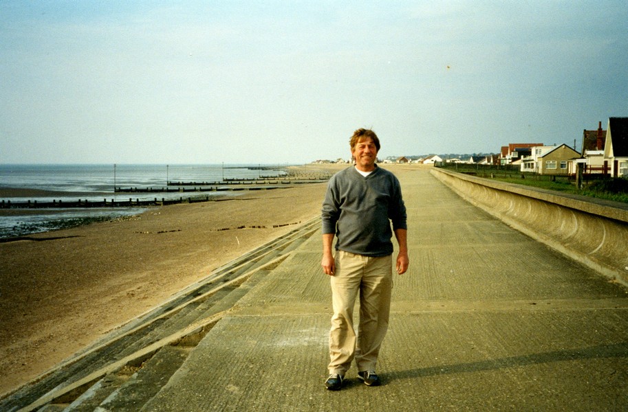
Adrian reliving childhood memories, Hunstanton
We then entered the gardens – one of the most beautiful anywhere. We wandered through the gardens. There was a lovely pink magnolia and some rhododendrons in flower. I really enjoyed the house too – there were some wonderful carpets and I liked parts of the ceiling in the lounge and dining room, painted as if you were looking up to the sky. There were lots of interesting photos of Royalty and all sorts of interesting bits and pieces. There was a separate Museum with all manner of things to interest us, including numerous vehicles of the past and potted histories of the various monarchs plus memorabilia of all sorts. It all seemed very alive and I thoroughly enjoyed it. We ended our visit with a look around Sandringham Church – a very small church with an ornate choir part. Lovely to have seen.
By now it was lunchtime. We drove down the road and parked in a long drive amongst the trees for lunch.
We drove now in a figure of eight around Wolferton, to the west of Sandringham. I should have mentioned the walls in Sandringham and around, which are of small thin bricks or slate – very attractive, and so different from the other parts of Norfolk we have seen.
We now took the road to Kings Lynn, turning off to go through Castle Rising with its Norman castle and past the common, again looking pretty with the sun shining through the trees.
We drove around and then through Kings Lynn. With larger towns one tends to see only the grotty exteriors, tatty industrial estates etc., but we were aware of some fine red brick buildings as we made our way to the smaller bridge over the Great Ouse River. We spied a petrol station, so refilled before making our way to West Lynn.
However, we did get a better view of Kings Lynn, as there is a passenger ferry from West Lynn with free parking. We had to wait about 15 minutes for the ferry.
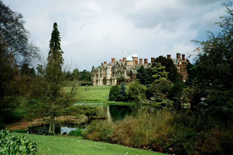


Beautiful Sandringham
I had wanted to see Kings Lynn, but we found it to be a very sad and rundown place. The centre was pedestrianised – Adrian said like Woodley, I said Swindon. Kids with dyed hair; tatty shops many closed down; the smell of stale chips – all pretty horrid. A man stopped to talk to us – he was very thin and pale with a set of even false teeth and he wore a cap. He said that all shops were closed down because of the Labour Council. We felt it was really unloved.
On our short walk around we did pass some lovely old redbrick buildings and the Guildhall with walls in a check pattern of flint and stone. So much could be or have been made of it. Let's hope they pick up the pieces soon.
We caught the ferry back to West Lynn to finish the last bit of coast, driving through Terrington St Clement to Sutton Bridge, where we crossed the River Nene. We had noticed lots of bright red tulips in the gardens and sometimes by the wayside, but of course we are not far from Spalding.
We found our way to one of the twin lighthouses either side of the River Nene. The opposite lighthouse had been rented for some time by Sir Peter Scott and where he painted many of his bird portraits.
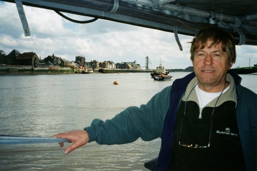
Adrian on the ferry from West Lynn to Kings Lynn
The weather for this last stretch of our journey was really erratic – sunshine interspersed by heavy showers of rain and hail. We saw a dramatic horizontal flash of lightning and saw rainbows against the dark sky.
We were now in Holbeach Marsh. There were several small hamlets, often with Holbeach in their name. We followed various small tracks, and finally took one through sodden ground to end by a height barrier car park, so that we had to walk the final quarter of a mile or so through the puddles to view the marshes beyond, eventually ending at the shoreline of the Wash. We could see Boston Stump in the far distance.
We had one last view, to the River Welland and then crossed it at about 6.30 pm to Fosdyke, where we had commenced our drive of the Lincolnshire Coast last year.
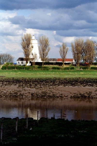
Lighthouse lived in by Sir Peter Scott
We drove south now passed Spalding, to find an odd bit of ground on the old London to Peterborough Road at Yaxley, ready to drive south tomorrow to meet up with some old Bishopshalt friends after our successful reunion last month.
There was a beautiful sky as the sun went down behind the flowering Blackthorn.
We ended our RAB of Suffolk & Norfolk at Fosdyke, Lincolshire
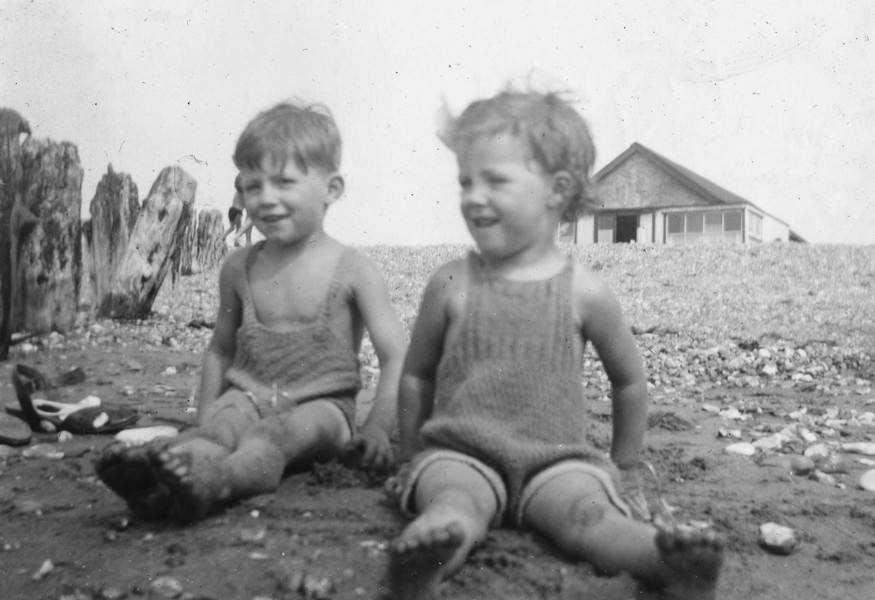
Adrian & Hilary in their trendy swimming costumes at Hunstanton 1946


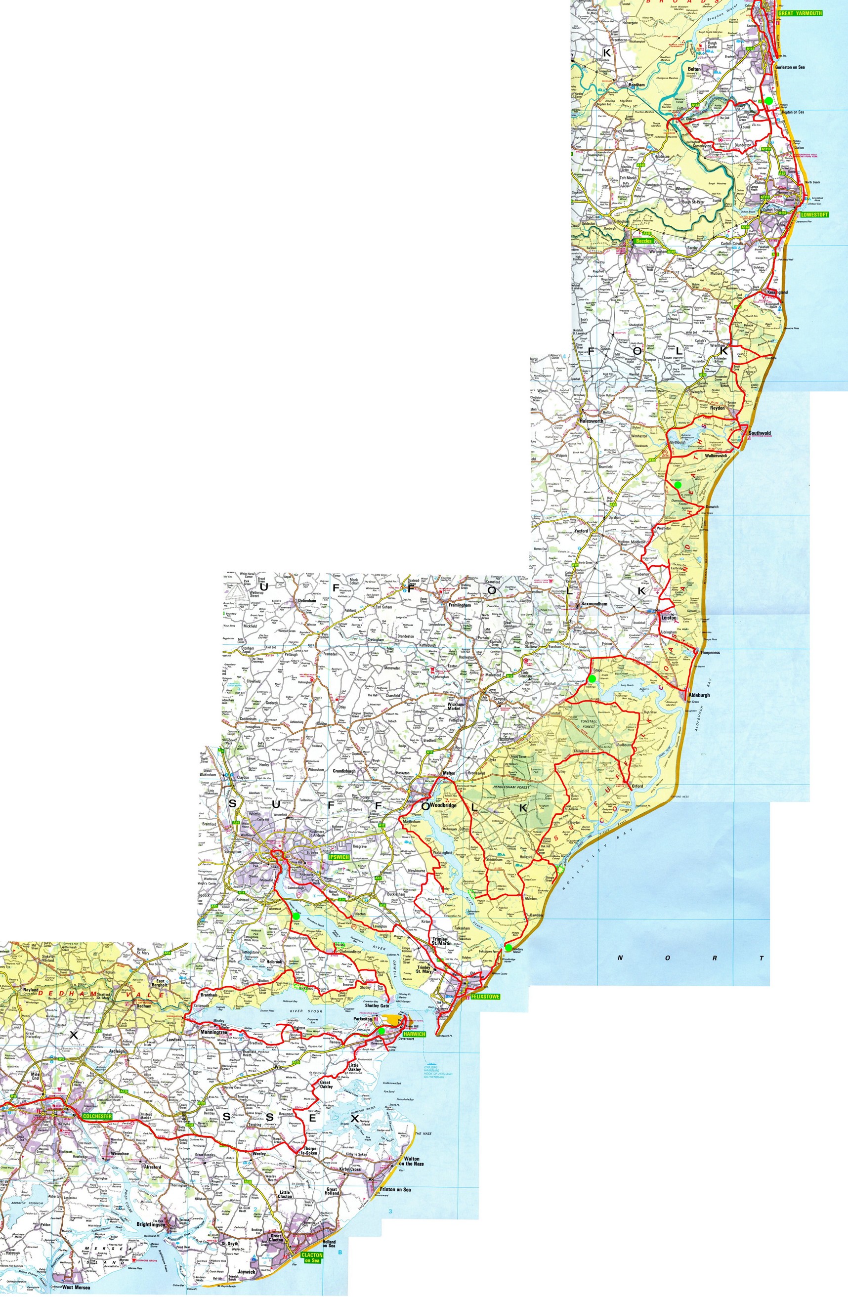
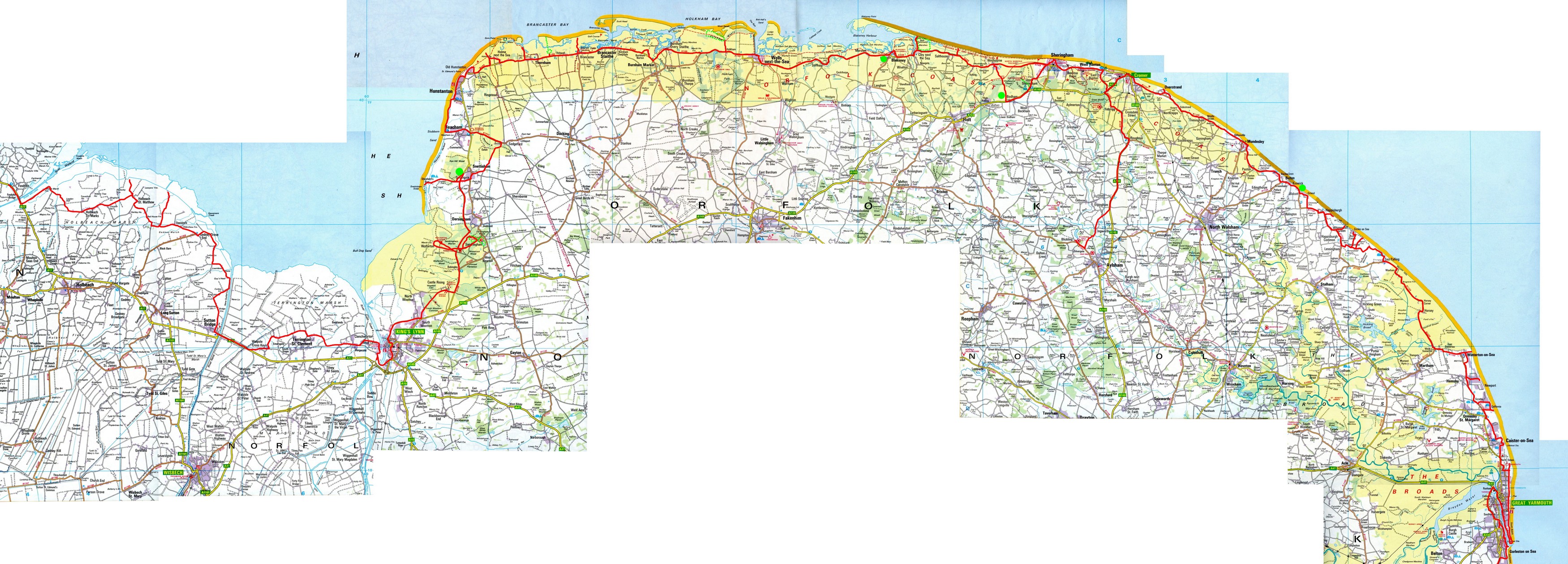
Suffolk & Norfolk Coast

