Thursday 13th November Happy 2nd birthday Ruby 60 miles
We woke to a grey morning, but at least it had stopped raining. After breakfast we walked out briefly and spoke to a young climber from Boston. We had been watching some Stellers jays and other blue jays.
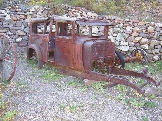
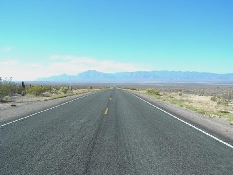
We left at 8.40 and drove through fantastic red gorge scenery until we came to the ugly mining towns of Miami and Claypool.
We had been looking out for a telephone, so that we could say Happy Birthday to Ruby. We eventually found one, so were able to speak to Ruby, Felix and Emma with the last of our phone ‘card’.
We now passed a Safeway, and couldn’t resist going in for a so-called ‘French’ loaf, which is so much nicer than the normal sweet American bread. Next door was Walmart, so in we went again – Adrian bought a plastic storage box and I bought a stripy jumper.
We turned off north west on the 88 and stopped soon afterwards for coffee and the best Danish pastry we have tasted in U.S. – even better as she charged us for a donut, which was half the price!
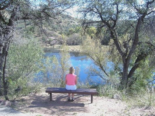
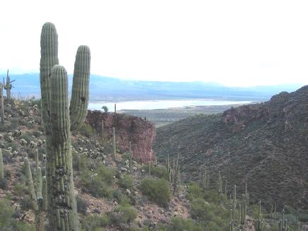
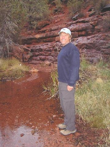
We drove on towards Roosevelt Lake, stopping at a viewpoint where we could look up to Upper Tonto Cliff Dwelling and down to the lake. By now it was warm and only partly cloudy. We drove on to the Tonto Cliff dwellings – another National Monument , so free to us with our pass. We walked to the lower cliff dwellings, but even these were 350ft upwards, but took half a mile to get there. They were similar to the Gila Cliff Dwellings we had visited, but these were inhabited by what are called Salado people. (from the Salt river, which is what has been dammed to make the Roosevelt reservoir).
Wednesday 19th November 132 miles
Another lovely day. We had breakfast and left before 9 o’clock, driving the 13 miles to Gila Bend and then south to Ajo, quite a large mining town.
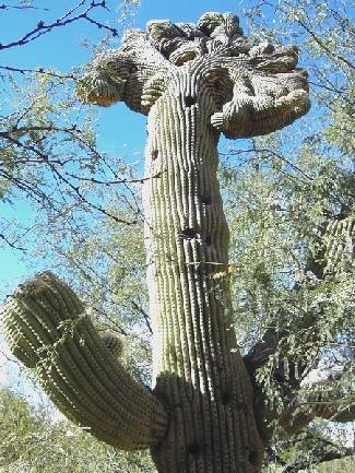
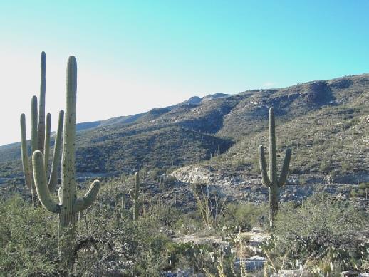
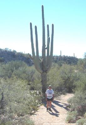
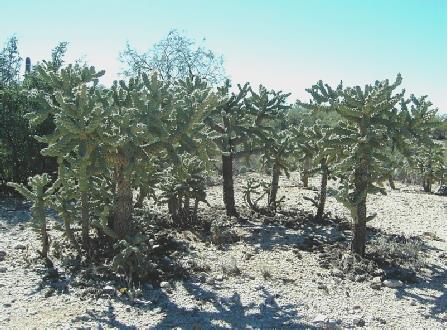
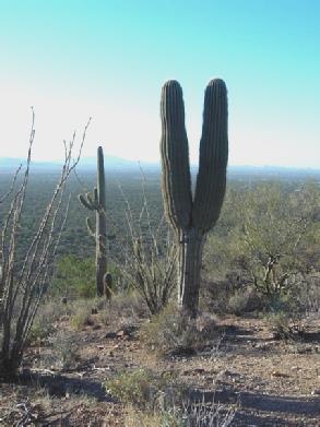
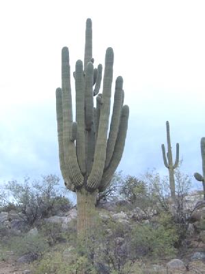
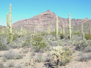
We continued to Why and then on to Organ Pipe Cactus National Monument. Although called this, we saw more saguaro cacti than organ pipe, which have several stems coming from the base, unlike the saguaros single stem.
We had coffee outside the Visitors Centre before going in, and then setting off at 11.30 to drive the 21 mile Mount Ajo loop. This was a mostly unsurfaced trail following a pretty route, with attractive mountains framed by a blue sky. We saw a variety of cacti – saguarao, organ pipe, cholla, plus other desert plants. We stopped several times to view and photograph. At Arch Rock, where we could see an arch in the rock, high up, reminding us of Pierre Percee, it said that there was a ¾ mile walk. We decided to have lunch first – feta salad, sitting in the Bam, as it was too hot in the sun. We then set off on our walk. We hadn’t gone far when we heard someone calling after us. Wondering what we had done wrong, we waited, then began to return. Imagine our surprise to see that it was Joe! We knew that Irene and Joe, Canadian friends from our Panama trip, were in Arizona, and had been deciding how best to contact them. I had a vague hope that we might just bump into them, but hadn’t expected them to be here – we thought they were 150 miles away in Yuma or Quartzite. They were with their Canadian friends Richard and Luce, and were camping in the desert near Why. We certainly wouldn’t have found them there, as they were ‘hidden’ down a long track.
We chatted for about half an hour, then arranged to meet up later. We now set off again on our walk, which was a pretty rough trail, and didn’t get anywhere near the arch.
Sunday 2nd November 152 miles
It was a cool, partly cloudy morning. We left at 9.30, which we will have to get used to as 8.30, as we are nearing Arizona.
We very soon turned off to drive 9 miles into the mountains to view the ghost mining town of Mogollan. What a ride it was! The road soon became narrow and winding, with an overhang of rocks as it wound up into the mountains. The autumn colours were beautiful. We reached the small town, where today just a few people choose to live. We drove right through it, then had trouble in turning round again on the narrow, now unsurfaced road.
We managed to, and enjoyed driving back through the town past the evocative old buildings in the early morning sunshine, enhanced by the lovely golden trees.
We drove back down again, seeing once more the large (dead) snake on the road which we had glimpsed on the way up. Back on the main road, we were once more amused by a sign saying ‘Narrow Bridge – 23 ft wide’! We drove through the humble little town of Luna, our last in New Mexico. The trees here beside the dry San Francisco River had already lost their leaves.
We crossed into Arizona and had our lunch beside Luna Lake, sitting inside as it was cool and very windy (this didn’t seem to bother a young courting couple outside!).
At appropriately named Alpine – all shacks and log cabins, we turned south on to the 191, following the Coronado Trail. We were now in Apache Sitgreaves National Forest at 8,000ft, and continued climbing for some way. It actually rained for a while. We were beside Hanagan Creek, and soon came to the small winter resort of Hanagan Meadows.
We pulled into ‘Blue Vista’ lookout, where we had views to both sides of absolute mountain wilderness. It felt pretty cool!
The atmospheric ghost mining town of Mogollan
We now drove through much of that wilderness on a winding forested road that seemed to go on for ever.
We stopped by an old wooden corral for a cup of tea and a bit more of the excellent pumpkin pie. We wondered how much further the road would go on, but at 4.30 new time we came across Granville Campsite, one of the free forest campsites. We walked around amongst the beautiful autumnal oak trees and watched some birds – notably attractive acorn woodpeckers and blue scrub jays.
We cooked and ate our meal of chicken, green beans and rice, followed by cheese and biscuits, inside.
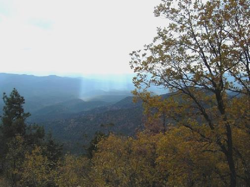
The view from Blue Vista lookout
Monday 3rd November 145 miles
The sun shone on the golden leaves of the oak trees as we breakfasted and left at our ‘new’ time of 9.00. The road soon descended in huge hairpin bends, rather like the St. Gothard Pass. We came out of the Apache National Forest to a contrast greater than we could possibly have imagined – an area of open copper mining so vast that it would have dwarfed the huge Santa Rita Mine we saw a couple of days ago and excavated 125,000 tons of ore a day. It stretched as far as the eye could see. Our rapid descent, coupled with the numerous bends and then this ‘rape of the earth’ left me feeling quite nauseous for a long time.
We had wondered yesterday why ‘Morenci’ was on the signposts, when it was marked on the map as a small town on a side road. The fact was that the road had been re-routed around the mine, and the actual ‘town’ of Morenci had been ‘buried’ and relocated a number of times, but still serves as the name of the mine.
We were amused that signs had been warning us to ‘Look out for animals’ for about 60 miles yesterday and today. We had seen nothing until we came to the mine area, and there we saw several bighorn sheep!
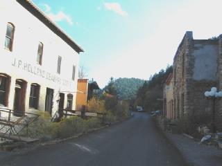
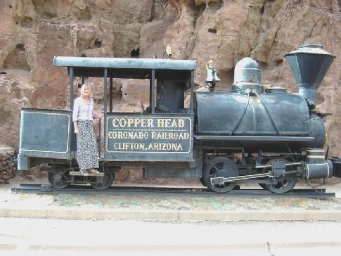
We came to the small town of Clifton, where they were trying to restore some of the old buildings of the earlier mining age. It had a certain attraction, and in the former railway station, the pleasant lady in the ‘tourist office’ delighted in telling us about the local area. Consequently we walked back up ‘Historic’ Chase Creek Street, which had a few restored buildings, and to the old jail in the cliffs, adjacent to an old steam engine.
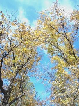
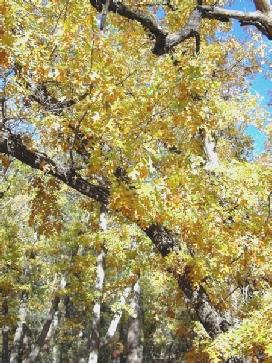
Oak leaves in the Autumn sunshine
At 11.30 we drove across the San Francisco River and out of town. We had seen a number of large trucks transporting the large sheets of copper. We were amused at a shop called a ‘Sanitary Market’, and wondered what it sold!
We drove on across the desert to Safford, a town which seemed to go on for ever in this wide, flat valley, where the cotton fields surrounded the town. We came to a Safeway store, and remembering that we had a Safeway card, we went in and did quite a shop. Adrian had given up buying ham, as everything we had bought had had an unpleasant texture. At the deli counter, the lady gave us both a slice of 2 different kinds of ham. We ended up buying some, plus some different (and expensive) cheeses – even Roquefort!
We ate lunch in the Bam in a rest area along the road, enjoying the ham and a nice loaf. After getting some petrol we headed down to the I10, which we took eastwards for a few miles. Just back into New Mexico we came to the ghost railroad town of Steins. The town ‘died’ in the 50’s, when its function as a ‘water stop’ for steam trains ended with dieselisation (there was no water there in any case and all of it had to be brought in by tanker trains!). This is now privately owned by a couple who bought it in 1988 to have as a ‘museum town’. It consisted of a few ramshackled buildings and all kinds of rusty old memorabilia. Inside the ‘store’ we chatted to the lady owner, Linda, and a woman friend of hers who drove a large ‘semi’ which was parked outside. We wandered around the buildings, but weren’t offered the ‘tour’, as I think that they were really closing up for the night.
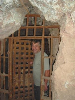
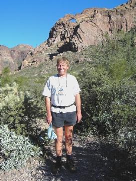
Adrian in the old jail, Clifton
Rosie on the footplate
We had read that you could stay on the land at the back, but that was next to the railroad, and the noisy train that passed told us that it wasn’t a good idea! We drove south a couple of miles and stopped beside the road, just south of Roadfork on the 80. We marvelled at the beautiful sky as the sun set behind the mountains in this windswept desert. Later the wind dropped.
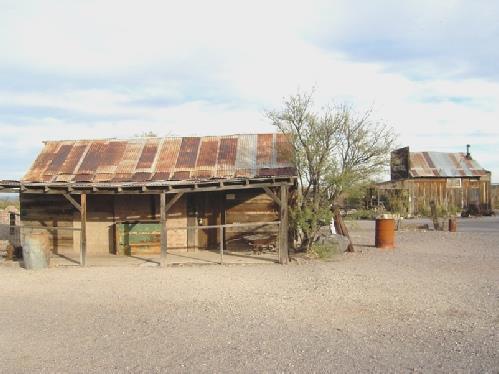
The museum town of Steins
Tuesday 4th November 115 miles
It stayed calm all night and we awoke to see the sun rise over the distant mountains beyond the flat desert. We left at 9 o’clock and travelled across this desert landscape enjoying the attractive mountain scenery.
We passed the small town of Rodeo, which had been another former rail town. We wondered what the people did here now. We had been told by Linda yesterday that the whole town did ‘home tutoring’, the parents clubbing together to give the children a broad education.
Just afterwards we crossed back into Arizona. We passed a marker to Geronimo, the Apache chief, who had been captured near here and had then surrendered.
We came to the town of Douglas and saw a laundrette. We were in very great need of one, so gathered up all our dirty washing and filled two machines. While waiting, we used the phone outside and spoke to Emma, and also to Ruby and Felix, who were full of talk of fireworks.
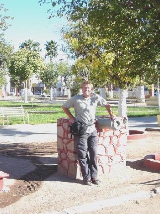
We drove on into Douglas, and found it to be an attractive town, with several nice buildings. It was actually on the border with Mexico, which we hadn’t realised, and we almost repeated our El Paso experience! Adrian enquired at the tourist information about a dump station, but there appeared not to be one. We had our lunch at a picnic table outside, then drove through the town. We stopped by the (Historic) Post office for me to post a card to Ali, and noticed that the library was opposite. As we knew that we had a few emails we went in, and were directed to the ‘seniors’ computer!
We had seen that you could walk into Mexico from here, so thought that we would have a go. We parked in a car park for $1 for an hour, and walked into Agua Prieta. It was nothing special, but had a nice Mexican feel. We wandered around and bought an ice-cream, which we ate sitting in a little park in the warm sunshine, next to a shoeshining man. We relived some memories of earlier in the year, and looked forward to next January.
We got back to the border with enough of our 1 hour left, but the American border officials were so flummoxed by our UK passports that they had to get a lady from another department to take them away and check them!
Four American ladies had been behind us in the queue, and got into conversation with us while we awaited the return of our passports. One had been to Hull many years ago (so knew to pronounce it Ool).
With our passports returned, we made our way back to the carpark, just in time, and set off towards Bisbee.
This town also owes its existence to mining, but has remained an attractive town with numerous brick buildings. However, it was late in the day, and the sun had gone behind the mountains, so it was pretty chilly.
We found the tourist information, and on finding out that there was no dump station here, we knew that we would have to resort to an RV park.
We had to drive out 3 miles to San José to one of the cheaper ones, which was just a motel (El Rancho), with a few spaces at the back. However, as no-one else was here, we had views to the hills, and up here we were in time to see the lovely sunset. There were no showers, so we put on our hot water, but the gas gave out a worrying smell, so we had to open all the windows for a while, even though it was now chilly.
I cooked Dover sole for supper. When we looked out at bedtime we could see Orion.
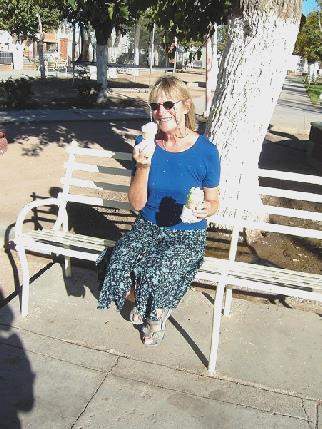
A quick visit to Agua Prieta in Mexico
Wednesday 5th November 39 miles
There was a clear blue sky all day, and it was warm in the sun. After breakfast we did the much needed ‘emptying and filling’, and I even cleaned some of the outside of the Bam. We left at 9.45, but stopped at nearby Safeway for a fresh loaf and a few other things. We then drove back into Bisbee and walked around the streets with their old buildings, many of which now housed art/craft shops of all sorts. There was a mixture of people – quite a few tourists (they do tours of the copper mine from here), and plenty of ‘hippies’ of all ages. The locals all seemed friendly. We had our tea/coffee and fresh bun sitting in the hot sunshine outside the attractive brick museum, part of the Smithsonian museum. We didn’t go in (there is a limit to how many museums one can take in) but there were a lot of mining artefacts outside.
Thursday 6th November 83 miles
We were glad to see the sun come up this morning, as it was very cold – in fact near freezing according to Adrian’s thermometer! We had breakfast and left at 9 o’clock. We drove towards Sierra Vista and adjacent Fort Huachaca. The maps made it difficult to see how these 2 places tied up, as each map was different. We had intended visiting Fort Huachaca, as there were several museums here, but we hadn’t bargained on the officialdom (presumably since Sep 11th). As the museums are inside the Fort, everyone has to get a day pass. This couldn’t be obtained at the first entrance point we had arrived at, so we had to drive to the main gate, and then get all our vehicle paperwork in order to get the pass. Also we needed our passports! We wondered if it was all worth it!
Having done all the official stuff to their satisfaction, we proceeded to the 3 museums. We visited the MI (Military intelligence) museum first, most of which was above my head, but they did have a small section of the former Berlin Wall hiding in a corner. The fort has for some time been the headquarters for army intelligence.
We came back out to the Bam to have coffee, before going to the Main museum, which was much more interesting to me, as it was very ‘people’ orientated, and told of the various people connected with the fort, since its beginnings as a defence against the apaches until the present day. It had been one of the ‘black’ forts, being home to the ‘Buffalo soldiers’ (non whites). The third museum was an annexe, with more exhibits of soldiers and their life.
Having been well ‘museumed’, we headed off for Garden Canyon, still within the fort, but several miles into a canyon. Here crops have been grown in the past, hence the name. Now it is pretty, with autumnal maples and other trees near to a little brook which must flow from a spring. There were several picnic areas, looking very uncared for, with strange signs saying that you must pay a fee to use them (where and how?)
We used one anyway, picnicking amongst the butterflies, with vegetation so different from the desert a couple of miles away. The sun was hot, but the wind still cool.
Friday 7th November 103 miles
Saturday 8th November 94 miles
A lovely blue sky. We left at 9.20, realising that we are now half way through our trip.
We drove a short way towards Madera Canyon, but decided not to visit and drove back and then north towards Tucson. I had wanted to visit San Xavier Mission church, but our variety of inadequate maps meant that getting there was difficult!
Sunday 9th November 77 miles
We had planned to be awake early, but I was already awake. We left at 7 o’clock to drive the short distance to Agua Caliente Park. The sun rose just as we got there, and it soon became hot. It was quite cool though as we walked around by the pond, which had lots of ducks and coots on it. In the palm trees on the banks were Gila Woodpeckers. Later we saw a red cardinal bird.
We ate our breakfast partly outside before walking around some more. There were 2 more ponds, but these were dry. The population around Tucson is growing so fast, that water supply is a serious problem, and the water table level has dropped considerably.
This park had been a ranch in the 1800s, and people had come to the hot springs. It changed hands many times, and is now run as a park. It was a pleasant place, but there were too many ‘strictly prohibited’ notices – it made us think of Singapore!
We left here at 9 o’clock and made our way to Saguaro National Park (east). This was a special weekend, celebrating Native American crafts, and in the Visitors Centre there were Indians doing weaving of both material and grasses. It made us realise what a lot of work goes into the pots and plates we see for sale. Outside a man was playing haunting flute music.
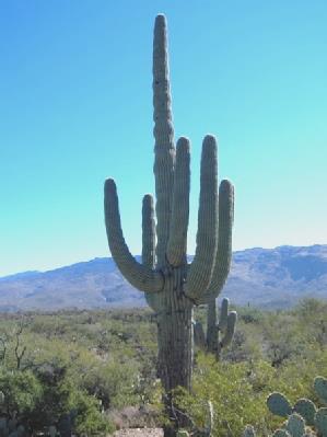
Saguaros are huge cacti with a single stem at the base, and we drove the 8 mile trail amongst them. We did feel that those we saw on the lower mountain slopes yesterday were just as spectacular.
Monday 10th November 41 miles
We woke at 7 o’clock to see the sun just rising so moved into a parking space inside the mountain park to have breakfast. We drove on to the so-called Desert Museum, arriving at the opening time of 8.30. We were still there at 1.45! The price had gone up to $12 each (on 1st November!), but we had a really excellent day.
Although called a museum, it was more like a zoo come botanical gardens.
It was set out in a very attractive way, with areas devoted to different aspects of desert life – the plants, creatures, birds, butterflies, reptiles. All good stuff. One of our favourite areas was the humming bird enclosure, and we marvelled at these tiny creatures with their rapidly moving wings. Perhaps the only complaint about the park was that it said ‘no picnicking’ on the leaflet (not that we were prepared for one), and coffee, as always was expensive. Still, it was a nice setting. We felt that we had seen and learnt a lot. At the end we looked into the vast and tasteful gift shop, but didn’t buy anything. There were ‘docents’ (trained volunteers) at various points around the park, keen to add more information.
Tuesday 11th November 33 miles
The night was really warm with even a little rain, and the morning was partly cloudy. We ate breakfast outside, then Adrian got busy with fixing the new vent cover/fan to the roof.
I put the latest photos into the album, and continued with the ‘scrap book’. We had coffee at the picnic table, but just as we were ready to leave, at gone 12.00, it started to rain a bit. We drove on round to the trailhead, and had lunch in the Bam before setting off for a 2.3 mile walk called the Canyon Loop Trail. Despite the light sprinkling of rain, it was an enjoyable walk, past many ancient saguaros, and close to a ‘wash’, which showed signs of having been flooded not too long ago. Once on the walk, we saw no other people, despite there being quite a few people around today as it is ‘Veterans day’, and a public holiday.
Wednesday 12th November 81 miles
Well, we had to have one day like this – let’s hope it is only one!
After a mild night, we awoke to a grey and rainy day, and that’s how it stayed all day! And they only get 8 inches a year here – it must have all come today!
We had breakfast and left at 9 o’clock and drove on into Florence. We located the well-stocked Tourist Information and asked where the library was. It was the county library, and was very small, but neither of the computers was being used, so we read and sent our emails with ease, including seeing some photos from Emma of the children.
At the post office Adrian sent off a disk to our home address with all our travel info on it. We drove the few miles to Casa Grande ruins – a 3 story adobe type building built by Hohokan Indians in the 1300s. However, today wasn’t the day to enjoy it at its best, and we spent some time in the visitors centre, looking at the usual excellent informative displays.
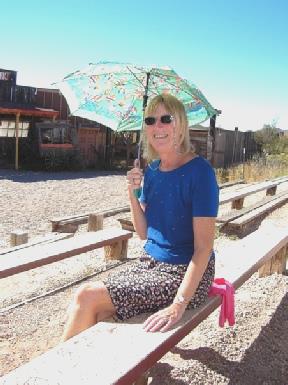
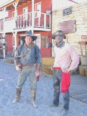
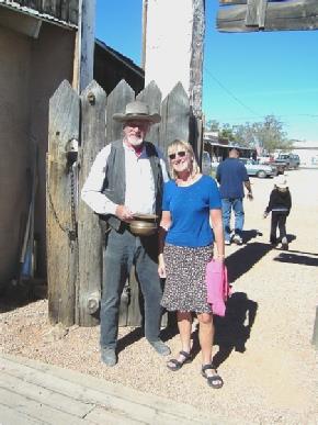
We left this hippy happy town and drove on to Tombstone. The two chaps, Steve and Pete, who we had met at White Sands, had said that we must go here. We could understand why. The whole town has been kept as a Wild West town, with ‘cowboys’ roaming the streets, and stagecoach trips around the sights. All the shops looked as though they were out of a western film set, and sold crafts and souvenirs of all kinds and prices.
We enjoyed one specialising in Victorian cards and paper dolls, and bought a few things in there.
We were touted to go to watch ‘Heldorado’ – a gunfight mock-up, which was about to start. Getting our $3 ‘Seniors’ tickets, we proceeded to sit in the front row in the hot sun (I picked up one of the tatty umbrellas for a sunshade, which I was glad of). It was a bit like a silly pantomime shoot out, but all good fun. We shouted and booed with the rest!
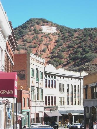
B for Bisbee
Fun at Heldorado, Tombstone
We left this interesting town at 3 o’clock and drove a couple of miles north before turning west on to the 82.
We pulled onto some BLM land and walked around, and found that we were at the ghost town of Fairbank, another town which had been associated with mining (silver this time, as was Tombstone). The ‘ruins’ of Fairbank were in a bad state of repair, and would appear to be being worked on – slowly! They had cordoned them off, and had changed the entrance, which is where we had parked. However, they hadn’t got themselves together, and there were no signs. We did manage to pick up a leaflet of a walk around here, and after a false start, set off to walk through the sandy scrub desert to the old town cemetery, about half a mile away, set on a little bluff. It was an evocative sight, with its tattered little wooden crosses on this remote desert hillside, with the sun setting behind the distant hills.
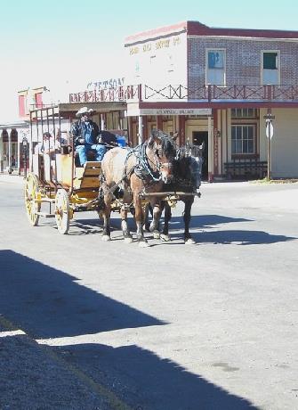
Tombstone stagecoach
We returned to the Bam, and moved to the parking area on the other side of the road, which Adrian thought preferable, as it didn’t have a lockable gate, as this side did.
Being 5th November, we had to have a barbecue, even if we couldn’t manage the fireworks or a bonfire! I made an excellent mulled wine, and a superb soup, and we cooked potatoes, pumpkin and sausages (well, the U.S. apology for them!)
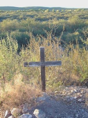
Evocative cross on the hillside
We drove into Sierra Vista in order to use the internet in the library. On the way we got some propane. The library was large, and not very friendly.
We had spent some time today discussing where we would go from here, and now looked up information on the internet on various National Parks which we hoped to visit. Mostly, things were trying to be difficult, with either the roads, or the probable weather conditions not being to our liking!
We came out to the Bam for a cup of tea, hoping for inspiration!
Then it was time to get out of Sierra Vista – a large ‘nothing’ town, which hadn’t appealed to us. However, it wasn’t that easy, as we took a wrong turn, and ended up going on a wild goose chase before we finally left! When we did, we found the 82 west and drove along as the sun was setting (actually it ‘set’ several times as we drove up hill and down). We found a little spot beside the road, just as it finally set, casting glorious colours briefly across the hills, which had looked so magical in the last of the light.
Garden Canyon, Fort Huachaca
We ate a hearty homemade soup, followed by a variety of cheeses (including expensive Roquefort) with the last of the Tuc biscuits we had brought from home. We looked out at the night sky before bed, seeing Orion again.
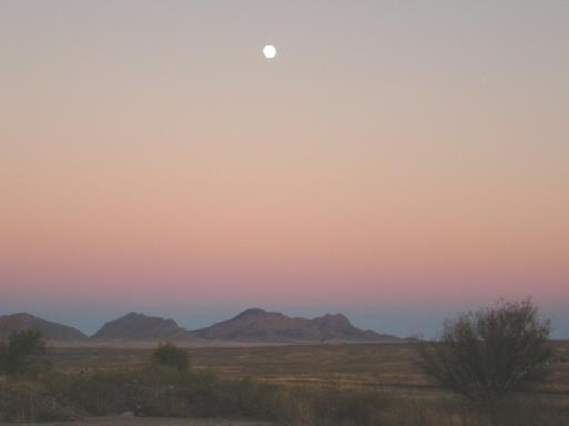
Sunset with the full moon
Having discovered that the road onwards was winding and unsurfaced, we returned to the I19 north. This road is interesting, as it is marked in kilometres not miles – we wonder how the Americans cope!
At Tumacacori we stopped to visit the former mission church, now a National Historic Park (it is always good to use our Nat. Parks pass, especially now that we have exceeded the $50 we paid for it!)
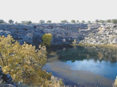
Pena Blanca Lake
It was a lovely temperature as we wandered around the old ruins, trying to make some sense of the history of this part of America.
We continued north a few miles to the village of Tubac, which has a State Historic Park incorporating the old Presidio. We saw this from the outside, but decided against going in. Instead, we drove around some of the streets of what has become a really ‘arty/crafty place’, with high class looking potteries and craft shops of all kinds. It all looked a bit posy to us. Nearby were several posh golf courses. We were still about 25 miles south of Tucson, but large developments were springing up everywhere as we drove north. We thought that we would have difficulty in finding anywhere to stay tonight, so turned off on the road to Madera Canyon.
This didn’t seem too forthcoming, but at about 4.30 we found an odd space beside the road that we thought would do. We realised a bit late that we were very near to a cattle grid, so every vehicle which passed took us by surprise!
It had become quite cloudy, and we remarked that we wouldn’t have a sunset tonight. But – just before it was about to set, the sun peeped out briefly from below the cloud and we had the most fantastic sky yet!
The lighting of the sky, and of the mountains surrounding us was what dreams are made of.
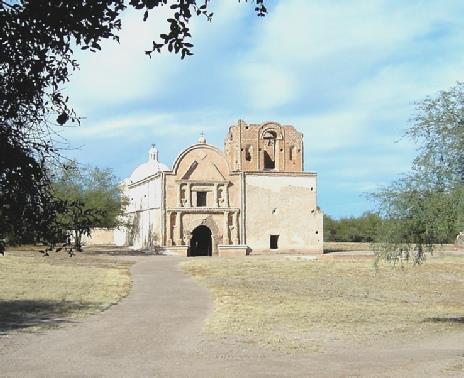
Tumacacori Church
I made a nice prawn taco dish and afterwards we did our ‘nightly ratings’.
On the road to Madera Canyon
Sunset near Madera canyon
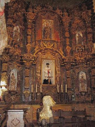
When we did get there, we saw that part of it was under scaffolding, but it still looked quite stunning, especially against the blue sky. There were quite a few visitors here already, but we enjoyed looking around this very ornate church, which was somehow really pretty. I particularly liked the painted ceilings. Nearby was a small hill which gave nice views of the surrounding beautiful scenery. We had coffee before heading into Tucson itself.
We searched hard to find the ‘historic district’, which seemed so small, dwarfed by the modern town business centre that it didn’t seem worth bothering about.
I navigated our way to the Botanic Gardens, hidden amongst the sprawling streets of suburban Tucson. We had lunch in the Bam before going in. It was $5 each (we had read of senior rates somewhere, but that was false information!) Anyway, it was well worth it, as the gardens were superb, and amazingly cool and shady. They had originally belonged to a couple in the 1930s, and still had a warm, family atmosphere.
There were some wonderful cacti, and also aloes, succulents, herbs, all arranged in a sort of maze, so that a lot was packed in to a relatively small space. I particularly liked the bench seats, which were covered in lovely mosaic tiles, with quotations about gardens incorporated in them.
There was a nice gift shop – a bit like our National Trust shops, and with their sort of prices! It was a really good visit, and we didn’t leave until gone 3 o’clock.
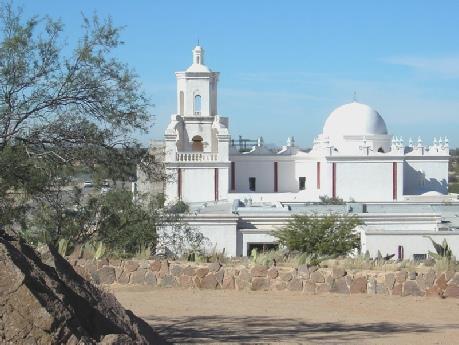
San Xavier church
We drove now to Sabino Canyon, said in our info to be free, but we found that it was $5 to park. Too late in the day for that, so we found our way to the road up Mt. Lemmon.
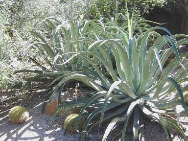
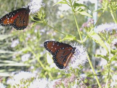
Saguara cactus, agave and monarch butterflies at Tucson Botanic gardens
This road is 25 miles long, and winds up into the mountains and on to a ski resort. We intended driving part way up and camping. However, this too had now become a ‘fee area’ - $5 to drive along and stop at any viewpoints etc. We did stop at a viewpoint, before the fee area, and enjoyed a cup of tea while looking at all the photogenic saguaro cacti on the hillside. The vegetation changes the higher up you go, and we now came to an area of scrub desert. We had hoped to stay at the campsite at Molina canyon, but this was closed for construction work, and the next one was several miles further on. Not understanding the fee policy – i.e. did the nightly camping fee cover the $5 road fee, and not relishing the cold of further up, we decided to descend again. The sun was low in the sky, so the views were wonderful across the flat plain, with more mountains beyond.
However, we knew that finding anywhere to stop would be difficult, as every bit of flat land was occupied by the spreading housing. We headed towards a small reserve area that we wanted to visit, knowing that it closed at sunset. We did peep in to it while desperately looking for a spare bit of land to stop on. At 5.30, just as the sun was setting, we found a space just big enough for us in Red Ruby Road, with plans to visit the reserve first thing in the morning.
We knew that it was full moon tonight, but when I looked out, the moon looked really strange. We realised that it was an eclipse. We went outside and could see lots of stars, as the moon had no brightness. It was eerily beautiful.
We had a nice meal of pork and veg.
Saguara cacti on the road to Mt Lemmon
We had coffee at a picnic site and then walked a short trail. Later we walked a longer trail – about a mile - to the site of a former homestead. By now the sun was really hot (82˚F). We had lunch just afterward at another picnic site, but we were bothered by really tiny flies which buzzed in my ear. One nice thing here was a tiny little ground squirrel - the only wildlife we saw apart from butterflies and crickets and just a few birds.
We left the park now and made our way towards Camping World in Tucson. On the way we passed the Air Force Base, where there were literally hundreds and hundreds of planes of all sizes lined up (all mothballed) – it gave me the eebie jeebies.
In Camping World Adrian took a long time sorting out a vent cover and fan to fit in the roof of the Bam – needed on hot or rainy evenings. He had been wanting to do this for some time, so we hope that it is the right thing to do, as it is rather pricey, although luckily it was ‘on sale’.
We now made our way to Saguaro National Park West, about 30 miles from the other ‘half’. Here we drove the 6 mile loop, this time on a dirt road, which was sometimes very corrugated! We did a walk for nearly a mile. We had hoped that, being late in the day, there would be some wildlife, but this wasn’t so. The saguaros are more prolific here, but otherwise the visit was unremarkable, although the sight of these tall cacti in the late afternoon light was quite lovely.
In Saguaro National Park (east)
Saguaro and cholla in Saguaro National Park (west)
We came out to the Bam well ready for our lunch, even if it was only ‘hot dogs’ in tasteless ‘buns’ – we are in need of food shopping!
We now made our way through the sprawling mass of outer Tucson to Walmart, where, after sorting them on to a disk, we took in the latest lot of photos for developing.
We had passed Albertsons just along the road, so made our way there for a big food shop. Then it was back to Walmart, but the photos weren’t yet ready, despite it being over an hour. While Adrian waited for them, I made some tea, which was drunk quickly before we headed off towards Catalina State park, a bit further out.
Traffic was pretty heavy, and clouds had gathered, but we were treated to a most amazing sky as the sun went down. The whole sky behind us was glowing a brilliant red, and there was an uncanny rainbow above the mountains for a short while.
We arrived at Catalina State Park just before dark and got settled in, then Adrian lit the barbecue. We enjoyed our meal of pork, corn on the cob and baked potatoes.
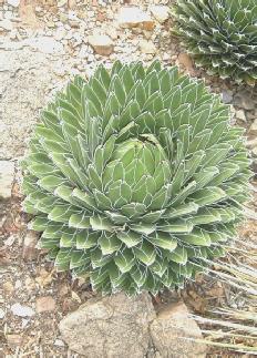
Queen Victoria agave
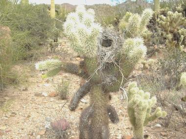
Teddy bear cactus (plus bird’s nest)
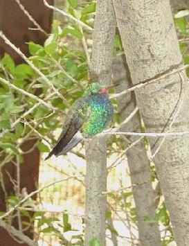
Colourful humming bird
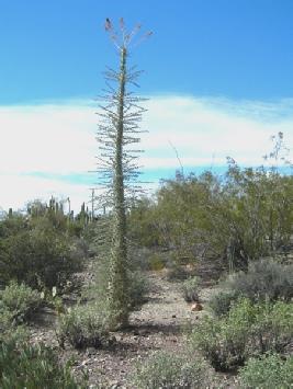
A ‘boojum’
In Tucson Desert museum
We came back to the Bam, and drove out of the park, after Adrian had done the dumping.
We drove on to the Pinal Pioneer Parkway, where there were a lot of suitable parking places beside the road. It reminded us of parts of Western Australia, especially the Nullabor (apart from the cactus!) At about 3 o’clock, we pulled off and decided to stay, so that Adrian could get on with wiring the ceiling fan.
Later that evening he finished it. I had spent the time sorting photos and the scrapbook before cooking chicken for supper. The weather was mild and cloudy, with occasional rain
About mile 111 on the 79 between Catalina and Florence
More saguaro cacti in Catalina State Park
Friday 14th November 98 miles
We ate breakfast sitting outside looking towards the lake and left at 9.45. We called in at Cholla campsite and were able to get some water, and opposite did the dumping again and continued north on the 88 at 10.15.
We pulled into a rest area just before the 87 and had coffee and the last of the chocolate brownie, sitting outside at a picnic table.
At Payson Adrian went into the Tourist Info to ask about a route we propose to take, then we drove along the so-called ‘Historic’ Main Street before continuing towards Tonto Natural Bridge State Park.
Saturday 15th November 71 miles
We had passed a Safeway, so returned there, where Adrian braved the rain to dash in and buy a fresh loaf for lunch, which we ate in the car park. We got some petrol and left just after 2 o’clock, driving north to Florence Junction, then east on the I60.
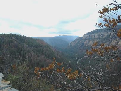
We came to Tonto National Forest (but we couldn’t see the Lone Ranger) and drove through some staggeringly dramatic scenery, which was a great surprise to us. We were very aware that we were not getting the best out of the views, so when we saw a sign to Oak Flats campsite, we headed in there. It was still tipping with rain, but a rough looking chappy standing under a makeshift cover beside his van told us that it was free to camp here, so we pulled in. We kept imagining that the sky was brightening, but it didn’t!
This seemed to be the time to start thinking about the Christmas letter, so we had a ‘useful time’. Adrian made another copy of the wedding video, so that he could delete the rest from the computer, and leave room to start editing the videos of our travels. I did more of the scrapbook and we enjoyed a nice prawn meal. And still it continued to rain!!
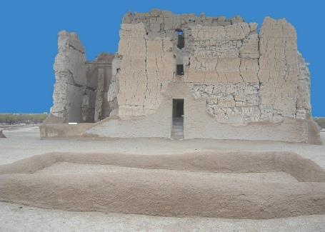
Casa Grande - as it should have looked!
It was a nice visit, but annoyingly the only 3 people we saw arrived noisily at the dwelling just after us. We came back down and had our lunch sitting at a picnic table looking down to the lake.
We drove on beside the Roosevelt lake, stopping at the visitors centre where there was much information on the area and on the building of the dam. We now made our way towards the dam which was originally built in 1911, but made much higher in the 90s. A new bridge had to be built then, and was a fine ‘Sydney Harbour’ type bridge.
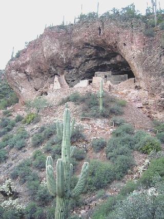
Tonto Cliff Dwellings, and the view from them
The road which led to the viewpoint of the dam was the beginning of the Apache Trail – a narrow, winding, unsurfaced road through apparently wonderful country. This first part however was a wide, surfaced road.
Having viewed the dam from both sides, we crossed the bridge and continued up beside the lake for a short way. We stopped to dump at the dump station, and soon afterwards we stopped at a $4 dollar site right by the lake, called Bachelors Bay.
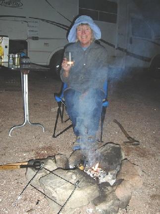
We sat on our seats by the water and Adrian lit a real fire! We then had our best night so far, sitting out by the wood fire beside the lake to eat our meal, with stars up above, which kept disappearing as the thin cloud cover passed over. Planes twinkled overhead, as we must be on a flight path, but it was still and quiet. We came in soon after 7.30, but it seemed as though we had spent the whole evening outside, and made us think of Great Slave Lake last year.
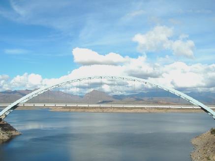
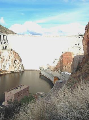
Roosevelt Lake dam and the new bridge
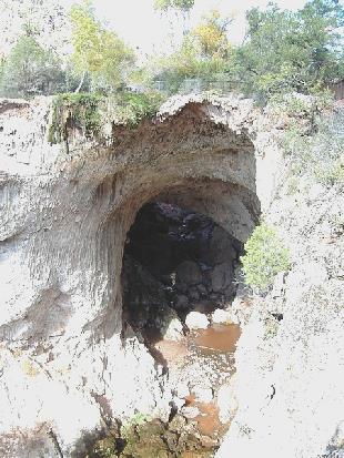
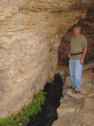
This was in an area of superb forested mountains. The entrance cost $6, but it was a great place. The ‘natural bridge’ is huge, and there were trails down to view it plus several viewpoints. We had lunch at a picnic table before walking to a pretty spray waterfall above the river, which was brown and more full than it usually must be.
We took the steep trail down to the observation platform under the bridge, then walked up the longer, more gradual slope to the top.
It was a good visit. We left at 3 o’clock and drove through Pine and Strawberry. I put the kettle on for tea, but was aware of a man walking up the road. It was not the sort of road to be walking on, especially in U.S. The man tentatively approached us – it turned out that he had just driven past with his wife, and had seen our Trail-lite van. They were interested in getting a Trail-lite, and wanted to know if we were happy with ours. He was very apologetic at having disturbed us, but pleased that we were so positive about the Bam. His ancestors were from England and Scotland and he had visited his ‘roots’ last year and loved it.
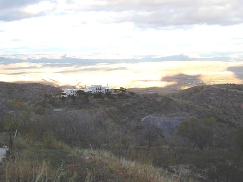
We now turned on to the 260, which runs along the top of the ‘Mogollon Rim’, stopping beside the road at 4.40, a few miles before Campe Verde. We were at a marker saying 13 mile rock, marking an expedition by General George Crook in 1871. Tall majestic cliffs towered above us on both sides. We had seen a mountain topped with snow.
Adrian cooked the fish (cod) on the stove outside, but the weather was really cool. Just as we were about to start our meal, we heard a siren, and a vehicle pulled in, but nothing happened. Just afterwards, a spider climbed up the curtain behind Adrian! After that, we enjoyed our meal! When we looked out at the stars at bedtime, the sky was almost as clear as it had been in Texas.
On the 260 at 13 mile rock near Campe Verde
Tonto Natural bridge
We had lunch at a picnic table afterwards in the pleasant autumn sun – it felt like an English ‘Indian Summer’s’ day. We drove on the few miles to Montezuma’s Well, where again there was a short trail, this time to a large, deep spring-fed ‘sinkhole,’ where there was once more a cliff dwelling hidden in the side. The trail led on to the place where the water emerged from the ‘well’, and the Indians had built a mile-long canal to irrigate their crops. It all looked lovely in the sunshine, and with the splashes of autumn colour.
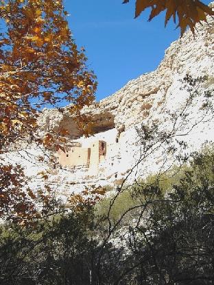
Montezuma’s Castle - with lovely autumn colours
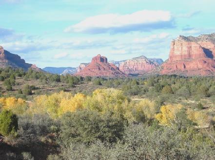
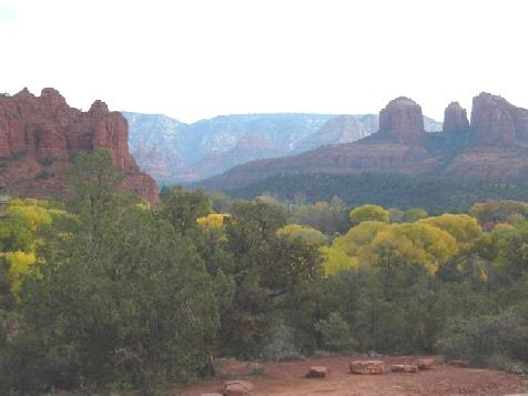
We now took the road towards Sedona, another place which Steve and Pete had said that we must visit, and the reason for us making this detour north. We had, in fact, come fairly close to here in February last year when we were at Flagstaff.
What we saw as we drove along the road took us by surprise, as it was so stunning! It felt a bit like seeing the Grande Canyon, it was so amazing. They call this area ‘Red Rock Country’ – huge barren rock structures, some red, others white, silhouetted against the blue sky, with the added bonus of the gold leaves at this time of year too. As our 2 chaps had said ‘you can’t stop taking photos’.
Montezuma’s well
The bad things though were firstly, the enormous amount of traffic and secondly the signs everywhere saying that you needed a pass. We drove on to a small side road, where we had been led to believe that there was free camping. In fact we found out later that there was, but only if you drove for more than 5 miles on a dirt road. We decided to visit the Park Visitors centre and enquire about camping. The end result was that we decided to put a $15 seal on to our National Parks Pass, which allows you several other benefits – one being that it is valid as a Red Rock Country Pass. However, the ranger there wasn’t authorised to do this, so we had to drive several miles south to another Ranger Station! We did this, got our pass sorted, then drove on to an area where free camping was allowed- just outside the ‘no camping’ limit. We saw the sun shining on to the dramatic rocks.
Later there were a lot of stars again.
Beside FR 525 - 8 miles south of Sedona
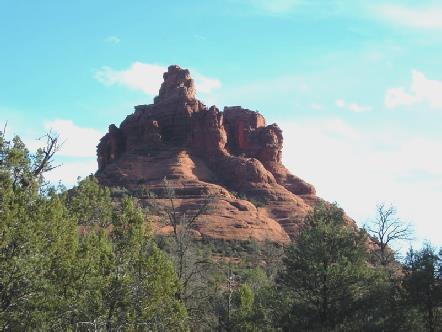
Stupendous Sedona
Sunday 16th November 60 miles
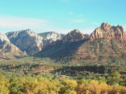
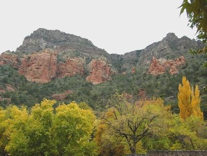
We were disappointed to wake up to a grey morning, and even more disappointed with the weather that followed! We had breakfast and left at 9.30 and headed back towards Sedona. We drove the scenic Red Rock Loop Trail, part of which was unsurfaced. It was frustrating to see the majestic rock formations, but without the sun shining on them to make them magical.
We drove on through Sedona. Adrian enquired about the internet, as the library was closed, being Sunday. It would cost $2.50 for 15 minutes, so we will have to wait to read our messages!
We drove on towards Oak Creek Canyon. We pulled into a picnic area, but it would cost an additional $5 to stop there so we continued to Indian Gardens, where we were able to stop beside the road above the delightful creek and amongst the beautiful autumn colours. However, it was pretty cool outside, so we had our coffee inside.
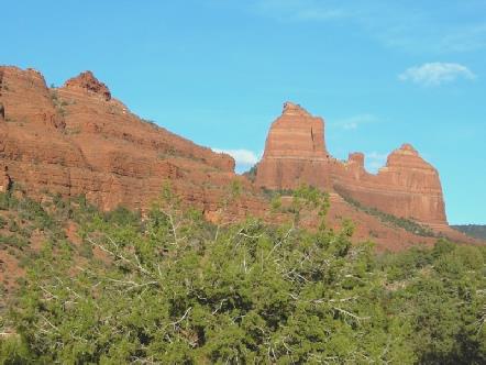
Sedona in the morning
Monday 17th November 67 miles
It was a brighter morning. We watched 3 hot air balloons in the sky as we had breakfast and left at 9 o’clock.
We drove the few miles to Cottonwood and drove through the town, but turned back to find the library. One thing led to another, and the whole morning had gone by the time we left! The tourist information, where we enquired about the library, was next to Walmart, so we went into there to take in the latest lot of photos. Adrian had had to put the photos on to a disk first, and there seemed to be a problem, but all was all OK.
We now made our way to the library, but this time we had to wait a while before we could use a computer. On our way back to Walmart, we passed Safeway, so we went in to buy a French type loaf and a few other things. Then it was back to Walmart to collect the photos. We drove back through the town, glad to be leaving, as towns aren’t our favourite places. We did drive through the ‘historic’ street, which was quite attractive with the autumnal trees around.
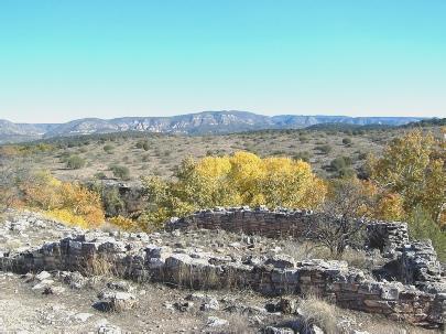
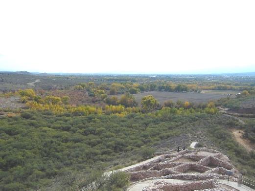
A few miles further on was another Sinagua ancient site, Tuzigoot – this one was on top of a hill. Another site to use our pass on! The position of this large collection of rooms was rather nice, especially with the autumn colour of the trees, and with lovely country all around. We walked the little trail, before coming back for lunch in the Bam.
Tuesday 18th November 148 miles
It was a lovely day with a clear blue sky all day. We ate breakfast sitting at the picnic table outside and didn’t leave until 10.30.
We drove through the town of Prescott, and around the attractive courthouse, which looked nice in the sunshine, with autumnal trees surrounding it. We stopped to get some petrol and drove on into Prescott National Forest where the hills were covered by dense pine forest. We pulled in beside the road and enjoyed our tea/coffee sitting outside on our seats in the warm sunshine.
We were still at over 6,000ft, but soon began descending to about 800ft. As we got lower, the land became very dry and flat.
We stopped at Wickenburg and had our sandwich lunch in the pleasant sunshine, sitting on an old platform truck beside a restored railway engine.
We enquired about the library, and made our way there, walking through this pleasant, laid back olde worlde town. We did a circuit of the library first before finding it, and the entrance. I left my grey jacket behind afterwards, but luckily remembered in time. We left at 3 o’clock and headed towards Phoenix. Not much to say about that, except that we managed to find our way around the western side to the 85 south, despite missing the road we really wanted – blame it on the inconsistent maps and bad signposting! The road was very busy with truck traffic. The flat lands were cultivated in some places – cotton and flowers being most noticeable, and there were areas of animal rearing too.
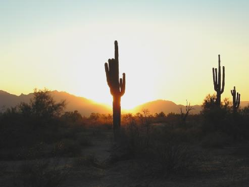
At 4.45 we spied a large area of waste land and pulled in, as far away from the noisy road as we could. I made up for not having taken any photos today by taking several of the sun going down, in this superb desert location with its scattering of Saguara cacti.
Thursday 20th November 0 miles
A lazy day! There was a clear blue sky all day. After breakfast we went over to Irene and Joe’s rig, and stayed there most of the day, chatting.
Richard and Luce left quite early, planning to meet up with the others in a day or two. We took a photo before they left.
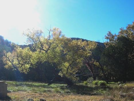
Indian Creek and Oak Tree Gardens
Back at the Bam, after viewing the bridge and the creek far below, it was time to make our way through Sedona to our parking spot of last night. We drove a bit further on the mucky dirt road, past last night’s stop, but finding nothing better returned to our place at about 5.45, just as it got dark.
I cooked spaghetti Bolognese for supper.
Beside FR 525 - 8 miles south of Sedona
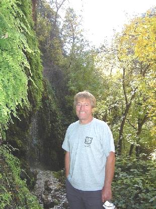
Happy Adrian by Wilson Creek
Now we drove on to Clarkdale, an attractive old copper mining town. A tourist train ran from here, but we could find no information about it. When we reached the station, we found that the daily train left at 1 o’clock! It was now 2.15!
A bit higher in the hills was Jerome – once an important mining town, with 15,000 inhabitants. After the mine closed in 1952, it became a ghost town, but has been resurrected as an ‘arty town’, full of little craft shops.
The ancient site of Tuzigoot
We had driven first to the state park, which appeared to be centred around the home of the former mine owner. We didn’t go in, but drove on into the town and parked. We decided to walk around the town.
It was very atmospheric, and had superb views across the valley far below to wonderful hills looking like offshoots of Sedona. The thing that really interested us was a marker explaining that the coke for the 1882 smelter had had to come from Wales(!) via Cape Horn and San Francisco, then by train to Ash Fork, from where mules transported it here.
Signs said that you couldn’t camp within the town so we set off winding up and up into the mountains – to over 7,000 ft! We had some lovely views on the way. Then it was down the other side through Prescott Forest to Prescott valley. There was a town of this name – full of fast roads (not on our map) and too much traffic. The landscape was flat and dry, and there was nowhere to stop. It was a lovely sky as we tried to find our way, but we were getting a bit anxious as light was fading.
We were heading for a rest area in our ‘free camping’ book. It was by Watson Lake recreation area, but when we got there, a sign said that the campsite was closed, and the park closed at dusk! Now pretty desperate, we pulled into an adjoining area, which we thought was OK. It was now 5.45. We got settled in, but it had to happen – the ‘ranger’ arrived and told us in a very direct manner that we couldn’t stay there. We think that he was stamped with the same mark as Mervin in Eungella, Australia!
There was an RV park a short distance back, so that is where we had to go. Now dark, we made our way there, plugged in the electric (which we were obliged to have) and poured ourselves a drink! Later I cooked a bacon and mushroom omelette for supper.
Point of Rocks Campground, Prescott
The former mining town of Jerome
Adrian lit the Barbie. We ate pork, acorn squash, baked potatoes and mushrooms.
On old road off the 85 between Buckeye and Gilla Bend
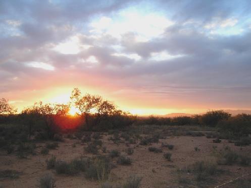
Arizona sunset
When we came to a really steep and rough bit, surely more than ¾ mile, we returned to the Bam. It was now 3.30, so we continued driving the trail through the park and then drove out of it and on towards Why. We found where Joe and the others were staying on BLM land just before Why, and spent a really pleasant evening in Richard and Luce’s rig.
Luce had made an excellent soup, and we ate cherries which Joe and Irene had picked and bottled in Canada, and melon. We took the wine!
The stars were great when we returned to the Bam.
Richard had said that there should be a meteor storm tonight, so when Adrian awoke at 1.45 am (thinking that he had a tick, which maybe he had!) we went outside and watched for some time. The stars were even brighter now, and we did see several shooting stars, so who knows?
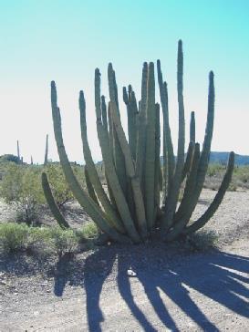
Organ Pipe National Monument
We ate enchilados for lunch, and continued to chat – about our Panama trip and about other travels. Later in the afternoon we sat outside, watching some humming birds which had come to Joe and Irene’s feeder. Around 4.30 we set off for a walk across the desert, returning at 6 o’clock, just after the sun had gone down. We ate a quick supper in the Bam, then Joe and Irene came in to us to chat until 8.30. The stars were good again tonight.
BLM land just before Why
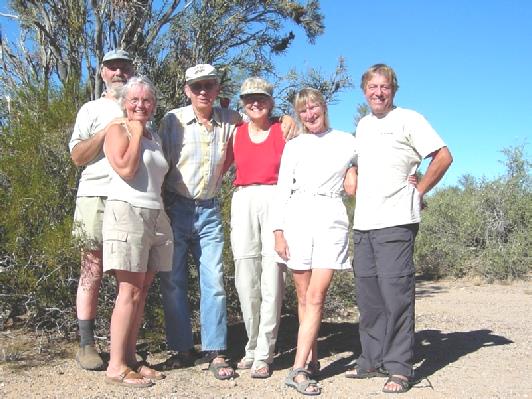
We meet up with our Canadian friends Joe & Irene (centre) and their friends Richard & Luce
We walked around the town – home of OK Corral, and of Wyatt Earp – then did an unusual thing for us – we ate out at the OK Corral Café.
Only a hamburger and chips – is there anything else in America? – but it was nicely cooked and presented. The ‘cast’ from our show came and sat
at the table next to us, and chatted to the efficient lady cafe owner. Altogether a nice experience.
It was not such a cold night, and the day was sunny, but partly cloudy. We had found a pleasant local radio station playing 60s and 70s music,
but we soon got out of range after we left at 9.15.
We drove through pretty country to Nogales, on the Mexican border. We located the Tourist Info, as we needed to know if a road we wanted
to take was surfaced. However, it was closed today for a conference! We drove around the ‘Historic Area’, which didn’t grab us too much, then
found a derelict fuel station which had a place to dump. This was too good an opportunity to miss, so we made use of the dumping facilities,
having showers in the Bam, and coffee while we were waiting for the water to heat.
We got some petrol and also water at another petrol station before heading out of Nogales again. We took the Ruby Road, which passed the
old mining town of Ruby, guessing that it was only surfaced as far as Pena Blanca Lake, which we later found out was right. The road to the lake
though was quite fun, becoming narrow and hilly. We drove to several different picnic areas around the lake, which had been formed in 1958 as a
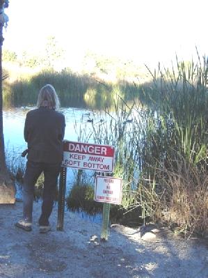
fishing lake. However, it now had high levels of mercury, and low levels of oxygen, so wasn’t much good for fishing.
Nevertheless, it was very peaceful, with lots of coots, and one grey heron and numerous butterflies and crickets. We ignored the grungy
weed, and ate our lunch sitting on a bench overlooking the water.
We left the park, and drove to a campsite in neighbouring Tucson Mountain Park. We arrived there just as the sun was setting, but found to our dismay that RV sites cost $20. We had looked up the site while in Camping World, and it was $7 for tents and $12 for Full Hook ups. Feeling most annoyed, we had to quickly think what to do, as you can’t stop overnight beside the road in a park. We decided to head out, and luckily found a space beside the road just as we left the park. This would do for us for the night, as it was now 5.30.
After supper, a bacon and pasta dish, we read through our past Christmas letters. Where did all that time go?
Just outside Tucson Mountain Park
After supper, a bacon and pasta dish, we read through our past Christmas letters. Where did all that time go?
Just outside Tucson Mountain Park
The night was cold, but it was a bright day. We breakfasted and left at 9 o’clock, driving down through beautiful scenery to the dry, misty
valley and Campe Verde. The trees by the river were a brilliant gold.
The whole of the road system through Campe Verde seemed to be dug up, but we located the laundrette, and did some much needed
washing. Meanwhile we looked into a tatty little dollar shop, and afterwards phoned Emma, as today was Ruby’s Birthday party.
We got some fuel, then had coffee outside ‘Basha’s’ store, with a nice apple turnover which Adrian had gone in to buy. After that we did a
shop in there, so it was now 12.00.
We found our way to Montezuma’s Castle – difficult again because of inaccurate maps! This is another National Monument, so we could us
our pass. What amazed us though was the huge number of people visiting - maybe because it was Saturday.
We walked the short trail to view yet another cliff dwelling, this time of the Sinagua people, again of the period 1000 – 1400 A.D. It was named
after ‘Montezuma’, as the early white explorers wrongly thought that it was built by the Aztecs. It certainly looked dramatic, set high in the
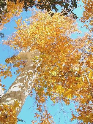
white cliffs with the blue sky behind, and the golden leaves of the Arizona sycamore (more like a plane tree) in the foreground.
We continued on up the canyon, with the colours becoming less bright the higher we got. We wound up several hairpin bends to the vista
point at the top at 6400ft. We think that we probably drove this far from Flagstaff last year when looking for somewhere to stop for the night.
We walked out to the view point – the canyon was quite dramatic, but the weather was freezing! The Native Americans with their handicraft
stalls looked frozen!
There had been odd spots of rain, but as we descended again we actually had hail! We pulled in to Halfway picnic area – one of the two
where you didn’t have to pay extra. After a quick walk around (you couldn’t get far), I made poached egg on toast for lunch, with a cup of tea!
As the weather didn’t improve, we thought it a waste of time to explore further, so we stayed put for a while and I started writing our
Christmas cards! The sky continued grey, often with rain (we found that it had rained harder further down the valley) so before leaving here at
4.30 we had enjoyed another cup of tea with an English type crumpet.
Warmed by that, we drove a few miles down the valley and stopped by Midgely Bridge (there was no hope of parking here this morning as it
was so busy). Dressed in our winter woollies we set off to walk a bit up Wilson Canyon. The sky was still grey with spots of rain, but just as we
arrived the sun had briefly peeped magically through the clouds. At least we met no people on our short walk!
Glenwood, New Mexico to Why, Arizona