
Friday 30th July 166 miles
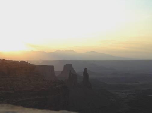
We had set the alarm for 6 o’clock, as we wanted to be up to see sunrise at Mesa Arch. We arrived just in time to see the sun shining through the arch, and stayed long enough to absorb the peaceful atmosphere. There were just a few other keen people taking photographs, but as it is a walk of just over a mile (total), and a long way from anywhere, you had to be keen to be here!
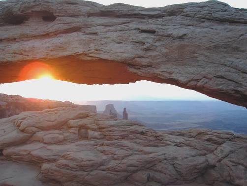
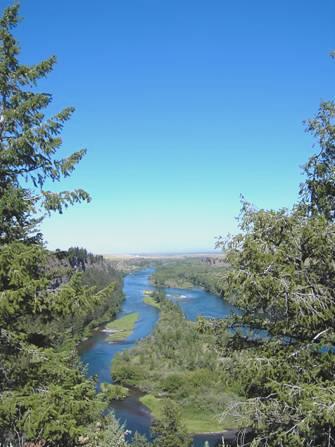
Sunrise at Mesa Arch
We had breakfast back at the car park and left at 8 o’clock. We drove out of the Park, and north to the I 70. We had note of 2 dinosaur sites on the way, but they appeared to be down 4x4 tracks, so unfortunately not for us!
We now drove across some desolate desert to the ‘city’ of Green River. This seemed to consist of a few motels, petrol stations and truck stops, which would appear to be its function. Melons are also grown here, and we bought one before leaving.
However, it did us well, as we were able to get an internet connection, and spent the rest of the morning sorting our email to send, with the diary, photos and map for the website. We moved across to road to have lunch, as we had been in one place since before coffee time! We then found a small shop to buy some food, and a place to get water (so we were able to have showers). We got more fuel, and as we got back on to the freeway at 3.30, a sign said ‘next services 100 miles’! It made us think of Alice Springs, especially as the temperature was 99ºF!
We expected to drive through more flat desert, and started listening to the recording of this trip’s travels. However, after a short stretch of desert, we came into the remarkable scenery of the San Rafael Reef. For the next 30 miles or so, we drove through this superb area of cliffs, stacks and mesas in all colours from deep red to almost white, stopping at several viewpoints to view the various scenes. Our feeling is that this area should also be made a National Park, although it looked too inhospitable to encourage many homeseekers! – although the Mormons had tried to settle it in the late 1800’s.
After some time, the landscape became a bit greener, with trees! as we approached Fishlake National Forest. We turned off at the first available place, on to a quiet little road, which went nowhere. We hadn’t counted on the huge number of mining semi-double trucks plying their way up and down (presumably the road goes to some sort of mine), and sand buggies cavorting along the road! However, there was a turn off signed Salina Creek, and a large parking area, which suited us fine, so we pulled in at 5.40.
We ate outside. We walked around a bit and found the little creek. We looked out at the full moon. The trucks were still running, and in fact continued all night.
Saturday 31st July 205 miles
The night turned cool, but we awoke to blue sky and ate our breakfast (including the melon) outside. We had a go at a quiz on the back of the cereal packet, about American geography, and didn’t leave until 9.45.
We drove through a few miles of pleasant mountain scenery before turning off at the old west looking town of Salina. We now drove through hilly country to Scipio, where we joined a short section of freeway south. We turned off again, following the 50, across flat fields of yellow grass, which were welcome at first after all the dramatic scenery we had been seeing. There were hills in the distance.
We arrived at the little town of Delta, where we were amazed that the computer logged in and we were delighted to receive messages from Lois and from Kath. There was a pleasant little town park with several picnic tables under a shade (and a nice little steam roller for Adrian to look at), so we enjoyed our lunch here while little children ran barefoot and rolled down hill on the green watered grass. The place had a nice feel.
A bit further on, at Hinkley, we were driving again through flat, arid desert, (on a very straight road!) We passed large, dry Sevier Lake on our left before ascending through dry, barren mountains and then more flat country. We crossed into Nevada at suitably named Border, where there was nothing but a petrol station (signposted for the last 80 miles) at 3 o’clock, but actually 2 o’clock, as Nevada is on Pacific time.
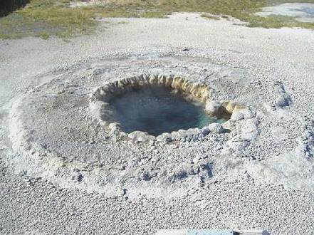
We very soon came to the tiny town of Baker, and the Great Basin National Park. After all the remote and empty roads we had been travelling on, it was a surprise to find quite a lot of people here. The two main attractions of the park are some caves, and towering Wheeler Peak. There is no entrance fee to the park, but you have to pay for cave trips. This is bad news for us, as we have a Parks Pass, but as we arrived at the Visitors Centre just as a tour was about to leave, we decided to join it.
The hour long, $6 tour into the Lehman Caves was good, as the caves were really pretty, with lots of ‘straws’ (called ‘soda straws’ here) amongst its prolific formations. They also had something called shields – sort of circles on the ceiling, which are fairly unusual. There were one or two largish chambers, but lots of narrow passages to walk through. Most of the rest of the group was made up of families, and the ranger liked to ask lots of questions. We discovered that Americans pronounce stalagmite stalAGmite and stalactite as stalACtite, which sounded strange to us.
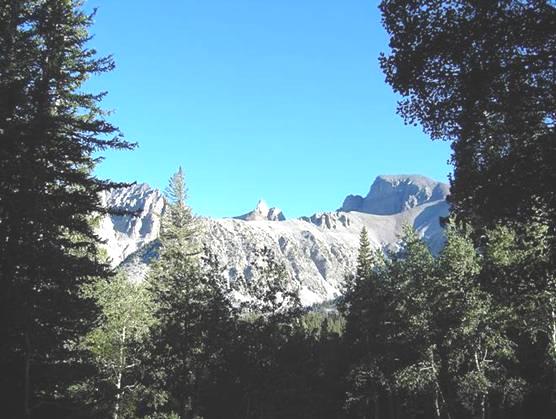
Wheeler Peak
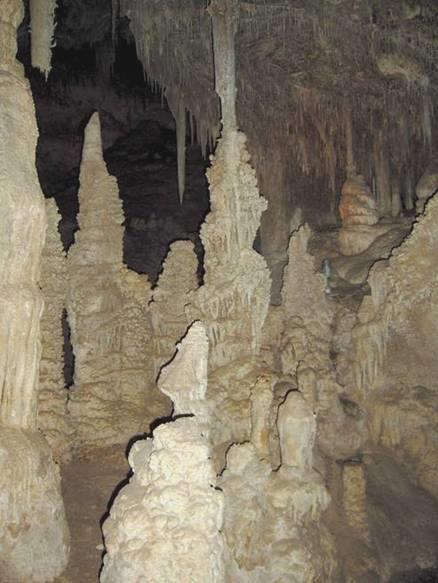
Lehman Cave
After our tour, we set off to drive the 12 mile road to Wheeler Peak. There is a campsite here, and we decided to stay for tonight. A 3 mile walk started from this area, so we had an early supper of calamari and rice, and at 7 o’clock set off to walk to Lake Stella and Lake Teresa. This was a pleasant walk through pinewoods, uphill for the first bit, but it was made more enjoyable by us coming across a pair of deer/elk. As we reached each lake, we had Wheeler Peak as a fine backdrop. There is a glacier (very small and unimpressive) on Wheeler Peak, but apparently it is the furthest south of any glacier.
We arrived back at the campsite at 8.45 (our time – we are not changing for such a short while), just in time to see the last rays of sunset on Wheeler Peak.
Sunday 1st August 204 miles
The sky was blue when we awoke, but it soon became very cloudy. It hadn’t been as cold as we’d imagined, and we were able to sit outside for breakfast.
We left at 8.45 our time, seeing several deer as we drove out of the campsite. We descended the 12 miles from Wheeler Peak, before leaving the park.
We headed westwards towards Ely, surprised by two things – firstly the weather, which was extremely windy and grey, and secondly by the attractive scenery – alternating plains and mountain ranges. We stopped just before Ely at a wildlife viewing rest area where there were supposed to be elk.
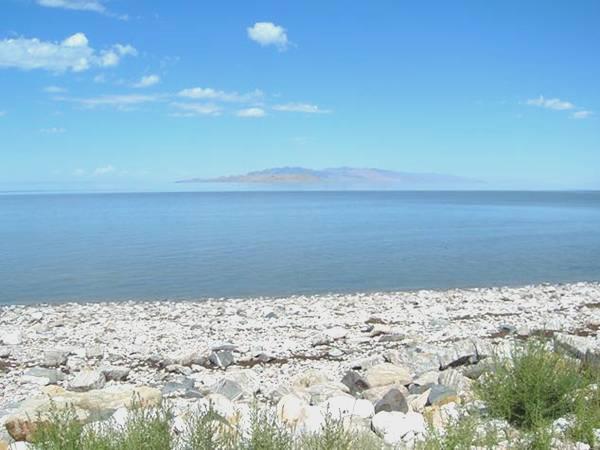
In Ely we drove down to the railway station, where the North Nevada Railway runs from. A steam train had recently returned from a trip, but the next trip was a diesel one. Adrian had a good time looking around so we didn’t leave until nearly 2 o’clock. We headed northwards through the wide Steptoe Valley, and as we got near to Wendover we could see the salt flats of Great Salt Lake on our right. It was quite uncanny, we had to photograph it. Wendover was full of casinos which looked really incongruous in this desert setting. We drove through and then pulled on to a bluff above the town.
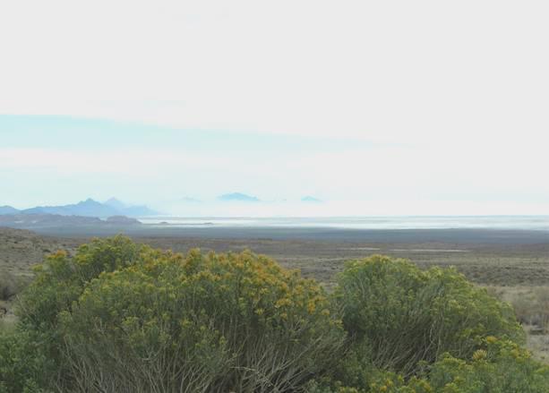
Great Salt Lake
We walked out across the rocky ground to try to get a view of the salt flats, but it was very unpleasant as there was an enormous amount of broken glass around. It became really hot and sunny for a while, but then a storm moved in and for a time it was extremely windy, but it passed over.
Monday 2nd August 154 miles
The sky was a clear blue, and the night had been fairly quiet. We left and drove past Wendover and back into Utah at 9.30 am. We very soon turned off to the Bonneville Salt Flats, where we drove for 3 or 4 miles on a dead straight road to the beginning of the Speedway, where nearly all of the land speed records have been set. There was a rather tatty sign saying about the speedway, but all we could see was a rough track across the snowlike salt flats and it didn’t look as though it had been used recently. Even so, it was an eerie experience, as the vast flatness of the white ground made all sorts of mirages. A chap from San Francisco came to view, and we had a pleasant chat to him.
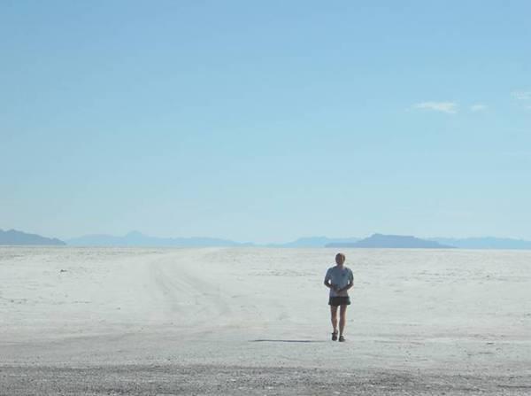
Adrian at Bonneville Speedway
We now had to drive the 4 miles back to the freeway, and on across what is called the Great Salt Desert. It could be said to be rather monotonous – just one straight, flat road. Signs warned of drivers getting drowsy, but there were very few places to pull off. In fact signs advised pulling on to the hard shoulder if you were feeling sleepy. It was a good place for us to listen to the recording of our travels! We stopped at one of the only 2 rest areas, sitting at a shady picnic table. Afterwards we walked up a little hill behind us, as we had now left the extremely flat ground.
We continued towards Salt Lake City, turning off just before to the signposted Visitors Centre. It was in the middle of a desolate bit of land, and when we reached it, a sign outside said ‘closed on Mondays and Tuesdays’! We decided that we might as well have lunch here, and while doing so, saw dozens more vehicles pull up for the Visitors Centre, all equally disappointed.
Now it was on into Salt Lake City, passing some actual lake with water in it. We were able to easily drive right into the centre of this large, clean and pleasant looking town, and in fact right up to the Capitol building. This looked really strange, as it was under ‘wraps’ for renovations. Opposite was the ‘historic’ council building, which housed another Visitors Centre, so we were able to pick up lots of leaflets.
Close by was the free Pioneer Museum, and this took up the rest of our afternoon, as there was so much stuff in there. It was housed in the rebuilt old theatre building, and was on 4 floors. Each one was crammed with artefacts from pioneer times, ranging from lace, quilts and china to the actual wagon belonging to Brigham Young. Perhaps most remarkable were the hundreds of photographic portraits hanging from every wall and available space. The ‘docents’ were again chatty – one lady looked like an original pioneer, and another had visited Britain on a tour and loved it. The only other people around were a mother and her 4 children – 2 sets of twins, teenage girls and a girl and boy of about 9. They seemed really interested in everything they saw.
While in there, we heard a huge clap of thunder, and realised later that there had been an enormous storm – we saw much evidence of flooding. Luckily the rain had stopped as we came out of the museum, but now came a nightmarish journey through rush hour traffic jams to almost match England’s, as we headed out to find a Walmart. This was both to get my next lot of photos printed, and to hopefully stop for the night, as we didn’t fancy to $30 plus of the KOA site. The journey was made worse as we had several wild goosechases. It didn’t help that road numbers were in thousands, like 2,000, and 5,400, and that Adrian had misread them. Finally, now in bright sunshine, we pulled into a huge Walmart carpark in the suburb called West Valley City at 6.30.
Tuesday 3rd August 31 miles
The sky was blue, and the night had been fairly quiet. We left at 8.30 and headed into Salt Lake City. We drove right to the centre, and were pleased to find a car park for only $3 for the day, right near Temple Square, which was where we wanted to visit and which is the ‘Mecca’ for Mormons.
You could not fail to be impressed by what you saw! The buildings were amazing, with the most wonderful flower beds surrounding them, and delightful statues wherever you looked. Near the temple we saw about a dozen brides, posing with their families for photographs. We spoke to some lovely ladies – 4 generations of a family, with a lovely month old baby being the youngest and they said this was ‘the’ place for Mormon brides to come.
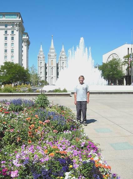
Salt Lake City
There were wonderful fountains, and a beautiful reflective pool. We walked on past the 2 houses once lived in by Brigham Young, to the park named after him, and the memorial site where his grave was.
A huge illustrious building, formerly a hotel, was named after Joseph Smith, the ‘prophet’ of the Mormons. There were two huge Visitors Centres, with all sorts of exhibits about the Mormon faith. One had an amazing statue of Jesus set at the top of a floor, with the universe behind. There were religious paintings which appealed to me much more than ancient paintings.
We looked in at the museum, which had so much about the Mormon history, which we tried to get some idea of understanding.
After lunch, then came back to the Family History Centre, which is THE place for Family Historians and which we had looked in at briefly before lunch. We spent the rest of the afternoon researching the Rutherford branch of the family in Chicago. Adrian had logged into a computer earlier and got details of Elizabeth Rutherford (nee Lawson - Rosie’s Gt. Gt. Aunt, born in 1838).
Afterwards we had a quick look in at the Tabernacle, which was now open, after Adrian had tried to find out from a young ‘missionary’, as they call themselves, how the Mormons differ from other Christian faiths.
We felt that we had had a good insight into central Salt Lake City, and now headed out for the Wasatch Mountains. We inadvertently drove right through the University and Hospital grounds, on the lower slopes of the hills, before finding the road out to ‘This is the Place’ park.
This is where Brigham Young decided that the Mormons would stop and build their city. There were huge statues and memorials to mark this spot, but we viewed them quickly, as huge spots of rain began to fall.
One of the many emotive statues
We now headed up into the mountains, but at first there were far more houses than we would have liked, and also, this is where all the cyclists cycle up the ‘hill’. When we finally reached the top of the ‘hill’, at Little Mountain summit, the view down to a peaceful lake was stunning, especially with the rainbow behind it. To add to it, a moose and its calf, the first we have seen this time, wandered up and across the road.
We drove a bit further, and found a suitable place to stop, at 7.15! A hummingbird was there to welcome us. The hot sun was just disappearing behind the hill. The storm we could see in the distance hit us briefly.
We were just going to bed at 10.45 when a car pulled in and the sheriff got out and said that we couldn’t stay there as it was a watershed area. Adrian chatted to him for a while, saying we were self contained etc, but he was having none of it, and said that the watershed people would be after us, and it would be a heavy fine. I asked about the parking area at the summit, and he reckoned that that would be OK, so that’s where we ended up!
Wednesday 4th August 100 miles
There were more cyclists this morning, but it was a lovely morning as we left at 9 o’clock. We drove on to ‘Big Mountain’ and stopped for the view down towards Salt Lake City. This was on the Pioneer route, and the original Pioneer path crossed here.
We continued through the pretty Wasatch Mountains seeing quite a bit of wildlife, the best being a small group of sandhill cranes. We drove on past East Canyon Reservoir and came down to the drier hills, which were used for farming. We made our way to the freeway, through pretty Weber Canyon, and then navigated towards Antelope Island, in the Great Salt Lake.
The flat countryside leading to Antelope Island was made up of small farms and unpretentious housing, making us think of places in England like the south or east coast.
Antelope Island is reached by a 7 mile causeway. It is a State Park, and the fee booth is at the near end of the causeway. We were pleasantly surprised to find that the $11 camping fee included the $8 entrance fee, so we decided to camp! No facilities, of course, not even any shade.
At the far end of the causeway we stopped and enjoyed the numerous shorebirds. Just after this we set off on a little walk, with wonderful views across the water. There were delightful lizards, but not so nice huge spiders – dozens of them. It was extremely hot! At the visitors centre there were more nice views.
View from Antelope Island
We made our way to the beach area, and had lunch under a shaded picnic shelter, looking down across the beach to the water beyond. Then it was our turn to try the water, but before that, as I had stood barefooted on the Bam step to get in, I had badly burned the sole of my foot!
Walking across the hot sand was arduous –especially the deep, dry sand leading down to the flat, harder stuff. We finally reached the water, and paddled out until it was deep enough to float. Although the ground was sandy, there were lots of slaty stones, which were unpleasant. Floating in the salty water (the second saltiest after the Dead Sea) could only be described as fun, but as we remembered from our experience at Droitwich, it is impossible to swim. Thoroughly soaked and salted, we made our way back across the wide beach, with our skin feeling really tight from the salt. Showers were very welcome!
Now it was time to drive down the eastern side of the island, as far as Garr Ranch, which was originally farmed by Fielding Garr in the 1840s. He was one of the early Mormons in Salt Lake City. Other Mormons used to graze their animals here, and the ranch was used by different people until 1981, when the island was made a State Park. The other thing of note on the island is the large herd of bison (700), but they didn’t show themselves to us!
It was 5.15 when we left the ranch and drove back up the island, arriving at our campsite at 5.45. This was in a beautiful position, looking down to the water, but it was still extremely hot. Adrian put the sunshade out, and we sat outside with a beer.
We had a barbie, enjoying our wonderful view, but not enjoying the flies etc. We then set off for a little walk across the sand. The sunset was interesting and colourful, but we both arrived back feeling so bitten by mosquitoes etc, that we had to try hard to see the beauty in it all!
Thursday 5th August 237 miles
It was a really hot night, which kept both of us awake! We awoke to another beautiful morning, and had breakfast sitting outside at our picnic table, with our wonderful view. It was very windy, but there were still a few flies about.
We left at 9 o’clock and drove up to Buffalo Point. There were lovely views from here, but we decided against walking the trail, which went even higher. At 9.45 we were driving back across the causeway. This is where there were most birds, as the water came right up to the road, but there weren’t any places to pull off. We drove back through the place called Syracuse to the I15 north.
We drove along here for about 30 miles. We now found our way westwards to the site of the Golden Spike – the joining of the Pacific Union and the Central Pacific railroads in 1869. This is now a national historic site, so once again we could use our National Parks pass, which is always good.
There are 2 beautiful replica engines here, both in working condition representing the 2 railroads at the joining of the railroads at the Golden Spike ceremony. We arrived at about midday, and at 1 o’clock they both had a little ‘run’ in steam. Adrian of course was in his element again! It was fascinating to see the problems associated in getting two groups of dignitaries, to the middle of nowhere, for such an important occasion.
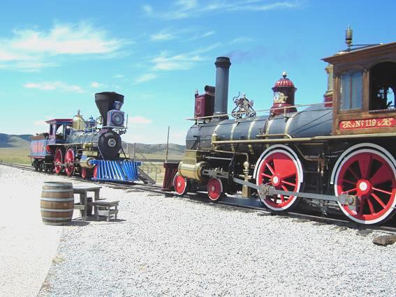
The Gold Spike
We made our way back across this area of pretty, green but treeless hills, looking a bit like Scottish moorland, to the I84.
We were soon into Idaho, and saw stormy skies up ahead. However, we weathered the storm, and came back to blue skies. We saw a lot of the green circles formed by irrigators, which we see so easily from the air. We turned off the freeway at Rupert and crossed the wide Snake River. We were hoping to find somewhere for the night, but it was agricultural land, with the railway at one side, and nowhere to pull off. Finally, at nearly 6.30, we pulled off onto a rough bit of track beside the road. We were both feeling very hot!
Friday 6th August 172 miles
The night was surprisingly cool, and the morning partly cloudy. We left at 9.15, heading for the ‘Craters of the Moon’. We passed a lot of lava beds beside the road, and stopped briefly by Lava Lake, where we saw a killdeer (a bird), and several coots. We then went into ‘Craters of the Moon’ National Monument.
This was just one huge area of lava beds, with several trails you could walk, and a route you could drive. We set off to drive, and walked several of the trails, trying to take in the different types of lava in this strange landscape. We continued around the route, hoping to walk the last lot of trails. We were amazed and disappointed to find that these were closed – there had been no signs, or anything to tell us, so our tour came to an abrupt end at 2.30!
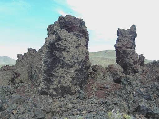
Craters of the Moon
We continued to Arco, and then on to Idaho Falls, through mostly barren country which has been the site of nuclear development over the years.
As we got near to Idaho Falls, we were aware of a grass fire which was giving obvious concern to local people. Idaho Falls itself did us well! I had just said that I wanted a shop for food, with a laundrette next door, and that is just what we found – Albertsons (which admittedly seemed expensive) with a laundrette right beside it! So with shopping and clean washing both done, we continued through the pretty flower bedecked streets to the park which Adrian had found we could stay at.
The park, called a Tourist Park, was right beside the Snake River, and had camping (for one night only), dump and water, all for free! We parked ourselves right by the river, and had a little walk around.
Adrian lit the barbie, but then we met Amanda! She came along with her little dog called Ebony, just as we were about to eat. Amanda was 10, and she was so like one’s image of Tom Sawyer, that I thought that she was a boy. She had shoulder length, curly light brown hair, and was wearing a T-shirt and knee length trousers. She was barefoot. She sat herself at our picnic table, telling us that we could stroke Ebony, if we liked!
She ran off, but soon returned, and anything more like a kid out of a fifties movie would be hard to imagine. She was Hayley Mills impersonated – even her teeth looked just like Hayley’s. She was just something else! It seemed that she was the youngest of 5 children, originally from California. She didn’t know where, and she didn’t know how long she had lived here. In fact, time seemed to mean nothing to her. We asked her about school, and she said that the only thing she liked was recess, oh, and free time! She said that she didn’t pay attention much at school.
We gave Ebony our pork bones to chew on, and Amanda joined in and chewed some too. A boat came in to the launching area, so she gave us the dog, and ran off, hoping to get a ride in on the boat – which she did! Suddenly, almost as fast as she came, she ran off, saying ‘See you folks later’. We both came inside, feeling that we wouldn’t ever meet anyone quite like her again!
Saturday 7th August 125 miles
The sky was really blue, but it was too windy to sit outside, so we had breakfast inside. We headed out of Idaho Falls, stopping to try once more to phone Emma. This time we left a message, which we hope that she gets. It was now 10.30 as we set off through really pretty country with fields of golden corn, beside the Snake River.
We stopped above this river, which we were going to follow for the rest of the day. There were two markers here to 2 local men who had both made their mark as writers. It was a very pretty spot.
The Snake River
We continued to the part of the river which forms Pallisade Reservoir, and looked very attractive. After Alpine, and now in Wyoming, we followed the Snake River through what is called ‘Grand Canyon’. This was superb scenery, looking like some of the rivers of the Canadian Rockies, but making us think of the River Tarn in France, as it was choc a block with young people rafting down it. We viewed them from above.
On now to Jackson, a not unattractive tourist town, serving as a ski resort in winter. Next we found the Visitors Centre and went in to get information on Grand Teton and Yellowstone National Parks. While in there, I noticed that there was a talk going on about Sacagawea, the young Indian girl who was taken on the Lewis and Clark expedition in 1804, and greatly helped them. As this expedition is one of our interests – we have followed up much about it, and hope to ‘do’ the trail one day – we sat down to listen. The speaker, a man called Kenneth Thomasma, was a very eloquent speaker, and the talk greatly added to our understanding of the events of the expedition. He had written a book about Sacagawea, and was instrumental in getting the image of her on the U.S. dollar coin. Although this coin is legal currency it is still rarely used here and you have to carry wadfuls of $1 notes. This also means the largest coin available is the 25 cent coin (quarter), so any coin machines you use only take these – lots of them if you are doing the washing!
As we know the campsites often get full in Grand Teton NP, we now made haste to the nearest one, Gros Ventre campsite. We had views of the stunning Teton Mountains on the way. The campsite is large, and we were able to camp in the ‘non-generator’ loop, which is always a bonus! The whole campsite was set amongst trees, and we found a spacious spot, where we found that the sun was still hot (but it’s much cooler here than we have been used to). It wasn’t long before Adrian lit the barbie.
We then spent a lovely evening. Adrian found a bit of wood around, so we lit a fire and sat by it until late, in our peaceful surroundings.
Sunday 8th August 114 miles
It was cool in the night and early morning, but the sky was a clear blue all day, which made the mountains look even more wonderful. We ate pancakes for breakfast, and didn’t leave until nearly 10 o’clock.
We drove back to the junction, and then took the more easterly road through the park – our plan being to book into a campsite at the northern end, and then enjoy a leisurely drive through the park and back, knowing that we had somewhere to stay tonight. As you can only camp in campsites within the park, and we are going straight on to Yellowstone, this was a big consideration.
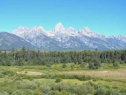
The Tetons (meaning ‘breasts’ in French, being named by the early French fur trappers) looked glorious against the blue sky, so my camera was doing more than overtime! There were several lookout points to enjoy them from, and the Snake River looked lovely too. The day soon became very warm.
We had a few things to slow us down on our journey – firstly a large group of bison were crossing the road in front of us. After a while, they stopped to graze on a hill beside the road, kicking up dust with their hooves.
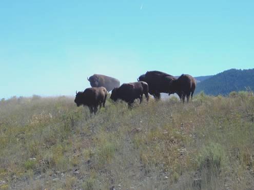
Bison
Then, just as we came to the toll booth along the northern road of the park, a huge lorry had tried to turn around, and had got stuck right across the road. Rangers were out controlling (and stopping) traffic, so this held us up for a while.
When we got to the control booth to Cotler Bay campsite, there was a queue of cars waiting to book in. At this point, I got our tea and coffee, and we finished it at our site at midday!
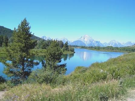
The beautiful Teton Mountains
We drove out again almost immediately, driving back to take the slower road south. We stopped first to view the Jackson Lake dam, and soon afterwards drove up Signal Mountain and had lunch with a lovely view down over the plains and the Snake River.
Further down the road, we turned off to String Lake. The large car park here was packed out, and we soon discovered why. The shallow lake was being used as a recreation area for families, with many people swimming and playing on the ‘beach’. We perhaps should have joined them, but the water felt quite cool!
We didn’t have much luck at nearby Jenny Lake, which seemed to be THE place to come, and we couldn’t even park at the viewpoint. A boat went across the lake here, and we liked the idea of getting the boat across, and walking back round the lake, but time seemed to be running out, so we reluctantly didn’t.
We continued to the southern end of the road, where we visited the late 19th century homestead of the former ferry operator, a man called Menor. The ferry took people, but mostly vehicles, across the fast flowing Snake River. His whitewashed log cabin had served as a shop, and was fitted out now as partly museum and partly old fashioned store. Nearby, another cabin had some lovely old black and white photos of this area in the past.
Also near here was the Chapel of the Transfiguration – a dear little log chapel built in 1925. Behind the simple altar was a large window, with a fantastic view up to the Teton mountains – surely an inspiration to anyone.
We now set off to drive back up the road, and back to the campsite. We were sorry that our site was in deep shade, but Adrian had bought some wood, so he lit the fire.
Monday 9th August 158 miles
We had wanted to leave early today, to avoid the roadworks just north of here, which apparently started at 7 o’clock, causing long delays. As it happened, we were awake early so we left at 6.30.
The roadworks here were pretty nonexistent, but we did come across another stretch just before Yellowstone. We could see the early sun on the Teton mountains, and the flowers beside the road were lovely.
We arrived at Yellowstone N.P. at 7 o’clock, and spent a wonderful day there.
We soon found a picnic site by the Snake River, and stopped to have breakfast. The picnic table outside didn’t entice us, as it was covered in frost! This melted while we breakfasted, and we left at 8 o’clock.
Our first delight was Lewis Canyon, where we saw the first of many rapids, and some lovely falls. The one thing to spoil the views today was the number of dead trees, the result of various forest fires. Park policy is to leave them, but we just wish that they would clear some of them away.
The park had already become busy, so we headed for Grants Campsite to book a place for tonight. This cost us $18, but we knew that we had to have somewhere for tonight. The campsite was huge (425 sites), and is only one of several in the park, but actually said ‘full’ when we returned in the evening. (The RV Park, with 346 sites with full hook ups, was already booked out!) Our pitch looked pretty dark and dingy, so we didn’t stop, and at 9.30 we were on our way again.
Now it was time to set off on our ‘Grand circle’, returning to Grants this evening, so that we can drive back up the western road tomorrow.
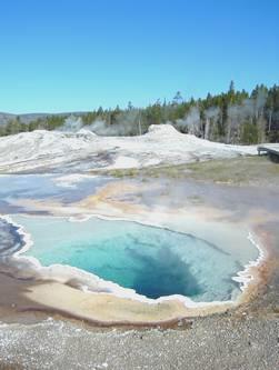
We travelled anticlockwise, stopping first at West Thumb geysers. Here we had a great walk around dozens of interesting geysers, with the wonderful backdrop of Lake Yellowstone behind. We had coffee afterwards at a picnic table, as the day quickly warmed up and became quite hot, but with more cloud than yesterday. We were glad to be self sufficient in our van, and didn’t envy the queues of people waiting to use the one loo here!
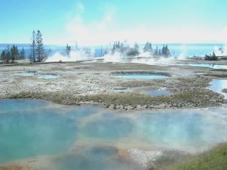
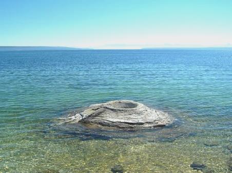
West Thumb Geysers by Lake Yellowstone
We drove now along beside Lake Yellowstone, stopping at Pumice Point to paddle a bit and take a photo. We now followed the Yellowstone River and had a little walk at Le Hardys rapids, where the flowers beside the river were lovely.
As we drove on, we passed great herds of bison, but now we came to another lot of roadworks, just where we wanted to pull in to view the next lot of geysers. We did manage to pull in to the crowded carpark, and had our lunch sitting in the Bam next to the ‘car park geyser’, which had sprung up through the tarmac a few years ago! After that it was a tour around another lot of geysers, all interesting and different. An added bonus was the 2 bison which came to visit. Mud volcano gives its name to this area, but every geyser delighted us with its own special character. We even walked across the road (despite the roadworks) to view Sulphur Cauldron, the most acidic of all the geysers in the park.
Then, of course, we had to wait for our turn through the roadworks, but it wasn’t too long, and as we drove on, we passed hundreds and hundreds of bison – they were just everywhere.
Now we came to what is called the ‘Grand Canyon of the Yellowstone’. This area was just fantastic, with 2 wonderful waterfalls, and a canyon just full of colour. We visited just about every viewpoint we could, and had views to both the Upper and Lower Falls, and of the ongoing canyon. As a bonus, osprey were nesting in unlikely locations on top of tall pillars.
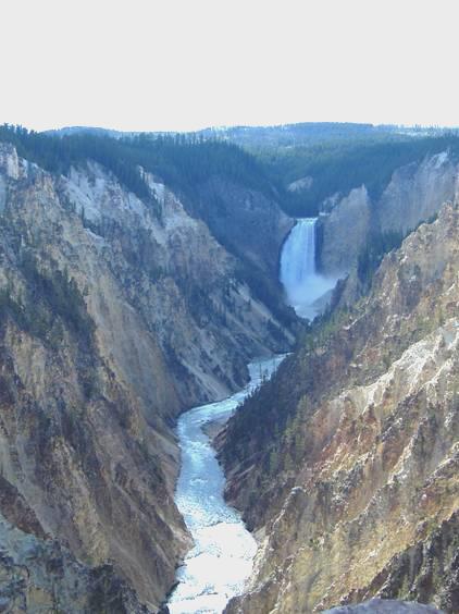
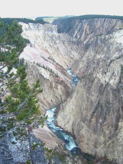
Grand Canyon of the Yellowstone
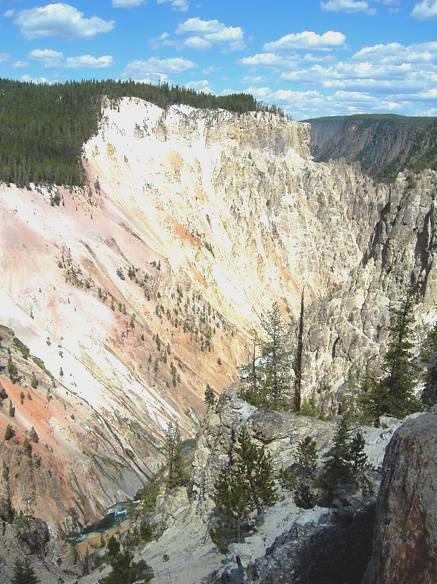
All this took time, as we visited viewpoints with names like ‘Artist Point’, and ‘Inspiration Point’. This was a real highpoint to our day, but we were aware of the passage of time, and we had a long way to go back to our campsite.
On our return journey, we did turn off to drive a short trail past Virginia Cascades, but there was nowhere really to stop. We turned off again to drive along Firehole Canyon, as this was a one-way drive, going ‘our’ way, but half way round we saw that it was a ‘swimming hole’, so will have to return tomorrow!
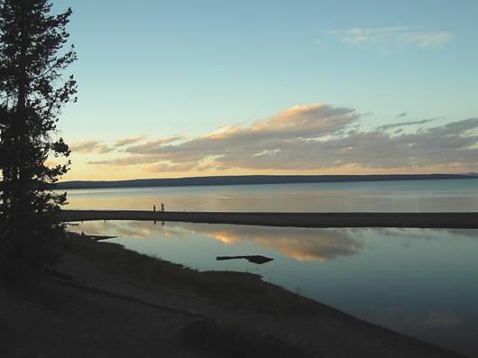
We passed much more stunning scenery, all put on hold until ‘tomorrow’, as we didn’t return to Grants campsite until after 7 o’clock. We were pleased to see that we had a bit of the setting sun left in our site, so sat outside with a drink to recover from our long and busy day. There was a phone nearby, so while I got a hasty supper of prawns and rice, Adrian phoned Simon about our imminent visit. We were pleased to hear that he had had an email from Emma, who we have been unable to contact.
We ate our supper outside, then walked down to the lake, which was a real delight, as the sun was just setting, and the colours were wonderful – a real bonus. We returned to the Bam at 9 o’clock.
Tuesday 10th August 95 miles
We left again at 6.30 for an even more wonderful day in Yellowstone National Park. The sun was just coming up over the water as we drove off.
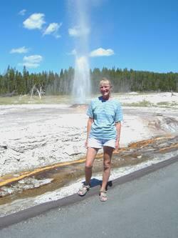
We set off towards ‘Old Faithful’. We crossed the Continental Divide twice within a short distance, at the second point there were yellow waterlily ponds.
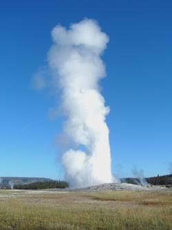
We arrived at the ‘Old faithful’ area and walked towards the Visitors Centre, where the ranger was just putting up the time of the next expected eruption – 7.55. This gave us just long enough to sit in anticipation, in the warm sunshine, although the air was still cold.
Sure enough, the geyser started erupting on cue, and we shared this lovely moment with the few others around. After it had done its turn we made our way back to the Visitors Centre, which was just about to open, to find out what time other geysers might be expected to erupt. None of the ‘popular’ ones seemed to be going to perform at a convenient time to us, but the lady ranger announced that ‘Beehive’ would shortly be erupting. We made our way there, and we weren’t disappointed! This was just another of our joys today. We walked back to the Bam for breakfast, looking at and photographing more geysers on the way.
Having eaten, we set off again on a trail around some more of the geysers in this area. Each one delighted us, as each had its own character. Some were very colourful, others bubbled or hissed, and some spurted. While walking around, we saw ‘Old faithful’ erupting again (it happens about every 90 minutes) We saw it once more as we were arriving back from our walk, and by now the previously empty carpark was full!
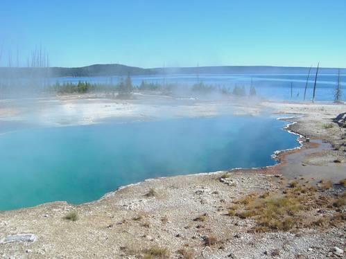
Now being 11 o’clock, we drove on a short distance to the next group of geysers, called Black Sand, and had coffee before walking around this wonderful area. One geyser, called Cliff Geyser was erupting regularly from beside the stream, with brilliant orange colours streaming down the white cliffs. Further along the trail was my favourite so far – Emerald Pool, which had the most wonderful clear green water, surrounded by orange rock, like a beautiful flower. Opalescent Pool was a deep blue, surrounded again by orange.
The next area, called Biscuit Flats, was equally brilliant, with a wonderful Sapphire Pool, aptly named, and the erupting Jewel Geyser. The colours of the surrounding ground, caused by the minerals and thermophiles (bacteria and algae), was stunning.
We travelled on to the next area, know as Midway Geyser Basin. Here there was beautiful Excelsior Geyser Crater, which was huge, and had water gushing from it, with glorious colours streaming down the white rock. Also in this area was Prismatic Spring, again beautiful, with the surrounding ground a mixture of brilliant oranges, turning to paler browns and beiges further away.
We drove on a bit, and had lunch beside bubbling Firehole Spring before driving on around the Firehole Lake drive, where more delights awaited us. Great Fountain geyser had an enormous base, but wasn’t actually erupting, but a bit further on, White Dome geyser was, and was lovely. So was Pink Dome geyser, which was spurting up really high, right beside the road.
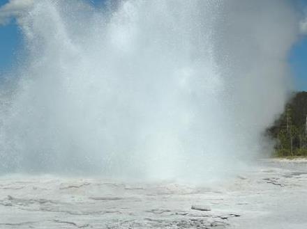
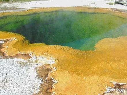
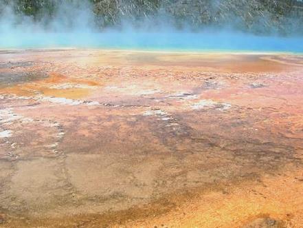
Just a few of the different springs and geysers at Yellowstone
Our next delight was the Fountain Paint Pot area. The Fountain Paint Pot was actually bubbling and spurting mud with some blobs jumping up high. Along this same trail, we were suddenly surrounded by half a dozen erupting geysers. Clepsydra often erupts, but others around, called Jet, Fountain, Spasm and Twig, joined in! It was really very exciting.
Now it was time for a different delight – we made our way to the Firehole River swimming area. This meant driving again on the one way road we had driven yesterday, and then hoping against hope that there was somewhere for us to park, as it was a tiny little road, with a vertical drop down to the river. We were in luck, and found a parking spot right at the end of the row. Then it was a walk back along the road, and down the rough steps to join the hordes down there – far more people than looked possible from the number of cars!
The water wasn’t as warm as I had hoped, but warmer than Adrian had imagined. The current was strong, but this didn’t deter the younger ones, who were leaping in upstream and surfing the rapids. We made do with a more genteel swim, and greatly refreshed, clambered back up to the Bam.
More delights followed – Terrace Spring, where yellow flowers added to the pretty scene; Gibbon Falls, which we viewed from below, as we had hoped to do when we saw them yesterday; Beryl Spring, right beside the road, and then the Norris Area. Time was getting on now, but we walked a trail past Steamboat Geyser, which was just spurting, but can erupt (which it does sporadically), highest of all, and many other geysers. Some in this area were a chalky green colour, but we looked down on the Porcelain area, where the pools of iridescent blue contrasted beautifully with the white ground.
Now came the difficult bit! We had known that finding a place in a campsite would not be easy, and this was true! All the campsites were now full, and as one can only stay in a campground, we had to make our way out of the Park. This meant driving past the Mammoth Springs area. Mammoth Springs looked a nice little ‘town’, with an old fort, and attractive buildings. The scenery continued to be stupendous, as we followed through a gorge and beside a pretty river. We entered Montana just before leaving the park, through a fine stone arch, which had been built as an entrance to Yellowstone, the first National Park in USA.
It was almost 7 o’clock when we left, and drove through the small town of Gardiner, finding a spot above the Yellowstone River soon afterwards. It had been a long but wonderful day.
Wednesday 11th August 278 miles
A travel day! The sky was blue all day, but the sun had just reached us, as we breakfasted and left at 9 o’clock. We drove up beside the Yellowstone River, driving down once to see it and put my feet in! The valley widened as we neared Livingston, but the scenery was still pretty.
Driving around Livingston, the computer logged in, and we received Emma’s e-mail first, and were really pleased that they were enjoying themselves, now in Spain. We were also pleased to hear from Tom (back from Croatia), Nicky, Simon, Lena, Trish and Joe & Irene. Livingston was an attractive town, and owed its existence, like so many other places, to the railway. In this case, it was the starting point of the passenger railway into Yellowstone National Park, in its early days.
We continued north on the 89, through lovely scenery.
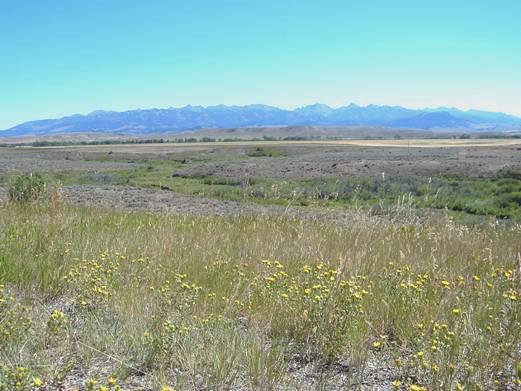
Looking across the Shield Valley to the Crazy Mountains
We left the Yellowstone River, and followed the Shield valley for a while. We stopped for lunch a few miles south of White Sulphur Springs, in the rest area of a weigh station. We now began ascending King’s Hill Pass, through part of the Lewis and Clark forest. The scenery was again lovely, with fir trees, streams, beaver ponds and flowers. After we descended, we drove through golden wheatfields to Great Falls, which we had driven through in 2002 on our way south from Calgary.
We crossed the Missouri river, and took the I15 north, through undulating but dry country which reverted to wheatfields again. We turned off at Brady, and found a spot beside the road next to some piles of chippings at 5.40.
We enjoyed a barbie, sitting in the warm sunshine, before the sun went down. As last night, the stars were wonderful.
Thursday 12th August 269 miles
The sky was blue all day. We had breakfast and left at 8 o’clock to drive on north through the flat land to Calgary. It was a good time to listen to some more of the recording of our travels. There was a long section of single lane, due to roadworks, before we reached the border. We arrived at 9.15 and got some fuel, so it was 9.30 when we arrived at the Canadian border at Coutts.
After the formalities, we were on our way at 9.45. We immediately noticed that distances were marked in kilometres, but this made them disappear more quickly! At 10.45 we got to Lethbridge and had coffee before shopping in Safeway, which we found much cheaper than in USA (except for the booze, bought from the adjacent Safeway liquor store!)
We left Lethbridge at 12.30, and turned off to have lunch on a gravel road just before Fort Macleod. We left here at 2 o’clock, and made good time to Calgary, where we followed the directions Simon had given us, and found our way to his and Laure’s house, arriving at 4 o’clock as planned!
They arrived back soon afterwards, so after a look around the house (and seeing our wedding present to them, which had just arrived), we had a walk ‘around the block’ with Simon.
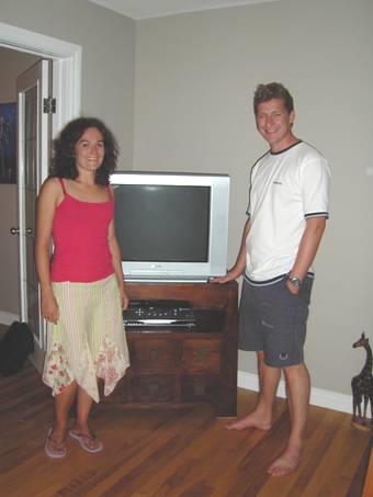
Simon and Laure with our present (not the telly - the cabinet)
This area is interesting as it is a former barracks, and the houses, some old and some new, were full of character, and plaques along the road told of the various battles of World War 2.
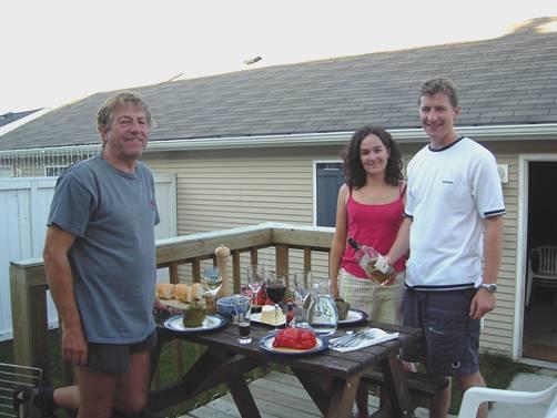
We came back and Simon cooked us a good meal of stuffed peppers, which we ate outside on their ‘deck’ in the garden, before going out to sleep in the Bam.
Canyonlands to Calgary


