
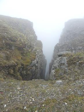
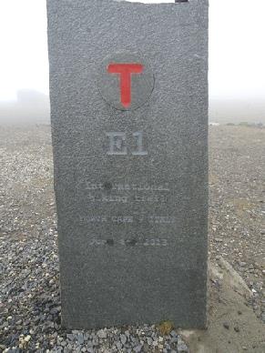
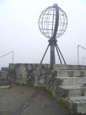
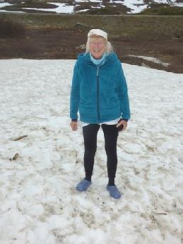
After posting our cards, we walked down to the globe area, where we took our photo and peered over the cliff edge where we had a few wintry views. Adrian found it really cold, so we returned to the van and left at 9 o’clock - when we’d found our way out of the car park in the fog!
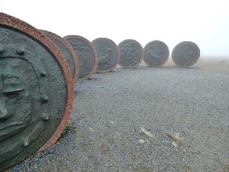

The ‘Children of the World’ monument
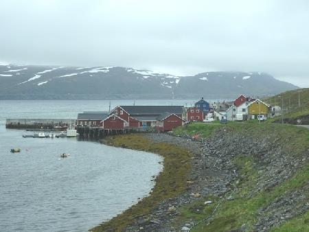
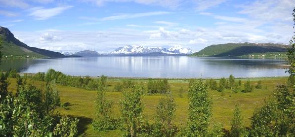
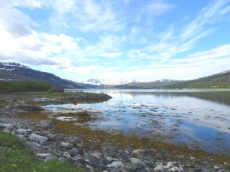
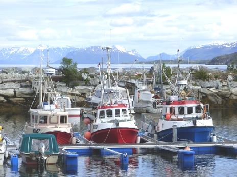
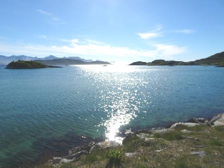
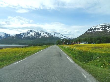
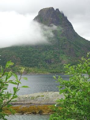
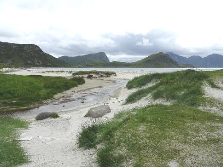
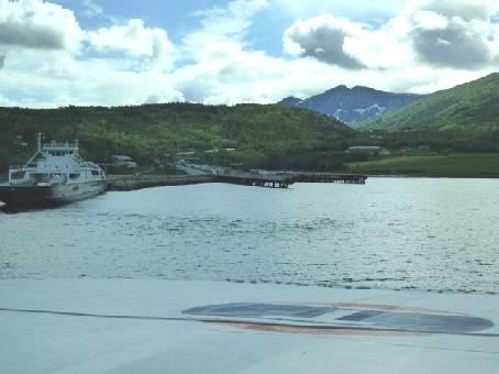
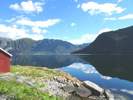
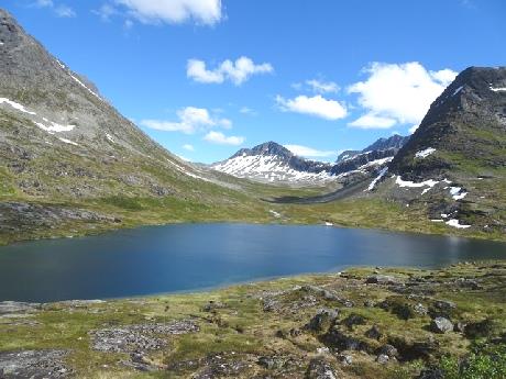
The fog gradually went as we drove back south and we enjoyed the stunning views of the barren mountains with the snow, inlets and lakes. A few miles on, we turned off to Skarsvag, where we’d intended staying last night before we knew that we could overnight at Nordkapp. It was the prettiest little fishing village, with a fleet of fishing boats reminding us of the Faroes. This was the place to finish the website!
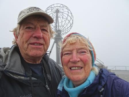
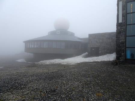
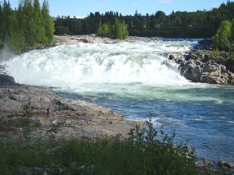
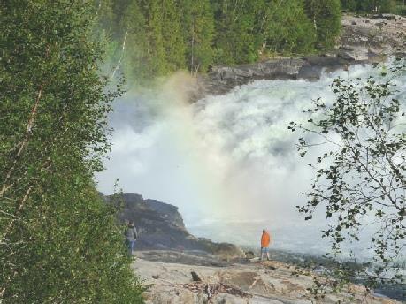
Foggy Nordkapp - anyone want to walk to Italy?
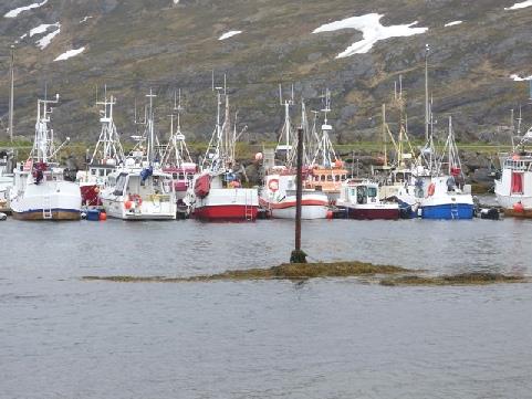
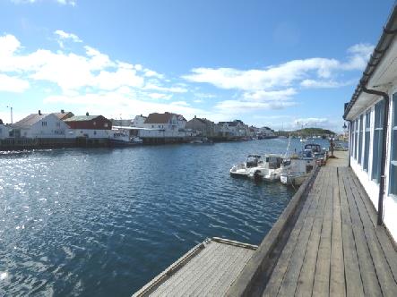
The harbour at Skarsvag
Tuesday 27th June
We didn’t wake to the sunshine we’d hoped for! It was still thick fog, so ‘dressed up for the Arctic’, we ventured out into the wind and damp . Everywhere looked desolate, and the ‘hall’ was empty except for the cyclist eating his breakfast! We walked out first to the ‘Children of the World’ monument, created in 1989, when seven children from around the world came here to made a joint monument to symbolise friendship, hope and happiness across borders. Beside it was an evocative sculpture of a mother and child .
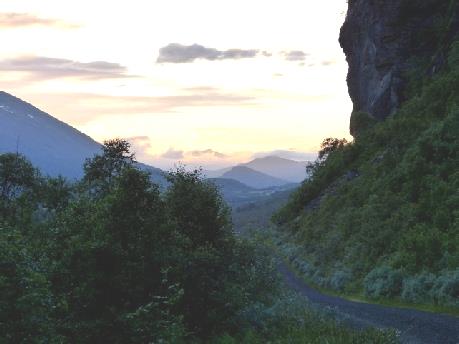
We left here at 11.30, going into more fog, but also having some lovely views. We passed many more hardy cyclists as we drove south, and also motor cyclists.
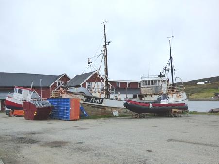
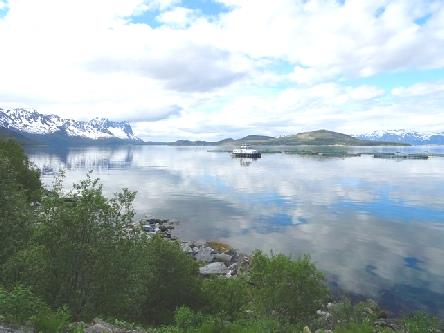
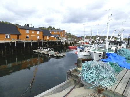
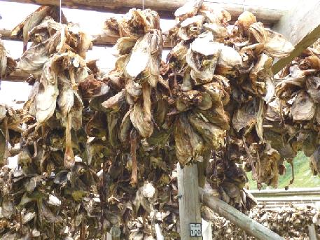
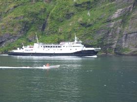
Sprawling Honningsvag wasn't attractive, but we did see large fishing nets with fish drying, near the harbour, where there were a few fishing boats.
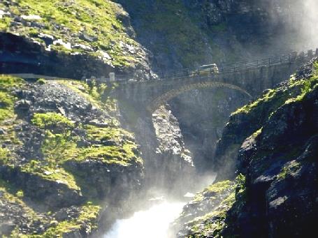
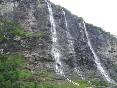
We drove back through the tunnels, stopping to eat excellent enchiladas for lunch just before the 'under the sea' tunnel, looking across to the vertical cliffs of the headlands and islands. The tunnel, which is 7km long, is also very deep in order to get under the fjord – 220m – and only the middle 1km is level. The poor cyclists have to not only cope with having no cycle lane and a dimly lit tunnel, but a 1 in 10 hill 3km long at each end!
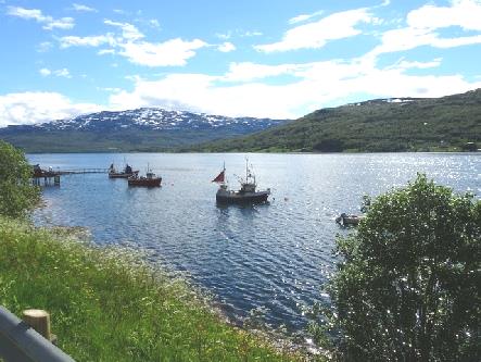
We turned off to quaint little Repvag, with its old fishing boats. It reminded us of Cartwright in Labrador.
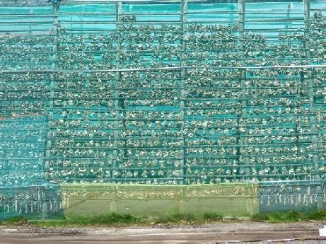
Fish drying on the racks at Honningsvag
We photographed the 'pancake rocks' we'd seen on the way up.
Repvag fishing village
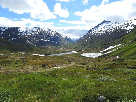
At Russones we turned west to drive across the base of the Parsanger peninsula. We now saw trees again, although we did drive through more desolate areas with dead looking trees, stale snow and huge puddles.
At Skiati we got some more diesel, our first in Norway. We now drove south-westwards to Alta. A sign said 'pass - open' – we hadn't even thought of that!
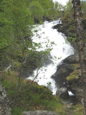
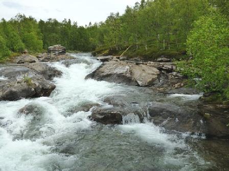
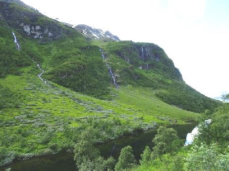
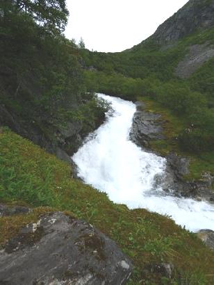
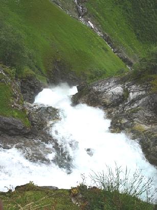
At first we followed a stunning large rushing river far below, with streams and waterfalls running into it, before driving over bleak, barren snowy moors. There was even frozen ice on the water!
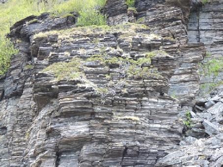
‘Pancake rocks’
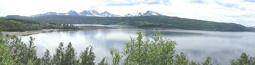
We came back into civilisation as we neared Alta, a spread out town on the Altafjord. We drove around the town, arriving at our overnighter by the world heritage rock art site at 4.50.
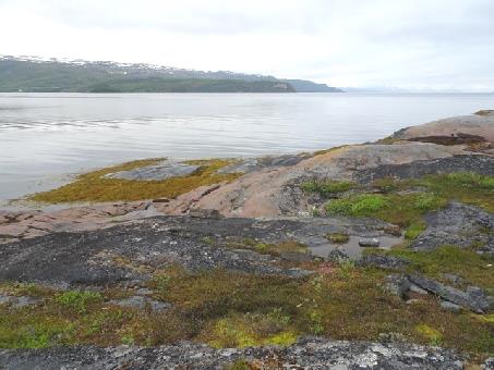
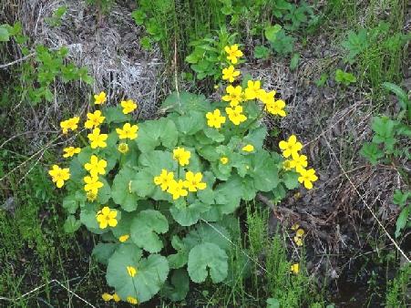
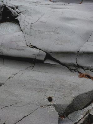
Adrian had read that the museum closed at 5.00, so you could walk around the site afterwards for free. However, we are now just into 'summer' opening times, and it stayed open until 8.00pm. Hence, after supper, we walked out in the lovely calm of the evening and had a delightful walk for an hour or so. We followed the trail, much of it on a boardwalk, above the bay. I enjoyed the wildflowers, in particular the marsh marigolds. We found the rock carvings, relevant as they are, being thousands of years old, rather difficult to see, but we loved the peace and quiet with nobody else about. When we got back at 9.50, it was damping a bit, and then turned to rain, so we had been very lucky.
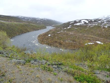
The rushing river far below
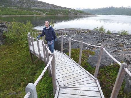
A walk to see Alta prehistoric rock art
Wednesday 28th June Fabulous fjord scenery and a bit of WW2 history 101 miles
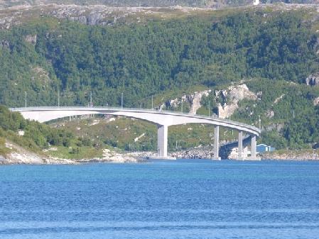
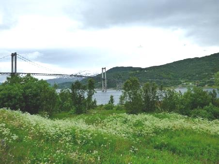
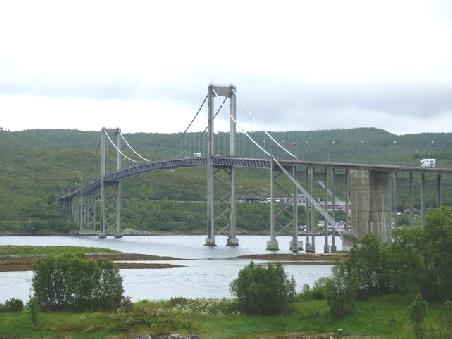
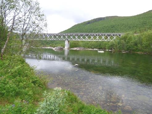
We ate our lunch above Kafjord looking at the attractive bridge we'd crossed, and to the site where Tirpitz had been.
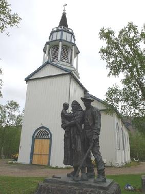
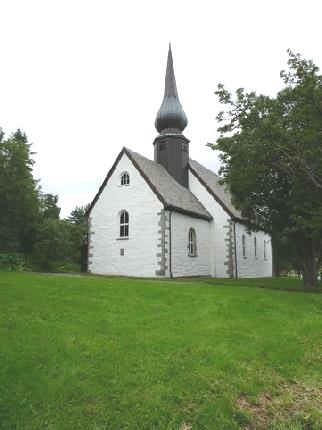
We drove back, passing the pretty white church which had been built by the English mining company in 1826, when thousands of people had lived here to work the copper mines. There was an evocative statue outside representing a miner with his wife and child.
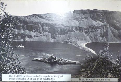
The Tirpitz museum at Kafjord
The miners church at Kafjord
It was 2.30 when we drove on around Altafjord, high above the sea. We went through several tunnels – a new one was being built at the end of the fjord. The sun looked lovely shining on the snow on the mountains. We passed several contingents of motorcyclists, presumably on their way to Nordkapp.
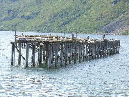
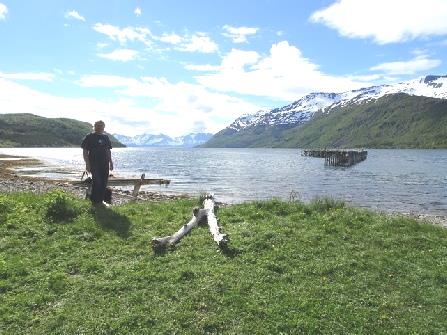
We had stunning views as we followed along beside a long narrow fjord. There was a little jetty in the water covered by noisy seabirds and sun was shining on snow on the mountains. Someone had recently had a campfire.
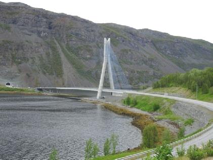
The tunnel emerges at the attractive modern bridge we’d crossed - the site of the Tirpitz in 1943
We now left Finnmark province and entered Troms. (no, I haven't forgotten the o!)
At 4.45, we arrived at the harbour at Oksfjord, where we'd intended staying for the night. Mostly we needed to do some washing, and Adrian's information had said that there was a washing machine here. We first filled with water and dumped, then went in search – no washing machines!
It cost £10 to stay here, so we decided not to! We made our way just down the road and parked in a rough pull-off with a view of the fjord. It was now 5.40.
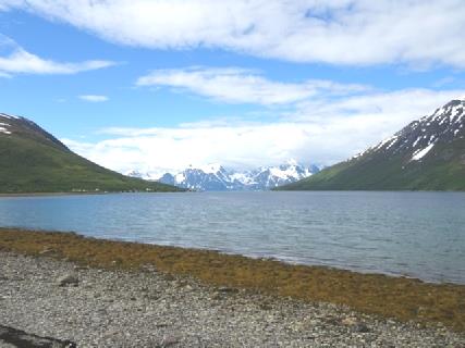
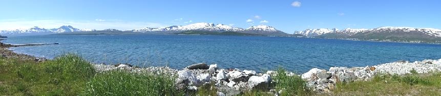
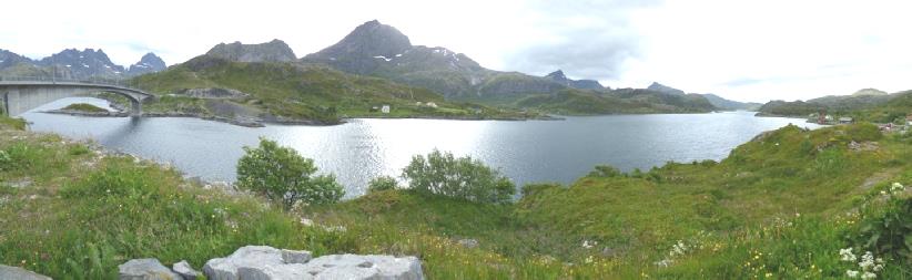
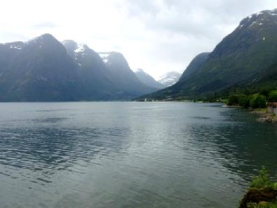
Typical fjord scenery
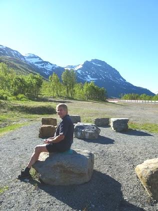
We woke to a beautiful morning, with sunshine and blue sky. We left at 9.30. We enjoyed the idyllic views as we drove beside Restarfjord, with yellow buttercups and mauve geraniums lining the road.
Thursday 29th June Typical Norway – fjords and snow topped mountains 138 miles
Another lovely overnighter
We stopped at pretty little Storslett, a stop off point for a National Park further south. We bought an expensive (£2.20) bun from the bakers to share. We located the Tourist Information, hoping that we could buy a stamp for our one outstanding postcard. The nice young chap told us where the nearest post offices were and gave us a travel guide to northern Norway, most of which was adverts, but with some maps.
We carried on a couple of miles to Sorkjosen, where the post office was located in the supermarket – luckily he'd told us! We had difficulty in finding the entrance, but got to the post office counter, where a young girl who spoke good English served us.
Beautiful scenes along Restarfjord
We passed another road tunnel being built as we drove on. We had our lunch with today's typical view of fjord, mountains, snow and a waterfall.
We left at 1.50 to drive back up the far side of Kafjorden (another one), driving through two tunnels. The scenery was similar as we drove on down Storfjorden to Nordkjosbotn.
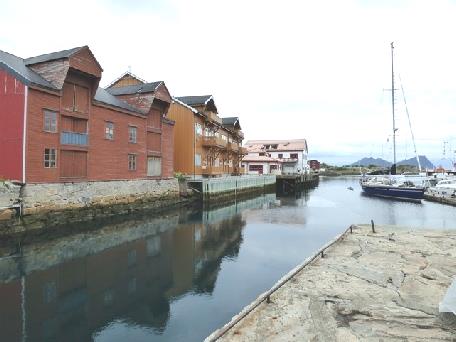
The harbour at Sorkjosen
From here we drove up towards Tromso. We travelled on the old road for a way, but found that there were houses dotted along beside the road, so no chance of free camping. We felt that we had reached civilisation after the wildness of the far north.
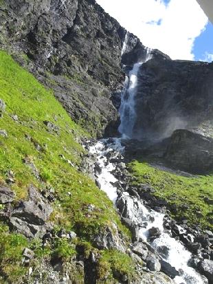
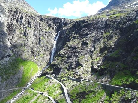
Back on the main road, at 4 o'clock we found a car park to stop in by a rushing stream. Although a bit chilly – it wasn't so sunny now - we sat at a new picnic table (with backs to the seats) for a cup of tea before walking up to the pretty gushing waterfall.
More typical views
The waterfall beside us
Friday 30th June Tromso 84 miles
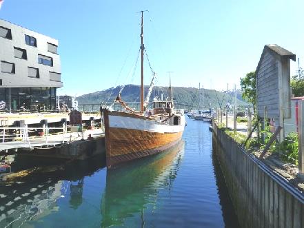
Tromso was much bigger and busier than we'd imagined, with plenty of road works and rebuilding.
We next went in search of the funicular, hoping to beat the crowds. We reached it, via a very difficult back street journey, at 10.00 when it opened. However, at £17 each plus £2 to park, we gave it the no-go! I don't like heights anyway!
There were lots of speed-humps and bumpy roads as we made our way to the centre of Tromso. Here my blue badge came up trumps again, and we were able to park right by the Stortorget, the main square.
We walked across the square, looking into the pleasant catholic church and passing the stalls with flowers and expensive Norwegian clothing. We enjoyed the many displays of flowers we walked on to the wooden Domkirche. It didn't open until noon, as we knew. The roads around were all dug up – I suppose that they can only work on them in the summer. We could see that a cruise ship was in, and were aware of what appeared to be passengers everywhere. We came back to the van, and took our coffee to drink on a seat above the square in the sunshine. A group of tiny nursery children sat happily on the grass with two helpers. Beside us sat two men who must have been brothers – even twins – they looked so alike.
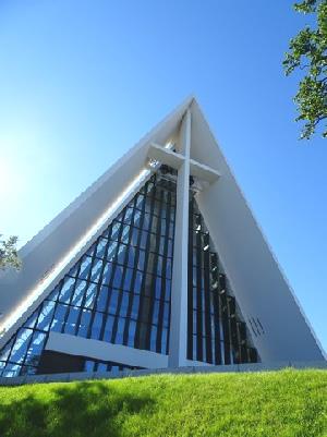
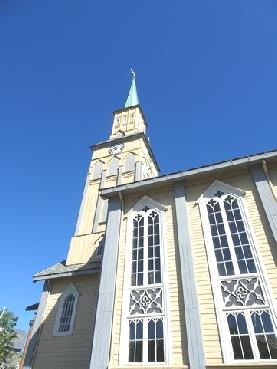
The Arctic cathedral in Tromso
We now drove up above Tromso to wonderfully peaceful Prestvannet Lake, which looked beautiful with the snowy mountains in the distance. We'd liked to have had our lunch here, but the masses of marauding gulls made us think that it wasn't a good idea – we've been attacked before!
Tromso - the wooden Domskirke and the Ixi parked by the main square
We just enjoyed the other birds then found our way to a lovely spot by the sea to have lunch. There was a wonderful panorama of snowy mountains all around. We thought about coming back here for the night, but then discovered that it was at the end of the airport runway!
Beautifully tranquil Prestvannet Lake above Tromso
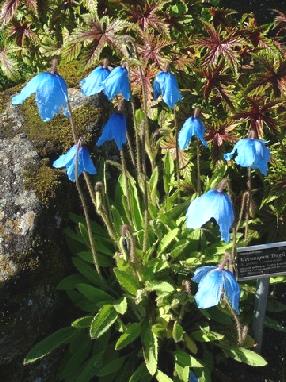
We left here at 1.45 and headed for the Botanic Gardens – apparently the most northerly in the world. These were delightful. They are free, and always open. Gardeners were just getting on with their work, while visitors milled around. There were a lot of older people, who looked as though they came from the cruise ship. There was plenty of colour – even a meconopsis! It was strange to see tulips and narcissi in flower at the end of June. The paths were rocky and uneven as we wandered around each little area in the warm sunshine.
Idyllic setting for lunch
Now we drove over the bridge to Kvaloya Island (the Tromso area is all islands). It was nice to be away from all the traffic of central Tromso. However, there was nowhere to pull off at all- just narrow bus laybys. In the end, we drove down a small road to Tisnes, and managed to find enough room to pull just off the road. We were looking back past the fields of buttercups and cow parsley to Tromso. A lovely spot to have our cup of tea and decide where to head for tonight.
As we turned around to drive back to the road, the lone house had a meconopsis flowering right by the gateway!
The lovely Botanic Gardens at Tromso
Idyllic views on Kvaloya Island
Stunning Sommaroy Island
On the way back above the sea, the terns attacked us – they were obviously nesting, so we came back by the road.
When we got back, we phoned Joanna to wish her a happy 7th birthday.
This was the time to see the midnight sun. The evening passed quickly – it didn't seem late at all. A group by us sat out celebrating the whole time, although it had got rather chilly. It felt a bit like New Years Eve, as we waited for midnight to raise a glass – quite fitting when it is exactly half way through the year.
The Midnight Sun
Saturday 1st July We leave the idyllic island of Sommaroy 129 miles
It was lovely to wake up to see the sun shining. We were a bit later than usual after our late night!
We sat on our chairs outside for breakfast, then at 9.30 drove back a bit to dump. We had sent photos of Tromso to Ruth and to Jon.
Everything looked perfect as we drove back off the island of Sommaroy with the white beaches and the turquoise sea with its little islets. We passed lots of people camping with little tents in idyllic spots - presumably come for the weekend from Tromso.
We now had the 25 miles to drive back on Kvaloya to the tunnel south. Adrian had found out from one of the leaflets that we had picked up that it is now a tunnel and not a ferry. Ferries are bad news for us, because as well as being expensive, the price doubles or trebles for vehicles over 6m, and we are on the limit!
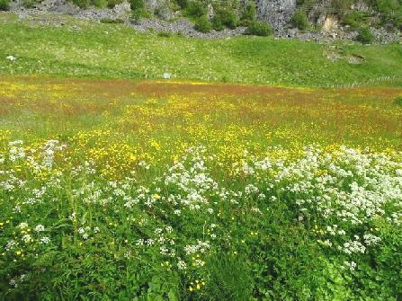
We stopped many times to view and photograph – I kept my camera in my hand! The verges and edges were a mass of colour – yellow buttercups and ladies slipper, frothy white cow parsley, brown sorrel and when we stopped for coffee, red clover too. We'd passed empty wooden fish racks.
Idyllic Sommaroy Island
As the day went on, it clouded over, but stayed very warm. After the tunnel, we drove down the eastern side of the Tennes peninsula. Unfortunately, on passing another vehicle, my wing mirror hit it and got badly cracked. It appears safe, but will be an expensive exercise on our return!
At Mestervik we shopped in a small co-op supermarket, where of course prices seemed high.
When we ate lunch at a rugged picnic table overlooking Malagen fjord it felt really warm. A large rubbish skip occupied the the only flat place on this sloping site!
Back across delightful Kvaloya Island
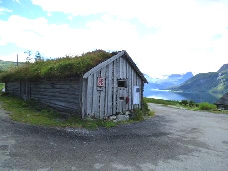
We left here at 1.30, driving south and eventually reaching the E6 at Olsburg. The smaller roads had been very bumpy, which hadn't suited my back. Now the scenery was pleasant, but not as dramatic as we had been driving through. We had had a lovely stop to look at an old saw mill on a fast flowing stream which entered the fjord. It had been built in 1799 and restored in the 1970s. The loos here must be the most evocative ever, with their turf roof!
We had lunch overlooking Malagen Fjord
We were surprised to pass a massive motorhome and caravan dealer with dozens of vehicles on display.
We stopped to get diesel as we continued to Fossbacken, where we were heading for Lapphaugen campsite. The site is terraced (reminding us of Motrico in Spain 1982), with snowy mountains all around.
We desperately needed to do some washing - we had been handwashing a few items to keep us going. The good news at this campsite is that the washing machines were included in the price. This had its problems though, as there were only two, and both were occupied. We moved from our initial spot to one a bit nearer the facilities (and with electricity - at a price!) Even so, our evening was spent in popping up and down there!
We had a skype conversation with Paul & Nicky and all, Joanna looking forward to her party tomorrow.
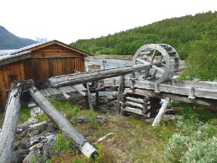
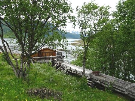
Aursfjord sawmill site
Sunday 2nd July To the Lofoten Islands 123 miles
The day became very grey. Although the scenery was pleasant, it was more 'domesticated' than we'd been seeing, and didn't hold the same attraction.
We ate lunch overlooking Astafjord, at a parking area for walks, but with a no parking sign!
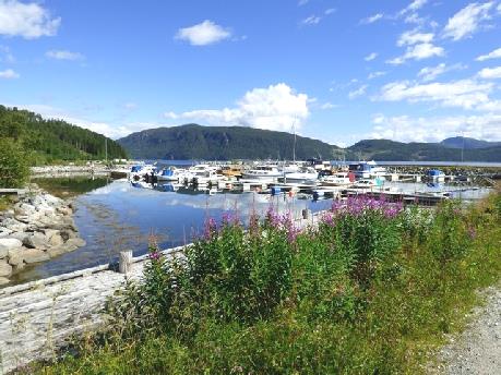
Nice coffee stop at Grovfjord
We crossed the impressive Tjelsund Bridge – the first of many – to reach the Lofoten Islands.
Lunch stop at Astafjord
We noticed blue, pink and white lupins flowering beside the road - it was a while since we'd seen them.
It began to rain as we approached the first of many tunnels. Like the Lake District, this area is very green, which means rain! We were now enjoying the wild, steep, tree covered mountains.
At 3.40 we stopped at Fiskebol, by the Hattnes Tunnel. The rugged green peaks with wisps of cloud in front reminded us of Ou Pou in the Marquesas.
Adrian had noticed the course of the old road around the tunnel, so we set off for a walk as far as the track went.
Another impressive bridge - the Tjelsund
Our overnighter at Fiskebol
Monday 3rd July Lovely Lofoten Islands 107 miles
It was cloudy as we sat discussing our onward route. The main problem was ferries and the expense, especially if we were charged at the higher rate as the Ixi is just over 6m long. The one back to Bodo might cost us £250, so we plan to drive back up the Lofoten islands and take a shorter ferry.
Just as we were leaving, the German couple next to us, from Potsdam, started asking Adrian about the mapping programme on our tablet. The husband didn't speak English, so his wife assisted. After much chat, Adrian discovered that they had an Ipad, so our mapping programme wouldn't work for them. By now it was 9.30.
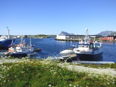
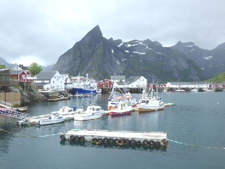
We drove on past the wild, steep, green, snow flecked peaks, constantly beside the water, to Svolvaer, which had a massive harbour with lots of pleasure craft moored. It felt cold, and was not particularly attractive. We walked across the main square to the Tourist Information to enquire about ferries. We found out that when booking, you had to pay a fee, plus a 'guarantee' payment, making it all extra expensive! Adrian purchased a map of the Lofoten Islands for £2.50, like the ones that are usually given away free! It was covered in adverts, but at least it was better than any we had.
We parked nearby and Adrian shopped for some tonic then we looked at our route while we had coffee. We phoned Emma and left her a happy birthday message.
A few miles further on was Kabelvag. The wooden Vagan Kirke looked lovely across the water. We drove down to the cobbled square beside the quay, where they were clearing up from a 'happening' at the weekend. There were attractive wooden houses, but somehow it didn't all come together.
We drove over the Gimsoy-Straumen bridge to the island of Gimsoy. We ate our lunch here, looking across to the steep, rugged scenery. It was all headlands and little islands. We drove over another bridge to Vestvagoy Island. For a short way we crossed flat land, with the wild, steep barren peaks above. We looked back to the high, vertical rocky peaks of Austvagoy Island. The ground was scattered with huge boulders as we drove along the southern shore to Stamsund.
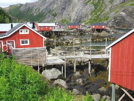
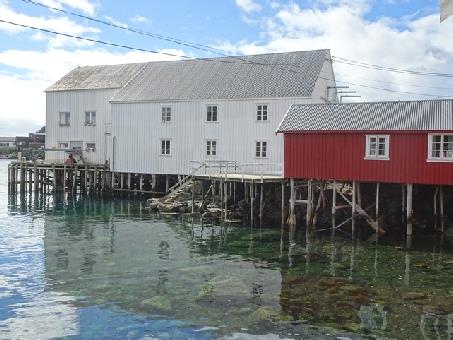
This little fishing village had deep yellow ochre coloured houses around the little harbour, some of it housing the youth hostel.
Vagan Kirke, the ‘Lofoten Cathedral’
Kabelvag
We continued around the island on a pleasant, smaller road to Leknes. From here there was a 2km tunnel to the next island, Flakstadoy. We turned onto a road south to Nusfjord through dramatic cirque like vertical rocks.
We'd read that this former fishing village was very attractive, and that you have to pay £5 to see it, a bit like Clovelly. We parked, and walked past many of the houses, all painted a deep sienna colour and centred around the massive vertical rocks around the inlet. Many are rorbuer, old fishermens huts, now used as accommodation. We hadn't intended paying to visit, so when we reached the entrance, we turned back! It was certainly picture book stuff!
Stamsund
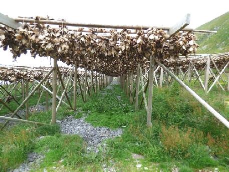
Driving on, we passed exquisite white beaches with tall vertical rocks behind and turquoise sea in front. Ramberg had loads of fish drying racks, some still with their supply of fish heads hanging on them.
Dramatic scenery on the way to Nusfjord
Picture book Nusfjord
Just as we reached the bridge to Moskenosoy, the last island you can visit by road, we found a superb place to stop for the night.
Fish heads drying on racks
We phoned Emma, and were able to wish her a happy birthday. We also spoke to Ruby, and to Felix, wishing him a happy 17th birthday for tomorrow.
After supper we phoned Simon and spoke to him & Millie and we phoned Tom, away canoeing with a friend.
We looked through our photos of Newfoundland & Nova Scotia 2016, seeing many comparisons with here.
The bridge to Moskenosoy Island - another great overnighter
Tuesday 4th July To the village of Å and back 60 miles
Our view looked even lovelier this morning, with some sunshine. We were puzzled then amused to see four people arrive by car, look around and then erect two tents!
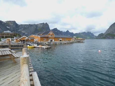
We left at 9.30, driving straight over the bridge to Moskenosoy Island, passing through several tunnels and snow galleries before arriving at Hamnoy, an atmospheric little village situated on causeways between islands, with enormous sheer cliffs towering above. There were masses of fish drying racks, some with fish heads on them (Adrian read that they are used for human consumption in Nigeria.) There were lots of the rorbuer - the former fisherman's huts which you can rent - here.
Over another bridge, on the tiny island of Sakrisoy, was another little habitation, where the rorbuer were yellow ochre, not burnt sienna coloured. We went into an attractive fish shop, where we bought some cod and some prawns (the cod tasted superb for supper). Cod has been the main product from these islands for centuries, as it is in the waters around them that they live. We could smell the fish from the drying racks, and wondered if you got used to it if you were staying here.
The atmospheric fishing village of Hamnoy
On tiny Sakrisoy Island
The cod liver oil factory in the fishing village of Å
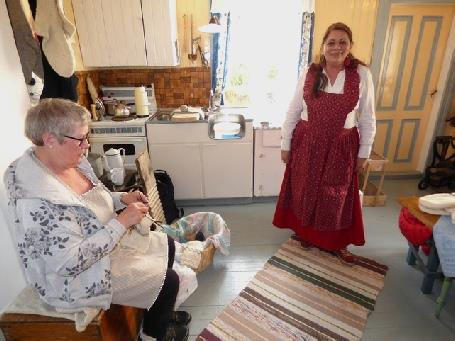
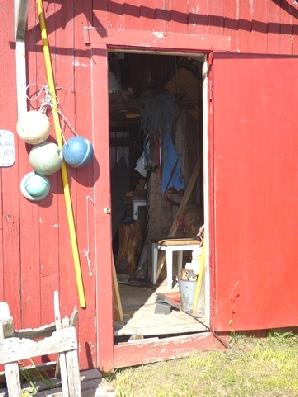
Knitting fishermen’s mittens
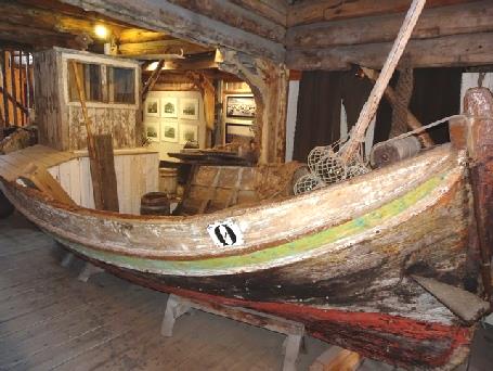
In the boat house
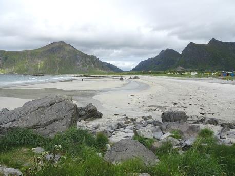
Superb Skagsanden beach and nearby Flagstad church
Hanklastrand, another wonderful overnighter
Wednesday 5th July Farewell to the Lofoten Islands 190 miles
We envied the campers even less when the wind blew and it rained! However, we woke to sunshine on a day of 'April showers' – we even had a rainbow.
We left at 8.30 to drive through the one km single lane tunnel to emerge into rain at Utakleiv, where the road ends. Tracks led down to beaches, and there were a scattering of houses – that was it!
We returned through the tunnel and drove along the northern shore of Vestagoy Island. It all looked rather British – very green, with cows in the fields.
Remote Utakleiv
We passed many inlets and lakes as we drove back to the bridge to Gimsoy Island, where a boat was still laying a cable.
We followed along the southern shore of Gimsoy, then over the bridge back to Austvagoy island.
Here we drove the few dramatic miles south to Henningsvaer, with colossal vertical cliffs beside us on one side and the turquoise sea on the other. To get to Henningsvaer, we had to drive over two single lane bridges joining the various islands.
It's a popular place with tourists, although at this hour there were only two coaches. Henningsvaer is a quaint fishing village, divided in two by an inlet. It made us think of Cornish fishing villages with its difficult access. Although sunny, there was a really chill wind as we walked around. It all seemed a bit too perfect and twee to us.
Northern Vestagoy Island
We drove the dramatic few miles back to the E10 just as a heavy shower came – we had been very lucky!
We were now travelling the route we followed on the way down, and enjoying the genuine little villages we were passing. The village of Slidpollneset, jutting into Austnesfjorden with a little church at the end of the peninsula looked particularly appealing.
We passed our first night's overnighter before driving back through the long tunnel – one of many today. We were really enjoying the scenery, even though it wasn't as spectacular as further south. It was greener, with less sheer slopes and more waterfalls.
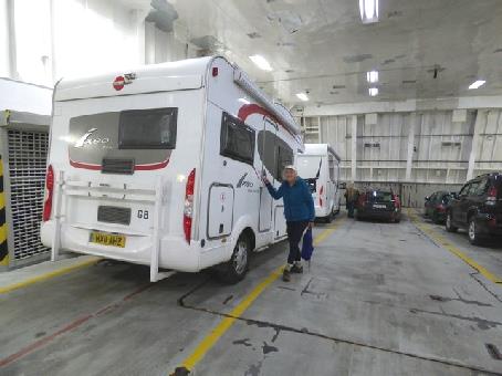
When we stopped for lunch overlooking Inverfjorden, Adrian took the spare wheel off the back in readiness for our ferry journey back to the mainland.
At 1.30, we set off to drive the few miles to Lodingen, arriving at 1.50, just in time to see a ferry leaving so Adrian drove back a short way to fill up with diesel, as the price was good, by which time several more cars had arrived for the ferry.
Two young boys were hanging around to see if anyone wanted their windows washed. Luckily they got a customer.
There were no signs telling you of the procedure for getting tickets (this ferry runs several times a day, and doesn't have to be booked), but soon a young chap appeared at the window. Adrian asked for two 'concessions' and a 6m motorhome. The chap said 'oh, you've done this before'. Adrian replied that no, he'd just looked it up. Anyway, there was no quibbling, and there we were, driving onto the ferry to Bognes.
Henningsvaer
t was a very easy and pleasant crossing, with no hassle or fuss. We sat at the front of the boat for the one hour crossing, occasionally looking out from the rear deck. We had constant views of the islands and headlands. The only problem was my water bottle, which had somehow leaked out all over the things in my bag and drenching them!
Lodingen - leaving the Lofoten Islands
At 3.30, we alighted at Bognes to drive south on the E6. We passed no pull-offs, so it was some time before we could stop. While I made a cup of tea, Adrian fixed the spare wheel back on. The vegetation was now of mixed forest as we drove past fjords, lakes, rivers and gushing waterfalls, with snowy peaks behind, and also driving through a succession of tunnels.
It was 5.40 when we pulled into a parking area high above a dark lake with forested slopes all around just after Kjelvik. Adrian had been heading for an overnighter a bit further on, but we had just passed a place I wanted to visit and anyway, I was clapped out!
And then I looked out and saw a little redpoll right by the van, feeding on dandelion seed heads.
Arriving at Bognes
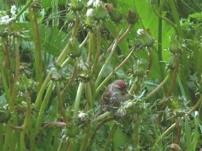
Redpoll feeding on dandelion seedheads outside the Ixi
Thursday 6th July Bodo and a maelstrom 105 miles
The morning was cloudy. As well as seeing the little redpoll again, we saw two small yellowish birds which didn't match anything in our bird book!
We had a lovely start by driving back a short way to Kjelvik homestead. We knew that it wouldn't be open for tours, but we were able to walk down very steeply to cross a tiny stream, and then back up the other side to the few simple turf roofed buildings. There had been people living here from 1739 until 1967. Until 1986 the only access had been by water. The fjord was a steep 2km walk away to collect any supplies, so it was a very isolated existence. It all looked very beautiful in the early morning peacefulness.
We left at 9.30, heading for Bodo. I had wanted to visit just because I'd had a penfriend in the fifties who'd lived there.
We drove along above a tranquil fjord for much of the way, which had wonderful reflections, but also we drove through many tunnels.
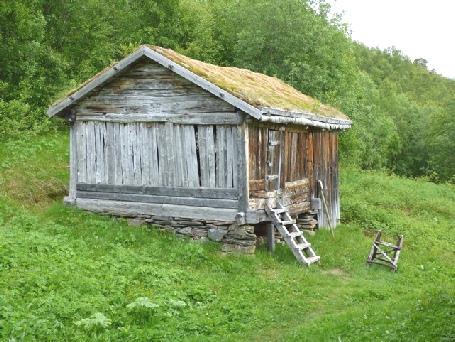
Evocative Kjelvik former homestead
We had to drive through the town of Fauske. Both here and at Bodo purple lilac trees were abundant.
Fauske is the northern limit of Norway's rail system, as we found when we stopped for coffee by the fjord – the railway was in front of us!
Just before Bodo we drove through a 2km well lit wide tunnel, for which there was a toll. Then along the road we kept passing automatic toll charges, like paying a congestion tax, which didn't please us!
Bodo has a nice setting but isn't an attractive town now, especially with so much of it dug up. Having paid the tolls, we felt that we had to drive down to the front, where I admired the colourful beds of pansies.
We made our way to onion-domed Bodin church, the one site I had down to visit (and passed another toll camera on the way!) We didn't get inside the church though, as when we arrived, a funeral party was just going in!
Wonderful reflections on the way to Fauste
We ate our lunch nearby then left Bodo, stopping to go into a supermarket.
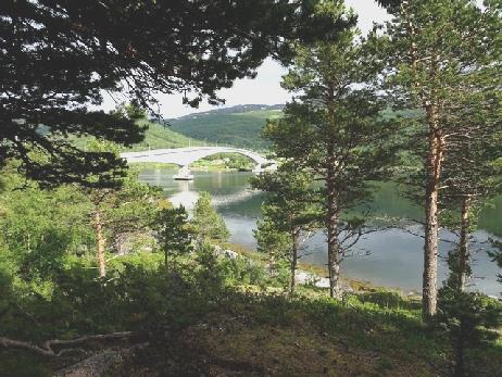
A few miles south of Bodo at Saltstraumen was a site we wanted to see – a 'maelstrom' on the river, apparently the world's strongest. We parked right underneath the huge bridge that spans the river. We were amazed at the crowds of people also visiting. We didn't rush down, as we'd read that it was a while until the 'peak', which depends on the tide.
It was a little trek down to the river where certainly the rushing, swirling water was impressive. It's a good place for fishing so several fisherman were standing on the edge with their lines out.
Bodin Church, Bodo
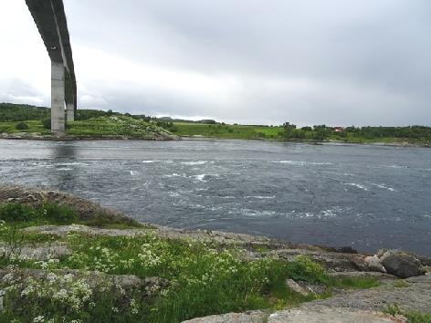
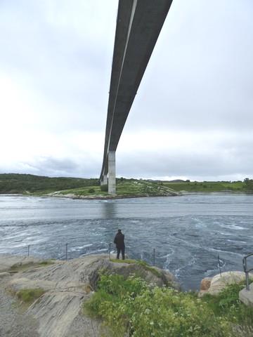
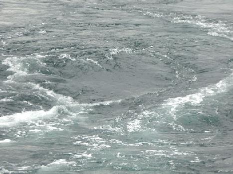
The maelstrom at Saltstraumen
Friday 7th July Back across the Arctic Circle 196 miles
Another great overnighter, with views of a lovely bridge over the water with tree covered slopes above. We left just after 9.00.
Everywhere looked beautiful in the sunshine and very green, suggesting that there must be lots of rain! There were beautiful reflections in the water, and then some rapids on the river. We were surprised to come across several groups of sheep sitting on the road, as if it was their normal procedure!
Yet another lovely overnighter!
A bit further on we passed a large herd of goats too. We were on a snowy plateau at 500m with a lot of ponds.
It was 10.00 when we reached the E6, we'd enjoyed the quiet roads. Now the railway and the road followed the river valley. We were at 682m when we stopped for coffee and to phone Tom and Rita, who had been making the lego we'd given her for her birthday. We then climbed even higher to 690m where it was very bleak and barren.
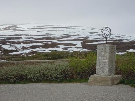
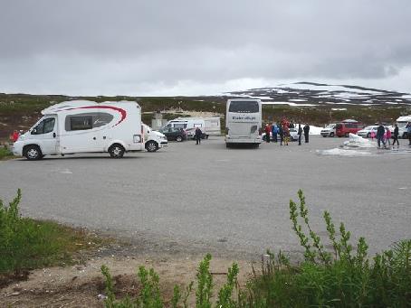
At 11.30 we crossed back over the Arctic Circle. There were a lot of vehicles in the car park, but not the razzmatazz of Finland – just one building housing a cafe and shop. Adrian 'bought the T-shirt', so now he was happy! There was a lot of snow around, including a great pile in the carpark.
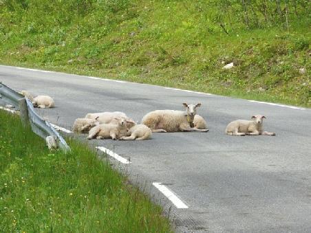
Watch out for sheep!
We felt quite sorry to be leaving the Arctic after two weeks, we'd really enjoyed the experience of being there, but do look forward to some warmer weather!
We now descended below the snowline, although there was still plenty on the mountains. We stopped for lunch by the river, where the railway crossed it. There was a memorial beside us to the Russian prisoners of war who'd built it for the Germans.
We cross back over the Arctic Circle
We now came to an extremely long section of roadworks (more than 20 miles), where they are straightening and improving the road. This included a lengthy wait for a pilot car and another for traffic lights. We were driving through splendid steeply forested country with snow on the peaks, making us think of Canada.
As we were skirting Mo-i-rana, Adrian noticed a dump station, so we back-tracked a little to use it.
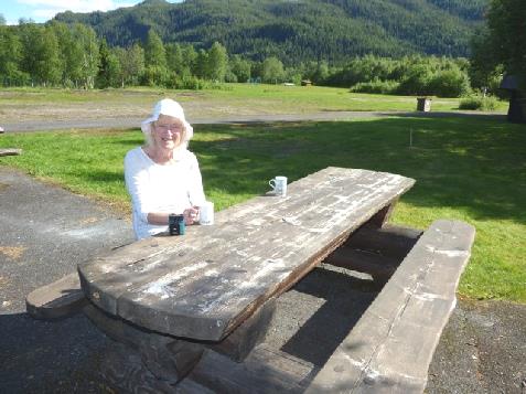
As we continued, there were lovely reflections in Nordranga Fjord. We stopped for a cup of tea, as I was feeling a bit droopy after all the twists and bends. It was wonderful to sit in the warm sunshine!
The railway built by Russian prisoners of war
We discovered that the overnighter Adrian was heading for was by the waterfall that I'd wanted to visit!
We stopped in Mosjoen for fuel, then headed for the overnighter.
We were able to park right opposite the tumultuous Laksforsen Falls, which looked rather like Rheinfall, and were fantastic with the sun shining on them.
Enjoying the warm sunshine
Fantastic Laksforsen Falls viewed from our motorhome
Saturday 8th July Towards Trondheim 191 miles
How often have we said 'we can't get a better view than this' at our overnighter? Well we certainly said it here, especially with the sun shining on the falls this morning!
Just before we left at 8.45, a coach arrived and disgorged its occupants. We felt very lucky to be on our own!
Back on the E6, we 'wiggled' down beside the Namsen River. It all looked very pretty with the mown green fields, the forests and the snow-flecked mountains. We came across more sheep on the road.
We stopped in the sunshine to enjoy the wonderful reflections of the snowy mountains in Svennningvatn Lake.
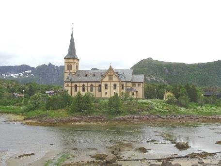
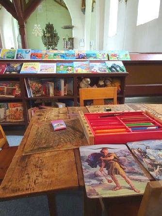
We reached Snasa, at the northern end of Lake Snasa. We stopped by the church of this scattered village, having read that it looked very English. It did, being built of grey stone. The roof was of slate. We walked across the large, well tended graveyard where many of the graves had flowers planted on them. On the church door was a wooden sign saying 'open'. Inside we could see that it was much loved. The children's corner had books, soft toys and coloured pencils attractively and trustingly displayed. It started to rain as we walked back to the van – and rained for the rest of the day, so once again we were lucky to have visited when we did.
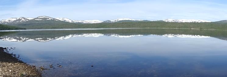
Snowy reflections in Svennningvatn Lake
We took a smaller road down the eastern side of Snasafjord to Steinkjer at the southern end. It was pretty but we were rarely by the water. We shopped in Spar in Steinkjer, then continued south, turning off to Stiklestad. This is a place of great importance to Norwegians, as it is where Olaf was supposedly killed in the year 1030. We viewed the church where this is supposed to have happened. Olaf founded the Norwegian church, and was later made a saint.
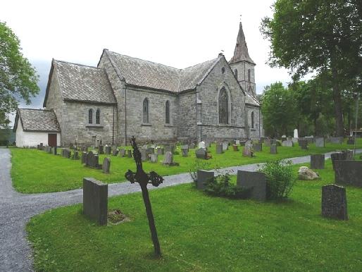
Snasa’s much loved church
The weather was now not pleasant, so soon afterwards, near Verdalsora, we turned off down a 3km rough track to a spot on Tronheimfjord for the night as it continued to rain.
Stiklestad Church, the site where St Olaf was killed
Sunday 9th July Trondheim and south 140 miles
The morning was grey but at least it wasn't raining!
We left just after 9.00, driving back to the E6 along the pretty tree-lined track with wheat and rapeseed growing in the fields.
It was a pleasant overnighter, now that we could see it!
The lovely drive back to the road
We walked through the large leafy cemetery to the river and Bakka bru, the attractive old bridge. We walked across it to Bakklandet, the old part, now pleasantly restored into cafes. Beautiful old warehouses lined the river. Trondheim had a very happy and relaxed feel with families enjoying Sunday lunchtime – children playing in the park and babies in buggies.
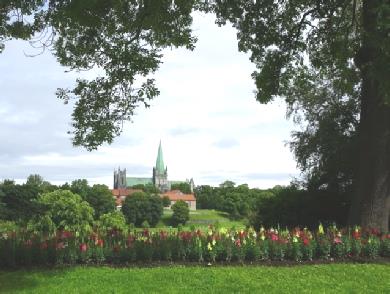
Trondheim’s ethereal Domkirke
Trondheim's streets are wide, the town having been rebuilt after a fire had destroyed most of it in 1681, so felt really spacious.
Back at the Ixi, we drove out, passing Torvet, the main square, with its Nelson's column-like statue of Olaf Tryggvason, who had founded Trondheim in the year 977.
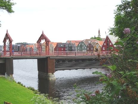
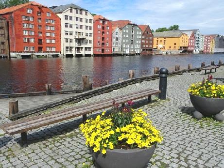
Bakka Bru and the old warehouses, Trondheim
Our next part – finding somewhere for lunch – wasn't so easy! We drove through another tunnel – this one with a roundabout in it! We have come across a tunnel with a road junction in Iceland, but not one with a roundabout! We eventually had lunch with a view to the sea, parked on a rough bit of ground. Then it was back through the tunnel and out of Trondheim, continuing south on the E6. The countryside was very scenic, but the road very busy!
We stopped for the night at 4.40 at a meadow near Oppdal.
Later we sat outside with our aperitifs in the sunshine, then Adrian cooked the fish outside.
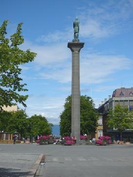
Statue of Olaf Tryggvason, Trondheim
Aperitifs in the sunshine!
Monday 10th July Tremendous Trollestigen – the Troll's Ladder 173 miles
A few miles on, at Eidsvag, we turned off onto the small 660 road beside Langfjorden. The deep aquamarine water beneath the high, near vertical slopes looked beautiful. At Eresfjord the road climbed to 500m then descended to sea level. We had lunch beside Langfjorden before taking the road 64 south at Afarnes. There were lovely views of fjords and of snowy mountains all around
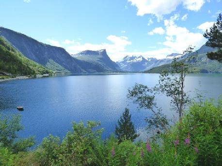
Tingvollfjorden
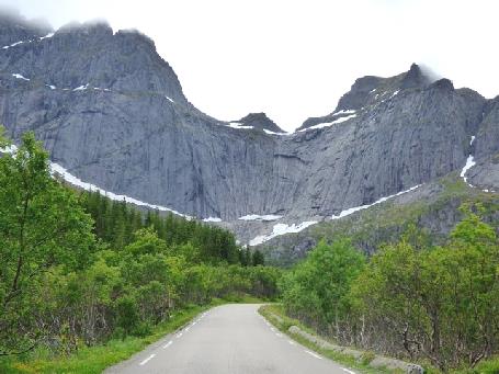
At Andalsnes we took the famed 63 road and soon came to Trollstigen. A lot of people had parked to look up at the sheer rockface with two waterfalls plunging down from a great height. This was the Trollstigen. It was certainly a 'wow' place! A bit like seeing the Grand Canyon, or Victoria Falls, it was quite overwhelming.
The road had 11 hairpin bends enabling vehicles to climb the vertical face. What made it difficult was the amount of traffic – it was a place for the tour buses, and negotiating them on the narrow road was no mean feat!
Langfjorden
We kept the camera out as we ascended! At the top was a packed out parking area beside a modern Visitors Centre, housing a cafe. The amount of people was horrendous. We joined them to walk along a walkway to a view. The walkway went on much further, but we'd seen enough, and returned to the Ixi for a cup of tea before driving on.
The descent was much more gentle.
Staggering Trollstigen
We came down to Valltal. Strawberries were being grown on the flat bits of land, and there were stalls selling them, just like on the A303! We bought a punnet (£4) from a young girl – they were very good!
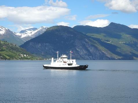
Adrian removed our spare wheel in preparation for our short ferry crossing from Linge to Eidsdal. We didn't know if we'd get across tonight, with so many vehicles on the road, but all was fine. The young chap, in English, booked us on and gave us our ticket - £9.50, which we were very pleased about!
We drove straight on and climbed the stairs to the top deck. We had marvellous views all around as we sailed to Eidsal. There had been no fuss or formalities.
On the descent from Trollstigen
We drove off at 4.50, through the pretty little village of Eidsdal, and ascended on hairpin bends, looking for a stopping place for tonight. Our luck was in after a few miles when we'd driven through a tunnel and found the bit of old road after it. We looked across to two more waterfalls plummeting from a great height into a small river.
The ferry from Linge to Eidsdal.
Yet another nice overnighter
Tuesday 11th July The glories around Geiranger Fjord 43 miles
We were despondent to wake to a grey morning, as today we planned a trip on Geiranger Fjord.
By the time we left at 9.50, the sky was clearing.
It was only 10 miles to Geiranger Fjord, most of it hairpins with views of the amazing fjord far below! There was a viewpoint, but no chance of pulling in, it was jam-packed.
We descended to the 'town', and were dismayed to find it packed out with dozens of tour buses and masses of people. There were two cruise ships anchored in the bay – one a reasonable sized Saga boat, the other one massive.
We managed to find a place to park, and made our way to the tourist office to get tickets for our trip. People swarmed everywhere, so we imagined that there would be little chance of getting tickets. We joined a queue of people, waiting we thought for the next boat trip in 10 minutes. We hadn't come prepared, so Adrian dashed back to the van to collect my little rucsac, which I'd hurriedly put a few things in, just in case. He asked a young assistant if we needed to have bought tickets. 'Of course' she replied.
Somehow, amidst all the crowds, he went up to the desk, and came back jubilantly with two tickets! The same assistant ushered us though the crowds, and we boarded the boat, just as it was leaving!
The weather had become sunny, and although it was a bit chilly on the boat, we couldn't believe our luck! It was a one hour trip, halfway along the fjord and back. Although a small ford, it is said to be one of the most scenic, being narrow and extremely high and steep. We were given headphones, with a commentary in English, which also explained a lot about living in Geiranger. There were numerous waterfalls, falling from a tremendous height, including of course the 'Bridal veil', and a group called 'the seven sisters'.
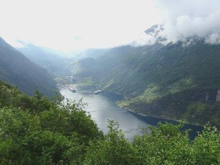
Looking down to Geiranger Fjord
As we arrived back at 11.30, we watched hang gliders high above.
I was ready for my coffee, but the car park was full, and we were parked on a steep slope. We drove up many hairpins and managed to park near the Norwegian Fjords Centre for a late coffee.
Afterwards we walked across to the centre, which we found cost £10, so didn't go in. We followed a walkway to view the waterfalls, but it was all much too busy for us.
The next viewpoint was packed with tour buses. We realise that the cruise ships unload their 'tourists' onto the tour buses which just go up and down the mountains either side, causing chaos on the narrow roads and hairpin bends, monopolising the views and then returning the same way! After this point there were far less buses. We continued up more hairpin bends and found a place to stop overlooking the valley and ate our lunch sitting at a picnic table. It felt a bit chilly now.
We left at 2.00, passing a motorhome which had broken down on a bend, with the occupants madly directing traffic around it.
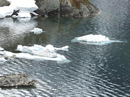
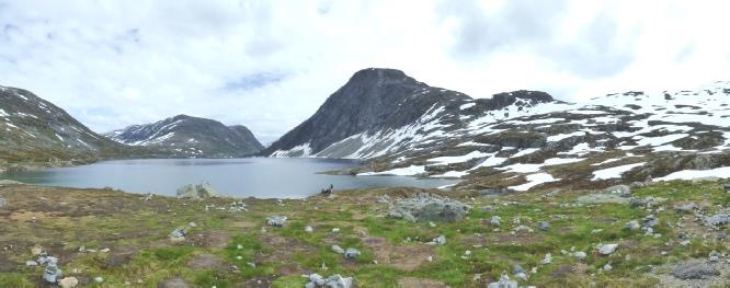
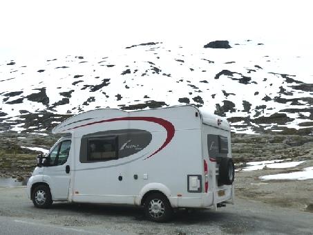
We stopped by the road up to Dallsnib (1500m), but found that the toll was £13, so didn't go. We were at 1056m, and there were small icebergs on the lake.
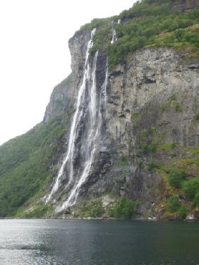
A trip on Geiranger Fjord
We drove on through this fantastic scenery, but passing through four quite long tunnels. We stopped by Ovstebro Falls, where a massive amount of water was gushing down. There were waterfalls everywhere, cascading from a great height into the deep valley below.
Wintry images near Dallsnib
We pulled in beside scenic Oppstrynsvatnet Lake for a cup of tea. The day had closed in, and it began to rain. We decided to stop here for the night. Little wagtails bobbed about outside.
Ovstebro Falls
Oppstrynsvatnet Lake
We finished the website ready to send.

It was cloudy when we left at 9.20. We first had to drive back into Alta for three things – money, LPG and shopping. That took the rest of the morning! The snow on the tops of the mountains looked lovely.
We first found a bank to get some Norwegian krone. Parking was difficult, but we found a spot and Adrian walked over to the bank. He couldn't make the machine work, and on enquiring was told 'No, we haven't any money'! He was shown another bank to try!
Now we made for a supermarket, stopping by a Co-op Extra. Imagine our surprise to see a Boots store next door! We went in there – '3for2' just like in England. We enquired about lens solution, but didn't buy any. The eye drops cost £13!
We found the supermarket prices high, with home produced goods being not too bad, but other goods at least twice UK prices. This was our first shop in Norway. The store was large, with very few customers. The male cashier understood and spoke English.
We had our cup of tea/coffee afterwards before going in search of the LPG. Another motorhome had arrived just before us, (a Dutch couple from last night) which was good, as Adrian could watch and then follow the difficult procedure for when it was his turn. He also got some good priced diesel, and then it was time to leave Alta. The town had been flattened in the war, losing all its mainly wooden houses. Although not particularly attractive now, it was a very green area, with flowers decorating the roundabouts.
It was midday when we drove past last night's spot! And Adrian had said that we only had 90 miles to go today and would arrive early!
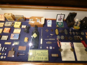
We were driving westwards along the coast. Just a few miles further on, we came to the little place of Kafjord. We knew that the German warship Tirpitz had been kept in the narrow fjord here, so intended stopping. What we didn't know was that there was a Tirpitz museum. We followed handwritten signs to it, down a side lane, and eventually came to a wooden hut. Inside sat an elderly gent who spoke no English at all! The entry fee was £10 - we tried asking if there was a discount for 'oldies', but no luck. We paid up, and the man pointed to large models of the Tirpitz and the Bismarck. His face lit up as he said 'film', and led us down the corridor to a room where he put on a film about the Tirpitz. It was in English, written and read by Ludovic Kennedy and dated from 1973. It was an excellent film, so now we looked around the masses of artefacts where many things were written in English. It had been so important to the British to stop the Tirpitz from going to sea that 15 major attempts were carried out to disable it, culminating in the dropping of 60 ‘tallboy’ bombs in late 1944 at Tromso, where it was finally sunk.
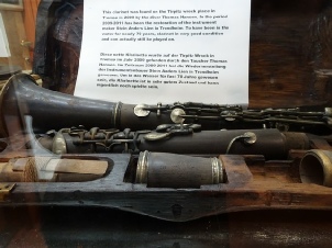
There were items found from the sunken ship in recent years – it felt a bit like seeing items from the Mary Rose. There was some men's clothing but what got to me was a clarinet (in its box), which apparently can still be played.
We walked back to the van, crossing the little fast flowing stream again. It had all been a bit too moving for me, as I dislike anything which brings home the horrors of war.
We first found a bank to get some Norwegian krone. Parking was difficult, but we found a spot and Adrian walked over to the bank. He couldn't make the machine work, and on enquiring was told 'No, we haven't any money'! He was shown another bank to try!
Now we made for a supermarket, stopping by a Co-op Extra. Imagine our surprise to see a Boots store next door! We went in there – '3for2' just like in England. We enquired about lens solution, but didn't buy any. The eye drops cost £13!
We found the supermarket prices high, with home produced goods being not too bad, but other goods at least twice UK prices. This was our first shop in Norway. The store was large, with very few customers. The male cashier understood and spoke English.
We had our cup of tea/coffee afterwards before going in search of the LPG. Another motorhome had arrived just before us, (a Dutch couple from last night) which was good, as Adrian could watch and then follow the difficult procedure for when it was his turn. He also got some good priced diesel, and then it was time to leave Alta. The town had been flattened in the war, losing all its mainly wooden houses. Although not particularly attractive now, it was a very green area, with flowers decorating the roundabouts.
It was midday when we drove past last night's spot! And Adrian had said that we only had 90 miles to go today and would arrive early!
We were driving westwards along the coast. Just a few miles further on, we came to the little place of Kafjord. We knew that the German warship Tirpitz had been kept in the narrow fjord here, so intended stopping. What we didn't know was that there was a Tirpitz museum. We followed handwritten signs to it, down a side lane, and eventually came to a wooden hut. Inside sat an elderly gent who spoke no English at all! The entry fee was £10 - we tried asking if there was a discount for 'oldies', but no luck. We paid up, and the man pointed to large models of the Tirpitz and the Bismarck. His face lit up as he said 'film', and led us down the corridor to a room where he put on a film about the Tirpitz. It was in English, written and read by Ludovic Kennedy and dated from 1973. It was an excellent film, so now we looked around the masses of artefacts where many things were written in English. It had been so important to the British to stop the Tirpitz from going to sea that 15 major attempts were carried out to disable it, culminating in the dropping of 60 ‘tallboy’ bombs in late 1944 at Tromso, where it was finally sunk.
There were items found from the sunken ship in recent years – it felt a bit like seeing items from the Mary Rose. There was some men's clothing but what got to me was a clarinet (in its box), which apparently can still be played.
We walked back to the van, crossing the little fast flowing stream again. It had all been a bit too moving for me, as I dislike anything which brings home the horrors of war.
It was lovely sitting on rocks by the van to eat breakfast in the sunshine, with the snowy mountains standing out against the clear blue sky.
We left at 8.45 for Tromso, passing a herd of deer just after we set off. It was a very pretty ride in, up beside the fjord.
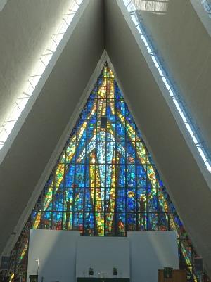
When we reached Tromso, the first thing we headed for was the Arctic Church. This had been built in 1965, and looked familiar to us, as Ruth had sent us a picture that she'd drawn of it when she was living here. We thought the 50krone each entry fee very pricey, especially as the only thing to see was a (superb) stain glass window, other than that it is very plain. We paid up, but escaped quickly when 3 coachloads of tourists arrived!
We left at 8.45 for Tromso, passing a herd of deer just after we set off. It was a very pretty ride in, up beside the fjord.
When we reached Tromso, the first thing we headed for was the Arctic Church. This had been built in 1965, and looked familiar to us, as Ruth had sent us a picture that she'd drawn of it when she was living here. We thought the 50krone each entry fee very pricey, especially as the only thing to see was a (superb) stain glass window, other than that it is very plain. We paid up, but escaped quickly when 3 coachloads of tourists arrived!
We now drove an idyllic 25 miles beside the water with mountains and wildflowers all around, but with nowhere to pull off at all. We were heading for Sommaroy Island, across a high, single lane bridge, where there was an overnighter. We passed many beautiful white beaches.
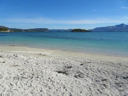
We located our place to stop, along with several other motorhomes, and immediately set off to walk around to the harbour and onto a lovely white sandy beach, made up of shells.
We located our place to stop, along with several other motorhomes, and immediately set off to walk around to the harbour and onto a lovely white sandy beach, made up of shells.
We realised last night that we had forgotten to wash our spare towels, hence the first job this morning was for Adrian to take them over to the laundry when he went for a shower, while I got mushrooms on toast for breakfast. He was annoyed to find that someone was using both tumble driers when he next went over. All was well when I went for my shower, and I was able to put the things in the drier. There were just two showers, each in a very large room with shower, toilet and sink - rather a waste of space. This site was good value when we add in all the washing we did!
We phoned Simon's number and spoke to Millie, but got cut off, and couldn't get back to her – annoying. Adrian was finding everything difficult. We filled with water, but that was very slow, so it was gone 10.00 when we left. The site had served us well though.
We followed a pretty route to the Lofoten Islands, turning off the E6 at Gratangen to follow along by the fjord on a badly surfaced road. It was really peaceful, sunny and warm when we stopped for coffee, sitting at a wooden picnic table by the water. We could clearly see the snow line on the tree covered mountains.
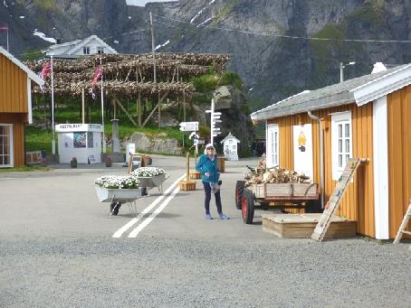
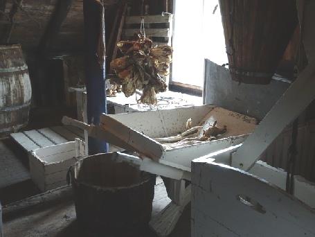
We drove on to Å, at the end of the road. Short names of places have always amused us - nearby is Bo! but Å takes the prize for the shortest name! It began to rain a bit as we arrived, but luckily stayed mostly dry as we walked down to the village and around it. It contains many of the rorbuer, the fishermen's huts. A museum comprises of several of these buildings. It was difficult to locate where you bought tickets, but having done that, we had a nice wander around (oldies rate £6). The boat house was atmospherically set up and in the fishermen's house, two ladies were knitting fisherman's gloves. These were made with thick wool which was 'roughened' afterwards to make them warmer. Each glove had two thumbs, so that they could be interchanged if one got lost, as apparently they often did!
The cod liver oil factory shed brought back childhood memories – and to think that it may well have come from here!
The cod liver oil factory shed brought back childhood memories – and to think that it may well have come from here!
Having enjoyed the delightful setting of the village, we walked back up to the car park to have lunch.
It was 1.50 when we set off on our return journey up the Lofoten islands. As we had decided to cross back to the mainland from the north of the islands, it was going to be a long drive.
We set off, with all the tunnels and bridges that link the various islands. This time we pulled off to Reine, close to Hamnoy, where we were able to dump and to get water by the harbour. There were an incredible number of fish drying racks here too, many with fish hanging on them.
It was all slow going, as we kept seeing different photo opportunities!
Back on Flakstadoy island, we stopped by exquisite Skagsanden beach, which we'd seen on our way down, between Flakstad and Ramberg. We couldn't resist a quick walk on to the wonderful white sand, warming up with a cup of tea afterwards.
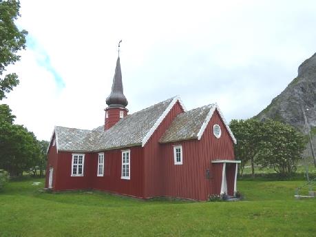
We stopped to look at red coloured Flakstad wooden church, with its onion shaped dome. It had been built in 1780 and restored in the 1930s.
Now it was time to drive towards Utakleiv, on the north coast, on a very narrow road. Shortly before the village, we stopped just after 5.00 at another beautiful white sandy beach, Hanklastrand, set in a circular bay of turquoise water and surrounded by green hills. It was a popular spot, with several motorhomes and cars, but we amazingly found a place to pull in. We had a very short walk onto the beach – the wind was blowing strongly! We didn’t envy the many campers with tiny tents! (despite the no camping sign!)
Now it was time to drive towards Utakleiv, on the north coast, on a very narrow road. Shortly before the village, we stopped just after 5.00 at another beautiful white sandy beach, Hanklastrand, set in a circular bay of turquoise water and surrounded by green hills. It was a popular spot, with several motorhomes and cars, but we amazingly found a place to pull in. We had a very short walk onto the beach – the wind was blowing strongly! We didn’t envy the many campers with tiny tents! (despite the no camping sign!)
As we walked back, it damped a bit, and rained hard briefly soon after.
Now we were heading south on small roads, stopping at 4.30 at Sand, overlooking a fjord (surprise surprise!) with a nice bridge going over it.
We managed to briefly phone Rita to wish her a happy 4th birthday for tomorrow - four family birthdays in a week!
Now we were heading south on small roads, stopping at 4.30 at Sand, overlooking a fjord (surprise surprise!) with a nice bridge going over it.
We managed to briefly phone Rita to wish her a happy 4th birthday for tomorrow - four family birthdays in a week!
We drove on towards Trondheim, finding with difficulty a place to dump at Levanger. We were mostly beside Trondheimfjord, but did drive through a surprising gorge, following the river and railway, emerging at another branch of the fjord.
Before reaching Trondheim, we drove through two toll tunnels and some bits of automatic toll road.
We stopped at a Shell garage and got some low priced diesel. Adrian was able to fill with water, and bought an inexpensive pastry which we ate with our coffee. Apart from the overflowing rubbish bins it was a good stop!
It was now becoming sunny as we drove into Trondheim. Adrian diverted past the youth hostel, but it didn't seem to be the place I'd stayed at in 1964!
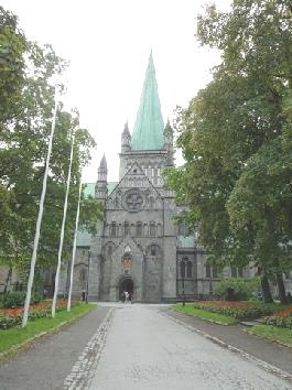
We parked near to the vast St Olav's Cathedral, which had been a place of pilgrimage for Norwegians. It is called Nidaros Domkirke, the old name for Trondheim. It certainly is a fantastic building. Our book said that it resembles English churches of the time – it did remind me of Bristol's St Mary Redcliffe.
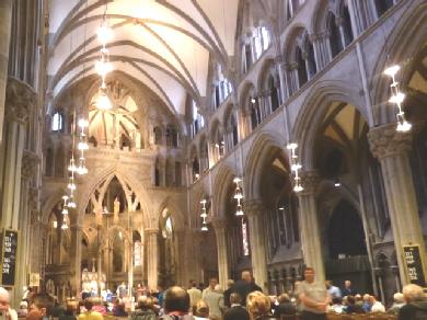
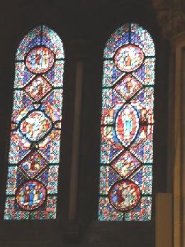
Being Sunday morning, a service was taking place. We joined the congregation and sat at the back while people went up for communion. Then 'Now thank we all our God' was sung. It felt it very moving, surrounded by beautiful stained glass windows, including a rose window.
As we left, the church clock was striking 12.00.
Before reaching Trondheim, we drove through two toll tunnels and some bits of automatic toll road.
We stopped at a Shell garage and got some low priced diesel. Adrian was able to fill with water, and bought an inexpensive pastry which we ate with our coffee. Apart from the overflowing rubbish bins it was a good stop!
It was now becoming sunny as we drove into Trondheim. Adrian diverted past the youth hostel, but it didn't seem to be the place I'd stayed at in 1964!
We parked near to the vast St Olav's Cathedral, which had been a place of pilgrimage for Norwegians. It is called Nidaros Domkirke, the old name for Trondheim. It certainly is a fantastic building. Our book said that it resembles English churches of the time – it did remind me of Bristol's St Mary Redcliffe.
Being Sunday morning, a service was taking place. We joined the congregation and sat at the back while people went up for communion. Then 'Now thank we all our God' was sung. It felt it very moving, surrounded by beautiful stained glass windows, including a rose window.
As we left, the church clock was striking 12.00.
We left at 8.30 on a fine morning. We stopped in Oppdal to use the internet before taking route 70 west, following Sunndalen, with snowy mountain peaks above us. Adrian found driving on the almost empty roads a pleasure after the busy roads of yesterday. It was very scenic - steeply forested mountains with a deep gorge below. We passed genuine wooden dwellings. Any flat bits of land had potatoes growing. With just these few scattered houses, we were surprised to see a fine football field!
We pulled in under some high vertical cliffs, with waterfalls emanating from them, and decided to have coffee here. The village of Sunndalsora was sandwiched between these high cliffs, with just one side open to the fjord. There were flower beds and flowers on the lampposts. We followed Route 62 from here, initially beside Tingvollfjorden, but immediately going into a 6km tunnel. We emerged to see a little white church and high waterfalls by the fjord. We went through another tunnel, 2km, before coming to the pretty village of Eidsora. It appeared very genuine, with a little harbour and some pretty gardens. A young mum was pushing her baby in a buggy and a fisherman was out in his little boat. Delightful!
We pulled in under some high vertical cliffs, with waterfalls emanating from them, and decided to have coffee here. The village of Sunndalsora was sandwiched between these high cliffs, with just one side open to the fjord. There were flower beds and flowers on the lampposts. We followed Route 62 from here, initially beside Tingvollfjorden, but immediately going into a 6km tunnel. We emerged to see a little white church and high waterfalls by the fjord. We went through another tunnel, 2km, before coming to the pretty village of Eidsora. It appeared very genuine, with a little harbour and some pretty gardens. A young mum was pushing her baby in a buggy and a fisherman was out in his little boat. Delightful!


Nordkapp to Geiranger, Norway


