
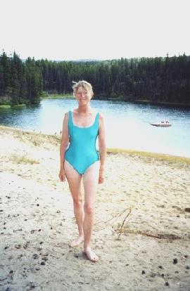
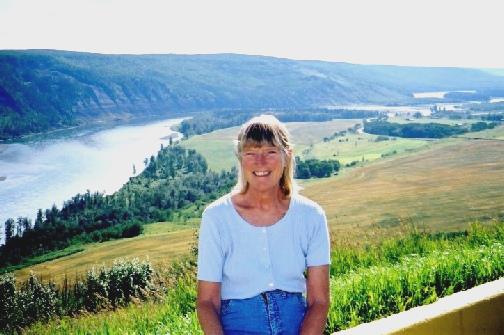
Friday 26th July. 152 miles.
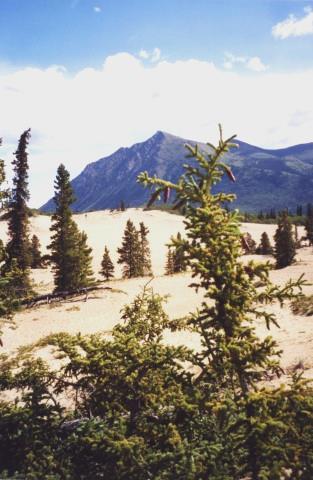
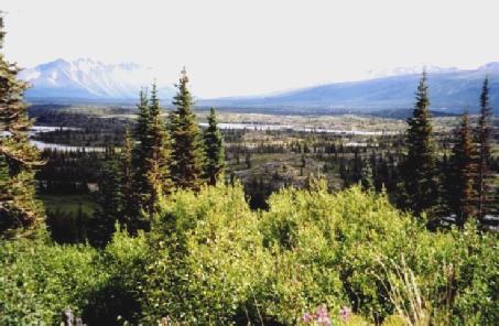
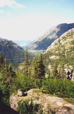
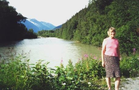
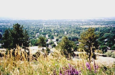
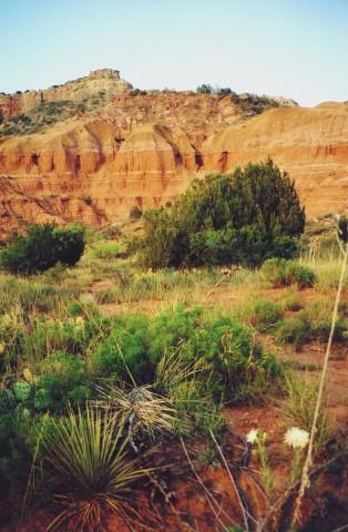
It was a mixed day, often windy, but dry. We had breakfast inside, and then continued to Tok where we got some fuel. We had coffee by the Tok River where there were nice different-coloured granite pebbles on the "beach". We continued a few miles to the turnoff to the Taylor Highway. The road had been newly resurfaced - we passed a whole group of coachtype motorhomes pulling cars and one threw up stones, which cracked our windscreen. We had lunch with nice views, then we stopped by Mount Fairplay "Wayside".
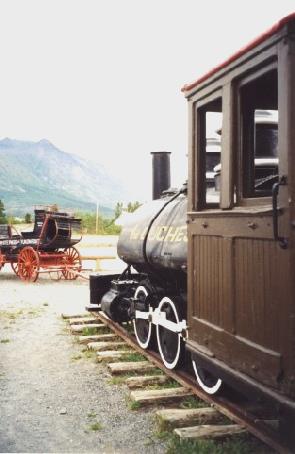
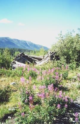
We were driving through wilderness mountain forests. We continued to Chicken (not Ptarmigan - the early miners couldn't spell it!) - the road was now unsurfaced. We viewed "Beautiful Downtown Chicken" - just three "shacks" - a cafe, a bar and a shop.
Saturday 27th July. 83 miles.
It was cold and windy, but got warmer as we neared Dawson City, but then we had heavy rain. We left at 10 o'clock after breakfast and stopped at the junction with Top of the World Highway. There were wonderful wilderness views - just forested slopes everywhere.
Sunday 28th July. 52 miles.
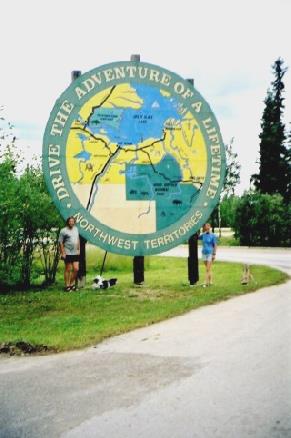
It rained all night and until about 6.00 pm! We breakfasted inside, got water and did the dumping. I bought some butter in the shop and then we left late and drove into Dawson City. We visited the Visitors Centre, which was very good and had a huge mammoth tooth and we also visited the Northern Territories Information Centre.
Monday 29th July. 181 miles.
It was a dry day with glimpses of sun. We left after breakfast and continued on the Klondike Highway. We stopped at Moose Creek campsite for coffee and then walked to Stewart River and back - it would have been very pleasant if not for the mossies! We left at midday and crossed the Stewart River at Stewart Crossing but decided not to drive the Silver Trail to Mayo and Keno. We had lunch at a pull-out beside the road before Pelly Crossing. We crossed the Pelly River and continued to Minto. We viewed the campsite, and then drove back to the site of Minto Riverboat Landing on the Yukon River. (Fort Selkirk was 25 miles downstream, but we didn't visit).
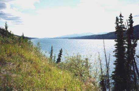
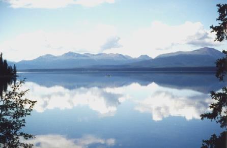
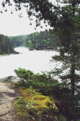
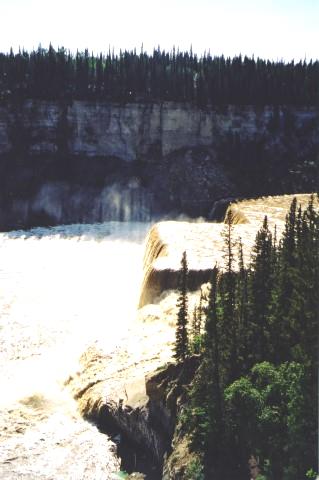
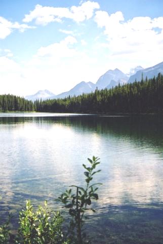
We stopped with good views of the Yukon River and then stopped to view the Five Finger Rapids and stopped for the night soon afterwards, beside the road in a large pull-out. It was a nice evening. I cooked chicken and rice .
Klondike Highway near Five Finger Rapids.
Tuesday 30th July. 120 miles.
We woke late to see the sun shining in. We breakfasted and didn't leave until 10.30. We turned off on to the Campbell Highway for a couple of miles beside the Yukon River .
Wednesday 31st July. 49 miles.
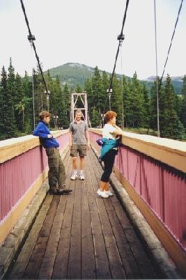
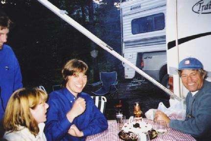
It was a cold night, but turned warm by the afternoon with a strong cool wind. We had breakfast then did the filling and emptying and left at 9.30 to drive to Whitehorse. We saw a deer on the way. We missed the turning to Whitehorse, so had to drive in from the South. We viewed SS Klondike and then located 'Envirolube' which did a service/oil change on the Bam very quickly. We called in at a place about the windscreen, but decided not to do anything about it. We got some food shopping, then went into Canada Tire, but they had no gas lighters. We booked in about the air-conditioning repair for tomorrow morning and then found our way to the Beringia Museum, having lunch first. We had a very interesting visit here, telling about the land mass bridge once joining America and Russia. We now found our way to Miles Canyon and walked over the bridge and to a viewpoint.
Thursday 1st August. 116 miles.
The alarm went at 7am so we had breakfast, spoke to the Dutch/Canadian chap and left at 8 o'clock for the air-conditioning place, but they couldn't do anything and sent us to a second place. We found that the air-conditioning couldn't be mended here so we got some fuel and left at 9.15. We drove past Whitehorse on the Alaska Highway and then turned off on to the South Klondike Highway. It was an amazing day of fantastic scenery. We pulled into Kookatsoon Lake - which was very quiet and peaceful. We saw some yellow legs (birds) and gulls.
Friday 2nd August. 19 miles.
We had a few drops of rain in the night, but a beautiful day. The alarm went at 7 am - we had breakfast and drove down into Skagway and got tickets to go on the 8.30 trip (we kept Yukon time, so it was like 9.30 to us).
Saturday 3rd August. 125 miles.
It was cool at first, and partly cloudy so we had breakfast inside and left at 9.30. We stopped to view the Taiya River - the sun had just come up over the mountain. We enjoyed the road back to the Klondike Highway and stopped to view. We had seen an eagle. We stopped at a viewpoint over Skagway and then set off on the Klondike Highway northwards, enjoying the wonderful scenery again. We stopped with views to the railway and spoke to a pleasant couple from Vancouver Island - she had been born in BHMB at Woolwich [this is where Rosie’s sister Renee was midwifery sister tutor]! We watched lots of little "buggies" on the railway. We stopped just afterwards to view Pitchfork Falls. We stopped at several more viewpoints, one by Moore Bridge. We passed White Pass and came back into British Columbia, past Summit Lake again with its wonderful aquamarine colour. We went through the Canadian customs and then stopped to admire the view. We continued past Log Cabin to Tutshi Lake. We drove back past Windy Arm to Carcross - a delightful small town with old buildings, a railway carriage, two pretty churches, a locomotive and in a really lovely setting. We went into "Matthew Watson" shop, which was full of gifts and memorabilia. We bought a CD of a local country singer Hank Kerr and a book of Robert Service poems and some old postcards. We walked around the "town", and then bought an ice-cream and sat overlooking the water to eat it. It was a delightful place.
Sunday 4th August. 187 miles.
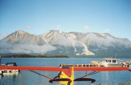
It was a cold night. We woke at 6.30 to see the sun just coming over the horizon. There was thick mist over the lake - an amazing sight. We got up just after 7 o'clock and left at 8 o'clock after breakfast and continued towards Atlin. We went into thick mist for a while. We were disappointed that the lake wasn't very visible from the road, but we did pass some small lakes and saw some ducks (red necked loons?) on Davie Hall Lake and we enjoyed Como Lake, which was clear and still. We arrived at Atlin at 9 o'clock - there was a clear blue sky but it was very crisp! We walked by the lake and by the boat MV Tarahne and looked around the small, peaceful town.
We looked around here and then returned and stopped to look around Atlin Cemetery which had graves of gold prospectors McLaren and Miller (discoverers of gold here) and others. We now returned on Atlin Road, the first part of which was surfaced and stopped at the north end of Atlin Lake for lunch.
We continued to Little Atlin Lake and stopped to view and saw a bald eagle sunning its wings. We now drove back to the Alaska Highway and drove east through pretty country. At Johnson's Crossing we crossed over the Teslin River and then passed Teslin Lake. We continued past the museum at Teslin, which closed just as we got there! We got water and dumped, and then got some fuel. We viewed Nisutlin Bridge, and then drove over it.
Monday 5th August. 152 miles.
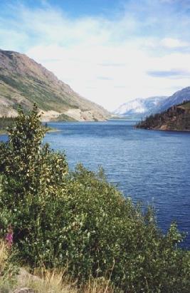
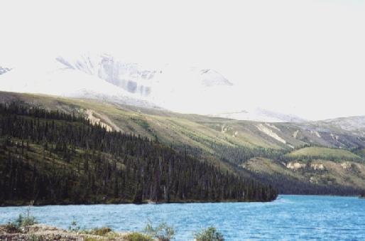
We left after breakfast at 9.30 and continued east on the Alaska Highway - about 40 miles through British Columbia and then back into the Yukon. We stopped at the Continental Divide (the Swift river flows west to the Yukon and the Bering Sea and the Pacific - 2300 miles; the Rancheria River flows east to the Liard River then the Mackenzie River and eventually to the Beaufort Sea in the Arctic Ocean). We will see no more salmon from the Pacific now. We stopped soon afterwards for a pleasant walk through boreal forest to Rancheria Falls where we saw ground squirrels.
Tuesday 6th August. 95.5miles.
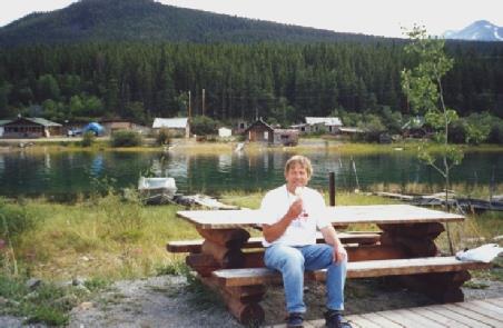
It was a sunny morning. We left at 8.20 and drove to Wye Lake for breakfast. We did the emptying and filling there first. We saw another "Bam" lookalike. We went back to yesterday's shop for more potatoes and butter and to exchange the lighter we had bought and then we got some beer and wine at the liquor store. We went to the library and Adrian phoned Escapees to ask them to send the post to Simon's and then we read and sent e-mails. The library was new, overlooking Wye Lake, as the previous one had been burned down a few years ago, along with the Post Office and the fire station and also later the general store had burned down. Adrian sent off a claim for the Bam engine repairs at Wasilla. It was now 11.30 - we drove five miles to Lucky Lake. Here we had a pleasant walk, in the warm sunshine, for just over a mile to Liard Canyon, but there were mosquitoes again. We walked back up and had our lunch overlooking the lake and then I had a VERY short swim in the cold water followed by a laze in the sun.
Wednesday 7th August. 120 miles.
It was a mostly greyish day with some glimpses of sun. We breakfasted and then continued east on the Alaska Highway. We saw a herd of buffalo / bison on the road.
Thursday 8th August. 212miles.
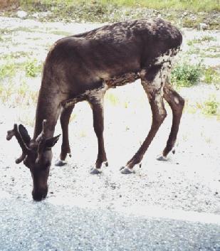
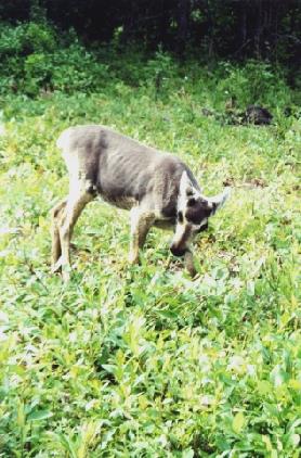
The day turned warm and sunny. We continued east on the Alaska Highway. We saw a lot of wildlife today - young deer, several caribou, a group of Stone sheep, an eagle on its prey, a moose and its young.
Friday 9th August. 167 miles.
It was dry at first, but then a mixed day with some heavy rain. I was woken by a mossie - and they were still queuing up outside, so we had breakfast inside with our view over the lake. We drove back into Fort Liard - Adrian thought he saw a bear on the way. We tried the Visitors Centre, but went to the wrong place. We found the "general store" and did some shopping and then we phoned Emma. We viewed the confluence of the Petitot and Liard Rivers.
Saturday 10th August. 142 Miles.
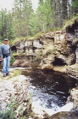
It had rained more in the night, but the day was dry and mostly overcast. We continued east on the Mackenzie Highway but the surface was generally not as bad as we had expected, after the rain. We stopped at Sambaa Deh Territorial Park and viewed the Whitaker Falls (now called Sambaa Deh, which were difficult to see) and then walked towards Coral Falls, which were also difficult to get to.
Sunday 11th August. 138 miles.
We woke late to a beautiful day. We were still in the shade, so had breakfast inside. We got some water and did the dumping and left just after 10 o'clock. We drove up through Fort Providence, beside the Mackenzie River. We had coffee at the end of the "town" above the river where there were seagulls, terns, crows and swallows. We saw an osprey as we left. It was peacefully beautiful here.
Monday 12th August. 137 miles.
We woke at 6 a.m. to see the sun just rising above the lake, and then slept until 8 o'clock. We had breakfast on the beach - it was a beautiful morning. We drove back into Hay River, stopping on the way to view Perrow Landing. We didn't have much luck in Hay River - the liquor store wasn't open until midday (it was now 10 a.m.); the Car Wash was expensive; we filled the tank with drinking water, but it didn't taste good. We got some petrol and propane then left at 11 o'clock. Drove back towards Enterprise, but there were no lay-bys so we turned off and had coffee, just stopped on the road (we couldn't find a picnic table as signposted) by the Hay River. At Enterprise, the service station craft shop was closed on Monday! However the Visitors Centre was open and he offered us e-mail use. We drove a few miles to Twin Falls Park and viewed Louise Falls, looking like a tiered wedding cake, and then drove on three miles to Alexandra Falls where we had lunch in the hot sunshine.
Tuesday 13th August. Our 36th Wedding Anniversary! 224 miles.
I awoke at 3.30 a.m. for the loo - I got up and saw the Northern Lights again! We stood outside, me in just my flimsy nightie, and watched! I also saw four shooting stars. It was cloudy again in the morning, and then a mixed day but quite warm. We had poached egg for breakfast and then continued south on the Mackenzie Highway. It was mostly flat and there was not much to see. We stopped at High Level(which was flat) and had coffee outside the Visitors Centre but it was very windy. We went inside afterwards and also got some fuel and then continued south. We stopped in a lay-by for lunch of pancakes. We continued south through agricultural land, but still mostly flat. We saw two deer. We looked at campsites at Hotchkiss and Manning but continued to Dixonville where we found a completely empty municipal site for $7. Adrian lit a fire and then we washed the outside of the Bam. We opened a bottle of bubbly and then ate feta salad followed by corn on the cob, steak, potatoes, spaghetti squash and mushrooms. We sat out until gone midnight.
Wednesday 14th August. 79 miles.
It was rainy at first, but the day improved and was sunny/windy by the afternoon. We woke very late. After breakfast we did the dumping and finished emptying and refilling the water tank, then we had our coffee, discussing our future route. We left at 11.45 and drove 25 miles to Grimshaw. We had seen a deer on the way. We did the washing in a rubbishy launderette and then did some shopping - films, cassettes, food, keys, beer. Both phones worked briefly and we had an Anniversary message from Val and Mike. We had lunch here and then drove through pretty, slightly undulating but tamed country to Fairview. There was farming, both arable and livestock (cows, sheep, pigs). We passed some lovely old wooden huts - I took a photo with rapeseed (Canola) in the foreground.
Thursday 15th August. 101 Miles.
It was a clear blue sky at first, but cloud built up and we then had some sun and some heavy showers. After breakfast we walked along beside the Peace River to Dunvegan Gardens (not yet open, but there were pretty flowers near the entrance).
Friday 16th August. 77 miles.
I woke at 2 a.m. for the loo, and then saw the Northern Lights again - not so bright, but we stood outside under the clear sky and with lots of stars - me in my mini nightie and I got really cold! I couldn't get warm again afterwards. We woke late to a lovely morning but cold like autumn. After breakfast I washed up outside. We left just after 10 o'clock. We came to Hythe where we got some fuel - it was a small town with the Visitors' Information in a log cabin and a lot of sports facilities. We inquired at the swimming-pool - under a large "tent" - but it was not open until noon. We had coffee in an unnamed campsite beside the road - there was a cool wind. A notice here said that there was a fire ban. We came into British Columbia, past Tom's Lake (a former Sudetenland Area) and through the small town of Pouce Coupe to Dawson Creek - Mile Zero of the Alaska Highway.
Saturday 17th August. 93 miles.
It was a mixed day of sun and cloud with an occasional shower. We had breakfast with our nice view and then drove back to the Alaska Highway. We soon came to Peace River at Taylor. We viewed the river and the bridge from Taylor Landing and then had a short visit to Peace Island Park. We saw a deer and several birds including a woodpecker. We drove on to Fort St John - a large and flat town and nothing special. We did the emptying and filling at a dump station and then had coffee on a gravel road before shopping in Safeway. We drove through the town past the museum etc and stopped for lunch beside Charlie Lake. Afterwards we drove into Charlie Lake Provincial Park and walked to the lake and back - it rained as we returned to the Bam. We finally left the Alaska Highway now on Hudson's Hope Loop. It was a pretty road with views of the Peace River - we stopped in a rest area with nice views. It was now warm sunshine.
Sunday 18th August. 156 miles.
It was a beautiful morning. After breakfast we set off on a 1.2 kilometre "Lake Trail", which ascended very steeply and went on for ever! We finally had a view over Peace Canyon and then continued for 15 minutes, but decided to return and arrived back at 11.30!
Monday 19th August. 186 miles.
It was a partly cloudy start, but hot and sunny later. After breakfast we did the "filling and emptying" and then drove through Mackenzie, but there was not much to see. We drove down to lovely Morfee Lake, but we couldn't get to Williston Lake. We drove back to the Highway and got some fuel. We crossed Parsnip River, and then stopped for coffee at Tudyah Lake - we sat on our mats on the beach. It was very peaceful. We passed long Lake Macleod and had lunch at Crooked River Provincial Park by Bear Lake - we sat at a picnic table and then lazed on the "beach" - some children were in swimming! We continued south to Prince George, crossing the Nechaco River. We shopped in Overwaitea and then stopped briefly at the Visitor Centre at to ask about Circuit City (not one here. We needed to see about the CD player.). We crossed the Fraser River and continued south. We looked at a free campsite, but continued to Hush Lake, which was very pretty with waterlilies and dragonflies. A local couple with a dog came down, and then several other people came to camp. We cooked fish (perch) and prawns and ate outside. It was a clear sky with a "dumpy" moon.
Tuesday 20th August. 187 miles.
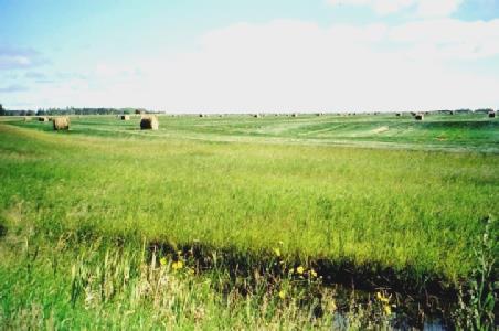
It was a beautiful day. We had breakfast of fruit sitting in the cab, looking over the absolutely still lake. We continued south to Quesnel, where there were a lot of wood pulp factories. We stopped by a little park area at the confluence of the Quesnel and Fraser Rivers and walked around, before driving on through Quesnel. We stopped for coffee at "Australian Rest Area" and sat out in the sun. It seemed like a French rest area (we didn’t find out why it was called Australian). We stopped by McLeese Lake and I paddled. At Williams Lake we had lunch on "Scout Island" at a picnic table, and then we both had a paddle. We watched a very long train going past. We continued south past Lac La Hache and stopped to visit ‘Mile 108’ Heritage site - several log buildings from the turn of the century. It was a really nice visit. There was huge "Watson Barn" and a very nice house. We continued to 100 Mile House, where we got some fuel, and then turned off on Highway 24 to Bridge Lake Provincial Park for the night. We walked out by the lake and arrived back right by the Bam! We had a fire and cooked corn on the cob, potatoes, chicken and mushrooms. We saw the stars and the fat moon before coming in.
Wednesday 21st August. 135 miles.
It was a beautiful day - I put shorts on straight away - but we had breakfast inside, as the sun hadn't reached us. We set off east and stopped by tranquil Lac des Roches and Adrian cleaned the windows.
Thursday 22nd August. 112 Miles.
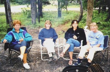
It was a lovely morning. We had breakfast outside and then walked to the lake. We got some water and then drove back along beside the lake and stopped for coffee sitting on the beach at Sunnybrae. We drove on round to the town of Salmon Arm, where there were roadworks. We stopped in the centre of the town and went to the launderette and to Safeway. We had lunch sitting on our seats outside near the lake.
Friday 23rd August. 137 miles.
It was a fine morning, but it was a long time until the sun rose above the mountain, and we were deep in trees, so we had breakfast inside and then had a pleasant walk out to the river. It felt like a September morn, and seemed very French. We left and headed for Rogers Pass. We had coffee by the river at the "Loop Trail" as last year.
Saturday 24th August. In Paul's and Simon's cars.
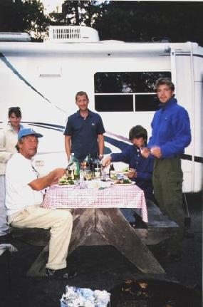
It was a lovely day, but cool at first in the shade. We had breakfast all together of bacon, eggs, mushrooms, and pancakes - all cooked on the fire outside. We left late morning in Paul's van and Simon's car, past Bow Lake (looking very different from in June) and had a lovely walk to Bow Glacier Waterfall. We had lunch by the waterfall and then walked back and took a group photo by Bow Lake.
Sunday 25th August. 124 miles.
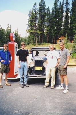
It was a lovely day, cool at first. We had blueberry pancakes for breakfast, cooked on the fire. We all left at about 10 o'clock and headed back towards Banff. We stopped briefly at Lake Louise and then to view Castle Mountain and then to walk at Johnson's Canyon, which was very busy. I took a photo of the menfolk by a vintage car.
Monday 26th August. 167 miles.
The alarm went at 7.00 a.m. Paul, Nicky and Tom came in for breakfast and then we all left at 8.30 and headed back past Bragg Creek to Calgary - Paul, Nicky and Tom for their flight home, and us to have the air-conditioning seen to. It was a long and tedious wait for us - we arrived at 9.45 a.m. and left at 4.45 p.m! We had not realised that it would be so long, so it was very frustrating. I was feeling pretty grotty, especially at first. I labelled most of the second photo album. We had lunch in the Bam, although we were told afterwards that we shouldn't be there. We found that the maple syrup had spilled out in the food cupboard - yuk! Adrian bought one or two bits and pieces from the spares shop. Just as we were finally leaving, a lady came to our window and wanted to know all about the Bam, as she liked the look of it! We now headed south out of Calgary on the Deerfoot Trail, and then Road 2 south. There was a lot of traffic at first. The land was very flat, with golden corn and a mixed sky towards the Rockies. We passed Okatoks, where we stayed last year and Nanton, where we had coffee last year. We tried the campsite at Claresholm, but continued to Fort Macleod. We were both tired. We ate beef burgers inside and then we both washed our hair using the new hose, which Adrian had bought in Calgary.
Tuesday 27th August. Happy Birthday Paul! 272 miles.
It was cloudy with some rain. After breakfast we drove into Fort Macleod and walked around "Historic Main Street". It seemed a very pleasant town. We crossed Oldman River and followed the valley to Lethbridge. It was now raining, but it was a much more attractive town then we'd imagined with a huge railway bridge over the Oldman River. We drove around part of the town and had coffee in Henderson Lake Park. We stopped for lunch at Milk River, by "Under 8 flags" campsite, sitting outside at a picnic shelter. There were a lot of wheat silos here and in this area. We now continued to the border (Coutts) with the USA - Montana. We continued south through Montana, through pleasant wheatlands. At Great Falls we searched for the tourist information to find out if there was a Circuit City here - no! We crossed the Missouri River (and back again). We had a cup of tea by the Lewis and Clark statue and discussed our ongoing route. We decided to take the Route 89/87 southeast. We drove through wonderful countryside - undulating, agricultural, with hills around and the sun shining on the golden wheat from an interesting sky.
Wednesday 28th August. 309 miles.
We woke early - several large trucks had parked here. We had breakfast and left at 7.45, enjoying the lovely countryside, which became flatter. We turned south at Eddies Corner, through Judith Gap to Harlowton, where we got some fuel, and then east to Lavina and then south to Billings. We stopped above Billings at 10.45 (we had come 165 miles) for coffee.
Thursday 29th August. 267 miles.
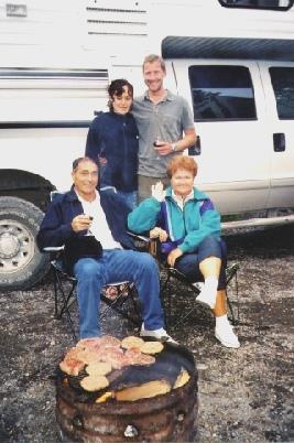
We were woken at 4 00a.m. by the automatic watering! We then slept until 7.30a.m. We had breakfast outside - it was warm and sunny, but the day became cloudier and stormy. We headed south on Route 87 on past Buffalo. The land became drier and less attractive. We turned off at Kaycee and drove through the small "film set" town and found that it had recently been flooded, and that much of it still was! We rejoined the main road. At Caspar we inquired at the tourist information about Circuit City - no! or at Cheyenne! We got some fuel then continued through some roadworks and had lunch in an uninspiring lay-by after Glenrock. We turned off at Douglas to use our American phone, but it didn't work. We stopped at a rest area at Orin and Adrian phoned there and found that we couldn't renew our American phone by card now, and it expires today! We now came to Wheatland, at 5 o'clock, and found a free camping place in the park here. We phoned Ali. We walked around the park area, again it felt very "French Municipal". Adrian cleaned some of the outside of the Bam. The evening cleared a bit, and we had a barbie (using briquettes, which were not good, and then some wood). We ate catfish, corn on the cob, mushrooms and sliced potatoes. It got dark at 8 o'clock. We came in and found that one of the containers of water under the settee had "exploded" and that everything under there, particularly all our travel bags, were damp! Not good!
Friday 30th August. 312 miles.
It was a clear blue sky, but we ate inside as the sun was not by us. We left at 8.30 and continued south. It was more interesting scenery near Chugwater (like Qua Qua in South Africa) but then flatter. At Cheyenne we went into the tourist information but they had no map of Colorado. We got some fuel. It was very windy. We came into Colorado at 10.15 and drove on to Fort Collins and visited the tourist information. There was a Circuit City here! We drove right through the town, which was large and very attractive with trees everywhere, to Circuit City, but they wouldn't change the C D player!! It was a university town with wonderful flowerbeds opposite the university. Adrian made unsuccessful phone calls about the CD player. We left Fort Collins and had lunch in a rest area soon afterwards, sitting at a sheltered table near a small lake. It was warm but windy. We continued south through Denver, which was huge and the traffic was very heavy as it was Labour Day weekend. The scenery south was quite hilly, with the Rockies to the West. We drove through Colorado Springs, which was quite large and also very busy and slow. We drove onto Pueblo, which was smaller, and took Road 50 and then turned off onto a waste bit of ground by piles of rubble. We were near the Arkansas River. It was very rural and looked very nice when the sun was going down from a clear blue sky. It was warm. I cooked a prawn/pasta/broccoli dish. We stood outside at bedtime to see the stars.
Saturday 31st August. 383 miles.
We were woken by the telephone (a rubbish e-mail) at 4.00 a.m! We were up early - there was a blue sky, but this was clouded by pollution later. We left after breakfast at 8.30a.m. and travelled south east towards La Junta on fairly empty roads through flat, rural country. We drove through the villages of Fowler, Manzanola and larger Rocky Ford. At La Junta we travelled east following the Arkansas River. At Lamar we got some fuel and headed south. We had seen thousands of cattle in pens. We located the library, but it was closed as it was Labour Day weekend. We then went through some awful desolate country. We found a rest area for coffee. The country was now greener and more undulating - we passed "Two Buttes”. We continued through Springfield (Colorado), and then Campo and then entered Oklahoma. At Boise City we shopped for some food and had a chat to our friendly lady packer. We had lunch afterwards beside the railway line - we just pulled off the road. We now drove into Texas - Stratford and then Amarillo. (we had been here in February this year) and located the library, which was still open (time one hour on) and were able to read our e-mails and reply to them. The library closed at 6 o'clock so we drove on to Circuit City, where we had bought the CD player in February. Great rejoicing, as they exchanged it - eventually! We had a cup of tea and then headed south to Palo Duro Canyon. There was no room to camp, but we were able to drive all around. There were some wonderful sights.
Sunday 1st September. 320 miles.
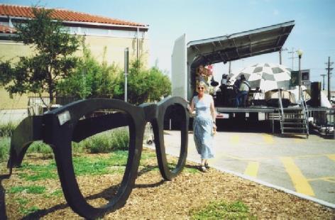
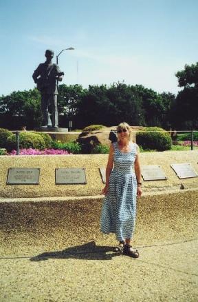
It was extremely hot and sunny with temperatures in the upper nineties. We were one hour on, so left at about 8.20 and drove back to the main road and then south towards Lubbock. We had coffee just before Lubbock at a shaded picnic table. At Lubbock we had difficulty in finding the Buddy Holly statue but finally found it. We drove on to the Buddy Holly Centre, which was like a museum. We looked around - there was a big music event about to happen, but we couldn't stop.
Monday 2nd September. 126 Miles.
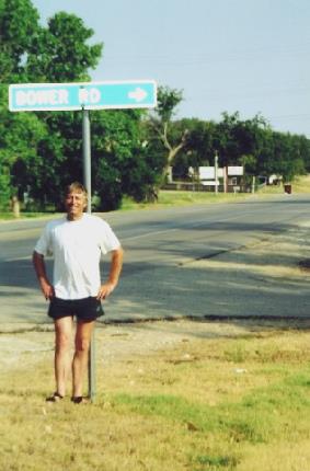
It was very hot. We were awake early to see the sun rising through the old trees. We had breakfast of pancakes outside. We left and headed towards Ford Worth. In Graham we went wrong, and had to return, (but we did find a ‘Bower Road’!)
Tuesday 3rd to Wednesday 4th September. 30 miles.
It was hot again in the night. We were up early - a swim for me and then later for both of us. We had breakfast outside and got sorted. We left late morning and drove through leafy suburbs and big roads to the storage place at Colleyville, arriving at 12.30. We left the Bam there and got a taxi to Dallas/Fort Worth Airport. There was very little to do here - we walked around a bit. We boarded our 4.30 flight to Gatwick, which was trouble-free - we had two window seats at the rear. We were pleased that they did serve wine with our meal. I had gluten-free -rotten rice cakes (cinnamon) again. It was partly cloudy at Dallas, and soon got dark. In the morning I saw an amazing red glow, with "Northern Lights" in the dark part. It was cloudy over Ireland. We landed at Gatwick soon after 7.30 a.m., to a pleasant, misty September morning. When we got to the bus, we found that we had booked it for the 3rd September! Luckily we were able to get one half-an-hour later at 9 o'clock. We slept/dozed to Savacentre, which we reached at 11.30a.m. Adrian phoned for a taxi, and I got a bit of shopping, but it was the last day of the school holidays and very crowded. The taxi came at 12.10. We got home to Hermitage just after 12.30 - lunch time. We were glad that we had got the grass cut but some of the plants were huge!
Another brilliant trip!
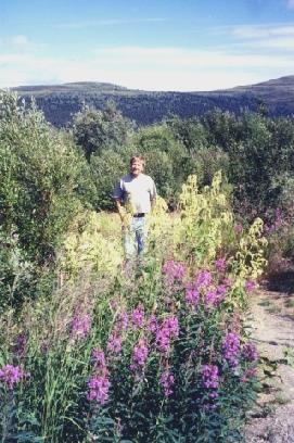
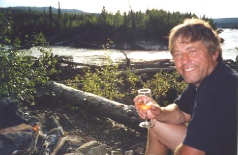
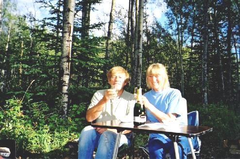
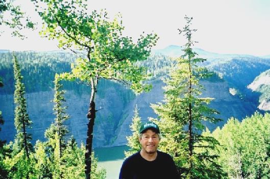
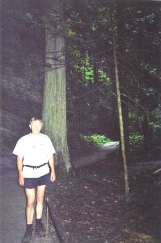
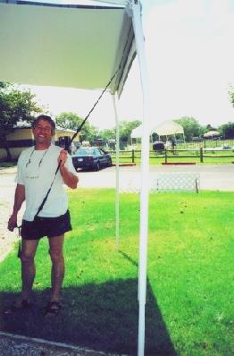
Adrian at Mt Fairplay
We continued to Walker Fork Campground and had a cup of tea outside in the sunshine. I had a little walk around seeing lots of wild flowers - monkshood, pale yellow Iceland poppies and little white star shaped flowers. We continued past Jack Wade Dredge, and stopped to view and photograph it, and then continued to the junction with Yukon Highway 9 (Top of the World Highway).
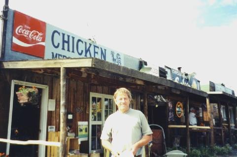
Adrian at ‘Beautiful Downtown Chicken’
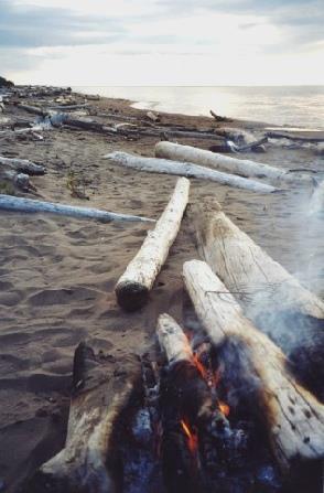
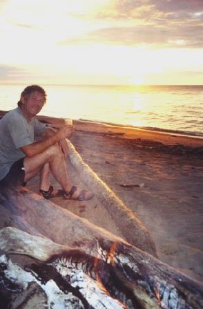
We stopped half a mile further on with wonderful views. We had a fire - by now the wind had dropped. We cooked pork, potatoes, cauliflower and courgette with fruit salad to follow. We came in it 8.45 - there was a lovely sky.
Junction of Taylor and Top of the World Highways.
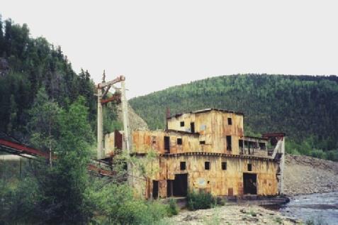
The Jack Wade goldmining dredge
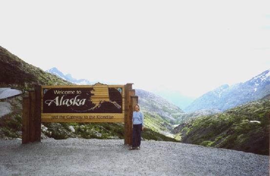
We soon came to the Canadian border and stopped by the Alaska sign where we talked to a couple from Washington State. They took our photo and we took theirs. We also took one by the Yukon sign.
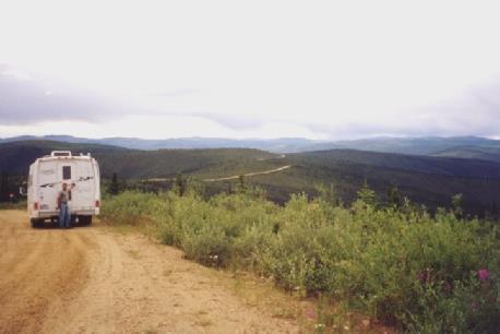
Top of the world highway
We had coffee just afterwards at the highest point on the Top of the World Highway. We had moved on one hour so it was now 12 o'clock. We didn't go for a walk here as it started to rain. We had lunch beside the road and then continued towards Dawson City, stopping to view the Yukon River and later Dawson City and the Yukon/Klondike Rivers.
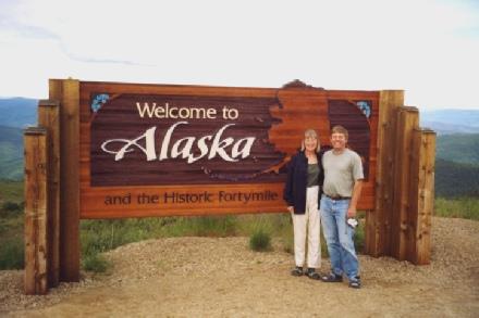
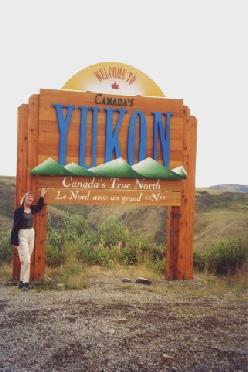
We leave Alaska and enter the Yukon
We had to wait a long time (about two hours) for the (free) ferry across the Yukon River to Dawson City. Once over the river we drove around Dawson City - the campsite there was full so we stayed at one called Dawson City RV Park, by the Klondike River. I had taken my films in to be developed. It was still raining and continued to rain all evening. We cooked trout, cauliflower and rice.
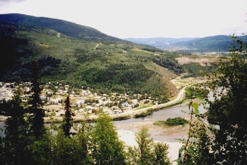
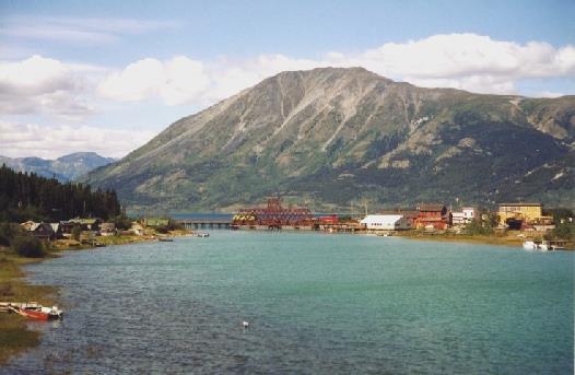
Looking across the Yukon River to Dawson City
We shopped in a large "General Store" and then parked by the Yukon River beside pretty flowers for our lunch of boiled egg. I wrote an e-mail on the computer and then we collected the photos, which were really good and then we sent an e-mail from the Internet cafe. We drove around past the cabins of Robert Service (poet of the North) and Jack London (White Fang) and then we drove up seven kilometres to the viewpoint at "The Dome" - there were views down to Dawson City and the Yukon and Klondike Rivers. We drove back down and left Dawson City on the Klondike Loop. We passed the junction with the Dempster Highway and stopped to view Tintina Trench (a long fault line) and stopped for the night just beyond here. We ate feta and bacon salad and then "a hearty soup". It rained again.
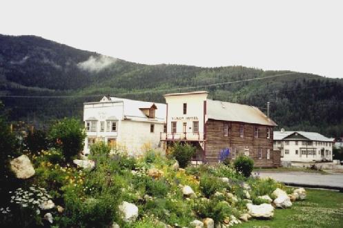
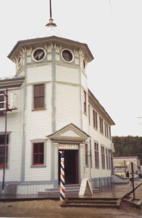
Dawson City - The Yukon Hotel and old Post Office
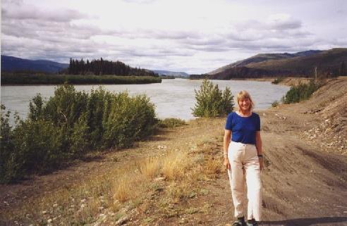
Rosie at Minto on the Yukon River
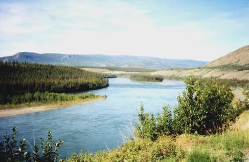
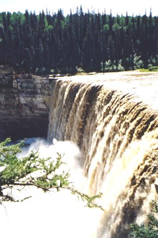
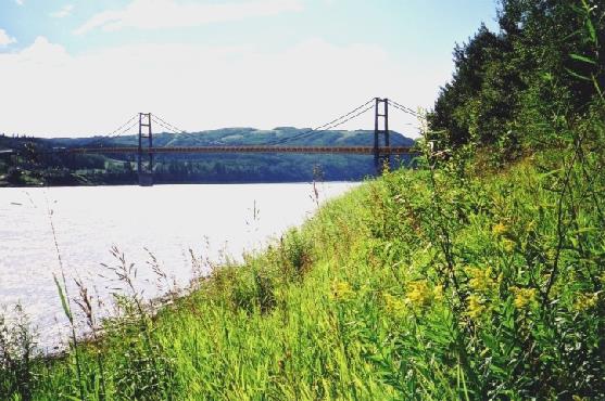
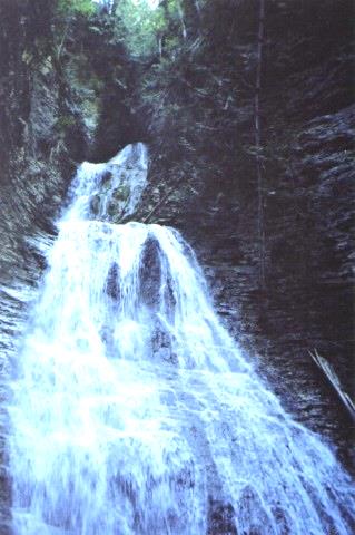
Five Finger Rapids
We then returned to Carmacks - an attractive small town on the Yukon River and the only highway crossing of it between Whitehorse and Dawson City. We drove along beside the river and had coffee by the boardwalk. We got some fuel and Adrian phoned to try to renew the American phone. We stopped by the ruins of Montague House - an early Road House.
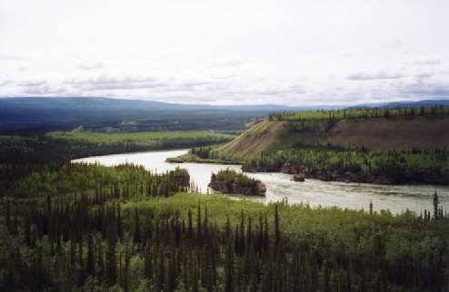
The Yukon River from the Campbell Highway
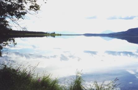
We had lunch at Twin Lakes campground and sat outside at a picnic table. It was a pretty spot and no mossies! We bought a huge cinnamon bun at Braeburn Lodge. We passed Little Fox Lake (a lot of fireweed after the 1998 burn) and then Fox Lake. We saw a nice campsite here.
Rosie at Montague House
We passed huge Lake Laberge (of Sam McGee fame), but couldn't really see it. We turned off six miles to Takhini Hot Springs. We went into the Springs which have mostly calcium, magnesium and iron. We were able to swim in the pools here, as they weren't too hot. We decided to stay in the adjacent campground. We had a campfire (Adrian had to go and collect the wood as they hadn't delivered it as they had said they would). We cooked pork, potatoes and then bananas. There were lots of flidgies. We went back to the pool at about 8.30, which was really pleasant. We chatted to a couple from Missouri - she had been born in Kenosha and her grandmother had come to America from Sweden aged 19. We got back to the Bam at 9.30 .
Fox Lake
It was very attractive - we saw a waxwing (bird). We drove to the fish ladder and viewed it and saw the first Chinook salmon of this year! We then drove back around Whitehorse, which we thought was a very attractive town, but were too late for a trolley (tram) ride. We got some money and then got to Walmart Car Park at 6 o'clock. On the way there a chap jumped onto the back step of the Bam! I cooked a whole salmon in the oven! We talked to two really nice couples - one from Germany and one from Ontario, but originally from Holland.
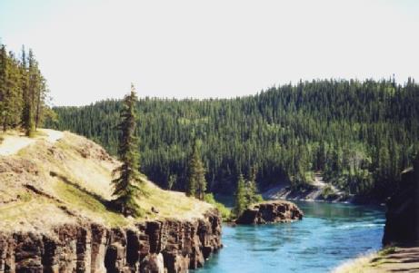
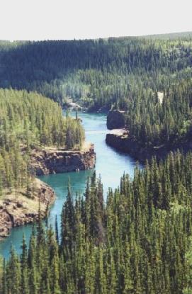
Miles Canyon
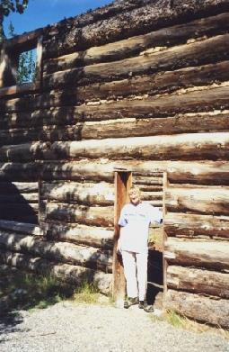
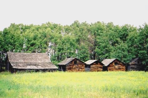
We then drove on to Robinson Town site ruins. There were several wooden buildings here in a delightfully rural setting.
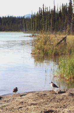
Yellowlegs at Kookatsoon Lake
We stopped to view Emerald Lake and then at Carcross desert.
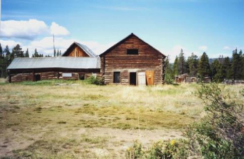
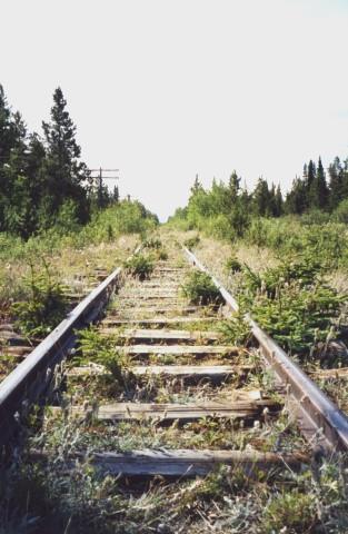
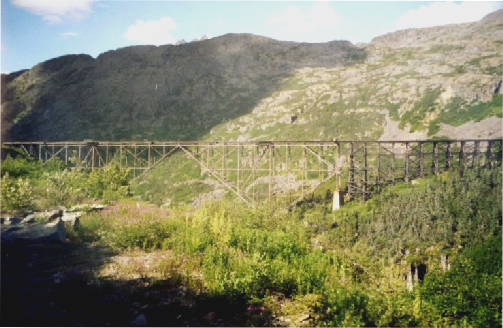
The ruins of Robinson Town and
abandoned section of the Skagway-Whitehorse railway
We crossed Nares Bridge at Carcross, which was very attractive. It was a lovely day, cold at first but becoming warmer.
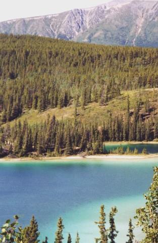
Emerald Lake
Carcross Desert
We viewed Windy Arm - a branch of Tagish Lake - with Bove Island.
Carcross
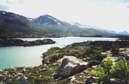
We entered British Columbia and then had lunch of salmon salad with wonderful views of Windy Arm and the mountains. Afterwards we passed Tutshi Lake with superb views to glaciers beyond. We stopped at Log Cabin (a former Customs checkpoint). A short train went by. We then passed "Tormented Valley" - a barren landscape of lakes and stunted trees and then at Summit Lake – an amazing colour and with Burren type landscape.
Windy Arm and Bove Island
At White Pass Summit (1003m) we had a beautiful view of the Skagway Valley.
Tormented Valley
Summit Lake
We were now back in Alaska, but the Customs were much further on. We had a delightful long descent to Skagway - we stopped to view a waterfall, and looked across the valley to the railway. The Customs man was really pleasant and friendly. We arrived in Skagway, which is in a lovely situation but there were a lot of cruise type tourists. We drove around and then parked and walked around on the wooden sidewalks. We bought hats for Felix and Ruby and for Adrian and we also bought ice-creams.
Back into Alaska!
We didn't like the RV parks here so we drove out past the rail depot to Gold Rush Cemetery. We walked up to Reid Falls and around the cemetery. There were lovely views from here and we decided to stay. I cooked turkey and we enjoyed the lovely views.
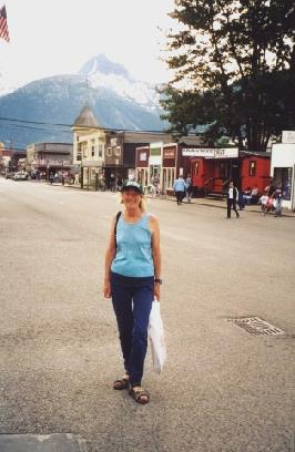
Rosie in Skagway
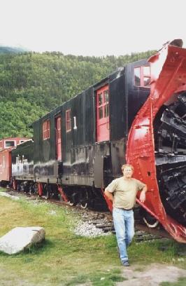
Adrian by the snowplough
View from our camping spot at Skagway
We were called "Depot" (ee) passengers - unlike the cruise passengers who were already on board and two groups (one was Adventure Caravans, who we're going to Central America with in January). We had only about eight people in our carriage, which was great! It was a beautiful day so we had excellent views. Just after the train got going, we saw firemen attacking a blaze on an old wooden building. We passed the cemetery where we had stayed last night.
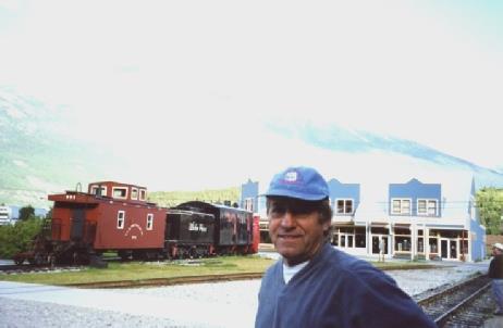
Adrian waiting for the train at Skagway
We saw some mountain sheep or goats very high up. When we reached White Pass there were lovely flowers. We made our return journey and I took a photo of the trestle bridge and at Inspiration Point.
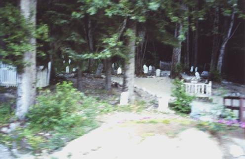
The train drives past the cemetery where we stopped last night
We saw the Bridal Veil (again) Falls - a continuation of where we had stopped by the road yesterday. It was an excellent, if expensive trip on the White Pass and Yukon Route train. We had a quick coffee at the Bam, and then bought a mouse mat with a picture of the train. We went to the launderette, and then had lunch sitting outside in Pullen Park, near the front. We put the clothes in the drier and then went to the library, but there were no vacancies for e-mail, however Adrian did manage to copy some bills. We bought some more Alaska hats as presents and some beer and some wine. We collected the washing and got some fuel and then left Skagway and drove to Dyea. We had a cup of tea at the campsite, and then found that it was free to camp here, so we found a spot before driving round to the site of the former gold-rush town of Dyea which is now just a few remains of buildings.
The trestle bridge and Inspiration Point
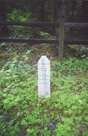
It was a delightful walk around the area in warm sunshine and very evocative. We also visited the cemetery from the 1898 landslide. We stopped by the bridge over the Taiya River - the start of the Chilkoot Trail - and walked a short way.
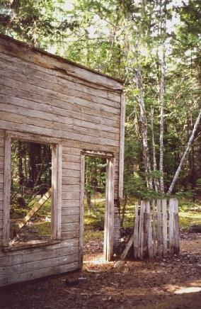
Signs of the former stampeders town of Dyea
We returned to the campsite and had a long search for Adrian's "Adrian" hat and finally found it - behind the sofa! Adrian lit a fire and we had baked potatoes, (burned)! and salmon. There were lots of flidgies. Afterwards we walked out to the river.
Looking back towards Skagway from Dyea
At the start of the Chilkoot Trail
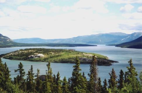
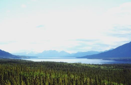
We now took the Tagish Road and stopped by Tagish River Bridge and spoke to a couple from St Louis. The view was wonderful as we crossed the Tagish River. The road was now mostly unsurfaced, but there was a short surfaced stretch, and then roadworks. We saw several tiny shrews run across the road today. We turned on to Atlin Road (south) which was unsurfaced. We passed Little Atlin Lake, looking very pretty, but we didn't stop. We continued to a viewpoint of Atlin Lake to stay for the night.
Delightful Carcross
I cooked a pasta dish with bacon/salmon/mushrooms and cheese. Afterwards we sat out in the lovely sun and then watched the rain coming and a brilliant double rainbow. We enjoyed the amazing different moods of our Atlin Lake view. I read the book of Robert Service poems.
From our spot overlooking Atlin Lake
We bought some bread, milk and meat then took Discovery Road but couldn't find (discover?) the RV dump. We had coffee with a view to Pine Creek and some amazing falls. We drove on (now unsurfaced) a few miles to the ghost town of Discovery.
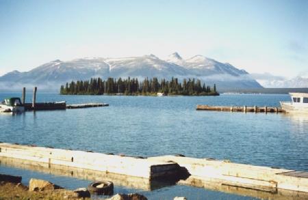
Atlin Lake with the mist rising
All that remains of the gold town of Discovery
Reflections on lovely Atlin Lake
And attractive Little Atlin Lake
We stopped at 6 o'clock, a few miles on, after Strawberry Creek, on an old bit of road. I cooked chicken and rice and then we had a short walk out.
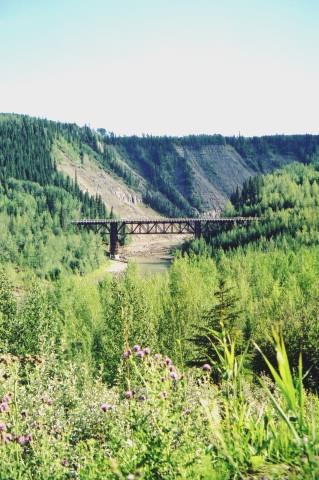
Bit of old Alaska Highway near Strawberry Creek.
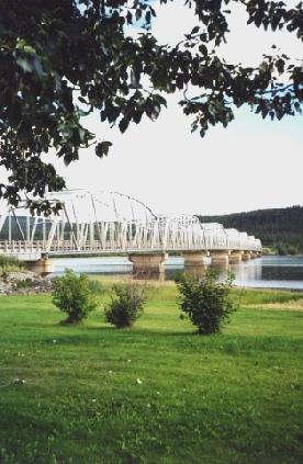
Nisutlin bridge
We drove on to Big Creek (now a campsite) for lunch outside at a picnic table above the river, and drank a can of Coke from the train and ate a nice peach. We walked down to the creek afterwards. We drove on to Watson Lake - and stopped to view the "Signpost forest" - about 50,000 signs from all over. We walked around, and then painted our own sign. It was very pleasant in the hot sunshine. We went into the adjacent Visitors Centre and saw a presentation on the Alaska Highway and then came back and nailed up our sign.
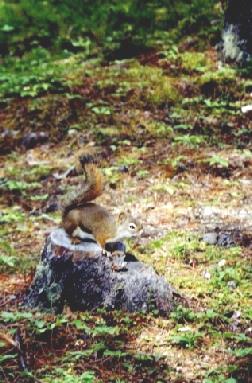
Endearing little ground squirrel
We did some shopping in a nearby store and then we had a short walk at Wye Lake - we had a little bit of light rain. We got some fuel (but no money off with our coupon) and then made our way to the Northern Lights Centre for the 6.30 pm show. It was not what we had expected, but quite pleasant. At 7.30 we made our way back to Watson Lake campground and Adrian got a fire a going. We cooked pork, potatoes and corn on the cob. It was a nice evening so afterwards we walked to the lake (with difficulty). We came in at 10.10 pm.
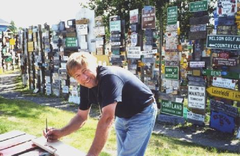
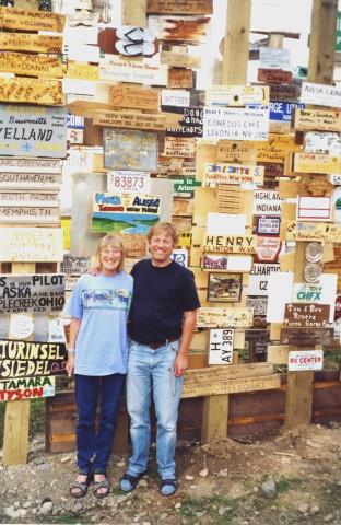
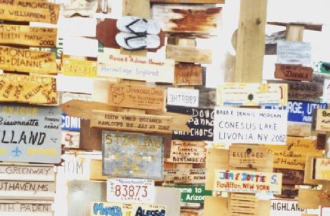
Our names immortalised at Watson Lake
We left at 2.45 and drove east, mostly in British Columbia, through forested hilly country. There were some long roadworks at first. We came to a lovely free campsite beside the Portage Rapids / Whirlpool on the Liard River. The access was very difficult, but we had a cup of tea in the hot sunshine overlooking the river - a super spot. We had a brilliant evening. Adrian lit a fire and we cooked potatoes, steak and acorn squash. We sat out until 10.50. It was really warm (I got sunburnt today!). Two lovely chaps from the roadworks walked down and we had a long chat to them. Top spot!
Rosie ready for a short swim at Lucky Lake
Top overnighter - Portage Rapids
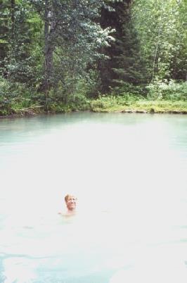
We arrived at Liard Hot Springs (free) and walked along the boardwalk for a few hundred yards through the rainforest swamp to Alpha Pool. The water was quite hot but we enjoyed soaking in this and then went on a ten-minute boardwalk to Beta Pool, which was deeper and slightly cooler, and we could swim. It was very muddy on the bottom.
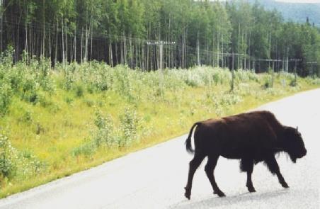
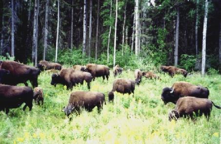
‘Biffalo Buffalo Bison’
We stopped to view the Tufa Gardens on the way back. We spoke to two ladies (a mother and daughter) in a B plus like ours, but with a different layout. They were from Michigan. We viewed each other's vans. They had a fussy little Yorkshire terrier called Raspberry Topping and I told them that there was a place in Yorkshire called this - only afterwards did we remember that it was Roseberry Topping! We continued for a few miles, and then stopped for lunch beside the road. We were following the Trout River. We stopped to walk the Loop Trail of about one mile to the mineral lick, and saw one solitary Stone sheep!
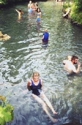
Rosie in Alpha Pool
Adrian in Beta Pool
We drove along beside Muncho Lake and saw two caribou (separately) on the road.
We now followed the Toad River through dramatic mountain scenery. While crossing Racing River we spied a caribou in the water and pulled into the parking area. We realised that it would be a lovely place to stop for the night. We had a fire - corn on the cob, potatoes (burnt) tacos and tuna. We saw more caribou across the river. We came in at 10.30 as it was just getting dark. A really nice stop!
The mineral lick
A lone caribou
From our spot by Racing River where we saw more caribou
We stopped to view Summit Lake - the highest point on the Alaska Highway - 4250 ft. The scenery was lovely. We had coffee sitting on a log beside Tetsa River. We got some fuel at Steamboat Mountain and then turned off on to the Liard Highway, which was mostly unsurfaced, and with a section of roadworks (20 minute wait). We found out that the CD player was not working. We had lunch in the Bam by a little pond. The scenery was now mostly flat and green with a lot of flowers. We came into North West Territories - time one hour on. We had crossed the Fort Nelson River on a 430-metre Bailey-type bridge - the longest of its type in the world! We had also crossed the Petitot River.
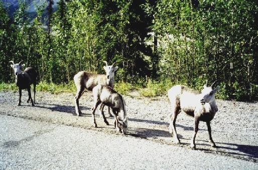
Stone sheep
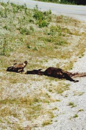
An eagle on its prey
A baby moose
Summit Lake
We turned off to Fort Liard and got some more fuel. We drove back a few miles to Hay Lake campground which was very pretty but had virulent mossies. Adrian lit a fire and cooked pork chops (which we had bought in Denali) potatoes and corn on the cob. We ate inside with our pretty view.
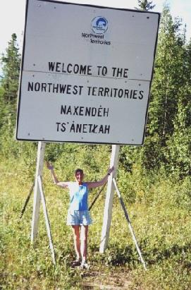
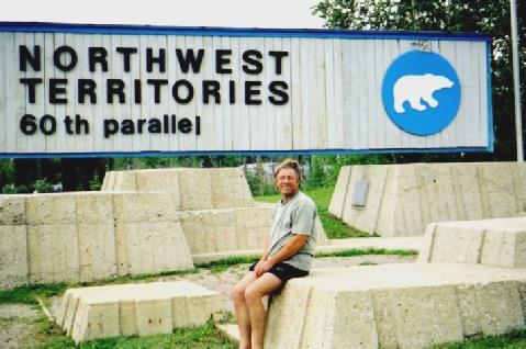
We enter NW Territories
Adrian at the confluence of the Petitot & Liard Rivers
We continued on the Liard Highway but there wasn't much to see! There were just green trees and some flowers, with the Mackenzie Mountains in the distance, but visibility was poor. We had lunch of bacon and eggs in a rough turnout beside the road. We drove into Blackstone Territorial Park and viewed Nahanni Butte across the Liard River.
We had a cup of tea in a lay-by by a "viewpoint" - we had to climb a gravel pile to see anything, and it was now raining heavily. The rain continued as we completed the Liard Highway and joined the Mackenzie Highway eastward. We got fuel at "Checkpoint" at the junction. We drove on 30 kilometres and stopped for the night in a lay-by near Jean Marie River. It continued to rain. We ate feta salad and a "hearty soup" and then cheese and biscuits. We had tuned into a pleasant radio station.
Rosie beside the Liard River
The mucky Bam after a day on the unsurfaced Liard Highway
We continued to Wallace Creek and walked along the shale-like edging of a canyon. We continued to the junction with the Yellowknife Highway, which we reached at 4 o'clock. The road was now surfaced! We drove north and stopped to quickly view the Mackenzie River at Dory Point (mozzies) and then we crossed the Mackenzie River on the free ferry MV Hardie. I made a cup of tea while we were waiting, and we drank it during the 10 minute crossing. We stopped soon afterwards at Fort Providence campground beside the Mackenzie River, surrounded by aspens. There were mossies! Adrian got two containers of water to put in the tank. We had a fire and a lovely evening with a beautiful sky. A North American Indian man came to collect our money and we had a chat to him. He said there wasn't much to do here in the winter, you had to cuddle your wife! We cooked chicken, potatoes and corn on the fire and came in at 10.30 by which time it was cool.
Looking towards Coral Falls
Adrian at Wallace Creek
The sun goes down at Fort Providence Campsite
We drove back through Fort Providence to the ferry over the Mackenzie River. We crossed it, and then continued to the junction.
We stopped at Kakisa River and had lunch of tortillas in the Bam above the river, sitting inside as there were flidgies etc. We drove off on an unsurfaced road for four miles to view the Lady Evelyn Falls - with a rainbow like the Wapta falls.
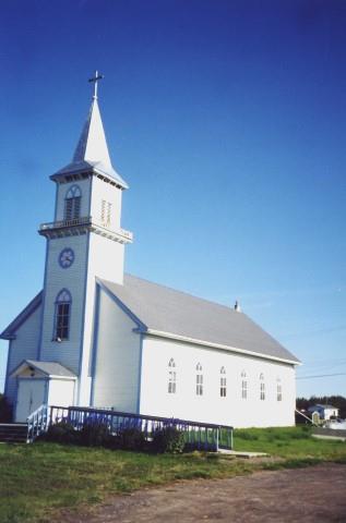
Pretty Fort Providence Church
The road back to the Mackenzie Highway
We drove back to the road and turned off one kilometre to Hart Lake fire tower where there was a tremendous view down from the escarpment to the acres of flatness below. We had 2 more similar views along the road. We also stopped at McNally Falls.
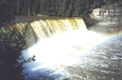
Lady Evelyn Falls
A local chap chatted to us as he was walking past, and later a local lady did. We cooked pork, potatoes, spaghetti squash and mushroom, which was all really good. It was a brilliant evening. Just as we were about to come in, WE SAW THE NORTHERN LIGHTS!!! Fantastic. We came in at 12.30. Amazing.
View from Hart Lake fire tower
At Enterprise we took the Hay River Highway (25 miles with nothing to see!) We drove around the small town of Hay River. We had a good shop in "Northern" then drove on to the campsite, but didn't stop. We had a cup of tea and a yummy bun beside the Great Slave Lake. We drove around and then returned to the same spot for the night. We walked along the beach in hot sunshine, and then Adrian lit a fire on the beach. It was a fantastic evening!
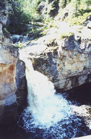
McNally Falls
Our brilliant evening beside the Great Slave Lake, where we saw the Northern Lights
We viewed the mighty Alexandra Falls then walked the trail back through the woodland to Louise Falls and back again. It felt very hot! It was now 3.30 p.m. - we drove 45 miles to the NWT/Alberta border where we went into the Visitors Centre and I filled in a questionnaire and they gave us a cup of tea. The weather had now become cloudy.
Louise falls
Alexandra Falls
We continued south 50 miles before there was a turn off and then pulled into a lay-by. We had stopped at Indian Cabins and bought a bottle of wine and some beer, as we had completely run out. There was a little kitten by the shop. I cooked spaghetti bolognese. We had some rain at bedtime
Lay-by beside the Mackenzie Highway, Alberta.
We reach the boundary between NW Territories and Alberta
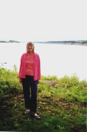
Happy Anniversary!
We drove a few miles to Dunvegan on the Peace River - a former mission and trading post. We looked around the Visitors Centre which had a lot of museum items, and then had a cup of tea in the campsite before walking around the historical area in the pleasant sunshine. We saw another deer. Adrian lit a fire and we ate chicken drumsticks, potatoes, cauliflower, and mushroom. There was a rain shower so we put out the awning. We sat by the fire until gone 10.30.
Old wooden huts in northern Alberta
We had coffee by Spirit River, sitting on our little mats by the peaceful stream. We continued past Woking to Sexsmith. We drove round here, then on to Grand Prairie - a large nondescript town. We had pulled in just before at a weigh station and weighed the vehicle. We went on to the Visitors Centre and had lunch outside and Adrian got a map of the town. We headed for Walmart and I got 4 films developed. Adrian rang several times about air-conditioning repairs. We drove to Canadian Tire and got a barbecue grid (we had left ours at Hay Lake, where the mossies had been such a problem) and then we got some more booze. We then drove west. We looked at campsites at Wembley and Beaverlodge, but stayed at one at Hommy. We had a fire. There was some rain so we put the awning out. We walked around the site and came in just before 10 o'clock.
Rural scene near Rycroft
Rosie at Sexsmith!
We walked back and rang Tom, who was leaving for Calgary tomorrow. We set off on Highway 2, passed Rycroft.
Suspension bridge over the Peace River, Dunvegan
We walked around the pleasant town and looked at a lot of Alaska Highway photos, and then went into the Visitors Centre/museum. We bought and sent a postcard to Emma. We drove to ‘Mile 0’ Park, at the other end of town, and had lunch in the campsite there at a picnic table. We then visited the delightful Walter Wright Pioneer Village, which had a lot of wooden buildings.
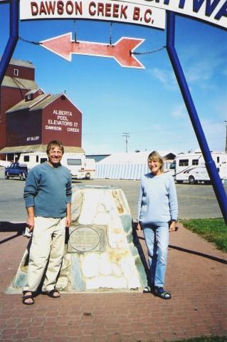
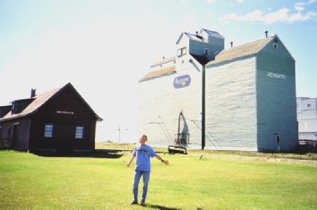
Mile Zero of the Alaska Highway, Dawson Creek
We bought an ice-cream. There were nice gardens here too. We tried at the swimming-pool, but it was not open until 6pm (we should now be in British Columbia time - back one hour). We drove round past the "Creek" and then off on the Alaska Highway north westwards. We turned off on to the Old Alaska Highway and stopped by Kiskatinaw Bridge (an original timber bridge). We decided to stop for the night. I cooked a rice dish for supper. We had a lousy wine (like low alcohol). There was a strange half-moon.
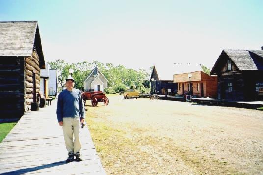
Walter Wright Pioneer Village
Kiskatinaw Bridge
We drove through Hudson's Hope - a pretty "necklace" of petunias surrounded the Central Park. We looked in at Alwin Holland campground, but stayed for the night at Dinosaur Lake Campground in Peace Canyon. We walked around by the lake and back through the woods. We had a fire and cooked a whole trout, potatoes and squash followed by apple pie. There was a funny moon again. The evening became very cool.
Rosie above the Peace River on Hudson’s Hope loop
We had tea and coffee and apple pie and I walked down to view the lake. We left just after midday. We viewed the Peace Canyon Dam and then crossed the Peace River on a lovely suspension bridge. We passed scenic Cameron Lake and then stopped for lunch at a picnic table at Moberly Lake (like Lake Gerardmer in the Vosges Mountains). There were lots of little butterflies by the Bam. We continued to Chetwynd and drove around the town - past an open air auction - and then took the road towards Prince George. We followed Pine River, with some nice scenery. We stopped once to view. We went over Pine Pass, where there were lots of flowers, and stopped to view the Bijou Falls, and then continued to the turn-off to Mackenzie - 30 kilometres. There was a free municipal campsite here with free showers! We had a fire with corn on the cob, pork, potatoes, squash and mushrooms. It was a fine, cool evening. We sat out until 10.30 p.m.
Adrian above Peace River Canyon
Hush Lake
We came to some mucky roadworks, and then to Little Fort on an amazingly long descent to join the road south (1989 route) through Barriere following the North Thompson River. We stopped at a fruit stall at Louis Creek (as in 1989) and bought a melon, and then continued to a rest area just north of Mclure (as in 1989 - and we were disappointed now, as we were then, that there was no view of the river). We had not meant to come this far and had passed the turn-off we'd intended to take at Louis Creek, so we returned. We saw a small deer at the turning. The road was surfaced at first, but then it was badly corrugated. We drove through pretty country with a farmed valley bottom and steep wooded sides. We went through some more roadworks and then came to Adams Lake, but we were way above it, so couldn't get to it or really see it. At the "town" of Adams Lake we turned south (we saw lots of logs on the lake), following the Adams River. We turned off to the north of Shuswap Lake and had lunch by Adams River - it was very hot in the sun and we got bitten by mossies. We had a walk on a little island here afterwards, and then drove to No.1 Road through Sorrento (south of Shuswap Lake) through very attractive scenery, like the Italian lakes. We turned off to the northern side of Salmon Arm and had a paddle at Sunnybrae and then drove on to Herald Provincial Park (it was 2.30, - 3.30 to us - and nearly full). We managed to find a place to stay. It was very hot, but we had a lovely walk up the canyon in the shade to Margaret Falls (like Silberkarklamm in Austria).
Lac des Roches
We walked back to the beach area, and then had a cup of tea by the Bam, using the sunshade/awning from its real purpose!
Walking to Margaret Falls
We walked to the beach and both had a swim. We had a meal of prawn and feta starter and then baked potatoes, corn on the cob, cauliflower, mushrooms and snapper, all cooked on the fire. It was our 150th night in the Bam! We sat by the fire until the moon rose above the mountain, and then walked to the beach. It reminded us of "beautiful beside the water". We came in just before midnight, our time.
A rare use of our awning as a sunshade
We bought some booze and then left Salmon Arm - it was now 3 p.m. to us! We followed along Salmon Arm Lake and stopped once to view, and then at Sicamous where we had an ice-cream by the little beach. We drove on to Craigellachie - the last spike - and stopped with memories of 89.
Lunch stop at Salmon Arm
We drove past Three Valley Gap (visited in 89, but now much more touristy). We looked at a Good Sam Campsite, but they had no firewood so we continued to Revelstoke where we did the dumping and got some fuel and then continued (there was a delay for an accident where a lorry had unloaded a lot of white paint!) to Canyon Hot Springs, which we had visited last year. We were given a very shady site. Adrian lit a fire and we ate pork, potatoes, cauliflower, carrots and mushrooms. Afterwards we walked up to the Hot Springs. We rang Laure, and then spoke to two ladies here. We spent a long time in the 2 pools, which were very nice particularly as it was now dark.
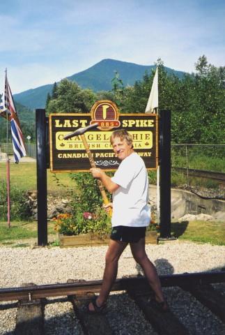
The Last Spike at Craigellachie
We walked back (we managed some long steep steps in the dark) but we couldn't see the full moon above the mountains. We just managed to see it at midnight as we went to bed.
Enjoying Canyon Hot Springs in the dark
We stopped at Rogers Pass and had a short walk and then had lunch at a picnic table by Beaver Creek (as 1989).
Mt Sir Donald
We drove on to Golden, and just drove past but we did get some propane. We continued through Yoho National Park and Kicking Horse Pass which we stopped to view and we then drove along the Icefields Parkway, stopping to view Herbert Lake, which had been closed in June.
Lunch at Beaver Creek
We arrived at Mosquito Creek at 4.15. Paul and Nicky were there, and then Simon, Laure and Tom arrived. We took photos, and had much chat, celebrations, a fire and sparklers. We came in at about midnight.
Herbert Lake
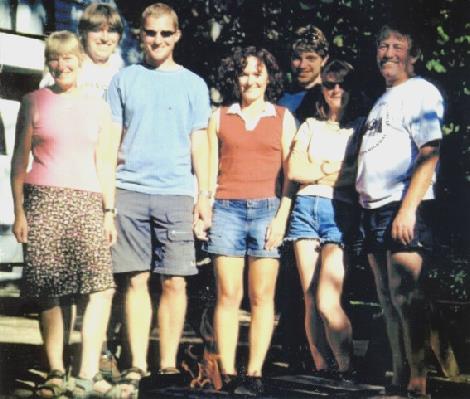
The family (except Emma) all meet up at Mosquito Creek
Laure left to collect her parents and we headed back to Mosquito Creek campsite. I had a short walk by the river, and then we played French cricket and frisbee. We had a fire and cooked pork, chicken, sliced potatoes, courgettes, mushrooms and broccoli.
Bow Glacier waterfall
We walked out to watch a storm, which never reached us. We played Newmarket, Who's in the bag? and Estimation Whist. We came in after midnight.
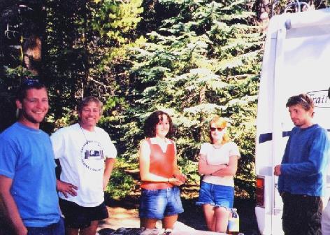
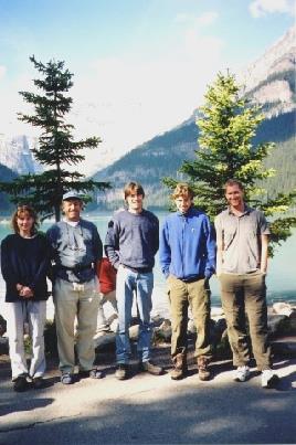
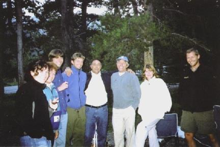
The family at Bow Lake - Tom, Nicky, Paul, Rosie, Adrian, Simon, Laure
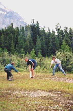
French cricket
Family barbecue
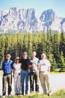
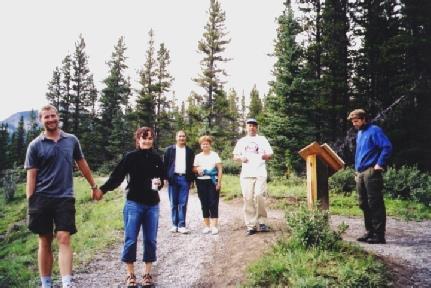
We drove on to Banff (all on the old road) and had a quick shop in Safeway. We left separately - us to "empty and fill" first. We stopped to eat rolls for lunch with a lovely view, and then headed for Canmore, and then the Kananaskis turn-off. We took the unsurfaced Siebold Trail, and then Powderface Trail, which was narrow and bumpy for about 50 kilometres, to Elbow Creek campsite. Here we met up with the others - Paul, Nicky, Tom, Simon, Laure, and Laure's parents Albert and Christiane. We had a fun evening. We walked to the Elbow River with Simon, Laure, Tom, Albert and Christiane.
Lake Louise
Castle Mountain
At Johnson’s Canyon
We had bubbly, and then a barbie of steak, beef burgers, potatoes etc. We had a birthday cake for Paul - a gateau - and then Simon etc. left at 9.15. Tom, Paul and Nicky came into the Bam and we played yahtzee and chatted until about 11.30p.m.
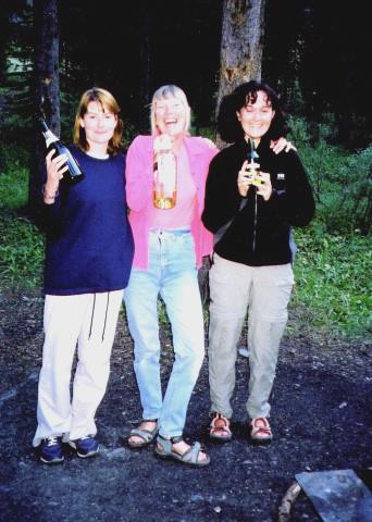
Fun with the family and Laure’s parents at Elbow Creek
We found a nice spot for the night beside a historic sign about agricultural homesteading of his area in the early 1900s. We had a lovely evening watching the interesting sky. I cooked prawns and rice.
Between Geyser and Stanford, Montana.
‘Square Butte’, Montana
We drove through to the tourist information, which had a nice cowboy statue outside, but again there was no Circuit City here. We got some more fuel. We noticed that the windscreen was cracked. We drove east and then south towards Hardin and stopped just before at a rest area for lunch. We sat outside - it was very hot. There were noisy lorries running engines. The countryside was very dry. We stopped at Little Big Horn battlefield - the site of Custer's Last Stand. We used our National Parks card. My left foot was hurting, so I couldn't walk much, but we looked around the site and the Visitors Centre and drove around the site route. There were roadworks and they were building an Indian monument, which meant that we couldn't drive far.
Looking down to Billings, Montana
We continued south out of Montana and into Wyoming. We stopped at Sheridan and asked at the Visitors Centre (no Circuit City) about free camping in the town and were directed there. We did the dumping at the Visitors Centre and then drove through the attractive town and got some shopping, mostly for fruit/vegetables and salad, in Safeway. We then stopped at Washington Park. Adrian filled the water tank (25 cents) and got soaked doing it. We got settled in and I cooked chicken and rice after an egg mayonnaise starter. We finished the wine from Paul and Nicky. We walked around the little park in the dark and then a storm came. It seemed very French.
Little Big Horn - site of Custer’s Last Stand
It was really warm - 84ºF. We stopped to cook supper of tacos and gammon. There were fireflies and stars. We left, after using the dump, just at 10p.m. new time. We drove back to our February spot by the gas pumping station.
Near Palo Duro ,Amarillo
Palo Duro Canyon
We got some fuel and set off east, having lunch soon after, just after Idalou, by the cemetery. We continued through flat agricultural country with small towns. There was very attractive scenery by an escarpment before and after Dickens, with red soil. The countryside was more undulating now. We drove on through Benjamin and Vera to Seymour. We had a cup of tea soon after, inside because it was too hot and there was a strong farm smell outside. We drove on to Olney, a nice town, and then south to tiny Newcastle and stopped soon after at Kindley Park by Lake Graham. We plugged in and put on the air conditioning (free!). We saw egrets on the lake. We had enjoyed playing CDs today! It was very, very hot! We walked down to the lake - there were a lot of dead trees. We had a little barbie and cooked fish - pollack! - potatoes (excellent) sweet corn (excellent) and mushrooms. We sat outside, but were besieged by flidgies and were glad to come in! Memories of Dawson River in Oz! We both read the little Buddy Holly book we had bought. We went out to see the stars at bedtime - the Plough was very low.
‘It doesn’t matter any more’- Lubbock, Texas
We drove through Jacksboro to Springtown. We didn't look at the campsite at Springtown, but looked at one just afterwards but there appeared to be no office (and no swimming pool) so we continued into Fort Worth past Lake Worth. Everywhere was very green with a lot of trees. We drove on to Arlington and the very pleasant All Seasons RV Park. We had lunch, and then spent the afternoon getting organised. We had 2 swims. We had a barbie of pork, potatoes and corn on the cob. We had a swim before bed! Good !!
A road for Adrian!
We’d only just discovered how to put up the awning properly!
We had 95 nights away - paid campsites - 38
freebies - 57
Miles travelled - 11,992
Tok, Alaska to Fort Worth, Texas


