
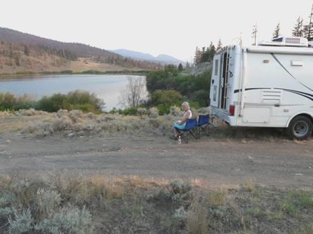
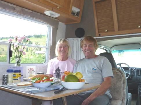
Wednesday 5th August Necessities at Williams Lake 86 miles
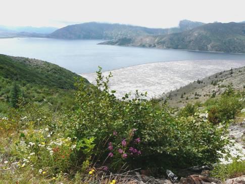
The morning was cool and grey. We enjoyed seeing two loons on the lake, plus a group of Canada geese, and some red-winged blackbirds on the rushes nearby. Yesterday a large speckled bird with barred tail had almost flown into the Bam, and we had seen a marmot beside the road.
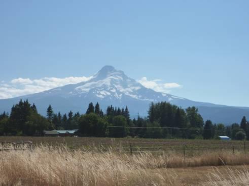
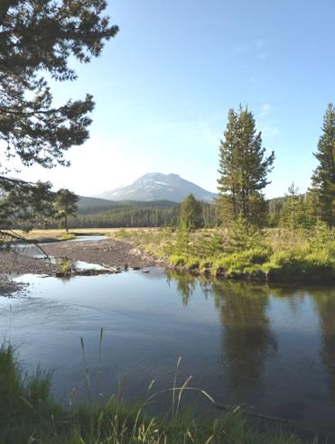
As we set off, we both admitted to being rather disappointed at the thought of going back into civilization, and through previously driven territory, as it is the adventure of new places which we love. But then we came to an unexpectedly steep and long descent to the turbulent Fraser River, which was a lovely surprise. We stopped with a great view of the bridge over it, looking like so many which we have seen before.
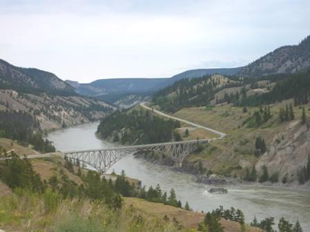
The Fraser River near Williams Lake
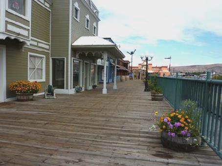
We then arrived at Williams Lake, which we had stopped at to have lunch when returning from Alaska in 2002. We hadn’t been inspired by the town then, and we weren’t now, although it did have some nice flowers!
However, we needed to do essential things – the most important being to get the engine seen to. After trailing around several different repairers we came to one which could look at it this afternoon.
We stopped to have coffee above Williams Creek, where I had seen that there was a river walk. We came back to have a hurried lunch here, after stopping to buy some booze, and shop in an uninspiring Sav-on shop – just afterwards we saw Safeway just up the road! We also managed to get some more money out, after much searching for a bank which liked our card.
We then proceeded to ‘Downtown Services’, where a really nice mechanic called Len started looking at the engine. While he was working, we set off for a walk on the riverside trail, finding a route down through a caravan park just along the road. The track down was really steep. At the top of it, a little dusky coloured kitten pushed its way out of the grass, meowing plaintively. I felt sure that it had lost its mother, and was fending for itself. It was hard not to fondle it, as it was keen to follow us. We waited for a long while, until it finally stayed. On the way down the rough, steep path, we passed two cyclists coming up the slope, pushing their bikes. They asked us it they could get to ‘downtown’ this way. Like locals, we advised them. The woman looked exhausted.
Down by the river, it was a different world from the conglomeration of the indifferent western town above. It was quiet and peaceful.
We returned to the repairers, where Len had changed all the spark plugs, which were in a bad way. Adrian was concerned about the implications of the problem, but at least it was sorted for today, and we could leave Williams Lake.
Before we did so, we found somewhere to send our next email home, along with the website.
We then headed south, hoping to find somewhere to stop for the night, but nothing was forthcoming, as the road was busy. We ended up at Lac La Hache Provincial Park, pulling in at 6 o’clock.
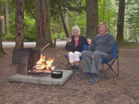
The overcast day now cleared to give a clear evening, which was cool, but pleasant. We had a barbecue, and sat outside, watching a tiny dark squirrel, looking like a furry caterpillar as it scampered down the tree.
The lorries on the road below were noisy, which is why we hadn’t stopped beside the road.
Thursday 6th August To Wells Gray Park at last 79miles
The morning was very cool and misty, but it was sunny before we left at 8.45, and the day became really hot.
We drove across the road to the lake, where there was a nice swimming area, deserted at this time of day. The water felt warm, so I had a delicious swim. Later in the day, the place would be packed.
In the small ‘town’ of Lac la Hache, we stopped at a fruit stall which was just setting up and bought raspberries and apricots. The lake was apparently named by French fur traders, who had lost their axe (hache) in the ice.
At 108 mile house we pulled into a rest area (as we had done in 2002, when we had driven this way). Adjacent to it was a delightful heritage site comprising of several historic buildings, which had either been rebuilt or relocated here. We walked around, as we had done before. One or two buildings had been added since then. There was a beautifully put-together school room, and an atmospheric trappers cabin. Afterwards we had coffee, watching grackles and swallows.
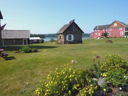
108 Mile House Heritage Site
Just 8 miles on, at 100 mile house, we stopped at the pretty flower-bedecked log Visitors Centre, set beside a small lake and marsh area. We wanted information on Wells Gray Provincial Park, part of which could be accessed from here. The naming of these places relates to the distance from Lillooet on the Cariboo Gold Rush Trail, and would originally have been road houses.
To access the park, we had to drive back a short way, and then take a road off, which eventually became a gravel road. Soon after reaching the gravel section, we stopped to have lunch above Camin Lake, sitting outside on our seats, and enjoying the fresh raspberries, with lovely bread bought yesterday.
When we reached the park, we had a wonderful walk through forest, high above a vertical canyon, to first Mahood, and then Camin falls.
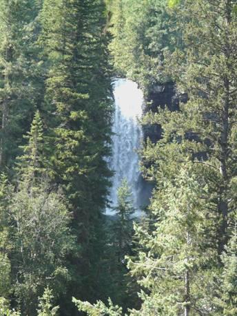
Mahood Falls
We had wanted to visit this park, which is vast, and has just 3 points of entry. We had never been able to stop before at Clearwater, the more popular part of the park, so were really pleased to be able to visit now.
There was a campsite just a bit further on at Mahood Lake, and we managed to secure the last available pitch with a view of the lake.
It was another 8km drive from here to walk to another lot of falls, Deception Falls. After crossing the Camin River, the gravel road became a 4x4 track, which didn’t please Adrian. We drove along for a few more kilometers, unable to turn around, but Adrian was not happy about it. When we reached a spot where he could make a ‘9 point turn’, we did turn around and began our return. We were both disappointed, but didn’t want to wreck the van.
Back at the campsite, we had a pleasant swim in the lake, but the water felt cooler than it had done for my swim this morning. Afterwards we had a barbie, but the mozzies were a bit of a nuisance.
We walked across to the lake before coming in, and again just before bed. The full moon was just rising above the mountain, and stars were beginning to appear in the sky. We could make out Cassiopeia and the Plough, and North Star. It felt very cool.
Friday 7th August A bad day at the office! 140 miles
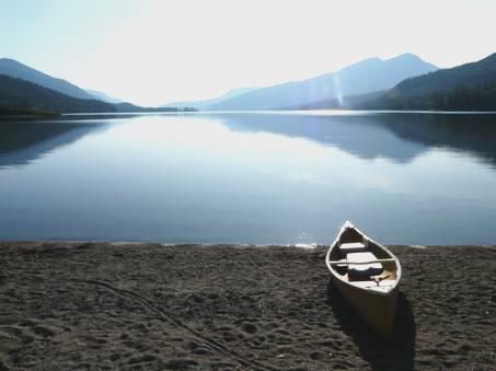
Early morning at Mahood Lake
The day started beautifully! It was a glorious morning, with the sun shining on the lake. We ate our breakfast outside – the only downer was the mosquitoes, but then, at the other side of Wells Gray Park is Blue River, which we remember well from 1989 for the worst mosquitoes ever!
We had opted for a different route back to 100 Mile House, which entailed even longer on the gravel road – 45 km in total. Sometimes the going was very rough, which got Adrian a bit anxious. Both a fox and a large deer ran across the road. Finally, at 10 o’clock, we reached the tarmac at Hathaway Lake.
We stopped to have coffee by Bridge Creek, at the western end of Horse Lake – we had seen no stopping places before that. We watched the ever present swallows and dragonflies, and spent a long time trying to identify a lone duck.
We got back to 100 Mile House, and set about the ‘essentials’. We located the launderette we had seen before, and put in some washing. We then drove back to Safeway (seeing a much nearer launderette), and after doing our shop, tried for an internet connection, which proved difficult. When we finally succeeded, we were surprised, and rather disappointed, to find almost no replies to our ‘escape from the fires’ email. We did hear that Simon & Laure were safely in France, and from Jon that Doug had done well in his ‘Higher’ exams.
We’d had lunch by now, and the washing was dry, so we went to leave. This is when disaster struck! On pulling out of the car park, Adrian brushed against the car parked next to us. Our awning support became wedged into the wing of the other car, and there was no way that we could get out. We were stuck! He tried moving slowly both forward and back, but no good. We had to wait for the owner to return. As this was a free carpark, we didn’t know how long this would be. It seemed an eternity!
Eventually a (rather large) lady – eating an icecream - returned. After her initial shock, she was quite collected, and set about phoning people (while Adrian held her icecream!). She tried the Police (luckily they didn’t want to know). She phoned her work to say that she wouldn’t be returning, and then she rang her husband. Finally she rang a towing firm to come and collect her, which she was able to cancel later.
Adrian was convinced that if she just backed slowly, the two vehicles would be released. She was very reluctant, but he was right, and soon the two vehicles were un-entangled. The driver’s door wouldn’t open, because of the damage to the wing, so the woman had had to get in through the passenger side, which of course she found difficult, because of her large size. Soon the husband arrived, and after his initial ’well, it’s only metal’, he showed a more unpleasant side of his ‘know-all’ nature. ‘Well, it’s gonna cost ya’.
It wasn’t a nice time, but, with addresses etc exchanged, we finally left.
So we left and drove on south towards Cache Creek – a place we well remember from our visit in 1989. The scenery around here is so arid – a semi-desert. We remembered that there was a petrol station then which wasn’t yet open – it would be open in two days! I saw a place selling jade, which is my memory from 20 years ago. We needed to get petrol, it was as troublesome here as it had been at 100 Mile House.
But now a bigger problem loomed – Adrian realized that the engine was still misfiring, despite having had all the plugs changed. This problem – that something is direly wrong with the engine, surpassed all the others!
We drove on through Ashcroft, where we saw a really long train, but when we stopped at the level crossing, just a double engine with two carriages went by!
Turning off from here, we found a BC free camping place, beside Willard Lake. The small site sloped steeply down to the little lake, but after investigating, we found that we could park right at the top by the road.
Calming down at Willard Lake
This place was the tonic we needed for our ‘troubled minds’. It was so peaceful! Many of the trees surrounding the lake had been killed (presumably by the spruce beetle), but the little lake was so still, with uncanny reflections, and it was so quiet, with the gentle scent of wormwood.
We sat for a long time, before we could think about eating, but in the end we cooked a nice meal of fish, and sat outside until it got almost dark. It had been really warm, and we had seen a couple of loons on the lake, and some Eastern kingbirds in the trees.
At bedtime we looked out to the full moon and the stars. It was oh so peaceful!
Saturday 8th August Drab and drear, but then more clear 142 miles
We saw the red sun rise, but it then went behind hazy cloud. The morning remained misty – I wondered if it was the smoke from the fires in the Okanagan, which we know are still affecting the area. It was cooler than we’d imagined.
Initially we followed a high mountain road, but the views were obscured because of the mist. Everything looked very drab and drear, with very little colour. Then we saw a strange sight- the whole valley was filled with water, with an eerie looking chalky sediment, some of it turquoise in colour.
Some miles further on, we came to the cause of all this – a vast open copper mine at Highland Valley.
The road by-passed Logan Lake, and then we arrived at Merritt, which we had driven through last year. When we got an internet connection, we looked at the weather forecast, and saw for the first time a flame symbol for some areas – indicating smoke from the fires. We looked up road closures, and luckily the route that we’d planned seemed to be OK.
Adrian bought some more oil for our hungry engine, but he was happier with its performance today.
From here we intended taking the route 5A, but mistakenly took the 5. As this was like a motorway, it was about 10 miles before we were able to do a U-turn! We stopped to have coffee before returning, and then taking the right road.
We had driven the later section of this road in 1989, and had liked it, but today it still looked rather drab. We stopped to have lunch by a nice little lake, and the sun tried to break through. Just a bit further on, we stopped at Allison Lake, which we had stopped at in 1989, and the boys had swum. We had noted then the chalky white soil, and it was the same now. What was different though, is that a small settlement has developed around the lake – we’re sure that there were no houses then. Bald eagles were noisily perching on a nest high in a tree opposite – this is certainly our year of the bald eagle!
Adrian at Allison Lake – remembered from 1989
At Princeton we took Route 3 eastwards, along the steep sided valley of the Similkameen River. This road was busier, but before too long we came to a Provincial Campsite called Bromley Rock. There was just a double line of pitches, 17 in total, but we were in luck – there was just one unoccupied (this is Saturday).
Bromley Rock on the Similkameen River
We pulled in above the river, and after a look around, had a refreshing swim from the sandy little area below. The sun was pleasantly out now, but it was quite windy.
Consequently we cooked and ate inside, which made a pleasant change. After supper the wind dropped.
Sunday 9th August Canadian desert, then back into USA 101 miles
The day turned out really hot, but it was cloudy at breakfast time, which was a shame, because the sun had shone briefly onto our pitch.
We ate our breakfast outside listening to the monotone sound of birds singing, and looking down to the clear river.
Adrian had decided to leave our lovely red cedar firewood behind, as he thought that they wouldn’t want us to take it into USA. We don’t expect to be able to have campfires there either.
We had been amused at the camping groups around us – next to us was a large group – presumably family – with a fifth wheeler, and tiny tent, which was all but collapsed, but kids had slept in it.
We continued down the lovely Similkameen valley – a bit like the Dordogne or Tarn – passing Hedley, which had been a former gold mining town. The town still looked quaint.
We stopped by a marker telling of mountain goats. We didn’t see any, but were surprised to find that they are not goats, but actually antelopes.
We reached Keremeos, and this was the start of the vast orchard and wine making area. There were fruit stalls everywhere, but no use to us, as we are travelling on into USA. The valley had now widened, and all available space was taken with market gardening.
We now left the valley, and drove through a really arid area before we came to Osoyoos. We stopped to look at Spotted Lake, a small pond, filled with 360 circles, formed by minerals. The pond was almost dried up, being summer, but it had great significance to the native population. It was a strange sight.
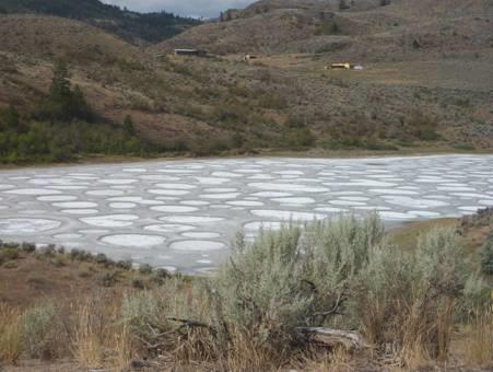
Spotted Lake
We stopped to have coffee with a view looking down over Osoyoos, the vineyards contrasting with the barren starkness of the surrounding arid, bare hills. Being Sunday, many cyclists had been riding up the mountainous road we were on.
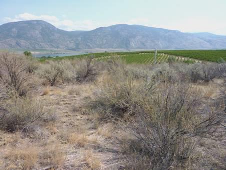
Vineyards contrasting with the natural desert
We had driven up through Osoyoos in 2002. We hadn’t remembered the significance of the vineyards filling the valley. This time, we located the Desert Park, and had a hot, but pleasant, boardwalk around this surprising desert area of Canada. As we know in desert situations, there is not a lot of colour or wildlife to see, but it was interesting to think how it contrasted with the irrigated fertile orchard lands. We did see a stuffed barred owl in the entrance, and are sure that it was a barred owl which almost flew into the Bam the other day.
We now made our way to a nice little beach area – a Lions Club park. The grass was watered, so the bright green contrasted with the desert around. Families were enjoying themselves here, but we found a shady table to have lunch, and then afterwards a swim, but the wind, and the profusion of pleasure craft, made the water choppy. This is supposed to be the warmest lake in Canada, and hence is very popular. It was good, but we have felt warmer water!
Near the centre of the town, we walked a bit along the lakeside walkway, which made us think of Nakusp, with flowers alongside the lake.
There was a Provincial Park campsite just south of here, and we had thought of stopping there for the night. It was on a long, thin peninsula which jutted out into the lake. We had read that it was the most popular park in BC, and of course it was full. We did stop to walk a nice little wetlands walk at the start of the peninsula.
So, before we were ready, we reached the border with USA at 4.15. We had been eating up any fruit, and although we were ‘searched’, everything was OK, and we found ourselves in Oroville, USA.
We stopped to shop here in a large supermarket called Princes, where prices seemed a bit cheaper than Canada. We were served by a pleasant and competent young girl, and then continued south.
We headed for a supposed free camping place at Tonasket, where we had stopped to get water in 2002. Now, sadly, camping cost $18 – a sign of the times. (Actually, on looking up our diary for 2002, it had cost $12 then!)
We continued south, having re-thought our route, as the one we had intended went over a pass, and we don’t think that the Bam engine is up to it. This means repeating some of our previous route.
There were few places to turn off the road, but at 6 o’clock, we found a pull-off amidst the dry scrub, with steep mountainside up behind. The sun hadn’t quite gone down behind the hill.
While I prepared a delicious prawn salad, Adrian sorted our onward route through USA.
We were both feeling rather sad that we have now left Canada, and all our exploring there, after so many years, and without the incentive of Simon & Laure being there.
Monday 10th August The fabulous and unexpected Grand Coulee 157 miles
We left our pleasant spot and drove south to Omak, where we had trouble in getting an internet connection, but anyway had no new messages when we did.
Adrian needed a phone connection, so that he could sort out our insurance, after Friday’s mishap. Finally he was successful, and was dealt with by a nice lady, so hopefully that is now settled.
We had travelled this bit of route in 2002, and I had noted then a marker about the Cariboo Trail. We saw it on passing, but were going through a section of roadworks, so couldn’t stop.
There were orchards in the valley here, and endless wooden crates ready for packing the fruit, but virtually no fruit stalls like there had been in Canada. We did find a small one to stop by, and bought some local cherries and nectarines.
We’d intended stopping at Fort Okanogan State Park for coffee, but when we got there, found that the park was closed on Mondays & Tuesdays!
After that we couldn’t find anywhere to stop. Orchards now lined the road. We reached Chief Joseph Dam, and stopped to get some petrol on the outskirts of Bridgeport. We drove into this quaint little place – rather like a Route 66 town – and stopped by a little campsite/picnic area beside Lake Pateros (part of the Columbia River).
As we drove back out of the town, we saw that the dead tree trunks beside the road had been carved into wonderful shapes.
We pulled in at a viewpoint over the dam, named for Nez Perce Chief Joseph, whose burial place we had seen last year when visiting this area. The dam looked like a smaller version of the Grand Coulee Dam, just a short way east, and is the second biggest producer of electricity in USA after the Grand Coulee.
The road we now took was sometimes lined with yellow grass, looking like fields of wheat, but later we did pass through a flat area, where the fields of stubble alternated with dry ploughed fields, where we could imagine the dust bowl, as clouds of dust blew up.
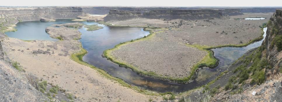
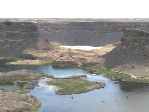
We stopped to have lunch in a large, newly tarmacked area just before Coulee City, at the end of Banks Lake. We looked down to the weird sight of the barren, colourless Grand Coulee (coulee means dry channel – a gorge). It was like the Grand Canyon in monochrome.
We drove on down the hill, and stopped at Dry Falls visitors centre. “Dry Falls”, said Adrian, “that can’t be very interesting”, but he was wrong!
Spectacular Dry Falls
These falls were apparently formed at the end of the ice age, and were supposedly the largest falls in the world – much bigger than Niagara. The sight was amazing. Inside the Visitors Centre, we saw exhibits about the phenomenon, and watched an excellent film about the formation of the falls, which flowed each time an ice dam broke, up in Montana. It is estimated it may have happened up to 80 times, but now all the water flows down through the Columbia Gorge so the falls are dry. The theory of all this was put forward by a geologist called J. Harlen Bretz who suggested the idea in the 1920’s, but it took another 45 years before it was generally accepted.
Just a bit further on, we drove down into Dry Falls/Sun Lakes State Park. This was in sharp contrast to the surrounding arid hills – it was a bright green watered area, with an RV resort, and a golf course. At the far end, we found a little beach area to swim in, but the place was much too busy for us. We enjoyed the surroundings, and drove on. Further down the valley we stopped to walk to Lenore Caves. This entailed a drive down a very corrugated track. The initial level walking track soon became a really rough one, as we wandered up the basalt cliffs to several openings in the rock face, where native people used to spend some of their summers. It was delightfully quiet up here, and very warm in the sun, and we had fantastic views down over the vertical gorge.
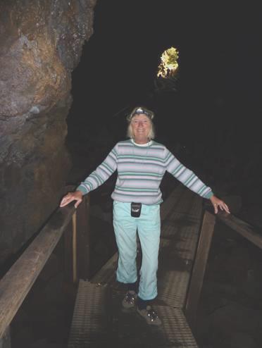
Rosie by one of Lenore Caves
We stopped again at Soap Lake, so called because the water leaves suds at the edge of the lake. Apparently the water of the lake is made up of many minerals, similar to Baden Baden in Germany. The native people knew of its healing properties. Today, the water level was rather low, so it wasn’t very inviting. There was an RVPark/campsite by the lake, but there was no shade, so we didn’t stop. Nearby was a newly erected statue, honouring the native people, and put together by local subscription.
The town of Soap Lake seemed nice enough, but now we came into real agricultural, flat lands, where there was nowhere at all to pull off. What a difference watering makes, and this was the area of the huge circular watering systems.
We turned off on to smaller roads, with no success, until at 6 o’clock, as if by magic, we came to a pull off for a conservation area, called ‘The Desert’, beside a fast flowing channel.
This suited us, and Adrian soon got the barbecue going.
The stars at bedtime were wonderful, but not the mozzies which came in!
Tuesday 11th August Petrified logs, and a stunning gorge 105 miles
It was cloudy as we left at 8.45, driving through the flat, irrigated, agricultural lands, contrasting with the dry lands of Frenchman Hills to the south.
We soon came to the wide Columbia River, which was dammed at this point. We crossed it to a place called Vantage, which had once been sited on the valley floor below, before the flooding of the valley.
We made for Ginkgo Petrified Forest State Park, high above the river. It was too early for the interpretive centre to be open, but there were lots of examples of huge petrified logs nicely arranged outside.
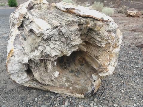
A petrified log
It was a lovely setting, with the steep sides of the valley, and the dark basalt. A short trail led to some well preserved petroglyphs, which had also been removed from their original site lower down in the valley to save them.
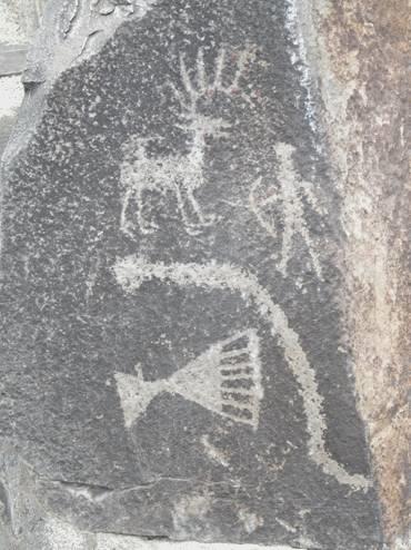
Well preserved petroglyphs
A couple of miles further on, we walked a trail around another group of petrified logs – some ginkgo, but also elm, horse chestnut and walnut, amongst others. It was a rough path through the arid hills – supposedly only ¾ mile long, but seeming further. It had been constructed by the CCC in the 1930’s. It was warm, but windy. We saw a Northern harrier flying over and then landing.
On the trail of petrified logs
We now drove to Ellensburg – a fine University town with some lovely old buildings. Adrian was keen to find someone to work on the Bam’s engine problem. He visited two different garages, where the people were pleasant and helpful, but couldn’t do the work this week.
We decided to drive on to Yakima, a larger town not far away. Our route followed the Yakima Canyon, winding back and forth by the river. It was quite delightful, with the fast flowing river set between the high, dry hills, covered in bright beige coloured grass, and alternating with the vertical basalt rocks.
We stopped to have lunch beside the river, watching bank swallows swooping down low over the water. As we were about to leave, a long train pulled by 3 Sante Fe engines noisily trundled past on the other bank. We set off in hot pursuit so that we could photograph it.
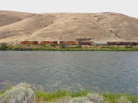
The Sante Fe zooms through Yakima Canyon
Yakima was not such an attractive town as Ellensburg. We spent a long time searching for the one Chevrolet dealer, and the man Adrian spoke to here was far less optimistic than the earlier people had been about sorting the problem. This worried Adrian, and left him feeling rather disgruntled.
We left there, and finally located the Visitors Centre, where we picked up some leaflets on the town and surrounding area. There were trays of local fruit which we could help ourselves to.
Not far away was Yakima Sportsman State Park – a very large area for so close to town – and with a campsite. We made our way there, and having located a pitch, walked out to a trail which the map showed as going beside the Yakima River, but it only led along the flood dike, with trees beyond, and no sign of the river! We walked back through the wild scrubland which covered this area before it was tamed.
We ventured outside to eat supper of the superb soup I had made the other day, until it began to rain lightly. We had seen a black and white skunk run across into the bushes.
Wednesday 12th August More work on the Bam, then off into the hills 48 miles
We had booked the Bam in to be seen to at 7.45 so left at 7.30 and made our way to the Chevrolet dealer.
It was an overcast morning, which later became hot. The locals were glad that it was cooler and damp – temperatures have been in 100’s°F lately.
Having left the Bam, we crossed the parking area to Walmart, trying to fill in time. We did buy a few things, including some bubbly for our wedding anniversary tomorrow. We hung around a bit, waiting for a diagnosis on the engine problem. There was an internet connection, so we occupied ourselves until a pleasant young woman called Shawna drove us down into the town.
The centre of Yakima, like so many American towns, is rather barren, but we did have a walking trail map, and saw one or two interesting buildings. The area by the old railway station was the most interesting. A row of tourist shops had been fashioned on to the front of old goods wagons, and a carriage was now a children’s nursery.
An unusual shopping mall, front and back, Yakima
Nearby we went into a huge emporium jam-packed with antiques of all sorts, all aesthetically arranged. Everything imaginable – glass, china, records, books, photos, dolls prams, children’s cars – were there. Another store also had records, cassettes, old games, pop posters. The man saw my walking leaflet, and said that he had delivered them to the Visitors Centre yesterday.
It was very hot as we made our way back to the repairers. The news regarding the plugs wasn’t good. It seems that the plugs which we’d had fitted the other day were the wrong ones. These were replaced, but apparently it’s an ongoing problem, which isn’t going to go away.
Adrian still thought that Kevin, the chap who he’d spoken to yesterday, had a pessimistic outlook. He was walking with crutches, after breaking his ankle in a fluke accident. The mechanic was even more dour.
However, one of the lady assistants had given Adrian a chuckle. She had liked his accent, and when she’d heard that he was from England, asked what was there to visit. She’d heard of London, and wondered if that is where the Eiffel tower was. When Adrian said ‘No, it’s in Paris, France’, she had said ‘isn’t that in England then?’
Having paid up, we left – originally we had thought that we might have been there for at least a day. Our route now was to head towards Mt Rainier. We had to travel a short way on the motorway, and just as we manoeuvred a junction which I had found confusing, a sudden blinding storm hit us, coming from nowhere. We couldn’t see anything, but luckily found a place to pull off and wait until the deluge had passed. This it did fairly quickly, and having travelled on a couple of miles, the road was bone dry – there’d been no rain at all there.
We drove through Naches, a small town with loads of fruit stalls, and hundreds of wooden boxes waiting to load the fruit, but we already had plenty.
We were following the scenic Naches River, which joins the Yakima River at Yakima, and then we continued on the Chinook Scenic Byway, through lovely scenery, with occasional basalt lava outcrops. It soon became quite forested.
We pulled into a forest campsite called Saw Mill Flats, and found a nice little pitch beside the river., but unfortunately, it then started to rain.
When it had stopped, we walked out around the site. It was a shame, that even though it is cooler, there is still a campfire and barbecue ban.
Thursday 13th August Marvellous mountain scenery and myriads of flowers for our 43rd Wedding Anniversary 82 miles
We exchanged cards, and then enjoyed bacon pancakes for breakfast, listening to some of our favourite music. The sun shone from a tiny gap in the tall trees before we left at 9 o’clock.
We continued through the fantastic scenery following the American River, with sheer outcrops of basalt beside us.
We stopped to view Fife’s Peak, and then to walk a mile long trail amongst huge anthills and gigantic ancient trees, some with trunks looking like chocolate Christmas logs.
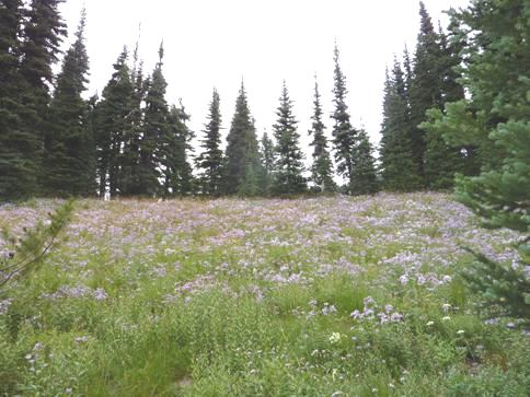
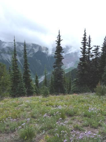
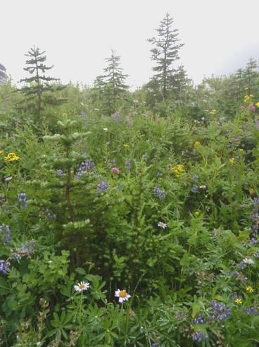
We reached Chinook Pass, 5432ft, and were staggered by the amount of wild flowers. Clouds were swirling around, but we had been pleased until then to have good visibility.
Men were working on the supports for the large wooden entrance to Mt Rainier National Park. We stopped just afterwards where there was a small pond on either side of the road. We walked down to one – the air was chill, but the flowers were wonderful.
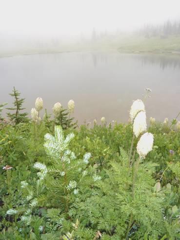
Misty seed heads
We continued through Cayuse Pass, and then took the road which follows the White River, before ascending to Sunrise – the highest place you can drive to in the park. The road was built in 1929, with some help from the CCC. Amazing to think of cars coming up here then.
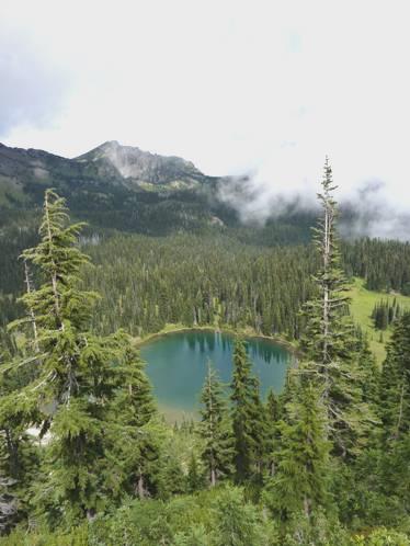
Sunrise Lake
We stopped at what was called Sunrise Point, where the cloud was variable, but there were no views of Mt Rainer. We drove on to Sunrise (6,400ft), and stopped to have a nice anniversary lunch, including some local fruit.
Anniversary Lunch
Lots of walks radiate from here, and Adrian chose one which took us to small Shadow Lake. It was a delightful walk, with few people. The air was really chill, but the wildflowers were out of this world – meadows of alpine michaelmas daises in shades of purple, yellow arnica, and flowers in pink, white and blue. Tiny ground squirrels scurried off, and we watched a hoary marmot. There were plenty of birds, including Clark’s nutcrackers.
Meadows of Michaelmas Daisies
Although we never did see Mt Rainer, we could see Emmons Glacier – one of dozens of glaciers on the mountain, and could look right down to where White River emerges from it.
Looking down to Emmons Glacier and White River
Now we drove back down from Sunrise, and followed the road south to Ohanapecosh campsite, just inside the park. We went through cloud and rain, but also some sun. The vast campsite was really busy – mostly with tent campers. The ‘reserved’ signs were difficult to comprehend, but we finally found a place suitable for us. We had seen people having campfires, so were upset to have left our lovely firewood behind in Canada (they didn’t even ask about it at the border).
Luckily there was a ‘firewood truck’, which was driven around the campsite. It was a long time before the man reached us, but then he cheerily handed over a nice bundle of wood, and Adrian got the fire going.
This was our first real campfire of this trip (we’d been allowed a small one after 8 o’clock at Port Hardy) – so how fitting that it was on our anniversary.
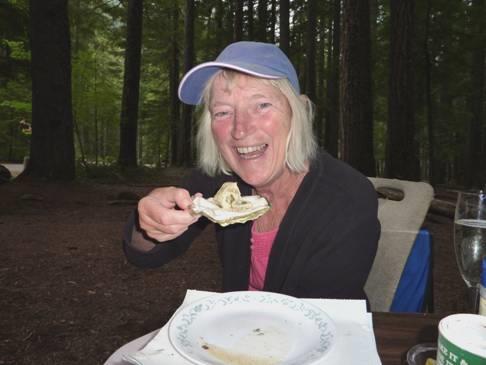
We opened the bubbly, and cooked fresh oysters on the fire – how romantic is that!
Oysters on our anniversary campfire
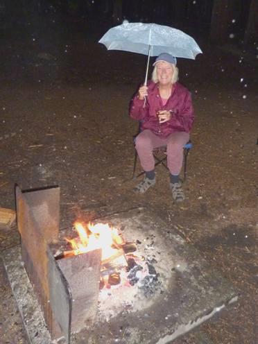
As we baked the potatoes, it began to rain lightly, but at first we were sheltered by the enormously tall trees. Soon the rain really did fall but, reluctant to go in, we sat out under our umbrellas, enjoying the fire for as long as possible!
Finally we came in and watched through the series of photos which our boys had prepared for our Ruby Wedding.
It had been a lovely, and memorable anniversary.
Friday 14th August More of Mt Rainier National Park 50 miles
It was a damp day as we left at 9 o’clock. We could have walked from the campsite to Silver Falls, but this was a long walk, so we drove a few miles up the road, entering the park proper at Stevens Canyon entrance, and then parking by the road - from here we could do two walks.
The first led to the Silver Falls, and was a lovely walk through ancient forest, with trees dripping with moss and lichen, and with no other people at all. We came to a series of rapids, and then finally to the falls. They were set amongst huge rock boulders, with a lot of logs caught in the river bed.
We returned from here, and set off to walk to the Grove of the Patriarchs. This was a much more popular walk, and was quite busy.
It was another lovely walk, initially beside the attractive Ohanapecosh River, and then crossing it on a ‘one person at a time’ suspension bridge, where the trail started from. It was through more ancient trees, some as old as 1,000 years.
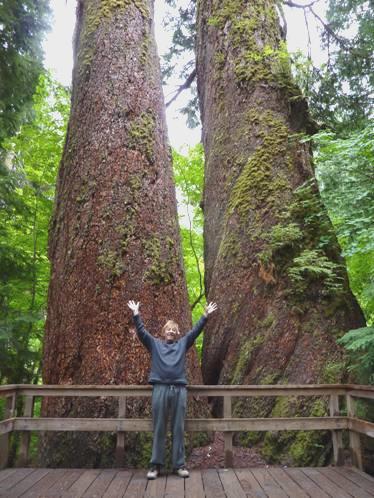
Adrian by twin 1,000 year old Douglas Firs
We returned to the Bam for coffee, and Adrian replaced one of the direction indicator light bulbs, which had blown.
Now we continued west through the park, stopping at Box Canyon where we walked a short trail past moss covered slabs of huge volcanic rock to look down into a canyon – 180 ft below.
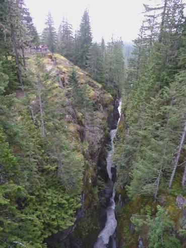
Deep Box Canyon
We were following Stevens Canyon, with dramatic scenery, but the visibility wasn’t very good. We reached the area called Paradise, and it was anything but that! We couldn’t even see where we were going, let alone any views. The thick cloud meant that we had no visibility at all. We managed to find the picnic area, and had lunch, with pretty flowers around us, but we couldn’t see anything else.
All we could see of ‘Paradise’
We drove on past the Visitors Centre, where the car park was jam packed, so we just continued on our way. Soon we came to a viewpoint to Narada Falls, where there was a dramatic view to the falls 168 ft below. We saw a Stellars Jay here, and another at Ricksecker Point, high above Paradise River. We had driven on a short diversion to reach this point, but by now the visibility had improved, and we could appreciate the fantastic scenery more.
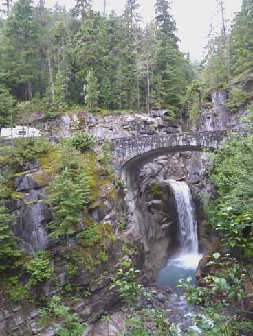
We stopped again by Christine Falls, admiring yet another deep canyon with waterfalls.
The Bam hiding by Christine Falls
By the time we reached Longmire, the sun had come out! This is where the Longmire family had settled in 1888, setting up a ‘health resort’, because of minerals which bubbled up from the ground. We really enjoyed our walk around here, through more ancient trees, and with meadows with views of the bubbling springs. There were quotations by John Muir as we walked around the site of the original homestead. We saw a colourful Evening Grosbeak bird.
The mineral meadows at Longmire
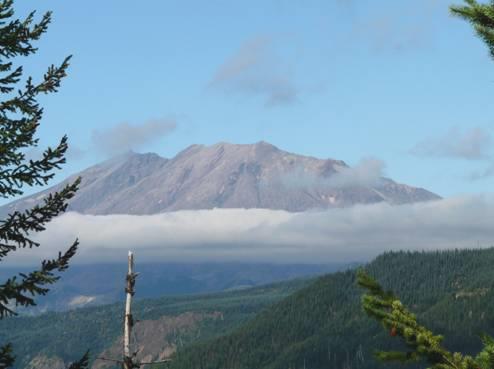
Now we drove out of Mt Rainier National Park, passing the site of Sunshine Point campsite, which had been completely destroyed by flooding in November 2006. We hadn’t ever viewed Mt Rainier, but we had enjoyed some wonderful scenery. (We have seen Mt Rainier before, both from the air, and from the ground.)
Soon we came to a National Forest site at Big Creek, and found a pitch beside the creek, right next to a huge erratic boulder. You could have campfires here, but we only had a very little wood left, and the wood to buy was expensive. As you could collect ‘downed wood’, we set off on a ‘wooding patrol’, and managed with the little that we found, plus two pieces of our own wood left from last night, to have enough for a fire. Adrian set about chopping, and lit the fire early, as the evening had clouded over again, and rain threatened.
We had a lovely evening, with a good fire, coming in when the fire died just before 9 o’clock, and just as the rain set in.
Saturday 15th August Mount St Helens revisited 100 miles
After a really cool night, we had a delightful drive down to Packwood, on a winding, badly surfaced road through the forest. After a while, the road followed a small river. There were little tents everywhere – this must be known as a haven for free camping.
At the small and unpretentious town of Packwood, we pulled in to buy some firewood from someone’s back yard. Adrian was served by a very pleasant chap, and as we went to drive out, I spied a ‘wood truck’, and we realised that it was the same man that we had bought firewood from at Ohanapecosh campsite a couple of days ago. That is only a few miles up the road, as we have been on a long loop to Mt Rainier.
We followed the wide, flat Cowlitz valley to Randle, where we called into the National Forest Ranger station for some info.
Now we took the road south, from where an offshoot leads up Mount St Helens. We visited Mount St Helens two years ago, from the western side, but were pleased to be able to access it from the east.
Many roads in the area have been closed because of various flood damage. A bridge on our route had only recently been replaced after 6 months, and as this is the only north-south road at this point, we were very lucky.
We stopped to have lunch at a well worn picnic table at Iron Creek, amidst huge moss covered trees. A biker was at the next table. He lived in Tacoma, and was out for a days ride, and had brewed up his kettle on a little stove, and was having lunch.
This area is popular with bikers. At the first viewpoint we stopped at on the road up the mountain, a biker asked me if I would photograph him and his mates (all with smart bikes). I looked through the viewfinder, and said ’I can’t see the one at the back’. This turned out to be someone who was just walking past!
Later two ladies asked Adrian to photograph them. When they found out that he was from England, they started speaking slowly, saying that they were from Oregon, and then said ‘merci’!
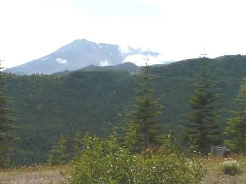
Mount St Helens
The cloudy morning had cleared to give a clear sky, so we were pretty lucky with our views of Mount St Helens. On our last visit, we had only glimpsed the summit.
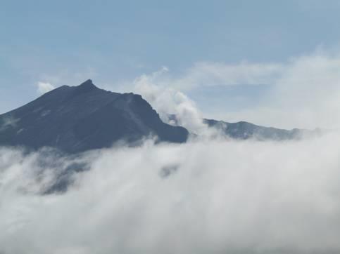
The summit of erupted Mount St Helens
Mount St Helens is famed for its eruption in May 1980. The effects were devastating to a wide area, and the shape of it was changed completely. We stopped at all the various viewpoints as we drove the road to aptly named Windy Ridge – the furthest you can drive to.
Log blocked Spirit Lake, formed by the 1980 eruption
A bonus was that we had excellent views of Mt Adams too, although Mt Hood stayed shrouded.
The site of forests of dead trees – killed by the tremendously high winds and high temperatures of the eruption - was quite eerie. Some areas had been replanted, and wildflowers were beginning to grow, and I saw swallows flying.
At Windy Ridge, you could climb 368 steps to get even higher, but as cloud now shrouded some of the summit, we declined!
We did make a short trail on our return to small Meta Lake, which contained hundreds of tadpoles, and where fish were jumping high out of the water.
Having descended from the mountain, we drove on south, stopping just before 5 o’clock beside the road, where we had excellent views back to Mount St Helens.
Although it got rapidly chilly, Adrian lit the barbecue, and we ate outside, enjoying our exquisite view of Mount St Helens as the sun went down, and coming in at 8.30.
Sunday 16th August From Mount St Helens to Mt Hood 100 miles
Ethereal Mount St Helens in the early morning
The clouds cleared to give us a good view of Mount St Helens as we left at 8.45. The view was even better just a bit further on, at the ‘official’ viewpoint. We watched birds here, including a Steller’s jay and a sapsucker (like a woodpecker).
We then descended a very long way, stopping to walk over to the Muddy River (which it wasn’t), which had been in a deep valley far below us last night.
We had one last superb view of Mount St Helens from McClellan’s viewpoint, and could just glimpse what we thought was Mt Rainier in the far distance.
We descended even more, towards the Columbia River, reaching it at the low-key town of Carson but it is always an unwelcome shock to come back into civilisation after the wilderness. We didn’t find the RV dump which was on one of our maps, and found ourselves back beside the river, with memories of our ‘Lewis and Clark’ expedition 2 years ago, when we had covered this area really well.
We were just repeating a short section now, in reverse, as far as the bridge across the Columbia River to the town of Hood River.
Remembering Lewis and Clark at the Columbia River
We very soon came to a riverside park at Home Valley – deserted when we arrived at 11 o’clock. We took our tea/coffee down by the river, beside a little swimming area. It had been lovely in the mountains, but it was wonderful to come back to warm sun!
We were in great need of getting water, and by luck, there was a tap right where we had parked. We thought that we’d have a swim, but filled the water tank first. By now the park was filling up rapidly – many had gathered for a family reunion. All went well – we enjoyed our swim, and left at about midday.
We drove east for a few miles. This is the area of the Columbia Gorge, where the scenery changes from green maritime to arid semi desert almost instantaneously. We remember it well from before, but it still staggered us.
We wanted to stop by the river for lunch, but everywhere was really busy, being a fine Sunday. We pulled off onto a rough space beside the road, and immediately above the river. We got out our chairs, and prepared lunch. It was then that a young chap arrived and unpacked his windsurf. He said that the place would fill up soon, as it was a top windsurfing spot! Luckily no more cars had arrived by the time we left!
Just before we crossed the river on a long and very narrow toll bridge, we could see Mt Hood splendidly in the distance. We had many more views as we continued south.
The town of Hood River was horribly busy. We stopped to get petrol, and then oil (the engine is still using it hungrily), but didn’t stop in the town itself. We did get an internet connection, and received a welcome email from Simon, telling of their latest developments in France.
We now left, and headed south on the Mt Hood scenic byway. We had been prevented from coming this way on our previous visit, as part of the road had been closed, and we’d had to make a long diversion. The weather then had been horrendous for part of the journey, and we’d only glimpsed Mt Hood briefly next morning. Today the weather was glorious, and the views perfect.
One of our ‘perfect’ views of Mt Hood
This was a prime fruit/vine growing area. We stopped at a fruit stall and bought blueberries and cherries and had an icecream – as so often, even the smallest size is enormous.
We now entered Mt Hood National Forest, and soon came to Sherwood Campsite, a small site beside the gushing east fork of the Hood River. (the next campsite is called Robin Hood!)There was one spot just right for us, but we took a long time manoeuvring into it, as there were small trees stumps right in the middle.
It was very quiet – just one other camper came in later. We had a fire, right by the river, and after our meal ate some of the fruit we had bought. A dipper was having fun in the water in front of us. Before coming in at 9 o’clock, we toasted crumpets on the fire.
The stars were good, but it was hard to see them through the trees.
Monday 17th August More forests and streams 140 miles
It was cool in the morning, with the sun behind the tall trees. We extricated the Bam from our spot, over the three small tree stumps, and left at 8.45.
We continued towards Bennett Pass (4647 ft), turning off first on the Sahalie Falls Loop. We finally reached the falls, but the road by them was blocked off, so it wasn’t a loop at all! The falls were quite pretty, and we had had more views of splendid Mt Hood.
This is a big winter sports area, with roads and pull-offs to match – not really our idea of a ‘Scenic Road’. We soon came to Barlow Pass, having crossed the White River, which is where the road had been closed when we were wanting to drive this loop 2 years ago.
The Oregon Trail passed through this way. We turned off at a marker to a grave to honour those who died on the trail. There was a mile long walk to the grave, but we didn’t find the start of it. We did see a marker to the ‘Barlow Road’, the first east- west road built through the Cascade Mountains.
We now followed rural, forest roads, stopping by a ranger station, but it was closed today, so we weren’t able to pick up any maps. Tracks went off to the side of the road, but there were no places just to pull off. We drove for a long stretch where the road was just a single track, but there was no other traffic about today.
We finally pulled in for coffee beside the Clackamas River, at a little spot which would have made a good overnighter. People must have been camping here at the weekend, and left some firewood, which Adrian couldn’t resist collecting and chopping up!
We drove through more forest to the Breitenbush River, but driving through roads with tall trees either side was beginning to lose some of its attraction!
We were now looking for somewhere to stop for lunch. We thought of pulling off beside the road, where people had been free camping at the weekend, but luckily we didn’t, as we came to an attractive day-use area where the river flowed into Detroit Lake. This did us nicely for lunch and for a swim across the river and back afterwards. By now the sun was really hot.
We continued south towards the Santiam Pass (4817ft), driving mostly through forest, but at one point through a section of lava beds. We had seen several peaks around, notably Mt Washington (7794ft), which we stopped to view. A vast area had been destroyed by fire here in 2003.
Mt Washington with fire burned trees
Soon afterwards we pulled into Indian Ford campsite, near Black Butte, at 3.40. We had just come back into the arid lands, and the ground here was just bull dust. There was a small stream running through the campsite, and the pitches were enormous, but as the ranger who called in just after we had arrived said, this is really an overnighter site, or an overflow when everywhere else is full.
It suited Adrian as he could continue with his polishing of the outside of the Bam.
We enjoyed the dry atmosphere, and the different vegetation, and had a lovely campfire and didn’t come in until 9.30.
Ponderosa Pines
Tuesday 18th August Going round the Bend, but getting out of it 70 miles
The deep red trunks of the ponderosa pines looked wonderful in the early morning sun. We walked to see the little stream which flows through the arid campground before leaving.
They’d started resurfacing the road just as the campsite road met the highway, but we were in luck – we were waved on, but there was a long queue at the end, waiting for the ‘flagger’.
We drove through the pleasant town of Sisters, and pulled in for a great view of the ‘3 Sisters’ peaks – all over 10,000ft, and of other high peaks around. The land here was flat, with sagebrush.
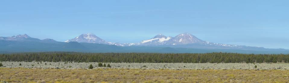
Broken Top and the Three Sisters
We reached the town of Bend, and did a long circular tour until we reached yet another engine repairers.
Even though we’ve now had the sparking plugs replaced twice, the engine still hasn’t been running properly. We found ‘Daniel Automotive’, but the owner was called Jason. Adrian chatted to him for a long time, but the end result was one which we didn’t want – we needed to have a new engine! This wasn’t what we wanted at this stage of the game, when we are hoping to sell the van after this trip. After a while, we drove off to a shady spot to talk things over, but came to the conclusion that this was the only option.
We returned to discuss our decision with Jason. He couldn’t start the job until Monday, but could do a ‘bodge’ later today to keep the engine going until then.
We drove back to the small Pioneer Park, beside the Deschutes River, and ate lunch sitting on a shady bench. We had just pulled in, when a man came and asked about the van – we’ve had a ‘for sale’ sign in the window for some days, and this was the first person to enquire! He was only asking out of interest, but we saw the funny side!
We stocked up in ‘Albertsons’, before coming back to ‘Daniels’, where we had to hang around for the engine to cool down, before Jason could start working on it.
By the time he’d finished, it was 5.30. We left Bend, stopping to get fuel and propane (the attendants asked Adrian about selling the Bam), and headed out on the Cascades Scenic Byway. We drove past Mt Bachelor – a top skiing area – to Soda Creek campsite. The small site was almost full, but we found a spot. From there we had views across a meadow to ‘Broken Top’ and other peaks, past sparkling Soda Creek which was just in front of us.
Birds flitted in the trees, and two crossbills came down to our fireplace, one sharpening its beak on a bit of pumice. Ground squirrels scurried around.
Looking across Soda Creek to South Sister
We sat in the sun, with our view out over the open meadow, and ate sushi (my favourite) and supped wine. There were annoying flidgies and a few mozzies and wasps, but after the sun had gone down, we lit the fire, and sat by it until 9.40. Bats had been flying over, and now the stars were brilliant, with no trees in front of us to hide the view.
Wednesday 19th August Peaks, lakes and lava 126 miles
It was a beautiful morning, with birds flying around, and our view up to South Sister and Broken Top. We braved the bull dust to breakfast outside.
There was a trail leading from beside our spot to Sparks Lake. We had no idea how far it was, so decided to drive there. After 1½ miles of corrugated track, we would have turned around if we’d been able, but at last we came to the actual lake. It was absolute perfection! The peaks of South Sister and Broken Top were reflected in the still water. Ospreys flew overhead, and plunged with a loud splash to get their prey. A bald eagle sat high in a dead tree. We really had to tear ourselves away.
South Sister reflected in Sparks Lake
There were outcrops of lava by the lake (our fireplace last night was made from lava rocks), and we passed many more as we drove along. We passed more lakes too.
At Elk Lake, I had a swim, and then we had coffee and yummy carrot cake. A family had just arrived to enjoy a day by the lakeside. We had a different view of South Sister from here.
We were in dire need of finding a dump station – one of the hazards of motorhoming! At Lava Lake campsite there was one – but at a price! I asked a warden who was in his little ‘golf buggy’ where it was, and how much. The old misery guts answered ‘$5 if you pay before, or $10 if you don’t pay until afterwards’. We’re quite sure that he would have seen that you did, too!
We paid our $5 quickly (and reluctantly!)
The ironical thing was, that when we pulled in to camp this evening, the site had a free dump station – and we had been looking for one for a week!
We drove on to view Little Lava Lake, which is the source of the Deschutes River. It was very pretty, with Mt Bachelor behind, as well as the previous two peaks.
Our next stop wasn’t so successful. Called Crane Prairie Observation Point, we followed a trail for half a mile through a forest of lodgepole pines. Many trees had fallen, and tracks had been made around them by previous walkers as time went on. We still had to climb over many fallen trunks. We then came to a few boards telling about ospreys. This (despite the name of the trail) was supposed to be a place to see osprey nesting. People had made a track through the long grass, which we followed, but realised that we weren’t going to get anywhere – the lake was still some way away, and the two man-made nesting poles were bare! No osprey at all!
We made our way back, and could have picnicked here, but thought that we’d continue, as we’d passed so many nice spots during the morning. However, after this, we passed no more picnic sites, and no more lakes! What’s more, we drove through a vast area where the trees had been burned by fire. We came to the end of the ‘Scenic Drive’, and drove a few miles in the direction that we didn’t want to go in, until we reached Odell Lake.
Odell Lake
There was a campsite here, and a small marina, but no real day use area. We got out our own chairs, and sat at the waters edge and had a really peaceful lunch, looking across now to different peaks, and thick, green forested slopes. There were lots of butterflies here, and had been as we’d driven along – almost like a swarm, with many just resting on the road.
Now we headed back, and took Route 97 south, turning off on the road to Crater Lake, which we plan to visit tomorrow. We continued past the turn off to it, coming to Diamond Lake, and finding our way to the Forest Campground there. The campsite was extremely long, running beside the lake for over 2 miles. It was also much busier than other places, but after a long tour around, we found a suitable spot, with shade for the van from the incredibly hot sun.
Surprisingly there was no actual beach area here, but we made our way down to the lake, and had a refreshing swim. It was too hot for a fire, so Adrian cooked the meal on the barbecue, and later we lit the fire. It was amazingly quiet and peaceful, and the stars were quite wonderful when we came in at 10 o’clock.
Thursday 20th August Stunning Crater Lake 91 miles
It was the warmest night for a long time. We had an attractive but raucous Steller’s jay to accompany us at breakfast, before we set off for our day at Crater Lake.
And what a fantastic day it was!
Crater Lake was formed 7,700 years ago, after the gigantic eruption of what is now known as Mount Mazama. The lake is 6 miles across, and nearly 2,000 ft (600m) deep – the deepest lake in USA. The annual snowfall is 44 ft (13.3m), and the Rim Drive is closed from mid October until early July. Even in August it could snow, but we had an absolutely perfect day for our visit.
To me, Crater Lake rates among the most beautiful sites in the world. Like the Grand Canyon and Bryce Canyon, the beauty of it left me speechless.
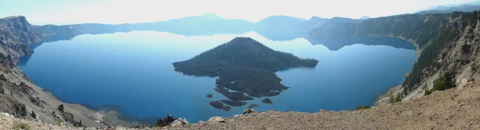
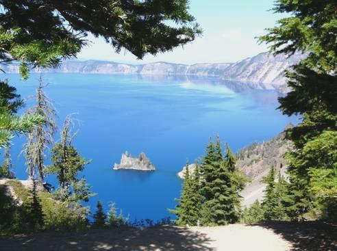
Wonderful Crater Lake and Wizard Island
The water itself is an intense blue, because of the depth. It is set deep down in the caldera, where the pastel colours of the volcanic rock form a beautiful contrast. Add to that the deep green pines, luminous yellow green lichen, and a clear blue sky, with tree-covered hills and peaks going on into the distance. Just stunning!
The 33 mile Rim Trail circumnavigates the lake, and we intended driving round in a clockwise direction, leaving from the south. First though, we drove a short way anticlockwise so that we could look at the lake from Watchman lookout.
It was already quite busy here. You could walk up to the top of Watchman Peak, and quite a lot of people were setting out to do so, but we voted it too hot! We just enjoyed the views down to Wizard Island, another volcano set inside the larger one. You could get a boat trip to the island by climbing down a steep path of over a mile on the other side of the lake (the only access to the lake itself). You could then climb to the top of Wizard Volcano!
We opted for less arduous activity! There were dozens of viewpoints as we drove around the lake, and we stopped at most of them! Each had a different charm.
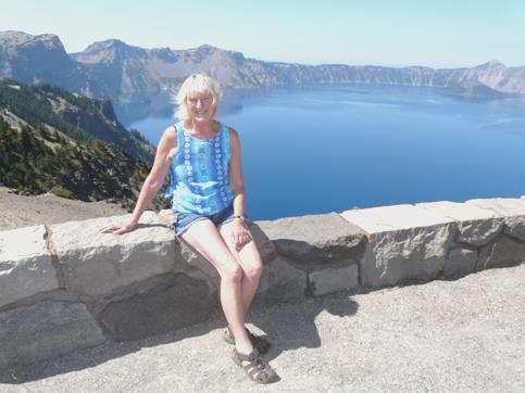
Rosie by Crater Lake
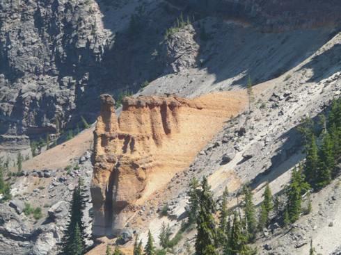
Pumice Castle
At one we looked down to what is called Pumice Castle, and did just look like a bright orange castle set in the steep canyon wall.
We found a shady spot for lunch, before driving off on a 7 mile side road to view ‘The Pinnacles’. These were 100ft (30m) tall ‘chimney stacks’ of hot ash cemented by escaping gas, set in the canyon sides of Pinnacle Valley. Although we walked a mile long trail, the views were just as good at the start of it!
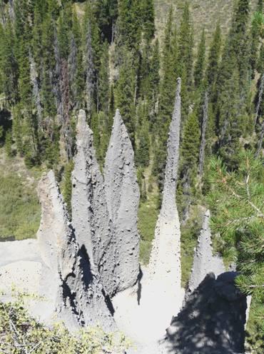
Some of the ‘Pinnacles’
When we drove back to the lake, we walked another short trail to look down to what is called the ‘Phantom Ship’ – a small island apparently formed by rocks 400,000 years old. It was an evocative sight, set in the deep blue water.
‘Phantom Ship’
We’d had a fantastic day, even if it was too hot to do much walking.
We now headed out of the park, following Annie Creek until we reached the southern exit. We were still on the ‘Scenic Route’, as we drove on past Fort Klamath through a flat, wide valley.
Soon after this, we reached another National Forest, and pulled into Crystal Springs Recreation Area at 4 o’clock. There was shade from the still hot sun, so it seemed a good place to stay.
The picnic table was a long way away, but we ate our supper there, having cooked it outside on the stove (fire ban, so no campfires or barbecues).
It was still warm when we came in, and the night remained warm.
Friday 21st August From forests to desert, and an unexpected hot spring 190 miles
It was a nice morning. Somebody came into the area just before we left – the only other person had come just after we’d arrived yesterday – both to use the loo. As the Rest Area wasn’t signposted at all, only locals knew about it. It had suited us fine!
We drove through more forest to Lake Klamath. We just got glimpses of the lake – much of it is a marsh area, but we did reach it at Wocus Bay, and stopped to enjoy the wildlife. This area is on the Pacific Flyway, and is known for its profusion of birds. We saw dozens of white pelicans, also cormorants, ibis and large egrets. In the distance we caught sight of 14,000ft Mt Shasta, which is in California, looking a surreal white.
The road skirted the town of Klamath Falls, but we stopped on the way out to get petrol. We got an internet connection and read an email from Simon, who was thrilled that their renting of a house in France had at last been approved.
Now we followed the road east, through arid farming lands with occasional forests and hills. We crossed 4 passes – 3 over 5,000 ft – but none very remarkable. It was difficult to find anywhere to stop for lunch, as there were no pull-offs, and no shade, and it was very hot.
We drove through the small decrepit town of Bly with a sign saying ’Smile, you are in Bly’, but we didn’t find much to smile about! The small rest area was in the blazing sun.
Eventually we came into an area of forest, and followed signs to a picnic area by the Sprague River. This entailed driving down steeply, with several hairpin bends, to a large ‘oasis’ by the pretty little river. All the picnic tables however, were right in the sun. We pulled into a shady spot, and actually ate inside, away from the attacking mozzies.
We soon came to the outback desert town of Lakeview, which had been established in the 1880s as a mining and lumber town. It was really attractive, with mural covered brick buildings as well as mid-west ones. It is known as the ‘tallest’ (highest) town in Oregon – 4,800ft. We were surprised to see a Safeway store, but sadly they had no ‘fresh’ bread. This town is reputed to have a geyser, which erupts every 90 seconds, but although we looked hard, we didn’t find it. The area is also well known as a hang gliding centre, because of the winds, and the high bluffs around.
We now set off on the ‘Outback Scenic Highway’, back towards Bend. As we travelled north, there were less and less trees, and it became more and more arid. It looked more like Australia, or parts of South Africa, with sagebrush and white grass and barren hills.
We could see Abert Rim, a ridge 2,000ft high, and 30 miles long, caused by a geological fault. In the fields beside us we saw several sandhill cranes.
Abert Rim on the Outback Highway
We stopped briefly in Paisley, a pleasant little ranching/farming town, named after the town in Scotland. It was a real oasis in the desert.
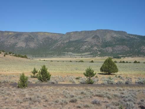
We couldn’t think where we would stop tonight, as there was not an atom of shade, and it was stiflingly hot. Then at 4.45 we came to Summer Lake Hot Springs, which was also an RV Park. The lake beyond was just a salt marsh at this point, and this really was a funny little place – a few shack buildings, and 3 antique Airstream caravans.
We went to enquire and although expensive by our terms, we could have a pitch with electricity, and with use of the hot pool. This was housed in an iron shed, built in 1925! There was not an ounce of shade anywhere, but with electricity to run the air conditioning, we thought that we’d cope. In fact, it was windy, so it wasn’t so much of a problem.
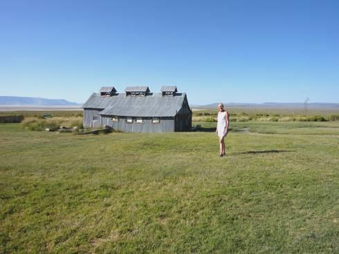
Off to the ‘bath house’
We soon made our way to the hot pool, where just one other couple were enjoying the waters. They lived in Bend (130 miles away), and came here most Fridays. They thought that they benefited from the water. I found it fun for a short while, but hot pools usually leave me feeling very dizzy.
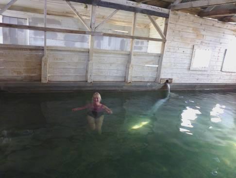
Enjoying the hot pool
He just reminded us of Michael Palin, and we kept expecting an amusing retort from him. She had been born in Oregon, and had never travelled out of USA. Her sister was going to South Africa shortly, and wanted to see the famous falls - ’Angel falls, is it?’ she said. They said how the weather here was changing, and that it was more humid in Bend in winter now. They had loved going back to the Oregon coast, to escape the 100°F heat of Bend. At the coast it was 60°F, and drizzly, which she thought was lovely!
Back at our pitch, it did cool down, so we were able to cook inside, but we ate out, just as the sun went down, and we had views all around of the changing colour of the sky. Unfortunately, even in this dry environment, there were some mozzies.
After supper we went back over to the hot pool. There was a small outdoor pool, set in rocks, which had been filled now, but it was really too hot. We went back inside, and there we met Annette, so we stayed much longer than we might have done! She was an attractive young woman who was with a small group here, filming for the American History Channel. It turned out that she was the producer! She was of German (Hamburg)/Polish origin, but had come to London aged 19. She had no trace of a German accent.
She was very easy to chat to. We realised how arduous a film crew’s life might be, with early starts, and long days.
We walked back in the dark (we hadn’t thought about torches), under a blanket of stars.
Saturday 22nd August A fort-like rock in the desert 100 miles
We walked across to the ‘bathhouse’ before breakfast and enjoyed a warming soak before the day got too hot! Swallows flitted amongst the ancient wooden rafters above us. The film crew were just leaving.
We ate breakfast outside in this isolated spot in the desert. A chap who looked just like Raymond Brigg’s Santa chatted on his mobile phone from beside his old caravan, otherwise it was quiet.
As we had both electricity and an internet connection, there was much to keep us busy – Adrian had booked a hotel in Bend for when the Bam is being mended – and we didn’t leave until late.
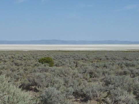
Dry Summer Lake, beyond the sagebrush
We continued our journey north, past dry Summer Lake. There had been a large wildfire, caused by lightning, in 2002, and the scattered trees on the hillside were just skeletons.
We came to the wildlife conservation area, where I had been hoping to see birds, but we didn’t fancy the 8 mile drive on rough gravel tracks, especially as there is no water around at the moment, so would be few birds. Spring and autumn are the times to come, to see the thousands of migratory birds. We couldn’t cope with the fact that the most important reason for the ‘conservation’, is so that hunters can go and shoot the birds.
Across the road was a shadier spot, with a lot of information about this remote desert area, and just beyond that was a large and pleasant shady picnic area where overnighting was allowed, so we could have stayed there last night! We had enjoyed our funky hot pool though, and there would have been mozzies here, as the grass was watered. Markers told of the exploration of Fremont, who had travelled through this area in 1843.
The road now went past dry Silver Lake, where we saw a group of pronghorns. We were enjoying this arid desert landscape, and thought that we’d turn off onto an even more remote road, which would lead us to Fort Rock. This was 7 miles off the route, so it would avoid backtracking from the main road. To our surprise, our new route went through a flat landscape, where irrigation meant that farming was being undertaken on a large scale. The early homesteaders had found this area too dry to survive on in the early 1900’s, and most had left by 1920.
There still wasn’t a tree in sight, so no hopes for a shady lunchtime. We ended up by reaching Fort Rock – and even then eating inside, as the only picnic tables were in the sun!
Fort Rock (so named as it is thought to resemble a large fort) is a stunning formation. It consists of tuff, from a former volcano – a maar, 325ft high. There are wave notches on the side far more evocative than Wave Rock in Australia!
Fort Rock
You could walk a long trail around the inside of the formation. We walked a shortened version – enough in this 90°F, 33°C heat – but it was spectacular.
In the small village of Fort Rock, there was a ‘Homestead Village’ – a collection of wooden buildings from this area, brought together to form a small museum. It was run by volunteers, and cost just $2 to go round. We have now visited lots of museums of this type, in different parts of the world. This one certainly had a charm and gave an idea of what it was like living in such a harsh environment as this – searingly hot and dry in the summer, and bitterly cold in the winter. The two lady volunteers at the entrance (who, like everybody, thought that we were Australian), were delighted when we said how delightful we thought the museum was.
Fort Rock Homestead Village
In one house was a list of tips telling a young housewife how to cope on washday. It finished with ‘Put on a clean dress and sit down and have a cup of tea’.
In the school house were two lists – one for schoolteachers.
‘Masters are allowed one night a week to go courting, or two if they have attended church!’
‘After 10 hours in school, the rest of the day can be spent reading the bible or other good books!’
The other listed how many lashes different misdemeanours would earn –
Boys and girls playing together -- 4 lashes
Playing cards at school –- 10 lashes
A hard life!
We now made our way back to Route 31, coming to a homemade sign in this desert landscape – ‘Taxidermist –1 mile’! We didn’t find it!
Back on the main route, we immediately came to trees again – ponderosa and lodgepole pines. It was another bit of National Forest. Just before we got to the town of La Pine, we pulled into a bit of the forest for the night.
We took some time in finding a suitable spot, and cooked and ate outside.
Sunday 23rd August Lava scenery then back to Bend 79 miles
The early morning was surprisingly cool, and it was a long time before the sun felt warm, but later it did become hot. Two mountain chickadees stopped off outside our window, before we left at 9 o’clock.
As we drove on to La Pine, we could see the peaks of South Sister and Mt Bachelor in the distance. We had almost completed our 5 day circular tour from Bend, which had been really enjoyable, with amazingly varied scenery.
In the small town of La Pine, we got an internet connection, and telephoned Elm Gable, where Tom had met up with Emma and family. We bought some fresh bread in a nearby supermarket before driving on, turning off to Newberry National Volcanic Monument.
This was another amazing site – a huge area of volcanic activity set inside a caldera. There were two lakes here. We stopped first to look at the Paulina Falls, and then by Paulina Lake.
The best part of the area was the ‘Big Obsidian Flow’ – a huge area of pumice and silica. We were able to walk a ¾ mile trail around part of the flow. It was one of the best walks we have done, being through such different terrain. The obsidian shone like polished jet. ‘It’s the shiniest rock I’ve ever seen’ a little girl said. The trail was very rough underfoot, and every now and then we came across a tree which had somehow managed to root amongst the seemingly dry rocks.
The Big Obsidian Flow
We had been given a simple photocopied map of the facilities and walks in the park, but the ‘Day Use’ areas were very hard to find. Eventually we stopped by the boat ramp for the second lake, called East Lake, and had lunch at the only picnic table, while ospreys and nighthawks soared overhead.
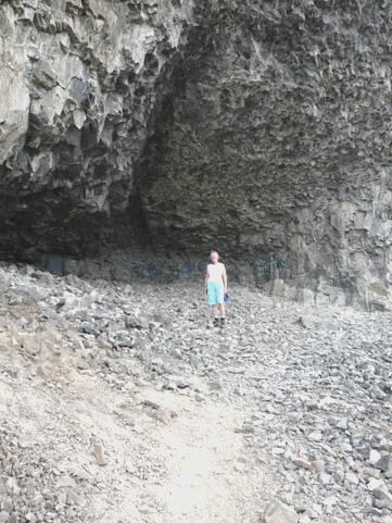
We now made our way back to the highway, and then north towards Bend. We stopped at another part of the park, called Lava River Cave, a classic Lava tube. We came prepared with our headtorches, but I didn’t get far into the pitch black cave before I’d had enough! The path underfoot was very rough, and we didn’t fancy walking on another mile in pitch darkness! Plenty of people seemed to be enjoying it though. You could rent a ‘miners lamp’, but it was still pretty dark!
In the Lava River Cave
We joined the throngs tearing back to Bend, and headed for the repairers where we are leaving the Bam. First we located the nearby laundrette, and caught up with 2½ weeks washing. We checked out the Days Inn Motel, where we will be staying for 2 nights, and then stopped for the night outside ‘Daniels’.
We knew that a small theatre was next door, and as we prepared to organise ourselves for our short ‘vacation’, we were entertained by the actors rehearsing.
We ate an excellent ‘Waldorf salad a la Rosie’ followed by minced beef jambalaya, sitting in the candlelight in our quiet urban situation.
Monday 24th August Enforced relaxation
After getting ourselves ready for our short ‘motel vacation’, we read through our diary since leaving Bella Coola. Around 10 o’clock, Jason drove us the short distance to the motel, where we were able to book in. The receptionist said we could have breakfast, as she hadn’t yet cleared away, so we enjoyed tea/coffee with a toasted muffin.
Our room seemed pleasant enough, with a fridge, microwave, and internet access, and a swimming pool across the yard.
We telephoned Paul and Nicky, and later Paul sent a short video of Louisa walking. We also phoned Tom, who was still at Elm Gable.
We made use of the nice pool. A young woman was giving a lesson to two little girls. Her enthusiasm and positive outlook were great to see. I told her so, which pleased her.
We wandered ‘around the block’ to see how the Bam was going. Jason had managed to get it inside, by letting out air from the tyres, but it was too soon to know anything.
We worked a lot on the website, and had another swim in the pool, with a relaxation in the Jacuzzi.
Tuesday 25th August Another day’s rest
We settled into our ‘motel life’, working a lot on the website, and enjoying the facilities of the pleasant swimming pool.
In the afternoon, we walked to ‘downtown Bend’, which was an attractive area, and found our way to the Deschutes River. There were some nice green spaces near the river, and some walking trails, but often these didn’t link up. It had been ‘cooler’ today (82°F), but felt plenty hot walking! We walked on to the Pioneer Park, where we had stopped a week ago to ponder our engine problem. We now read that this park commemorated the early pioneers, who had crossed the river at this point, on the Oregon Trail.
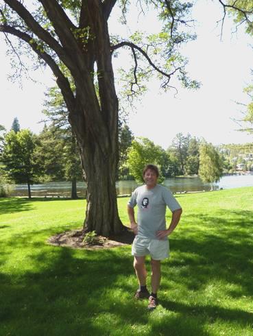
Adrian in Pioneer Park, Bend
We called in at ‘Daniels’ on the way back. Dave, the technician, had got the old engine out, and the brand new one was there, waiting to be installed. All seems to be under control, but we don’t think that we’ll get away before Thursday.
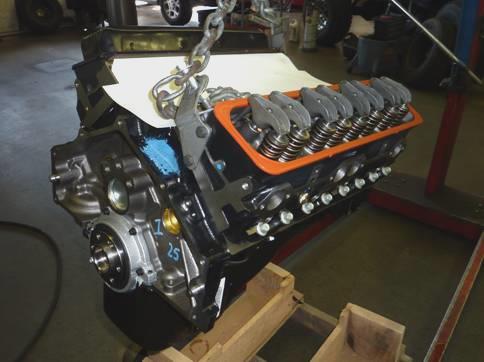
The Bam’s new engine
Williams Lake, Canada to Bend, Oregon, USA


