
John O' Groats to Uig, Skye
Thursday 20th September 36 miles
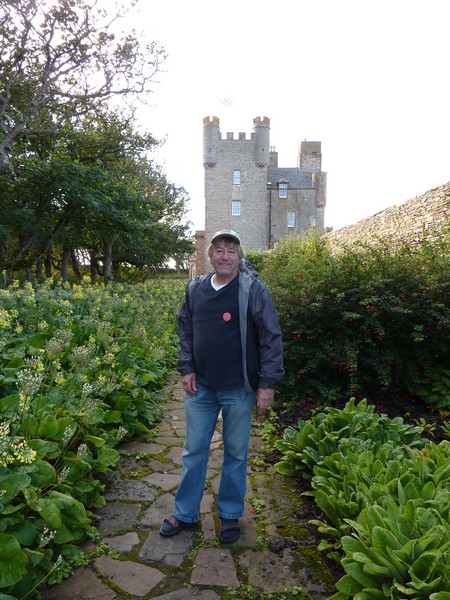
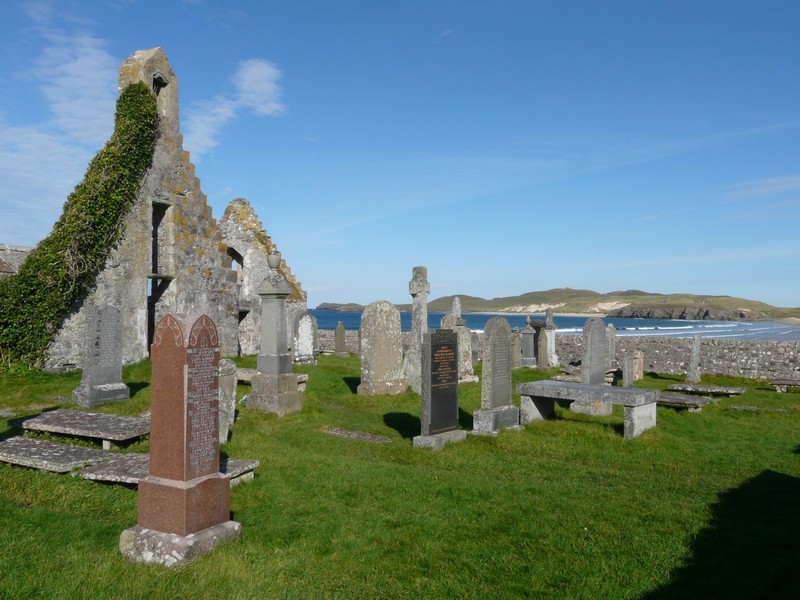
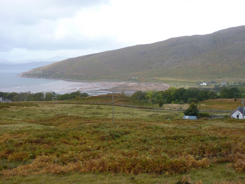
We left Gills Bay and headed for the Castle of Mey, the summer holiday home of the Queen Mother after the death of King George 6th in 1952.
You had to have a guided tour of the house, and our tour turned out to be a private one, as there was nobody else visiting. Our guide was excellent, and we found the castle very interesting and personal. We were both impressed with paintings by Prince Charles and Prince Philip. We had a separate guide in the dining room – an elderly gent who had been a friend of the Queen Mother’s.
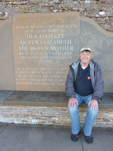
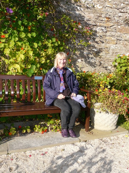
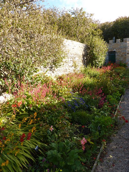
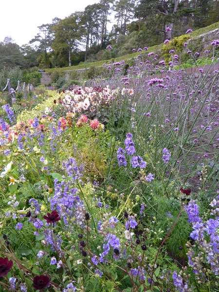
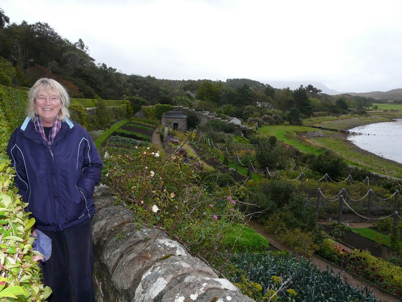
We both enjoyed the large walled garden, particularly the sunny rose garden, where there was a seat dedicated to the Queen Mother, as it was a spot she loved to sit in. It was sheltered, and warm in the sun when we were there. The head gardener spoke to us for a while – we congratulated her on such a well kept garden in what would often be difficult weather.
Continued from the Aberdeen to John O' Groats section
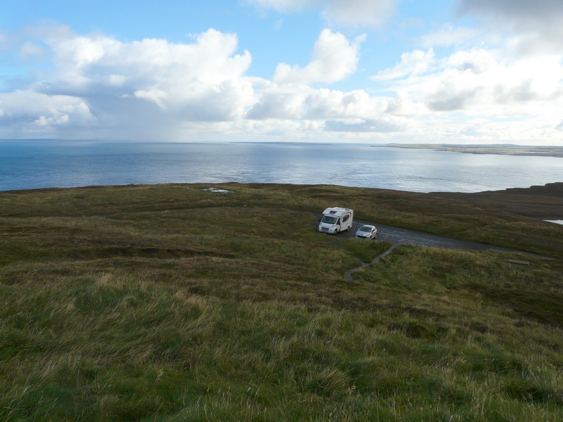
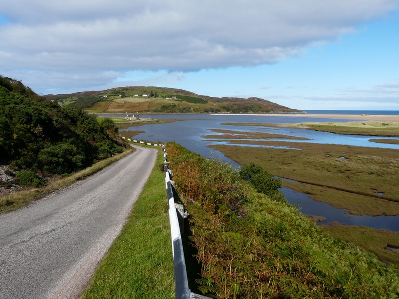
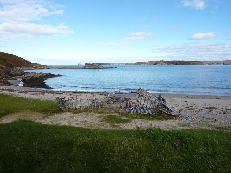
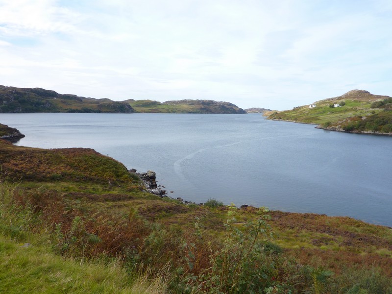
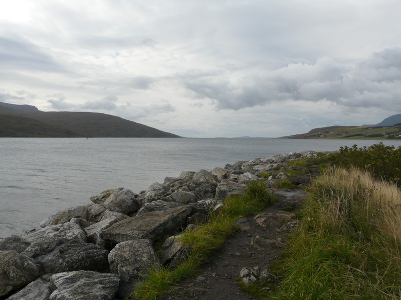
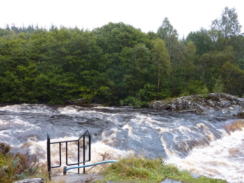
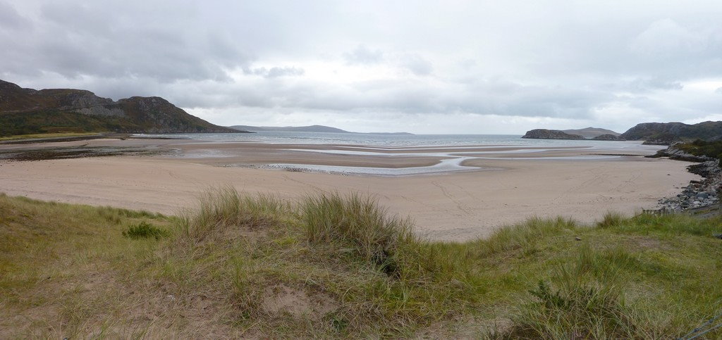
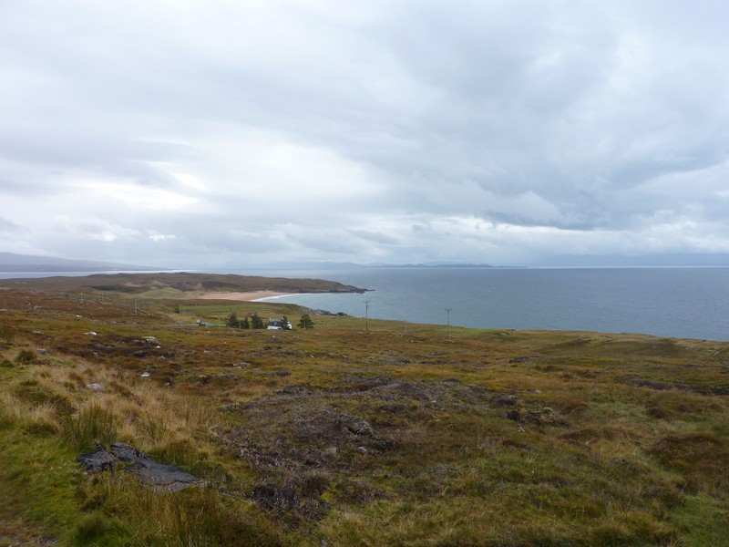
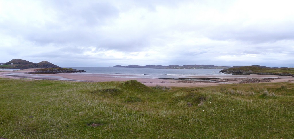
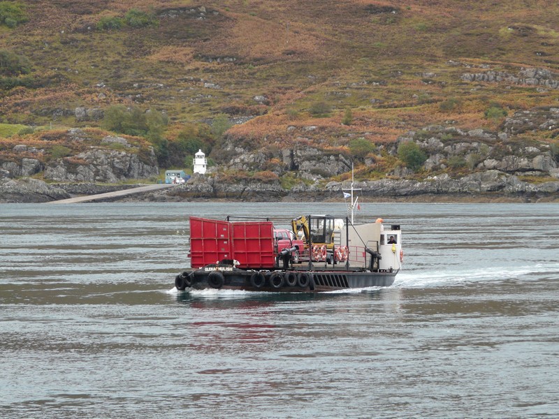
We now drove along the coast towards Dunnet Head, stopping amongst the moorland on our way up to the head
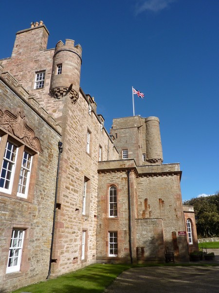
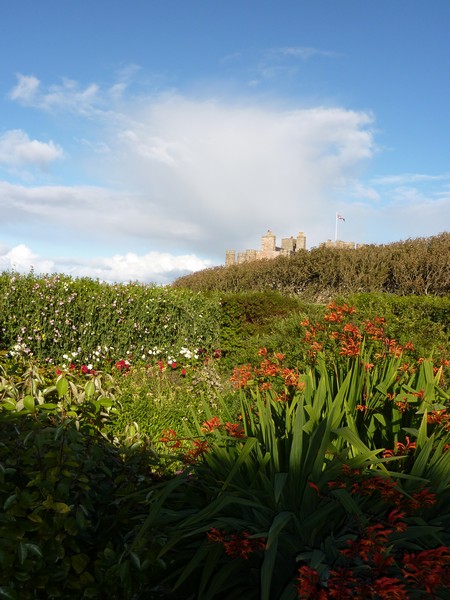
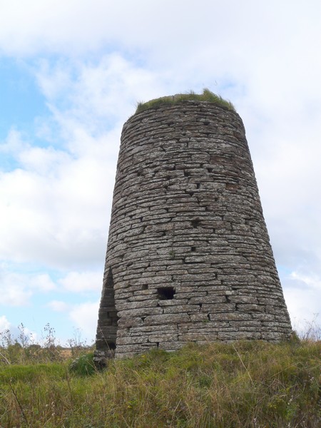
The Castle of Mey
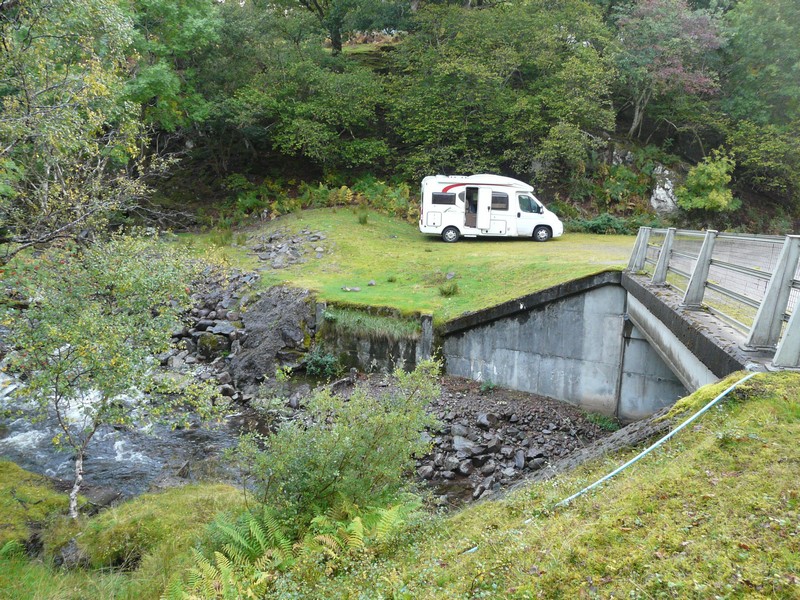
I was busily getting supper when there was a knock on the van – a chap had parked his vehicle just down the road, and had got stuck – he needed a tow! We rapidly packed everything up – a large pan of soup had to stand in the sink – and we went to his aid. Adrian found out that he had parked in our spot last night, but because we were there tonight, he had tried another spot! Adrian successfully gave him a tow out, and we returned to finish preparing supper!
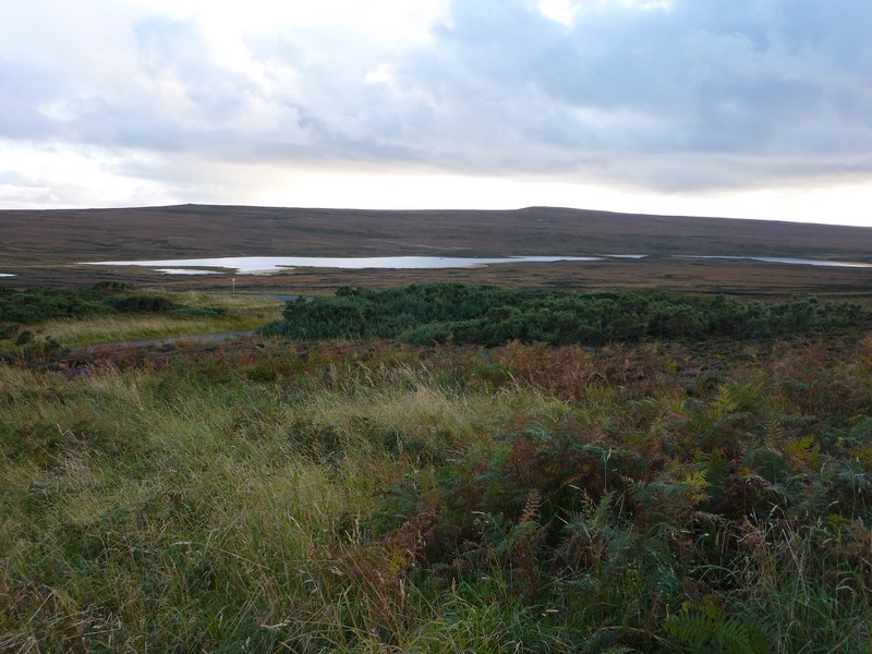
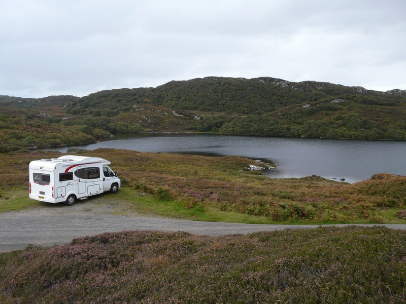
Our overnighter near Dunnet Head
Friday 21st September The very top of Scotland 58 miles
We had slept on the top bed, and discovered that the rain sounded louder up there!
We had a ‘useful time', so didn’t leave until 10.15.
We drove on up to Dunnet Head, parking by the lighthouse, which had been built by Stephenson, grandfather of Robert Louis. While we were there, standing by the sign which said ‘most northerly point in mainland Britain’, we met 4 chaps, one from Newbury, who were on their way to Orkney! We went on to the viewpoint above.
.
We now drove down through the village of Dunnet to tiny Dwarwick Pier. A plaque stated that in 1955, The Queen and Prince Philip, with Anne and Charles, had landed here from the Royal Yacht Britannia, on their way to visit the Queen Mother at Castle of Mey.
We drove on round Dunnet Bay to Castletown, the last bit through an area of trees, unusual in Caithness. We spied a little post office, and were able to buy extra stamps and send off our postcards. A voice said ‘hello, you two again’ and there was our guide from Castle of Mey yesterday! (although I didn’t recognise him). A bit further on we stopped for diesel, and were able to fill the water tank too, which pleased us.
Now we drove inland for 3 miles or so, as Adrian had spotted a place called ‘Bower’ on the map. It consisted of a scattering of houses, but there was Bower Primary School, which we stopped to photograph, and Bower Church.
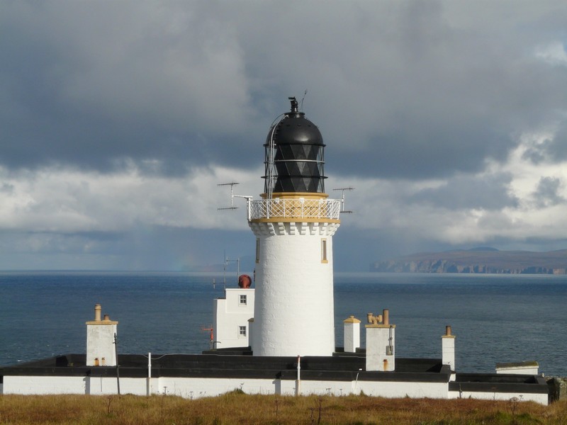
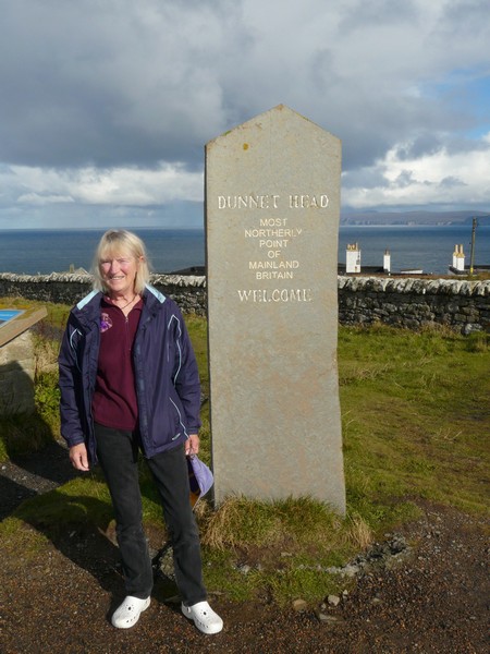
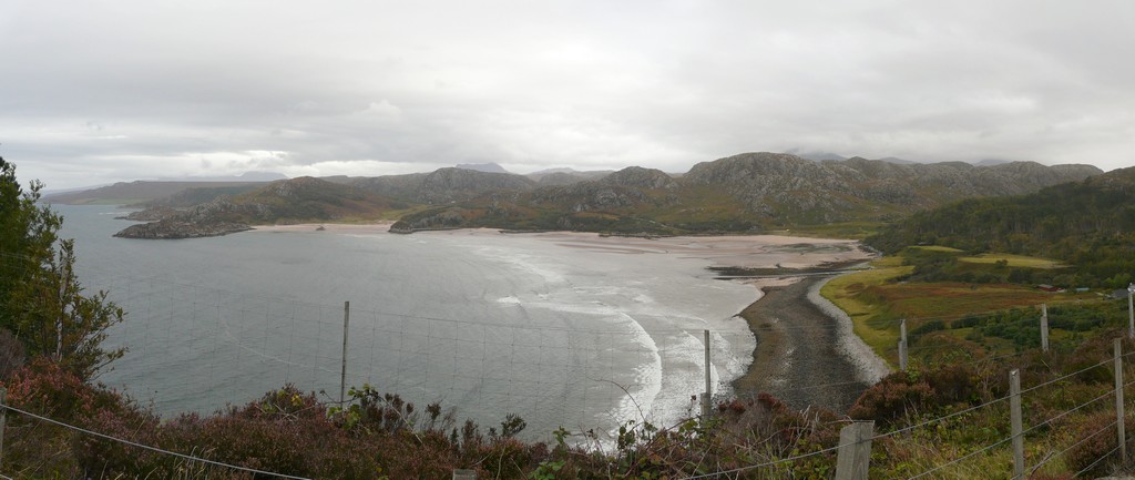
Dunnet Head
We drove back to the edge of Castletown, stopping with a view to the sand and dunes of Dunnet Bay to have lunch.
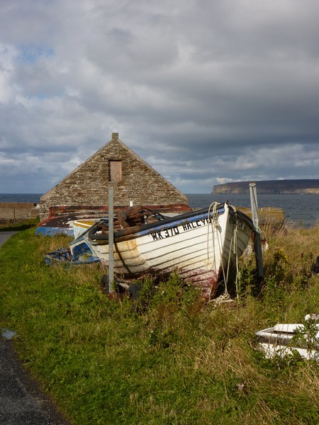
As we drove on beside the coast, we passed the small harbour, with lobster pots and one little boat. Flagstone was shipped all over the world from here in Victorian times. We stopped to walk a little trail, past the now derelict works at Castlehill. Flagstones – large, flat pieces of rock, were of great value as they split but didn’t break. In the surrounding area, they were often used as fencing.
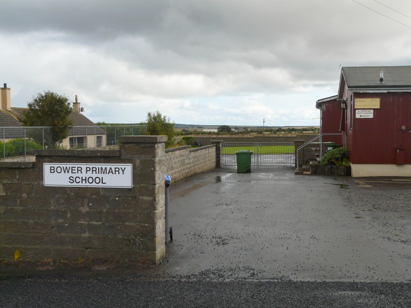

Bower school and church
It rained just as we reached the van – today was again a day of bright sunshine and sudden showers.
We drove on now to Thurso, and looked across the bay from the eastern side to the port of Scrabster. We wondered why there were cars parked at this apparent bleak farm yard beside the derelict former castle, until we saw people out surfing.
We drove on through the town, which was brightened by well tended hanging baskets, and a square in front of the church with brightly coloured flower beds. We stopped to have a shop in Tesco, and also to buy some more diesel.
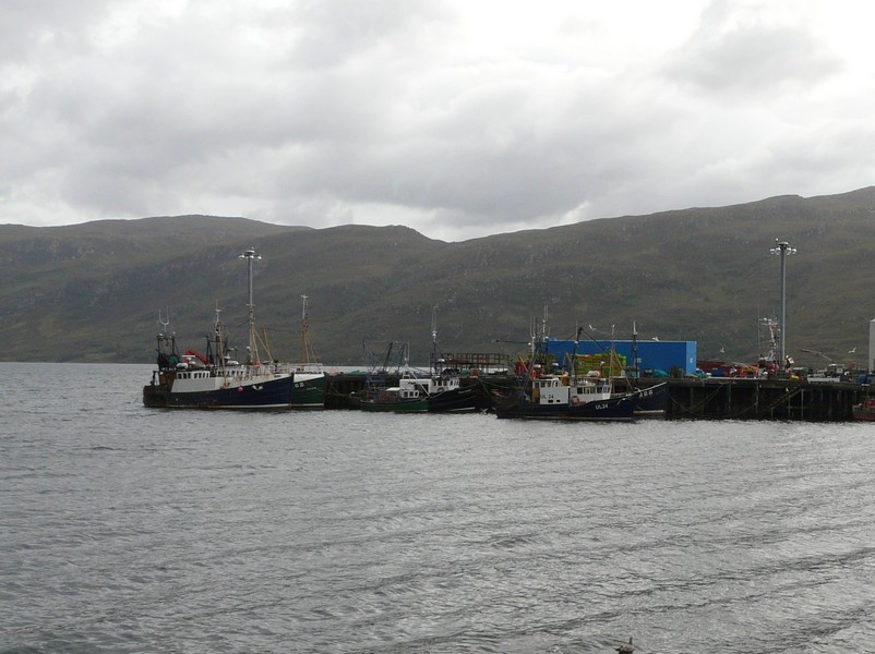
Thurso had a wide sandy beach. We drove on round to Scrabster with its ferry terminal (for Orkney) and a large harbour port. We looked back across the bay to Thurso.
After this we took two long and unproductive tracks – the first to eerie and derelict Brims Castle and the second to St Mary’s Chapel.
We drove on past the large Nuclear Power establishment of Dounreay, and then down a long lane to Sandside beach at Reay. We walked down to the large sandy and rocky beach, where a sign warned not to pick up stones as they might be radioactive! There was also a ‘No Overnighting’ sign here.
We thought it a good idea to head inland for a bit, and found a place to pull off at 5.30 beside the A897 (single track!), south of Melvich
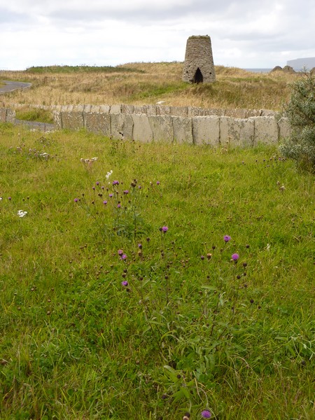
Castletown with its windmill and its flagstone fence
Saturday 22nd September The glorious Sutherland Coast 80 miles
We left at 9.30 on a fine, still day – our best weather yet, which meant that we saw this wonderful wild coast in its best light. We’d had no radio connection, and got none all day. Also we had no phone or internet connection in the evening.
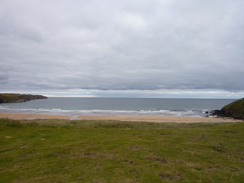
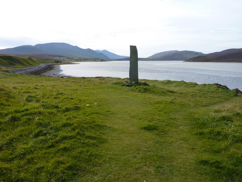
There was no access to the coast at Melvich – only a track unsuitable for us. At nearby Portskerra we took a long track to overlook sandy Melvich Bay, which looked remote with steep cliffs surrounding it. There was a simple pier down below and a memorial to the locals who had died in three shipping disasters in the 19th & early 20th centuries. We noticed that three surnames dominated the list. The isolated community of Portskerra consisted of many scattered houses. Next along was Strathy, where we took a long track which stopped beside a graveyard. We walked across an area of rough grass to view the sandy bay, and the remote headland to Strathy Point.
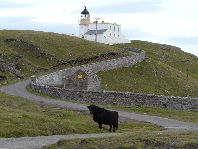
We now took the long road to Strathy Point, which ended by a lighthouse. We parked nearby, with a view of the coast to the east. When we got back to the junction with the A838 again, a Highland cow was standing behind the information sign, making for a good photo opportunity!
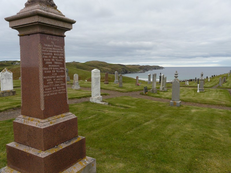
The graveyard and beach at Strathy
At Armadale, the houses were strung out along the road to the headland. We had a view of Armadale Bay, but no access to it.
The A838 wound on through remote barren heather clad moorland, with sheep roaming free.
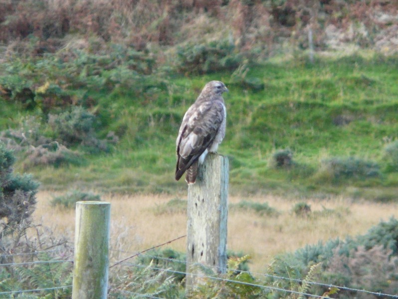
We turned off on the long road to Kitlomy, where we had some good views, then we drove on to Bettyhill, where we took a road to the wonderful sandy Naver River estuary. There was no road access from the other side of the bay. We had to follow the main road south for a bit to cross the Naver River, but actually drove a few miles further to stop near the site of a ‘clearance village’ to have our lunch. A large bird of prey landed on a post as we drove back to the main road.
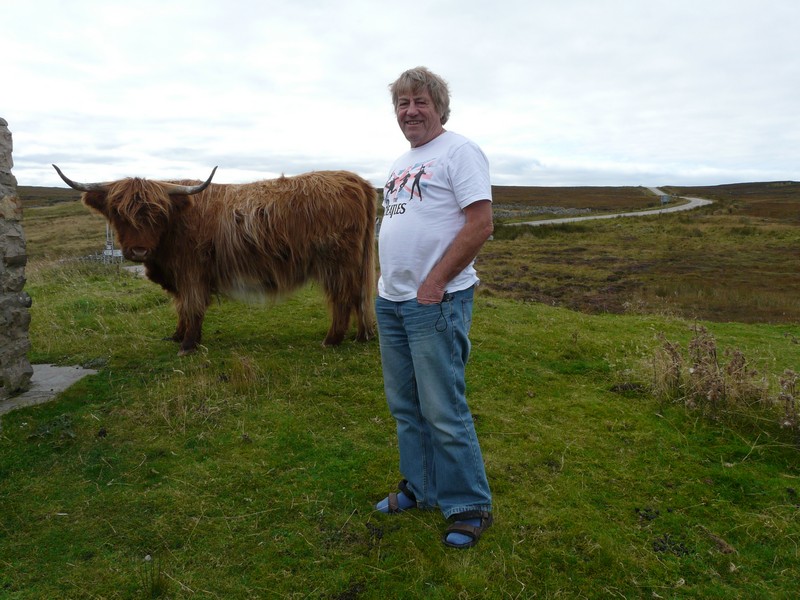
Adrian joins the highland cow
The road now continued across the moors until we took the road north following the Borgie River on the other side of Torrisdale Bay, to Skerray. There were some trees growing in this area. We had nice moorland views, in warm sun, when we stopped.
The Borgie estuary was beautiful. Near the steep line of houses of Airdtorrisdale there was a really atmospheric graveyard at the water’s edge. We saw what we thought was an osprey.
A bird of prey lands by us near the Naver River estuary
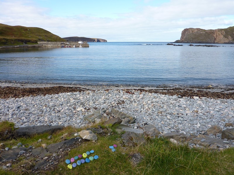
Further on, at Skerray, the pretty stone cottages had piles of peat stacked outside. Skerray Bay was beautiful, surrounded by steep cliffs, and with a little island off shore. A gentleman here came over from his car and got chatting. He said that a group of four Czech people had come in their car and collected pebbles from the beach. They had then left two lines of brightly coloured pebbles, with a letter painted on each. The letters didn’t make up into words. He was puzzled by it all, and we couldn’t offer a solution!
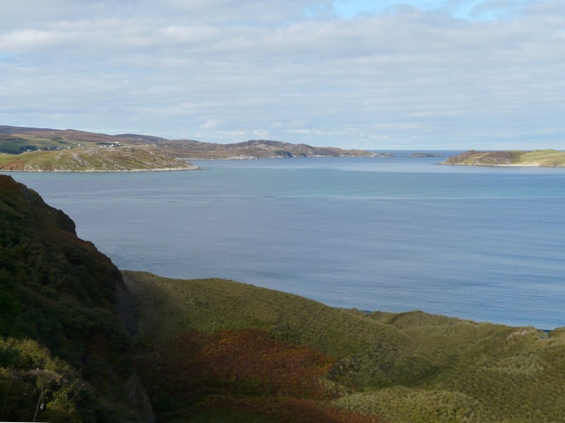
We next came to the large inlet of Kyle of Tongue, which the road crossed after making a long ‘V’ down to the village of Tongue and back. Tongue Bay was absolutely beautiful with the blue sky, calm blue sea and green grassy headlands and islands.
The Borgie estuary
Skerray Bay
We stopped on the causeway before driving up the western side of the bay. Here we had fantastic views as we drove through several small hamlets as far as Achininver. We looked down to the sandy beach and estuary far below. It was all absolutely gorgeous, and I took several photos on our return to the main road.
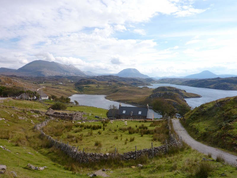
The A838 now crossed more moorland to follow around the long inlet of Loch Eriboll. This deep water loch was used during the war to shelter our boats. The view down, with a little island joined by an isthmus, was stunning.
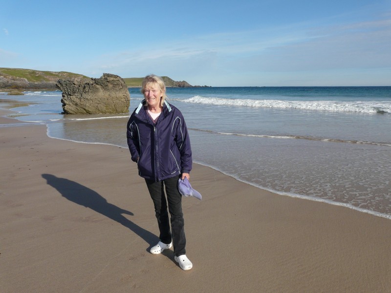
Rosie at Achininver
Tongue Bay
Tongue Bay from Talmine
We continued round the loch, stopping on the western side for the night, with superb barren mountain views all around.
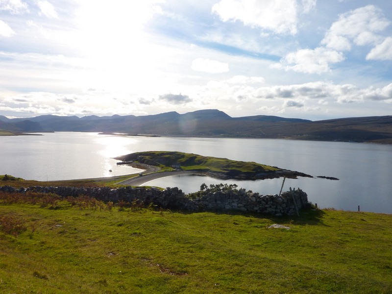
Loch Eriboll Ard Neackie
Sunday 23rd September Even more remote and beautiful 84 miles
It was a fine morning, and another lovely day followed, enabling us to enjoy the beautiful scenery.
After a Sunday cooked breakfast, we drove back up beside Loch Eriboll, driving down to a tiny inlet, where just one boat was pulled up.
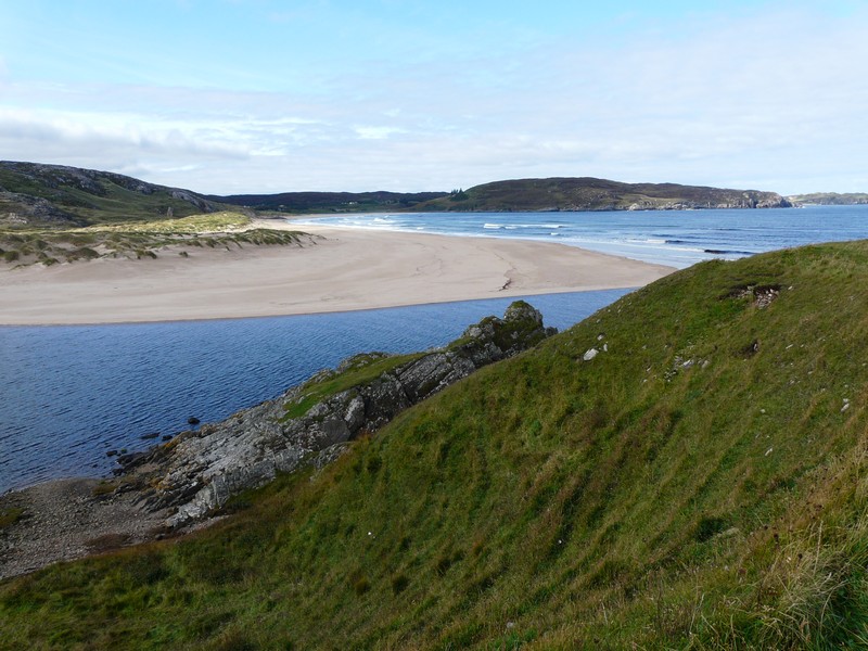
We arrived back at the open sea, stopping to look down to the first of many wonderful sandy bays on this gorgeous remote rocky coast. We were near Ceannabeinne, the site of a former clearance village. Soon after, at Leirinore, we stopped by Smoo Cave. Adrian walked right down and into the first chamber of the cave which had formed at a sea inlet.
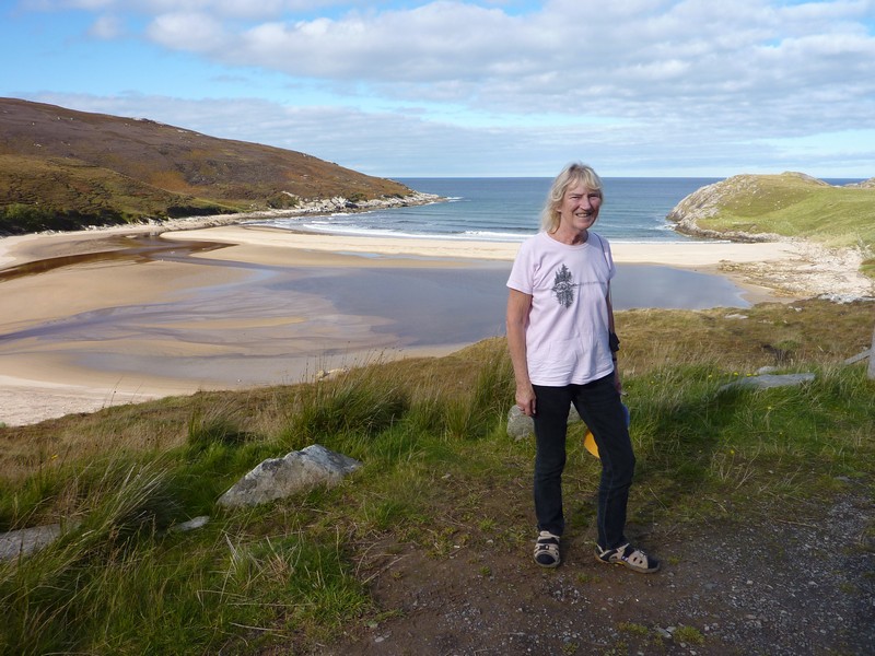
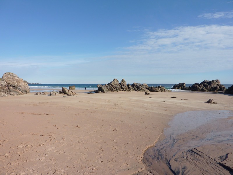
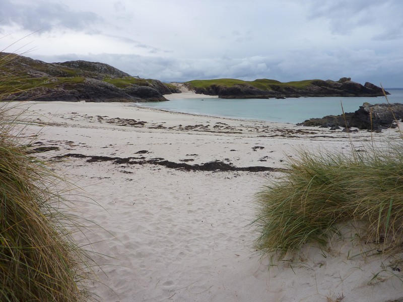
At Durness we both walked down to fantastic Sango Bay – a sandy beach with a lot of rock stacks.
We were looking in the direction of the large wilderness promontory of Cape Wrath. The only way to get there is by ferry across the beautiful Kyle of Durness from Keoldale and then a four wheel drive trip.
We drove down to the jetty at Keoldale and admired the wild scenery.
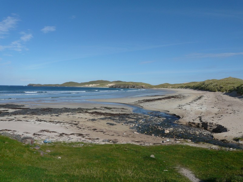
Nearby Balnakeil also had a lovely sandy beach. We looked around the graveyard with its many graves, and the evocative ruins of a church.
We stopped to have lunch overlooking the loch at Achriesgill before driving up the eastern side of the loch as far as Oldshoremore.
We passed the small town of Kinlochbervie, said in our seventies book to be a place which is expanding with the fishing industry. It looked as if this was still true. The pretty area was made less attractive by the signs of modern industry. The houses were mostly white with grey roofs, and very ordinary, which seemed incongruous in this wild setting.
At Oldshoremore, the road again ended by a graveyard above the sea. Little rocky streams rushed down to the sea, and there were nice views. We drove back to the main road, enjoying the views to the dramatic peaks inland.
We continued on the A838 across the wild, remote peaty moors with dozens of small lakes to Loch Inchard.
We took another turning to follow a small road to Kerricha, where there was an activity centre beside the loch, started by John Ridgeway in the seventies. It was windy as we looked down to the wild coast.
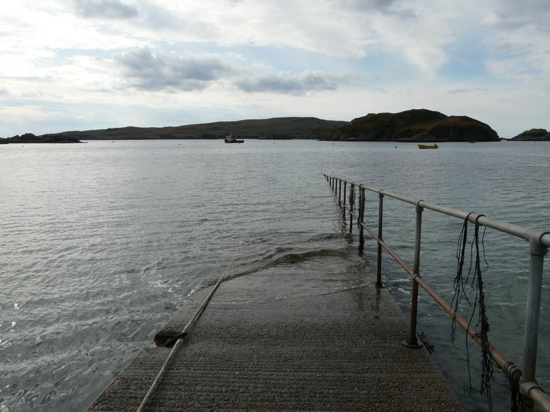
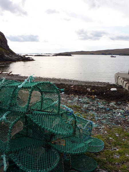
We followed the main road, turning off on a loop to Foindle and Fanagmore and then down to Tarbet. The wild, rocky scenery was delightful, and Tarbet was particularly lovely. A ferry leaves from here for nearby Handa Island, which is an RSPB reserve. The ferry appeared to have stopped for the winter, and the seafood restaurant, the only other thing here, was also closed. We just enjoyed the peaceful, rocky little bay with its stacks of lobster pots and seaweed covered jetty.
We turned off next to Scourie, and sat at a picnic table above the sandy beach to have our cup of tea. Around the sandy bay, the road once more ended by the cemetery.
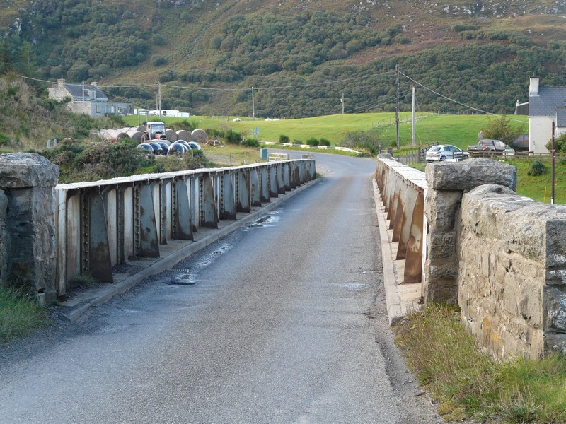
We drove onwards, and were pleased that there is now a bridge at Kylesku instead of the ferry mentioned in our coast book.
After this we took an interesting and challenging B road which went near to the coast, often with superb views of the wonderfully indented coastline and off shore islands. It was a single track road with a lot of passing places, but nowhere else to pull off. With the wet, peaty soil, we were particularly wary of not driving off the road. We have noticed how wary and foolish other drivers are – always pulling into a passing place, even if we’ve already pulled into one, and seeming to not be able to drive past us. This was particularly noticeable today, and frustrated Adrian no end!
The road wound up and down over hill and dale, often quite steeply. We drove through quite a lot of wooded area, which was a change from the bleak but wonderful moorland.
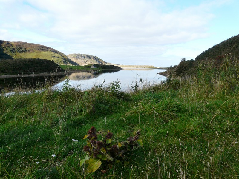
At Drumbeg we stopped at a pretty viewpoint, and soon afterwards, at 5.15, found a spot to pull into for the night, overlooking Loch Drumbeg.
We had a radio connection after two days without, but no phone or internet contact.
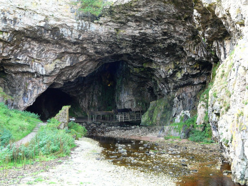
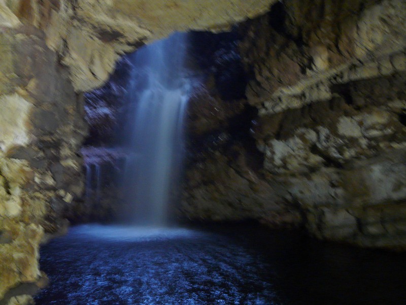
Smoo Cave with its internal waterfall
Sango Bay
Balnakeil graveyard and beach
Ferry to Cape Wrath - so we're not going to get there in the Ixi?
Perhaps it's this way!
The Kyle of Durness
Loch Inchard
Tarbet
The bridge at Kylesku, where there used to be a ferry
The Ixi at our overnighter at Drumbeg
Monday 24th September More wonderfully remote coast, before a change of plan 111 miles
The day started grey and windy, but was mostly fine until early evening, when we had some heavy rain. We heard of flooding further south.
We left at 8.50, taking a small road first for a long way down to Culkein Drumbeg where there was a little jetty and a few small boats and lobster pots beside a smart white house. The views were lovely.
Back on our ‘loop’, we passed the lovely sandy bay at Clashnessie before setting off on small roads on the Stoer peninsula. We came to a second village called Culkein, with a scattering of houses and a nice sandy bay.
We now took a long narrow road across to the western side of the Stoer headland, stopping by a parking area near to the lighthouse at what seemed to be called Cluas Deas. At this remote spot, an ‘outdoor’ type woman was just setting up her little trailer stall, selling refreshments. She’d named it ‘Living the Dream’. She told Adrian that she managed to make her living this way. Many people stopped here to walk, she said, presumably up to the tip of the headland, the Point of Stoer, where there is a stack called Old Man of Stoer. Yesterday the car park had been full by 1.30 pm!
We drove back to the B road, and on past the sandy bay at Stoer itself to Clacktoll, where we drove through the caravan park to walk to an idyllic white sandy cove. The rocks jutted up at 45°.
We turned off next on to a long winding road above Loch Roe to Achmelvich, where there were static caravans.
We soon joined the road to Lochinver, turning off to drive along to Baddidarach first. Lochinver had a row of stone cottages fringing the bay. We drove around by the harbour, where there was still evidence of fishing by the lobster pots and piles of nets.
We crossed into Ross and Cromarty as we continued on small roads to Inverkirkaig. There were now areas of woodland, particularly silver birch. We continued on a narrow winding road across the rocky landscape, with occasional meadows of rough grass. The first part of the road was particularly taxing, as there was a low stone wall on one side, and steep rocks at the other side. We drove on to Achnahaird where there was a sandy bay at the end of a rocky inlet. We had lunch here, with superb views back to the high peaks inland and to the very indented coastline.
From here we drove across this headland and up to the isolated cottages of Reiff. There were lovely views on our return. We then took a small road towards Old Dornie, opposite the Isle Ristol, one of the Summer Isles. There were a lot of little boats on the water. We continued south to the junction with our ‘return loop’ on this small road, having a view of the line of crofts of Achiltbuie lining the shore. There was a nice pebbly cove, with a grassy area behind and views south to the hills.
We completed our ‘circle’, then had to join the road to go southeast past lochs and steep hills to join the A835 at Drumrunie. From here we drove down to Ullapool, passing the little hamlet of Ardmair with its beach of flat white pebbles, its little boats and a campsite. We had a view of Ullapool in its pretty location, jutting out into Loch Broom.
I needed to have a blood test before starting my next lot of chemo, and we had hoped that we could get this done at Ullapool. We located the Medical Centre, but found that things weren’t as simple as we’d hoped! The receptionist tried her best, but it seemed that the results would take several days, and we need to have them back straight away. We came back out to the van for a cup of tea while we pondered what to do. The nearest place to get immediate results was Inverness, so after some discussion, that is what we decided to do. The receptionist had suggested contacting the oncology department there, which we did. We had difficulty hearing what the nurse was saying, with her strong accent, and the heavy rain which began at that moment! We hope to have the test done in the morning, so this meant starting on the way there now.
We had a quick look at Ullapool, with its cottages looking pretty beside the loch and its collection of fishing boats close to the ferry terminal for the Hebrides. We then set off towards Inverness, in the now heavy rain, which spoilt any views we might have had. At 5 o’clock we found a sheltered spot beside the A835 road in the valley of Strath Garve.
Cluas Deas - remote place for a mobile café!
Stoer lighthouse
Clacktoll

Ullapool 2012 and Adrian's 1958 photo
Loch Broom
Ullapool Harbour
Tuesday 25th September A monster of a day 83 miles
A very wet and windy day! We left at 8.20 to drive to Inverness. The going was very slow over the bridge into the town. We made our way to Raigmore hospital and found the oncology department. We were offered a cup of tea/coffee while we waited for my blood test. The nurse I saw was a really delightful young woman. After about ¾ hour, she came back with the results, which appeared to be OK, so then it was back to the van. The weather had become extremely unpleasant. The wind was so violent that one person fell flat on the ground when trying to get into their car. A young boy, who had gone with his mother and her baby towards their car, returned a few minutes later saying ’I never want to go out there again’!
We had hoped to visit the laundrette while in Inverness, as we had done before, and shop in the nearby Tesco metro. The weather was so fierce however, that we thought it better to visit the huge Tesco next to the hospital. This took up the rest of the morning. When we came out, we were ready for lunch.
In the still dreadful weather, we made our way to the laundrette, parking in the car park behind littleTesco. Each time we crossed the road to the laundrette the wind nearly blew us away. The rain was horrendous. We were glad that we hadn’t been able to park in the little road close to the laundrette, when we saw an emergency vehicle parked there, and a police car parked alongside – we would have been stuck!
Our mission accomplished, we left at 4.15, emerging into the traffic once more – Inverness doesn’t seem to have sorted out its traffic lights. I had wanted to see Loch Ness, so we made our return journey towards Ullapool by going that way.
Needless to say, we didn’t see much of the loch! The road was often flooded as we drove on. We were heading for the spot we had stopped at last night, but looked in at others on the way. Adrian had got water from a garage we had passed, and emptied the loo at a forest car park before we came across another Forest parking area at Black Water River and decided to stop there. It had almost stopped raining, and on venturing outside we found that we had parked above a river which had become a raging torrent, with dramatic waterfalls of deep brown water.
Amazingly we had an internet connection (but no radio).
Loch Ness - no monster, just rain!
From our spot above the swollen Black Water River
Wednesday 26th September Back on our coastal route 71 miles
The river was still high in the morning. We stopped to have a look at it from the old bridge, and left at 9.20. The day was grey, but much better than yesterday.
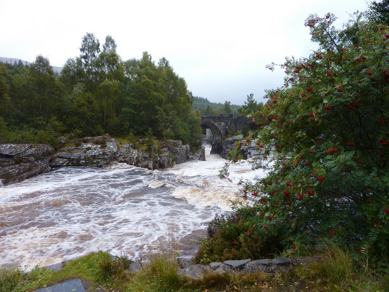
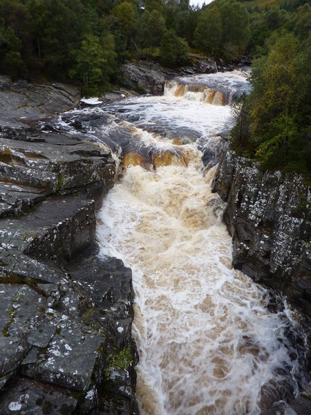
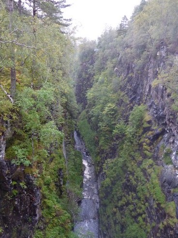
We came back to Braemore Junction, where we left the road to Ullapool and took the left hand road, stopping soon at Corrieshalloch Gorge. There was a zig zag walk down to the River Broom far below to view the Falls of Measach. We braved the mizzle to reach the narrow pedestrian suspension bridge over the river in the impressively deep gorge.
We continued through dramatic barren scenery, following the Dundonnell River, again in a gorge, and with numerous waterfalls, and probably a few extra ones today! We had coffee at a pretty spot by the river – it would have been lovely to sit outside!
We then had to go through a stretch of roadworks, where we had to wait for an escort vehicle, making us think of USA.
At the village of Dundonnell we reached the southern end of Little Loch Broom, so we were back on our ‘coast’ track again. There was a nice coastline, and good views of the headland between here and Loch Broom, which was inaccessible. We were surprised when looking across from further up the headland, on a ‘yellow’ road we had taken from Badcaul, that there were a few scattered houses, and according to the map, a school, but no roads!
The lovely views of the coast and islands continued around Gruinard Bay. At Little Gruinard we walked onto a large sandy bay with steep, high rocky mountains up behind and great views. Offshore was uninhabited Gruinard Island, which is off limits because of anthrax testing during the war.
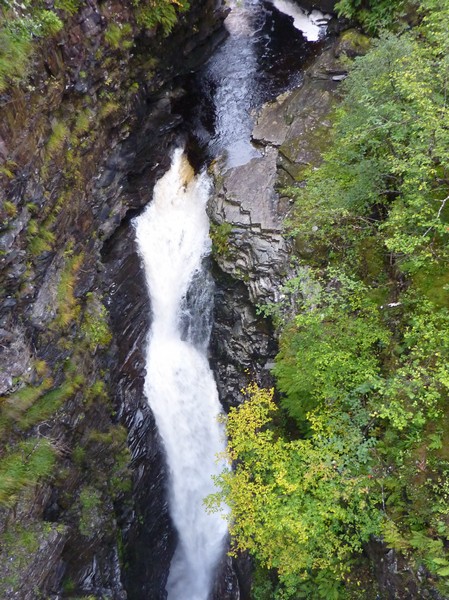
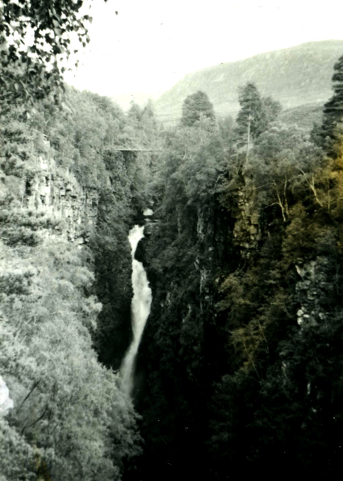
The Falls of Measach in the Corrieshalloch Gorge 2012 - not much different in 1958!
The road went on through steep, barren hills with great views and two hamlets called First Coast and Second Coast! We stopped for lunch near here before driving some way up the eastern side of the next steep peninsula, which led to Rubha Mor. We stopped at the tiny village called Mellon Udrigle, after we’d met a whole flock of black faced sheep roaming loose in the road. In this isolated situation, there was a wooden walkway to the beautiful sandy beach. We met 2 women who said that they were collecting litter from the beach. This was strange, as we’d just been listening to Jeremy Vine, and a woman doing just that had been on the radio.
We returned to meet the A road again at Laide and drove across the foot of the peninsula to Aultbea on the western side. Houses were built along the pier of the sheltered harbour. We were now overlooking Loch Ewe, which is sheltered by the Island of Ewe. This loch was again used in WW2 by the home fleet. We stopped at a parking area where there were information boards about this part of our history. It seemed ironic that there was a German car here, and the occupants were busy cooking lunch from the back of the vehicle. They must have been tough, as the wind was pretty cold!
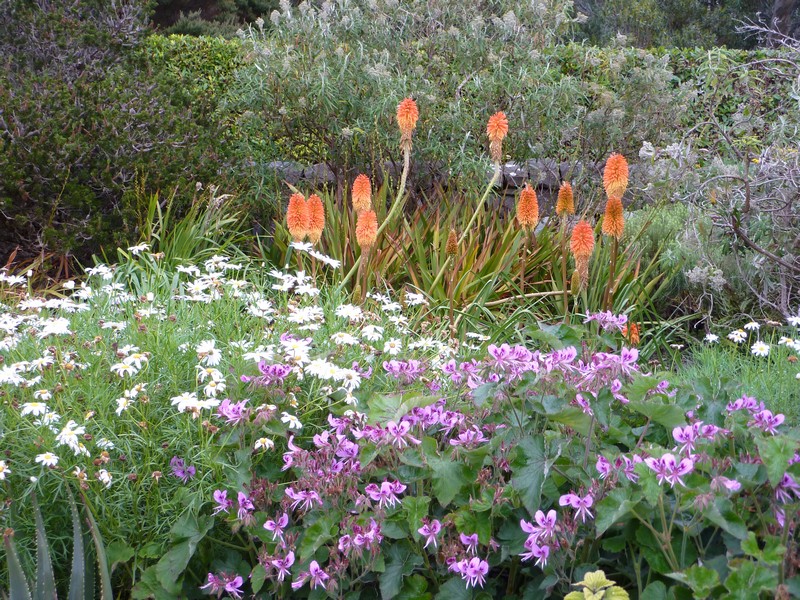
We now drove down to the southern end of the loch, which is where Inverewe gardens are situated. These are run by the National Trust, so free for us, as members. Because of their sheltered situation, ‘tropical’ plants can grow here. It wasn’t very tropical today, but the gardens were pleasant, with a lots of flowers still out, and many huge trees.
We warmed ourselves afterwards with a cup of tea, leaving at 4.30 and continuing up the western side of Loch Ewe on a long ‘no through road’, stopping by Firestone Beach, where there was a camping area above the beautiful bay of pink sand. We walked down on to the beach, which was so lovely but cool and windy.
Little Gruinard
Inverewe Gardens
We drove back down beside Loch Ewe to Poolewe, where we were able to get an internet connection. We received the message from Oxford to say that my blood test was fine, so I will be able to continue with the chemo. We sent a happy anniversary message to Simon & Laure for today.
We drove westwards across remote mountains to Gairloch, situated on Loch Gairloch. It seemed a proud little town with grey roofed, white painted houses lining the shore. Adrian located the medical centre, and a pharmacy, hoping to get an appointment about his diverticulitis, but with no luck. Later he was able to make an appointment for tomorrow at Applecross.
We drove up the western side of the peninsula, across moorland, and then high up above the rocky coast with some sandy bays far below. We drove back to Gairloch, and stopped soon afterwards above a nice sandy bay to have lunch with views of Gairloch and the loch. We drove on to the harbour, which looked busy, with boats trips advertised, and evidence of fishing – lots of lobster pots and several boats.
We drove along the south of the loch, which was beautiful, with woods and ferns showing their autumn colours. There were bays of golden seaweed-covered rocks. We saw what we think was an osprey. The scenery changed to moorland as we drove on around to Red Point, with its pink sandy bay. There were views across to Skye.
Thursday 27th September A lot of roads going nowhere! 99 miles
We left late – 10 o’clock, on a damp, grey day.
Firestone beach
We returned across the unforgiving boggy peat moors with its few scattered communities to Badachro and the pretty wooded coves.
Red Point
South of Gairloch we took the A832 for our route south, travelling east first through the moors until we reached Loch Maree and followed its shore south eastwards. We took a long trail to a parking area beside the lake, but then stopped at a second parking area by the lake in Beinn Eighe National Nature Reserve – apparently Britain’s oldest national nature reserve. It was a lovely spot with views across to the steep rocky slopes on the other side.
At Kinlochewe, at the southern end of the lake, we took a road back westwards through dramatic mountain scenery to Torridon. From here we took a road along the northern side of Upper Loch Torridon on a very narrow road through steep scenery to Inveralligin. The rough grass was a bright bronze colour.
We stopped at Shieldaig, where we watched a heron.
Badachro
Golden seaweed (and a heron) at Shieldaig (near Gairloch)
We drove back to Torridon and then south of the loch to Shieldaig (another one). It was very pretty, with white houses beside the shore, but didn’t have any suitable stopping places, which we had hoped for.
We now continued with our plan to drive around the next peninsula on a small road, to be at Applecross, on the western side, tomorrow. We had passed many suitable overnighting spots earlier, but wanted to be in striking distance of Applecross. The road was very narrow, with numerous passing places but steep rocks both upwards and down to the loch. At 5.30, we spotted a grassy area behind a passing place, beside a small rocky stream and right by the loch near Inverbain (probably one house) – an ideal place to stop.
Upper Loch Torridon
Nightstop near Inverbain
Friday 28th September Over the bridge to Skye 97 miles
We left at 9 o’clock on a day of sun and showers. I had started my 17th course of chemo.
We had wonderful views down to the water as we drove on around Applecross peninsula. We turned down to pretty Ardheslaig, set above an inlet. A rainbow added to the beauty.
There was a violent shower as we reached Kenmore, a little cluster of white cottages with one boat in the loch. The sun looked lovely on the water.
We continued right around this remote, treeless, rocky moorland peninsula, with views on the western side to the Isle of Raasay with Skye beyond.
We reached delightful Applecross - a row of white cottages by the shore. There was a wide cove with a pink, rocky beach.
The road continued south to Toscaig, with a few isolated cottages and small clusters of houses.
Ardheslaig
We drove almost to the end of the road, but needed to be at the medical centre for Adrian’s appointment at 11.15, and we didn’t know where that was!
We drove back to the small habitation of Camusteel, where the road had gone two ways. We stopped at THE shop/P.O. and Adrian asked. The medical centre was back where the road had divided! (in an unmarked bungalow)
The doctor Adrian saw was a locum, up from Durham for 10 days, and finding it very quiet here, with not much ‘custom’. (there was nobody else in the surgery - not even a receptionist). Hence he was happy to chat, and handed Adrian the antibiotics he wanted in case his diverticulitis became problematic.
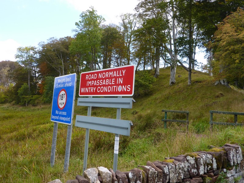
Now we had a really dramatic drive across the middle of the Applecross peninsula on a very narrow road which went up to the Pass of the Cattle at 2054 ft. A sign at the beginning of the road said ‘This road is not normally passable in wintry conditions’, and further on one stated ‘weak road’! Adrian considered it the most hairy road yet! We loved the remoteness of the bleak, rocky, treeless moorland.
Camasterach Bay south of Applecross
We had a violent hail storm on our steep descent, but then we had views down to Loch Kishorn.
The road across the Applecross peninsula
Looking back to Applecross
When we’d descended, we had lunch beside the loch at Ardarroch – there’d been no parking places before.
We continued around the bay to Achintraid where there was a line of pretty grey and white houses lining the bay, many with pots of flowers outside. We had views across the loch of the mountains we’d come over.
We had another drive across remote moorland to Lochcarron, and continued to North Strome, where the ferry used to go across Loch Carron to South Strome. Now there is a road running right around the loch. By the jetty, there are remains of an ancient castle, and beside it was a neat vegetable garden set out in plots.
.jpg)
.jpg)
Looking down to Loch Kishorn from the 'cattle pass'
.jpg)
Looking back up the Applecross Pass
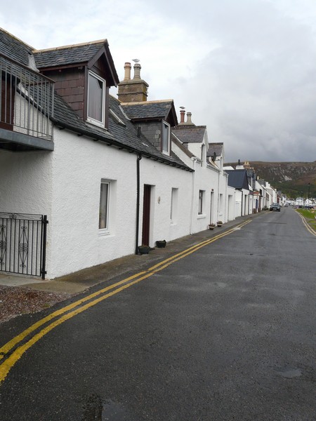
We returned to the town of Lochcarron – a long line of grey and white cottages, many with pretty gardens in front. We were able to get more propane here before driving on around the loch. We stopped high up, opposite the castle remains, above South Ferry.
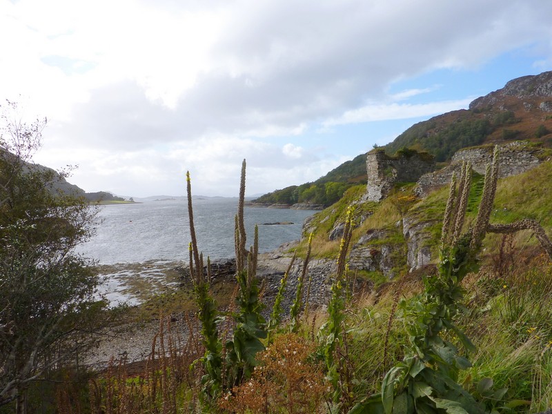
The castle by the former North Strome ferry
The road now went through an area of forest, so we had no views. We drove down to the pretty little town of Plockton, in a lovely situation at the end of Loch Carron, but busy, even today.
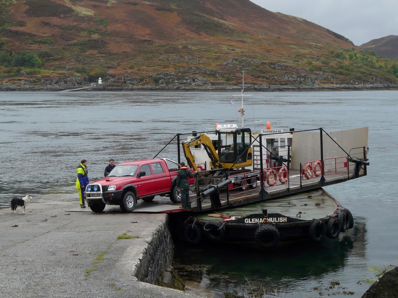
Now we drove on around to Kyle of Lochalsh, which I knew that I had come to in 1962. We made for the ‘Skye Bridge’ – a name we knew well, as we so often hear on the radio of it being closed because of high winds. We passed one or two ferries, bound for the outer isles, before heading across the bridge. We both thought it smaller than we’d imagined.
The old ferry terminal at South Strome
Once on Skye, we drove into attractive Kyleakin, looking back to the bridge. We now had to think what to do on Skye. I saw that there was a road going down to the ferry point from Glenelg, where I thought I’d come 50 years ago. We took this road – a long steep and narrow road over completely barren moorland. We arrived at Kylerhea at 5.40, at a parking area for an otter hide (we’d seen a programme on this ‘otter haven’ not long ago). We had superb views, including across to Glenelg, where I’d stayed in the Youth Hostel, but it was very windy.
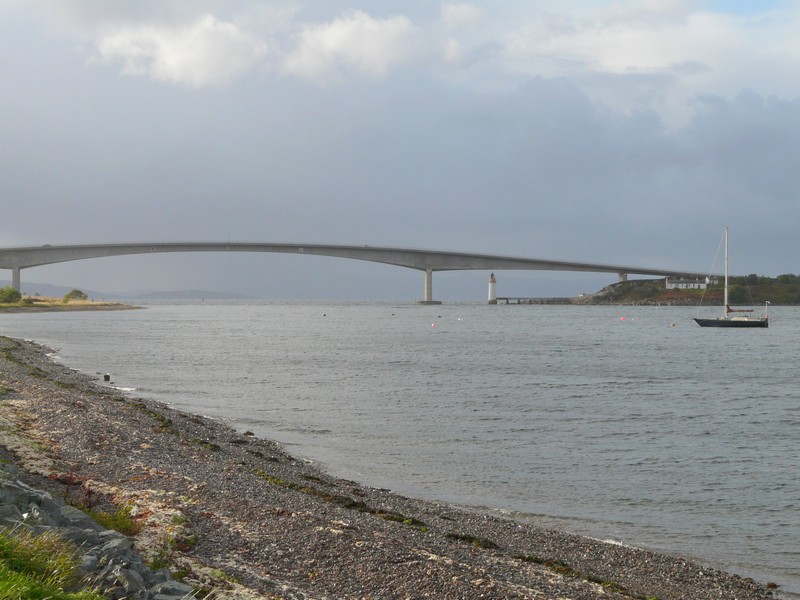
The 'Skye bridge' at Kyleakin
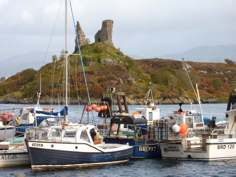
The harbour and castle at Kyleakin
Saturday 29th September Glenelg ferry is top trumps! 75 miles
The morning started wet, grey & windy, so we didn’t trek down to the otter hide, which was over a mile’s walk, mostly down (and then back up).
We left at 9.45 and drove down to Kylerhea – a scattering of white and grey cottages.
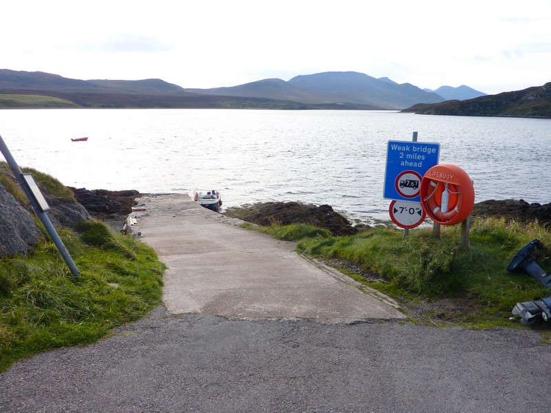
The ferry leaves from here to Glenelg, but we had given up any idea of travelling on it, despite me wanting to revive my 1962 memory. The ferry was docked out in the bay. A sign said that it ran until October, the first ferry from this side being 10.10. Soon we saw it making its way to the other side, where it picked up a car and JCB. Soon it was over by us – an unusual ferry, with a turntable to let the vehicle off.
It turned out to be a top job – 2 young lads and an older chap were running it – all smiles and politeness. We were the only passengers – the young chap charged us £16 instead of £20, as he said they weren’t busy! A bonus was that we saw several otters in the water or maybe they were only seals!
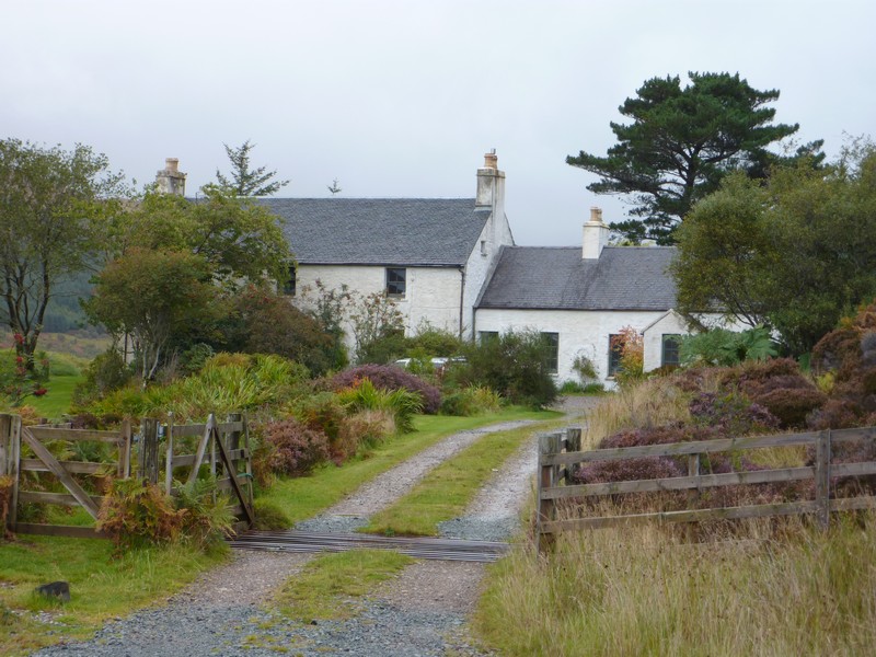
As we neared the jetty, we thanked them, and chatted to the older man (who was actually the skipper.) I said that I’d stayed at Glenelg Youth Hostel 50 years ago. ’That’s it’ he said, pointing to the lone white stone cottage just above the jetty. I’d noticed the attractive house, and suddenly it all fell into place – the jetty was where Angela, Pykey & I had pretended to go for a swim, and had been welcomed back to the hostel and given a place by the fire! I’d often thought about this setting, and was overjoyed to relive it. The house has been privately owned for many years. Later we found photos of it as a Youth Hostel on the internet – in those days it was plain stone.
The Glenelg ferry approaches (slipway behind, where we supposedly swam in 1962)
The ferry unloads its cargo
Quite elated, we drove on around the long bay of scattered houses which make up the ‘town’ of Glenelg, and continued around the shore as far as Eilanreach, and then a bit further, where we had a view right back to the ferry and YHA cottage.
Back at Glenelg, we took a road which followed Loch More, then wound up high and steep before descending very steeply to Shiel Bridge. The sun was now shining, and the seaweed glowed a bright orange. The road now went along the shore of Loch Duich, but trees often obscured the view.
At Dornie, where Loch Long joins Loch Duich as they reach Loch Alsh, there was the dramatic castle, Eilean Donnan, set on a little island.
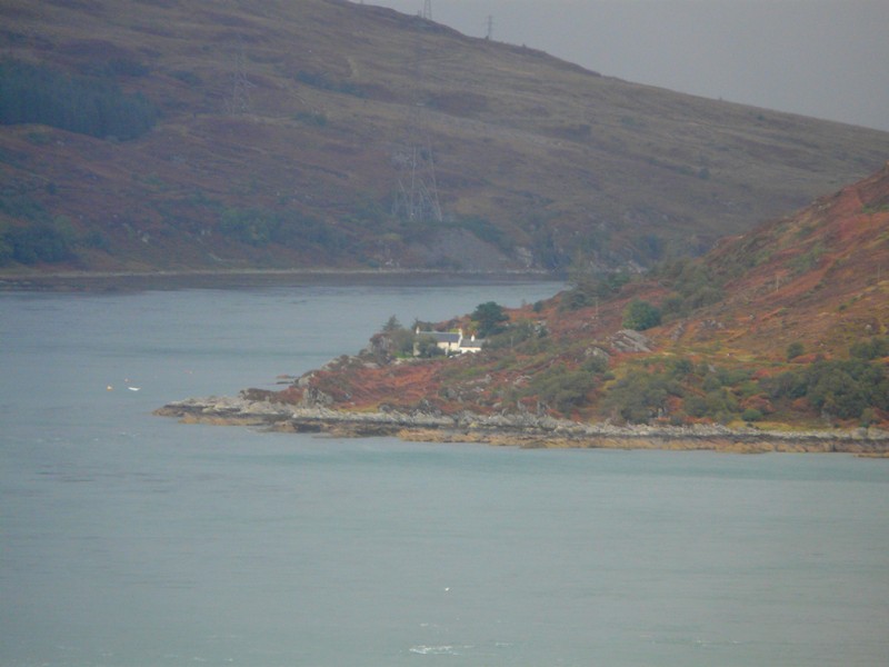
The now private white house - in 1962 it was the Youth Hostel
We continued to Kyle of Lochalsh, where for the second time in two days, we crossed the Skye Bridge. We had been a bit concerned, as we’d heard forecast of high winds, so hoped that the bridge was still open.
Once across we stopped once more in the car park at Kyleakin and had lunch before proceeding to Broadford, where we stopped to get diesel, then had a shop in a co-op store, which didn’t impress me!
From here we took a road south westwards, driving as far as Torrin, on Loch Slapin. We had good views of the bare Cuillin Hills, and were pleased to see two deer – the first we have seen. As we drove on around the loch to the wooden jetty and couple of houses which made up the hamlet of Faoilean, we saw a grey heron. There were a few fishing boats in the loch.
We drove back to Broadford, then continued north on the main road, turning off to drive a dreadfully badly surfaced loop of the old road around a steep promontory, starting beside Loch Ainort. The road was narrow, and set high above the sea, with little opportunity for pulling off. About half way round, we passed the couple of houses which made up Moll. We had views now to the island of Raasay, and watched a ferry travelling there from Sconser, a bit further on. We at last found a place to pull off, and decided to stay for the night, although the internet connection which Adrian had hoped for became erratic.
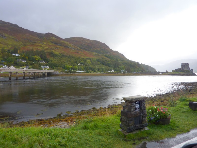
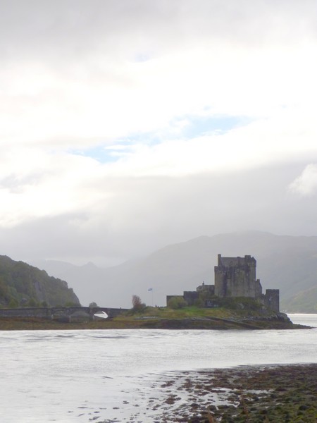
The dramatic castle of Eileen Donnan
Sunday 30th September Wild Skye and waterfalls 87 miles
There had been continual rain for a long time in the night, followed by a period of alarmingly high winds for a while. Even so, the moon had shone brightly.
The day that followed was a mixture of squally showers, wind, and occasional brighter spells.
We didn’t leave until 10.30. We had seen no vehicle after arriving last night. We drove on the short distance to Sconser with its little jetty for the Raasay ferry.
We followed the road along the southern shore of Loch Sligachan and continued across the island, taking a long, narrow road through bleak, austere landscape down to Eynort, where there was just one little boat. We passed a few scattered dwellings in this land of mostly rough grass, with occasional areas of forest. Waterfalls often gushed from the hillsides. There was some kind of ‘scarecrow’ competition, with effigies outside many of the houses.
It rained heavily as we returned to Carbost, on Loch Harport. We drove on to Portalong, at the end of the loch, where there was a lone pier with a collection of nets and of ropes in bags. There were several small boats in the bay.
We drove on to Fiskavaig Bay on the west of this peninsula, but there was nowhere to stop so we returned to the pleasant village of Carbost, and had lunch in a parking area by the loch, next to Talisker distillery. We rejoined the A road at Drynoch and continued northwestwards but it rained hard, and the visibility was bad.
At Dunvegan we turned on to the B884 through desolate moorland with a lot of scattered white and grey houses. We had views of Loch Dunvegan. We drove right on to a little jetty at remote Milovaig, passing steep high cliffs of basalt with a lot of waterfalls. There were a few small boats and some lobster pots.
Two boats at Portalong
We drove up the western side of Dunvegan Loch with more isolated dwellings before returning to Dunvegan, where I spied a water tap, so Adrian was able to fill the tank.
We drove up the Waternish peninsula as far as Lusta by Loch Bay but then returned to the junction of the B850 and B886 by a little bridge known as Fairy Bridge at 5.45.
Loch Pooltiel at Milovaig
Monday 1st October To the Outer Hebrides 47 miles
We left at 9 o’clock, after Adrian had booked the ferry from Uig to Tarbert for 2.00.
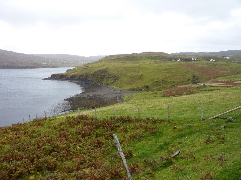
We took the road to Grenshornish, beside Loch Grenshornish. There were just two houses along this narrow road which led through grass, bracken and sheep and just ended at a hotel. The day had started a bit brighter, but there was a big rainbow over the loch. There was a scattering of grey/white houses as we continued past Aird and made our way northwards on the western side of the Trotternish peninsula to Uig. We both were reminded of Cartwright in Labrador – a tiny community we’d arrived at after a long ferry journey. Uig looked as small and unassuming! There was a little harbour, and some fishing stuff, and the jetty for the ferry terminal.
Although we’d arrived at 10.30, time was taken up by writing emails, collecting our tickets, getting diesel, pumping up the tyres and having lunch. We looked into the small Skye brewery shop, and a pottery where a young woman was putting the finishing touches to some small highland cattle.
We made our way to the ferry queue, and were surprised that the boat left promptly at 2.00, having only arrived shortly before. We had a calm crossing, seeing some of the highland scenery of northern Skye as we left. After an hour and a half we arrived at yet another ‘Cartwright’ – Tarbert, on North Harris.
This day continues in the Outer Hebrides Section


The old Glenelg Youth Hostel


