
Aberdeen to John O' Groats
Monday 10th September
We pick up our 'Scotland' trip again at Aberdeen Airport (Dyce)
We made our way back to the coast at Balmedie (there had been no easy access before this), but were disappointed to find that there was a width barrier for the car park, so we weren’t able to view the long sandy beach.
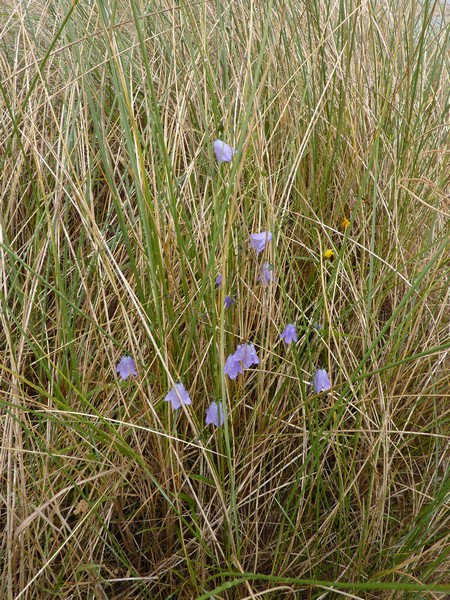
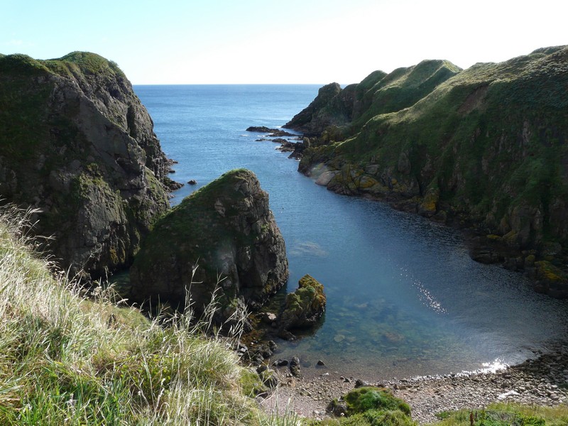
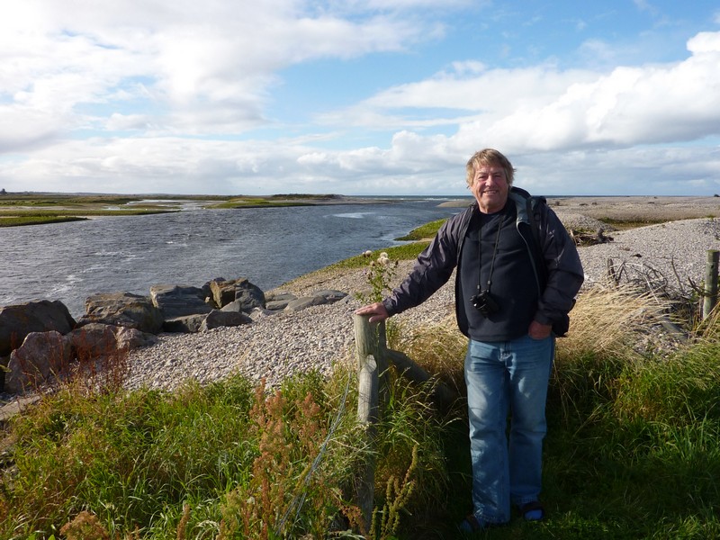
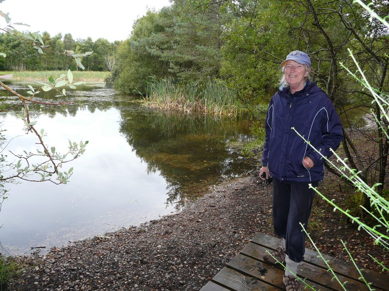
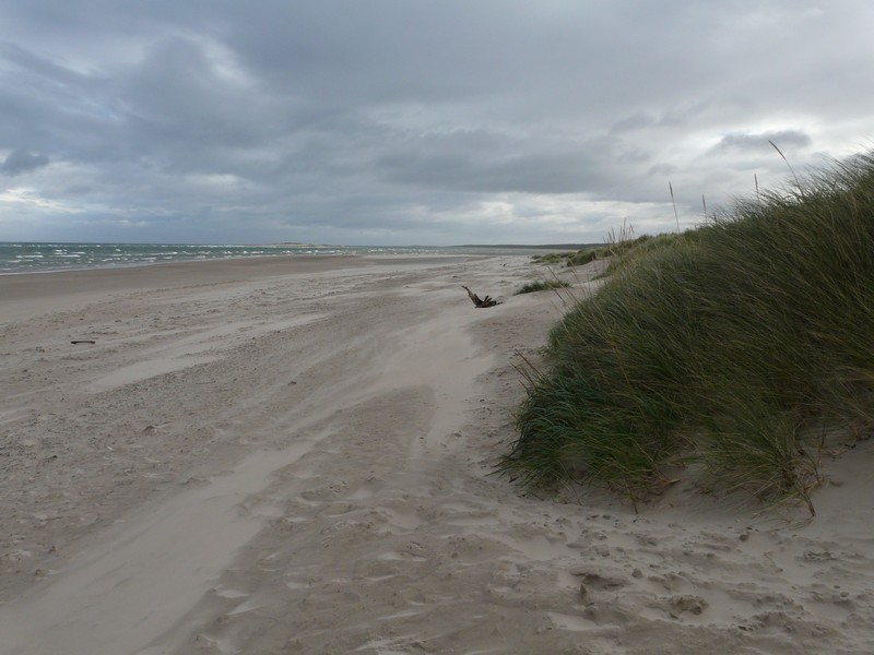
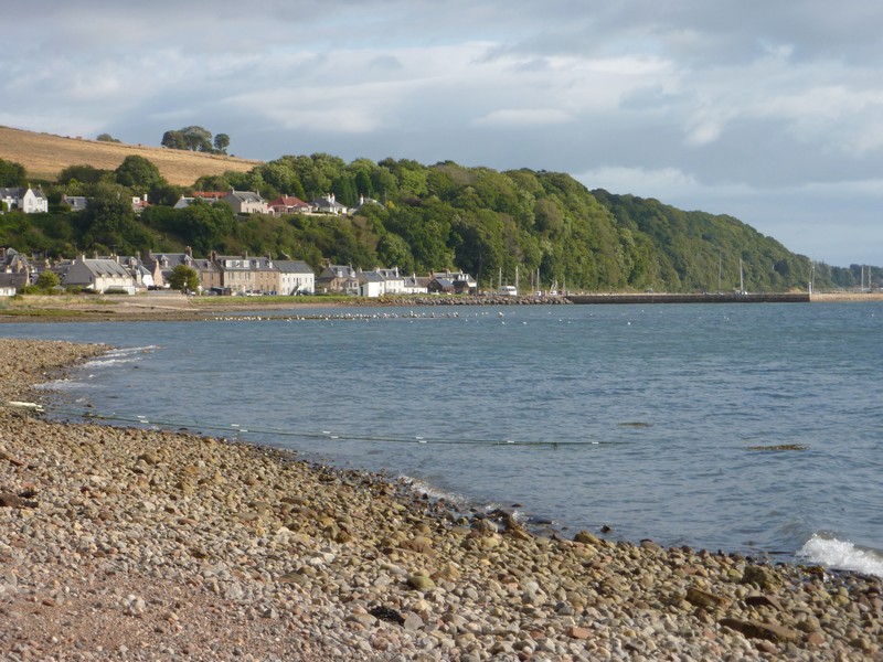
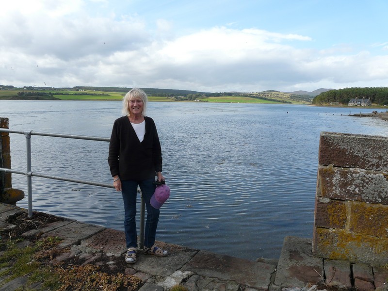
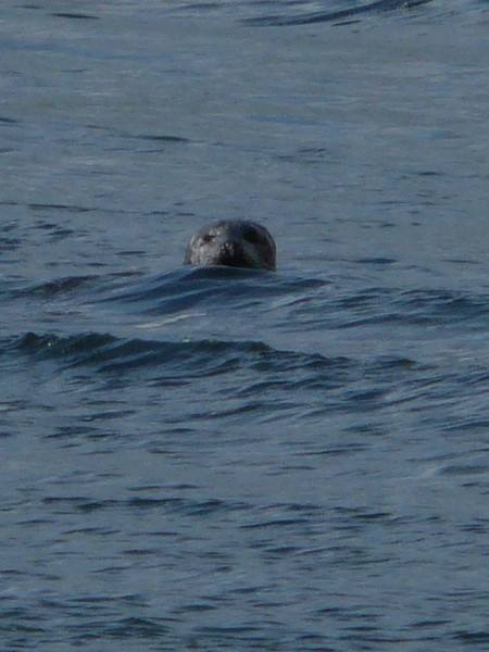
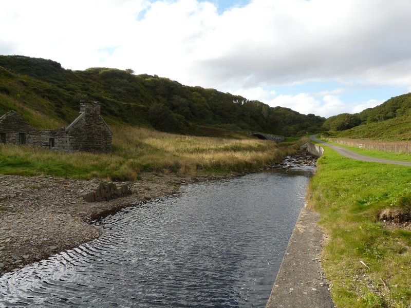
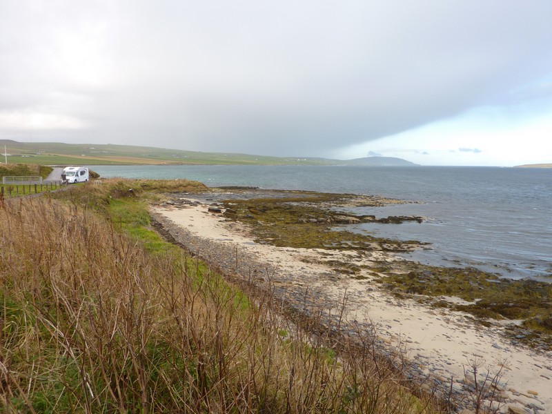
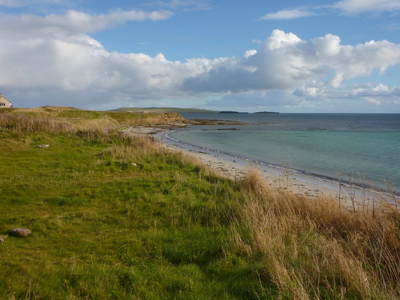
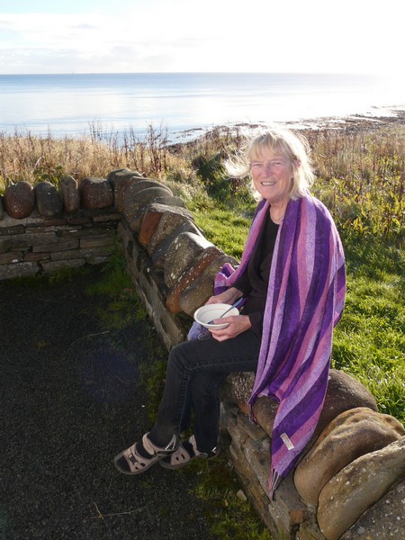
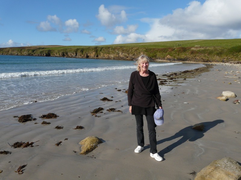
We continued to Newburgh and took a road to the dunes. The car park here had a height barrier, but we were able to park beside it. We wandered through the dunes, climbing up them (me rather reluctantly and with Adrian’s help). It was certainly well worth it! We had the most amazing view of the Ythan River estuary, with sand dunes all around. There were myriads of sea birds, including lots of eider ducks, and on the shore were a large group of seals ‘mewing’. Amongst the dunes were harebells and violets. A real winner!
Aberdeen to John O'Groats (including the Orkney Islands)
Back in the van we drove on across the Ythan River, where we pulled into a parking area briefly, but decided to drive on to Collieston. The area of sand dunes before there is a nature reserve – we looked into Forvie Visitors centre before driving on to Collieston, where there was a lovely parking area by St Catharine’s Dub, which would have made a wonderful overnighter, above a wild rocky cove, but it had ‘no overnighter’ signs. We drove on to view the village of grey and white houses above a very pretty sandy bay.
We had note of some overnighters a bit further on, but thought that we would go back to the parking area by the Ythan River near Newburgh. When we reached it, it was with disbelief – in the time we had been gone, posts had been ‘erected’ at the entrance! A gentleman parked in the carpark asked us if we knew about them – he was having difficulty in getting out, and we certainly couldn’t get in!
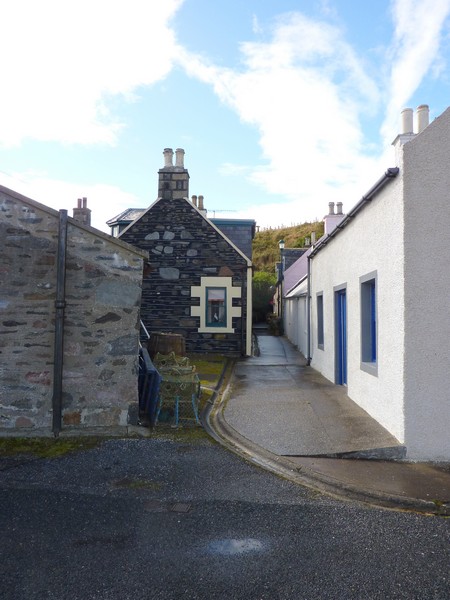
Now we had to head to the other places, but were without an OS map – Adrian had tried unsuccessfully to buy one. Hence we took the main road, when there was shorter way, as ours entailed us going right back on ourselves. Only when we got there did we find that it was the wrong place anyway! It was called Whinnyfold, and consisted, as our coast book said, of four rows of (dark) houses above a pretty cove far below.
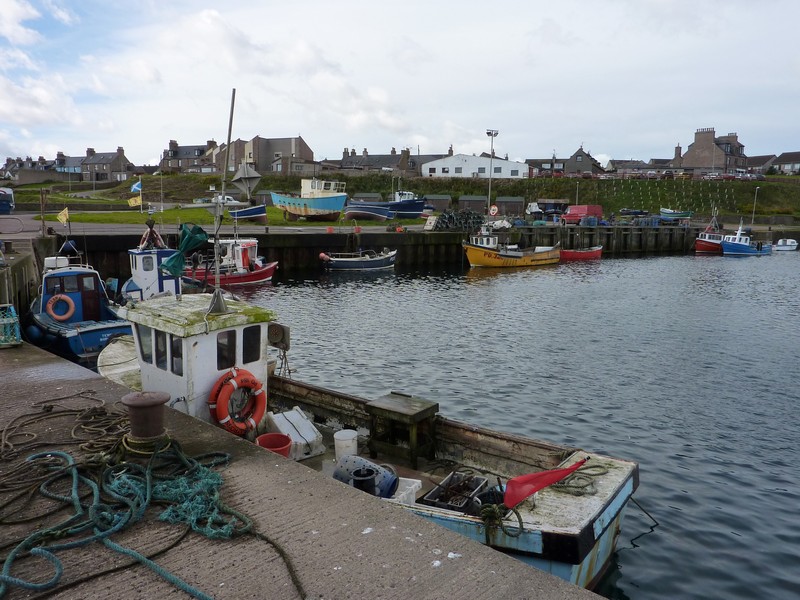
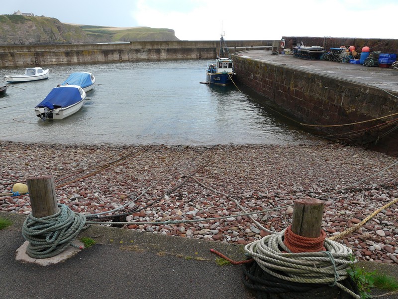
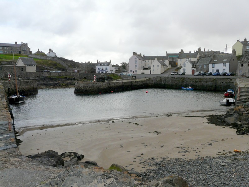
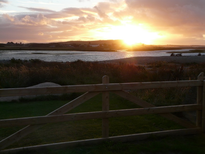
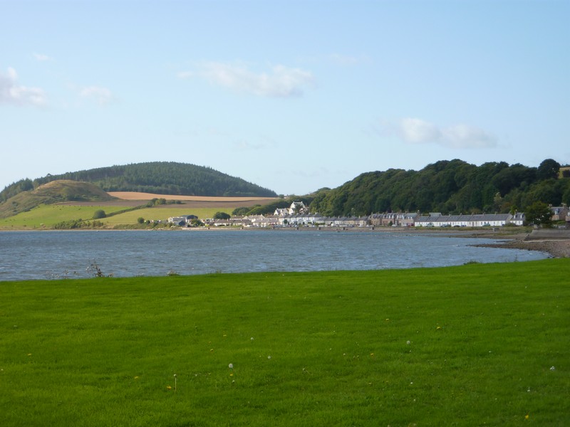
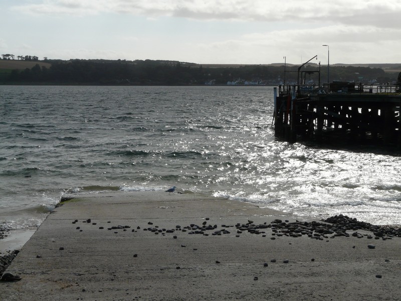
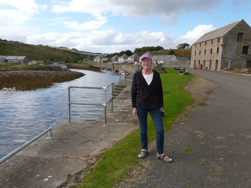
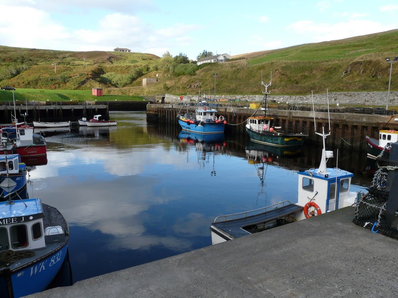
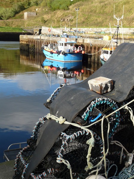
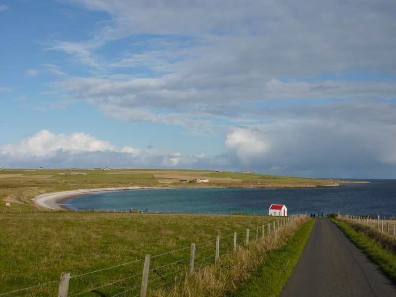
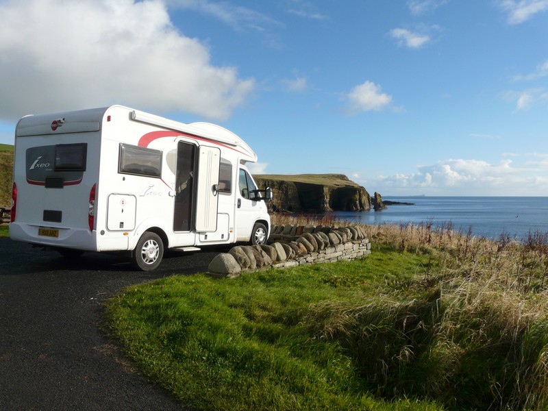
We drove on to the Harbour Car Park, Cruden Bay, where we stopped by the little working harbour, looking across to a long sandy beach. It was nearly 6 o’clock.
Tuesday 11th September Through Peterhead and Fraserburgh 52 miles
It was a fine morning with a cool wind, which stayed all day. After breakfast (looking out to oystercatchers and a little wagtail) we had a walk around the small harbour. Fishing nets had been drying on poles.
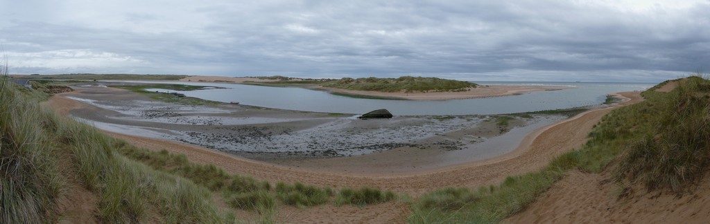
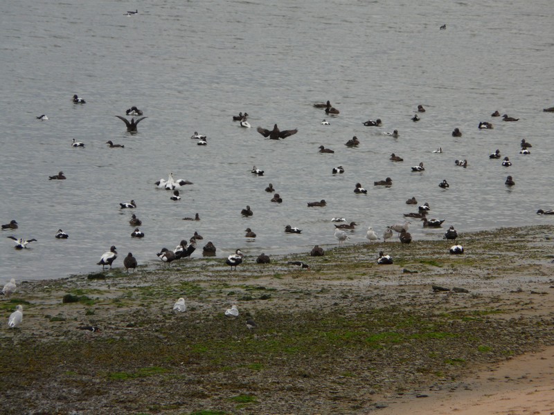
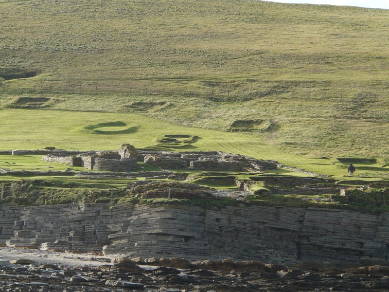
The Ythan River Estuary, with Eider ducks and harebells
We were able to get water for the van, so didn’t leave until 9.30.
Adrian tried in two shops to get an OS map – in the second one the lady said ‘we did have one. Someone must have bought it’.
A bit further on, we stopped to walk to ‘Bullers of Buchan’. Past two rows of houses, we came to a narrow path 200ft above the sea. A large arch in the rock, formed a circular pool of sea water. Despite the wind, the sea was calm today, but apparently it is a spectacular sight when rough.
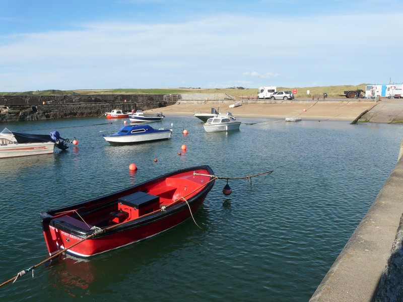
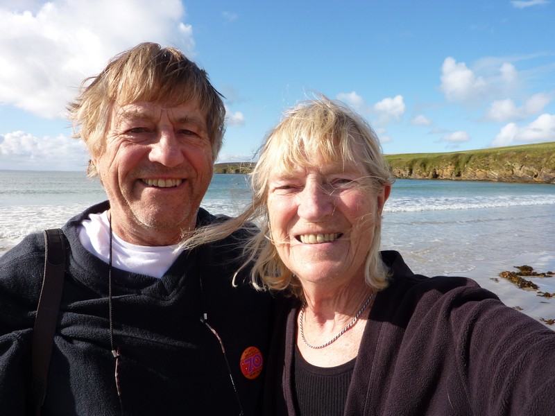
Cruden harbour, where we overnighted with the Ixi in the distance
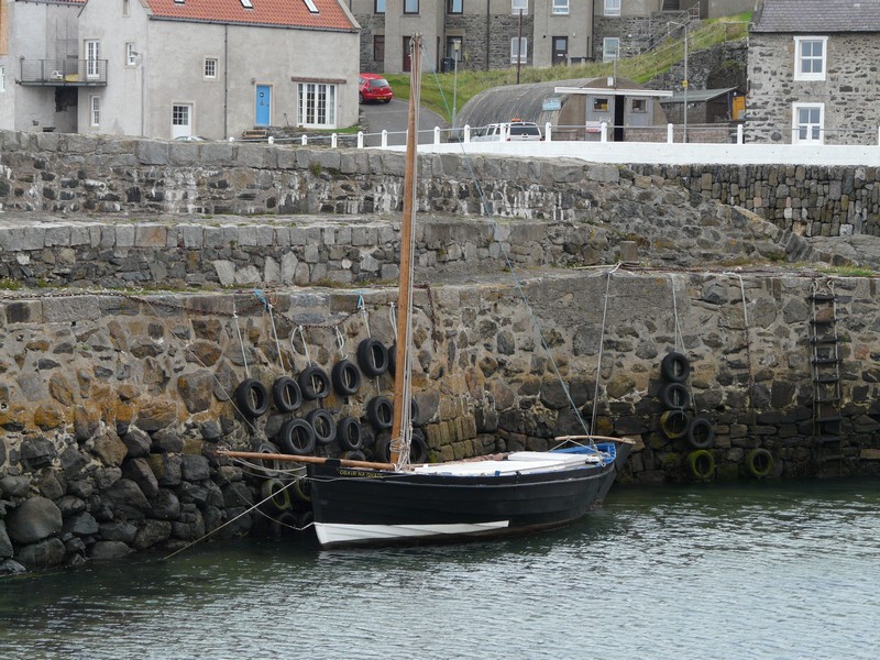
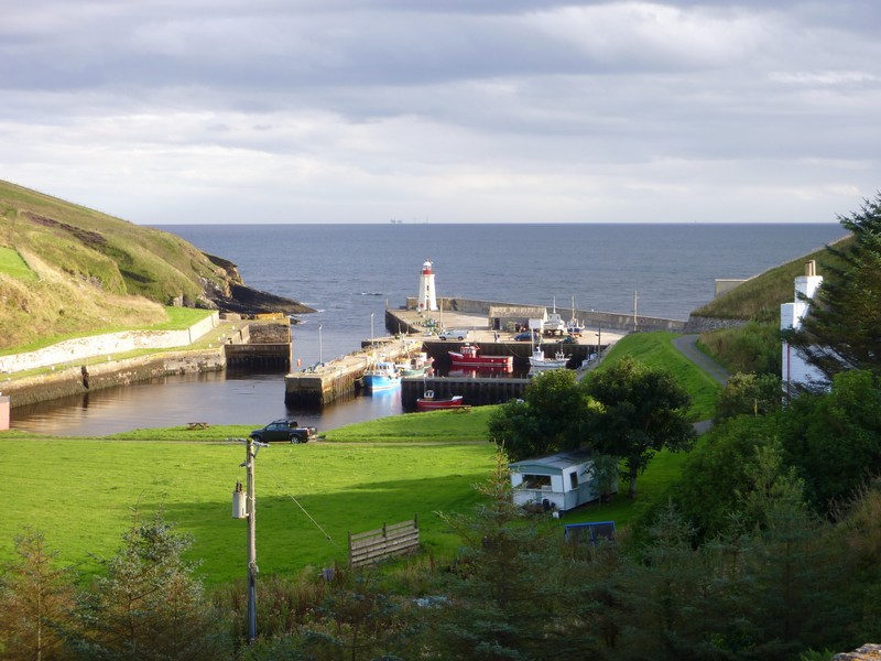
We turned off again to Boddam, a fishing village just south of Peterhead. We parked by the little harbour, where there were some fishing boats. A lighthouse stood on a craggy islet close by and cormorants lazed on the rocks. We had a little walk around.
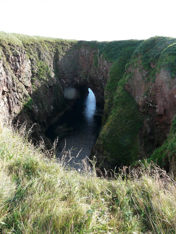
The Bullers of Buchan
Boddam harbour
The works and power station up behind detracted from the niceness.
We drove on to Peterhead which still has two busy harbours. One was concerned with oil, the other still with fishing. We walked down on to a pink pebbly beach, where there were cormorants and oystercatchers on the craggy rocks, before driving around the fishing harbour to the part called Keith Inch – the most easterly point in Scotland. The skyline around the harbour as we looked back was nice.
On driving on, Adrian went into Halfords, but still no luck in getting an OS map. Using just the road atlas often proved difficult.
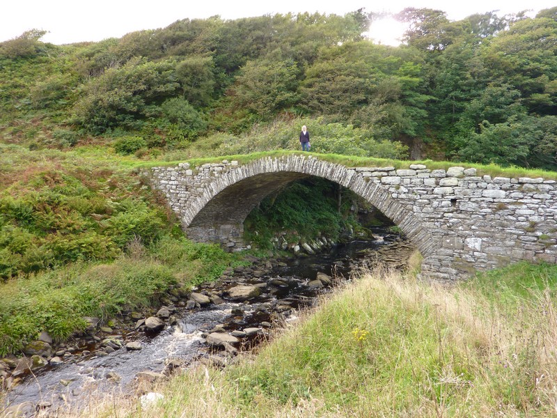
We turned off to Rattray, which had once been a thriving port. A storm in 1720 had blocked the sea access, and all that remains is the ruins of the church.
The remote area around it is now an oil refinery, but we found a way to Loch of Strathbeg, an inland lake formed by the 1720 storm, and frequented by many birds. We couldn’t get close to it, but could see a large group of swans on it while we ate our lunch.
As we tried to find our way now to St Combs, we discovered that all the roads to it were closed! We tried one route after another. We finally succeeded, but even then couldn’t find the way to the coast. When we did, we found a bright sandy beach which we walked across to the rocks at the water’s edge. This former grey stone fishing village had its houses gable end on to the sea as protection from storms, as several villages here had. We took a long narrow road close to the sea, and fringed by a golf course to the twin towns of Inverallochy and Cairnbulg. The road had the worst ‘topes’ ever! Behind the end-on houses of these former fishing villages, washing lines hung on the lawns beside the sea.
Fraserburgh, a large grey town, still had evidence of its fishing industry around its large harbour.
The rocky beach from here along to Sandhaven was smelly! Sandhaven had a small harbour with fishing boats, but the larger harbour was unused now. There were fishing boats in the harbour at Rosehearty too.
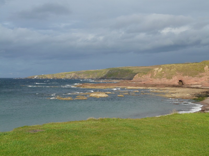
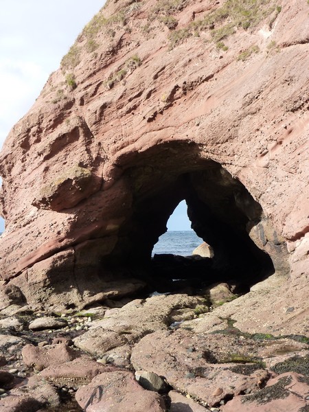
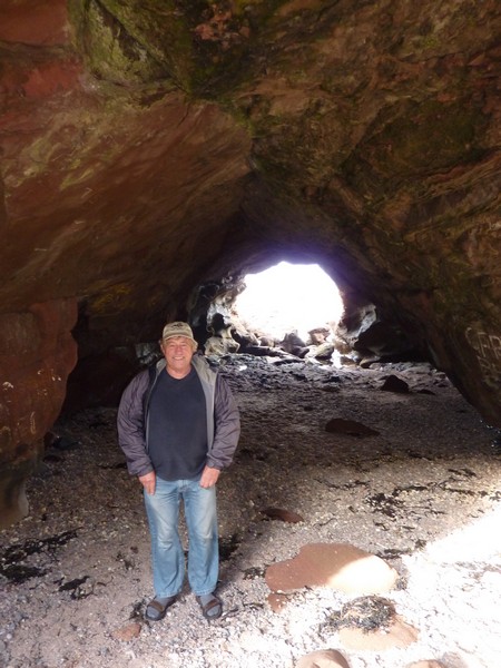
We drove on to New Aberdour. The village is a little inland, but we drove on past the ruins of a medieval church to a semicircular bay with ample parking. We enjoyed the lovely colours of the red rocks and green grass against the blue sky. We had already decided to overnight here, although only 3.30 when we arrived.
We battled the strong wind to walk to the end of the bay, past St Drostan’s Well to the cliffs with their caves. We walked through one cave, then back over the pebbly/shingly beach to cross the little Dour stream at the other end.
We were surprised at how many cars came down to this remote beach during the evening despite the rain showers which now came.
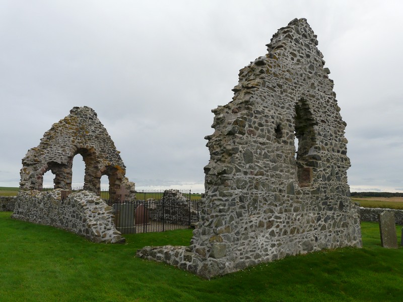
Rattray Church

Aberdour Beach
Wednesday 12th September Delightful fishing villages along the Moray Firth 55 miles
There were some sudden heavy rain showers in the night, and in the morning, and the day alternated between sunshine and sharp showers, still with this cold wind.
No cars came down this morning, except the man who came to unlock the two portaloos which he had locked last night!
We left at about 9.15. It had been a lovely spot, if isolated – we’d had no radio, phone or internet connection.
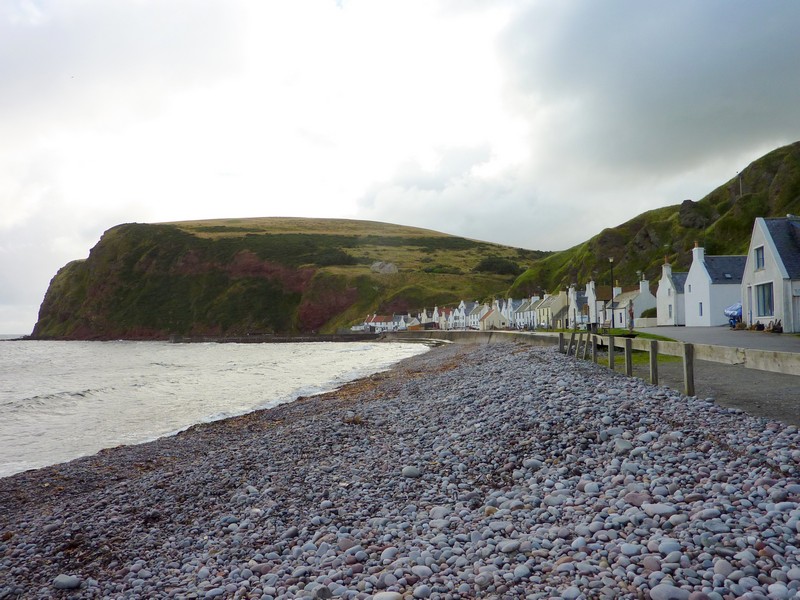
Our first stop was Pennan, said in our coastal book to be the most picturesque village on the Moray Firth. It certainly was lovely. We drove down an extremely steep, zig-zagging road to find a line of pretty ‘end-on’ houses, many painted white or pastel, with grey or red roofs, fringing the pebbly beach of the bay. There was a perfect little harbour. The wind was very cool, but it luckily didn’t rain until after we had got back into the van.
Soon afterwards we turned off by a pretty little bridge at Cullykhan Bay, where the isolated former mill house had a productive vegetable garden right down to the bridge. There was a simple campsite opposite, in a nice situation.
Just on from here, the road to Covie was too steep and narrow for us to drive down, but we could see the single line of houses sandwiched between the steep cliffs and the sea as we drove along to the neighbouring village of Gardenstown. This was larger, but just as steep. The houses had spread up the hill. We made the long, steep descent to the still active fishing village with a lot of boats in the harbour, and a collection of wooden fishermen’s huts.
The skies today were often dark, with the sea reflecting the metallic grey, and often with sections of rainbow.
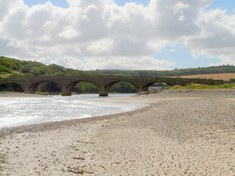
We drove on now to the ‘no-nonsense town of Macduff (we hadn’t known that there was a real place called this), where fishing and ship’s chandlery were still much in evidence. We crossed the Deveron River, on an attractive seven span bridge built in 1722 by Smeaton, of lighthouse fame, to Banff.
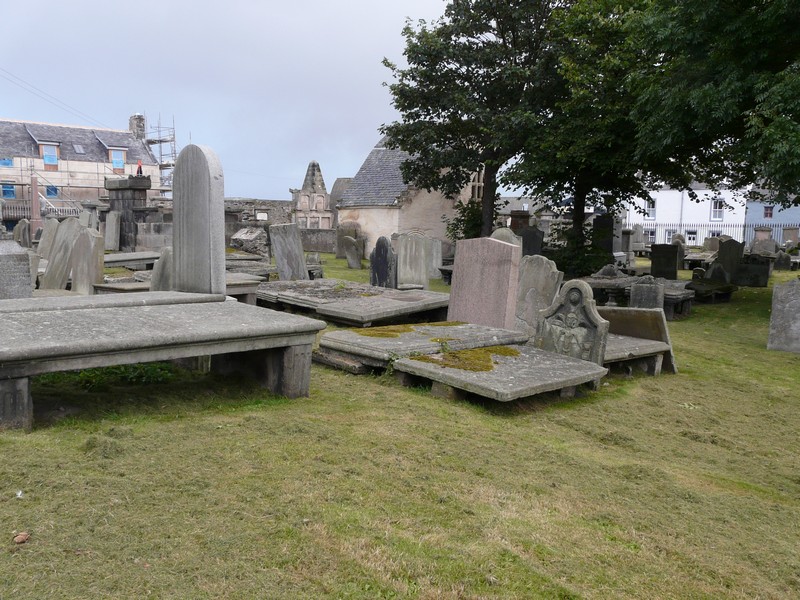
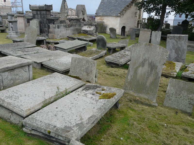
This was a very smart town, with rows of attractive simple houses and many grander ones. There were lots of hanging baskets. We stopped by a graveyard where the gravestones were all slightly raised, like a table.
The streets rose steeply from the harbour, which now contains pleasure boats.
A bit further on was Whitehills, which had larger pleasure craft and just a few fishing boats. This had changed from the time of our coast book, when it was still all fishing. There was a children’s play area now in one filled-in harbour. We had our lunch (of bacon baps) just beside here.
The next place, Potsoy, had attractive houses and two largish harbours with a few fishing boats.
We enjoyed our walk around Sandend, as we arrived in sunshine after a shower of rain! It was a treasure of a place anyway, with pretty ‘end-on’ houses and two small harbours with a few little boats. The rocky coastline contrasted with the adjacent sandy bay.
We drove on to Cullen Bay, where the village of Seatown with its white houses and grey roofs was crammed into the valley. There were a few little boats in the harbour, and a huge railway viaduct towered up behind.
We now came to Portknockie, and –joy of joys - we were now on an OS map! The houses here, and at the next few villages were prettily painted, with ‘castle turret’ (up and down) painted stones around the windows. Many of the houses were ‘end-on’ again. We walked along by a wonderful bit of craggy coastline to view ‘bow fiddle rock’ – a rock formation with a large ‘eye’ in it. As we drove along the top of the cliff past the harbour, a lady was hanging her washing on one of the lines which fringe so many of the villages.
The next village, Findochty, was even prettier. The rows of houses were painted similarly and there was a small low-key grassy picnic area above the little beach on this rocky, craggy coast. There were pleasure boats in the harbour.
Buckie – at the time of our book, the largest harbour on the Moray Firth - is actually five villages of prettily painted houses strewn along the shore. We passed the large harbour with its few fishing boats, and a fish market. Port Gordon came just afterwards, and then we drove on to Spey Bay at the mouth of the River Spey.
A wide beach of pebbles lay in front, with the metal coloured water of the Spey contrasting with the turquoise sea beyond. We pondered our onward route and decided to overnight here in the Nature Reserve car park.
We had a short, blowy walk beside the Spey before looking in at the adjacent dolphin centre.
Adrian had a big downer when he found that there were no places left on the steam train from Fort William to Mallaig on his birthday. We therefore had a big rethink, and decided to continue up the east coast to John o’ Groats.
We enjoyed a lovely sky as the sun went down.
Thursday 13th September Our 200th night in the van! 54 miles
Not the sort of day we wanted – it had rained in the night, and the morning was overcast grey with continual rain. No spotting dolphins this morning! Nobody even came down to walk their dog!
We left at 9.40 to drive the 9 miles to cross the Spey River and come back to Kingston, opposite where we had stayed. It was still very grey and wet as we looked back to our spot.
We had to take a cross country route to Lossiemouth/Branderburgh, which had long sandy beaches to both west and east. We stopped by the mouth of the Lossie River before stopping again by the west beach, where it was high tide. The beach stretched round to a lighthouse. Noisy plains from RAF Lossiemouth flew overhead.
We drove on to Hopeman, which had a nice sandy beach on either side of the harbour, where there were a few pleasure boats. We had passed close to Gordonstoun.
From Burghead we could see over the Moray Firth to the northern side. We had a ‘blow’ around the tip of the headland, past a Pict fort and on a wild goose chase to find a well which is thought to be an ancient place of baptism. The strong wind had blown over some of the wheelie bins, and scattered the plastic recycling boxes.
There was a narrow harbour with a few fishing boats. We ate our lunch overlooking Burghead Bay, where there were ‘white horses’ on the waves (this is the first day we have seen any serious waves as the wind has been blowing off the land all week). Flower displays brightened this otherwise grey town.
Findhorn might have looked better on a brighter day! Today it looked wet, deserted and miserable. Almost land locked Findhorn Bay, described in our book as a ‘semi-tropical lagoon’ in good weather offered nothing today. Even the bird hide was locked!
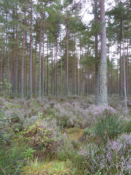
We drove on around Forres to Culbin Forest. This is another area of sand, where a village was buried by sandstorms in the 17th century. In the 1920s the Forestry Commission started reclaiming the land by planting trees.
Although we had arrived at 3 o’clock, we decided to stay for the night in the Forestry Commission Car Park, as the wet weather meant that we weren’t seeing places in their best light and we were relatively out of the wind in the trees.
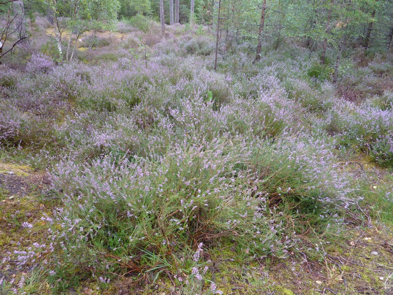
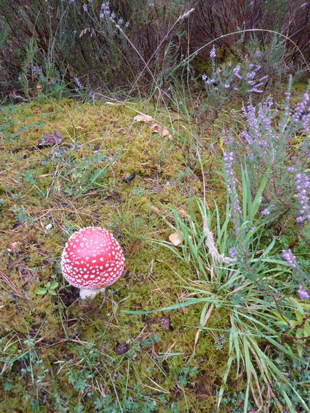
When the rain had almost stopped, we went for a walk through the forest as far as some ponds. We saw no wildlife here, but enjoyed walking through the forest of tall fir trees, with a carpet of purple heather underneath. We did see a dragonfly, and Adrian had almost trodden on a frog, and later a tiny frog jumped off from a perfect fly agaric toadstool.
Tonight is our 200th night in the Ixi (but we can’t drink to it, as Adrian has been taking antibiotics for his diverticulitis! What a shame!)
We enjoyed listening to the very last of our year in Australia 1998 by listening to all the lists we had made.
Friday 14th September Culloden and Inverness 55 miles
We left at 8.50 and drove on through the forest to Nairn, which Adrian had visited as a ‘lad’. We endured driving through a static caravan park with its numerous speed humps to get to an area by the beach, which was an RSPB reserve. We walked up the sand dunes and looked down to the unspoilt sandy beach where there were terns and redshanks or godwits. It was VERY windy!
Picturesque Pennan
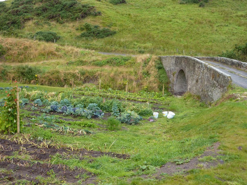
The productive vegetable patch at Cullykhan
Gardenstown
The seven span bridge over the Deveron River
The table-like graves at Banff
One of the harbours at Potsoy
Sandend
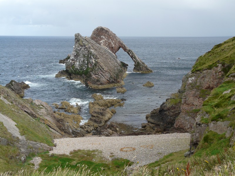
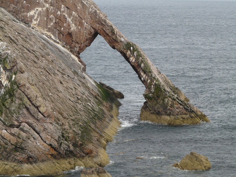
Bow fiddle rock, Portknockie
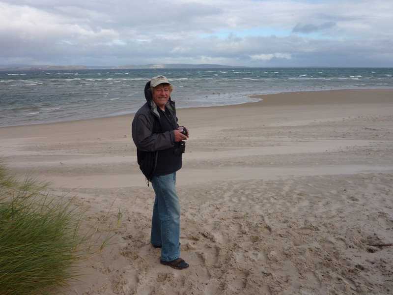
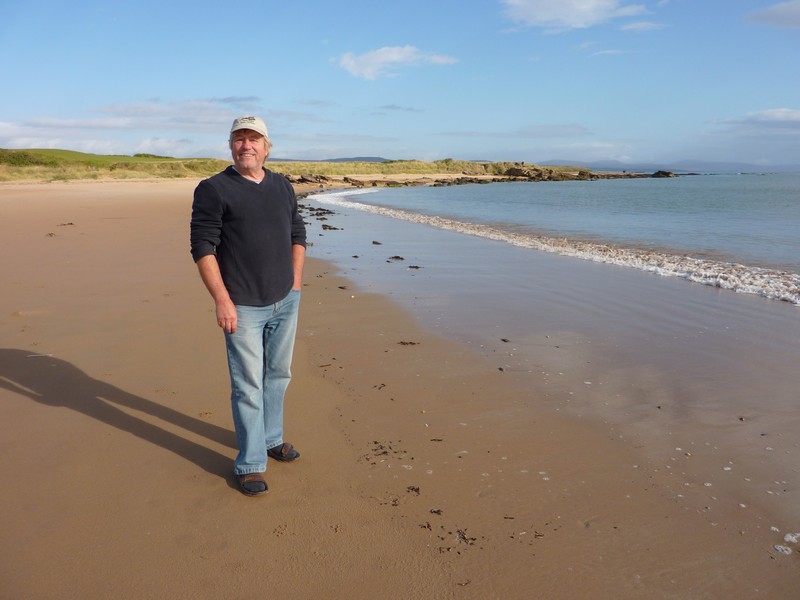
Adrian near the mouth of the Spey
The sun goes down over the Spey

Lossiemouth
The ancient well at Burghead
The harbour now is filled with pleasure boats. We continued driving westwards, having to brake sharply on a narrow road. When we stopped, and I opened a cupboard, a dinner plate shot out & smashed on the floor!
We stopped by Fort George, situated on a headland jutting out into the Firth. It seemed sad that the sandy beaches surrounding the fort are always closed to the public because of military operations.
As we drove south along the Firth, we stopped briefly at Ardersier, where the water looked grey and angry.
We took a small road to the promontory at Alturlie. We were surprised by the second track on the road, separated by a central grass strip, until we realised that the road went to a quarry. At the very end of the headland were just a few simple cottages, now seemingly occupied by 'older people'.
Now we diverted slightly inland in order to visit the important site of the Battle of Culloden. This is now owned by the National Trust, so free to us. The modern, comprehensive museum is very impressive. I couldn’t get into all the battle stuff, but could appreciate the relevance of this last battle site on British soil.
We ate our lunch here before heading for Inverness, a place which Adrian had stayed at in his teens, with his family. It proved a useful place for us – first we shopped in Tesco, as we needed to stock up for the next little while. Then we headed for a laundrette – always an essential when travelling for some time. Adrian had located one, but the difficult thing was that it was in the middle of Inverness, so parking wasn’t easy! We managed to park in a neighbouring street, using my blue badge, and came out triumphant, with a load of clean and dry washing.
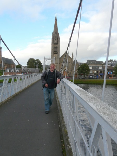
We drove on a short way – we were right near the cathedral – and parked by a pedestrian suspension bridge over the River Ness, which was the one thing that Adrian remembered. We walked on to the bridge, which swayed and vibrated enormously, and looked at the skyline with its castle and plethora of spires. Buildings were of pink stone.
Next we drove on a bit so that we (I) could see the Caledonian Canal – near to a flight of locks.
Now we drove over the bridge to North Kessock. With the sun shining down on Beauly Firth, it was lovely. We had note of a place to stay, right by the water, past the row of houses called Charlestown, but sadly there was a newly erected ‘no overnighting’ sign.
We took a small road northwards, heading for another overnighter, but came to a suitable spot by Drumderfit Forest Entrance, near Munlochy and pulled in. This peninsula is called Black Isle.
We opened a bottle of bubbly to celebrate our 200 nights in the van.
Culbin Forest
Saturday 15th September No ferry today! 105 miles
We had a short walk along the forest track before leaving at 9.20.
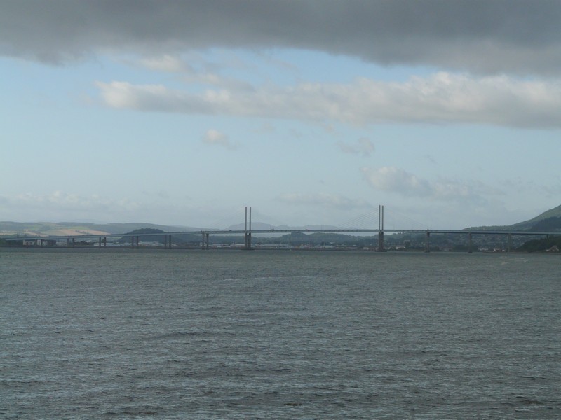
We backtracked a bit to take a pretty ride through forest to a steep, narrow road down to the little line of cottages of Kilmuir. Although remote, it wasn’t far from the bridge we had driven across yesterday, but looked beautiful in the morning sun.
On the beach at Nairn
Fort George
The 'dual carriageway' at Alturlie
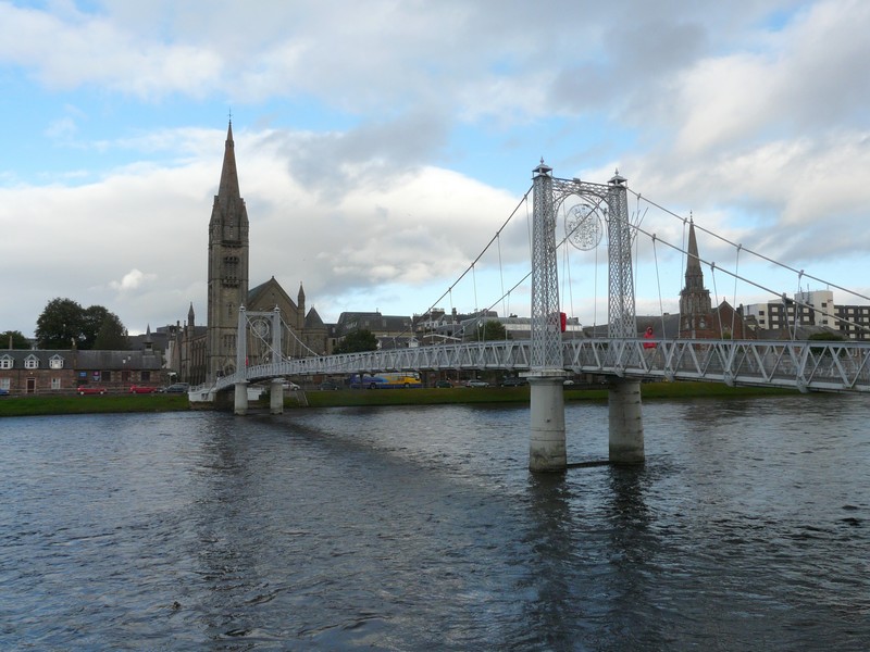
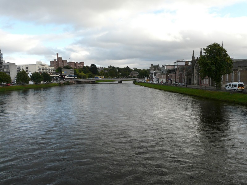
Inverness
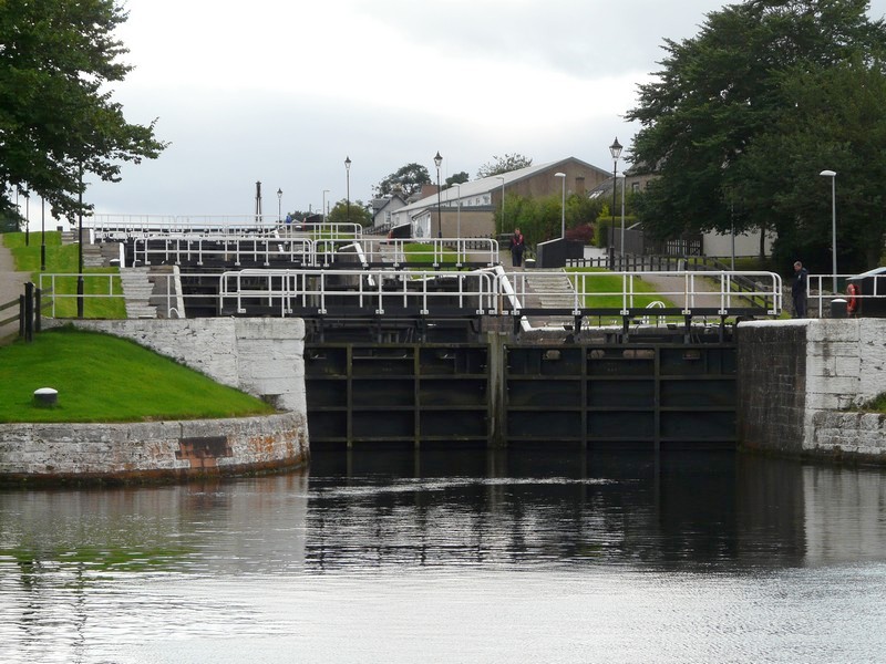
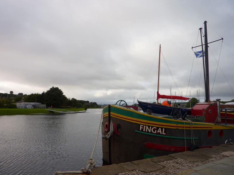
The Caledonian Canal
We now drove back, and on through Munlochy, where we passed the overnighter spot overlooking Munlochy Bay which we had been heading for yesterday. It didn’t have any ‘no overnighting’ signs, and would have been a good spot.
We turned off to Avoch, where we had another lovely view of the Moray Firth. We walked on to the pebbly beach and watched birds, possibly shearwaters, diving for fish. There was a line of white cottages with grey roofs, and just one or two fishing boats in the harbour. Our 1970’s book stated that it was the only place on Black Isle which had a fishing fleet. A sign written in French, German and Italian (not English) said ‘no overnighting’!
The road now ran along the shore to Fortrose, where there was another possible overnighter, but also a campsite all along the shore towards Chanonry Point. There was a lighthouse here. It was sunny, but very windy – the way it stayed all day.
We drove back through the golf course along the northern side of the promontory to Rosemarkie. We had passed a large pile of sand in a pullout, covered by tarpaulin. Adrian had said as we approached it – ‘oh, someone is camping here’! There was a Caravan & Camping site all along this shore. We were opposite Fort George, where we had been yesterday.
Now we took the minor road to Cromarty, which was unfortunately the cycle route, and so quite busy on this fine Saturday. We drove along a narrow road to Suters of Cromarty, stopping at the viewpoint very high up, across to the rocky shore of North Suter.
The white and grey village of Cromarty looked very pretty as we returned. We passed the bowls green, where a serious match was taking place. There was a mixture of boats in the little harbour. We drove on to the ferry point, and awaited the return of the Nibbs ferry. We had wondered initially if this took motorhomes. It did – but that wasn’t the problem. Adrian had likened it to the Lundy vessel, and like that one, this couldn’t land on the other side today because of the wind direction.
Instead, we had to make the 40 mile detour around Cromarty Firth! At least there is a bridge now just before the end of the bay, unlike in our coast book.
We stopped by the shore at Cromarty before setting off on our ‘tour’. It was warm and sunny, but still very windy.
The road ran along beside the shore for much of the way. We passed the line of cottages of Jemimaville and then Balblair, but otherwise just enjoyed the views across the Firth. We drove back along the north shore to the oil rigs of Invergordon. Again the road often ran along beside the shore. After industrial Invergordon, Saltburn now appeared very rural, with just a row of cottages beside the water.
We decided that we would drive right down to Nigg Ferry, where the ferry didn’t appear to be running at all now.
Then it was back up to Balintore, on the eastern coast. Just before then we came to a sign about the Shandwick Stone, but this large carved Pictish stone was a bit further on, encased in a glass frame, and on the other side of the road! Although warm – we were both in shorts – the wind was unpleasantly strong as we made our little walk to the stone. There were small boats in Balintore harbour.
We drove back to Portmahomack, apparently the only village in eastern Scotland which faces west. There were fishing boats in the harbour, and a wide sandy beach, but the way that the wind is blowing today, it was still very windy!
After this, we drove down to the village of Inver, where the simple houses stood beside muddy Inver Bay.
We were half heartedly heading for a certificated site near Dornoch Firth Bridge, but when we came to a large pull-off beside the road at 5.15, decided to stop for the night. It was close to the military area of Morrich More near Tain.
Sunday 16th September Superb coastal scenery with fascinating villages 105 miles
We saw a red sun rise, but it was raining by the time we left at 8.45. However the day was mostly fine.
We soon arrived at the down-to-earth town of Tain, which had a lot of unpretentious hanging baskets. We drove down to the muddy shore where swans were swimming. It would have made a good overnighter!
We now drove on the long bridge over Dornoch Firth and on to the town of Dornoch. We had a bit of a wild goose chase here looking for a garage which had propane, but did locate it, and better still, we were able to get water for the tank.
We drove down to Dornoch beach – past the inevitable golf course - to a lovely sandy beach with rocks at the end. We walked on to the beach, looking back to where we had been yesterday. Dornoch is the county town of Sutherland, and had some grand and elegant buildings.
The fishing village of Avoch
Looking to North Suter

The Nigg Ferry (which then stopped because of the strong wind)
Where the Nigg ferry would have arrived
We continued north now to Tarbat Ness, turning off to make a long steep descent to Rockfield, where we viewed the row of houses above a craggy beach. Nearby was restored Ballone Castle, looking boldly bright.
We were surprised when we reached the carpark near Tarbat Ness lighthouse, at the end of a long, narrow road, that there were quite a few cars in the car park. I thought that we should walk to the lighthouse, as our book said that it offered excellent views. There were several problems here – firstly, it was still VERY windy as we walked the long, straight track to the lighthouse; secondly – there weren’t really any views – the lighthouse is now privately owned, so there is no admission. We had to think of it as a good bit of exercise!
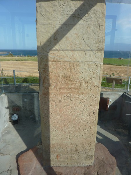
The Shandwick Stone (in its glass case)
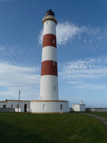
Tarbet Ness Lighthouse
At Embo we drove right through the caravan park to find a lovely sandy beach and a tiny pier – and – it wasn’t windy!
Our drive around Loch Fleet – an almost enclosed bay – was sheer delight. It is a National Nature Reserve. We stopped by the southern shore and sat on a seat, watching the myriad of sea birds. As we drove on beside the water on the quiet little road, we saw several herons and curlews.
At the far end of the bay, we drove across the causeway built by Telford, and known as ‘The Mound’ to Golspie, where we turned down to drive the 3 miles to Littleferry at the sea end of the loch. We had wondered if this would be worth the effort, but it certainly was! The tiny pier (with a long forgotten rotting boat beside it) was a vantage point to watch the many sea birds, including eiders. Even better were the three seals which cavorted in front of us as the tide came racing in.
Golspie itself consisted of stone houses either side of the street, again with hanging baskets. There was a monument to the first Duke of Sutherland high on the hill behind the town.
We drove on to Brora, where we had lunch above where the River Brora reaches the sea. It was stony on our side, but the other side of the river was a lovely sandy shore. A little boy was running around in circles, reminding us of Simon as a little boy. The sea looked turquoise, but a shower of rain came as we left. There were little boats in the riverside harbour.
The road now went past moorland – scenery more like we had been expecting to see in northern Scotland. At Helmsdale, a proud and pretty little village of low houses, the river reaches the sea with a little harbour where small boats looked as though they still fished for lobsters, which the town had been famed for in the past.
We managed to stop at Berriedale, where two peaty rivers flow steeply to the sea. There were just a couple of cottages and a large war memorial, but there was nowhere to park at all. The road had descended steeply for a very long way, and ascended on the other side just as steeply, with hairpin bends. We pulled in near the top, and got a glimpse of a few more cottages and a pedestrian suspension bridge by the shore, but we couldn’t see any access to it.
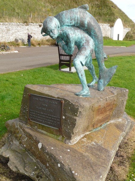
The road wound on above the sea to Dunbeath where we stopped by the little harbour made on the river. We sat on a seat above the few fishing boats. There were a lot of lobster pots – some had been lying there for a long time! Across the water were a row of cottages looking like a film set of a fishing village of former times. There was a statue of a boy carrying a huge salmon to a local author by the name of Neil Gunn who had been born in 1891.
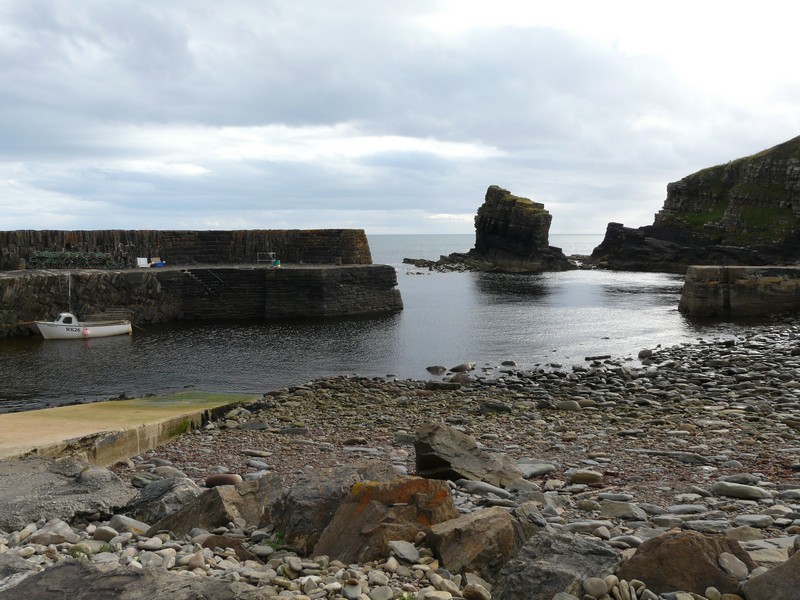
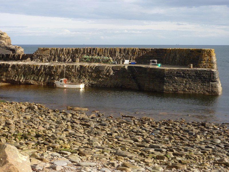
The pretty places went on! We drove down a long steep track through moorland to Latheronwheel, which had a small harbour with just one boat. A tiny peaty stream trickled down, crossed by an old grass covered bridge. In the grassy area behind the harbour there were a few picnic tables. A top place!
Lybster came next – a town planned and built by Sir John Sinclair in the early 19th century. We drove down another steep lane to a beautiful harbour with fishing boats and a collection of lobster pots, most of which looked homemade! There was even a little lighthouse. The road down to it followed a deep ‘gorge’, with a peaty waterfall. On our way back up, we pulled in for a Belgian motorhome to pass. They asked if we were staying there, and we were very tempted, but Adrian wanted to get a bit further so that we can reach John o’ Groats tomorrow on his birthday.
We then drove through a line of cottages, many in ruins, to Sarclet – where we looked down to the former fishing harbour steeply below.
We were without an OS map again now, so made our way to Wick, going literally ‘round the houses’, some of them being pretty awful, looking for an overnighter which Adrian had, but not finding it. We drove on through Wick, which seem to be very severe, but did have a nice large grassy square surrounded by smart stone houses. It didn’t help that we had arrived at the time of a heavy shower.
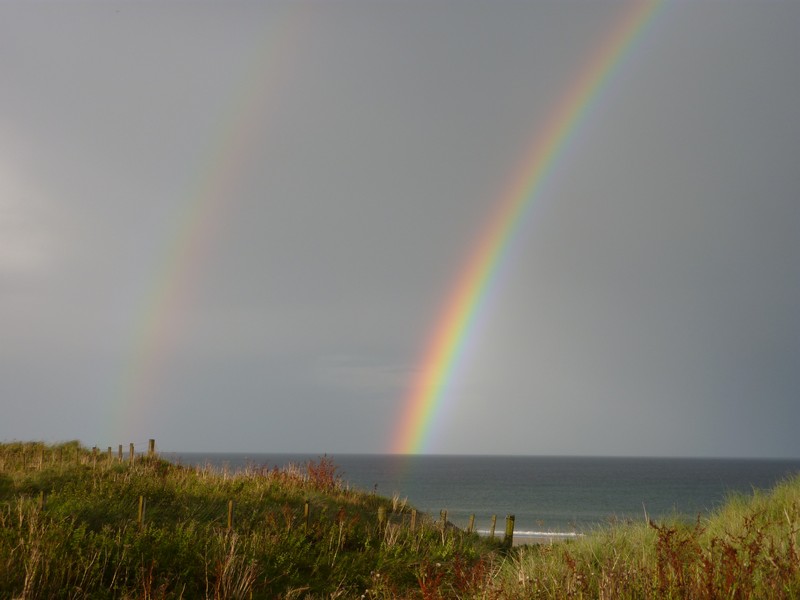
We continued to Sinclair Bay, and this time we were in luck, and found a good overnighter above the bay at Reiss Sands. Our arrival at it was made wonderful by the appearance of a double rainbow. The main rainbow was amazingly bright, and reflected in the sea. The rain stopped as we arrived, so we walked down to a most superb huge wild beach of fine sand. We could see the lighthouse of Noss Head, and a castle above the cliffs.
Dornoch beach
Loch Fleet
Lovely Littleferry - complete with seal!
The two streams at Berriedale
Dunbeath with a statue to local author Neil Gunn born 1891
Lathronwheel
Lovely Lybster
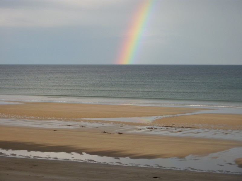

Sinclair Bay
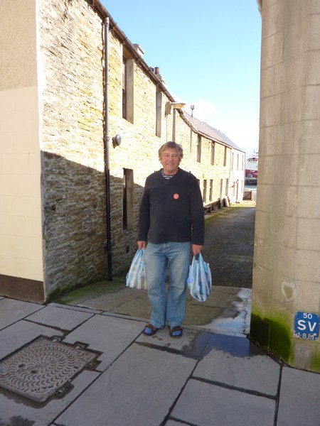
Monday 17th September The Orkneys on Adrian’s 70th birthday 44 miles
It was a lovely morning. After a breakfast of scrambled egg, Adrian opened his cards and presents. These included a footplate ride on the Watercress Line steam railway from ‘our four’, which particularly pleased him, and a CD by folk singer Peta Webb, who we had heard at Hermitage many years ago.
We had a breezy walk on the glorious wide sandy beach after booking the ferry from Gills to Orkney for 1.30 today.
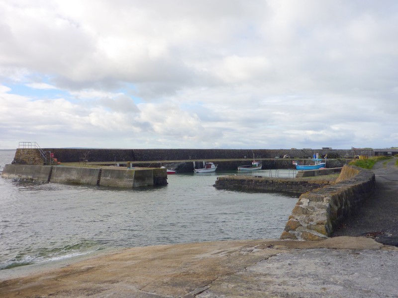
At the north of the bay we stopped at Keiss Beach and took a photo looking back to the bay. Keiss was another pretty harbour, where the large stone building, said in our 70’s book to be disused, had now been restored. There were small boats and lobster pots.
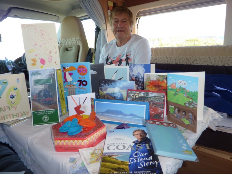
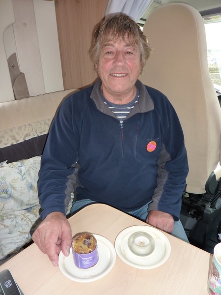
Adrian with his birthday cards and presents
At Auckingill we stopped to look down at the craggy coastline with a tiny inaccessible derelict harbour. We watched the birds as we viewed the several unusual cairns built by a local man in the 19th century.
When we came to the sign saying John O’Groats, we had to stop to take a photo. A good place to have reached on Adrian’s special birthday! We could see the Orkney Islands spread out before us. We drove on to Duncansby Head and had coffee near the lighthouse. The view looked windswept, with no trees.
We drove back to John O’Groats and went into the tourist information where Adrian was able to purchase several OS maps, and I bought some postcards. We had to walk over to the ‘Last House’ to pay by card!
The birthday boy at Keiss Beach
Keiss harbour
There were a lot of little touristy shops around, but we proceeded to Gills Bay, stopping briefly to walk around the churchyard surrounding Kirksdale Church. This is apparently where John de Groot, the Dutchman that the town is named after, is buried. The many gravestones were quite impressive. This church is where the Queen Mother used to worship when she was staying at nearby Castle of Mey.
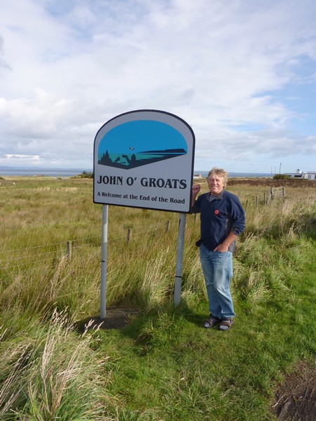
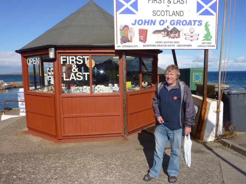
Adrian at John o' Groats
The ferry terminal at Gill’s Bay was very basic. We ate a sandwich for lunch while we waited for the ferry to Orkney. Adrian was amused at a man welding the boat ramp (after stopping for his lunch break) right until the boat came in.
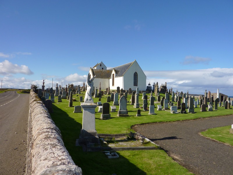
Kirksdale church, where John de Groot is buried
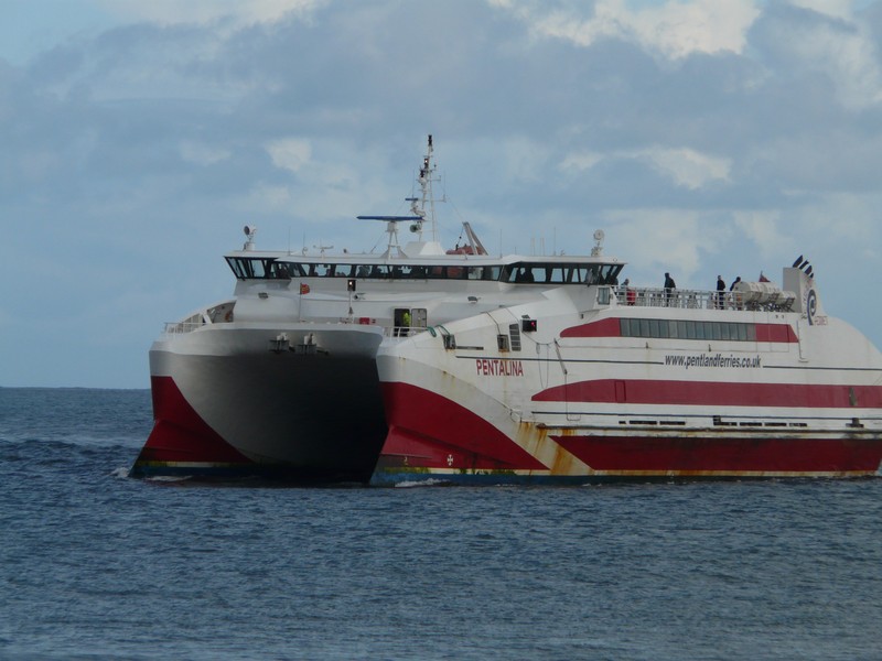
At 1.30 we boarded, and sat in a lounge as we sailed across Pentland Firth and up beside the western side of South Ronaldsay island. We could see remains of wartime gun emplacements, and were reminded that we were at Scapa Flow.
We had a heavy shower of rain as we disembarked at St Margaret’s Hope at 2.40. The little harbour was atmospheric, but the town was very plain.
We drove northwards to what is known as ‘Mainland’ – by far the largest of the Orkney islands - crossing several causeways which joined the smaller islands together. The causeways were built during WW2 to protect the warships in Scarpa Flow from attack by the Germans from the North Sea ( they would never be allowed environmentally now!).
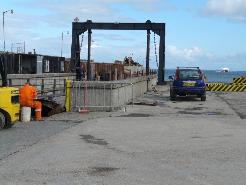
A worker welding the ramp, until the ferry arrived
The ferry to Orkney
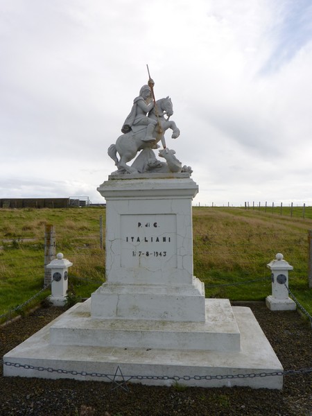
We crossed the island of Burray, to Glimps Holm and then Lamb Holm. We stopped here at a very moving little chapel known as ‘The Italian Chapel’. This had been built during the war by Italian prisoners of war (who were building the causeways), using two Nissan huts. It was quite delightful. The man behind it, Domenico Chiocchetti, was an artist. We bought a little booklet about it – it was a really inspirational story.
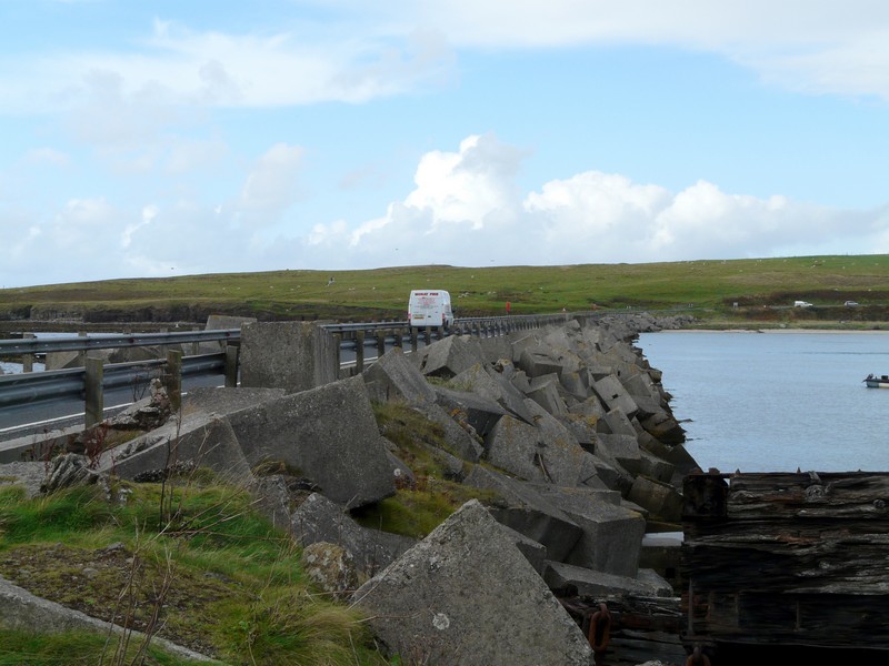
One of the causeways between the islands
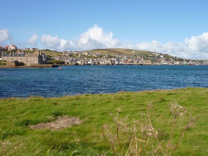
Once on ‘Mainland’, we headed north to Kirkwall, the capital. We stopped in the harbour carpark and had Adrian’s weeny birthday cake, which we’d got at Tebay.
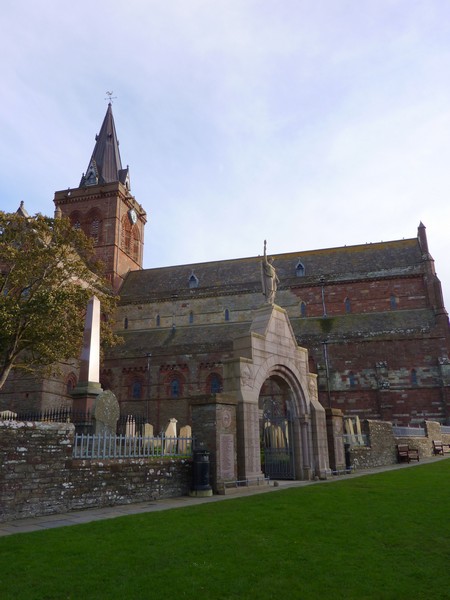
We drove down to the front and parked, while Adrian looked up various eating places for tonight. There was a small pub type restaurant just along the road. We walked along to have a look at the menu, and booked a table for later on. We wandered along the streets to the ‘cathedral’.

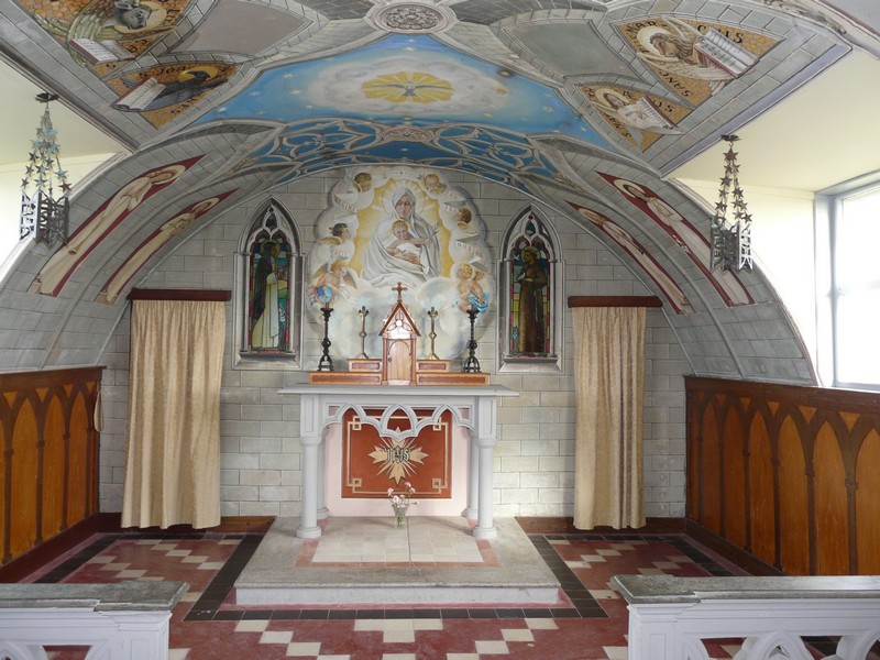
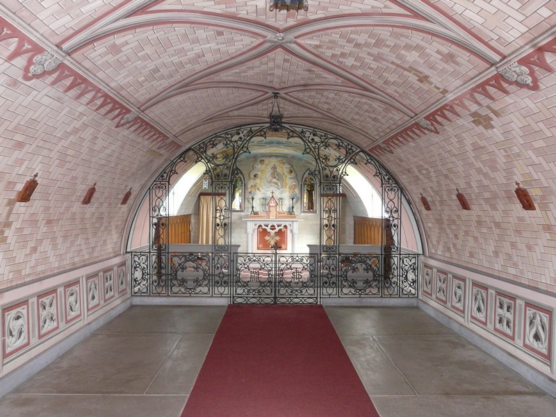
The 'Italian' Chapel
(you should have already seen this mentioned under the Shetland islands)
Some of the streets were completely made up of paving slabs. We went into a ‘poundland’ type shop, where we got some much needed goods – loo rolls and tissues!
Back at the van, we phoned all four of our ‘kids’, the call to Paul being on skype, so that Louisa & Joanna could join in. Manolo & Millie had sung happy birthday.
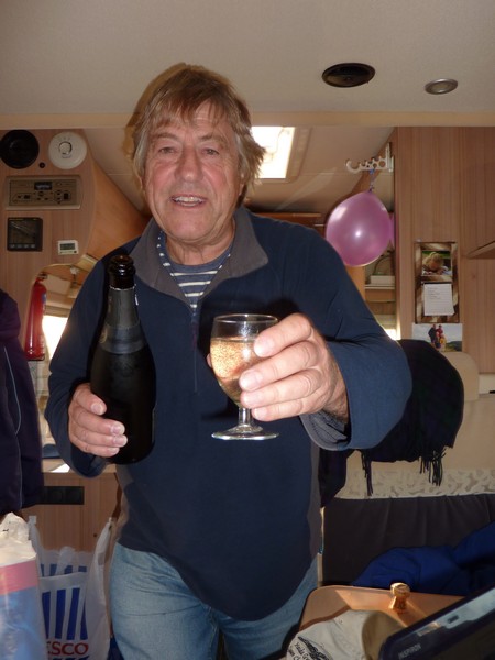
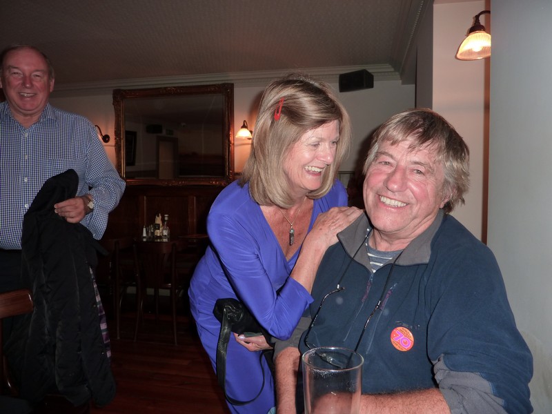
Then it was time to open the bubbly before we walked across to the restaurant. Here we had a really enjoyable evening, sitting upstairs overlooking the harbour, and chatting to the two people on the neighbouring table –Wendy and Jim, from Northern Ireland who were here for a business meeting.
A nice ending for Adrian’s special birthday.
Tuesday 18th September Exploring Orkney 60 miles
Heavy showers, sunny and breezy summed up today. We spent some time catching up with diary, photos etc. Adrian got in touch with our insurance company and we were overjoyed to find that our insurance claim for our break-in in Estonia had been honoured.
We left at 11.15, watching an eider duck just before we left.
We drove down to Scapa Bay, where the tide was in, but we could see the clear turquoise water. We drove through country with cattle and woolly coated sheep and heather clad moorland to Waulkmill Bay, then we drove on past Orphir Bay to Houton Bay, which was almost enclosed. There were a lot of cars parked here, where ferries leave for the island of Hoy.
Then it was round the ‘Bay of Ireland’ to Stromness ( a bit different from the one in Antarctica). Here there were narrow streets covered by paving slabs, making driving in a motorhome very difficult! We managed to park in a steep side street and walk back to the ‘Bakers’, where we bought much more than the loaf we’d gone in for!
Adrian with his 'mighty' birthday cake!
The cathedral in Kirkwall
Birthday bubbly!
Greetings from fellow diners Wendy and Jim
We drove around the bay to Ness Point, where we stopped to have lunch, looking back to Stromness.
We now took a long track between dry stone walls to the SW of Stromness which ended by a pebbly beach with lines of rocks. We could see the line of rough waves across Hoy Sound to the high and steep island of Hoy.
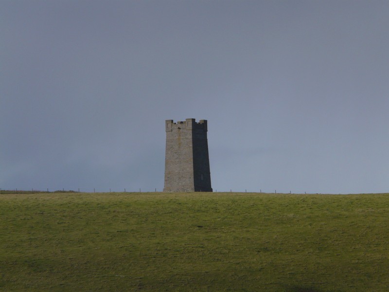
We took a long narrow road to the west coast where we could see the open sea. There were caves below us, but we continued to the Bay of Scaill where we stopped by Skara Brae, supposedly the best preserved Viking village in Europe. Sadly the wind was much too strong for us to attempt a visit (you should have by now seen our visit there on the way back from the Shetlands). We headed for semi-circular Marwick Bay. From here we had a good view of the hill-top memorial to Lord Kitchener, who had died off the shore here when the ship he was travelling to Russia on in 1916 was hit by a mine.
Stromness
We continued to the north west of the island where we stopped by the Brough of Birsay. There was a causeway here across to Brough Head, where there was another Viking village. The beach consisted of lines of almost horizontal rocks.
Memorial to Lord Kitchener
It was rainbow weather, with sunshine and sharp, heavy showers We stopped by the ruins of the Earl’s Palace, a 16th century ruined castle, before driving along the north coast, then south east.
The Viking village of Brough of Birsay
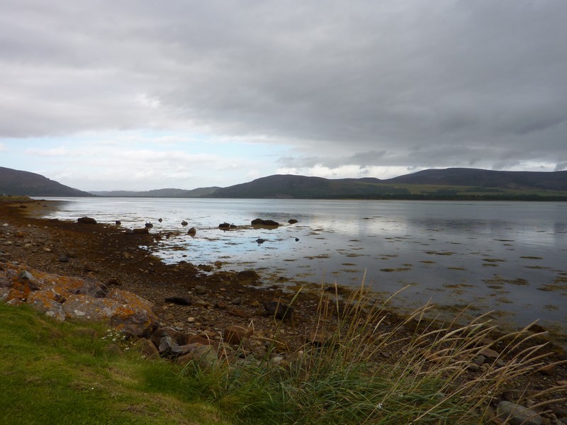
At six o’clock we came to the little bay by Sands of Evie, looking across Eynhollow Sound to Rousay Island.
Earl's Palace
We listened to an enlightening interview between Simon Mayo and John Major about John Major’s music hall father as we watched the terns expertly diving for fish.
Our night time view, Sands of Evie
Wednesday 19th September A lovely day on Orkney 92 miles
A windy day of sunshine and showers, so rainbows again! A lady had come down to clean the nice loos – the only thing here except for the rubbish bin.
We left at 8.45 and took a long road to come down to the other end of the bay at Broch of Gurness. This was another stone age village, but not open until 9.30. We walked in briefly and had a quick look, and enjoyed the view back to where we had stayed at Stenso at the other end of Evie Sands.
We received a message from Mary & Roger to say that they were on a day trip to Orkney. We phoned them later, and discovered that they were on a bus tour, so we were unlikely to meet up here.
We drove on to Tingwall, where boats leave from for Rousay and two other islands. There were lobster pots in the harbour.
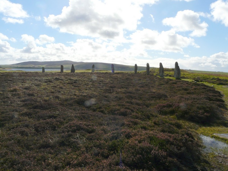
We now drove south to Finstown, and back to the Standing Stones of Stenness – a group of five Stonehenge type stones (originally there were more). We braved the wind to have a look.
The Broch of Gurness
Just on from here was a even more impressive stone circle, the Ring of Brodgar. It was very boggy underfoot as we walked around, but we were impressed by these 5,000 year old marvels.
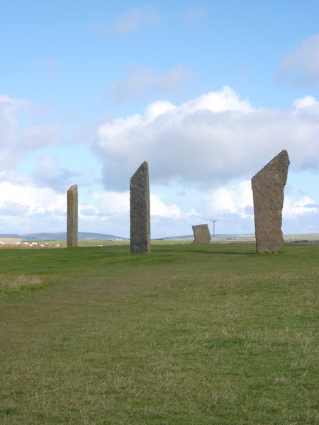
The Standing Stones of Stenness
We drove back to Finstown and on to Kirkwall, driving on around the bay a bit, and then over to Heatherquoy, near the airport. The wreck of the Juanita stood in the bay. There was a tiny lake behind this beautiful white sandy beach, where we stopped for lunch.
We now carried on to the eastern promontory of ‘Mainland’ to ‘The Gloop’. This was an impressive sea cave which we walked out to – starting in sunshine, but ending in a heavy shower of rain and hail!
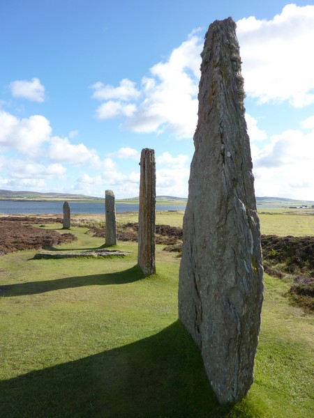
The Ring of Brodgar
We came down to the beautiful sands of Newark Bay at the south of this promontory. We then drove round to the other end of the bay, which was even more beautiful. Turnstones and a redshank gathered on the rocks as we looked across to the uninhabited island of Copinsay, with its lone lighthouse. Below us was a little jetty, and beside us was a smart red and white hut and some winding gear.
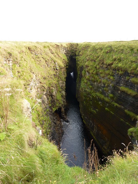
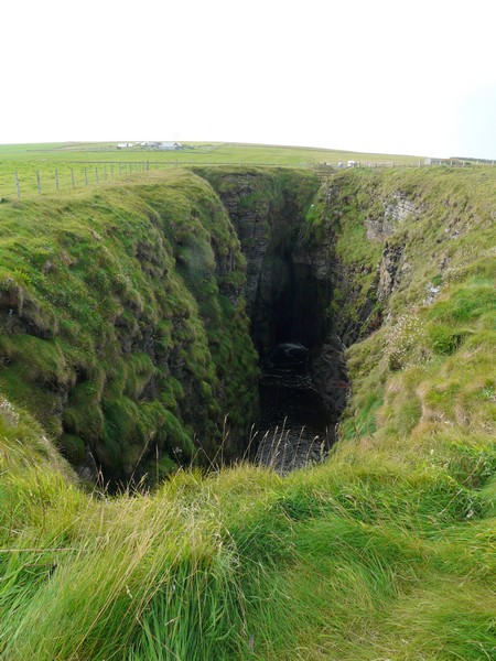
The Gloop - a collapsed seacave
Our last stop on ‘Mainland’ was at Howes Wick, before we reached the Churchill barriers connecting the small islands of Lamb Holm and Glimps Holm, and then Burray. We tried one track here, but it was difficult as we had run out of our OS map.
We drove on to South Ronaldsay, where at the third attempt at finding a stopping place, we arrived at Windwick at 5.45 – a beautiful spot affording splendid views of the coastal cliffs, with a stack nearby, and the ‘crag and tail’ island of Colinsay in the distance.
An emotive plaque beside us remembered the 188 sailors who had been lost from two ships in 1918 during a severe snow storm.
Newark Bay
We had supper of spaghetti bolognese, using Orkney beef.
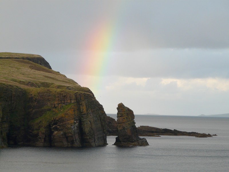
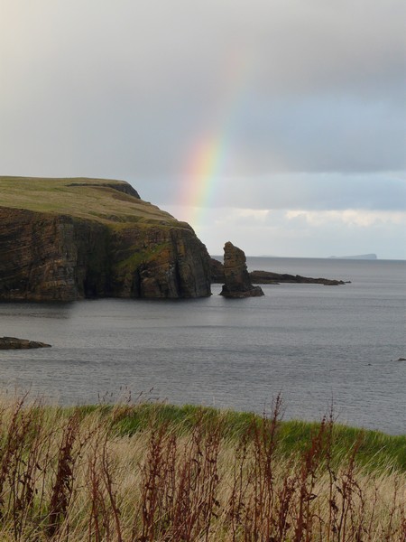
Rainbows finish the day Windwick Bay
Thursday 20th September A ferry back to mainland Scotland 36 miles
The morning was so beautiful that we were able to sit on the stone wall to have our breakfast. By the time we had a very short walk to the cliffs, it had clouded over, but the day stayed mainly fine and sunny.
We left just after 9.30 and continued to the south of South Ronaldsay, where the passenger ferry arrives from John O’ Groats. Four coaches were just leaving the harbour with their passengers. There were some piles of lobster pots. We drove back up the island, seeing our ferry pass on its way to St Margaret’s Hope.
We drove to Hoxa Bay, where we walked across the large stones to the lovely sandy beach – our last stop on the Orkneys, which we had really enjoyed.
We now made our way to St Margaret’s Hope for the 12.00 ferry back to Gills Bay. The boat is called the Pentalina. We had a pleasant crossing, looking across to the various islands, the last being Stroma.
We docked soon after one o’clock, and there were Mary and Roger waving to us as we disembarked. We had spoken on the phone last night, and arranged to meet up.
We then spent a pleasurable hour or two chatting and comparing notes, as they had recently bought a new motorhome, and were trying it out.
Breakfast at Windwick Bay
Our ferry passes us
Hoxa Bay - lovely when we were there, but obviously sometimes windy!
We say goodbye to Orkney, which we'd really loved
We chat to fellow travellers Mary & Roger (who we first met in the Cascade Mountains, USA)
This day is continued in the section of Road Around Britain John O'Groats to Uig


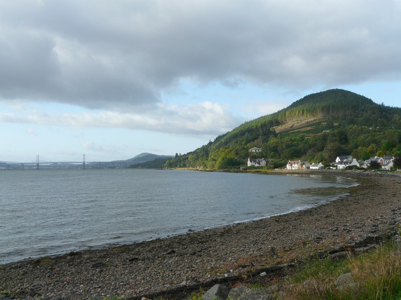
The A9 Kessock Bridge from Kilmuir