
Tuesday 22nd July To Leduc 173 miles
We left at 9.15. We drove north through flat country to Leduc. We turned off to drive through Red Deer, which was just one mall after another – the only bit of interest was the City Park outside the City Hall, where there were brightly coloured flowers. We were driving the Queen Elizabeth 2 Highway, renamed after the Queen’s recent visit.
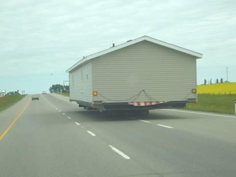
Traffic on the highway
We arrived at Joe and Irene’s at Leduc at 2 o’clock. We spent a happy time talking and reminiscing, and after a walk around a nearby lake we came back for a nice supper of roast beef. We chatted more before going out to the Bam to sleep.
Wednesday 23rd July The largest mall in the world – to a lovely National Park 61 miles
After rain in the night, the day became warm and sunny.
We enjoyed pancakes for breakfast, cooked by Joe, and with Irene’s chokecherry syrup.
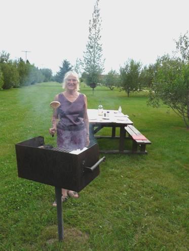
We set off with Irene and Joe in their jeep for West Edmonton Mall – apparently the biggest mall in the world. We had no interest in shopping there, but enjoyed seeing the ice rink, the funfair, the sea lion pool (where a photo shoot was happening, so we saw lots of antics), the pirate ship and the enormous swimming pool with about 6 flumes. We stopped for coffee, and just enjoyed the atmosphere.
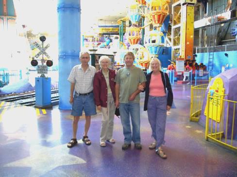
With Joe & Irene at West Edmonton Mall
On the way back, we met up with Joe & Irene’s son Jeff’s partner Rose at Tim Horton’s (our first visit there) and enjoyed soup and a roll for lunch.
Just before arriving back at Leduc, we stopped off at Nisku, where we met up with Jeff at his place of work. Both he and Rose were very charismatic, and it was lovely to meet them. Adrian particularly enjoyed seeing Jeff’s workshops with the huge trucks he was working on.
We got back to Joe & Irene’s place, and said our fond goodbyes before setting off again on our travels.
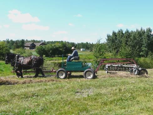
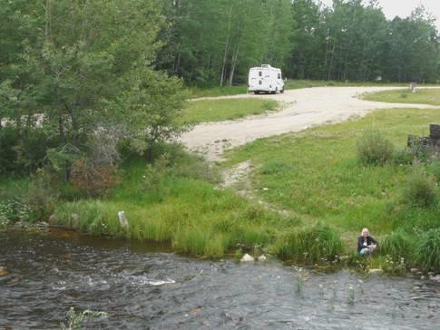
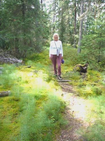
We’d decided to head for Elk Island National Park, and hour or so’s drive away to the east. We found our way quite easily, and made our way to the campsite. Having got a nice spot amongst the aspen trees, we set off to walk along beside the lake. The park is here because of its elk and bison. We didn’t see any today, but enjoyed the lovely situation.
We came back and lit the campfire and had a lovely meal with T-bone steak, corn on the cob, squash, mushrooms and baked potatoes.
The sunset looked lovely on the lake, so we wandered down to enjoy the exquisite view before coming back to the Bam.
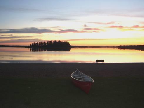
Magical Astotin Lake at sunset
Thursday 24th July On to a Ukrainian Village 92 miles
We had a pleasant walk beside the lake partly on a floating boardwalk, before coming back for breakfast. The sun was still behind the fir trees, but it was warm enough to sit outside and the day became quite hot again.
A motorbike with a trailer tent attached to its small trailer had come in beside us very late last night.
We set off to walk the Amisk Wuche Trail, which was 2½ km, partly through aspens and lined with rosebay willow herb, and partly on boardwalks over the swampy areas. We didn’t see any of the large wildlife, but did see a woodpecker, a stripy toad, a rabbit and several butterflies.
We now drove south on the park road, where we saw a solitary bison on ‘duty’. This was a plains bison - the wood bison are in a separate area of the park south of the highway.
We turned off to Tawayik Lake for late coffee. This was supposed to be a good wildlife viewing area, but the lake had receded, and it was too far away to see any of the birds.
As we drove on south, we passed 2 bison with a young one, and then just opposite the Bison Loop Road there was a whole herd of them.
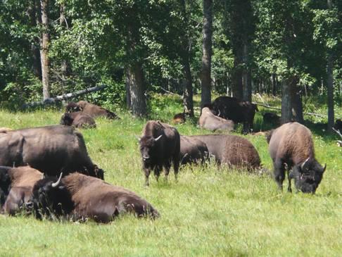
A whole herd of bison
We stopped for a while, and then needlessly drove the loop road where we saw one or two bison in the distance, but Adrian did photograph a ground squirrel.
We now left the park – it had been a good visit, even if we hadn’t seen as much wildlife as we’d hoped.
Just a couple of miles further on was the Ukrainian Village which we wanted to visit. We had a picnic lunch before spending a delightful afternoon enjoying the village. This area of Alberta had been settled by Ukrainians in the late 1800s and early 1900s. The terrain and climate are apparently similar to the steppes they came from.
Young people in costume acted as guides in the houses we visited, and spoke as if they were immigrants of past times. It was fun to go along with them, and ask them questions. There was a cart pulled by two horses, which gave us a couple of rides, as the houses were quite spaced out, as they might have been in an actual village. Several of the buildings weren’t open, as they were being rebuilt or refurbished – the museum had come into some government money to do the place up.
There weren’t many other visitors, but we did meet up with an elderly Swiss couple who didn’t speak much English. They became quite confused when one of the guides said he didn’t recognise the map they were following (there would have been no maps of the park in 1890!) This particular guide was at the sod house, similar to the one which Joe’s grandfather apparently built when he emigrated to Canada.
Old fashioned hayraker at the Ukrainian Village
There was another cart pulled by horses which was turning the grass with an old fashioned hay maker.
Also there were two vintage cars – a lovely old Ford, and a 1920s Chevrolet driven by the local ‘RCMP’. He gave us a ride, and later we looked over ‘his’ house, complete with the lock-up, which I tried.
All told, it was an excellent visit, and we left with a greater understanding of the Ukrainian immigrants.
Now we headed east, hoping to find a stopping place for the night, but with straight roads over almost flat farming country this proved very difficult. The only turn-offs were into the fields and we had to drive about 70 miles before we finally found a rough layby near the road junction at Myrnam at 5.45. I had even had a short drive when Adrian had become sleepy.
We enjoyed supper, looking out to our tapestry of wild flowers in mauve, yellow and white. We decided to have a walk around the layby, and while doing so, a local chap in a pick up truck stopped by. At first he said that he thought that Adrian was a friend of his. When he realised that he wasn’t, he just wanted to chat anyway. His name was Mike, and he used to own a garage (that still bears his name) in the town. He also had a farm nearby. He was 67, and he told us of his family – 2 married sons, each with a son & daughter, and an unmarried daughter. We chatted as the sun went down, and the mozzies came out! He told us that a park in town, with a large model of a dove, was being officially opened tomorrow, with a lot of celebrations.
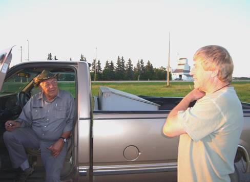
Adrian chats to local man Mike at Myrnam
Friday 25th July Two fur trading forts 62 miles
As usual, it was cool at dawn. I saw the sun just come up at 6.20, before dozing for a while longer.
After breakfast, we drove into the small town of Myrnam and located the little park with the dove.
We now drove on through pleasant rolling country with fields of yellow canola (rape) to the town of Elk Point. We were in dire need of fuel, but were in luck, as we were able to fill up there with very cheap petrol. There was a small Co-op store in town, where we bought a few things, which seemed to be expensive.
We were trying to locate the historic sites of Fort George and Buckingham House, two trading posts from the fur trading days. We had been given free tickets for this when visiting the Ukrainian Village yesterday, as we had filled in a questionnaire. (in fact it only cost $2 each!)
The site was further than we’d thought, and it was a bit of a wild goose chase to find it – the last bit on a very rough road. We arrived for a late coffee, and left after a late lunch.
There was only one other couple there, and they turned out to be English, from Harpenden. They were spending a month in Canada, visiting a lot of her relatives. She came from Reading (just a couple of miles from where Adrian lived as a boy) and went to Kendrick School, and her maiden name was Bowers!
A young female guide was giving them a tour of the ‘museum’, and we joined in. We found it very interesting, as the forts dated from the late 1700s, one belonging to the Hudson’s Bay Company and the other to the rival North West Company. There were many references to explorer David Thompson. We were surprised to learn that many of these early traders came from the Orkney Islands, including William Tomison, who built the Hudson’s Bay Company’s Buckingham House. Both forts were abandoned in 1800.
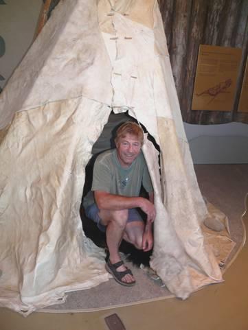
Adrian in a tepee
After viewing the exhibits inside, we walked through the aspen woods to the site of both forts, and enjoyed lovely views down to the North Saskatchewan River.
We felt very hot when we returned. We didn’t leave here until 2.45. We returned to Elk Point and drove north for a short way. We pulled in above a lake when Adrian became sleepy, and stopped for a while. Just a little way further on we saw that there was a campsite beside the lake, which was called Kehewin Lake. We pulled in there, and decided to stop for the night.
Having settled ourselves into a lovely position beside the lake, we both had a refreshing swim in the rather mucky lake, which necessitated having a ‘shower off’ in the van afterwards.
It turned out to be a ‘top spot’. We had our own little sandy beach, and it remained very warm until the sun went down at 9 o’clock. I couldn’t decide whether to sit by the campfire (which we didn’t need for the heat) or on the beach. We’d cooked our meal on the fire, watching yellow warblers on the reeds. There were a few ‘posers’ in their fast boats, but generally it was really pleasant. We toasted marshmallows on the fire (and thought of Felix & Ruby last year), and didn’t come in until 10.15.
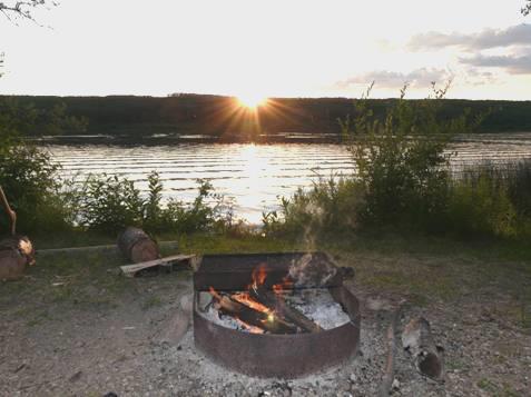
Our idyllic spot on Lake Kehewin
Saturday 26th July Into remote Saskatchewan 220 miles
There had to be a ‘downer’ – a group of noisy kids had revelries all night long! Consequently we were up very late. We talked of Douglas Hot Springs in Australia, which had had a similar group of noisy youngsters. We looked up our diary of then, and went on to read about a chap called Peter who had joined us at our campfire and chatted to us for an hour, by which time our potatoes were burnt.
As we sat outside with our breakfast, a genial looking chap in blue shirt and jeans came by and said the usual ‘you’re a long ways from home’, seeing our Texas plates. I mistook him for a man who had said the same thing last night, but this was a chap from a neighbouring camper who was here with his wife and brother and wife. The two women were discussing the meals for the day, as family were visiting, so he’d walked off with his cigarette and coffee. By the time he’d finished chatting, our coffee and toast were cold! Still, it was interesting to hear from a ‘local’.
We didn’t leave until 10.30. We’d wondered which route to follow around large Lake Muriel, and took the less obvious one. We were just discussing about ‘putting on a few miles today’, when the road suddenly turned to gravel! When we reached a junction, we turned right, following our map, but a ‘new’ road had been built, so we were going in the wrong direction. We discovered this when Adrian became suspicious, and had resorted to the computer to find our way.
We got back on track, and reached Saskatchewan at about midday. The road surface immediately deteriorated! We came to sections of gravel followed by sections of paved, and stopped for lunch by one of the paved sections.
At the town of Meadow Lake we got an internet connection and I sent several emails. After leaving here, we passed areas of stunted boreal forest.
At 4.30 we came to a reasonably priced campsite, but the large horseflies present meant that Adrian didn’t even consider stopping! We drove on for another ¾ hour, without seeing a single place to pull off, when we reached the small town of Big River. We followed campsite signs and came to a pleasant, manicured campsite with a very obliging host. It seemed incongruous to be in this neat ‘French Municipal’ in this remote area of Saskatchewan. What’s more, we had an internet connection!
Anyone for toasted muffin?
We lit a fire in the upright stand and cooked red snapper. We were able to telephone Simon, and I sent some more emails. We could hear some celebrations coming from not far away, so walked down to the ‘library’ building, where we saw the end of what appeared to be a wedding reception.
Sunday 27th July To Prince Albert National Park 133 miles
We had some rain in the night, and the morning was damp. Still having an internet connection, we were able to phone our other 3 children. Emma was at Elm Gable, where the weather was lovely. Paul sent some recent photos of Louisa for us to see on the internet. Tom had just arrived in Limerick for a cycling holiday with Cormack and other friends.
We’d cooked pancakes for breakfast – more successful than the last lot - and had some of the chokecherry syrup from Irene on them. We didn’t leave the campsite until 11.30.
As the campsite was a ‘Regional Park’, we’d had to buy a regional park day permit, which lasted until today. After some miles we passed a sign to another regional park at Canwood, so thought that we’d stop there for lunch. All we found was a golf course, not very exciting!
The colours of the brilliant yellow fields contrasted with the overly grey sky as we drove on to Prince Albert National Park. We entered this on a good gravel road, and having gone through the official entry point, we made our way to Sandy Lake campsite. This looked pretty full, so we thought that we’d better try to find a spot, although we would rather have driven further into the park.
Having found a place (it seemed busier than it really was, as many people had extended their weekend, and were still occupying a pitch), we drove north on the so-called ‘scenic drive’ to the town ofWaskesiu. This was 20 miles of almost straight road, with manicured edges, through forests of aspen and fir trees. Pleasant, but hardly scenic!
At Waskesiu – a place much too busy for us - we located the visitors centre. We wanted to know if there was a way of reaching the hut of Grey Owl, apart from the 20km walk there. The assistant wasn’t very helpful, and didn’t know the answer. Grey Owl was the name given to a man born in Hastings in 1888. He had spent much of his life in this area as a trapper, and toured the world giving talks about conservation. He was particularly interested in beavers. People believed him to be a North American Indian, and only after his death was the truth known. We had become very interested his story, which we’d first learnt of in Hastings some years ago. He was the reason for us wanting to come to this park.
It seemed to us though, that the park exists as a holiday resort, and/or for boating, although there are a lot of long walks in the park for serious hikers. We felt rather disappointed.
We looked into a small supermarket, where we bought one or two items (the shop in Big River didn’t open today until 12.00, and we didn’t think we could stay around any longer).
We had a look at the beach here – supposedly one of the best in Saskatchewan – before driving back to our campsite. We stopped off at Shady Lake, where we intended to walk a 2km trail. Unfortunately this was not to be. Despite covering up, the mosquitoes made a ‘beeline’ for me, and by the time we’d descended a long flight of steps, I had been attacked many times, and we had to make a hasty retreat.
A bit further on we did manage to ascend a lookout at ‘Height of Land’ Tower, on a watershed between the Saskatchewan and Churchill Rivers.
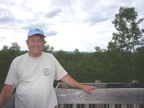
Adrian up the tower
Back at our campsite we had a look at Sandy Lake before lighting the fire.
We were entertained by several groundhogs. Once the day trippers’ had left, it was pleasant and quiet.
Monday 28th July Mozzies drive us out of the park 130 miles
The thunderstorm hit us just after we’d gone to bed. Unfortunately we’d left a window open, so much of our bedding got soaked!
While I went for an early morning swim in the lake, Adrian began sorting things out. We drove across to the boating car park to dry stuff in the sun while we had breakfast.
Afterwards we drove our ‘scenic’ road once more, back to Waskesiu, and then on along the northern road around the lake. After a while, the road became a dirt road. The grader had been along, and we met him just before the end of the road, and again on our return. We did see one or two elk and deer, but mostly what we saw today was mosquitoes!
We reached the end of the road at 11 o’clock. This is where the trail goes from to Grey Owl’s Cabin. There is a shorter trail which starts at the same place and follows the Kingsmere River, and we hoped to walk it. However, having walked about 200m along the 20km trail, we were forced back by the mozzies. This was the story of the rest of the day!
We drove back along the road, stopping at Birch Bay, beside Waskesiu Lake, where we enjoyed lunch, with very few mozzies.
After that we had a really nice walk beside the Waskesiu River, along a boardwalk. We could have continued through the forest to make it a loop trail, but returned the same way, which we knew was fairlymozzie free. Here, and everywhere in the park, there were dozens of large dragonflies, looking like giant mosquitoes, but without their bite!
We now found our way to the Narrows Road, which follows the southern side of the lake for about 20km. This was a dirt road too.
There were several places to stop beside the lake. At South Bay we’d intended walking the Mud Creek trail, but gave up on that when it entered the forest. Same reason as the others!
Trippes Beach was calm and pleasant. We saw a white pelican on the water – there is apparently a large colony on a remote lake further north in the park.
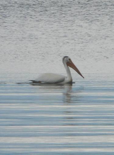
A lone peli on Waskesiu Lake
At pretty Paignton beach (named after the one in Devon) we felt the first spots of rain from the storms which had been gathering all around us. When we reached the campsite at The Narrows, which we’d thought of staying at, the storm hit. The dark, forested campsite held no attraction for us at that time, so we decided to leave the park.
We drove back along the dirt road in ever more rain, and left the park with the intention of heading for the town of Prince Albert in order to stock up again on supplies before heading into more remote areas
We now needed somewhere to stop for the night. We did find a place quite early on, but it was right next to a campsite! After that the rain got heavier, until it was frighteningly torrential for a while, before it suddenly stopped.
Still we couldn’t see anywhere to pull off. At about 5.30, we sufficed with a layby close to the road, just south of Northside.
Tuesday 29th July Off into rural Saskatchewan 143 miles
It was a grey morning. We drove through pleasant country to the town of Prince Albert, which is on the North Saskatchewan River.
We needed to do a big shop, and managed this well at Sobeys. We were pleased to find that we had an internet connection, so while we sorted the shopping, we telephoned Emma at Elm Gable again, and Trish in southern Saskatchewan.
Getting some petrol proved more difficult, but we succeeded in the end, and the young chap interestedly asked Adrian about the Bam and our travels.
Getting some more beer proved impossible – when we finally did find a beer store, the lady said that there was no call here for dark beer.
We crossed back over the river and stopped for lunch in Little Red River Park, which was on the Spruce River! Afterwards we had a little walk around before heading east through flat, rural countryside.
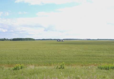
Saskatchewan Countryside
We were amused at a road sign which read ‘Slow Down for surface failures’ – in other words potholes!
At Smeaton we turned north by a sign which read ‘Where the north begins’. We now drove mostly through forest until we reached Narrows Hills Provincial Park. We drove about 30km through here, and only saw one deer.
We didn’t stop at a campsite in the park, but just afterwards turned off to Little Bear Lake, where we came to an old fashioned campsite which seemed to be full of fishermen who had come for the duration! The low-key atmosphere and some of the vehicles made us think that we were on a camping holiday in the 60s or 70s. It was nice to be where everything wasn’t as pristine as a national park. We wandered down to find the lake, where there was evidence that it must have rained hard recently.
We came back and lit the campfire. It was very quiet – we only heard one other family, most people must reserve their sites for weekend only.
Wednesday 30th July Into Manitoba at Flin Flon 152 miles
The morning was quite cool, but the day became warm later. We ate breakfast outside before leaving the site. Adrian stopped to pay at the ‘office’ – people were sitting around outside the hut drinking coffee – it seemed that sort of site, where those who stayed regularly saw it as a sort of club.
Coffee stop
We drove on through the forest and tundra, stopping by Puskwakau River to have coffee. We saw no wildlife as we drove on, except at one point we saw about 20 pelicans circling overhead. Otherwise it was just a few crows.
We pulled in for lunch at a little campsite on Maligne Lake, on the Sturgeon-Weir River. We noticed that the terrain now contained great slabs of rock, and realised that we must have reached theCanadian Shield.
After driving over 300km since joining this road yesterday, we came to the first ‘Point of Interest’. There was a marker to geographer/geologist Joseph Burr Tyrrell (1858-1957), who, amongst other things, found the first oil strike in Alberta (presumably at Leduc) and transcribed the chronicles of explorer David Thompson. There was also a plaque about a local forest fire in 1995.
We reached Creighton, the last town in Saskatchewan before the border with Manitoba. There was a tourist notice for ‘Fishing, golf course, museum’!
What we immediately noticed was the presence of mining. Adrian went into a liquor store, where he was able to buy a couple of bottles of interesting looking beer. The assistant said that they mined for copper, zinc and some gold, and that down the road was an official ‘pot’ farm!
It seemed to be a very ordinary small town for being so far from anywhere. I stopped to post a card to Paul & Nicky for their anniversary, and Adrian got some more fuel.
We immediately came into the neighbouring town of Flin Flon, Manitoba. This was a larger place with a busy main street. We stopped to get some money, and to enquire about a tourist information, as we wanted a map of Manitoba. We were directed by the helpful lady at the library to the tourist information, which also had a campsite, on the other side of town. This entailed us driving right around the town and past the vast mine, with its 250m high chimney. A leaflet I picked up described the town as ‘the ultimate vacationer’s destination nestled in the majestic Canadian Shield’ and ‘a great place to live and raise a family’. We wouldn’t have described it like that!
We did notice people of all sorts, including a lot of Indians.
We reached the campsite, to find the office closed. The neighbouring museum (in the former railway station building) was open so we asked in there – the young girls knew nothing about the campsite. We noticed the clock, and realised that we had moved on one hour in time – it was now 4.20, and the office closed at 4.00 pm.
We’d decided to stay at the campsite, which was reasonably priced, even with electricity. Annoyingly the washrooms were only accessed by a key, which we wouldn’t be able to get until the office reopened at 8.00 am.
The museum only cost $1 for seniors, so that couldn’t be bad! As many small, local museums, it was crammed with donated stuff. Some was about the mine, but some was local artefacts such as gramophones and sewing machines.
We had discovered the origin of the name Flin Flon (which had made us think that we were in China!). A brief version of the story is that prospector Tom Creighton had found a book with a fictional character called Josiah Flintabbatey Flonatin who travelled on a subterranean river and found gold. When the party found some ore under a lake, they called it ‘Flin Flon’. In 1929 the name was accepted for the railway station, and the name has stuck.
Flin Flon
We lit the campfire and sat out until our new time of 10 o’clock. Just after we had come in, it started to rain, and rained a bit in the night too.
We had found out this morning that the other end of our bed had broken – Adrian had mended one end last year. He had procured a piece of wood from the campsite this morning, and had set about the task of mending it tonight, but had to complete it in the morning, when the drill had had a chance to be recharged.
Thursday 31st July Between the Canadian Shield and the Manitoba Lowlands 68 miles
A mosquito had disturbed us in the night – we always wonder how they get in. We had a late ‘all day breakfast’ of bacon and egg (the milk had gone off, and the new lot was in the freezer, so no cereal!) after we had got a key from the now open office, and had showers. Adrian had met a chap who had told him his life story, so was even later!
We left the campsite late – we couldn’t get a Manitoba map from the office, or from the nearby garage as suggested, but we did get one from tonight’s campsite.
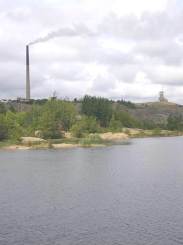
Ross Lake with giant copper smelting chimney
We drove part way down into Flin Flon and walked some of the pathway around Ross Lake, which the town surrounds. We could see the huge chimney, and came to another statue of ‘Flinty’.
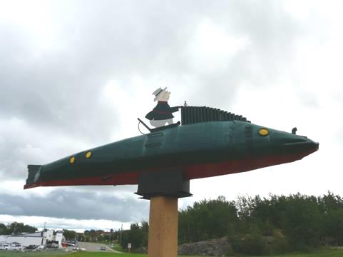
Flinty in his submarine
Now it was time to leave this town with an interesting name. We headed eastwards through scenery more attractive than yesterday, with outcrops of often vertical cliffs of rocks beside the road. They were covered in ‘graffiti’ – it seemed to be the thing to do to write names on the rocks – most were attractively written in bright colours. We realised later that we were on the boundary between the Canadian Shield and the sedimentary rocks of the Manitoba Lowlands.
We stopped for lunch by Neso Lake, one of numerous lakes in this area. It was the prettiest place we have stopped, with islands in the lake, and surrounded by forests – it was reminiscent of Finland. We heard more bird song here than anywhere. Geese flew over, waxwings flew down from high fir trees to peck at berries from bushes by the water, and a sand piper flew low across the lake to a small rock which looked as though it was made of fibre glass. The dragonflies looked larger than ever. Apart from the mosquitoes it was idyllic, and we didn’t leave until 2.30.
We’d had many discussions about which route to take through Manitoba. By now we had discounted the idea of trying to get to Churchill, on Hudson Bay, to see what it was like in summer (we were there last October to see the polar bears). It would have necessitated a 13 hour overnight rail journey both there and back, from Thompson, 135 km further on from any return point.
We did decide though to take the route 39 continuing east through Grass River Provincial Park, after driving through the town of Cranberry Portage, which had long been a portage between the Nelson River and the Saskatchewan River systems.
We were now on a long straight road lined with trees, although there were some limestone outcrops beside the road, looking like brick walls.
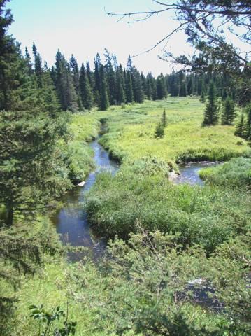
We turned into Iskwasum campsite, on a lake of the same name. From here there was a walk to ‘Karst Spring’, where water gushes out of the rocks to make a rushing river for a short way until it reaches the lake.
In the boreal forest
We had our usual worry about mosquitoes, so covered ourselves up, although the day had become warm. We were walking through boreal forest, on spongy ground covered in moss and primeval looking vegetation. It reminded us of both Alaska and Labrador. The going wasn’t easy, as the path was strewn with rocks, tree roots crossed it continually, and it was one dip after another. Even so we raced along, because of the mosquitoes. We completed the 2 hour walk in just an hour! No stopping to ‘smell the roses’!
The campsite here was large, and we decided to stay for the night. We found an airy spot, and Adrian went to book in with the ‘stand-in’ host – a chap from Omaha who’d come here for a month every year since 1980, but now that he’s retired he comes for the whole summer!
Despite the large plots, we had noisy neighbours, but luckily we liked their music! We cooked chicken on the campfire, and survived the mozzies and sat out until gone 10 o’clock.
Friday 1st August A long way of nothing 236 miles
We were pleased to see that the sun was shining through the trees onto our picnic table, but the mozzies made us give up on eating breakfast outside.
By 9.00 a.m. we were on the road and travelling east. After about an hour we turned north for 15 km to Wekuska Falls Provincial Park. We had read in this year’s Manitoba brochure of a walking trail here over two suspension bridges, with views to falls and rapids on the Grass River as it reaches Wekuska Lake. The scenery was attractive, as, being north again, we were once more between the limestone and the Canadian Shield granite.
We searched for the start of the walk, and eventually found it with difficulty. However, when we reached the first bridge, we saw that it was closed (and looked as though it had been for some time). We located the second bridge, which was similarly closed. So – no walk here for us. We stopped to have coffee and take in the pleasant situation. There were 2 beds with colourful flowers, including a fine display of delphiniums, so someone with pride must be looking after the place.
We returned to route 39, and at about midday reached route 6 south, at Ponton Service station (like an Australian roadhouse). We soon crossed the single rail track – the line to Churchill - which was the only thing on the map until the town of Grand Rapids in 175km!
The first section of the road was being rebuilt, and consequently we had to drive sections of gravel road. All we had for wildlife were crows/ravens and several brown cranes/herons, plus one family of ducks. The road was lined with stretches of water on both sides for most of the time, so there was absolutely nowhere to pull off for lunch until we reached a large gravel area at 12.45.
Soon after this we passed an unmarked truck stop, with scarcely room for even one truck to pull off!
We finally reached the small town of Grand Rapids, and stopped to get some fuel. We were interested in this town, as it is where there was a short ‘railway’, built in 1877, to transport goods from the boats around the rapids where the Saskatchewan River meets Lake Winnipeg. It was apparently Western Canada’s first railway.
We knew that a section of the rails were still there, in Tramway Park, but this was very hard to find, with no signs to it at all. We made our way to a little boat ramp area by the lake, which would have made a nice overnighter, except that there was a ‘no camping’ sign.
Where the Saskatchewan River joins Lake Winnipeg
In our short time here we saw some pelicans, a group of grebes and several cormorants flying over. Adrian chatted to some people with a small truck camper. One man was going off in a canoe. It turned out that he was canoeing 80km a day, and the others were his support crew.
The people told Adrian how to get to Tramway Park. On the way to it, we came to Lovers Point Park, which had been one end of the tramway (called Hudson Bay Point then!). A bit further on we came to rundown Tramway Park, with its section of rails. Unfortunately we had the old ‘mozzie problem’, so had to make a rushed visit.
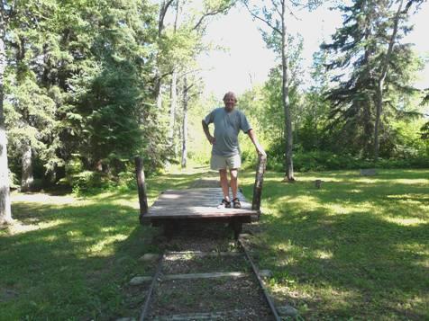
Adrian on the ‘train’
There is now a hydro electric dam on the river, so we drove up to that afterwards before continuing on our route south. We had seen a campsite symbol on the map, but nothing materialised, so we continued south – past the 53rd parallel (north of there is known as ‘wilderness country’) to the junction of the 6 and 60 roads. We had been discussing which way to continue, and as we found a large gravel area close to the junction, we pulled in there for the night.
Saturday 2nd August Biting and stinging things bring trouble 212 miles
Adrian is known for his Murray Walker predictions. As we’d stayed indoors last night, he’d said ‘well at least we don’t have trouble with the mozzies when we’re inside’. We went to bed, as two large trucks pulled into the area to exchange loads, and then another pulled in with noisy air brakes. They were nothing to the horror we suffered from the mosquitoes! As we lay down to sleep, first one came buzzing and then another, tormenting us as they buzzed by our ears. Memories of a similar night in Happy Valley, Labrador came flooding back! We chased one after another, and finally got to sleep sometime after 3.00.
The morning was grey, and soon turned to rain, with some dramatic lightning. By now we had made the decision to continue travelling south on highway 6, with all its excitement! We were glad to have our music! Gradually the boreal forest gave way to aspen trees.
After abut ¾ hour we pulled into a small rest area with a simple campsite and a little café (where does he get all his stuff from – it’s 50 miles to the nearest shop?). We wished that there were more like it, and should have stopped then for coffee, as it was another ½ hour before we found a gravel track to pull on to. I had seen one small solitary duck!
By now the rain had stopped, but it did reappear once or twice. I saw a heron – I think a young blue heron.
We reached the St Martin/Gypsumville area, and now passed cattle, cultivation and habitation – this is as far north as most villages have got to.
We still went back to areas of forest. At one point we saw a sign for a ‘garage sale’ down a side road – we looked down the dead straight, tree-lined sandy track, and wondered where the garage was!
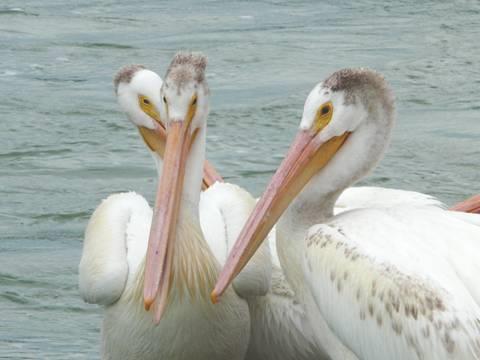
More pelis – was it worth the mozzie bites?
We crossed the Fairford River, where there was a group of pelicans, cormorants fighting the strong rapids, and terns diving for fish. Adrian stopped to take photos and got bitten of course! We put our music back on to hear The Byrds singing ‘turn, turn, turn’, which made us laugh.
At Moosehorn we went into a small Co-op store hoping to buy fresh bread. None of that, but Adrian did sniff out an ‘unsweet’ rye loaf. There was nowhere at all here to pull off for lunch, so we continued a few miles to Ashern, where we pulled into a small park/campsite with a huge model of a sharp-tailed grouse. After lunch I had to photograph the grouse, which has become a funny story with us. This time it was me who got bitten.
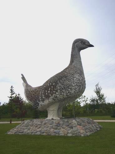
and a sharp tailed grouse
We tried for an internet connection, and received a long email from Simon telling of a recent crisis they had had. Laure had been stung by a wasp, and had had a severe reaction, necessitating emergency treatment. We were anxious to telephone, but had great difficulty in getting a good connection. Finally we did, and spoke to Simon, and hope that all is now well.
We now headed west, crossing the turbulent Manitoba Lake Narrows, but otherwise finding the route very monotonous. At last we reached the small town of Ste Rose du Lac, which our 2008 Manitoba guide told us had 2 free camping places. Well, it didn’t, of course! The first was a pleasant town campsite, the second didn’t exist now! After driving around, we had found a local and asked him. We made our way to the town campsite called Parc Molgat, where we found a nice spot above the muddy little river, in the now warm sunshine. Refreshed by showers, we set about enjoying the evening, which we did! We sat by the campfire until 9.45, when the night time mozzies arrived.
Sunday 3rd August Mixed luck in Riding Mountain NP 94 miles
We hadn’t expected to wake to grey skies and rain!
We drove along the main street of Sainte Rose du Lac – certainly a different small town. There were dozens of cars outside the church. Along the main street were 3 large food stores – all closed today, being Sunday.
Now 10.30, we headed east towards Riding Mountain NP, by which time the sky was blue.
On entering the park, we looked at the route and possibilities of walks etc. while we had coffee. You could drive straight through the park without a permit, but needed one if you stopped for a walk etc. We decided to get permits, but our walks were met with mixed success. Sometimes we had to give up because the walks were through very wet ground, and un-maintained, with tall growth either side, so that we couldn’t really see anything.
We walked up to a lookout tower, from where we could see – trees – they had grown up, so there was no view.
We had a pleasant walk around a grassy meadow filled with wildflowers at Kippans Mill. This had once been the site of a sawmill, with accompanying village, but now there was nothing.
We had lunch at Moon Lake before walking the ‘Boreal Walk’. This was a really pleasant walk around clear Jackfish Creek, which was surrounded by tall grasses. This bit of boreal (northern) forest is the furthest south because of its high elevation and heavy rainfall. There were a profusion of dragonflies, and lots of butterflies.
Jackfish Creek
We drove on south to Clear Lake, commenting that we had not seen any wildlife, and hoping to see a moose. At that point, something black ran across the road – a bear!! We hadn’t believed that there was any wildlife in the park.
We now had a quandary of what to do – whether to try to stay in the park – being a long weekend, the campsite was likely to be full. We could drive several miles of gravel road to another campsite, but in the opposite direction from where we wanted to go.
We decided on the road east – again gravel, for 20 miles. We turned off to Lake Katherine – supposedly the warmest lake to swim in, but the muddy edges didn’t entice us.
There was another of Grey Owl’s cabins in this park – a 9km one way trek – too far for us at this time. We drove on out of the park, leaving by the East Lodge gate – an original old log park gate, at 5.00 pm.
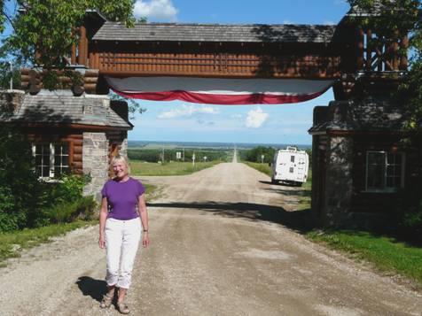
Leaving Riding Mountain NP by the old East Gate
Driving south, we soon came to the tiny habitation of Kelwood, with signs to a campsite. We followed these, past the community hall and the Canadian Legion and found a large field with room for all kinds of sports, but at one end a small campsite with electric points for $12!
Soon after arriving, and elderly gent on an ATV drove up to tell us that there were showers in the curling hall. I went to investigate, but couldn’t find them. There was one other couple camping here – just sleeping in the back of their car. They came across later to tell us where the key was for the showers. They were Linda and Chip, from St Petersburg, Florida, and were spending 3 months touring around. We offered them a beer, and chatted to them for some while. They were boaters as well as campers. We didn’t envy them their ‘car’ bedroom, but they seemed quite happy with it.
After they left, we cooked enchiladas outside, and sat there until the sun went down behind Riding Mountain.
Monday 4th August Manitoba sand dunes 81 miles
We found the key to the showers this morning – a tiny padlock key high up above the doorway – no wonder I couldn’t find it. The old chappie came by on his buggy and we said goodbye. We were impressed by this tiny town of Kelwood, which, apart from the campsite and playing fields had a ‘drop in centre’, a community hall, a skating rink and a curling rink, a dear little church and a Canadian Legion building. Sadly the school appeared to have closed down, and the railway had gone some time ago.
It was 10 o’clock as we headed south. We stopped at the town of Neepawa, where most of the shops were closed, being Holiday Monday, but we did find a Safeway open and were able to stock up a bit, though no fresh-baked bread.
We stopped for lunch where our road crossed Route 1 (Trans Canada Highway). By now it was quite hot. We had seen a dark cloud a bit further south, where we were heading to Spruce Woods Provincial Park. This is a large park, but the part that we were interested in is called Spirit Sands. This is an area of sand dunes, in the south of Manitoba, so very unexpected.
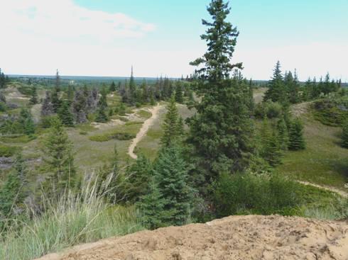
Spirit Sands
We managed to find the right parking place, and set off on a hot walk across the sand dunes for 1½ hours. The dark cloud had gone, and it stayed sunny. Being not true desert – it receives more rainfall than a desert - there were lots of wildflowers in purple, yellow and white.
As usual we found the ‘footpaths’ difficult to follow, with confusing signposting, but we really enjoyed our walk, arriving back looking like 2 pickled beetroot.
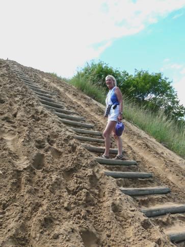
A hot climb!
Just a bit further on was the park campsite, called Kiche Manitou, meaning ‘Great Spirit’. It was a large but pleasant ‘holiday’ site, and had spaces now that the long weekend is over. We found a nice sunny spot, and soon made our way to the nearby little beach area on Manitou Lake (an oxbow of the Assiniboine River). It looked as though it had rained here earlier, but the nice thing was that the ground was sandy. The water was on the cool side, but it was just what we needed!
We came back and Adrian lit the fire, but he had a lot of trouble with the damp wood and the difficult fireplace. Nevertheless, the meal was good. We sat out in our isolation – the family opposite had left, and it was just us and the trees – in great variety. The pitches here are enormous, so we felt just on our own.
We watched the red sky, and at 9 o’clock a sudden shower started, despite the flimsy clouds overhead, so we came inside.
Calgary, Alberta to Winnepeg, Manitoba


