
Friday 26th September West through North Dakota 317 miles
We had intended getting off early, as we hadn’t seen anywhere to pay, and didn’t expect anybody to come. However, when we got up at 7 o’clock, we found an envelope attached to the windscreen. Adrian hunted around the campsite until he found how much we had to pay – far more than our info had suggested!
Having paid, we thought that we might as well stay and get the website sorted. It was a lovely morning – despite the clear skies, the night hadn’t been cold. We ate breakfast outside before driving back into pretty Menahga town. We pulled in beside Spirit Lake and sent our email with the website.
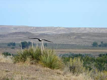
Now it was time to head west. Soon after we started off, we were pleased to see a bald eagle right beside the road.
We stopped at Hawley for coffee, and to get fuel and some wine. After that it was onto the I94 and out of Minnesota and into North Dakota at Fargo (named after the man of Wells Fargo fame).
We found the drive much more pleasant than we had expected, with empty rolling countryside with lakes and rivers, and quite a lot of birds. We passed the time listening to our travels in the American Rockies in 2004.
We drove through Bismarck, which we had visited last year, and turned off at New Salem (another one) at 4.45. There was a campsite here in North Park, next door to an outdoor heritage park, which asked for a $5 donation – with electricity. It had previously been free, but this was still pretty good.
The only problem was that lots of cars were pulling into the park, and loud music started up at the arena – we wonder what we are in for!
Well, what we were in for was American Football! And we are not impressed!
Adrian had lit the barbie outside and started to cook the meal. More and more cars arrived, until we were surrounded by about 300 cars!
We went out to see what was going on. A low loader had come in, carrying the band, which started up to play, sounding like the bands at New Orleans for Mardi Gras.
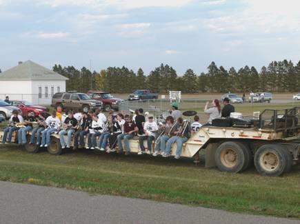
The band arrives
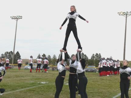
The local team, the Holsteiners (which were pronounced Holsteeners), were wearing black and white, as were their supporters. Cheer leaders – a group of young girl dancers, performed before and during the match. A stand was cooking beefburgers and hot dogs. As time came for the game to start, the announcer said that the National Anthem would be played. The teams lined up – in their stupid ‘Superman’ costumes with huge shoulder pads.
The game is about to start
There seemed to be about 50 players for each side, but the starting players were announced, and each ran onto the pitch. Then the game started, but to us it just seemed that each player grabbed his opponent so that they couldn’t move. The game stopped every few seconds. We are not games people at all, but this seemed just ridiculous.
We returned to the van and ate our supper – the sun had gone down, and the wind was chill.
After supper, we ventured out again. By now it was quite dark. Quite a lot of the teenagers had come across to the park area behind us, and were playing on the roundabouts. Several little girls were doing their own thing, just dancing around. The game continued – Carey seemed to be THE man, with Anderson the only other name that we heard. All the support seemed to be for the local team. We returned to the Bam, and became aware that the game had ended. No announcement – had the other team won?
We looked out at 9.30, and once more we were on our own – silently all the hundreds of cars had left.
Saturday 27th September Theodore Roosevelt’s Badlands 219 miles
After yesterday’s warm night, last night was really cold. We saw the sun just come up, and left at 8.30. We were about to change time zones once again – this time to Mountain Time, making it 7.30.
We continued west through the hilly open grasslands. Near Hebron, we passed a lovely sculpture of ‘geese in flight’, right beside the road. The geese were suspended on a wire ‘eye’ shape, and you could see through to the blue sky beyond.
We carried on to the southern section of the Theodore Roosevelt National Park. We had stopped here in 2004, and last year we had visited the northern section of the park briefly. The I94 went right past the park. We were pleased to have something memorable and special to do today, when the rest of the Capes were celebrating Katy and Aaron’s wedding in London.
We remembered enjoying driving the 36 mile loop through the park last time, and knew that we wouldn’t be disappointed.
We suddenly reached the badlands scenery, and I became quite excited. There is something magical about the strange barren hills with their amazing colours and ‘hoodoo’ rock formations.
We stopped at the Painted Canyon Rest Area first, and walked across to look down into the amazing area of badlands. It was really windy here, but later the wind wasn’t a problem.
We drove on to the pretty little town of Medora, and turned into the park. Apart from the scenery, the things to see here are the bison (one posed beautifully for us in a very photogenic situation, and we saw others from a distance) and the prairie dogs. There were just hundreds of these, in several different ‘towns’. They are such fun to watch, a bit like meerkats.
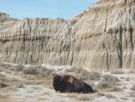
A lone bison
They were gathering up stuff for their hibernation – Adrian thought that the first one we saw had huge ears, but it was carrying enormous leaves for such a small animal.
We revelled in the fantastic scenery as we drove around the loop, stopping to climb to the top of ‘Buck Hill’ as we had done before. The view from here was 360° of Badlands – photos can’t capture the image.
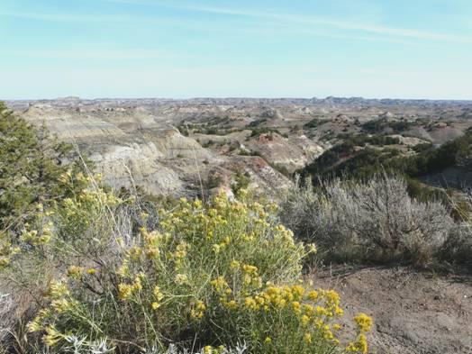
The badlands of Theodore Roosevelt NP
We saw a beautiful mountain bluebird as we drove on. At Wind Canyon we walked up above the Little Missouri River, and on our return almost trod on a thin blue/grey snake!
We ate our lunch sitting at a picnic table amongst small cottonwood trees – the yellow of their foliage had been an added bonus.
As we left the park we had a glimpse of Roosevelt’s cabin, which we had looked at last time. We stopped in Medora, and I had a short walk around this pleasant little town – now a tourist spot, but very quiet at this time of year.
We now continued on I94, out of North Dakota at a town called the unlikely name of Beach, and into Montana. We had stayed at the town of Glendive last year, when following the Lewis and Clark Trail. We knew that there was a free camping place there, but had a lot of trouble in finding it this time, as it was on the opposite side of the Yellowstone River from the main town. We’d forgotten the wonderful badlands scenery which surrounds it.
Once we’d located the little park, (resorting to the computer for help) we shopped in Albertsons store opposite, as we had done before.
Sunday 28th September Westwards following the delightful Yellowstone River 321 miles
We set off westwards on I94, repeating last year’s route, when we were following Lewis and Clark, but then we had often turned off onto side roads. We loved the wild, empty, barren scenery, as we had done then.
We were following the lovely Yellowstone River, and were quite happy to be repeating the journey. We’d remembered the views to distant hills near Terry, where we’d stopped last year near the Powder River to take in the landscape.
At 10 o’clock we pulled into a Rest Area just before Rosebud, thinking that we’d have an early coffee. It was an hour later when we left! We were in a beautiful situation above the Yellowstone River, and immediately became aware of half a dozen bald eagles flying around noisily overhead. We have been through lots of areas where we have been told that we might see bald eagles, and have indeed often seen some – but six of them! We watched transfixed, until I went in to get the coffee – at which point they disappeared!
One of the bald eagles
Soon after leaving here, we saw several deer in fields beside the road. The yellow grass was really bright, and sometimes we had the bonus of aptly coloured yellow trees by the river.
We stopped to have lunch sitting on a bench in a Rest Area just before Pompey’s Pillar, which we’d visited last year – named by Clark after Sacagawea’s little son.
We saw it as we drove on past Billings, which again we’d visited last year, and also in 2002 on our way back from Alaska. Now we joined the I90, and left our previous routes. We were still following the Yellowstone River, and now we could see the misty outline of the Rockies in the distance.
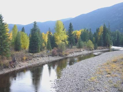
At about 4.30 we turned off just after Springdale, where there was a rough track right above the Yellowstone River. The motorway ran right by us, and between that the railway – as I write this, the first train, with about 60 coal trucks and 3 engines, went by – so the night won’t be quiet!
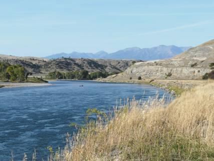
A lovely spot beside the Yellowstone River
The beauty of the location made up for it though. We’d sat outside in the sun and watched the sun go behind the hills at 6 o’clock.
It then became rapidly cool. We did watch a large bird (osprey or bald eagle), zoom down to try to catch a fish. By chance, the next CD in our pack was the one of ‘Lewis and Clark’ music, which was very fitting.
Adrian cooked the chicken on the barbie, but we ate inside. The stars were bright at bedtime.
Monday 29th September Reliving some memories of last year, as we continue west 294 miles
We didn’t hear the motorway at all, and there were only one or two trains. The night, though was really cold – we resorted to the blanket on top of the duvet!
We left at 8.30, just as the sun was peeping over the hill.
We soon drove past Livingston, which we had visited in 2004. It was surrounded by trees amongst the bright yellow grass in the arid mountains – the first of several towns we saw like that today.
Livingston is the gateway to Yellowstone National Park, which we went to last year and in 2004. I had to restrain myself from going there again!
We now reluctantly said goodbye to the Yellowstone River, but we were still following Clark’s return route, when he rode on horseback until he reached the Yellowstone River. At the top of Bozeman Pass, where the trees were now conifers, we pulled into a parking area where large trucks were hiding the historic marker. We were glad that we stopped to read it, as it said that Sacagawea had suggested this route to Clark – we can’t get away from L & C that easily!
At Belgrade we stopped for fuel, and then phoned Emma and later Tom, and heard about Katy and Aaron’s wedding, which seemed to go very well.
We were following some of last year’s route, but then we had been going round in circles following both the outward and return journey of Lewis and Clark, so now we were seeing things from a different perspective.
We crossed all three rivers (the Gallatin, Jefferson and Madison) which converge at the Missouri Headwaters, where we had camped last year.
We ascended Homestake Pass, which is the Continental Divide, and had spectacular rocks and scenery.
We drove past Butte, with the statue of Mary high up in the mountains, as we remembered from before.
We could see the huge chimney at Anaconda, remembering having lunch near there last year.
Now we took a different route from then, pulling off at the town of Deer Lodge, where we had lunch in Arrowhead Park, sitting in the warm sun. The town has several museums, including a prison museum and a historical museum. We stopped to look around the Grant Kohrs Ranch, which is now a National Historic Site.
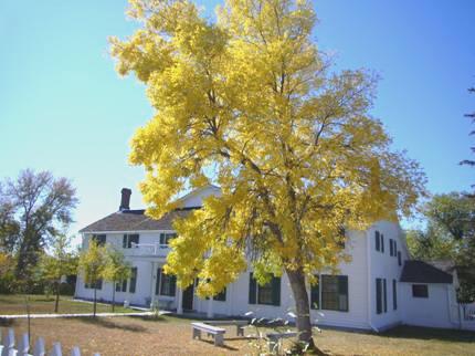
Grant Kohrs ranch house
The white ranch house looked attractive, with the bright yellow foliage on trees in front. We didn’t go into it, but did wander around the other ranch buildings, which gave us a feel of how the cowboys used to live.
We were now following the lovely Clark Fork River, and saw where we had stayed for one night last year near Garnet.
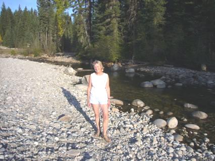
We passed spreading Missoula, then needing somewhere to stay tonight, I suggested turning off at Tarkio and following the smaller road. This paid off, as after a while we came to a lovely little fishing campsite right beside the Clark Fork River.
We were able to enjoy the sun for a short while before it went down behind the hills.
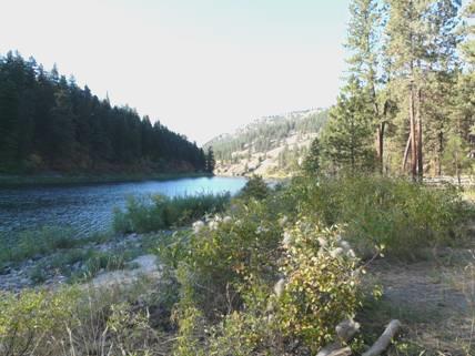
Beside the Clark Fork River
I cooked a chicken stir fry, which we ate outside (we’d no food left to barbecue, as we will cross into Canada in a day or two). Adrian had found some wood, so we sat by our campfire and toasted marshmallows, looking up once more to a fantastic display of stars before coming in.
Tuesday 30th September Full Circle – back to Lake Roosevelt 239 miles
The morning was really cold again, but we were off at crack of dawn – 7.20. There was weird mist in the valley, and we sometimes found ourselves driving through it after we’d rejoined the I90 at a town called Superior, a few miles on.
The scenery seemed very Italian, and the road hugged the mountainside, so we felt like being in the Alps.
At the town of St Regis, we left the lovely Clark Fork River, and followed the St Regis River as we ascended to Lookout Pass. We stopped at the Rest Area just before to have our welcome breakfast, having been going for just over an hour. The sun reached the top of the mountain just before we left, and then the day started warming up.
We left here at 9.20, and 10 minutes later reached the pass (4,600ft), and the border with Idaho. We now changed time zones once again, and went back another hour.
We read a marker about a huge forest fire in this area in 1910, when the sky was blackened as far away as Montreal.
We passed the former silver mining town of Wallace, where bad signposting meant that we didn’t actually drive through the old town, but we did pull off to drive through a similar town, Kellogg, which was very pretty, with colourful maples along the street. We were able to get an internet connection and receive one or two emails, including photos from Paul.
We now came to 4th July Pass, and turned off to a marker to John Mullan, who had built a road from Walla Walla, Washington to Fort Benton, Montana in 1859-60. He had reached this point on 4th July, and inscribed the date on a tree. The tree no longer stands, but we had a nice little walk through the Alpine forest in the vicinity of it. We had to cross a small rickety bridge which had scribbled signs at each end saying ‘bridge temporarily closed’!
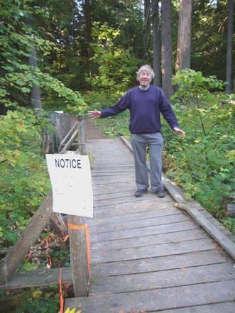
‘Bridge Closed Temporarily’
We now descended from this splendid mountain scenery to a wide flat valley, and the town of Coeur d’Alene. We drove on into Washington State, reaching the sprawling town of Spokane.
Here we were leaving the motorway, and travelling north, but this entailed driving through the non-stop American grot for some miles. We did stop to get petrol, propane and water from a garage, and a lovely fresh loaf from good old Fred Meyers
Finding a place to stop for lunch proved difficult, and we ended up sitting on our seats outside a closed campsite called Dragon Creek. The sun now was really hot, and the ground looked parched.
Continuing north, we actually repeated about 4 miles of our route from Orin-Colville when we were driving from the Cascade Mountains to Calgary 2½ months ago.
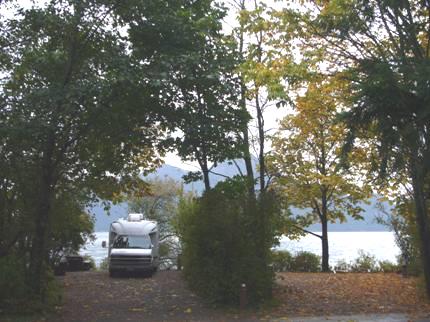
A bit further on, at Kettle Falls, we took a road that we hadn’t intended, but found ourselves at a delightful spot just before the Colville River joins Lake Roosevelt. Although only 3.30 (but 4.30 to us this morning) we knew that it was the place to stop for the night.
As we sat outside with our cup of tea, a bald eagle flew over.
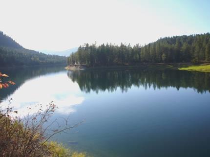
The Colville River reaches Lake Roosevelt
We sat out with our sundowners as we watched the sun go down behind the hill at 6 o’clock.
We then came in for ‘store cupboard’ supper – tuna, sweetcorn and rice.
Wednesday 1st October Into British Columbia 133 miles
It was another beautiful morning. We were awake early, ate yummy pancakes for breakfast, and left at 8 o’clock.
We found our way back to the bridge over Lake Roosevelt near the town of Kettle Falls. We crossed the bridge, and took Scenic route 20, which followed Sherman Creek, and ascended to Sherman Pass at 5575 ft. It was a delightful drive, with lots of places to pull off (but none when we wanted one for coffee later!)
There were also several points to stop off and walk, the first being at the site of an old log flume. It was still chill in the mountain air. Our next stop was at the site of Camp Growden, yet another former CCC camp. There was a lifelike statue of a CCC worker and his boots.
Near the summit we had a short walk in Colville National Forest, where it was surprisingly warm. We stopped once more where there had been a vast forest fire in 1988.
Now we descended to the small town of Republic, where we got some more fuel before we enter Canada.
When we reached Curlew, we turned left to once more follow the Kettle River to the border. The Kettle River makes surprising curves on its route through this part of northern USA and southern British Columbia.
Just before reaching the border, we stopped near the grave of Ranald Macdonald. This amazing man had been born in 1840s to a white man and an Indian princess, who had died soon after his birth. He had been brought up in an Indian community, but had gone on to sail to Japan, where he had been put into jail, and while there taught English to the Japanese. He had also travelled to Australia before returning to America.
We reached the border with Canada at such a quiet crossing that the official asked us many questions - we think that he needed something to do. He told us that he was English.
We had reached the delightful little town of Midway, and found ourselves by the river at a pleasant picnic area/campsite. Although barely midday, I knew that it was the place to stop for lunch. The sun was now really hot. We drove on around the ‘town’, hoping to get some shopping, and also an internet connection. We got both, and also a laundrette, which was our other need. This was in a pleasant little coffee house/internet/ book exchange – the owner seemed to have a go at everything. His internet didn’t work for us, but we got one while at the RV dump station opposite! (which was closed for the winter)
We were pleased to receive a message from Richard, and just as we were about to leave, had a Skype telephone conversation with Paul.
Now 2.45, we continued to follow the Kettle Valley, then at Westbridge we took the road by the West Kettle River.
Autumn colour by the Kettle River
The first place we stopped to look at for an overnighter was a ‘no go’ for us, but as we drove back across the small bridge from the forestry road, and stopped to take a photo, a car screeched to a halt just behind us, and zoomed past and off up the road like a madman.
Where we did stop, some time later, we were still by the Kettle River, on another forestry road.
Another nice place to stay
A small creek called Trappings Creek joined the river here, and there was a supposed trail beside it. We attempted it, but it left a lot to be desired, but we did see a grouse.
Back at our spot, yet another bald eagle flew low over us as we sat out with our beer and crisps before the sun went down.
Adrian cooked our meal on the barbie, and we ate outside by the campfire.
Another lovely evening.
Thursday 2nd October We cross two previous routes 141 miles
Despite the clear skies and the stars last night, the morning was partly cloudy and the day turned out disappointingly miserable, considering that we are in the supposedly hot, dry Okanagan.
We soon ascended through a surprisingly rocky gorge to a pass, and then made the long descent to the unattractively vast, dry and sprawling town of Kelowna. We had driven through here in 2002, and found it similarly busy.
This time we got quite lost when each turn we took was onto a wide, unsigned road, with no chance of turning round.
We were glad to get out and cross Okanagan Lake on a new bridge – last time it was a floating bridge. Westbank was similarly busy and filled with ‘American grot’.
We turned onto route 97c, which we were sorry to find was a dual carriageway with no pull-offs – we had our coffee in a ‘chain up area’. A sign read that all commercial vehicles must carry snow chains from 1st October. Lucky that we’re not a truck!
The day continued grey as we drove on through this mountain country. A few splurges of autumn colour permeated the evergreens, but sadly there were also a lot of dead trees, killed by the beetle fungus.
For a few miles before Merritt, we were repeating our 1989 route. We turned off to a grassland reserve, which was to honour local man Laurie Guichon, who had died in 1999 aged 55. He had been a keen conservationist, and sounded a lovely man.
Initially we drove for some way down a very bumpy track, with clumps of bright golden aspens. We returned to walk to a pond, where a whole lot of cows had gathered, but they moved off when we came near. It began to rain lightly so we returned to the Bam. This was just the day to have beans on toast for lunch. Heinz at that!
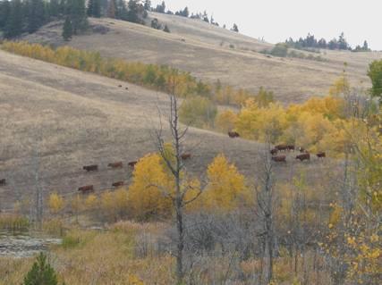
Cattle cross the Laurie Guichon Reserve
We left and descended to Merritt, where we got an internet connection, and managed to speak to Rosie’s cousin Joyce, who we hope to visit at the weekend in Vancouver. We looked at the weather forecast and saw that the prospect for the next few days isn’t good – a storm in the Pacific seems to be bringing wet (and cold) weather to this area. We have been so lucky this trip with having fantastic weather, so we can’t really complain, but when everywhere is so dry, it’s a shame it couldn’t last a bit longer.
We took a road to follow the Nicola River, which again was brightened by the aspens. We were really pleased to see a sign to a recreation area by the river – a large but simple campsite with tables made from planks fixed to huge logs.
There was nobody about at all. We found a place with some wood left behind, so prepared to have a campfire, and sat outside with a cup of tea. The sun appeared weakly before descending behind the mountains.
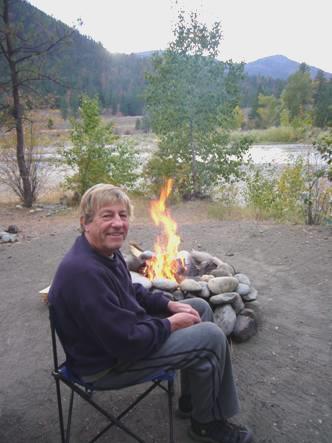
A surprise campfire beside the Nicola River
This unexpected delight turned out to be another ‘Top Spot’, as we sat out around our campfire until late, and even saw some stars!
Friday 3rd October More and more arid 97 miles
Despite the weather forecast, the night wasn’t cold, and I was able to sit outside for breakfast before we left at 8.45.
As we drove on beside the Nicola River, the yellow trees by it looked so evocative that we kept stopping to take photos. A group of cows came along the road and eyed us up.
Yellows by the Nicola River
The landscape became more and more arid until it was quite barren with just a few scattered fir trees and one or two patches of bright red tiny rhus plants.
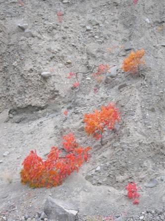
Bright red rhus in the arid ground
We stopped at Spences Bridge, where the Nicola River meets the Thompson River, named after the amazing explorer. We tried to take in the atmosphere, with a little graveyard with wooden crosses, a few cacti hidden amongst the grass, and a couple of weeny purple starlike flowers. The road, two railways and the mighty river were dwarfed by the tall barren slopes.
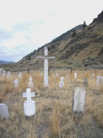
The graveyard at Spences Bridge
The twenty miles from here to Lytton we had travelled (in the opposite direction) in 1989. We had been amazed then at how arid it was.
We stopped to have coffee at a picnic table above the river, enjoying reading some of that past diary – our first trip in a motorhome.
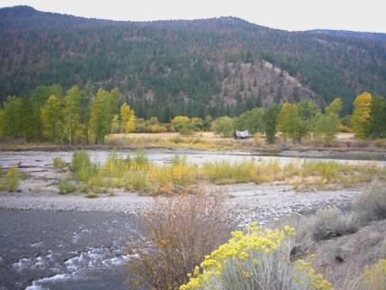
At the small mountain town of Lytton, where the Thompson River joins the Fraser River, we even had some sun. The day was turning out so much better than expected. We stopped to get some fuel, which is important in this desert mountain area with few petrol stations, and bought a few items, the most expensive being drinking water!
We got an internet connection and received a couple of photos of the wedding from Emma, and were able to phone her. We also received a message from Steve Flett.
We now followed the Fraser River to Lillouett. We were often high above the river and the road was often tortuous, particularly at the area of ‘the big slide’, where we hung precariously to the cliff side.
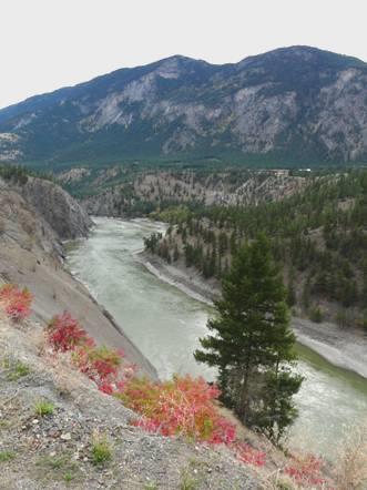
The Fraser River
We reached Lillouett, which in the 1860s was a really big town. The area is noted for its jade. The cliffs sides around it were really steep. Golden aspens lit up clefts in the mountainside amongst the dark green of the firs. Explorer Simon Fraser had come here in 1808. We saw a ‘Rocky Mountaineer’ train, which got us excited about our impending trip.
We were pleased to get an internet connection and receive a message from Steve to say that all is well to meet up on Sunday.
We now took route 99, following Cayoosh Creek, and very soon came to a campsite at Seton Lake. This was a free campsite run by BC Hydro, and looked pretty good to us. We found a nice sunny spot, and then set off to walk around on the ‘Goldrush trail’. We were so pleased to find this place, with the steep, stark mountains around, and the weather staying better than we had hoped.
We were able to collect free firewood, but this had a downer, as Adrian found it really hard to get going. The warden came along later and told us that there was drier wood if we wanted it. By then the fire was going well, and we had a good meal, and sat out until late. Rain had threatened, which got Adrian to move the van closer, but nothing happened, and we even saw a few stars before we came in. Another Top Spot!
Saturday 4th October Fantastic scenery, variable weather! 128 miles
It was mild enough to have breakfast outside. When we left at 8.45, sun was peeping through onto the mountains, the highest of which had a little snow on it.
We stopped to look at Seton Lake Reservoir, which looked quite stunning, like a Norwegian fjord, with its almost vertical sides.

Seton Lake
Our journey on through this majestic scenery was slow, partly because of the narrow and winding road, and partly because we stopped often to take in the view and to photograph. The deep green firs were lightened by the brilliant golden aspens. Sometimes they were so bright that they looked as if they were on fire, or lit up from inside. We’d wondered if they looked brighter without the sun, and with the dark sky, but the sun did shine on them once or twice – they looked marvellous whatever!
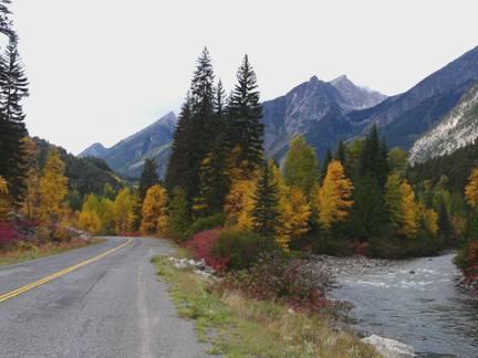
Ever more glorious colours
We stopped at one point and walked across a dilapidated bridge over Cayoosh Creek and looked down at the crystal clear water. The road beyond had a sign saying that it was ‘deactivated’, in other words not looked after. The bridge told us that, and we trod very carefully!
We stopped by a natural log dam at the end of Duffy Lake, and had coffee sitting in the cab to enjoy the view of the snow topped mountains further on. We enjoyed a bit more of the 1989 diary.
We now made an unexpectedly long and steep descent through sun, rain and cloud to aquamarine Lake Lillouett. We just had a glimpse of this, and for a short while the visibility was uncannily clear.
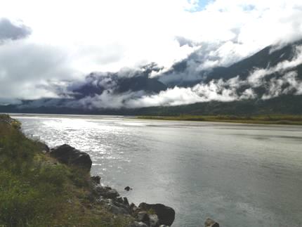
Lake Lillouett with gathering clouds
We drove on through a flat valley to Pemberton. The trees here looked dowdy after the brilliant colours we had been enjoying. At Pemberton there was a place where we could ‘dump’, outside the Visitors Centre, which was closed until next May! We got an internet connection and spoke on the phone to Tom.
After the long and hairy drive down, we were wondering what the ascent to Whistler would be like. What a contrast – this was a wide and fast road. We stopped just before Whistler by Green Lake to have lunch.
We drove on past Whistler, the huge ski resort built during the early 1980s, and the host for the 2010 Winter Olympics. Driving along the road, we saw little evidence of the huge complexes, which were well hidden by trees.
After this things became really bad. The weather deteriorated to torrential rain, the visibility diminished to almost nothing, and the non stop road works (for the impending Olympics), made the driving a nightmare.
We pulled in by a so-called viewpoint, where we just got odd glimmers of what must be a superb view when cloud occasionally lifted slightly. We finished reading the 1989 diary while we pondered what to do.
We didn’t really need a campsite, as we had done the ‘necessities’, and wouldn’t be having a campfire. On the other hand, if we found somewhere to stop, we wouldn’t be able to use the computers for long, as they haven’t been charging properly.
We drove on past Squamish, unable to see anything at all, so we didn’t know that we’d passed it. Driving was now an absolute nightmare with increased traffic and more roadworks. We just wanted to stop.
Our saviour came in the form of Porteau Cove Provincial Park, which had a campsite right beside the water – the SEA in fact – our first encounter with it since leaving Seattle 3 months ago.
We backed into a spot by the log strewn beach, looking across in the greyness to forested islands and headlands. The rain actually stopped as we revived with a cup of tea (we’d have liked something stronger) after our horrendous journey.
We had a very short walk out, but the rain returned with a vengeance, and stayed all evening. While I was cooking the meal, the young warden came along for his money. We had to ask him inside, and didn’t envy him his task on a night like this.
Things continued to be difficult - Adrian’s computer was playing up, and he couldn’t get it to work – very aggravating when there was so much we could do on this, our last night ‘on the road’.
After supper we thought that we could watch the DVD of ‘The Bridges of Madison County’, which we had bought for Adrian’s birthday, but we couldn’t get that to work either.
What we did do was to watch though the photos of our trip to Mexico 2004, and that we really enjoyed.
Sunday 5th October Cousins in Vancouver 32 miles
We heard more rain in the night, and the morning was cold and damp when I walked out soon after 7.00am. Adrian was surprised to see that the tide had gone out, after all the times by Lake Superior, when we had expected it! We saw harlequin ducks on the water and stellars jays in the trees..
Our spot at Porteau Cove
Adrian was thrilled that this morning his computer was working again. We had a short walk to a lookout over Howe Sound before leaving.
There were lovely views as we drove on down to Vancouver, and we even had some sunshine, but the construction work still made driving difficult.
We arrived at Steve and Connie’s, and enjoyed a lovely lunch with them and Joyce and Dave. S&C then left to visit their son Gavin, who had broken both legs in an accident while serving in Afghanistan.
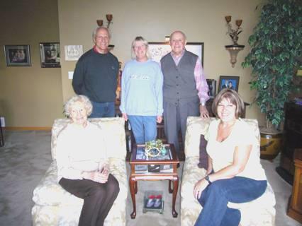
Rosie with Steve & Connie, Joyce & Dave
We chatted some more, including family history stuff, to J&D. After they left, we looked through a whole lot of family history letters which Steve had, and copied them.
After they returned, we chatted until late, then came out to sleep in the Bam.
Monday 6th October Jobs on the Bam, and more rellies 16 miles
We woke early and went in to have breakfast with Steve and Connie before they both left for work. It had been lovely to meet up with them again after 19 years!
We left at 8.15 and joined the rest of the traffic heading into Vancouver. Adrian needed a repairers, as he wanted the Bam brakes seen to again. We found that places didn’t seem to open until 9 o’clock, but did find a place where they said that they could do the job.
We left the Bam there, and had intended to catch a bus to Downtown, but ended up walking all the way there. All we saw on the way were junkies and ‘down and outs’.
It was different to have time to wander around, without any parking problems! It felt like walking around Sydney, Australia on a damp autumn day in 1998, when similarly there was construction work everywhere because of the impending Olympics.
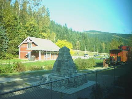
We stopped for coffee in the old station building, and later for soup at Tim Hortons. The day was grey as we walked around Canada Place, and looked across to Stanley Park and North Vancouver.
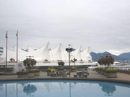
Canada Place, Vancouver
We’d enquired where to catch a bus back, and also where the station was for our ‘Rocky Mountaineer’ trip on Thursday.
We got to our bus stop, but when the bus arrived, the driver said that the stop was really closed because of the roadworks – nothing said so. By 1.15 we were back at the Bam, with the work having been done. Adrian now wanted it to have an oil change, in preparation for our next trip. This proved to be a much longer (and more expensive) job than anticipated, as they assured us that extra things needed doing, such as changing the antifreeze.
By now it was raining as we made our way to the Rocky Mountaineer Station. We found this to be a strange place, with nothing happening, and no office. We luckily found a pleasant lady employee, who answered our questions – we had expected to pick up our tickets today, but she said that we would get them on Thursday when we arrived to board.
By now the day was really horrid, with constant rain and poor visibility. We thought it best to find our way to Richard’s house, as we knew that parking might be a problem. It certainly wasn’t easy, with the ‘traffic calming’ and one way systems, but we did manage to pull up by his house.
We made a cup of tea and busied ourselves while we waited for his return.
His girlfriend Teaney arrived home first, and made us welcome until Richard returned.
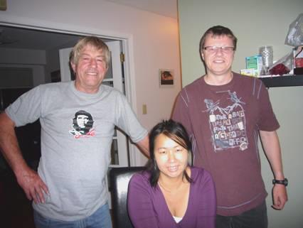
Adrian with Richard and Teaney
Teaney cooked us a nice meal and we sat and chatted until 11.15, when we came out to sleep in the Bam.
Tuesday 7th October Back into USA for our last night in the Bam 50 miles
Richard and Teaney came to say goodbye as they left for work at 8 o’clock.
We spent some time booking a hotel for tomorrow night, and the bus from Bellingham to Vancouver, then I cooked pancakes for breakfast.
We received an email from Simon to say that they were back in Calgary after their holiday in Japan.
We left at 9.30 and headed out of busy Vancouver, crossing the wide Fraser River with its gatherings of logs.
We made our way to the border with United States, and then on into the pretty little town of Lynden, with its tree lined main street and prolifically flowering baskets.
We found a car wash, and Adrian gave the Bam a much needed clean, and also a thorough hoover. We eventually found Safeway, and bought the things we needed for today.
Then it was on to Hidden Village RV site/storage place, where we’d organised to leave the Bam. The campsite was more pleasant than most which we have stayed in for our last night, with a lot of grass and trees, but of course the swimming pool was covered for the winter.
After lunch we began on all the clearing up jobs and packing.
Wednesday 8th October Goodbye to the Bam for now – back to Vancouver
It was a glorious crisp autumn day for us to organise ourselves for leaving the Bam.
We saw the sun come up in an orange glow as we busied ourselves with the washing, sorting and packing. I even did some ironing!
We had spent a lot of time yesterday and this morning looking for a computer key which Adrian thought he must have dropped outside. He found it this morning in the pocket of his jeans!
We had both coffee and lunch outside, and were pleased to have finished up all our food.
We put the Bam in its storage place – this campsite has a small storage area – and got ready for our 2 o’clock taxi. We were allowing plenty of time to get to Bellingham airport for the shuttle bus to Vancouver, and of course the taxi was early. Our driver was a young chap with an artificial ‘Terry Fox’ leg. It would have seemed silly to ask if he could drive OK. He was a quiet chap, so we didn’t find anything out.
We saw more on our coach journey than we had when we arrived 3 months ago. In fact it was quite an entertaining time. Our driver was a bit of a stand up comedian, and the many different characters on the bus would have been a feast for Joyce Grenfell!
We had a longer than usual delay at the customs post. Each passenger had to take his luggage and be interrogated, but one person caused a problem – it would appear that somebody had ‘stolen’ his name/address, and the officials took a very long time deciding that he could enter Canada.
The ongoing journey to Vancouver was pleasant – there was a lot of agricultural land – fields of ripe pumpkins – and some views to the sea, and also to the mountains. We even had a little ‘tour’ of downtown Vancouver, looking out to English Bay, as we made our way to our hotel, Howard Johnson, where we arrived just before 6 o’clock.
Later we walked out and ate at ‘White Spot’, a Thai restaurant recommended by the girl at the desk (the Chinese restaurant opposite that she also recommended was closed for 3 days). The restaurant was part of another hotel, and neighbouring diners seemed to be English people on tours, which didn’t please Adrian! Also his dish was a bit spicy.
We came back for an early night, ready for our early start tomorrow.
Thursday 9th October Off on the Rocky Mountaineer
We were awake at 5.30am, ready for our 6.15 taxi to the Rocky Mountaineer station for the start of our 2 day trip to Calgary.
We were at the station by 6.30, and had soon booked in (like a flight, but not such a hassle) and waiting for 7.30 boarding.
Soon the station was very busy – very different from how we had seen it when we called in the other day!
After the call to board, we all found our places, and our ‘onboard attendant’ Michael introduced himself. He was a really pleasant young chap with a constantly cheerful face and a desire to be ever helpful. Nothing was too much trouble.
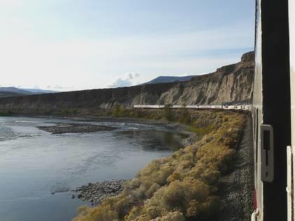
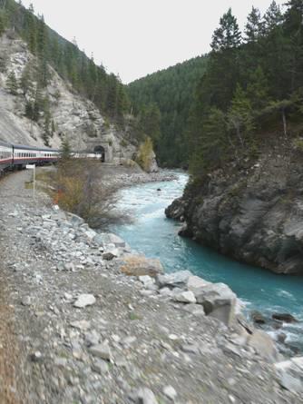
Our trip was through country which we have visited before, but never from this perspective. After leaving Vancouver, and the fertile farming country, we followed the Fraser River, coming to the impressive gorge, and Hell’s Gate, which we had experienced in 1989.
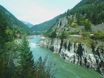
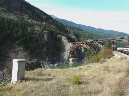
Approaching Hell’s Gate Cisco Bridges
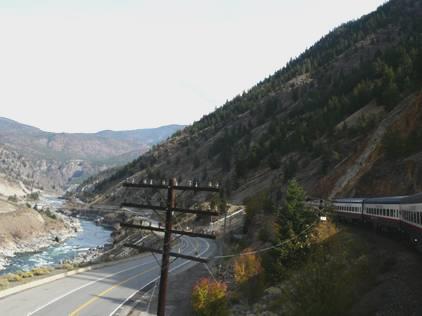
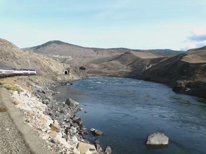
Later we followed the Thompson River, after it joined the Fraser at Lytton. From here to Spences Bridge, we had driven only last week – it was fun to see it from the train, and to recognise places we had seen then.
The countryside had become increasingly arid, as we knew. We saw several bald eagles, and the back view of some mountain goats.
We’d been served pleasant meals, and there were always drinks and snacks available. Among the other passengers in our carriage were a family of 5 – a young couple from Cardiff with their 3 children – Amelia aged 6 months, Lydia about 3 or 4 and Elliott about 7. With them was another couple (her brother) with Elizabeth, about 2 or 3. The children were all very good for such a long journey, and the mums very competent and unruffled.
Adrian had spent some time in the ‘vestibule’, at the end of the carriage, where you could see out from the opened windows – many photos were taken!
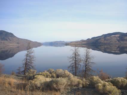
Kamloops Lake
The last part of the journey was around long Kamloops Lake, which had a pastel beauty in the late afternoon sun.
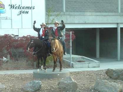
Our welcome at Kamloops
When we arrived at Kamloops (meaning meeting of the waters – the North & South Thompson Rivers), we all ‘de-trained’, and were driven by coach to our hotels. Ours was the ‘Comfort Inn’, at ‘the top of the hill’. Our big surprise was how big Kamloops is – 85,000 people. We had come here in 1989, and don’t remember anything of the town. We have always joked about the campsite which we stayed at, which was supposedly ‘quiet and relaxing’, and was far from it!
Having found our room, I saw that there was an indoor pool, so we headed there fast. It was a lovely relaxation after a day of travel. There was even a hot tub.
After that we made for the hotel restaurant, which was actually an Italian restaurant in the neighbouring block. Here Adrian ate an excellent pizza, and I had pleasant lemon sole.
Friday 10th October On track through the Rockies to Calgary
I hadn’t slept much, but we were up at 5.40 ready for our 6.30 pick up by coach. We were surprised to see that nearly everybody was already on the bus when we arrived at 6.25.
Our driver Norm was bright and cheery as he had been yesterday, and told us many facts about the Kamloops area as he drove us back down to the station. The two crops grown are alfalfa and ginseng.
We boarded the train, and were soon eating breakfast, and tootling out of Kamloops. We had evocative views of this arid landscape as the dawn came. We thought that we saw the campsite which we stayed at in 1989, which had had a sign saying ‘Quiet and Relaxing’, which had always amused us (It was close to the road and the railway). We also spied the waterslides – being dismantled it seemed - where we had stayed at another campsite. It always seemed that when we were trying to look for a view, a l-o-n-g train passed us, which made it difficult to see!
There was mist over the river, and the frost stayed for a long time. We went through a section of fog, but were lucky to have another beautiful day for our journey on to Calgary.
We saw virtually no wildlife today, except for many bald eagles and a red wing blackbird, and later some mountain sheep.
The landscape became gradually greener as we left the rain shadow.
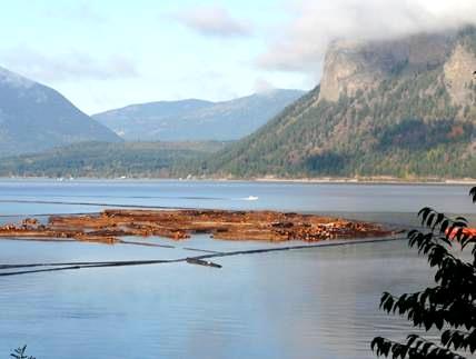
We saw the Adams River, renowned for the biggest salmon run (sockeye) in the world. We had stopped here last year and in 2002, but not at the right time for the salmon. This was the right time, but we didn’t see any.
We were now to pass many places familiar to us. We wondered if it would be an anticlimax to be going through areas which we had already visited, but it only added to the interest. We travelled along beside vast Shuswap Lake to Salmon Arm.
At Sicamous we relived our stop here last year (with Felix and Ruby) and in 1989 and 2002 – and the same at The Last Spike at Craigellachie.
Craigellachie
We now followed the Eagle River through 3 Valley Gap (more memories) to Revelstoke, where we crossed the Columbia River. Many of the mountains were topped with new snow. We were enjoying reliving these past visits with such magnificent scenery. Now there was snow on the trees as well as the mountains.
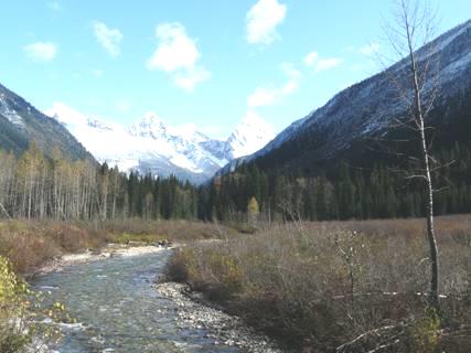
We recognised Canyon Hot Springs, and the place we had walked near Mt Sir Donald. Adrian spent much of the time dashing to the ‘vestibule’ in order to get better photos and views, but it often got crowded there
.
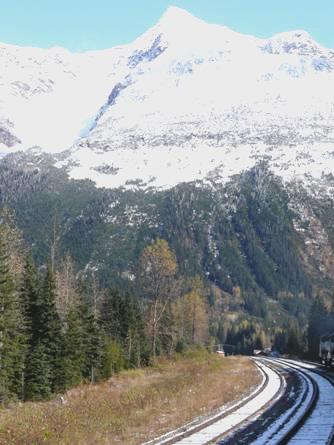
We travelled on past Golden, where we could see the Kicking Horse ski slopes as we followed the Kicking Horse River. There was now snow on the ground, and as we travelled on, much of the water was frozen.
Field
Now it was on through Kicking Horse Pass, where we passed a campsite we had stayed at in 1989, with the river flowing down from Takakkaw Falls. Then it was the excitement of going through the Spiral Tunnels, which we have often viewed from the road, and which have long fascinated Adrian. The first tunnel went through Mt Cathedral, and the second through Mt Ogden. Once in the tunnels, you weren’t aware of the steepness of the track, or the curves which the line was taking.
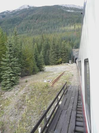
Entering the spiral tunnels
We crossed the Continental Divide near partly frozen Lake O’Hara. We now moved our watches on one hour.
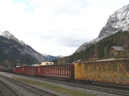
We saw Castle Mountain and Vermillion Lakes, as we came into Banff at about 6.30. Here some of our passengers alighted, including the Welsh families with the children who had been so good.
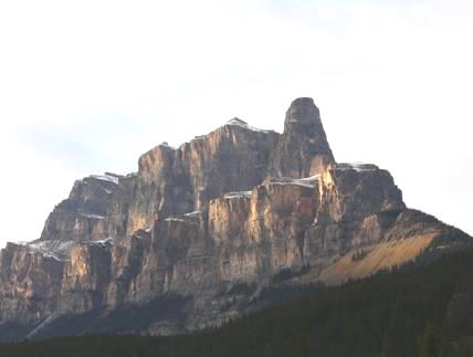
Castle Mountain
It rapidly became dark as we travelled on to Calgary. We were served a light supper, and arrived at about 9 o’clock. Simon was soon there to meet us and drive us back to their house where we chatted to him and Laure about their recent holiday in Japan, and looked forward to spending a few days with them and the children before returning to England.
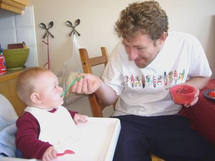
Millie’s first spoonfeed from Simon Typically happy Manolo
Menahga, USA to Calgary, Canada


