
Monday 14th May A failed Utopia 121 miles
We were up early on a lovely morning, and worked on the website.
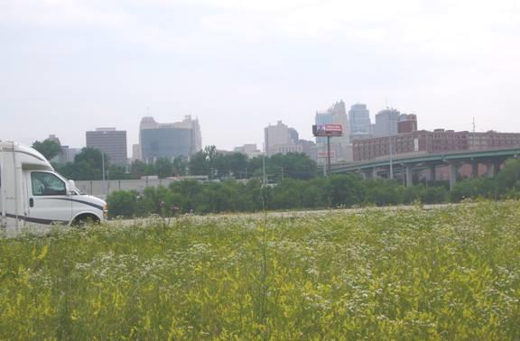
We soon joined the motorway west, turning off at humble Poseyville, which didn’t live up to its name!
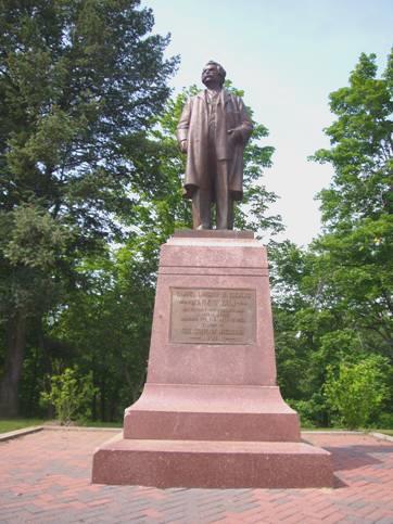
We were heading for New Harmony, the site of two experiments in communal living in the early 1800s. The first was a religious group from Pennsylvania, originally from Germany, rather like the Amish and the Shakers. They called themselves the Harmonie Society, and lasted here for about 10 years. Then along came Robert Owen, with his hopes of ‘Utopia’, but it seems that this project only lasted a couple of years. This was the part that interested us, as we remembered learning about him at school, but we came away feeling rather disillusioned.
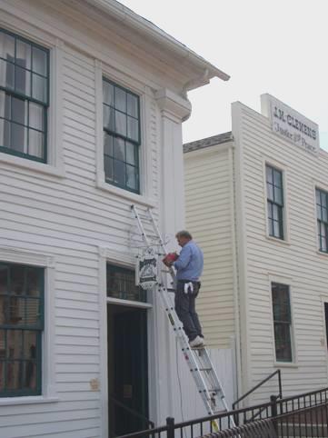
The present town of New Harmony is attractive enough. We were directed to the Visitors Centre – and that certainly was posey! It had been designed by Richard Meier and completed in 1979, and was a really odd building, supposedly resembling a boat on the side facing the river. There was a small charge to see the exhibits, and a short film about the two settlements. We couldn’t find out what we wanted to about Robert Owen i.e. whether this was his only Utopia project. In fact he came over as a difficult man, who fell out with his business partner.
Whereas yesterday’s exhibits about the Lincoln family had been simply and nicely portrayed, here we found everything confusing. The town became a centre for ‘alternative thinkers’, scientists, artists, explorers etc, and there were small exhibits on many different people.
We had been welcomed initially by a young girl by the name of Tracy Gholson – she wondered if her name might be English, so we enlightened her! She seemed rather nervous, unlike the young lad Josh, who was very informed about the history of New Harmony. He took us up onto the roof of the building, and told us that the land around floods almost every spring. There were tours around the town in the afternoon, which we were encouraged to go on, but declined. We both felt rather uneasy in the building, and Adrian particularly wanted to get out!
There was plenty to see roundabout. One thing was a paved labyrinth, a copy of the one which we have seen in Chartres Cathedral. The rector of Chartres Cathedral had been here to give his blessing when the labyrinth was opened in 1997. Later we found another labyrinth made from privet hedging – a copy of one the original Harmonie group had planted.
We visited what was called a ‘roofless church’ – a large open area, with a sculpted statue of the descent of the holy spirit, which had two other copies – one in Assy, Haute Savoie and one on the island of Iona.
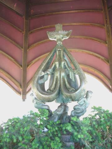
‘Descent of the Holy Spirit’
We liked the simple baptismal font, particularly the inscription – ‘In celebration of all grandparents for the great goodness that flows through and from them’.
We’d eaten our lunch down by the wide Wabash River, which flows into the Ohio some miles away. We’d discovered that we’d lost the 3rd wheel trim (only one to go!) and the tyre inflator extenders were hanging out, so Adrian had to fix it.
While in New Harmony we’d spent some time getting our email and website sorted, and when that was done, we made haste to Evansville, where we were able to get some much needed propane, then across the Ohio and back into Kentucky at Henderson, where we got some even more essential petrol! (less expensive than Indiana)
Now we headed south on the freeway, turning off in the hopes of finding somewhere to stay, but ending up at Walmart in Madisonville.
We couldn’t even get the photos done, as the machines were broken, as Adrian discovered the hard way.
Tuesday 15th May Nashville 159 miles
It was already hot when we walked across to Walmart to shop at 7.15. We left after breakfast at 8.45 and joined the motorway south toHopkinsville. We turned off here to visit a ‘Trail of Tears’ park, which we had difficulty in finding because of lack of signposts. There was a log cabin which served as an information place, but this was only open on Fridays and Saturdays. We looked at the few markers, and a fine statue of two chiefs, whose graves were here.

‘Trail of Tears’ Hopkinsville
The overland route had stopped here on their long trail to Oklahoma. Although early, we had coffee in the little park, which looked sadly unkempt – I had difficulty in not pulling up some weeds! There was the glorious scent of honeysuckle from nearby bushes.
We rejoined the motorway, and continued south, leaving Kentucky and crossing back into Tennessee at 10.30.
Before long we were in Nashville, and my first thoughts were to get out again fast, as it is always difficult to orient oneself in a large city. We persevered, and pulled in to park by the Country Music Hall of Fame. There are so many things which you could visit in a place like this, and we thought this the most appropriate. After a quick bite to eat, we entered the large and ostentatious building. Things had changed since our few years old ‘Lonely Planet’, including the price! They were keen to get you to go on all sorts of tours, but we just settled for the actual museum, and that proved to be plenty.
At first we felt quite out of our depth, as we know very little of early country music, so nothing meant very much to us. We moved on to an era that we did know, and found lots to interest us. Interestingly we didn’t know much about recent country music artists either. We still came out confused about the definition of country music, but think that it must be the equivalent of folk music in England, although the boundaries aren’t clear. We are puzzled at some artists classed as country – e.g. Shania Twain, and the Eagles. There were some nice little bits of film, and we enjoyed seeing snippets of Elvis, Dolly Parton and Carl Perkins amongst others.
In our continuing discussions about country music, we decided that the museum had included those people that it wanted to, whether country artists or not.
We now set off to walk around some of Nashville, coming down to the Columbia River, and a reconstruction of Fort Nashborough, which was settled in the 1790s.
We walked on to the capitol building, and the area around it, which had several war memorials. It was amazing to us to see how many men, just from Tennessee, had died in the wars in Korea and Vietnam.
A group of young people were holding some sort of race, which entailed a runner from the 3 teams dashing all around the area and ascending the steps of the capitol – I almost got felled in the process! Adrian thought they had all the signs of being on a team building course.
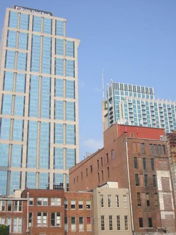
Old and new, Nashville
Nashville had a mix of old and new buildings, and was quite pleasant for an American city. We walked down Broadway, which had endless bars, with live music emanating from all of them. It seemed a fun place.
We saw a plaque stating that this was where Bluegrass music started, with Bill Monroe and his group.
Now we had to head out of Nashville. The only camping place we knew of was several miles out of town in the wrong direction. We were heading for the northern end of the Natchez Trace, so decided to set off, and hope that we could find somewhere to stop.
We navigated superbly out of the town, but as we might have imagined, there was nowhere at all to stop. We set off down the Natchez Trace, knowing that there was nowhere we could stay at this end.
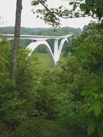
Birdsong Bridge, Natchez Trace
We turned off once, and made a circular tour, but found not one inch of spare ground amongst the manicured farms. We continued down the Trace, annoyed that we weren’t able enjoy it, and turned off again. I had seen that there was a Walmart in a town about 10 miles away. We were driving through a small place called Fly, when we spotted a bit of ‘spare road’. We made our way to the end of it, and stopped - it was 7.30!
While Adrian was cooking the meat outside, he saw lightning, but the brief storm didn’t hit us until bedtime.
Wednesday 16th May Meriwether Lewis’ grave site on the Natchez Trace 109 miles
We were disappointed to wake to a grey morning, which soon turned to rain. We seemed to be thwarted with our visits to the Natchez Trace, as each time it has rained! In fact by mid morning the rain had stopped, and the afternoon became hot and sunny.
We drove the short distance back to the Natchez Trace, soon stopping to have breakfast. We drove on southwards stopping at numerous viewpoints and walks. Early on, we walked down to Jacksons Falls, when it was still raining lightly. It felt a bit like being in the rainforest.
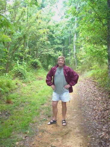
Adrian on a bit of the original ‘Trace’
We walked on bits of the actual trace, and drove along some – the Parkway doesn’t follow the ancient path all the time – a bit like an American film of a book – as long as the title is right, everything is OK!
We stopped for coffee at the site of an ancient inn – called Sheboss Stand. Stand was the name given to an inn/trading post. Apparently the Indian who ran it had a white wife. He could speak very little English, and if asked something would point to his wife and say ‘She boss’!
The most important site we stopped at was the memorial and grave site of Meriwether Lewis.
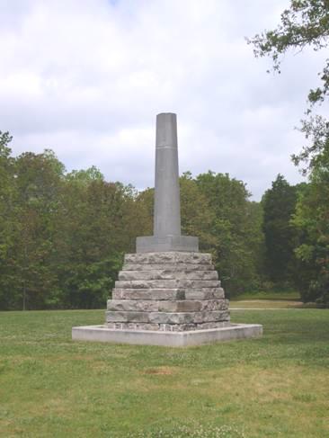
Memorial at the gravesite of Meriwether Lewis
This joint leader of the Lewis and Clark expedition had died here on October 11th 1809 while on his way back to Washington with the completed report of his excursion. His death is thought to have been suicide (he suffered from depressed moods), but some still think that he might have been murdered. Whatever the cause, it was a tragic ending to a gifted young man. The memorial had been built to him in 1848. We both felt moved to be here.
The memorial was in a large park named after Lewis, and there was also a campsite here (too far for us last night). We stopped to have lunch at a sunny picnic table before continuing on our way south. We hadn’t gone far when we were delighted to see 3 small armadillos grazing on the grass verge. A bit further on we saw a larger one – presumably a parent.
In a field beside the Natchez Trace
After making several more stops and short walks, we discussed where to turn off the parkway, as tomorrow we want to visit Florence, to see the house of Helen Keller. Having decided to drive on a bit, and cut back to Florence, we had just crossed into Alabama when we came to a sign saying ‘Natchez Trace closed’! There had been no previous warning!
We have now driven almost all of the 500 mile Trace, which runs from Nashville to Natchez. It was an old trading route, linking the Cumberland andMississippi Rivers. There is a section north of Tupelo which we haven’t driven – it will be as far as the Alabama border now!
After the initial anxiety of wondering if we were going the right way (the road had a different number on the signs from the map) we found our way to Florence, and the large McFarland Park beside the Tennessee River.
We found a sunny spot by the river. The limestone cliffs on the other side made us think that we were in France.
We had a walk around by the river, and saw a group of cedar waxwings.
Adrian cooked on the barbecue, and we ate outside, but it was teacups again!
The stars in Alabama were good.
Thursday 17th May From the inspiration of Helen Keller to Memphis 160 miles
We were up early on a lovely morning and ate bacon and mushrooms for breakfast outside.
We crossed the Tennessee River to Tuscumbia to visit Ivy Green, the home of Helen Keller. Once again we had difficulty in finding the place, but once there, we had an excellent visit.
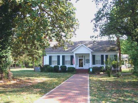
Ivy Green – Helen Keller’s home
Helen had been born in 1880 in the home which her grandparents had built, and which is now on the National Register of Historic Places It is set up as a museum of her life and work. She had been perfectly healthy when born, but at 19 months suffered a severe illness – possibly meningitis – which left her both deaf and blind. What this was like for the little girl and for her parents is impossible to imagine. Her parents pampered to her every wish, perhaps not surprisingly, and she became a half-wild and unmanageable creature.
Her parents took her to Alexander Graham Bell in Washington DC, where he was living then (last year we had visited a museum at the home he made in Nova Scotia). He was an expert in teaching deaf children, and realised that Helen was very bright. Following this visit, a young woman named Annie Sullivan came to look after Helen. After a short while, she had ‘tamed’ her, and soon Helen was able to read Braille and to write, and later to talk and so was able to go to college. She wrote many books, and toured the world, lecturing on conditions for the blind and deaf/blind, and becoming a world renowned figure.
She died aged 88 in 1968, but her legacy goes on.
We were greeted at the house by two lady guides, who proceeded to show us around the house. An enormous number of family artefacts have survived. As well as furniture and clothing, there were books Helen had written, examples of her own handwriting – some when she was aged 8 years – and numerous photographs.
Outside the house was the actual pump which Annie had used to teach Helen the word ‘water’ – the first time that Helen understood what words meant.
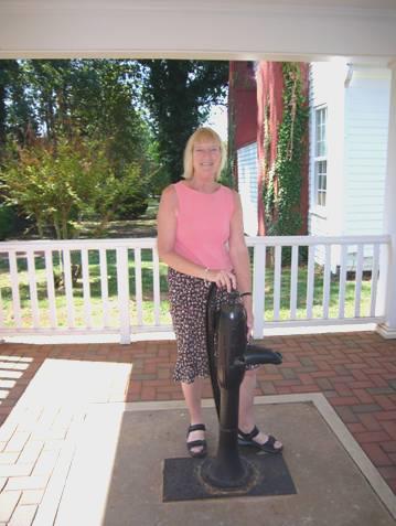
The pump where Helen first understood the word ‘water’
There was also a stage set, as a production of ‘The Miracle Worker’, the story of Helen and Annie, is performed during the summer.
While we were there, a large group of Primary age schoolchildren came for a visit. They were extremely well behaved, which was lovely to see.
We had coffee afterwards near the tree which had been Helen’s favourite, and which she used to hide in.
Now it was eleven o’clock and time to head for Memphis. As we drove to the Alabama boundary, we noticed swathes of wild flowers planted along the verges – mostly bright red poppies, but also yellow, white and blue flowers.
We had to cross the Natchez Trace, a bit further south than we had left it yesterday, and stopped to walk to a shady spring, where there had been a ‘stand’ in the past.
We drove on through Mississippi, stopping to have lunch just before Burnsville, near a wildlife area. Then it was on past the small town of Walnut and towards Memphis. We crossed into Tennessee just before reaching the outskirts, and then followed the motorway. When we came to a traffic jam, we turned off and took smaller roads to Fuller State Park, where there was a campsite. It was windy, but later the wind dropped and we had a campfire. We were just about to eat, with our drink in teacups, when the camp host came across to warn us about the poison ivy, which was all around us. He was also an Escapees member, with a Livingston address.
Friday 18th May Memphis – Music, Mississippi and Martin Luther King 28 miles
It was sunny, but with a cool wind at first. The camp host came across to help Adrian with the difficult water tap, and Adrian asked him about parking in Memphis. It seems that there is a ‘Mayfest’ going on, so some roads are closed, but he thought that we might be able to park by the Visitors Centre.
We drove around some of the vast park before leaving – there is a medieval Indian village in the park, but we hadn’t enough time to see that today.
We made our way quite easily to the visitors centre, where sure enough, we were told that we could park, even though there wasn’t much parking space.
The car park opposite charged $3, but when we returned in the afternoon, it had gone up to $10, because of the festival.
We had driven through some pretty rundown areas, and much of Memphis still seems very poor, but we had a fantastic day.
We walked up to the tram (trolley) stop, and caught the tram down to the National Civil Rights Museum. We had wondered about visiting yet anotherCivil Rights Museum, but this one is rather special, in that it is housed in the actual Lorraine Motel where Martin Luther King was shot on April 4th 1968.
The displays followed through the history of the Civil Rights movement with tremendous detail. Having come right up to 1968, with a film of Martin Luther King talking on that day, we suddenly found ourselves right by the room that he had stayed in, still looking as it would have done then. Outside was the balcony which he had stood on when he was shot. Beneath the balcony were the 2 cars of the time. It felt eerie and moving to be there.
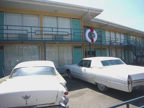
The motel where ML King was shot – now a museum about him
Across the road the museum exhibits continued, with details of the police search in finding Earl Ray, and the actual window where they think the shot was fired from. As well as this, there was a section on Ghandi, who was an inspiration to M L King, and more about the ongoing issue of world wide civil rights. We could have stayed much longer, but there were other things that we wanted to do, and by now it was past lunch time. It had been a memorable visit.
We walked up to Beale Street – THE music street. It was W.C. Handy’s ‘Beale Street Blues’ which started the tradition of blues music here.
We immediately saw Blues City Café, and went in to have lunch. We both ordered barbecued ribs, which the café is renowned for. These came served with good fat chips and other bits, and we drank a nice beer. It was very atmospheric, and people were really pleasant and polite. In front of a giant sized portrait of Elvis sat a chap in a white suit, with long black sideboards. He was obviously someone well known, as several people came up to him and shook his hand, and he gave them his card.
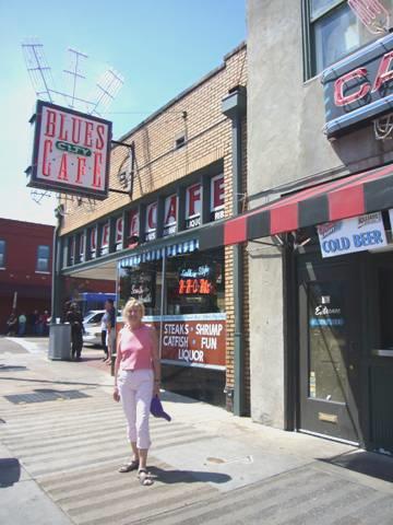
Beale Street Memphis
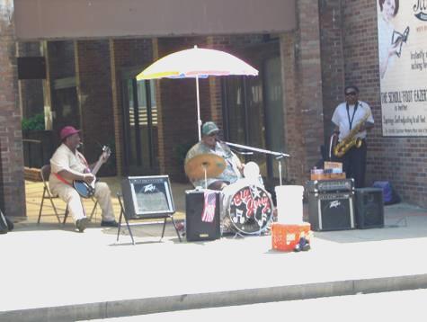
Well fed, we came out and wandered down Beale Street, enjoying the vibrant atmosphere, and the occasional live music. It was actually a very small section of this vast city.
We walked on back to the Mississippi River and located the monorail across to Mud Island. There was a museum about the Mississippi River here, but no time today. What we did enjoy was a model of the Mississippi River, set into the ground, with towns it passed through marked into the ground, and information boards about the history.
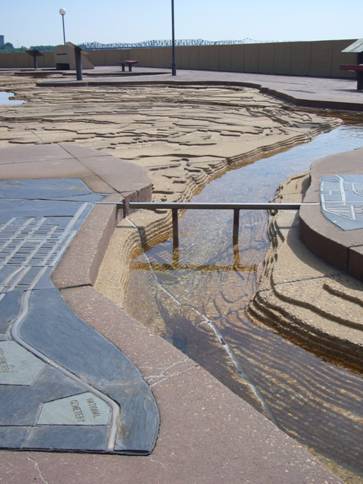
Giant sized model of the Mississippi River
It was an enormous structure, and ended where the Mississippi reaches the sea. Here there was a fountain which could spray the unwary! A large group of teenage schoolchildren were having fun here. We dashed back to the monorail as we thought that they would take all the places on it, as they were about to leave too.
We had one more call to make – Sun studio. We drove there, and after a bit of trouble in locating the car park, arrived just after 4.30 – we knew that it closed at 6 o’clock. Our hearts sank when we saw a huge group of people outside, but we went in, to be told that a tour had just started, so we could join them, and pay later.
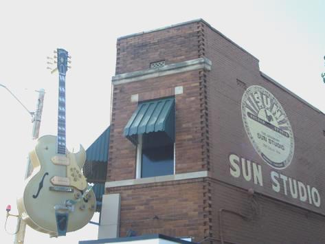
Sun Studio
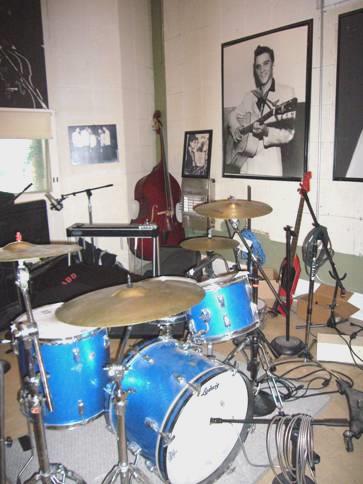
It was great fun. A young chap told us all sorts of little anecdotes about the studio, and the artists – in particular Elvis, who began his recording time here. He played the first recording that Elvis ever made. We went down into the studio – a very humble little place, full of musical instruments – drums, guitars, a piano. It was supposedly the actual piano which Jerry Lee Lewis had played ‘Great Balls of Fire’ on.
Adrian ‘Jerry Lee Lewis’
There was a large photo of Elvis, Jerry Lee Lewis, Carl Perkins and Johnny Cash doing a ‘jam session’ in this studio. We have a CD of the recording of that session – by then Elvis was recording for RCA, and had come back to the studio and met up with the others.
Where Elvis cut his first disc
We were glad that we had visited the other Memphis ‘must’, Elvis’ home Graceland, 2 years ago (South East USA - Diary 1 – 27th January), but we hadn’t driven right into Memphis then.
Now we had to find our way out of Memphis and across the Mississippi River into West Memphis in Arkansas. We managed despite dreadful road junctions and terrible road surfaces, and located Walmart at around 6 o’clock. Once more we had no luck with the photos, as, after Adrian had taken them in, the young girl disinterestedly said that they wouldn’t be ready until tomorrow, by which time we will be gone.
Adrian in particular is aware of the ‘don’t care’ attitude of people, and wonders if it is the area we are in, or a developing trend. It was therefore delightful to see next morning a young mum dancing across the car park with her young baby in her arms.
Later in the evening we transcribed an item about my ancestor George Thompson who died in 1806.
Saturday 19th May On to the confluence of the Ohio and the Mississippi 173 miles
Well we did in fact get the photos! We shopped in Walmart at 7.30, when it was already quite busy. We left after breakfast and went in search of an internet connection. Having got one, we read and wrote a few emails, but annoyingly the phone wasn’t working properly. Adrian was able to speak to the storage place in Omaha where we plan to leave the van, but when we tried phoning our kids they couldn’t hear us.
By now it was 10 o’clock, and as the girl hadn’t bothered to cancel our photo order last night, the photos were there when we called in. We now joined the motorway north.
We turned off and drove through the tiny communities in the flat, agricultural flood plains of the Mississippi.
We turned right down to an offshoot of the Mississippi to have lunch at Osceola. Being Saturday, people were fishing from the bank.
We rejoined the motorway and almost immediately came into Missouri. We stopped at the welcome centre for some maps and continued to New Madrid, which is situated on a large meander of the river. This was one of the places which we had seen on yesterday’s map of the Mississippi River on Mud Island. There was a catfish festival going on today, and some of the roads were closed off. We headed for an observation deck over the river, and from here we watched as pick ups towing boats containing the catfish which had been caught earlier were brought along, so that the fish could be released back into the river.
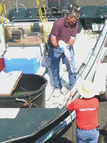
Catfish ready to go back in the river
A huge tube had been erected, and a truck was used to bring a hosepipe of water to ‘flush’ the fish back into the river. There were some very large fish! It was hot and pleasant standing here (79°F), but we left and continued on the motorway, turning off to Cairo. It is here that the Ohio River meets the Mississippi River. There was once a state park here, called Fort Defiance, after the former fort. Now it is just a park apparently with a campsite, but there was nobody around. We drove down to view the confluence of the two rivers.
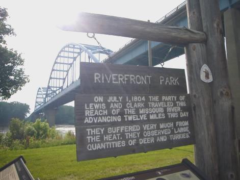
Lewis and Clark had camped here for several days on their way to St Louis, and we found a small marker and recent statue to commemorate that.
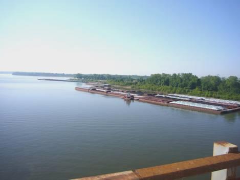
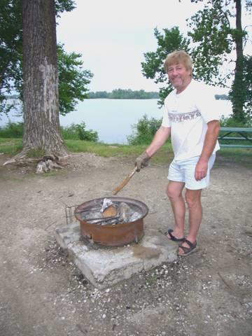
Back at our deserted campsite we cooked on the barbie and ate outside, with the rumble of the river barges passing by on both rivers.
Sunday 20th May An ancient Indian settlement, and more recent sites along the Mississippi 96 miles
We were awake early on a beautiful morning, but the bad thing was a really unpleasant smell which permeated the air for a long while into the morning.
We drove down to the picnic area at the confluence of the 2 rivers to have breakfast and watch the huge river barges being assembled.
Barges being assembled at the confluence of the Ohio and Mississippi rivers
We drove across the Ohio River on another gigantic bridge. This one, like the last one, had roadworks on it, but that gave us the chance to look back to the confluence. We were now in Kentucky, and we had come across to visit Wickliffe Mounds, an excavated site of Mississippi Indians, who lived here about 1,000 years ago, and like those in the west, suddenly left at about 1300AD. We were there before the opening time of 9.00 a.m., but the cheery lady let us in. The exhibits were housed in 3 long huts, and had mostly been excavated in the 1930s. The information by the exhibits was detailed and ‘deep’, but this was perhaps because the site had been owned by the university until recent years. After our visit we had a nice chat to the lady – whose ancestors had come from England in 1600s, and her assistant, a young girl called Jessica with Welsh/German ancestry who liked Pink Floyd, but wasn’t fond of Elvis.
We now had to drive back over the Ohio Bridge, to Cairo, Illinois. This small town had some pleasant brick buildings, but along one street all the houses were desolate, deserted and fallen down. The only people about were those going to church.
We drove on a bit further, and stopped at Thebes, right by the full and fast flowing, muddy Mississippi and had lunch at a shady picnic table. Lewis and Clark had overnighted here on their way to St Louis.
We now crossed the river again, so left Illinois and came into Missouri at Cape Girardeau. Unlike Cairo, this town looked very well loved, and was a pleasant place to walk around on a Sunday afternoon.
A flood wall had been built in 1960’s, but this had been covered in attractive murals of Missouri characters and history.
Floodwall mural at Cape Girardeau
We walked through a gap in it to view the river. It felt very hot now. The settlement dates from 1793, when a Frenchman had a trading post here. Lewis had stayed here, but Clark had stayed a bit further on at the original settlement, now called Cape Rock. We drove on to there. Apparently this is the only inland Cape in USA.
We drove on a few miles to Trail of Tears State Park, which was much larger than we had realised. Adrian was panicky because we were very low on petrol, so after looking in at the visitors centre, we made our way back 10 miles to Cape Girardeau to get petrol. We returned to the park, located the campsite, then made our way to nearby Lake Boutin, where a small swimming area was cordoned off. We had our first swim of the trip! before lazing on the ‘beach’ for a while, people watching.
We drove on down to the Mississippi, through very undulating and thickly forested ground. There was a lookout here over the river. It looked magnificent with the clear blue sky, forested bluffs across the river, and the massive riverboats ploughing up and down. On the distant hills of Illinois we could see the huge white cross on Bald Knob.
Barges on the Mississippi from Trail of Tears Park
Lewis and Clark had passed by here, and, as the park name suggests, this is where one route of the tragic Trail of Tears had crossed the Mississippiby ferry.
It was 6 o’clock when we found a forested camping spot, and Adrian lit the fire.
For the last 9 days, we have been in a different state each night – a total of 7 different states!
Monday 21st May Rough roads and interesting sites along the Mississippi 99 miles
We left at 9.30 on another beautiful day, with a clear blue sky all day. We had the idea of taking small roads northwards rather than return to the main road. At first we drove through pretty Devon-like lanes, but then the roads became unsurfaced. Sometimes it was OK, just very rattly, but other times it was difficult to know what was road and what was stony river! We wondered many times if we would get through, but we made it back to a surfaced road, turning off to Apple Creek, which Lewis and Clark had mentioned as being a sizeable river, with some habitation along it. We stopped by the muddy brown river to have coffee. Huge pike fish were swimming around. A young chap with his 2 small blond children came down to the river. The dad apologised when the little boy was about to have a wee not far from us!
A couple of days ago Adrian had found that the mozzies are about – now it was my turn to find out!
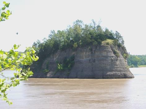
Undaunted by our earlier experience, we took the road to Tower Rock, which entailed a couple of miles of unsurfaced track before we reached the river.
Tower Rock
We were glad that we persevered, as the isolated island rock in the middle of the river was quite a sight. Lewis and Clark had commented on it, and the dangerous whirlpools which formed around it. Later it became a ‘Right of Passage’ of the Mississippi, with new sailors being given a dunking! We enjoyed seeing a lot of birds here. It was very hot.
We now made our way to the Great River Road.
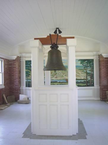
We turned off the road to drive to Kaskaskia. This is an island, belonging to Illinois, but accessible by bridge only from Missouri. It dates from 1703, and has a liberty bell given by Louis XV of France in 1741. After a huge flood in 1888, the Mississippi changed course, and now follows the course of the former Kaskaskia River. The bridge went over the old Mississippi, which was now a wide muddy backwater. We then drove for 5 miles across flat agricultural land to the bell, which is housed in a brick building near the large church. When we reached it, we found the doors shut. Thinking that this was a bit of a bummer, we walked over, and I noticed a green button. We pressed it, and lo and behold, the doors opened, and we were able to view the bell!
Kaskaskia Liberty Bell
There were markers nearby telling of the capture of Kaskaskia by George Rogers Clark from the British in 1778.
There was also a marker about Lewis and Clark, who had stopped at Fort Kaskaskia to collect their third boat, and to enlist some more men, as well as an interpreter - Labiche.
It had been worth the drive!
Our next stop was pretty Sainte Genevieve, dating from 1735, and apparently the first permanent settlement in Missouri.
Felix Valle house, Sainte Genevieve
It had French origins, but also German connections, and had a very different feel to it. It was a pleasant town to wander around, with lots of attractive old houses. In fact the town was first sited a couple of miles away, nearer the river. After enjoying our walk around, we made our way to the river, where there was a ferry across to Illinois. We were disappointed to find no L&C marker here, as we had expected, as they had camped here, and commented on the flood prone fields. We had wondered whether to take the ferry, and approach St Louis tomorrow from that side, but had seen a nice place to pull off for the night a short way back, so returned there.
There was a steep bank up behind, covered in honeysuckle, and the railway runs along beside the road. We hoped that it wouldn’t be too noisy.
( We had visited St Louis on our first motorhome trip in 2002, and had driven past it last year.)
Tuesday 22nd May St. Louis and the real start of the Lewis and Clark expedition 118 miles
We had only heard one noisy train during the evening – they must have been saving it up for the night time! If I hadn’t known, I would have thought that they were running right through us! They were incredibly long, with engines at each end, so the noise went on for ages. Then we woke to hear a few drops of rain, but this soon cleared, and the day became very hot and sultry.
We set off before breakfast, driving through Sainte Genevieve, where schoolchildren were in the playground waiting for the start of the school day. It amazes us that the rules of overtaking a school bus when it has stopped are so strict, but outside a school, we have seen young children standing in the road, stopping traffic like our ‘lollipop ladies’.
We had been hoping to stop for breakfast at Magnolia Hollow, a few miles on, which was another Lewis and Clark site. When we turned off onto the road, however, we found it to be freshly tarred. We drove on for a bit, but Adrian imagined that we would soon come across the tarrers, and that after that the road would be worse, so we turned round.
We took the motorway from here to St Louis.
We were just approaching St Louis when we came across a family of Canada geese – 2 adults and a gaggle of young ones – striding across the 10 lane motorway! Adrian slowed down and managed to avoid them, but we don’t know if others did.
We made our way right to Gateway Arch, and found a parking spot for RVs by the river.
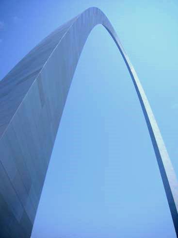
Looking up to Gateway Arch
We wanted to visit the ‘Gateway to the West’ museum, housed under the arch. We had come here in January 2002, 5 days into our ‘Route 66’ trip, and had seen displays about Lewis and Clark, which had fuelled our enthusiasm for their exploration. This time we tried to limit our viewing just to displays about them, as the museum is quite large, and had become very busy by the time we left.
We walked back to the Bam, deciding not to visit the Historic Museum, which apparently housed more artefacts of the trip. We headed for Bellefontaine Cemetery, which is where Clark is buried.
The cemetery was a vast area of undulating grassland, a bit like Arlington Cemetery. We wondered how we would ever find Clark’s grave, as there were so many smart memorial stones. We stopped and asked some other visitors, who had a map of the cemetery, and they directed us. Even then we had trouble finding it.
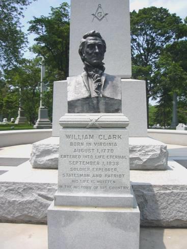
William Clark’s grave
After having our look at the grave, we drove on through rather rundown areas of St Louis, pulling in to get some petrol. Adrian’s dismay at the ‘don’t care’ attitude was reinforced here, as after he, and others , had tried to fill their tanks, and nothing worked, the attendants just said ‘No, we’re out of gas’.
We pulled in by Riverside Park, which had a smart running/cycling path, but was otherwise unloved. There were no picnic tables, so we sat on our own seats under the shade of a tree to have lunch.
A bit further on was the ‘Chain of Rocks’ bridge, the bridge which had formed part of Route 66. We had stopped by on our previous trip, but men were working on the bridge then, so we couldn’t really access it. It is now reserved for pedestrians/cyclists, so we walked out as far as a little Route 66 display.
On the Chain of Rocks bridge – memories of our Route 66 trip!
Ironically there were picnic tables by the parking area here.
Now we made our way to the Illinois Lewis and Clark State Historic Site. This hadn’t been built when we were here in 2002, and like a lot of things, had been built for the bicentenary of the expedition a couple of years ago.
Lewis and Clark had spent the winter of 1803/4 camped at Fort Dubois, near the meeting of the Mississippi and Missouri Rivers, and had set off from here on 14th May. It is recognised as the start of the expedition proper.
As part of the bicentenary work, a reconstruction of Fort Dubois had been built. We had a look around it. A ‘guide’ was telling us all about it, while another American kept asking whether we’d been to Disneyland.
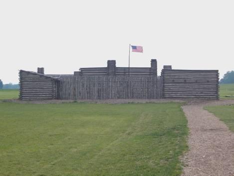
Reconstructed Fort Dubois
In the bookshop we bought the book about Sacajawea, the Indian girl who had accompanied L&C on part of the trip, by Ken Thomasna, who we had heard talk about her when we were in Jackson’s Hole 3 years ago.
We drove on down to the point where the two rivers meet. There was now a marker and a display board, but the building which had been here when we had come before had been taken down. We were intrigued that the rivers have changed course so much that the original camp would probably now be under water.
Lewis and Clark went that way
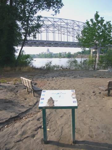
We now headed north on the ‘Meeting of the Rivers Byway’, following the Mississippi River on the Illinois side. We were heading for Hannibal, about 100 miles upstream, as this had been the home of Mark Twain.
After following the pretty road, right beside the river, for a few miles, we stopped by the boat ramp in Grafton at 5 o’clock.
This is where the Illinois River meets the Mississippi. A ferry also runs from here. Two chaps were just going off on a sailing boat - one asked us to join them. As they still hadn’t returned at bedtime, we’re glad that we didn’t accept!
(Their car had gone in the morning, so they must have come back!)
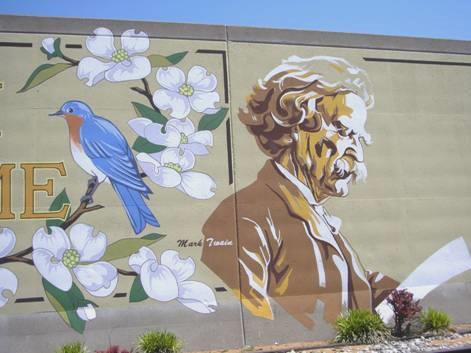
Wednesday 23rd May Hannibal, childhood home of Mark Twain 137 miles
We left at 8.30 and drove north through Illinois, following the Illinois River at first. The countryside was pleasantly rural, and the road quiet. We just had to avoid a few wandering tortoises! We stopped to have coffee just before reaching the bridge over the Mississippi to Hannibal, in Missouri.
We made our way firstly to Riverside Park, where there was a statue of Mark Twain.
Statue of Mark Twain at Hannibal
The park was much larger than we’d imagined, and was hilly and forested, with views down over the Mississippi.
We drove on into the small town of Hannibal, locating the Visitors Centre to find out about the Mark Twain museum. This, in fact, was a collection of houses, the first being the one that Mark Twain, as Samuel Clemens, had lived in as a boy. There were exhibits and quotations in each building, and the price for entry was very reasonable, and even cheaper for seniors. There were houses named for Becky Thatcher and Huck Finn – we were amused at this last, which had just been built! In fairness, it was meant to be a reproduction of the house which Mark Twain’s friend, who he had based the character of Huck Finn on, had lived. The Becky Thatcher home was named similarly. We had a long chat to the lady docent, who had never travelled, but loved to hear about our travels.
We had hoped to pass a food shop today, but never succeeded, so for lunch we had soup/sandwich/cheesecake in a pleasant and reasonably priced café before going on to visit the last building – an excellent museum with models representing the raft Huck Finn had travelled on, and part of a Mississippi steamer, which Twain had worked on, amongst other things. It is sad that Mark Twain, like Captain Cook, has no direct descendants, despite having four children. Most of them died young, but he did have one granddaughter, who died childless.
Tom Sawyer and Huck Finn
Outside ‘Tom Sawyers house’, there was a white fence emulating the one which Tom had tricked his friends into painting for him. We were amused that opposite, a chap was actually painting the walls of the house white! He even looked like Mark Twain!
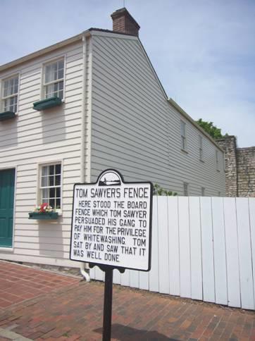
A man paints by Tom Sawyer’s fence
We really enjoyed our visit to this pleasant little town. We think that Mark Twain would have been amused at all the touristy attractions waiting to satisfy the people needy of them. We drove on to the Mark Twain cave, supposedly where Twain got the inspiration for that part of the story. By contrast this was very expensive, and as we thought that it was mostly a tourist gimmick, we didn’t bother to go in.
We now headed south, following the Mississippi on the Missouri side, and stopping at one or two pleasant lookouts. We drove through the attractive town called Louisiana – rather confusing, as it is in Missouri, on the Mississippi, and most of the roads were named after other states!
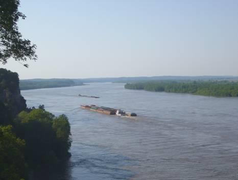
Soon after here, we came to a grassy free camping area, surrounded by cottonwood trees, beside the river – but also near the railway! We were delighted to see 2 blue jays as we arrived, and watched the long barges being tugged along the river.
Adrian lit a fire, although it was too hot to sit by it.
Campfire by the Mississippi
We had taken some chicken out of the freezer compartment, so ate this, with baked potatoes and a feta salad. We drank beer, as we had run out of wine. We had almost finished eating when another motorhome came in. The couple in it came over and asked about staying. Later they came and joined us by our fire. They were Siegfried and Ingrid from Munich, and had shipped their motorhome over from Germany and spend 6 months at a time here. Her sister lives in Astoria, Oregon. They had 2 daughters and 6 grandchildren. We sat chatting until 10.15.
Thursday 24th May Goodbye Mississippi River, hello to the Missouri 94 miles .
We hadn’t been disturbed by trains in the night, although the hooters were alive and well in the morning!
We sat by the Mississippi to enjoy our breakfast, on a lovely morning, but we were about to have a major crisis! Adrian noticed water leaking from the loo pipe, and realised that it was broken. What to do? Initially he had to sort the messy problem, which was unpleasant and embarrassing. In our rush to sort things, a glass got broken as I hurriedly put things away.
Ingrid had come over with a plate of strawberries for us, and we shared a few moments talking of our families and exchanging email addresses before saying goodbye. They were a really pleasant couple, and we had enjoyed each others company.
We continued on our route back down towards St Louis, but only wanted to go to St Charles, on the north bank of the Missouri. This is where Lewis and Clark had finally set sail from, after spending a few days here on final preparations, and there were some sites which we wanted to see. Adrian could only find addresses of RV repairers on the south side of St Louis, and we had no desire to return there.
As we were driving through the next small town, Clarksville, a mower fell off the trailer of a van which had crossed the road in front of us. Adrian flashed our lights and sounded the horn to alert the driver, but she didn’t take any notice. We stopped, and Adrian moved the mower out of the middle of the road.
Our rural idyll came to a sudden end when we reached the outer parts of St Louis – confusing fast roads and huge shopping malls. We were in desperate need of a supermarket as amazingly we hadn’t passed one for nearly a week. We had no luck in our search, and found ourselves fast approaching St. Charles. We stopped to get some petrol, and had coffee while we decided what to do. We thought that we might as well visit the Lewis and Clark sites before trying to sort the loo problem, but in the mean time, we couldn’t use it!
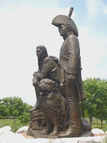
With our usual difficulty of finding sites, we eventually located the museum beside the river, near the point which L&C had set off from. The museum was excellent, and we watched an endearing National Geographic film about the expedition. It was watching a film in England some years ago which had first got us interested in Lewis and Clark. The repercussions of their trip - the western expansion of America - is not of primary concern to us. We are fascinated by explorers, and this exploration is a wonderful tale of good leadership, and the overcoming of endless difficulties.
Inside this museum was a huge black Newfoundland dog, obviously representing Lewis’ dog Seaman, which went along on the expedition with them. We assume that he is used when they do re-enactments of the story.
We drove along the pleasant Main Street of St Charles, which has become a real tourist haven of olde worlde cafes and gift shops. Not a food store in sight, and US doesn’t have bakers as we do.
We ended up back by the river, and ate the last few tacos, and savoury biscuits for lunch, plus the strawberries from Ingrid.
On our second drive along Riverside Drive, we saw the statue of Lewis and Clark, which we had missed before. It was a superb statue, and included Seaman the dog.
Lewis, Clark and Seaman the dog
Now we had to return to our problems, and after much searching, we found ‘Save-a-lot’, which we are pleased to say served us well with our needs – both food and drink.
Adrian had decided to try to mend the loo himself and so needed an RV spares place. Finding this gave us more problems, especially as the motorways were horrendously busy, and people seemed to be rushing home for Memorial Weekend, perhaps taking an extra day’s holiday. Finally we found it, and Adrian was able to get most of the bits that he wanted to do the job, but he still needed to get some pipe, and the man recommended a hardware store. In trying to find this, we just ended up in a high class ‘out of city’ housing estate, where everybody was arriving home!
We extricated ourselves from that, and were following a fast road out of town, when we passed Lowes – a huge B&Q type place. We found our way around to it, and Adrian got the bit he wanted but this entailed buying 5ft of ‘drainpipe’, when he only needed 3 inches!
There was a Walmart close by, which we thought would make a suitable place to stay for the night, while Adrian made temporary repairs. This he successfully did, and although he was told that it was OK to stay, the town apparently didn’t really like it.
Friday 25th May A surprise memorial to Sir Winston Churchill 144 miles
The night was warm, but the morning was cool and grey, and we had several rainy outbursts. We left early, hoping to stop for breakfast, but had trouble in finding our way out of this labyrinth of ‘out of town’ newly built housing estates.
We found our way back to the Missouri, and stopped just after Defiance at a parking area for the Katy Trail. This is a 200 mile cycling/walking trail following the course of the former Missouri, Kansas, Texas railroad (MKT). With our usual luck, the workers arrived to cut and strim the grass just after we had started breakfast!
At Klondike Park, a former quarry, we walked up to a viewpoint over the river. A billy goat with large horns and long beard seemed to be resident here! It was close to this point that Lewis had fallen from the cliffs, narrowly escaping death. The next day, one of the boats had capsized – all this just a few days into the expedition.
We now drove through an area known as Rhineland, which had been settled mostly by German people in the early 1800s. There were lots of vineyards to justify the name!
We turned off to view early explorer Daniel Boone’s grave.
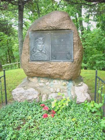
Pioneer Daniel Boone’s grave
The Katy Trail followed alongside the road for most of the way. The small towns beside it looked like film sets. At Marthasville we heard a tourist ask some cyclists about a café he had visited 5 years ago, opposite a cycle shop. A local person answered and said that both had now gone – a sad sign of the times. Adrian was able to get the cheapest petrol for ages here.
We continued through the pleasant agricultural countryside, crossing over the Missouri River to Hermann. It was close to this point that Lewis andClark had formerly organised the ‘Corps of Discovery’, and we saw a list of the persons assigned to each boat.
We crossed back over the river, but found that the Lewis and Clark markers were mostly positioned several miles along the Katy Trail, so not accessible to us. I had been hoping to hire bikes, but the only place we had seen for this was back in St Charles yesterday, and that wasn’t on.
We pulled in beside the trail at Mokane, and saw on the map a reference to a ‘Winston Churchill Memorial’ at Fulton, a few miles north. We thought that we ought to see it, so drove there. The pleasant, brick street town was larger than we’d expected, and not being able to find the monument, went to the tourist office (We’d mistakenly walked into the Courthouse first, but a nice gentleman directed us.)
We discovered that the ‘memorial’ was what we would call a museum, and was housed in Westminster College. Although there was only an hour before it closed at 4.30, we decide that we had to go in.
The museum was excellent. There were impressive displays on Winston Churchill’s life – his early days, school days, family life, and his long political career. We knew that we couldn’t do justice to it all, and were still looking at things when the nice young black man and Asian girl assistants were trying to lock up!
It seemed a strange place to have this tribute to Churchill, in a small town in the middle of Missouri. A year after World War 2, Churchill had been persuaded to come here and make a speech. This he actually did, accompanied by President Truman. The famous speech he made was about the Cold War, and the potential dangers of the eastern European powers - before anyone else had seemed to notice. It was all an absolutely amazing thing to have happened at the time, to this tiny town in Missouri.
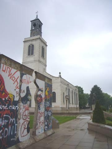
An addition to the museum was the church of St Mary, Aldermanbury, which had been designed by Sir Christopher Wren, and brought over from London, having been bombed in WW2, and rebuilt here.
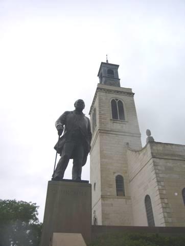
Statue of Sir Winston Churchill by St Mary’s church, Fulton
It was a superb, but rather rushed visit. When we got outside, we found that it had rained hard. We drove back to the road near the river, hoping to find somewhere to pull of for the night, but this proved difficult.
We had almost reached Jefferson City when we pulled into a rough parking area beside the Katy Trail, at 5.45.
Saturday 26th May Side by side on the Katy Trail 108 miles
We put on one of our bluegrass CDs, and found them singing ‘John Henry’ – so that’s where we had it!
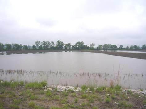
At 8.15 we left, and almost immediately came into northern Jefferson City. We took a long trail to find a Lewis and Clark marker by the boat ramp, with a view to the State capitol across the river. A little ‘Lewis and Clark garden had been made here, but sadly all had been washed away in the recent floods.
Flooded Lewis and Clark site, Jefferson City
We now remembered that we had heard about Missouri being declared a State of Emergency only a couple of weeks ago. Today we saw the evidence of vast areas which had been flooded, and which were now covered in thick mud. A marker by the Katy Trail told of previous floods, in particular 1993 and 1844.
We crossed on the bridge over to Jefferson City, and parked right by the huge State Capitol. We continued on to Jefferson’s Landing, and to other viewpoints over the river, particularly to Cedar Island, which had been mentioned in the L&C journals.
Early L&C marker - 1953
We left Jefferson City, and continued along the south side of the river. We saw a marker about Sugar Loaf Mountain, but it was behind a locked gate, with ‘no trespassing’ signs. As it was an official L&C marker, we climbed the gate to read it.
At Marion we read about York, Clark’s slave, who had swum ashore to collect ‘greens’ for the crew to eat.
Site where York, Clark’s slave, swam ashore to gather ‘greens’
Just after this, we could see that the water had flowed right over the road during the flooding.
We drove several miles down to the river at Lupus, population 29! The whole area here had been badly flooded. We sat on our own chairs by the river to have lunch – the picnic tables were rather mud embedded! There was a loud clap of thunder, but the storm missed us.
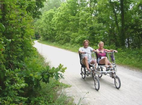
At Woodbridge we joined the motorway to cross the Missouri to Rocheport. We followed signs to a marker on the Katy Trail here, and I was delighted to see that there was a place to hire bikes. We settled on side by side reclining bikes, which were great fun. It was a particularly attractive section of the trail – steep cliffs on one side, and the muddy Missouri to the other. Prairie dogs scampered across the track, and tradescantia flowers lined the banks. Other cyclists were friendly as they passed.
Side by side
We returned after our hour’s cycle, and rewarded ourselves with an icecream. We were enjoying these, and watching the other groups of people happily gathered there, when spots of rain fell. We stood under the shelter by the information markers and all hell let loose! It rained cats and dogs for a while. We were so glad that we had got back before it started!
We drove on to Franklin, where we crossed back south again to Boonesville. We now headed for Arrow Rock State Park – a Lewis and Clark site, which also had a campground. As we had expected, it was very full – being the Saturday of Memorial Weekend. We desperately needed to fill our water tank, so stopped to do this. We drove on to the ‘tent’ area, which was almost as full, with just a couple of steeply sloping sites left. We thought that we’d have showers while we pondered what to do. The camp host had spied us, and when we said that the remaining pitches were too steep for us, he led us to an ‘overflow’ place. This was just on the grass by the picnic area, and right by the Lewis and Clark marker, with a view down to the river! It suited us fine! There was no fireplace of course, so we cooked on the barbie. Honeysuckle covered the trees around us.
After supper we transcribed another of Thomas Lawson’s letters, this one sent from Tahiti in 1852.
Sunday 27th May Through Kansas City 145 miles
After some rain in the night, and more in the morning, it remained a damp day.
We drove through the quaint little town of Arrow Rock, dating from 1841 when the Sante Fe Trail came through this way.
We headed west, missing out the large river meander to the north.
Our first stop was at Waverly, where the river was very fast flowing and the banks muddy. The section past here had been difficult for Lewis and Clark. The fast flowing river had broken their oars, and they had to stop and make more. The men were exhausted from rowing against the strong current.
We continued to Lexington, driving mistakenly over the wide river. At least this gave us a chance to see the vast extent of the recent floods.
A small part of the floods by the Missouri
We crossed back, and took a bumpy road down to the river, where we found the road on to the water’s edge was closed because of the flooding. We walked on across so that we could read the marker. Much debris had been deposited by the raging river, which looked amusing with the ‘no dumping’ sign beside it! The Lewis and Clark group had had difficulties with debris getting caught up around the boats in this area.
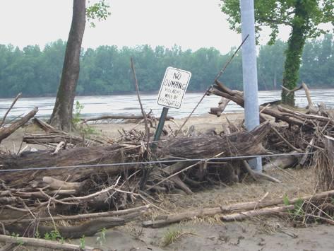
Is this what ‘no dumping‘ means?
We took a pleasant small road along to Napoleon, hoping that we wouldn’t find it too flooded to negotiate. As we drove along, we could see that two or three miles had previously been under water. The former riverside park here was equally muddy, but we negotiated it to read the sign, then stopped to have lunch. A group of children were playing along by the railway.
A bit further on we turned off to Fort Osage. Clark had built a fort here in 1808, after returning from the expedition. Now you can see re-enactments in the reconstructed fort.
We didn’t go in, and continued on our way to Kansas City.
There were one or two places which we wanted to see here, relating to Lewis and Clark. Never ones for cities, we charged on, and persevered after the many problems of roads being closed, taking wrong turns, and lack of signposting. Having found the first site, we found that it was a very long park beside the river, only accessible on foot. There were numerous markers along it. We set off with umbrellas, as the sky was really black, and it was raining lightly. We tried a few of the markers, which told of different aspects of Kansas City’s history, but then gave up.
Kansas City
We did locate a nice little park area on top of a hill, with an attractive statue of the group of explorers, and information on the various French traders who had been trading along the rivers long before Lewis and Clark.
Their maps and information had been crucial to the success of the expedition.
The Kansas River joins the Missouri at Kansas City. L&C had scaled this hill on their return journey in 1806, thinking that it would be a good site for a fort, because of its location above the confluence. The fort was never built, but a town eventually grew up here, which then became this vast city.
Kansas City straddles both Missouri and Kansas (a large part of it seems to be in Missouri), but we didn’t get into the Kansas side. After more horrendous ‘wrong road’ encounters, we extricated ourselves, and drove across the river to North Kansas City, and then thankfully out!
We soon drove through the pleasant university town of Parkville, where we tried to go down to the river but the road was closed for some sort of fete. Not long afterwards, at 5.15, we found a place to stop for the night, above the river and the railway!
Monday 28th May Memorial Monday along the Missouri 184 miles
The night was surprisingly quiet.
A few yards after we left, the road became unsurfaced. It was the story of today!
Leavenworth Lewis and Clark site
We soon crossed the Missouri on the bridge to Leavenworth, Kansas. Lewis had collected his last specimen of the trip from near here on 14th September 1806, on their return journey. It was a racoon grape leaf.
At Landing Park, sandbags were stacked up – we weren’t sure whether they had been used, or whether it was ‘just in case’.
We crossed back to the Missouri side of the river and went into Weston Bend State Park, where we looked down onto the muddy Missouri. We drove on through the delightful olde worlde main street of Weston, as lovely as any town we have seen, rather like an old English market town.
Lewis and Clark had camped here, but because of the shifting course of the river, the place where they camped was now at the end of the high street!
We drove on to Little Bean Marsh Conservation area, which then, as now, was a wetland area.
Next we turned off into Lewis and Clark State Park, after the tiny village of that name. A walkway had been built for the bicentenary, with markers about the lake here, now known as Lewis and Clark Lake, but which they had named Gosling Lake because of all the geese on it.
We crossed again into Kansas at Atchison and looked briefly into the newly restored rail depot, which doubled as a museum. We saw about aviator Amelia Earhart, who had been born in the town.
Driving on, we soon found ourselves on unsurfaced roads again. A lady stopped in her car and asked if we were lost. She was heading for Doniphan cemetery, where her family were buried. It seems to be a thing to do on Memorial weekend. Doniphan is more or less a ghost town, despite it being the name of the county.
We negotiated ourselves along the maze of unsurfaced roads back on to the main road, and headed for Troy. This had been on an offshoot of the Pony Express route, which started at St Josephs, in Missouri, where we now made our way to.
This large town looked sadly neglected and unloved, especially the bit we visited down by the river. The so-called Riverside Park (they are all called that) was situated under a double storey freeway, with a ‘spaghetti junction’ close by. One struggling flower bed was the only bit of brightness amongst the devastation.
The town had gained its importance after a ferry service enabled the Pony Express route to travel to the west. Later people crossed here on their way to California during the gold rush. Jesse James lived, and died here!
We left the town, and turned off to Nodaway Island, which had been much larger two hundred years ago than it is now, because of the changing course of the river. Once more, after we left here, the newly surfaced road became an unsurfaced track which ascended and descended like a big dipper!
We came to an area which showed more signs of recent flooding than any we have seen. We reached Big Lake State Park, which was closed because of flooding. The village of Big Lake was a sorry place, with people’s furniture and bedding stacked up outside their previously flooded homes.
The country side was as flat as flat – the straight road stood just above the mostly flooded fields, so that there was nowhere to pull off, let alone stop.
The sky had looked ominously stormy and black – and then the storm hit us!
The road ahead was invisible, so we reversed into the tiny hamlet we were in, and pulled onto the flooded verge. I would have been happy to have stopped there, but the rain stopped almost before it had started, and Adrian voted to keep going.
We took a long trail down to a boat ramp, with a Lewis and Clark marker about the wolves they had seen in the area, but overnight camping didn’t appear to be welcome. Then Adrian remembered that he had seen about a camping place at Brownville, Nebraska, 10 miles north, across the river. We headed for there, but just as we were crossing the Missouri, we could see that the park had been devastated by flooding. There was thick mud covering everything, and huge trees lay fallen. We pulled into a small parking bit near the entrance and decided to stay put.
In the ‘park’ is a Missouri dredge boat named Captain Meriwether Lewis, which serves as a museum, but looks unreachable at the moment.
After supper we finished transcribing a long letter from Thomas Lawson from the Marquesas, written in 1855.
Tuesday 29th May Our last but one day, and last but one state 102 miles
It was nice to receive an email from Lena, telling us about last weekend’s family camp.
We drove through the tiny town of Brownville, which had been an important and flourishing town in the mid 1800s, but then is importance declined. It is now a ‘historic district’. Not much was happening as we drove through it today.
As we drove north to Nebraska City, we passed a very large tortoise on the road. The scenery was slightly undulating and agricultural.
We stopped to buy a few things for our last couple of days, before driving around the small town. The visitors centre was closed, but we picked up a leaflet on a Lewis and Clark museum here, then went down to have coffee beside the flooded river.
We had given up on finding the museum, when we spied it just before we came to the bridge over the Missouri. It was an excellent museum, with a replica of Lewis and Clark’s boat.
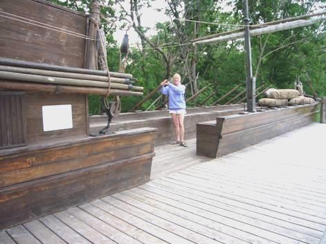
Rosie rowing the boat, Nebraska City
We now crossed into Iowa – a state we haven’t visited before. The only one of the fifty states we haven’t been to now is Minnesota.
We found the ‘Welcome Centre’, and got a leaflet on the Loess Hills , which we then proceeded to drive through. The scenery was pleasant, but not stunning, with several pig farms as well as crops. We noticed that the fields were often separated by ‘hedges’ of long grass, presumably to prevent the dustbowl effect.
We drove through Glenwood to Council Bluffs, on the opposite side of the Missouri from Omaha, where we leave from on Thursday. We made our way to Manawa Lake State Park. This lake was once an oxbow of the Missouri River. Lewis and Clark had stayed here for several days in July/August 1804, when the river took a different course from today.
We decided that we might as well stay in the campsite here. I would have liked a swim in the lake, but the swimming place was a cordoned off paying area, and judging by the water at the adjacent campsite, was probably very muddy.
Adrian burning the handle of his first trusty axe
The weather was unsettled, so Adrian put out the awning. I saw that the fire at the next pitch was still burning, so Adrian brought over the logs, and started our fire. It was lovely sitting out by the lake.
Wednesday 30th May Our last day, and everything’s closed! 63 miles
The windy and overcast morning heralded a most difficult day for our last one here. It started well – we still had an internet connection, and received an email from Emma, and were able to contact Simon about our arrival in Calgary tomorrow. We drove down to the river before leaving the park, imagining Lewis and Clark camping here in 1804.
We thought that we would spend today looking at a couple of historical sites, and then locating a campsite for our last night – it all sounded so simple!
We headed first for the Western Trails Center, but even getting there proved a problem, with road works and road closures. As we arrived at the ‘museum’, the rain started. The centre was trying to tell the story of the various trails which passed through here – the Mormon, Oregon, Overlander, Lewis & Clark and others. Putting all the information together in one place didn’t work for us. The rangers were busy getting ready for a visit from the State Governor later today. There was an amazingly well stocked book and gift shop. We braved the rain to look at a really nice mosaic type sculpture of the expedition outside.
Images of the expedition
We drove on through the horrendous road system to the RV Park we had hoped to stay at, which was by a casino. When we arrived, the name outside was different, and there was no sign of an RV park. We had opted for an RV Park rather than a campsite, as there are many things we need to do on the last night that require facilities.
There were a couple of campsites north of Omaha, so we thought that we would have to settle for one of these, but first we wanted to visit a monument to Lewis and Clark on top of the ‘bluffs’ of Council Bluffs. L&C had given it this name, as they had held a ‘council’ with Indians in this area, but actually several miles upstream.
The monument was much further than we realised. We drove on the motorway for a few miles, then turned off, following directions on the computer. Suddenly we came to a ‘low bridge’ sign, with directions for RVs to go another way. We started following the directions, but found that we were driving a long way south, and then were no more signs. We tried to find a way through, using our computer map, but the vital road was dug up – closed! No sign to tell you. It became a nightmare as we tried to find our way on the dreadful, badly surfaced roads, so we didn’t arrive until gone midday.
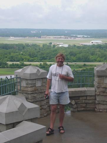
We looked out from the monument – we had a good view past the river to the airport, and to Omaha beyond.
Looking from Council Bluffs across to Omaha airport
We remarked how pleased we were that the rain had washed off some of the other day’s thick mud from the van.
Our delight turned to dismay as we turned off onto the road north which we wanted, to find that it was unsurfaced. Worse, the surface was white, like cement, and part way along, trucks were coming out and everywhere was thick with the gluey mess. Our van looked as though it had come through a cement storm.
We crossed the Missouri into Omaha, back in Nebraska, and located the campsite in Dodge Park, down beside the river. We had worried that it might be flooded, especially with a name like that, but it was OK. The bad thing was that there were no facilities – showers, laundrette etc. We need at least to wash the towels and duvet covers before going home, and also wanted to do our personal washing.
We ate our last lunch at a picnic table beside the river, then went in search of the other campsite, which was in a park by a lake, hoping that we might pass a laundrette on the way.
More horrors were in store, as the vital road which we needed to go along had been dug up, and we had to make a long diversion. The computer was playing up, which made things doubly difficult, and we had to negotiate another unsurfaced road.
I had joked at the previous campsite that I hoped this one wouldn’t be closed, and Adrian had remarked ‘No, it’s a City Park, it won’t close’.
We finally arrived to find the whole place in a mess. There were trucks about, and some men were gathering up the picnic tables. We called across to them and asked if the park was open – we had been following signs to it, after all. ‘No’, he said, ‘it’s closed until 2009’!!!
As Clark is quoted as saying ‘We were in a situation’.
But, just as he had said, ‘we proceeded on!
Time was getting on, and it was now 2.15. We had driven 50 miles going nowhere!
We tried to tell ourselves that if we didn’t find a laundrette, things would be OK, but we knew that we didn’t really think that. We headed back towards the first campsite, turning down a road where we hoped that we would find a laundrette and a carwash, as we hadn’t seen any sign of either.
We were actually driving through the area of the Mormon’s ‘winter camp’, when they were on their trail, now called Florence.
We were having no luck, so pulled into a garage, and Adrian asked in there. When he came out, a car had come and almost blocked us in!
Now we were in luck – the lady had directed us to a laundrette a mile or so away. To anyone who hasn’t been in this situation, it would sound funny to say how joyous we were!
It was a very large and well equipped laundrette. We loaded up three washing machines, and came out to the van to get ourselves a bit organised for tomorrow’s flight.
With everything washed and dried, we headed back along the road towards a car wash we had passed. There had been one near to the laundrette – but it was closed!! The only other time we have used a car wash was during our Alaska/NW Territories trip, when the van was equally mucky from the rough roads.
With our van clean, or at least cleaner, we made one last stop – at a liquor store for a bottle of ‘last night bubbly’. The Greek owners, who have lived here for 40 years, so enjoyed chatting to Adrian, that he couldn’t get away!
We reached Dodge Park some time after 5 o’clock, and Adrian set about cleaning out the tanks. We’d hoped to use the toilet facilities here, but they seemed to be locked up too!
We soon got ourselves sorted and packed, and after supper walked across under the full moon to the Missouri in the cool evening.
Thursday 31st May To Calgary 6 miles
We left at 8.30 as planned, on a beautiful morning. We had eaten breakfast outside under the lovely large white-flowered trees.
Today things went well, and we arrived 15 minutes later at the storage place. It was like nothing we have used before, being mostly filled with rusting old American cars, which hadn’t been moved for years. Next to it was a working, dusty quarry, so we wonder how our van will look on our return!
Adrian sorted out the paperwork with the large and rather simple lady. She had no idea how to go about ringing for a taxi, but with Adrian’s help, did this for us, and wished us well for our trip.
Our taxi driver to the airport was a very intelligent and likeable chap. He had moved here from Santa Cruz, California, 5 years ago with his wife and 2 young sons, after his mother had remarried and moved here. He found housing so much cheaper in Omaha, but just had to endure the cold winters. He said that the wind was relentless, and there were no hills to stop it.
All in all, he was happy living here, and thought that the schooling was better than in California. He used to be a ‘semi’ (truck) driver, and had visited all ‘Lower 48’ states except Vermont.
At Omaha Airport we were booked in by the most pleasant assistant we have had. She rebooked our seats, which for some reason hadn’t come up as window seats, and rearranged our two bags, as one was too heavy, and the airlines have become rather fussy about that.
All went well, and we even had a very cheery lady to serve us coffee and donuts.
The plane was a bit late in taking off, but it was no problem to us, as we had quite a long wait at Denver anyway, and our departure bay was only the next one along. We had been glad of our cheese rolls which I had made up. We had flown over the ‘circles and rectangles’ of agricultural country, and saw the snow topped mountains as we landed at Denver.
Our flight from Denver to Calgary was in a very small plane, with just one ‘wordy’ young hostess, who made each instruction into a story!
And then we arrived at Calgary, commenting that we hoped that we didn’t have to wait as long for our bags as when we arrived 2 months ago. Well, we didn’t – they didn’t arrive at all! For the 4th time in just over a year, we arrived without our luggage!
Laure had come to collect us from the airport, wondering if the small car would be big enough for all our stuff! She drove us through the heavy traffic back to their home, where Simon and Manolo were waiting to greet us. The weather was a bit different from when we left for Dallas in a blizzard at the beginning of April – this time we sat outside in the sunshine to enjoy a barbecue meal, while Manolo delighted us with his happy antics.
(Our luggage arrived at 9.00am next day).
Total Mileage 5963 miles
Manolo
Lynneville, Indiana to Calgary, Canada


