
Tuesday 18th September To Great Falls 102 miles
Again a cold night, but a lovely morning. We ate breakfast sitting on a large rock, with our lovely wild view down to the edge of the Gates of the Mountains. The statue of the homesteader by the display boards constantly made us think that somebody was there!
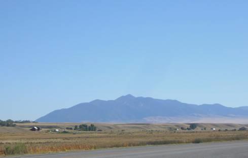
By 9.30 we were driving northwards, on the motorway for a few miles, and then turning off to a smaller road. This followed up a beautiful valley with deep red rocky cliffs, along with the railway and motorway, beside Little Prickly Pear Creek, until that joined the Missouri.
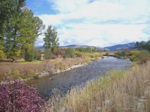
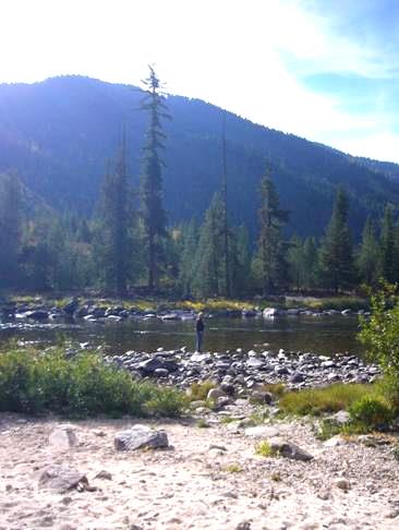
The scenery was quite delightful. We had an elongated stop beside the river, enjoying another piece of the birthday cake, and watching the fish jumping. A belted kingfisher, a great blue heron and a couple of mule deer joined us as we sat in the warm sunshine
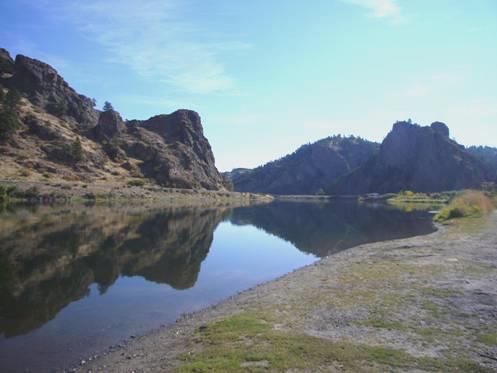
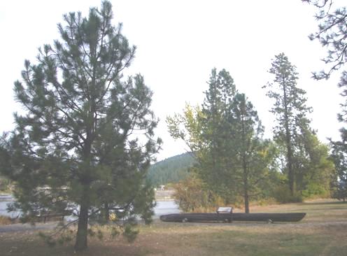
A lovely stop by the Missouri River
We now made our way to Great Falls, which we had driven through twice before – in 2002 we had stopped briefly at the Visitors Centre, and remember a statue of Lewis and Clark We hadn’t realised then the significance of this area to the expedition.
Lewis and Clark had been told by the Indians that there were falls on the river, but in fact there were five separate falls. What the corps had thought would take less than a day to pass, took them a whole month. They had had to portage all their gear, and the boats, around these 5 falls.
Sadly, none of the falls can be seen now as they were then, as dams have been built, which have completely changed the appearance of the river.
We still wanted to see what we could, but unfortunately our first experience in Great Falls was not a happy one. Adrian had indicated to turn left in plenty of time and when he went to do so, the driver behind became very irate, and became quite abusive.
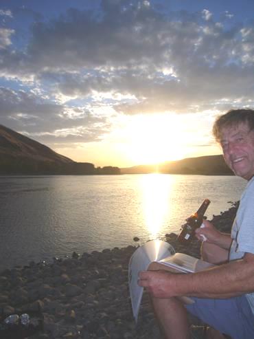
We soon got over that, as we found a lovely place down beside the river to eat our crab salad lunch. We sat on a rock beside the water, with only birds for company.
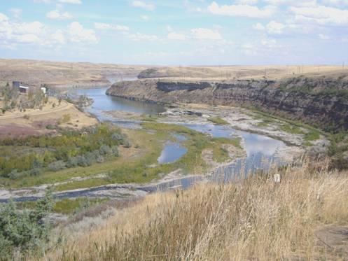
View from Rainbow dam viewpoint
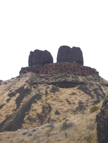
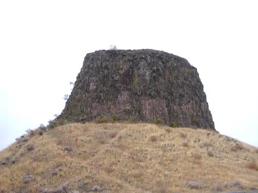
We had stopped to look at Black Eagle Falls, and then went on to Rainbow dam, which L&C had called Beautiful Falls. A man immediately collared Adrian, and told him that we ought to see Ryan Falls because they were really good, but were much more difficult to get to. These were the first of the five falls, and are still known as ‘Great Falls’.
We had to return now, so that we could see Giant Springs, again mentioned by L&C as being the biggest springs they had seen. They were in a State Park, but as we only wanted a quick look, we didn’t want to bother with the $5 fee. Just our luck – as we got to the springs, there was the chap again. He started telling me about the large trout by the spring – and he could talk! We just wanted to get away, which we eventually did, and went on to the adjacent Interpretive Centre.
That was the rest of the afternoon gone! It was an excellent museum, with so much information that we were still there at 5 o’clock. During that time we had watched two films – one on the L&C expedition by Ken Burns, who many people had told us about, and one which was more about the portaging around the Great Falls.
There was a life-size model of one of the canoes being ‘portaged’ up a steep cliff, which really brought home how difficult this would have been. The men had been so exhausted, that they just fell asleep each night when they stopped hauling.
We saw a lot of displays about the routes through this mountain area. On the return journey, the corps had divided into several groups, in order to explore more of the area, and the excellent maps and information enabled us to understand this better.
Armed with several leaflets about our onward trail, we now left, and set off in search of Ryan Falls. This entailed a drive of about twelve miles through fields of golden stubble, until we finally found the way down to the falls. As this is now a hydro electric dam, it didn’t have the attraction that it once might have. Ryan Island, immediately below the dam, was closed ‘for the season’, so we couldn’t get a really good view.
We had passed a parking area some way back, above the valley, so returned there for the night, surrounded by wild, dry grasslands.
After supper we worked on the website.
Wednesday 19th September Back towards the Rocky Mountains 80 miles
There was some rain in the night, and the day remained cold and grey. We spent more time working on the website before braving the weather and walking out above the river. I even wore my new gloves! The rough grass was littered with yucca plants, and prickly pear cactus lay hidden underneath. We could imagine how unpleasant it was for the corps members as they pushed on through the undergrowth in their moccasins. We walked until we had views down to the steeply sided river, but then returned for a welcome hot drink.
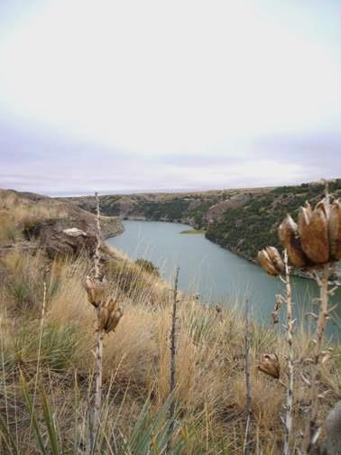
The Missouri River below Ryan Dam
It was 11.30 when we set off to drive back into Great Falls. We had a lot of trouble in getting a good internet connection, and as often happens, the website photos proved problematic, but finally we got it sorted.
We drove on to the so-called portage lookout by the Visitors Centre, where we had stopped in 2004, and I cooked enchiladas for lunch. We now thought it time to leave Great Falls, but on the way out, we spied a laundrette, so couldn’t pass that by, as we needed to do some washing. We managed to get an internet connection here, so that kept Adrian busy!
One more stop for petrol, and at 4.20 we were at last on our way – we had driven 18 miles!
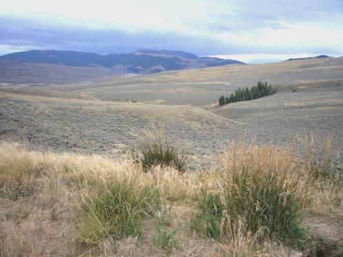
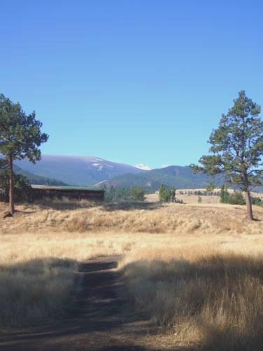
We headed back now towards the mountains, driving through wild, dry grassland, which became increasingly hilly. The occasional black cows made a nice contrast with the never ending parched grass.
Finding anywhere to stop for the night was as difficult as ever, but just after 5.30, we found a largish pull-off, where the grasslands met with the evergreens as we approached the Rocky Mountains.
Soon after we had pulled in, a large motorhome passed by – towing a helicopter!
Thursday 20th September Following the Blackfoot River to Missoula 148 miles
It was a fine morning, after a really cold night, but then we began climbing Rogers Pass, and just after the summit (also the Continental Divide) there was a board saying ‘Record cold spot – January 20th 1954 70ºF ‘below zero’!
No wonder we had a wintry shower last night!
It became cloudier now, as we followed the Blackfoot River, which is the route that Lewis took on his return, but on horseback. We stopped to have lunch beside the river.
We decided to drive into the town of Missoula, although we would be leaving it again to travel south-eastwards to rejoin Lewis and Clark’s westward trail.
It was a pleasant university town, with a mixture of some brick and some wooden houses, and a hippy sort of feel. We thought that we’d try to log in, and were initially pleased to see that there were several messages, but then we found that they conveyed the sad news that my dear college friend Terry Trezise had died. His funeral had been the same day as Doug’s. I spent some time replying to the emails before we had a short walk around. After that it was another shop in Safeway before we headed out on the motorway. Needing somewhere to stop for the night we tried a couple of options. The first was a primitive campsite between the motorway and the railway, with an airfield behind. It was part of a shanty café, advertising the ‘Testicle Festival’ There were even buses with ‘Testy Festy’ on the side! We didn’t stop! Neither did we at the state park nearby which had virtually no facilities.
We turned off again on the road which led to the ghost town of Garnet. We had passed the track to this place on the road into Missoula earlier. We followed the road for a way – there was a small campsite attached to a roadhouse here – but we drove on further, finding a pleasant stop near to the river called Clark Fork, which the Blackfoot River joins at Missoula.
It was a damp evening.
Friday 21st September Back to the Jefferson River 160 miles
It was very cold again towards morning, but a beautiful day followed, although the sun didn’t reach our spot until after we had left.
The river looked really lovely as we drove back the 4 miles to the motorway. It did appear that our road went on to the next junction, but we didn’t want to risk it.
We very soon passed the motorway rest area, which was cordoned off for construction work, with no signs at all to tell you!
We turned off to drive up beside pretty, meandering Flint Creek. We drove through the attractive former mining town of Phillipsburg before ascending a dramatic pass, which wasn’t shown on the map!
We stopped beside Geargetown Lake, which unfortunately had houses built around it. Although sunny, the wind was very cool as we sat at the water’s edge with our coffee.
We were in desperate need of water. We had tried one campsite, without luck, but then we did have some luck! I noticed a sign saying ‘Water’, and on investigating, we found a place where water was pouring from several pipes, presumably from a spring! How often does that happen? With great glee we filled our water tank, then drove on a bit to have showers before refilling the tank! The stream we were now following was called Warm Spring Creek. The water wasn’t warm, but was really welcome!
The nearby picnic site was rather shady, and the next one we passed was 2 miles down a dirt track. After that of course we couldn’t see anywhere to stop for lunch.
We found ourselves at the brick built town of Anaconda, which again was attractive, despite having road works which shut off much of the main road. Although all the side roads were barricaded off, the traffic lights were still working, and we had to stop!
At the far end of town we pulled into ‘Benny Goodman Park’, which had a large children’s play area, toilets and a barbecue, but no picnic tables at all!
We ate our lunch sitting on the low wooden fence surrounding the play area, enjoying the hot sunshine.
After that it was on to Butte, another former mining town with a large historic district, which gave some impression of its former glory. It looked good in the sunshine, with snow topped mountains beyond. We saw several nuns walking around, and on top of one of the surrounding hills was a huge white statue of Mary.
Butte
We left again on the motorway, driving over Homestake Pass (6375ft), and crossing the Continental Divide again. It was a long hill downwards, making it seem a bit like an Italian motorway.
We turned off at Whitehall to drive along the valley of the Jefferson River. We had now rejoined Lewis and Clark’s outgoing journey, a few miles on from Three Forks.
The scenery looked great with the clear blue sky, but the valley was wide, and finding somewhere to pull off was difficult. Around 4.30 we pulled in to an unused weigh station, beside a marker telling of Lewis and Clark’s travels in this area. They were finding it very hard going, as most of them had sore feet from pushing on through rough ground, and one of the men had almost been killed when a canoe had capsized and dragged over him.
View from the weigh station
Saturday 22nd September To the Bitterroot Mountains 109 miles
The night wasn’t as cold, and the traffic not as bad as we might have thought –BUT – a large truck had come in behind us and left his engine running! At 4.00am Adrian drove the Bam to the end of the parking area, and we finally got back to sleep.
The day was disappointingly cloudy, after the clear sky last night.
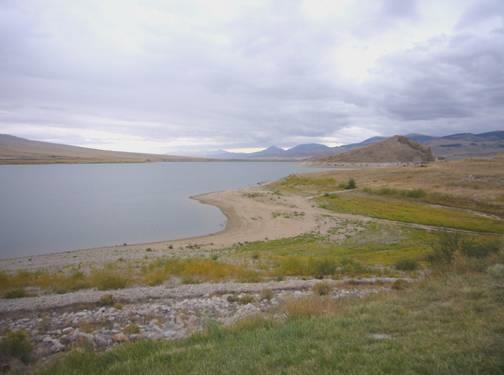
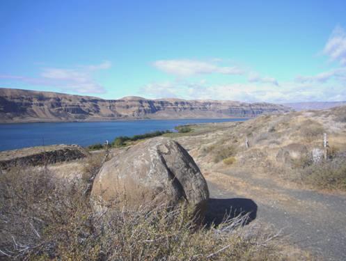
We soon came to Twin Bridges, where the Jefferson River is now called the Beaverhead River. There were two more forks here, which L&C had named Wisdom and Philanthropy, supposedly after two of Jefferson’s qualities. The rivers are now called Big Hole and Ruby. We diverted to drive to a crossing place over the Ruby River, then returned to Twin Bridges.
There was a rest area here, right beside the river. We were pleased to see that there was a ‘no camping’ sign, as it would have been a nicer place to stop last night. There was a rough boat launching place, and we were surprised to see how much it was used – particularly for boats which took people on fishing trips. Adrian had much fun watching the people get ready for their trips, while we had coffee.
We had looked around a nice outdoor L&C site opposite, which had an attractive statue of Sacagawea, Pomp, and Seaman the dog and a partly finished dug-out canoe, which gave a good impression of how they were made.
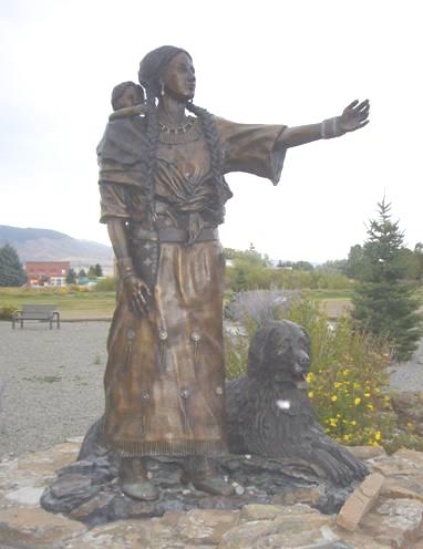
Statue of Sacagawea, Pomp and Seaman
We drove on to view Beaverhead Rock. This place is significant because apparently Sacagawea recognised it as a place from her childhood. The captains thought that they might soon meet with Shoshone Indians who would have horses which could be used to cross the difficult Bitterroot Mountains ahead. There is no access to Beaverhead Rock, and the view from the road doesn’t look at all like a beaver’s head! We stopped at a viewing area where there were hundreds of water birds in the wetlands below, including herons, swans and geese.
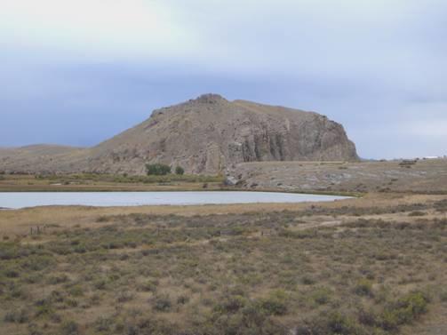
Beaverhead Rock
We drove on to Dillon, where, after some difficulty (and a man coming to offer help, as he had seen our Texas number plate) we found our way to Clark’s Lookout. This was on top of a limestone bluff, which offered good views in all directions. Clark was constantly mapping their route, and marking sites important to future travellers.
We drove on through the pleasant town of Dillon, past a large historic museum, and stopped by the visitors centre. This had nice exhibits of Indian homes, and of the nearby ghost town of Bannack (the former territorial capitol in 1864), made by local schoolchildren. Adrian spoke to another couple who came in. They were from Pennsylvania, but were en route to overwinter in Arizona. However, they were following the Lewis and Clark Trail. Last year they had followed the Oregon Trail. Different Americans!
We drove on to Camp Fortunate. L&C had named this ‘Fortunate Camp’, as it was where they found that they could get horses from the Indians. A remarkable ‘Hollywood’ type coincidence had happened here. Sacagawea, who had been kidnapped from her people when a child, met up with a childhood friend, who had been stolen with her, but had escaped. Then – the leader of the Shoshone Indians, who L&C had finally found after many days of searching, turned out to be Sacagawes’s own brother Cameahwait!
The unfortunate part of the story is that the site where they camped is now under a large reservoir called Clark Canyon Dam. Unfortunate, Camp Fortunate!
The site of Camp Fortunate
You can visit a ‘lookout point’, which we did. It was close to the road, but you had to drive quite a distance on a rough road to get there. Never mind, there were a lot of campsites near the reservoir where people could come and enjoy boating and fishing!
We now had to decide which route to follow. L&C had ascended the Lemhi Pass, which is a rough and difficult track, not open to RVs. We had discovered that there was another road, also unsurfaced for most of the way, going over the Bannock Pass, and apparently suitable for RVs. We had thought that we would have to take a more northerly route, and miss out this part.
We were both game to try the Bannock Pass, even though the weather was rather unsettled.
The scenery was quite superb as we climbed higher – really wild country, with just a scattering of cows – some black, some brown, some white – in the colourful valley bottom. We reached the top of the pass (7681ft) – the Continental Divide again, and the boundary with Idaho. The scenery on the descent was even more wild. However, the route had long been used by Indians, particularly the Nez Perce , and in the early 1900s there was even a railway built through here!
Bannock Pass Scenery
We were really pleased to see that the last part of the road had been newly surfaced, and just at the point where there was a sign saying ‘Leaving Salmon National Forest’ there was room to pull off, so we did.
Adrian spied a sign saying ‘rest area’, in the distance, so we drove down there just to have a look. It was like a small, primitive campsite, right by a little stream, and with picnic tables and fireplaces. However – it was packed full with an assortment of RVs, most of which had off-road vehicles with them, and one at least had a very noisy outside generator. No way – we drove back to our former isolated spot!
Sunday 23rd September Sacagawea country 112 miles
We’d looked down to the sun in the valley last night, and then to the large moon rising in a partly cloudy sky. Adrian said, with confidence, ‘we’ll have a peaceful night tonight – no traffic to disturb us’.
At 3.00am we were awoken by violent rain, and winds which rocked the Bam so much that I thought we’d be knocked over! After a worrying time we got back to sleep. In the morning we awoke to find it cloudy, but as still as still!
Again there was sun down in the valley, so at 9.15 we were on our way down to Leadore – population 90! This small place had had an interesting history, being on old Indian routes, fur trade routes, and the gold rush of the 1880s. In the 1850s, a group of Mormons had made their way to this valley, but the harsh climate, and trouble with the Indians, had forced them to retreat after a couple of years.
There was an odd rainbow in the sky – unfortunately this heralded some bad weather to come – it rained for the rest of the morning, and we could see snow on the mountains lining the valley. We were glad that we had come over the pass yesterday.
We now drove northwards, following the Nez Perce Trail, and what is called Sacagawea Historical Route, beside the Lemhi River. The river was lovely, but the surrounding area looked wet in this normally arid country.
We stopped at Tendoy (named after an Indian chief who died in 1907). There was just one shop/post office. The track to the Lemhi Pass joined here – it looked very mucky. We were at the 45th Parallel – halfway between the equator and the North Pole.
It was around here that Lewis had finally met Cameahwait, on 13th August 1805, and persuaded him to go back with him over the Lemhi Pass to Camp Fortunate, where of course he had met Sacagawea.
It was wet and cold as we stopped here to have coffee, we thought of all the difficulties the corps had had while trying to traverse these inhospitable mountains.
We back tracked a bit to find a marker signifying Sacagwea’s birthplace – we have found it difficult to find sites we are looking for, despite having numerous books and leaflets, because things are so often not signposted.
Soon afterwards we stopped at the Sacagawea Centre, where we watched a short film of the L&C journey through this area. There was only a small ‘museum’; most of what there was to see was outside, on a walking trail. We returned to the Bam to have a warming lunch, and luckily by then the rain had stopped, so our walk around was really pleasant. We even saw a couple of deer.
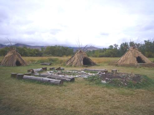
A Shoshone Indian camp
There were some different books about Lewis and Clark in the centre, and we bought two – as a belated birthday present for Adrian. One was on the different members of the expedition, and another was set out like a calendar, with what happened on each day of the expedition.
We were now at Salmon, where the Lemhi River joined the Salmon River. Clark had named them East and West Lewis River. In the wide valley bottom were cows, horses, goats, and occasionally llamas.
We stopped by Waggonhammer Springs and walked a short distance up into the hills. There really was a spring here, so we were able to refill our water tank once more.
The main Salmon River now flowed sharply westwards, being joined by the North Fork, formerly called Fish Creek. Clark had desperately wanted to follow the Salmon River, despite the Indians telling him that the route wasn’t possible. He still had to find out for himself, so set off with a small group to investigate. After about 20 miles he had to admit defeat. There was a forest road following beside the river, and we were really pleased to find that it was surfaced, so we set off to follow it. The scenery was certainly wild, with steep valley sides and a swiftly flowing river.
We followed along until the road became unsurfaced – about as far as Clark had travelled, and then began our return journey.
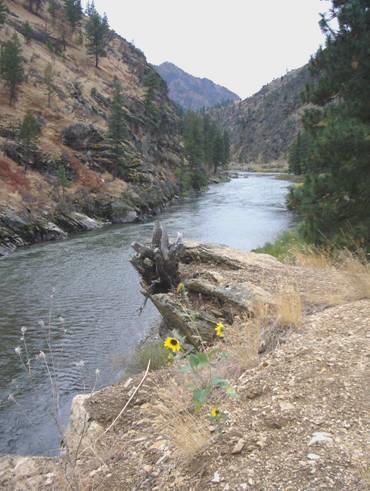
The Salmon River
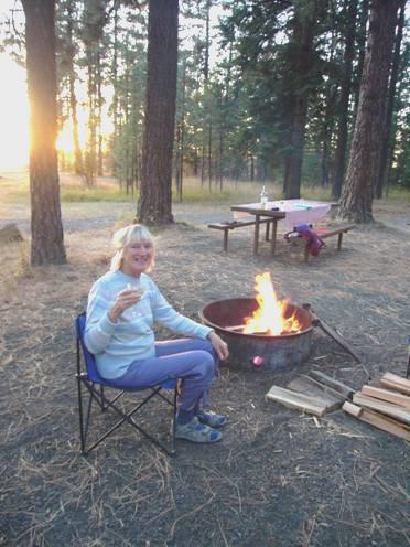
There were one or two camping areas by the river, but Adrian had his eye on a beautiful spot just by the river, so at about 5.30 we pulled in onto the rough track. Unfortunately the rain had returned, but undeterred, Adrian pulled out the awning so that he could light a campfire.
A wonderful evening followed, as we sat our in our isolation by the campfire, imagining what it might have been like for those explorers 200 years ago. The rain held off enough for us to sit out until nearly 9 o’clock, ending up by singing a selection of favourite campfire songs.
Monday 24th September The Snowy Bitterroots 137 miles
We’d only had the soothing sound of the river during the night! Again it was cold just before morning, but warm enough for us to have a fun game outside with the birthday balloons, until they popped!
By 8.45 we were driving the five miles back to the main road.
We drove north to the Lost Trail Pass. I had commented on the snow covered trees higher up the mountains, and now we were level with them, and driving though a Christmas card view 3 months early! It looked wonderful, but we had to go over another pass and back again, so our excitement was tempered with a little anxiety!
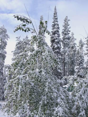
The Lost Trail Pass – almost lost in snow!
We were now back in Montana. We were diverting to go over Chief Joseph Pass, and then 16 miles down to Big Hole Battlefield site. This is where a tragic battle was fought between the Nez Perce Indians and the American army in 1877. The Nez Perce were being hounded into a small reservation – basically because white man wanted their lands, as they hoped to find gold there. The story is more complicated than that, and we watched a half hour film about the battle, so that we could try to understand it. The end result was that, after many deaths of both Indians and soldiers, some of the Nez Perce stayed on the reservation in Idaho, some escaped over the border to Canada, and some settled in a reservation in Oklahoma.
There were walks out around the battlefield, but with the cool temperature, and our desire to get back over the pass, meant that we didn’t attempt any.
Clark had used this route on his return journey. As we stopped at Trail Creek, where he had joined this route, there was a wintry shower so we made haste back up to the pass! By now some of the snow had melted. Chief Joseph Pass is very close to the Lost Trail Pass, but is actually on the Continental Divide and at 7264ft.
Although it was now really lunchtime, we wanted to get down out of the snowy area. At Big Hole, there was no sign of snow, and we’d wondered if we’d imagined all that snow at the top!
The terrain around the passes was very difficult – Lewis and Clark had had great difficulty in knowing which way to go, and Toby, their Indian guide at this point, actually went the wrong way. Experts on the L&C route are still not sure which way they actually went, but as the notice said, they all agreed that it was difficult!
We descended out of the snowy area, coming to Sula. From here a rough track goes off over the Gibbon Pass, which is the route which Clark had followed on his return journey.
Scenery at Sula
A bit further along, we stopped by the site where the corps had camped for a couple of days on their outward journey while they obtained more horses from the Salish (Flathead) Indians.
We had lunch by the East Fork of the Bitterroot River. Soon after this, the West Fork joined to make the wider Bitterroot River. We drove through Darby – a wild west looking town which seemed to exist for logs and hunting. After that the valley widened, and with the flat valley floor came habitation. We stopped at Hamilton, and shopped in Safeway. Afterwards we drove down the attractive Main Street – passing ‘Bower Buildings’. The street was reminiscent of Banff, with snow capped mountains at either end.
We had got an internet connection and heard of isolated tornadoes in England!!
We now took a smaller road northwards, driving through pleasant but inhabited country. We drove through Stevensville, which again had a pleasant main street lined with trees. We were despairing of finding anywhere to stop in this civilised area, when we came to a bridge over the Bitterroot River, and there beside it was an area where we could pull in. Beside it was a Riverside Park (no camping), but our spot was lovely. We watched birds – sandpipers and plovers – then I set off for a nice little walk along beside the river in the sunshine.
By now the sun was descending behind the mountains, but Adrian lit the barbecue. We ate T-bone steak for the second night running, and afterwards sat in the cab with our glass of wine, enjoying the sight of the snow-topped mountains lit up by the near-full moon.
Tuesday 25th September Lolo Pass 79 miles
Again it was cold – there was even a slight frost. The snow on the mountaintops was lit up by the sun as we left at 9 o’clock.
We drove northwards to Lolo. It was here that L&C had camped from 9th-11th September 1805 before setting off over the Lolo Pass. They camped here again from 30th June - 3rd July 1806 on their return journey. They called the camp ‘Travellers Rest’. The place has recently become a State Park, and is one of the most interesting sites of the expedition, as artefacts have been found here. These include lead, which has been identified as coming from Kentucky, where Lewis prepared for the trip. Also, in a latrine site, traces of mercury were found. These are said to be from ‘Dr Rush’s pills’, a strong purgative which was given to sick men, which several were after the arduous journey back over the mountains. The site of the camp was originally thought to be 1½ miles away, but it has now been proved to be here.
View from the latrine at Travellers Rest
We had a delightful walk around the area. It was sunny, but the air was cool, and there was still some frost on the ground. Two deer watched us cautiously, and we could see snow capped Mt Lolo up behind us. We tried to imagine being part of the group camping here 200 years ago. After our walk we sat on a bench in the sun to have coffee before heading off up the Lolo Pass. We were only a few miles south of Missoula, which we had visited a few days ago, after following Lewis’ return journey.
Our next stop was at Howards Creek, where we walked a half mile section of the Lolo Trail. It was a lovely autumnal walk, and we were able to get some idea of the steep and difficult terrain which L&C had had to lead their horses over.
Soon we came to Lolo Hot Springs. L&C had passed by here on their way in 1805, and on their return on 29th June 1806 they had camped here. They had used the hot springs, and Lewis commented that the Indians with them went continually from the hot pools to the cool stream.
The original pools at Lolo Hot Springs
We could see the old pools, surrounded by enormous rocks, but now there is a privately owned ‘Hot Springs’, which we were keen to try. First we ate our lunch at a picnic table opposite, where the wind was strong and cool. We then spent a pleasant time in the pools. The whole affair was rather antiquated, but at least it didn’t come with any razzmatazz. There was a very warm indoor pool, and a pleasant, cooler outdoor pool. I enjoyed both – it was a long time since I’d had a swim, and the setting here was magnificent!
Feeling well refreshed, we continued on up the pass. Lolo pass is the border between Montana and Idaho, so we should finally have left Montana! We should also have changed time zones, but as this would mean it being darker in the evenings, we are continuing with our old time for the moment.
The visitors centre at the summit is housed in a delightful log cabin. There was a log fire burning, and free tea/coffee. We perused the information on L&C’s onward journey, and actually bought the video of their expedition by Ken Burns, which we have heard so much about.
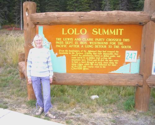
Lolo Summit
We drove out behind the cabin to Packer Meadows, which L&C had crossed, and which is a blaze of blue in June with camas flowers. Near here we walked to Glade campsite, where L&C had camped on 13th September 1805, and had passed on their return journey before stopping at the hot pools.
As we left to descend the pass, a sign read ‘Winding road 77 miles’!
We stopped to walk 2 short trails through giant cedars, dedicated to de Voto, a historian and naturalist who had stayed here while editing L&C’s journals in the 1950s.
We soon began following the attractive Lochsa River, and at 5.15 found a place to stop opposite, where Doe Creek joins it.
We walked out at bedtime to see the full moon shining down on the Lochsa River.
Wednesday 26th September To the Clearwater River 118 miles
Again it was cold, but when we left at 9.30 the sun was just appearing over the mountains.
We continued descending along this forested, deeply side gorge beside the scenic Lochsa River. We stopped at a lovely spot where Fish Creek joins the river and had coffee sitting on a log on a sandy beach by the river.
The Lochsa River at Fish Creek
Lewis and Clark had taken a route along the ridges to the north of here. A rough track now follows the old Indian trail, but sadly not suitable for our vehicle! L&C had found this part of the journey horrendous – on the way, they had little or no food, and on the return journey they had had to retreat because the deep snow (in June) had made it impossible to find the path, and there was no food for the horses to find.
We reached the few houses of Lowell at midday – having driven 50 miles today and passed just one building – a maintenance shed!
The Selway River now joined the Lochsa, and the name changed to the Middle fork of the Clearwater River. We had a lovely lunch stop at Wild Goose campground, sitting at a picnic table by the river in the warm sunshine.
Soon after this the valley widened and flattened. We came to Kooksia, where the South Fork joined. This small town is in the Nez Perce Reservation. After driving along the main street, we stopped to read some information boards. A pretty, elderly lady came over to talk to us. She certainly was an inspiration – she was in a ‘Minnie Winnie’ – a motorhome a bit bigger than ours - and was travelling alone. She was presumably a widow (she mentioned a grandson). She belonged to the Loners RV club, and spent about half the year travelling. She also had a pick-up camper, which she used to travel on rough roads like the one mentioned above. She had been born in California, but lived near here. She said how she loved to find out the history of places she visited. She didn’t travel much to the east of U.S. because she didn’t like driving in towns and traffic. We admired her ‘go’.
Driving on through the Nez Perce reservation, we came to the site of the ‘Heart of the Monster’. This small mound is important to Nez Perce people, as legend says that this is where they all come from. It was beautifully warm as we walked around the site and by the river.
A bit further on we came to Kamia. Near here was the site of Long Camp, where L&C stayed from May 14th - June 10th 1806, waiting for the snows to melt enough for them to cross the Bitterroot Mountains. While here they hunted and preserved meat, and traded with the Nez Perce. They also offered a lot of medical help to the Indians, treating many of them who had bad eyes, and supposedly healing a chief who had lost the use of his limbs. Their ‘cures’ sometimes sounded unusual, but seemed to work. One of their own men, Bratton, had been suffering with a horrendously bad back. They finally seemed to cure him by ‘sweating’ him – a bit like giving a sauna, and then a cold bath. They also treated Pomp, Sacagawea’s son, who had become ill at this time.
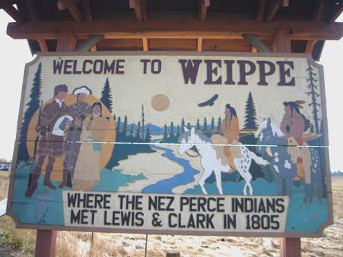
We followed beside the Clearwater River through ruggedly beautiful scenery for a few more miles until we came to Greer. Here we turned off to drive back up into the hills, following a gold mining route of late 1800s. We wanted to reach Weippe, about 18 miles along the road. This was another important L&C site. After their horrific journey through the Bitterroots in September 1805, they had finally come to this plateau, which was ‘beautiful and level’ For the first time they met up with the Nez Perce Indians, who were to be such a help to them. In June 1806, they again stopped here, preparing for their return crossing of the Rockies.
The road wound up with endless hairpin bends until we came to the dry prairies. At about 4.30, we reached a real treasure of a place. Called Fraser Park, it was a large arid area which served as a park for the surrounding scattered ‘community’ of Fraser. There were picnic tables and fire rings, and a sign which said that you could camp for 3 nights. We only wanted one!
We pulled into a lovely sunny spot, enjoying a cup of tea while we read of L&C’s adventures in this area – they had actually passed right through here. Weippe will have to wait for tomorrow!
Lewis and Clark were here!
Adrian lit a fire, and we sat out until 10 o’clock. As we watched the sun go down, we saw 2 deer silhouetted against the darkening sky as they walked along the horizon.
Later the full moon shone through the trees.
Thursday 27th September On through Nez Perce Lands 79 miles
The night wasn’t so cold, but the morning was still cool. We ate breakfast outside, with the sun peeping through the trees. By 9.45 we were driving the few miles on to Weippe, enjoying the autumn colours of the bushes beside the road.
We drove on past Weippe to the supposed site where the Corps first met the Nez Perce. In spring the meadows are apparently a mass of blue from the camas flowers – L&C noted that it looked like water.
Back in the unpretentious little town of Weippe, there was a place where we could dump – right opposite the school, and next to the village hall! After doing that, we enjoyed coffee sitting in a little park in the now warm sunshine.
We now made the 20 miles or so return to Greer, descending the dozens of hairpin bends to the Clearwater valley. We drove on, coming to the point where L&C had joined the river after their descent from the hills, which had followed an old Indian route. They had continued on horseback for 16 miles by the river until they reached a place where they stopped to build canoes to take them downstream towards the coast.
Just before that we came to the town of Orofino. We continued to ‘Canoe Camp’, and had lunch sitting on a seat by the river. This little park was a disappointment. There was one canoe here, in a rather bad state, and a couple of information boards, but no feeling of the importance of this site. The corps had built five canoes – 4 of them were 50 ft long, the other smaller. They had used huge ponderosa pine trees to make them, and the Nez Perce had given them advice. Many of the men had been ill here, after their near starvation in the mountains, and then eating unfamiliar food.
Canoe Camp
Our annoyance was added to by a man cutting the grass – when there was hardly any grass to cut, and all he did was to stir up great clouds of dust!
As we continued, we had nice views of the river at Lenore and Gibbs Eddy, but these belied the difficulty which the men had had in negotiating the many rapids. At Spalding we stopped by another Nez Perce site, where there was a small museum with some nice black and white photos of the Indians. L&C had stopped near here to repair one of their canoes which had been damaged in the rapids. They also had to dry out all their goods from the canoe, which had been soaked in the river.
From here it is only a few miles to Lewiston (Idaho) and Clarkston (Washington), where the Clearwater River joins the Snake River. The road on from here is a fast dual carriageway, but luckily we found a place to turn off almost immediately to a beautiful spot by the river where camping is allowed – called Upper Hog Island.
It was an idyllic situation. We sat on the ‘beach’ with a cup of tea, and I had a paddle. Later we had a beer, before Adrian lit the barbecue – it was too hot to light the fire! We ate our meal sitting by the river, then Adrian did light the fire and we sat out until 9.15. We had watched the sun go down, and then the full moon rise through the clouds. Top spot!
Beside the Clearwater River
Friday 28th September Onto Washington State, and the Snake River 153 miles
After a warm night, we watched the sun rise, but it belied the unpleasant day which followed! First cloud, then rain and wind and increasingly cool temperatures!
We enjoyed our bacon pancakes for breakfast, with our lovely view, before driving the few miles into Lewiston. Our first impression was passing the large, ugly, smelly chemical works – the stench permeated the whole town. In fact it was one of the most unattractive towns we have visited. And to think that it is named after Lewis! It is now a port – vessels travel up the Columbia and Snake Rivers to here. The whole town just seemed ugly. It was really arid – only the areas that were watered were green.
We made our way, with some difficulty, to Pioneer Park, where we had expected to see L&C Information boards, but there were none. All we saw was a fountain with a statue of Sacagawea – a copy of one made in 1910. I couldn’t wait to get out of the place!
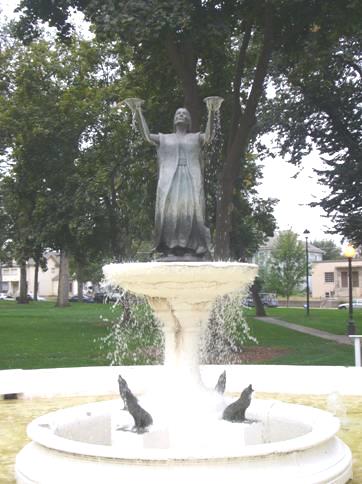
Sacagawea Fountain, Lewiston
We crossed the Snake River and came into Clarkston, Washington. We didn’t drive through much of the town – perhaps there wasn’t much of it – all we saw were several RV Parks – the sort of places we hate.
We drove along beside the Snake River between dry cliffs with columns of basalt protruding from them. We pulled in by Chief Timothy Park to have coffee.
We now made a long ascent to Alpowa Summit. Although only 2785 ft, it was a long drag up. We looked out at the flat, windswept plain. Lewis and Clark had returned this way in 1806 on horseback, to avoid fighting up the rapids of Snake Canyon. It was difficult for us to reach the river here, but we did turn off after Pomery – which had an attractive centre, once we had negotiated the long road works – to Central Ferry. Despite the name, there was a bridge over the Snake River here to a manicured State Park, which looked so incongruous, when everything else was insipid looking, dry, blond grass. There was a port here too, where hay was waiting to be loaded onto boats. We’d stopped in the arid hills for lunch, now we returned to one house Dodge before driving on to Dayton. This town had promise of being nice, but the unkind weather (8ºC, 46ºF) meant that we spent the time writing emails!
We followed a route now to the Snake River – called Lake Sacagawea here as it is dammed. Just before reaching it, we were amazed to come into a vast wine growing area, after all the endless dry hills. We’d found nowhere to pull off for the night, so arrived at so-called Charbonneau Park – a Corps of Engineers campground.
This is Friday night, but we were still surprised to find that the campsite was full – we have seen very little RV traffic today. There was an ‘overflow’ campground – a once grassy area right beside the marina. The remarkable thing was that the sun had now come out – we could have had a campfire if we’d been in a proper pitch. As it was, we poured ourselves an illicit drink (no alcohol in the park).
Saturday 29th September A fun day where the Snake River joins the Columbia 29 miles
The night was cooler than we’d imagined, but we had a day of blue sky, with a cool wind. We drove along to have breakfast above Ice Harbour Dam. There was a monument here to all the Indian people who had lived in this area – before the river had been dammed for white man’s exploits – as if by putting a monument there it made everything OK.
The Snake River from Ice Harbor Dam
We’d been amazed at the number of people out fishing so early, but were about to have this partially solved. We drove down to the bottom of the dam, where there was a Visitors Centre. Beside the dam was an enormous fish ladder. We had to ‘sign in’, and bring in no camera or mobile phone. After that we were on our own. There was a small museum about the dam, but most interesting were the large viewing windows where we could see the chinook salmon and steelhead trout making their way up river. It was really exciting to see ‘the real thing’. We imagine that all the fisher people were sitting waiting for the salmon to emerge before catching them (we never have understood fishing). There was a board telling how many of each type of fish had come upstream.
We were almost at the confluence of the Snake and Columbia Rivers. As we drove to the bridge over the Snake River, we passed orchards of apple trees. We were making for Sacagawea State Park, at the confluence, and as usual had difficulty in finding our way there. It was close to the town of Pasco, one of the ‘Tri cities’ situated at this confluence.
We had to drive through an ugly area to reach the park, but once there we had a really great day. This time we got it right – it was a ‘Heritage Day’ – a bit like a fete, but all based on days of old – Lewis & Clark and the fur trading time.
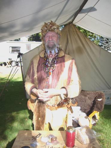
A fur trader
Almost all the ‘stalls’ were based in old canvas tents, and all the exhibitors were dressed as the part – there was even a Meriwether Lewis holding forth! Some of the stalls were selling trade related articles, others were just there to relive a bit of history. The nice thing was that they were all such interesting people, and most had plenty of time to chat. We learnt a lot from one chap about guns and flintlocks – not a thing that I’d expect to find interesting, but it was.
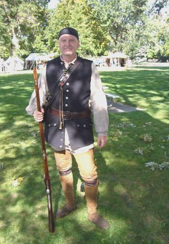
A ‘Frenchman’ with his flintlock
We saw lead shot being made (Adrian had wondered how they did that) and a gun being fired. At the far end of the field there was an ongoing performance of music. One of the musicians portrayed Gibson, one of the fiddlers on L&C’s expedition.
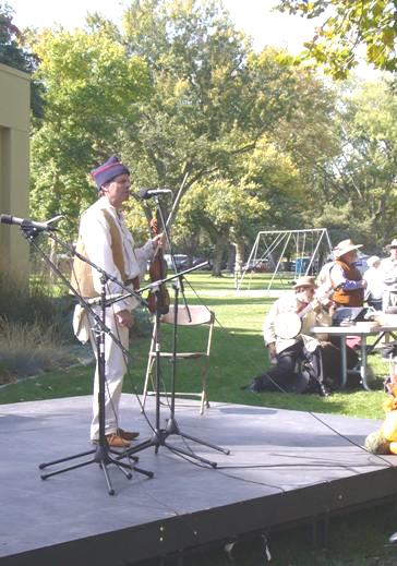
Lewis and Clark’s Fiddler ‘Gibson’
Near here was another interpretive centre, particularly relating to Sacagawea and of the Indians of the area between here and the coast.
There were even a few vintage cars for Adrian to admire (they didn’t really fit into the fur trading days!) We’d gone back to the Bam to have lunch, but we stopped to eat a funnel cake – surely the most unhealthy food out – just lots of fried batter with sugar – but I wanted to try one!
We looked at the stalls about the various Indian tribes before returning to the Bam. By now it was late afternoon. We’d had a great time – it made us think of weekends with our old caravan at shows in England.
We drove back to the bridge over the Snake River, and as there was a campsite here at Hood Park, decided that it was sensible to stop. We found ourselves a so-called riverfront pitch, but sheltered from the river by trees, which at least masked the unattractive works opposite. It was ‘no alcohol’ once more, so teacups again, but we enjoyed a pleasant evening sitting out by the campfire.
Sunday 30th September Beside the Columbia River 71 miles
It was a grey and damp day. We spent time printing the diary and working on the website, before sitting outside for coffee. Squirrels were entertaining us by scampering up and down the trees. We had seen four marmots stroll through the campsite.
We set off now following the Columbia River. We turned off in search of the sand dunes mentioned on a leaflet, at a point which the corps had passed on their homeward journey, but didn’t find them.
We stopped to have lunch beside the Walla Wallla River, just before it met the Columbia. It was in Madame Dorion Park. She was a lady of Indian birth, married to Pierre Dorion, a French trader who had lived amongst the Sioux Indians for many years. He had joined the L&C expedition for a while to act as interpreter to the Sioux. She had survived a difficult life in the west, hiding with her young children after her husband and the other men in her party had been killed, and finally escaping after a long, cold winter.
The Wallula Gap
We now passed through Wallula Gap, which was dramatic with its steep black cliffs covered in light yellow grass. The expedition had crossed theColumbia River here on their return, before continuing on horseback. They had been helped by Chief Yellipit, who they had met on the outward journey.
The Two Sisters
We stopped by ‘Two Sisters’ – two basalt rock formations which the Indians had a legend about. We soon came into Oregon, and the interesting rock formations continued. We stopped to walk around a feature called Hat Rock, which was mentioned by L&C. It did look just like a top hat.
Hat Rock
The first time we had followed a long and bumpy track, following the signs, it had led to a horse trail! Our actual walk was delightful. We enjoyed the natural, arid vegetation – grasses in pastel pink, orange and yellow. The adjacent campsite with its lush and manicured grass seemed obscene in this setting. Why can’t people just enjoy what is native to the area?
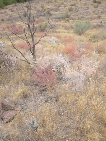
Pastel Vegetation
At Umatilla we crossed the Columbia River by McNary Dam, so were back in Washington State at a place called Plymouth. We drove down a small track and pulled into a spot beside the Columbia River, which was sadly littered with rubbish. Once more, the railway ran right by us! As there were level crossings nearby, we were well aware of it!
Monday 1st October More of the dammed Columbia River 148 miles
We moved along to have breakfast with a better view of the river. It was sunny for most of the day, but the wind was cool. As we drove westwards beside the Columbia River through the arid hills, there were occasional fields of vines, which looked quite incongruous.
Arid scenery as we approach the Columbia River Gorge
The scenery became more dramatic as we neared the Columbia River Gorge, with steep black basalt cliffs. We turned off to view ‘Stonehenge’ – a poor apology for the real thing, but with an interesting story. A man named Samuel Hill, a Quaker pacifist, who had unsuccessfully tried to establish a town here called Maryhill, had visited Stonehenge during the First World War. He returned to build this structure as a monument to the 17 men of Klickitat Countywho had died in the war. He had thought that Stonehenge was a place of sacrifice, so it was fitting to honour the sacrifice of the young soldiers by replicating it. It was certainly in a superb location, high above the river. Hill did also leave the legacy of an arts museum at Maryhill.
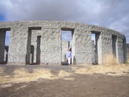
Stonehenge?
We drove down to Maryhill State Park to have lunch of salmon burgers – we had been reading of L&C’s encounter with the Indian’s salmon preparation.
There was a fruit growing area around here – obviously irrigated, and standing out from the dry grasslands – so after lunch we stopped by a roadside stall and stocked up with fresh produce.
We were opposite the town marked ‘Biggs’ on the map. As this was Adrian’s Mum’s maiden name, we thought that we had to cross the river (to Oregon) to drive through it. This was an experience! It was really just a crossroads. There were four petrol stations, two antiquated motels, parking for trucks, and a ‘Front Door chapel’ – a shed with a cross beside it!
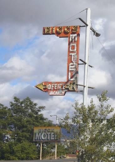
Biggs!
As we arrived, a flotilla of oversize trucks were passing through with their cargo of parts to make a wind turbine!
We drove along to photograph the ‘Biggs’ town name, and passed a sign which read ‘Seat belts must be worn. Fine $97’! That’s a nice even number!
At the crossroads there was a bright red bus which was advertising fish sales. The owner welcomed us in – we bought a 5lb bag of Alaskan shrimps (prawns) which certainly look good. Outside, another man was standing by the boot of his car, carving up the head of a large deer. Our fish man said that the hunters stop here, and he freezes the game for them. It was all a bit surreal!
We were now able to drive along a bit of the old road, but stopped at Celilo Park to look out at the dammed river. L&C had mentioned the tumultuous falls here, which of course are now under water. Shame! We picked a few large blackberries from beside the river. We’d wondered whether blackberries were indigenous to here, but did find that Lewis mentioned them in his journals.
The Columbia River Corridor!
We now had to drive a section of motorway, but turned off to drive through The Dalles – a pleasant town. The name derives from the French for ‘the narrows’, which is what the fur traders had called it. We stopped to briefly view the dam, but couldn’t help thinking how much more dramatic it would all look if it was still undammed.
Back on the old road, we drove right up to a viewpoint at Rowena Crest, on a very Italian seeming road. From here, we had splendid views down to theColumbia River Valley, just as the vegetation is changing from the dry grasslands of the east to the forested areas. It felt really windy here, and we could see an odd rainbow. Sadly that meant bad weather to come!
We stopped again to look down to Memaloose Island, where the Indians used to bury their dead.
We weren’t having any luck in finding anywhere to stay, and had to drive another section of motorway. We turned off at Hood River, and even tried Walmart (we haven’t stopped in one this trip at all), but overnighting wasn’t allowed. We were feeling very despondent now, especially as the roads were really busy, and it had come on to rain torrentially. Back on the motorway, we saw a sign to Viento State Park, and on reaching this pulled into a spot. The rain continued, so the fact that we had no wood for a fire didn’t matter. What did matter is that the trains run right by, and are even noisier than last night because there is a (damned) crossing for boaters to get to the river!
After supper we enjoyed watching some of the Ken Burns film about the Lewis and Clark Expedition.
Tuesday 2nd October Wonderful waterfalls along the Historic Columbia River Highway 43 miles
The trains were far worse than we could possibly have imagined! Apart from feeling that they were running right through the motorhome – and U.S.trains are long! – each one hooted about six times as it approached! We couldn’t imagine anyone staying here for more than one night – sandwiched between the motorway and the railway!
The morning was damp and grey. We continued westwards. We soon pulled off at Cascade Locks, where we actually did stop by the old locks for coffee before walking across to Thunder Island, where there was a gaggle of over 30 Canada geese. We noticed chicory growing amongst the grass.
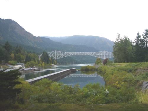
Bridge of the Gods from Cascade Locks
There was a bridge across the Columbia River at Cascade Locks, called ‘Bridge of the Gods’. The bridge had originally been built as a toll bridge in the 1920s, with a fee of 50 cents. The fee is still the same now! It was named after an Indian legend of a natural bridge, formed when there was a mighty landslide about 700 years ago.
Just a bit further on we stopped at Bonneville Dam, and followed a long trail across the dam to the visitors centre. There were lots of exhibits here, and the place was busy with school trips. Again we were able to see the salmon ‘running’, through the large viewing windows. Afterwards we drove onto another of the islands, Robins Island, to have lunch before stopping at the fish hatchery. We hadn’t been sure whether to bother coming here, but we really enjoyed seeing the large salmon leaping. We also viewed rainbow trout and enormous sturgeon (450 lbs) in the ponds both from the surface and through a viewing window.
Time now to get going – we had driven just 20 miles! We had to drive just a short way on the motorway before turning off again at Warrendale onto the scenic Historic Columbia River Highway. This road had been started in 1915, and the bits of it that remain are still amazingly attractive and nostalgic.
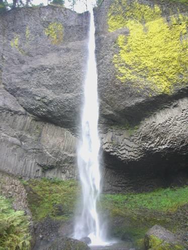
We first stopped to look across to prominent Beacon Rock, which L&C had noted. After that, it was a lovely drive past numerous waterfalls. We stopped to view five – each of them attractive and different from the others.
First was Horsetail Falls, which looked just like that – a horse’s tail. The next one was the ‘big one’ – Multnomah Falls, which is 620ft high. This is the popular one, and was quite busy with tourists. We walked up to a bridge which had been built between the upper and lower falls. We saw photographs of visitors coming in their cars in the 20’s.
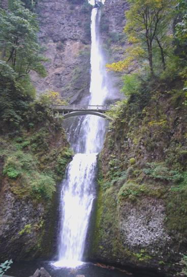
Multnomah Falls
Just half a mile further on we stopped at Wahkeena Falls, which were pretty, but a coach party pulled in, so we didn’t stay long!
We continued along the forested drive – making us think of the Hobby Drive at Clovelly. How different from yesterday’s treeless, arid plains! We walked a trail to Bridal Veils Falls (well, there had to be one of those!) which indeed were very lovely.
The last one was perhaps our favourite – Latourell Falls. After chatting to a friendly couple from Utah, we walked along a ‘North Devon-like’ stream to the foot of these high falls. The rock here was dark basalt, which formed wonderful shapes behind and beside the falls. Bright green algae growing on the rock added to the attraction. We made a longer detour back by the stream and under the old highway bridge.
Latourell Falls
The road now climbed up to a viewpoint called Crown Point Vista, where there was a little stone ‘Vista house’ built in 1916. There were splendid views from here to the Columbia River in both directions.
Now needing somewhere to stop for the night, we turned off to Larch Mountain road, and were pleased to find a suitable lay-by at 5.45.
Soon afterwards, the rain returned.
Wednesday 3rd October Contrasting weather and scenery near Mt Hood 126 miles
When it wasn’t raining torrentially in the night, rain was dripping from the trees! Added to that, a car came in behind us at 4.00 am, and stopped for several minutes, which quite unsettled me!
It was a grey morning as we set off again down the hill to the River Road. We stopped to look out from Chanticleer Point, a viewpoint provided by ‘Portland Womens Forum’! We looked out in the rain!
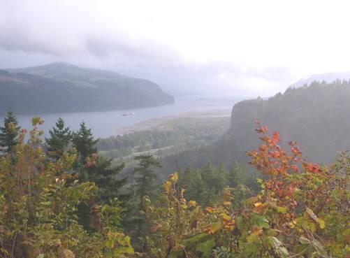
View to the Columbia River from Chanticleer Lookout
We wanted to drive the ‘scenic loop’ around Mt Hood, as we’d heard that the scenery was wonderful. The roads made a triangle, returning to the Columbia River at the town of Hood River. From here we intended driving on the Washington side of the river, back to Portland. We managed to find our way to the Scenic Byway, without driving right into Portland by driving through forested, hilly, ‘yuppy’ country, where people had large out-of-town properties.
We reached the byway at Sandy, and made our way to Jonsrud Viewpoint. From here there should have been great views over the Sandy River. We had coffee, waiting for the rain to stop, but when it didn’t, we ran outside anyway, but could see very little.
From here the weather just deteriorated, and became quite horrendous, so that driving was a nightmare. This so-called ‘scenic byway’ was a fast, busy road full of both cars and trucks. We could find nowhere to pull in until the rain subsided a bit. We had trouble in seeing the trees beside the road, let alone Mt Hood! On top of this, it became apparent that it was a real ‘touristy’ area, with all the trappings that we hate! As the rain turned to sleet, things became even more unpleasant. We passed a lone cyclist, and a pedestrian, so we could have been worse off! We thought of all the times Lewis & Clark had become soaked by rain and snow, with no way of keeping dry.
Then we came to an illuminated sign which read ‘Road closed 5 miles north of White River’. This was the way we intended going – the only road!
We stopped, while we decided what to do. If we returned, we would miss driving through the gorge on the Washington side, which we wanted to do. By perusing the map, we found that we could make a longer detour, arriving back at the Columbia River at The Dalles. We decided to do that. We never did see another sign about the road closure – even at the turn-off!
Just minutes after turning off to Blue Box Summit (4025ft), the sun shone and the sky became blue! It didn’t last, but at least it wasn’t that low, thick, wet cloud!
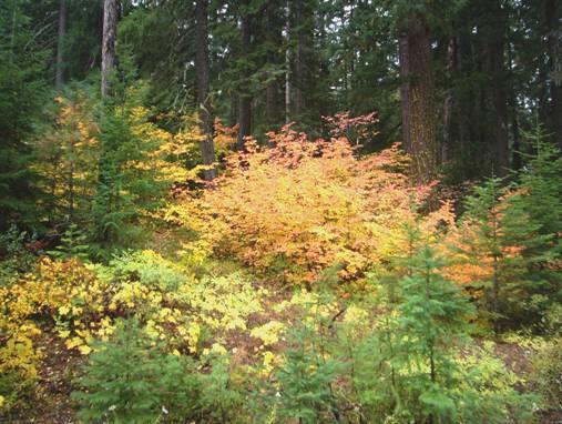
Fiery Maples at Bear Springs
We stopped to have lunch at Bear Springs picnic area. By the time we walked outside to see the lovely colours of the maple trees, looking like fire amongst the firs, it was sleeting again.
Then we continued on our way, and were instantly back into the dry grasslands!
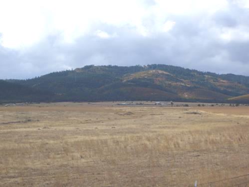
Dry grasslands meet the forests
We stopped to look at a flat rainbow against the hills. On the other side of us, work was going on at an electricity pylon. A helicopter was helping proceedings. It was all quite familiar to Adrian, but for me, seeing three men each riding out across the high wires sent shivers down my spine!
We ascended to Tygh Summit driving up a long incline through yellow coloured basalt.
We wanted to stop for the night before we reached the built up area of The Dalles, and luckily at 3.30 we found a rough area where we could pull off near Rice – with no trees in sight to drip on us tonight!
We never did see Mt Hood! (Next morning, just after we set off, we saw it as a perfect cone, white with snow, protruding above the landscape!)
For supper we tucked into some of the gigantic Alaskan prawns.
Helena, Montana to the Columbia River


