
Thursday 4th October Columbia Gorge from the Washington side 62 miles
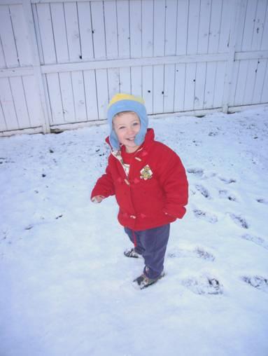
The night was cold, but at least it was quiet! Just after we left, we saw Mt Hood – a white pyramid of snow above the landscape!
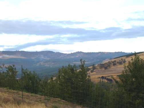
A glimpse of Mt. Hood
We drove down to The Dalles, which we had driven through a few days ago, and set up our website and sent the email.
We now crossed over the Columbia River, back to Washington State, at what appeared to be called Dallesport. It was about here that the corps had got enough horses to proceed up the Columbia on horseback, on their return journey.
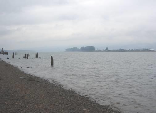
We stopped at a delightful little spot called Doug’s Beach – a small State Park which had a few picnic tables, but was otherwise undeveloped. We enjoyed views of the gorge in both directions, in the autumn sunshine.
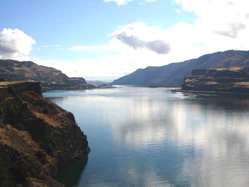
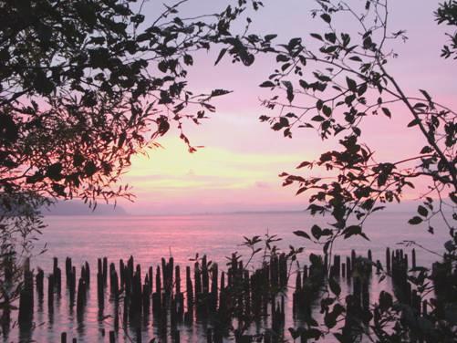
The Columbia River Gorge
The sun was still shining when we stopped to have lunch at a picnic table above the river, at a spot called Chamberlain Lake. We could see across to the Oregon side of the river, and tried to work out places that we remembered driving through. We ate the delicious giant peach which we had bought from the stall the other day.
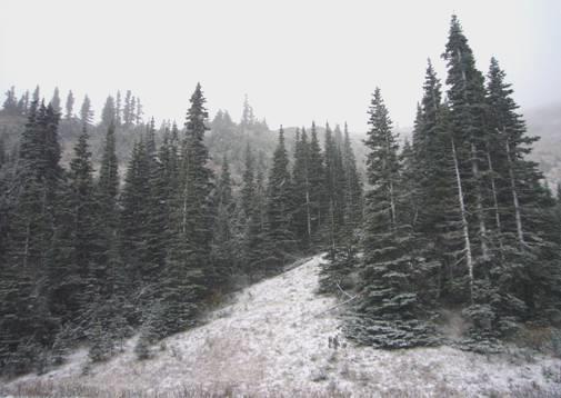
The scenery was gradually changing back to be more maritime again, and soon all the slopes were covered by pine trees.
At Stevenson there was the ‘Columbia Gorge Interpretive Centre’ located in a wonderful setting overlooking a lake at the edge of the river. The views from the vast windows were stunning, and were enhanced by a double rainbow. There was some information about Lewis and Clark in the museum, amongst a wealth of other things, but we did find it all a bit muddled. Perhaps the most amazing thing was a one-man collection of rosaries – the largest in the world it seems. There were literally thousands of them!
We were almost opposite Cascade Locks, and near the ‘Bridge of the Gods’. We didn’t want to go any further, as there were places we want to stop at tomorrow. We tried an old bit of road, which went around a small lake, but just as we pulled in to a spot which we thought suitable, the sheriff drove past and glared at us! We thought that he might be back, so drove down to the main road, where we pulled into a large gravel area. The railway was just across the road, and as we stopped, a train pulled by six engines went by! At least it didn’t hoot!
Friday 5th October On top of the beacon 107 miles
We passed the end of the ‘Bridge of the Gods’ soon after setting off and noticed the Pacific Crest Trail also crossing here.
We drove past Bonneville Dam, and pulled in by Cascades Fort. It was still cool as we walked a mile and a half trail through the forest. This was the former site of the fort, and also of a mid 1800s town, although there was very little sign of it now. Lewis and Clark had also camped near here.
A few miles on we came to Beacon Rock. We knew that there was a path to the top of this vertical 848ft ‘rock’, and fortified by a cup of tea/coffee, we decided to give it a go!
The path had been constructed by Henry Biddle in 1915. He was a descendant of Nicholas Biddle, who had originally transcribed the journals of Lewis and Clark in 1810. As we began the climb, we thought what a crazy idea it was to build a path up the rock. Some of it had to be on wooden palings fixed to the side of the rock. Luckily there was a guard rail – I was being very brave, as I hate heights. Anyway, to Adrian’s astonishment, we made it to the top!
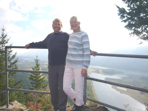
On top of Beacon Rock
We weren’t the only mad ones, as there were 2 other groups of people at the top – two local men, and a couple from Chicago with their daughter of about eight. They had come to Washington for a cousin’s wedding tomorrow. The little girl was excited, as she was to be bridesmaid. We spent a pleasant time chatting to all these people before making our long descent. We’d had good views of the river, particularly from the top.
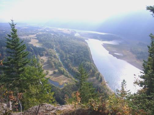
The Columbia River from the top of Beacon Rock
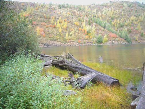
Clark had noted in 1805, that this is where the tide water reached. We certainly noticed that the river was muddy when we stopped to have lunch at Washougal. L&C had camped here for a few days on their return, while they tried to get more food for their onward journey.
Washougal was quite a large town, and did us well – after a bit of a search, we got petrol, propane, and most importantly, we had a service done on the van.
We had abruptly left the Columbia River Gorge, and were now in suburbia. We reached Vancouver (Washington State!), and here crossed the Columbia Riveron an enormously long bridge to Oregon.
Adrian needed to get some bits for the van, and had found that there was a spares place in Portland. However, Portland is vast, and the place we wanted was on the south western side. Consequently we had to drive right around Portland on the motorway. This is my idea of hell, but we did reach our destination. The stores place at Tualatin wasn’t very inspiring, but Adrian was able to purchase new taps (ours have been leaking for some time), and a new fridge roof vent cover, as ours has been disintegrating.
We stopped long enough to receive a few emails, then had the nightmare of leaving Portland on a Friday afternoon! We worked out a route which we thought would be least troublesome, and skirted up the western side – it was a bit like the M4 on a Friday night! We reached the road out – which was a big busy road.
Just before Scappoose, we turned down on a smaller road beside the river, but this was prime agricultural land, so we had little hope of finding anything. Fortunately, just before reaching the town, we found a space to park by a track which looked as though it was once a railway.
We enjoyed a meal of sushi followed by more of our giant prawns. At bedtime we looked out to a star-filled sky.
Saturday 6th October The Tidal Columbia River on a dismal day 89 miles
After the starry night, we were disappointed to wake to a few drops of rain, and a very grey day. It stayed that way all day, but did clear a bit in the afternoon. We had been hoping for a good day, as we had planned to visit Mount St Helens, which erupted dramatically on 18th May 1980, with far reaching consequences.
With the poor visibility, we just plodded on slowly, following the now tidal Columbia River. We attempted to phone all our ‘children’, getting hold of Tom in Scappoose, and both Emma and Simon in St. Helens, where we had coffee by the old landing. The main street was quite quaint, with signs saying ‘Discover St Helens’. We did that accidentally, as we drove around in circles trying to get out of the place!
We stopped again by the river at the small town called Columbia, at the only space which didn’t have a house built on it along ‘The Strand’. It was designated as a small park (for dog walkers to get down to the river!). The river was wide, and looked very grey on this miserable day.
The river from Columbia
We became aware of large boats plying the river. Lewis and Clark had stopped on Deer Island, near here, on their return journey. They mentioned the large amount of birds near here – ducks and geese – which Clark said kept him awake with their dreadful noise.
At Rainier we crossed over the wide Columbia River to Kelso – an industrialised area with vast piles of logs waiting at the docks. We drove north for a short way on the I5, turning off at Castle Rock. There was a place here where you could dump (and get water, but we had got some earlier). It was in a roughly surfaced part of ‘Riverside Park’, on the Cowlitz River. It would have been an ideal place to stop overnight, but unfortunately had ‘no camping’ signs.
We continued to Mount St Helens Silver Lake Visitors Centre (there are a number), but were surprised that you had to pay to go in, so we didn’t bother. Just opposite was a state park, which we looked into, but didn’t like the high camping fee, so continued on the road towards Mt. St Helens. We found this to be busier than we’d hoped, but turned off on a road to the ‘Retention Dam’, where, after having a quick look at the dam (which was only built to get the mud out of the river after the eruption), we decided to stop.
After supper we played games.
Sunday 7th October Mount St. Helens 114 miles
It was today or never to visit Mount St Helens, so we set off early to drive the thirty or so miles to the farthest point you can get to. The weather was fairly cloudy, and changed by the moment as we gradually ascended this one-time inhospitable area.
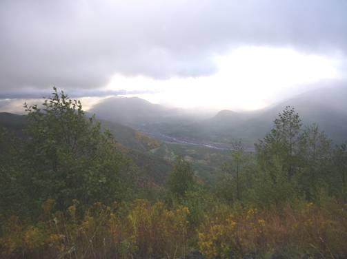
Elusive Mount St Helens
We pulled in at Elk Point and again at Loowit Lookout, which was just before the Johnson’s Ridge observatory – the end of the road. We braved the drizzle to walk out at Loowit Lookout, and had just returned to the van when the clouds cleared momentarily, and we had a glimpse of Mount St Helens. It was all we were going to get, but we had at least seen it!
We drove on up to the observatory, thinking that we would get a better view from there, but it didn’t open for another hour, and from the car park you couldn’t see anything. We returned to our lookout, but although we waited about ¾ hour, the clouds didn’t part again.
We decided to begin our return journey, so drove back down to Coldwater Lake. This lake had been formed when mud from the eruption on 18th May 1980 blocked it. We had a walk alongside the lake, surprised by how settled the area seemed – plants and flowers had established themselves. We saw lupins, clover, golden rod, penstemon and ox eye daisies.
Coldwater Lake – formed as a result of the 1980 eruption
We drove up above the lake to the posey visitors centre, which had a lot of modern exhibits, but didn’t work for us at all – Adrian said ‘I hate these modern places’.
Our next stop was much more successful. Called the Forest Learning Center, it was operated by Weyerhaeuser. This logging/timber firm, which was started in 1900, had owned thousands of acres of forest which had been destroyed by the eruption. The whole area had been replanted with trees, including the beautiful noble fir. The Federal lands, in contrast, had left their areas to regenerate naturally. This would probably take 100 years, whereas the replanted areas looked good now. We found much to interest us in here, including a short bit of film explaining the regeneration programme.
We ate lunch after our visit before continuing downhill. We stopped once more, at Hoffstadt Bluffs Visitors Center, but this didn’t have a great deal more to show us, although Adrian did enjoy looking at newspaper reports of the time of the eruption. Fifty seven people lost their lives, plus a great many animals which were living on the mountain.
We now drove back towards Castle Rock. It had been good to be on the mountain, and some of the vistas, especially with a bit of autumn colour amongst the evergreens, were splendid. We would like to have seen it in better weather, but it could have been a lot worse!
At the dear little town of Castle Rock we were able to get a bit of shopping, and then to dump, as before, and to get more water. If only we had been able to stay here, it would have got top marks!
As it was, we drove south to Longview, and then back to the Columbia River. We were back on the Lewis and Clark trail! By now the weather had turned really wet. At Stella we drove up beside attractive Mill Creek, but the little spot we found to stay at was under trees, so we returned to where Mill Creek joins the Columbia, and pulled into a parking area there as the heavy rain continued.
Later it stopped enough for us to walk out and look at the river. We ate more of our prawns, and looked out to see the stars before bed.
Monday 8th October ‘We are now at the end of our voyage’ 95 miles
The night was noisy with traffic but we slept well. Lots of vehicles used this area as a turn around, or meeting place.
Just as we were leaving, a woman came and knocked on the window and asked if she could use the phone. Adrian hesitated, as we rarely use it – it is expensive, and often isn’t in contact. He asked if it was really important and she said ‘yes’ so he let her try, which amazingly she did successfully. She spoke to someone, but she acted very strangely. We left without knowing what it was all about.
The cloud hung low as we drove up beside the Columbia River. At Cathlamet a road goes across to Puget Island, and from there a ferry to Oregon, but we were staying on the Washington side of the river, which is the side that Lewis and Clark camped on their way down to the Pacific.
In fact, this part of their expedition was extremely gruelling. They suffered every type of difficulty including dreadful weather, with incessant rain and high winds. They were constantly drenched, and were often in danger, as the river banks were so steep that they were squashed onto an unsafe area of rocks to spend the night.
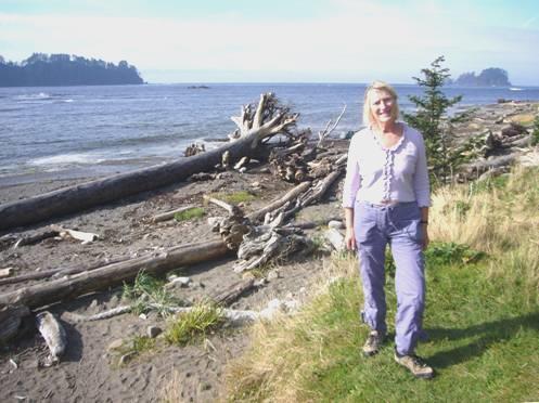
We, though, had an unexpected delight. We turned into Julia Hansen Butler wildlife reserve – supposedly a reserve for Columbia white tailed deer, although we didn’t see any deer (one did run across in front of us later). There was a well surfaced road which ran right by the shore through beautiful unspoilt vegetation. We stopped by a sandy beach – the sun had come out, so we sat on a large log to have coffee before a lovely walk along the isolated sands. We saw lots of cormorants, a white tailed kite, and many other birds.
We drove on again – the road went for several miles through the reserve, finally coming back to the main road at Skamokawa. This delightful little town was named after an Indian chief. We drove into the ‘Vista Park’, where there was a marker telling of Clark’s famous line ‘Oh the joy, ocean in view’. This was supposedly said a few miles further on, at a place unable to be accessed by road because of the sheer cliffs. In fact, we had to drive inland now, but did take a road down to the river again, to be as near as we could to the ‘joy’ spot. From here we could see the Columbia River Bridge at Astoria, and had to imagine the ocean! We stopped to have lunch before driving back beside tranquil Grays Bay to the main road. Here we rejoined the long stretch of roadworks, where very little was being done, but you had to wait for the pilot car all the same!
The road now returned towards the riverside, and we stopped by more markers which told of the misery of Lewis and Clark on this difficult section. ‘Oh how horrible is the day’ was quoted at a camp which was named ‘Dismal Nitch’. The corps were unable to leave it for 6 days, because of storms, to try for a better place either up or downstream, or to get more food. They and their belongings were drenched.
View from ‘Dismal Nitch’
We reached Astoria Bridge, which we had crossed in 2002. Just after here was the site of Station Camp, where the corps had stayed from 15th-24thNovember 1805, while they sorted a place to stay for the winter. This was ‘the end of the voyage’ – after a journey of over 4,000 miles, they had reached their destination – the Pacific Ocean.
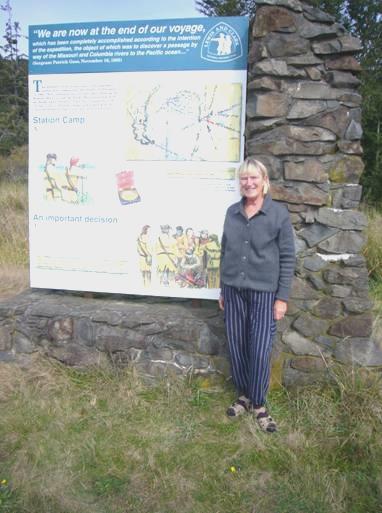
Station Camp – ‘We have reached the end of our voyage’
We have been involved with following this expedition for so long, that I felt real emotion. I also felt really sorry that all there was to mark this site was one information board, and a sign saying ‘no trespassing’!
It was while they were here that the corps all voted on where to build their winter quarters. The voters included York, Clark’s black servant, and Sacagawea, the Indian girl (Neither of these groups of people would be able to vote freely in the USA for another 150 years). The decision was to cross the Columbia River and find a place to the south, which is what they did.
We now continued to Cape Disappointment, where the Columbia River meets the Pacific. (It was named by British Captain John Mears in 1788). We had visited here in 2002, but had little memory of it – it was called ‘Fort Canby’ then! The whole area is a State Park, and we had thought of camping here, but found it far too expensive. The park was a disappointment to us, as it seemed to have lots of ‘No RV’ signs. When we asked, we were told that it would be alright now - out of season! We drove up to near the Visitors centre, but didn’t go in, as once more, this had a fee, and we have seen so many L&C exhibitions, mostly free. We looked down to Cape Disappointment Lighthouse, and enjoyed the views of the wild looking waves. As we walked back, a tiny snake slithered across our path. We also viewed North Head Lighthouse before leaving the park.
While staying at Station Camp, Clark had taken a group of men to explore the coast, so we wanted to visit the most northerly place he reached. There is now a bronze tree marking the spot where he supposedly carved his name and date - 16th Nov 1805.
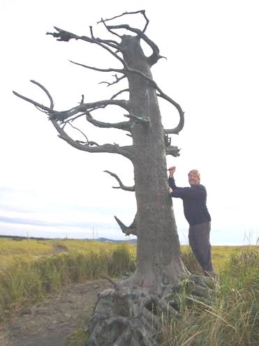
Clark carved his name when he reached the Pacific Ocean
We drove up through a very touristy little area, and did find the tree, adjacent to the wonderful long sandy beach called Long Beach. We had passed an RV park nearby which didn’t look too bad, and was at least grassed, so we now made our way there for the night.
After supper, of red snapper which Adrian cooked outside, we watched the rest of the Ken Burns Lewis and Clark film, so didn’t go to bed until late – but even then I couldn’t sleep, maybe my head was too full of the expedition still!
Tuesday 9th October A wet day at the Columbia Mouth 71 miles
A most unpleasant day! It started grey, but then turned to rain, which stayed all day. At least it gave us a feel of the sort of weather that Lewis and Clark had for their winter by the coast!
We spent the morning being ‘busy’ – Adrian fitted the new taps, and also fixed the fridge outlet cover on to the roof, so it was a morning well spent! We listened to the recording of our travels in this area in 2002, to refresh our memories.
We left at around midday, and made our way to the monument by the sea to Clark, and the 14 men who had walked here from their campsite at Station Camp. Like everything we viewed today, it had to be done in the rain!
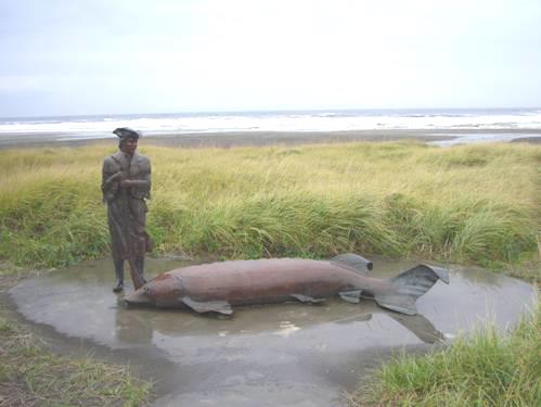
Clark saw a sturgeon like this at Long Beach
Further down the beach we looked at a whale skeleton, similar to one which Clark had described.
Just south of here, at Seaview, we had lunch of halibut and chips in a little ‘Caboose Diner’. We were the only customers, and just as the man gave us our meal, the phone rang, and he told us that a water main had burst, so he couldn’t serve any more customers (actually there weren’t any).
He said not to hurry our meal, but as soon as we had finished, he and the young girl waitress both left in their car, putting a ‘temporarily closed’ sign on the door. The meal was actually good. We puzzled the girl by asking for tea ‘one black and one white’. She asked what we meant! The place was decorated with all sorts of railway memorabilia from the line which once ran along the shore here.
We were now driving back to the bridge over the Columbia River to Astoria, but did pull in to Fort Columbia State Park, where there would have been great views of the estuary on a fine day.
We crossed on the 4 mile bridge to Astoria, and drove around this town (which we had visited in 2002). In nice weather, it would be an attractive place to saunter, although vast new marina apartments are spoiling it.
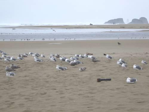
We now took the road south as far as Cannon Beach, a quaint little seaside resort, which we had found too busy in 2002, but today, in the rain, it was very quiet! The beach here is superb, with a number of rock stacks offshore. We walked along the sandy beach, braving the rain. Pelicans and seagulls were lined up, looking as though they weren’t enjoying the weather either!
At Cannon Beach they saw a large whale
Our reason for coming here is that this is where Clark and a group of the corps (including Sacagawea) had come from Fort Clatsop to view a huge whale which had been washed up on the shore. They wanted to get some of its blubber but by the time they got there the Indians had cut the whale up, so they had to buy some of the blubber from them.
Now needing somewhere to stop, we took a very winding road, called Lewis and Clark Road, and eventually found a large area to pull off in for the night.
Tomorrow we plan to visit the town called Seaside, as this is where L&C had made their salt camp while at Fort Clatsop, and then we want to revisit the fort itself.
Wednesday 10th October Goodbye to Lewis and Clark! 45 miles
The morning was still grey and wet, after more rain in the night, but better was to follow!
Three large electricity trucks pulled in just before we were about to leave, but they then left to start repairs along the road from us.
It wasn’t raining as we drove back to Seaside – the oldest coastal resort in Oregon. It was here that a party from Fort Clatsop had set up a place to make salt from seawater. The stone ‘oven’ and kettles have been set up on the spot where it apparently would have been. In 1900, a daughter of the Indian chief of L&C’s time had said that this is where the salt plant had been.
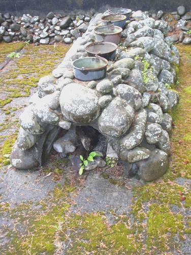
Lewis and Clark’s saltworks
We stopped to have a look, before walking across to the beach. The wonderful thing was that the weather just got better and better!
We drove to the northern end of Seaside, which is where I remembered stopping in 2002, and once more walked across the wide sands, with Tillamook Headstanding out to the south.
Now we drove on to Fort Clatsop – or back to it, as we had visited here in 2002 as well. After having lunch, we went into the Visitors centre. The film we saw in here was telling the story of L&C’s time at Fort Clatsop as if told by a Clatsop woman in 1841. It was sometimes a bit ‘twee’ and over sentimentalised, but told the story well.
Fort Clatsop had been rebuilt in the 1950s, using plans which Clark had drawn for the original building. The reconstructed fort had been burned down in 2005 (which must have been right in the middle of the bicentenary celebrations). A new one has recently been completed, but there are no artefacts inside. As we videoed on our previous visit, we will be able to compare.
The recently reconstructed Fort Clatsop
After looking at the fort, we wandered along to see the canoe landing spot (as we had done before).
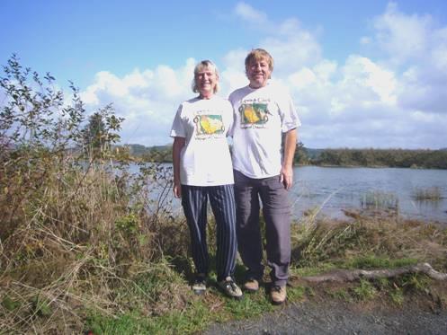
Us at the canoe landing spot – note the T-shirts!
As it was now such a fine day, we continued our walk along beside the Lewis and Clark River for 1½ miles to Netul Landing. It was so lovely to be enjoying the sunshine, and it gave us time to reflect on the completion of our mission – following Lewis and Clark’s journey right to the end. Of course they now had to make the return journey – which was fraught with many difficulties, whereas we just have a few days to ‘recuperate’.
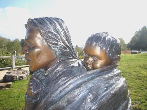
Sacagawea and Pomp – the most treasured members of the expedition
Time now to leave! We drove back to Astoria and over the long bridge. We were glad not to be here on Sunday, when there is a run across the bridge, so delays would be long!
It was wonderful to see everything in the sunshine. We had a place in mind to stop tonight, but when we came to a spot right beside the Columbia River (we had pulled in to say goodbye before turning north), we decided to stay there for the night.
Adrian would have liked to have had a fire on the beach, but it wasn’t really suitable, so he had to make do with a barbie instead.
We looked out at the stars at bedtime.
Thursday 11th October North to the Olympic Peninsula 141 miles
There was more traffic than we’d imagined, which woke us both very early. We could hear the waves too. We were surprised how long it took to get light, but we were finally treated to a wonderful red sky before the sun rose to shine down on the water. After that, it was a mostly overcast day, but not cold.
Just before sunrise on the Columbia River
We now really did say goodbye to the Columbia River. For the first few miles of our journey we were retracing our route of a few days ago, before we turned north towards the Olympic Peninsula.
We soon joined our route of 2002 to Raymond, but then took an inland road across the forested hills to Cosmopolis, Aberdeen and Hoquiam, which all merged into one another, and none had anything to offer! We searched everywhere for a good food store, but didn’t find one. We reluctantly went into a grotty ‘value grocery store’, where the only good thing was the pleasant cashier – even if she did ask why we had come all the way from Texas!
We left this run-down area and drove west along the northern side of Grays Harbour, having now left our 2002 route. We hadn’t had time then to visit much of the Olympic Peninsula, (which is west of Seattle) so now we wanted to make amends.
Although near the shore, there was nowhere to stop for lunch. We finally pulled into a fishing spot beside the Humptulips River. The name amused me, but we were to see more of it later.
We now headed for the west coast, pulling into Ocean City State Park. We walked right across the duney area and then across the wide sandy beach. I was wearing my little wellies – but they were too short to prevent getting filled with water when I paddled a bit too far! I squelched all the way back to the Bam!
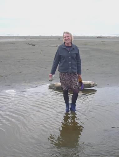
Who got her boots full of water?
Driving up this low-key coast, we came to a sign which read ‘Beach Access. No Water’. We had to go and investigate – we thought that perhaps the plug had been pulled on the sea! In fact there was a lovely wide sandy beach again, backed by steep, forested, red cliffs. This time I wore sandals to cross the sand – and I didn’t get my feet wet!
We drove north as far as Pacific Beach, where we looked in at a beach park by the name of Griffin Priday(!), where we once more explored the sandy beach.
Now we drove inland through an area which was all privately owned forest, with the odd house, so nowhere to pull off. We were heading towards Olympic National Park, but before reaching there, we did find somewhere to stop for the night. We had crossed the Humptulips River once more and were just past the village called Humptulips!.
Friday 12th October Giant trees and a fantastic beach spot for our 850th night in the Bam 67 miles
We’d passed a small park just before we turned off last night, and decided to return there for breakfast. We had found that it was on Adrian’s list of free places, but didn’t imagine that it still was free to camp, but it was! We could have pulled in last night. It was called Rayonier Promised Land, so had presumably been set up by the Rayonier timber company, whose land we drove past, having enjoyed our breakfast with a view of the pond.
We very soon came into Olympic National Forest, and turned off to drive alongside Quinault Lake. We were among majestic tall trees – this is rainforest – they get 145 inches of rain a year. We walked a wonderful trail through the enormous Douglas Firs, Sitka Spruce, Western Hemlock and Red Cedar. The day was beautiful, with the sun shining from a blue sky. It was absolute heaven!
After our walk, we drove into nearby Willaby Campsite, where we enjoyed our coffee at a picnic table beside the lake. It was still cool, as the sun couldn’t penetrate the enormous trees.
Just along the road, we went on a longer walk up beside Falls Creek and past the pretty waterfall. We were loving it so much, that we walked on through the forest to make a longer loop.
Now it was time for lunch, but we then discovered that the campsite we had gone into was the only one still open. We had driven some way past that, so ate our lunch sitting in the Bam and looking out to the lake, before walking to the ‘Worlds Largest Spruce Tree’. It was huge – but the world’s largest, or Americas?
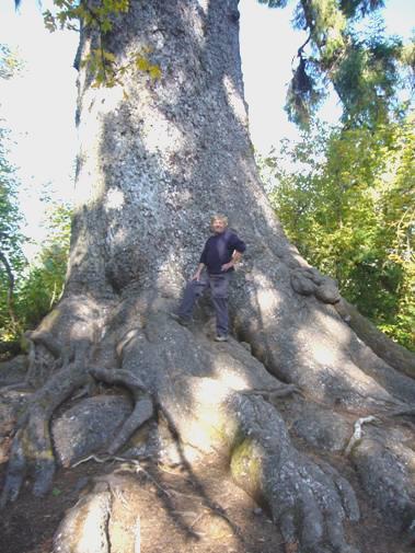
The ‘world’s largest spruce tree’?
Also in this area there was supposed to be the ‘worlds tallest’ of four other species of giant evergreens – we wonder!
We had intended driving a loop along past the lake, and down the other side, so set off to do this. We knew that some of it was unsurfaced, but when we reached it, it was soft and muddy – and not much fun to drive for 10 miles on, so we returned the way we had come.
We wanted to know whether a National Parks campsite on the coast was still open, so pulled in by an information place at Amanda Park. We found out that it was.
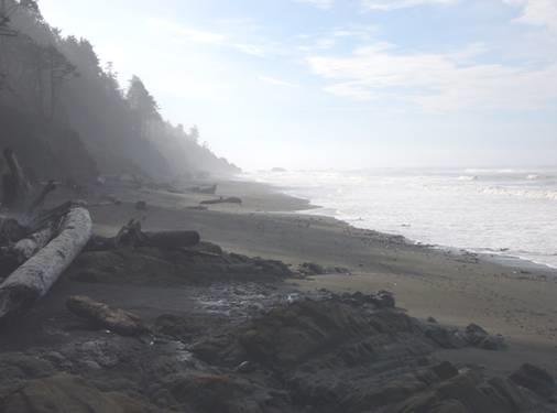
We drove on, through the Quinault Indian Reservation, and reached the superb coast, edged with forests of conifers. Kalaloch campsite had a great location right above the beach, but, being Friday, all the best spots had been taken. We did find one which looked out past huge gnarled trees to the sea, which we could hear thundering in. We set off immediately for a long walk along the beach – reminiscent of the west coast of Vancouver Island, which of course is immediately north of here. We couldn’t have hoped for more for our 850th night in the Bam – clear blue sky and sunshine, and a really beautiful beach.
Beautiful Kalaloch beach
When we returned, we found that we had put our reservation ticket into the wrong slot, so spent quite some time retrieving it (the thing was set up so that you couldn’t!)
Adrian lit the fire, and although the American sausages that we bought today weren’t up to much, the wine was great (we had bought it in the rubbish store yesterday, and it was Washington wine from the vineyards we had seen near Pasco). We ate our meal outside before walking across to watch the sun set beautifully over the sea.
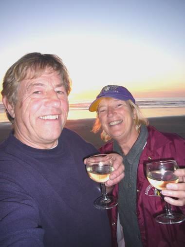
Cheers to 850 nights!
We looked up at the stars before coming in – they were brilliant!
Saturday 13th October Enjoying the fantastic west coast of Olympic Peninsula 55 miles
A really beautiful day! It was still cool as we ate our breakfast outside, but then we were really late leaving – having done all the ‘useful things’, Adrian discovered that we had a flat tyre, so we had to wait while he pumped it up.
We drove on up beside this wonderful coast, with primeval forest lining the road. We stopped at what is called ‘Beach 4’, and walked down a lovely forested chine to the beach, where logs were masquerading as seals!
‘Beach 4’
We walked back up, thinking that the steep chine made us think of some in the Isle of Man. We stopped next by the ‘big cedar’, the base of which was certainly huge. The tree was divided into lots of ‘bits’, and looked like something from a horror movie!
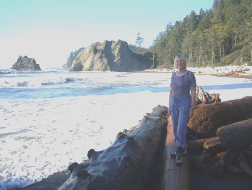
We soon came to Ruby Beach, which of course we had to visit. It was delightful – a creek reached the sea here, and there were dozens of huge logs on the beach, and stacks out to sea.
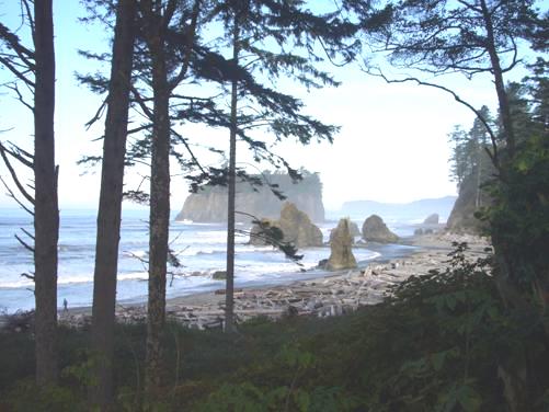
Ruby Beach
We had lunch afterwards at a picnic table overlooking the sea, with Destruction Island looking like Lundy. The sun was really warm – hot even!
The road now went inland to the only town of this remote western side of the Olympic Peninsula, called Forks. We had hoped to find a place here where we could have the tyre changed, but the only tyre fitters was closed on a Saturday afternoon.
There was one large store in the town, and it did us well for the few items that we needed, including a nice fresh loaf at last!
We were impatient to get back to the coast on such a wonderful day, so headed out to Rialto Beach. From here there was a 1½ mile walk along the pebbly/shingly beach to what is known as ‘Hole in the wall.’
When we looked at the beach, the tide looked really high, but we soon spoke to a couple who said that it was going out. So we set off for a most enjoyable trek along this beach, fighting sometimes with the tide, and scrambling often over the enormous logs which littered the shore.
The couple had told us of a stream which reached the beach, and which had caused them to turn back. When we got to Ellen Creek, we could see why – the stream was too wide and deep to cross without getting wet feet. One young couple were making a long diversion by walking over logs, but we decided that it was time to take off our boots and socks, and paddle!
We carried on along the beach, which had huge rock stacks out to sea. We made it right to the ‘hole in the wall’ – a large arch in one of these stacks.
Can you find the ‘hole in the wall’?
The walk back across constant shingle made our backs ache. Once more I forded the stream, but Adrian tried putting a log across as a bridge.
It had been a really super walk, in such ideal conditions.
We drove back a few miles to Mora campsite, beside Quillayute River, not expecting to find a river side pitch on a Saturday night in this small campsite set in the deep forest. Sometimes, though, you have to be lucky! A young couple beckoned us, and said that they had paid for the site, but had to leave, as they had just remembered that they had left their cat locked indoors! They hoped that we would have a good evening.
We thanked them, and settled into the lovely spot, watching as the sun descended over the river. Adrian lit the fire, before setting about changing the tyre.
The couple would have been really pleased to know that we enjoyed sitting by the campfire until late.
Sunday 14th October Ozette, in the extreme north west of Washington State 64 miles
It was a cool, but lovely morning. We could hear the distant roar of the ocean as we sat outside for breakfast.
After the success of yesterday’s beach walk, we thought that we’d try a longer one today. It didn’t work out though!
The walk started from about 15 miles up the coast from here, but as there was no connecting road, it was a very long detour (60 miles)! We drove back to just north of Forks, and then across to the north coast at Clallam Bay. From here you could see across to Vancouver Island. It was reminiscent of North Devon or Somerset, looking across to Wales, particularly with the headland at nearby Sekiu, which looked a bit like Minehead.
After that it was another 25 miles southwest to Ozette. We had understood this to be wilderness country, but it was tamed forest land, which was disappointing.
The walk we’d hoped to do made a triangle from Ozette – a 3 mile walk to the coast, 3 miles along the beach, then 3 miles back by a different route. The difficulty was the tide, but we hoped that we’d got enough time.
We set off on the first leg, through forest and heathland.
I spy Adrian!
The walk was mostly on a boardwalk, because of the swampy ground, however the boardwalk was often very rickety and unstable. The terrain wasn’t flat either – it was constantly up and down. We enjoyed seeing a variety of fungi, including some pale mauve toadstools. Also there was a profusion of what looked like, and what seem to be called, closed gentians.
We reached the coast, and climbed down steeply to it. We ate our sandwich lunch sitting on an enormous log, looking across to Ozette Island and several rock stacks covered in gulls and cormorants and three harlequin ducks.
We set off enthusiastically to start the next phase of the ‘walk’. Only it wasn’t a walk! The sandy/pebbly beach was covered by seaweed several inches deep, from which millions of flies flew up constantly. There were numerous large boulders, but worst of all, gigantic trees and logs lay across the beach at all angles. It was impossible to proceed without climbing over and under these vast objects, so progress was very slow! We kept going for quite a way, but were aware of the incoming tide, and the fact that there were a couple of headlands at least which had to be negotiated. We had only gone about ½ mile and it had taken more than ½ hour. This meant that this section would take 3 hrs and it was high tide in 2 hours. We pressed on, but then decided that discretion is the better part of valour, and very reluctantly started to make our way back, scrambling over, under and round each obstruction.
We carried on northwards, past our path, and here the beach was more like we had expected – sandy and pebbly, with just scatterings of seaweed, rocks and logs. At the edge of the forest was a primitive campsite area, presumably for those walking the western coastal trail.
At Cape Avala, before walking back
We now started on our long trek back – well it seemed it, because we’d hoped to have gone back by a different route!
It was 4 o’clock our time (we haven’t ever changed to Pacific time, as we don’t like the thought of the dark evenings) when we reached the Bam. There was a campsite adjacent, right beside Lake Ozette, so we pulled in there. It was really pleasant – right on the lake – and quiet. A couple who had reached the end of the walk at the same time as us also came into the campsite, but that was all, until a small camper came in later. We had seen very few people on the walk, but we did talk briefly to a couple who lived here now, but came from Colchester.
We had a splendid campfire, (and some more excellent Columbia Valley wine) and enjoyed this lovely quiet location.
Monday 15th October A fine autumn day in the north Olympic Peninsula 123 miles
The day started overcast, but we actually had a really pleasant day – everybody had told us that it was going to rain. We wound our way back through the forested hills to the north coast.
Here we turned left, to drive as far northwest as possible. Cape Flattery is supposedly the furthest northwest in the ‘contiguous U.S.’ There was a problem however – the top corner is part of the Makah Indian Reservation, and a roadside notice said that you had to purchase an annual pass to enter the reservation – it didn’t say how much that was. As the final few miles of road were unsurfaced (which we didn’t want, with no spare tyre), and then it was a walk, we decided not to proceed. We had been delighted by the road we had driven along – right beside the sea, with views again across to Vancouver Island near Port Renfrew. It made me think of Kaua’i Island in Hawaii, with the steeply forested rainforest up behind us, and lovely little sandy beaches.
Looking towards Vancouver Island from north Olympic Peninsula
We stopped on the way back and strolled along the beach. A flock of black terns entertained us. We had passed a bald eagle on the way, and when we returned, we saw two of them together, and later another one.
When we reached Clallam we’d hoped to have a little stroll along the beach from the parking area – it was supposed to be nice. Having finally found the right place, we set off, only to find that the bridge over the river was blocked off – no signs, and no other way to go! We thought that we’d have lunch here anyway, at one of the picnic tables, but were amused that the area was fenced, but there was no gap or gate – you had to climb over! We were surrounded by squabbling gulls as we ate.
We continued past Pysht, but didn’t have the views of the coast that we’d hoped for, so further along we turned inland to Lake Crescent. This was back into the National Park for a short way. The lake looked glorious – like an Italian lake, surrounded by steep mountains covered in green and gold trees. It was really still and peaceful.
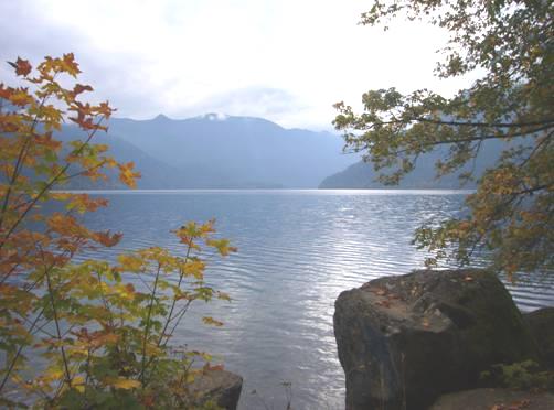
Lake Crescent
The road left the park now, but we turned into it again so that we could visit Madison Falls. This was just a short walk, and the falls were pretty. We had passed a good spot to stay for the night, right beside the Elwa River, which we had been following. We thought that we’d just drive on into the park as far as the road went – no roads go through this vast mountainous park, they just penetrate it for a few miles - after that it is the haven of the hardy hikers.
We were enjoying the pleasant autumn drive and the splendid mountain views. We started our return journey, but as the weather was so unexpectedly nice, we thought how good a campfire would be, but we hadn’t any wood. There was one campsite open, so we drove in to look around. It was really pleasant, and very quiet – just one small trailer tent. We scouted around, and managed to find enough firewood left in fireplaces to make a fire, so Adrian set to work.
We had just finished our meal – including more of our giant prawns from Biggs – when a few drops of rain fell. We put out the awning and sat under it, enjoying our unexpected campfire.
Tuesday 16th October Last view of the Olympic Mountains 144 miles
We were both awake very early, so it was still dark when we had breakfast. It was very autumnal, with colourful leaves scattered on the ground.
We drove back down to Port Angeles. From here we took another road into the Olympic Mountain National Park. We were hoping to locate the site of a walk which we did with the boys in 1989, when we were waiting for the next ferry to Vancouver Island. Just before the toll booth, we pulled into a parking area, and Adrian immediately said – ‘there it is, I remember that we walked straight out of the end of the car park for the walk.’ We are quite sure that this was the right place. The walk had been memorable, because it just climbed straight up, and we never got anywhere. When we looked at the map of trails (not there in 1989), we could see that the walk was over 6 miles long, and then joined with another 6 mile walk! Luckily we had turned back after walking for an hour or so! My diary of the time also stated that we didn’t go right into the park – that was because we hadn’t reached the booth, but it was still the Park. Problem solved, we think!
We drove on up to Hurricane Ridge. On the way, as we stopped to look out from a viewpoint, where you could see the coastline and Vancouver Island spread out below, we disturbed a sharp-tailed grouse which was foraging in the leaves.
Snowy Hurricane Ridge
As we continued uphill, it began to rain, and higher up this became snow, so that by the time we got to Hurricane Ridge (5,242 ft), with the fog as well, we couldn’t see anything of the supposedly superb scenery. As we descended again, the sun came out, so we could get an impression of these steep, forested mountains, with a glacier in the distance. We passed several black tailed deer.
Back in Port Angeles, we took the Dungeness Scenic Loop, which led to a wildlife reserve beside the sea, but we found nothing to see, and the whole area was surrounded by houses – not as remote as Dungeness in Kent, and not very scenic!
Now it was time to head for Port Orchard, where we planned to spend tonight before getting organised tomorrow to leave the Bam in Seattle on Thursday. The weather was a mixture of sunshine and showers, with rainbows, and mostly the drive was much more pleasant than we’d imagined, through this very attractive scenery, but close to habitation. The last bit was not nice, with much traffic, difficult roads, rain and sunshine all together.
We headed for a free camping place which Adrian had a note of. In 2002, we hadn’t been able to find it. This time, with the aid of the map on his computer, we could – but sadly the little park had now been blocked off to vehicles. And so it was, that we spent our last but one night in the nearby Walmart carpark, as we had done in 2002. With the sun shining on the surrounding red maples, against the black sky (which soon turned to blue), it looked really pretty.
It was pleasantly quiet. We enjoyed a candlelit supper, including the last of the Alaskan prawns.
Wednesday 17th October The joys of packing up 51 miles
A mostly rainy day, but that was better than the high winds forecast for tomorrow, as we had to cross the Tacoma Narrows Bridge. In fact the middle of the day was quite bright.
When Adrian stopped to get some petrol, he found that another tyre was flat. He pumped it up, and hoped that it would be OK as far as Kent, just south of Seattle, where we were heading. It was, and we survived the often heavy traffic as we made our way towards the place where we are going to store the Bam. First of all, we stopped at a repairers, as there were several things that Adrian was keen to get fixed on the Bam, including sorting the tyres and brakes. It was all a bit touch and go, as there was no time to get it done before we leave, so we had to hope that we could leave the Bam there tomorrow, with instructions for the man to take it round to ‘Sharon’s Storage’ when it was fixed. Luckily the man appeared competent, and Adrian was happy with the situation – except of course we will not know if everything is alright for about seven months.
We located Sharon’s, to let her know of the plan. Adrian said her house looked in a complete muddle, like Mrs Pengelly’s next door, and he didn’t really ever expect to see the spare key to the van again! Then after calling back at the tyre place to confirm things we made our way to Joy of Joys! The KOA RV Park a few miles away. This was the only campsite anywhere near, which was the only reason that we patronised it! As I detest these RV Parks, I have to just accept that it is a necessity of our last night, so that we can leave everything sorted in the van. We knew that it would be expensive – but ludicrously it cost more than the hotel we are staying in tomorrow night in Seattle (so that we are ready for our early start on Friday).
Campsites never look good in the rain, but this one looked particularly grim, with large puddles of water everywhere – they must have had more rain than we had. We pulled into our spot, and actually just sat there for a few minutes, incredulous that anyone would stay at a place like this for choice! (Plenty do)
We were given a little ‘pack’ of information. One piece of paper asked you ‘not to wash your vehicle in the park – use one of the nearby car washes – the nearest one which fits RVs is 20 miles away’!!!
As our van was very grubby, we had intended cleaning it before we left it. I at least surreptitiously cleaned some of the dirt off the back.
We spent the rest of the day ‘organising’. In the laundry room I got chatting to a lady from far north Canada who had run a bakery, and her husband had a dairy farm. They had recently sold up, bought a large fifth wheeler, and had just set off travelling. They had never been anywhere before, because of the limitations of the farm. She was looking forward to seeing the ocean, which she’d never seen!
After a splendid last supper in the Bam, we watched interviews about Lewis and Clark on the video we had bought. We were amazed at how young Ken Burns, who had made the film, was. It was a real bonus to hear him, and writer & producer Dayton Duncan and historian Stephen Ambrose add their thoughts about Lewis and Clark.
Thursday 18th October Senseless in Seattle 5 miles
It was a very wet night and morning. Our packing up went smoothly.
By now the weather had cleared up, but the windy weather was moving in. We drove to the repairers, and while Adrian was chatting to the owner, the taxi arrived before we had expected it. At that point a lady parked beside us wanted to get into a conversation with us when she found that we were from England.
We passed a lot of autumn colour on our way to the hotel. Our taxi driver had a back problem, so wasn’t keen to lift any of the bags. He chatted in a foreign language on the phone most of the way to the Rodeway Inn, Seatac.
A very pleasant Indian lady from Bombay booked us in, even if she had a lot of trouble finding our booking and getting Adrian’s card to work.
Our room was a nice surprise. It was clean and nicely cared for. To think that it cost less than last night’s RV Park – and you even get breakfast!
We didn’t hang around though, because we wanted to see a bit of Seattle. A bus went from nearby, but we had quite a long wait for it. The journey took about ¾ hour, so we had time to ‘people watch’ the other passengers, who were a motley lot, and not amongst the world’s prettiest!
After driving through China Town, we alighted at what we thought must be near the centre. In fact we did really well, and very much enjoyed our short visit to Seattle. The bus had gone underground for the last little bit – it seems to be a former railway route.
Rosie in Pioneer Square
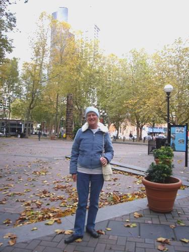
We soon reached Pioneer Square – the oldest part of Seattle, and made our way down to the Waterfront. We could see that Seattle has a vibrant atmosphere, and seems to be a happy city, with a lot going for it. There are plenty of attractive older buildings – sometimes it felt like being in London.
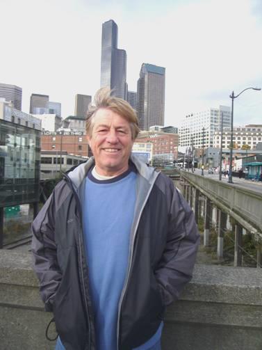
Enjoying Seattle
We found our way to Pike Place Market – a bit like our Covent Garden and Billingsgate. The fish stalls were just something else – beautifully displayed enormous halibut from Alaska. One stall had an entertainment going when one of the young chaps threw the huge fish up to another to pack up.
We’d found a nice little place to eat inside the market, with great views out over the water. We both enjoyed a soup (crab/clam chowder) and salad with an excellent local beer. After leaving, the woman came running after us, as she thought that we hadn’t paid (we had). It was just as Adrian was having a phone conversation with the man at the garage. He found that all the work had been done, but the owner thought that we needed a new distributor – a huge expense, so a bit of a concern.
We walked on, hoping to get a view of the Space Needle, which we did. We were aware of a huge number of emergency vehicles. Earlier a fire engine had come to the assistance of a young chap who was collapsed in a doorway. Now fire engines were blocking off the road. In this extreme wind (someone had told us that it was blowing tiles off roofs) a window on 32nd floor had been caught and was dangling on high. We weren’t able to see the result, as it was time to find our way back to the hotel. We walked through a smart but pleasant shopping area, and came to the bus station down in the tunnel by Pioneer Park. We were sorry to discover that there were no public toilets anywhere about, but found the right bus stop and waited for our bus. It was strange to be on a bus, but travelling through a (very clean and well lit) railway tunnel. We have since discovered that it was built as a bus tunnel in 1990 but has been closed for the last 2 years to allow it to be converted to a joint-use tunnel with a light transit railway to the airport which opens in 2009. It has only been reopened for a month.
The journey back seemed quicker. You had to pay on leaving the bus, but for ‘oldies’ it was only 25 cents! This time we didn’t go via the airport, as we had on the way, so it was lucky that we both realised that we had got to our stop, as it was now dark.
We returned to enjoy the facilities of our room – the luxury of a bath and an internet connection, and supping the wine we had brought with us.
We were just getting ready for bed at 11 o’clock when …….. Adrian suddenly let out an exclamation of horror – we had left the passports in the Bam! Neither of us had even given them a thought! Coming into a hotel for the night, rather than straight to a flight, things had been so different from normal, and Adrian was also very wrapped up with leaving the Bam at the garage, and not at the storage place.
So – what to do? We had to return to the Bam, of course – but could we get into it when we got there? I got dressed, and we went to book a taxi. They were busy, and we had to wait an agonisingly long time. We thought of putting it off until the morning, when the garage would be open, so we could be let in if necessary, but that would be cutting things a bit fine.
The taxi finally arrived, and we made our expensive return trip to the Bam, through driving rain. We both stayed amazingly calm. At the garage, we rejoiced to see that the Bam was outside, so we could get into it. Adrian dashed across and retrieved the passports and we set off back to the hotel – it was now gone midnight, our time. The taxi fare cost as much as the hotel, but at least now we could relax. It had given us a chance to converse with the driver – a Swahili speaking shaven haired young chap from Kenya, who had been here for 4 years. In Kenya he had been a teacher, but they didn’t recognise his qualification here. His observation of Americans was that they didn’t know where anywhere in the world was, whereas Europeans did.
Friday 19th October ‘If you don’t like it ………‘
How often we have thought of dear Uncle Ali’s words – ‘If you don’t like it, don’t travel’. Last night the passports, today the whisky!
We were up early, had breakfast, then went to book out. Difficulty number one was that the man charged us for the wrong room, so Adrian was still sorting it as we were boarding the shuttle to the airport.
Booking in was mayhem – a flight to San Francisco had been cancelled, and the clerks were trying to book alternative flights for a lot of irate people, so there was nobody to deal with us. After a frustrating time standing around – we’d had to ‘self book in’, which wasn’t straight forward for us with our long term visa – it made answering the computer questions difficult.
Once sorted, we went through security. They asked to look inside my bag – I had no idea why – until the man found the small bottle of whisky we’d brought with us! Again, I had completely overlooked this. We had been so concerned about having essentials with us if our main luggage doesn’t arrive at Winnipeg. This hadn’t included the whisky, but there was so much to think about. Perhaps we’re getting too old for all this flying lark! All the constantly changing restrictions are making travelling so tedious.
The man was really nice about the whisky – I think it broke his heart too. He suggested that I go back and have a couple of slurps (I felt like it after this!)
It had occurred to me while we were waiting to go through security that it was like a weird, unpleasant obstacle race – take off your coat, then shoes, computers out of their bags, liquids in small bottles in a separate clear bag, boarding pass ready, put each item into a tray, walk through an archway, retrieve all your things, put them all back together and get dressed, then continue to ‘go’.
Next time, at Calgary, where we changed flights, they checked both me and my bag again – I knew that I had nothing in it this time, but it made me very anxious!
Our flight to Calgary was pleasant enough, although the small plane was very bumpy through the clouds. We had just glimpses of the snowy Rockies. We were even given a drink and snack on this hour long flight from the friendly steward.
It was funny to be at Calgary, and not to be seeing Simon, Laure and Manolo.
Adrian had phoned the garage again, and found that everything had been done, and the man had taken the Bam to the storage place. He said that the distributor was in a very bad way, so perhaps it was a blessing in disguise that we had had it done now, and not waited until next time, when it might have broken down in the wilds of Canada.
We had another small plane for our flight on to Winnipeg. There was no window by our seat, but it was mostly cloudy anyway. We had a very jolly hostess, and a lovely family behind us with a 3 year old boy, and a gorgeous baby boy.
We had very modern individual screens, but we had plenty to read and there wasn’t enough time to watch a full film, as the flight was under 1½ hours.
We arrived at Winnipeg at 5.30 local time – we had moved on an hour. I was delighted that my bag was the third one on the carousel!
We asked two chatty elderly airport ‘helpers’ how to contact our hotel for the shuttle. One said that she had lived in Churchill for 3 years.
Our shuttle driver was another chap with a bad back. He liked living here, and thought that the hotel and restaurant were good. He was brought up in a tiny community in western Manitoba. Later, he was sitting along from me in the bar, but I didn’t realise that it was him. I started talking about him to Adrian – saying that if you came from the sticks, you would think that this was the high life etc. When he spoke to me, I asked where he used to live – a bit embarrassing!
The Howard Johnson hotel wasn’t as well appointed as last night’s, although more expensive. The room was dimly lit, as so many are. We wanted good light to re-sort our bags for our trip to Churchill.
We went down for our meal – only the bar was open – the restaurant closed at 7 o’clock, as the one waitress was finishing her shift. There was to be a ‘grand re-opening’ of the refurbished restaurant next week. Our meals were OK – surf and steak/ shrimps and ribs, but we were both aware afterwards that they were garlicky.
We chatted first to a young chap whose family had come here from Romania. After he had downed his whisky, he left, and I heard an English voice. We spent the rest of the evening talking to Ted, from Tiverton! He was 40, divorced, and had been here 4 months and was hoping to stay. His work had involved a lot of travelling, and he loved wild and open places. We wished him luck.
Some music had started up – a woman with a good voice, a chap called Jason, who sang well, then, as it was a sort of Karaoke, an elderly chap called Esau had a go. At least he had a go!
Saturday 20th October A long way to go to see polar bears!
Today was the day to fly to Churchill in search of polar bears.
We were up very early (4.20 – or 3.20 by yesterday’s time), although I’d hardly slept. We got an early shuttle to the airport, where, having met up with the rest of the group, we were driven by bus right around the houses to our charter plane on the other side of the airport.
I managed a bit of shut-eye on our cloudy flight to Churchill. We were served breakfast (of sorts), but didn’t need it, as we’d found one or two things to eat beforehand. It was wonderful to board a flight without any formalities – it made you realise that all the joy has normally been taken out of flying.
We landed at Churchill, which had just one large shed as an airport building. We were picked up by Jim, our driver/guide for the next two days. He was excellent, and fun. In the summer he worked as a rafting instructor. He drove us in an old school bus, painted white, to the place where the tundra buggies were waiting.
The landscape was reminiscent of Labrador – a flat, rockstrewn, desolate plain, but with just a few stunted trees (which was more like Alaska).
We transferred to the large white buggy to begin our tour of the tundra. Nobody is allowed to walk on the ground at all. The tour company, Tundra Buggy, and the one other tour operator here, each have a ‘lodge’ – a group of white vehicles, where guests can stay overnight. This is the domain of the animals, and no human trace must be left.
The tundra scenery was more interesting, with the ground covered in lichen of differing colours. It was still rock-strewn, and the journey in this gigantic vehicle was far from smooth. Much of the time we travelled through water – numerous small lakes - but Jim assured us that these were supposedly roads. One track followed along an esker, and it was here that the windblown black spruce trees grew. They call them flag trees, because they only grow on one side because of the wind.
We had passed the strange sight of a missile launcher, and a missile, dating from the time when this was a military testing area.
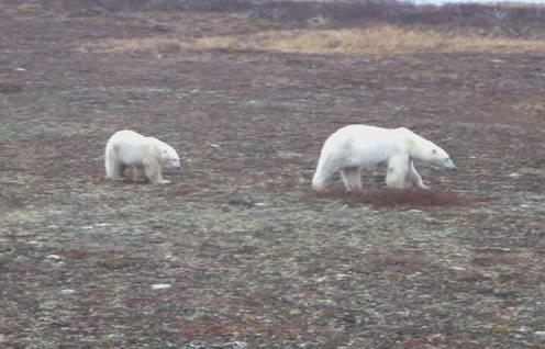
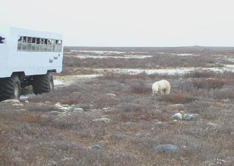
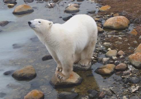
The ground wasn’t snowy yet, but soon the whole area will be frozen. The bears are around just for a short time, as they travel from the areas inland, where they spend the summer, to the frozen Hudson’s Bay. We were all keen to see our first one, and when we did, all agreed that it looked just like a large white rock! We were to see much better!
There was other wildlife too – we saw hundreds of snow buntings, in their white and black plumage, snow geese, and ptarmigan (also white, ready for winter). Hiding amongst the low bushes were several arctic hares, looking like a bundle of white cotton wool.
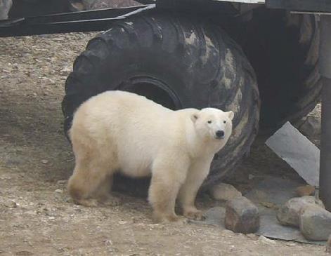
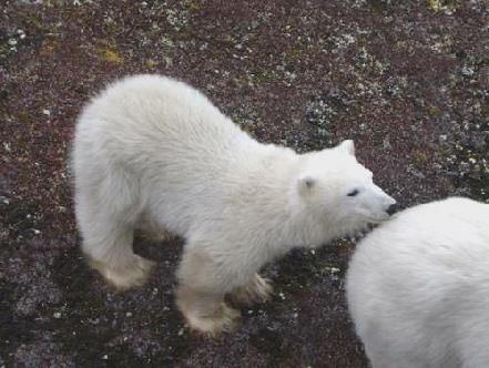
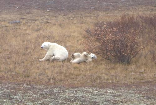
The real object of our mission was the polar bears, and yes, we did see quite a few. They spend much of their time resting, as they haven’t eaten for 4 months, but we did see activity. Around the ‘launch area’ (the Tundra Buggy HQ) one was lying, and then walking, and then standing right up. That was great to see, but my favourite image was seeing a baby following along behind its mother.
After our day’s viewing, it was a long trail back over the bumpy ground to ‘base’, where we transferred to the bus again to be taken back to Churchill.
We then had our glimpse of this remote town (founded in 1700), which is only accessible by air and rail (although this has had problems). It cannot be called a pretty town! When we visited a remote town in Northern Australia, someone called it ‘The arsehole end of the world’ – that description could well fit Churchill! On a raw, grey day, it didn’t hold much attraction!
We were taken to our respective hotels. Ours was a simple, rustic place called Northern Nights. It was cold and quiet when we arrived. The one girl around got hold of a chap who arrived and gave us all keys, before disappearing again. Our room was very simple, and warmed up once we’d got the heater on. The really good thing was that there was a hot tub, so we lost no time in making our way there, which warmed us up nicely.
We went out into the gloomy street in the chill air, and walked along to an eating place called Seaport Hotel. Here we had a good meal (ribs/fish and chips). We had joined a couple from our tour – Karen and Butch from near Toronto. She was a University lecturer, and he was a teacher. They were both keen travellers, and good company. Following their example, we had a carafe of house wine – it helped the evening along, blow the expense!
Then it was back to our rather grubby hotel for the night.
Sunday 21st October Mother and baby polar bear
We were being picked up by Jim at 7.30, so another early morning. We couldn’t get any breakfast, but had put on the TV and found a programme about Shania Twain, which we were so enjoying that we were reluctant to leave! It was good to see the mutual respect and affection which she and Dolly Parton have for each other – both talented singer/songwriters.
Well, if yesterday was good, today was fantastic!
We didn’t see so many birds today, but the additional wildlife that we saw were a gyrfalcon, an eider duck, an immature ring billed gull and a young caribou. We also saw a muskrat, which was swimming in the water that we were driving through. It suddenly jumped into the wheel hub of the buggy in front, and did a few circuits, like a hamster, before jumping out again!
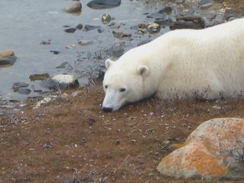
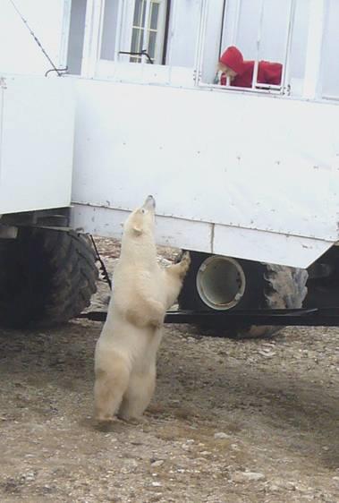
We watched three bears, separately, up close, but none were too active. But then we got our prize! Jim positioned the vehicle at a place where other vehicles had gathered, and sure enough, there was a mother and baby close by. He had decided that we would have lunch here. This was a simple affair – soup, roll, tea/coffee etc. Having had no real breakfast, we were well ready for it, but suddenly it took second place! The mother and baby approached our vehicle and spent the next hour or two entertaining us. Polar bears have a strong sense of smell, so maybe they smelt our soup, but they stayed by us and not the other vehicles. They walked right close to the buggy, and first the mother and then the cub stood up on hind legs. Everybody’s cameras were clicking like mad!
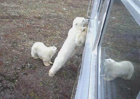
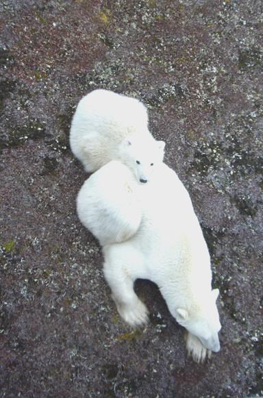
Later both bears lay down close by, but every little while the baby would begin playing, rolling on its back, and grabbing at the nearby bush! We couldn’t have hoped for more!
We had a young girl Cara, a representative of Polar Bear International, who gave us a short presentation, but she’d had to wait until the 2 bears had settled down before she dared to do this!
Feeling quite exhilarated, it was now time to make the long trek back to the bus, and then the long drag back to Churchill. Jim, who was good fun, a real outdoors person, had said that you don’t need a licence to drive in this reserve. There was an 11 year old lad, Graham, who was on the tour with his grandma, so when we reached a flat, dry stretch, he let Graham have a go at driving!
Back at ‘base’ we boarded the old bus back to Churchill. It was grey and cold, as we had a chance of our last (and first) look around the town. We wandered along to Seaport, and ordered something to eat, but ended up asking for a ‘doggy bag’ to take the rest with us as we dashed back to get onto the bus to be taken to the airport.
Then it was back on the plane to Winnipeg, and goodbye to the rest of the group. People had been more sociable today. There were several English people on the tour, but we didn’t really talk to them. One family were from Hobart, Tasmania. And we had enjoyed the company of bubbly Laura from Michigan, who was keen to get back to show her photos to her husband and 13 year old son.
The rest of the group were staying in the Sheraton Hotel, which is right at the airport. The bus dropped them all there, but we then had the big bummer – we phoned for the shuttle to our hotel, just a short distance away, but it was almost an hour, and several more phone calls, before it arrived! The driver gave us a sob story, which we didn’t really believe. It was gone 11 o’clock when we got back to our room. A long way to go to see some polar bears, but worth it!
Monday 22nd October Winnipeg to Calgary
This was the first day for some time that we didn’t have to set the alarm. It was a really beautiful day. We spent a while getting ourselves sorted, before taking a taxi down to the centre of Winnipeg.
This was much larger than we had imagined, and we found it to be really pleasant – the lovely blue sky helped.
Winnipeg
Like in Calgary, there were many indoor walkways. After wandering through these for a while, we walked down to the Red River, and right across it into the French Quarter. We had a soup and roll lunch in a little café before walking back across the bridge and through the vast Union Station. It was soon time to be looking out for a taxi back to the hotel, but we’d had a good time. Once more we had a silent taxi driver.
Having collected up all of our luggage, we were driven to the airport by a very young looking local lad.
Booking in was easy, and apart from having my bag checked yet again, all went smoothly. We looked through all our polar bear photos while we waited to board.
We had rear seats on the flight, which was good. I finished watching the film called ‘Once’, which I had started watching on the outward journey, and really enjoyed (these new Air Canada super screens allow you to pick any film at any time and go to any position on the film, just like an ordinary video recorder).
We looked down to the dry lands below, and were soon at Calgary, where our bags were almost first off the carousel.
Laure was there to meet us, and she drove us back to Garrison Boulevard, where we were greeted by Simon and Manolo, who has grown up in the last couple of months, but is still great fun.
James is his favourite engine Fireman Manolo at a Hallowe’en party
Enjoying some early snow
The Columbia River to Calgary, via Churchill, Canada


