
Tuesday 5th August Around Winnipeg to a pretty little lake 162 miles
We enjoyed our breakfast sitting out in the warm sunshine. The sky was blue all day.
We spent a busy morning doing the washing, having showers, emptying & filling and getting the website ready and didn’t leave this pleasant site until midday.
We drove towards Winnipeg on Route 2, which was quieter and nicer than the Trans Canada Highway. It was very rural, with small towns along the way – at Holland I photographed a windmill!
While we were refuelling at Treverne, a ‘house on wheels’ which took up the whole road, passed by. We ate lunch here afterwards – the day had become really hot.
We passed fields of sunflowers as well as sweetcorn and other crops.
We turned north some way before Winnipeg (which we’d visited last October when on our Polar Bear mission, so don’t intend visiting now). The countryside was still flat and rural. We crossed theAssiniboine River after St Eustache, and noticed a field with a monument in it. It was to George Antoine Belcourt (1803-1874). He was a missionary who had helped the local Indian community before moving on to Dakota and then Prince Edward Island. He died in New Brunswick.
At Warren a bypass had been built, but there were no signs to show you which way to go, which had us confused for a bit.
We came to Stonewall, where we thought we would be able to send our website/email from. It was a small but incredibly busy town, and gave us a lot of problems in finding an internet connection. Before we were able to send our message, we did receive a few, including another one from Simon. We telephoned him, and actually spoke to Laure first, which was a relief, as she sounded well after her catastrophic wasp sting.
Simon had told us of a horrific murder on a Greyhound bus a few days ago, in the area we were in. We looked it up on the News. Amazingly, we had had discussions about Greyhound buses recently, when we had seen several on the road.
Finally we managed to send our email. There was a campsite in the town, but we weren’t able to find it, and made our way towards Route 7 north. As we reached it, there was a large layby which would have been suitable to stay in.
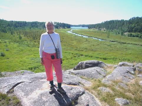
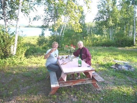
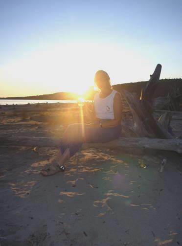
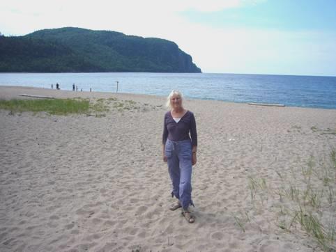
We contemplated it, being now 5 o’clock, but as it was so hot, we made the decision to continue north to a campsite marked beside Norris Lake. This proved to be the right decision, as, when we reached it at 5.45, we found that it was a delightful location right on a pretty little lake. There was even a swimming area right in front of us, so I couldn’t resist a swim before we set about organising supper and lighting the fire.

From our spot by lovely Lake Norris
It was an idyllic situation as we cooked our meal and then sat out to eat it. The only annoyance was the few speed boats which interrupted the peace.
A couple with two small children had returned from their boat and came to the swimming area at some time after 8.00. Both children dashed into the water – a ginger haired boy of about 6, and a little girl of barely 2. Both children thrashed around in the water, the boy continually diving under. The little girl complained bitterly when it was time to come out!
We had looked at the weather forecast earlier, and seen of thunderstorms tonight, but even so, we were taken a bit by surprise at the speed of a sudden storm coming in. Luckily by then the fire had died down, and we were prepared to come in anyway, but for a short time, all hell let loose, and we were glad o be in the safety of our motorhome.
Wednesday 6th August A little bit of Iceland in Canada 104 miles
The sky was blue, and it was even warm sitting in the shade for breakfast. We watched several birds – yellow warblers, flycatchers and a brown creeper.
We drove north to Narcisse, where there was an area of ‘snake pits’. Just before reaching there, a large deer sprang across the road.
The snake pits were in a wildlife management area, and are apparently the largest gathering of snakes in the world – in spring and autumn that is! There were none here to see today, but we did have a really pleasant walk amongst wild flowers, with birds and butterflies abounding.
The snakes that do gather here are harmless red garter snakes. In spring they come out from their hibernation amongst the limestone rocks, and in autumn they return. They actually give birth to live young, the eggs having hatched inside the mother.
We continued to Arborg, where we were able to get an internet connection and speak to Paul on the phone, as well as send and receive a few messages. We were parked by a real bakers, where we bought a proper loaf (the best of this trip) and a couple of buns.
We were making our way to Hecla Island – the area of a previous Icelandic Community, and now a Provincial Park. We stopped to have lunch at a picnic table just before the causeway to the island – hundreds of swallows were flying around. Before the causeway was built, a ferry used to run from here to the island.
Once on the island, we made our way to the village of Hecla. For some time in the 1900s it had flourished as a village, but declined in the 70s, after fishing also declined in Lake Winnipeg. Several of the buildings remain, and you can walk around and view them. We arrived to find 160 Icelandic tourists looking around too. They were on a trip from Iceland, having visited the Icelandic Festival at Gimli, just down the coast, at the weekend. It was quite strange to be in such a minority, but did make the village seem real. Descendants of the original Icelandic inhabitants do still live here, renting their homes from the provincial government, who’d bought up the place after most people left in the early 70’s. One such lady spoke to us, and showed us a beautiful book of photographs which she and her daughter had taken of the island.
An Icelandic house in Hecla
Having had a good look around the village, we continued towards Gull Harbour Campground, turning off to a long beach area, where I enjoyed a swim in Lake Winnipeg. We then made for the campsite, where the girl said that she’d give us ‘the best pitch in the park’ (about 250 pitches). She said that it had its own little path through the woods to the lakeside. Well, it did, but it entailed a very steep climb down before reaching the pebbly beach – worth the effort though! Our spot was quite sunny, but rather enclosed by tall trees.
For the second night running, we had to use our own wood (which we have been carrying around with us for ages, as it was always supplied).
We had a nice little fire, then after eating our meal we waited until the sun was about to go down and set off once more on our trail to the shore. We watched as the sun went down over Lake Winnipeg, with the tiny moon rising.
Thursday 7th August Back down towards Winnipeg 114 miles
It was a nice morning. On our way out of the campsite, we stopped to have showers. They were single cubicles facing outwards. Stripped off ready for my shower, I found that there was no water coming out! I had to wrap a towel around me, and locate a shower which worked, before I stood under the lukewarm spray.
We drove down out of Hecla Island, stopping just before the bridge/causeway at Grassy Meadows Marsh.
There were several walks in this area. We walked a short boardwalk over the marsh. As we’d arrived, we were looking at the various walks, one called the chorus frog walk, marked in green. We looked down and saw a pretty green frog! Later we saw a different coloured frog – we think it was a leopard frog, in beautiful autumn colours.
We could hear noise by the boardwalk, and realised that there were lots of birds. Two of them performed a striking mating dance in front of us. We think that they were marsh wrens.
We walked out on the boardwalk, but the birds were so hard to see, as they kept to the bottom of the bulrushes. We could hear them though, and also the ‘plop’ of frogs leaping into the water.
We didn’t do any more of the walks – another we tried was very wet and ‘mozzie-y’, but we’d been so happy with what we’d seen.
We left the island and drove south, stopping at Hnansa Provincial Park – a pleasant campsite, but I got greatly bitten as I investigated the beach.
Soon after here we pulled in by a ‘Heritage Park’ to the family of Magnus Magnusson, no less (not ours of Mastermind fame). It was a small wooden structure with picnic tables, right by the beach. It commemorated a family who had immigrated here. The daughter had died in 2001, and this little ‘park’ was erected in memory of the family.
It was adjacent to a lovely beach, where a group of locals were enjoying themselves. I had a swim from the beach before we had lunch at the picnic table. Two women came up and one was telling the other about the site – it was dedicated to her great grandparents. It was the loveliest picnic spot we have stopped at.
A bit further on we stopped to see a monument to the arctic explorer Stefansson, who had been born here in 1879.
On again, and we stopped by Camp Morton, which had actually been a summer camp for catholic children, set up in 1920.
Then we came to Gimli – a real ‘resort’ on the banks of Lake Winnipeg. We joined the holidaymakers as we walked along beside the wide sandy beach as far as the harbour, where there were murals of varying talent and state of preservation, but generally attractive.
Murals by Gimli Harbour
There was a tower with bird boxes for the purple martin, and dozens hovered overhead. We stopped for an icecream in the main street, and thought that we could have been almost anywhere in the world!
We now travelled south through flat country with straight roads, and not a chance to pull off for the night. Hence we ended up at Selkirk, not far from Winnipeg, in the Municipal campsite. This was in the vast town park, adjacent to the Red River. It was like a VERY busy French Municipal, but as we didn’t need electricity, we had lots of space around us.
We had a walk along the dyke by the river, then came back to light the first barbecue of this trip. We had no wood left, and it was too hot for a fire anyway.
Friday 8th August A Hudson Bay Fort and another wildlife sanctuary 48 miles
The grey start to the day belied the extreme heat which was to follow!
We left and drove out of the park, past the Maritime Museum of Manitoba, which is housed in half a dozen large boats, and stopping in the town of Selkirk to shop in Safeway, to get fuel (twice – we got a good price) and to stock up with more booze.
Selkirk dates from 1882 and was named after Thomas Douglas, 5th Earl of Selkirk, who settled the town with Scottish and Irish immigrants.
We drove on a few miles to Lower Fort Garry, a National Historic Site of Canada. We had an excellent visit at his fort which is one of the only stone forts remaining from the Hudson Bay Company days.
The fort was set up as if in the 1850s, once more with costumed guides acting their parts. Everything was really well done, and again we enjoyed chatting to the ‘actors’ and playing along with them.
The fort would have been used as a trading post, reminding us of Fort Union in USA. We were amused at the different ethnic background of the ‘guides’ – we had to ignore the West Indian features of the chatty young carpenter who said that he had come from the Orkneys! The blacksmith showed us ox shoes – very different from horse shoes – and the contraption used to hoist the oxen, as, unlike a horse, they can’t stand on 3 legs.
We met the lady and the gent from the ‘Big House’, and the labourers who were hired by the day, working on their nearby farms for most of the time, but coming in occasionally to earn some extra cash.
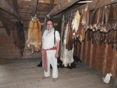
In the fur loft at Lower Fort Garry
We saw the fur loft stacked with hundreds of furs – all waiting to be shipped to England at the time. There was only one ship a year from England, bringing supplies, so orders had to be well thought out in advance.
We came out to have a late lunch – it had been a superb visit, just a bit too hot!
We now drove off to Oak Hammock Marsh – the last of the ‘sites’ that we wanted to visit in the Winnipeg area. This is a large conservation area, with a very high reputation. Unfortunately for us, it was just too hot to enjoy properly. We did walk out a bit, but the wildlife too was hiding from the heat.
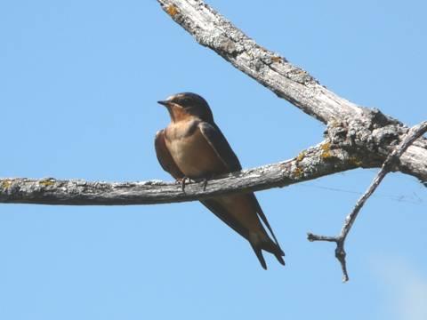
A Barn Swallow
We saw a variety of ducks and great multitudes of swallows – some were nesting under the eaves of the interpretive building.
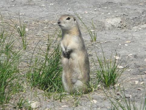
A friendly ground squirrel
We also came to a whole area of ground squirrels, which are always so entertaining to watch. Adrian was sorry to find that he had lost the end of his binoculars, but on walking back along the boardwalk, he actually found them, which was great.
We left here at 4.30 and retraced our steps, making for Bird’s Hill Provincial Park, which had a campground. The park was enormous – 5km from the entrance to the campsite. This too was huge, with well over 400 pitches.
We got settled into one, and Adrian lit the barbie – for the second night running. Firewood had to be purchased here, and anyway, it was far too hot for a fire. You can’ sit round a barbie though!
We seemed to be surrounded by a group of noisy campers, but thy eventually turned their music off (Adrian had gone and asked them to turn it down earlier).
The ‘firewood man’ did drive round during the evening, so Adrian bought some wood to be ready for next time.
Saturday 9th August An unforgettable vehicle collection and ancient stone pictures 97 miles
It was a beautiful morning as we sat outside to eat our breakfast including fresh raspberries.
We left the campsite, and made for the swimming area of the park, which is like a giant playground for Winnipeg. The cyclists, rollerbladers, joggers were all out in great numbers. Arriving quite early by the lake, it was fairly quiet, and we both enjoyed a swim. By the time we left at about 10.30, the car park was filling up fast.
We wanted to leave by the east gate of the park. This meant passing by the site of Pope John Paul’s visit here in 1984. I hadn’t realised what a great and influential man he had been, particularly with relations between Christians, Moslems and Jews. The Folk Festival is held in this area of the park every July, which seems a fitting tribute to him.
Having left the park, we followed quiet roads towards Beausejour. Before reaching the town, we turned right at a small road junction and saw dozens of cars parked on both side of the road. Realising that it was Saturday, so ‘car boot/garage sale/fleamarket’ day, we’d intended driving on through the congestion. On looking closer, we saw that it was something a bit different. We were lucky to find a space to pull into, and positioned the Bam on the steep roadside.
We walked back to the ‘happening area’. There were a hundred or more rusty old trucks, cars and tractors in front of a simple shed. This contained more vehicles and ‘bits’, and out the back were as many more, with even some old horse drawn carriages. Nothing at all had been restored, and they looked so evocative in their unrestored condition.
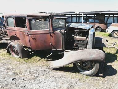
A few for the car enthusiasts
Crowds of people were milling around, mostly men in jeans and checked shirts. We’d become aware of the auctioneers voice before we reached the site – he would have done the ‘song of the auctioneer’ proud! I didn’t notice anybody bidding, and was scared of nodding, beckoning or blinking!
Adrian was in seventh heaven, clicking away at this ‘never to be seen again’ sight. He went to enquire about it, and discovered that it was all one man’s collection – he had been an incorrigible collector, who just bought everything. He had recently died, and his family were selling off all his collection – there had been several auctions before this one.
It made us rather sad to think of this huge collection being sold off. Things were going for ridiculously cheap prices too – a few hundred dollars for an old truck.
We drove on into Beausejour, where we got an internet connection, but didn’t receive any messages of interest – didn’t anyone like our last email, or are they all on holiday?
We stopped to have lunch in Agassiz Provincial Forest before coming to Whiteshell Provincial Park. This is a vast park, which reaches to the border with Ontario. It stretches north for a long way, where the only access is by canoe. All of it is full of forests and lakes. We realised that we have reached the Canadian Shield again.
There are numerous campsites in the park, and we intended staying in one of them tonight, for what should be our last night in Manitoba.
We discovered that each of the lakes had its ‘resort’ area, although later we did find some wilder parts between the lakes.
Our most interesting stop was at Bannock Point Petroforms. Unlike petroglyphs and pictographs, these aren’t pictures on the rocks, but ‘pictures’ made by rocks.
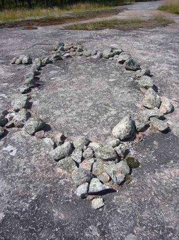
A petroform turtle
As we walked out on the large rocky outcrop, we met up with a group which had left some time earlier with a guide Ron. He was of local aboriginal descent, so had all the stories. Rocks had been used to make the shapes of turtles, snakes, human figures etc. We were surprised that the rocks hadn’t been tampered with – you could see that by the moss and lichen surrounding them. Often there were ‘rags’ hanging from the trees – ‘prayer cloths‘. It was interesting to hear of the similarities and differences between other religions and beliefs.
Now it was time to find a campsite, but the first one we tried was full – it is Saturday night of course. Luckily the next one had room – Brereton Lake. We had a nice little spot near the lake. There was a really pleasant swimming area, so we both refreshed with a swim. The lake was very brown with tannin, which made our bodies look rather jaundiced!
Adrian had put out the sunshade for an ‘airing’ – we tried to remember when we had last used it.
We cooked on the barbie, but later lit the fire. At sundown we walked down to watch the sun go down behind the lake. Two young women had gone out in a canoe, which had capsized. They came in swimming and laughing – either drunk, or very happy!
Sunday 10th August Into Ontario 82 miles
Another beautiful morning as we sat outside for breakfast. The lake looked really tranquil with no swimmers or sunbathers.
Our first stop was at McGillivray Falls, where we set off on a 3km trail. There was nothing to see at the falls – beaver activity had stopped that – but the walk was delightful. We’d covered up, but in fact mozzies weren’t a problem. This meant that we could stop and look at the birds, even if we couldn’t identify them.
The walk was well signposted, and went over varied, interesting granite terrain, with views down to McGillivray Lake (we later found out that he was an early fur trader/explorer). It was one of the best walks of this trip.
Rosie on the rocks above McGillivray Lake
We cooled off afterwards with a swim at nearby Caddy Lake, a really pretty spot, before eating our sandwiches for lunch on the beach.
Now we came to the busy area of West Hawks Lake – the deepest lake in Manitoba apparently, but bordering with Ontario.
We now left the park, and Manitoba, which we had really enjoyed. We had had great weather, and lovely places to visit.
We stopped at the Ontario Visitors Centre and picked up lots of leaflets. We discovered that Provincial Parks in Ontario were much more expensive than in Manitoba, which didn’t please us. We were now on the Trans Canada Highway, which had more traffic than we were used to! At busy Kenora we managed to phone Simon, who was back from a camping weekend in Kananaskis.
We were in the area of the vast Lake of the Woods, but soon turned south, having decided to take this route to Thunder Bay.
Despite our reservations, we pulled into Rushing River Provincial Park, which cost $29 (including park fee) – far more than Manitoba, but not exorbitant.
It was the right choice, as we had a beautiful spot overlooking Dogtooth Lake.
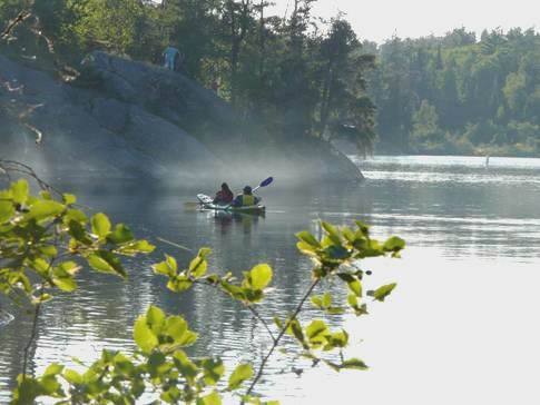
Kayakers pass us on Dogtooth Lake
We lit the campfire, and enjoyed this exquisite position, taking our wine down to the edge of the lake afterwards, as the sun went down.
A couple from Winnipeg came along and liked our spot. We got chatting about our motorhome, which they also liked, but we feel that they might have been bitten by mosquitoes as they talked to us.
Monday 11th August Lakes and Forest en route to Thunder Bay 159 miles
Our day started with a walk to Beaver Pond, which began from opposite our spot. No beavers, of course, and the pond was rather low on water, but it was good to come back for our breakfast, sitting above the lake.
Then it was off on another walk – a delightful one along one side of Rushing River and back along the other bank, crossing on a wooden bridge at the picturesque Lower Rapids. Despite many steps and boardwalks, the going was pretty rough, with tree roots and boulders across the path.
Back to the campsite for a quick swim for me in Dogtooth Lake, then showers for both. By the time we’d done with all this, it was almost midday.
We drove south, arriving at Sioux Narrows, where there was another Provincial Park. As our permit lasted until this evening, we thought that we’d use it to have lunch in this park.
We drove in, finding a sandy track which led down to the beach area – badly signposted, so we wondered what we were coming to. We’d driven right past the entrance hut, as permit holders are usually told to do.
We found the parking area, and Adrian went off to investigate a place to have lunch. He’d just left, when a car came rushing in, and stopped by us. The woman ranger in it said that she needed to see our permit. I grabbed the one from the windscreen, and proudly showed it to her. ‘This is no good’, she said, it’s for Manitoba, this is Ontario’. I looked in disbelief, before realising that I’d given her our previous permit – the Ontario one was lying on the dashboard. She quite believed that we hadn’t got one, so had to climb down graciously when she realised that we had!
We couldn’t stop giggling about it as we ate our lunch by the lovely little beach area in this park where we appeared to be the only visitors. I suppose that we’d given her something to do!
We soon crossed the rebuilt bridge over the Sioux Narrows, site of a battle between the Sioux Indians and the local Cree and Ojibwe, which the local people had won.
A bit further on we pulled into another Provincial Park, called Caliper Lake, which again had a pleasant little beach by the lake. The weather had become cloudy, and was cooler than of late. On our way out, we passed a female and young deer – we have seen several during the last few days.
We reached Highway 11, and started off eastwards, very soon reaching Emo, where there was a tiny roadside chapel – a shrine really – which once more welcomed people of all faiths to stop by in.
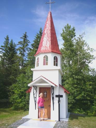
Tiny Norlund Chapel at Emo
As we drove along the road, there appeared to be something wavy crossing the road – it was a mother duck and a whole line of babies!
We reached Fort Francis, a town of neat houses and gardens on the border with USA. A whole lot of emergency vehicles rushed along the main road as we drove through. We’d hoped to find a store to shop in, but didn’t pass one. On the way out we were able to get some fuel at a petrol station in a First Nations area.
We now had to cross part of enormous Rainy Lake on a causeway, and after this, we went into remote country, with the next/only town 100 miles further on. We began looking for somewhere to stop for the night – being not quite so warm we could free camp, and we had no firewood or barbie food left anyway.
At around 5 o’clock we turned into a huge truck parking area on the gravel road to Turtle Lake. Half an hour later 2 trucks with ginormous loads pulled into the area! The men went off in an accompanying vehicle, leaving the trucks, and saying that they would be off at 6.00 am!
‘Nobody will come in here’ said Adrian
We moved to another part of the parking area!
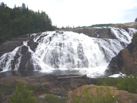
Tuesday 12th August Another ‘Niagara’ 169 miles
Although we love our campfires, we really enjoyed ‘free camping’.
The morning was grey to start, so we didn’t mind being indoors. The men with their oversize loads had apparently left at 6 o’clock, as they’d said, but we didn’t really hear them. By the time we had got up, a chap had come to work with his grader, which was also parked here.
We continued east – there were no official parking areas before Atikokan (50 miles).
We drove past vast Quetico Provincial Park, which had very little access, and is mostly for canoe travel.
We crossed the watershed between the Arctic (Hudson’s Bay) and the Atlantic. It was now 12.00 (and we had to change to 1.00 Eastern time) Soon after this route 17 joined us. When we stopped for lunch in a picnic area surrounded by yellow birdsfoot trefoil, looking like a field of buttercups, we discussed our onward plans.
We decided to pull into nearby Kakabeka Falls Provincial Park, where there was an adjacent campsite. This looked good, so, having selected a site, we set off to walk on the walkways around the impressive falls, continuing to walk the ‘Portage route’, which had been taken by earlier explorers including David Thompson.
Kakabeka Falls
After that it was a quick swim in the Kaministiquia River before making our way to the campsite. We stopped off to do the washing and have showers. When I returned to the Bam, a chap was standing there, wanting to know all about it. I did what I could, and when Adrian returned, he chatted for some time longer.
Then back at our pitch we lit the campfire and sat out enjoying the warm evening, and reminiscing over the last 42 years!
Wednesday 13th August Our 42nd Wedding Anniversary 77 miles
We opened our cards to each other, and one from Renee & Lena. We were listening to a favourite song of ours, when a small flock of blue jays came to pay a visit to the trees beside us. They didn’t stop long, but it was nice.
The sun was up, but it had been very damp – our costumes left out hadn’t dried at all. We took our bacon pancakes outside, but the table and seat were still so wet that we came indoors to eat the second one (with the chokecherry sauce from Irene).
We headed for Thunder Bay, 30 miles further on. This ‘town’ started as two separate habitations – Port Arthur and Fort William, and only amalgamated to be called Thunder Bay in 1970. The situation beside Lake Superior is indeed superb, but the town hasn’t made the best of it.
We had to spend a ‘useful’ time – getting money, fuel, and shopping. We did this at dreaded Canadian Superstore, which is so large that it is difficult to be quick! The shopping included some red roses forme, and a bottle of bubbly for later. We had no luck with the internet, which was frustrating, as we’d wanted to contact Wendy, who we were hoping to meet up with. We did receive an anniversary message from Simon.
We found our way down to the front, and ate our lunch sitting on the rocks beside the lake. This was fine until Adrian threw a piece of his bread to the ducks below. In an instant, about 30 seagulls zoomed in from nowhere, noisily squabbling after the bit of bread long after it had gone. It made us think of the film ‘The Birds’.
As we reached the Trans Canada Highway again, we pulled into the viewpoint/rest area. We particularly wanted to come in here, as there is a monument to Terry Fox. It was near to this point that Terry Fox had had to give up his marathon across Canada, when the cancer which had taken one of his legs had returned. He died in June 1981, when he was 20.
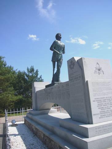
The Terry Fox monument at Thunder Bay
Like many people, we had been inspired by his story, and had come to know the high regard with which he is thought of in Canada. He is like a national inspirational hero. We had first got to know about him after we’d viewed Mt Terry Fox in British Columbia in 1989, and wondered who he was. Last year we watched a recently made and moving film of his story.
Now we had to start off around Lake Superior, on what is called the Terry Fox Courage Highway. We’d become aware of how time is slipping away, but soon realised that we weren’t going to get as far as we’d intended today, especially when a long section of roadworks slowed us down.
I’d wanted to visit a place called Ouimet Canyon, but we hadn’t realised that it was 11 km off the road. We drove there, passing a small shop/campsite on the way.
The visit to the canyon was good – we walked to 2 separate lookouts over a really impressive steep sided gorge – I had to hold my breath!
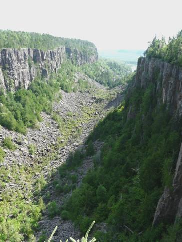
Ouimet Canyon
The canyon, 100 metres deep, gets little sunshine and so has its own microclimate at the bottom. Ice remains below the boulders all year round, and several arctic plants, normally only found 1000 km further north, survive. Not surprisingly, no-one is allowed down there!
A French Canadian couple reached the lookout when we were there, so we took photos for each other.
We drove back and looked in at the campsite – the other couple arrived at that moment to buy icecreams. After they’d left, we chatted to the owners, after we’d decided to stay at the campsite.
They were a young couple with 2 small children – a little boy of 2 or 3 and a baby girl. They’d moved out from the Toronto area and bought this land (160 acres) for half the price of their small town house there. They hope to build their own house on it in the future. For the moment they run the small campsite (there was nobody else here) and gift shop. She had other plans lined up, but he just loved the quiet. It was certainly that!
Just us and the view
After they’d gone back to their rented home, it was just us and the view – a small lake surrounded by forest. We opened the bubbly and set about enjoying the evening, in our complete isolation. (Some workers from the canyon had stopped by to deliver a whole lot of decking from the bridge we had crossed to get to the canyon earlier, as it was being rebuilt – which meant that we wouldn’t have been able to go there tomorrow).
Lovely spot for our anniversary
Adrian lit the fire –it had been quite windy, but calmed down as we cooked our meal of steak, squash, mushroom and potato. It was really pleasant until about 9 o’clock, when the night time mozzies arrived.
We came in and watched through the photos of our Ruby Wedding two years ago.
A lovely anniversary.
Thursday 14th August The lovely north shore of Lake Superior 136 miles
It was even chillier and damper when we woke this morning. The sun was just rising, and there was mist aver the lake.
It was warm enough to sit outside for breakfast though, and the day soon became really hot.
By 9.15 we were driving back to the highway, ready to continue along beside the north shore of Lake Superior. We were hoping today to fill the propane tank, but the first place we stopped at only did propane for bottles. Soon afterwards, a propane truck overtook us, and as we pulled into the second place to get some, in Nipigon, he had just pulled in to fill their tank up! We had to wait until we reached Terrace Bay, in the afternoon, before we were successful!
Nipigon seemed a nice little town, except that the railway ran through the middle of it. We managed better with the internet, and discovered that it was their (Virgins) problem yesterday, not ours. We phoned Wendy, and hope to meet up at the weekend. We received a new photo of Louisa, and sent best wishes back to Paul and Nicky for their 15th Wedding Anniversary today.
We now went through another long section of roadworks, but realised that the scenery was becoming really attractive, with images of forested hills and rocky outcrops, sometimes looking like streaky bacon.
We first glimpse Lake Superior
We caught glimpses of the lake, with green islands dotted in it. At times we were able to pull in and view a whole panorama of the lake, looking glorious with the blue sky, and occasionally with wildflowers as a foreground. The lake is 400 miles long and 160 miles wide! It is the largest fresh water lake in the world, and holds 10% of the world’s surface fresh water.
We needed somewhere for lunch, but any picnic tables we passed were just beside the road, and missing the magnificent view. We drove down to the delightfully quiet little ‘town’ of Rossport and ate our lunch, sitting on our seats by the bay. The place looked lost in time, and made us think of Newfoundland.
Rural Rossport
After that, of course, we passed more than one lovely picnic spot.
We decided against visiting Rainbow Falls Provincial Park, as we would need a day pass, and then have to get one if we stopped at a Provincial Park campground tonight, which we intended to do. We did stop to view Aguasabon Falls though, just before Terrace Bay. The falls gushed out at 90° to the deep gorge, but although good, the viewpoint really missed the best view. There was the unpleasant stink of the Kimberley Clark pulp mills permeating the air.
We now proceeded to Neys Provincial Park. Our initial impressions were not good, as Adrian had unwittingly been given a site with electric, which we hadn’t intended, and it was dark and gloomy – my pet hate!
We plugged in, then set off to explore the area. The 2km long wide sandy beach was strewn with ‘driftwood’, reminiscent of Vancouver Island or the Olympic Peninsula, except that the water here is like a millpond today.
The lovely beach at Neys
We wandered through the campsite to the Visitors Centre, where we found out more about the place. During the war, it had been the site of a POW camp – for the ‘extreme’ Germans, those who still appeared to support the Nazis. They were known as blacks. (Those definitely anti Nazi were known as whites, and there were various shades of grey in between, all put in separate camps). Adrian particularly was fascinated by all the information, especially that this was the camp that people tried to escape from.
After the war, the camp was used to house the ‘enemy alien’ Japanese, and reunite them with their families, but sadly with little success.
The park is also an area where stromatilites have been found. These are not as old as those we came across in Australia, being only 2 billion years old!
We walked back along the beach with its photogenic bits of wood, as far as the Little Pic River, which reaches Lake Superior here. The water of Lake Superior is decidedly cold – 46ºF, but the water here was warmer, so I had to strip to bra & pants for a quick swim.
Back at our spot, (which wasn’t that bad) Adrian worked on mending the printer, with apparent success. He was then able to print out the diary.
He lit the campfire, and after our meal we took the last of our wine down onto the beach, where we watched a glorious sunset in this idyllic tranquil situation, with the almost full moon rising.
Another gorgeous sunset
Friday 15th August One shoe off and one shoe on 107 miles
It was sunny, but still cool under the trees.
After breakfast we set off on a lovely walk around part of the bay, to ‘The Point’. Some of the time we walked though the woods, crossing clear sandy streams, reminding us of Fraser Island in Australia. Other times we walked along the sandy beach, where the water of the lake was also really clear.
Adrian on The Point
At The Point, we came out onto huge boulders, and continued for a way along them, but the going wasn’t easy. There were the remains of some old boats here, used to carry logs down the Little Pic River, when the inmates of the POW camp had had to work on the local logging industry.
It was all quite beautiful, with the blue lake reflecting the sky, and forested islands and headlands across the water.
When we returned, we stopped to have coffee in this lovely situation before going to do the ‘useful things’. This was perhaps a bad idea, as, for the first time, we had to wait to have a shower (there were only 5 for the whole campsite – one of those a handicapped one, which in fact we used in the end).
So, near midday we set off, turning off in a few miles to the town of Marathon, where we got an internet connection, and were able to contact Wendy about meeting up, and also Simon again.
Back on the highway, I had seen a rest area – with just one picnic table. We got ready to have lunch there, and were joined by another couple, who we invited to share the table with us. They came from Sault Ste Marie, and had been staying at Neys Park too. They had been kayaking with a group of other people – we had in fact seen the group on the beach last night. They were keen outdoor people – skiers, cyclists etc, and made us think of Stuart & Mary – the woman in particular. We spent a pleasant time chatting to them.
Now we continued to White Lake, another Provincial Park, where the water was supposed to be warmer than Lake Superior.
We drove the long way down to the swimming area, both enjoyed a swim in the shallow, and yes, warm, lake, then drove on.
We passed the town of White River, and began looking for somewhere to stop for the night. The scenery was lovely, with the road often running close by various lakes, but nowhere to stop. Then we saw a track off, and pulled in. We stopped a short way down the bumpy track and reversed out of the way. It was when we got out that Adrian saw that the step was down – with just one of my sandals on it! Then we remembered that we hadn’t checked at White Lake – we’d come back from our swim with sandy feet, left our sandals outside, and the door had swung to – Adrian had greased it this morning, before that it never shut on its own! So there we were – no sandals for Adrian, and just one for me (at least mine were my old ones).
We walked a long way down the track, surrounded by wild flowers, and with a few interesting stripy rocks (and some mosquitoes), but didn’t find anything, so returned to the van. Adrian found on the computer that we were on ‘road 30’. He cooked the fish outside, and afterwards we sat out amongst all the wild flowers to finish our wine.
Our spot by ‘Road 30’
We came in as the full moon appeared above the trees, and began reading through our diary of this trip.
Saturday 16th August More great Lake Superior scenery 125 miles
As we left at 9.15 we looked out to see if our sandals had fallen off the step as we bumped up the track yesterday, but no!
We very soon passed a boundary sign for Obatanga Provincial Park, so we had been just outside it.
We reached Wawa at 10.30, and stopped to try the internet, but there were no messages. Wawa means wild goose in Obijway, and is named because of the huge flocks of geese gathering here during migration. There is a huge goose statue by the Visitors Centre.
Just south of the town we drove for 3 km down a very corrugated track, but it was worth it to see the superb Magpie High Falls. We were able to walk on a path/steps up around the falls to get different views.
Magpie High Falls
Now the highway went right through Lake Superior Provincial Park for about 60 miles. The scenery and views were often stunning.
Rosie at Old Woman Bay
We stopped by a lovely beach at Old Woman Bay, but when we found that you could only get a day permit ($12), or 2hrs ($4), we ate a hurried lunch in the cab, enjoying the view.
Later we stopped at a ‘Scenic Lookout’ over Agawa Bay while Adrian had a rest – this was highway property, so you didn’t need a permit!
We’d thought that we’d have to find a campsite tonight, and were intending camping at Pancake Bay PP. About 10 miles before that, we saw a little track going off, and were delighted to find that there were spots where we could stay right by the lake.
Our ‘Top Spot’ by Lake Superior
We chose one, before having a wander around the lovely rocky shoreline – I even had a quick dip in a large rockpool. It was hard to think that this wasn’t the sea.
Later, after he had collected and chopped wood for the fire, Adrian had a ‘plunge’ in the pool too. He had chatted to a young girl in the next ‘hollow’, who was also collecting firewood. She had put up a tiny tent, and had a well behaved dog with her. She had come out from SS Marie to suss out this place for camping, so that the rest of her family (parents etc) could come out. She had a swim in the lake, saying that it was warm for Lake Superior.
When we got up in the morning, she had already left.
We sat by the campfire with our exquisite view. We were looking forward to the sunset, as we could see that the sun would set over the lake. We watched until it was almost time for it to go down – and then up came a bank of cloud – no sunset!
We did see a few stars, and could just about make out the plough, as the full moon appeared behind the trees at bedtime.
Sunday 17th August To Sault Ste Marie 59 miles
Bacon and mushrooms in our lovely situation for breakfast.
It was warm and sunny – I even washed up outside. We left reluctantly at 9.45, but soon went into mist.
We pulled into Batchawana Bay, a beautiful sandy beach. There was a couple here who were driving back to Thunder Bay today (9 hours drive), ready for work tomorrow. They’d already driven for 3 hours. Their 9 year old daughter was enthusiastically swimming naked in the lake. After they’d left, I also had a pleasant swim (not naked), before we had coffee and continued towards Sault Ste Marie.
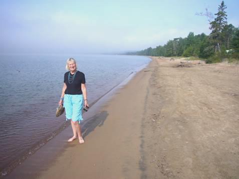
Rosie at misty Batchawana Bay
We stopped briefly at Chippewa Falls, where there wasn’t much water falling over the rocks, but we did see a marker saying that this was the half way point on the Trans Canada Highway.
We drove on to S S Marie, and passing Walmart we were sorry to see that there was no overnight parking (City Law). We continued to Skyline Motel, reaching it at midday – the time that Wendy said she would be there.
She had already arrived, after her 4 hour drive, so we had a pleasant time chatting before driving off with her, and finally having lunch in Sandrios. We both had fish and chips, which were acceptable, but not brilliant.
Our next stop was at ‘The oldest stone house north of Toronto’ (1814). This was actually a really nice visit. The house had belonged to the family of a fur trader called Ermatinger, and felt quite personal. Adjacent to it was a house built like a block fort, which had belonged to entrepreneur Clergue, who had established much of the industry which the town still thrives on. The hollyhocks in the garden were really pretty.
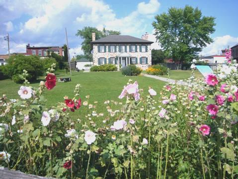
Ermatinger House
We now made our way down to the waterfront, stopping at Roberta Bondar Park – the first Canadian woman astronaut, and famous daughter of the town. There was ‘Art in the Park’ taking place in the open air pavilion. We walked on by St Mary’s River, viewing the huge bridge over to USA.
Back at Wendy’s Motel, we imbibed a little before she went off to visit some friends.
We enjoyed her facilities, but calamity struck when Adrian tried to fill our water tank from the outside tap, and flooded the floor of the room! (shades of ‘Some mothers do have ‘em’)
With an internet connection, we were able to phone Simon, back from a hot camping weekend in Banff.
When Wendy returned we watched a bit of the Olympics! Canadian influenced of course!
Monday 18th August The Soo Locks 5 miles
Rain woke us at 6.00am, but it was short lived.
Still having our internet connection, we phoned Emma, Felix and Ruby at Hermitage, where we found that the weather has been very wet. We phoned Tom, who had just finished paragliding in Spain, and was returning to his flat. Later we phoned Nicky, who repeated that it had been wet!
We set off with Wendy in her car to the east of Sault Ste Marie, stopping by a pleasant bit of beach where we sauntered, and looked across to Michigan.
Adrian and Wendy at Gros Cap
We drove on a bit further to Gros Cap, before driving back into the city. We ate lunch in a Chinese restaurant and chatted until about 2.30, when Wendy set off on her 4 hour drive back to her cottage.
We made our way down to the Waterfront for the 3 o’clock boat trip through the ‘Soo Locks’ – the locks on the St Mary’s River. ‘Sault’, we discovered meant ‘falls’, and we saw the little rapids which the locks had been built to bypass.
Our 2 hour boat trip was very pleasant. The weather was nice, and we went through both the American and the Canadian locks – about 20 ft up or down each time, as the river joins Lake Superior.
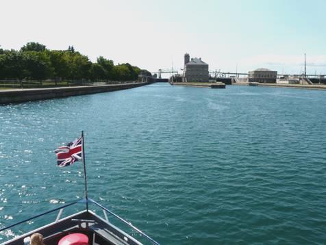
The American Soo Locks
The American town of Sault Ste Marie looked interesting, so we hope to see some of it as we drive through.
We arrived back at 5.00 and located the rail station for the excursion train to Agawa Gorge, which we intend to do tomorrow. We bought our tickets, then made our way to the nearby Casino, where we thought that we could overnight. We had intended going to a campsite, but the train leaves at 8.00am, so we wanted to be as close as possible. On enquiring, we found out that we could stay. Soon after settling in, today’s train noisily returned to the station.
Tuesday 19th August Train tourists for a day 1 mile
The alarm went at 6.30. It was a beautiful day – cool to start, but the sun had risen by the time we left to drive across to the rail station, and we had blue sky all day. The car park was already busy (7.30). A motorhome had overnighted here, but on enquiring, Adrian was told that it wasn’t legal (City Law again) but you could stay in the Casino carpark (which we had).
The train left at 8 o’clock as planned, and we were soon into lovely forested scenery, with lakes and rivers. Just a few leaves had changed colour, giving us a glimpse of the autumn colours (when the train price is higher!).
It was very bumpy as we walked all the way down to the first carriage to get our tea/coffee. We wondered why the snack car was right at the end. It was very badly organised – the snacks were impossible to see, being hidden opposite the desk, obstructing anyone who wanted to come by.
Our route was east of Highway 17, and we passed many familiar names, like the Batchewana and Chippewa rivers. We also glimpsed Lake Superior a couple of times.
When we arrived at Agawa Canyon, we had about 1½ hours to wander. This was really enjoyable – we ate the sandwiches I had brought with us at a remote picnic table, but we were aware that the whole contents of train passengers had also embarked, so there were always people about.
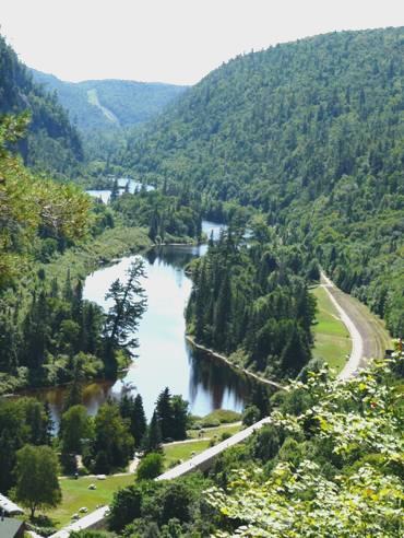
Agawa Canyon from the lookout
We walked just about all the possible trails, including the 350 steps up to the lookout, and the double ‘Beaver Falls’. The canyon can only be reached by rail, but because of the ‘tour train’, you can never be alone. We half envied the 2 rangers who stay here year round, so only have to endure the ‘crowds’ for a short time each day!
We left promptly at 1.40 for our return journey. We thought that we had picked the best side of the train, particularly when we went over the Montreal River Trestle Bridge – the highlight of the trip, and on all the pictures.
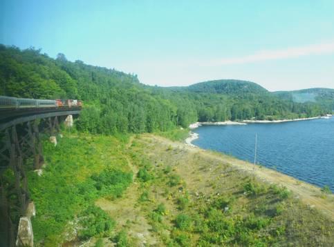
Going over the Montreal River trestle bridge
We were sorry to see no wildlife to speak of, but just before returning to Sault Ste Marie, we did see a large deer leap across a stream, which was deeper than he had thought!
We arrived back at the station just after 6.00 pm. It had been a good day, but rather passive, apart from the time at the canyon. The many sleeping (and often too large) passengers reinforced that!
We bought a few postcards, so that we could use our Canadian stamps before driving into America tomorrow. We returned over the road to the Casino carpark.
Wednesday 20th August Back into the USA 35 miles
4.00am – we were awoken by violent rain on the window – only it wasn’t rain, it was the automatic grass watering! Only if it’s happened to you, can you know the violence of the torrent of water at close range! It has happened to us a number of times now, and always takes us by surprise.
We survived about 6 onslaughts, hoping that each would be the last. Adrian had pulled forward a short way, but it was no better, so we drove across to the other side of the parking lot, where it was concrete behind, not grass. Two ladies in a small camper, who had come in last night and been assured by us that it was OK to stay, had similarly moved. The night before there had been no problem.
An hour or so later, more loud noises disturbed us – crashing, hissing, banging – coming we think from the nearby steelworks. Then at 8 o’clock, of course, there was the sound of the train hooting as it left on today’s excursion.
It was another nice morning, which turned to a hot day. After eating our pancake breakfast (we have been using up all the food we could, because of crossing the border), we headed off for the mighty bridge over the locks and St Mary’s River into Michigan, USA. It was good to look down and see the rapids, and the locks we went through the other day.
The International Bridge at Sault Ste Marie
Then we came to customs. The large, unattractive official was confused, as most are, as we don’t fit into the usual ‘picture’, and they can’t make out what we’re up to – is it our vehicle, yes we bought it 6 years ago, we live in England, we’ve been in Canada for a month – they can never fathom it out. He had to come in for a look, and spotted my (now drooping) roses. He asked where we got them, we explained about our anniversary – he said ‘Sorry, I’ll have to take them’. (At least I didn’t have to make the decision to throw them out). What he didn’t notice was my little plant right next to them!
He seemed happy that he’d ‘scored’, but I was happy too!
We paid our $4 bridge toll, then proceeded to the ‘Welcome Centre’ to get a Michigan map. We also of course ended up with loads of leaflets about Michigan, which then needed looking through and sorting.
We drove down into ‘Sault Michigan’, the twin town with the Ontario one, hoping to see something of the front, which we’d viewed from the boat the other day. On this USA side though, we found so much security and fencing that it made us feel uneasy (the locks which all the ships use are in the USA, but of course the people on them are not. The authorities are presumably worried that somebody will ‘jump ship’ and then be in the USA). We stopped in a little park, had a look at the canal through the wire fencing, then came back into the Bam to sort through the leaflets while we had coffee.
Then we needed to start on the shopping, to replenish our diminished stocks. This took a good part of the rest of the day, but was pretty successful.
A large store provided most of our needs, including some booze, which was unexpectedly good (not all states sell liquor in their supermarkets).
New sandals for Adrian presented more of a problem – he ended up with some trainers, which he hadn’t planned on, from an adjacent sports store.
On our first visit to Walmart of this trip Adrian got some new reading glasses. I got some for me from the Dollar store, where we also got a much needed gas lighter. Finally, in ‘Payless’ Adrian got some sandals which look good, even if he’s not too keen on them.
From the petrol station opposite we first filled the almost empty water tank with water, and then the gas tank – by now it was 3.15!
We left Sault, and found a road to take us back to the southern side of Lake Superior, being rather dismayed at the amount of habitation beside the lake. When we reached part of Hiawatha National Forest, we turned into the first campsite – Monocle Lake. This of course had the usual problem of having pitches amongst the trees, but we found a large airy space near the lake, which seemed pleasant enough.
Having located the swimming area of the lake, we both had a nice swim
We had a lovely campfire, having previously stopped to buy firewood beside the road.
We had a good meal, with a little chipmunk coming to visit. The sun was going down over the lake, but there was a hill which stopped it from doing that.
The colours afterwards though were so wonderful – pale orange/yellow gradually deepening until there was a rosy glow. We walked across to the lake twice, trying to absorb the beauty.
Magical colours at Monocle Lake
We came back to the campfire, and only came in when the dying embers of the fire matched the last of the colour of the sky.
A brilliant evening.
Thursday 21st August To the southern shore of Lake Superior 120 miles
The morning started misty – it made the lake look rather eerie. I still ate breakfast outside. We spent a long and fruitless time looking for our U.S. change, which we thought we must have had before entering Canada, so didn’t leave until about 9.00 a.m.
Just along the road was Point Iroquois Lighthouse, and we spent about an hour here.
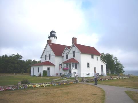
Iroquois Lighthouse
We chatted to the voluntary keeper – he and his wife had come for a year. There were beautiful flower borders around the lighthouse garden, which they had planted. The man liked to chat. His wife had taught textiles, and they had visited Britain several times – mostly Scotland. She was at present out picking blueberries, he said.
There were a lot of exhibits relevant to the lighthouse, and one wing was set up as if the home of the lighthouse keeper in the fifties.
We climbed the 72 steps up to the ‘light’, where we had good views over to Gros Cap, which we had visited with Wendy from Sault Ste Marie, Ontario. We walked back to the Bam along by the sandy beach.
A bit further west we stopped again by a delightful white sandy ‘squeaky’ beach beside Whitefish Bay. It made a lovely coffee stop, and I could have stayed much longer. By now the sun was out and it was hot.
We were driving the Whitefish Bay Scenic Byway, which was beautifully quiet.
We now joined a larger road, and came to Tahquamenon Falls State Park. We first reached the Rivermouth section of the park, which had a really pleasant campsite, but it was too early to stop. The road now left the park and we drove north to a small place called Paradise before joining a road which entered the falls section of the park. This is where we met the crowds! We could have camped here, but it was really too busy for us. We did buy an annual Michigan State Parks Pass, thinking that we would only need to visit State Parks on 4 days to make it worth it.
The campsite was in the ‘Lower Falls’ area. We had a picnic lunch before walking the trails. There are several falls here, either side of an island in the Tahquamenon River. They are not dramatic, but pretty. The touristy thing to do is to hire a rowing boat and row to the island, then walk around it. We sufficed with the boardwalks!
We drove on four miles to the Upper Falls parking area. This was busy too – we read that the falls are the number 1 attraction of the Upper Peninsula, as this part of Michigan is called.
We walked the trail to view the Upper Falls, which were impressive with their rush of brown (from the tannin) water. We walked back by a different route, with more views of the falls, and far less people.
Taquamenon Upper Falls
This is Hiawatha country, and the Tahquamenon River is where Hiawatha built his canoe, in the poem by Longfellow. I had bought two different illustrated books of the poem, both of them lovely, at the lighthouse.
Now we drove onwards, and eventually back to the shore of Lake Superior. There was a State campsite here, but we continued on a now unsurfaced road, often near the shore. We stopped by another lovely sandy beach, but just afterwards came to a State forest campsite which was absolutely chocka . We had started down the most corrugated track ever to another State forest site, but had given up after a mile or so.
We continued on the corrugations, relieved to finally reach a bit of surfaced road a few miles before Grand Marais. This was a really pretty little old-fashioned town with a long harbour inlet. We drove round to the simple lighthouse, and positioned ourselves beside it. We had heard that you could stay here, and it seemed a lovely spot to us.
Adrian had purchased an excellent bundle of logs from the roadside for $3, so now he had to find somewhere to put them! After that we walked out across the dunes to the wide sandy beach. From here we could look along to Pictured Rocks National Lakeshore and see the cliffs, but it was too misty for a photo.
Friday 22nd August Coloured cliffs by Lake Superior 90 miles
There was a little light rain in the night, but the wind got up, which disturbed us in our exposed situation, so I didn’t have a good sleep. That was nothing compared with the sudden crash of thunder as I was pouring the drinks at breakfast time! The nearest thing to overhead that we have ever experienced! We hurriedly moved a bit closer to some buildings, but the storm vanished as quickly as it had come. The day remained very warm and humid.
We left delightful Grand Marais, which had made us think of places in Newfoundland and New England. We very soon came into Pictured Rocks National Lakeshore, and found when we reached the small visitors centre that the road through the park was closed. Much of it was unsurfaced anyway, so we detoured through Seney, (we saw 2 sandhill cranes with their brilliant red head patches) and came to the western end of the park.
The park is named for its colourful sandstone rocks, but we thought that coloured rocks would have been a better name.
We drove to the area known as Miners Castle, where we walked to view the ‘hoodoo’ type rock beside Lake Superior. The water down below looked exceptionally clear.
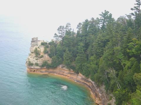
Miners Castle
We drove on a part gravel road the short distance to Miners Beach. After our picnic lunch, we walked down to the lovely white sandy beach, where the water was too cold to swim, but the colour of the blue lake against the dark sky was dramatic. Flies were the annoyance here.
We drove on to Munising, where we walked to Munising Falls, one of many waterfalls in the park. The town itself had a large unattractive factory. We stopped to get some fuel, before driving up to a lookout, where at the second attempt we had good views to Grand Island, the large island close by in the lake.
The next little place we drove through was called ‘Christmas’. At that point, the John Lennon record ‘so this is Christmas’ came on the CD player!
We pulled into a National Forest campsite/picnic area called Bay Furnace as Adrian had seen that there was a restored iron furnace right beside Lake Superior. It was all that remained of a once busy iron producing town. It ceased production in 1877. Its situation by the lake was evocative, and I learnt that pig iron is so called because the rods of iron look like suckling pigs.
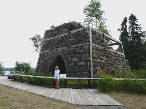
Old Bay Furnace
Wild bergamot was growing by the furnace, which we thought of when we had a cup of Earl Grey tea later.
We looked in at the campsite – there were no spots left by the lake, but we found a large, airy spot above a little stream and decided to stay, although it was still early. We have noticed how busy everywhere is here compared with Canada.
Adrian immediately got chatting to a chap from Florida, who later came back with his wife and 2 dogs to tell us of places we must visit in Michigan.
It was still warm and windy. We’d enjoyed our campfire meal when Bob and Linda, the Florida couple, returned with their neighbouring camper. He was Mike, a New Zealander from Christchurch. He was 51, married with 2 grown up children, but was travelling on his own around USA for 9 weeks on his motorbike, hoping to visit all 50 states. He’d hired motorbikes in Hawaii and Alaska, and had his own bike shipped to Vancouver. He was having to average 330 miles a day. We offered him a beer, which he enjoyed while we chatted until about 9.15. We watched bats flying around just before we came in.
We didn’t envy Mike when another brief storm hit at about 6.00 a.m., but we saw him drive off on his motorbike at 8 o’clock.
Winnipeg to Lake Superior, Michigan


