
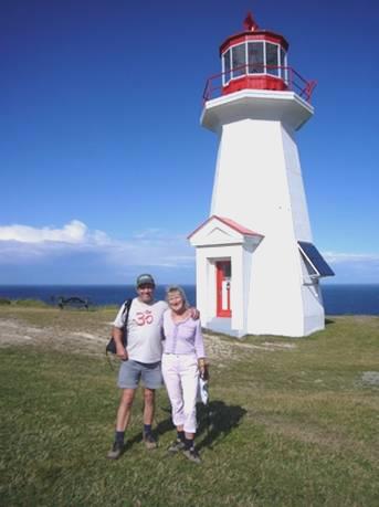
Wednesday 2nd August First day in pretty Prince Edward Island 114 miles
We were off early to catch the 8 o’clock ferry to Prince Edward Island (known as PEI). The good thing about travelling by ferry in this direction, is that you don’t have to pay, and we intend travelling on to New Brunswick by the Confederation Bridge, which is much cheaper!
The ferry didn’t come in until almost 8 o’clock, but all the vehicles were loaded on, and we only left about 10 minutes late.
The journey across the Northumberland Strait takes about 1¼ hours. It was very plain sailing. Initially it was sunny, after the wind and rain we had had in the night, but then it became dark and overcast. We had pretty views as we left Nova Scotia, and could see the Wood Islands lighthouse as we came into PEI.
Prince Edward Island is small, (280 km long), and divides into 3 separate sections, almost islands, known as Prince, Queens and Kings. We were touring Kings, the eastern, and least busy, part first.
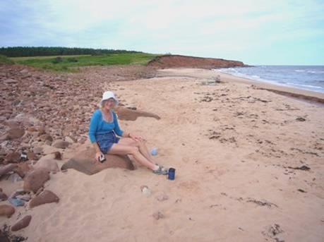
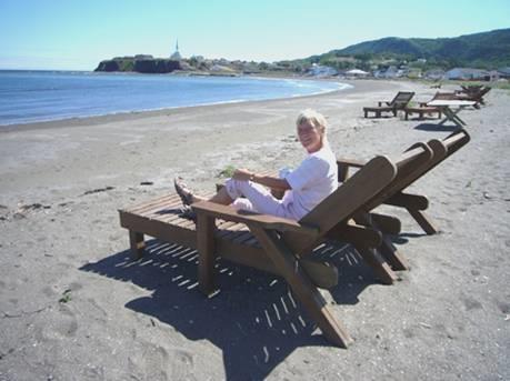
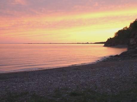
By 9.30 we were on our way, soon pulling in to Northumberland Provincial Park above a red sandy beach. There was a pleasant campsite here, but we just stayed for coffee, after a quick look at the beach.
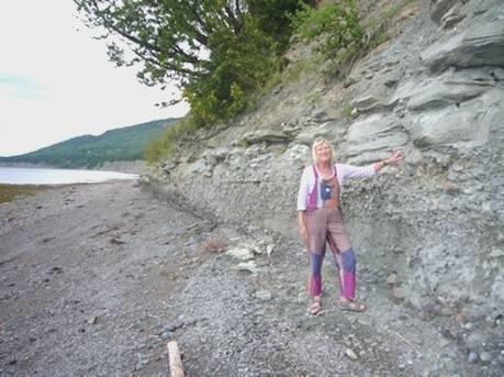
As we drove on, we were struck by the prettiness of the island – a quiet road, lined with mown grass and a line of trees. Masses of golden rod added to the rich greenness.
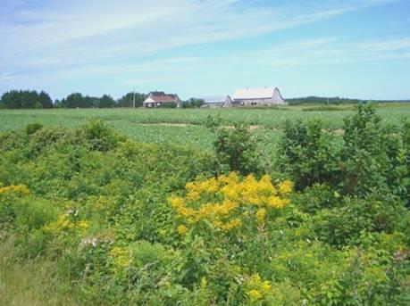
Pretty Prince Edward Island with fields of potatoes
Later we could see the fields of potatoes which PEI is known for, and actually bought some. The rich red soil was also home to fields of golden corn, and to vines. Everywhere was very neat and unspoilt, giving the feeling of days gone by. There were simple but neat farm buildings, and clapperboard houses with pretty gardens.
It was sunny by the time we stopped at Cape Bear, where there was a small lighthouse. There had been a Marconi station here in the early 1900s, and it was apparently the first to hear the distress signal from the doomed Titanic.
At Murray Harbour Adrian was able to get fuel AND propane, while I sat and looked at the attractive harbour, which had once been a large port, but is now concerned with fishing. A cycle track starts from here along the course of the old railtrack. Another section of it transverses the island, under the name of Confederation Trail.
We stopped next at Panmure Island Provincial Park, where there was a lovely white sandy beach, with views up to another lighthouse. The water here was too shallow to swim in, so we continued on our way.
We drove on through Montague, which had lots of nice old buildings, but some of the modern grot too. We stopped for lunch just after Cardigan, with views down to the lovely inlet, surrounded by red cliffs and covered in pine forests. As we both sat down at the picnic table, it tipped right up, but luckily no harm was done!
Being aware of how quickly time is passing, we tried to limit driving to some of the many peninsulas, but things were against us – firstly there was a tree down, blocking the road. It seems that a beaver had gnawed through the tree, felling both it and the electricity wires! We had to retrace our steps – ‘no worries, the man had said, its just a little diversion’ – but we didn’t fancy the long red dirt track we would have to have taken!
Next there was a ‘barricade’ where they were resurfacing the road, so we had to take an alternative rough and bumpy route!
We got to where we were aiming for though – Basin Head and its ‘singing beach’. It was such a pretty place – we had read that it was the islanders favourite beach, and the number of people there confirmed this!
It was a beautiful white sandy beach which ‘squeaked’ when you walked on it. There was a small inlet, with a wharf and fishermen’s huts – in fact there was also a fishermens museum here. In 2004, a storm had wrecked the wharf, which had partly been rebuilt. What the kids were loving, was leaping off the wharf and the temporary bridge, into the water below. With so many people around, it looked rather dangerous! There were a couple of young lifeguards, who were happily chatting together. As we left, we saw the sign which read ‘No jumping from wharf’!
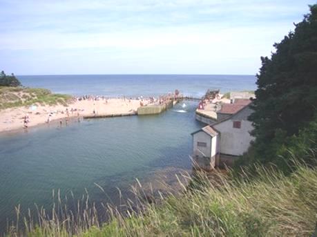
Basin Head Wharf
Plenty more people were happily enjoying the beach and the sea, and we joined them. Mind you, the sea was pretty cold! We tried the inlet, but that was no warmer, so we had to go for the sea. I had quite a swim, and Adrian was enticed to do a few strokes. People here must have thicker blood than us, but we did feel nicely refreshed afterwards, and even enjoyed an icecream.
It was 4.45 when we left here, and continued up as far as East Point lighthouse, at the most NE point of the island.
At North Lake, just along from here, we found a place to pull off near an inlet to the sea.
After supper we attempted a walk out to the sea, but the mozzies drove us back, so we dashed in and worked on the website.
Thursday 3rd August Charming Charlottetown – capital of PEI 86 miles
There was some rain in the night, but it was a fine and warm day.
After pancakes for breakfast, we set off, driving through pretty North Lake Harbour, and then along the coast, but always slightly inland.
At Naufrage, another small harbour, we came across a building with showers for public use, so we made good use of them!
A bit further on we took a track called MacAskill River Rd which ended by a lovely pink sandy beach where we sat and had coffee.
Nice beach for a coffee stop
There was a part of the National Park near here called the ‘Greenwich’ section. It formed the end tip by St Peters Bay, and was supposed to be wonderful, with dramatic sand dunes. We walked through a bit of pleasant but unremarkable wayside to the edge of the bay. There were floats used for mussel farming out on the water, and a board told of the mussel ‘mud’ which used to be collected from the sea bed and used as a fertiliser.
Nearer the shore, there was a car park and a boardwalk to the beach. Families were just arriving for the day, but we didn’t stop, and the dunes didn’t impress us much!
We did stop at the small town of St Peters Bay, at the inland end of the actual bay. We looked for a café mentioned in Lonely Planet which had good food, and also rented out bicycles, as this is another end of the Confederation Trail. We couldn’t find it, so ate instead at Rick’s Fish and Chips, which seemed popular. We ordered mussels/clams and chips, which we ate at a picnic table outside. The fish was in batter – supposedly Cajun, but was nothing special.
We now made our way to Charlottetown, on the other side of the island, which is only a few miles wide at this point.
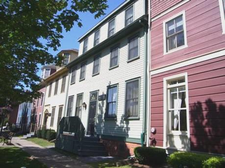
Clapperboard houses in Charlottetown
This is the capital of PEI, and must be the prettiest and most casual capital ever! The outskirts are much like any western town, and there were one or two ‘mistake’ buildings, but generally it was quite charming, with lovely clapperboard houses, and quite a few stone buildings too.
One of these was Province House – a National Historic Site, and still the site of the legislature. It was here in 1864 that discussions took place that heralded the formation of the Dominion of Canada. We stopped and had a look around some of the rooms.
Charlottetown is set on a 3 armed harbour, and the waterfront area is attractive, with some live music coming from outside the Visitors Centre, which is in one of the former port buildings. It seemed a really lively and happy town. We peeped inside St Dunstan’s basilica, where a wedding was about to take place. It was very ornate, with a nice stained glass rose window.
We now headed to the outer, less attractive part of the town, where we did some shopping, and then got a good internet connection, so were able to send our last email and website, which really pleased us. This done, we made our way to nearby Walmart for the night.
It was really quiet for a Walmart carpark, especially as the shop closed at 10 o’clock.
Friday 4th August Anne of Green Gables 85 miles
We found our way out of Charlottetown and back northwards, stopping to have breakfast at Corran Ban, on the edge of Tracadie Bay.
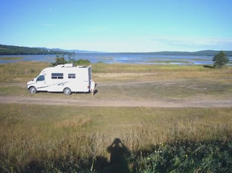
We drove on into Prince Edward Island National Park, which is basically just the coastline, rather like Cape Canaveral National Seashore in Florida, and people mostly come just for the beach. Today wasn’t really a beach day, as the grey skies didn’t clear until late in the day. We drove along westwards, stopping here and there and sometimes walking down on to the pinkish sand. We drove right along to the end of this first section, at Robinson Island, but here the road just ran out, and the campsite was all closed up. There was nowhere to pull off, just views over Rustico Bay, with lots of blue herons – this section is called the blue heron route.
We had to drive right around Rustico Bay to get to the next section of the park. There were 5 ‘Rustico’ villages, where the inhabitants are mostly descendants of the Acadians who lived here in the 1700s. North Rustico was a big deep sea fishing centre. We drove right round to North Rustico Harbour, before heading back into the Park at the Cavendish section. We parked at Cavendish East, and walked on a trail by the dunes, and across McNeil’s Pond (once open to the sea, but now cut off by a sand bar) to Cavendish West. This is the big, popular beach. There were already a lot of people on it, and quite a few in the sea, despite the greyness.
We walked back and had lunch before driving out of the park again, then back into it at Cavendish Campsite. We knew that it got busy here, despite the high price, but at 1.50 pm, the large campsite was already full! – but we did manage to use the dump.
If the National Park had not lived up to its expectations for us, the Anne of Green Gables sites certainly did! Lucy Maud Montgomery, the author of Anne of Green Gables, had lived in Cavendish as a child, and had written many of her famous books about Anne here. She had lived with her grandparents, from a baby, after her mother had died of TB. She loved the island and although after she married, she moved to Toronto, she always held the island dear.
We both had only misty memories of the story of Anne, although I had bought a copy of the book yesterday, and had just started reading it. Even before we reached PEI, we realised the huge influence of LM Montgomery and her writings.
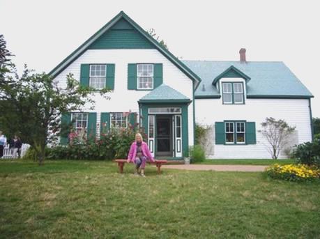
Green Gables
We arrived at the ‘Green Gables’ site – a National Historic Site, so included in our passes. The house here is the one owned by relatives of LM Montgomery, and the inspiration for her story about Anne, a spirited girl who is adopted by an elderly couple, who grow to be very fond of her. The house was painstakingly restored to look like the story made it out to be. It looked quite delightful, with its sunflowers, its hollyhocks by the door, and pretty flower garden.
Anne’s room at Green Gables
Inside was lovely too, but as we went around, we both found that we were muddling the story of the fictitious Anne, with the real story of L M Montgomery being brought up by her grandparents.
We walked a short trail which started at ‘Lovers Lane’, which comes into the books. We got a real feel of this lady who loved nature and in particular this area where she was brought up.
We drove a short way to the cemetery where she was buried, which had a sign at the entrance saying ‘no artificial flowers please’, so immediately endeared us! The grave looked really pretty, surrounded by red geraniums and white alyssum.
There was a petrol station opposite, where, after getting fuel, we were able to fill the water tank, which was wonderful, as we were desperately in need of some.
We had a bit of trouble in finding the site of LM Montgomery’s grandparents home site, but we are glad that we persevered. There was a little ‘bookstore’, where the young girl gave us a quick introduction to the site. The house isn’t there any more – it was knocked down by the relative who was living close to it in the early 20th century, when he was fed up with all the visitors tramping over his land to see the site! There was a copy of a photo, taken by LMM of the view of this area, and also many other exhibits to make it all come real. LMM’s first book had been rejected many times before it was finally accepted for publication.
We had parked beside the church where LMM had married in 1911. Across from this was the Post office. LMM’s grandparents ran the post office in their house, and this represented the one they had lived in. As well as being the current Post office, this one had a little (free) ‘museum’ explaining about post office life in the late 1800s (when communication with the mainland was difficult and erratic, especially in winter), and what would have happened to LMM’s manuscripts when she had sent them off.
So we came away with a really good feeling about it all – an inspired lady, whose writings have had a great influence, both on PEI and amongst ordinary folk worldwide.
We drove on through Cavendish, with its little bit of garish amusements. Although quite late, we stopped by the laundrette to get up to date with the washing. It was 6.15 when we headed out, hoping to find somewhere to stop for the night. This wasn’t easy to find. It was after 7 o’clock when we pulled into a lovely spot beside Indian River, just after the village of that name, which had a delightful church with a white painted round tower.
Adrian cooked the cod outside, and we sat and watched fish jumping in the river in front of us as we supped the last of our wine.
Saturday 5th August The North Cape Coastal Drive 184 miles
I awoke to see the red glow as the sun rose. After becoming a yellow ball, it disappeared into a huge bank of cloud, to emerge later and shine down on the pretty inlets and on the fields of golden corn.
We ate our breakfast sitting in the cab, with our lovely view over the water.
Nice place for an overnighter
The blue heron was in its same position as last night. We chatted about ‘Anne of Green Gables’, which I was so enjoying reading.
We set off, and at Miscouche joined the ‘North Cape Coastal Drive’. Miscouche had a huge catholic church. It is the centre of the Acadian region, as the enormous Acadian flag outside the museum showed. Many of the Acadians in PEI had managed to stay here when most were expelled . Some had travelled to Europe, but returned to PEI.
We passed through villages with the unbelievable names of Central Lot 16, SW Lot 16 and Lot 11! Later, we saw maps which showed this northern section divided up into just such numbered lots. This also explained why the roads nearly all run diagonally across the peninsula – SW to NE and NW to SE.
At Alberton we could see that the road was blocked. This turned out to be for a parade. The young chap directed us to a road opposite, where Adrian was able to squeeze the Bam between parked cars, so that we could park. We thought that we’d go and see what was going on – the chap had said that they were finishing in the school opposite. What he didn’t say, and probably didn’t know, was that the parade had really finished, and all we saw were the people and floats trying to sort themselves out!
We saw posters telling us that this was all part of Prince County Exhibition, which is on this weekend. As most people had now drifted away, we joined the cars in driving through the small town, pulling in to have coffee in a little park by what was once the station, and is now part of the Confederation Trail. The sun was warm, but the wind was strong and gusty.
There was a war memorial here – strange to think that such a small remote town lost several young men in both world wars.
We continued north to Tignish, passing pretty bits of coast, but the water was very shallow. The church in Tignish was enormous and ornate, with a high ceiling, painted deep blue and covered in stars.
The nearby Cultural Centre had an excellent display on the history of the town, all packed into a small space. The Acadians had come here first, but lots of Irish had settled here too, in the early 1800s and there was much intermarrying.
We didn’t drive the last bit up to Cape North, knowing that much of the area was covered with wind turbines. We headed for the west coast, but the first road we tried had a bridge just a bit too low for the Bam!
We took a different road, and had lunch at Cape Cage, where we saw people on the beach collecting up Irish moss seaweed. Apparently 80% of the world’s Irish moss comes from PEI. It is used in icecream, toothpaste and car tyres, amongst other things!
We saw people collecting some again at Miminegash, and laying it out to dry.
From this western coast we could sometimes see the low outline of New Brunswick in the distance.
We drove down to Howards Cove, where the luminous fishing floats on all the piles of fishing cages was quite a spectacle. The long lines of blue doors, each with someone’s name on, on the fishing huts was another photogenic site!
At West Point, the southernmost point of this northern peninsula, we pulled into Cedar Dunes Provincial Park, which was quite delightful. The colours of the pink sandy beach, the turquoise sky, the white fluffy clouds, the deep blue sea, red at the edge, and the black and white lighthouse were obviously so popular that 2 separate wedding groups had come down for photos.
We settled for a short laze on the beach, before I had a pleasant swim, in water which was just deep enough, but nicely warm.
We made our way around the next promontory, hoping at Abram Village to see some activity, as I had seen that there were celebrations this weekend, but the village was as quiet as a mouse!
We continued on our way, pulling in to a nice little beach park at Union Corner, where we could see the 9 mile (13km) Confederation Bridge, which we plan to drive over tomorrow, in the far distance.
From here we made our way to Summerside, PEI’s second largest town, arriving at the waterfront just after 6 o’clock.
We hoped to ‘hit the town’, being Saturday night, and unusual for us to be overnighting near habitation. We tried the seafood restaurant next to us, but it closed at 8 o’clock, and it was now 7.45. We had heard music coming from across the large parking area, so made our way there, when we realised that the music had stopped – the band was just packing up when we arrived! We went into the nearby ‘Deckhouse’ restaurant, which was milling with people. We sat outside, as the sun went down, and ate mussels (steamed)/ scallops and chips, and drank a beer. The manager, a dapper little fellow, looking like Freddy Garrity, in thin striped t-shirt, shorts and trainers, joined in serving, and told us that a band would be playing later.
We asked at the Visitors Information next door, and she said that the only other place with live music tonight was the Heritage Pub. We walked around the town, following her directions, and our map, but never found it. We returned to the Bam for a while, bemoaning the fact that we were in the ‘centre’ of town, and nothing was happening. We read in Lonely Planet that the ‘Deckhouse’ was THE place to be, so made our way back there. By now the band had started up, but we were given a seat outside, and it had got chilly. Our previous waitress recognised us, and found us a table inside. This was better, but 2 enormously obese women were sitting in front of us, obscuring our view of the 3-piece band, who were good. After a bit, we grabbed 2 seats by the bar, and soaked up the atmosphere of this vibrant place, where all the numerous staff were constantly busy serving the many customers, and the atmosphere was buzzing. The manager thanked us for coming back. We left at 11.30, but the band was playing on until 1.00 am. It had been a good night.
Sunday 6th August We cross the Confederation Bridge to busy New Brunswick 117 miles
It was a beautiful day as we left Summerside at 9.45 and headed off to leave Prince Edward Island. I had thought what a silly, made up name Summerside was, but it turned out it was given in 1840, by someone who thought that it had seemed warm there!
We located the Heritage Pub, on the way out of town, nowhere near where Lonely Planet had it – a dreadful 70s looking building – we were pleased not to have gone there last night!
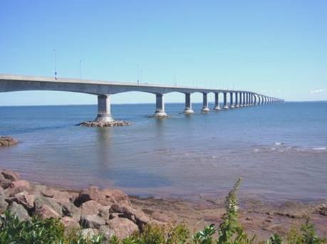
The sun shone on the fields of potatoes and of golden corn as we made our way to Borden/Carleton to cross the 9 mile (13km) Confederation Bridge to New Brunswick. This bridge, which took 4 years to build, was finished in 1997. The major problem in designing it was the ice which crushes against it during the winter. It has 44 piers in its main spans, which were built in situ, but the rest of the bridge was built on land and lifted into place by a huge floating crane. Each of the 44 bridge sections on top of each pier weighed 7200 tons!
Confederation Bridge
We had really enjoyed PEI, it is so pretty everywhere, and so easy. It is a tourist island, but in the same way as the Isle of Wight – laid back and old fashioned, which was great.
We stopped to get fuel before crossing the bridge, and had a long wait – later we found that it was no dearer in New Brunswick!
It was pleasant driving across the bridge, as it wasn’t too busy. Once we reached New Brunswick, we pulled into the Visitors Centre attached to Cape Jouriman – an area of trees and beach which we had hoped to explore.
Our first disappointment was finding that you now have to pay to enter the area, so we only stopped long enough to have coffee (and get bitten by mosquitoes) and view the bridge.
And so it went on – nearby Murray Beach Provincial Park, where there was an enormous campsite – it cost $7 a day to visit. In PEI they were all free. Other beaches were the same, so we were feeling a bit desperate! On top of that, everywhere was SO busy – traffic, housing, RVs, crowded campsites.
We needed to stop for lunch, and I suggested taking Emery Leger Shore Road. We didn’t hold out much hope, but to our delight, the road just led a short way and ended by a boardwalk over the dunes to a delightful sandy beach!
We lost no time in making up sandwiches, which we took down to eat on the beach. The tide was out, and it was rather like Wittering – wide stretches of sand with warm shallow pools. We had to walk out a long way to get any sort of swim, but we came away with our faith restored!
Driving on through Shediac - supposedly lobster capital of the world – was horribly busy. We continued to Bouctouche, where we walked along a boardwalk and saw several herons and a kingfisher. They harvest oysters and other shellfish in the bay here.
Just north of the town was a long sandspit, where they restrict the number of visitors each day. It is really just a sandy beach, backed by dunes, but there is an enormous boardwalk structure over the dunes to save you walking on them, when we thought that you could have walked along the beach anyway! It is all supposed to be eco-friendly. There were lots of jellyfish by the shoreline. This is again an Acadian area, and there are so many French speaking people, and signs are in French first, English second, that it was difficult to imagine that we weren’t in France!
We stopped to have an ice cream before driving on to find somewhere to stay. We felt pretty hopeless, because everywhere was so busy, so turned inland on a road which, despite how it was shown on the map, became unsurfaced. Still we couldn’t find anywhere to pull off.
We joined a larger, surfaced road, and at 6 o’clock, found a large area – an old quarry, where we pulled in, and enjoyed the warm sunshine in our isolation. Adrian lit the barbecue, and we sat out until 8.30. There was scarcely a mozzie, and it was as lovely as anywhere we have stopped, with the sound of the crickets and nothing else.
Monday 7th August Kouchi Bou on a bicycle made for two! 57 miles
We left our nice spot at 8.30. There was a blue sky as we drove north to Kouchibouguac National Park. We were enjoying the pretty inlets and the quiet roads at this time of the day.
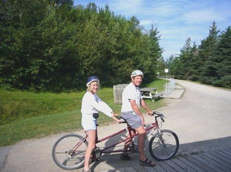
We arrived at the park at 9 o’clock and made our way to the rental place so that we could hire bikes. This park had lots of cycle trails as well as footpaths.
On a bicycle made for two
We saw that you could hire a tandem, so this is what we went for! The last (and only) time we did this was in Melbourne 8 years ago. As we set off, another couple were coming to swap their tandem for 2 bikes, as they couldn’t manage it! It really is a test of harmony, and after 40 years together we got on pretty well! The person in the front has all the control, and the one at the back has to follow! We did have a swap over, so we both had a chance as leader! The paths weren’t as exciting as in Keji, but it was good fun! We were ready for our tea/coffee when we returned!
There was a large campsite here, with a ‘full’ sign up when we arrived. There probably was room for tonight, but we had decided to see what we wanted to of the park and move on. As the wind and cloud increased, we were pleased with our decision!
The park is edged by the sea, with a lagoon and long sandspit which is home to terns and piping plovers. You can use a boardwalk to reach the sand spit, but the increasingly strong wind made it not a beach day!
We walked several of the shorter trails, the most enjoyable being the last one we did, which was through open country beside the Kouchibouguac River.
By 3 o’clock we were heading out of the park, and half an hour later arrived at Pointe Sapin, where we pulled in by the sandy beach, beside the working harbour. The wind had really got up now, but this didn’t deter 3 young boys from enjoying the beach!
The wind got even stronger, and everywhere inside the van got covered in gritty dust. We moved round behind the large building, which was a bit less windy and dusty, but we became aware of dozens of cars pulling up. Today is ‘New Brunswick Day’ and there was obviously some kind of ‘do’ on in the ‘village hall’ so after a bit we moved back to the beach. As the wind didn’t die down, we were keen to move back to the shelter of the building, but wanted to wait until the vehicles had left. Then we looked out at 9.30, and found that they had all gone – we hadn’t heard a thing!
Tuesday 8th August Miramichi and Lord Beaverbrook 99 miles
We were glad that we did move back behind the building again, as at 12.30 a.m. the storm hit! Then at 4 o’clock there was more torrential rain!
The morning was grey, but brightened a bit later. We set off at 8.30, but had a delay, as Adrian found that a stone had got caught between the two ‘duallies’ (back tyres). He expertly managed to remove it, by letting down the tyre, and once he had pumped it up again, we were on our way to Miramichi.
This large ‘town’, near the mouth of the Miramichi River, is really the conglomeration of several smaller towns and villages, on either side of the river, so without decent maps it was difficult to find our way around.
We located Walmart, but despite our best efforts, weren’t able to get the next lot of photos printed, as they had run out of matt paper. Well, they had just got some in, but hadn’t set up the machine for it!
We went off to find a shop to buy food, as we intend going off into the ‘wilds’ for a day or two. Having shopped, we wasted a long time trying to get an internet connection, and when we did get one, there were still no new messages. We tried phoning Paul, but the line was too poor for him to hear us!
We located a place to dump, but had much more trouble getting water. We pulled into Ritchie Wharf – now a park area beside the river – and had lunch.
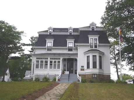
It had been a surprise to us to find out that Lord Beaverbrook had spent his childhood years in Newcastle, which is the main town of Miramichi. His father had moved here to be minister at the local church. Beaverbrook had done much to benefit the town, and ‘Beaverbrook House’, his former home, is open to visitors. We located it with some difficulty, and a nice young girl showed us around. They were trying to get the place set up as a museum, but for now it was just a hotch potch of things associated with Lord Beaverbrook, including a splendid album of his showing large black and white photos of London.
Beaverbrook House
There were also posters advertising the folk singing festival, which he had helped to start up. It is now in its 49th year, and is being held at the moment. I had been hoping to see some of it, but when we located its venue, it was just a lunchtime and evening concert each day, held in an unattractive building bearing Beaverbrook’s name. We weren’t going to hang around until the evening – but I was intrigued to see that one of the performers was a gent of 102, who had played at every festival!
Beaverbrook’s ashes are buried under his statue in the town square, which reminded me of Exmouth.
It was now time to leave, but as we did, a chap came up on his bike and tried to befriend us (thinking that we were Texans)!
We headed south, but had difficulty finding the road by the river, which was our intended route, and when we did find it, we only got glimpses of the river anyway. Its popularity is as a salmon fishing river. Our route was now taking us westwards, but first we needed both petrol and water. Luckily, at Renous, where the road headed away from habitation, we were able to get both.
Now properly prepared for the ‘outback’, we set off, finding a large gravel area at 4.30 to stop at, apparently near McGraw.
It was still sunny and warm, so Adrian lit the barbie and we sat out until 8.30 in our isolated stillness.
Wednesday 9th August Goodbye Maritimes, hello again Quebec (or 2 loons in a lake) 222 miles
The night had been cold, but we left just after 9 o’clock on a beautiful morning.
We drove through the continuing forest. After an hour or so, we pulled into a lookout (which was just of trees). It had been built by the Fraser paper company, and we were aware of logging trucks as we drove along. We had a nasty experience of one later, on an unsurfaced bend, when he approached us at speed, stirring up clouds of dust.
We skirted the town of Plaster Rock to drive north through pretty country following the Tobique River to Mt Carleton Provincial Park. It was now midday.
We drove into the park on an unsurfaced road, coming to a sign which said ‘picnic site 15 km’! We took another road, and soon reached another picnic area beside a lake. It was completely deserted as we took our picnic lunch to eat by the lake. Afterwards we both had an enjoyable swim in the lake (Adrian in his starkers outfit). A couple of loons were swimming about and diving. It was beautifully warm and peaceful. Mt Carleton is the highest peak in the Maritimes.
In Mt Carleton Provincial park before our swim
We now drove north, initially on an unsurfaced road, and came to Saint Quentin. The road now went north, through very French feeling Kedgwick. We were driving through the Restigouche forested hills. We arrived at Campbellton at 3.45. From here there is a bridge over the Restigouche River to Quebec Province. We realised that we would be leaving the Maritime Provinces, and wanted to say ‘goodbye’. Luckily there was a nice area with picnic tables where we stopped to enjoy the view over to Quebec on the other side. It was hot and beautiful.
We managed to log in, but there were still no messages – is everyone on holiday?
Goodbye to the Maritimes – the bridge to Quebec
We crossed on the attractive bridge, reminding us of one at Nelson BC, to Quebec province. There was a National Historic Site a few miles back at Pointe a la Croix, so we made our way there. This is where there was an important battle between the British and French in 1760, resulting in the French withdrawing from ‘New France’, and the British taking over Canada.
It was a really good visit, mostly because of the people we met. The lady at the desk (French speaking) had visited England in the eighties, and had fond memories of Oxford. She said that ours was only the second ‘National Historic Pass’ which she had seen this year!
The guide who we saw most of was a delightful Micmaw lady, who spoke Micmaw, English and French. She said that her parents had ensured that they spoke Micmaw at home, and that now people were working hard to resurrect the Micmaw language.
Our plan now was to visit the Gaspe Peninsula, which is supposed to be both beautiful and uncrowded. We set off eastwards, driving through a long section of unsurfaced roadworks, and reaching a rest area at Pointe a la Garde at 6.15 (but 5.15 new time).
It was still beautifully warm. We sat at the picnic table, and later Adrian cooked the fish outside. We had hoped to eat outside, but as we sat down to eat, the mosquitoes descended, so we came indoors.
We were amused to see young girls (one was old enough to drive), pull in and dash for the swings. After much fun, they left again.
Thursday 10th August Are we descended from a fish? 84 miles
After such a beautiful day, we were surprised to hear rain in the night, and the day was very grey. Some men had come in to work on the cleared area behind us. We passed many similar picnic areas today – all well equipped with large play areas, picnic tables, well looked after toilets, and sometimes barbecues – all very French! It seemed like being in France, with the large French looking churches, and all the signs in French only, of course.
We left at 8.30 new time, and soon came to Miguasha fossil site, which opened at 9 o’clock. This is a World Heritage site, but is a Quebec National Park, as opposed to a Canadian National Park, so our passes didn’t apply!
Its importance is the number of fish fossils found here, in particular lobe-finned fish, with air-breathing lungs and with vertebrae which evolved to limbs rather that fins. This suggested the evolution of water animals to land animals and therefore to humans. This was all during the Devonian period (342-395 million years ago).
We were given a short introduction to the contents of the museum, by a pleasant young girl who had worked in London for a while as an au pair. We then wandered around the vast number of exhibits ourselves. There was far too much to take in, but it was fascinating. Strange to think that these innocuous looking cliffs led to such world shattering discoveries.
The fossil cliffs at Miguasha
The weirdest thing of all in the museum was a live fish, a South American dipnoan which they called ‘yoyo’, which spent its time moving from underwater to dashing up to breathe air. It was a bit like a long eel, but with the strangest face – we didn’t believe that it was real. Luckily all the explanations were in English as well as French!
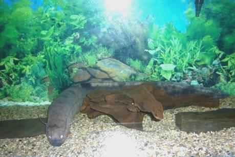
A Dipnoan called Yoyo
Saturated with information, we drove along the southern Gaspe coast, to the north of Chaleurs Bay.
At Carlton we stopped to have our lunch in the beach park, and we stopped again at Maria, where we walked along the sandy/pebbly beach which was dotted with huge logs, reminding us of the Great Slave Lake. It was very calm and still, and the water looked a metallic grey. We saw a little sandpiper, camouflaged against the beach.
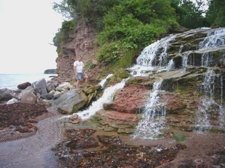
At Caplan there was a nice little waterfall cascading onto the beach, but we were generally disappointed to find how populated the area is, with quite a lot of ‘No Camping’ signs.
Caplan beach
About 4.30 we found a nice spot under the red cliffs, by the red sandy/pebbly beach at Hope. Still not adjusted to our new time, we had a cup of tea, as it’s a long time till supper.
Our plans were somewhat upset by an ‘older’ couple who pulled in right behind us and proceeded to have a barbecue at the picnic table. Much wine must have been imbibed, as the woman got very loud and giggly. They walked about for a bit, then sat in their car for ages. Finally they left, but we had given up the idea of cooking outside by then!
The lovely sky at Hope
After such a miserable day, there was a really beautiful sky, especially after the sun had gone down. We are always prepared for surprises! We had seen a man drive down and unload a pile of wood earlier, which he built into a bonfire at a place on the beach which seemed to be set up for it. Then, at around 8.30, a whole lot of cars drove down, and parents and children made their way across to the fire. No fireworks, food or drink, but they enjoyed themselves for an hour or so, then all left. We walked out to the dying embers, but there was no heat left in the fire. The full moon was half hidden by cloud.
Friday 11th August Along the southern Gaspe peninsula in the sunshine 105 miles
6.00 am, and the sun was shining on the water from a clear blue sky. We enjoyed breakfast sitting at our picnic table in our isolation, with the beach in front, and a mass of wildflowers behind – blue chicory, pink clover and yellow golden rod. We set off at 7.45, but just up the hill saw a parking area for a walk along above the cliff. This was too good to miss, so we started off along the path to Pointe aux Corbeaux. It was a real treasure! We looked down into the sea at black and white guillemots, swimming just below the surface, so that we could see their orange legs. Great cormorants were nesting in the cliffs at the point, and a mass of sunflowers were growing in the garden behind (how much more French can you get?). The path had been made with much pride – there were labels (in French of course) on many of the trees.
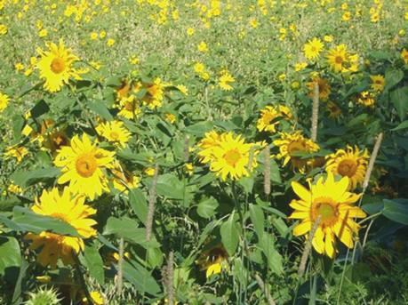
Glorious sunflowers
It was therefore an hour later when we set off along the coast, which was so much more enjoyable today in the sunshine.
At Port Daniel, we stopped where a river reached the sea, and the railway crossed on a bridge. We watched ducks swimming in a very strange way, and sat for ages trying to decide what they were. We came to the conclusion that it was a female Common Merganser and her 11 young, and she was giving them a ‘swimming lesson’!
There were so many lovely coves and inlets, often making us think of Dawlish, with the red cliffs, and with the railway beside the sea. We stopped at a nice sandy cove at Newport, and had a walk on the beach.
At one of the many picnic areas (each small town seemed to have one), we were able to dump, and to get water. We had lunch at another picnic area above the little harbour at St Therese. We had stopped to get a bit of shopping, so enjoyed a delicious French loaf, and some lovely cherries. There are good things to this Francophile Province – among them, the fact that you can buy wine in supermarkets!
We were now nearing the popular place along this coast – Percé. It was really pretty as we approached Cap Blanc – a white cape, standing out from the usual red rock. The colours were wonderful – the red and white rock, vivid green vegetation, bright blue sky and sea, yellow flowers.
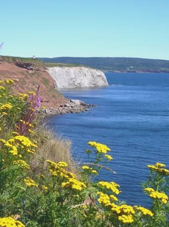
Looking to Cap Blanc
The actual ‘Percé’ rock was just beyond this, and was certainly stunning. There was a pull-in viewpoint, where we could look down to this large ‘cliff’ just offshore, with a hole in it, and another stack beside it. The rock here was also whitish, but streaked with all sorts of other colours. It was one of those sights which takes your breath away on first seeing it. What Adrian couldn’t come to terms with though, was the large motel built right in the way of this spectacular view!
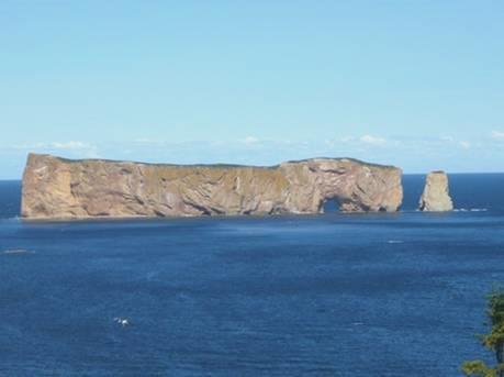
Percé
You can walk across to the island at low tide, but now wasn’t the right time! Also offshore is Ile Bonaventure, where there is a huge gannet colony. However, as soon as we reached the town, we knew that we didn’t want to stay long! Everywhere was SO busy – hotels and campsites wherever you looked, and so touristy. We knew that you had to pay for anything you did, including parking, and we had been so enjoying the quiet places we had been driving through.
We drove on through the town admiring the wonderful forested hills as we followed the coast north. We stopped at Barachois where we could look back to Percé from a river estuary. We climbed up over the railway, which crossed the river on another large bridge, and down to a sandy beach, but by now it was quite windy.
We had many good views back to Percé until we rounded the next point, St Pierre. Just after here we pulled into a viewpoint to ‘Indian Head’. We couldn’t see where it was, but a chap came and told us (in English) that if we walked down a little path, we would get a view of the ‘Indian head’ – a fallen rock stack looking like the silhouette of an Indian.
At Douglastown took a small road which led down to a sandspit, which seemed an excellent place to stop for the night. There was a lagoon on one side, and across the railway (we didn’t ever see any trains), a lovely sandy beach. We had a barbie, and ate outside, but the thing that spoilt it tonight was a family who came down with a small motorbike for the kids. They rode it continually, one after the other, and the noise was like a non stop chainsaw. We were glad when they left, but that wasn’t until late.
As this was the start of our anniversary weekend, we climbed up the dune and over the railway track to the beach, where Adrian gathered wood, and we sat out by the fire until 10 o’clock. The moon, just past full, had risen like a huge squashed lemon. A lovely evening!
The start of our anniversary weekend
Saturday 12th August A bear at the end of the trail 78 miles
Our spot by the lagoon in the early morning
The night had been cold, but the sky was blue, even if the wind was cool.
We walked back to the beach, and were surprised to find that someone had come along and used our fire after we had left.
We drove the few miles to the town of Gaspé. This is in a beautiful situation, at the end of Gaspé Bay, and with wonderful scenery all around. It is where Jacques Cartier first landed in 1534, and we found the monument to him.
The town didn’t serve us well though – we wanted both an internet connection, and somewhere to shop, and we found neither. As we were heading into Forillon National Park, at the end of the Gaspé peninsula for the weekend, this was a calamity, but we just had to continue on our way.
Luckily, as we drove through a small village, we did get an internet connection, and eventually received a couple of emails, including one from Hil wishing us a happy anniversary.
We entered the park, and decided which of the two campsites we would like to stay at – they were some distance apart, and we had to consider which walks we might do. We settled on trying the northern campsite, but when we finally reached there, and found the booking in kiosk, we were told that we couldn’t book until about 11.30, in an hours time. We were assured that there was room, so we drove off as far as Cap des Rosiers lighthouse. We were amused at watching gannets diving expertly for fish. We looked through the anniversary cards which we had brought with us.
We returned to the campsite at the allotted time – called Cap des Rosiers (almost Rosie Cape) – it seemed fitting!
We had been given a nice pitch with views to the sea, and to the remarkable Cap Gaspé with its sheer cliff sides.
View from our pitch at des Rosiers
After a quick walk to the pebbly beach, we returned to have lunch at our picnic table, using our red and white cloth for the first time this trip.
We now left and drove back to the south of the peninsula with the intention of walking the trail known as ‘Les Graves’, which ends at the Gaspé lighthouse, at the end of the peninsula. This also is the end of the International Appalachian trail (the Canadian part, continuing from Maine), as it is the very end of the Appalachians.
There was a walking trail, and also a cycle path, so we thought that we would make it a loop trail by walking the 4 km there on one and returning on the other. This worked well – we started by walking along a nice little beach, and then had lovely views down into pretty little coves, with steep cliff sides. We could also see across Gaspé Bay to the stunning scenery beyond, as far as Percé, and including the sand bar we had stayed at last night. Golden rod added to the colour, but the rosebay willow herb was mostly over. Whereas our weather was lovely and sunny, we watched increasing thunderstorms develop across the bay, and were glad that the weather had been so lovely when we were there yesterday. We had been disappointed to see that rain was forecast for us tomorrow, which was part of the reason for us doing this walk today.
We were getting to the end of the trail, walking through a bit of forest. We had joked about not having seen any wildlife, and Adrian said that if there was a bear around, it would wait until all the visitors had gone. Then suddenly, there he was – a black bear - he just sauntered across the path in front of us, and disappeared into the woods the other side! We were both struck dumb – we have seen many bears in western Canada, but never as closely as this, and usually from a vehicle, not walking.
We were so excited, that as we came out of the woods at the lighthouse, we were telling everybody we saw! We asked one man to take our photo by the lighthouse – 2 excited people at the end of the trail.
At Cap Gaspé, just after seeing the bear
We spent some time admiring the great views from here, before making our return walk along the cycle path. We had only gone a short distance when I stopped to take a photo looking across the bay. I had just taken the photo, when - there was the bear again! He must have walked through the wood, and emerged just as we walked along the lower path! There were lots of walkers around today, but nobody else saw it. Again we were so excited, that we walked on elated for the rest of the way!
We passed 2 rangers in a car as we were driving back, and told them. We still couldn’t believe our luck!
A short part of our way back to the campsite was outside the park. We continued along the road for a bit, and found a busy little supermarket, where we were able to get some of the extras that we wanted for this special weekend, including a delicious French loaf.
We made one more short, but unremarkable walk on our way back. It led to some pretty falls, and there were lots of ups and downs on the way!
It was 6.30 when we got back to our pitch, so Adrian lost no time in getting the fire going for our meal. We sat out until 10.30, enjoying our lovely view.
We lit some of the sparklers we had bought.
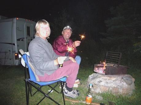
Anniversary sparklers
Sunday 13th August ‘We’ve been together now’ 48 miles
It seems crazy to think that we have been married 40 years today!
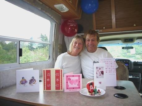
Forty years on
We opened our cards to each other, and one or two others we had brought with us, before enjoying pancakes for breakfast.
We had expected the weather to be really bad today, so it was a pleasant surprise to find that it was cool, but not wet.
We had had such a good day yesterday, and were still elated because of the bear, that today we were just enjoying not rushing about. We had coffee, and a last piece of our anniversary cake, which I had brought with us from England.
We drove along to Bon Ami, where it had been too busy to park yesterday.
Even today, in the greyness, there were a lot of people here. But then the view of the crazy cliffs, with their jumbled rock formations was worth anyone coming to see! There were hundreds of amusing cormorants, just one lovely guillemot, and one seal basking (but not in the sun!) All beautiful memories for our anniversary day.
We had a pleasant walk near the ‘interpretive centre, right by a little harbour. This had been a great fishing area, with people settling from Jersey, Guernsey and Ireland.
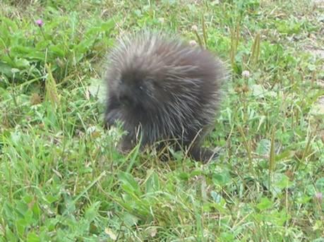
We now drove along the north of the peninsula, which meant leaving the park, but we returned to it further along to walk one more walk. Called ‘La Vallee’ it followed the valley of the Anse au Griffon River for about 3 miles each way. It was a pleasant temperature for walking, but as the walk followed a track on both side of the river, it wasn’t very varied. Our excitement this time, though, was seeing a porcupine, which stopped long enough for us to see and photograph, and then, with a quick glance back at us, toddled off! We have seen porcupines before, but not when out walking.
A prickly porcupine
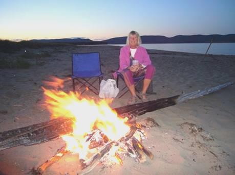
Our plan had been to find a restaurant for a meal tonight, and hope to stay the night there. However, there were no restaurants as we drove along through one little village after another. Worse, the rest areas here didn’t allow you to stay overnight. It was with great relief, that at 6.30, we found a newly made picnic area right beside the sea, at a little place called Saint Yvon. Some men were just hauling a small boat out of the water, but we set to and opened the bubbly.
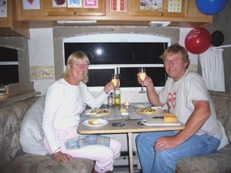
Cheers to 40 years
We ate our ‘reserve plan’ meal of prawns and mushrooms, and lit the last of our sparklers on the beach.
Monday 14th August Along the north Gaspé Coast 106 miles
We were up early catching up with the diary, after our relaxing weekend.
We ate breakfast outside on the ‘decking’, and had a little walk around the beach area before leaving at 9.30.
We passed 2 restaurants in the next little town – Cloridome!
We drove westwards along the coast, passing through one pretty village after another. Many of the houses had delightful flower displays.
At Grand Vallée we went into a small and unimpressive supermarket. We had been trying to log in on the computer, and wondered why we had been getting no connections at all, when we discovered that the internet part wasn’t switched on! In fact, when we did turn it on, we had a connection, so were able to phone Paul and Nicky and wish them Happy Anniversary for today. Later we spoke to Emma, who had just arrived at Elm Gable for a couple of days.
Grand Vallee beach
We had coffee sitting on large wooden deck chairs on the beach before continuing. We had to go through a long stretch of roadworks. We had lunch sitting high above the coast at Madeleine. The scenery had been delightful – steep cliffs, occasionally covered by trees, but often showing their strange and wonderful strata. Now the road went along right beside the shore for many miles, reminding us of the Antrim Coast Road. We just had the huge cliffs up to one side, and sea to the other - lovely.
By the time we got to St Anne de Monts, the land had become flatter, but also the nice day had deteriorated to rain. We reached Cap Chat, where the St Lawrence River widens to become the estuary – much too wide to see across. There are hundreds of wind turbines here, apparently the biggest wind farm in Canada. We stopped just before 5 o’clock just out of sight of the windmills, at Capucins, looking out to the water.
We enjoyed watching the ‘slide show’ of our 40 years of marriage, which the boys had done for us for our party in May.
It turned into a wet evening, as we worked on the website and photos.
Tuesday 15th August Some lovely gardens and a forgotten tragedy 130 miles
A lorry had come in noisily at 4 o’clock, and disturbed us.
After the wind and rain in the night, it was a pleasant surprise to wake up to a blue sky, even if the wind was still gusty. We had a little walk along beside the bay before leaving at 8.15. There was a marker here telling of the prehistoric sites which have been excavated along this North Gaspé shoreline.
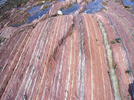
We continued driving along beside the shore, passing through numerous small villages, to Matane. We stopped soon after, just before Baie des Sables. The beach here was wonderful, made up of layers of rock in all sorts of colours – red, green, purple, white. We walked for some time on it, marvelling at nature, and thinking of the history of these rocks.
Wonderful rock strata at Baie des Sables
We drove on through the village of Metis, where there were some quite smart houses, to the Metis Gardens at Grand Metis. These had been started by a lady called Elsie Reford, after she had inherited the land in the early 1900s from her uncle, Lord Mount Stephen, founder of the CPR.
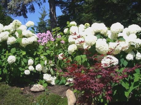
We thought that it would make a nice ‘anniversary visit’ to come here, and it certainly was pleasant wandering around the gardens, said to be set out in an English design – several linked gardens on differing themes. Elsie’s favourite flower (and mine too) was the Himalayan blue poppy (Meconopsis), which was of course not flowering now, but there were plenty of other flowers to enjoy.
Huge hydrangeas at Metis garden
The house here, called Estevan Lodge, is set up as a museum, with photos by Elsie’s husband, and many exhibits and artefacts of life here in the first half of the 20th century.
There was also a smart restaurant in the lodge, with a reasonably priced set lunch, which made an excellent meal for our ‘missed’ anniversary one. Like all good French cuisine, it was beautifully presented, and we had a nice young lad serving us, who tried so hard to explain the menu to us in English. We weren’t sure about the ‘bat soup’ though, so settled for pumpkin soup, which came with hot French bread. This we followed with cod/salmon, accompanied by a nice dark beer. The dessert – a chocolate cup filled with a creamy mixture with berries, had been made by the Belgian chef, and was scrumptious. With the lovely surroundings, we couldn’t have done better.
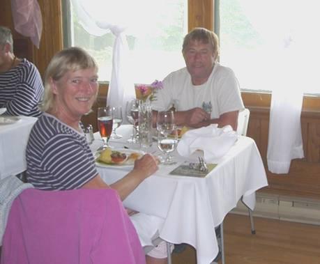
Belated anniversary meal – note the matching man!
The day was unfortunately deteriorating once more, as we made our way over to the ‘International Garden festival’. More properly, this was a collection of modern strange set ups, which weren’t our cup of tea, but were interesting to see. A storm was brewing, but we managed to get back to the Bam before it arrived. It had been a really good visit.
In fact the storm didn’t really happen, and it was fine as we continued on our way, stopping soon to view the Marcel Gagnon art gallery at St Flavie. There was a strange array of life size figures, made simply from concrete, in groups by the seashore. Inside the gallery there were some vivid paintings in the same simplistic form. Nice for a short visit, but as all the labelling was in French, we couldn’t get the whole meaning of it!
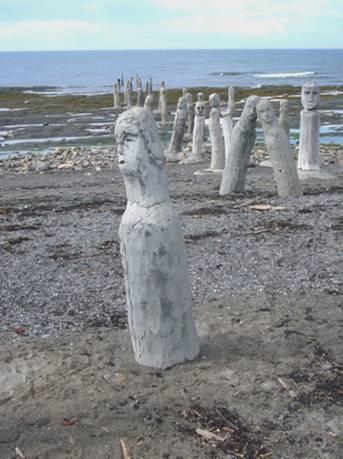
Gagnon’s figures by the sea
Our next visit was far more sobering. This was to the Museum of the Sea at Pointe au Pere, just before Rimouski. It was here, on 29th May 1914, that the ‘Empress of Ireland’ sank, after another ship had run into her in thick fog. Over 1,000 people lost their lives, including many children. Only 460 survived. It was the second greatest maritime disaster at the time, after the sinking of the Titanic, two years before. With the outbreak of World War 1 a few months afterwards, the tragedy was forgotten. In the sixties, divers started searching the wreckage, and now this museum commemorates the ship’s history and the story of that night.
There were many artefacts and photographs of the disaster, but the most moving thing was a film presentation, reliving that night – there had only been 14 minutes from the first distress signal to the ship being totally submerged. We were the only people to view the English version, which was just as well, as we emerged feeling very moved.
There wasn’t time for us to view Pointe au Pere lighthouse afterwards – built in 1909, and the second tallest in Canada - but we did look around some more of the museum buildings, which had displays about the salvage diving operations and about fog horns.
Now we had to find somewhere to stop, and tonight it was really difficult. We drove on through Rimouski, but were now on a fast road, with no alternatives. We went through an area of the Bic Quebec Park, so couldn’t stop there. Eventually, at 7 o’clock, we pulled in behind the church at St Simon.
Pictou, Nova Scotia to St. Simeon, Quebec


